Volume 82, Issue 7, 2004
NEBRASKAland
Nebraska Game & Parks Commission August-September 2004 $2.50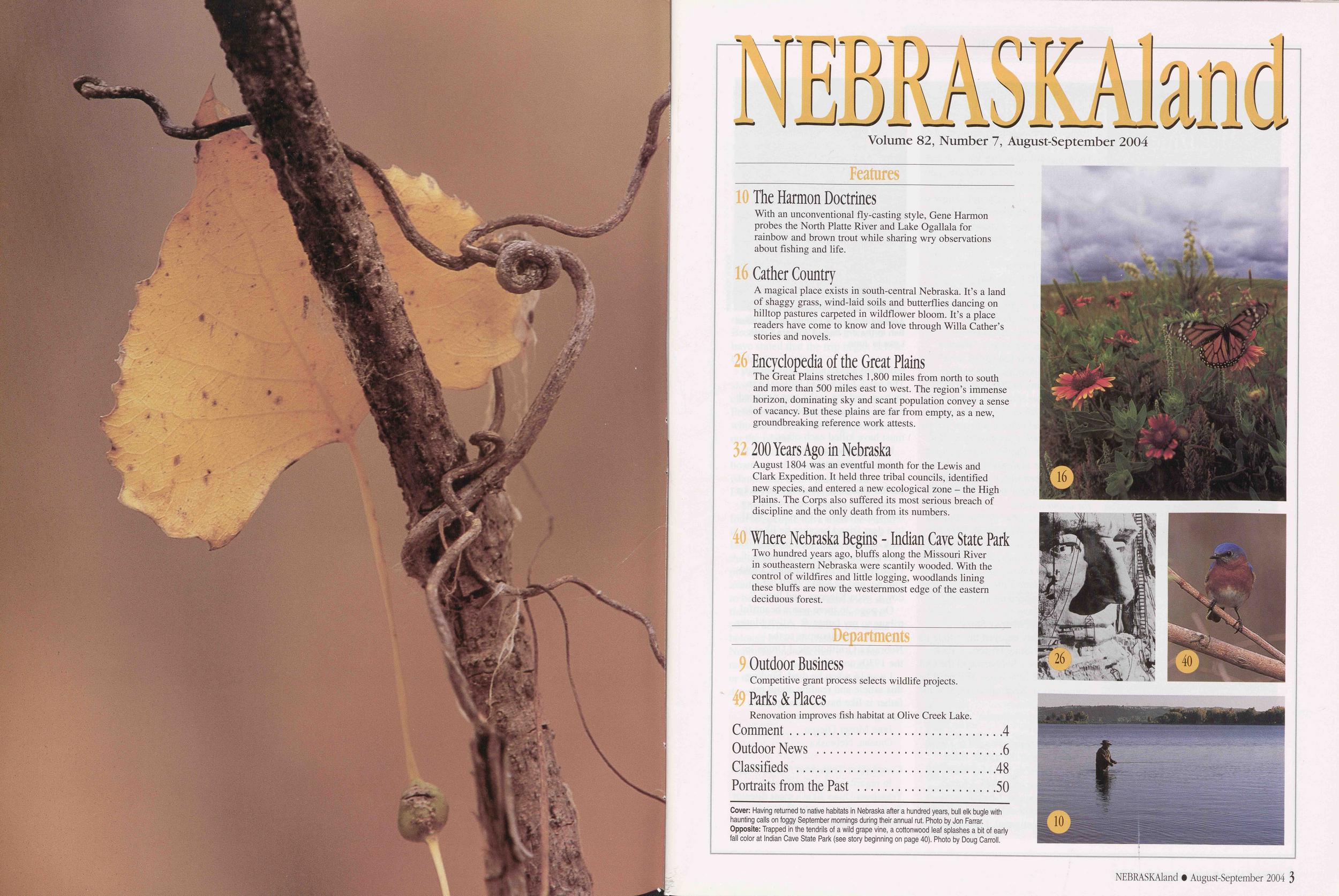
NEBRASKAland
Volume 82, Number 7, August-September 2004
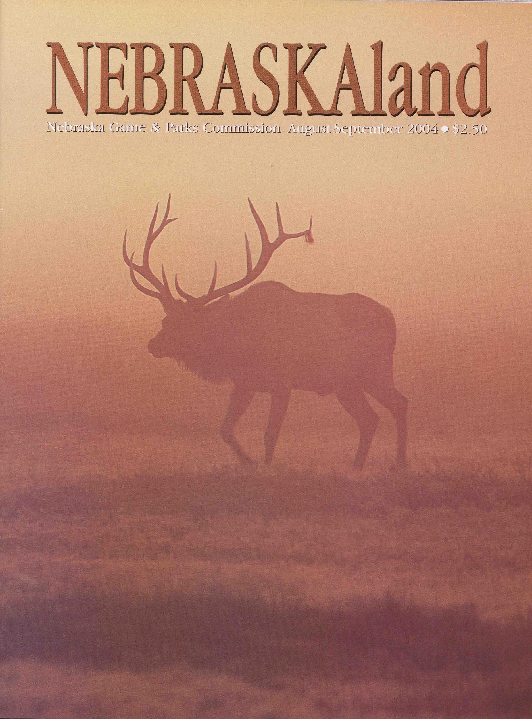
Features 10 The Harmon Doctrines With an unconventional fly-casting style, Gene Harmon probes the North Platte River and Lake Ogallala for rainbow and brown trout while sharing wry observations about fishing and life. 16 Gather Country A magical place exists in south-central Nebraska. It’s a land of shaggy grass, wind-laid soils and butterflies dancing on hilltop pastures carpeted in wildflower bloom. It’s a place readers have come to know and love through Willa Gather’s stories and novels. 26 Encyclopedia of the Great Plains The Great Plains stretches 1,800 miles from north to south and more than 500 miles east to west. The region’s immense horizon, dominating sky and scant population convey a sense of vacancy. But these plains are far from empty, as a new, groundbreaking reference work attests. 32 200 Years Ago in Nebraska August 1804 was an eventful month for the Lewis and Clark Expedition. It held three tribal councils, identified new species, and entered a new ecological zone - the High Plains. The Corps also suffered its most serious breach of discipline and the only death from its numbers. Where Nebraska Begins - Indian Cave State Park Two hundred years ago, bluffs along the Missouri River in southeastern Nebraska were scantily wooded. With the control of wildfires and little logging, woodlands lining these bluffs are now the westernmost edge of the eastern deciduous forest. Departments 9 Outdoor Business Competitive grant process selects wildlife projects. Parks & Places Renovation improves fish habitat at Olive Creek Lake. Comment 4 Outdoor News 6 Classifieds 48 Portraits from the Past 50 Cover: Having returned to native habitats in Nebraska after a hundred years, bull elk bugle with haunting calls on foggy September mornings during their annual rut. Photo by Jon Farrar. Opposite: Trapped in the tendrils of a wild grape vine, a cottonwood leaf splashes a bit of early fall color at Indian Cave State Park (see story beginning on page 40). Photo by Doug Carroll.
Comment
NEBRASKAland Magazine Published by the Nebraska Game and Parks Commission Director: Rex Amack Assistant Directors: Roger Kuhn, Kirk Nelson Information & Education Administrator: Ken Bouc Information & Education Art Director: Steve O’Hare Commissioners Chairman: Randall K. Stinnette, Inland Vice Chairman: Marvin Westcott, Holdrege 2nd Vice Chairman: James Stuart, Jr., Lincoln Bill Grewcock, Omaha Dr. Mark Pinkerton, Wilber Bill Zutavem, Dunning Gary Parker, Columbus George E. Hall, Bridgeport Magazine Staff Editor: Tom White Associate Editor: Doug Carroll Art Director: Tim Reigert Senior Editors: Jon Farrar, Ken Bouc Regional Editors: Eric Fowler, Bob Grier, Rocky Hoffmann Contributing Editors: Michael Forsberg, Tom Keith Circulation: Donna Robinson Photo Librarian: Sarah Johnson NEBRASKAland VOL. 82 / NO. 7 ISSN: 0028-1964 AUGUST-SEPTEMBER 2004 Published monthly, except for Jan ./Feb. and Aug./Sept. issues, by the Nebraska Game and Parks Commission, 2200 N. 33rd St, Lincoln, NE. Copyright 2004, all rights reserved. Please address comments or questions to this address. Periodicals postage paid at Lincoln, Nebraska, and other locations. POSTMASTER: Send all address changes to NEBRASKAland, P.O. Box 30370, Lincoln, NE 68503-0370. Address submissions to: The Editor, NEBRASKAland Magazine, P.O. Box 30370, Lincoln, NE 68503. Include a stamped, self-addressed return envelope. The publisher assumes no responsibility for unsolicited material. NEBRASKAland is available on audio cassette from the Nebraska Library Commission Talking Book and Braille Service, Suite 120, 1200 N St., Lincoln, NE 68508. (800) 742-7691 Rates: $16 for one year; $30 for two years. Nebraska residents must add appropriate sales tax. To subscribe call 1-800-NEBLAND (632-5263), or go online to: outdoornebraska.org Drought Damaging FisheriesI went to Winters Creek Lake, part of the North Platte National Wildlife Refuge in June. Due to drought, the lake had completely dried up. Thousands of dead fish were on the lake bottom. I wonder why the state did not remove the game fish to Lake Minatare or let people know so they could catch them. The lake is dead. It was once a great place to take kids because you could always catch something.
Roger Holsinger Scottsbluff, NebraskaAl Hanson, a fisheries supervisor in the Alliance office of the Nebraska Game and Parks Commission, responds: “Winters Creek Lake was scheduled for a chemical renovation this spring. Fish sampling in 2003 found the lake was dominated by carp and the only game fish in significant numbers were channel catfish. Salvage efforts were impossible because of the low water levels. The lake was open for fishing. Due to drought, the lake dried up when water was delayed by the Pathfinder Irrigation District for about a week.
“The district has decided that no water will be stored in the lake in 2004. We have repaired the fish screen on the inlet ditch to prevent carp from entering the lake again, if it is refilled. “North Platte Valley fisheries losses are growing because of drought.”
Enjoyed Fort Kearny StoryI thoroughly enjoyed the article on Fort Kearny State Historical Park [Fort Kearny - Soldiering in the Old West] in the June issue. You must be commended. Keep up the good work.
Glenn Gibbs Red Cloud, Nebraska Snake and Hawk Fought to DeathWhen I read the article titled “Hawk Eyes” in the May issue, it reminded me of a hawk I found several years ago. I had noticed something light-colored in my pasture. When I investigated, I found a dead
Marvin Davison Auburn, Nebraska Father Found in Birding Nebraska
I recently gave a copy of Birding Nebraska [January-February 2004] to a dear friend because he likes to look at birds while he’s fishing. The next day he called me and asked if I had read any of the articles. I told him no, and he said, “Well, sit down, get a Kleenex, and listen.”
On page 26 there was a beautiful tribute to my father, R. Allyn Moser, about his contributions to the Nebraska Ornithological Union in the 1930s and 1940s.
I was 16 when he died. Finding this article and reading about my father is like having him speak to me again after all these years.
Jane Moser Diesen Omaha, Nebraska Cornhusker Trapshoot Nation’s BestIn regards to the Cornhusker Trapshoot [June 2004], meet director Rocky Hoffmann and all the Nebraska Game and Parks 4 NEBRASKAland O August-September 2004 Commission employees and volunteers did a great job this year. Despite controversy, Rocky extended the shoot by starting it on Thursday and adjusted the awards to match the size of the shoot. It is the premier high school shoot in the country.
Ted Vasko, Head Coach, Creighton Prep Trap Team Papillion, Nebraska Reader Corrects Canoeing StoryJim Peterson of Vermillion, South Dakota, pointed out an error in “Canoeing the Missouri River” in the June issue of NEBRASKAland. The article stated that the float trip on the river began “six miles below Brooky Bottoms Park.” It should have stated that the trip began below Cedar County Park.
Peterson also questioned the story’s assertion that “no one ever claimed or homesteaded” Goat Island. Peterson wrote that he knew a man who had a small farming operation on the island.
“I personally helped him haul boatloads of watermelons from the island farm to his place on the Dakota shore,” Peterson wrote.
The story oversimplified the issue. Indeed, people have used the island in the past. But according to Paul Hedren of the National Park Service, the island, the origin of which predates statehood, was never made available by the federal government to be claimed or homesteaded, and therefore will likely remain in the public domain. Whether the island belongs to South Dakota or Nebraska and whether it will be managed by one of those states or the park service has yet to be determined.
Comment NEBRASKAland Magazine P.O. Box 30370, Lincoln, NE 68503. E-mail: nebland@ ngpc. state, ne. us. Please include your postal address and telephone number. Letters may be condensed and edited for clarity. Photographs are welcome and will be returned.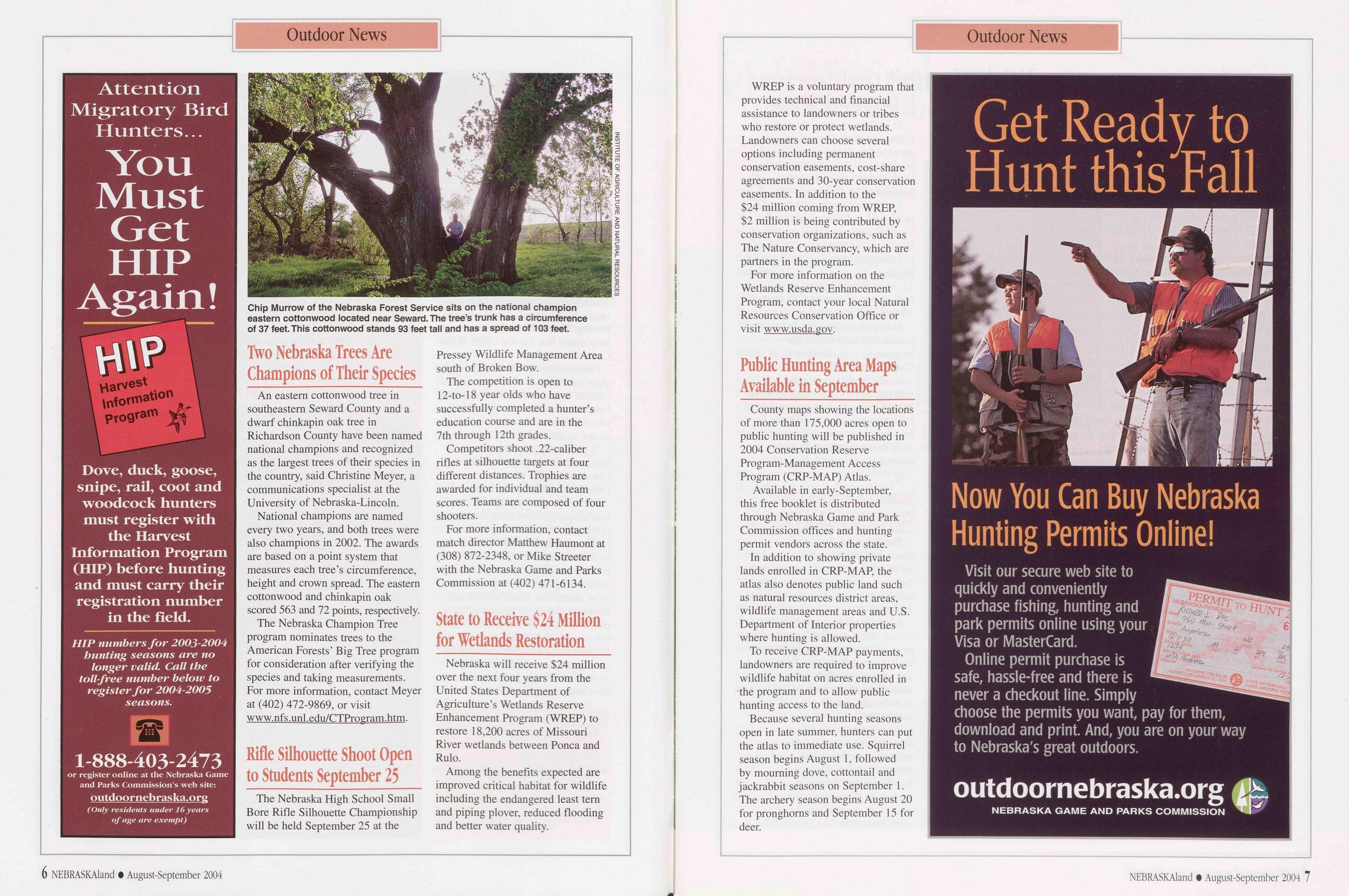
Outdoor News
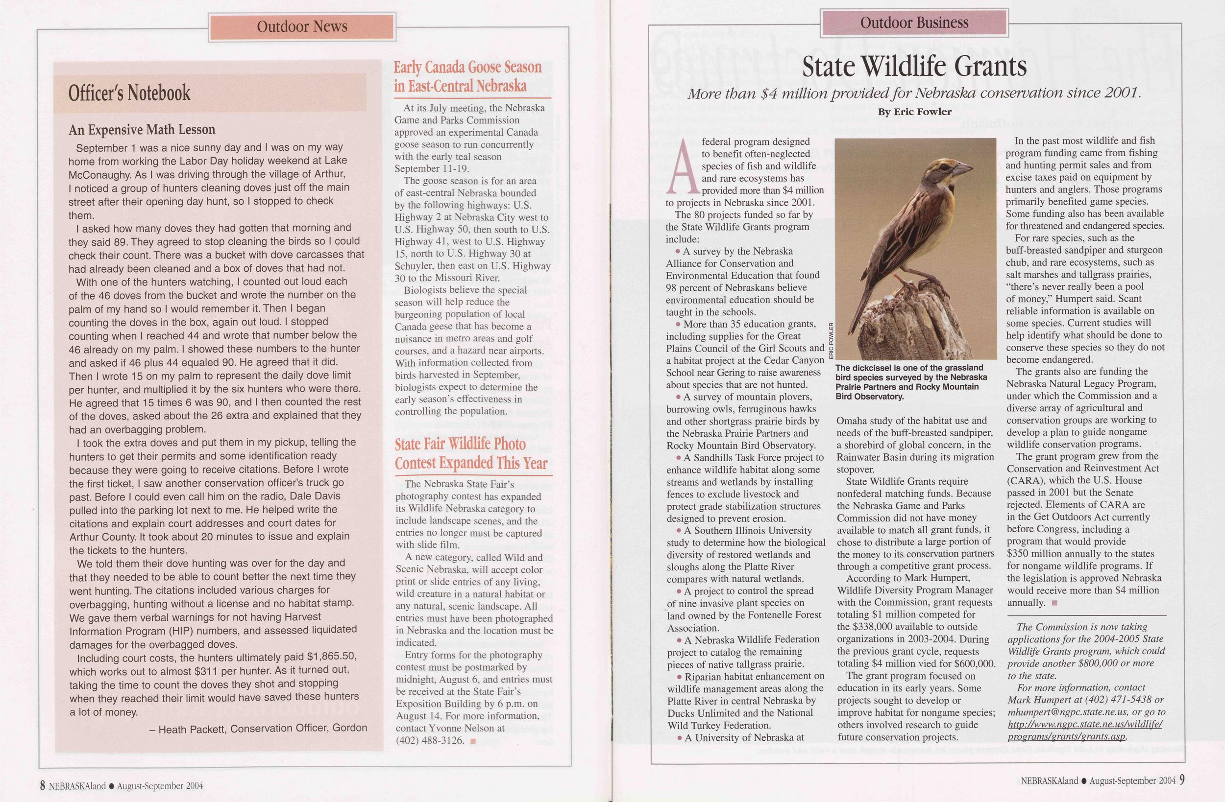
Chip Murrow of the Nebraska Forest Service sits on the national champion eastern cottonwood located near Seward. The tree’s trunk has a circumference of 37 feet. This cottonwood stands 93 feet tall and has a spread of 103 feet.
An eastern cottonwood tree in southeastern Seward County and a dwarf chinkapin oak tree in Richardson County have been named national champions and recognized as the largest trees of their species in the country, said Christine Meyer, a communications specialist at the University of Nebraska-Lincoln.
National champions are named every two years, and both trees were also champions in 2002. The awards are based on a point system that measures each tree’s circumference, height and crown spread. The eastern cottonwood and chinkapin oak scored 563 and 72 points, respectively.
The Nebraska Champion Tree program nominates trees to the American Forests’ Big Tree program for consideration after verifying the species and taking measurements. For more information, contact Meyer at (402) 472-9869, or visit www.nfs.unl.edu/CTProgram.htm.
Rifle Silhouette Shoot Open to Students September 25The Nebraska High School Small Bore Rifle Silhouette Championship will be held September 25 at the Pressey Wildlife Management Area south of Broken Bow.
The competition is open to 12-to-18 year olds who have successfully completed a hunter’s education course and are in the 7th through 12th grades.
Competitors shoot .22-caliber rifles at silhouette targets at four different distances. Trophies are awarded for individual and team scores. Teams are composed of four shooters.
For more information, contact match director Matthew Haumont at (308) 872-2348, or Mike Streeter with the Nebraska Game and Parks Commission at (402) 471-6134.
State to Receive $24 Million for Wetlands RestorationNebraska will receive $24 million over the next four years from the United States Department of Agriculture’s Wetlands Reserve Enhancement Program (WREP) to restore 18,200 acres of Missouri River wetlands between Ponca and Rulo.
Among the benefits expected are improved critical habitat for wildlife including the endangered least tern and piping plover, reduced flooding and better water quality.
6 NEBRASKAland • August-September 2004WREP is a voluntary program that provides technical and financial assistance to landowners or tribes who restore or protect wetlands. Landowners can choose several options including permanent conservation easements, cost-share agreements and 30-year conservation easements. In addition to the $24 million coming from WREP, $2 million is being contributed by conservation organizations, such as The Nature Conservancy, which are partners in the program.
For more information on the Wetlands Reserve Enhancement Program, contact your local Natural Resources Conservation Office or visit www.usda.gov.
Public Hunting Area Maps Available in SeptemberCounty maps showing the locations of more than 175,000 acres open to public hunting will be published in 2004 Conservation Reserve Program-Management Access Program (CRP-MAP) Atlas.
Available in early-September, this free booklet is distributed through Nebraska Game and Park Commission offices and hunting permit vendors across the state.
In addition to showing private lands enrolled in CRP-MAP, the atlas also denotes public land such as natural resources district areas, wildlife management areas and U.S. Department of Interior properties where hunting is allowed.
To receive CRP-MAP payments, landowners are required to improve wildlife habitat on acres enrolled in the program and to allow public hunting access to the land.
Because several hunting seasons open in late summer, hunters can put the atlas to immediate use. Squirrel season begins August 1, followed by mourning dove, cottontail and jackrabbit seasons on September 1. The archery season begins August 20 for pronghorns and September 15 for deer.
Officer's Notebook
An Expensive Math LessonSeptember 1 was a nice sunny day and I was on my way home from working the Labor Day holiday weekend at Lake McConaughy. As I was driving through the village of Arthur, I noticed a group of hunters cleaning doves just off the main street after their opening day hunt, so I stopped to check them.
I asked how many doves they had gotten that morning and they said 89. They agreed to stop cleaning the birds so I could check their count. There was a bucket with dove carcasses that had already been cleaned and a box of doves that had not.
With one of the hunters watching, I counted out loud each of the 46 doves from the bucket and wrote the number on the palm of my hand so I would remember it. Then I began counting the doves in the box, again out loud. I stopped counting when I reached 44 and wrote that number below the 46 already on my palm. I showed these numbers to the hunter and asked if 46 plus 44 equaled 90. He agreed that it did. Then I wrote 15 on my palm to represent the daily dove limit per hunter, and multiplied it by the six hunters who were there. He agreed that 15 times 6 was 90, and I then counted the rest of the doves, asked about the 26 extra and explained that they had an overbagging problem.
I took the extra doves and put them in my pickup, telling the hunters to get their permits and some identification ready because they were going to receive citations. Before I wrote the first ticket, I saw another conservation officer’s truck go past. Before I could even call him on the radio, Dale Davis pulled into the parking lot next to me. He helped write the citations and explain court addresses and court dates for Arthur County. It took about 20 minutes to issue and explain the tickets to the hunters.
We told them their dove hunting was over for the day and that they needed to be able to count better the next time they went hunting. The citations included various charges for overbagging, hunting without a license and no habitat stamp. We gave them verbal warnings for not having Harvest Information Program (HIP) numbers, and assessed liquidated damages for the overbagged doves.
Including court costs, the hunters ultimately paid $1,865.50, which works out to almost $311 per hunter. As it turned out, taking the time to count the doves they shot and stopping when they reached their limit would have saved these hunters a lot of money.
- Heath Packett, Conservation Officer, GordonOutdoor News
Early Canada Goose Season in East-Central NebraskaAt its July meeting, the Nebraska Game and Parks Commission approved an experimental Canada goose season to run concurrently with the early teal season September 11-19.
The goose season is for an area of east-central Nebraska bounded by the following highways: U.S. Highway 2 at Nebraska City west to U.S. Highway 50, then south to U.S. Highway 41, west to U.S. Highway 15, north to U.S. Highway 30 at Schuyler, then east on U.S. Highway 30 to the Missouri River.
Biologists believe the special season will help reduce the burgeoning population of local Canada geese that has become a nuisance in metro areas and golf courses, and a hazard near airports. With information collected from birds harvested in September, biologists expect to determine the early season’s effectiveness in controlling the population.
State Fair Wildlife Photo Contest Expanded This YearThe Nebraska State Fair’s photography contest has expanded its Wildlife Nebraska category to include landscape scenes, and the entries no longer must be captured with slide film.
A new category, called Wild and Scenic Nebraska, will accept color print or slide entries of any living, wild creature in a natural habitat or any natural, scenic landscape. All entries must have been photographed in Nebraska and the location must be indicated.
Entry forms for the photography contest must be postmarked by midnight, August 6, and entries must be received at the State Fair’s Exposition Building by 6 p.m. on August 14. For more information, contact Yvonne Nelson at (402)488-3126.
8 NEBRASKAland • August-September 2004Outdoor Business
State Wildlife Grants
More than $4 million provided for Nebraska conservation since 2001. By Eric FowlerA federal program designed to benefit often-neglected species of fish and wildlife and rare ecosystems has provided more than $4 million to projects in Nebraska since 2001. The 80 projects funded so far by the State Wildlife Grants program include:
• A survey by the Nebraska Alliance for Conservation and Environmental Education that found 98 percent of Nebraskans believe environmental education should be taught in the schools.
• More than 35 education grants, including supplies for the Great Plains Council of the Girl Scouts and a habitat project at the Cedar Canyon School near Gering to raise awareness about species that are not hunted.
• A survey of mountain plovers, burrowing owls, ferruginous hawks and other shortgrass prairie birds by the Nebraska Prairie Partners and Rocky Mountain Bird Observatory.
• A Sandhills Task Force project to enhance wildlife habitat along some streams and wetlands by installing fences to exclude livestock and protect grade stabilization structures designed to prevent erosion.
• A Southern Illinois University study to determine how the biological diversity of restored wetlands and sloughs along the Platte River compares with natural wetlands. • A project to control the spread of nine invasive plant species on land owned by the Fontenelle Forest Association.
• A Nebraska Wildlife Federation project to catalog the remaining pieces of native tallgrass prairie.
• Riparian habitat enhancement on wildlife management areas along the Platte River in central Nebraska by Ducks Unlimited and the National Wild Turkey Federation.
The dickcissel is one of the grassland bird species surveyed by the Nebraska Prairie Partners and Rocky Mountain Bird Observatory.
State Wildlife Grants require nonfederal matching funds. Because the Nebraska Game and Parks Commission did not have money available to match all grant funds, it chose to distribute a large portion of the money to its conservation partners through a competitive grant process.
According to Mark Humpert, Wildlife Diversity Program Manager with the Commission, grant requests totaling $1 million competed for the $338,000 available to outside organizations in 2003-2004. During the previous grant cycle, requests totaling $4 million vied for $600,000.
The grant program focused on education in its early years. Some projects sought to develop or improve habitat for nongame species; others involved research to guide future conservation projects.
In the past most wildlife and fish program funding came from fishing and hunting permit sales and from excise taxes paid on equipment by hunters and anglers. Those programs primarily benefited game species. Some funding also has been available for threatened and endangered species.
For rare species, such as the buff-breasted sandpiper and sturgeon chub, and rare ecosystems, such as salt marshes and tailgrass prairies, “there’s never really been a pool of money,” Humpert said. Scant reliable information is available on some species. Current studies will help identify what should be done to conserve these species so they do not become endangered.
The grants also are funding the Nebraska Natural Legacy Program, under which the Commission and a diverse array of agricultural and conservation groups are working to develop a plan to guide nongame wildlife conservation programs.
The grant program grew from the Conservation and Reinvestment Act (CARA), which the U.S. House passed in 2001 but the Senate rejected. Elements of CARA are in the Get Outdoors Act currently before Congress, including a program that would provide $350 million annually to the states for nongame wildlife programs. If the legislation is approved Nebraska would receive more than $4 million annually.
The Commission is now taking applications for the 2004-2005 State Wildlife Grants program, which could provide another $800,000 or more to the state.
For more information, contact Mark Humpert at (402) 471-5438 or mhumpert@ngpc.state.ne.us, or go to http://www. ngpc. state, ne. us/wildlife/ pro grams/grants/grants, asp.
NEBRASKAland • August-September 2004 9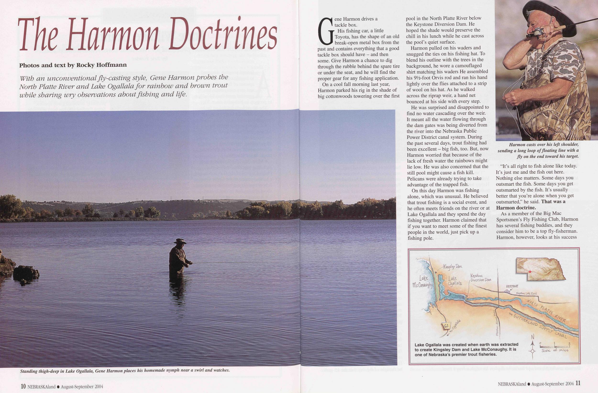
The Harmon Doctrines
With an unconventional fly-casting style, Gene Harmon probes the North Platte River and Lake Ogallala for rainbow and brown trout while sharing wry observations about fishing and life.
Standing thigh-deep in Lake Ogallala, Gene Harmon places his homemade nymph near a swirl and watches.
Gene Harmon drives a tackle box.
His fishing car, a little Toyota, has the shape of an old break-open metal box from the past and contains everything that a good tackle box should have - and then some. Give Harmon a chance to dig through the rubble behind the spare tire or under the seat, and he will find the proper gear for any fishing application.
On a cool fall morning last year, Harmon parked his rig in the shade of big cottonwoods towering over the first pool in the North Platte River below the Keystone Diversion Dam. He hoped the shade would preserve the chill in his lunch while he cast across the pool’s quiet surface.
Harmon pulled on his waders and snugged the ties on his fishing hat. To blend his outline with the trees in the background, he wore a camouflaged shirt matching his waders He assembled his 9*/2-foot Orvis rod and ran his hand lightly over the flies attached to a strip of wool on his hat. As he walked across the riprap weir, a hand net bounced at his side with every step.
He was surprised and disappointed to find no water cascading over the weir. It meant all the water flowing through the dam gates was being diverted from the river into the Nebraska Public Power District canal system. During the past several days, trout fishing had been excellent - big fish, too. But, now Harmon worried that because of the lack of fresh water the rainbows might lie low. He was also concerned that the still pool might cause a fish kill. Pelicans were already trying to take advantage of the trapped fish.
On this day Harmon was fishing alone, which was unusual. He believed that trout fishing is a social event, and he often meets friends on the river or at Lake Ogallala and they spend the day fishing together. Harmon claimed that if you want to meet some of the finest people in the world, just pick up a fishing pole.
Harmon casts over his left shoulder, sending a long loop of floating line with a fly on the end toward his target.
"It’s all right to fish alone like today. It’s just me and the fish out here. Nothing else matters. Some days you outsmart the fish. Some days you get outsmarted by the fish. It’s usually better that you’re alone when you get outsmarted,” he said. That was a Harmon doctrine.
Lake Ogallala was created when earth was extracted to create Kingsely Dam and Lake McConaughy. It is one of Nebraska's premier trout fisheries.
 and reputation with a fly rod differently.
"I don’t consider myself to be a great fly-fisherman, but I am a pretty good fisherman with a fly rod,” he said with a smile as he eyed a spot to land his first fly.
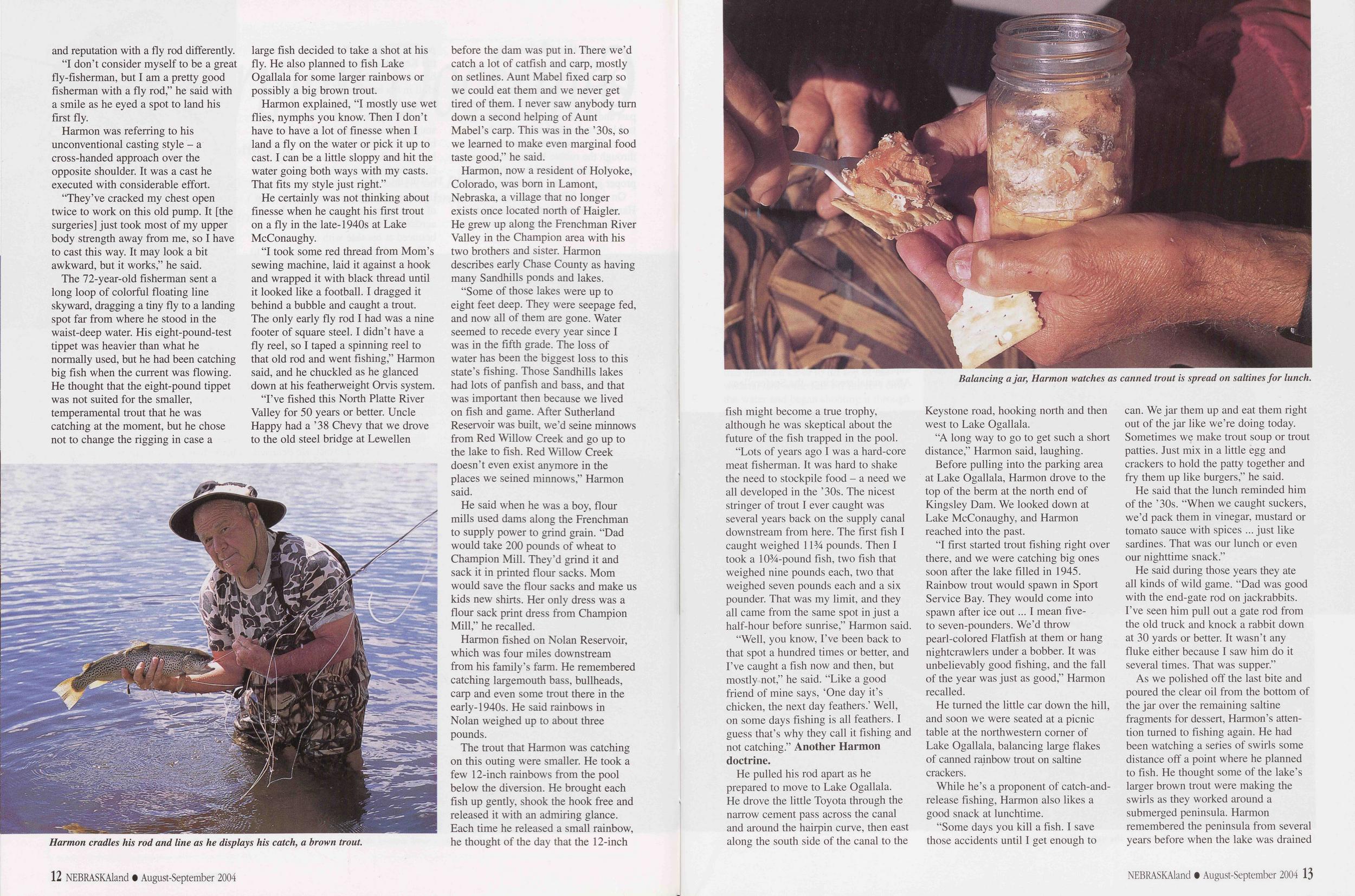
Harmon was referring to his unconventional casting style - a cross-handed approach over the opposite shoulder. It was a cast he executed with considerable effort.
“They’ve cracked my chest open twice to work on this old pump. It [the surgeries] just took most of my upper body strength away from me, so I have to cast this way. It may look a bit awkward, but it works,” he said.
Harmon cradles his rod and line as he displays his catch, a brown trout.
Harmon explained, T mostly use wet flies, nymphs you know. Then I don’t have to have a lot of finesse when I land a fly on the water or pick it up to cast. I can be a little sloppy and hit the water going both ways with my casts. That fits my style just right.”
He certainly was not thinking about finesse when he caught his first trout on a fly in the late-1940s at Lake McConaughy.
“I took some red thread from Mom’s sewing machine, laid it against a hook and wrapped it with black thread until it looked like a football. I dragged it behind a bubble and caught a trout. The only early fly rod I had was a nine footer of square steel. I didn’t have a fly reel, so I taped a spinning reel to that old rod and went fishing,” Harmon said, and he chuckled as he glanced down at his featherweight Orvis system.
"I’ve fished this North Platte River Valley for 50 years or better. Uncle Happy had a ’38 Chevy that we drove to the old steel bridge at Lewellen before the dam was put in. There we’d catch a lot of catfish and carp, mostly on setlines. Aunt Mabel fixed carp so we could eat them and we never get tired of them. I never saw anybody turn down a second helping of Aunt Mabel’s carp. This was in the ’30s, so we learned to make even marginal food taste good,” he said.
Harmon, now a resident of Holyoke, Colorado, was bom in Lamont, Nebraska, a village that no longer exists once located north of Haigler. He grew up along the Frenchman River Valley in the Champion area with his two brothers and sister. Harmon describes early Chase County as having many Sandhills ponds and lakes.
"Some of those lakes were up to eight feet deep. They were seepage fed, and now all of them are gone. Water seemed to recede every year since I was in the fifth grade. The loss of water has been the biggest loss to this state’s fishing. Those Sandhills lakes had lots of panfish and bass, and that was important then because we lived on fish and game. After Sutherland Reservoir was built, we’d seine minnows from Red Willow Creek and go up to the lake to fish. Red Willow Creek doesn’t even exist anymore in the places we seined minnows,” Harmon said.
He said when he was a boy, flour mills used dams along the Frenchman to supply power to grind grain. "Dad would take 200 pounds of wheat to Champion Mill. They’d grind it and sack it in printed flour sacks. Mom would save the flour sacks and make us kids new shirts. Her only dress was a flour sack print dress from Champion Mill,” he recalled.
Harmon fished on Nolan Reservoir, which was four miles downstream from his family’s farm. He remembered catching largemouth bass, bullheads, carp and even some trout there in the early-1940s. He said rainbows in Nolan weighed up to about three pounds.
Balancing a jar\ Harmon watches as canned trout is spread on saltines for lunch.
“Lots of years ago I was a hard-core meat fisherman. It was hard to shake the need to stockpile food - a need we all developed in the ’30s. The nicest stringer of trout I ever caught was several years back on the supply canal downstream from here. The first fish I caught weighed 1134 pounds. Then I took a 1034-pound fish, two fish that weighed nine pounds each, two that weighed seven pounds each and a six pounder. That was my limit, and they all came from the same spot in just a half-hour before sunrise,” Harmon said.
"Well, you know, I’ve been back to that spot a hundred times or better, and I’ve caught a fish now and then, but mostly not,” he said. "Like a good friend of mine says, ‘One day it’s chicken, the next day feathers.’ Well, on some days fishing is all feathers. I guess that’s why they call it fishing and not catching.” Another Harmon doctrine.
He pulled his rod apart as he prepared to move to Lake Ogallala. He drove the little Toyota through the narrow cement pass across the canal and around the hairpin curve, then east along the south side of the canal to the Keystone road, hooking north and then west to Lake Ogallala.
“A long way to go to get such a short distance,” Harmon said, laughing. Before pulling into the parking area at Lake Ogallala, Harmon drove to the top of the berm at the north end of Kingsley Dam. We looked down at Lake McConaughy, and Harmon reached into the past.
"I first started trout fishing right over there, and we were catching big ones soon after the lake filled in 1945. Rainbow trout would spawn in Sport Service Bay. They would come into spawn after ice out... I mean five- to seven-pounders. We’d throw pearl-colored Flatfish at them or hang nightcrawlers under a bobber. It was unbelievably good fishing, and the fall of the year was just as good,” Harmon recalled.
He turned the little car down the hill, and soon we were seated at a picnic table at the northwestern corner of Lake Ogallala, balancing large flakes of canned rainbow trout on saltine crackers.
While he’s a proponent of catch-and- release fishing, Harmon also likes a good snack at lunchtime.
"Some days you kill a fish. I save those accidents until I get enough to can. We jar them up and eat them right out of the jar like we’re doing today. Sometimes we make trout soup or trout patties. Just mix in a little egg and crackers to hold the patty together and fry them up like burgers,” he said.
He said that the lunch reminded him of the ’30s. “When we caught suckers, we’d pack them in vinegar, mustard or tomato sauce with spices ... just like sardines. That was our lunch or even our nighttime snack.”
He said during those years they ate all kinds of wild game. "Dad was good with the end-gate rod on jackrabbits. I’ve seen him pull out a gate rod from the old truck and knock a rabbit down at 30 yards or better. It wasn’t any fluke either because I saw him do it several times. That was supper.”
As we polished off the last bite and poured the clear oil from the bottom of the jar over the remaining saltine fragments for dessert, Harmon’s atten- tion turned to fishing again. He had been watching a series of swirls some distance off a point where he planned to fish. He thought some of the lake’s larger brown trout were making the swirls as they worked around a submerged peninsula. Harmon remembered the peninsula from several years before when the lake was drained NEBRASKAland • August-September 2004 13 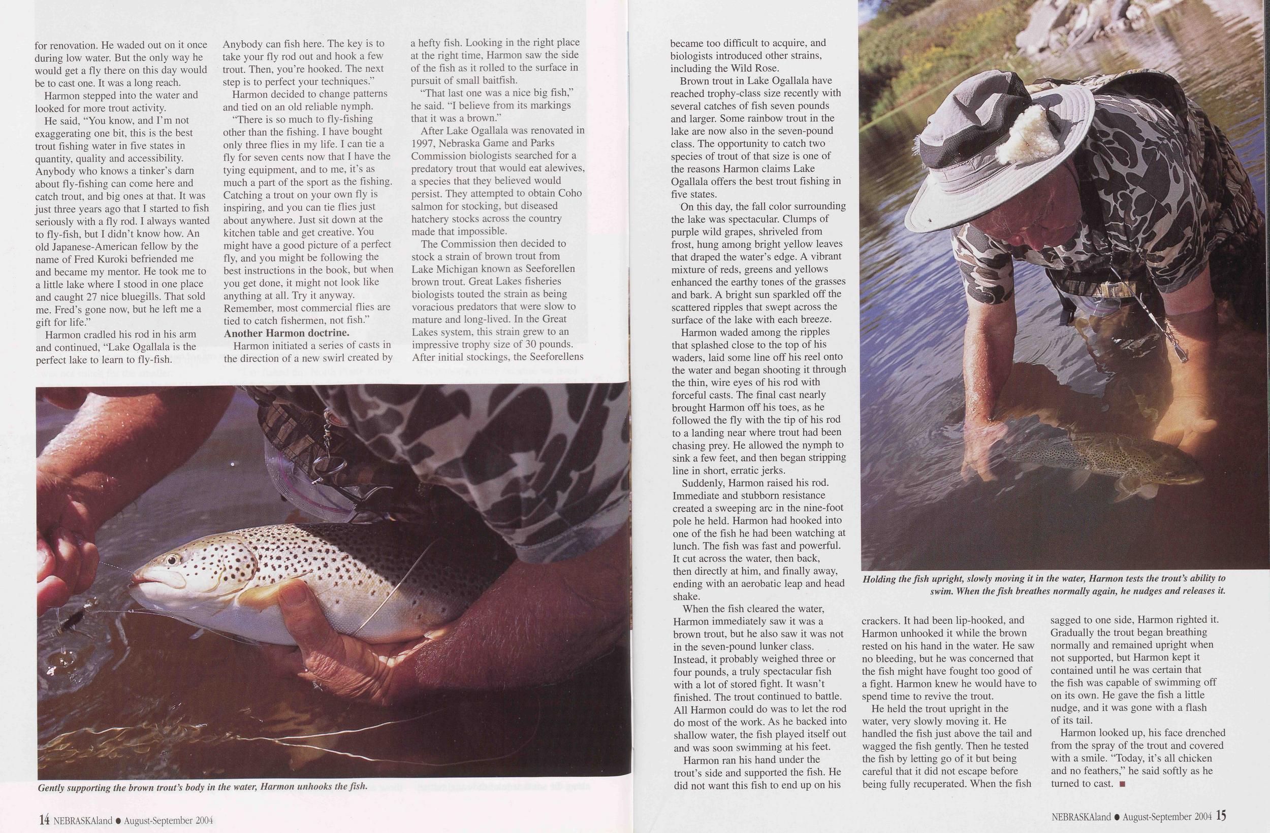 for renovation. He waded out on it once during low water. But the only way he would get a fly there on this day would be to cast one. It was a long reach.
Harmon stepped into the water and looked for more trout activity.
He said, “You know, and I’m not exaggerating one bit, this is the best trout fishing water in five states in quantity, quality and accessibility. Anybody who knows a tinker’s darn about fly-fishing can come here and catch trout, and big ones at that. It was just three years ago that I started to fish seriously with a fly rod. I always wanted to fly-fish, but I didn’t know how. An old Japanese-American fellow by the name of Fred Kuroki befriended me and became my mentor. He took me to a little lake where I stood in one place and caught 27 nice bluegills. That sold me. Fred’s gone now, but he left me a gift for life.”
Gently supporting the brown trout’s body in the water; Harmon unhooks the fish.
Harmon decided to change patterns and tied on an old reliable nymph.
“There is so much to fly-fishing other than the fishing. I have bought only three flies in my life. I can tie a fly for seven cents now that I have the tying equipment, and to me, it’s as much a part of the sport as the fishing. Catching a trout on your own fly is inspiring, and you can tie flies just about anywhere. Just sit down at the kitchen table and get creative. You might have a good picture of a perfect fly, and you might be following the best instructions in the book, but when you get done, it might not look like anything at all. Try it anyway. Remember, most commercial flies are tied to catch fishermen, not fish.” Another Harmon doctrine.
Harmon initiated a series of casts in the direction of a new swirl created by a hefty fish. Looking in the right place at the right time, Harmon saw the side of the fish as it rolled to the surface in pursuit of small baitfish.
“That last one was a nice big fish,” he said. “I believe from its markings that it was a brown.”
After Lake Ogallala was renovated in 1997, Nebraska Game and Parks Commission biologists searched for a predatory trout that would eat alewives, a species that they believed would persist. They attempted to obtain Coho salmon for stocking, but diseased hatchery stocks across the country made that impossible.
The Commission then decided to stock a strain of brown trout from Lake Michigan known as Seeforellen brown trout. Great Lakes fisheries biologists touted the strain as being voracious predators that were slow to mature and long-lived. In the Great Lakes system, this strain grew to an impressive trophy size of 30 pounds. After initial stockings, the Seeforellens 14 NEBRASKAland • August-September 2004 became too difficult to acquire, and biologists introduced other strains, including the Wild Rose.
Brown trout in Lake Ogallala have reached trophy-class size recently with several catches of fish seven pounds and larger. Some rainbow trout in the lake are now also in the seven-pound class. The opportunity to catch two species of trout of that size is one of the reasons Harmon claims Lake Ogallala offers the best trout fishing in five states.
On this day, the fall color surrounding the lake was spectacular. Clumps of purple wild grapes, shriveled from frost, hung among bright yellow leaves that draped the water’s edge. A vibrant mixture of reds, greens and yellows enhanced the earthy tones of the grasses and bark. A bright sun sparkled off the scattered ripples that swept across the surface of the lake with each breeze.
Harmon waded among the ripples that splashed close to the top of his waders, laid some line off his reel onto the water and began shooting it through the thin, wire eyes of his rod with forceful casts. The final cast nearly brought Harmon off his toes, as he followed the fly with the tip of his rod to a landing near where trout had been chasing prey. He allowed the nymph to sink a few feet, and then began stripping line in short, erratic jerks.
Suddenly, Harmon raised his rod. Immediate and stubborn resistance created a sweeping arc in the nine-foot pole he held. Harmon had hooked into one of the fish he had been watching at lunch. The fish was fast and powerful. It cut across the water, then back, then directly at him, and finally away, ending with an aerobatic leap and head shake.
When the fish cleared the water, Harmon immediately saw it was a brown trout, but he also saw it was not in the seven-pound lunker class. Instead, it probably weighed three or four pounds, a truly spectacular fish with a lot of stored fight. It wasn’t finished. The trout continued to battle. All Harmon could do was to let the rod do most of the work. As he backed into shallow water, the fish played itself out and was soon swimming at his feet.
Holding the fish upright, slowly moving it in the water, Harmon tests the trout’s ability to swim. When the fish breathes normally again, he nudges and releases it.
He held the trout upright in the water, very slowly moving it. He handled the fish just above the tail and wagged the fish gently. Then he tested the fish by letting go of it but being careful that it did not escape before being fully recuperated. When the fish sagged to one side, Harmon righted it. Gradually the trout began breathing normally and remained upright when not supported, but Harmon kept it contained until he was certain that the fish was capable of swimming off on its own. He gave the fish a little nudge, and it was gone with a flash of its tail.
Harmon looked up, his face drenched from the spray of the trout and covered with a smile. “Today, it’s all chicken and no feathers,” he said softly as he turned to cast.
NEBRASKAland • August-September 2004 15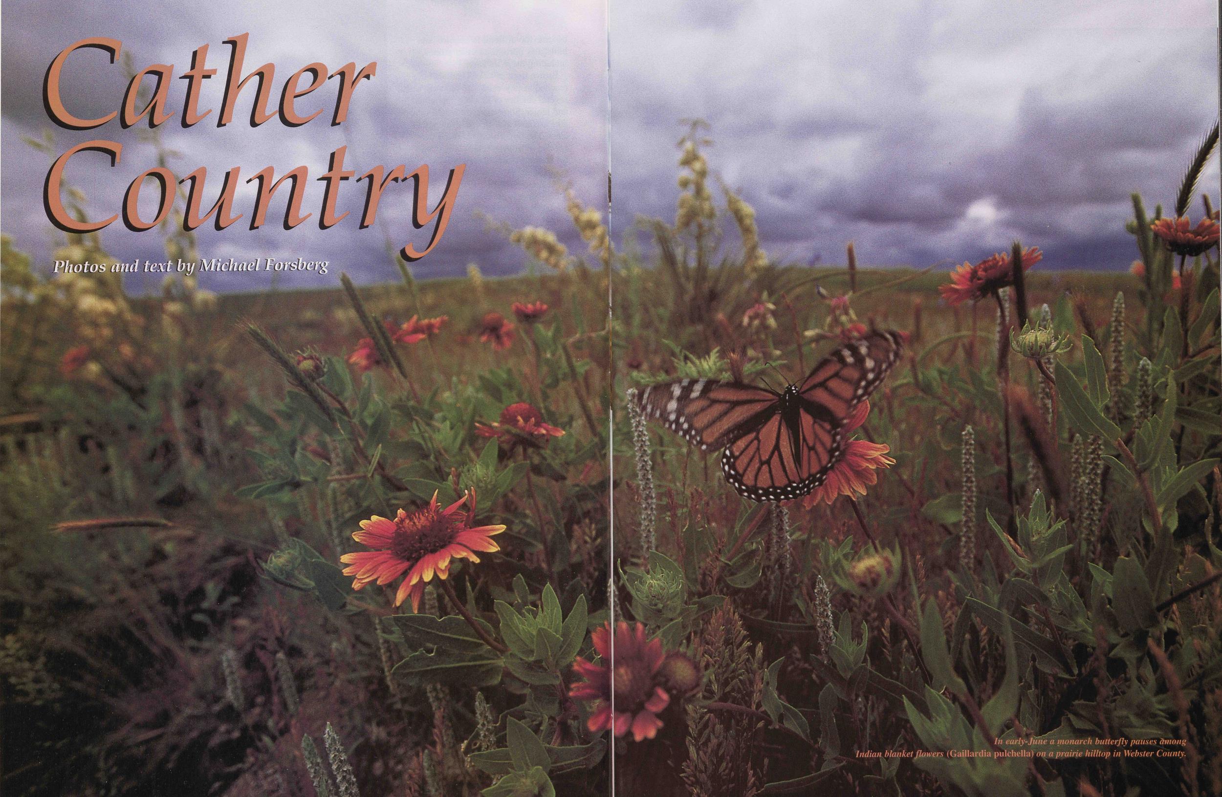
Cather Country
In early-June a monarch butterfly pauses among Indian blanket flowers (Gaillardia pulchella) on a prairie hilltop in Webster County.
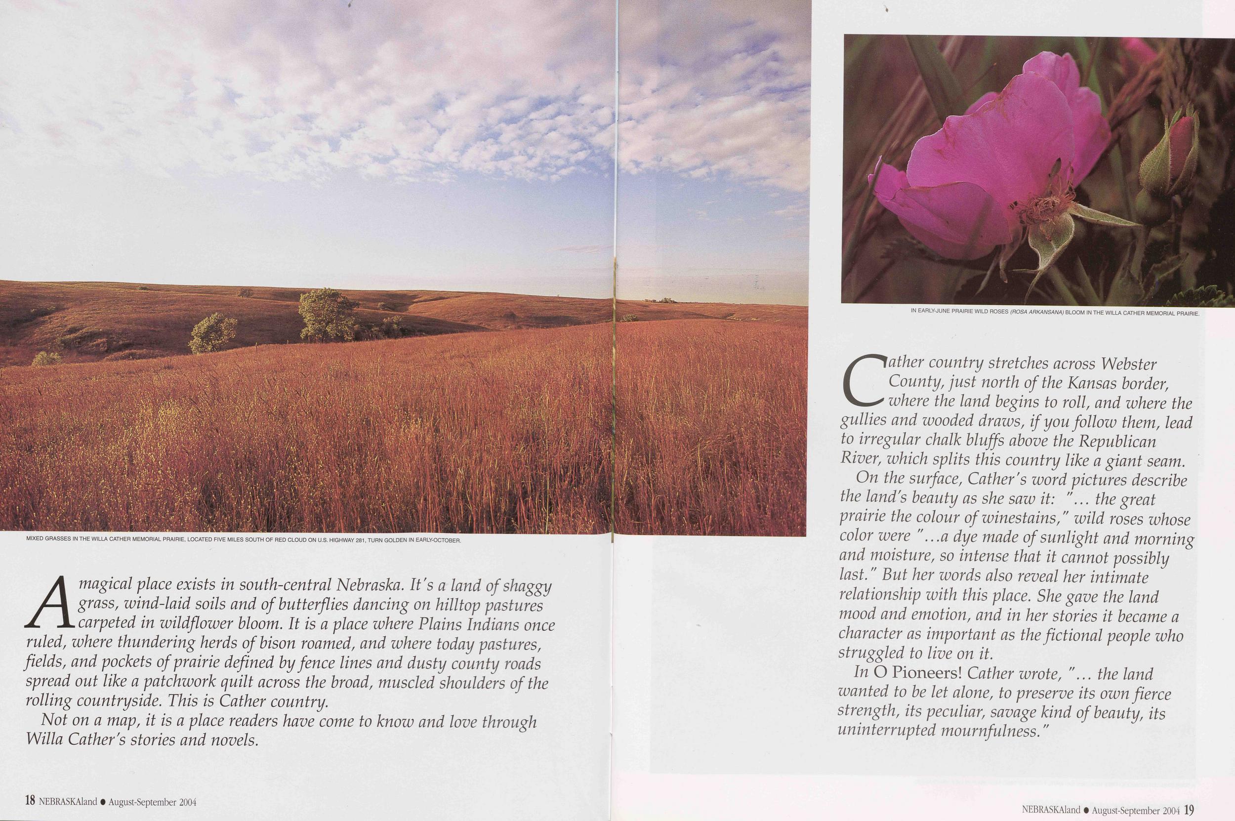
MIXED GRASSES IN THE WILLA CATHER MEMORIAL PRAIRIE, LOCATED FIVE MILES SOUTH OF RED CLOUD ON U.S. HIGHWAY 281, TURN GOLDEN IN EARLY-OCTOBER.
A magical place exists in south-central Nebraska. It's a land of shaggy grass, wind-laid soils and of butterflies dancing on hilltop pastures carpeted in wildflower bloom. It is a place where Plains Indians once ruled, where thundering herds of bison roamed, and where today pastures, fields, pockets of prairie defined by fence lines and dusty county roads spread out like a patchwork quilt across the broad, muscled shoulders of the rolling countryside. This is Cather country.
Not on a map, it is a place readers have come to know and love through Willa Gather's stories and novels.
18 NEBRASKAland • August-September 2004IN EARLY-JUNE PRAIRIE WILD ROSES (ROSA ARKANSANA) BLOOM IN THE WILLA CATHER MEMORIAL PRAIRIE.
Cather country stretches across Webster County, just north of the Kansas border, where the land begins to roll, and where the gullies and wooded draws, if you follow them, lead to irregular chalk bluffs above the Republican River, which splits this country like a giant seam.
On the surface, Gather's word pictures describe the land's beauty as she saw it: "... the great prairie the colour of winestains," wild roses whose color were "...a dye made of sunlight and morning and moisture, so intense that it cannot possibly last." But her words also reveal her intimate relationship with this place. She gave the land mood and emotion, and in her stories it became a character as important as the fictional people who struggled to live on it.
In O Pioneers! Cather wrote, "... the land wanted to be let alone, to preserve its own fierce strength, its peculiar, savage kind of beauty, its uninterrupted mournfulness."
NEBRASKAland • August-September 2004 19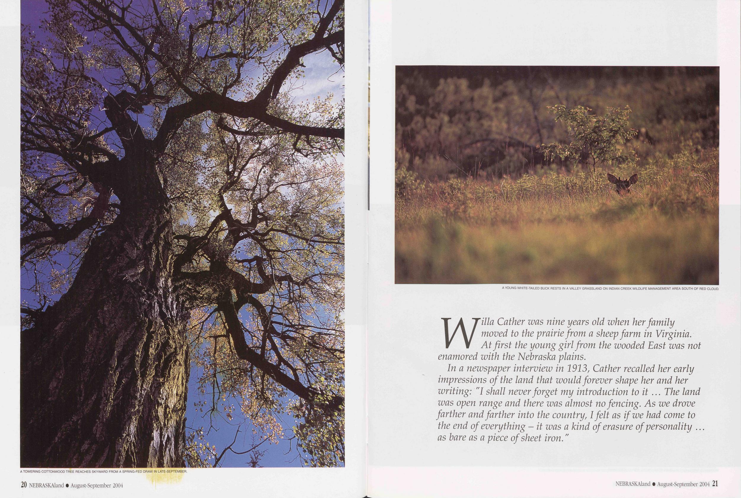
A TOWERING COTTONWOOD TREE REACHES SKYWARD FROM A SPRING-FED DRAW IN LATE-SEPTEMBER.
A YOUNG WHITE-TAILED BUCK RESTS IN A VALLEY GRASSLAND ON INDIAN CREEK WILDLIFE MANAGEMENT AREA SOUTH OF RED CLOUD.
Willa Cather was nine years old when her family moved to the prairie from a sheep farm in Virginia. At first the young girl from the wooded East was not enamored with the Nebraska plains.
In a newspaper interview in 1913, Cather recalled her early impressions of the land that would forever shape her and her writing: "I shall never forget my introduction to it... The land was open range and there was almost no fencing. As we drove farther and farther into the country, I felt as if we had come to the end of everything - it was a kind of erasure of personality ... as bare as a piece of sheet iron."
NEBRASKAland O August-September 2004 21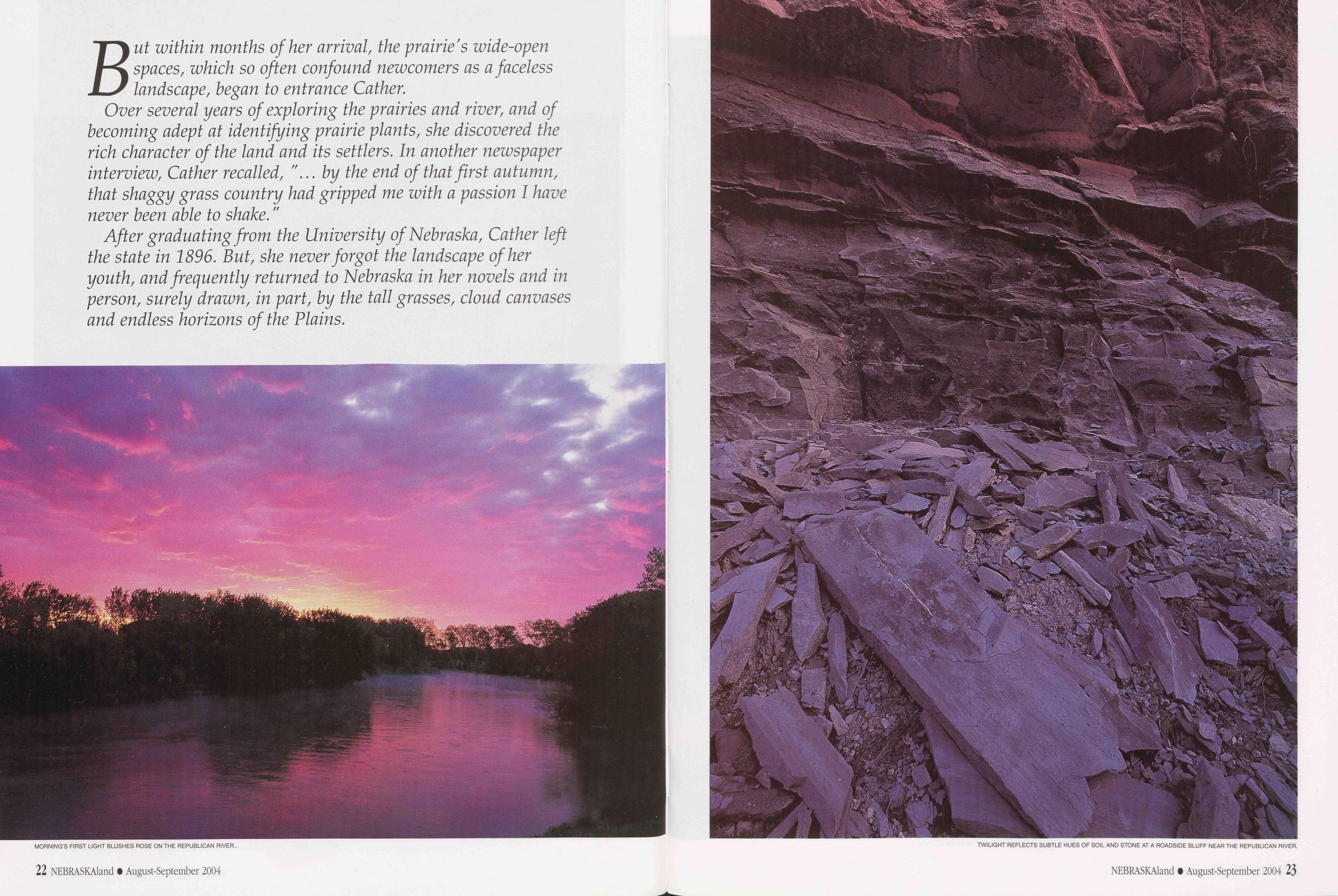
But within months of her arrival, the prairie's wide-open spaces, which so often confound newcomers as a faceless landscape, began to entrance Gather. Over several years of exploring the prairies and river, and of becoming adept at identifying prairie plants, she discovered the rich character of the land and its settlers. In another newspaper interview, Gather recalled, "... by the end of that first autumn, that shaggy grass country had gripped me with a passion I have never been able to shake."
After graduating from the University of Nebraska, Gather left the state in 1896. But, she never forgot the landscape of her youth, and frequently returned to Nebraska in her novels and in person, surely drawn, in part, by the tall grasses, cloud canvases and endless horizons of the Plains.
MORNING’S FIRST LIGHT BLUSHES ROSE ON THE REPUBLICAN RIVER..
TWILIGHT REFLECTS SUBTLE HUES OF SOIL AND STONE AT A ROADSIDE BLUFF NEAR THE REPUBLICAN RIVER.
Nearly 60 years after her death, Cather is still one of Nebraska's great prairie ambassadors. With a heartfelt passion, a keen eye and talented pen, she brought the prairies alive at the turn of a page.
"... more than anything else I felt motion in the landscape; in the fresh, easy-blowing morning wind, and in the earth itself, as if the shaggy grass were a sort of loose hide, and underneath it herds of wild buffalo were galloping, galloping ..."
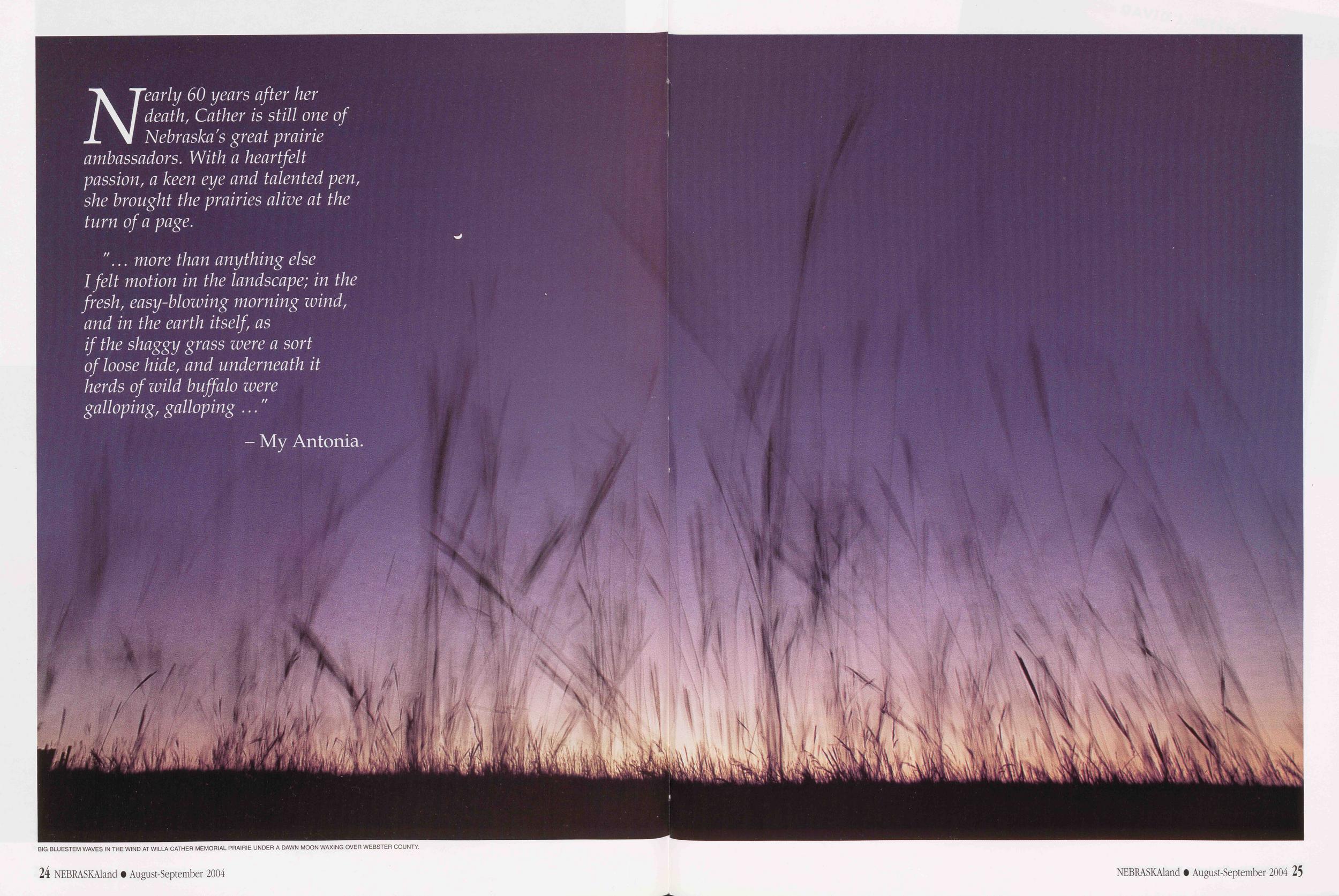
- My Antonia.BIG BLUESTEM WAVES IN THE WIND AT WILLA CATHER MEMORIAL PRAIRIE UNDER A DAWN MOON WAXING OVER WEBSTER COUNTY.
Encyclopedia of the Great Plains
The Great Plains stretches 1,800 miles from north to south and more than 500 miles from east to west. The region’s immense horizon, dominating sky and scant population convey a sense of vacancy. But these plains are far from empty, as this new, groundbreaking reference work attests.
So this is the proposition: Great Plains history, culture and natural attributes barely 300 years old in the Euroamerican mind - merit a scholarly encyclopedia.
Merely daring to define the American Plains - a vast, varied, amorphous area unbound by seas - is daunting. But the Encyclopedia of the Great Plains, to be published by the University of Nebraska Press in September, pushes much further. In 1,316 entries contributed by almost 1,000 writers over a period of 10 years, this book hones commonalities and differences among Plains people and places, deems what and who were historically relevant, and shapes a reliable, readable and groundbreaking reference work to inform readers today and for generations to come.
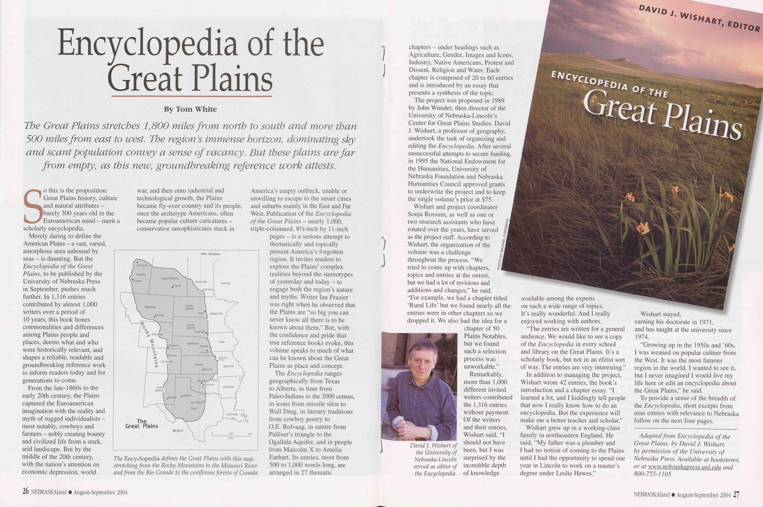
The Encyclopedia defines the Great Plains with this map, stretching from the Rocky Mountains to the Missouri River and from the Rio Grande to the coniferous forests of Canada.
The Encyclopedia ranges geographically from Texas to Alberta, in time from Paleo-Indians to the 2000 census, in icons from missile silos to Wall Drug, in literary traditions from cowboy poetry to O.E. Rolvaag, in nature from Palliser’s triangle to the Ogallala Aquifer, and in people from Malcolm X to Amelia Earhart. Its entries, most from 500 to 1,000 words long, are26 NEBRASKAland • August-September 2004 arranged in 27 thematic 26 NEBRASKAland • August-September 2004 chapters - under headings such as Agriculture, Gender, Images and Icons, Industry, Native Americans, Protest and Dissent, Religion and Water. Each chapter is composed of 20 to 60 entries and is introduced by an essay that presents a synthesis of the topic.
The project was proposed in 1989 by John Wunder, then director of the University of Nebraska-Lincoln’s Center for Great Plains Studies. David J. Wishart, a professor of geography, undertook the task of organizing and editing the Encyclopedia. After several unsuccessful attempts to secure funding, in 1995 the National Endowment for the Humanities, University of Nebraska Foundation and Nebraska Humanities Council approved grants to underwrite the project and to keep the single volume’s price at $75.
Wishart and project coordinator Sonja Rossum, as well as one or two research assistants who have rotated over the years, have served as the project staff. According to Wishart, the organization of the volume was a challenge throughout the process. “We tried to come up with chapters, topics and entries at the outset, but we had a lot of revisions and additions and changes,” he said. "For example, we had a chapter titled ‘Rural Life’ but we found nearly all the entries were in other chapters so we dropped it. We also had the idea for a chapter of 50 Plains Notables, but we found such a selection process was unworkable.”
David J. Wishart of the University of Nebraska-Lincoln served as editor of the Encyclopedia.
Remarkably, more than 1,000 different invited writers contributed the 1,316 entries without payment. Of the writers and their entries, Wishart said, "I should not have been, but I was surprised by the incredible depth of knowledge
“The entries are written for a general audience. We would like to see a copy of the Encyclopedia in every school and library on the Great Plains. It’s a scholarly book, but not in an elitist sort of way. The entries are very interesting.”
In addition to managing the project, Wishart wrote 42 entries, the book’s introduction and a chapter essay. "I learned a lot, and I kiddingly tell people that now I really know how to do an encyclopedia. But the experience will make me a better teacher and scholar.”
Wishart grew up in a working-class family in northeastern England. He said, "My father was a plumber and I had no notion of coming to the Plains until I had the opportunity to spend one year in Lincoln to work on a master’s degree under Leslie Hewes.”
Wishart stayed, earning his doctorate in 1971, and has taught at the university since 1974.
"Growing up in the 1950s and ’60s, I was weaned on popular culture from the West. It was the most famous region in the world. I wanted to see it, but I never imagined I would live my life here or edit an encyclopedia about the Great Plains,” he said.
To provide a sense of the breadth of the Encyclopedia, short excepts from nine entries with relevance to Nebraska follow on the next four pages.
Adapted from Encyclopedia of the Great Plains, by David J. Wishart, by permission of the University of Nebraska Press. Available at bookstores, or at www. nebraskaoress. uni pdu and 800-755-1105 NEBRASKAland • August-September 2004 27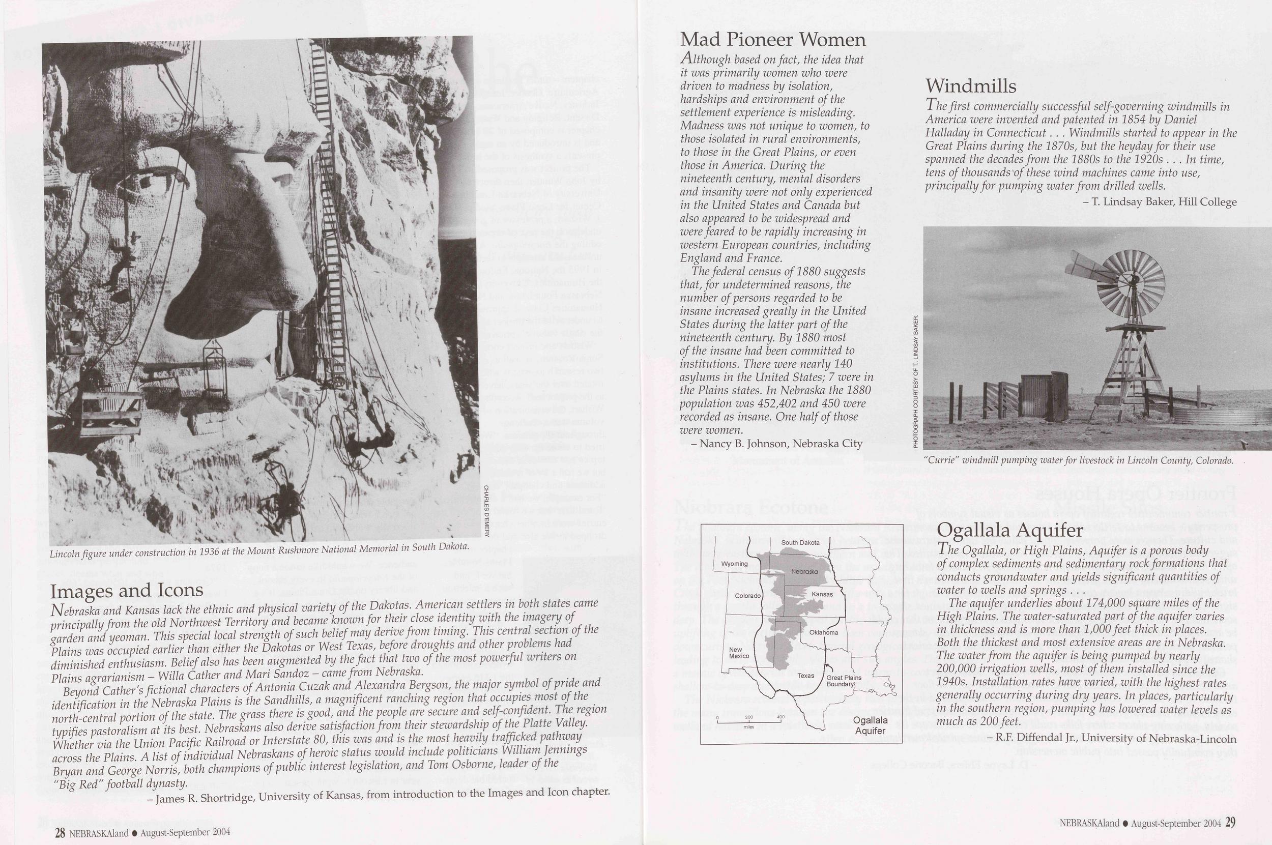
Lincoln figure under construction in 1936 at the Mount Rushmore National Memorial in South Dakota.
Nebraska and Kansas lack the ethnic and physical variety of the Dakotas. American settlers in both states came principally from the old Northwest Territory and became known for their close identity with the imagery of garden and yeoman. This special local strength of such belief may derive from timing. This central section of the Plains was occupied earlier than either the Dakotas or West Texas, before droughts and other problems had diminished enthusiasm. Belief also has been augmented by the fact that two of the most powerful writers on Plains agrarianism - Willa Gather and Mari Sandoz - came from Nebraska.
Beyond Gather's fictional characters of Antonia Cuzak and Alexandra Bergson, the major symbol of pride and identification in the Nebraska Plains is the Sandhills, a magnificent ranching region that occupies most of the north-central portion of the state. The grass there is good, and the people are secure and self-confident. The region typifies pastoralism at its best. Nebraskans also derive satisfaction from their stewardship of the Platte Valley. Whether via the Union Pacific Railroad or Interstate 80, this was and is the most heavily trafficked pathway across the Plains. A list of individual Nebraskans of heroic status would include politicians William Jennings Bryan and George Norris, both champions of public interest legislation, and Tom Osborne, leader of the "Big Red" football dynasty.
- James R. Shortridge, University of Kansas, from introduction to the Images and Icon chapter. 28 NEBRASKAland • August-September 2004 Mad Pioneer WomenAlthough based on fact, the idea that it was primarily women who were driven to madness by isolation, hardships and environment of the settlement experience is misleading. Madness was not unique to women, to those isolated in rural environments, to those in the Great Plains, or even those in America. During the nineteenth century, mental disorders and insanity were not only experienced in the United States and Canada but also appeared to be widespread and were feared to be rapidly increasing in western European countries, including England and France.
The federal census of 1880 suggests that, for undetermined reasons, the number of persons regarded to be insane increased greatly in the United States during the latter part of the nineteenth century. By 1880 most of the insane had been committed to institutions. There were nearly 140 asylums in the United States; 7 were in the Plains states. In Nebraska the 1880 population was 452,402 and 450 were recorded as insane. One half of those were women.
- Nancy B. Johnson, Nebraska City WindmillsThe first commercially successful self-governing windmills in America were invented and patented in 1854 by Daniel Halladay in Connecticut. .. Windmills started to appear in the Great Plains during the 1870s, but the heyday for their use spanned the decades from the 1880s to the 1920s ... In time, tens of thousands of these wind machines came into use, principally for pumping water from drilled wells.
- T. Lindsay Baker, Hill College"Currie" windmill pumping water for livestock in Lincoln County, Colorado.
The Ogallala, or High Plains, Aquifer is a porous body of complex sediments and sedimentary rock formations that conducts groundwater and yields significant quantities of water to wells and springs . ..
The aquifer underlies about 174,000 square miles of the High Plains. The water-saturated part of the aquifer varies in thickness and is more than 1,000feet thick in places. Both the thickest and most extensive areas are in Nebraska. The water from the aquifer is being pumped by nearly 200,000 irrigation wells, most of them installed since the 1940s. Installation rates have varied, with the highest rates generally occurring during dry years. In places, particularly in the southern region, pumping has lowered water levels as much as 200 feet.
- R.F. Diffendal Jr., University of Nebraska-Lincoln NEBRASKAland • August-September 2004 29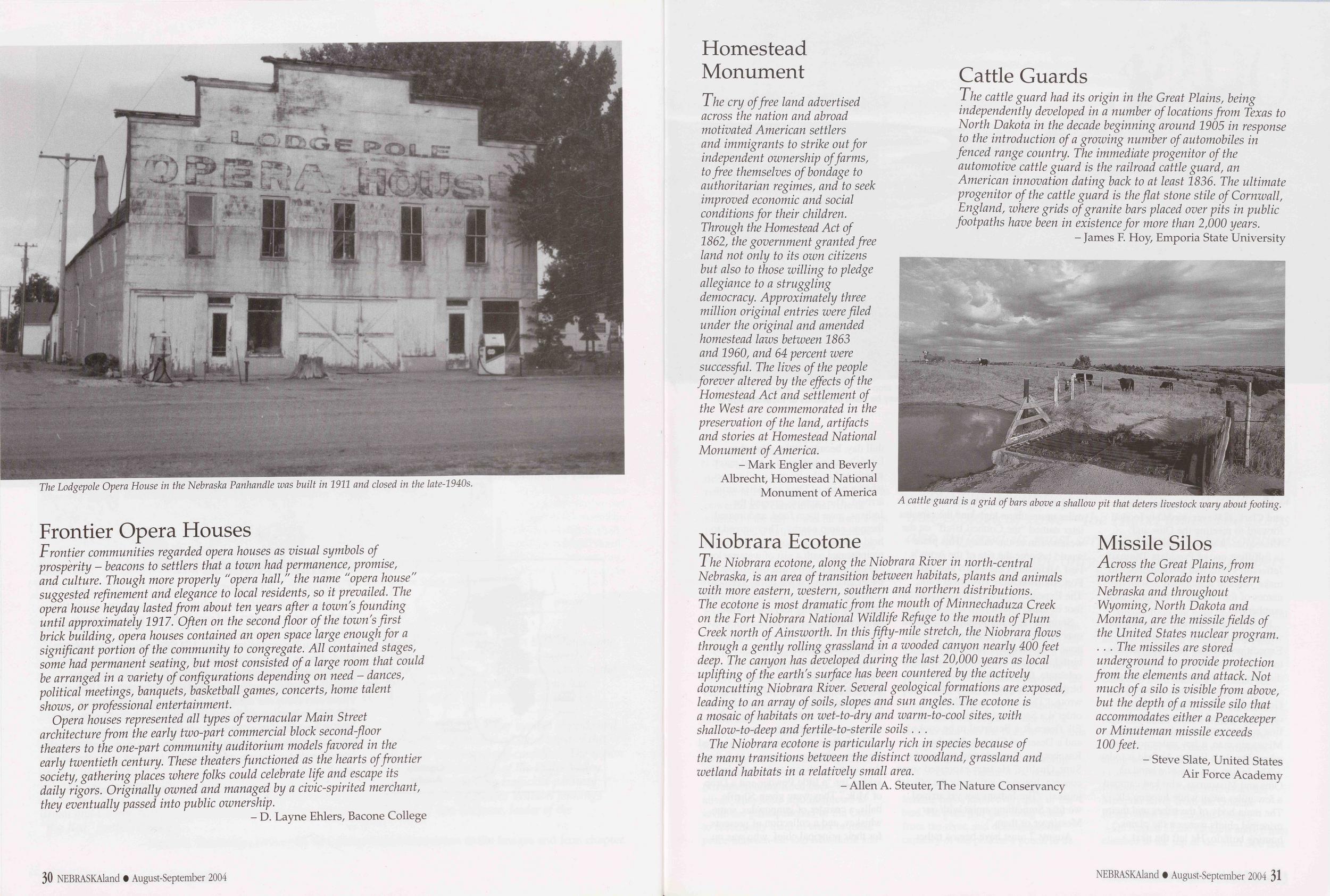
The Lodgepole Opera House in the Nebraska Panhandle was built in 1911 and closed in the late-1940s.
Frontier communities regarded opera houses as visual symbols of prosperity - beacons to settlers that a town had permanence, promise, and culture. Though more properly "opera hall," the name "opera house" suggested refinement and elegance to local residents, so it prevailed. The opera house heyday lasted from about ten years after a town's founding until approximately 1917. Often on the second floor of the town's first brick building, opera houses contained an open space large enough for a significant portion of the community to congregate. All contained stages, some had permanent seating, but most consisted of a large room that could be arranged in a variety of configurations depending on need - dances, political meetings, banquets, basketball games, concerts, home talent shows, or professional entertainment.
Opera houses represented all types of vernacular Main Street architecture from the early two-part commercial block second-floor theaters to the one-part community auditorium models favored in the early twentieth century. These theaters functioned as the hearts of frontier society, gathering places where folks could celebrate life and escape its daily rigors. Originally owned and managed by a civic-spirited merchant, they eventually passed into public ownership.
- D. Layne Ehlers, Bacone College 30 NEBRASKAland • August-September 2004 Homestead MonumentThe cry of free land advertised across the nation and abroad motivated American settlers and immigrants to strike out for independent ownership of farms, to free themselves of bondage to authoritarian regimes, and to seek improved economic and social conditions for their children. Through the Homestead Act of 1862, the government granted free land not only to its own citizens but also to those willing to pledge allegiance to a struggling democracy. Approximately three million original entries were filed under the original and amended homestead laws between 1863 and 1960, and 64 percent were successful. The lives of the people forever altered by the effects of the Homestead Act and settlement of the West are commemorated in the preservation of the land, artifacts and stories at Homestead National Monument of America.
- Mark Engler and Beverly Albrecht, Homestead National Monument of America Cattle GuardsThe cattle guard had its origin in the Great Plains, being independently developed in a number of locations from Texas to North Dakota in the decade beginning around 1905 in response to the introduction of a growing number of automobiles in fenced range country. The immediate progenitor of the automotive cattle guard is the railroad cattle guard, an American innovation dating back to at least 1836. The ultimate progenitor of the cattle guard is the flat stone stile of Cornwall, England, where grids of granite bars placed over pits in public footpaths have been in existence for more than 2,000 years.
- James F. Hoy, Emporia State UniversityA cattle guard is a grid of bars above a shallow pit that deters livestock wary about footing.
The Niobrara ecotone, along the Niobrara River in north-central Nebraska, is an area of transition between habitats, plants and animals with more eastern, western, southern and northern distributions. The ecotone is most dramatic from the mouth of Minnechaduza Creek on the Fort Niobrara National Wildlife Refuge to the mouth of Plum Creek north of Ainsworth. In this fifty-mile stretch, the Niobrara flows through a gently rolling grassland in a wooded canyon nearly 400feet deep. The canyon has developed during the last 20,000 years as local uplifting of the earth's surface has been countered by the actively downcutting Niobrara River. Several geological formations are exposed, leading to an array of soils, slopes and sun angles. The ecotone is a mosaic of habitats on wet-to-dry and warm-to-cool sites, with shallow-to-deep and fertile-to-sterile soils . . .
The Niobrara ecotone is particularly rich in species because of the many transitions between the distinct woodland, grassland and wetland habitats in a relatively small area.
- Allen A. Steuter, The Nature Conservancy Missile SilosAcross the Great Plains, from northern Colorado into western Nebraska and throughout Wyoming, North Dakota and Montana, are the missile fields of the United States nuclear program. ... The missiles are stored underground to provide protection from the elements and attack. Not much of a silo is visible from above, but the depth of a missile silo that accommodates either a Peacekeeper or Minuteman missile exceeds 100 feet.
- Steve Slate, United States Air Force Academy NEBRASKAland • August-September 2004 31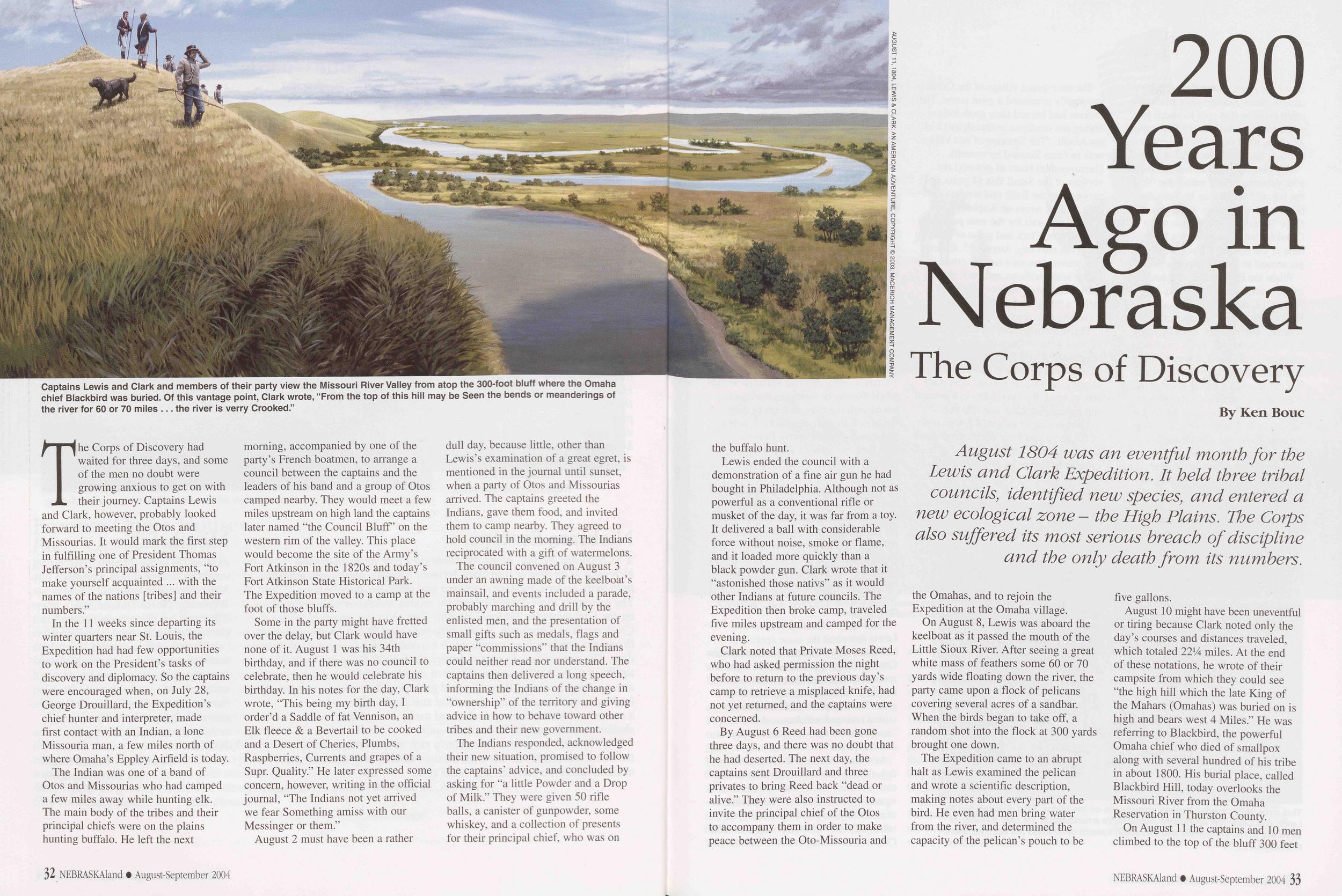
Captains Lewis and Clark and members of their party view the Missouri River Valley from atop the 300-foot bluff where the Omaha chief Blackbird was buried. Of this vantage point, Clark wrote, “From the top of this hill may be Seen the bends or meanderings of the river for 60 or 70 miles ... the river is verry Crooked.”
200 Years Ago in Nebraska
The Corps of Discovery
August 1804 was an eventful month for the Lewis and Clark Expedition. It held three tribal councils, identified new species, and entered a new ecological zone - the High Plains. The Corps also suffered its most serious breach of discipline and the only death from its numbers.
The Corps of Discovery had waited for three days, and some of the men no doubt were growing anxious to get on with their journey. Captains Lewis and Clark, however, probably looked forward to meeting the Otos and Missourias. It would mark the first step in fulfilling one of President Thomas Jefferson’s principal assignments, "to make yourself acquainted ... with the names of the nations [tribes] and their numbers.”
In the 11 weeks since departing its winter quarters near St. Louis, the Expedition had had few opportunities to work on the President’s tasks of discovery and diplomacy. So the captains were encouraged when, on July 28, George Drouillard, the Expedition’s chief hunter and interpreter, made first contact with an Indian, a lone Missouria man, a few miles north of where Omaha’s Eppley Airfield is today.
The Indian was one of a band of Otos and Missourias who had camped a few miles away while hunting elk. The main body of the tribes and their principal chiefs were on the plains hunting buffalo. He left the next morning, accompanied by one of the party’s French boatmen, to arrange a council between the captains and the leaders of his band and a group of Otos camped nearby. They would meet a few miles upstream on high land the captains later named "the Council Bluff’ on the western rim of the valley. This place would become the site of the Army’s Fort Atkinson in the 1820s and today’s Fort Atkinson State Historical Park. The Expedition moved to a camp at the foot of those bluffs.
Some in the party might have fretted over the delay, but Clark would have none of it. August 1 was his 34th birthday, and if there was no council to celebrate, then he would celebrate his birthday. In his notes for the day, Clark wrote, "This being my birth day, I order’d a Saddle of fat Vennison, an Elk fleece & a Bevertail to be cooked and a Desert of Cheries, Plumbs, Raspberries, Currents and grapes of a Supr. Quality.” He later expressed some concern, however, writing in the official journal, "The Indians not yet arrived we fear Something amiss with our Messinger or them.”
August 2 must have been a rather dull day, because little, other than Lewis’s examination of a great egret, is mentioned in the journal until sunset, when a party of Otos and Missourias arrived. The captains greeted the Indians, gave them food, and invited them to camp nearby. They agreed to hold council in the morning. The Indians reciprocated with a gift of watermelons.
The council convened on August 3 under an awning made of the keelboat’s mainsail, and events included a parade, probably marching and drill by the enlisted men, and the presentation of small gifts such as medals, flags and paper "commissions” that the Indians could neither read nor understand. The captains then delivered a long speech, informing the Indians of the change in "ownership” of the territory and giving advice in how to behave toward other tribes and their new government.
The Indians responded, acknowledged their new situation, promised to follow the captains’ advice, and concluded by asking for "a little Powder and a Drop of Milk.” They were given 50 rifle balls, a canister of gunpowder, some whiskey, and a collection of presents for their principal chief, who was on 32 NEBRASKAland • August-September 2004 the buffalo hunt.
Lewis ended the council with a demonstration of a fine air gun he had bought in Philadelphia. Although not as powerful as a conventional rifle or musket of the day, it was far from a toy. It delivered a ball with considerable force without noise, smoke or flame, and it loaded more quickly than a black powder gun. Clark wrote that it “astonished those nativs” as it would other Indians at future councils. The Expedition then broke camp, traveled five miles upstream and camped for the evening.
Clark noted that Private Moses Reed, who had asked permission the night before to return to the previous day’s camp to retrieve a misplaced knife, had not yet returned, and the captains were concerned.
By August 6 Reed had been gone three days, and there was no doubt that he had deserted. The next day, the captains sent Drouillard and three privates to bring Reed back "dead or alive.” They were also instructed to invite the principal chief of the Otos to accompany them in order to make peace between the Oto-Missouria and the Omahas, and to rejoin the Expedition at the Omaha village.
On August 8, Lewis was aboard the keelboat as it passed the mouth of the Little Sioux River. After seeing a great white mass of feathers some 60 or 70 yards wide floating down the river, the party came upon a flock of pelicans covering several acres of a sandbar. When the birds began to take off, a random shot into the flock at 300 yards brought one down.
The Expedition came to an abrupt halt as Lewis examined the pelican and wrote a scientific description, making notes about every part of the bird. He even had men bring water from the river, and determined the capacity of the pelican’s pouch to be five gallons.
August 10 might have been uneventful or tiring because Clark noted only the day’s courses and distances traveled, which totaled 2214 miles. At the end of these notations, he wrote of their campsite from which they could see "the high hill which the late King of the Mahars (Omahas) was buried on is high and bears west 4 Miles.” He was referring to Blackbird, the powerful Omaha chief who died of smallpox along with several hundred of his tribe in about 1800. His burial place, called Blackbird Hill, today overlooks the Missouri River from the Omaha Reservation in Thurston County.
bed to the top of the bluff 300 feet NEBRASKAland • August-September 2004 33 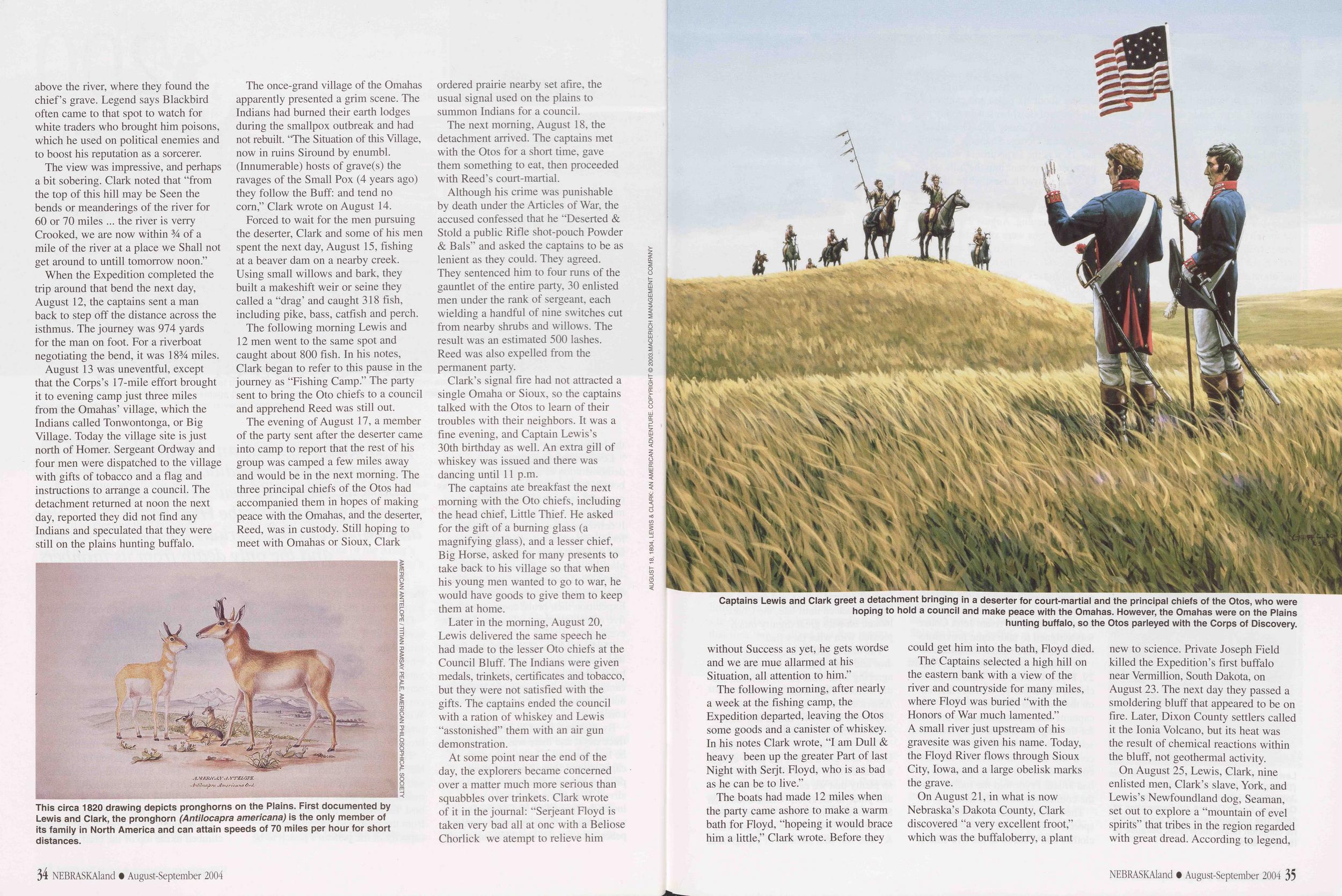 above the river, where they found the chief’s grave. Legend says Blackbird often came to that spot to watch for white traders who brought him poisons, which he used on political enemies and to boost his reputation as a sorcerer.
The view was impressive, and perhaps a bit sobering. Clark noted that “from the top of this hill may be Seen the bends or meanderings of the river for 60 or 70 miles ... the river is verry Crooked, we are now within 3/4 of a mile of the river at a place we Shall not get around to untill tomorrow noon.”
When the Expedition completed the trip around that bend the next day, August 12, the captains sent a man back to step off the distance across the isthmus. The journey was 974 yards for the man on foot. For a riverboat negotiating the bend, it was 18 3/4 miles.
August 13 was uneventful, except that the Corps’s 17-mile effort brought it to evening camp just three miles from the Omahas’ village, which the Indians called Tonwontonga, or Big Village. Today the village site is just north of Homer. Sergeant Ordway and four men were dispatched to the village with gifts of tobacco and a flag and instructions to arrange a council. The detachment returned at noon the next day, reported they did not find any Indians and speculated that they were still on the plains hunting buffalo.
This circa 1820 drawing depicts pronghorns on the Plains. First documented by Lewis and Clark, the pronghorn (Antilocapra americana) is the only member of its family in North America and can attain speeds of 70 miles per hour for short distances.
The once-grand village of the Omahas apparently presented a grim scene. The Indians had burned their earth lodges during the smallpox outbreak and had not rebuilt. “The Situation of this Village, now in ruins Siround by enumbl. (Innumerable) hosts of grave(s) the ravages of the Small Pox (4 years ago) they follow the Buff: and tend no corn,” Clark wrote on August 14.
Forced to wait for the men pursuing the deserter, Clark and some of his men spent the next day, August 15, fishing at a beaver dam on a nearby creek. Using small willows and bark, they built a makeshift weir or seine they called a “drag’ and caught 318 fish, including pike, bass, catfish and perch.
The following morning Lewis and 12 men went to the same spot and caught about 800 fish. In his notes, Clark began to refer to this pause in the journey as “Fishing Camp.” The party sent to bring the Oto chiefs to a council and apprehend Reed was still out.
The evening of August 17, a member of the party sent after the deserter came into camp to report that the rest of his group was camped a few miles away and would be in the next morning. The three principal chiefs of the Otos had accompanied them in hopes of making peace with the Omahas, and the deserter, Reed, was in custody. Still hoping to meet with Omahas or Sioux, Clark ordered prairie nearby set afire, the usual signal used on the plains to summon Indians for a council.
The next morning, August 18, the detachment arrived. The captains met with the Otos for a short time, gave them something to eat, then proceeded with Reed’s court-martial.
Although his crime was punishable by death under the Articles of War, the accused confessed that he “Deserted & Stold a public Rifle shot-pouch Powder & Bals” and asked the captains to be as lenient as they could. They agreed. They sentenced him to four runs of the gauntlet of the entire party, 30 enlisted men under the rank of sergeant, each wielding a handful of nine switches cut from nearby shrubs and willows. The result was an estimated 500 lashes. Reed was also expelled from the permanent party.
Clark’s signal fire had not attracted a single Omaha or Sioux, so the captains talked with the Otos to learn of their troubles with their neighbors. It was a fine evening, and Captain Lewis’s 30th birthday as well. An extra gill of whiskey was issued and there was dancing until 11 p.m.
The captains ate breakfast the next morning with the Oto chiefs, including the head chief, Little Thief. He asked for the gift of a burning glass (a magnifying glass), and a lesser chief, Big Horse, asked for many presents to take back to his village so that when his young men wanted to go to war, he would have goods to give them to keep them at home.
Later in the morning, August 20, Lewis delivered the same speech he had made to the lesser Oto chiefs at the Council Bluff. The Indians were given medals, trinkets, certificates and tobacco, but they were not satisfied with the gifts. The captains ended the council with a ration of whiskey and Lewis “asstonished” them with an air gun demonstration.
Captains Lewis and Clark greet a detachment bringing in a deserter for court-martial and the principal chiefs of the Otos, who were hoping to hold a council and make peace with the Omahas. However, the Omahas were on the Plains hunting buffalo, so the Otos parleyed with the Corps of Discovery.
The following morning, after nearly a week at the fishing camp, the Expedition departed, leaving the Otos some goods and a canister of whiskey. In his notes Clark wrote, “I am Dull & heavy been up the greater Part of last Night with Serjt. Floyd, who is as bad as he can be to live.”
The boats had made 12 miles when the party came ashore to make a warm bath for Floyd, “hopeing it would brace him a little,” Clark wrote. Before they could get him into the bath, Floyd died.
The Captains selected a high hill on the eastern bank with a view of the river and countryside for many miles, where Floyd was buried “with the Honors of War much lamented.” A small river just upstream of his gravesite was given his name. Today, the Floyd River flows through Sioux City, Iowa, and a large obelisk marks the grave.
On August 21, in what is now Nebraska’s Dakota County, Clark discovered “a very excellent froot,” which was the buffaloberry, a plant new to science. Private Joseph Field killed the Expedition’s first buffalo near Vermillion, South Dakota, on August 23. The next day they passed a smoldering bluff that appeared to be on fire. Later, Dixon County settlers called it the Ionia Volcano, but its heat was the result of chemical reactions within the bluff, not geothermal activity.
On August 25, Lewis, Clark, nine enlisted men, Clark’s slave, York, and Lewis’s Newfoundland dog, Seaman, set out to explore a “mountain of evel spirits” that tribes in the region regarded with great dread. According to legend, NEBRASKAland August-September 2004 35 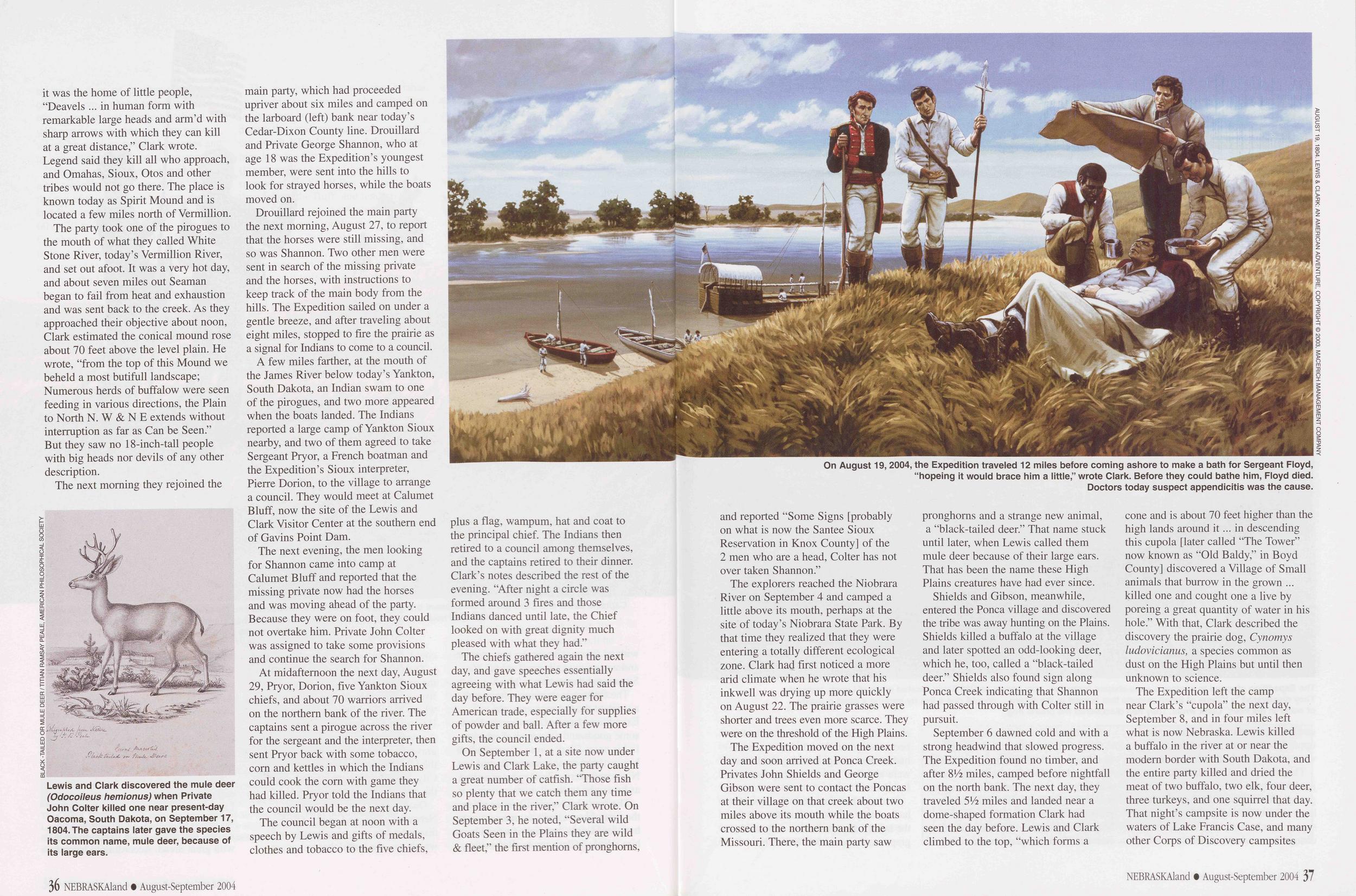 it was the home of little people, “Deavels ... in human form with remarkable large heads and arm’d with sharp arrows with which they can kill at a great distance,” Clark wrote. Legend said they kill all who approach, and Omahas, Sioux, Otos and other tribes would not go there. The place is known today as Spirit Mound and is located a few miles north of Vermillion.
The party took one of the pirogues to the mouth of what they called White Stone River, today’s Vermillion River, and set out afoot. It was a very hot day, and about seven miles out Seaman began to fail from heat and exhaustion and was sent back to the creek. As they approached their objective about noon, Clark estimated the conical mound rose about 70 feet above the level plain. He wrote, “from the top of this Mound we beheld a most butifull landscape; Numerous herds of buffalow were seen feeding in various directions, the Plain to North N. W & N E extends without interruption as far as Can be Seen.” But they saw no 18-inch-tall people with big heads nor devils of any other description.
BLACK -TAILED OR MULE DEER / TITIAN RAMSAY REALE, AMERICAN PHILOSOPHICAL SOCIETY Lewis and Clark discovered the mule deer (Odocoileus hemionus) when Private John Colter killed one near present-day Oacoma, South Dakota, on September 17, 1804. The captains later gave the species its common name, mule deer, because of its large ears.
Drouillard rejoined the main party the next morning, August 27, to report that the horses were still missing, and so was Shannon. Two other men were sent in search of the missing private and the horses, with instructions to keep track of the main body from the hills. The Expedition sailed on under a gentle breeze, and after traveling about eight miles, stopped to fire the prairie as a signal for Indians to come to a council.
A few miles farther, at the mouth of the James River below today’s Yankton, South Dakota, an Indian swam to one of the pirogues, and two more appeared when the boats landed. The Indians reported a large camp of Yankton Sioux nearby, and two of them agreed to take Sergeant Pryor, a French boatman and the Expedition’s Sioux interpreter, Pierre Dorion, to the village to arrange a council. They would meet at Calumet Bluff, now the site of the Lewis and Clark Visitor Center at the southern end of Gavins Point Dam.
The next evening, the men looking for Shannon came into camp at Calumet Bluff and reported that the missing private now had the horses and was moving ahead of the party. Because they were on foot, they could not overtake him. Private John Colter was assigned to take some provisions and continue the search for Shannon.
At midaftemoon the next day, August 29, Pryor, Dorion, five Yankton Sioux chiefs, and about 70 warriors arrived on the northern bank of the river. The captains sent a pirogue across the river for the sergeant and the interpreter, then sent Pryor back with some tobacco, corn and kettles in which the Indians could cook the corn with game they had killed. Pryor told the Indians that the council would be the next day.
The council began at noon with a speech by Lewis and gifts of medals, clothes and tobacco to the five chiefs, plus a flag, wampum, hat and coat to the principal chief. The Indians then retired to a council among themselves, and the captains retired to their dinner. Clark’s notes described the rest of the evening. “After night a circle was formed around 3 fires and those Indians danced until late, the Chief looked on with great dignity much pleased with what they had.”
The chiefs gathered again the next day, and gave speeches essentially agreeing with what Lewis had said the day before. They were eager for American trade, especially for supplies of powder and ball. After a few more gifts, the council ended.
On August 19, 2004, the Expedition traveled 12 miles before coming ashore to make a bath for Sergeant Floyd, “hopeing it would brace him a little,” wrote Clark. Before they could bathe him, Floyd died. Doctors today suspect appendicitis was the cause. AUGUST 19, 1804. LEWIS & CLARK: AN AMERICAN ADVENTURE, COPYRIGHT © 2003, MACERICH MANAGEMENT COMPANY
The explorers reached the Niobrara River on September 4 and camped a little above its mouth, perhaps at the site of today’s Niobrara State Park. By that time they realized that they were entering a totally different ecological zone. Clark had first noticed a more arid climate when he wrote that his inkwell was drying up more quickly on August 22. The prairie grasses were shorter and trees even more scarce. They were on the threshold of the High Plains.
The Expedition moved on the next day and soon arrived at Ponca Creek. Privates John Shields and George Gibson were sent to contact the Poncas at their village on that creek about two miles above its mouth while the boats crossed to the northern bank of the Missouri. There, the main party saw pronghorns and a strange new animal, a “black-tailed deer.” That name stuck until later, when Lewis called them mule deer because of their large ears. That has been the name these High Plains creatures have had ever since.
Shields and Gibson, meanwhile, entered the Ponca village and discovered the tribe was away hunting on the Plains. Shields killed a buffalo at the village and later spotted an odd-looking deer, which he, too, called a “black-tailed deer.” Shields also found sign along Ponca Creek indicating that Shannon had passed through with Colter still in pursuit.
September 6 dawned cold and with a strong headwind that slowed progress. The Expedition found no timber, and after 8A2 miles, camped before nightfall on the north bank. The next day, they traveled 5Vi miles and landed near a dome-shaped formation Clark had seen the day before. Lewis and Clark climbed to the top, “which forms a cone and is about 70 feet higher than the high lands around it... in descending this cupola [later called “The Tower” now known as “Old Baldy,” in Boyd County] discovered a Village of Small animals that burrow in the grown ... killed one and cought one a live by poreing a great quantity of water in his hole.” With that, Clark described the discovery the prairie dog, Cynomys ludovicianus, a species common as dust on the High Plains but until then unknown to science.
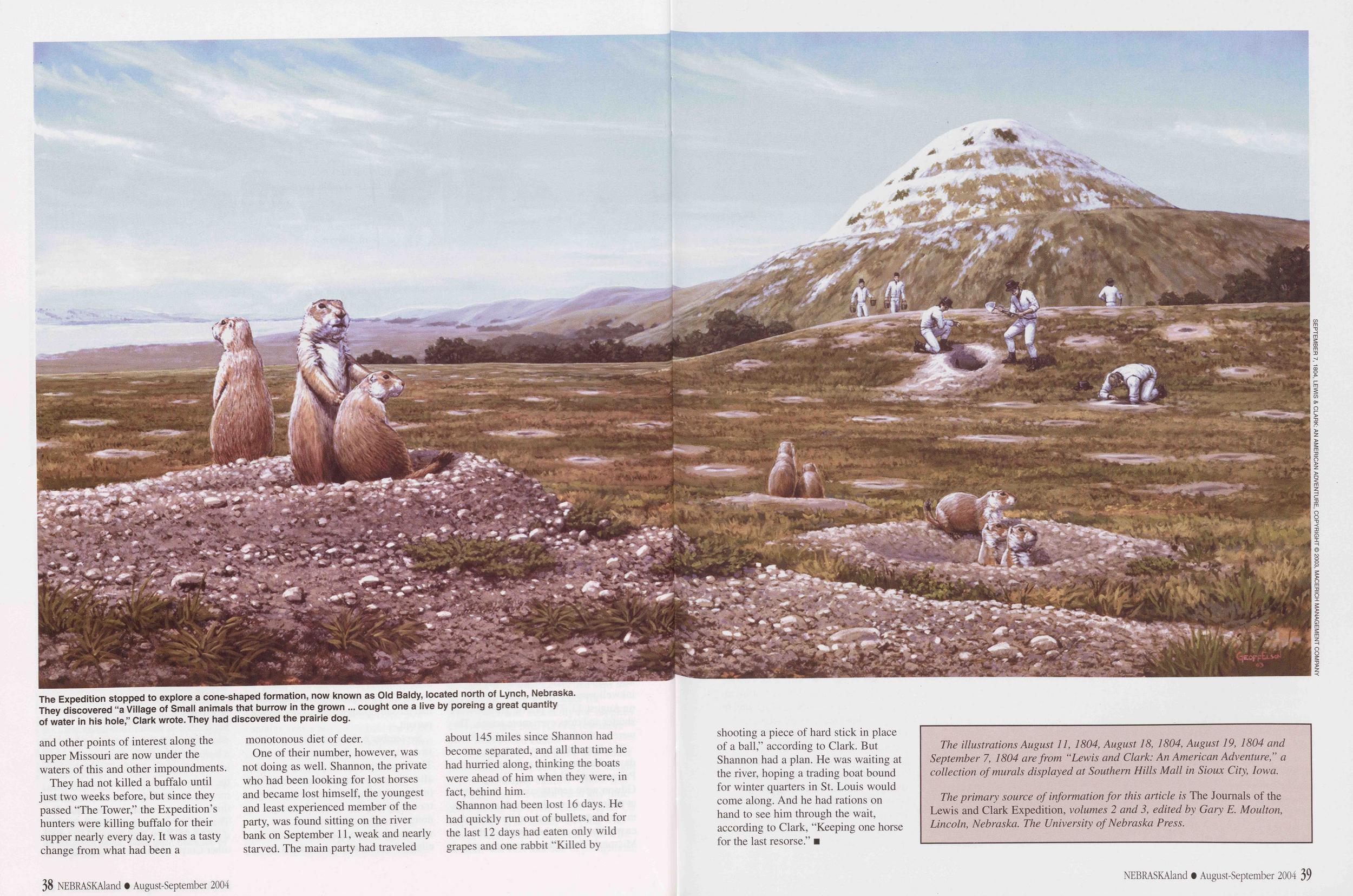
The Expedition stopped to explore a cone-shaped formation, now known as Old Baldy, located north of Lynch, Nebraska. They discovered “a Village of Small animals that burrow in the grown ... cought one a live by poreing a great quantity of water in his hole,” Clark wrote. They had discovered the prairie dog. SEPTEMBER 7, 1804, LEWIS & CLARK: AN AMERICAN ADVENTURE, COPYRIGHT © 2003, MACERICH MANAGEMENT COMPANY
They had not killed a buffalo until just two weeks before, but since they passed "The Tower,” the Expedition’s hunters were killing buffalo for their supper nearly every day. It was a tasty change from what had been a monotonous diet of deer.
One of their number, however, was not doing as well. Shannon, the private who had been looking for lost horses and became lost himself, the youngest and least experienced member of the party, was found sitting on the river bank on September 11, weak and nearly starved. The main party had traveled about 145 miles since Shannon had become separated, and all that time he had hurried along, thinking the boats were ahead of him when they were, in fact, behind him.
Shannon had been lost 16 days. He had quickly run out of bullets, and for the last 12 days had eaten only wild grapes and one rabbit "Killed by 38 NEBRASKAland • August-September 2004 shooting a piece of hard stick in place of a ball,” according to Clark. But Shannon had a plan. He was waiting at the river, hoping a trading boat bound for winter quarters in St. Louis would come along. And he had rations on hand to see him through the wait, according to Clark, "Keeping one horse for the last resorse.”
The illustrations August 11, 1804, August 18, 1804, August 19, 1804 and September 7, 1804 are from “Lewis and Clark: An American Adventure,” a collection of murals displayed at Southern Hills Mall in Sioux City, Iowa. The primary source of information for this article is The Journals of the Lewis and Clark Expedition, volumes 2 and 3, edited by Gary E. Moulton, Lincoln, Nebraska. The University of Nebraska Press. NEBRASKAland • August-September 2004 39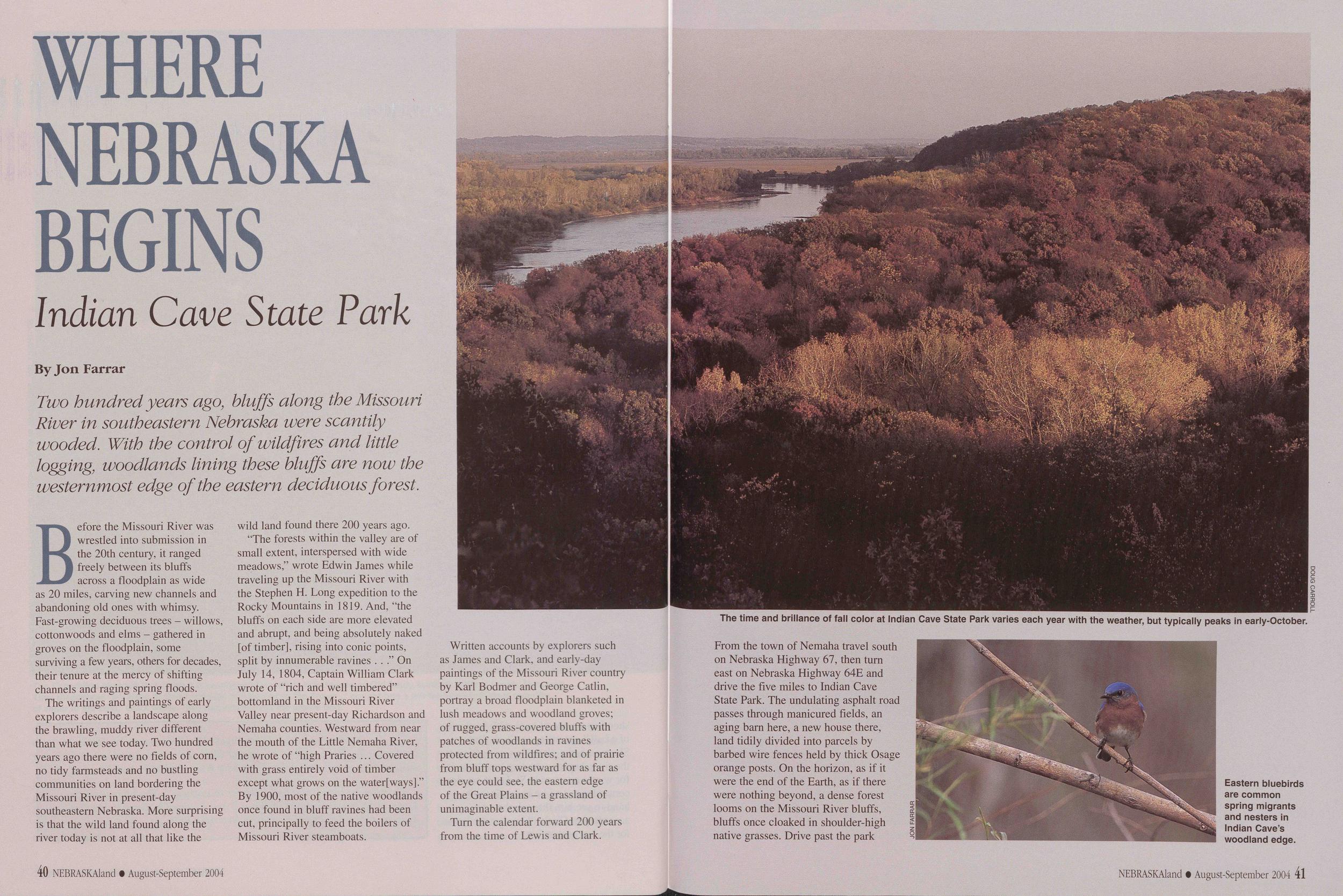
WHERE NEBRASKA BEGINS
Indian Cave State Park
Two hundred years ago, bluffs along the Missouri River in southeastern Nebraska were scantily wooded. With the control of wildfires and little logging, woodlands lining these bluffs are now the westernmost edge of the eastern deciduous forest.
Before the Missouri River was wrestled into submission in the 20th century, it ranged freely between its bluffs across a floodplain as wide as 20 miles, carving new channels and abandoning old ones with whimsy. Fast-growing deciduous trees - willows, cottonwoods and elms - gathered in groves on the floodplain, some surviving a few years, others for decades, their tenure at the mercy of shifting channels and raging spring floods.
The writings and paintings of early explorers describe a landscape along the brawling, muddy river different than what we see today. Two hundred years ago there were no fields of com, no tidy farmsteads and no bustling communities on land bordering the Missouri River in present-day southeastern Nebraska. More surprising is that the wild land found along the river today is not at all that like the wild land found there 200 years ago.
"The forests within the valley are of small extent, interspersed with wide meadows,” wrote Edwin James while traveling up the Missouri River with the Stephen H. Long expedition to the Rocky Mountains in 1819. And, "the bluffs on each side are more elevated and abrupt, and being absolutely naked [of timber], rising into conic points, split by innumerable ravines . . .” On July 14, 1804, Captain William Clark wrote of “rich and well timbered” bottomland in the Missouri River Valley near present-day Richardson and Nemaha counties. Westward from near the mouth of the Little Nemaha River, he wrote of "high Praries ... Covered with grass entirely void of timber except what grows on the waterways].” By 1900, most of the native woodlands once found in bluff ravines had been cut, principally to feed the boilers of Missouri River steamboats.
Written accounts by explorers such as James and Clark, and early-day paintings of the Missouri River country by Karl Bodmer and George Catlin, portray a broad floodplain blanketed in lush meadows and woodland groves; of rugged, grass-covered bluffs with patches of woodlands in ravines protected from wildfires; and of prairie from bluff tops westward for as far as the eye could see, the eastern edge of the Great Plains - a grassland of unimaginable extent.
The time and brillance of fall color at Indian Cave State Park varies each year with the weather, but typically peaks in early-October. DOUG CARROLL
Eastern bluebirds are common spring migrants and nesters in Indian Cave’s woodland edge.
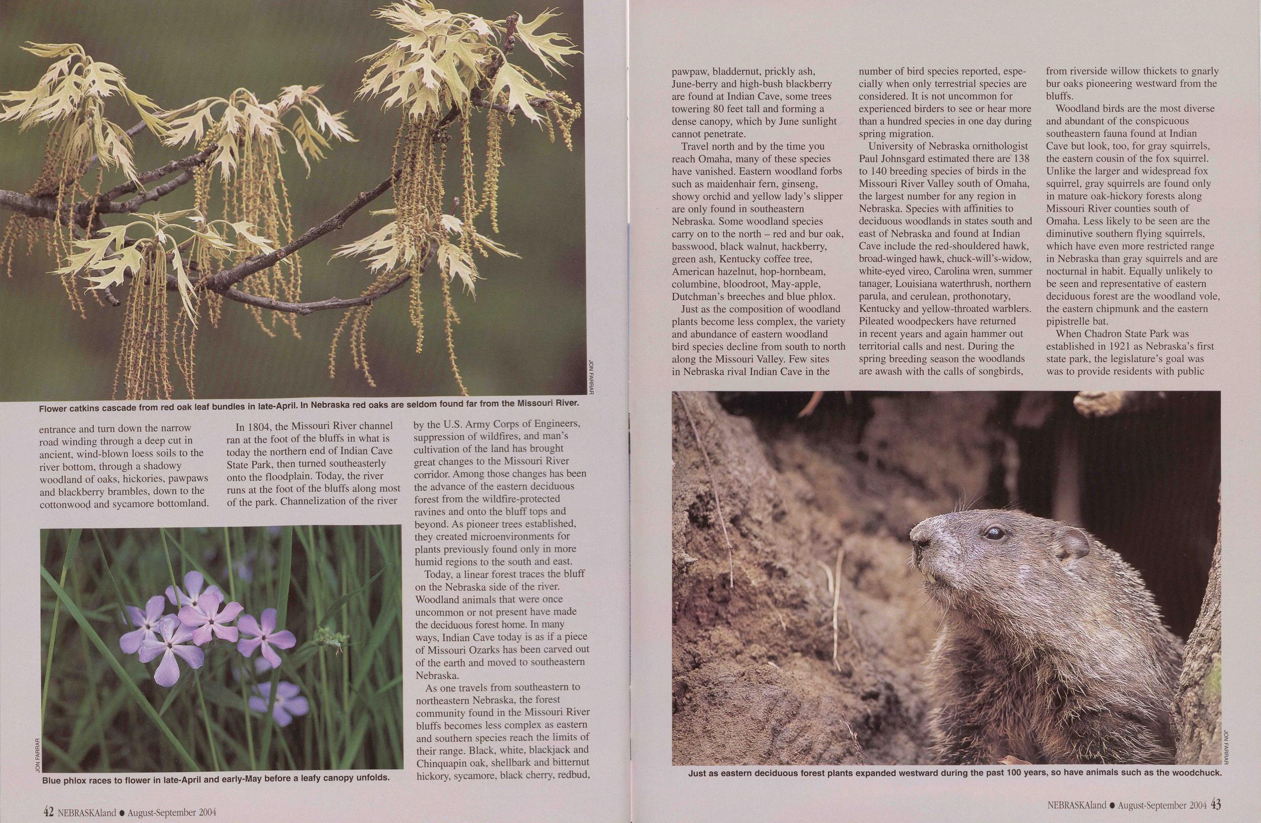
Flower catkins cascade from red oak leaf bundles in late-April. In Nebraska red oaks are seldom found far from the Missouri River.
JON FARRAR Blue phlox races to flower in late-April and early-May before a leafy canopy unfolds.
In 1804, the Missouri River channel ran at the foot of the bluffs in what is today the northern end of Indian Cave State Park, then turned southeasterly onto the floodplain. Today, the river runs at the foot of the bluffs along most of the park. Channelization of the river by the U.S. Army Corps of Engineers, suppression of wildfires, and man’s cultivation of the land has brought great changes to the Missouri River corridor. Among those changes has been the advance of the eastern deciduous forest from the wildfire-protected ravines and onto the bluff tops and beyond. As pioneer trees established, they created microenvironments for plants previously found only in more humid regions to the south and east.
Today, a linear forest traces the bluff on the Nebraska side of the river. Woodland animals that were once uncommon or not present have made the deciduous forest home. In many ways, Indian Cave today is as if a piece of Missouri Ozarks has been carved out of the earth and moved to southeastern Nebraska.
As one travels from southeastern to northeastern Nebraska, the forest community found in the Missouri River bluffs becomes less complex as eastern and southern species reach the limits of their range. Black, white, blackjack and Chinquapin oak, shellbark and bitternut hickory, sycamore, black cherry, redbud, 42 NEBRASKAland • August-September 2004 pawpaw, bladdernut, prickly ash, lune-berry and high-bush blackberry are found at Indian Cave, some trees towering 80 feet tall and forming a dense canopy, which by June sunlight cannot penetrate.
Travel north and by the time you reach Omaha, many of these species have vanished. Eastern woodland forbs such as maidenhair fern, ginseng, showy orchid and yellow lady’s slipper are only found in southeastern Nebraska. Some woodland species carry on to the north - red and bur oak, basswood, black walnut, hackberry, green ash, Kentucky coffee tree, American hazelnut, hop-hornbeam, columbine, bloodroot, May-apple, Dutchman’s breeches and blue phlox.
Just as eastern deciduous forest plants expanded westward during the past 100 years, so have animals such as the woodchuck. JON FARRAR
University of Nebraska ornithologist Paul Johnsgard estimated there are 138 to 140 breeding species of birds in the Missouri River Valley south of Omaha, the largest number for any region in Nebraska. Species with affinities to deciduous woodlands in states south and east of Nebraska and found at Indian Cave include the red-shouldered hawk, broad-winged hawk, chuck-will’s-widow, white-eyed vireo, Carolina wren, summer tanager, Louisiana waterthrush, northern parula, and cerulean, prothonotary, Kentucky and yellow-throated warblers. Pileated woodpeckers have returned in recent years and again hammer out territorial calls and nest. During the spring breeding season the woodlands are awash with the calls of songbirds, from riverside willow thickets to gnarly bur oaks pioneering westward from the bluffs.
Woodland birds are the most diverse and abundant of the conspicuous southeastern fauna found at Indian Cave but look, too, for gray squirrels, the eastern cousin of the fox squirrel. Unlike the larger and widespread fox squirrel, gray squirrels are found only in mature oak-hickory forests along Missouri River counties south of Omaha. Less likely to be seen are the diminutive southern flying squirrels, which have even more restricted range in Nebraska than gray squirrels and are nocturnal in habit. Equally unlikely to be seen and representative of eastern deciduous forest are the woodland vole, the eastern chipmunk and the eastern pipistrelle bat.
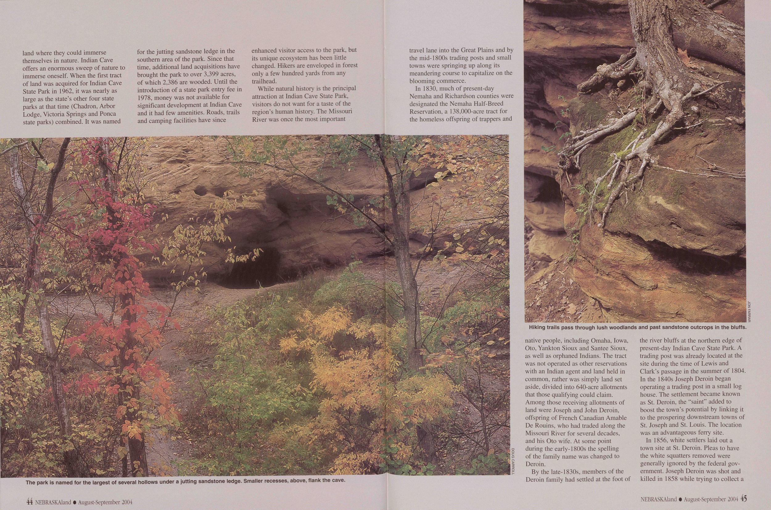 land where they could immerse themselves in nature. Indian Cave offers an enormous sweep of nature to immerse oneself. When the first tract of land was acquired for Indian Cave State Park in 1962, it was nearly as large as the state’s other four state parks at that time (Chadron, Arbor Lodge, Victoria Springs and Ponca state parks) combined. It was named
The park is named for the largest of several hollows under a jutting sandstone ledge. Smaller recesses, above, flank the cave.
While natural history is the principal attraction at Indian Cave State Park, visitors do not want for a taste of the region’s human history. The Missouri River was once the most important 44 NEBRASKAland • August-September 2004 travel lane into the Great Plains and by the mid-1800s trading posts and small towns were springing up along its meandering course to capitalize on the blooming commerce.
Hiking trails pass through lush woodlands and past sandstone outcrops in the bluffs. JON FARRAR
By the late-1830s, members of the Deroin family had settled at the foot of the river bluffs at the northern edge of present-day Indian Cave State Park. A trading post was already located at the site during the time of Lewis and Clark’s passage in the summer of 1804. In the 1840s Joseph Deroin began operating a trading post in a small log house. The settlement became known as St. Deroin, the “saint” added to boost the town’s potential by linking it to the prospering downstream towns of St. Joseph and St. Louis. The location was an advantageous ferry site.
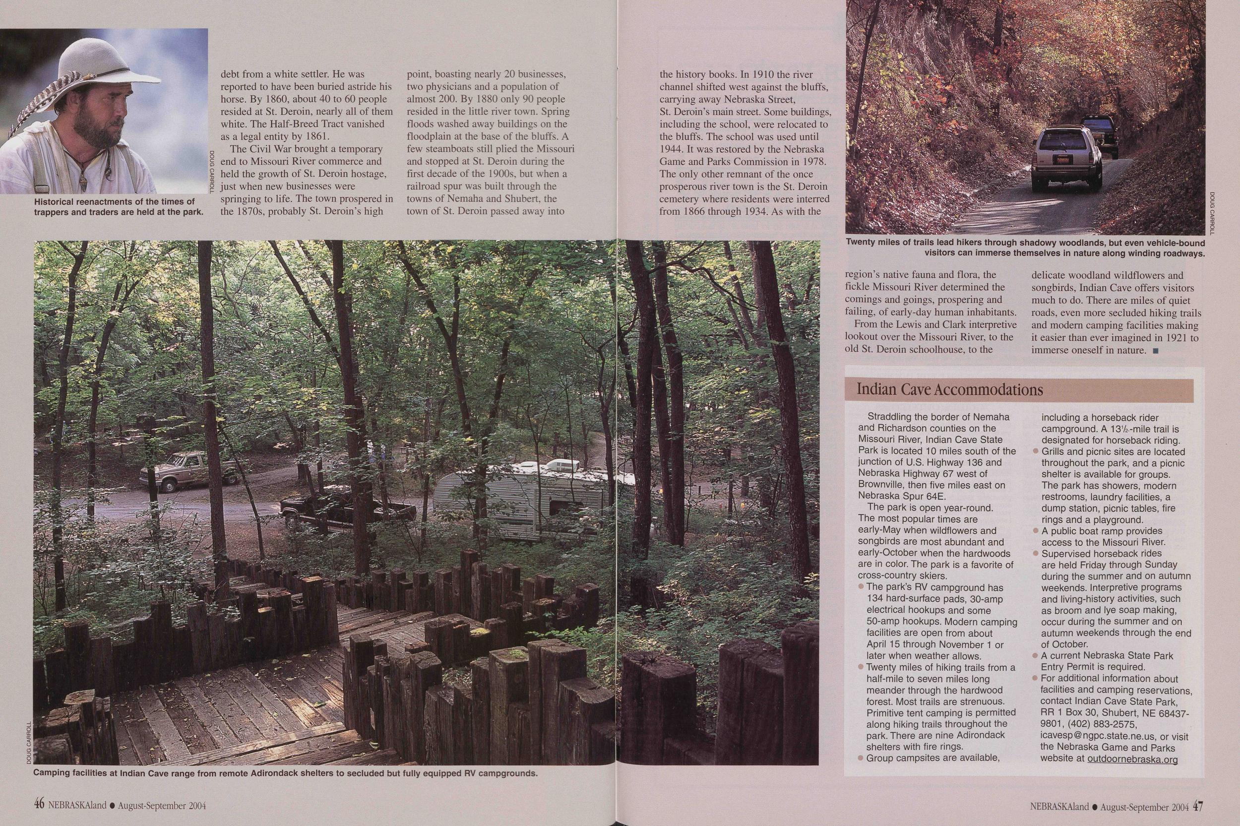
Historical reenactments of the times of trappers and traders are held at the park.
DOUG CARROLL Camping facilities at Indian Cave range from remote Adirondack shelters to secluded but fully equipped RV campgrounds.
Twenty miles of trails lead hikers through shadowy woodlands, but even vehicle-bound visitors can immerse themselves in nature along winding roadways. DOUG CARROLL
From the Lewis and Clark interpretive lookout over the Missouri River, to the old St. Heroin schoolhouse, to the delicate woodland wildflowers and songbirds, Indian Cave offers visitors much to do. There are miles of quiet roads, even more secluded hiking trails and modem camping facilities making it easier than ever imagined in 1921 to immerse oneself in nature.
Indian Cave AccommodationsStraddling the border of Nemaha and Richardson counties on the Missouri River, Indian Cave State Park is located 10 miles south of the junction of U.S. Highway 136 and Nebraska Highway 67 west of Brownville, then five miles east on Nebraska Spur 64E.
The park is open year-round. The most popular times are early-May when wildflowers and songbirds are most abundant and early-October when the hardwoods are in color. The park is a favorite of cross-country skiers.
The park’s RV campground has 134 hard-surface pads, 30-amp electrical hookups and some 50-amp hookups. Modern camping facilities are open from about April 15 through November 1 or later when weather allows.
Twenty miles of hiking trails from a half-mile to seven miles long meander through the hardwood forest. Most trails are strenuous. Primitive tent camping is permitted along hiking trails throughout the park. There are nine Adirondack shelters with fire rings.
Group campsites are available, including a horseback rider campground. A 131/2 -mile trail is designated for horseback riding.
Grills and picnic sites are located throughout the park, and a picnic shelter is available for groups. The park has showers, modern restrooms, laundry facilities, a dump station, picnic tables, fire rings and a playground.
A public boat ramp provides access to the Missouri River.
Supervised horseback rides are held Friday through Sunday during the summer and on autumn weekends. Interpretive programs and living-history activities, such as broom and lye soap making, occur during the summer and on autumn weekends through the end of October.
A current Nebraska State Park Entry Permit is required.
For additional information about facilities and camping reservations, contact Indian Cave State Park, RR 1 Box 30, Shubert, NE 68437- 9801, (402) 883-2575, icavesp@ngpc.state.ne.us, or visit the Nebraska Game and Parks website at outdoornebraska.org
NEBRASKAland • August-September 2004 47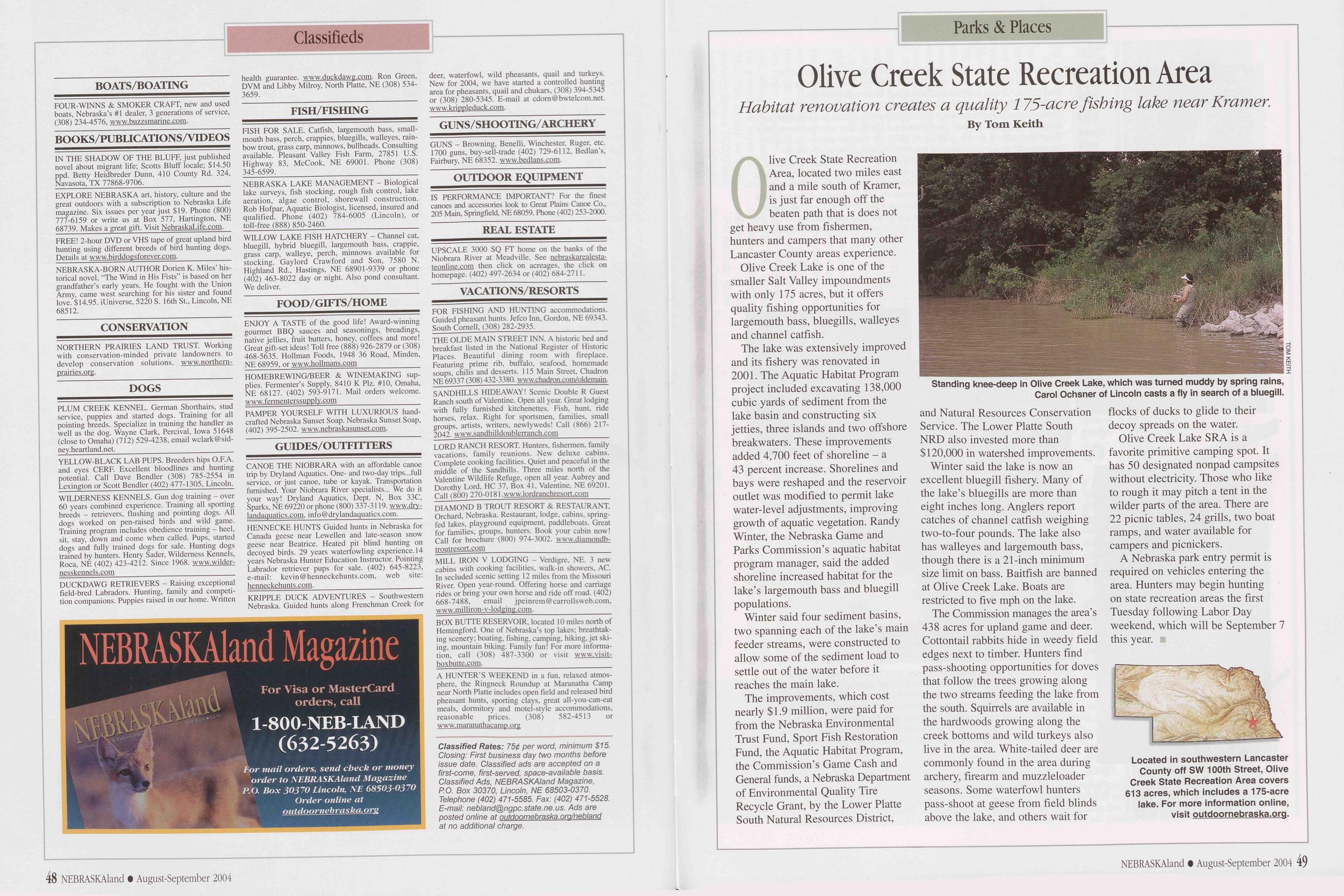
Classifieds
BOATS/BOATING FOUR-WINNS & SMOKER CRAFT, new and used boats, Nebraska’s #1 dealer, 3 generations of service, (308) 234-4576, www.buzzsmarine.com. BOOKS/PUBLICATIONS/VIDEOS IN THE SHADOW OF THE BLUFF, just published novel about migrant life; Scotts Bluff locale; $14.50 ppd. Betty Heidbreder Dunn, 410 County Rd. 324, Navasota, TX 77868-9706, EXPLORE NEBRASKA art, history, culture and the great outdoors with a subscription to Nebraska Life magazine. Six issues per year just $19. Phone (800) 777-6159 or write us at Box 577, Hartington, NE 68739. Makes a great gift. Visit NebraskaLife.com. FREE! 2-hour DVD or VHS tape of great upland bird hunting using different breeds of bird hunting dogs. Details at www.birddogsforever.com. NEBRASKA-BORN AUTHOR Dorien K. Miles’ his- torical novel, “The Wind in His Fists” is based on her grandfather’s early years. He fought with the Union Army, came west searching for his sister and found love. $14.95. iUniverse, 5220 S. 16th St., Lincoln, NE 68512. CONSERVATION NORTHERN PRAIRIES LAND TRUST. Working with conservation-minded private landowners to develop conservation solutions, www.northern- prairies.org. DOGS PLUM CREEK KENNEL. German Shorthairs, stud service, puppies and started dogs. Training for all pointing breeds. Specialize in training the handler as well as the dog. Wayne Clark, Percival, Iowa 51648 (close to Omaha) (712) 529-4238, email wclark@sid- ney.heartland.net. YELLOW-BLACK LAB PUPS. Breeders hips O.F.A. and eyes CERF. Excellent bloodlines and hunting potential. Call Dave Bendler (308) 785-2554 in Lexington or Scott Bendler (402) 477-1305, Lincoln. WILDERNESS KENNELS. Gun dog training - over 60 years combined experience. Training all sporting breeds - retrievers, flushing and pointing dogs. All dogs worked on pen-raised birds and wild game. Training program includes obedience training - heel, sit, stay, down and come when called. Pups, started dogs and fully trained dogs for sale. Hunting dogs trained by hunters. Henry Sader, Wilderness Kennels, Roca, NE (402) 423-4212. Since 1968. www.wilder- nesskennels.com NEBRASKAIand Magazine For Visa or MasterCard orders, call 1-800-NEB-LAND (632-5263) For mail orders, send check or money order to NEBRASKAIand Magazine P.O. Box 30370 Lincoln, NE 68503-0370 Order online at outdoornebraska. org DUCKDAWG RETRIEVERS - Raising exceptional field-bred Labradors. Hunting, family and competi- tion companions. Puppies raised in our home. Written health guarantee, www.duckdawg.com. Ron Green, DVM and Libby Milroy, North Platte, NE (308) 534- 3659. FISH/FISHING FISH FOR SALE. Catfish, largemouth bass, small- mouth bass, perch, crappies, bluegills, walleyes, rain- bow trout, grass carp, minnows, bullheads. Consulting available. Pleasant Valley Fish Farm, 27851 U.S. Highway 83, McCook, NE 69001. Phone (308) 345-6599. NEBRASKA LAKE MANAGEMENT - Biological lake surveys, fish stocking, rough fish control, lake aeration, algae control, shorewall construction. Rob Hofpar, Aquatic Biologist, licensed, insured and qualified. Phone (402) 784-6005 (Lincoln), or toll-free (888) 850-2460. WILLOW LAKE FISH HATCHERY - Channel cat, bluegill, hybrid bluegill, largemouth bass, crappie, grass carp, walleye, perch, minnows available for stocking. Gaylord Crawford and Son, 7580 N. Highland Rd., Hastings, NE 68901-9339 or phone (402) 463-8022 day or night. Also pond consultant. We deliver. FOOD/GIFTS/HOME ENJOY A TASTE of the good life! Award-winning gourmet BBQ sauces and seasonings, breadings, native jellies, fruit butters, honey, coffees and more! Great gift-set ideas! Toll free (888) 926-2879 or (308) 468-5635. Hollman Foods, 1948 36 Road, Minden, NE 68959, or www.hollmans.com HOMEBREWING/BEER & WINEMAKING sup- plies. Fermenter’s Supply, 8410 K Plz. #10, Omaha, NE 68127. (402) 593-9171. Mail orders welcome. www.fermenterssupplv.com PAMPER YOURSELF WITH LUXURIOUS hand- crafted Nebraska Sunset Soap. Nebraska Sunset Soap, (402) 395-2502. www.nebraskasunset.com. GUIDES/OUTFITTERS CANOE THE NIOBRARA with an affordable canoe trip by Dryland Aquatics. One- and two-day trips...full service, or just canoe, tube or kayak. Transportation furnished. Your Niobrara River specialists... We do it your way! Dryland Aquatics, Dept. N, Box 33C, Sparks, NE 69220 or phone (800) 337-3119. www.drv- landaquatics.com, info@drylandaquatics.com. HENNECKE HUNTS Guided hunts in Nebraska for Canada geese near Lewellen and late-season snow geese near Beatrice. Heated pit blind hunting on decoyed birds. 29 years waterfowling experience. 14 years Nebraska Hunter Education Instructor. Pointing Labrador retriever pups for sale. (402) 645-8223, e-mail: kevin@henneckehunts.com, web site: henneckehunts.com. KRIPPLE DUCK ADVENTURES - Southwestern Nebraska. Guided hunts along Frenchman Creek for deer, waterfowl, wild pheasants, quail and turkeys. New for 2004, we have started a controlled hunting area for pheasants, quail and chukars, (308) 394-5345 or (308) 280-5345. E-mail at cdom@bwtelcom.net. www.krippleduck.com. GUNS/SHOOTING/ARCHERY GUNS - Browning, Benelli, Winchester, Ruger, etc. 1700 guns, buy-sell-trade (402) 729-6112, Bedlan’s, Fairbury, NE 68352. www.bedlans.com. OUTDOOR EQUIPMENT IS PERFORMANCE IMPORTANT? For the finest canoes and accessories look to Great Plains Canoe Co., 205 Main, Springfield, NE 68059. Phone (402) 253-2000. REAL ESTATE UPSCALE 3000 SQ FT home on the banks of the Niobrara River at Meadville. See nebraskarealesta- teonline.com then click on acreages, the click on homepage. (402) 497-2634 or (402) 684-2711. VACATIONS/RESORTS FOR FISHING AND HUNTING accommodations. Guided pheasant hunts. Jefco Inn, Gordon, NE 69343. South Cornell, (308) 282-2935. THE OLDE MAIN STREET INN. A historic bed and breakfast listed in the National Register of Historic Places. Beautiful dining room with fireplace. Featuring prime rib, buffalo, seafood, homemade soups, chilis and desserts. 115 Main Street, Chadron NE 69337 (308) 432-3380. www.chadron.com/oldemain. SANDHILLS HIDEAWAY! Scenic Double R Guest Ranch south of Valentine. Open all year. Great lodging with fully furnished kitchenettes. Fish, hunt, ride horses, relax. Right for sportsmen, families, small groups, artists, writers, newlyweds! Call (866) 217- 2042. www.sandhilldoublerranch.com______________ LORD RANCH RESORT. Hunters, fishermen, family vacations, family reunions. New deluxe cabins. Complete cooking facilities. Quiet and peaceful in the middle of the Sandhills. Three miles north of the Valentine Wildlife Refuge, open all year. Aubrey and Dorothy Lord, HC 37, Box 41, Valentine, NE 69201. Call (800) 270-0181.www.lordranchresort.com DIAMOND B TROUT RESORT & RESTAURANT, Orchard, Nebraska. Restaurant, lodge, cabins, spring- fed lakes, playground equipment, paddleboats. Great for families, groups, hunters. Book your cabin now! Call for brochure (800) 974-3002. www.diamondb- troutresort.com_______________________ MILL IRON V LODGING - Verdigre, NE. 3 new cabins with cooking facilities, walk-in showers, AC. In secluded scenic setting 12 miles from the Missouri River. Open year-round. Offering horse and carriage rides or bring your own horse and ride off road. (402) 668-7488, email jpeinrem@carrollsweb.com, www.milliron-v-lodging.com. BOX BUTTE RESERVOIR, located 10 miles north of Hemingford. One of Nebraska’s top lakes; breathtak- ing scenery; boating, fishing, camping, hiking, jet ski- ing, mountain biking. Family fun! For more informa- tion, call (308) 487-3300 or visit www.visit- boxbutte.com. A HUNTER’S WEEKEND in a fun. relaxed atmos- phere, the Ringneck Roundup at Maranatha Camp near North Platte includes open field and released bird pheasant hunts, sporting clays, great all-you-can-eat meals, dormitory and motel-style accommodations, reasonable prices. (308) 582-4513 or www.maranathacamp.org Classified Rates: 75¢ per word, minimum $15. Closing: First business day two months before issue date. Classified ads are accepted on a first-come, first-served, space-available basis. Classified Ads, NEBRASKAIand Magazine, P.O. Box 30370, Lincoln, NE 68503-0370. Telephone (402) 471-5585. Fax: (402) 471-5528. E-mail: nebland@ngpc.state.ne.us. Ads are posted online at outdoornebraska. ora/nebland at no additional charge. 48 NEBRASKAIand • August-September 2004Parks & Places
Olive Creek State Recreation Area
Habitat renovation creates a quality 175-acre fishing lake near Kramer.
Olive Creek State Recreation Area, located two miles east and a mile south of Kramer, is just far enough off the beaten path that is does not get heavy use from fishermen, hunters and campers that many other Lancaster County areas experience. Olive Creek Lake is one of the smaller Salt Valley impoundments with only 175 acres, but it offers quality fishing opportunities for largemouth bass, bluegills, walleyes and channel catfish.
The lake was extensively improved and its fishery was renovated in 2001. The Aquatic Habitat Program project included excavating 138,000 cubic yards of sediment from the lake basin and constructing six jetties, three islands and two offshore breakwaters. These improvements added 4,700 feet of shoreline - a 43 percent increase. Shorelines and bays were reshaped and the reservoir outlet was modified to permit lake water-level adjustments, improving growth of aquatic vegetation. Randy Winter, the Nebraska Game and Parks Commission’s aquatic habitat program manager, said the added shoreline increased habitat for the lake’s largemouth bass and bluegill populations.
Winter said four sediment basins, two spanning each of the lake’s main feeder streams, were constructed to allow some of the sediment load to settle out of the water before it reaches the main lake.
TOM KEITH Standing knee-deep in Olive Creek Lake, which was turned muddy by spring rains, Carol Ochsner of Lincoln casts a fly in search of a bluegill.
Winter said the lake is now an excellent bluegill fishery. Many of the lake’s bluegills are more than eight inches long. Anglers report catches of channel catfish weighing two-to-four pounds. The lake also has walleyes and largemouth bass, though there is a 21-inch minimum size limit on bass. Baitfish are banned at Olive Creek Lake. Boats are restricted to five mph on the lake.
The Commission manages the area’s 438 acres for upland game and deer. Cottontail rabbits hide in weedy field edges next to timber. Hunters find pass-shooting opportunities for doves that follow the trees growing along the two streams feeding the lake from the south. Squirrels are available in the hardwoods growing along the creek bottoms and wild turkeys also live in the area. White-tailed deer are commonly found in the area during archery, firearm and muzzleloader seasons. Some waterfowl hunters pass-shoot at geese from field blinds above the lake, and others wait for flocks of ducks to glide to their decoy spreads on the water.
Olive Creek Lake SRA is a favorite primitive camping spot. It has 50 designated nonpad campsites without electricity. Those who like to rough it may pitch a tent in the wilder parts of the area. There are 22 picnic tables, 24 grills, two boat ramps, and water available for campers and picnickers.
A Nebraska park entry permit is required on vehicles entering the area. Hunters may begin hunting on state recreation areas the first Tuesday following Labor Day weekend, which will be September 7 this year.
Located in southwestern Lancaster County off SW 100th Street, Olive Creek State Recreation Area covers 613 acres, which includes a 175-acre lake. For more information online, visit outdoornebraska.org.
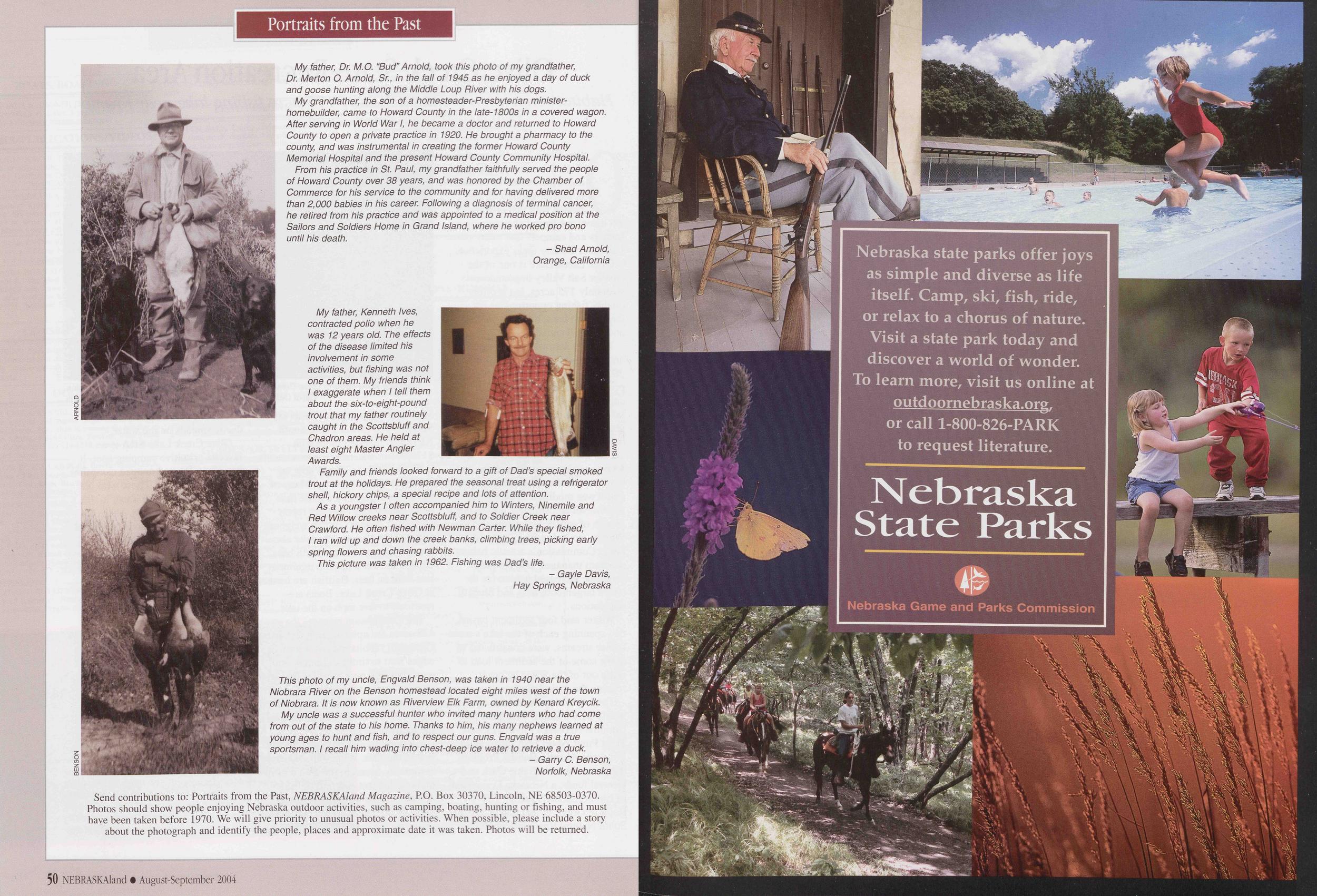
Portraits from the Past
Position: 737 (15 views)