Volume 82, Issue 6, 2004
NEBRASKAland
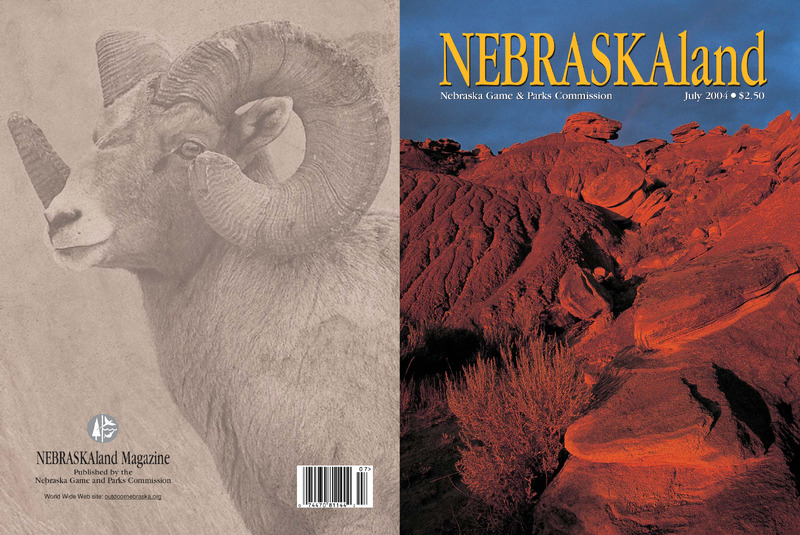
Nebraska Game & Parks Commission July 2004 $2.50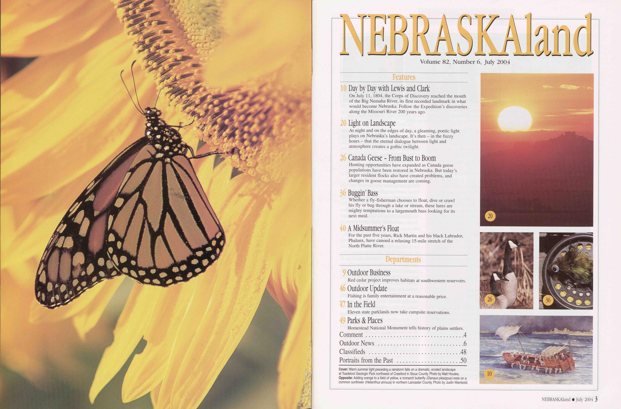
NEBRASKAland
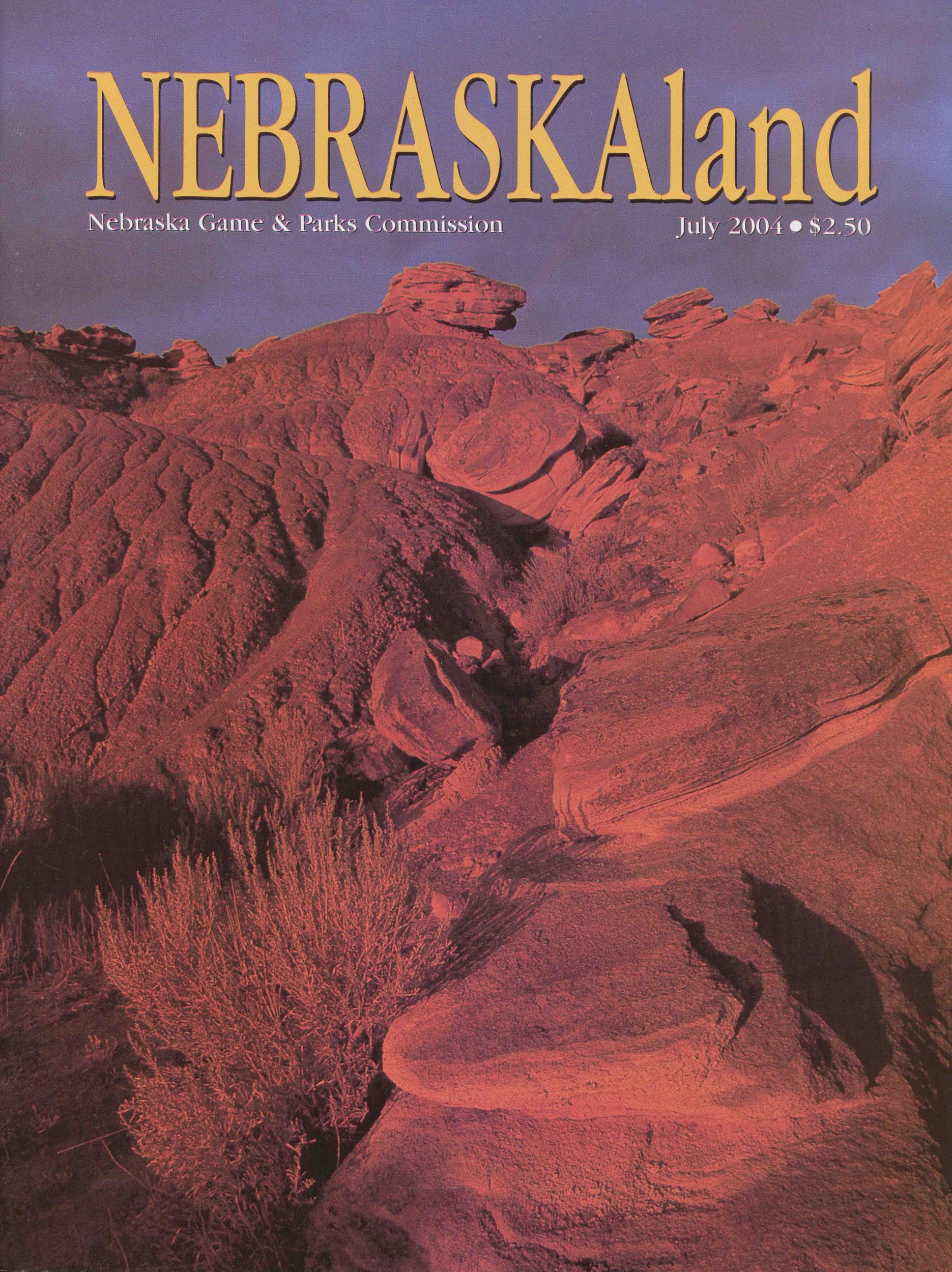
Volume 82, Number 6, July 2004 Features 10 Day by Day with Lewis and Clark On July 11, 1804, the Corps of Discovery reached the mouth of the Big Nemaha River, its first recorded landmark in what would become Nebraska. Follow the Expedition’s discoveries along the Missouri River 200 years ago. 20 Light on Landscape At night and on the edges of day, a gleaming, poetic light plays on Nebraska’s landscape. It’s then - in the fuzzy hours - that the eternal dialogue between light and atmosphere creates a gothic twilight. 26 Canada Geese - From Bust to Boom Hunting opportunities have expanded as Canada geese populations have been restored in Nebraska. But today’s larger resident flocks also have created problems, and changes in goose management are coming. 36 Buggin’Bass Whether a fly-fisherman chooses to float, dive or crawl his fly or bug through a lake or stream, these lures are mighty temptations to a largemouth bass looking for its next meal. 40 A Midsummer’s Float For the past five years, Rick Martin and his black Labrador, Phalanx, have canoed a relaxing 15-mile stretch of the North Platte River. Departments 9 Outdoor Business Red cedar project improves habitats at southwestern reservoirs. 46 Outdoor Update Fishing is family entertainment at a reasonable price. 47 In the Field Eleven state parklands now take campsite reservations. Parks & Places Homestead National Monument tells history of plains settlers. Comment........................................ 4 Outdoor News ...................................6 Classifieds ...................................48 Portraits from the Past .......................50 Cover: Warm summer light preceding a rainstorm falls on a dramatic, eroded landscape at Toadstool Geologic Park northwest of Crawford in Sioux County. Photo by Matt Houska. Opposite: Adding orange to a field of yellow, a monarch butterfly (Danaus plexippus) rests on a common sunflower (Helianthus annuus) in northern Lancaster County. Photo by Justin Wambold.20
26
36
10
Comment
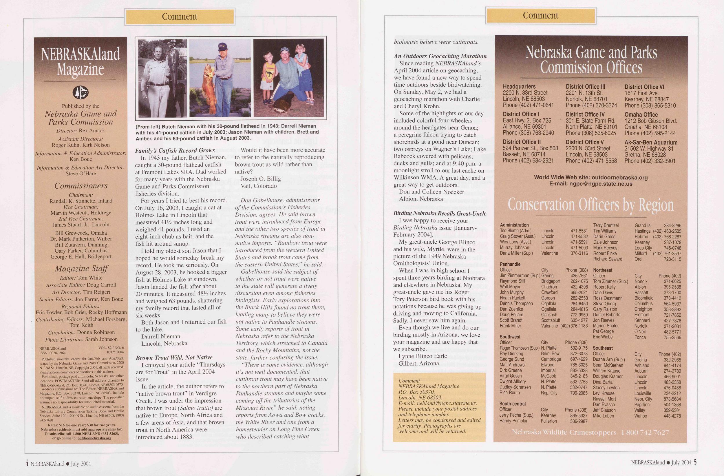
In 1943 my father, Butch Nieman, caught a 30-pound flathead catfish at Fremont Lakes SRA. Dad worked for many years with the Nebraska Game and Parks Commission fisheries division.
For years I tried to best his record. On July 16, 2003,1 caught a cat at Holmes Lake in Lincoln that measured 411/? inches long and weighed 41 pounds. I used an eight-inch chub as bait, and the fish hit around sunup.
I told my oldest son Jason that I hoped he would someday break my record. He took me seriously. On August 28, 2003, he hooked a bigger fish at Holmes Lake at sundown. Jason landed the fish after about 20 minutes. It measured 48Lz inches and weighed 63 pounds, shattering my family record that lasted all of six weeks.
Both Jason and I returned our fish to the lake.
Darrell Nieman Lincoln, Nebraska Brown Trout Wild, Not NativeI enjoyed your article “Thursdays are for Trout” in the April 2004 issue.
In the article, the author refers to “native brown trout” in Verdigre Creek. I was under the impression that brown trout (Salmo trutta) are native to Europe, North Africa and a few areas of Asia, and that brown trout in North America were introduced about 1883.
Would it have been more accurate to refer to the naturally reproducing brown trout as wild rather than native?
Joseph O. Billig Vail, ColoradoDon Gabelhouse, administrator of the Commission’s Fisheries Division, agrees. He said brown trout were introduced from Europe, and the other two species of trout in Nebraska streams are also non- native imports. “Rainbow trout were introduced from the western United States and brook trout came from the eastern United States,” he said.
Gabelhouse said the subject of whether or not trout were native to the state will generate a lively discussion even among fisheries biologists. Early explorations into the Black Hills found no trout there, leading many to believe they were not native to Panhandle streams. Some early reports of trout in Nebraska refer to the Nebraska Territory, which stretched to Canada and the Rocky Mountains, not the state, further confusing the issue.
“There is some evidence, although it’s not well documented, that cutthroat trout may have been native to the northern part of Nebraska Panhandle streams and maybe some coming off the tributaries of the Missouri River,” he said, noting reports from Aowa and Bow creeks, the White River and one from a homesteader on Long Pine Creek who described catching what biologists believe were cutthroats.
An Outdoors Geocaching MarathonSince reading NEBRASKAland’s April 2004 article on geocaching, we have found a new way to spend time outdoors beside birdwatching. On Sunday, May 2, we had a geocaching marathon with Charlie and Cheryl Krohn.
Some of the highlights of our day included colorful four-wheelers around the headgates near Genoa; a peregrine falcon trying to catch shorebirds at a pond near Duncan; two ospreys on Wagner’s Lake; Lake Babcock covered with pelicans, ducks and gulls; and at 9:40 p.m. a moonlight stroll to our last cache on Wilkinson WMA. A great day, and a great way to get outdoors.
Don and Colleen Noecker Albion, NebraskaBirding Nebraska Recalls Great-Uncle I was happy to receive your Birding Nebraska issue [January- February 2004].
My great-uncle George Blinco and his wife, Myrtle, were in the picture of the 1949 Nebraska Ornithologists’ Union.
When I was in high school I spent three years birding at Niobrara and elsewhere in Nebraska. My great-uncle gave me his Roger Tory Peterson bird book with his notations because he was giving up driving and moving to California. Sadly, I never saw him again.
Even though we live and do our birding mostly in Arizona, we love your magazine and are happy that we subscribe.
Lynne Blinco Earle Gilbert, Arizona Comment NEBRASKAland Magazine P.O. Box 30370, Lincoln, NE 68503. E-mail: nebland@ ngpc. state, ne. us. Please include your postal address and telephone number. Letters may be condensed and edited for clarity. Photographs are welcome and will be returned. Nebraska Game and Parks Commission Offices Headquarters 2200 N. 33rd Street Lincoln, NE 68503 Phone (402) 471-0641 District Office I East Hwy. 2, Box 725 Alliance, NE 69301 Phone (308) 763-2940 District Office II 524 Panzer St., Box 508 Bassett, NE 68714 Phone (402) 684-2921 District Office III 2201 N. 13th St. Norfolk, NE 68701 Phone (402) 370-3374 District Office IV 301 E. State Farm Rd. North Platte, NE 69101 Phone (308) 535-8025 District Office V 2200 N. 33rd Street Lincoln, NE 68503 Phone (402) 471-5558 District Office VI 1617 First Ave. Kearney, NE 68847 Phone (308) 865-5310 Omaha Office 1212 Bob Gibson Blvd. Omaha, NE 68108 Phone (402) 595-2144 Ak-Sar-Ben Aquarium 21502 W. Highway 31 Gretna, NE 68028 Phone (402) 332-3901 World Wide Web site: outdoornebraska.org E-mail: ngpc@ngpc.state.ne.us Conservation Officers by Region Administration Terry Brentzel Grand Is. 384-8296 Ted Blume (Adm.) Lincoln 471-5531 Tim Williams Hastings (402) 463-2535 Craig Stover (Asst.) Lincoln 471-5532 Darin Gress Hebron (402) 768-2287 Wes Loos (Asst.) Lincoln 471-5591 Dale Johnson Kearney 237-1079 Murray Johnson Lincoln 471-5003 Mark Reeves Loup City 745-0748 Dana Miller (Sup.) Valentine 376-3116 Robert Finke Milford (402) 761-3537 Richard Seward Ord 728-3115 Panhandle Officer City Phone (308) Northeast Jim Zimmerman (Sup.) Gering 436-7561 Officer City Phone (402) Raymond Still Bridgeport 262-1075 Tom Zimmer (Sup.) Norfolk 371-6625 Walt Meyer Chadron 432-4398 Robert Kelly Albion 395-2538 John Murphy Crawford 665-2021 Dale Davis Bassett 273-1700 Heath Packett Gordon 282-2553 Ross Oestmann Bloomfield i 373-4412 Dennis Thompson Ogallala 284-6450 Steve Oberg Columbus 564-5937 Dan Zuehlke Ogallala 284-4815 Gary Ralston Creighton 358-3892 Doug Pollard Oshkosh 772-9950 Daniel Roberts Fremont 721-7852 Scott Brandt Scottsbluff 635-1277 Jon Reeves Kennard 427-7378 Frank Miller Valentine (402)376-1183 Marion Shafer Norfolk 371-2031 Pat George O’Neill 482-5771 Southwest Eric Wiebe Ponca 755-2566 Officer City Phone (308) Roger Thompson (Sup.) N. Platte 532-9175 Southeast Ray Dierking Brkn. Bow 872-3078 Officer City Phone (402) George Sund Cambridge 697-4629 Duane Arp (Sup.) Gretna 332-2965 Matt Andrews Elwood 785-3025 Sean McKeehan Ashland 944-4174 Dirk Greene Imperial 882-5328 William Krause Auburn 274-3789 Virgil Gosch McCook 345-2185 Douglas Kramer Lincoln 466-9001 Dwight Allbery N. Platte 532-2753 Dina Barta Lincoln 483-2358 Dudley Sorensen N. Platte 532-0747 Stacey Lewton Lincoln 476-0436 Rich Routh Rep. City 799-2085 Levi Krause Louisville 234-2212 Russell Mort Nebr. City 873-5684 South-central Dan Evasco Papillion 504-1368 Officer City Phone (308) Jeff Clauson Valley 359-5301 Jerry Pecha (Sup.) Kearney 865-5327 Mike Luben Wahoo 443-4278 Randy Pomplun Fullerton 536-2987 Nebraska Wildlife Crimestoppers 1-800-742-7627 4 NEBRASKAland • July 2004 NEBRASKAland • July 2004 5
Outdoor News
Tune In To Turpin Time Veteran outdoorsman Dick Turpin offers outdoor tips in Turpin Time, a new offering produced by the Nebraska Game and Parks Commission. Each 60-second spot features Dick's trademark humor, and includes advice on camping, hunting, fishing, cooking, wildlife viewing, or safety. KOLN-KGIN (Lincoln) Thursdays: 6:25 AM ‘10-11 This Morning” 6 PM News KDUH (Scottsbluff) Tuesdays: Noon, 5:30 PM and 10 PM News KNOP (North Platte) Fridays: 6:55 AM ‘Early Today” KMEG (Sioux City) Tuesdays and Thursdays: 10 PM NewsMore than 500 people took part in Take Pride in America Day activities May 15 and donated more than 3,000 working hours at 31 state parks, recreation areas and wildlife management areas across Nebraska.
Nebraska Game and Parks Commission Director Rex Amack said volunteer help is immensely important given current budget restraints that limit the ability of parks staff to fully maintain facilities. Volunteers picked up trash, planted flowers and shrubs, and completed painting projects, as well as a variety of other jobs.
“It’s really impossible to place a value on the volunteers in our state,” said Amack. Events such as Take Pride in America “are a wonderful opportunity for people to give something back to our community.”
The day’s events were organized as part of a national partnership with the U.S. Department of Interior’s Take Pride in America program.
For more information about the national Take Pride program, visit the web site at www.takepride.gov. Contact Suzanne Ridder at (402) 471-1623, sridder @ ngpc. state.ne .us for information about volunteering at Nebraska state parks and wildlife management areas.
Effects of Pine Wilt Subject of WorkshopThe Nebraska Forest Service and the University of Nebraska-Lincoln Cooperative Extension are sponsoring a pine wilt workshop July 8 from 8:30 a.m. to 3 p.m. at UNL’s East Campus Union.
Pine wilt, a disease that kills Scotch and Austrian pines and which is transmitted by pinewood nematode, Bursaphelenchus xylophilus, a microscopic, worm-like animal, which travels from infested to non- infested pine trees through the pine sawyer beetle, Monochamus spp., is reaching epidemic proportions in southeastern Nebraska after spreading from Kansas and Missouri. The workshop will discuss how this epidemic will affect the state and how to deal with it, including increasing and diversifying tree planting statewide.
Lunch and parking passes will be provided for attendees. Please call Christine Meyer at (402) 472-9869 to register.
Cyanbacteria Found in Some Nebraska WatersCyanbacteria, sometimes referred to as toxic blue-green algae, was found in several Nebraska lakes this spring. The bacteria can cause skin irritations, liver damage and gastrointestinal illness in humans, and it can kill pets and farm animals.
The Nebraska Department of Health and Human Services found the toxic algae at Buccaneer Bay Lake in Cass County and at Hanson lakes No. 1 and 2 and Linder Lake in Sarpy County.
Cyanbacteria are single-celled organisms that thrive in stagnant water during warm weather with drought conditions. Where these organisms create algal blooms they form a green scum and the water has a disagreeable odor.
These algal blooms can appear and dissipate quickly, but the toxins can remain in the water after the bloom. Although naturally occurring, the growth of toxic algae can be accelerated by nutrients, such as fertilizers or wastes from septic systems, seeping into a lake.
For more information and results of state testing, go online to www.deq.state.ne.us.
New Record Spotted Gar Taken in Salt CreekA 2-pound, 15-ounce spotted gar shot by Jim Foral of Lincoln is a new state record.
Foral shot the 26V2 -inch fish while bowfishing last August in Lancaster County’s Salt Creek. Foral’s spotted gar is the first entry for that species in the state records bowfishing category.
The Nebraska Game and Parks Commission recognizes state record and Master Angler-size fish for a variety of species. For a current listing of state record fish and minimum size limits for Master Angler awards, look in the 2004 Nebraska Fishing Guide.
Family Fun! Fishing's Great at Nebraska's Parks and Recreation Areas Few activities combine family fun and togetherness as well as camping and fishing. Whether your family includes experienced anglers or beginning campers, Nebraska's state parks and recreation areas offer something for everyone. Visit our web site today for information about fishing and camping opportunities across the state. You can even purchase state park entry and fishing permits online. Round up your family and head outdoors for great family fun! outdoornebraska.org NEBRASKA GAME AND PARKS COMMISSION 6 NEBRASKAland • July 2004 NEBRASKAland • July 2004 7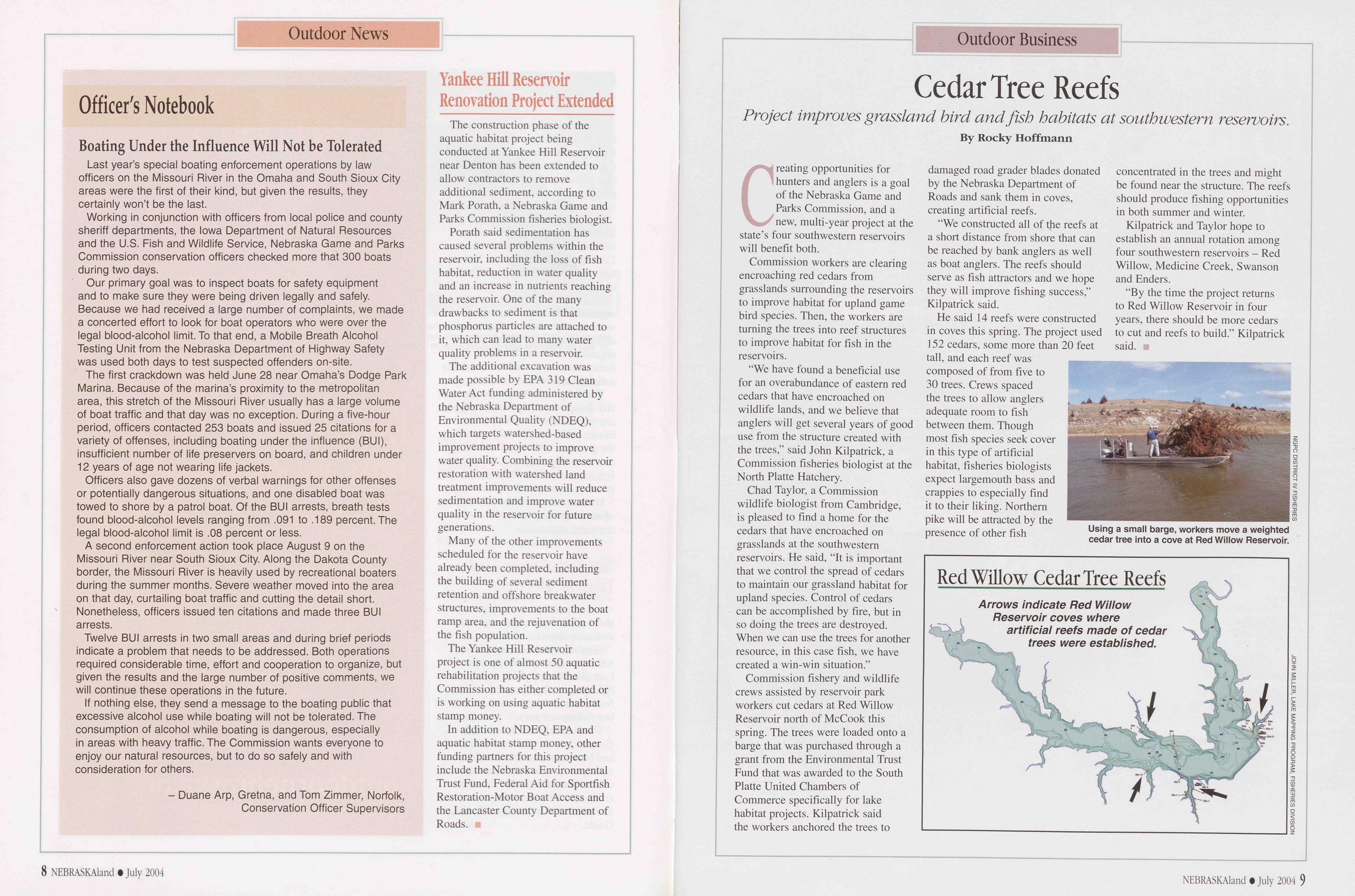
Outdoor News
Officer's Notebook Boating Under the Influence Will Not be ToleratedLast year’s special boating enforcement operations by law officers on the Missouri River in the Omaha and South Sioux City areas were the first of their kind, but given the results, they certainly won’t be the last.
Working in conjunction with officers from local police and county sheriff departments, the Iowa Department of Natural Resources and the U.S. Fish and Wildlife Service, Nebraska Game and Parks Commission conservation officers checked more that 300 boats during two days.
Our primary goal was to inspect boats for safety equipment and to make sure they were being driven legally and safely. Because we had received a large number of complaints, we made a concerted effort to look for boat operators who were over the legal blood-alcohol limit. To that end, a Mobile Breath Alcohol Testing Unit from the Nebraska Department of Highway Safety was used both days to test suspected offenders on-site.
The first crackdown was held June 28 near Omaha’s Dodge Park Marina. Because of the marina’s proximity to the metropolitan area, this stretch of the Missouri River usually has a large volume of boat traffic and that day was no exception. During a five-hour period, officers contacted 253 boats and issued 25 citations for a variety of offenses, including boating under the influence (BUI), insufficient number of life preservers on board, and children under 12 years of age not wearing life jackets.
Officers also gave dozens of verbal warnings for other offenses or potentially dangerous situations, and one disabled boat was towed to shore by a patrol boat. Of the BUI arrests, breath tests found blood-alcohol levels ranging from .091 to .189 percent. The legal blood-alcohol limit is .08 percent or less.
A second enforcement action took place August 9 on the Missouri River near South Sioux City. Along the Dakota County border, the Missouri River is heavily used by recreational boaters during the summer months. Severe weather moved into the area on that day, curtailing boat traffic and cutting the detail short. Nonetheless, officers issued ten citations and made three BUI arrests.
Twelve BUI arrests in two small areas and during brief periods indicate a problem that needs to be addressed. Both operations required considerable time, effort and cooperation to organize, but given the results and the large number of positive comments, we will continue these operations in the future.
If nothing else, they send a message to the boating public that excessive alcohol use while boating will not be tolerated. The consumption of alcohol while boating is dangerous, especially in areas with heavy traffic. The Commission wants everyone to enjoy our natural resources, but to do so safely and with consideration for others.
- Duane Arp, Gretna, and Tom Zimmer, Norfolk, Conservation Officer Supervisors Yankee Hill Reservoir Renovation Project ExtendedThe construction phase of the aquatic habitat project being conducted at Yankee Hill Reservoir near Denton has been extended to allow contractors to remove additional sediment, according to Mark Porath, a Nebraska Game and Parks Commission fisheries biologist.
Porath said sedimentation has caused several problems within the reservoir, including the loss of fish habitat, reduction in water quality and an increase in nutrients reaching the reservoir. One of the many drawbacks to sediment is that phosphorus particles are attached to it, which can lead to many water quality problems in a reservoir.
The additional excavation was made possible by EPA 319 Clean Water Act funding administered by the Nebraska Department of Environmental Quality (NDEQ), which targets watershed-based improvement projects to improve water quality. Combining the reservoir restoration with watershed land treatment improvements will reduce sedimentation and improve water quality in the reservoir for future generations.
Many of the other improvements scheduled for the reservoir have already been completed, including the building of several sediment retention and offshore breakwater structures, improvements to the boat ramp area, and the rejuvenation of the fish population.
The Yankee Hill Reservoir project is one of almost 50 aquatic rehabilitation projects that the Commission has either completed or is working on using aquatic habitat stamp money.
In addition to NDEQ, EPA and aquatic habitat stamp money, other funding partners for this project include the Nebraska Environmental Trust Fund, Federal Aid for Sportfish Restoration-Motor Boat Access and the Lancaster County Department of Roads.
Outdoor Business
Cedar Tree Reefs Project improves grassland bird and fish habitats at southwestern reservoirs. By Rocky HoffmannCreating opportunities for hunters and anglers is a goal of the Nebraska Game and Parks Commission, and a new, multi-year project at the state’s four southwestern reservoirs will benefit both.
Commission workers are clearing encroaching red cedars from grasslands surrounding the reservoirs to improve habitat for upland game bird species. Then, the workers are turning the trees into reef structures to improve habitat for fish in the reservoirs.
“We have found a beneficial use for an overabundance of eastern red cedars that have encroached on wildlife lands, and we believe that anglers will get several years of good use from the structure created with the trees,” said John Kilpatrick, a Commission fisheries biologist at the North Platte Hatchery.
Chad Taylor, a Commission wildlife biologist from Cambridge, is pleased to find a home for the cedars that have encroached on grasslands at the southwestern reservoirs. He said, “It is important that we control the spread of cedars to maintain our grassland habitat for upland species. Control of cedars can be accomplished by fire, but in so doing the trees are destroyed. When we can use the trees for another resource, in this case fish, we have created a win-win situation.”
Commission fishery and wildlife crews assisted by reservoir park workers cut cedars at Red Willow Reservoir north of McCook this spring. The trees were loaded onto a barge that was purchased through a grant from the Environmental Trust Fund that was awarded to the South Platte United Chambers of Commerce specifically for lake habitat projects. Kilpatrick said the workers anchored the trees to damaged road grader blades donated by the Nebraska Department of Roads and sank them in coves, creating artificial reefs.
“We constructed all of the reefs at a short distance from shore that can be reached by bank anglers as well as boat anglers. The reefs should serve as fish attractors and we hope they will improve fishing success,” Kilpatrick said.
He said 14 reefs were constructed in coves this spring. The project used 152 cedars, some more than 20 feet tall, and each reef was composed of from five to 30 trees. Crews spaced the trees to allow anglers adequate room to fish between them. Though most fish species seek cover in this type of artificial habitat, fisheries biologists expect largemouth bass and crappies to especially find it to their liking. Northern pike will be attracted by the presence of other fish concentrated in the trees and might be found near the structure. The reefs should produce fishing opportunities in both summer and winter.
Kilpatrick and Taylor hope to establish an annual rotation among four southwestern reservoirs - Red Willow, Medicine Creek, Swanson and Enders.
“By the time the project returns to Red Willow Reservoir in four years, there should be more cedars to cut and reefs to build.” Kilpatrick said.
Day by Day with Lewis and Clark
 By Ken Bouc Two hundred years ago as the Lewis and Clark Expedition approached what is now Nebraska, the explorers noticed woods along the Missouri River giving away to lush prairies. These men from eastern timbered areas were entering a new land of endless grass. This is the story of their passage.
Until captains Meriwether Lewis, William Clark and their Corps of Discovery left St. Louis in May, 1804, the expanse of territory drained by the Missouri River had been owned by France or Spain, at least in the eyes of the “civilized” world. But on May 2 the fledgling United States completed its Louisiana Purchase for $15 million, and the Expedition was the first step in settling of the American West.
The 55-foot keelboat and two smaller pirogues spent eight weeks passing through what is now the state of Missouri, a stretch of river well known to the dozen or so French-speaking boatmen hired in St. Louis to help haul the Expedition’s supplies upstream. In contrast, the 34 American soldiers had a lot of learning to do early in the voyage. The captains organized their command and established their authority, the men hardened themselves to the grueling labor of river travel and struggled with Army discipline, and they all awakened to the gradual change in the country as
Fortunately, many interesting facets of the Voyage of Discovery are preserved in the Expedition’s documents. At President Thomas Jefferson’s order, an official daily journal was kept by the captains, and in most cases, daily events were recorded twice, once in field notes as an event happened and again in the final draft of the journal. Enlisted men were also encouraged to keep personal journals, and sergeants Ordway, Gass and Floyd and Private Whitehouse did.
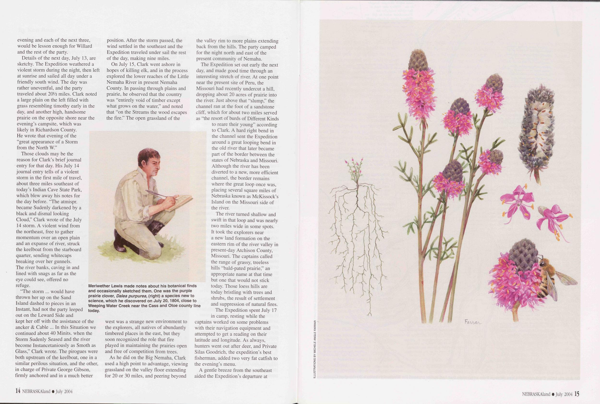
During most of the upstream travel on the Missouri, Clark, who was familiar with boats and got along well with the enlisted men, usually stayed with the main party on the river while Lewis, the more studious and science oriented of the two officers, followed on shore collecting botanical and zoological specimens and observations. As a result, Clark made most of the field notes and journal entries, while Lewis wrote his botanical, zoological and geological observations.
A few days after celebrating the Fourth of July near present-day Atchison, Kansas, and naming a nearby stream Independence Creek in honor of the occasion, they noticed thinning timber being replaced by lush grasses and the hills lining the river valley becoming less pronounced. On July 10, 1804, Clark wrote in his notes that “the high land is near the river on the L.S. [Larboard or left side, in this case the west bank] and but thinly timbered.” In camp that night, perhaps sensing an ecological transition, he wrote in the Expedition’s journal that “back of those hills the Plains Commence.” That camp was a bit more than a mile downstream and across the river from what would one day become the southeastern tip of
The next day, July 11, the Corps of Discovery arrived at its first Nebraska landmark, the mouth of the Big Nemaha River in today’s Richardson County, and camped on a sand island in the Missouri River opposite the Nemaha’s mouth. Several hunters were sent to both sides of the Nemaha to find meat for camp. They brought in seven deer. Of these, six were killed by the Expedition’s half-French, half-Shawnee civilian scout and interpreter, George Drouillard. Lewis, meanwhile, took celestial readings with his navigational instruments to establish latitude and longitude of the site.
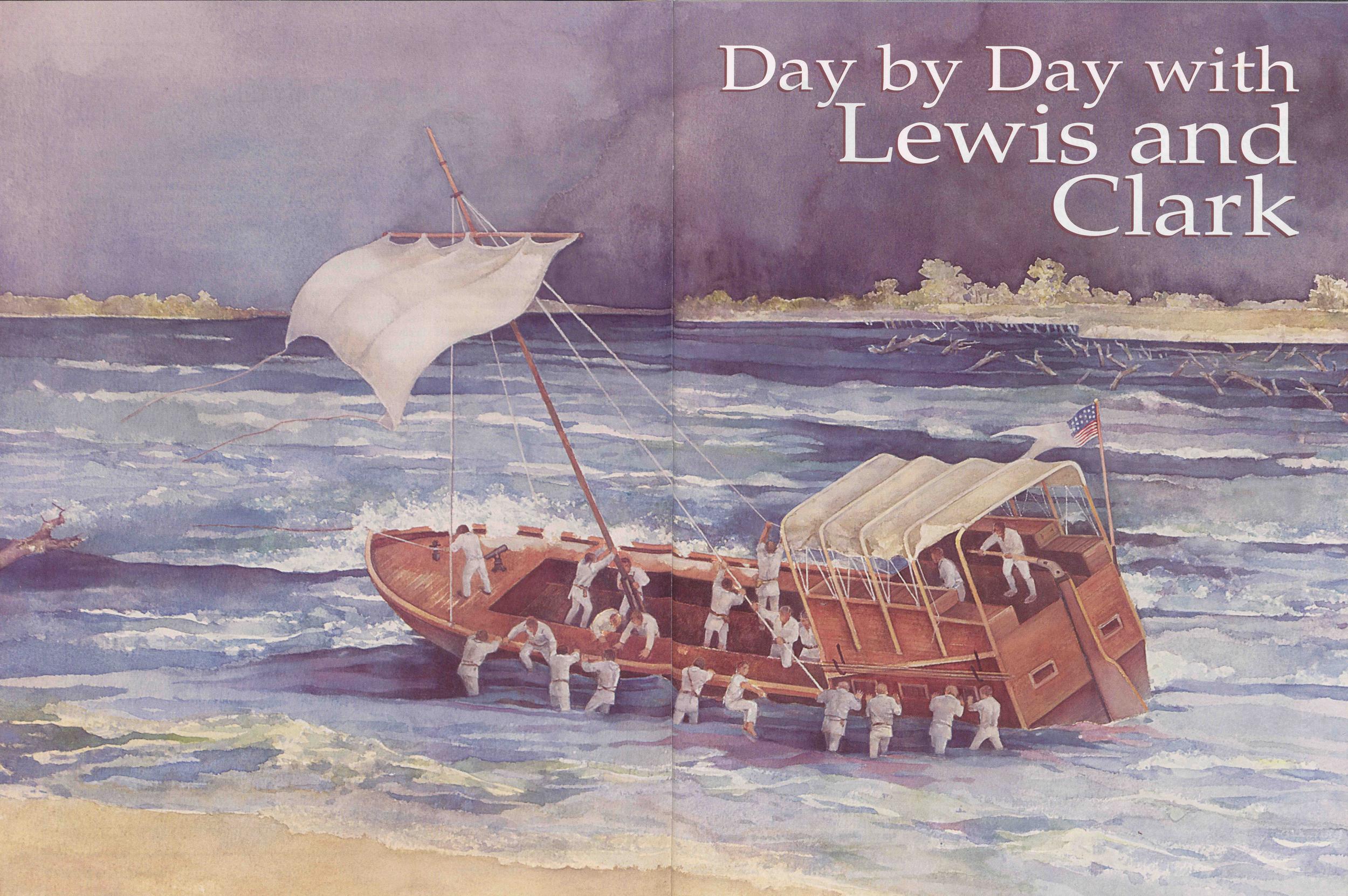
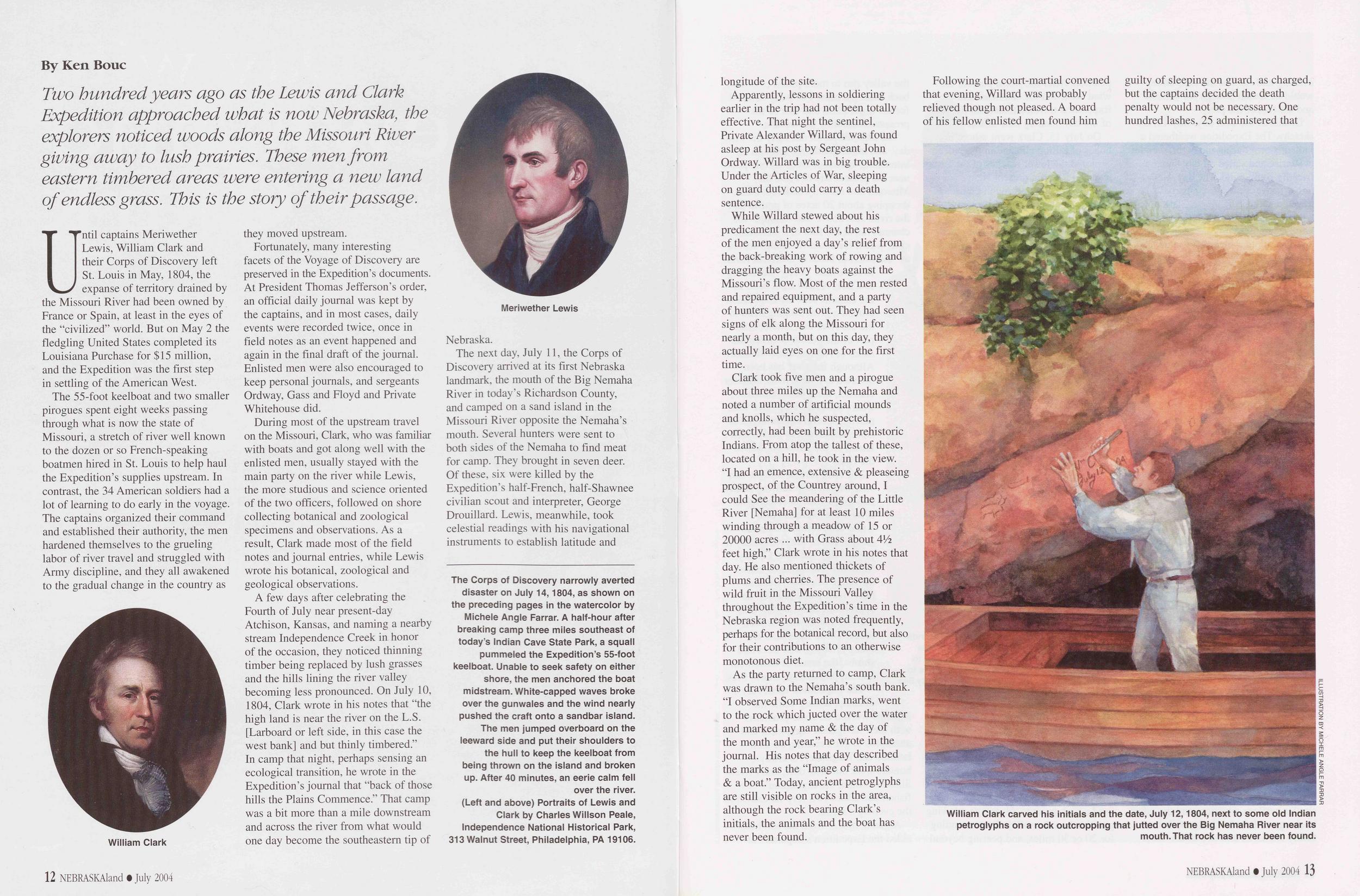
The Corps of Discovery narrowly averted disaster on July 14,1804, as shown on the preceding pages in the watercolor by Michele Angle Farrar. A half-hour after breaking camp three miles southeast of today’s Indian Cave State Park, a squall pummeled the Expedition’s 55-foot keelboat. Unable to seek safety on either shore, the men anchored the boat midstream. White-capped waves broke over the gunwales and the wind nearly pushed the craft onto a sandbar island. The men jumped overboard on the leeward side and put their shoulders to the hull to keep the keelboat from being thrown on the island and broken up. After 40 minutes, an eerie calm fell over the river. (Left and above) Portraits of Lewis and Clark by Charles Willson Peale, Independence National Historical Park, 313 Walnut Street, Philadelphia, PA 19106.
Apparently, lessons in soldiering earlier in the trip had not been totally effective. That night the sentinel, Private Alexander Willard, was found asleep at his post by Sergeant John Ordway. Willard was in big trouble. Under the Articles of War, sleeping on guard duty could carry a death sentence.
While Willard stewed about his predicament the next day, the rest of the men enjoyed a day’s relief from the back-breaking work of rowing and dragging the heavy boats against the Missouri’s flow. Most of the men rested and repaired equipment, and a party of hunters was sent out. They had seen signs of elk along the Missouri for nearly a month, but on this day, they actually laid eyes on one for the first time.
Clark took five men and a pirogue about three miles up the Nemaha and noted a number of artificial mounds and knolls, which he suspected, correctly, had been built by prehistoric Indians. From atop the tallest of these, located on a hill, he took in the view. “I had an emence, extensive & pleaseing prospect, of the Countrey around, I could See the meandering of the Little River [Nemaha] for at least 10 miles winding through a meadow of 15 or 20000 acres ... with Grass about 41/2 feet high,” Clark wrote in his notes that day. He also mentioned thickets of plums and cherries. The presence of wild fruit in the Missouri Valley throughout the Expedition’s time in the Nebraska region was noted frequently, perhaps for the botanical record, but also for their contributions to an otherwise monotonous diet.
As the party returned to camp, Clark was drawn to the Nemaha’s south bank. “I observed Some Indian marks, went to the rock which j acted over the water and marked my name & the day of the month and year,” he wrote in the journal. His notes that day described the marks as the “Image of animals & a boat.” Today, ancient petroglyphs are still visible on rocks in the area, although the rock bearing Clark’s initials, the animals and the boat has never been found.
Following the court-martial convened that evening, Willard was probably relieved though not pleased. A board of his fellow enlisted men found him guilty of sleeping on guard, as charged, but the captains decided the death penalty would not be necessary. One hundred lashes, 25 administered that
 evening and each of the next three, would be lesson enough for Willard and the rest of the party.
Details of the next day, July 13, are sketchy. The Expedition weathered a violent storm during the night, then left at sunrise and sailed all day under a friendly south wind. The day was rather uneventful, and the party traveled about 2014 miles. Clark noted a large plain on the left filled with grass resembling timothy early in the day, and another high, handsome prairie on the opposite shore near the evening’s campsite, which was likely in Richardson County. He wrote that evening of the “great appearance of a Storm from the North W.”
Those clouds may be the reason for Clark’s brief journal entry for that day. His July 14 journal entry tells of a violent storm in the first mile of travel, about three miles southeast of today’s Indian Cave State Park, which blew away his notes for the day before. “The atmispr. became Sudenly darkened by a black and dismal looking Cloud,” Clark wrote of the July 14 storm. A violent wind from the northeast, free to gather momentum over an open plain and an expanse of river, struck the keelboat from the starboard quarter, sending whitecaps breaking over her gunnels. The river banks, caving in and lined with snags as far as the eye could see, offered no refuge.
“The storm ... would have thrown her up on the Sand Island dashed to pieces in an Instant, had not the party leeped out on the Leward Side and kept her off with the assistance of the ancker & Cable ... In this Situation we continued about 40 Minits. when the Storm Sudenly Seased and the river become Instancetaniously as Smoth as Glass,” Clark wrote. The pirogues were both upstream of the keelboat, one in a similar perilous situation, and the other, in charge of Private George Gibson, firmly anchored and in a much better position. After the storm passed, the wind settled in the southeast and the Expedition traveled under sail the rest of the day, making nine miles.
On July 15, Clark went ashore in hopes of killing elk, and in the process explored the lower reaches of the Little Nemaha River in present Nemaha County. In passing through plains and prairie, he observed that the country was “entirely void of timber except what grows on the water,” and noted that “on the Streams the wood escapes the fire.” The open grassland of the
As he did on the Big Nemaha, Clark used a high point to advantage, viewing grassland on the valley floor extending for 20 or 30 miles, and peering beyond the valley rim to more plains extending back from the hills. The party camped for the night north and east of the present community of Nemaha.
The Expedition set out early the next day, and made good time through an interesting stretch of river. At one point near the present site of Peru, the Missouri had recently undercut a hill, dropping about 20 acres of prairie into the river. Just above that “slump,” the channel ran at the foot of a sandstone cliff, which for about two miles served as “the resort of burds of Different Kinds to reare their young” according to Clark. A hard right bend in the channel sent the Expedition around a great looping bend in the old river that later became part of the border between the states of Nebraska and Missouri. Although the river has been diverted to a new, more efficient channel, the border remains where the great loop once was, placing several square miles of Nebraska known as McKissock’s Island on the Missouri side of the river.
The river turned shallow and swift in that loop and was nearly two miles wide in some spots. It took the explorers near a new land formation on the eastern rim of the river valley in present-day Atchison County, Missouri. The captains called the range of grassy, treeless hills “bald-pated prairie,” an appropriate name at that time but one that would not stick today. Those loess hills are today bristling with trees and shrubs, the result of settlement and suppression of natural fires.
The Expedition spent July 17 in camp, resting while the captains worked on some problems with their navigation equipment and attempted to get a reading on their latitude and longitude. As always, hunters went out after deer, and Private Silas Goodrich, the expedition’s best fisherman, added two very fat catfish to the evening’s menu.
A gentle breeze from the southeast aided the Expedition’s departure at
Clark went ashore on the west bank after breakfast the morning of July 19, and was soon following elk tracks that led him through the hills. He emerged from a narrow strip of woods and “Came Suddenly into an open and bound less Prairie, I Say bound less because I could not See the extent of the plain in any Demotion ... This prospect was So Sudden & entertaining that I forgot the object of my prosute.” Clark continued on the grassland for a time, then turned back toward the river and found himself on a “buitful Streem of running water” that led to others which, after about three miles, fell into the Missouri. Likely among these streams were North and South Table creeks, which today run through Nebraska City.
Clark rejoined the main party at that point, and Lewis went ashore. Just above those creeks, they must have stopped for lunch on an island, which, of course, no longer exists. Clark named that piece of ground “Butter Island” because the party consumed the last of its butter there.
It was there that Clark mentioned the first signs of the Platte River’s effect on the Missouri. “As we approach this great River Plate the Sand bars are much more numerous and the quick or moveing Sands much worse than they were below,” Clark wrote. They camped that night on the upstream tip of a willow island about three miles above Nebraska City.
After three miles travel the next morning, the boats passed the mouth of a stream the French boatmen called U Eau Que Pleure (The Water Which Cries), today’s Weeping Water Creek. At that point, Clark, along with Private Reubin Field, again went ashore in search of elk. They walked all day in the prairie on the valley floor without seeing elk, but Clark killed “an emence large yellow Wolf,” probably one of the now-extinct huge gray wolves that followed the buffalo herds. Clark again wrote of the prevalence of fire on the prairie. “The Soil of Those Prairies appears rich but much Parched with the frequent fires,” he wrote in the journal. The boats covered 18 miles that day.
of the Platte River, Clark wrote in his journal, “This Great river being much more rapid than the Missourie forces its [the Missouri’s] current against the opposit [eastern] Shore.”The party set out very early on July 21, passing some rocky and timbered high land on the west bank, probably today’s King Hill in Cass County, with a large sandbar between it and the river channel. Three miles farther, after seeing signs of its influence on the Missouri for several days, the Expedition finally pulled into view of the Platte River. “This Great river being much more rapid than the Missourie forces its [the Missouri’s] current against the opposit [east] Shore,” Clark wrote in the journal.
Clark also wrote of many sandbars in the mouth of the Platte, making it difficult to pass through. However, he, Lewis and six men took a pirogue through those obstacles and several miles upstream. They found multiple channels through a sandy bed and rapid current moving the fine sand along in great quantities, causing Clark to declare that it was not navigable with boat or pirogue.
Two members of the party, privates Francois Labiche and Pierre Cruzatte, were sons of French traders and Omaha women, and probably were born in the area and had spent considerable time there. One or both informed the captains of features of the lower Platte, including its Elkhorn River and Salt Creek tributaries, and the presence of Oto and Pawnee villages farther upstream.
They returned to the main party waiting on the Missouri, proceeded upriver two or three miles and camped for the evening on the Missouri’s west bank a little above the mouth of Papillion Creek. Clark concluded his journal entry for the day with the mention of “a Great number of wolves about us this evening.”
Even as they left the Platte River the day before, the captains were on the lookout for a place to pause for a few days to rest, repair their gear and dry their cargo, and take celestial readings to determine latitude and longitude. Since the Big Nemaha, timber had become so rare that any significant stand along the way rated a line in the journals. On July 22, they found a stand of oaks, walnuts and elms nine miles above the Papillion Creek camp on the east bank of the Missouri near Mosquito Creek, south of present Council Bluffs, Iowa, and opposite Bellevue, Nebraska. They called this “White Catfish Camp” after a fish caught by Private Goodrich. From its description, the fish was probably a blue catfish, a species still present in the Missouri.
The next day, July 23, the captains sent the civilian hunter and interpreter, Drouillard, and Cruzatte, who were both half-Indian, to the Oto and Missouri a village that Cruzatte knew 16 NEBRASKAland • July 2004 NEBRASKAland • July 2004 17 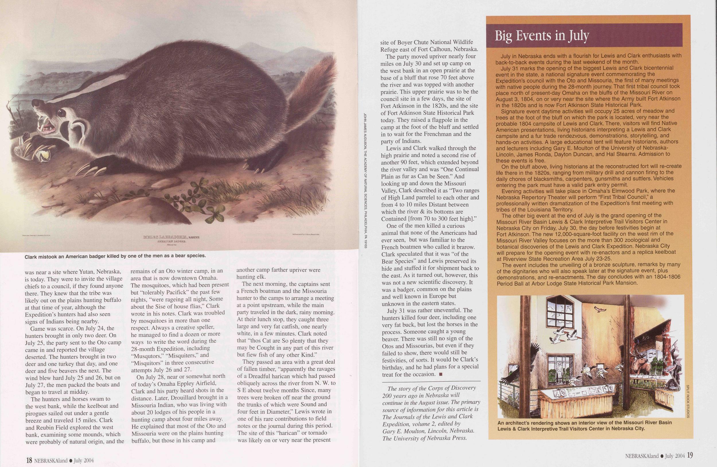
Game was scarce. On July 24, the hunters brought in only two deer. On July 25, the party sent to the Oto camp came in and reported the village deserted. The hunters brought in two deer and one turkey that day, and one deer and five beavers the next. The wind blew hard July 25 and 26, but on July 27, the men packed the boats and began to travel at midday.
The hunters and horses swam to the west bank, while the keelboat and pirogues sailed out under a gentle breeze and traveled 15 miles. Clark and Reubin Field explored the west bank, examining some mounds, which were probably of natural origin, and the remains of an Oto winter camp, in an area that is now downtown Omaha. The mosquitoes, which had been present but “tolerably Pacifick” the past few nights, “were rageing all night, Some about the Sise of house flias,” Clark wrote in his notes. Clark was troubled by mosquitoes in more than one respect. Always a creative speller, he managed to find a dozen or more ways to write the word during the 28-month Expedition, including “Musqutors,” “Misquiters,” and “Misquitors” in three consecutive attempts July 26 and 27.
On July 28, near or somewhat north of today’s Omaha Eppley Airfield, Clark and his party heard shots in the distance. Later, Drouillard brought in a Missouria Indian, who was living with about 20 lodges of his people in a hunting camp about four miles away. He explained that most of the Oto and Missouria were on the plains hunting buffalo, but those in his camp and another camp farther upriver were hunting elk.
The next morning, the captains sent a French boatman and the Missouria hunter to the camps to arrange a meeting at a point upstream, while the main party traveled in the dark, rainy morning. At their lunch stop, they caught three large and very fat catfish, one nearly white, in a few minutes. Clark noted that “thos Cat are So plenty that they may be Cought in any part of this river but fiew fish of any other Kind.”
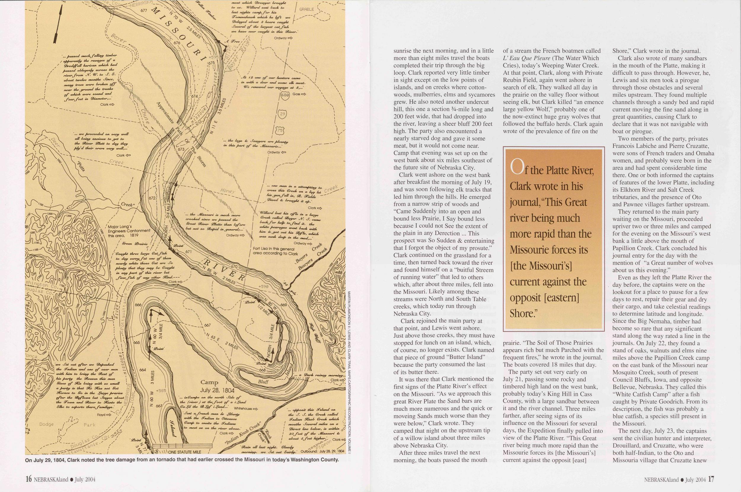
They passed an area with a great deal of fallen timber, “apparently the ravages of a Dreadful harican which had passed obliquely across the river from N. W. to S E about twelve months Since, many trees were broken off near the ground the trunks of which were Sound and four feet in Diameter,” Lewis wrote in one of his rare contributions to field notes or the journal during this period. The site of this “harican” or tornado was likely on or very near the present site of Boyer Chute National Wildlife Refuge east of Fort Calhoun, Nebraska.
The party moved upriver nearly four miles on July 30 and set up camp on the west bank in an open prairie at the base of a bluff that rose 70 feet above the river and was topped with another prairie. This upper prairie was to be the council site in a few days, the site of Fort Atkinson in the 1820s, and the site of Fort Atkinson State Historical Park today. They raised a flagpole in the camp at the foot of the bluff and settled in to wait for the Frenchman and the party of Indians.
Lewis and Clark walked through the high prairie and noted a second rise of another 90 feet, which extended beyond the river valley and was “One Continual Plain as fur as Can be Seen.” And looking up and down the Missouri Valley, Clark described it as “Two ranges of High Land parrelel to each other and from 4 to 10 miles Distant between which the river & its bottoms are Contained [from 70 to 300 feet high].”
One of the men killed a curious animal that none of the Americans had ever seen, but was familiar to the French boatmen who called it brarow. Clark speculated that it was “of the Bear Species” and Lewis preserved its hide and stuffed it for shipment back to the east. As it turned out, however, this was not a new scientific discovery. It was a badger, common on the plains and well known in Europe but unknown in the eastern states.
July 31 was rather uneventful. The hunters killed four deer, including one very fat buck, but lost the horses in the process. Someone caught a young beaver. There was still no sign of the Otos and Missourias, but even if they failed to show, there would still be festivities, of sorts. It would be Clark’s birthday, and he had plans for a special treat for the occasion.
The story of the Corps of Discovery 200 years ago in Nebraska will continue in the August issue. The primary source of information for this article is The Journals of the Lewis and Clark Expedition, volume 2, edited by Gary E. Moulton, Lincoln, Nebraska. The University of Nebraska Press.Big Events in July
July in Nebraska ends with a flourish for Lewis and Clark enthusiasts with back-to-back events during the last weekend of the month.
July 31 marks the opening of the biggest Lewis and Clark bicentennial event in the state, a national signature event commemorating the Expedition’s council with the Oto and Missouria, the first of many meetings with native people during the 28-month journey. That first tribal council took place north of present-day Omaha on the bluffs of the Missouri River on August 3, 1804, on or very near the site where the Army built Fort Atkinson in the 1820s and is now Fort Atkinson State Historical Park.
Signature event daytime activities will occupy 25 acres of meadow and trees at the foot of the bluff on which the park is located, very near the probable 1804 campsite of Lewis and Clark. There, visitors will find Native American presentations, living historians interpreting a Lewis and Clark campsite and a fur trade rendezvous, demonstrations, storytelling, and hands-on activities. A large educational tent will feature historians, authors and lecturers including Gary E. Moulton of the University of Nebraska- Lincoln, James Ronda, Dayton Duncan, and Hal Stearns. Admission to these events is free.
On the bluff above, living historians at the reconstructed fort will re-create life there in the 1820s, ranging from military drill and cannon firing to the daily chores of blacksmiths, carpenters, gunsmiths and suttlers. Vehicles entering the park must have a valid park entry permit.
Evening activities will take place in Omaha’s Elmwood Park, where the Nebraska Repertory Theater will perform “First Tribal Council,” a professionally written dramatization of the Expedition’s first meeting with tribes of the Louisiana Territory.
The other big event at the end of July is the grand opening of the Missouri River Basin Lewis & Clark Interpretive Trail Visitors Center in Nebraska City on Friday, July 30, the day before festivities begin at Fort Atkinson. The new 12,000-square-foot facility on the west rim of the Missouri River Valley focuses on the more than 300 zoological and botanical discoveries of the Lewis and Clark Expedition. Nebraska City will prepare for the opening event with re-enactors and a replica keelboat at Riverview State Recreation Area July 23-25.
The event includes the unveiling of a bronze sculpture, remarks by many of the dignitaries who will also speak later at the signature event, plus demonstrations, and re-enactments. The day concludes with an 1804-1806 Period Ball at Arbor Lodge State Historical Park Mansion.
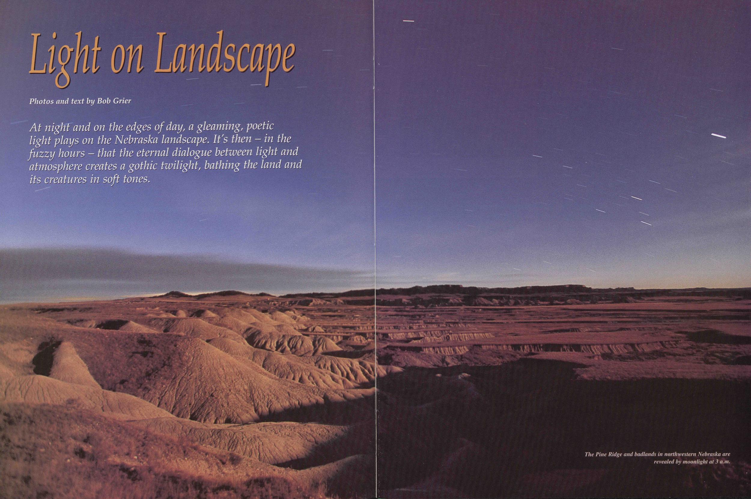
Light on Landscape
Photos and text by Bob Grier At night and on the edges of day, a gleaming, poetic light plays on the Nebraska landscape. It's then - in the fuzzy hours - that the eternal dialogue between light and atmosphere creates a gothic twilight, bathing the land and its creatures in soft tones.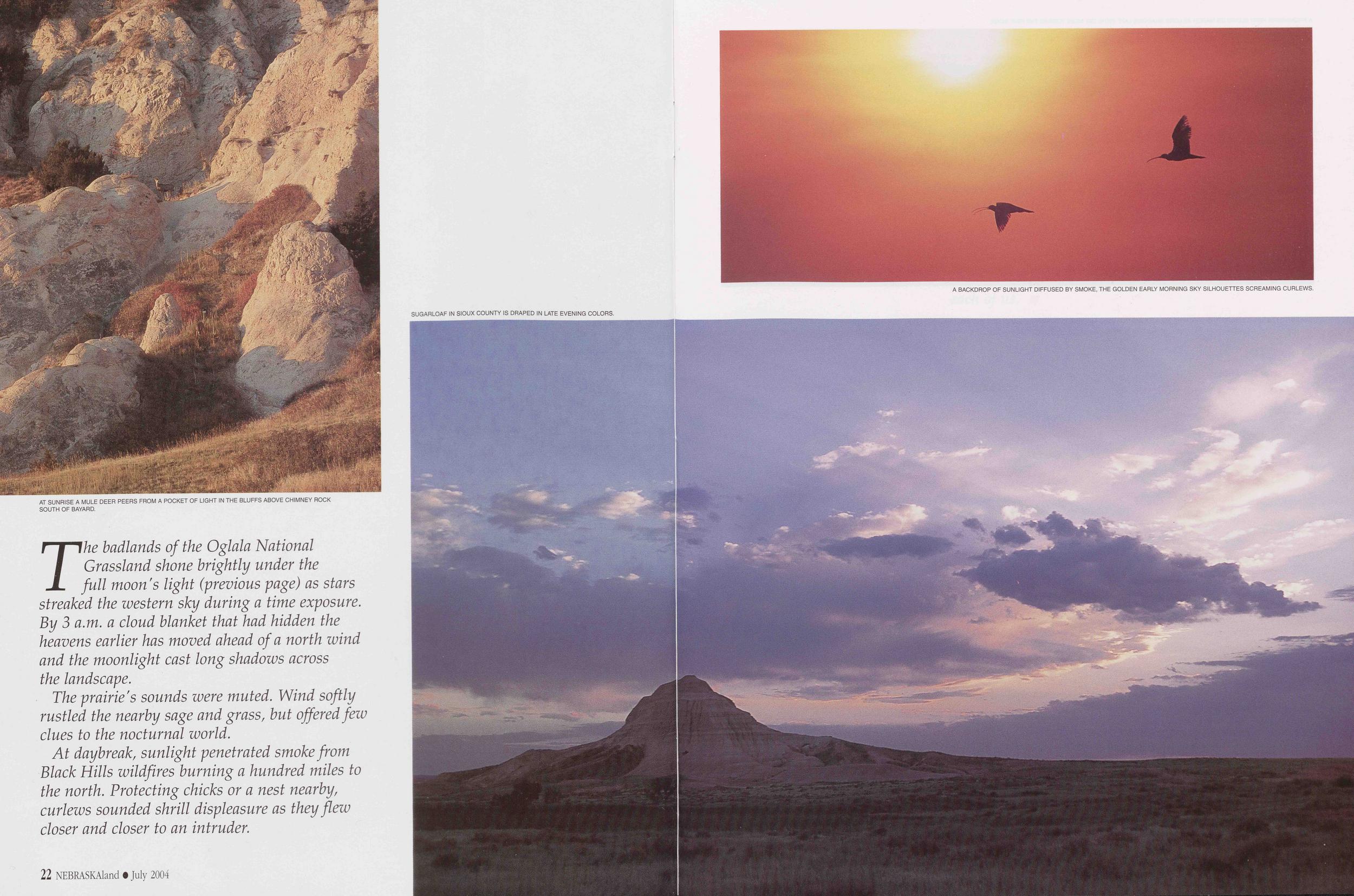
AT SUNRISE A MULE DEER PEERS FROM A POCKET OF LIGHT IN THE BLUFFS ABOVE CHIMNEY ROCK SOUTH OF BAYARD.
The badlands of the Oglala National Grassland shone brightly under the full moon's light (previous page) as stars streaked the western sky during a time exposure. By 3 a.m. a cloud blanket that had hidden the heavens earlier has moved ahead of a north wind and the moonlight cast long shadows across the landscape.
The prairie's sounds were muted. Wind softly rustled the nearby sage and grass, but offered few clues to the nocturnal world.
At daybreak, sunlight penetrated smoke from Black Hills wildfires burning a hundred miles to the north. Protecting chicks or a nest nearby, curlews sounded shrill displeasure as they flew closer and closer to an intruder.
SUGARLOAF IN SIOUX COUNTY IS DRAPED IN LATE EVENING COLORS.
A BACKDROP OF SUNLIGHT DIFFUSED BY SMOKE, THE GOLDEN EARLY MORNING SKY SILHOUETTES SCREAMING CURLEWS.
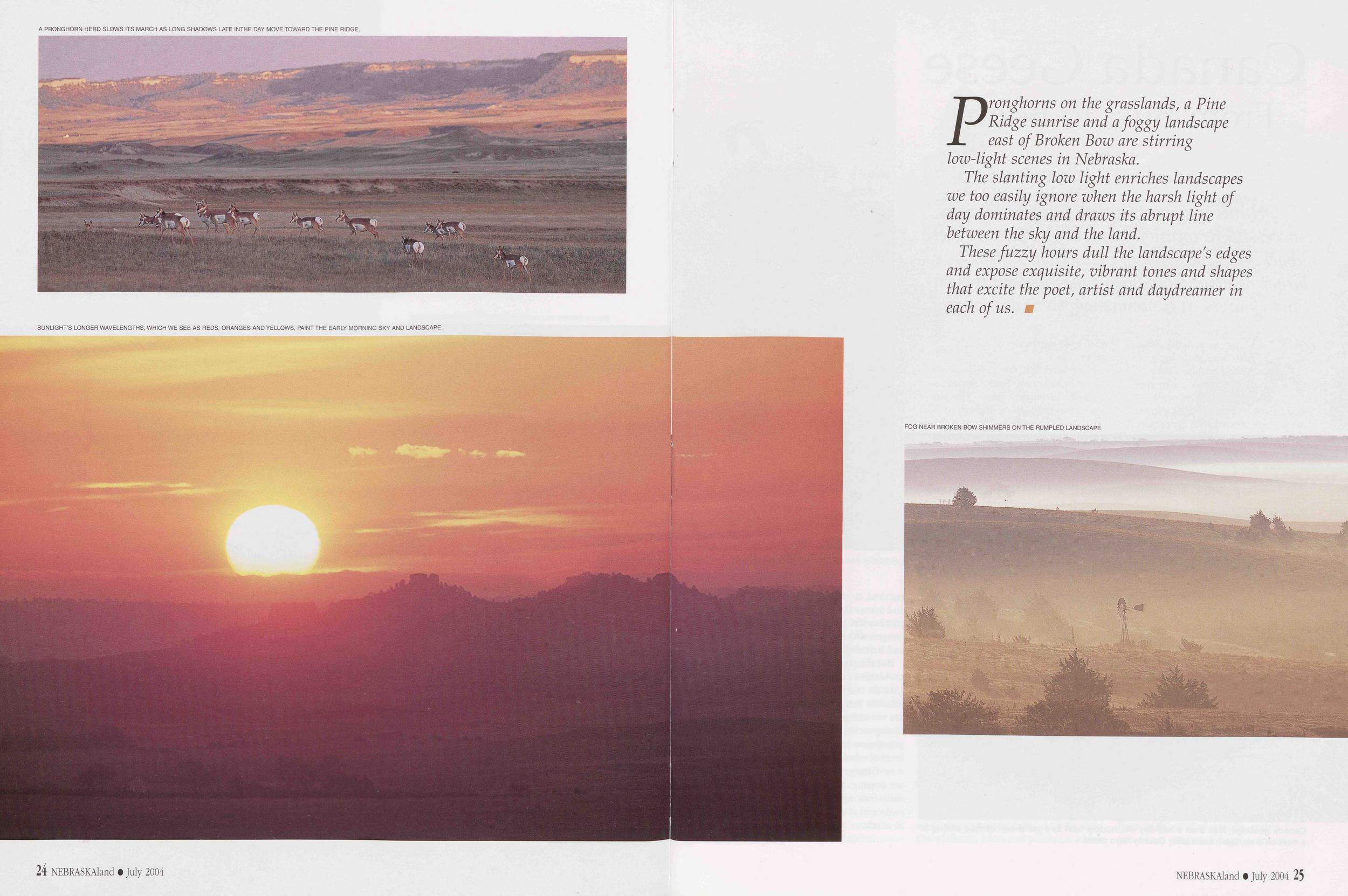
A PRONGHORN HERD SLOWS ITS MARCH AS LONG SHADOWS LATE INTHE DAY MOVE TOWARD THE PINE RIDGE.
SUNLIGHT’S LONGER WAVELENGTHS, WHICH WE SEE AS REDS, ORANGES AND YELLOWS, PAINT THE EARLY MORNING SKY AND LANDSCAPE.
Pronghorns on the grasslands, a Pine Ridge sunrise and a foggy landscape east of Broken Bow are stirring low-light scenes in Nebraska.
The slanting low light enriches landscapes we too easily ignore when the harsh light of day dominates and draws its abrupt line between the sky and the land.
These fuzzy hours dull the landscape's edges and expose exquisite, vibrant tones and shapes that excite the poet, artist and daydreamer in each of us.
FOG NEAR BROKEN BOW SHIMMERS ON THE RUMPLED LANDSCAPE.
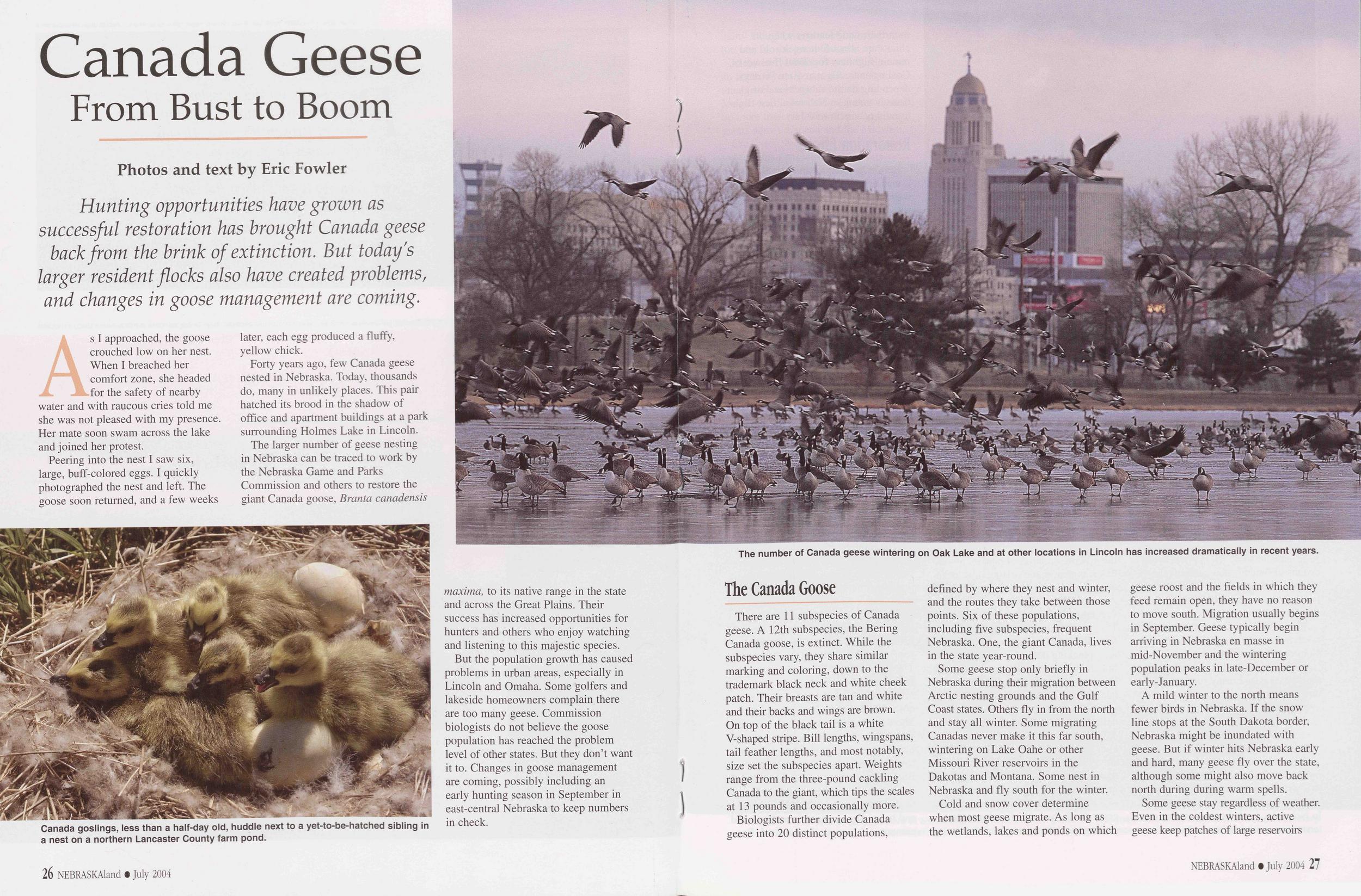
Canada Geese
From Bust to Boom
Hunting opportunities have grown as successful restoration has brought Canada geese back from the brink of extinction. But today's larger resident flocks also have created problems, and changes in goose management are coming.
As I approached, the goose FM crouched low on her nest. When I breached her comfort zone, she headed for the safety of nearby water and with raucous cries told me she was not pleased with my presence. Her mate soon swam across the lake and joined her protest.
Canada goslings, less than a half-day old, huddle next to a yet-to-be-hatched sibling in a nest on a northern Lancaster County farm pond.
Forty years ago, few Canada geese nested in Nebraska. Today, thousands do, many in unlikely places. This pair hatched its brood in the shadow of office and apartment buildings at a park surrounding Holmes Lake in Lincoln.
The larger number of geese nesting in Nebraska can be traced to work by the Nebraska Game and Parks Commission and others to restore the giant Canada goose, Branta canadensis maxima, to its native range in the state and across the Great Plains. Their success has increased opportunities for hunters and others who enjoy watching and listening to this majestic species.
But the population growth has caused problems in urban areas, especially in Lincoln and Omaha. Some golfers and lakeside homeowners complain there are too many geese. Commission biologists do not believe the goose population has reached the problem level of other states. But they don’t want it to. Changes in goose management are coming, possibly including an early hunting season in September in east-central Nebraska to keep numbers in check.
26 NEBRASKAland • July 2004The number of Canada geese wintering on Oak Lake and at other locations in Lincoln has increased dramatically in recent years.
There are 11 subspecies of Canada geese. A 12th subspecies, the Bering Canada goose, is extinct. While the subspecies vary, they share similar marking and coloring, down to the trademark black neck and white cheek patch. Their breasts are tan and white and their backs and wings are brown. On top of the black tail is a white V-shaped stripe. Bill lengths, wingspans, tail feather lengths, and most notably, size set the subspecies apart. Weights range from the three-pound cackling Canada to the giant, which tips the scales at 13 pounds and occasionally more.
Biologists further divide Canada geese into 20 distinct populations, defined by where they nest and winter, and the routes they take between those points. Six of these populations, including five subspecies, frequent Nebraska. One, the giant Canada, lives in the state year-round.
Some geese stop only briefly in Nebraska during their migration between Arctic nesting grounds and the Gulf Coast states. Others fly in from the north and stay all winter. Some migrating Canadas never make it this far south, wintering on Lake Oahe or other Missouri River reservoirs in the Dakotas and Montana. Some nest in Nebraska and fly south for the winter.
Cold and snow cover determine when most geese migrate. As long as the wetlands, lakes and ponds on which geese roost and the fields in which they feed remain open, they have no reason to move south. Migration usually begins in September. Geese typically begin arriving in Nebraska en masse in mid-November and the wintering population peaks in late-December or early-January.
A mild winter to the north means fewer birds in Nebraska. If the snow line stops at the South Dakota border, Nebraska might be inundated with geese. But if winter hits Nebraska early and hard, many geese fly over the state, although some might also move back north during during warm spells.
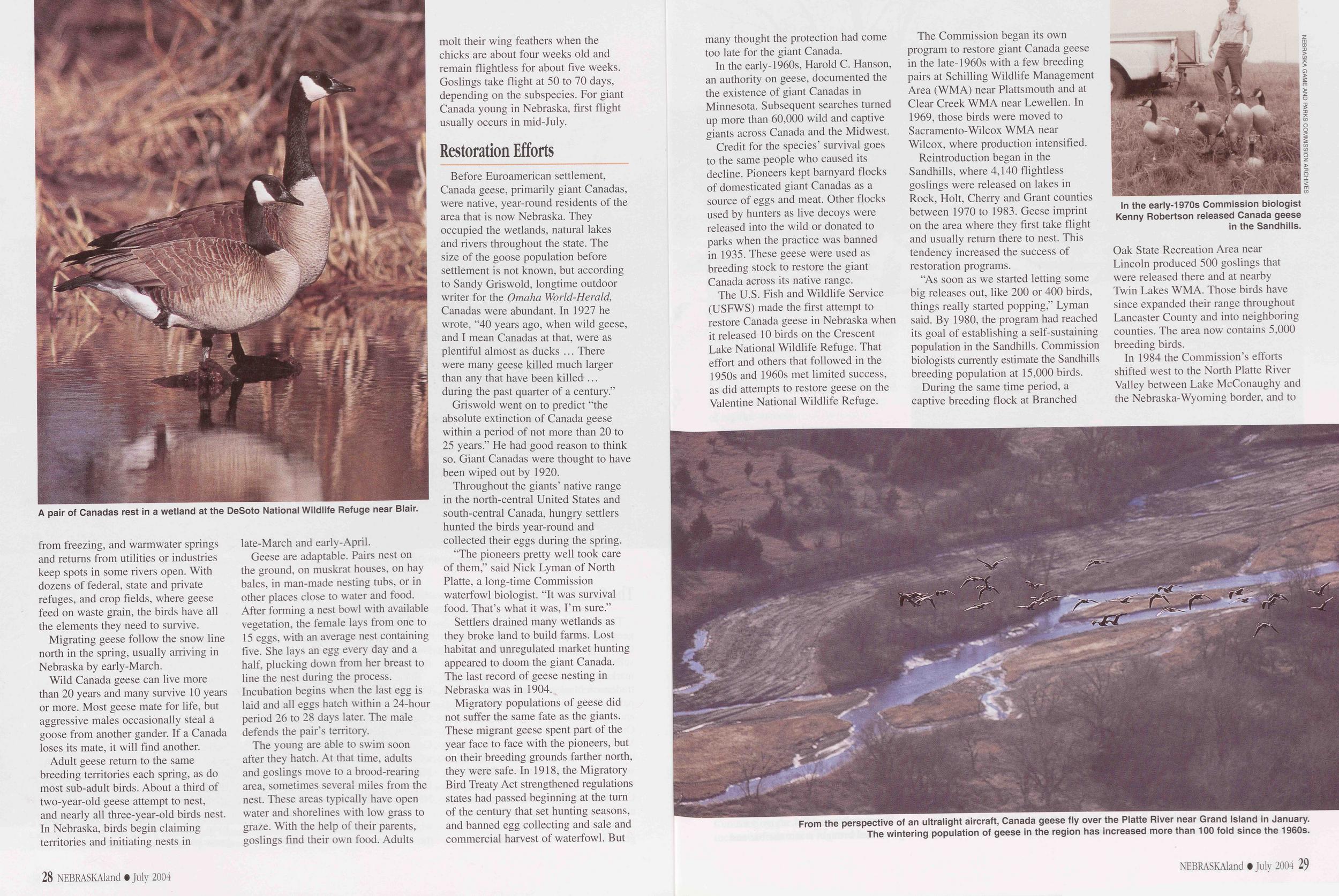
A pair of Canadas rest in a wetland at the DeSoto National Wildlife Refuge near Blair.
Migrating geese follow the snow line north in the spring, usually arriving in Nebraska by early-March.
Wild Canada geese can live more than 20 years and many survive 10 years or more. Most geese mate for life, but aggressive males occasionally steal a goose from another gander. If a Canada loses its mate, it will find another.
Adult geese return to the same breeding territories each spring, as do most sub-adult birds. About a third of two-year-old geese attempt to nest, and nearly all three-year-old birds nest. In Nebraska, birds begin claiming territories and initiating nests in late-March and early-April.
Geese are adaptable. Pairs nest on the ground, on muskrat houses, on hay bales, in man-made nesting tubs, or in other places close to water and food. After forming a nest bowl with available vegetation, the female lays from one to 15 eggs, with an average nest containing five. She lays an egg every day and a half, plucking down from her breast to line the nest during the process. Incubation begins when the last egg is laid and all eggs hatch within a 24-hour period 26 to 28 days later. The male defends the pair’s territory.
The young are able to swim soon after they hatch. At that time, adults and goslings move to a brood-rearing area, sometimes several miles from the nest. These areas typically have open water and shorelines with low grass to graze. With the help of their parents, goslings find their own food. Adults molt their wing feathers when the chicks are about four weeks old and remain flightless for about five weeks. Goslings take flight at 50 to 70 days, depending on the subspecies. For giant Canada young in Nebraska, first flight usually occurs in mid-July.
Restoration EffortsBefore Euroamerican settlement, Canada geese, primarily giant Canadas, were native, year-round residents of the area that is now Nebraska. They occupied the wetlands, natural lakes and rivers throughout the state. The size of the goose population before settlement is not known, but according to Sandy Griswold, longtime outdoor writer for the Omaha World-Herald, Canadas were abundant. In 1927 he wrote, “40 years ago, when wild geese, and I mean Canadas at that, were as plentiful almost as ducks ... There were many geese killed much larger than any that have been killed ... during the past quarter of a century.”
Griswold went on to predict “the absolute extinction of Canada geese within a period of not more than 20 to 25 years.” He had good reason to think so. Giant Canadas were thought to have been wiped out by 1920.
Throughout the giants’ native range in the north-central United States and south-central Canada, hungry settlers hunted the birds year-round and collected their eggs during the spring.
“The pioneers pretty well took care of them,” said Nick Lyman of North Platte, a long-time Commission waterfowl biologist. “It was survival food. That’s what it was, I’m sure.”
Settlers drained many wetlands as they broke land to build farms. Lost habitat and unregulated market hunting appeared to doom the giant Canada. The last record of geese nesting in Nebraska was in 1904.
Migratory populations of geese did not suffer the same fate as the giants. These migrant geese spent part of the year face to face with the pioneers, but on their breeding grounds farther north, they were safe. In 1918, the Migratory Bird Treaty Act strengthened regulations states had passed beginning at the turn of the century that set hunting seasons, and banned egg collecting and sale and commercial harvest of waterfowl. But 28 NEBRASKAland • July 2004 many thought the protection had come too late for the giant Canada.
In the early-1960s, Harold C. Hanson, an authority on geese, documented the the existence of giant Canadas in Minnesota. Subsequent searches turned up more than 60,000 wild and captive giants across Canada and the Midwest. Credit for the species’ survival goes to the same people who caused its decline. Pioneers kept barnyard flocks of domesticated giant Canadas as a source of eggs and meat. Other flocks used by hunters as live decoys were released into the wild or donated to parks when the practice was banned in 1935. These geese were used as breeding stock to restore the giant Canada across its native range.
The U.S. Fish and Wildlife Service (USFWS) made the first attempt to restore Canada geese in Nebraska when it released 10 birds on the Crescent Lake National Wildlife Refuge. That effort and others that followed in the 1950s and 1960s met limited success, as did attempts to restore geese on the Valentine National Wildlife Refuge.
From the perspective of an ultralight aircraft, Canada geese fly over the Platte River near Grand Island in January. The wintering population of geese in the region has increased more than 100 fold since the 1960s.
The Commission began its own program to restore giant Canada geese in the late-1960s with a few breeding pairs at Schilling Wildlife Management Area (WMA) near Plattsmouth and at Clear Creek WMA near Lewellen. In 1969, those birds were moved to Sacramento-Wilcox WMA near Wilcox, where production intensified.
Reintroduction began in the Sandhills, where 4,140 flightless goslings were released on lakes in Rock, Holt, Cherry and Grant counties between 1970 to 1983. Geese imprint on the area where they first take flight and usually return there to nest. This tendency increased the success of restoration programs.
“As soon as we started letting some big releases out, like 200 or 400 birds, things really started popping,” Lyman said. By 1980, the program had reached its goal of establishing a self-sustaining population in the Sandhills. Commission biologists currently estimate the Sandhills breeding population at 15,000 birds.
In the early-1970s Commission biologist Kenny Robertson released Canada geese in the Sandhills.
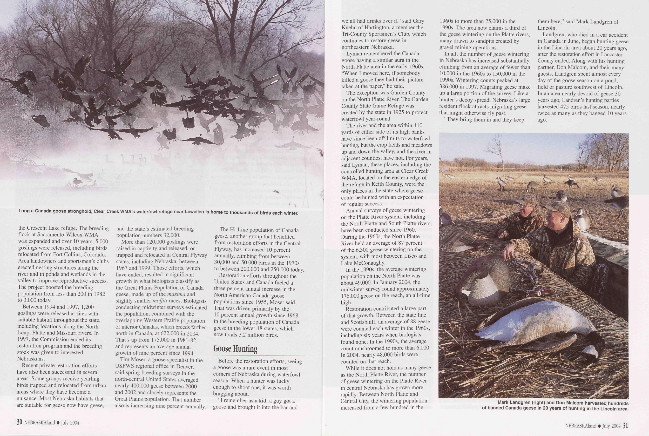
Long a Canada goose stronghold, Clear Creek WMA’s waterfowl refuge near Lewellen is home to thousands of birds each winter.
Between 1994 and 1997, 1,200 goslings were released at sites with suitable habitat throughout the state, including locations along the North Loup, Platte and Missouri rivers. In 1997, the Commission ended its restoration program and the breeding stock was given to interested Nebraskans.
Recent private restoration efforts have also been successful in several areas. Some groups receive yearling birds trapped and relocated from urban areas where they have become a nuisance. Most Nebraska habitats that are suitable for geese now have geese, and the state’s estimated breeding population numbers 32,000.
More than 120,000 goslings were raised in captivity and released, or trapped and relocated in Central Flyway states, including Nebraska, between 1967 and 1999. Those efforts, which have ended, resulted in significant growth in what biologists classify as the Great Plains Population of Canada geese, made up of the maxima and slightly smaller moffiti races. Biologists conducting midwinter surveys estimated the population, combined with the overlapping Western Prairie population of interior Canadas, which breeds farther north in Canada, at 622,000 in 2004. That’s up from 175,000 in 1981-82, and represents an average annual growth of nine percent since 1994.
Tim Moser, a goose specialist in the USFWS regional office in Denver, said spring breeding surveys in the north-central United States averaged nearly 400,000 geese between 2000 and 2002 and closely represents the Great Plains population. That number also is increasing nine percent annually.
The Hi-Line population of Canada geese, another group that benefited from restoration efforts in the Central Flyway, has increased 10 percent annually, climbing from between 30,000 and 50,000 birds in the 1970s to between 200,000 and 250,000 today.
Restoration efforts throughout the United States and Canada fueled a three percent annual increase in the North American Canada goose populations since 1955, Moser said. That was driven primarily by the 10 percent annual growth since 1968 in the breeding population of Canada geese in the lower 48 states, which now totals 3.2 million birds.
Goose HuntingBefore the restoration efforts, seeing a goose was a rare event in most corners of Nebraska during waterfowl season. When a hunter was lucky enough to shoot one, it was worth bragging about.
"I remember as a kid, a guy got a goose and brought it into the bar and 30 NEBRASKAland • July 2004 we all had drinks over it,” said Gary Kuehn of Hartington, a member the Tri-County Sportsmen’s Club, which continues to restore geese in northeastern Nebraska.
Lyman remembered the Canada goose having a similar aura in the North Platte area in the early-1960s. “When I moved here, if somebody killed a goose they had their picture taken at the paper,” he said.
The exception was Garden County on the North Platte River. The Garden County State Game Refuge was created by the state in 1925 to protect waterfowl year-round.
The river and the area within 110 yards of either side of its high banks have since been off limits to waterfowl hunting, but the crop fields and meadows up and down the valley, and the river in adjacent counties, have not. For years, said Lyman, these places, including the controlled hunting area at Clear Creek WMA, located on the eastern edge of the refuge in Keith County, were the only places in the state where geese could be hunted with an expectation of regular success.
Annual surveys of geese wintering on the Platte River system, including the North Platte and South Platte rivers, have been conducted since 1960. During the 1960s, the North Platte River held an average of 87 percent of the 6,300 geese wintering on the system, with most between Lisco and Lake McConaughy.
In the 1990s, the average wintering population on the North Platte was about 49,000. In January 2004, the midwinter survey found approximately 176,000 geese on the reach, an all-time high.
Restoration contributed a large part of that growth. Between the state line and Scottsbluff, an average of 88 geese were counted each winter in the 1960s, including six years when biologists found none. In the 1990s, the average count mushroomed to more than 6,000. In 2004, nearly 48,000 birds were counted on that reach.
While it does not hold as many geese as the North Platte River, the number of geese wintering on the Platte River in central Nebraska has grown more rapidly. Between North Platte and Central City, the wintering population increased from a few hundred in the 1960s to more than 25,000 in the 1990s. The area now claims a third of the geese wintering on the Platte rivers, many drawn to sandpits created by gravel mining operations.
In all, the number of geese wintering in Nebraska has increased substantially, climbing from an average of fewer than 10,000 in the 1960s to 150,000 in the 1990s. Wintering counts peaked at 386,000 in 1997. Migrating geese make up a large portion of the survey. Like a hunter’s decoy spread, Nebraska’s large resident flock attracts migrating geese that might otherwise fly past.
Mark Landgren (right) and Don Malcom harvested hundreds of banded Canada geese in 20 years of hunting in the Lincoln area.
Landgren, who died in a car accident in Canada in June, began hunting geese in the Lincoln area about 20 years ago, after the restoration effort in Lancaster County ended. Along with his hunting partner, Don Malcom, and their many guests, Landgren spent almost every day of the goose season on a pond, field or pasture southwest of Lincoln. In an area nearly devoid of geese 30 years ago, Landren’s hunting parties harvested 475 birds last season, nearly twice as many as they bagged 10 years ago.
NEBRASKAland • July 2004 31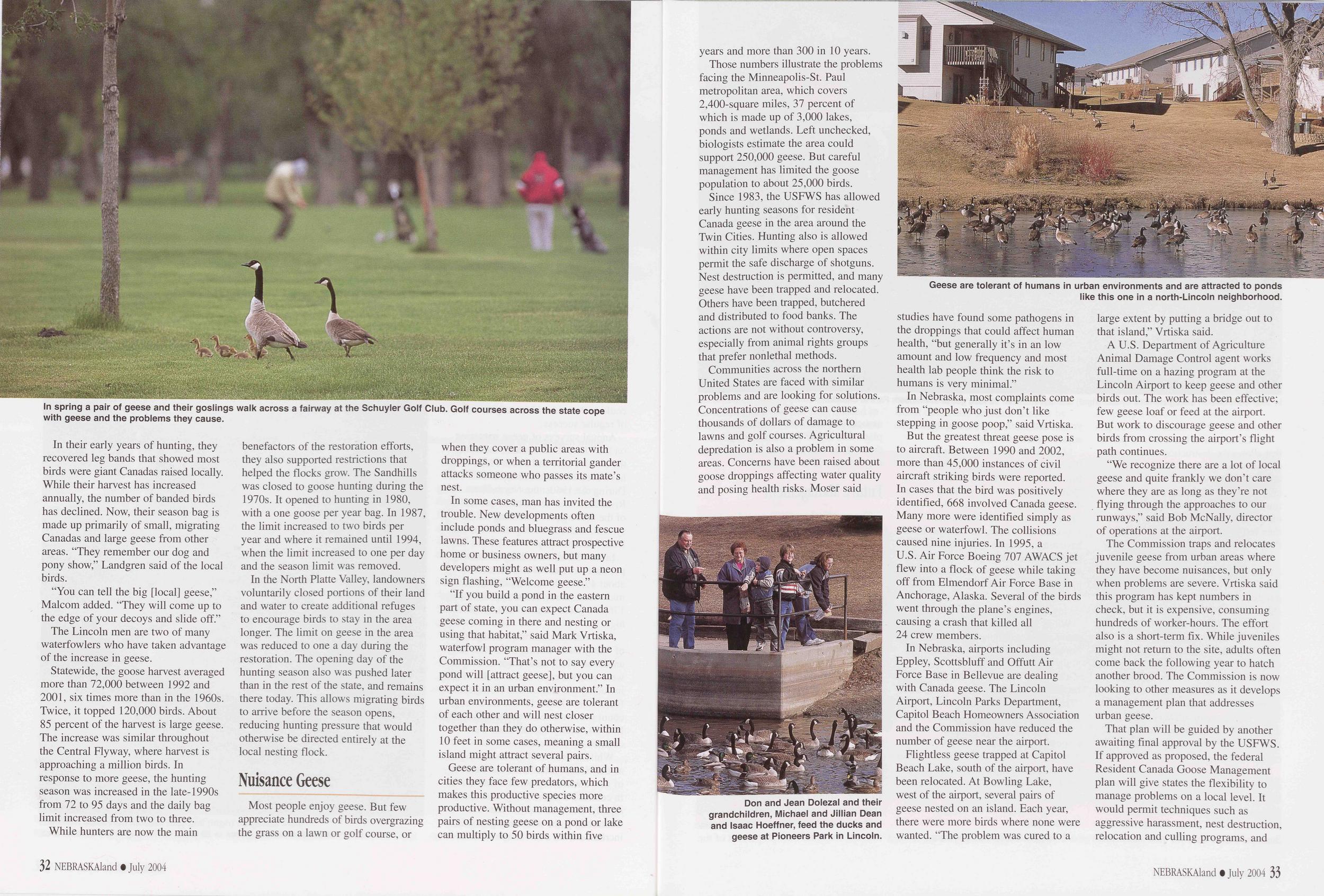
In spring a pair of geese and their goslings walk across a fairway at the Schuyler Golf Club. Golf courses across the state cope with geese and the problems they cause.
In their early years of hunting, they recovered leg bands that showed most birds were giant Canadas raised locally. While their harvest has increased annually, the number of banded birds has declined. Now, their season bag is made up primarily of small, migrating Canadas and large geese from other areas. “They remember our dog and pony show,” Landgren said of the local birds.
“You can tell the big [local] geese,” Malcom added. “They will come up to the edge of your decoys and slide off.”
The Lincoln men are two of many waterfowlers who have taken advantage of the increase in geese.
Statewide, the goose harvest averaged more than 72,000 between 1992 and 2001, six times more than in the 1960s. Twice, it topped 120,000 birds. About 85 percent of the harvest is large geese. The increase was similar throughout the Central Flyway, where harvest is approaching a million birds. In response to more geese, the hunting season was increased in the late-1990s from 72 to 95 days and the daily bag limit increased from two to three.
While hunters are now the main benefactors of the restoration efforts, they also supported restrictions that helped the flocks grow. The Sandhills was closed to goose hunting during the 1970s. It opened to hunting in 1980, with a one goose per year bag. In 1987, the limit increased to two birds per year and where it remained until 1994, when the limit increased to one per day and the season limit was removed.
In the North Platte Valley, landowners voluntarily closed portions of their land and water to create additional refuges to encourage birds to stay in the area longer. The limit on geese in the area was reduced to one a day during the restoration. The opening day of the hunting season also was pushed later than in the rest of the state, and remains there today. This allows migrating birds to arrive before the season opens, reducing hunting pressure that would otherwise be directed entirely at the local nesting flock.
Nuisance GeeseMost people enjoy geese. But few appreciate hundreds of birds overgrazing the grass on a lawn or golf course, or when they cover a public areas with droppings, or when a territorial gander attacks someone who passes its mate’s nest.
In some cases, man has invited the trouble. New developments often include ponds and bluegrass and fescue lawns. These features attract prospective home or business owners, but many developers might as well put up a neon sign flashing, “Welcome geese.”
“If you build a pond in the eastern part of state, you can expect Canada geese coming in there and nesting or using that habitat,” said Mark Vrtiska, waterfowl program manager with the Commission. “That’s not to say every pond will [attract geese], but you can expect it in an urban environment.” In urban environments, geese are tolerant of each other and will nest closer together than they do otherwise, within 10 feet in some cases, meaning a small island might attract several pairs.
Geese are tolerant of humans, and in cities they face few predators, which makes this productive species more productive. Without management, three pairs of nesting geese on a pond or lake can multiply to 50 birds within five 32 NEBRASKAland • July 2004 years and more than 300 in 10 years.
Those numbers illustrate the problems facing the Minneapolis-St. Paul metropolitan area, which covers 2,400-square miles, 37 percent of which is made up of 3,000 lakes, ponds and wetlands. Left unchecked, biologists estimate the area could support 250,000 geese. But careful management has limited the goose population to about 25,000 birds.
Since 1983, the USFWS has allowed early hunting seasons for resident Canada geese in the area around the Twin Cities. Hunting also is allowed within city limits where open spaces permit the safe discharge of shotguns. Nest destruction is permitted, and many geese have been trapped and relocated. Others have been trapped, butchered and distributed to food banks. The actions are not without controversy, especially from animal rights groups that prefer nonlethal methods.
Don and Jean Dolezal and their grandchildren, Michael and Jillian Dean and Isaac Hoeffner, feed the ducks and geese at Pioneers Park in Lincoln.
Geese are tolerant of humans in urban environments and are attracted to ponds like this one in a north-Lincoln neighborhood.
In Nebraska, most complaints come from “people who just don’t like stepping in goose poop,” said Vrtiska. But the greatest threat geese pose is to aircraft. Between 1990 and 2002, more than 45,000 instances of civil aircraft striking birds were reported. In cases that the bird was positively identified, 668 involved Canada geese. Many more were identified simply as geese or waterfowl. The collisions caused nine injuries. In 1995, a U.S. Air Force Boeing 707 AWACS jet flew into a flock of geese while taking off from Elmendorf Air Force Base in Anchorage, Alaska. Several of the birds went through the plane’s engines, causing a crash that killed all 24 crew members.
In Nebraska, airports including Eppley, Scottsbluff and Offutt Air Force Base in Bellevue are dealing with Canada geese. The Lincoln Airport, Lincoln Parks Department, Capitol Beach Homeowners Association and the Commission have reduced the number of geese near the airport.
Flightless geese trapped at Capitol Beach Lake, south of the airport, have been relocated. At Bowling Lake, west of the airport, several pairs of geese nested on an island. Each year, there were more birds where none were wanted. “The problem was cured to a large extent by putting a bridge out to that island,” Vrtiska said.
A U.S. Department of Agriculture Animal Damage Control agent works full-time on a hazing program at the Lincoln Airport to keep geese and other birds out. The work has been effective; few geese loaf or feed at the airport. But work to discourage geese and other birds from crossing the airport’s flight path continues.
“We recognize there are a lot of local geese and quite frankly we don’t care where they are as long as they’re not flying through the approaches to our runways,” said Bob McNally, director of operations at the airport.
The Commission traps and relocates juvenile geese from urban areas where they have become nuisances, but only when problems are severe. Vrtiska said this program has kept numbers in check, but it is expensive, consuming hundreds of worker-hours. The effort also is a short-term fix. While juveniles might not return to the site, adults often come back the following year to hatch another brood. The Commission is now looking to other measures as it develops a management plan that addresses urban geese.
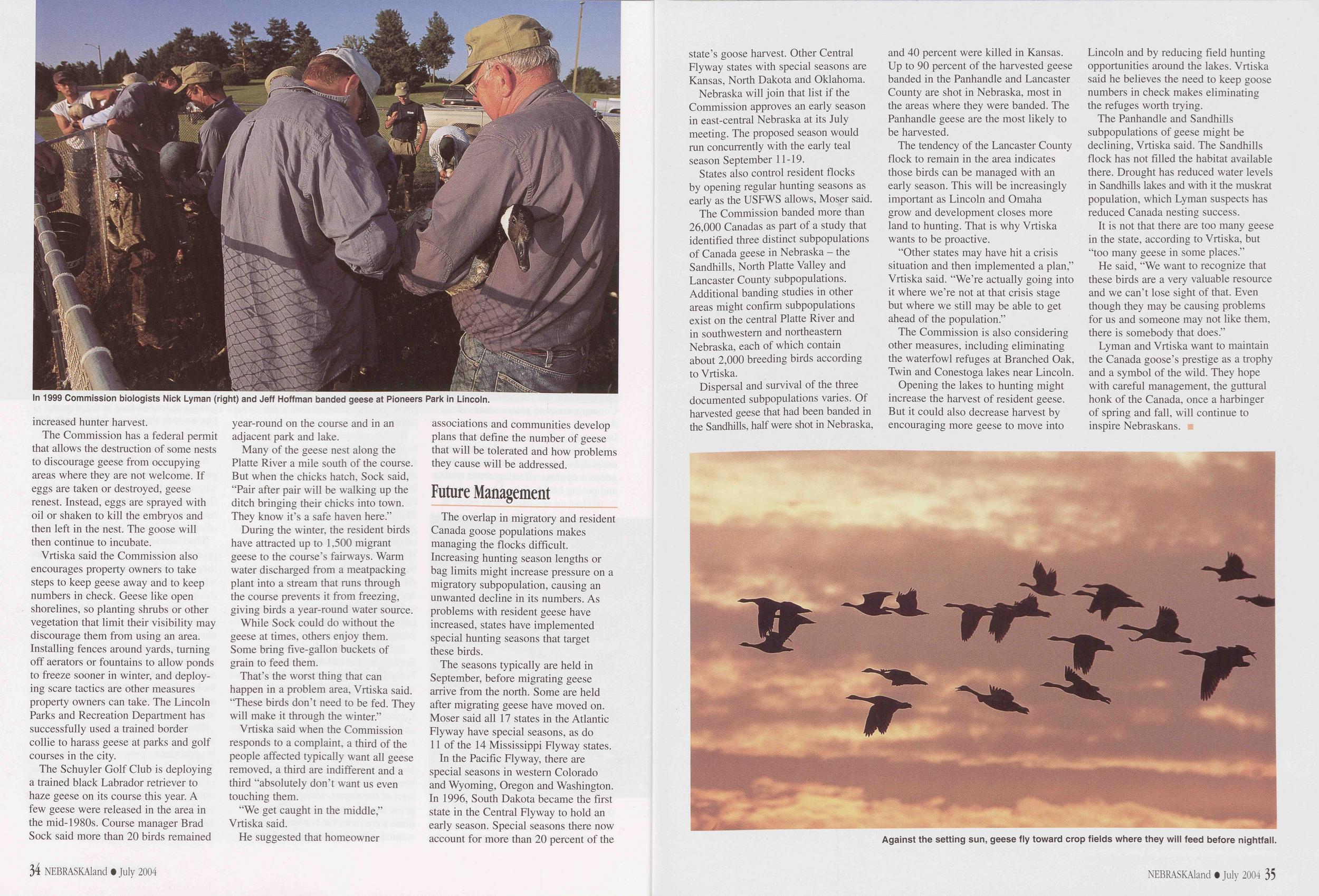
In 1999 Commission biologists Nick Lyman (right) and Jeff Hoffman banded geese at Pioneers Park in Lincoln.
The Commission has a federal permit that allows the destruction of some nests to discourage geese from occupying areas where they are not welcome. If eggs are taken or destroyed, geese renest. Instead, eggs are sprayed with oil or shaken to kill the embryos and then left in the nest. The goose will then continue to incubate.
Vrtiska said the Commission also encourages property owners to take steps to keep geese away and to keep numbers in check. Geese like open shorelines, so planting shrubs or other vegetation that limit their visibility may discourage them from using an area. Installing fences around yards, turning off aerators or fountains to allow ponds to freeze sooner in winter, and deploy- ing scare tactics are other measures property owners can take. The Lincoln Parks and Recreation Department has successfully used a trained border collie to harass geese at parks and golf courses in the city.
The Schuyler Golf Club is deploying a trained black Labrador retriever to haze geese on its course this year. A few geese were released in the area in the mid-1980s. Course manager Brad Sock said more than 20 birds remained year-round on the course and in an adjacent park and lake.
Many of the geese nest along the Platte River a mile south of the course. But when the chicks hatch, Sock said, “Pair after pair will be walking up the ditch bringing their chicks into town. They know it’s a safe haven here.”
During the winter, the resident birds have attracted up to 1,500 migrant geese to the course’s fairways. Warm water discharged from a meatpacking plant into a stream that runs through the course prevents it from freezing, giving birds a year-round water source.
While Sock could do without the geese at times, others enjoy them. Some bring five-gallon buckets of grain to feed them.
That’s the worst thing that can happen in a problem area, Vrtiska said. “These birds don’t need to be fed. They will make it through the winter.”
Vrtiska said when the Commission responds to a complaint, a third of the people affected typically want all geese removed, a third are indifferent and a third “absolutely don’t want us even touching them.
“We get caught in the middle,” Vrtiska said.
He suggested that homeowner associations and communities develop plans that define the nunjber of geese that will be tolerated and how problems they cause will be addressed.
Future ManagementThe overlap in migratory and resident Canada goose populations makes managing the flocks difficult. Increasing hunting season lengths or bag limits might increase pressure on a migratory subpopulation, causing an unwanted decline in its numbers. As problems with resident geese have increased, states have implemented special hunting seasons that target these birds.
The seasons typically are held in September, before migrating geese arrive from the north. Some are held after migrating geese have moved on. Moser said all 17 states in the Atlantic Flyway have special seasons, as do 11 of the 14 Mississippi Flyway states.
In the Pacific Flyway, there are special seasons in western Colorado and Wyoming, Oregon and Washington. In 1996, South Dakota became the first state in the Central Flyway to hold an early season. Special seasons there now account for more than 20 percent of the 34 NEBRASKAland • July 2004 state’s goose harvest. Other Central Flyway states with special seasons are Kansas, North Dakota and Oklahoma.
Nebraska will join that list if the Commission approves an early season in east-central Nebraska at its July meeting. The proposed season would run concurrently with the early teal season September 11-19.
States also control resident flocks by opening regular hunting seasons as early as the USFWS allows, Moser said. The Commission banded more than 26,000 Canadas as part of a study that identified three distinct subpopulations of Canada geese in Nebraska - the Sandhills, North Platte Valley and Lancaster County subpopulations. Additional banding studies in other areas might confirm subpopulations exist on the central Platte River and in southwestern and northeastern Nebraska, each of which contain about 2,000 breeding birds according to Vrtiska.
Against the setting sun, geese fly toward crop fields where they will feed before nightfall.
The tendency of the Lancaster County flock to remain in the area indicates those birds can be managed with an early season. This will be increasingly important as Lincoln and Omaha grow and development closes more land to hunting. That is why Vrtiska wants to be proactive.
“Other states may have hit a crisis situation and then implemented a plan,” Vrtiska said. “We’re actually going into it where we’re not at that crisis stage but where we still may be able to get ahead of the population.”
The Commission is also considering other measures, including eliminating the waterfowl refuges at Branched Oak, Twin and Conestoga lakes near Lincoln.
Opening the lakes to hunting might increase the harvest of resident geese. But it could also decrease harvest by encouraging more geese to move into Lincoln and by reducing field hunting opportunities around the lakes. Vrtiska said he believes the need to keep goose numbers in check makes eliminating the refuges worth trying.
The Panhandle and Sandhills subpopulations of geese might be declining, Vrtiska said. The Sandhills flock has not filled the habitat available there. Drought has reduced water levels in Sandhills lakes and with it the muskrat population, which Lyman suspects has reduced Canada nesting success.
It is not that there are too many geese in the state, according to Vrtiska, but “too many geese in some places.”
He said, “We want to recognize that these birds are a very valuable resource and we can’t lose sight of that. Even though they may be causing problems for us and someone may not like them, there is somebody that does.”
Lyman and Vrtiska want to maintain the Canada goose’s prestige as a trophy and a symbol of the wild. They hope with careful management, the guttural honk of the Canada, once a harbinger of spring and fall, will continue to inspire Nebraskans.
NEBRASKAland • July 2004 35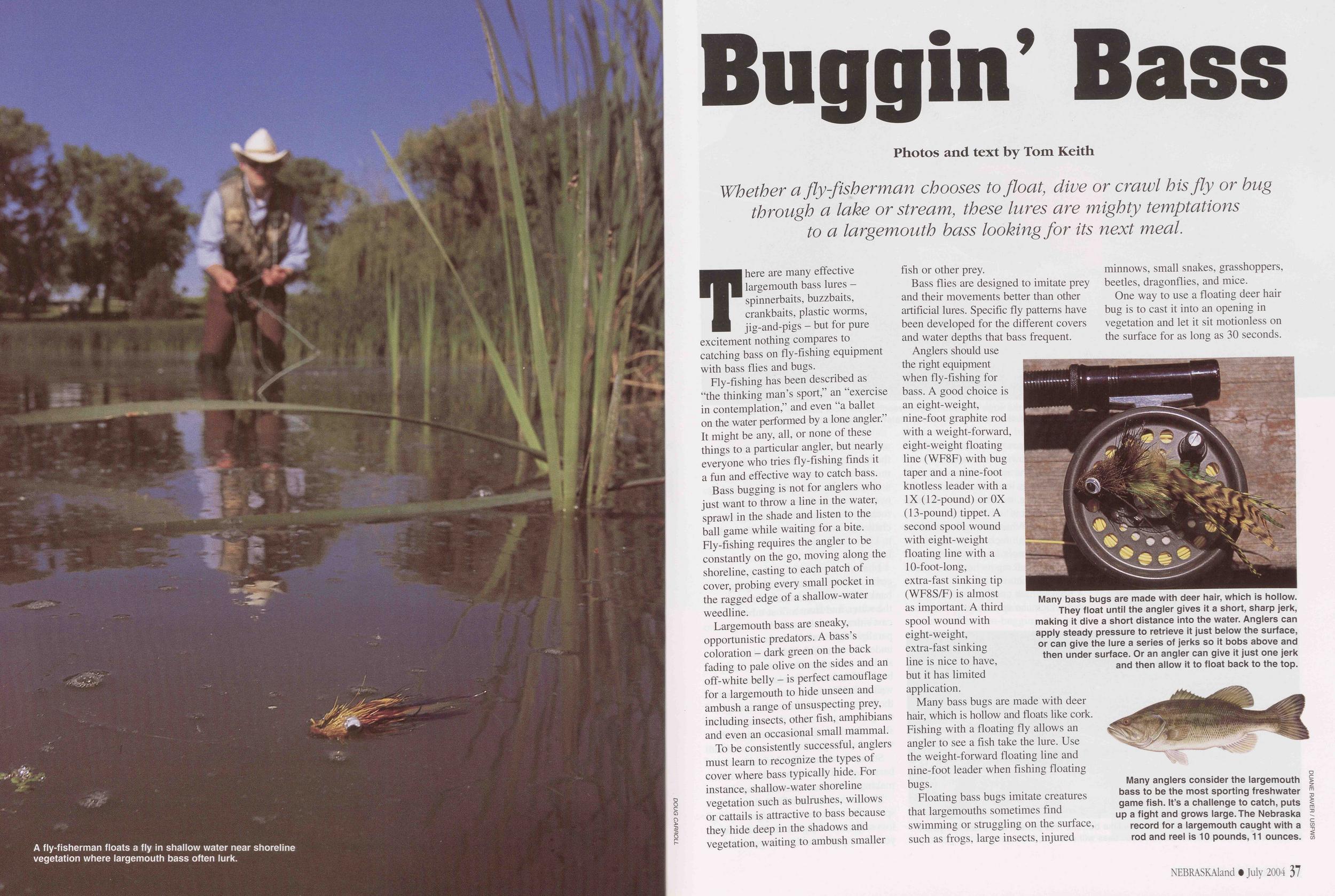
A fly-fisherman floats a fly in shallow water near shoreline vegetation where largemouth bass often lurk.
DOUG CARROLLBuggin’ Bass
Whether a fly-fisherman chooses to float, dive or crawl his fly or bug through a lake or stream, these lures are mighty temptations to a largemouth bass looking for its next meal.
Photos and text by Tom KeithThere are many effective largemouth bass lures - spinnerbaits, buzzbaits, crankbaits, plastic worms, jig-and-pigs - but for pure excitement nothing compares to catching bass on fly-fishing equipment with bass flies and bugs.
Fly-fishing has been described as "the thinking man’s sport,” an “exercise in contemplation,” and even "a ballet on the water performed by a lone angler.” It might be any, all, or none of these things to a particular angler, but nearly everyone who tries fly-fishing finds it a fun and effective way to catch bass.
Bass bugging is not for anglers who just want to throw a line in the water, sprawl in the shade and listen to the ball game while waiting for a bite. Fly-fishing requires the angler to be constantly on the go, moving along the shoreline, casting to each patch of cover, probing every small pocket in the ragged edge of a shallow-water weedline.
Largemouth bass are sneaky, opportunistic predators. A bass’s coloration - dark green on the back fading to pale olive on the sides and an off-white belly - is perfect camouflage for a largemouth to hide unseen and ambush a range of unsuspecting prey, including insects, other fish, amphibians and even an occasional small mammal.
To be consistently successful, anglers must learn to recognize the types of cover where bass typically hide. For instance, shallow-water shoreline vegetation such as bulrushes, willows or cattails is attractive to bass because they hide deep in the shadows and vegetation, waiting to ambush smaller fish or other prey.
Bass flies are designed to imitate prey and their movements better than other artificial lures. Specific fly patterns have been developed for the different covers and water depths that bass frequent.
Anglers should use the right equipment when fly-fishing for bass. A good choice is an eight-weight, nine-foot graphite rod with a weight-forward, eight-weight floating line (WF8F) with bug taper and a nine-foot knotless leader with a IX (12-pound) or OX (13-pound) tippet. A second spool wound with eight-weight floating line with a 10-foot-long, extra-fast sinking tip (WF8S/F) is almost as important. A third spool wound with eight-weight, extra-fast sinking line is nice to have, but it has limited application.
Many bass bugs are made with deer hair, which is hollow and floats like cork. Fishing with a floating fly allows an angler to see a fish take the lure. Use the weight-forward floating line and nine-foot leader when fishing floating bugs.
Floating bass bugs imitate creatures that largemouths sometimes find swimming or struggling on the surface, such as frogs, large insects, injured minnows, small snakes, grasshoppers, beetles, dragonflies, and mice.
Many bass bugs are made with deer hair, which is hollow. They float until the angler gives it a short, sharp jerk, making it dive a short distance into the water. Anglers can apply steady pressure to retrieve it just below the surface, or can give the lure a series of jerks so it bobs above and then under surface. Or an angler can give it just one jerk and then allow it to float back to the top.
Many anglers consider the largemouth bass to be the most sporting freshwater game fish. It’s a challenge to catch, puts up a fight and grows large. The Nebraska record for a largemouth caught with a rod and reel is 10 pounds, 11 ounces.
DUANE RAVER / USFWS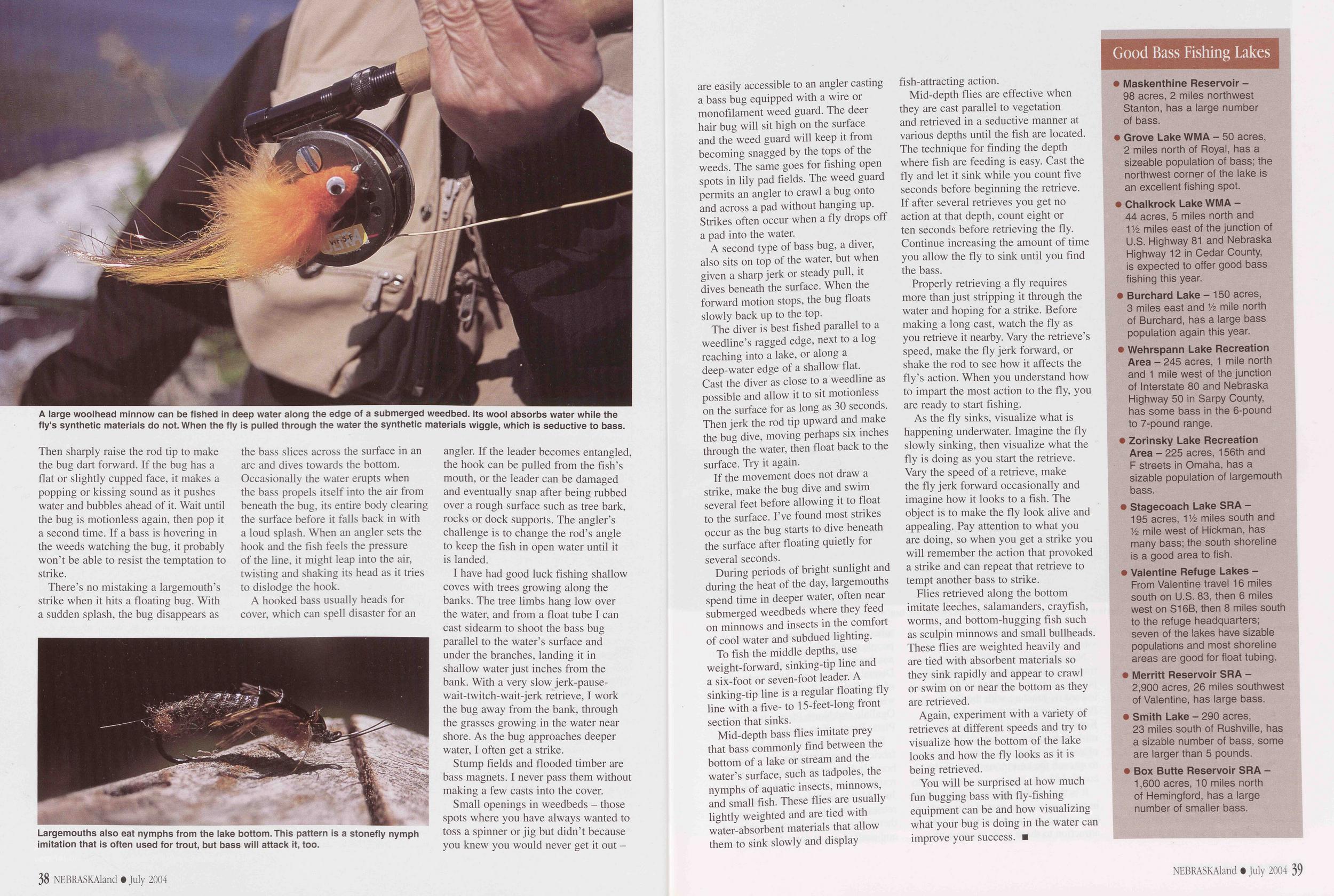
A large woolhead minnow can be fished in deep water along the edge of a submerged weedbed. Its wool absorbs water while the fly's synthetic materials do not. When the fly is pulled through the water the synthetic materials wiggle, which is seductive to bass.
Largemouths also eat nymphs from the lake bottom. This pattern is a stonefly nymph imitation that is often used for trout, but bass will attack it, too.
A hooked bass usually heads for cover, which can spell disaster for an angler. If the leader becomes entangled, the hook can be pulled from the fish’s mouth, or the leader can be damaged and eventually snap after being rubbed over a rough surface such as tree bark, rocks or dock supports. The angler’s challenge is to change the rod’s angle to keep the fish in open water until it is landed.
I have had good luck fishing shallow coves with trees growing along the banks. The tree limbs hang low over the water, and from a float tube I can cast sidearm to shoot the bass bug parallel to the water’s surface and under the branches, landing it in shallow water just inches from the bank. With a very slow jerk-pause- wait-twitch-wait-jerk retrieve, I work the bug away from the bank, through the grasses growing in the water near shore. As the bug approaches deeper water, I often get a strike.
Stump fields and flooded timber are bass magnets. I never pass them without making a few casts into the cover.
Small openings in weedbeds - those spots where you have always wanted to toss a spinner or jig but didn’t because you knew you would never get it out 38 NEBRASKAland • July 2004 are easily accessible to an angler casting a bass bug equipped with a wire or monofilament weed guard. The deer hair bug will sit high on the surface and the weed guard will keep it from becoming snagged by the tops of the weeds. The same goes for fishing open spots in lily pad fields. The weed guard permits an angler to crawl a bug onto and across a pad without hanging up. Strikes often occur when a fly drops off a pad into the water.
A second type of bass bug, a diver, also sits on top of the water, but when given a sharp jerk or steady pull, it dives beneath the surface. When the forward motion stops, the bug floats slowly back up to the top.
The diver is best fished parallel to a weedline’s ragged edge, next to a log reaching into a lake, or along a deep-water edge of a shallow flat. Cast the diver as close to a weedline as possible and allow it to sit motionless on the surface for as long as 30 seconds. Then jerk the rod tip upward and make the bug dive, moving perhaps six inches through the water, then float back to the surface. Try it again.
If the movement does not draw a strike, make the bug dive and swim several feet before allowing it to float to the surface. I’ve found most strikes occur as the bug starts to dive beneath the surface after floating quietly for several seconds.
During periods of bright sunlight and during the heat of the day, largemouths spend time in deeper water, often near submerged weedbeds where they feed on minnows and insects in the comfort of cool water and subdued lighting.
To fish the middle depths, use weight-forward, sinking-tip line and a six-foot or seven-foot leader. A sinking-tip line is a regular floating fly line with a five- to 15-feet-long front section that sinks.
Mid-depth bass flies imitate prey that bass commonly find between the bottom of a lake or stream and the water’s surface, such as tadpoles, the nymphs of aquatic insects, minnows, and small fish. These flies are usually lightly weighted and are tied with water-absorbent materials that allow them to sink slowly and display fish-attracting action.
Mid-depth flies are effective when they are cast parallel to vegetation and retrieved in a seductive manner at various depths until the fish are located. The technique for finding the depth where fish are feeding is easy. Cast the fly and let it sink while you count five seconds before beginning the retrieve. If after several retrieves you get no action at that depth, count eight or ten seconds before retrieving the fly. Continue increasing the amount of time you allow the fly to sink until you find the bass.
Properly retrieving a fly requires more than just stripping it through the water and hoping for a strike. Before making a long cast, watch the fly as you retrieve it nearby. Vary the retrieve’s speed, make the fly jerk forward, or shake the rod to see how it affects the fly’s action. When you understand how to impart the most action to the fly, you are ready to start fishing.
As the fly sinks, visualize what is happening underwater. Imagine the fly slowly sinking, then visualize what the fly is doing as you start the retrieve. Vary the speed of a retrieve, make the fly jerk forward occasionally and imagine how it looks to a fish. The object is to make the fly look alive and appealing. Pay attention to what you are doing, so when you get a strike you will remember the action that provoked a strike and can repeat that retrieve to tempt another bass to strike.
Flies retrieved along the bottom imitate leeches, salamanders, crayfish, worms, and bottom-hugging fish such as sculpin minnows and small bullheads. These flies are weighted heavily and are tied with absorbent materials so they sink rapidly and appear to crawl or swim on or near the bottom as they are retrieved.
Again, experiment with a variety of retrieves at different speeds and try to visualize how the bottom of the lake looks and how the fly looks as it is being retrieved.
You will be surprised at how much fun bugging bass with fly-fishing equipment can be and how visualizing what your bug is doing in the water can improve your success.
Good Bass Fishing Lakes
•Maskenthine Reservoir - 98 acres, 2 miles northwest Stanton, has a large number of bass. •Grove Lake WMA - 50 acres, 2 miles north of Royal, has a sizeable population of bass; the northwest corner of the lake is an excellent fishing spot. •Chalkrock Lake WMA - 44 acres, 5 miles north and 114 miles east of the junction of U.S. Highway 81 and Nebraska Highway 12 in Cedar County, is expected to offer good bass fishing this year. Burchard Lake - 150 acres, 3miles east and 14 mile north of Burchard, has a large bass population again this year. •Wehrspann Lake Recreation Area - 245 acres, 1 mile north and 1 mile west of the junction of Interstate 80 and Nebraska Highway 50 in Sarpy County, has some bass in the 6-pound to 7-pound range. •Zorinsky Lake Recreation Area - 225 acres, 156th and F streets in Omaha, has a sizable population of largemouth bass. •Stagecoach Lake SRA - 195 acres, 114 miles south and 14 mile west of Hickman, has many bass; the south shoreline is a good area to fish. •Valentine Refuge Lakes - From Valentine travel 16 miles south on U.S. 83, then 6 miles west on S16B, then 8 miles south to the refuge headquarters; seven of the lakes have sizable populations and most shoreline areas are good for float tubing. •Merritt Reservoir SRA - 2,900 acres, 26 miles southwest of Valentine, has large bass. •Smith Lake - 290 acres, 23 miles south of Rushville, has a sizable number of bass, some are larger than 5 pounds. •Box Butte Reservoir SRA - 1,600 acres, 10 miles north of Hemingford, has a large number of smaller bass. NEBRASKAland • July 2004 39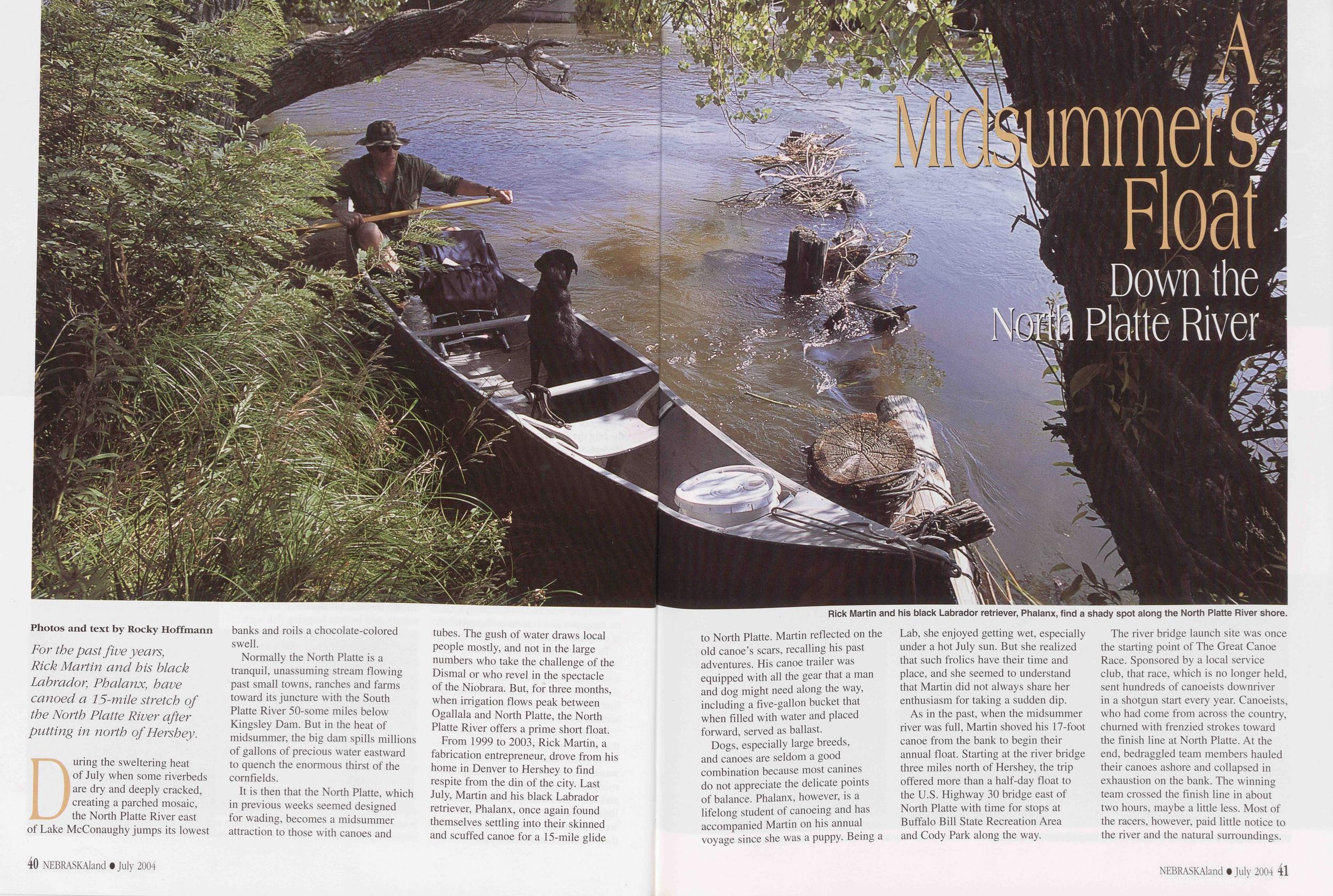
A Midsummer's Float
Down the North Platte River
Rick Martin and his black Labrador retriever, Phalanx, find a shady spot along the North Platte River shore.
During the sweltering heat of July when some riverbeds are dry and deeply cracked, creating a parched mosaic, the North Platte River east of Lake McConaughy jumps its lowest banks and roils a chocolate-colored swell.
Normally the North Platte is a tranquil, unassuming stream flowing past small towns, ranches and farms toward its juncture with the South Platte River 50-some miles below Kingsley Dam. But in the heat of midsummer, the big dam spills millions of gallons of precious water eastward to quench the enormous thirst of the cornfields.
It is then that the North Platte, which in previous weeks seemed designed for wading, becomes a midsummer attraction to those with canoes and tubes. The gush of water draws local people mostly, and not in the large numbers who take the challenge of the Dismal or who revel in the spectacle of the Niobrara. But, for three months, when irrigation flows peak between Ogallala and North Platte, the North Platte River offers a prime short float.
From 1999 to 2003, Rick Martin, a fabrication entrepreneur, drove from his home in Denver to Hershey to find respite from the din of the city. Last July, Martin and his black Labrador retriever, Phalanx, once again found themselves settling into their skinned and scuffed canoe for a 15-mile glide 40 NEBRASKAland • July 2004 to North Platte. Martin reflected on the old canoe’s scars, recalling his past adventures. His canoe trailer was equipped with all the gear that a man and dog might need along the way, including a five-gallon bucket that when filled with water and placed forward, served as ballast.
Dogs, especially large breeds, and canoes are seldom a good combination because most canines do not appreciate the delicate points of balance. Phalanx, however, is a lifelong student of canoeing and has accompanied Martin on his annual voyage since she was a puppy. Being a Lab, she enjoyed getting wet, especially under a hot July sun. But she realized that such frolics have their time and place, and she seemed to understand that Martin did not always share her enthusiasm for taking a sudden dip.
As in the past, when the midsummer river was full, Martin shoved his 17-foot canoe from the bank to begin their annual float. Starting at the river bridge three miles north of Hershey, the trip offered more than a half-day float to the U.S. Highway 30 bridge east of North Platte with time for stops at Buffalo Bill State Recreation Area and Cody Park along the way.
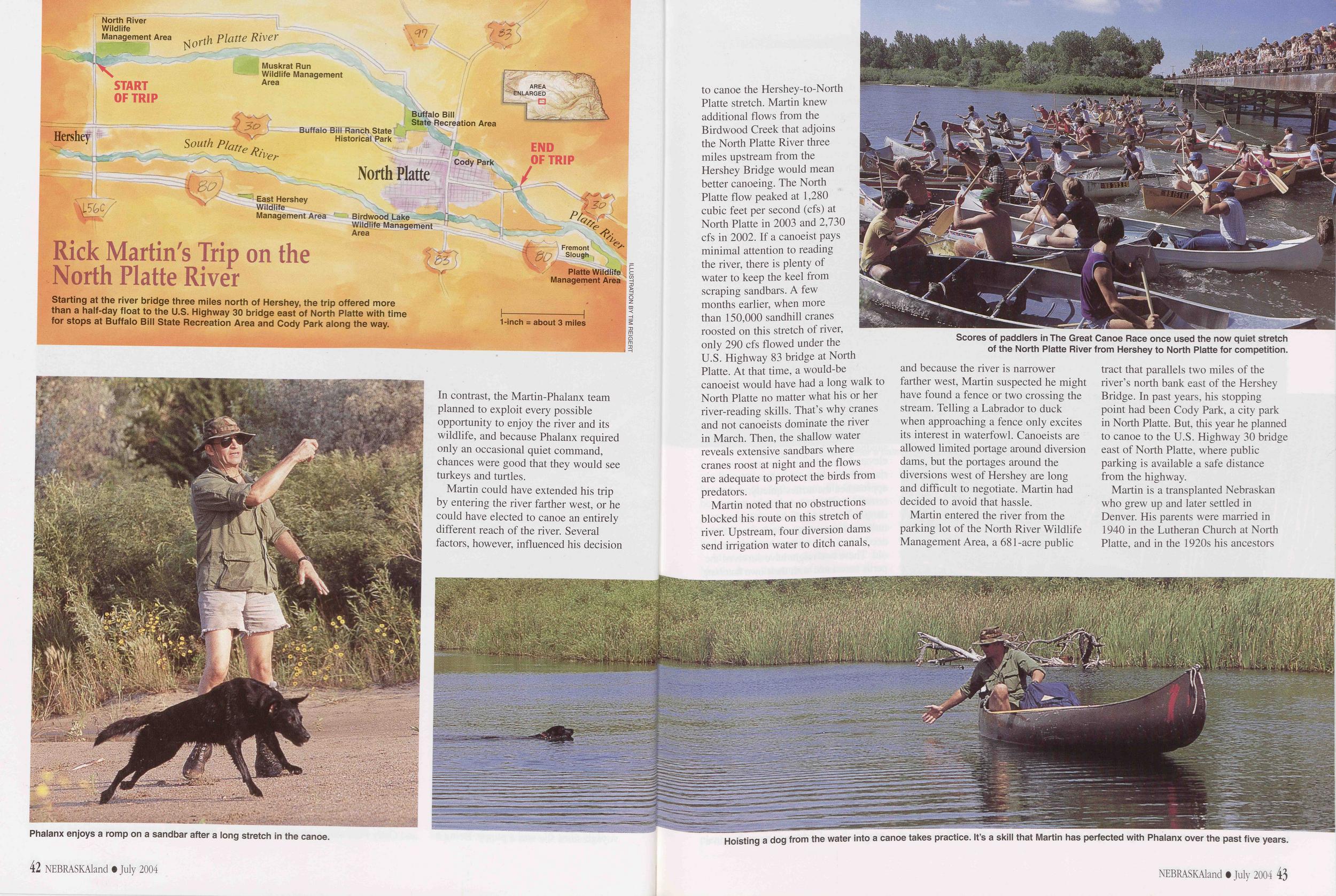
Starting at the river bridge three miles north of Hershey, the trip offered more than a half-day float to the U.S. Highway 30 bridge east of North Platte with time for stops at Buffalo Bill State Recreation Area and Cody Park along the way. to canoe the Hershey-to-North
Phalanx enjoys a romp on a sandbar after a long stretch in the canoe.
Martin could have extended his trip by entering the river farther west, or he could have elected to canoe an entirely different reach of the river. Several factors, however, influenced his decision 42 NEBRASKAland • July 2004 to canoe the Hershey-to-North Platte stretch. Martin knew additional flows from the Birdwood Creek that adjoins the North Platte River three miles upstream from the Hershey Bridge would mean better canoeing. The North Platte flow peaked at 1,280 cubic feet per second (cfs) at North Platte in 2003 and 2,730 cfs in 2002. If a canoeist pays minimal attention to reading the river, there is plenty of water to keep the keel from scraping sandbars. A few months earlier, when more than 150,000 sandhill cranes roosted on this stretch of river, only 290 cfs flowed under the U.S. Highway 83 bridge at North Platte. At that time, a would-be canoeist would have had a long walk to North Platte no matter what his or her river-reading skills. That’s why cranes and not canoeists dominate the river in March. Then, the shallow water reveals extensive sandbars where cranes roost at night and the flows are adequate to protect the birds from predators.
Scores of paddlers in The Great Canoe Race once used the now quiet stretch of the North Platte River from Hershey to North Platte for competition.
Martin entered the river from the parking lot of the North River Wildlife Management Area, a 681-acre public tract that parallels two miles of the river’s north bank east of the Hershey Bridge. In past years, his stopping point had been Cody Park, a city park in North Platte. But, this year he planned to canoe to the U.S. Highway 30 bridge east of North Platte, where public parking is available a safe distance from the highway.
Hoisting a dog from the water into a canoe takes practice. It’s a skill that Martin has perfected with Phalanx over the past five years.
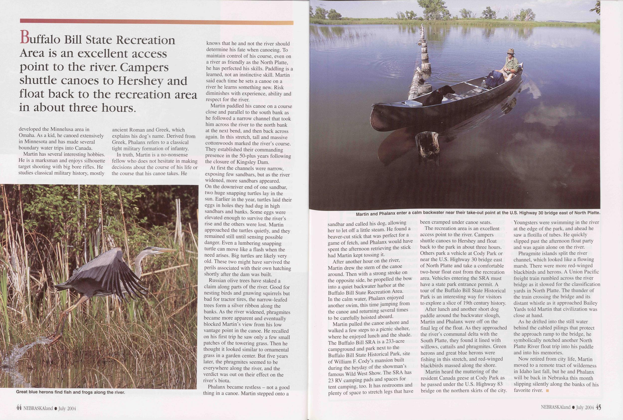 developed the Minnelusa area in Omaha. As a kid, he canoed extensively in Minnesota and has made several boundary water trips into Canada.
Great blue herons find fish and frogs along the river.
In truth, Martin is a no-nonsense fellow who does not hesitate in making decisions about the course of his life or the course that his canoe takes. He knows that he and not the river should determine his fate when canoeing. To maintain control of his course, even on a river as friendly as the North Platte, he has perfected his skills. Paddling is a learned, not an instinctive skill. Martin said each time he sets a canoe on a river he learns something new. Risk diminishes with experience, ability and respect for the river.
Martin paddled his canoe on a course close and parallel to the south bank as he followed a narrow channel that took him across the river to the north bank at the next bend, and then back across again. In this stretch, tall and massive cottonwoods marked the river’s course. They established their commanding presence in the 50-plus years following the closure of Kingsley Dam.
At first the channels were narrow, exposing few sandbars, but as the river widened, more sandbars appeared. On the downriver end of one sandbar, two huge snapping turtles lay in the sun. Earlier in the year, turtles laid their eggs in holes they had dug in high sandbars and banks. Some eggs were elevated enough to survive the river’s rise and the others were lost. Martin approached the turtles quietly, and they remained still until sensing possible danger. Even a lumbering snapping turtle can move like a flash when the need arises. Big turtles are likely very old. These two might have survived the perils associated with their own hatching shortly after the dam was built.
Russian olive trees have staked a claim along parts of the river. Good for nesting birds and gnawing squirrels but bad for tractor tires, the narrow-leafed trees form a silver ribbon along the banks. As the river widened, phragmites became more apparent and eventually blocked Martin’s view from his low vantage point in the canoe. He recalled on his first trip he saw only a few small patches of the towering grass. Then he thought it looked similar to ornamental grass in a garden center. But five years later, the phragmites seemed to be everywhere along the river, and the verdict was out on their effect on the river’s biota.
Phalanx became restless - not a good thing in a canoe. Martin stepped onto a 44 NEBRASKAland • July 2004 Martin and Phalanx enter a calm backwater near their take-out point at the U.S. Highway 30 bridge east of North Platte. sandbar and called his dog, allowing her to let off a little steam. He found a beaver-cut stick that was perfect for a game of fetch, and Phalanx would have spent the afternoon retrieving the stick had Martin kept tossing it.
After another hour on the river, Martin drew the stern of the canoe around. Then with a strong stroke on the opposite side, he propelled the bow into a quiet backwater harbor at the Buffalo Bill State Recreation Area. In the calm water, Phalanx enjoyed another swim, this time jumping from the canoe and returning several times to be carefully hoisted aboard.
Martin pulled the canoe ashore and walked a few steps to a picnic shelter, where he enjoyed lunch and the shade. The Buffalo Bill SRA is a 233-acre campground and park next to the Buffalo Bill State Historical Park, site of William F. Cody’s mansion built during the heyday of the showman’s famous Wild West Show. The SRA has 23 RV camping pads and spaces for tent camping, too. It has restrooms and plenty of space to stretch legs that have been cramped under canoe seats.
The recreation area is an excellent access point to the river. Campers shuttle canoes to Hershey and float back to the park in about three hours. Others park a vehicle at Cody Park or near the U.S. Highway 30 bridge east of North Platte and take a comfortable two-hour float east from the recreation area. Vehicles entering the SRA must have a state park entrance permit. A tour of the Buffalo Bill State Historical Park is an interesting way for visitors to explore a slice of 19th century history.
After lunch and another short dog paddle around the backwater slough, Martin and Phalanx were off on the final leg of the float. As they approached the river’s communal delta with the South Platte, they found it lined with willows, cattails and phragmites. Green herons and great blue herons were fishing in this stretch, and red-winged blackbirds massed along the shore.
Martin heard the muttering of the resident Canada geese at Cody Park as he passed under the U.S. Highway 83 bridge on the northern skirts of the city. Youngsters were swimming in the river at the edge of the park, and ahead he saw a flotilla of tubes. He quickly slipped past the afternoon float party and was again alone on the river.
Phragmite islands split the river channel, which looked like a flowing marsh. There were more red-winged blackbirds and herons. A Union Pacific freight train rumbled across the river bridge as it slowed for the classification yards in North Platte. The thunder of the train crossing the bridge and its distant whistle as it approached Bailey Yards told Martin that civilization was close at hand.
As he drifted into the still water behind the cabled pilings that protect the approach ramp to the bridge, he symbolically notched another North Platte River float trip into his paddle and into his memories.
Now retired from city life, Martin moved to a remote tract of wilderness in Idaho last fall, but he and Phalanx will be back in Nebraska this month slipping silently along the banks of his favorite river.
NEBRASKAland • July 2004 45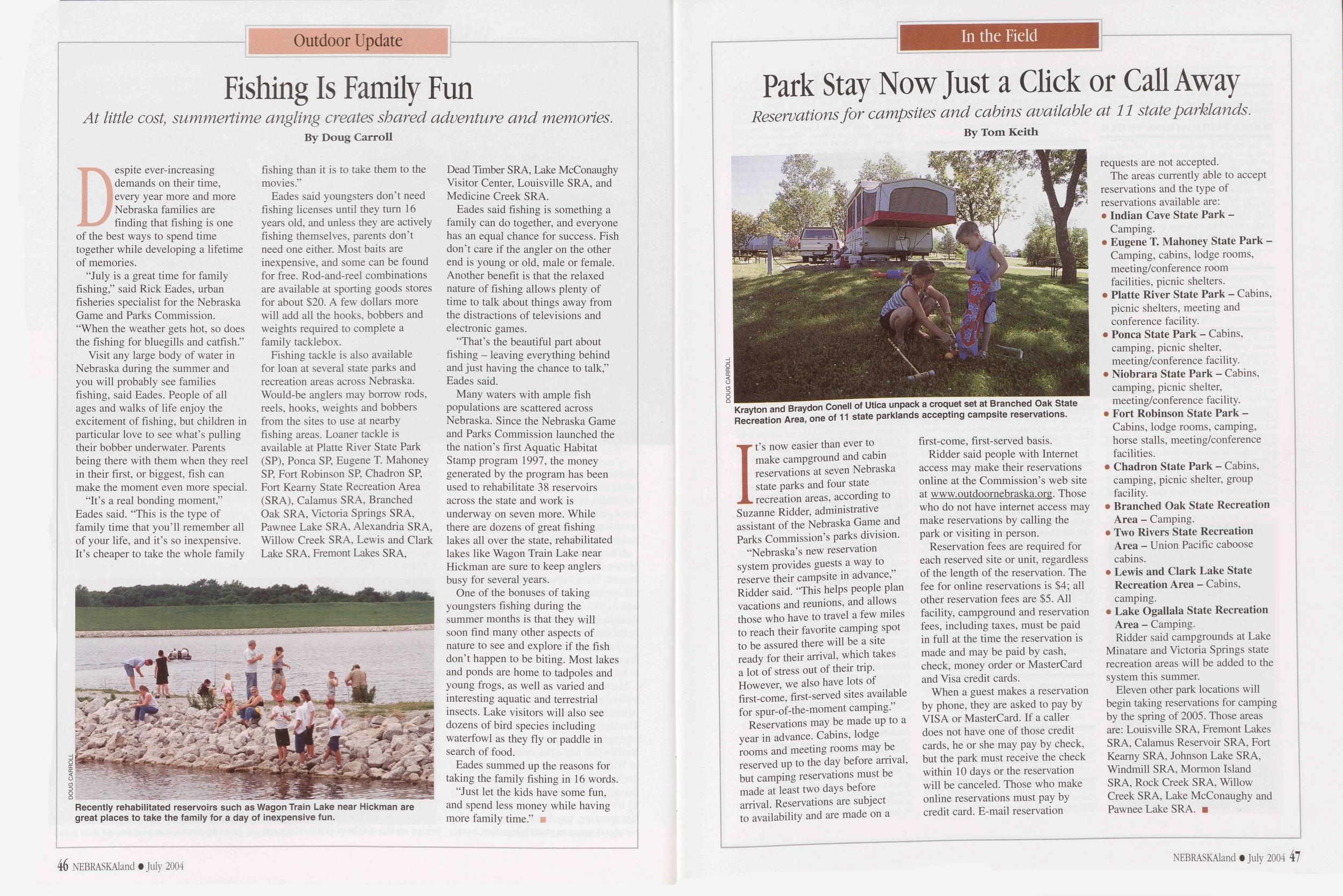
Outdoor Update
Fishing Is Family Fun
At little cost, summertime angling creates shared adventure and memories.
By Doug CarrollDespite ever-increasing demands on their time, every year more and more Nebraska families are finding that fishing is one of the best ways to spend time together while developing a lifetime of memories.
“July is a great time for family fishing,” said Rick Eades, urban fisheries specialist for the Nebraska Game and Parks Commission. “When the weather gets hot, so does the fishing for bluegills and catfish.”
Visit any large body of water in Nebraska during the summer and you will probably see families fishing, said Eades. People of all ages and walks of life enjoy the excitement of fishing, but children in particular love to see what’s pulling their bobber underwater. Parents being there with them when they reel in their first, or biggest, fish can make the moment even more special.
Recently rehabilitated reservoirs such as Wagon Train Lake near Hickman are great places to take the family for a day of inexpensive fun.
Eades said youngsters don’t need fishing licenses until they turn 16 years old, and unless they are actively fishing themselves, parents don’t need one either. Most baits are inexpensive, and some can be found for free. Rod-and-reel combinations are available at sporting goods stores for about $20. A few dollars more will add all the hooks, bobbers and weights required to complete a family tacklebox.
Fishing tackle is also available for loan at several state parks and recreation areas across Nebraska. Would-be anglers may borrow rods, reels, hooks, weights and bobbers from the sites to use at nearby fishing areas. Loaner tackle is available at Platte River State Park (SP), Ponca SP, Eugene T. Mahoney SP, Fort Robinson SP, Chadron SP, Fort Kearny State Recreation Area (SRA), Calamus SRA, Branched Oak SRA, Victoria Springs SRA, Pawnee Lake SRA, Alexandria SRA, Willow Creek SRA, Lewis and Clark Lake SRA, Fremont Lakes SRA, Dead Timber SRA, Lake McConaughy Visitor Center, Louisville SRA, and Medicine Creek SRA.
Eades said fishing is something a family can do together, and everyone has an equal chance for success. Fish don’t care if the angler on the other end is young or old, male or female. Another benefit is that the relaxed nature of fishing allows plenty of time to talk about things away from the distractions of televisions and electronic games.
“That’s the beautiful part about fishing - leaving everything behind and just having the chance to talk,” Eades said.
Many waters with ample fish populations are scattered across Nebraska. Since the Nebraska Game and Parks Commission launched the the nation’s first Aquatic Habitat Stamp program 1997, the money generated by the program has been used to rehabilitate 38 reservoirs across the state and work is underway on seven more. While there are dozens of great fishing lakes all over the state, rehabilitated lakes like Wagon Train Lake near Hickman are sure to keep anglers busy for several years.
One of the bonuses of taking youngsters fishing during the summer months is that they will soon find many other aspects of nature to see and explore if the fish don’t happen to be biting. Most lakes and ponds are home to tadpoles and young frogs, as well as varied and interesting aquatic and terrestrial insects. Lake visitors will also see dozens of bird species including waterfowl as they fly or paddle in search of food.
Eades summed up the reasons for taking the family fishing in 16 words. “Just let the kids have some fun, and spend less money while having more family time.”
46 NEBRASKAland • July 2004In the Field
Park Stay Now Just a Click or Call Away
Reservations for campsites and cabins available at 11 state parklands.
By Tom KeithKrayton and Braydon Conell of Utica unpack a croquet set at Branched Oak State Recreation Area, one of 11 state parklands accepting campsite reservations.
It’s now easier than ever to make campground and cabin reservations at seven Nebraska state parks and four state recreation areas, according to Suzanne Ridder, administrative assistant of the Nebraska Game and Parks Commission’s parks division.
“Nebraska’s new reservation system provides guests a way to reserve their campsite in advance,” Ridder said. “This helps people plan vacations and reunions, and allows those who have to travel a few miles to reach their favorite camping spot to be assured there will be a site ready for their arrival, which takes a lot of stress out of their trip. However, we also have lots of first-come, first-served sites available for spur-of-the-moment camping.”
Reservations may be made up to a year in advance. Cabins, lodge rooms and meeting rooms may be reserved up to the day before arrival, but camping reservations must be made at least two days before arrival. Reservations are subject to availability and are made on a first-come, first-served basis.
Ridder said people with Internet access may make their reservations online at the Commission’s web site at www.outdoornebraska.org. Those who do not have internet access may make reservations by calling the park or visiting in person.
Reservation fees are required for each reserved site or unit, regardless of the length of the reservation. The fee for online reservations is $4; all other reservation fees are $5. All facility, campground and reservation fees, including taxes, must be paid in full at the time the reservation is made and may be paid by cash, check, money order or MasterCard and Visa credit cards.
When a guest makes a reservation by phone, they are asked to pay by VISA or MasterCard. If a caller does not have one of those credit cards, he or she may pay by check, but the park must receive the check within 10 days or the reservation will be canceled. Those who make online reservations must pay by credit card. E-mail reservation requests are not accepted.
The areas currently able to accept reservations and the type of reservations available are: •Indian Cave State Park - Camping. •Eugene T. Mahoney State Park - Camping, cabins, lodge rooms, meeting/conference room facilities, picnic shelters. •Platte River State Park - Cabins, picnic shelters, meeting and conference facility. •Ponca State Park - Cabins, camping, picnic shelter, meeting/conference facility. •Niobrara State Park - Cabins, camping, picnic shelter, meeting/conference facility. •Fort Robinson State Park - Cabins, lodge rooms, camping, horse stalls, meeting/conference facilities. •Chadron State Park - Cabins, camping, picnic shelter, group facility. •Branched Oak State Recreation Area - Camping. •Two Rivers State Recreation Area - Union Pacific caboose cabins. Lewis and Clark Lake State Recreation Area - Cabins, camping. •Lake Ogallala State Recreation Area - Camping.Ridder said campgrounds at Lake Minatare and Victoria Springs state recreation areas will be added to the system this summer.
Eleven other park locations will begin taking reservations for camping by the spring of 2005. Those areas are: Louisville SRA, Fremont Lakes SRA, Calamus Reservoir SRA, Fort Kearny SRA, Johnson Lake SRA, Windmill SRA, Mormon Island SRA, Rock Creek SRA, Willow Creek SRA, Lake McConaughy and Pawnee Lake SRA.
NEBRASKAland • July 2004 47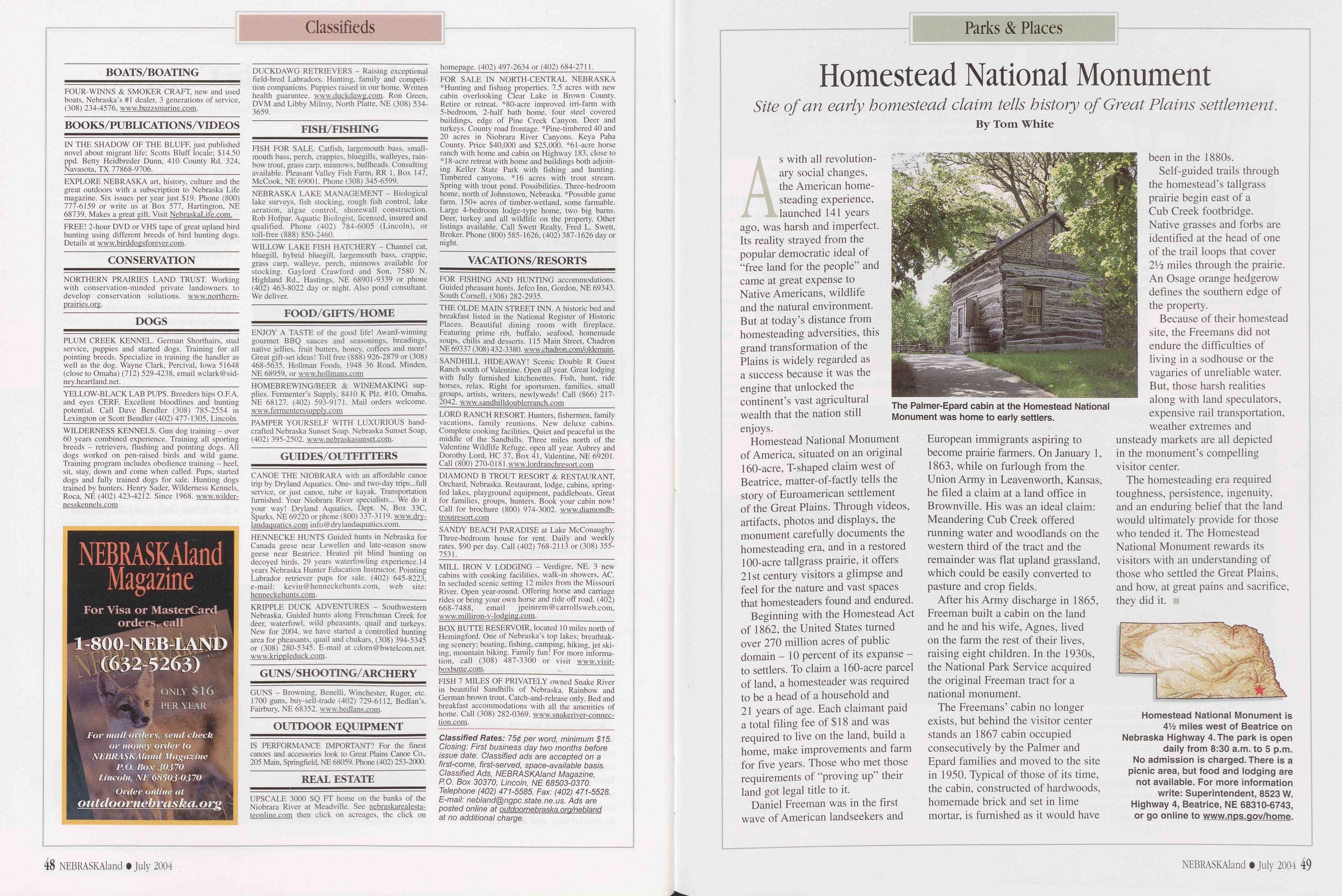
Classifieds
BOATS/BOATING FOUR-WINNS & SMOKER CRAFT, new and used boats, Nebraska’s #1 dealer, 3 generations of service, (308) 234-4576, www.buzzsmarine.com. BOOKS/PUBUCATIONS/VIDEOS IN THE SHADOW OF THE BLUFF, just published novel about migrant life; Scotts Bluff locale; $14.50 ppd. Betty Heidbreder Dunn, 410 County Rd. 324, Navasota, TX 77868-9706. EXPLORE NEBRASKA art, history, culture and the great outdoors with a subscription to Nebraska Life magazine. Six issues per year just $19. Phone (800) 777-6159 or write us at Box 577, Hartington, NE 68739. Makes a great gift. Visit NebraskaLife.com. FREE! 2-hour DVD or VHS tape of great upland bird hunting using different breeds of bird hunting dogs. Details at www.birddogsforever.com. CONSERVATION NORTHERN PRAIRIES LAND TRUST. Working with conservation-minded private landowners to develop conservation solutions, www.northern- prairies. org. DOGS PLUM CREEK KENNEL. German Shorthairs, stud service, puppies and started dogs. Training for all pointing breeds. Specialize in training the handler as well as the dog. Wayne Clark, Percival, Iowa 51648 (close to Omaha) (712) 529-4238, email wclark@sid- ney.heartland.net. YELLOW-BLACK LAB PUPS. Breeders hips O.F.A. and eyes CERF. Excellent bloodlines and hunting potential. Call Dave Bendler (308) 785-2554 in Lexington or Scott Bendler (402) 477-1305, Lincoln. WILDERNESS KENNELS. Gun dog training - over 60 years combined experience. Training all sporting breeds - retrievers, flushing and pointing dogs. All dogs worked on pen-raised birds and wild game. Training program includes obedience training - heel, sit, stay, down and come when called. Pups, started dogs and fully trained dogs for sale. Hunting dogs trained by hunters. Henry Sader, Wilderness Kennels, Roca, NE (402) 423-4212. Since 1968. www.wilder- nesskennels.com DUCKDAWG RETRIEVERS - Raising exceptional field-bred Labradors. Hunting, family and competi- tion companions. Puppies raised in our home. Written health guarantee, www.duckdawg.com. Ron Green, DVM and Libby Milroy, North Platte, NE (308) 534- 3659. FISH/FISHING FISH FOR SALE. Catfish, largemouth bass, small- mouth bass, perch, crappies, bluegills, walleyes, rain- bow trout, grass carp, minnows, bullheads. Consulting available. Pleasant Valley Fish Farm, RR 1, Box 147, McCook, NE 69001. Phone (308) 345-6599. NEBRASKA LAKE MANAGEMENT - Biological lake surveys, fish stocking, rough fish control, lake aeration, algae control, shorewall construction. Rob Hofpar. Aquatic Biologist, licensed, insured and qualified. Phone (402) 784-6005 (Lincoln), or toll-free (888) 850-2460. WILLOW LAKE FISH HATCHERY - Channel cat, bluegill, hybrid bluegill, largemouth bass, crappie, grass carp, walleye, perch, minnows available for stocking. Gaylord Crawford and Son, 7580 N. Highland Rd., Hastings, NE 68901-9339 or phone (402) 463-8022 day or night. Also pond consultant. We deliver. FOOD/GIFTS/HOME ENJOY A TASTE of the good life! Award-winning gourmet BBQ sauces and seasonings, breadings, native jellies, fruit butters, honey, coffees and more! Great gift-set ideas! Toll free (888) 926-2879 or (308) 468-5635. Hollman Foods, 1948 36 Road, Minden, NE 68959. or www.hollmans.com HOMEBREWING/BEER & WINEMAKING sup- plies. Fermenter’s Supply, 8410 K Plz. #10, Omaha, NE 68127. (402) 593-9171. Mail orders welcome. www.fermenterssupply.com PAMPER YOURSELF WITH LUXURIOUS hand- crafted Nebraska Sunset Soap. Nebraska Sunset Soap, (402) 395-2502. www.nebraskasunset.com. GUIDES/OUTFITTERS CANOE THE NIOBRARA with an affordable canoe trip by Dryland Aquatics. One- and two-day trips...full service, or just canoe, tube or kayak. Transportation furnished. Your Niobrara River specialists... We do it your way! Dryland Aquatics, Dept. N, Box 33C, Sparks, NE 69220 or phone (800) 337-3119. www.dry- landaquatics.com info@drylandaquatics.com._ HENNECKE HUNTS Guided hunts in Nebraska for Canada geese near Lewellen and late-season snow geese near Beatrice. Heated pit blind hunting on decoyed birds. 29 years waterfowling experience. 14 years Nebraska Hunter Education Instructor. Pointing Labrador retriever pups for sale. (402) 645-8223, e-mail: kevin@henneckehunts.com, web site: henneckehunts.com. KRIPPLE DUCK ADVENTURES - Southwestern Nebraska. Guided hunts along Frenchman Creek for deer, waterfowl, wild pheasants, quail and turkeys. New for 2004, we have started a controlled hunting area for pheasants, quail and chukars, (308) 394-5345 or (308) 280-5345. E-mail at cdom@bwtelcom.net. www.krippleduck.com. GUNS/SHOOTING/ARCHERY GUNS - Browning, Benelli, Winchester, Ruger, etc. 1700 guns, buy-sell-trade (402) 729-6112, Bedlan’s, Fairbury, NE 68352. www.bedlans.com. OUTDOOR EQUIPMENT IS PERFORMANCE IMPORTANT? For the finest canoes and accessories look to Great Plains Canoe Co., 205 Main, Springfield, NE 68059. Phone (402) 253-2000. REAL ESTATE UPSCALE 3000 SQ FT home on the banks of the Niobrara River at Meadville. See nebraskarealesta- teonline.com then click on acreages, the click on homepage. (402) 497-2634 or (402) 684-2711. FOR SALE IN NORTH-CENTRAL NEBRASKA *Hunting and fishing properties. 7.5 acres with new cabin overlooking Clear Lake in Brown County. Retire or retreat. *80-acre improved irri-farm with 5-bedroom, 2-half bath home, four steel covered buildings, edge of Pine Creek Canyon. Deer and turkeys. County road frontage. * Pine-timbered 40 and 20 acres in Niobrara River Canyons. Keya Paha County. Price $40,000 and $25,000. *61-acre horse ranch with home and cabin on Highway 183, close to *18-acre retreat with home and buildings both adjoin- ing Keller State Park with fishing and hunting. Timbered canyons. *16 acres with trout stream. Spring with trout pond. Possibilities. Three-bedroom home, north of Johnstown, Nebraska. *Possible game farm. 150+ acres of timber-wetland, some farmable. Large 4-bedroom lodge-type home, two big bams. Deer, turkey and all wildlife on the property. Other listings available. Call Swett Realty, Fred L. Swett, Broker. Phone (800) 585-1626, (402) 387-1626 day or night. VACATION S/RESORTS FOR FISHING AND HUNTING accommodations. Guided pheasant hunts. Jefco Inn, Gordon, NE 69343. South Cornell, (308) 282-2935. THE OLDE MAIN STREET INN. A historic bed and breakfast listed in the National Register of Historic Places. Beautiful dining room with fireplace. Featuring prime rib, buffalo, seafood, homemade soups, chilis and desserts. 115 Main Street, Chadron NE 69337 (308) 432-3380. www.chadron.com/oldemain. SANDHILL HIDEAWAY! Scenic Double R Guest Ranch south of Valentine. Open all year. Great lodging with fully furnished kitchenettes. Fish, hunt, ride horses, relax. Right for sportsmen, families, small groups, artists, writers, newlyweds! Call (866) 217- 2042. www.sandhilldoublerranch.com LORD RANCH RESORT. Hunters, fishermen, family vacations, family reunions. New deluxe cabins. Complete cooking facilities. Quiet and peaceful in the middle of the Sandhills. Three miles north of the Valentine Wildlife Refuge, open all year. Aubrey and Dorothy Lord, HC 37, Box 41, Valentine, NE 69201. Call (800) 270-0181.www.lordranchresort.com DIAMOND B TROUT RESORT & RESTAURANT, Orchard, Nebraska. Restaurant, lodge, cabins, spring- fed lakes, playground equipment, paddleboats. Great for families, groups, hunters. Book your cabin now! Call for brochure (800) 974-3002. www.diamondb- troutresort.com SANDY BEACH PARADISE at Lake McConaughy. Three-bedroom house for rent. Daily and weekly rates. $90 per day. Call (402) 768-2113 or (308) 355- 7531. MILL IRON V LODGING - Verdigre, NE. 3 new cabins with cooking facilities, walk-in showers, AC. In secluded scenic setting 12 miles from the Missouri River. Open year-round. Offering horse and carriage rides or bring your own horse and ride off road. (402) 668-7488, email jpeinrem@carrollsweb.com, www.milliron-v-lodging.com. BOX BUTTE RESERVOIR, located 10 miles north of Hemingford. One of Nebraska’s top lakes; breathtak- ing scenery; boating, fishing, camping, hiking, jet ski- ing, mountain biking. Family fun! For more informa- tion, call (308) 487-3300 or visit www.visit- boxbutte.com. FISH 7 MILES OF PRIVATELY owned Snake River in beautiful Sandhills of Nebraska. Rainbow and German brown trout. Catch-and-release only. Bed and breakfast accommodations with all the amenities of home. Call (308) 282-0369. www.snakeriver-connec- tion.com. Classified Rates: 75 j per word, minimum $15. Closing: First business day two months before issue date. Classified ads are accepted on a first-come, first-served, space-available basis. Classified Ads, NEBRASKAIand Magazine, P.O. Box 30370, Lincoln, NE 68503-0370. Telephone (402) 471-5585. Fax: (402) 471-5528. E-mail: nebland@ngpc.state.ne.us. Ads are posted online at outdoornebraska. ora/nebland at no additional charge. 48 NEBRASKAIand • July 2004Parks &Places
Homestead National Monument
Site of an early homestead claim tells history of Great Plains settlement.
As with all revolutionary social changes, the American homesteading experience, launched 141 years ago, was harsh and imperfect. Its reality strayed from the popular democratic ideal of “free land for the people” and came at great expense to Native Americans, wildlife and the natural environment. But at today’s distance from homesteading adversities, this grand transformation of the Plains is widely regarded as a success because it was the engine that unlocked the continent’s vast agricultural wealth that the nation still enjoys.
Homestead National Monument of America, situated on an original 160-acre, T-shaped claim west of Beatrice, matter-of-factly tells the story of Euroamerican settlement of the Great Plains. Through videos, artifacts, photos and displays, the monument carefully documents the homesteading era, and in a restored 100-acre tailgrass prairie, it offers 21st century visitors a glimpse and feel for the nature and vast spaces that homesteaders found and endured.
Beginning with the Homestead Act of 1862, the United States turned over 270 million acres of public domain - 10 percent of its expanse - to settlers. To claim a 160-acre parcel of land, a homesteader was required to be a head of a household and 21 years of age. Each claimant paid a total filing fee of $18 and was required to live on the land, build a home, make improvements and farm for five years. Those who met those requirements of “proving up” their land got legal title to it.
The Palmer-Epard cabin at the Homestead National Monument was home to early settlers.
After his Army discharge in 1865, Freeman built a cabin on the land and he and his wife, Agnes, lived on the farm the rest of their lives, raising eight children. In the 1930s, the National Park Service acquired the original Freeman tract for a national monument.
The Freemans’ cabin no longer exists, but behind the visitor center stands an 1867 cabin occupied consecutively by the Palmer and Epard families and moved to the site in 1950. Typical of those of its time, the cabin, constructed of hardwoods, homemade brick and set in lime mortar, is furnished as it would have been in the 1880s.
Self-guided trails through the homestead’s tailgrass prairie begin east of a Cub Creek footbridge. Native grasses and forbs are identified at the head of one of the trail loops that cover 2Vi miles through the prairie. An Osage orange hedgerow defines the southern edge of the property.
Because of their homestead site, the Freemans did not endure the difficulties of living in a sodhouse or the vagaries of unreliable water. But, those harsh realities along with land speculators, expensive rail transportation, weather extremes and unsteady markets are all depicted in the monument’s compelling visitor center.
The homesteading era required toughness, persistence, ingenuity, and an enduring belief that the land would ultimately provide for those who tended it. The Homestead National Monument rewards its visitors with an understanding of those who settled the Great Plains, and how, at great pains and sacrifice, they did it.
Homestead National Monument is 41/2 miles west of Beatrice on Nebraska Highway 4. The park is open daily from 8:30 a.m. to 5 p.m. No admission is charged. There is a picnic area, but food and lodging are not available. For more information write: Superintendent, 8523 W. Highway 4, Beatrice, NE 68310-6743, or go online to www.nps.aov/home.
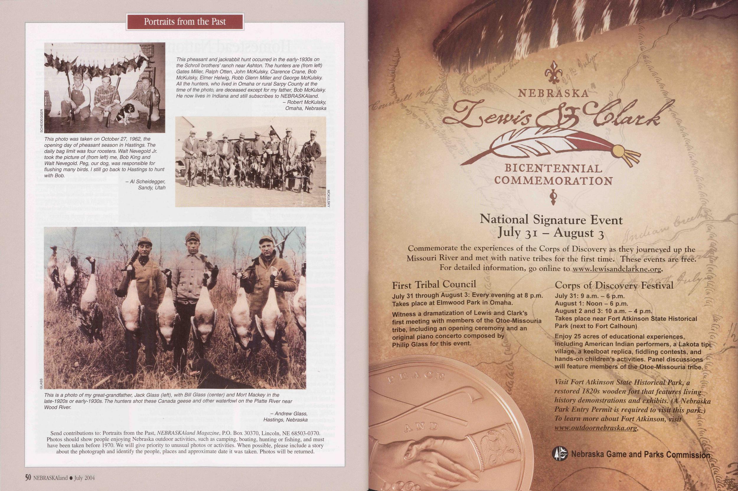
Portraits from the Past
NEBRASKA Lewis &Clark BICENTENNIAL COMMEMORATION
National Signature Event July 31 - August 3 Commemorate the experiences of the Corps of Discovery as they journeyed up the Missouri River and met with native tribes for the first time. These events are free. For detailed information, go online to www.lewisandclarkne.org. First Tribal Council July 31 through August 3: Every evening at 8 p.m. Takes place at Elmwood Park in Omaha. Witness a dramatization of Lewis and Clark's first meeting with members of the Otoe-Missouria tribe, including an opening ceremony and an original piano concerto composed by Philip Glass for this event. Corps of Discovery Festival July 31. 9 a m. - 6 p.m. August 1: Noon - 6 p.m. August 2 and 3: 10 a m. - 4 p.m. Takes place near Fort Atkinson State Historical Park (next to Fort Calhoun) Enjoy 25 acres of educational experiences, including American Indian performers, a Lakota tipi village, a keelboat replica, fiddling contests, and hands-on children’s activities. Panel discussions will feature members of the Otoe-Missouria tribe. Visit Fort Atkinson State Historical Park, a restored 1820s wooden fort that features living history demonstrations and exhibits. (A Nebraska Park Entry Permit is required to visit this park.) To learn more about Fort Atkinson, visit www.outdoornebraska.org. Nebraska Game and Parks Commission
Position: 511 (21 views)