Volume 81, Issue 10, 2003
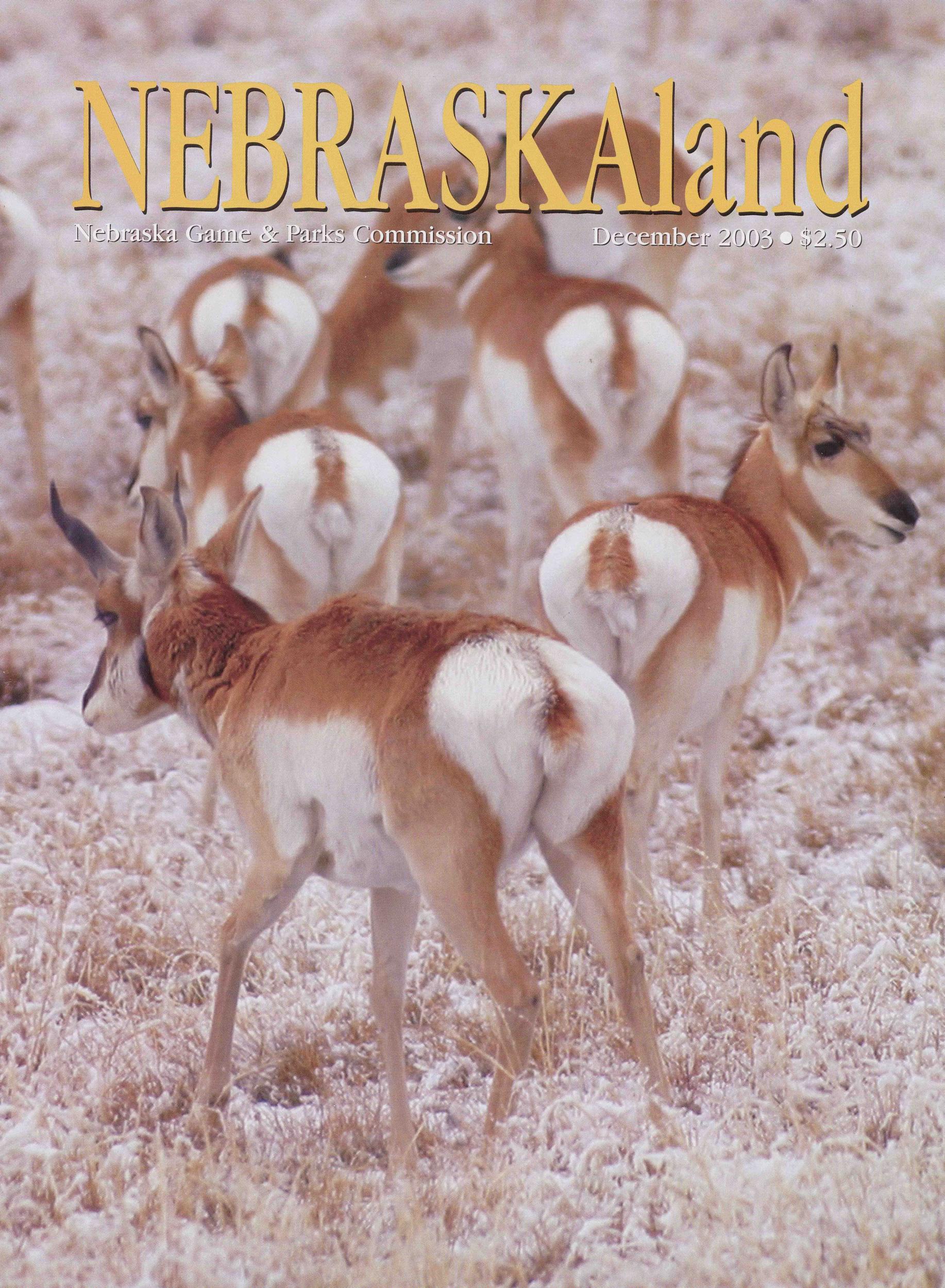
NEBRASKAland
Nebraska Game & Parks Commission December 2003 $2.50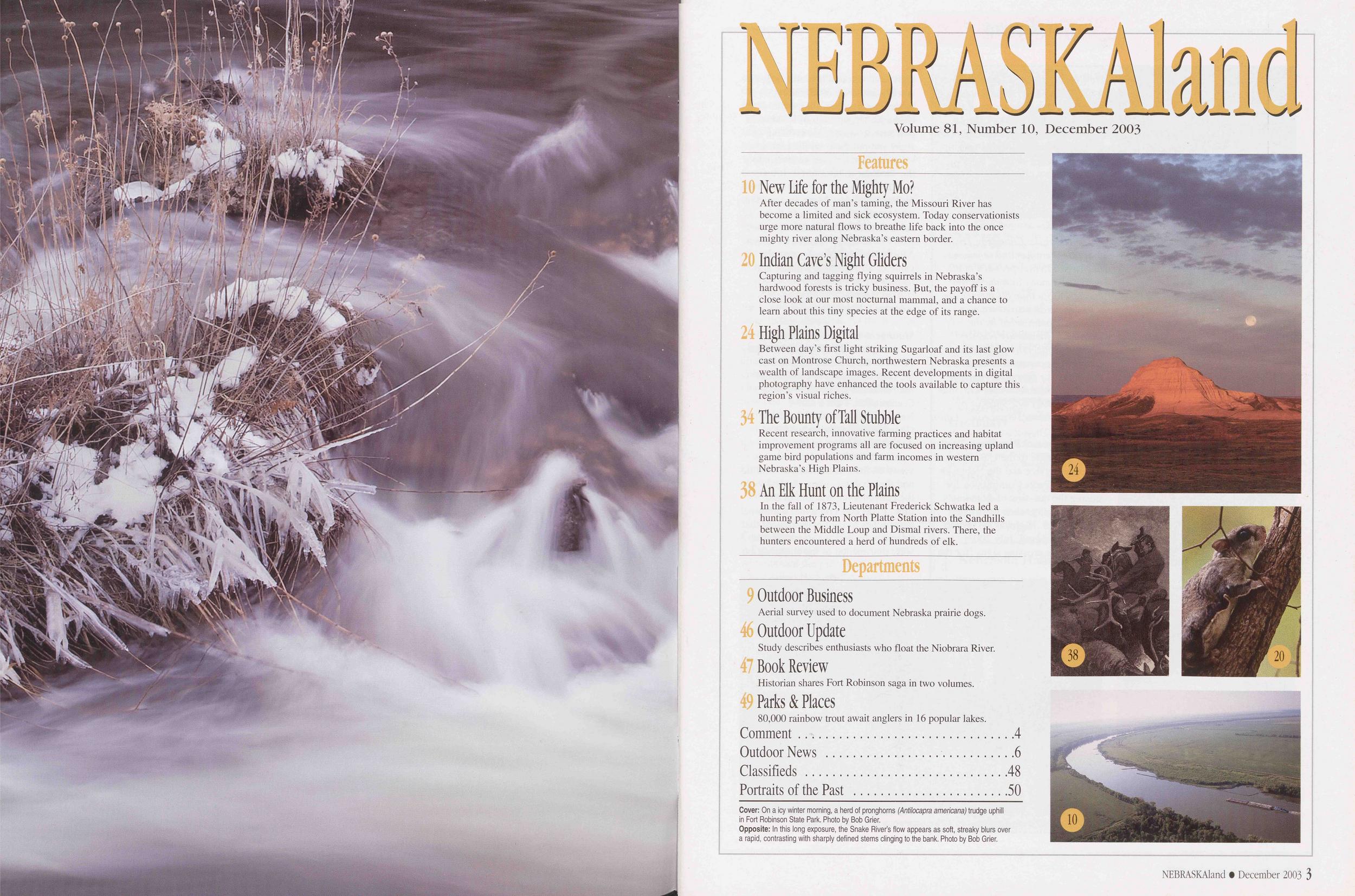
NEBRASKAland
Volume 81, Number 10, December 2003 Features New Life for the Mighty Mo? After decades of man's taming, the Missouri River has become a limited and sick ecosystem. Today conservationists urge more natural flows to breathe life back into the once mighty river along Nebraska's eastern border. Indian Cave's Night Gliders Capturing and tagging flying squirrels in Nebraska's hardwood forests is tricky business. But, the payoff is a close look at our most nocturnal mammal, and a chance to learn about this tiny species at the edge of its range. High Plains Digital Between day's first light striking Sugarloaf and its last glow cast on Montrose Church, northwestern Nebraska presents a wealth of landscape images. Recent developments in digital photography have enhanced the tools available to capture this region's visual riches. 34 The Bounty of Tall Stubble Recent research, innovative farming practices and habitat improvement programs all are focused on increasing upland game bird populations and farm incomes in western Nebraska's High Plains. j An Elk Hunt on the Plains In the fall of 1873, Lieutenant Frederick Schwatka led a hunting party from North Platte Station into the Sandhills between the Middle Loup and Dismal rivers. There, the hunters encountered a herd of hundreds of elk. Departments Outdoor Business Aerial survey used to document Nebraska prairie dogs. Outdoor Update Study describes enthusiasts who float the Niobrara River. Book Review Historian shares Fort Robinson saga in two volumes. Parks & Places 80,000 rainbow trout await anglers in 16 popular lakes. Comment................................4 Outdoor News............................6 Classifieds ..............................48 Portraits of the Past .......................50 Cover: On a icy winter morning, a herd of pronghorns (Antilocapra amencana) trudge uphill in Fort Robinson State Park. Photo by Bob Grier. Opposite: In this long exposure, the Snake River's flow appears as soft, streaky blurs over a rapid, contrasting with sharply defined stems clinging to the bank. Photo by Bob Grier. NEBRASKAland Mazine
Published by the
Nebraska Game and
Parks Commission
Director: Rex Amack
Assistant Directors:
Roger Kuhn, Kirk Nelson
Information & Education Administrator:
Ken Bouc
Information & Education Art Director:
Steve O'Hare
Commissioners
Chairman:
Connie Lapaseotes, Bridgeport
Vice Chairman:
Randall K. Stinnette, Inland
2nd Vice Chairman:
Marvin Westcott, Holdrege
James Stuart, Jr., Lincoln
Bill Grewcock, Omaha
Dr. Mark Pinkerton, Wilber
Bill Zutavern, Dunning
Gary Parker, Columbus
Magazine Staff
Editor: Tom White
Associate Editor: Doug Carroll
Art Director: Tim Reigert
Senior Editors: Jon Farrar, Ken Bouc
Regional Editors:
Eric Fowler, Bob Grier, Rocky Hoffmann
Contributing Editors: Michael Forsberg,
Tom Keith
Circulation: Donna Robinson
Photo Librarian: Terry Fingerhut
NEBRASKAland
ISSN: 0028-1964
VOL. 81 /NO. 10
DECEMBER 2003
Published monthly, except for Jan./Feb. and Aug/Sept.
issues, by the Nebraska Game and Parks Commission, 2200
N. 33rd St., Lincoln, NE. Copyright 2003, all rights reserved.
Please address comments or questions to this address.
Periodicals postage paid at Lincoln, Nebraska, and other
locations. POSTMASTER: Send all address changes to
NEBRASKAland, P.O. Box 30370, Lincoln, NE 68503-0370.
Address submissions to: The Editor, NEBRASKAland
Magazine, P.O. Box 30370, Lincoln, NE 68503. Include
a stamped, self-addressed return envelope. The publisher
assumes no responsibility for unsolicited material.
NEBRASKAland is available on audio cassette from the
Nebraska Library Commission Talking Book and Braille
Service, Suite 120, 1200 N St., Lincoln, NE 68508. (800)
742-7691
Rates: $16 for one year; $30 for two years.
Nebraska residents must add appropriate sales tax.
To subscribe call 1-800-NEBLAND (632-5263),
or go online to: outdoornebraska.org
NEBRASKAland Mazine
Published by the
Nebraska Game and
Parks Commission
Director: Rex Amack
Assistant Directors:
Roger Kuhn, Kirk Nelson
Information & Education Administrator:
Ken Bouc
Information & Education Art Director:
Steve O'Hare
Commissioners
Chairman:
Connie Lapaseotes, Bridgeport
Vice Chairman:
Randall K. Stinnette, Inland
2nd Vice Chairman:
Marvin Westcott, Holdrege
James Stuart, Jr., Lincoln
Bill Grewcock, Omaha
Dr. Mark Pinkerton, Wilber
Bill Zutavern, Dunning
Gary Parker, Columbus
Magazine Staff
Editor: Tom White
Associate Editor: Doug Carroll
Art Director: Tim Reigert
Senior Editors: Jon Farrar, Ken Bouc
Regional Editors:
Eric Fowler, Bob Grier, Rocky Hoffmann
Contributing Editors: Michael Forsberg,
Tom Keith
Circulation: Donna Robinson
Photo Librarian: Terry Fingerhut
NEBRASKAland
ISSN: 0028-1964
VOL. 81 /NO. 10
DECEMBER 2003
Published monthly, except for Jan./Feb. and Aug/Sept.
issues, by the Nebraska Game and Parks Commission, 2200
N. 33rd St., Lincoln, NE. Copyright 2003, all rights reserved.
Please address comments or questions to this address.
Periodicals postage paid at Lincoln, Nebraska, and other
locations. POSTMASTER: Send all address changes to
NEBRASKAland, P.O. Box 30370, Lincoln, NE 68503-0370.
Address submissions to: The Editor, NEBRASKAland
Magazine, P.O. Box 30370, Lincoln, NE 68503. Include
a stamped, self-addressed return envelope. The publisher
assumes no responsibility for unsolicited material.
NEBRASKAland is available on audio cassette from the
Nebraska Library Commission Talking Book and Braille
Service, Suite 120, 1200 N St., Lincoln, NE 68508. (800)
742-7691
Rates: $16 for one year; $30 for two years.
Nebraska residents must add appropriate sales tax.
To subscribe call 1-800-NEBLAND (632-5263),
or go online to: outdoornebraska.org
Christine Meyer, the Nebraska champion tree coordinator at the University of Nebraska-Lincoln, helped us register this champion Osage orange tree located four miles southeast of Table Rock. The tree has a circumference of 17 feet 6 inches.
Bob Brandt, Unadilla, NebraskaThe Nebraska Champion Tree program identifies and recognizes the largest living specimen of all native and many introduced tree species. More than 80 species are listed in the Nebraska register, which is administered by the Nebraska Community Forestry Council, University of Nebraska- Lincoln Cooperative Extension, and the Nebraska Forest Service. For more information contact Christine Meyer at (402) 472-9869 or by e-mail at cmeyer3@unl.edu - Editor
Respect, Protect Standing's TurtlesMy gratitude to the U.S. Fish and Wildlife Service and the Nebraska Game and Parks Commission for raising the question of Blanding's turtle mortality when confronted with the U.S. Highway 83 project [NEBRASKAland, July 2003].
The turtle crossing signs [for the highway] supplied by Jeff Lang, the world's authority on Blanding's turtles, were stolen. I hope the Nebraska Department of Roads will purchase its own turtle crossing signs and put them on the highway.
I witnessed a driver swerve onto the shoulder to hit a turtle. It was one of two that I removed from the highway that day. More areas of this road need to be fenced and larger culverts need to be installed so they won't be as easily blocked by debris. All citizens should recognize the value of all Nebraska wildlife and respect it.
Alan Bartels Farwell, Nebraska Management Practices PraisedI was pleased with much of what I read in the October issue about the land management practices of the Nebraska Game and Parks Commission. I am a native Nebraskan and worked for the Commission in the early-1990s. At that time, I was an idealistic, passionate college student whose views on the management of wildlife and their habitats often clashed with the conventional wisdom of the time. I was concerned that traditional approaches to land management that intensely focused on game species were detrimental to the conservation
Numerous Commission employees talked with me about these issues, and I am grateful for their patience with a young start-up who challenged them. A common theme in those dialogues was the need for land management strategies that integrate the needs of both game and nongame species without compromising the ecological integrity of the natural communities that make Nebraska unique and valuable.
The October articles on prescribed fire and pheasant habitat demonstrated the Commission is taking substantial steps in that direction. As the articles state, new initiatives such as tree clearing and summer burning are changes from past practices. I commend the Commission on changing old practices and adopting new ones when science makes a compelling case to do so. Equally commendable is the willingness to do what is right for the land when your traditional constituency - hunters - might not immediately appreciate its value.
Stephen Winter Alamo, Texas Cover Photo Was a HitI'm sure that I'm not the only one who noticed the picture of the large white-tailed buck on the cover the August-September issue.
Before I even looked at the credits of the picture, I told myself that it had to taken by Mark Dietz. He has taken great pictures of wildlife for many years. Keep up the good work.
Joe Welsh North Platte, Nebraska Comment NEBRASKAland Magazine P.O.Box 30370, Lincoln, NE 68503. E-mail: nebland@ ngpc. state, ne. us. Please include your postal address and telephone number. Letters may be condensed and edited for clarity. Photographs are welcome and will be returned. 27th ANNUAL NEBRASKA LTAT STAMP ART CONTEST SUBMISSION Entries may be protected by a covering but will not be accepted in frames, under glass or in plastic kitchen wrap. Wrap securely and send to: Habitat Stamp Contest, Game and Parks Commission, 2200 N. 33rd Street, RO. Box 30370, Lincoln, NE 68503-0370. A completed entry form and reproduction agreement, or a facsimile thereof, must be attached to the back of the entry. Name and address of the artist must appear only on the reverse side of the entry. The Game and Parks Commission is not responsible for any entry lost or damaged in transit. Entries will not be returned unless specifically requested and a self-addressed mailer with proper return postage is included. PRIZES Adult division first-place winner receives $300 from the Omaha Fish and Wildlife Club. Youth division first-place winners in each section receive $100 from the Omaha Fish and Wildlife Club. Runners-up in all divisions receive a subscription to NEBRASKAland Magazine. TECHNICAL IREQULREMENTS Design must be 772 inches by 4"/,6 inches. It may be matted, but mats must not exceed 10 inches by 7 inches. Any medium is acceptable. No scrollwork or lettering may appear on the design. Color is preferred. SUBJECT MATTER Any Nebraska wildlife species in an appropriate habitat setting, except for wild turkey, Canada geese, western bluebird, American wigeon, and elk, which are not eligible this year. ELIGIBILITY Contest is open to Nebraska residents only, and winning entry in the adult division will appear on the 2005 Nebraska Habitat Stamp. Employees of the Game and Parks Commission and their immediate families are not eligible to enter the adult division of the contest. Only one entry allowed per person. DIVISIONS Adult: Amateur or professional artists. Youth: Senior Section - Grades 9-12; Junior Section - Grades 5-8; Primary Section - Grades K-4. ENTRY DllADITNE March 1,2004. Nebraska Habitat Stamp Art Contest Entry Form Please accept my entry in the 2004 Habitat Stamp Art Contest. I hereby certify that I have complied with all the rules governing this competition and that the work submitted is my own creation. Further, the Nebraska Game and Parks Commission is hereby authorized to reproduce my design on the 2005 Habitat Stamp or in any other fashion it may deem appropriate. All information requested is required. Form may be copied. NEBRASKAland • December 2003 5
A young male mountain lion captured in west-central Omaha on October 1, 2003, marked the first confirmed sighting of the big cats in the eastern third of the state.
The cougar was seen several times during the morning of its capture, and it was eventually surrounded near a creek. Lee Simmons, director of Omaha's Henry Doorly Zoo, hit the cat with a dart containing a sedative. But before the drug took effect, the cat tried to escape the perimeter and was wounded in a leg when an Omaha police officer fired a load of 00 buckshot at it.
At the time of its capture, the cougar weighed 108 pounds and measured almost seven feet long from its nose to the tip of its tail. The animal is being held at the zoo and has been put on display.
Richard Bischof, a biologist with the Nebraska Game and Parks Commission, said the lion will be held at the zoo until it is decided whether to place it in another zoo or leave it in Omaha. The lion will not be released into the wild in Nebraska, Bischof said. Genetic tests are being done to see if it can be linked to the mountain lion population that exists in South Dakota.
Before the lion's capture, the last confirmed sighting of a mountain lion occurred in Brown County, where a trail camera photographed one in June 2002. The Omaha lion is the first confirmed sighting in eastern Nebraska. In November 2000 a male mountain lion was shot and killed in the city limits of St. Paul in Howard County.
To confirm the presence of a mountain lion, the Commission requires specific evidence. Videos, photos, feces, tracks, hair or the carcass of an animal killed by a mountain lion can be used to confirm the presence of a lion in an area. Tracks are the most common evidence, and if they are well defined, they should be photographed with a coin or ruler to indicate scale, preserved by making a cast, or covered until they can be studied by a biologist.
Mountain lions are native to Nebraska but were extirpated from the state by the end of the 19th century.
New Guide Published About Restoring Nebraska PrairiesPeople interested in restoring prairies and wetlands in eastern Nebraska have new resource offering tips and advice - "A Guide to Prairie and Wetland Restoration in Eastern Nebraska."
A joint publication of the Prairie Plains Resource Institute (PPRI) and the Nebraska Game and Parks Commission, the guide describes Nebraska prairies before settlement and discusses techniques to restore prairies in areas as small as a backyard to as large as several thousand acres. The 84-page booklet discusses many aspects of restoration, from choosing a site, to collecting and processing seeds, to mixing and planting seeds, to post-planting management.
For more information or to receive a copy of the book, contact PPRI at (402) 694-5535, or e-mail them at ppri @ hamilton. net.
Songbird Nesting in Basin Wetlands Under StudyA study by the University of Nebraska-Lincoln Institute of Agriculture and Natural Resources is looking for ways to restore wetland habitat to make it more attractive to nesting songbirds while limiting chances they will fall prey to predators. That combination also will likely attract waterfowl.
"Many waterfowl species and songbirds nest in similar habitat and their nests are exposed to the same risks, so good habitat for songbird nesting should be good habitat for waterfowl nesting," said Larkin Powell, a UNL wildlife ecologist.
Rainwater basins are scattered across south-central Nebraska. Only about 21,000 acres remain - less than 10 percent of what was once there. Millions of ducks, geese and other migratory birds rest and feed in Nebraska's rainwater basins during their spring and fall migrations, and at least 12 native songbird species use them for breeding and nesting during the summer.
For the past two summers, Powell
"The radio telemetry information . . . helps us determine what kinds of wetlands they frequent the most, which we can compare with songbird nesting patterns," Powell said.
The research is continuing, but some patterns have emerged: Predators tend to favor wetlands close to others, and songbird nesting success depends on how attractive a wetland is to animal predators. Bull snakes and other predators not included in this study also affect nesting success, but mammalian predators are more significant. Powell said that restoring wetlands in ways that reduce their influence should improve nesting success. This might include planning for larger, somewhat remote wetlands, and providing a border of upland habitat, which may buffer the wetland birds from foraging predators.
Plan to Build power Plant at Merritt Dam DroppedPlans to build a hydroelectric power plant at Merritt Reservoir have been dropped.
"It was not economically feasible. It did not pencil out at all," said Hart Evans, a spokesman for the Logan, Utah-based company pursuing the project.
Symbiotics LLC said the reasons for dropping of the project included not enough water flowing from the dam and the low cost of publicly owned electricity in Nebraska.
The plant could have produced electricity to power 1,200 homes. It would have taken five years to convert the U.S. Bureau of Reclamation dam on the Snake River southwest of Valentine in Cherry County.
Report Totals Economic Effects of Wildlife WatchingA recent report released by the U.S. Fish and Wildlife Service found that 66 million Americans spent more than $38 billion in 2001 observing, photographing and feeding wildlife.
"Many Americans enjoy watching wildlife, however we often overlook the positive impact these activities have on state and local economies," said Steve Williams of the USFWS.
Some of the money spent by wildlife watchers went for items such as cameras, binoculars and bird food. Other expenses are trip-related, including lodging, transportation and food. For each $1 of direct spending associated with wildlife watching, an additional $1.49 of economic activity was generated.
The total industrial output of $95.8 billion resulted in more than a million full and part-time jobs, with total salaries of $27.8 billion. In Nebraska the survey showed that more than a half million people ages 16 years old and older watched wildlife in 2001, and almost $130 million was spent by residents and another $20 million was spent by nonresidents while watching wildlife. These expenditures created more than $5.5 million in sales tax revenue in 2001 and were responsible for more than 37 jobs in Nebraska, the report said.
Commission Changes Turkey and Life Jacket RegulationsAt their October meeting, Nebraska Game and Parks Commissioners reduced the number of spring turkey hunting units from four to two, the West Unit and the East Missouri Unit. The dividing line between the two units will be U.S. Highway 81, and the East Missouri Unit will have separate early and late seasons. The Commission also authorized unlimited permits in both units, with the only restrictions being that a person may not obtain more than two spring turkey permits in a given year, and that a person may not obtain more than one spring shotgun permit in the East Missouri Unit each year. A limited landowner permit will not count against the limit.
NEBRASKAland • December 2003 7 Outdoor News
Officer's Notebook
The Buck Stops Here
Outdoor News
Officer's Notebook
The Buck Stops Here
On a cold, late-December night I had pulled up to my home after a long day of patrolling when I noticed my porch light was blinking. My wife wanted to talk before I put the truck away. Someone had just called and I might be leaving again.
I returned the call. One of two men who had been calling coyotes in northwestern Saunders County told me they were quitting for the night when they saw a truck about a mile to the south swing its headlights into a field. They saw a passenger get out and fire six to eight shots from what sounded like a .22-caliber rifle. Then he got back in and the truck continued towards the coyote hunters. Figuring the passenger had been shooting at deer, they decided to hide in a ditch and try to get a license plate number as the vehicle passed. Unfortunately it did not have license plates and by the time the coyote callers returned to their own vehicle, the suspects were long gone. Where the shots had been fired, the coyote hunters found a wounded white-tailed buck. It was hunched up as if it had been gut shot. It slowly crossed the road in front of them, dragging its right rear leg and laid down in a cornfield next to the road.
I met the coyote hunters about 20 minutes later. We found six .22 rim-fire casings where the shots were fired. We also noticed that none of the tires on the shooter's truck seemed to match. The right front was an extremely knobby mud tire, and the others were mix-and-match passenger car treads. The wounded deer had moved and because there were so many deer tracks in the area it was impossible to track it. The chances of making a case looked bleak except for one thing - the witnesses were sure the vehicle was an older, square-backed Jeep Cherokee, dark in color. I drove past some local bars to see if these guys had stopped for a drink before heading home. Then I drove past a few of the houses in the area looking for the vehicle. Nothing.
I headed north toward the next town. I had not gone far when, lo and behold, sitting on the shoulder of the road with a blown-out tire was the vehicle I was looking for. Sometimes you get lucky. It did not appear to be the road hunters' night, but I sure thought it was mine!
The Jeep was deserted and locked, but inside I could see a spotlight cord, .22 shells, and fresh snow on the floorboard. I knew it was the truck I was looking for. I ran the vehicle identification number through the sheriff's department, but it hadn't been registered since 1999 and there was no telephone number for the last registered owner.
I called my supervisor, Duane Arp, and told him the situation. Although I hadn't found the deer, I told him I hadn't looked very hard yet. Arp agreed to come watch the Jeep in case the owner came back while I looked for the deer. It was very cold, 5 or 10 degrees above zero, but I looked for the deer until 2 a.m. without success. When I decided to go home, Arp and I made the decision not to tow the Jeep because we had not found the deer. At best we had a shooting from the road charge, so I went home discouraged.
The next morning I looked for the deer again and finally found the buck. It had died during the night. I was tickled to find the deer, but after loading it into my truck and heading toward the abandoned Jeep, my good cheer disappeared - the vehicle was gone.
The previous night I had had the vehicle but no deer, now I had the deer but no vehicle! Because the Jeep had been going north, I went that way to see if I could find it again. I drove around the next town with no luck, then I noticed a full-service gas station on the main highway. On a hunch, I went inside and asked the man behind the counter if he had sold any tires that morning. He replied, "Yep, sold one to a fella for a Jeep Cherokee this morning." He even had a ticket with the guy's name and address on it.
Without going into the details, let's just say that wasn't the only ticket that day with that particular name and address on it.
- Mike Luben, Conservation Officer, WahooThe 2004 spring turkey archery season will be March 25-May 23. The shotgun season in the West Unit will be April 17-May 23 and in the East Missouri Unit the early season will be April 17-25 and the late season will be April 26-May 23.
The commissioners also increased the age of children who are required to wear life jackets while aboard any vessel in Nebraska. Now anyone 12 years old or younger, except when they are hunting waterfowl from an anchored vessel, must wear a life jacket. Previously only children younger than 12 years old were required to wear life jackets.
The next Commission meeting will be held Tuesday, January 13, in Bridgeport.
8 NEBRASKAland • December 2003Outdoor Business
Prairie Dog Survey
Flying low, researchers document number of acres occupied by this species. By Richard Bischof, Nebraska Game and Parks Commission Wildlife BiologistAlthough habitat changes and persistent control efforts have taken a toll on its populations, the black-tailed prairie dog (Cynomus ludovicianus) remains an important component of Nebraska's fauna and a keystone species of the North American shortgrass prairie. In 2000, the U.S. Fish and Wildlife Service made the determination that the black-tailed prairie dog was a candidate species for the endangered species list. As a result and in an effort to remove the species from the candidate list, state wildlife management agencies within the species range have been monitoring black-tailed prairie dog populations within their state's borders.
To assess trends in the species' abundance in Nebraska, biologists must determine the number and distribution of acres occupied by prairie dogs. Previous efforts to derive statewide and county prairie dog acres included inspection of aerial photos taken since the 1960s and an extensive survey by the University of Nebraska-Lincoln in 2000 and 2001. The latter entailed on-ground verification and mapping of towns that had been identified on aerial photos. However, the accuracy and geographic coverage of the estimates derived from these attempts have not been completely satisfactory nor have they allowed unbiased comparisons over multiple years to assess changes in prairie dog town distribution and ground coverage.
Last August, the Commission initiated an aerial survey that included most of the black-tailed prairie dog's range in Nebraska. Funding for this survey came from the U.S. Fish and Wildlife Service's special fund for endangered species. The statistically based survey design applied in this study has previously been used with success in Colorado. The two main objectives of the Nebraska survey are: 1) to collect information on the number and total size of active prairie dog towns in Nebraska, and 2) to create a baseline that could be used to compare data from future surveys to assess trends over time about the abundance of black-tailed prairie dogs in Nebraska.
For more than two months pilot Franz Mullen, the owner of South Side Aero in Cody, Nebraska, and observer Melissa Hough, a recent graduate of Iowa State University, flew countless parallel lines over counties in the western two-thirds of the state. These lines, also called aerial transects, were flown at a very low altitude of 150 feet above ground level, requiring extreme caution to avoid hazards such as radio towers and trees. Using a sophisticated data recording and global information system, Mullen and Hough recorded data on location, size and activity as they entered and exited prairie dog colonies in their flight path.
The survey makes use of the distinct changes prairie dogs make to their habitat. Two features of a prairie dog colony most visible from the air are bare prairie dog mounds marking burrow entrances and shorter vegetation throughout the towns.
At the low altitude used for this survey, individual prairie dogs were often spotted and fresh dirt near burrows was visible - both signs that a town was currently occupied. Because the dirt mounds can persist for months, or even years, even if prairie dogs have been removed by poisoning, verification of recent activity is critical for an accurate census of prairie dog towns.
Commission biologists will soon begin analyzing the data recorded by Mullen and Hough. Because of the volume of the data collected, the analysis will take several months. The first estimates of the number and total size of active prairie dog towns in the prairie dog's range in Nebraska will be available in January 2004.
NEBRASKAland • December 2003 9
New Life for the Mighty Mo?
Photos and text by Eric FowlerIn the name of progress, man spent much of the past century taming the Missouri River. Now, we're having second thoughts. With six dams, we flooded a third of the Missouri's historical bottomland, and straightened and deepened the lower third of the river into a channel for commercial navigation. Only a third of Mighty Mo's 2,341 miles now remains in a natural or semi-natural state. In some ways the work has paid huge dividends, including billions of dollars in flood control. But, there were losses, too.
When the dams and channel were built, some people knew fish and wildlife habitat would be lost. Such costs were considered the price of progress. But most did not appreciate the real value of a healthy and incredibly diverse river ecosystem until recently. The nation's values have changed, and today many want to see some of man's work and its damage to the river undone. They want a more natural flow to breathe life back into what is now a very sick river.
During the past 14 years, competing visions for the Missouri have fueled a debate about the U.S. Army Corps of Engineers work to revise the Missouri River Master Water Control Manual, the blueprint the Corps follows in managing the river. The U.S. Fish and Wildlife Service (USFWS) has said the Corps' current management practices jeopardize three federally threatened or endangered species - the interior least tern, piping plover and pallid sturgeon - as well as other native species. It recommended that a semblance of the river's natural flows be restored, including a spring rise and a low summer flow.
Environmental interests, including the Nebraska Game and Parks Commission, which manages the state's fish and wildlife resources, support proposed flow changes. Agricultural, navigation and other interests want things to stay as they are. To say the debate pits the environment against agriculture and industry is true, but it oversimplifies the issue. Many have stakes in the issue, including those who live along the river in Nebraska and elsewhere, and those who have gained or lost because of changes to the river.
The Missouri River forms at Three Forks, Montana, where the Jefferson, Madison and Gallatin rivers flow from the Bitterroot Mountains. The nation's longest river, the Missouri drains 530,000 square miles in 10 states and part of Canada.
Not long ago, many described the Missouri River as a sleeping giant. Each spring, when the snow melted on the plains and the spring rains came, the river raged. A boiling mass of mud and sand, it chewed its way through the soft alluvial bottomland soils, and wreaked havoc with anything in its path through Montana, North and South Dakota, Nebraska, Iowa, Kansas and Missouri to the Mississippi River at St. Louis. Soon the early spring flows would subside, but when the snow in the Rocky Mountains melted, another surge of water would come. By today's standards, a 100-year flood occurred every three years on the Missouri before the dams were built.
George Fitch wrote about the river in American Magazine in 1907: "It makes farming as fascinating as gambling too. You never know whether you are going to harvest corn or catfish. The farmer may go blithely forth in the morning with a twine binder to cut his wheat only to come back at noon for a trotline - his wheat having gone down the river the night before.
"These facts lead us naturally to the subject of the Missouri's appetite. It is the hungriest river ever created. It is eating all the time - eating yellow clay banks and cornfields, eighty acres at a mouthful; winding up its banquet with a truck garden and picking its teeth with the timbers of a big red barn. It's yearly menu is ten thousand acres of good, rich farming land, several miles of railroad and a few houses, a forest or two and uncounted miles of sandbars."
After the spring rises, the river would 10 NEBRASKAland • December 2003
 become a lazy meander, except during
occasional downpours, for the rest of the
year. It still chewed its banks, but took
smaller bites. The river's appetite for
soil gave it one of its many nicknames,
the Big Muddy. Often said to be too
thick to drink and too thin to plow, the
river was "the muddiest stream in the
world," according to Fitch, who said it
was, "so thick that it cracks, sometimes,
in working its way around the bends."
How Man Changed the Missouri River
become a lazy meander, except during
occasional downpours, for the rest of the
year. It still chewed its banks, but took
smaller bites. The river's appetite for
soil gave it one of its many nicknames,
the Big Muddy. Often said to be too
thick to drink and too thin to plow, the
river was "the muddiest stream in the
world," according to Fitch, who said it
was, "so thick that it cracks, sometimes,
in working its way around the bends."
How Man Changed the Missouri River
In winter, ice halted the river's flow on the surface. In spring, when the ice broke up, the huge shards would form ice dams. Where the river couldn't break through, it went around, spilling water over the floodplain.
Erosion and flooding are natural processes of all rivers. The Missouri was better at it than most. The river's rages created some of the most diverse habitat for fish and wildlife found anywhere. It made wide, sweeping bends through its valley, which ranges from two to 20 miles wide in Nebraska. As the river cut away outer banks, it deposited soil on inner banks, causing bends to grow wider. Meriwether Lewis and William Clark, on their journey upriver in 1804, calculated that around one bend now near Decatur, Nebraska, the river flowed 183A miles to cover 974 yards. These loops were often breached, creating oxbow lakes no longer connected to the river.
Flood pulses would reshape sandbars and islands and scour them clean of vegetation. When the flows receded, a braided, sinuous river remained - a swift and deep main channel, shallow side channels and chutes, and slowly moving or still water in backwaters and sloughs. Countless sandbars, which became habitat to the least tern, piping plover and other shorebirds, dotted the river. Where the river found a new channel, its old one became a trail of wetlands, lakes and marshes that were filled by flooding or groundwater.
Moist soils found throughout the river bottom during low flows were ideal places for cottonwood and willow trees to sprout. These saplings matured into cottonwood forests that were important to the river's ecosystem. In the forest's understory grew hackberries, oaks and other hardwoods that would eventually replace the cotton woods. The mixed vegetation in the Missouri River Valley - woodlands, grasslands and wetlands - served the needs of many species of resident and migratory wildlife. The constant lateral movement of the river maintained a natural succession.
Fish that adapted to the Missouri's turbid waters included the shovelnose and pallid sturgeons, paddlefish, catfish and sauger. Flooding in the spring filled the river with nutrients that served as the base of the food chain. Many fish species took rising or falling water levels as cues to spawn, as did insects that the fish fed upon. Some species spawned in the floodplain when the river left its banks. When the river subsided, slack water areas below sandbars and in side channels and backwaters provided ideal nursery habitat for young fish, and as primary habitat for small species such as the plains minnow. Trees consumed by the river during high flows dotted the riverbed, offering habitat for aquatic insects that were another key food-chain component. Largemouth bass, bluegills, crappies and other fish filled the oxbow lakes. On September 1, 1804, Clark 12 NEBRASKAland • December 2003
Work to tame the Missouri River, or at least make it manageable, began soon after the first steamboats began to ply its waters in the early-1800s. The U.S. Army Corps of Engineers began removing snags to improve steamboat navigation. In the late-1800s, the Corps attempted to stabilize the river's banks in places, but with little success. In the early-1900s, Congress authorized the Corps to build a six-foot navigation channel from Kansas City to St. Louis. That project stalled, but resumed in 1927 when Congress provided funds and called for the six-foot channel to be extended to Sioux City, Iowa.
Pile dikes were driven across much of the Missouri's width, forcing its water into a narrow, deep, self-scouring channel. Side channels and backwaters were cut off from the river. Slowed by these dikes, the river dropped its sediment behind them, creating new land that became forest and in most locations was later cleared and farmed. In Nebraska, these accretion areas became property of adjacent landowners. Iowa kept it as public land.
The first dam on the main stem of the Missouri River, Fort Peck Dam in Montana, was built under President Franklin D. Roosevelt's Works Progress Administration and finished in 1937. Calls for more flood control in lower basin states followed floods in 1943 and led Congress the next year to pass the Flood Control Act, which included the Pick-Sloan Missouri Basin Program.
This project would build five more dams, primarily for flood control and to support navigation below Sioux City. But it would provide jobs for soldiers when they returned from World War II, too. The project would supply water to 4.7 million acres of farmland and generate hydropower, both of which were expected to expand settlement in the arid upper-basin states. Only 10 percent of the irrigation project was developed. Fish, wildlife and recreation were also to benefit.
Construction of the dams - Garrison in North Dakota, Oahe, Big Bend and Fort Randall in South Dakota and Gavins Point in Nebraska - was completed in 1963. Combined, the six dams can store 74 million acre-feet of water. The resulting reservoirs inundated 1.6 million acres of bottomland, displacing, among others, thousands of Native Americans, many of whom had been moved to reservations along the river less than 100 years earlier.
A nine-foot navigation channel from Sioux City to the river's mouth was completed in 1981. Once a mile wide or more, the river now spans only 600 feet through most of Nebraska. To improve navigation, the river was straightened. The lake at DeSoto National Wildlife Refuge near Blair is one result of that effort. In all, the work cut 205 miles from the river's length in 1895.
Below Sioux City, the Missouri River's floodplain covers 1.9 million acres. An estimated 168,000 acres of aquatic habitat and 354,000 acres of adjacent riverine habitat were lost to channelization and the development that followed. Nearly 20 percent of the combined losses were in Nebraska.
Nebraska's Piece of the RiverFor about 385 miles, the Missouri serves as Nebraska's northern and eastern border. It has many different faces in that length, most with problems that detract from the river's value as fish and wildlife habitat.
The water released from Fort Randall
Dam a few miles from Nebraska's
NEBRASKAland • December 2003 13
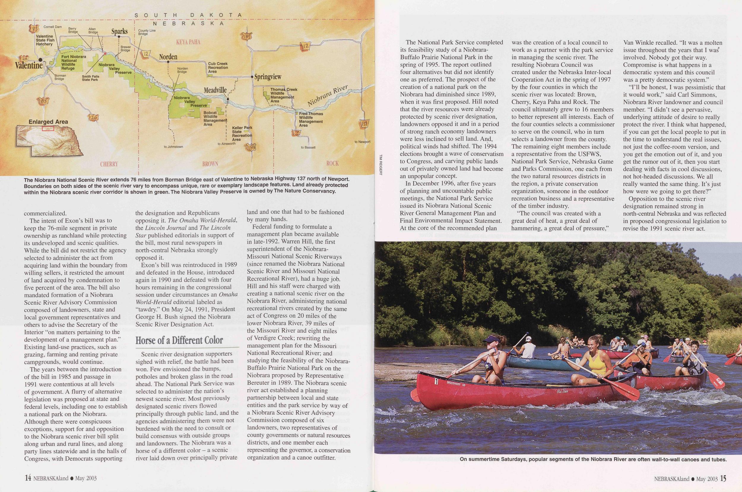 northern border flows cold and clear.
For 39 miles to Niobrara, the Missouri
retains some of its natural characteristics,
including islands, side channels, sandbars
and backwaters. This reach was
designated a National Recreational
River by Congress in 1991.
northern border flows cold and clear.
For 39 miles to Niobrara, the Missouri
retains some of its natural characteristics,
including islands, side channels, sandbars
and backwaters. This reach was
designated a National Recreational
River by Congress in 1991.
But this stretch and two others in Nebraska suffer from insufficient sediment. Before 1950, the river annually carried an average of 142 million tons of sediment past Sioux City. It now carries just four million tons. The rest is trapped in the upstream reservoirs. Clean water continually scours the riverbed deeper, greatly incising its channel.
Flows from Fort Randall Dam are highly regulated, varying slightly each day to meet hydropower demands, and seasonally, to provide high flows during the navigation season and low flows in winter. The clear water supports sight-feeding fish such as walleyes, but native river fishes are few. This segment is cut off from the rest of the river by two dams, preventing fish from moving up or downstream.
Gene Zuerlein, a Commission fisheries biologist and leader on Missouri River issues, said the cold water released from the depths of the reservoirs disrupts natural cues aquatic insects use to reproduce or hatch. "All of those insects are in sync," Zuerlein said. "They're part of the food base, so if they're out of sync, that means the food may not be available for the fish at the right time."
At the mouth of the Niobrara River, the Missouri changes. The Niobrara dumps 1,400 acre-feet of sediment into the Missouri each year, enough to cover a football field a quarter-mile deep. That is more than half of the sediment deposited annually in Lewis and Clark Lake a few miles downstream. The sediment has formed a delta at the upper end of the reservoir, which has lost more than 20 percent of its original 575,000 acre-foot capacity, and according to Corps estimates will be completely filled with sediment by 2175. Between the mouth of the Niobrara and the lake, the riverbed is aggrading, or rising. This has raised the local water table, forcing relocation of the village of Niobrara and Niobrara State Park from the floodplain to higher ground, and requiring roads to be raised.
From Gavins Point Dam to Ponca State Park, the river again appears natural, meandering through the countryside, with a few islands and sandbars. This 59-mile segment was designated a National Recreational River in 1978. But it faces problems similar to the reach below Fort Randall Dam. Channel incision has lowered the bed by as much as 14 feet. As the last dam in the system, Gavins Point releases water to support navigation. Its flows are steady and vary seasonally.
Bank stabilization is a significant problem in this unchannelized reach. Wayne Werkmeister of the National Park Service, which manages national recreational rivers, said between 17 to 35 percent of the river bank in this stretch has been stabilized with rock, concrete rubble, cinder blocks, tires, and even concrete, which has been poured down banks.
The Wild and Scenic Rivers Act generally prohibits bank stabilization on designated rivers, Werkmeister said. The Corps, however, was granted authority for demonstration stabilization projects in the late-1970s and has maintained them since by adding more rock. "When you start looking at it, it dawns on you that all they're doing here is connecting the dots [between stabilized areas]," he said.
Landowners along the river also stabilize the banks to prevent the river from claiming their cabins or farms, which sit only a few feet above the river. Such projects are required by law to be approved by the Corps, but many are not. Recent violations include a landowner who dumped concrete rubble over the bank to limit erosion on his mile of shoreline.
The Park Service is working with the Corps to resolve this problem, which reduces needed sediment in the river and reduces its scenic value.
The bank stabilization and navigation project that was part of Pick-Sloan begins below Ponca State Park, where the mile-wide river is funneled into a channel 600 feet wide. Incision is a problem between Sioux City and the mouth of the Platte River, lowering the riverbed 10 feet or more.
In the three incised stretches, the water table has fallen. Wetlands in the floodplain that historically were filled when water overflowed the banks or were maintained by groundwater are now dry. Many have been filled in and are now farmed.
From the mouth of the Platte River to the southern Nebraska border and beyond, the channel is aggrading, or rising, thanks to heavy inflows of sand and soil contributed by the Platte. A levee system, originally proposed to run along the entire channelized reach 14 NEBRASKAland • December 2003 to protect much of the bottomland from flooding, follows the river downstream from Omaha. When the river comes out of its banks during periodic high flows, vegetation along the river filters out sediment. This has raised the land between the levees, and filled wetlands.
There is little shallow, slow-moving water in the channelized reach. Some is formed in eddies below wing dikes. But the river in this stretch resembles a canal, with swift flows from bank to bank and little variation in depth. Catfish are still caught there, but their numbers have been greatly reduced. Other native fish are rare. A Commission study in 1994 found a 70 to 98 percent decline in several chub and minnow species native to the Missouri River in Nebraska.
What Can Be Done to Fix It?The Corps of Engineers is working to restore some riverine habitat that was lost to channelization. The Missouri River Fish and Wildlife Mitigation Project is the primary tool. Approved by Congress in the 1986 Water Resources Development Act and expanded in 1999, it authorizes the Corps to acquire private land from willing sellers in the floodplain and restore aquatic and terrestrial habitat on that land and existing public land. If fully funded, 166,750 acres could be improved in the next 30 years, including 27,000 acres in Nebraska. Six projects in Nebraska, five of which are complete, include constructed chutes and backwaters and will provide more than 7,150 acres of public land. On those projects, however, only 250 acres of new aquatic habitat were created.
The USFWS contends more acres are needed. It has recommended the Corps create 20 to 30 acres of shallow water habitat per river mile and create sandbars in the channel.
The Corps is working on such a project between Hamburg Bend, near Nebraska City, and Peru. It is lowering the wing dikes on inside river bends, which will allow water to flow over the dikes rather than around them, and erode the adjacent publicly owned land. This process will create holes, sandbars and shallow water in the river and increase its surface width. The Corps also is installing chevrons, structures that will cause sandbars to form below them. These projects are designed so they will not hinder navigation.
Zuerlein said, "That's what the river needs. It needs to be able to wiggle a little bit versus being chained down."
This work and current and future mitigation projects will restore some of the river's natural form. But in its biological opinion, the USFWS said the Corps must also restore function - including changes in flows - to give native species a chance to recover. A spring rise would provide spawning cues for fish, rebuild or maintain sandbar habitat and enhance aquatic habitat by connecting the river to side channels and backwaters. Low summer flows would ensure that tern and plover nests on the sandbars would not be flooded and also enhance fish productivity.
The National Academy of Sciences, which in 2002 released findings of its study of the Missouri River system, agreed with the USFWS. "Degradation of the Missouri River ecosystem will continue unless some portion of the hydrologic and geomorphic processes that sustained the preregulation Missouri River and floodplain ecosystem are restored - including flow pulses that emulate the natural hydrograph and cut-and-fill alluviation associated with river meandering," the Academy's report stated.
In the revision of its Master Manual, the Corps proposed four alternatives that included a spring rise from May through mid-June, conducted every three years on average, that would increase flows from Gavins Point Dam 40 to 60 percent more than normal. Lower summer flows from mid-June through August each year would cut flows by 30 to 40 percent. Opposition to change was been intense, and the issue has become a political football that is still being kicked around.
Foes of More Natural FlowsDespite assurances that a spring rise would not occur during years when tributary runoff is high, many fear that a rise will cause flooding in lower basin states, keeping farmers out of their fields during planting season. Scientists said the fears are unfounded. For each tributary that joins the Missouri, releases from Gavins Point Dam become a smaller percentage of total river flows. Downstream, large tributary inflows are the main cause of flooding.
Robert Jacobsen, a research
hydrologist with the U.S. Geological
Survey in Columbia, Missouri, modeled
the Missouri River's flows for the Corps
alternatives based on daily flows for the
past 100 years. For the model that calls
for the highest spring rise and lowest
summer low - a plan recommended by
the Commission and others - "there's
little change" below the mouth of the
Platte River, Jacobsen said. "[At
Nebraska City] the spring rise would
be very similar to what's going on now.
The big difference would be in the
summer low, when there would be an
NEBRASKAland • December 2003 15
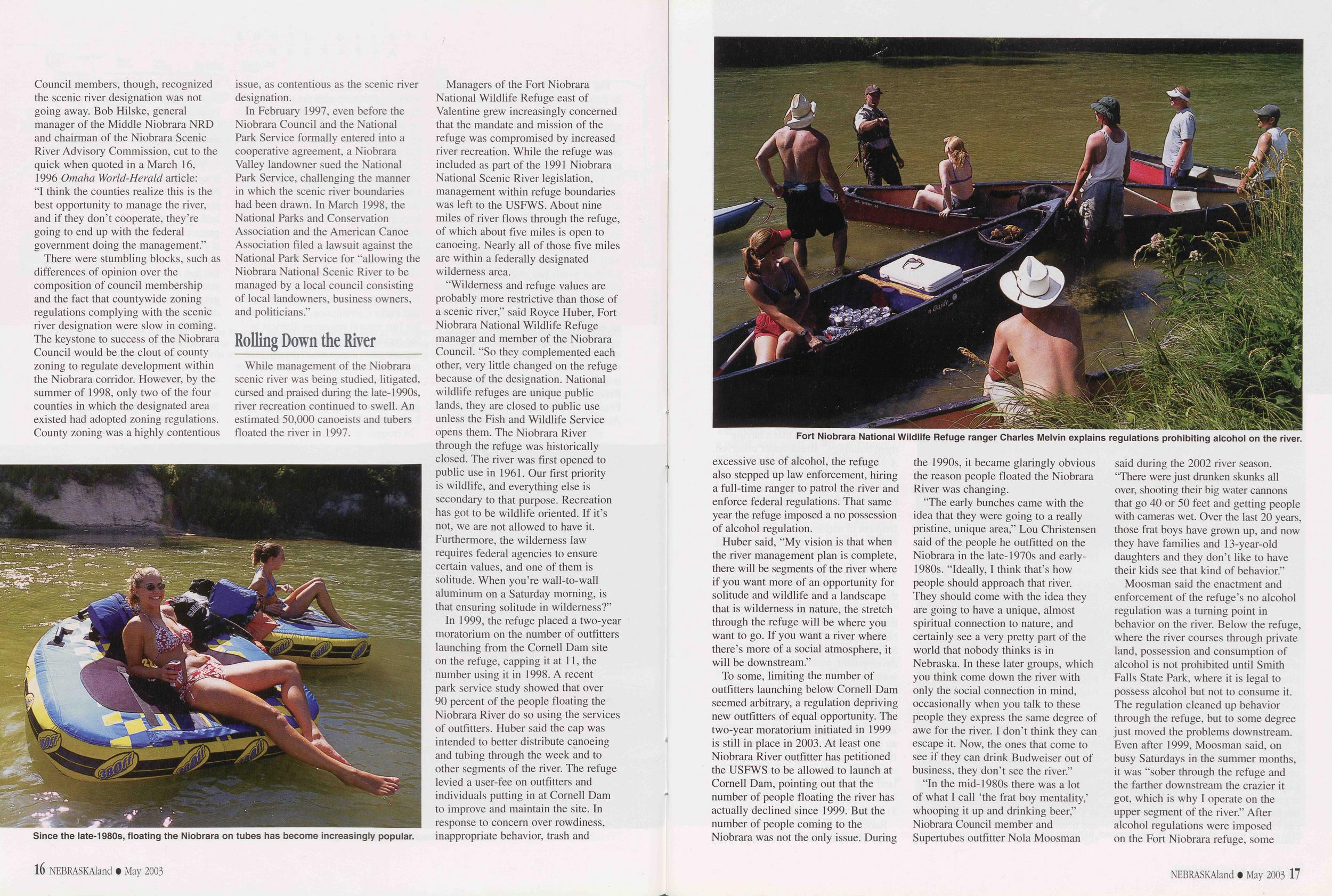 appreciable time from July to September
when flows would be less than the
current water control plan and also less
than the minimum navigation levels."
appreciable time from July to September
when flows would be less than the
current water control plan and also less
than the minimum navigation levels."
Some farmers are concerned about interior drainage problems caused by higher river flows in the areas protected by levees. In these areas, streams flow through the levees when the Missouri's levels are normal. When the river is high, gates are closed so water doesn't back up into the bottomland. Pump stations operated by drainage districts move water from creeks over the levees and into the river.
Allan Adams is the fourth generation to farm bottomland near Peru. His son, Brett, is the fifth. He thinks the Corps has underestimated the damage that can be caused when a heavy rain falls while the river is high. "You can only pump so much," he said. If pumps can't keep up, water can back up and flood fields miles from the river. Closer to the river, groundwater seepage can make fields too wet to plant even before the river reaches flood stage. Farmers and drainage districts developed the land under the assumption that river management would stay the same. Adams said changing things now would be "like changing the rules of a ballgame in the seventh inning."
He added, "The reason they want to do all of this is to save two birds and a fish. Well those two birds and a fish, they're not game birds or a game fish. They're not really good for anything in our point of view."
Navigation interests are opposed to lower summer flows that could require a split navigation season, something they say would break the industry. The Corps estimates the $7 million in economic benefits provided by navigation would be reduced by up to $2 million under the proposed changes. Randy Asbury of the Coalition to Protect the Missouri River, a group representing agricultural and commercial interests, said the Corps estimates are well off the mark and that the mere presence of barge traffic forces railroads to "be more efficient and competitive." This, he said, helps support grain prices.
But those backing changes on the river point out that barge traffic has not met expectations, and the cost of maintaining the navigation channel exceeds the benefits. Projected by the Corps to reach 5 million tons by 1980, commercial traffic peaked at 3.3 million tons in 1977. In 2000, it totaled only 1.3 million tons. Less than a third was grain, according to an Iowa State University study. Most commercial traffic, the study said, is fertilizer brought upriver in the spring and grain shipped downriver in the fall, a schedule that fits with a split navigation season that low summer flows might require.
The National Academy of Sciences report said the Corps Master Manual is "a self-imposed limitation on its discretion" and that the agency is not bound by law to provide a navigation season or flows outlined within the manual. The Academy even suggested the Corps do an incremental analysis of the economic benefits provided to each segment of the river, compared to the amount spent to maintain it. Most commercial barge traffic is in Missouri, and traffic progressively decreases between there and Sioux City. If it were shown that costs outweighed benefits above Omaha, Nebraska City or even Kansas City, it would allow more habitat restoration in those reaches, "changes that would compromise, but not necessarily eliminate, navigational uses," the report stated.
The USFWS said the Corps was to implement flow changes by 2003. The Corps was on pace to meet that deadline until July 2002, when President George W. Bush supported a five-year delay.
In response, a coalition of 10 environmental groups, including American Rivers, took the Corps to court in February, arguing its management of the Missouri violated the Endangered Species Act. A prolonged drought that had drawn reservoirs to nearly historical lows ruled out a spring rise in 2003. But environmental groups and upstream states, which were concerned about low reservoir levels, still wanted the Corps to reduce summer flows. Supported by the state of Missouri, the Corps planned to continue its water releases to maintain navigation. In Nebraska, the opinions on reduced summer flows were split: the Game and Parks Commission backed low flows while others, including the attorney general and governor, backed higher flows. Upstream states 16 NEBRASKAland • December 2003
The issue bounced between courts, and judges issued conflicting rulings. In August, the Corps complied with one ruling and lowered flows for three days ending August 15, a date chosen to coincide with the end of the tern and plover nesting seasons. Municipalities along the river expressed fears that flows would drop river levels below their water intake pipes. Power plants, which draw cooling water from the river, feared they would have to cut production. Marina operators feared boaters would not be able to get through channels that led from docks to the river. Others feared it would halt all recreational boating on the river.
"What's happened over time, because of the way the Missouri River is managed, is people have almost come to think of it as a lake," said Chad Smith, director of American Rivers' Nebraska field office. "And it's not a lake. It's a river and people need to understand that water levels go up and down on a river."
The lower flows in August 2003 were a test under difficult conditions - a drought that reduced inflows. But, of all the fears, there were few adverse effects. The city of Omaha closed one marina to protect its docks and some large boats had difficulty getting in and out of other marinas. The Commission contends those issues can be resolved. Boat ramps on the river were functional.
"What it shows is that in the real world, if you can break through all of the rhetoric, teeth gnashing and hand wringing, the bottom line is that we can make these modest flow changes, do better things for the river and life goes on," said Smith.
The Benefits of ChangeWith normal releases, water levels in the channelized reach run high on the river's steep banks, giving boaters few places to stop. River levels last summer were lower than normal because of drought and the reduced releases. These lower flows exposed sandbars below wing dikes, providing boaters, sunbathers and picnickers room to roam.
"This gives the kids a place to play," said Susie Ledger of Omaha, as her children played and swam in the shallow water next to a sandbar north of Omaha where her family beached their boat the first Sunday in August.
A week later, when flows dropped further to meet the court order, even more sandbars were exposed, especially between Gavins Point Dam and Ponca State Park. It is there that flow changes will provide the most benefits to least terns and piping plovers.
Summer releases from Fort Randall and Gavins Point dams were higher than normal from 1995 through 1997. The releases were double the norm in 1997, but less than what is proposed for a spring rise. The high flows rebuilt sandbars in the unchannelized reaches and scoured them of vegetation. With ideal habitat, average production of both terns and plovers from 1998 to 2001 increased by more than 200 percent in those reaches when compared to the averages for 1986 to 1994.
Corps biologists monitoring nests
between Montana and Ponca have
documented record production for four
years straight, in part because of habitat
created in 1997, and in part because of
drought. Greg Pavelka, who monitors
tern and plover nests on the river in
northern Nebraska, said 829 of the
1,338 adult plovers nesting throughout
the Missouri this year used the shoreline
exposed by falling water levels at Lake
Sakakawea and Lake Oahe. Pavelka
said 51 of the birds nested in the reach
between Fort Randall Dam and Lewis
and Clark Lake, where there had been
NEBRASKAland • December 2003 17
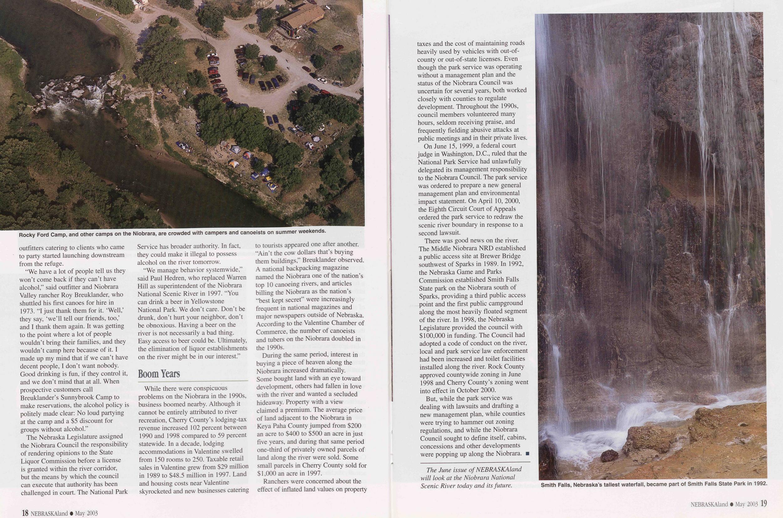 almost no activity before the high
flows. Another 286 plovers nested
between Gavins Point Dam and Ponea.
almost no activity before the high
flows. Another 286 plovers nested
between Gavins Point Dam and Ponea.
Production in that reach has remained high for longer than expected, Pavelka said. "We expected, at most, four to five years of good production, and now we've had six years," he said. But the river has eroded more than 40 percent of the 3,016 acres of sandbars available in 1998, and vegetation has covered 80 percent of what remains, forcing the birds to concentrate in a few open areas. Production fell in the same reach for the endangered tern, which requires more riverine habitat than plovers. Considering 366 of the 741 terns nesting on the system did so in that 59-mile reach, continued decline in habitat there does not bode well for the species.
For fish, the first mitigation project completed in Nebraska, a flow-through chute at Hamburg Bend, demonstrated what habitat and high flows could provide. In 1997, the river left its banks and covered the entire bend, scouring the newly reopened chute as well as other areas. Sampling by Commission biologists found increased production of native chubs and minnows following the wet period. But the river has not been out of its banks since, and populations have quickly declined. "Habitat alone is not enough to sustain the positive responses," said Gerald Mestl, a Commission fisheries biologist working on Missouri River programs. "But if you build the habitat and get the flows, you will get the response."
Those years also showed what high flows can do for terrestrial habitat along the river. New growth of cottonwoods and willows, which had for the most part ceased throughout the Missouri River, was found in many areas. And some new wetlands were scoured in the floodplain between the levees.
In restoring habitat along the Missouri, other states have focused on creating terrestrial habitat. For many years the Commission's guiding philosophy in restoration has focused on creating aquatic habitat. "You start with aquatic habitat and the other habitats will follow," said Scott Luedtke, a Commission wildlife biologist who works on river habitat projects.
According to Corps estimates, recreation provided $87 million in economic benefits in 1994. About three-fourths of those benefits are realized in the upper basin states, primarily in the large reservoirs in the Dakotas and Montana. Those states want their interests placed on equal footing with navigation and want the barge industry to share more of the pain in drought years. South Dakota Game, Fish and Parks estimated receding water levels at Lake Oahe in 2003 would cost the state's economy $9.6 million. Similar losses were expected in North Dakota, which saw Lake Oahe recede from its borders for the second time and watched Lake Sakakawea approach record lows.
Zuerlein believes a healthier river in the channelized reaches will provide more economic and recreational benefits, too. More than 40 percent of Nebraska's population lives in counties that border the river, and studies have shown a need for more water-based recreation opportunities in eastern Nebraska. Lower flows will make the river more inviting to smaller craft. Zuerlein pointed out that in a restored river, fish and wildlife populations will increase, leading to more fishing, hunting and wildlife watching opportunities.
Through the mitigation project, the decision has already been made to restore habitat. Resolving the flow issue will not be the last difficult decision to make for the river. For example, biologists believe more sediment should move through Lewis and Clark Lake, where it causes 18 NEBRASKAland • December 2003
If nothing is done to restore the health of the Missouri's ecosystem, more than the least tern, piping plover and pallid sturgeon could disappear. In all, 82 species of fish, birds, plants, reptiles, mammals, insects and mussels native to the Missouri are now rare, threatened or endangered. "Current operations, if continued without significant alterations, likely will cause further declines in other native species and likely will result in additional species being listed as threatened or endangered," the USFWS said in its biological opinion.
The Corps, in its proposed Master Manual revision, suggested incorporating adaptive management in its operations. The philosophy calls for the testing of theories, monitoring of the tests and basing management decisions on what is learned. The National Academy of Sciences report recommends the Corps abandon its Master Manual revision and move ahead solely under the guiding principal of adaptive management. The manual can then be revised when more questions have been answered.
The Academy's report said a stakeholders group should be formed to form consensus- and science-based river management decisions. It said Congress should enact legislation that would facilitate recovery of the river ecosystem, including authority for the Corps to compensate those adversely affected by changes in dam operations.
"They're basically saying 'Let's set up some experiments and try a few different things and acknowledge we're not going to know everything about everything immediately,' " Zuerlein said. "So you do things on an incremental basis. You try it and if it works, you do more."
No matter what decisions are made regarding the future of the river, the Corps will likely find itself in court. The legal battles could take as long or longer than the process to revise the Master Manual, which the Corps said should be finished this year. Any decision will have negative effects on someone or something somewhere along the river. But so does continuing to operate the river as is.
"If we wait until we know everything there is to know about the Missouri River, the world will have come and gone," Zuerlein said. "We need to change because the opportunity to do a lot of different things is there. We know what the problems are, let's fix them."
More information about the Missouri River is available at these web sites: American Rivers: www.americanrivers.org/ U.S. Fish and Wildlife Service: www.r6.fws.gov/MissouriRiver/ U.S. Army Corps of Engineers: www.nwd-mr.usace.army.mil/ mmanual/mast-man.htm U.S. Geological Survey: infolink.cr.usgs.gov/ Coalition to Protect the Missouri River: www.protectthemissouri.com/ National Academy of Sciences: www.nap.edu/books/Q309083141/html/ NEBRASKAland • December 2003 19
Indian Cave's Night Gliders
Text by By Richard Bischof, Nebraska Game and Parks Commission Wildlife Biologist Photos by Doug Carroll Capturing and tagging flying squirrels in Nebraska's dwindling hardwood forests is tricky business. The payoff is a close look at our most nocturnal mammal, and a chance to learn about this tiny species at the edge of its range.Just arrived at nest box 21 - nine more to go after this. We are on the hiking trails of Indian Cave State Park, located along the Missouri River in southeastern Nebraska. It's raining, but not heavily, just enough to soak everything on this otherwise fine October day. The rain would be worse without the remaining foliage of the deciduous trees surrounding us.
That doesn't comfort Ralph Wall, the Nebraska Game and Parks Commission's video and radio production specialist. After an hour and a half of hiking, he is tired of carrying his heavy video equipment up and down the rugged terrain while trying to keep it dry. Most of all, he is disappointed because he has not yet been able to film a southern flying squirrel while we tag it.
EAR-TAGGING southern flying squirrels, which are using nest boxes that we put up, is part of a marking and recapturing project that allows us to monitor individual animals. We expect the study to provide information about the survival rates, dispersal and size of the flying squirrel population at Indian Cave. Two biologists, a photographer and Caleb Morgenson, the assistant superintendent at the park, are also along for the nest box check. Everyone is eager to see a flying squirrel up close. Desperate to get any footage he can, Ralph had earlier videotaped a deer mouse we removed from one of the nest boxes. Excitement sets in when we realized, after a quick peek, that flying squirrels occupy box 21.
TO THIS POINT, we had found only one flying squirrel in a nest box; unfortunately it escaped before we could get a firm hold on it. The squirrel scrambled up the tree, took a quick leap, then spread its gliding membranes and sailed to a nearby tree. Contrary to their name, flying squirrels do not fly, but they are great gliders. The patagium, a fold of skin extending to the wrists between the front and hind legs, acts as a gliding surface and the squirrel's long and flat tail functions as a rudder. This setup allows flying squirrels to glide for distances up to 50 feet, and even steer around obstructions in their path, typically landing on vertical surfaces, such as the trunks of trees. If not for their gliding membranes and flattened tails, flying squirrels would look like small, bug-eyed tree squirrels. Their large eyes confirm nocturnal habits; they are probably the most nocturnal of 20 NEBRASKAland • December 2003
TO EXTRACT a flying squirrel
from a nest box, you can sometimes
knock on the box and the squirrel will
scramble out of the opening and it can
be captured in a bag or a wire-mesh
cone. This method often works, but not
always. Southern flying squirrels are
the smaller of the two flying squirrel
species that occur in North America.
Adults typically weigh between 1.6 and
2.7 ounces and measure nine inches
from nose to tail tip. They are small
enough to squeeze Houdini-style through
tiny cracks and holes. Thus, while trying
to coax reluctant squirrels out of nest
boxes, escapes can, and do, happen.
And, oh yes, flying squirrels bite, too.
NEBRASKAland • December 2003 21
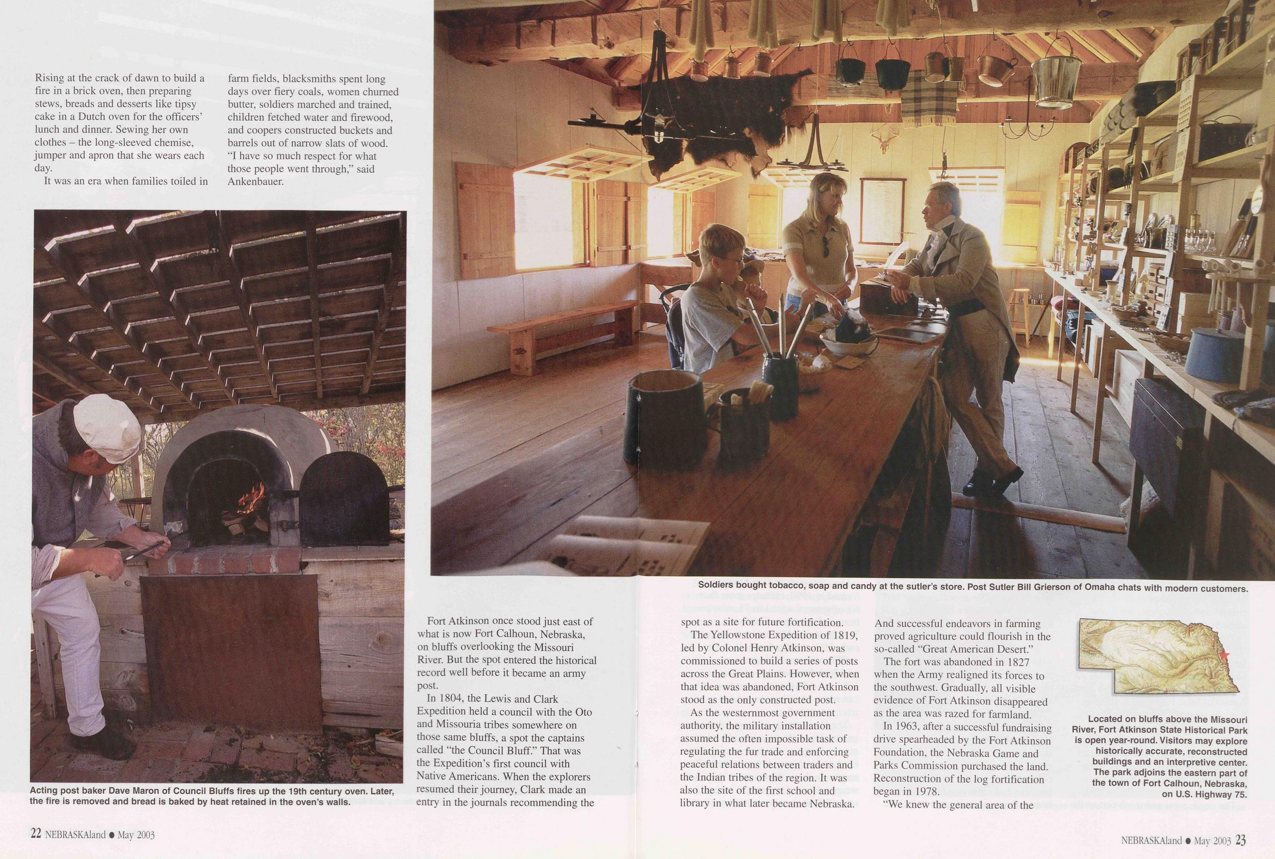 NEST BOX 21 has flying squirrels
in it, and the pressure is on. I place a
wire cone over the entrance hole and
begin tapping the bottom of the box. A
flying squirrel quickly climbs into the
wire cone and I make my first mistake.
Just as I grab the cone with the flying
squirrel in it, sealing its opening with
my gloved hand, two more squirrels
escape through the nest box opening.
Hastily, I stuff a leather glove from my
free hand into the nest box opening,
hoping there might be more animals in
the box. Then, I climb down the ladder
to tell my colleagues about the capture
and the escapees.
NEST BOX 21 has flying squirrels
in it, and the pressure is on. I place a
wire cone over the entrance hole and
begin tapping the bottom of the box. A
flying squirrel quickly climbs into the
wire cone and I make my first mistake.
Just as I grab the cone with the flying
squirrel in it, sealing its opening with
my gloved hand, two more squirrels
escape through the nest box opening.
Hastily, I stuff a leather glove from my
free hand into the nest box opening,
hoping there might be more animals in
the box. Then, I climb down the ladder
to tell my colleagues about the capture
and the escapees.
YES, TWO GOT AWAY but we have one to ear tag. Ralph's face lights up as he begins setting up his video camera to finally get the footage he has been waiting for all morning. He gets close enough to witness how the flying squirrel in the wire cone pushes my hand off the opening and follows his box-mates to freedom. Aaargh!
Lucky for me, and to everyone's surprise, there are two more flying squirrels hiding in the nest material in Box 21 that we capture and tag. Caleb ear-tags his first flying squirrel and gets bitten, Ralph gets his footage, and I get my data.
THIS STORY BEGAN in 2001, when Nate Stender, a volunteer, and I pushed a wheelbarrow filled with flying squirrel nest boxes up and down muddy paths at Indian Cave State Park, armed with an aluminum ladder and a battery-powered drill. Nate had just finished building the boxes and we were selecting mature oak and hickory trees to attach them to. Flying squirrel nest boxes had been used at the park and some other areas in southeastern Nebraska in the past. Old boxes can still be found dangling from trees, often severely damaged by weather and fox squirrels, which chew on the boxes and occasionally establish residences.
The nest boxes we were putting up would serve two purposes: Not only are they a great way to study flying squirrels, but they also supplement natural nesting sites that are becoming increasingly rare in many parts of Nebraska's flying squirrel range. Southern flying squirrels prefer mature deciduous forests with an abundance of mast, especially acorns and hickory nuts. Because of their small size, they are at risk of hypothermia in winter, so southern flying squirrels depend more on tree cavities (or nest boxes) as den sites than do larger northern flying squirrels or tree squirrels. Like tree squirrels, flying squirrels do not hibernate during the winter.
A FEW MONTHS AFTER we installed the nest boxes at the park, flying squirrels began leaving signs of visiting some of the boxes. We found the empty shells of hickory nuts and acorns, with neatly cut openings as proof of the foraging skills of these little squirrels. Although nuts make up
SOON AFTER those initials signs, we found flying squirrel nests in a few boxes - sometimes the dry, green leaves of ironwood or oak, and sometimes fine strips of light, inner bark resembling fancy packaging material. Eventually we found flying squirrels, individual animals as well as groups of juveniles or adults of both sexes. Often flying squirrels will use the same nest to share body heat during cold months. We have found as many as eight flying squirrels squeezed into a single nest box the size of a shoebox and many more share larger, natural nests.
FOR A BIOLOGIST, the most exciting event is to find a mother in a nest box accompanied by several tiny babies hidden in the nest material. Flying squirrel mothers are very protective of their young, and usually will not leave the vicinity of the box even when disturbed. This makes studying flying squirrels easier, because they are relatively tolerant of brief disturbances and mothers will not abandon their litter. Two to four young are born after a 40-day gestation period and even though they are blind for the first four weeks of life, their gliding membranes are already visible - as a trademark of their species and a herald of glides to come.
Southern flying squirrels usually breed twice a year, once in late winter and again in midsummer. Young flying squirrels grow quickly and are weaned when they are about six to eight weeks old, but they remain with their mother until shortly before she gives birth again.
ALTHOUGH SOUTHERN FLYING squirrels are rare in Nebraska and are listed as an endangered species in the state, they are quite common in other parts of the country. Nebraska is at the periphery of their distribution, which includes most of the eastern United States and ranges from as far north as Minnesota to the Gulf Coast.
If they are so abundant elsewhere, why worry about the Nebraska population of flying squirrels? For one, they are an important part of our state's natural diversity, and fascinating inhabitants of the oak and hickory forests and woodlands that have all but disappeared from the state. While nest boxes help us learn more about this species in our state, and while they might complement naturally occurring nesting and hiding sites, they cannot take the place of actual flying squirrel habitat.
Conversion of forests to croplands and pasture, urban expansion and logging have decimated the available homes and food sources for this tenant of deciduous woods in Nebraska. That alone is reason to keep a finger on the population's pulse, but there are other reasons for closer monitoring and protection, too. Nebraska's flying squirrels are at the utmost edge of the the species' range. Range edges are special because conditions are often marginal, making these populations even more sensitive to additional stresses. Thus, changes, good and bad, are often first noticed at the edge of a species' range.
Morgenson and Tom Morrison, the Indian Cave State Park superintendent, now check flying squirrel nest boxes every two months. They ear-tag new captures and record the tag numbers of flying squirrels caught earlier. Since December 2002 they tagged and released 19 flying squirrels.
And every now and then a flying squirrel still escapes untagged, m Using a small pair of pliers, Bischof carefully attaches an ear tag.
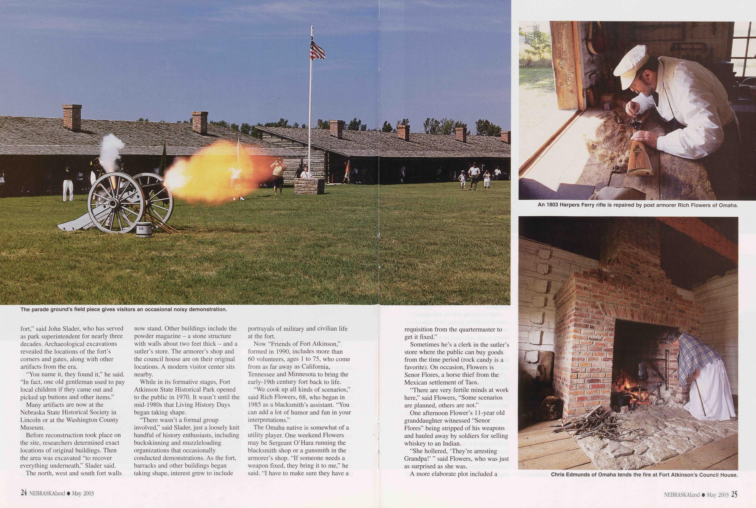
High Plains Digital
Photos and text by Bob Grier Between day's first light striking Sugarloaf and its last glow cast on Montrose Church, northwestern Nebraska's grasslands and badlands present a wealth of landscape and wildlife images. Recent developments in digital photography have enhanced the tools now available to capture this region's visual riches.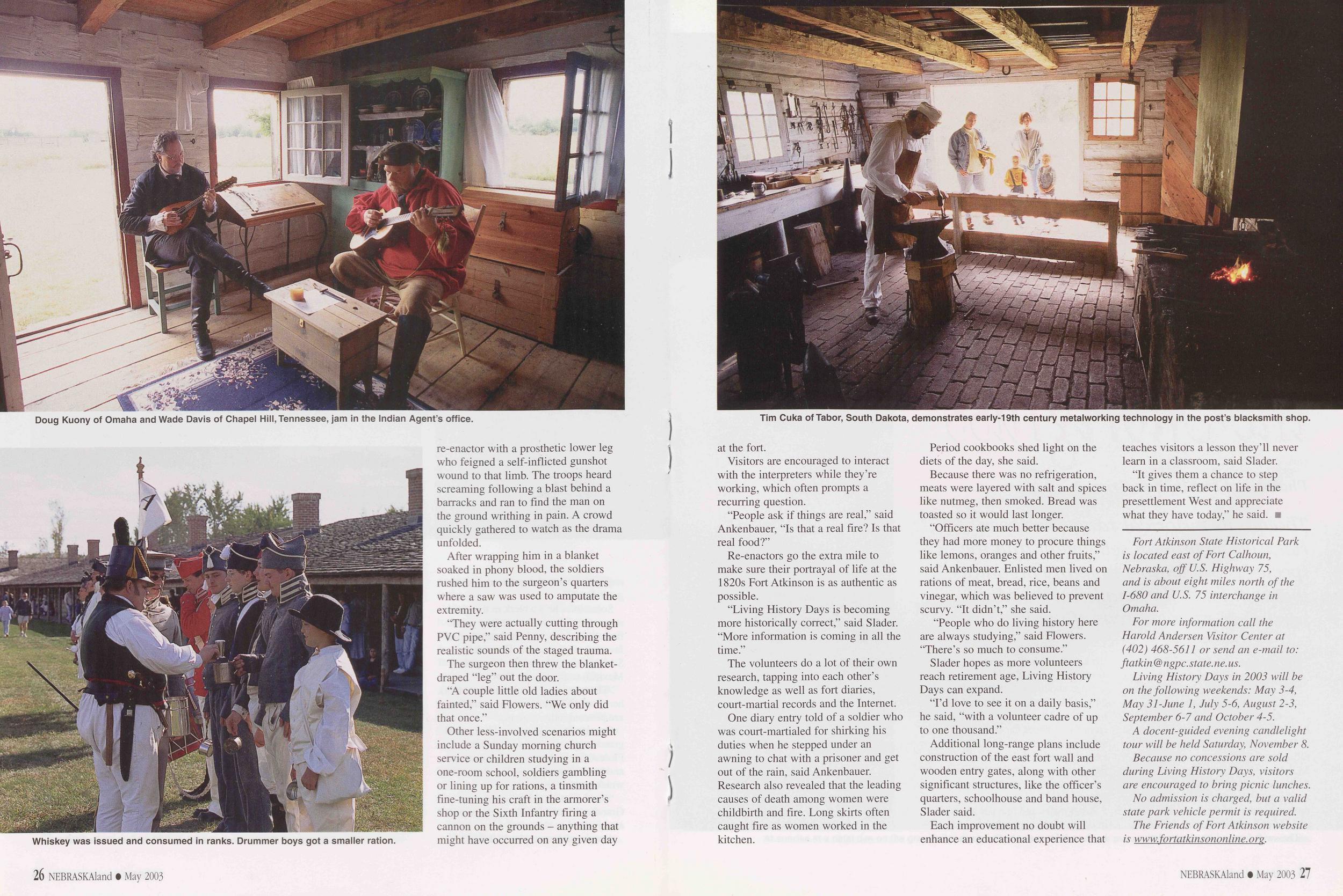
A landscape masterwork - Toadstool Park's nuanced shapes and muted colors beneath a gossamer sky - and a wildlife portrait - an elegant mule deer in an impressionistic grassland - attest the new technology's precision.
In the span of a few years, digital images have become comparable to those captured with the best light-sensitive film developed over 160 years.
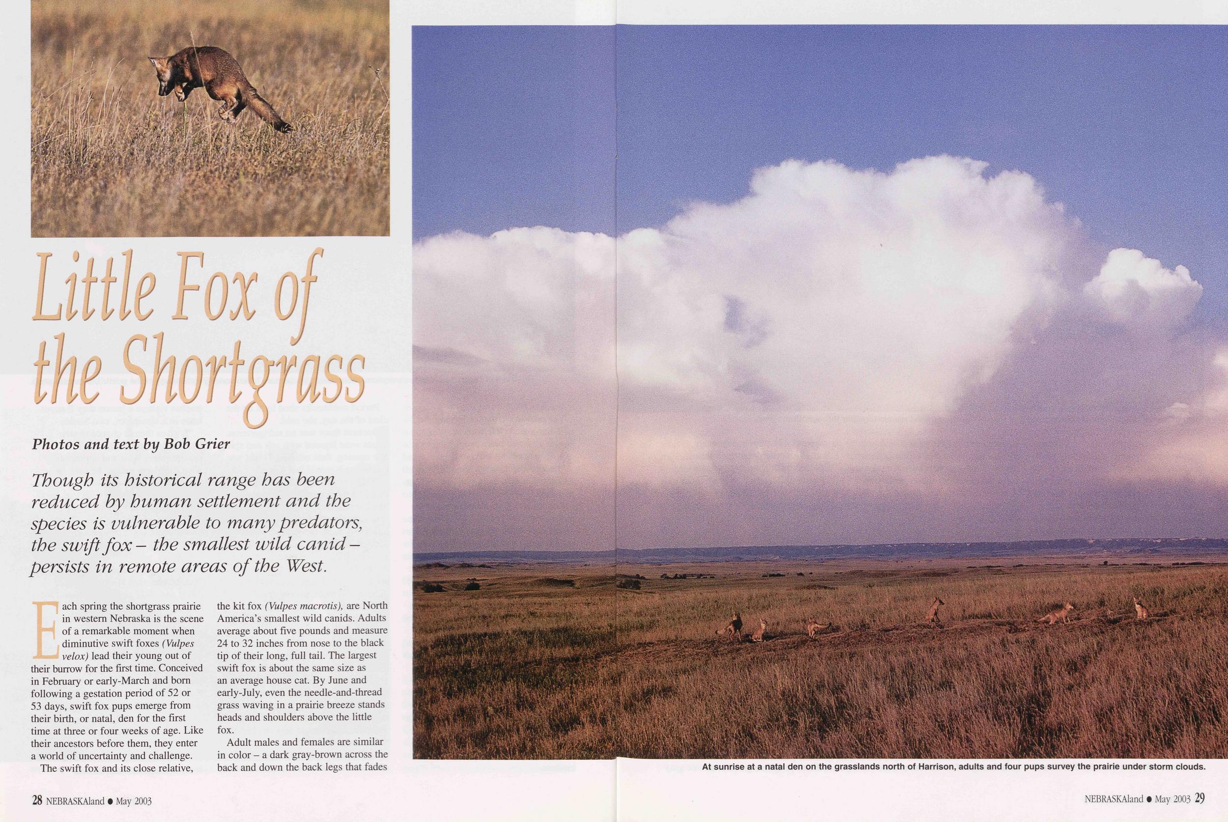
Equipped with small screens, today's best digital cameras photographers instant feedback - displaying composition and exposure in the field, and often allowing second and third chances to improve images. With editing software and a personal computer, digital technology also increases photographers' control over the images they capture - a role usually played by technicians in darkrooms with color film.
A pronghorn herd at full tilt and a bighorn ram headed downhill become artistic streaks of speed against vibrant, colorful habitat blurs.
28 NEBRASKAland • December 2003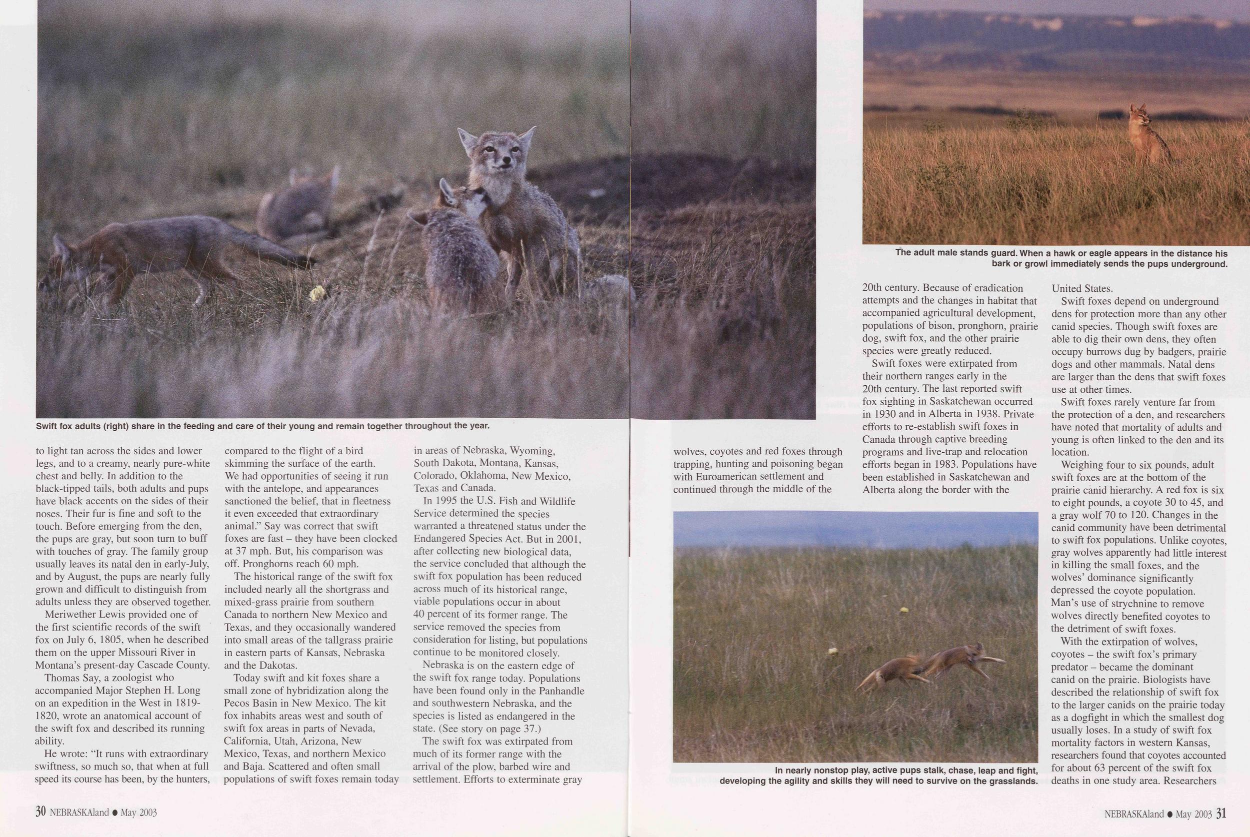
Panoramic composite images are easily stitched together using digital editing software. The length of the Pine Ridge on the horizon requires three or four horizontally framed images and about 15 minutes at a computer workstation. Such stitched images are similar to wide-format photos captured with specialized, panoramic film cameras.
30 NEBRASKAland • December 2003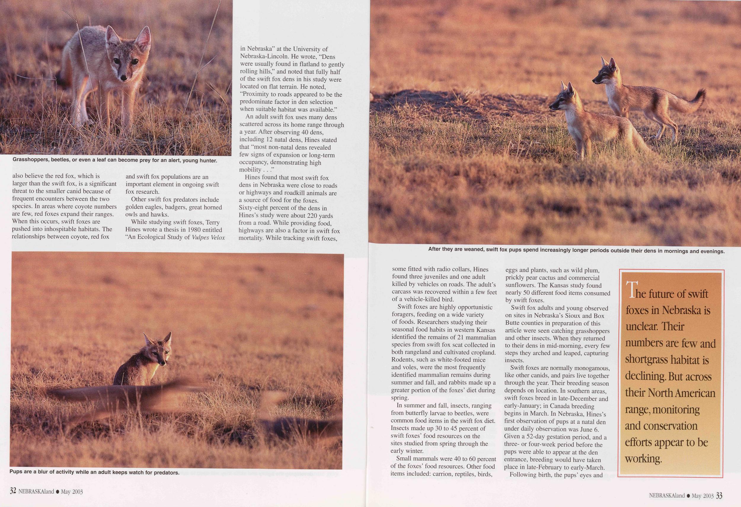
Us image of the moon above Montrose Church in Sioux County is reminiscent of Ansel Adam's famous 1941, black-and- white photo titled "Moonrise over Hernandez."
Adams, one of Americas most revered landscape photographers, did not live to see digital technology. But, given his gentle enthusiasm for innovation, if he were alive today it is easy to imagine Adams capturing nature in the High Sierras, with one of today's whiz-bang, battery-powered digital marvels, m
NEBRASKAland • December 2003 33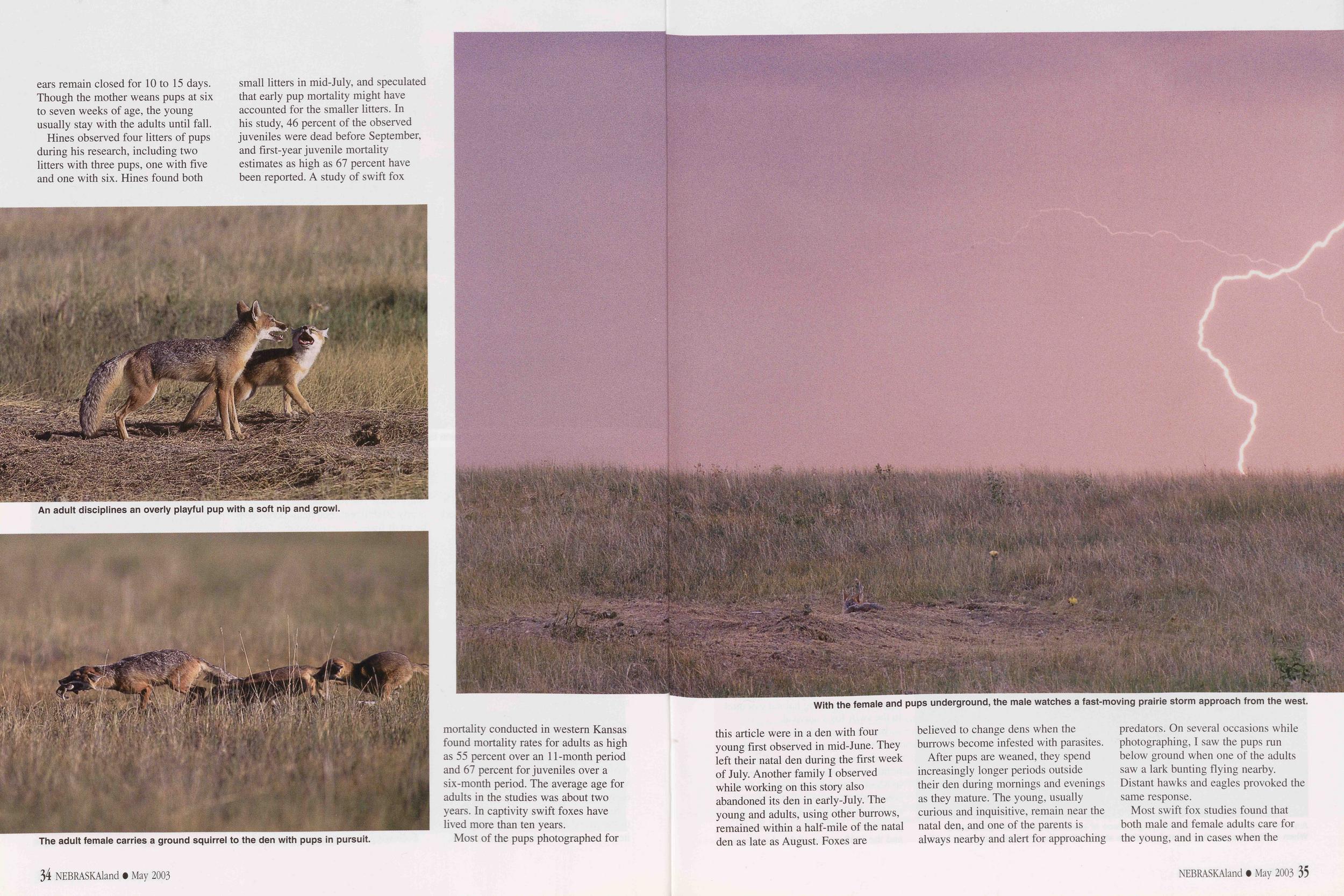
The Bounty of Tall Stubble
Photos and text by Bob Grier Recent research, innovative farming practices and habitat improvement programs are all focused on increasing upland game bird populations and farm incomes in western Nebraska's High Plains.Research, real farm costs and profits are proving the value of tall wheat stubble in conserving soil moisture and improving pheasant habitat on the High Plains. The region, which includes western Nebraska, southeastern Wyoming, eastern Colorado, and western Kansas, normally receives 14 to 19 inches of precipitation during a year. Continuing drought has hit the region hard, and agronomists, farmers, wildlife biologists and conservation groups have joined forces to seek better practices.
In western Nebraska, a partnership between the Nebraska Game and Parks Commission, the South Platte Natural Resources District and Pheasants Forever has developed the Tall Wheat Stubble Management Pilot Program, now in its second year.
"The program basically pays the landowner incentives depending on the level of management on the enrolled acres of wheat stubble," said Ritch Nelson, a Commission district habitat manager from Alliance. The program is currently offered in Kimball, Cheyenne and Deuel counties located in the southern Panhandle. Nelson said the pilot effort has shown promise. In addition to conserving soil moisture and improving pheasant habitat, it has increased income to participating farmers and opened more acres to walk-in public hunting similar to the Conservation Reserve Program- Management Access Program (CRP-MAP).
Wheat-fallow is the predominant farming practice in the High Plains. To conserve moisture, farmers generally plant winter wheat in a field once every two years. After the wheat is harvested the field remains idle, or fallow, for the following 14 months. Wheat-fallow fields are often planted in long strip patterns perpendicular to prevailing winds to reduce soil erosion. From the air, the alternating strips of wheat and fallow form a characteristic, and almost uniform, striped landscape across much of the High Plains.
The wheat-fallow cycle begins when winter wheat is planted in early-September. The seeds germinate and plants grow in the fall before they enter a period of dormancy in winter. Spring brings a period of fresh growth, and harvest usually begins in July.
Historically, this wheat-fallow agriculture supported thriving ring-necked pheasant populations during the first half of the 20th century. Weedy fields, fencerows and abandoned farmsteads provided pheasants the necessary types of cover for raising broods and surviving harsh winter weather. While the wheat strips lacked tall structure and diverse vegetation, they offered pheasants large blocks of nesting cover undisturbed by farm machinery until after their chicks had hatched, usually in June.
Beginning in the 1960s, however, pheasant populations began a precipitous drop. In many areas, their numbers have declined 75 percent or more during the past 30 years. While the general appearance of the High Plains showed 34 NEBRASKAland • December 2003
The most obvious landscape changes included center-pivot irrigation adopted in the 1960s, and fencerow-to-fencerow farming of the 1970s. More subtle, incremental changes included the use of more efficient farm machinery, shorter varieties of wheat resistant to lodging - areas where wheat stems lay on the ground - and widespread use of herbicides to kill vegetation including volunteer wheat, and broad-leaved weeds, such as sunflower, kochia and pigweed, as well as downy brome, foxtail and other undesirable annuals.
In 1990 Randy Rodgers, a Kansas
biologist, set out to study how changes
in traditional wheat-fallow management
practices affected pheasants. Looking
at residual cover or stubble remaining
in the fields after harvest, Rodgers'
research revealed that different stubble
heights had significant effects on
pheasant populations. On average,
NEBRASKAland • December 2003 35
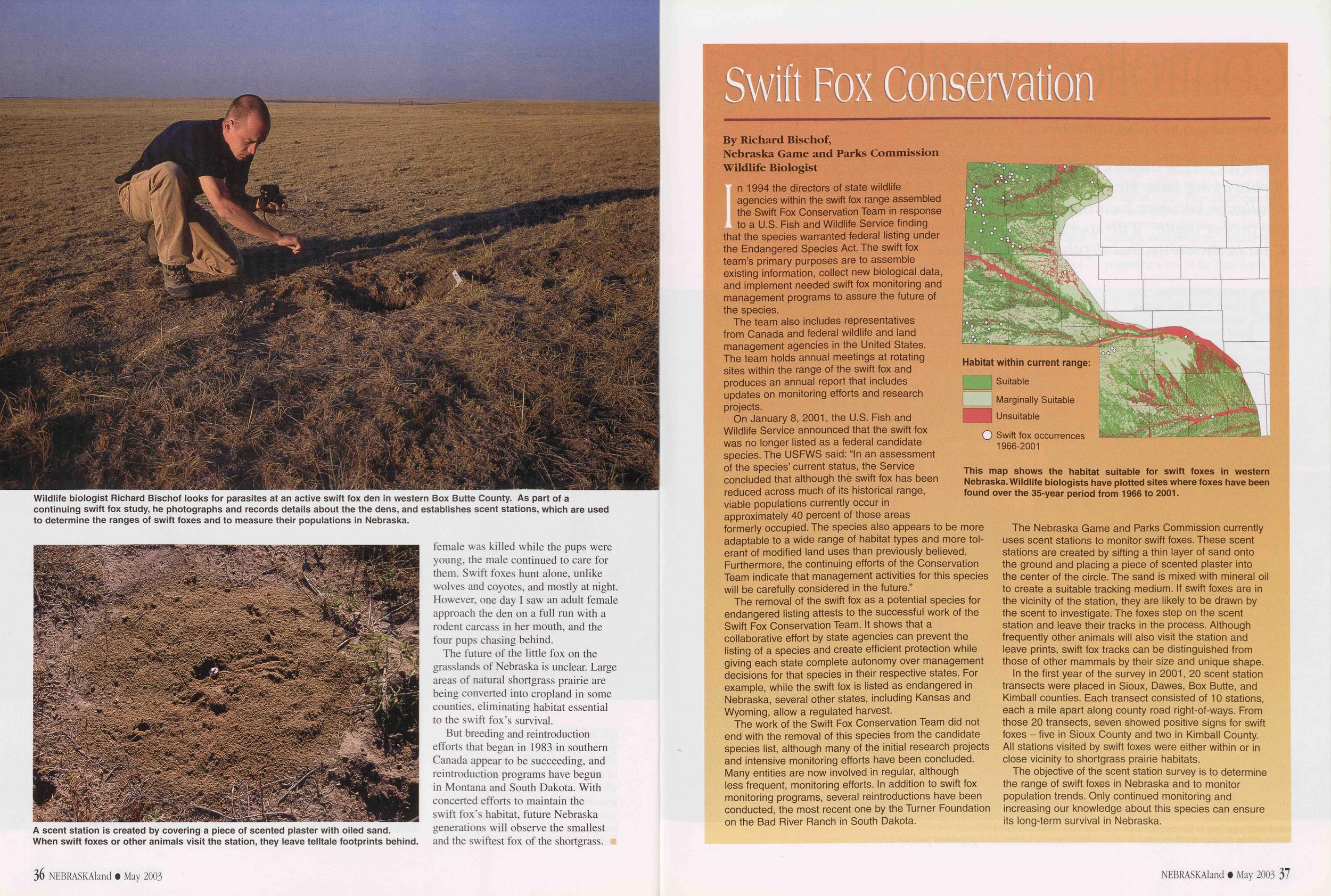
"Put another way, every five inches of additional stubble height resulted in a tripling of pheasant use," Rodgers wrote in his original five-year study in northwestern Kansas. He also reported that short stubble was more readily invaded by grassy weeds such as foxtail, downy brome and rye, which are less beneficial to pheasants than broad-leaved weeds such as sunflower, kochia and pigweed.
More recent economic studies of actual farm costs and profits by agronomists and others at Kansas State University show tall stubble has a dramatic effect on a producer's bottom line, too.
The economics of three wheat-fallow cropping systems were tested at the KSU Southwest Research and Extension Center at Tribune, Kansas, between 1996 and 2001.
The no-till (NT) system used herbicide weed control throughout the 14-month fallow period. Sweep tillage was used for weed control throughout the fallow period in the conventional tillage (CT) system. The delayed minimum tillage (DMT) system used no post-harvest weed control, one herbicide treatment for initial weed control in spring, and sweep tillage for the remainder of the fallow period.
The following chart compares the costs, yields and profits per acre for the three systems in the test.
Non-harvest costs ..............$99.13 $81.05 $69.80 Harvest costs..$24.26 $19.98 $21.82 Total cost ....$123.39 $101.03 $91.62 Yields.............. 53.2b 36.5b 43.7b Gross return..$153.76 $103.99 $130.66 Net returns ....$30.37 $2.95 $39.05This real-world test found that farmers who use the delayed minimum tillage system would see significantly greater net returns, or profit per acre.
Nelson said, "Rodgers's studies of High Plains wheat-fallow systems and the ongoing research by agronomists at KSU suggest the Tall Wheat Stubble Management pilot program is a perfect fit for wheat-fallow areas here in Nebraska. The partnership between Game and Parks, the South Platte Natural Resources District and Pheasants Forever enrolled roughly 1,600 acres during the 2002-2003 hunting season in Kimball, Cheyenne and Deuel counties and a similar enrollment is expected this season. Producers have used each of the three different options here in western Nebraska."
Two other NRDs in western Nebraska have approved the concept or practices and the pilot program might expand into other areas. The program used incentive payments of $1, $3 and $5 per acre. The lowest rate is for tall stubble - 15 inches or more - and there are no restrictions on herbicide use. To receive the $3 per acre payment, landowners must provide tall stubble, and not conduct after-harvest weed control. There is also a restriction that any spring herbicides used on green wheat must not suppress weed growth through residual effects after harvest. The $5 option is identical to the $3 practice, and the landowner agrees to 36 NEBRASKAland • December 2003 leave the stubble through the nesting season the following spring, or through June 30.
Nelson said, "In my opinion, the intent of the $1 per acre enrollments is to provide basic winter cover, but it is not ideal [for pheasants] by any means. Then, in the $3 fields, we require tall stubble with pheasant-friendly weeds resulting from weed control restrictions. This will provide important brood habitat since these weeds produce bountiful insect populations, which are eaten by the young chicks. Furthermore, the weed "skeletons" and associated seeds will enhance the winter cover quality in the tall stubble. Finally, the $5 option has all of those benefits plus providing suitable nesting cover the following spring."
Participating landowners must also allow walk-in public access for hunting.
While this program is ideal for wheat-fallow farming areas, Nelson said there is some indication that the tall stubble component will also benefit fields where wheat is used in rotation with row crops such as corn. Leaving the tall stubble to capture snow in winter provides more soil moisture.
Nelson said the required parameters of the pilot program can be changed in ways that are mutually acceptable.
"For example, some participants want to be able to spray herbicides in late fall to control volunteer wheat, and at least for now, we've agreed to that as long as it is done in late-September just before frost. Even though the herbicide will kill all of the vegetation, the weeds have done their job basically. They've provided brood cover, they have set seed, and the weed skeletons will help provide winter cover and help catch and conserve soil moisture. In another adaptation of the program, we recognize that a producer might have only eight to 10 inches of stubble and still have a lot of quality broad-leaved weed cover from the pheasant's prospective and we didn't want to exclude those fields from the program. To be fair, if the weed cover is basically 15 inches or more, even though the stubble might be shorter, those fields are still eligible for the program, but at the next lower rate.
"We basically have three parameters that we want to meet. First is tall stubble - 15 inches or more. We also want good distribution of broad-leaved weeds in that stubble post-harvest. We are selective as to what we consider beneficial broad-leaved weeds such as sunflower, kochia and pigweed. The third parameter is we want the cover to remain in the field through the following spring and the pheasant nesting period
"Perhaps a better way to describe the pilot program's payments, the producer will receive the $ 1 per acre rate if they meet the stubble height or the weedy stubble parameter. They'll receive $3 per acre for meeting two of the three parameters, and the $5 rate for meeting all three.
"We chose 15-inch stubble because we felt it was attainable by some producers depending on the variety of wheat they plant and the type of harvest equipment they use. We work on an average, if the stubble is 11 inches tall on the hill and 18 inches in the draws, we will accept that. The big issue, we are trying to provide a micro-site that promotes beneficial broad-leaved weeds as opposed to a site that seems to be more prone to weedy annuals like jointed goat grass, volunteer wheat and rye as well as downy brome. But every field and growing season is different, this is not a fool-proof concept. At the very basic level, we are providing a pilot program for producers in those counties, and we are promoting wheat stubble management practices that benefit both pheasants and the ag producer's bottom line." a
For more information, contact Ritch Nelson at the Nebraska Game and Parks Commission, Box 725, East Highway 2, 299 Husker Rd., Alliance, NE 69301 (308) 763-2940.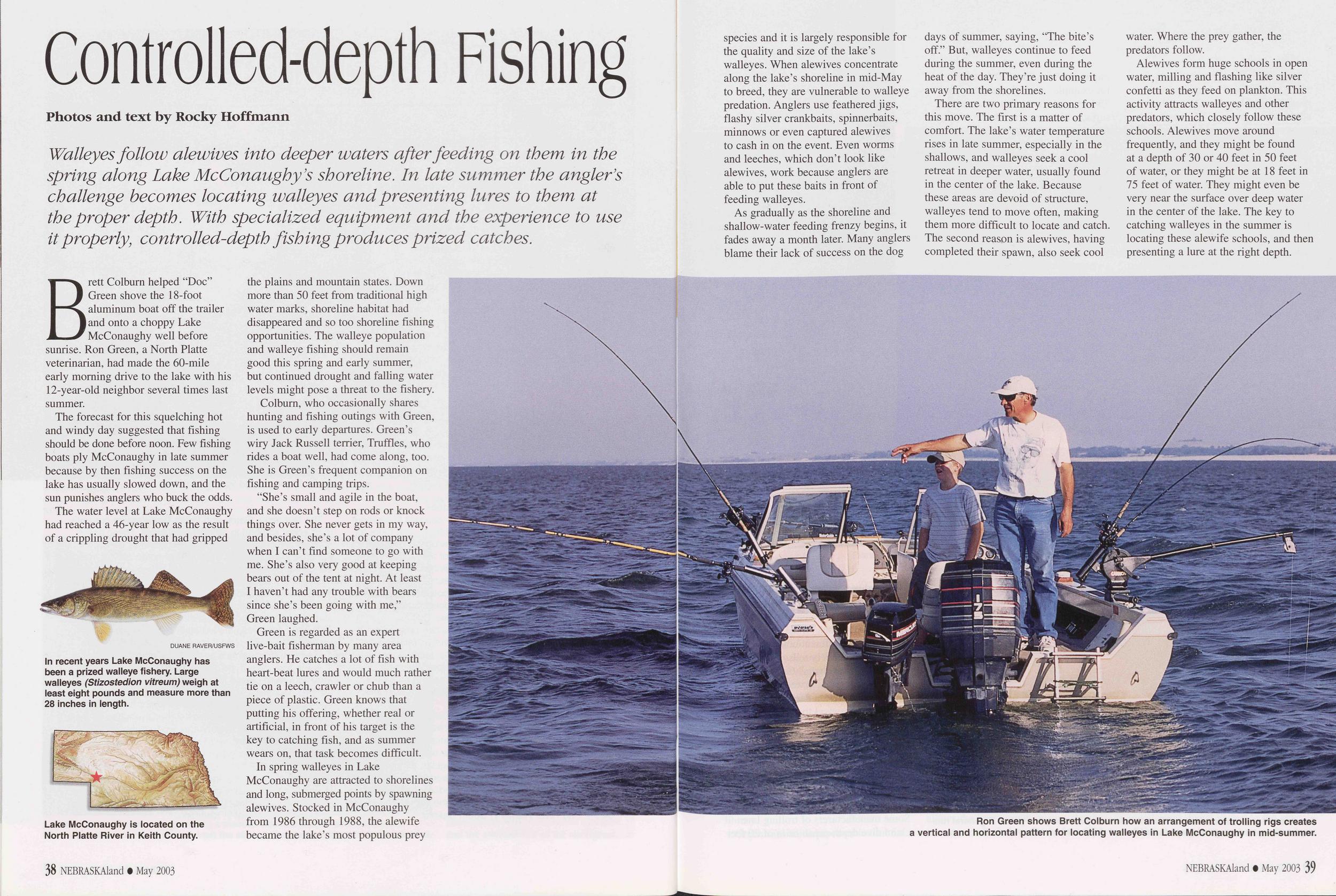
AN ELK-HUNT ON THE PLAINS
By Frederick Schwatka with illustrations by George Inness, Jr., after sketches by the author "Dashing through this little bewildered herd like a gust of wind, the hunting party swung to the left of the slope of the long ridge where, from a hundred and fifty to two hundred yards away, the main herd had Punched' six to eight hundred, if not a thousand, strong."In the January 1888 issue of The Century Magazine, Frederick Schwatka published this account of an elk hunt that took place 15 years earlier near the present site of the Bessey Ranger District of the Nebraska National Forest between the Middle Loup and Dismal rivers.
At the time of the hunt, Schwatka was a lieutenant in the U.S. Army's 3rd Cavalry at North Platte Station. He commanded a group of about 35 soldiers and two mule-driven wagons to accompany a group of VIPs on a hunt in the Sandhills. They found a herd of hundreds of elk where no elk herds are today.
An 1871 graduate of the U.S. Military Academy at West Point, New York, Schwatka qualified for law and medical degrees while serving in the Army in Nebraska and other western states from 1872 to 1877 during Indian campaigns. Beginning in 1877, he led a series of notable Canadian Artie and Alaskan expeditions, which he later described in several books. Schwatka died unexpectedly in November 1892, at the age of 42, from an accidental overdose of laudanum, which he took to relieve acute gastric pain.
Schwatka's story is illustrated with the original drawings as it was published in The Century Magazine.
- EditorThough untold numbers of elk, as the American red deer, or wapiti, is generally called, still roam the wild hill-lands of the West or seek refuge in the timber districts of its less mountainous regions, the swift advance of civilization has swept the elk from the plains and has made elk hunting on those wide and timberless tracts a thing of the past.
But fifteen or sixteen years ago, when the author was stationed as an American cavalry-officer at North Platte barracks, at the junction of the North and the South Platte rivers, it was a different tale. The elk country lay to the north of us, with a slight preponderance of the larger herds towards the east. The herds were generally found along that net-work of streams known as the various forks of the Loup, and the nearer to the head of the Loup one hunted, the more numerous they became, though among the lakes and marshes and high rolling sandhills of Nebraska, just west of the Loup's head-waters, they again disappeared. As a hunting-district this region was almost entirely monopolized by military parties and by such people as were escorted by them; for nearly all of it was on the great Sioux reservation, and, in consequence of the small war parties of Sioux that constantly infested it, was extremely unsafe.
In the fall of 1873 I was told that a number of distinguished and titled people would be at the post in a few days, with the usual papers from high officials that would entitle them to every consideration they could ask for and we could grant. Above all things, they wished to go on an elk-hunt to the northward, and I was asked to take command of the little escort. Hunting and scouting was the principal field duty of the frontier stations, and the former only differed from the latter in that it was volunteer work so long as enough volunteers could be found; but since a hunt for buffalo or elk counted as "a tour of field duty," we never wanted for volunteers.
Our visitors arrived in good time, and we soon made ready for the hunt. With two six-mule teams to haul our ten days' rations and forage, and with other necessary outfits, we got away one fine forenoon in early October, with the air so crisp and clear that half the horses of our troop of thirty or forty danced along as if going to a tournament, and not on a trip that would bring them back with hanging heads. Where we crossed the line of the railroad for the last time - for we had been winding along it for four or five miles - we partly loaded our wagons with discarded railroad ties, to serve us as fuel. On the banks of many of the streams of this part of the country no firewood, not even a twig, can be found; and nothing can be more cheerless and disconsolate to a little troop of cavalry that has marched all day in the cold than to reach, in the bleak evening, a stream where it is evident that camp must be made and find no sign of wood as far as the eye can reach. But add to a soldier's hard-tack and bacon his regulation quart of hot coffee, and he will be satisfied with his repast.
Our course, after leaving the railroad, was over what might be called the semi-sandhills of Nebraska, or the sandhills covered with grass, the only turf or soil being that formed by the grass roots. The longer a road is used through such a country, the worse it gets. Wagon wheels soon cut through 38 NEBRASKAland • December 2003
Our first camp was made on the South Loup, so near its head that one could jump across the stream, and in a barren tract of low, flat country, where the grass grew a little higher in the valley than on the hills, and a few willow brakes marked the course of the stream. Three wall tents in a line indicated where the officers and the visitors slept, and twice as many "A," or "wedge," or common tents, twenty or thirty yards away, showed where the men were sheltered. Between the two camps, tied to the picket-line, - a long rope stretched from wagon wheel to wagon wheel, - the horses munched their oats and corn in their nose-bags, with a sentinel walking at each end of the line. One of the greatest pleasures of a frontier camp is a roaring fire, with its flames climbing into the sky; but with us wood was too scarce for that. Two half-smothered fires for "kitchens" were all we had. If the chances for Indians were good, military hunting parties always placed a picket of a trusty corporal and from three to six men on the hill a half-mile from and overlooking camp; but a party of our size (about thirty-five in number) is avoided by the few war parties prowling around on the confines of civilization trying to get the scalp of a herder or a stray pony or two. Tracks seen early in the evening, just before camping, had shown that wild horses were in the vicinity, and this made us keep our own horses close to the picket-line; otherwise they would be "lariated out." For wild horses snorting near camp in the dead of night are likely to cause a stampede, and few things are more disastrous to a cavalry command. Any trifling thing may cause a stampede when the herd is scattered out to graze, - the howling of a coyote, a keen flash of lightning, the noise of a big weed carried by the wind, or, as happened in one case, the violent coughing of the sentinel stationed near the horses to keep them quiet.
In a small party like ours, all the stated military calls are
laid aside. Even "taps" is omitted; and one by one we
dropped asleep, till nothing was left to the ear but the dull
pacing of the sentinels or an occasional deep-drawn sigh
from some horse at the picket-line. Before dawn the next
morning the party was routed out of bed so as to be able to
start by sunrise, and the usual preparations for breaking
camp were begun, - fortunately by the light of a full moon
just sinking in the west. An unfledged recruit, sleepy from
having talked too late the night before, dug his fists into his
rebellious eyes, and, glinting around, asked for the tenth
time if the party were not to start at sunrise. Being gruffly
answered in the affirmative by his uncommunicative tent-mate,
NEBRASKAland • December 2003 39
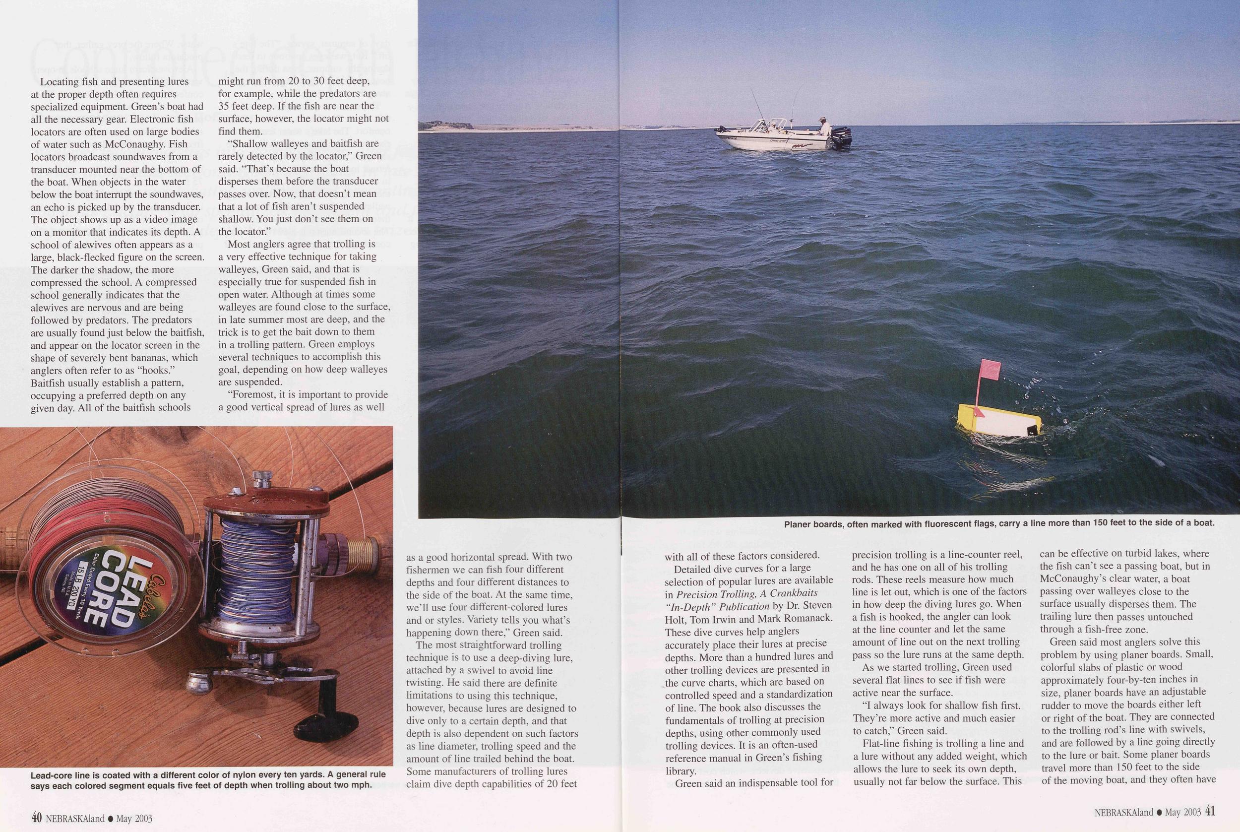
The early sun saw the little caravan moving northward in the chill morning air. The officers and visitors were ahead, with ten or twelve troopers, while from half a mile to a mile behind, with an equal number of soldiers, came the two wagons, the two little parties being within ample supporting distance should anything of a serious nature happen. Small companies of flankers of from one to three men were thrown out on both sides of the road from a quarter of a mile to a mile from it and slightly in advance of the main party. These flankers are always composed of the best hunters and trailers among the soldiers, and the flanking was done because that day's march was supposed to bring us to a possible elk district, and elk are apt to turn back if from an elevation they catch sight of a road ahead of them. Such trails as these retreating herds might make only flankers would be likely to find. Coming near a road in a valley or on a flat plain they are much more likely to cross it; but if a person will take the trouble to study the trail on both sides of the road, he will notice how the elk will fight shy of civilization. The incoming trail may show that they have scattered out over the grassy district for grazing, and here and there a place will be seen where they have been lying down resting; but as soon as the road is crossed, if it is not an old, abandoned one, the scattered trails converge into one of Indian file, which may be traced at times for three or four miles before the herd shows signs of grazing or being in an easy frame of mind.
That day's march, of from twenty to twenty-five miles, brought us to a picturesque little stream erroneously called the Dismal, which had received this inappropriate title from having been first seen at its mouth, where it empties into the Middle Fork of the Loup in a truly melancholy way. The Indian name of Cedar is much more applicable, however, for its steep banks are here and there covered with patches of cedar, that make it a pleasant-looking stream. It cuts so abruptly through its almost canon-like bed, that one hardly sees it until it is right under his nose. I remember belonging to the expedition that made the "government road" that cuts across it. It was a hot day in July, and about the hottest part of the day, - 2 or 3 o'clock in the afternoon, - and we had been marching in the sandhills since morning. Our teams were tired out, and stopping the entire command in a hot little hollow between the hills, we sent one of the best guides ahead to find, if it were possible, the best and shortest road to the first stream to the south. He had not disappeared over the crest in that direction twenty seconds, when he was seen coming back, most persons who had heard his orders supposing that he was returning for something he had lost or left behind. But he reported that the Dismal had been found about two hundred yards ahead, and within half an hour we were all engaged in the pleasant occupation of making camp.
Our hunting party also camped on this stream, and a large amount of wood was secured for the night's camp-fire. On mild nights it was always burned in a huge fire in front of the tents, but when it was uncomfortably chilly, the wood was put into the little Sibley stoves inside the tents, which on the very coldest day can be made warm and cozy if there be plenty of dry wood. A Sibley camp stove is simply a great sheet-iron funnel, turned upside down, and furnished with enough small stove-pipe at the neck to protrude from the 40 NEBRASKAland • December 2003 tent. This funnel is about three feet high, and two feet across the bottom, and in its conical sides is cut a door large enough to admit small stove-wood. The hearth is the earth or sand of the tent floor, and a piece of tin or sheet iron through which the stove-pipe projects is fastened to the tent roof. Thus fixed, it is comfortable in a wall tent even with the thermometer at twenty-five to thirty degrees below zero. Filled with cedar wood, the stove has a most annoying way of dropping sparks on the canvas roof and burning holes through it, although there is but very little danger of the tent catching afire unless a very strong wind is blowing; even then it is hardly worth any great precaution. When the smell of burning cotton is noticed by the occupant of the tent, looking up he will always see a little circle of fire, from a quarter to a third of an inch in diameter, vividly outlined against the black sky outside, and showing where the spark has fallen. It is always put out by inserting the little finger as far as it will go, and then withdrawing it, all being done with a quick thrust and recover that does not burn one's finger.
A few tracks of elk had been seen not far from camp, and although they were three or four days old, it was decided to spend one day in giving the vicinity a thorough inspection. An excellent method of beating up a country to determine the presence of game is to send out four parties of two to five hunters each at an angle of forty-five degrees to the direction of the stream, all of them, when reaching a certain distance to be agreed upon, say four, five or even ten, miles, turning to the left or right at the same angle. This brings two parties on the river who turn and hunt back along it to camp. The other two parties hunt parallel to the river from their turning-points until directly opposite camp, when they turn in directly for it. A diagram of such a plan will show that the country has received a pretty good examination by the time all parties are in camp. Of course such a plan depends somewhat on the kind of game to be hunted, and as I have given it is particularly applicable to elk. If only "white-tailed" deer are wanted, there is no great use in leaving the valleys of the streams of the little partly wooded pockets running out from them. If "black-tailed" or mountain deer are wanted, only the hills need be scoured.
Our first day's regular hunt was planned on this method, and after the other three parties had taken their choice, there was left for the doctor and me and our attendant a south-east course of six or seven miles to the right, which would make us hunt parallel to the Dismal, which there runs from west to east. It was understood by all four parties that if any small band of elk were seen it would be given chase by the discoverers, but if large, it would be allowed to rest until the morrow, unless circumstances forced an immediate attack. Any small game that fell in the way, as any kind of deer, antelope, etc., would fall a prey at once, if the hunter were only a good enough shot. Our course was over rolling hills covered with the autumn's somber colors of brown and drab, a most fortunate hue for the elk, almost the same shade, and we had to watch with keen eyes and good field-glasses to prevent our stumbling on top of our game or getting so close that they would get our "wind." By the time we turned back to hunt parallel to the river we had seen nothing but a few old tracks, and as the breeze was now blowing in our faces, thereby increasing our chances of success, at the doctor's suggestion we separated about four hundred yards apart, hoping that we might pick up a black-tailed deer or antelope, their tracks being fresher and much more numerous than the few elk signs we had found. Our man was placed about half-way between us and a little to the rear, to communicate from one to the other should it be deemed necessary. We had hardly gone a mile on our new course when I discerned a yellowish-brown mass of creatures on the hillside from six to eight hundred yards away. At first I supposed they were elk, but the glass showed them to be a band of eight or ten antelope. Beckoning to the man to approach me cautiously, I dismounted, and, leaving my horse standing, ran forward a couple of hundred yards to a low ridge. Seeing that I could get no closer without considerable manoeuvring, and fearing that the doctor might frighten them, I took aim at the most conspicuous fellow in a bunch of them and fired. After a quick scattering dash to the right and then one to the left they seemed to collect their senses and made off through a little gap in the hills, allowing me one more shot "on the wing" as they disappeared. I thought I had been unsuccessful,
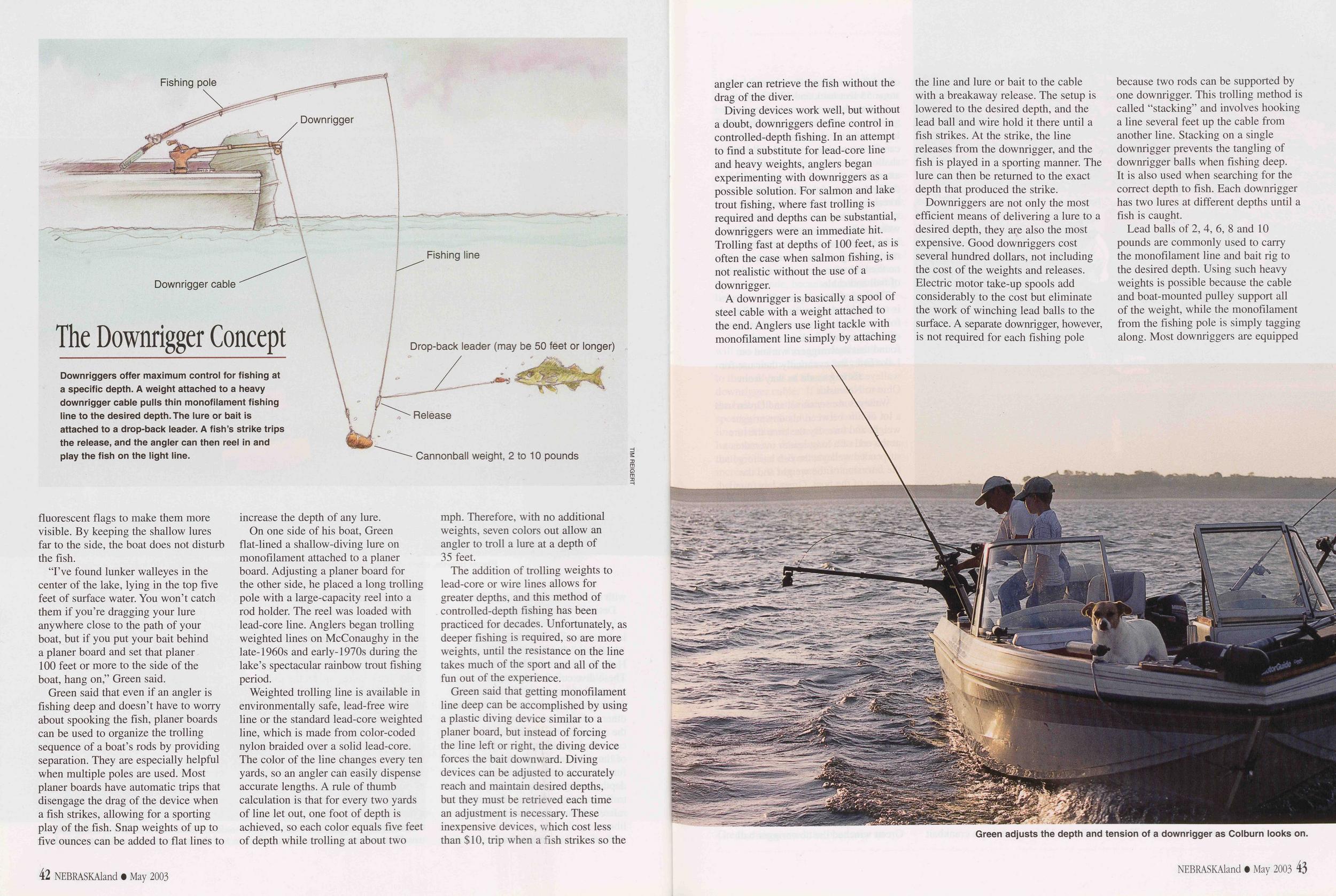
The most important problem of the chase, however, was what to do as the result of the day's investigations, and we were not long in determining to break camp next morning, and move over to the Middle Fork of the Loup, some twenty miles to the northward, where the prospects were supposed to be better. In fact, this stream was our main objective point in starting out, but the Dismal was always worth giving a fair trial, and in some instances had proved to be better hunting-ground than the main stream. As we approached the Middle Loup the next afternoon, a few scattering snow-flakes were falling softly around us in the gloomy weather, but as a light fall of snow was exactly what we wanted, we saw them more with pleasure than with regret. Too deep a fall, however, was more to be deplored than none at all. Just as camping was nearly completed, an over-zealous flanker, who had pushed his excursions some three or four miles to the westward, put in an appearance, and reported that not only had he seen abundant signs of elk (we ourselves had crossed a small, fresh trail that day), but had seen the animals themselves on the crest of a distant hill. He had made no unusual efforts to ascertain their numbers, for fear of frightening them, but judging from the trail which he had crossed, he had estimated the herd to number from five hundred to a thousand. As he was a trusty trailer and hunter, his statements sent our thermometer of hunting-excitement up to fever heat. All the evening was employed in getting ready and making the most formidable preparations for the next day's chase, and I was appealed to by the novices for information of all kinds, as if I were a Kit Carson or a Daniel Boone. Ordinarily the horses are fed half their forage 42 NEBRASKAland • December 2003 at night and half in the morning, whether they be on full or reduced forage; but in this case the rule was departed from, and the "elk" horses received three-quarters forage at night and a quarter forage in the morning. As the weather threatened to be stormy, the horses were blanketed so that none would feel stiff and chilly on starting the next day. Even the mules were given extra feed, to prevent these noisy creatures from breaking forth in stentorian brays, as they are very likely to do when a little hungry and there is any semblance of feeding going on around them. Some energetic soldiers get up early in the morning and spend a good while in a thorough grooming of their horses, which no doubt freshens them for a lively dash of a few miles. The question of arms and ammunition was settled by our being armed with the government Springfield carbines, although a far superior weapon for these horseback chases are any of the trustworthy kinds of magazine guns. Even the old Sharp's carbine was better, because when heated by rapid firing to a point where it would no longer eject the cartridge shell by the usual methods, the open guard could be brought down on the pommel of the saddle with a vehemence that brought out the shell or broke the guard, and ninety-nine cases in a hundred it would be the former. With the Springfield carbine, however, the rider was hors de combat under the same circumstances. In hunting game on horseback, the cartridges are taken from the belts, given a good cleaning, and the number that it is expected will be used on a single run - from twenty to thirty - are place in the right-hand side-pocket of a loose-fitting sacque coat. I know of no improvement on this very simple method. With a Sharp's carbine I have in this way used sixty cartridges in a single run after buffaloes. We went to bed early, with good intentions of rising early for the fray, but, as generally happens, we did not get a wink of sleep till well past our usual hours. We were up in good time, however, for the simple reason that the night sentinels had orders to look after that; and although at first many yawned and stretched in the cold night air, fully an hour before daylight, it was not long before all were thoroughly awake and keener than ever for the sport.
We hurried through our breakfast of half-cooked antelope steak and hot coffee, and when daylight streamed through the dark-gray eastern clouds it saw our little party of about a dozen moving up the valley of the Middle Loup, talking in whispers and closely filing after one another in sets of two. The wagons had orders to follow in about an hour, and sooner if they heard firing; and the mules were being watered and hitched up as we "pulled out" of camp. As the wind was in the south, I thought it best to follow the valley of the Loup to a point directly opposite the place where the herd had been "raised" by the sergeant the day before, and then make squarely for it. When we struck the trail, we could follow it up until we overtook the game. The sergeant had seen the herd so late the evening before, and we had started so early, with a dismal, dreary night and a light fall of snow in our favor, that I had but few doubts of finding it soon after we left the river. One amusing incident of our march will show how narrowly our well-arranged plan escaped utter failure. While riding alongside of me when within about a mile of our point of turning out from the valley, the judge, a venerable Nimrod with white hair that had taken nearly sixty winters to bleach, but with an enthusiasm for the sport of a man of half his years, saw a large pair of fine elkhorns in the high valley grass near a clump of willow brake about forty yards away. He expressed a desire to examine them more closely, and I sent a trumpeter back to pick them up. He left the ranks to do so, everything, for reasons that are manifest, being done in as noiseless and subdued a manner as possible. When the trumpeter was within about ten yards of the horns, the owner of them, a noble buck five or six years old, with a snort that startled every one jumped high into the air, and with a bound started for the main herd, leaving us all too astounded to know what to do. Seeing the main column, he wheeled abruptly around, and, dashing across the Loup, made to the northward. Had this animal reached the main herd, as he at first attempted to do, our fun would have been ended for that day. It was great temptation to shoot at him, and the trumpeter, forgetting all the surroundings, started to pull his pistol and fire; but his rearing horse, half frightened out of his wits, by wheeling and plunging prevented him from doing so.
I remember, on another hunt after elk in the Nebraskan hills, planned on the same method as this, that when nearing the herd of elk that we had pretty definitely located, and
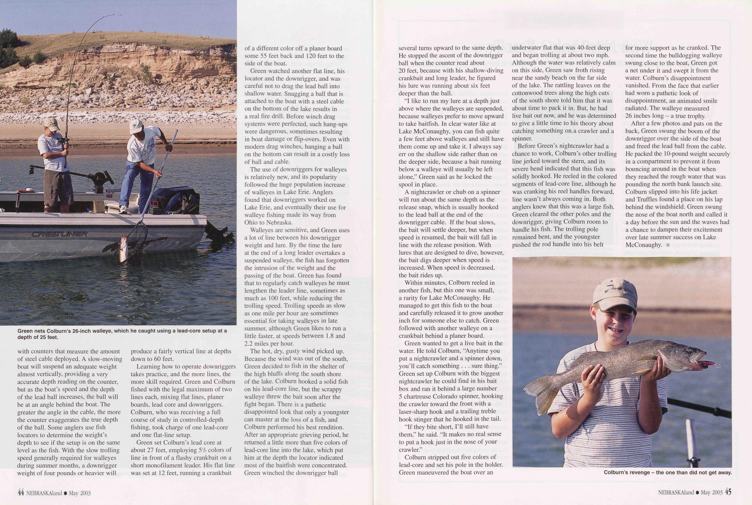 while crossing the "pocket" of a canon liberally wooded or
"brushed" with wild plums and rose-bushes, a couple of
white-tailed deer jumped up just beyond the clump, from
forty to fifty yards away, and remained in full view until we
had ridden by. They were so close that any one of the party
could have easily killed them. Not till we had passed did
they run away. There were a number of experienced hunters
in the party who had often hunted this wary animal, and
every one acknowledged it to be the boldest effrontery ever
shown by that species of deer. Surely these two must have
known how fatal to our success with the elk the sound of a
gun-shot would have been at that moment.
while crossing the "pocket" of a canon liberally wooded or
"brushed" with wild plums and rose-bushes, a couple of
white-tailed deer jumped up just beyond the clump, from
forty to fifty yards away, and remained in full view until we
had ridden by. They were so close that any one of the party
could have easily killed them. Not till we had passed did
they run away. There were a number of experienced hunters
in the party who had often hunted this wary animal, and
every one acknowledged it to be the boldest effrontery ever
shown by that species of deer. Surely these two must have
known how fatal to our success with the elk the sound of a
gun-shot would have been at that moment.
After the incident of the elk-horns we advanced up the valley of the Loup for nearly a mile; then turning abruptly southward against the wind, we began to ascend a long winding acclivity up through a little valley where luxuriant grass grew as high as our stirrups. Looking ahead even a couple of hundred yards, we could see stripes of darker green cutting at all angles through this grass, and advancing warily we saw the tracks of elk in the light covering of snow. Our party huddled together in the ravine while two of us dismounted and slowly crawled up the slight ascent. About two-thirds of the way up we saw a moving bush on the crest of the hill a third of a mile away. The bush proved to be the fine antlers of a young buck, and when we had crept a little higher we saw twenty or thirty other elk about him, some of them lying down and plainly outlined against the white snow. When we had returned and mounted our horses again there came the difficult feat of winding around through the lowest levels and depressions and gaps, and at the same time making headway towards the game while keeping completely out of their sight. Another ravine was reached, and once more two of us dismounted and crawled forward to the crest to get a view of the situation. It was also necessary to do so rapidly, for it was perfectly evident that the outlying members of the herd were close by, and the snorting and snuffing of a horse might send them away with the speed of the wind. I felt perfectly satisfied, before I got half-way across the slope, that a substratum of sand makes a much better support for a covering of snow for crawling purposes than can ever be found in the tick growth of the prickly-pear of the plains, although on this particular slope Nature seemed to think otherwise. Nearing the crest of the ridge, I secured a "tumble-weed" or "rolling-weed," - one of those globular perennials of the plains that when dead is pulled up by the wind and goes rolling around over the prairies at the mercy of the blast, - and, keeping it in front of my face, took a careful view ahead.
Not more than a hundred yards away was a fine grouping of game that would have delighted the heart of Landseer, and certainly delighted mine. Slowly retreating until the friendly ridge once more covered us, we crawled back through the cactus to rejoin our horses and our impatient comrades. As I mounted, I said briefly that our time was at hand and the battle not far off. I believe the horses knew this better than the men, for as I came crawling back through the snow every equine ear in the party followed me as closely as if I had a bushel of oats in my possession; and when I mounted my own little sorrel he was trembling from head to foot, and he lay his nose against my knee as if to gain information in his own peculiar way. Every horse in that platoon knew as well as every man what was ahead of him, - and better, too, for all of them had been in those exciting chases more times than two-thirds of the party. The only noises that broke the hush of the still morning were a few hurried whispers and the ominous clicks of the breech-locks as the cartridges fell home in their chambers. All the horses' ears were as rigidly set towards the crest about a hundred yards away as if they were a charge of fixed bayonets, and the red, dilated nostrils, the fixed eyes, and the heaving breasts showed that they, too, felt all the excitement of their masters. We had arranged our plans the night before, and we now hurried to carry them out. Down the hollow of the ravine the hunters, separated from one another by a space of from three to four yards and facing the ridge that hid us from the unsuspecting elk, were stretched like a skirmish-line, while I rode out in front of the center of the line just far enough to be easily seen by all. Looking hurriedly along the little line, I saw that all were ready, with the loaded carbines pointing in the air, the butts resting on the right thighs, and a couple of spare cartridges in each man's hand. Raising the butt of my carbine high in the air as a signal for starting, I took a half-dozen steps forward at a prancing walk, brought the carbine down to a level, and the line took up a trot for a dozen yards. Then I raised the carbine muzzle up and 44 NEBRASKAland • December 2003
It was growing dark as the sergeant in charge of the wagon party rapped at my tent and reported: "The wagons are in with the carcasses of nineteen elk, and I am satisfied we have gotten them all, sir." The next day we started for home.
Frederick Schwartka. NEBRASKAland • December 2003 45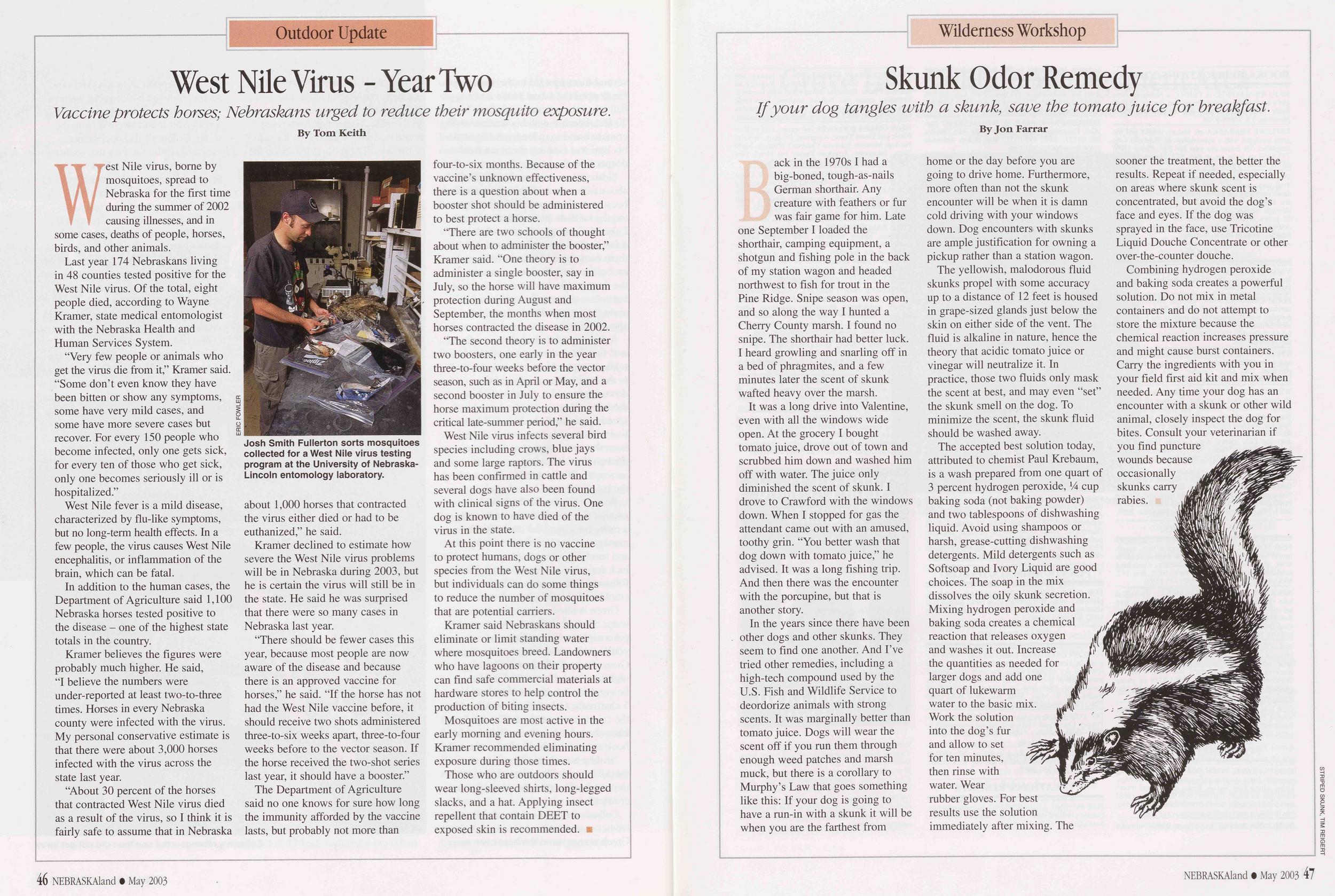
Outdoor Update
Study Describes Niobrara Floaters
90% use local outfitters when enjoying scenery along the natural river. By Jon FarrarBefore 1970 most of the people who floated the Niobrara River below Valentine were scouts and local people bobbing down the river on inner tubes and flat-bottomed boats. Few Nebraskans had canoes then, and few canoeists elsewhere thought Nebraska had a river worth canoeing. During the early-1970s, seat-of-the- pants canoe outfitters began taking customers down the Niobrara, and the glories of the wooded valley and its fast running water spread by word of mouth. The secret was out of the box. In 1991 Congress designated 76 miles of the Niobrara east of Valentine as a National Scenic River.
In 2001 the Cooperative Park Studies Program at the University of Minnesota studied recreational uses of the Niobrara east of Valentine. The study was sponsored and funded by the National Park Service, which manages the Niobrara National Scenic River. Here are the highlights of the study.
Canoeists and tubers had similar demographics. Most were middle-aged and well educated. Ninety percent used the services of a local outfitter and 85 percent were traveling with family or friends.
Five percent of those responding to the survey resided in the local area, 39 percent in the Lincoln-Omaha area and the remainder from elsewhere.
Group sizes varied from one to 50 or more. The most common party sizes were 11 -to-20 for canoeists and 4-to-6 for tubers. Canoeists were more likely to travel in larger groups.
Canoeists were slightly more likely to use the river on weekends rather than weekdays, and a few more tubers floated on weekdays.
Eighty-three percent of canoeists put in at the Fort Niobrara National Wildlife Refuge launch site, compared to 53 percent of tubers. Tubers were more likely to launch downstream from the refuge and 91 percent of them took one-day trips. Canoeists generally traveled farther downstream than tubers and were more likely to take two- or three-day trips.
Canoeists and tubers surveyed responded that "enjoying the scenery, getting away from the usual demands of life and interacting with others on the river" were an important part of their experience. Canoeists responded higher when rating the importance of wildlife viewing, and that the experience was important in developing skills and for physical fitness. Tubers were more inclined to rank "resting physically" as more important. Canoeists were more likely to rate behavioral problems, such as alcohol consumption and rowdiness, as a problem than were tubers. Most respondents were "generally satisfied with their experiences."
The researchers concluded that "a visitor's first experience in a natural area may dictate their expectations for future visits." If the river is crowded and raucous, first time visitors will assume that is the norm and not expect a wilderness experience in the future. The report suggested that those seeking solitude and wildlife viewing should use the river weekdays and outside of the busy summer season.
In another aspect of the study, researchers looked at visitor-use trends, comparing the results of the 2001 study to a similar study conducted in 1993. That comparison revealed some changes.
The use of tubes increased from 15 percent in 1993 to 31 percent in 2001. No kayak use was reported in 1993, but in 2001 it accounted for seven percent. In 1993, more people traveling down the Niobrara were on a trip longer than one day. In 2001, 80 percent were on the river only one day.
The absence of litter, vandalism, inappropriate behavior and noise were rated as more important aspects of a quality experience in 2001 than in 1993. More respondents in 1993 believed "they saw the types of wildlife they hoped to see" than did those in 2001. In general, those canoeing the Niobrara in 2001 were more concerned with inappropriate behavior and having a nature experience.
In conclusion, the researchers noted that recreation on the Niobrara River is in transition. People are traveling down the river in different ways than they once did and with different expectations. They added that visitors "treasure the diversity of experience opportunities, benefits and values that the river provides" and that there is a need for "community thinking" to accommodate those diverse expectations in the future.
46 NEBRASKAland • December 2003Book Review
Fort Robinson Saga
Tom Buecker's two-volume history vividly tell stories of people and events. By Bob GrierTom Buecker, curator of the Fort Robinson Museum, probably knows more about Fort Robinson's history than anyone.
His easy-to-read, two-volume history breathes life into the frontier outpost and the colorful personalities - Euroamericans and Indians - who walked across the fort's parade grounds and into American history. Buecker's books detail day-to-day activities and significant events from the fort's beginnings in 1874, and provide regional and national contexts for the times that brought glory and tragedy to this site at the confluence of Soldier Creek and the White River in northwestern Nebraska.
In the preface to the first volume, Fort Robinson and the American West, 1874-1899, Buecker writes, "Fort Robinson played a vital part in the story of the American West. One of the most important military posts of the Indian wars, Fort Robinson, Nebraska, 'survived' after the peace because of its advantageous location on the railroad. The United States Army used the fort longer, from 1874 to 1948, than any other Indian Wars post on the upper Plains, with one exception [Fort D.A. Russell, established at Cheyenne, Wyoming, in 1867, is now Francis E. Warren Air Force Base]."
With admiration and compassion, Buecker describes the Indian tribes - the Northern Cheyenne, Arapaho and dominant Sioux tribes, the Oglala and Brule - who occupied northwestern Nebraska as settlement advanced. He weaves human events at the fort into an unfolding national drama, writing, "The stage was set for a contest of cultures on the upper Plains. Sometimes on the battlefield, other times at the council fire."
Buecker vividly tells the stories of soldiers, warriors and noncombatants from all stations - from Red Cloud, Spotted Tail and Crazy Horse, and Generals Arthur McArthur, Sheridan, Ord and Crook to Lieutenant Levi Robinson, who died at Fort Laramie's woodcutting camp in February 1874 and was given the honor of the new fort bearing his name, to the famous buffalo soldiers of the 9th Cavalry.
The second volume, Fort Robinson and the American Century, 1900- 1948, documents the fort as a quartermaster remount depot and a World War II K-9 training and prisoner-of-war camp. Interviews and writings of people who lived at the fort, including prisoners of war, document the later history.
Both volumes are illustrated with photographs and maps that set the scene and show event locations.
The first five chapters of Buecker's history of Fort Robinson began as a master's thesis in 1992. In more than 19 years of active research, he has traveled five times to the National Archives and Records Administration in Washington, D.C. and to the U.S. Army's Military History Center at Carlisle Barracks, Pennsylvania.
"It was interesting to me that by 1899, the old fort was mostly dismantled, and the new Fort Robinson came on the scene as the American army's missions became global. It was exciting to visit with German veterans of the prisoner-of-war camp, army remount veterans and their dependents, and meeting people stationed at Fort Robinson. The information helped put a human face on activities at Fort Robinson."
With the research completed, publication of the two-volume history was made possible with the support of The Ronald K. and Judith M. Stolz Parks Publishing Fund, made in the memory of Wayne Kemper Parks (1909-1995) and Hazel Virginia Hill Parks (1911-1991), lifelong Nebraskans who were born in Madison County, married in 1930, and farmed in Madison and Pierce counties.
Fort Robinson and the American West, 1874-1899, by Thomas R. Buecker, 1999. Red River Books edition, 2003, University of Oklahoma Press, Norman, Oklahoma by arrangement with the Nebraska State Historical Society. Paperback, 265 pages. $19.95. oupress.com.
Fort Robinson and the American Century, 1900-1948, by Thomas R. Buecker, 2002, Nebraska State Historical Society, Lincoln. Hardback, 214 pages. $40. Nebraska State Historical Society, Box 82554, Lincoln, NE 68501.
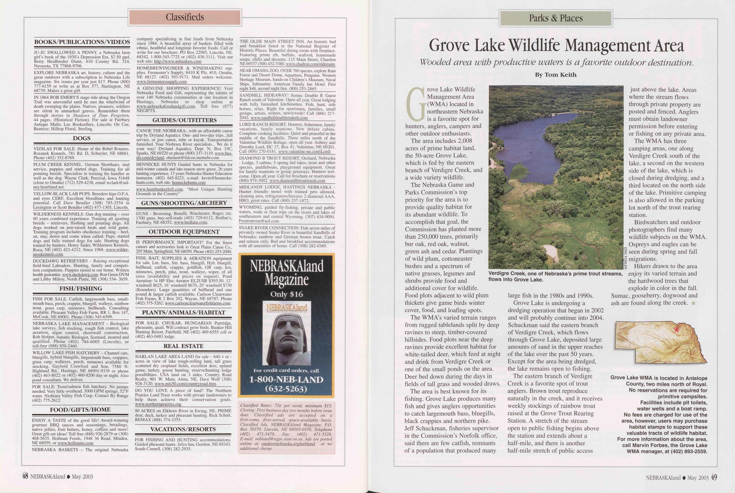
Classifieds
BOOKS/PUBLICATIONS/VIDEOSIN THE SHADOW OF THE BLUFF, just published novel about migrant life; Scotts Bluff locale; $14.50 ppd. Betty Heidbreder Dunn, 410 County Rd. 324, Navasota, TX 77868-9706._____________________
EXPLORE NEBRASKA art, history, culture and the great outdoors with a subscription to Nebraska Life magazine. Six issues per year just $19. Phone (800) 777-6159 or write us at Box 577, Hartington, NE 68739. Makes a great gift. Visit NebraskaLife.com.
DOGSVIZSLAS FOR SALE. Home of the Rebel Rousers. Rozanek Kennels, 781 Rd. D, Schuyler, NE 68661. Phone (402) 352-8769._________________________
PLUM CREEK KENNEL. German Shorthairs, stud service, puppies and started dogs. Training for all pointing breeds. Specialize in training the handler as well as the dog. Wayne Clark, Percival, Iowa 51648 (close to Omaha) (712) 529-4238, email wclark@sidney.heartland.net.
YELLOW-BLACK LAB PUPS. Breeders hips O.F.A. and eyes CERE Excellent bloodlines and hunting potential. Call Dave Bendler (308) 785-2554 in Lexington or Scott Bendler (402) 477-1305, Lincoln.
WILDERNESS KENNELS. Gun dog training - over 60 years combined experience. Training all sporting breeds - retrievers, flushing and pointing dogs. All dogs worked on pen-raised birds and wild game. Training program includes obedience training - heel, sit, stay, down and come when called. Pups, started dogs and fully trained dogs for sale. Hunting dogs trained by hunters. Henry Sader, Wilderness Kennels, Roca, NE (402) 423-4212. Since 1968. www.wilder- nesskennels.com
PRAIRIE RIDGE KENNELS, PAXTON, NE - Nothing fancy, just reputable trainers who specialize in retrievers! 25 miles river property, 10,000 acres upland. Quality puppies to finished dogs available. (308) 239-4719 / (308) 289-6605.
FISH/FISHINGFISH FOR SALE. Catfish, largemouth bass, small- mouth bass, perch, crappie, bluegill, walleye, rainbow trout, grass carp, minnows, bullheads. Consulting available. Pleasant Valley Fish Farm, RR 1, Box 147, McCook, NE 69001. Phone (308) 345-6599.
NEBRASKA LAKE MANAGEMENT - Biological lake surveys, fish stocking, rough fish control, lake aeration, algae control, shorewall construction. Rob Hofpar, Aquatic Biologist, licensed, insured and qualified. Phone (402) 784-6005 (Lincoln), or toll-free (888) 850-2460.
FOOD/GIFTS/HOMEENJOY A TASTE of the good life! Award-winning gourmet BBQ sauces and seasonings, breadings, native jellies, fruit butters, honey, coffees and more! Great gift-set ideas! Toll free (888) 926-2879 or (308) 468-5635. Hollman Foods, 1948 36 Road, Minden, NE 68959, or www.hollmans.com________________
NEBRASKA BASKETS - The original Nebraska company specializing in fine foods from Nebraska since 1984. A beautiful array of baskets filled with ethnic, healthful and longtime favorite foods. Call or write for our brochure: PO Box 22985, Lincoln, NE. 68542. 1-800-345-7725 or (402) 438-3111. Visit our web site: http://www.nebaskets.com______________
HOMEBREWING/BEER & WINEMAKING supplies. Fermenter's Supply, 8410 K Plz. #10, Omaha, NE 68127. (402) 593-9171. Mail orders welcome. www.fermenterssupply.com_____________________
A GENUINE SHOPPING EXPERIENCE! Visit Nebraska Food and Gift, representing the talents of over 140 Nebraska communities at one location in Hastings, Nebraska or shop online at www.nebraskafoodandgift.com. Toll free (877) NEGIFTS.
GUIDES/OUTFITTERSCANOE THE NIOBRARA with an affordable canoe trip by Dryland Aquatics. One- and two-day trips...full service, or just canoe, tube or kayak. Transportation furnished. Your Niobrara River specialists... We do it your way! Dryland Aquatics, Dept. N, Box 33C, Sparks, NE 69220 or phone (800) 337-3119. www.drvlandaquatics.com info@drylandaquatics.com._______
HENNECKE HUNTS Guided hunts in Nebraska for mid-winter Canada and late-season snow geese. 26 years hunting experience, 13 years Nebraska Hunter Education instructor. (402) 645-8223, e-mail: kevin@henneckehunts.com, web site: henneckehunts.com____________
KRIPPLE DUCK ADVENTURES - Southwest Nebraska Guided hunts along Frenchman Creek for deer, geese, ducks, pheasants, dove and coyotes. (308) 394-5345, cdorn@bwtelcom.net.
NEBRASKAland Magazine - only $16per year For Visa or MasterCard orders, call 1-800-NEB-LAND (632-5263) For mail orders, send check or money order to NEBRASKAland Magazine P.O. Box 30370, Lincoln, NE 685030370. Order online at outdoornebraska. ore GUNS/SHOOTING/ARCHERYGUNS - Browning, Benelli. Winchester, Ruger, etc. 1700 guns, buy-sell-trade (402) 729-6112. Bedlan's, Fairbury, NE 68352. www.bedlans.com.
OUTDOOR EQUIPMENTIS PERFORMANCE IMPORTANT? For the finest canoes and accessories look to Great Plains Canoe Co., 205 Main, Springfield, NE 68059. Phone (402) 253-2000.
HIGH-QUALITY, HAND-FORGED CUTLERY, hunting, kitchen, everyday carry. Prices start at $45.00 Spring Creek Knife Works, www.springcreekknives.homestead.com. scknifeworks@mail.com, (402) 224-3132.
____________REAL ESTATE____________HARLAN LAKE AREA LAND for sale - 640 + or - acres in view of lake rough-rolling land, tall grass scattered dry cropland fields, excellent deer, upland game, turkey, goose hunting, reserve/hunting lodge possibilities. USA land on 3 sides. Country Road Realty, 901 W. Main, Alma, NE, Dave Wolf (308) 928-3120. www.mls50.com/countryroad.htm.
VACATIONS/RESORTSFOR FISHING AND HUNTING accommodations. Guided pheasant hunts. Jefco Inn, Gordon, NE 69343. South Cornell, (308) 282-2935.__________________
THE OLDE MAIN STREET INN. A historic bed and breakfast listed in the National Register of Historic Places. Beautiful dining room with fireplace. Featuring prime rib, buffalo, seafood, homemade soups, chilis and desserts. 115 Main Street. Chadron NE 69337 (308) 432-3380. www.chadron.com/oldemain.
NEAR OMAHA ZOO, OVER 760 species, explore Rain Forest and Desert Dome, Aquarium, Penguins. Western Heritage Museum, hands-on Children's Museum, Naval Ships, Submarine. American Family Inn Motel. $46 single or double. (800) 253-2865._____________
SANDHILL HIDEAWAY! Scenic Double R Guest Ranch south of Valentine. Open all year. Great lodging with fully furnished kitchenettes. Fish, hunt, ride horses, relax. Right for sportsmen, families, small groups, artists, writers, newlyweds! Call (866) 217-2042. www.sandhilldoublerranch.com____________
LORD RANCH RESORT. Hunters, fishermen, family vacations, family reunions. New deluxe cabins. Complete cooking facilities. Quiet and peaceful in the middle of the Sandhills. Three miles north of the Valentine Wildlife Refuge, open all year. Aubrey and Dorothy Lord, HC 37, Box 41, Valentine. NE 69201. Call (800) 270-0181.www.lordranchresort.com
DIAMOND BE TROUT RESORT. Orchard, Nebraska. Lodge, cabins, spring-fed lakes, playground equipment, paddleboats. Great for families, groups, hunters. Book your cabin now! Call for brochure 1-800-974-3002. www.diamondtroutresort.com
MIDLANDS LODGE, HASTINGS NEBRASKA - Hunter friendly motel with trained pets allowed, cleaning area, refrigerators/freezers, 2-diamond AAA, HBO, great rates. Call (800) 237-1872.____________
NE PANHANDLE PARADISE. Gordon. NE Hunters can enjoy pheasant hunting on almost 2000 acres. Complete accommodations including lodging with kitchen, game dressing & cleaning areas and freezer. Very reasonable rates. For more information contact Myra Wilcox at 605-341-1168 or 605-390-7031 or email at olemyrn@aol.com.
Classified Rates: 750 per word, minimum $15. Closing: First business day two months before issue date. Classified ads are accepted on a first-come, first-served, space-available basis. Classified Ads, NEBRASKAland Magazine, RO. Box 30370, Lincoln, NE 68503-0370. Telephone (402) 471-5478. Fax: (402) 471-5528. E-mail: nebland@ngpc.state.ne.us. Ads are posted online at outdoornebraska.org/nebland at no additional charge. 48 NEBMSKAland • December 2003Parks & Places
Winter Trout Stocking
80,000 rainbows await anglers in 16 popular lakes this year. By Rocky Hoffmann"To think that some kid in Nebraska City will catch a trout this month without traveling to the opposite end of the state is exciting," said Dean Rosenthal, who is in charge of the Nebraska Game and Parks Commission's fish hatchery system. He believes the winter trout fishing program has become a very popular program among Nebraska anglers.
"Three of our fish hatcheries will produce and stock more than 80,000 advanced rainbow trout this season as part of the winter trout program," Rosenthal said. "Those three hatcheries, Rock Creek, Calamus and Grove, will distribute the keeper-size trout to 16 lakes this winter, much to the delight of anglers that may otherwise never have an opportunity to catch a scrappy rainbow trout."
He said the allure of the program is in the species being stocked.
"Trout have always been looked upon with a great deal of respect. They are glamorous fish to catch. There is something mystical about trout that fascinates fishermen. I think if we were stocking catfish or even bass for winter fishing, the appeal wouldn't be as strong, and we wouldn't see the number of fishermen on the ice of these winter trout lakes that we now see," Rosenthal said.
If trout are popular, why doesn't the Commission establish year-round trout fisheries in these lakes? The problem is water temperature. Rainbow trout require water below 70 degrees Fahrenheit and rich in dissolved oxygen. Only a few lakes and streams in western Nebraska have year-round trout-supporting water. However, in winter - usually beginning in October and continuing through April - many Nebraska lakes will support trout.
The winter trout program began several years ago in Lake No. 1 at Windmill State Recreation Area (SRA), off Interstate 80 near Gibbon, and Birdwood Lake near North Platte. It was so successful that it was expanded into southeastern Nebraska lakes, especially near population centers. Fisheries managers believe the program has recruited new anglers and prompted others to return to fishing. They hope the program will be expanded.
Rainbows with an average length of about 10 inches are stocked twice during the winter season. The accompanying chart shows the lakes and schedule for stocking in 2003- 2004.
Anglers must have a valid fishing permit and aquatic stamp.
2003-2004 Winter Trout Stocking LOCATION LAKE Birdwood Lake US WEST Lake Standing Bear Lake Crystal Springs, Middle Lake Bowling Lake Steinhart Park David City Park Benson Park Hitchcock Park Towi Park Windmill SRA Lake # 1 Holdrege Park, North Lake Grove Lake WMA Crystal Cove Champion Lake SRA Fremont SRA Lake # 5 Near North Platte Mahoney State Park Omaha Fairbury Lincoln Nebraska City David City Omaha Omaha Omaha Near Gibbon Holdrege Near Royal South Sioux City Champion Fremont MONTHS TOTAL STOCKED STOCKED Oct./Dec. 8,000 Oct./Dec. 5,000 Oct./Dec. 15,000 Nov./Dec. 1,200 Oct./Dec. 7,200 OctVDec. 2,400 Oct./Dec. 1,200 Oct./Dec. 2,100 Oct./Dec. 900 OcL/Dec. 600 Oct./Dec. 8,000 Oct./Dec. 6,000 Oct./Jan. 3,000 Oct/Jan. 9,000 Oct./Mar. 2,000 Oct./Jan. 9,000 NEBRASKAland • December 2003 49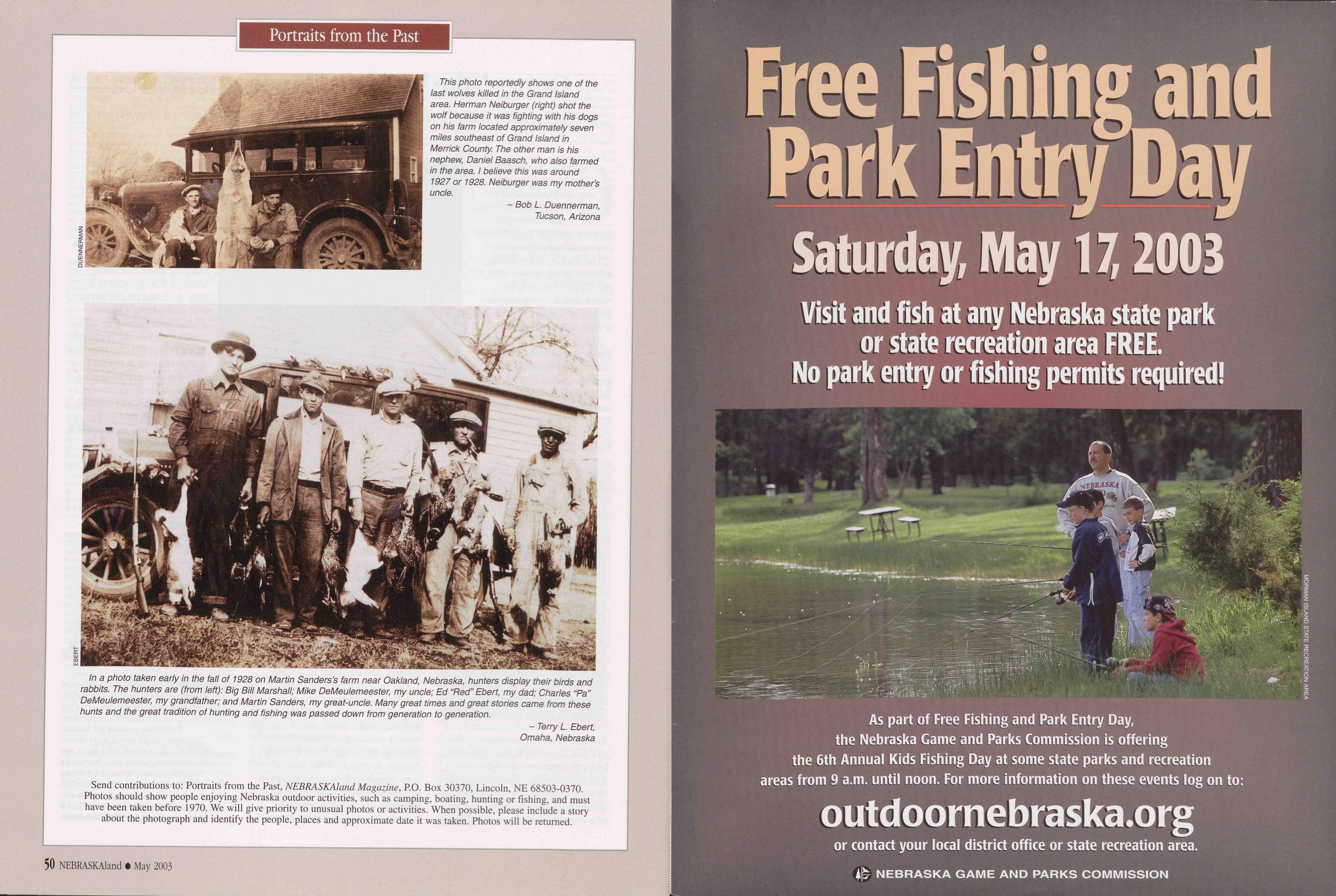
Portraits from the Past
My father, Stanley Wymore, who lived in Arthur County, is shown with his coyote hounds and pelts of nine coyotes he caught during the winter of 1940-1941.
I am standing next to him. I remember thinking as a little girl how terrible the pelts smelled when he brought them in the house to sew up the tears that the hounds made before he stretched the pelts.
- Ardeen McCord, Oshkosh, NebraskaMy father, Walter Mauch, stands next to a morning's bag of mallards in 1928 or 1929.1 was quite young, but I remember him coming home with all those ducks. Later he would recall the hunt when we looked at this photo. He said he had taken the ducks on a small pothole lake two miles north and three miles east of Bassett. He emptied his five-shot Remington (Browning style) auto-loader at the flock when he jumped them, and then dropped five more ducks when a bunch turned and flew back over him. With this bounty, he supplied a number of his elderly friends a duck dinner - an early-day Hunters for the Hungry program. He said he had a few cripples, but did not lose any.
Having learned his shooting skills while market hunting as a teenager, my father was a superb shot. I cannot recall him ever missing a shot. We had a cabin at the lake where he hunted and I remember the great fishing before the dry years of the 1930s.
- Dick Mauch, Bassett, Nebraska
Position: 842 (11 views)