Volume 81, Issue 5, 2003
NEBRASKAland
Nebraska Game & Parks Commission June 2003 $2.50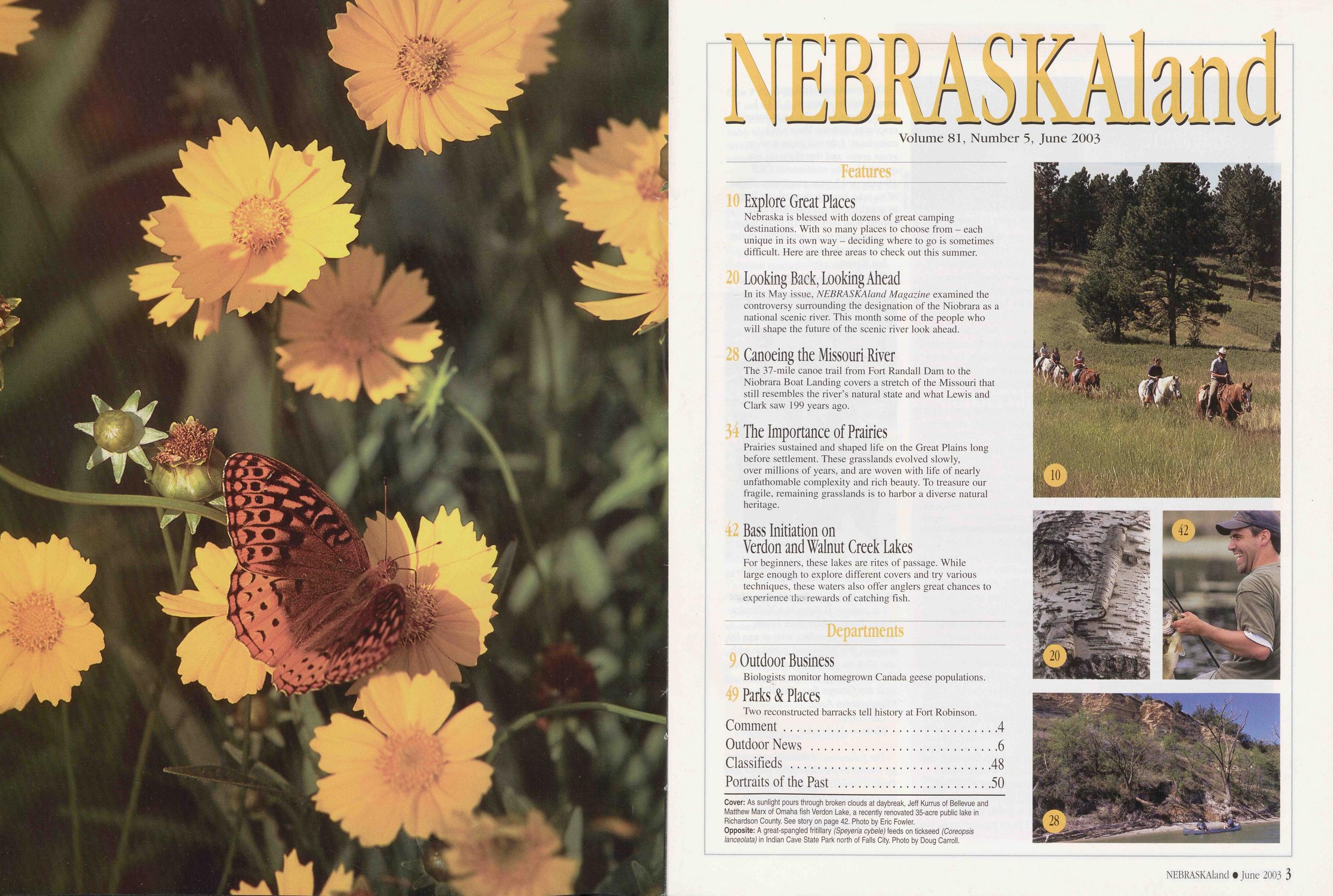
NEBRASKAland
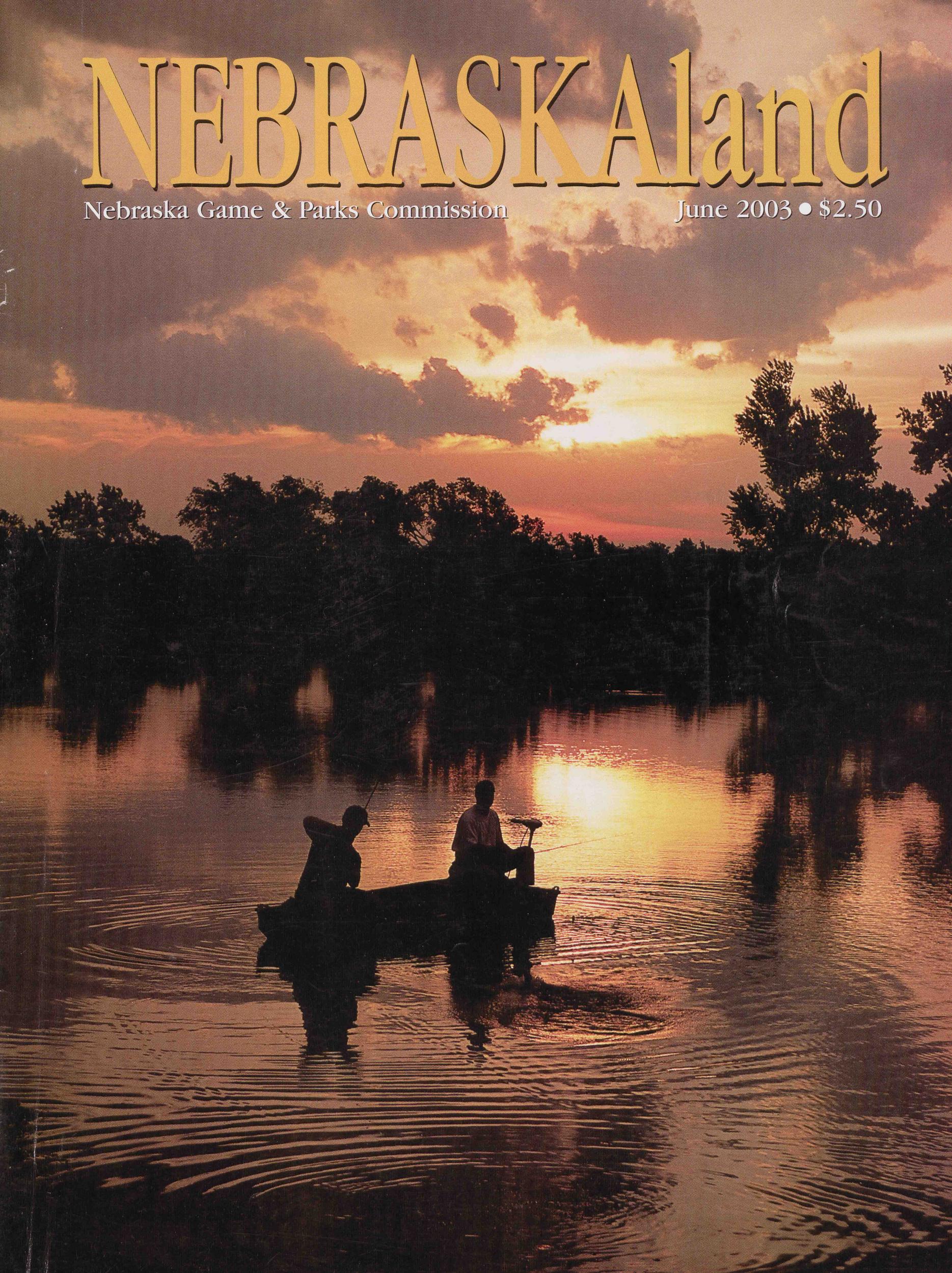
Volume 81, Number 5, June 2003 Features 10 Explore Great Places Nebraska is blessed with dozens of great camping destinations. With so many places to choose from - each unique in its own way - deciding where to go is sometimes difficult. Here are three areas to check out this summer. 20 Looking Back, Looking Ahead In its May issue, NEBRASKAland Magazine examined the controversy surrounding the designation of the Niobrara as a national scenic river. This month some of the people who will shape the future of the scenic river look ahead. 28 Canoeing the Missouri River The 37-mile canoe trail from Fort Randall Dam to the Niobrara Boat Landing covers a stretch of the Missouri that still resembles the river's natural state and what Lewis and Clark saw 199 years ago. 34 The Importance of Prairies Prairies sustained and shaped life on the Great Plains long before settlement. These grasslands evolved slowly, over millions of years, and are woven with life of nearly unfathomable complexity and rich beauty. To treasure our fragile, remaining grasslands is to harbor a diverse natural heritage. 42 Bass Initiation on Verdon and Walnut Creek Lakes For beginners, these lakes are rites of passage. While large enough to explore different covers and try various techniques, these waters also offer anglers great chances to experience the rewards of catching fish. Departments 9 Outdoor Business Biologists monitor homegrown Canada geese populations. 49 Parks & Places Two reconstructed barracks tell history at Fort Robinson. Comment Outdoor News ............................6 Portraits of the Past .......................50 Cover: As sunlight pours through broken clouds at daybreak, Jeff Kurrus of Bellevue and Matthew Marx of Omaha fish Verdon Lake, a recently renovated 35-acre public lake in Richardson County. See story on page 42. Photo by Eric Fowler. Opposite: A great-spangled fritillary (Speyeria cybele) feeds on tickseed (Coreopsis lanceolata) in Indian Cave State Park north of Falls City. Photo by Doug Carroll.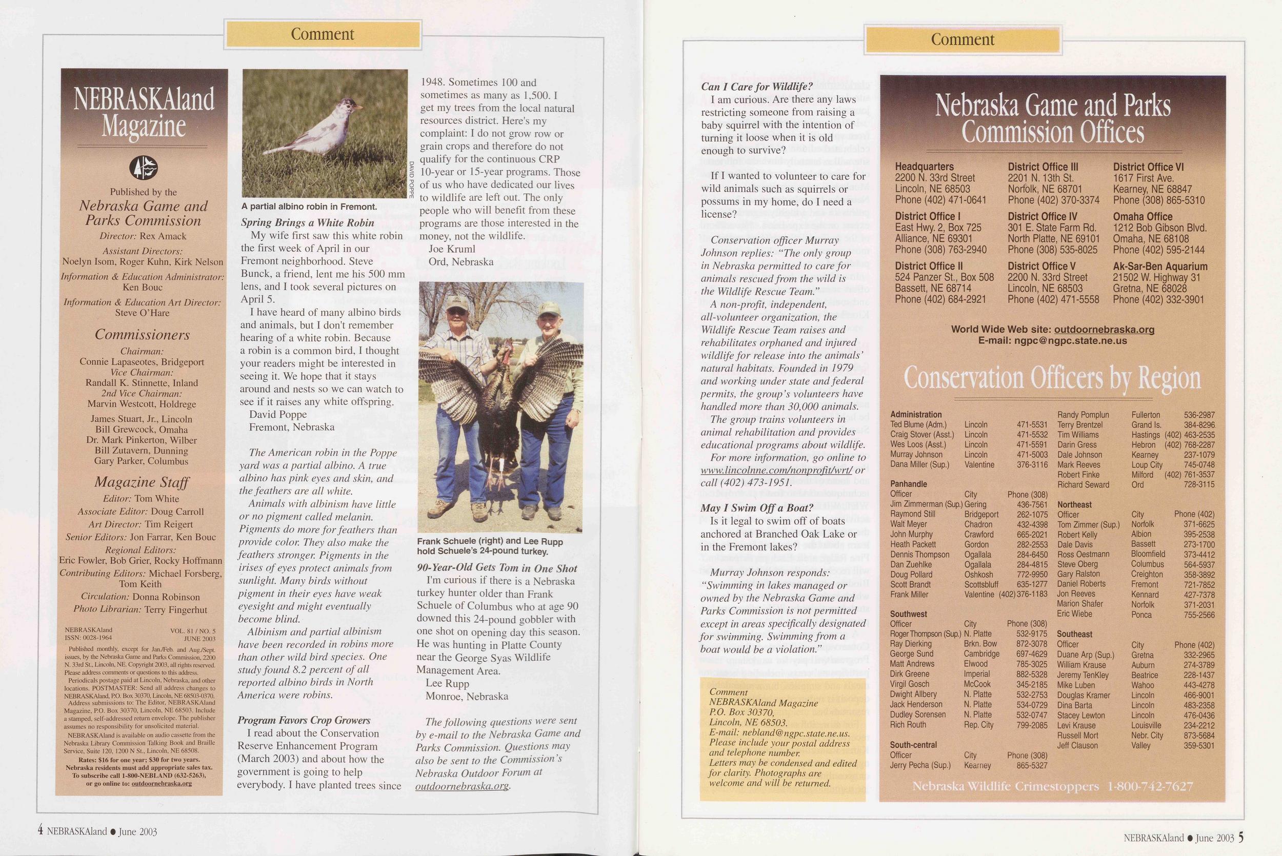 Comment
NEBRASKAland
azine
Published by the
Nebraska Game and
Parks Commission
Director: Rex Amack
Assistant Directors:
Noelyn Isom, Roger Kuhn, Kirk Nelson
Information & Education Administrator:
Ken Boue
Information & Education Art Director:
Steve O'Hare
Commissioners
Chairman:
Connie Lapaseotes, Bridgeport
Vice Chairman:
Randall K. Stinnette, Inland
2nd Vice Chairman:
Marvin Westcott, Holdrege
James Stuart, Jr., Lincoln
Bill Grewcock, Omaha
Dr. Mark Pinkerton, Wilber
Bill Zutavern, Dunning
Gary Parker, Columbus
Magazine Staff
Editor: Tom White
Associate Editor: Doug Carroll
Art Director: Tim Reigert
Senior Editors: Jon Farrar, Ken Bouc
Regional Editors:
Eric Fowler, Bob Grier, Rocky Hoffmann
Contributing Editors: Michael Forsberg,
Tom Keith
Circulation: Donna Robinson
Photo Librarian: Terry Fingerhut
NEBRASKAland
ISSN: 0028-1964
VOL. 81/NO. 5
JUNE 2003
Published monthly, except for Jan./Feb. and Aug./Sept.
issues, by the Nebraska Game and Parks Commission, 2200
N. 33rd St., Lincoln, NE. Copyright 2003, all rights reserved.
Please address comments or questions to this address.
Periodicals postage paid at Lincoln, Nebraska, and other
locations. POSTMASTER: Send all address changes to
NEBRASKAland, P.O. Box 30370, Lincoln, NE 68503-0370.
Address submissions to: The Editor, NEBRASKAland
Magazine, P.O. Box 30370, Lincoln, NE 68503. Include
a stamped, self-addressed return envelope. The publisher
assumes no responsibility for unsolicited material.
NEBRASKAland is available on audio cassette from the
Nebraska Library Commission Talking Book and Braille
Service, Suite 120, 1200 N St., Lincoln, NE 68508.
Rates: $16 for one year; $30 for two years.
Nebraska residents must add appropriate sales tax.
To subscribe call 1-800-NEBLAND (632-5263),
or go online to: outdoornebraska.org
Comment
NEBRASKAland
azine
Published by the
Nebraska Game and
Parks Commission
Director: Rex Amack
Assistant Directors:
Noelyn Isom, Roger Kuhn, Kirk Nelson
Information & Education Administrator:
Ken Boue
Information & Education Art Director:
Steve O'Hare
Commissioners
Chairman:
Connie Lapaseotes, Bridgeport
Vice Chairman:
Randall K. Stinnette, Inland
2nd Vice Chairman:
Marvin Westcott, Holdrege
James Stuart, Jr., Lincoln
Bill Grewcock, Omaha
Dr. Mark Pinkerton, Wilber
Bill Zutavern, Dunning
Gary Parker, Columbus
Magazine Staff
Editor: Tom White
Associate Editor: Doug Carroll
Art Director: Tim Reigert
Senior Editors: Jon Farrar, Ken Bouc
Regional Editors:
Eric Fowler, Bob Grier, Rocky Hoffmann
Contributing Editors: Michael Forsberg,
Tom Keith
Circulation: Donna Robinson
Photo Librarian: Terry Fingerhut
NEBRASKAland
ISSN: 0028-1964
VOL. 81/NO. 5
JUNE 2003
Published monthly, except for Jan./Feb. and Aug./Sept.
issues, by the Nebraska Game and Parks Commission, 2200
N. 33rd St., Lincoln, NE. Copyright 2003, all rights reserved.
Please address comments or questions to this address.
Periodicals postage paid at Lincoln, Nebraska, and other
locations. POSTMASTER: Send all address changes to
NEBRASKAland, P.O. Box 30370, Lincoln, NE 68503-0370.
Address submissions to: The Editor, NEBRASKAland
Magazine, P.O. Box 30370, Lincoln, NE 68503. Include
a stamped, self-addressed return envelope. The publisher
assumes no responsibility for unsolicited material.
NEBRASKAland is available on audio cassette from the
Nebraska Library Commission Talking Book and Braille
Service, Suite 120, 1200 N St., Lincoln, NE 68508.
Rates: $16 for one year; $30 for two years.
Nebraska residents must add appropriate sales tax.
To subscribe call 1-800-NEBLAND (632-5263),
or go online to: outdoornebraska.org
My wife first saw this white robin the first week of April in our Fremont neighborhood. Steve Bunck, a friend, lent me his 500 mm lens, and I took several pictures on April 5.
I have heard of many albino birds and animals, but I don't remember hearing of a white robin. Because a robin is a common bird, I thought your readers might be interested in seeing it. We hope that it stays around and nests so we can watch to see if it raises any white offspring.
David Poppe Fremont, NebraskaThe American robin in the Poppe yard was a partial albino. A true albino has pink eyes and skin, and the feathers are all white.
Animals with albinism have little or no pigment called melanin. Pigments do more for feathers than provide color. They also make the feathers stronger. Pigments in the irises of eyes protect animals from sunlight. Many birds without pigment in their eyes have weak eyesight and might eventually become blind.
Albinism and partial albinism have been recorded in robins more than other wild bird species. One study found 8.2 percent of all reported albino birds in North America were robins.
Program Favors Crop GrowersI read about the Conservation Reserve Enhancement Program (March 2003) and about how the government is going to help everybody. I have planted trees since 1948. Sometimes 100 and sometimes as many as 1,500. I get my trees from the local natural resources district. Here's my complaint: I do not grow row or grain crops and therefore do not qualify for the continuous CRP 10-year or 15-year programs. Those of us who have dedicated our lives to wildlife are left out. The only people who will benefit from these programs are those interested in the money, not the wildlife.
Joe Kruml Ord, NebraskaI'm curious if there is a Nebraska turkey hunter older than Frank Schuele of Columbus who at age 90 downed this 24-pound gobbler with one shot on opening day this season. He was hunting in Platte County near the George Syas Wildlife Management Area.
Lee Rupp Monroe, NebraskaThe following questions were sent by e-mail to the Nebraska Game and Parks Commission. Questions may also be sent to the Commission's Nebraska Outdoor Forum at outdoornebraska. org.
4 NEBRASKAland • June 2003 Can I Care for Wildlife?I am curious. Are there any laws restricting someone from raising a baby squirrel with the intention of turning it loose when it is old enough to survive?
If I wanted to volunteer to care for wild animals such as squirrels or possums in my home, do I need a license?
Conservation officer Murray Johnson replies: "The only group in Nebraska permitted to care for animals rescued from the wild is the Wildlife Rescue Team."
A non-profit, independent, all-volunteer organization, the Wildlife Rescue Team raises and rehabilitates orphaned and injured wildlife for release into the animals' natural habitats. Founded in 1979 and working under state and federal permits, the group's volunteers have handled more than 30,000 animals.
The group trains volunteers in animal rehabilitation and provides educational programs about wildlife.
For more information, go online to www, lincolnne. com/nonprofit/wrt/ or call (402) 473-1951.
May I Swim Off a Boat?Is it legal to swim off of boats anchored at Branched Oak Lake or in the Fremont lakes?
Murray Johnson responds: "Swimming in lakes managed or owned by the Nebraska Game and Parks Commission is not permitted except in areas specifically designated for swimming. Swimming from a boat would be a violation."
Comment NEBRASKAland Magazine P.O. Box 30370, Lincoln, NE 68503. E-mail: nebland@ ngpc. state, ne. us. Please include your postal address and telephone number. Letters may be condensed and edited for clarity. Photographs are welcome and will be returned. Nebraska Game and Parks Commission Offices Headquarters 2200 N. 33rd Street Lincoln, NE 68503 Phone (402) 471-0641 District Office I East Hwy. 2, Box 725 Alliance, NE 69301 Phone (308) 763-2940 District Office II 524 Panzer St., Box 508 Bassett, NE 68714 Phone (402) 684-2921 District Office III 2201 N. 13th St. Norfolk, NE 68701 Phone (402) 370-3374 District Office IV 301 E. State Farm Rd. North Platte, NE 69101 Phone (308) 535-8025 District Office V 2200 N. 33rd Street Lincoln, NE 68503 Phone (402) 471-5558 District Office VI 1617 First Ave. Kearney, NE 68847 Phone (308) 865-5310 Omaha Office 1212 Bob Gibson Blvd. Omaha, NE 68108 Phone (402) 595-2144 Ak-Sar-Ben Aquarium 21502 W. Highway 31 Gretna, NE 68028 Phone (402) 332-3901 World Wide Web site: outdoornebraska.org E-mail: ngpc@ngpc.state.ne.us Conservation Officers by Region Administration Randy Pomplun Fullerton 536-2987 Ted Blume (Adm.) Lincoln 471-5531 Terry Brentzel Grand Is. 384-8296 Craig Stover (Asst.) Lincoln 471-5532 Tim Williams Hastings (402) 463-2535 Wes Loos (Asst.) Lincoln 471-5591 Darin Gress Hebron (402) 768-2287 Murray Johnson Lincoln 471-5003 Dale Johnson Kearney 237-1079 Dana Miller (Sup.) Valentine 376-3116 Mark Reeves Loup City 745-0748 Robert Finke Milford (402)761-3537 Panhandle Richard Seward Ord 728-3115 Officer City Phone (308) Jim Zimmerman (Sup.) Gering 436-7561 Northeast Raymond Still Bridgeport 262-1075 Officer City Phone (402) Walt Meyer Chadron 432-4398 Tom Zimmer (Sup.)Norfolk 371-6625 John Murphy Crawford 665-2021 Robert Kelly Albion 395-2538 Heath Packett Gordon 282-2553 Dale Davis Bassett 273-1700 Dennis Thompson Ogallala 284-6450 Ross Oestmann Bloomfield 373-4412 Dan Zuehlke Ogallala 284-4815 Steve Oberg Columbus 564-5937 Doug Pollard Oshkosh 772-9950 Gary Ralston Creighton 358-3892 Scott Brandt Scottsbluff 635-1277 Daniel Roberts Fremont 721-7852 Frank Miller Valentine (402)376-1183 Jon Reeves Kennard 427-7378 Marion Shafer Norfolk 371-2031 Southwest Eric Wiebe Ponca 755-2566 Officer City Phone (308) Roger Thompson (Sup.) N. Platte 532-9175 Southeast Ray Dierking Brkn. Bow 872-3078 Officer City Phone (402) George Sund Cambridge 697-4629 Duane Arp (Sup.)Gretna 332-2965 Matt Andrews Elwood 785-3025 William Krause Auburn 274-3789 Dirk Greene Imperial 882-5328 Jeremy TenKley Beatrice 228-1437 Virgil Gosch McCook 345-2185 Mike Luben Wahoo 443-4278 Dwight Allbery N. Platte 532-2753 Douglas Kramer Lincoln 466-9001 Jack Henderson N. Platte 534-0729 Dina Barta Lincoln 483-2358 Dudley Sorensen N. Platte 532-0747 Stacey Lewton Lincoln 476-0436 Rich Routh Rep. City 799-2085 Levi Krause Louisville 234-2212 Russell Mort Nebr. City 873-5684 South-central Jeff Clauson Valley 359-5301 Officer City Phone (308) Jerry Pecha (Sup.) Kearney 865-5327 Nebraska Wildlife Crimestoppers 1-800-742-7627 NEBRASKAland • June 2003 5
Outdoor News
Outdoor Woman A three-day outdoor skills workshop designed primarily for women age 18 or olden Topics and sessions include: Fishing > Hunting Firearms Archery Field Photography Map and Compass > Reading the Woods Fly-tying Canoeing 1 Kayaking Dutch-oven Cooking -1 Camping 1 Day Hiking Backyard Wildlife > Birdwatching Survival Skills October 3-5, 2003 Nebraska State 4-H Camp Nebraska National Forest near Halsey. Enrollment is limited, enroll early. For more information, call (800) 577-8283 and record your request For online information click on the Outdoor Education link from the Game and Parks Commission's web site at outdoornebraska. org Sponsored by the Nebraska Game and Parks Commission Wildlife Rabies Cases Have Increased in 2003As of late-April, 44 animals in Nebraska had tested positive for rabies this year compared to 27 in all of 2002. Of this year's cases, 28 occurred in Hall County, and 36 of the 44 rabid animals were skunks.
Dennis Leschinsky, communicable disease surveillance officer with Nebraska Health and Human Services, said that spikes in the number of rabies cases seem to go in 20-year cycles, and Nebraska rabies cases last peaked in the early-1980s. The most rabies cases ever recorded in Nebraska occurred in 1981 with 198.
Rabies is carried by warm-blooded animals and is usually transmitted when an infected animal bites another animal. The most common wild carriers of the disease are skunks, raccoons, bats, foxes and coyotes. Cats, dogs and cattle are the domesticated animals with the highest incidences of the disease. The time period from exposure to the onset of clinical signs of the disease varies from a few days to several years, but typically it is one to three months. There is no treatment for rabies after symptoms of the disease appear, but a vaccine can be administered after exposure with excellent results.
To reduce the possibility of contracting rabies, don't handle, feed or attract wild animals with open garbage cans, litter or pet food outside. Never bring wild animals into your home, and teach children to not handle unfamiliar animals, wild or domestic, even if they appear friendly. Prevent bats from entering areas where they might contact pets or people, and beware of any animal that behaves strangely.
Lewis and Clark Journal Entries Are Now OnlineAnyone interested in the Lewis and Clark expedition can now go online and visit http://lewisandclarkjournals.unl.edu/. a free web site devoted to the expedition's journals.
Initially offering almost 200 pages from volume four of Gary Moulton's celebrated edition of the journals, the site will eventually have the full text of the journals - almost 5,000 pages. Moulton is a University of Nebraska-Lincoln American history professor and a highly regarded expert on the expedition. His edition of the journals is acclaimed as the most accurate and inclusive ever published.
In addition to the text, the site offers some images from the period, and sound files of poet William Kloefkorn reading selected passages.
Biodiversity Workshop Scheduled at Fort RobinsonA workshop for educators and natural resources professionals will be held June 23-25 at Fort Robinson State Park near Crawford.
The workshop will explain the concept of biodiversity in the Pine Ridge and teach its importance and some of the land management techniques used to foster it. Project WET, WILD, and Learning Tree activities will be incorporated into the workshop and participants will learn about the flora and fauna in the Pine Ridge area. Each participant will receive the World Wildlife Fund's Biodiversity Basics curriculum, which includes an educator guide, student activity book, biodiversity primer and poster.
A grant from the federal Wildlife Conservation and Restoration Program will pay for workshop participants' costs, including hotel, meals and supplies, but a refundable deposit is required to hold reservations.
For more information and to receive registration forms, contact Karen Palazzolo at kpalazzolo@ ngpc.state.ne.us, call (402) 471-5581, or go online at www.ngpc.state .ne.us/outdoor/workshops.pdf.
6 NEBRASKAland t June 2003 State Environmental Trust Announces 2003 GrantsThe Nebraska Environmental Trust announced in April that 50 projects will receive $7,544,900 in state lottery proceeds for natural resource work in Nebraska. Some projects receiving funding this year include: Holmes Lake restoration project, Fort Robinson tree replanting, no-till drills for Pheasants Forever chapters, and the Nebraska Water Policy Task Force.
The Nebraska Legislature created the Nebraska Environmental Trust in 1992 to preserve, protect and restore the state's natural resources. Using revenue from the Nebraska Lottery, the trust has provided grants to more than 600 projects across the state. A complete listing of all of this year's grants can be found at www.environmentaltrust.org.
Several Lake Renovation Projects Are UnderwayYankee Hill Lake near Denton is one of several lakes undergoing renovation this summer as part of the Nebraska Game and Parks Commission's aquatic rehabilitation program.
Mark Porath, a Game and Parks Commission biologist, said the Yankee Hill project will include fish renovation, excavation of accumulated silt, construction of sediment retention structures, repair and protection of shorelines, and improvements to the boat launch area. As a result of the project, Porath said, there will be improved water quality, an increase in the amount of aquatic vegetation and a much improved fishery.
The project is expected to take about a year to complete and during that time access to the lake will be difficult. Road number one on the west side of the area will be closed until the project is completed. The eastern and southern entrances might be periodically closed depending on construction needs. In addition, work to repair SW 56th Street near the lake is scheduled to coincide with the renovation project. The road will be closed beginning in June.
Fishing Has Never Been Easier Now You Can Buy Nebraska Fishing Permits Online! Visit our secure web site to quid conveniently purchase fishing, hunting and park permits online using your Visa or MasterCard. Online permit purchase is safe, hassle-free and there is never a checkout line. Simply choose the permits you want, pay for them, download and print. And, you are on your way to Nebraska's great outdoors. outdoornebraska.org Nebraska Game and Parks Commission NEBRASKAland June 2003 7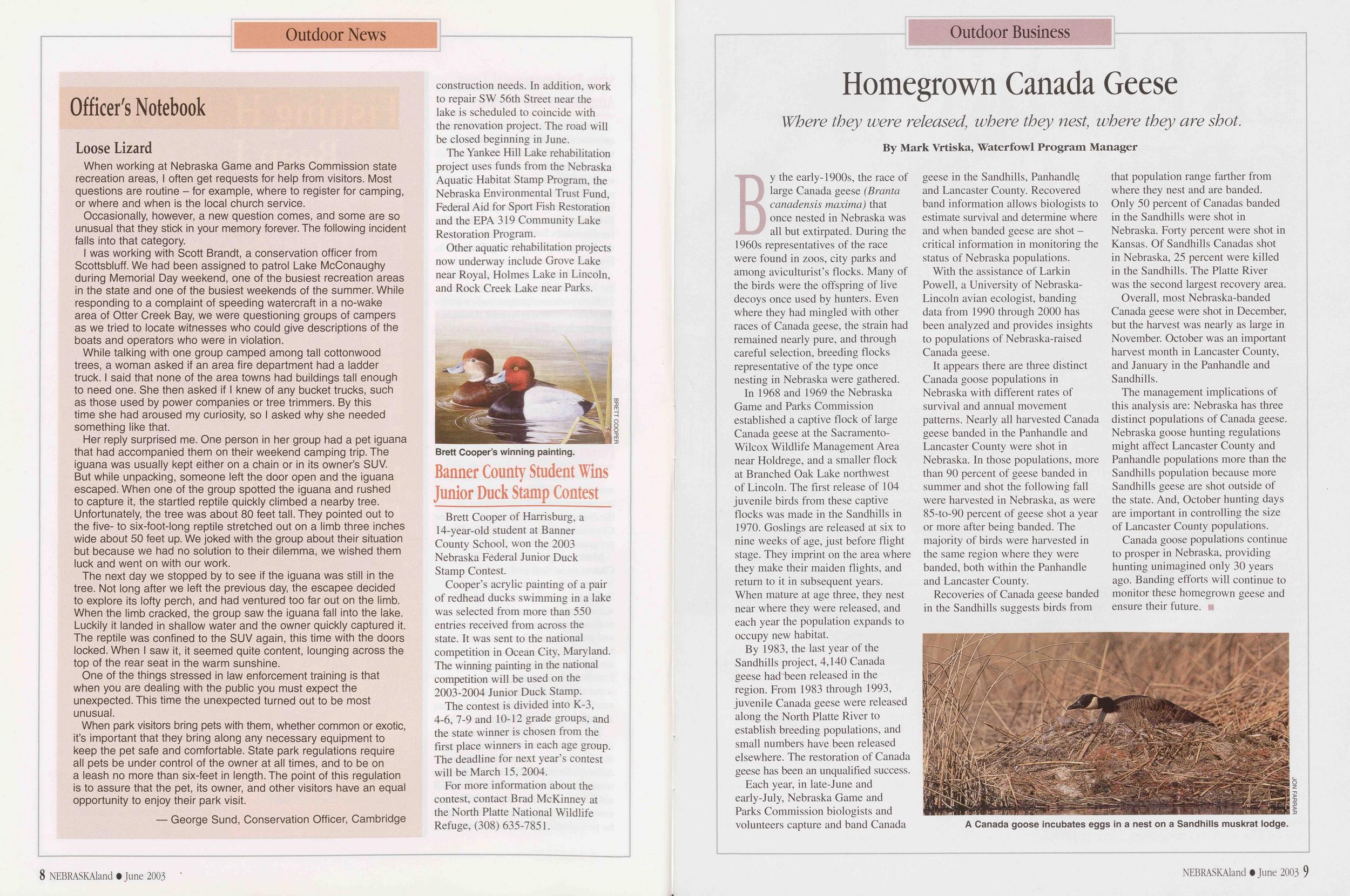 Officer's Notebook
Loose Lizard
Officer's Notebook
Loose Lizard
When working at Nebraska Game and Parks Commission state recreation areas, I often get requests for help from visitors. Most questions are routine - for example, where to register for camping, or where and when is the local church service.
Occasionally, however, a new question comes, and some are so unusual that they stick in your memory forever. The following incident falls into that category.
I was working with Scott Brandt, a conservation officer from Scottsbluff. We had been assigned to patrol Lake McConaughy during Memorial Day weekend, one of the busiest recreation areas in the state and one of the busiest weekends of the summer. While responding to a complaint of speeding watercraft in a no-wake area of Otter Creek Bay, we were questioning groups of campers as we tried to locate witnesses who could give descriptions of the boats and operators who were in violation.
While talking with one group camped among tall cottonwood trees, a woman asked if an area fire department had a ladder truck. I said that none of the area towns had buildings tall enough to need one. She then asked if I knew of any bucket trucks, such as those used by power companies or tree trimmers. By this time she had aroused my curiosity, so I asked why she needed something like that.
Her reply surprised me. One person in her group had a pet iguana that had accompanied them on their weekend camping trip. The iguana was usually kept either on a chain or in its owner's SUV. But while unpacking, someone left the door open and the iguana escaped. When one of the group spotted the iguana and rushed to capture it, the startled reptile quickly climbed a nearby tree. Unfortunately, the tree was about 80 feet tall. They pointed out to the five- to six-foot-long reptile stretched out on a limb three inches wide about 50 feet up. We joked with the group about their situation but because we had no solution to their dilemma, we wished them luck and went on with our work.
The next day we stopped by to see if the iguana was still in the tree. Not long after we left the previous day, the escapee decided to explore its lofty perch, and had ventured too far out on the limb. When the limb cracked, the group saw the iguana fall into the lake. Luckily it landed in shallow water and the owner quickly captured it. The reptile was confined to the SUV again, this time with the doors locked. When I saw it, it seemed quite content, lounging across the top of the rear seat in the warm sunshine.
One of the things stressed in law enforcement training is that when you are dealing with the public you must expect the unexpected. This time the unexpected turned out to be most unusual.
When park visitors bring pets with them, whether common or exotic, it's important that they bring along any necessary equipment to keep the pet safe and comfortable. State park regulations require all pets be under control of the owner at all times, and to be on a leash no more than six-feet in length. The point of this regulation is to assure that the pet, its owner, and other visitors have an equal opportunity to enjoy their park visit.
— George Sund, Conservation Officer, CambridgeThe Yankee Hill Lake rehabilitation project uses funds from the Nebraska Aquatic Habitat Stamp Program, the Nebraska Environmental Trust Fund, Federal Aid for Sport Fish Restoration and the EPA 319 Community Lake Restoration Program.
Other aquatic rehabilitation projects now underway include Grove Lake near Royal, Holmes Lake in Lincoln, and Rock Creek Lake near Parks.
Brett Cooper of Harrisburg, a 14-year-old student at Banner County School, won the 2003 Nebraska Federal Junior Duck Stamp Contest.
Cooper's acrylic painting of a pair of redhead ducks swimming in a lake was selected from more than 550 entries received from across the state. It was sent to the national competition in Ocean City, Maryland. The winning painting in the national competition will be used on the 2003-2004 Junior Duck Stamp.
The contest is divided into K-3, 4-6, 7-9 and 10-12 grade groups, and the state winner is chosen from the first place winners in each age group. The deadline for next year's contest will be March 15, 2004.
For more information about the contest, contact Brad McKinney at the North Platte National Wildlife Refuge, (308)635-7851.
Outdoor Business
Homegrown Canada Geese
Where they were released, where they nest, where they are shot. By Mark Vrtiska, Waterfowl Program ManagerBy the early-1900s, the race of large Canada geese (Branta canadensis maxima) that once nested in Nebraska was all but extirpated. During the 1960s representatives of the race were found in zoos, city parks and among aviculturist's flocks. Many of the birds were the offspring of live decoys once used by hunters. Even where they had mingled with other races of Canada geese, the strain had remained nearly pure, and through careful selection, breeding flocks representative of the type once nesting in Nebraska were gathered.
In 1968 and 1969 the Nebraska Game and Parks Commission established a captive flock of large Canada geese at the Sacramento- Wilcox Wildlife Management Area near Holdrege, and a smaller flock at Branched Oak Lake northwest of Lincoln. The first release of 104 juvenile birds from these captive flocks was made in the Sandhills in 1970. Goslings are released at six to nine weeks of age, just before flight stage. They imprint on the area where they make their maiden flights, and return to it in subsequent years. When mature at age three, they nest near where they were released, and each year the population expands to occupy new habitat.
By 1983, the last year of the Sandhills project, 4,140 Canada geese had been released in the region. From 1983 through 1993, juvenile Canada geese were released along the North Platte River to establish breeding populations, and small numbers have been released elsewhere. The restoration of Canada geese has been an unqualified success.
Each year, in late-June and early-July, Nebraska Game and Parks Commission biologists and volunteers capture and band Canada geese in the Sandhills, Panhandle and Lancaster County. Recovered band information allows biologists to estimate survival and determine where and when banded geese are shot - critical information in monitoring the status of Nebraska populations.
With the assistance of Larkin Powell, a University of Nebraska- Lincoln avian ecologist, banding data from 1990 through 2000 has been analyzed and provides insights to populations of Nebraska-raised Canada geese.
It appears there are three distinct Canada goose populations in Nebraska with different rates of survival and annual movement patterns. Nearly all harvested Canada geese banded in the Panhandle and Lancaster County were shot in Nebraska. In those populations, more than 90 percent of geese banded in summer and shot the following fall were harvested in Nebraska, as were 85-to-90 percent of geese shot a year or more after being banded. The majority of birds were harvested in the same region where they were banded, both within the Panhandle and Lancaster County.
Recoveries of Canada geese banded in the Sandhills suggests birds from that population range farther from where they nest and are banded. Only 50 percent of Canadas banded in the Sandhills were shot in Nebraska. Forty percent were shot in Kansas. Of Sandhills Canadas shot in Nebraska, 25 percent were killed in the Sandhills. The Platte River was the second largest recovery area.
Overall, most Nebraska-banded Canada geese were shot in December, but the harvest was nearly as large in November. October was an important harvest month in Lancaster County, and January in the Panhandle and Sandhills.
The management implications of this analysis are: Nebraska has three distinct populations of Canada geese. Nebraska goose hunting regulations might affect Lancaster County and Panhandle populations more than the Sandhills population because more Sandhills geese are shot outside of the state. And, October hunting days are important in controlling the size of Lancaster County populations.
Canada goose populations continue to prosper in Nebraska, providing hunting unimagined only 30 years ago. Banding efforts will continue to monitor these homegrown geese and ensure their future.
ECPLORE GREAT PLACES
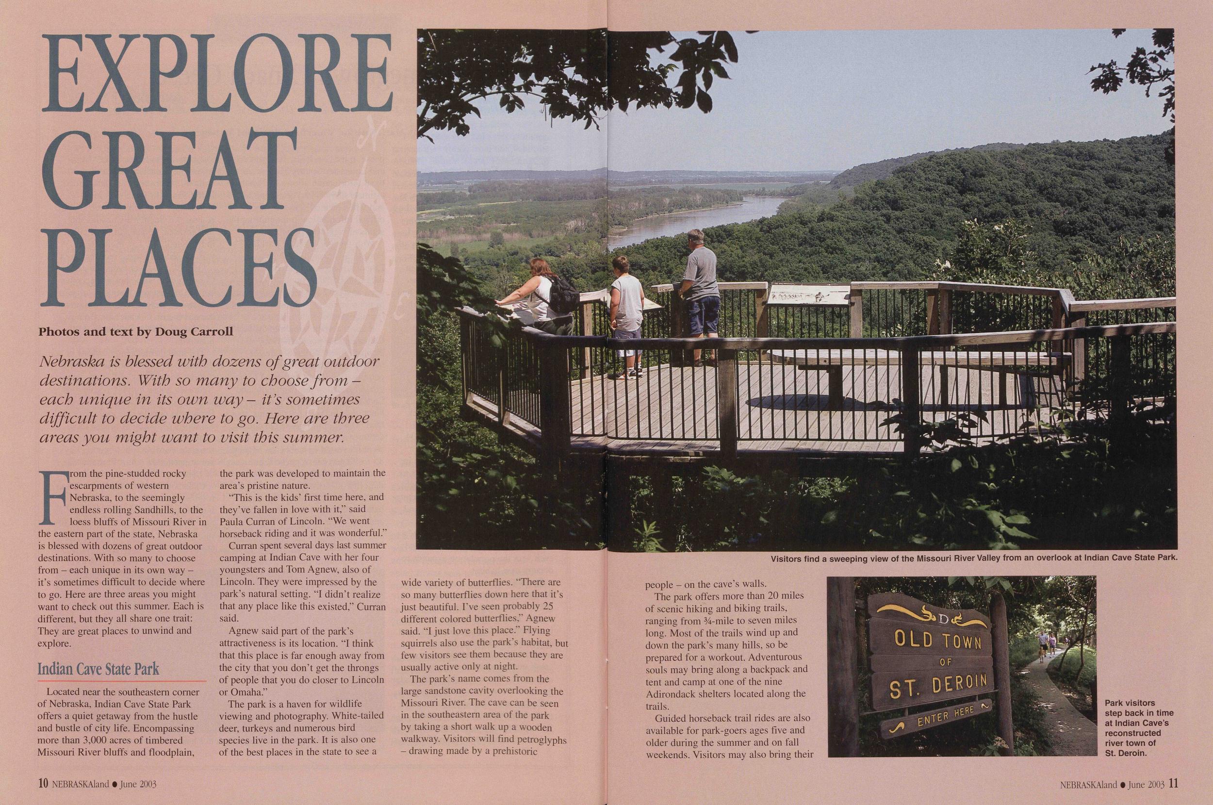
Photos and text by Doug Carroll Nebraska is blessed with dozens of great outdoor destinations. With so many to choose from - each unique in its own way- ids sometimes difficult to decide where to go. Here are three areas you might want to visit this summer.From the pine-studded rocky escarpments of western Nebraska, to the seemingly endless rolling Sandhills, to the loess bluffs of Missouri River in the eastern part of the state, Nebraska is blessed with dozens of great outdoor destinations. With so many to choose from - each unique in its own way - it's sometimes difficult to decide where to go. Here are three areas you might want to check out this summer. Each is different, but they all share one trait: They are great places to unwind and explore.
Indian Cave State ParkLocated near the southeastern corner of Nebraska, Indian Cave State Park offers a quiet getaway from the hustle and bustle of city life. Encompassing more than 3,000 acres of timbered Missouri River bluffs and floodplain, the park was developed to maintain the area's pristine nature.
"This is the kids' first time here, and they've fallen in love with it," said Paula Curran of Lincoln. "We went horseback riding and it was wonderful."
Curran spent several days last summer camping at Indian Cave with her four youngsters and Tom Agnew, also of Lincoln. They were impressed by the park's natural setting. "I didn't realize that any place like this existed," Curran said.
Agnew said part of the park's attractiveness is its location. "I think that this place is far enough away from the city that you don't get the throngs of people that you do closer to Lincoln or Omaha."
The park is a haven for wildlife viewing and photography. White-tailed deer, turkeys and numerous bird species live in the park. It is also one of the best places in the state to see a Visitors find a sweeping view of the Missouri River Valley from an overlook at Indian Cave State Park. wide variety of butterflies. 'There are so many butterflies down here that it's just beautiful. I've seen probably 25 different colored butterflies," Agnew said. T just love this place." Flying squirrels also use the park's habitat, but few visitors see them because they are usually active only at night.
The park's name comes from the large sandstone cavity overlooking the Missouri River. The cave can be seen in the southeastern area of the park by taking a short walk up a wooden walkway. Visitors will find petroglyphs - drawing made by a prehistoric 10 NEBRASKAland • June 2003
The park offers more than 20 miles of scenic hiking and biking trails, ranging from 34-mile to seven miles long. Most of the trails wind up and down the park's many hills, so be prepared for a workout. Adventurous souls may bring along a backpack and tent and camp at one of the nine Adirondack shelters located along the trails.
Guided horseback trail rides are also available for park-goers ages five and older during the summer and on fall weekends. Visitors may also bring their
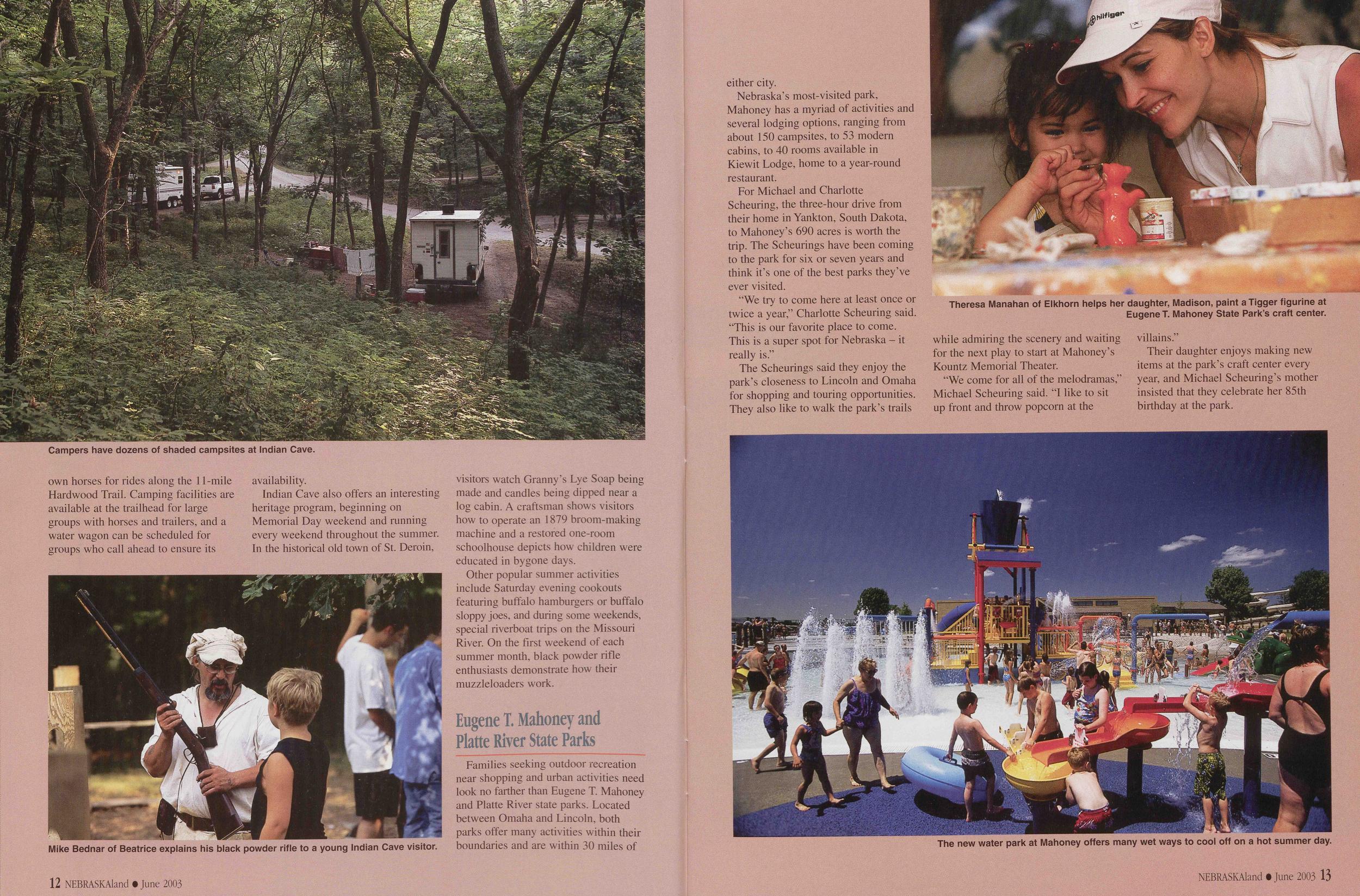
Indian Cave also offers an interesting heritage program, beginning on Memorial Day weekend and running every weekend throughout the summer. In the historical old town of St. Deroin, visitors watch Granny's Lye Soap being made and candles being dipped near a log cabin. A craftsman shows visitors how to operate an 1879 broom-making machine and a restored one-room schoolhouse depicts how children were educated in bygone days.
Other popular summer activities include Saturday evening cookouts featuring buffalo hamburgers or buffalo sloppy joes, and during some weekends, special riverboat trips on the Missouri River. On the first weekend of each summer month, black powder rifle enthusiasts demonstrate how their muzzleloaders work.
Families seeking outdoor recreation near shopping and urban activities need look no farther than Eugene T. Mahoney and Platte River state parks. Located between Omaha and Lincoln, both parks offer many activities within their boundaries and are within 30 miles of 12 NEBRASKAland • June 2003 either city.
Nebraska's most-visited park, Mahoney has a myriad of activities and several lodging options, ranging from about 150 campsites, to 53 modern cabins, to 40 rooms available in Kiewit Lodge, home to a year-round restaurant.
For Michael and Charlotte Scheuring, the three-hour drive from their home in Yankton, South Dakota, to Mahoney's 690 acres is worth the trip. The Scheurings have been coming to the park for six or seven years and think it's one of the best parks they've ever visited.
"We try to come here at least once or twice a year," Charlotte Scheuring said. "This is our favorite place to come. This is a super spot for Nebraska - it really is."
The Scheurings said they enjoy the park's closeness to Lincoln and Omaha for shopping and touring opportunities. They also like to walk the park's trails
"We come for all of the melodramas," Michael Scheuring said. "I like to sit up front and throw popcorn at the villains."
Their daughter enjoys making new items at the park's craft center every year, and Michael Scheuring's mother insisted that they celebrate her 85th birthday at the park.
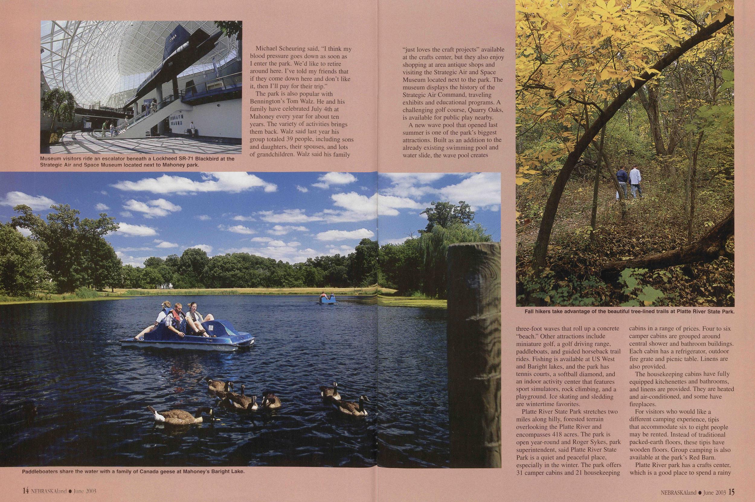
Michael Scheuring said, "I think my blood pressure goes down as soon as I enter the park. We'd like to retire around here. I've told my friends that if they come down here and don't like it, then I'll pay for their trip."
The park is also popular with Bennington's Tom Walz. He and his family have celebrated July 4th at Mahoney every year for about ten years. The variety of activities brings them back. Walz said last year his group totaled 39 people, including sons and daughters, their spouses, and lots of grandchildren. Walz said his family
A new wave pool that opened last summer is one of the park's biggest attractions. Built as an addition to the already existing swimming pool and water slide, the wave pool creates
Platte River State Park stretches two miles along hilly, forested terrain overlooking the Platte River and encompasses 418 acres. The park is open year-round and Roger Sykes, park superintendent, said Platte River State Park is a quiet and peaceful place, especially in the winter. The park offers 31 camper cabins and 21 housekeeping cabins in a range of prices. Four to six camper cabins are grouped around central shower and bathroom buildings. Each cabin has a refrigerator, outdoor fire grate and picnic table. Linens are also provided.
The housekeeping cabins have fully equipped kitchenettes and bathrooms, and linens are provided. They are heated and air-conditioned, and some have fireplaces.
For visitors who would like a different camping experience, tipis that accommodate six to eight people may be rented. Instead of traditional packed-earth floors, these tipis have wooden floors. Group camping is also available at the park's Red Barn.
Platte River park has a crafts center,
which is a good place to spend a rainy
NEBRASKAland • June 2003 15
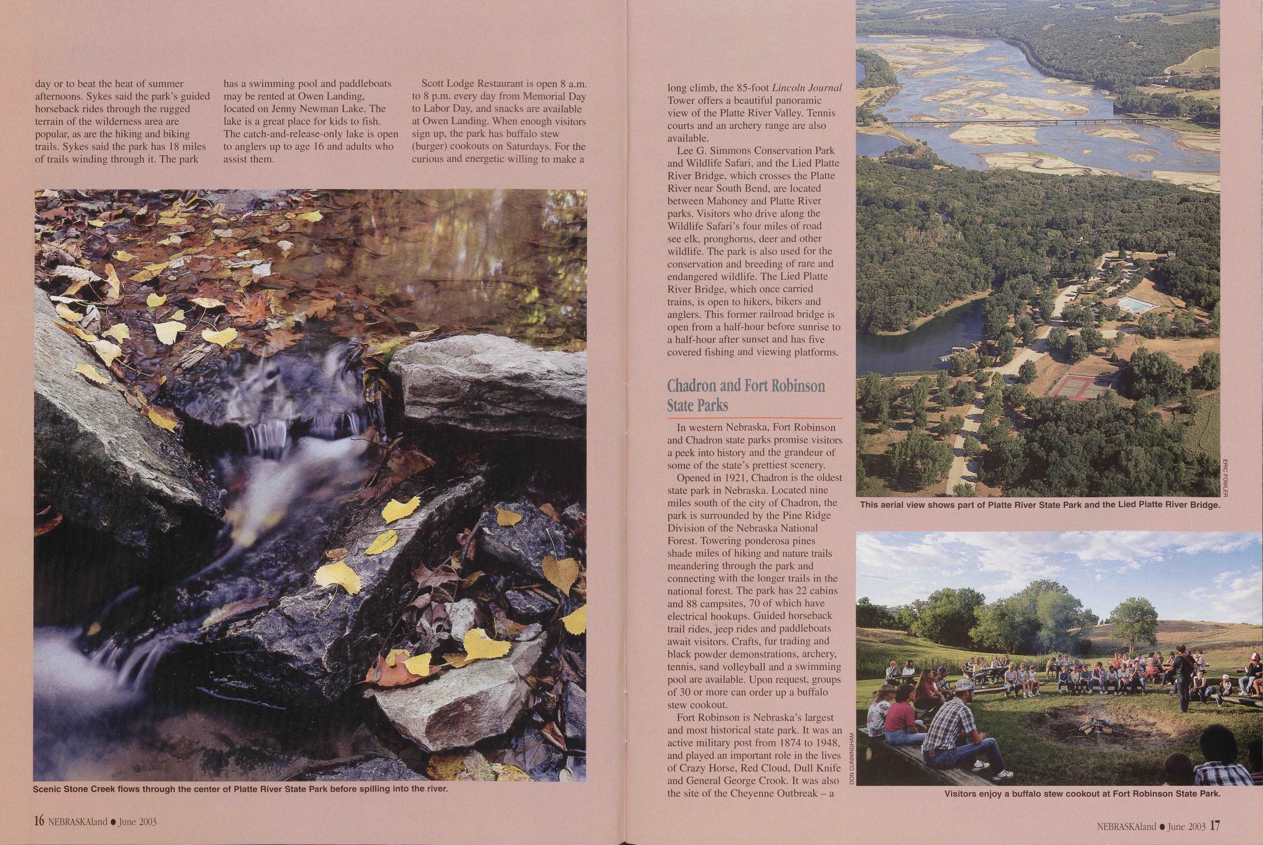 day or to beat the heat of summer
afternoons. Sykes said the park's guided
horseback rides through the rugged
terrain of the wilderness area are
popular, as are the hiking and biking
trails. Sykes said the park has 18 miles
of trails winding through it. The park
has a swimming pool and paddle boats
may be rented at Owen Landing,
located on Jenny Newman Lake. The
lake is a great place for kids to fish.
The catch-and-release-only lake is open
to anglers up to age 16 and adults who
assist them.
day or to beat the heat of summer
afternoons. Sykes said the park's guided
horseback rides through the rugged
terrain of the wilderness area are
popular, as are the hiking and biking
trails. Sykes said the park has 18 miles
of trails winding through it. The park
has a swimming pool and paddle boats
may be rented at Owen Landing,
located on Jenny Newman Lake. The
lake is a great place for kids to fish.
The catch-and-release-only lake is open
to anglers up to age 16 and adults who
assist them.
Scott Lodge Restaurant is open 8 a.m. to 8 p.m. every day from Memorial Day to Labor Day, and snacks are available at Owen Landing. When enough visitors sign up, the park has buffalo stew (burger) cookouts on Saturdays. For the curious and energetic willing to make a
Lee G. Simmons Conservation Park and Wildlife Safari, and the Lied Platte River Bridge, which crosses the Platte River near South Bend, are located between Mahoney and Platte River parks. Visitors who drive along the Wildlife Safari's four miles of road see elk, pronghorns, deer and other wildlife. The park is also used for the conservation and breeding of rare and endangered wildlife. The Lied Platte River Bridge, which once carried trains, is open to hikers, bikers and anglers. This former railroad bridge is open from a half-hour before sunrise to a half-hour after sunset and has five covered fishing and viewing platforms.
Chadron and Fort PRobinson State ParksIn western Nebraska, Fort Robinson and Chadron state parks promise visitors a peek into history and the grandeur of some of the state's prettiest scenery.
Opened in 1921, Chadron is the oldest state park in Nebraska. Located nine miles south of the city of Chadron, the park is surrounded by the Pine Ridge Division of the Nebraska National Forest. Towering ponderosa pines shade miles of hiking and nature trails meandering through the park and connecting with the longer trails in the national forest. The park has 22 cabins and 88 campsites, 70 of which have electrical hookups. Guided horseback trail rides, jeep rides and paddle boats await visitors. Crafts, fur trading and black powder demonstrations, archery, tennis, sand volleyball and a swimming pool are available. Upon request, groups of 30 or more can order up a buffalo stew cookout.
Fort Robinson is Nebraska's largest and most historical state park. It was an active military post from 1874 to 1948, and played an important role in the lives of Crazy Horse, Red Cloud, Dull Knife and General George Crook. It was also the site of the Cheyenne Outbreak - a
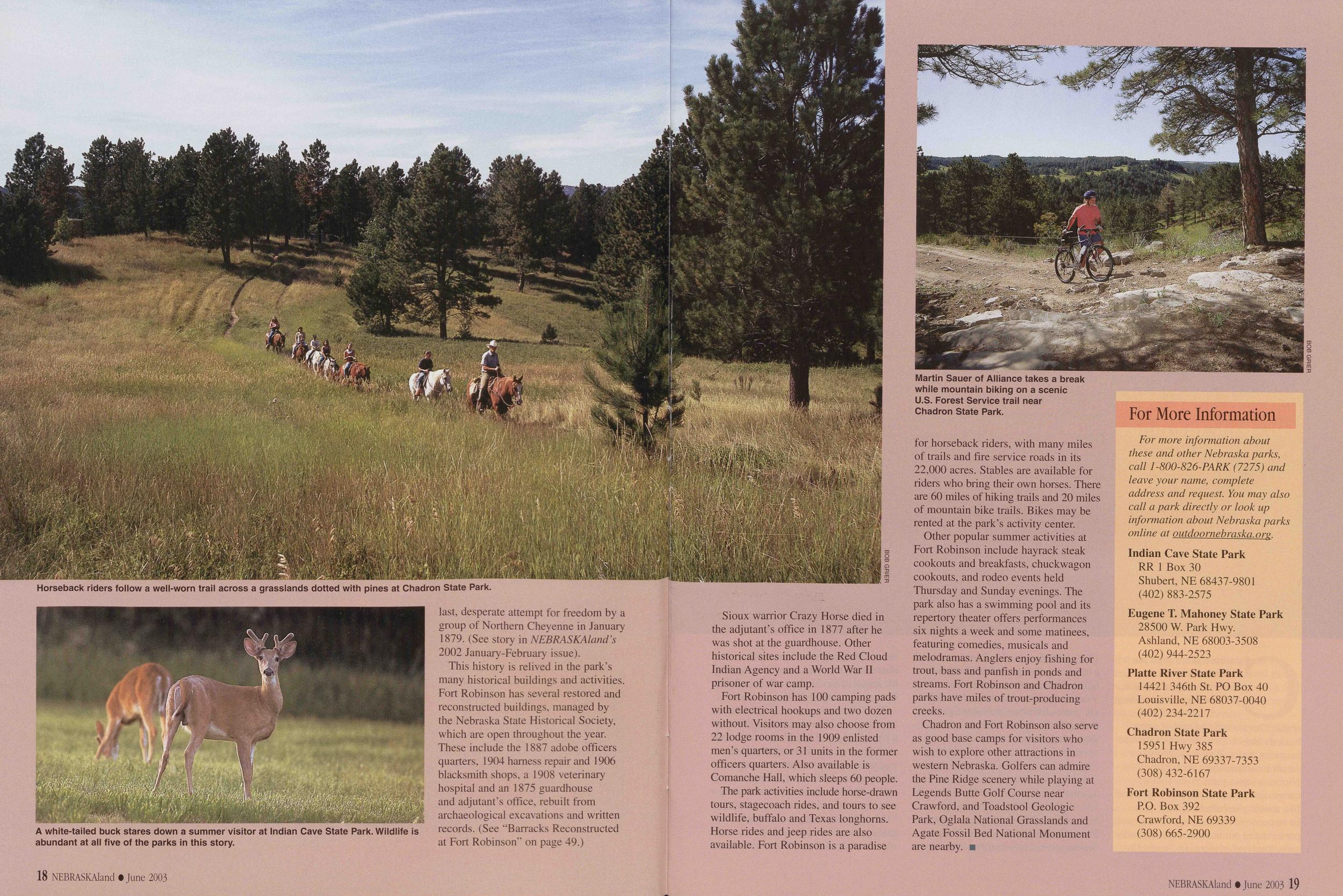
This history is relived in the park's many historical buildings and activities. Fort Robinson has several restored and reconstructed buildings, managed by the Nebraska State Historical Society, which are open throughout the year. These include the 1887 adobe officers quarters, 1904 harness repair and 1906 blacksmith shops, a 1908 veterinary hospital and an 1875 guardhouse and adjutant's office, rebuilt from archaeological excavations and written records. (See "Barracks Reconstructed at Fort Robinson" on page 49.)
18 NEBRASKAland • June 2003Sioux warrior Crazy Horse died in the adjutant's office in 1877 after he was shot at the guardhouse. Other historical sites include the Red Cloud Indian Agency and a World War II prisoner of war camp.
Fort Robinson has 100 camping pads with electrical hookups and two dozen without. Visitors may also choose from 22 lodge rooms in the 1909 enlisted men's quarters, or 31 units in the former officers quarters. Also available is Comanche Hall, which sleeps 60 people.
The park activities include horse-drawn tours, stagecoach rides, and tours to see wildlife, buffalo and Texas longhorns. Horse rides and jeep rides are also available. Fort Robinson is a paradise
Other popular summer activities at Fort Robinson include hayrack steak cookouts and breakfasts, chuckwagon cookouts, and rodeo events held Thursday and Sunday evenings. The park also has a swimming pool and its repertory theater offers performances six nights a week and some matinees, featuring comedies, musicals and melodramas. Anglers enjoy fishing for trout, bass and panfish in ponds and streams. Fort Robinson and Chadron parks have miles of trout-producing creeks.
Chadron and Fort Robinson also serve as good base camps for visitors who wish to explore other attractions in western Nebraska. Golfers can admire the Pine Ridge scenery while playing at Legends Butte Golf Course near Crawford, and Toadstool Geologic Park, Oglala National Grasslands and Agate Fossil Bed National Monument are nearby.
For More InformationFor more information about these and other Nebraska parks, call 1-800-826-PARK (7275) and leave your name, complete address and request. You may also call a park directly or look up information about Nebraska parks online at outdoornebraska. org.
Indian Cave State Park RR 1 Box 30 Shubert, NE 68437-9801 (402) 883-2575 Eugene T. Mahoney State Park 28500 W. Park Hwy. Ashland, NE 68003-3508 (402) 944-2523 Platte River State Park 14421 346th St. PO Box 40 Louisville, NE 68037-0040 (402)234-2217 Chadron State Park 15951 Hwy 385 Chadron, NE 69337-7353 (308) 432-6167 Fort Robinson State Park P.O. Box 392 Crawford, NE 69339 (308) 665-2900 NEBRASKAland t June 2003 19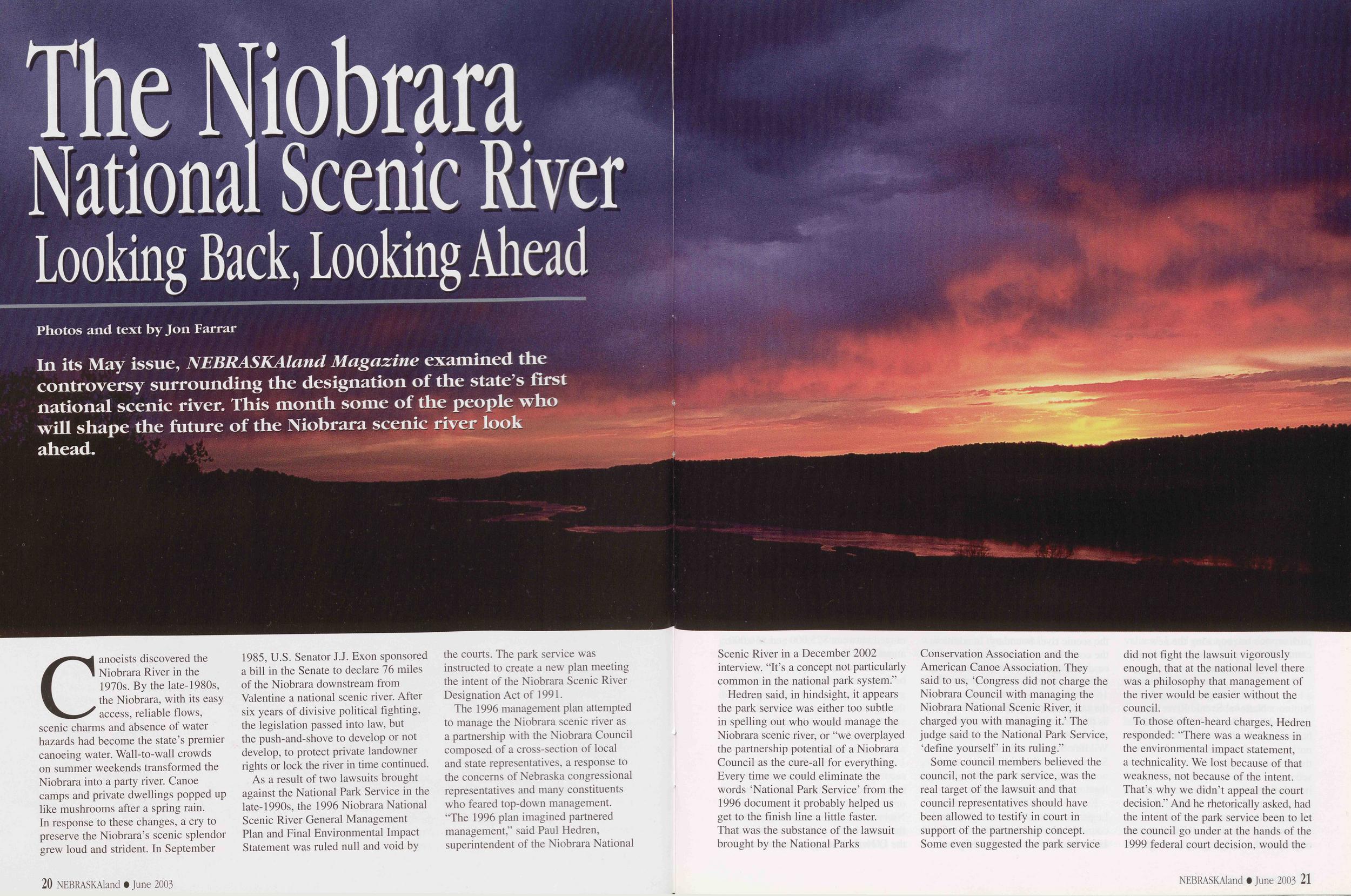
The Niobrara National Scenic River Looking Back, Looking Ahead
Photos and text by Jon Farrar In its May issue, NEBRASKAland Magazine examined the controversy surrounding the designation of the state's first national scenic river. This month some of the people who will shape the future of the Niobrara scenic river look ahead.Canoeists discovered the Niobrara River in the 1970s. By the late-1980s, the Niobrara, with its easy access, reliable flows, scenic charms and absence of water hazards had become the state's premier canoeing water. Wall-to-wall crowds on summer weekends transformed the Niobrara into a party river. Canoe camps and private dwellings popped up like mushrooms after a spring rain. In response to these changes, a cry to preserve the Niobrara's scenic splendor grew loud and strident. In September 1985, U.S. Senator J.J. Exon sponsored a bill in the Senate to declare 76 miles of the Niobrara downstream from Valentine a national scenic river. After six years of divisive political fighting, the legislation passed into law, but the push-and-shove to develop or not develop, to protect private landowner rights or lock the river in time continued.
As a result of two lawsuits brought against the National Park Service in the late-1990s, the 1996 Niobrara National Scenic River General Management Plan and Final Environmental Impact Statement was ruled null and void by the courts. The park service was instructed to create a new plan meeting the intent of the Niobrara Scenic River Designation Act of 1991.
The 1996 management plan attempted to manage the Niobrara scenic river as a partnership with the Niobrara Council composed of a cross-section of local and state representatives, a response to the concerns of Nebraska congressional representatives and many constituents who feared top-down management. 'The 1996 plan imagined partnered management," said Paul Hedren, superintendent of the Niobrara National 20 NEBRASKAland • June 2003 Scenic River in a December 2002 interview. "It's a concept not particularly common in the national park system."
Hedren said, in hindsight, it appears the park service was either too subtle in spelling out who would manage the Niobrara scenic river, or "we overplayed the partnership potential of a Niobrara Council as the cure-all for everything. Every time we could eliminate the words 'National Park Service' from the 1996 document it probably helped us get to the finish line a little faster. That was the substance of the lawsuit brought by the National Parks Conservation Association and the American Canoe Association. They said to us, 'Congress did not charge the Niobrara Council with managing the Niobrara National Scenic River, it charged you with managing it.' The judge said to the National Park Service, 'define yourself in its ruling."
Some council members believed the council, not the park service, was the real target of the lawsuit and that council representatives should have been allowed to testify in court in support of the partnership concept. Some even suggested the park service did not fight the lawsuit vigorously enough, that at the national level there was a philosophy that management of the river would be easier without the council.
To those often-heard charges, Hedren
responded: "There was a weakness in
the environmental impact statement,
a technicality. We lost because of that
weakness, not because of the intent.
That's why we didn't appeal the court
decision." And he rhetorically asked, had
the intent of the park service been to let
the council go under at the hands of the
1999 federal court decision, would the
NEBRASKAland • June 2003 21
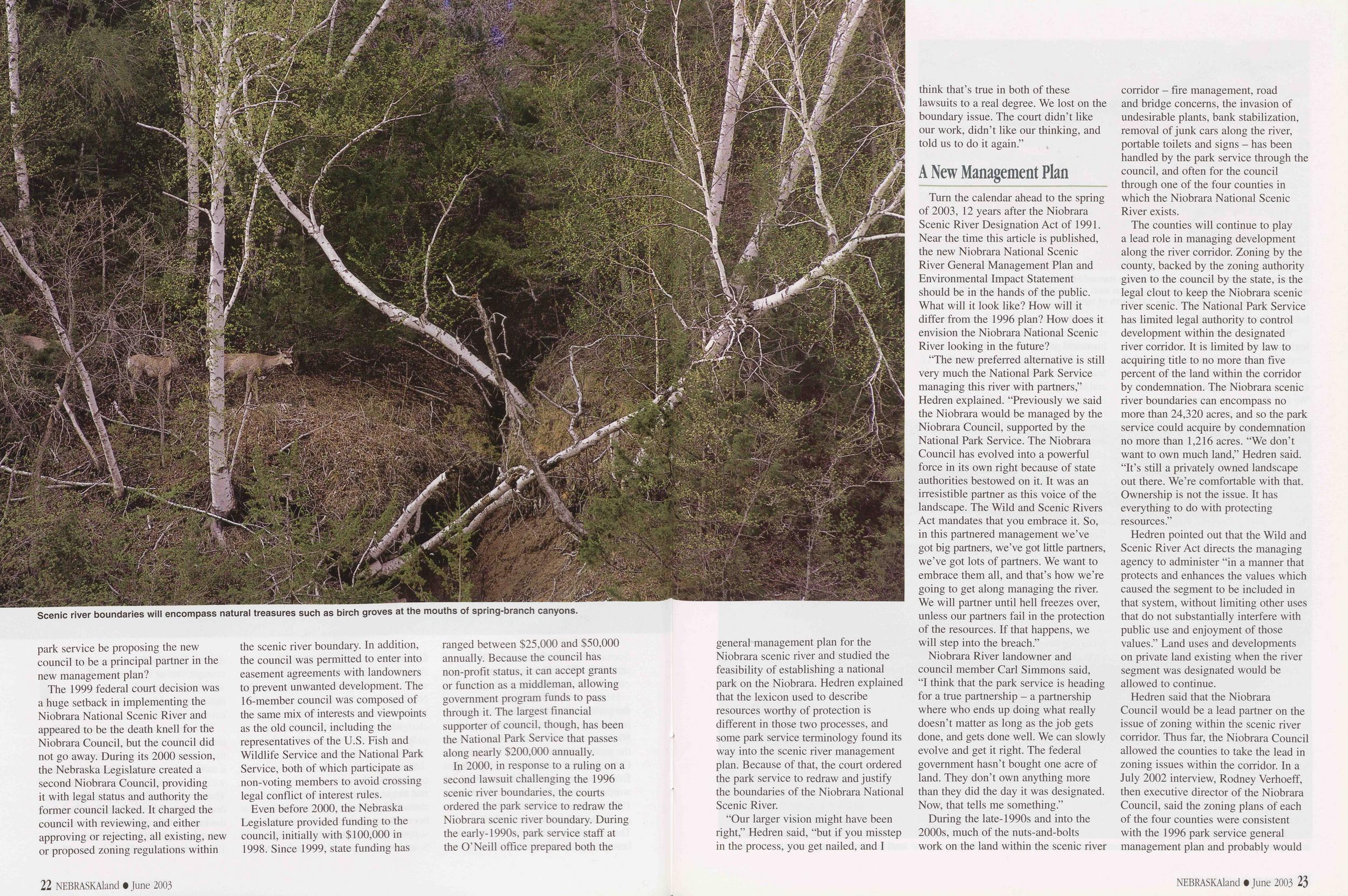
The 1999 federal court decision was a huge setback in implementing the Niobrara National Scenic River and appeared to be the death knell for the Niobrara Council, but the council did not go away. During its 2000 session, the Nebraska Legislature created a second Niobrara Council, providing it with legal status and authority the former council lacked. It charged the council with reviewing, and either approving or rejecting, all existing, new or proposed zoning regulations within the scenic river boundary. In addition, the council was permitted to enter into easement agreements with landowners to prevent unwanted development. The 16-member council was composed of the same mix of interests and viewpoints as the old council, including the representatives of the U.S. Fish and Wildlife Service and the National Park Service, both of which participate as non-voting members to avoid crossing legal conflict of interest rules.
Even before 2000, the Nebraska Legislature provided funding to the council, initially with $100,000 in 1998. Since 1999, state funding has ranged between $25,000 and $50,000 annually. Because the council has non-profit status, it can accept grants or function as a middleman, allowing government program funds to pass through it. The largest financial supporter of council, though, has been the National Park Service that passes along nearly $200,000 annually.
In 2000, in response to a ruling on a second lawsuit challenging the 1996 scenic river boundaries, the courts ordered the park service to redraw the Niobrara scenic river boundary. During the early-1990s, park service staff at the O'Neill office prepared both the 22 NEBRASKAland • June 2003 general management plan for the Niobrara scenic river and studied the feasibility of establishing a national park on the Niobrara. Hedren explained that the lexicon used to describe resources worthy of protection is different in those two processes, and some park service terminology found its way into the scenic river management plan. Because of that, the court ordered the park service to redraw and justify the boundaries of the Niobrara National Scenic River.
"Our larger vision might have been right," Hedren said, "but if you misstep in the process, you get nailed, and I think that's true in both of these lawsuits to a real degree. We lost on the boundary issue. The court didn't like our work, didn't like our thinking, and told us to do it again."
A New Management PlanTurn the calendar ahead to the spring of 2003, 12 years after the Niobrara Scenic River Designation Act of 1991. Near the time this article is published, the new Niobrara National Scenic River General Management Plan and Environmental Impact Statement should be in the hands of the public. What will it look like? How will it differ from the 1996 plan? How does it envision the Niobrara National Scenic River looking in the future?
"The new preferred alternative is still very much the National Park Service managing this river with partners," Hedren explained. "Previously we said the Niobrara would be managed by the Niobrara Council, supported by the National Park Service. The Niobrara Council has evolved into a powerful force in its own right because of state authorities bestowed on it. It was an irresistible partner as this voice of the landscape. The Wild and Scenic Rivers Act mandates that you embrace it. So, in this partnered management we've got big partners, we've got little partners, we've got lots of partners. We want to embrace them all, and that's how we're going to get along managing the river. We will partner until hell freezes over, unless our partners fail in the protection of the resources. If that happens, we will step into the breach."
Niobrara River landowner and council member Carl Simmons said, "I think that the park service is heading for a true partnership - a partnership where who ends up doing what really doesn't matter as long as the job gets done, and gets done well. We can slowly evolve and get it right. The federal government hasn't bought one acre of land. They don't own anything more than they did the day it was designated. Now, that tells me something."
During the late-1990s and into the 2000s, much of the nuts-and-bolts work on the land within the scenic river corridor - fire management, road and bridge concerns, the invasion of undesirable plants, bank stabilization, removal of junk cars along the river, portable toilets and signs - has been handled by the park service through the council, and often for the council through one of the four counties in which the Niobrara National Scenic River exists.
The counties will continue to play a lead role in managing development along the river corridor. Zoning by the county, backed by the zoning authority given to the council by the state, is the legal clout to keep the Niobrara scenic river scenic. The National Park Service has limited legal authority to control development within the designated river corridor. It is limited by law to acquiring title to no more than five percent of the land within the corridor by condemnation. The Niobrara scenic river boundaries can encompass no more than 24,320 acres, and so the park service could acquire by condemnation no more than 1,216 acres. "We don't want to own much land," Hedren said. "It's still a privately owned landscape out there. We're comfortable with that. Ownership is not the issue. It has everything to do with protecting resources."
Hedren pointed out that the Wild and Scenic River Act directs the managing agency to administer "in a manner that protects and enhances the values which caused the segment to be included in that system, without limiting other uses that do not substantially interfere with public use and enjoyment of those values." Land uses and developments on private land existing when the river segment was designated would be allowed to continue.
Hedren said that the Niobrara
Council would be a lead partner on the
issue of zoning within the scenic river
corridor. Thus far, the Niobrara Council
allowed the counties to take the lead in
zoning issues within the corridor. In a
July 2002 interview, Rodney Verhoeff,
then executive director of the Niobrara
Council, said the zoning plans of each
of the four counties were consistent
with the 1996 park service general
management plan and probably would
NEBRASKAland June 2003 23
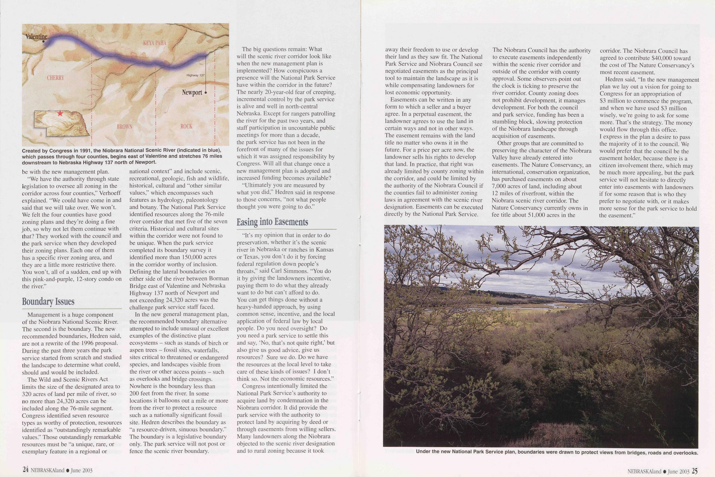
"We have the authority through state legislation to oversee all zoning in the corridor across four counties," Verhoeff explained. "We could have come in and said that we will take over. We won't. We felt the four counties have good zoning plans and they're doing a fine job, so why not let them continue with that? They worked with the council and the park service when they developed their zoning plans. Each one of them has a specific river zoning area, and they are a little more restrictive there. You won't, all of a sudden, end up with this pink-and-purple, 12-story condo on the river."
Boundary IssuesManagement is a huge component of the Niobrara National Scenic River. The second is the boundary. The new recommended boundaries, Hedren said, are not a rewrite of the 1996 proposal. During the past three years the park service started from scratch and studied the landscape to determine what could, should and would be included.
The Wild and Scenic Rivers Act limits the size of the designated area to 320 acres of land per mile of river, so no more than 24,320 acres can be included along the 76-mile segment. Congress identified seven resource types as worthy of protection, resources identified as "outstandingly remarkable values." Those outstandingly remarkable resources must be "a unique, rare, or exemplary feature in a regional or historical, cultural and "other similar values," which encompasses such features as hydrology, paleontology and botany. The National Park Service identified resources along the 76-mile river corridor that met five of the seven criteria. Historical and cultural sites within the corridor were not found to be unique. When the park service completed its boundary survey it identified more than 150,000 acres in the corridor worthy of inclusion. Defining the lateral boundaries on either side of the river between Borman Bridge east of Valentine and Nebraska Highway 137 north of Newport and not exceeding 24,320 acres was the challenge park service staff faced.
In the new general management plan, the recommended boundary alternative attempted to include unusual or excellent examples of the distinctive plant ecosystems - such as stands of birch or aspen trees - fossil sites, waterfalls, sites critical to threatened or endangered species, and landscapes visible from the river or other access points - such as overlooks and bridge crossings. Nowhere is the boundary less than 200 feet from the river. In some locations it balloons out a mile or more from the river to protect a resource such as a nationally significant fossil site. Hedren describes the boundary as "a resource-driven, sinuous boundary." The boundary is a legislative boundary only. The park service will not post or fence the scenic river boundary.
The big questions remain: What will the scenic river corridor look like when the new management plan is implemented? How conspicuous a presence will the National Park Service have within the corridor in the future? The nearly 20-year-old fear of creeping, incremental control by the park service is alive and well in north-central Nebraska. Except for rangers patrolling the river for the past two years, and staff participation in uncountable public meetings for more than a decade, the park service has not been in the forefront of many of the issues for which it was assigned responsibility by Congress. Will all that change once a new management plan is adopted and increased funding becomes available?
"Ultimately you are measured by what you did," Hedren said in response to those concerns, "not what people thought you were going to do."
Easing into Easements"It's my opinion that in order to do preservation, whether it's the scenic river in Nebraska or ranches in Kansas or Texas, you don't do it by forcing federal regulation down people's throats," said Carl Simmons. "You do it by giving the landowners incentive, paying them to do what they already want to do but can't afford to do. You can get things done without a heavy-handed approach, by using common sense, incentive, and the local application of federal law by local people. Do you need oversight? Do you need a park service to settle this and say, 'No, that's not quite right,' but also give us good advice, give us resources? Sure we do. Do we have the resources at the local level to take care of these kinds of issues? I don't think so. Not the economic resources."
Congress intentionally limited the National Park Service's authority to acquire land by condemnation in the Niobrara corridor. It did provide the park service with the authority to protect land by acquiring by deed or through easements from willing sellers. Many landowners along the Niobrara objected to the scenic river designation and to rural zoning because it took 24 NEBRASKAland • June 2003 away their freedom to use or develop their land as they saw fit. The National Park Service and Niobrara Council see negotiated easements as the principal tool to maintain the landscape as it is while compensating landowners for lost economic opportunity.
Easements can be written in any form to which a seller and a buyer agree. In a perpetual easement, the landowner agrees to use the land in certain ways and not in other ways. The easement remains with the land title no matter who owns it in the future. For a price per acre now, the landowner sells his rights to develop that land. In practice, that right was already limited by county zoning within the corridor, and could be limited by the authority of the Niobrara Council if the counties fail to administer zoning laws in agreement with the scenic river designation. Easements can be executed directly by the National Park Service. The Niobrara Council has the authority to execute easements independently within the scenic river corridor and outside of the corridor with county approval. Some observers point out the clock is ticking to preserve the river corridor. County zoning does not prohibit development, it manages development. For both the council and park service, funding has been a stumbling block, slowing protection of the Niobrara landscape through acquisition of easements.
Other groups that are committed to preserving the character of the Niobrara Valley have already entered into easements. The Nature Conservancy, an international, conservation organization, has purchased easements on about 7,000 acres of land, including about 12 miles of riverfront, within the Niobrara scenic river corridor. The Nature Conservancy currently owns in fee title about 51,000 acres in the corridor. The Niobrara Council has agreed to contribute $40,000 toward the cost of The Nature Conservancy's most recent easement.
Hedren said, "In the new management plan we lay out a vision for going to Congress for an appropriation of $3 million to commence the program, and when we have used $3 million wisely, we're going to ask for some more. That's the strategy. The money would flow through this office. I express in the plan a desire to pass the majority of it to the council. We would prefer that the council be the easement holder, because there is a citizen involvement there, which may be much more appealing, but the park service will not hesitate to directly enter into easements with landowners if for some reason that is who they prefer to negotiate with, or it makes more sense for the park service to hold the easement."
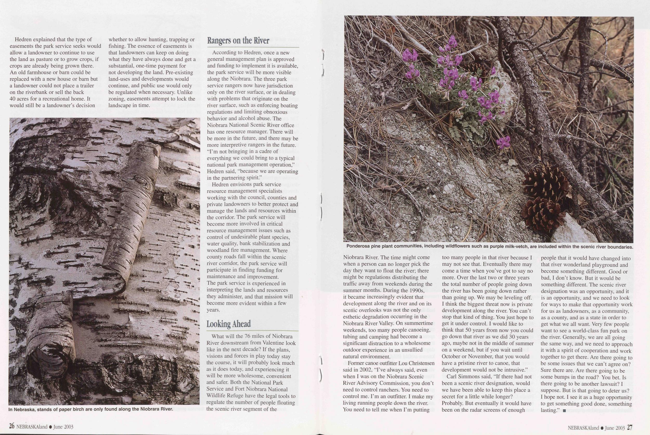
Hedren explained that the type of easements the park service seeks would allow a landowner to continue to use the land as pasture or to grow crops, if crops are already being grown there. An old farmhouse or barn could be replaced with a new house or barn but a landowner could not place a trailer on the riverbank or sell the back 40 acres for a recreational home. It would still be a landowner's decision whether to allow hunting, trapping or fishing. The essence of easements is that landowners can keep on doing what they have always done and get a substantial, one-time payment for not developing the land. Pre-existing land-uses and developments would continue, and public use would only be regulated when necessary. Unlike zoning, easements attempt to lock the landscape in time.
According to Hedren, once a new general management plan is approved and funding to implement it is available, the park service will be more visible along the Niobrara. The three park service rangers now have jurisdiction only on the river surface, or in dealing with problems that originate on the river surface, such as enforcing boating regulations and limiting obnoxious behavior and alcohol abuse. The Niobrara National Scenic River office has one resource manager. There will be more in the future, and there may be more interpretive rangers in the future. "I'm not bringing in a cadre of everything we could bring to a typical national park management operation,"
Hedren said, "because we are operating in the partnering spirit." Hedren envisions park service resource management specialists working with the council, counties and private landowners to better protect and manage the lands and resources within the corridor. The park service will become more involved in critical resource management issues such as control of undesirable plant species, water quality, bank stabilization and woodland fire management. Where county roads fall within the scenic river corridor, the park service will participate in finding funding for maintenance and improvement. The park service is experienced in interpreting the lands and resources they administer, and that mission will become more evident within a few years.
Looking AheadWhat will the 76 miles of Niobrara River downstream from Valentine look like in the next decade? If the plans, visions and forces in play today stay the course, it will probably look much as it does today, and experiencing it will be more wholesome, convenient and safer. Both the National Park Service and Fort Niobrara National Wildlife Refuge have the legal tools to regulate the number of people floating the scenic river segment of the 26 NEBRASKAland t June 2003
Former canoe outfitter Lou Christensen said in 2002, "I've always said, even when I was on the Niobrara Scenic River Advisory Commission, you don't need to control ranchers. You need to control me. I'm an outfitter. I make my living running people down the river. You need to tell me when I'm putting too many people in that river because I may not see that. Eventually there may come a time when you've got to say no more. Over the last two or three years the total number of people going down the river has been going down rather than going up. We may be leveling off. I think the biggest threat now is private development along the river. You can't stop that kind of thing. You just hope to get it under control. I would like to think that 50 years from now you could go down that river as we did 30 years ago, maybe not in the middle of summer on a weekend, but if you wait until October or November, that you would have a pristine river to canoe, that development would not be intrusive."
Carl Simmons said, "If there had not been a scenic river designation, would we have been able to keep this place a secret for a little while longer? Probably. But eventually it would have been on the radar screens of enough people that it would have changed into that river wonderland playground and become something different. Good or bad, I don't know. But it would be something different. The scenic river designation was an opportunity, and it is an opportunity, and we need to look for ways to make that opportunity work for us as landowners, as a community, as a county, and as a state in order to get what we all want. Very few people want to see a world-class fun park on the river. Generally, we are all going the same way, and we need to approach it with a spirit of cooperation and work together to get there. Are there going to be some issues that we can't agree on? Sure there are. Are there going to be some bumps in the road? You bet. Is there going to be another lawsuit? I suppose. But is that going to deter us? I hope not. I see it as a huge opportunity to get something good done, something lasting."
NEBRASKAland • June 2003 27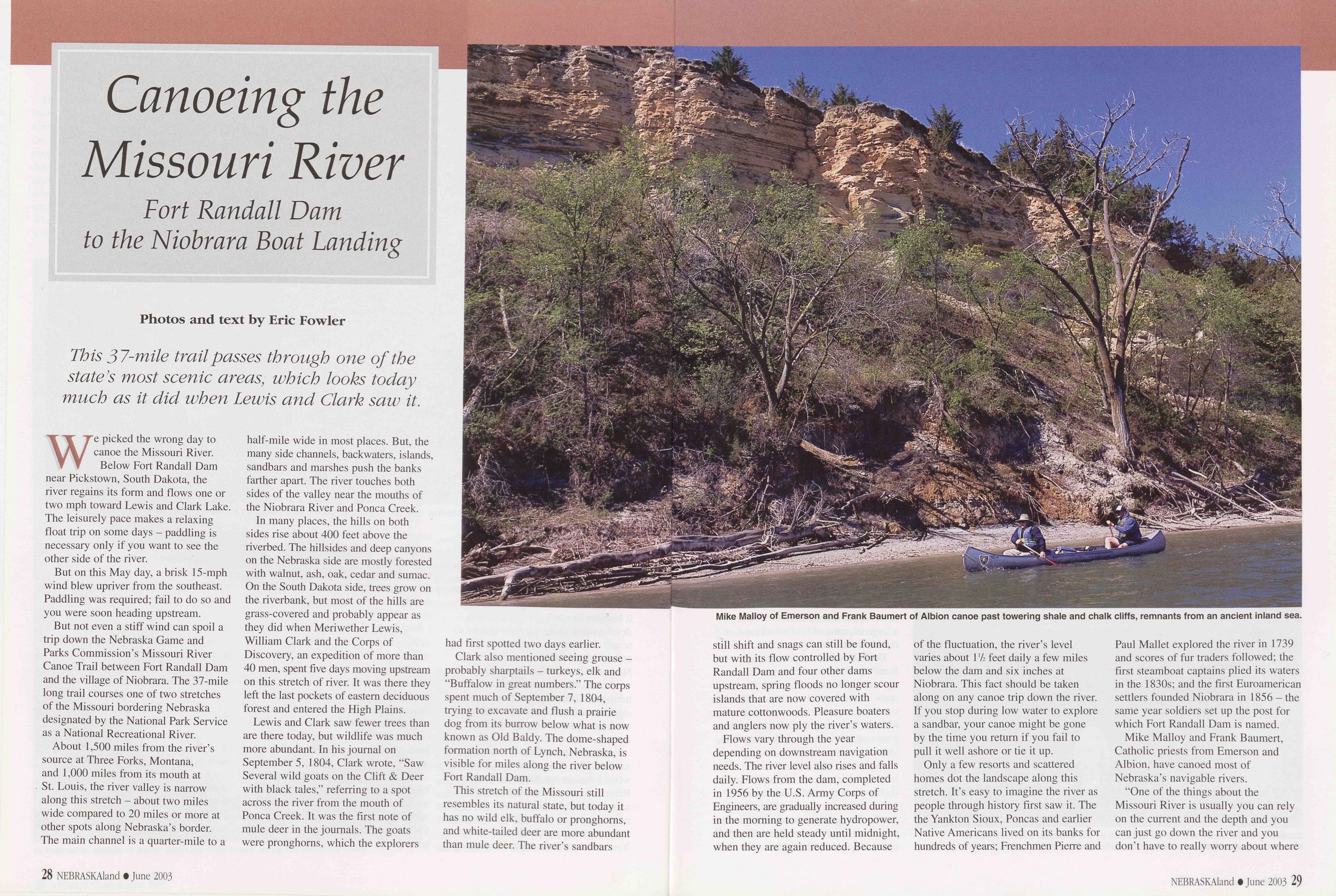
Canoeing the Missouri River Fort Randall Dam to the Niobrara Boat Landing
Photos and text by Eric Fowler This 37-mile trail passes through one of the state's most scenic areas, which looks today much as it did when Lewis and Clark saw it.We picked the wrong day to canoe the Missouri River. Below Fort Randall Dam near Pickstown, South Dakota, the river regains its form and flows one or two mph toward Lewis and Clark Lake. The leisurely pace makes a relaxing float trip on some days - paddling is necessary only if you want to see the other side of the river.
But on this May day, a brisk 15-mph wind blew upriver from the southeast. Paddling was required; fail to do so and you were soon heading upstream.
But not even a stiff wind can spoil a trip down the Nebraska Game and Parks Commission's Missouri River Canoe Trail between Fort Randall Dam and the village of Niobrara. The 37-mile long trail courses one of two stretches of the Missouri bordering Nebraska designated by the National Park Service as a National Recreational River.
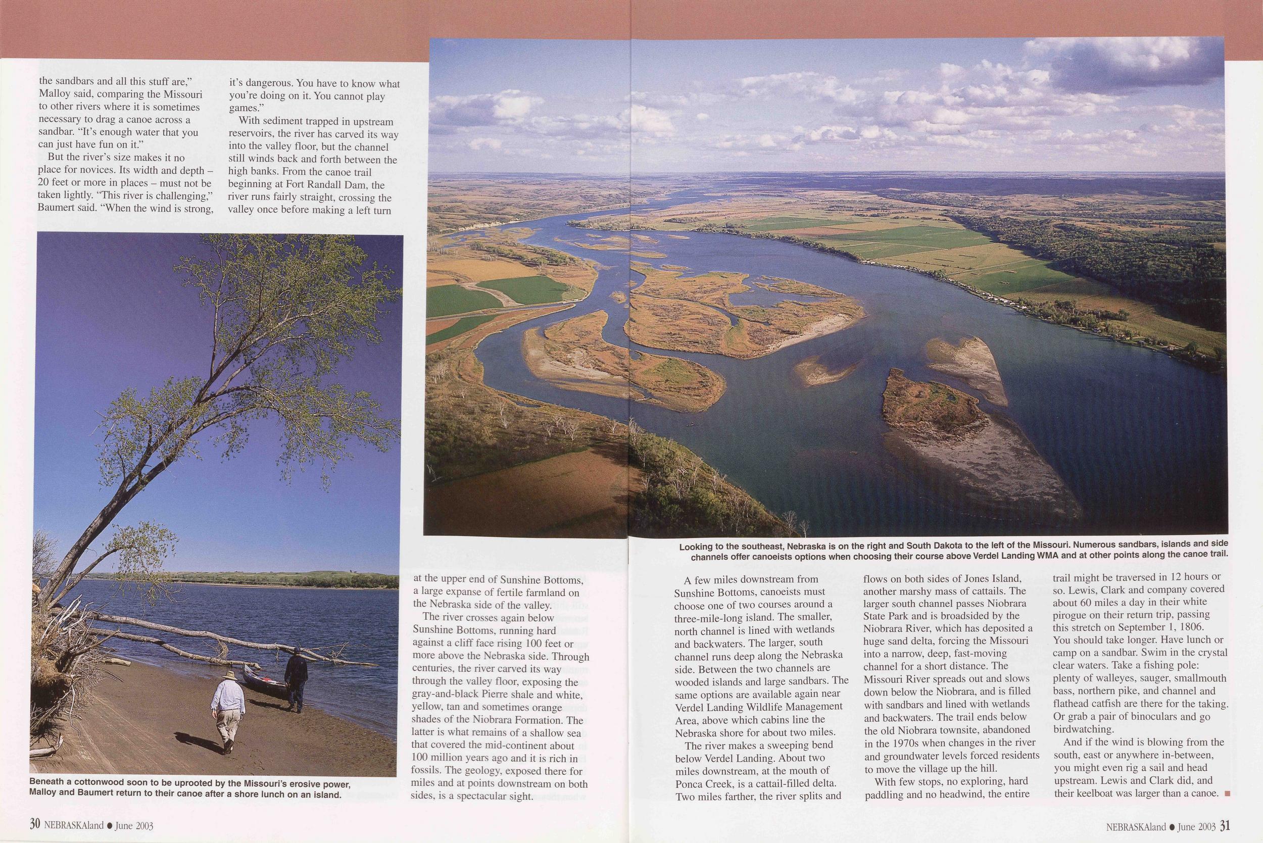
About 1,500 miles from the river's source at Three Forks, Montana, and 1,000 miles from its mouth at St. Louis, the river valley is narrow along this stretch - about two miles wide compared to 20 miles or more at other spots along Nebraska's border. The main channel is a quarter-mile to a half-mile wide in most places. But, the many side channels, backwaters, islands, sandbars and marshes push the banks farther apart. The river touches both sides of the valley near the mouths of the Niobrara River and Ponca Creek.
In many places, the hills on both sides rise about 400 feet above the riverbed. The hillsides and deep canyons on the Nebraska side are mostly forested with walnut, ash, oak, cedar and sumac. On the South Dakota side, trees grow on the riverbank, but most of the hills are grass-covered and probably appear as they did when Meriwether Lewis, William Clark and the Corps of Discovery, an expedition of more than 40 men, spent five days moving upstream on this stretch of river. It was there they left the last pockets of eastern deciduous forest and entered the High Plains.
Lewis and Clark saw fewer trees than are there today, but wildlife was much more abundant. In his journal on September 5, 1804, Clark wrote, "Saw Several wild goats on the Clift & Deer with black tales," referring to a spot across the river from the mouth of Ponca Creek. It was the first note of mule deer in the journals. The goats were pronghorns, which the explorers had first spotted two days earlier.
Clark also mentioned seeing grouse - probably sharptails - turkeys, elk and "Buffalow in great numbers." The corps spent much of September 7, 1804, trying to excavate and flush a prairie dog from its burrow below what is now known as Old Baldy. The dome-shaped formation north of Lynch, Nebraska, is visible for miles along the river below Fort Randall Dam.
This stretch of the Missouri still resembles its natural state, but today it has no wild elk, buffalo or pronghorns, and white-tailed deer are more abundant than mule deer. The river's sandbars 28 NEBRASKAland • June 2003
Flows vary through the year depending on downstream navigation needs. The river level also rises and falls daily. Flows from the dam, completed in 1956 by the U.S. Army Corps of Engineers, are gradually increased during in the morning to generate hydropower, and then are held steady until midnight, when they are again reduced. Because of the fluctuation, the river's level varies about 1 xk feet daily a few miles below the dam and six inches at Niobrara. This fact should be taken along on any canoe trip down the river. If you stop during low water to explore a sandbar, your canoe might be gone by the time you return if you fail to pull it well ashore or tie it up.
Only a few resorts and scattered homes dot the landscape along this stretch. It's easy to imagine the river as people through history first saw it. The the Yankton Sioux, Poncas and earlier Native Americans lived on its banks for hundreds of years; Frenchmen Pierre and Paul Mallet explored the river in 1739 and scores of fur traders followed; the first steamboat captains plied its waters in the 1830s; and the first Euroamerican settlers founded Niobrara in 1856 - the same year soldiers set up the post for which Fort Randall Dam is named.
Mike Malloy and Frank Baumert, Catholic priests from Emerson and Albion, have canoed most of Nebraska's navigable rivers.
"One of the things about the
Missouri River is usually you can rely
on the current and the depth and you
can just go down the river and you
don't have to really worry about where
NEBRASKAland • June 2003 29
 the sandbars and all this stuff are,"
Malloy said, comparing the Missouri
to other rivers where it is sometimes
necessary to drag a canoe across a
sandbar. "It's enough water that you
can just have fun on it."
the sandbars and all this stuff are,"
Malloy said, comparing the Missouri
to other rivers where it is sometimes
necessary to drag a canoe across a
sandbar. "It's enough water that you
can just have fun on it."
But the river's size makes it no place for novices. Its width and depth - 20 feet or more in places - must not be taken lightly. "This river is challenging," Baumert said. "When the wind is strong, it's dangerous. You have to know what you're doing on it. You cannot play games."
With sediment trapped in upstream reservoirs, the river has carved its way into the valley floor, but the channel still winds back and forth between the high banks. From the canoe trail beginning at Fort Randall Dam, the river runs fairly straight, crossing the valley once before making a left turn
The river crosses again below Sunshine Bottoms, running hard against a cliff face rising 100 feet or more above the Nebraska side. Through centuries, the river carved its way through the valley floor, exposing the gray-and-black Pierre shale and white, yellow, tan and sometimes orange shades of the Niobrara Formation. The latter is what remains of a shallow sea that covered the mid-continent about 100 million years ago and it is rich in fossils. The geology, exposed there for miles and at points downstream on both sides, is a spectacular sight.
30 NEBRASKAland • June 2003A few miles downstream from Sunshine Bottoms, canoeists must choose one of two courses around a three-mile-long island. The smaller, north channel is lined with wetlands and backwaters. The larger, south channel runs deep along the Nebraska side. Between the two channels are wooded islands and large sandbars. The same options are available again near Verdel Landing Wildlife Management Area, above which cabins line the Nebraska shore for about two miles.
The river makes a sweeping bend below Verdel Landing. About two miles downstream, at the mouth of Ponca Creek, is a cattail-filled delta. Two miles farther, the river splits and flows on both sides of Jones Island, another marshy mass of cattails. The larger south channel passes Niobrara State Park and is broadsided by the Niobrara River, which has deposited a huge sand delta, forcing the Missouri into a narrow, deep, fast-moving channel for a short distance. The Missouri River spreads out and slows down below the Niobrara, and is filled with sandbars and lined with wetlands and backwaters. The trail ends below the old Niobrara townsite, abandoned in the 1970s when changes in the river and groundwater levels forced residents to move the village up the hill.
With few stops, no exploring, hard paddling and no headwind, the entire trail might be traversed in 12 hours or so. Lewis, Clark and company covered about 60 miles a day in their white pirogue on their return trip, passing this stretch on September 1, 1806. You should take longer. Have lunch or camp on a sandbar. Swim in the crystal clear waters. Take a fishing pole: plenty of walleyes, sauger, smallmouth bass, northern pike, and channel and flathead catfish are there for the taking. Or grab a pair of binoculars and go birdwatching.
And if the wind is blowing from the south, east or anywhere in-between, you might even rig a sail and head upstream. Lewis and Clark did, and their keelboat was larger than a canoe.
NEBRASKAland • June 2003 31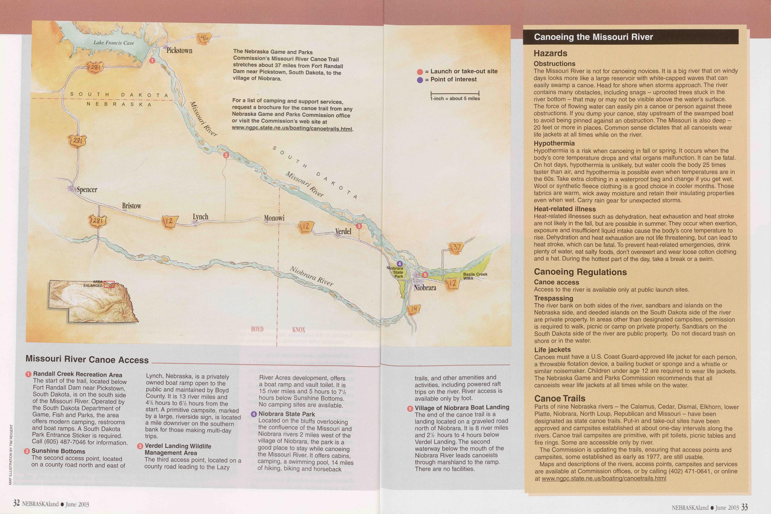
1 Randall Creek Recreation Area The start of the trail, located below Fort Randall Dam near Pickstown, South Dakota, is on the south side of the Missouri River. Operated by the South Dakota Department of Game, Fish and Parks, the area offers modern camping, restrooms and boat ramps. A South Dakota Park Entrance Sticker is required. Call (605) 487-7046 for information.
2 Sunshine Bottoms The second access point, located on a county road north and east of Lynch, Nebraska, is a privately owned boat ramp open to the public and maintained by Boyd County. It is 13 river miles and 41/2 hours to 61/2 hours from the start. A primitive campsite, marked by a large, riverside sign, is located a mile downriver on the southern bank for those making multi-day trips.
3 Verdel Landing Wildlife Management Area The third access point, located on a county road leading to the Lazy River Acres development, offers a boat ramp and vault toilet. It is 15 river miles and 5 hours to 7V2 hours below Sunshine Bottoms. No camping sites are available.
4 Niobrara State Park Located on the bluffs overlooking the confluence of the Missouri and Niobrara rivers 2 miles west of the village of Niobrara, the park is a good place to stay while canoeing the Missouri River. It offers cabins, camping, a swimming pool, 14 miles of hiking, biking and horseback 32 NEBRSKAland • June 2003 trails, and other amenities and activities, including powered raft trips on the river. River access is available only by foot.
5 Village of Niobrara Boat Landing The end of the canoe trail is a landing located on a graveled road north of Niobrara. It is 8 river miles and 21/2 hours to 4 hours below Verdel Landing. The second waterway below the mouth of the Niobrara River leads canoeists through marshland to the ramp. There are no facilities.
Canoeing the Missouri River Hazards ObstructionsThe Missouri River is not for canoeing novices. It is a big river that on windy days looks more like a large reservoir with white-capped waves that can easily swamp a canoe. Head for shore when storms approach. The river contains many obstacles, including snags - uprooted trees stuck in the river bottom - that may or may not be visible above the water's surface. The force of flowing water can easily pin a canoe or person against these obstructions. If you dump your canoe, stay upstream of the swamped boat to avoid being pinned against an obstruction. The Missouri is also deep - 20 feet or more in places. Common sense dictates that all canoeists wear life jackets at all times while on the river.
HypothermiaHypothermia is a risk when canoeing in fall or spring. It occurs when the body's core temperature drops and vital organs malfunction. It can be fatal. On hot days, hypothermia is unlikely, but water cools the body 25 times faster than air, and hypothermia is possible even when temperatures are in the 60s. Take extra clothing in a waterproof bag and change if you get wet. Wool or synthetic fleece clothing is a good choice in cooler months. Those fabrics are warm, wick away moisture and retain their insulating properties even when wet. Carry rain gear for unexpected storms.
Heat-related illnessHeat-related illnesses such as dehydration, heat exhaustion and heat stroke are not likely in the fall, but are possible in summer. They occur when exertion, exposure and insufficient liquid intake cause the body's core temperature to rise. Dehydration and heat exhaustion are not life threatening, but can lead to heat stroke, which can be fatal. To prevent heat-related emergencies, drink plenty of water, eat salty foods, don't overexert and wear loose cotton clothing and a hat. During the hottest part of the day, take a break or a swim.
Canoeing Regulations Canoe accessAccess to the river is available only at public launch sites.
TrespassingThe river bank on both sides of the river, sandbars and islands on the Nebraska side, and deeded islands on the South Dakota side of the river are private property. In areas other than designated campsites, permission is required to walk, picnic or camp on private property. Sandbars on the South Dakota side of the river are public property. Do not discard trash on shore or in the water.
Life jacketsCanoes must have a U.S. Coast Guard-approved life jacket for each person, a throwable flotation device, a bailing bucket or sponge and a whistle or similar noisemaker. Children under age 12 are required to wear life jackets. The Nebraska Game and Parks Commission recommends that all canoeists wear life jackets at all times while on the water.
Canoe TrailsParts of nine Nebraska rivers - the Calamus, Cedar, Dismal, Elkhorn, lower Platte, Niobrara, North Loup, Republican and Missouri - have been designated as state canoe trails. Put-in and take-out sites have been approved and campsites established at about one-day intervals along the rivers. Canoe trail campsites are primitive, with pit toilets, picnic tables and fire rings. Some are accessible only by river.
The Commission is updating the trails, ensuring that access points and campsites, some established as early as 1977, are still usable.
Maps and descriptions of the rivers, access points, campsites and services are available at Commission offices, or by calling (402) 471-0641, or online at www.ngpc.state.ne.us/boating/canoetrails.html
NEBRASKAland • June 2003 33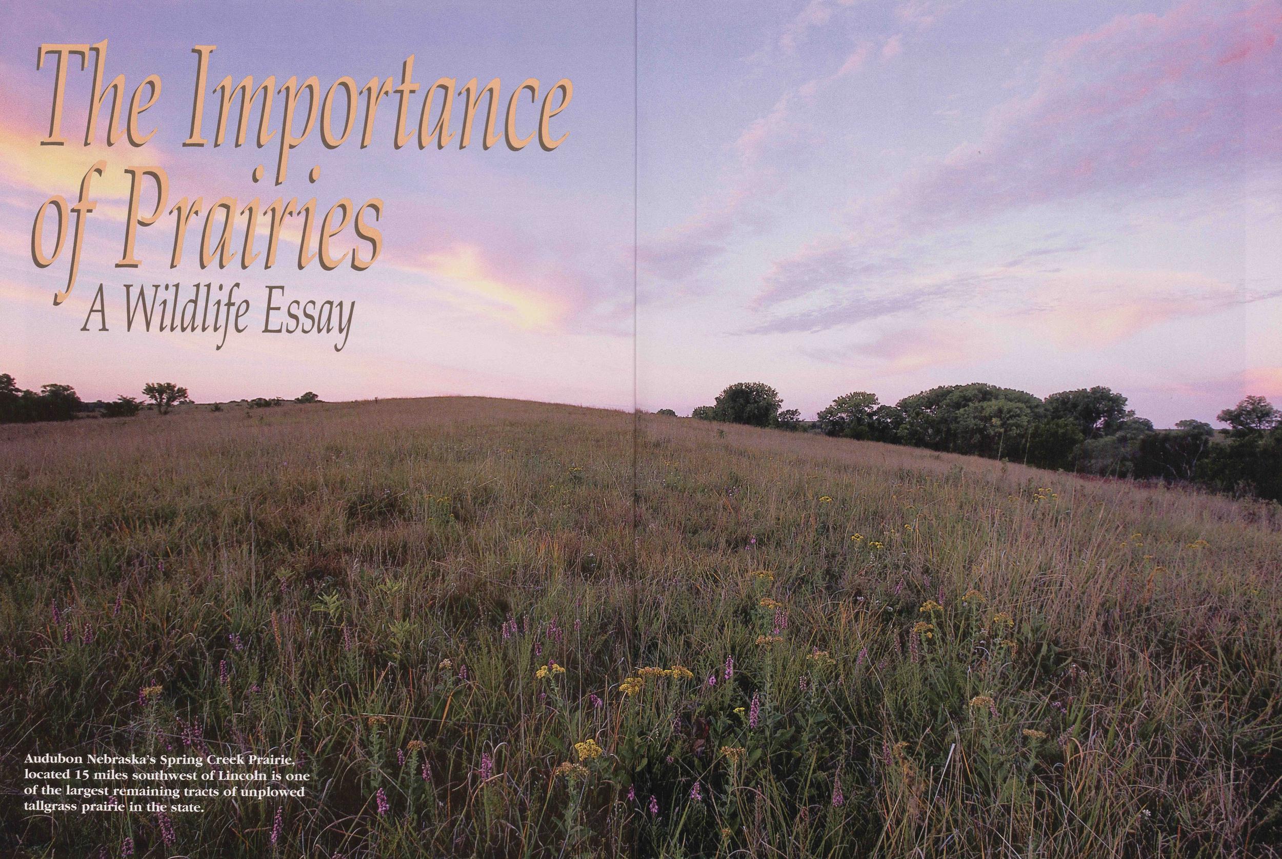
The Importance of Prairies
A Wildlife Essay Audubon Nebraska's Spring Creek Prairie, located 15 miles southwest of Lincoln is one of the largest reemaining tracts of unplowed tallgrass prairie in the state.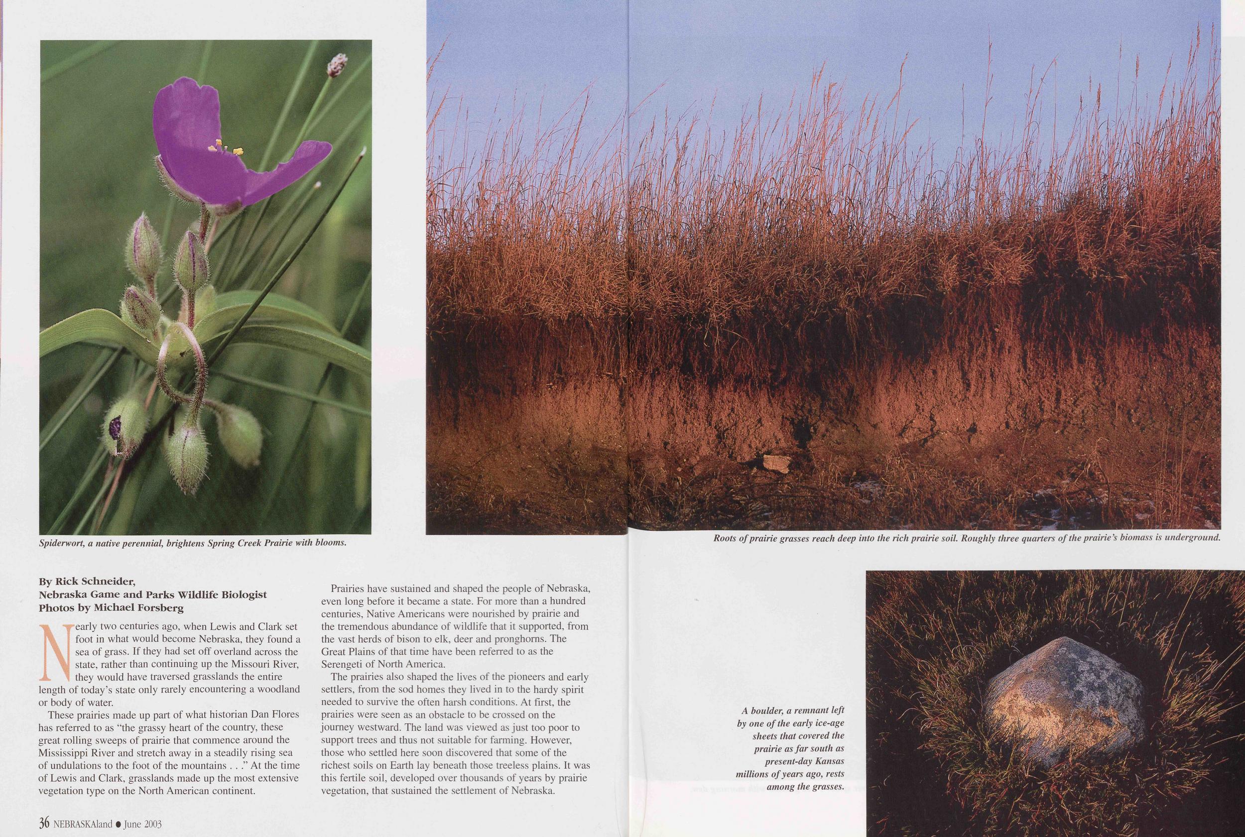
Nearly two centuries ago, when Lewis and Clark set foot in what would become Nebraska, they found a sea of grass. If they had set off overland across the state, rather than continuing up the Missouri River, they would have traversed grasslands the entire length of today's state only rarely encountering a woodland or body of water.
These prairies made up part of what historian Dan Flores has referred to as "the grassy heart of the country, these great rolling sweeps of prairie that commence around the Mississippi River and stretch away in a steadily rising sea of undulations to the foot of the mountains . . ." At the time of Lewis and Clark, grasslands made up the most extensive vegetation type on the North American continent.
Prairies have sustained and shaped the people of Nebraska, even long before it became a state. For more than a hundred centuries, Native Americans were nourished by prairie and the tremendous abundance of wildlife that it supported, from the vast herds of bison to elk, deer and pronghorns. The Great Plains of that time have been referred to as the Serengeti of North America.
The prairies also shaped the lives of the pioneers and early settlers, from the sod homes they lived in to the hardy spirit needed to survive the often harsh conditions. At first, the prairies were seen as an obstacle to be crossed on the journey westward. The land was viewed as just too poor to support trees and thus not suitable for farming. However, those who settled here soon discovered that some of the richest soils on Earth lay beneath those treeless plains. It was this fertile soil, developed over thousands of years by prairie vegetation, that sustained the settlement of Nebraska.
36 NEBRASKAland • June 2003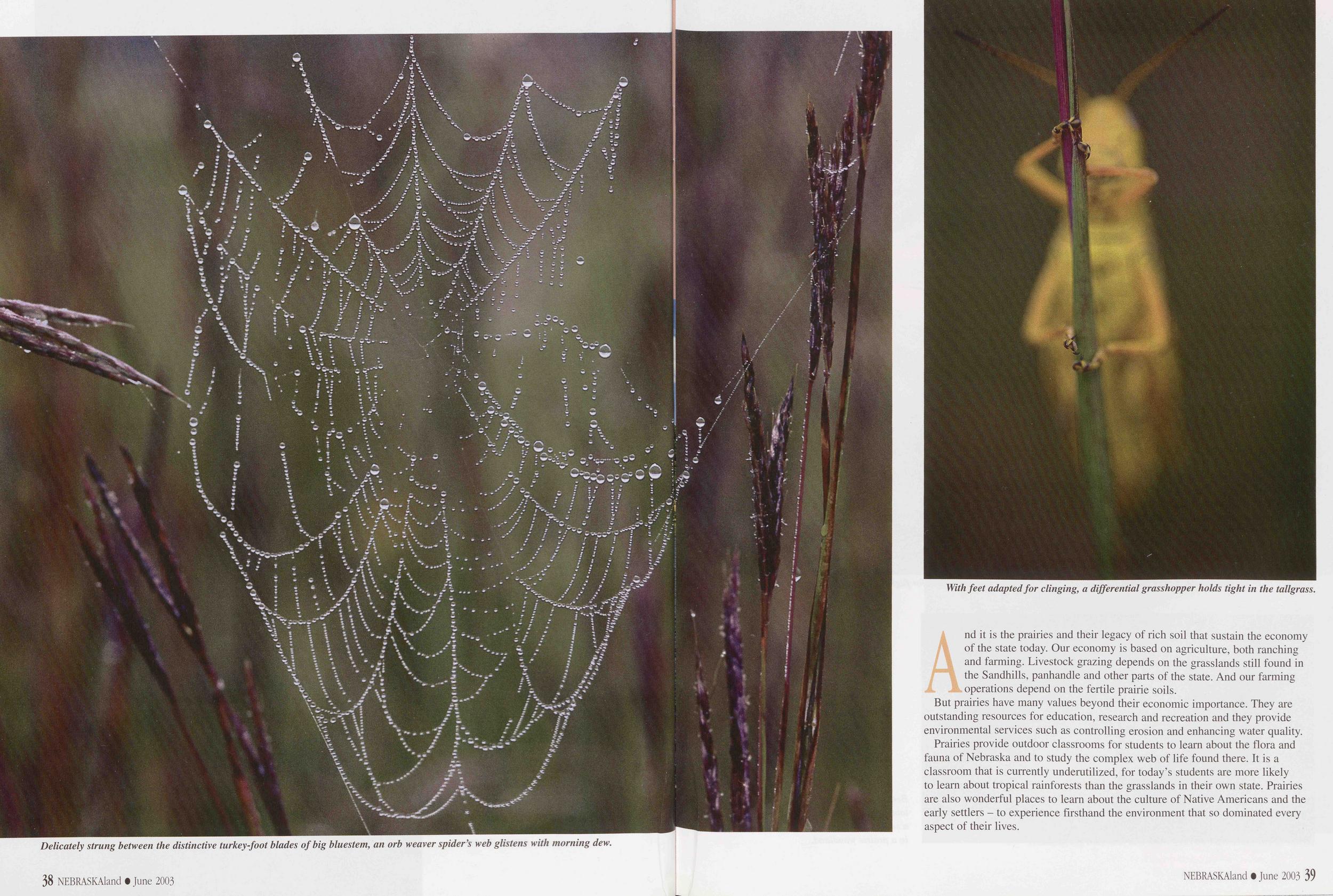
And it is the prairies and their legacy of rich soil that sustain the economy of the state today. Our economy is based on agriculture, both ranching and farming. Livestock grazing depends on the grasslands still found in the Sandhills, panhandle and other parts of the state. And our farming operations depend on the fertile prairie soils. But prairies have many values beyond their economic importance. They are outstanding resources for education, research and recreation and they provide environmental services such as controlling erosion and enhancing water quality.
Prairies provide outdoor classrooms for students to learn about the flora and fauna of Nebraska and to study the complex web of life found there. It is a classroom that is currently underutilized, for today's students are more likely to learn about tropical rainforests than the grasslands in their own state. Prairies are also wonderful places to learn about the culture of Native Americans and the early settlers - to experience firsthand the environment that so dominated every aspect of their lives.
NEBRASKAland • June 2003 39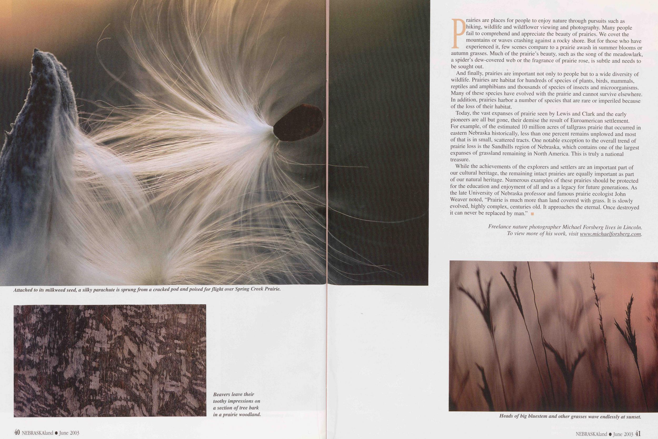
Prairies are places for people to enjoy nature through pursuits such as hiking, wildlife and wildflower viewing and photography. Many people fail to comprehend and appreciate the beauty of prairies. We covet the mountains or waves crashing against a rocky shore. But for those who have experienced it, few scenes compare to a prairie awash in summer blooms or autumn grasses. Much of the prairie's beauty, such as the song of the meadowlark, a spider's dew-covered web or the fragrance of prairie rose, is subtle and needs to be sought out.
And finally, prairies are important not only to people but to a wide diversity of wildlife. Prairies are habitat for hundreds of species of plants, birds, mammals, reptiles and amphibians and thousands of species of insects and microorganisms. Many of these species have evolved with the prairie and cannot survive elsewhere. In addition, prairies harbor a number of species that are rare or imperiled because of the loss of their habitat.
Today, the vast expanses of prairie seen by Lewis and Clark and the early pioneers are all but gone, their demise the result of Euroamerican settlement. For example, of the estimated 10 million acres of tallgrass prairie that occurred in eastern Nebraska historically, less than one percent remains unplowed and most of that is in small, scattered tracts. One notable exception to the overall trend of prairie loss is the Sandhills region of Nebraska, which contains one of the largest expanses of grassland remaining in North America. This is truly a national treasure.
While the achievements of the explorers and settlers are an important part of our cultural heritage, the remaining intact prairies are equally important as part of our natural heritage. Numerous examples of these prairies should be protected for the education and enjoyment of all and as a legacy for future generations. As the late University of Nebraska professor and famous prairie ecologist John Weaver noted, "Prairie is much more than land covered with grass. It is slowly evolved, highly complex, centuries old. It approaches the eternal. Once destroyed it can never be replaced by man."
Freelance nature photographer Michael Forsberg lives in Lincoln. To view more of his work, visit www, michaelforsberg. com.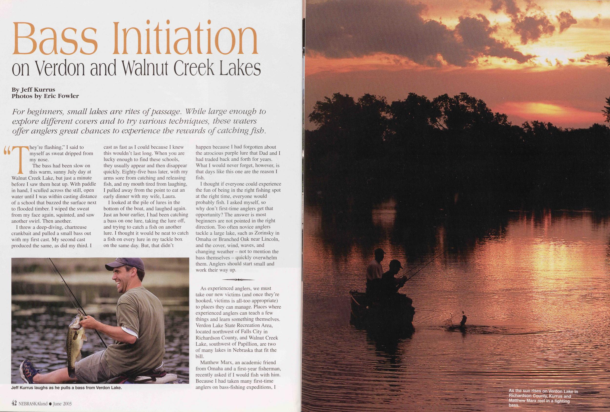
Bass Initiation on Verdon and Walnut Creek Lakes
By Jeff Kurrus Photos by Eric Fowler For beginners, small lakes are rites of passage. While large enough to explore different covers and to try various techniques, these waters offer anglers great chances to experience the rewards of catching fish.They're flashing," I said to myself as sweat dripped from my nose.
The bass had been slow on this warm, sunny July day at Walnut Creek Lake, but just a minute before I saw them heat up. With paddle in hand, I sculled across the still, open water until I was within casting distance of a school that buzzed the surface next to flooded timber. I wiped the sweat from my face again, squinted, and saw another swirl. Then another.
I threw a deep-diving, chartreuse crankbait and pulled a small bass out with my first cast. My second cast produced the same, as did my third. I cast as fast as I could because I knew this wouldn't last long. When you are lucky enough to find these schools, they usually appear and then disappear quickly. Eighty-five bass later, with my arms sore from catching and releasing fish, and my mouth tired from laughing, I pulled away from the point to eat an early dinner with my wife, Laura.
I looked at the pile of lures in the bottom of the boat, and laughed again. Just an hour earlier, I had been catching a bass on one lure, taking the lure off, and trying to catch a fish on another lure. I thought it would be neat to catch a fish on every lure in my tackle box on the same day. But, that didn't
I thought if everyone could experience the fun of being in the right fishing spot at the right time, everyone would probably fish. I asked myself, so why don't first-time anglers get that opportunity? The answer is most beginners are not pointed in the right direction. Too often novice anglers tackle a large lake, such as Zorinsky in Omaha or Branched Oak near Lincoln, and the cover, wind, waves, and changing weather - not to mention the bass themselves - quickly overwhelm them. Anglers should start small and work their way up.
As experienced anglers, we must take our new victims (and once they're hooked, victims is ail-too appropriate) to places they can manage. Places where experienced anglers can teach a few things and learn something themselves. Verdon Lake State Recreation Area, located northwest of Falls City in Richardson County, and Walnut Creek Lake, southwest of Papillion, are two of many lakes in Nebraska that fit the bill.
Matthew Marx, an academic friend from Omaha and a first-year fisherman, recently asked if I would fish with him. Because I had taken many first-time anglers on bass-fishing expeditions, I 42 NEBRASKAland t June 2003
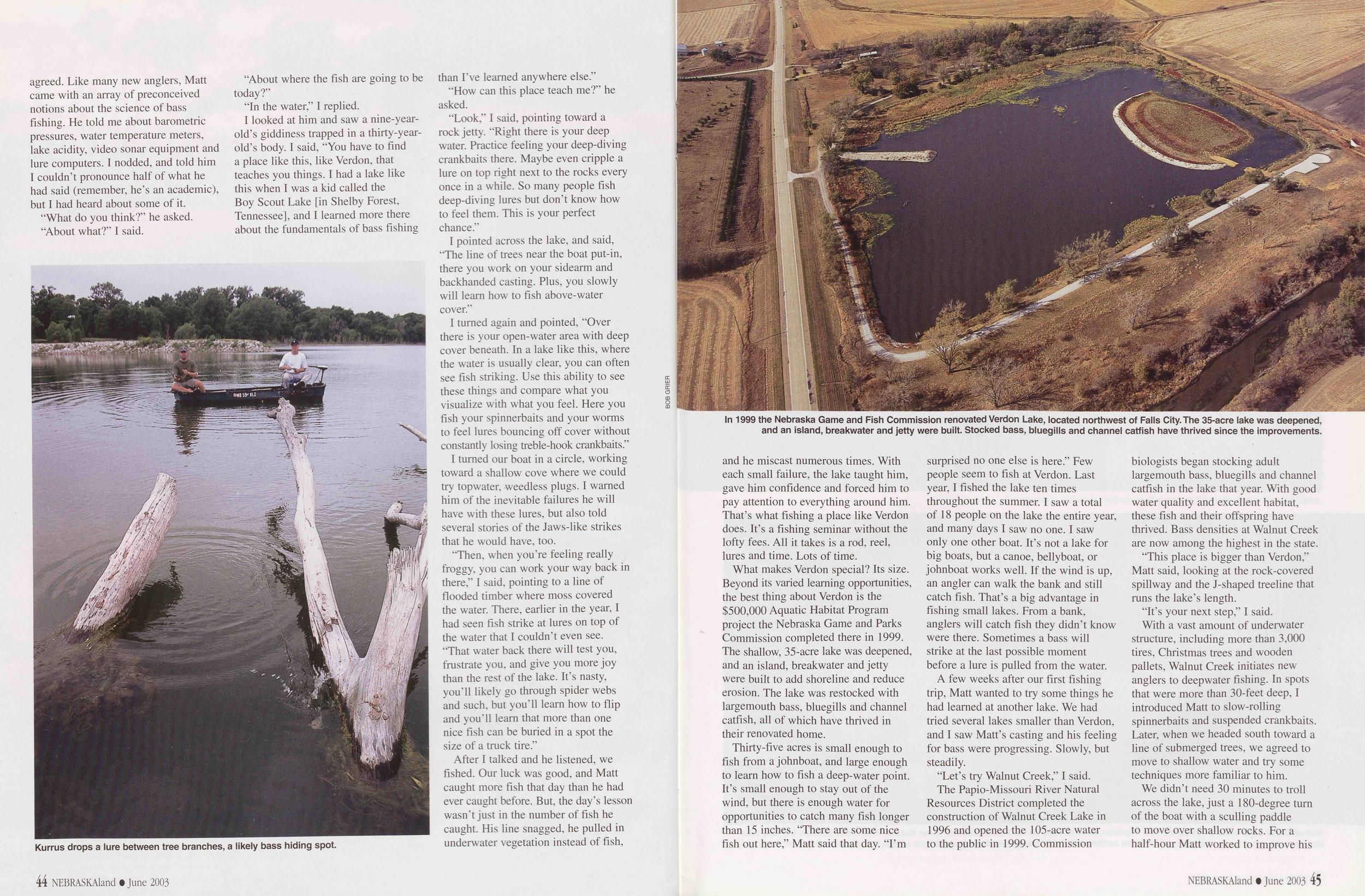 agreed. Like many new anglers, Matt
came with an array of preconceived
notions about the science of bass
fishing. He told me about barometric
pressures, water temperature meters,
lake acidity, video sonar equipment and
lure computers. I nodded, and told him
I couldn't pronounce half of what he
had said (remember, he's an academic),
but I had heard about some of it.
agreed. Like many new anglers, Matt
came with an array of preconceived
notions about the science of bass
fishing. He told me about barometric
pressures, water temperature meters,
lake acidity, video sonar equipment and
lure computers. I nodded, and told him
I couldn't pronounce half of what he
had said (remember, he's an academic),
but I had heard about some of it.
"What do you think?" he asked.
"About what?" I said.
"About where the fish are going to be today?"
"In the water," I replied.
I looked at him and saw a nine-year-old's giddiness trapped in a thirty-year-old's body. I said, "You have to find a place like this, like Verdon, that teaches you things. I had a lake like this when I was a kid called the Boy Scout Lake [in Shelby Forest, Tennessee], and I learned more there about the fundamentals of bass fishing Kurrus drops a lure between tree branches, a likely bass hiding spot. than I've learned anywhere else."
"How can this place teach me?" he asked.
"Look," I said, pointing toward a rock jetty. "Right there is your deep water. Practice feeling your deep-diving crankbaits there. Maybe even cripple a lure on top right next to the rocks every once in a while. So many people fish deep-diving lures but don't know how to feel them. This is your perfect chance."
I pointed across the lake, and said, "The line of trees near the boat put-in, there you work on your sidearm and backhanded casting. Plus, you slowly will learn how to fish above-water cover."
I turned again and pointed, "Over there is your open-water area with deep cover beneath. In a lake like this, where the water is usually clear, you can often see fish striking. Use this ability to see these things and compare what you visualize with what you feel. Here you fish your spinnerbaits and your worms to feel lures bouncing off cover without constantly losing treble-hook crankbaits."
I turned our boat in a circle, working toward a shallow cove where we could try top water, weedless plugs. I warned him of the inevitable failures he will have with these lures, but also told several stories of the Jaws-like strikes that he would have, too.
"Then, when you're feeling really froggy, you can work your way back in there," I said, pointing to a line of flooded timber where moss covered the water. There, earlier in the year, I had seen fish strike at lures on top of the water that I couldn't even see. "That water back there will test you, frustrate you, and give you more joy than the rest of the lake. It's nasty, you'll likely go through spider webs and such, but you'll learn how to flip and you'll learn that more than one nice fish can be buried in a spot the size of a truck tire."
After I talked and he listened, we fished. Our luck was good, and Matt caught more fish that day than he had ever caught before. But, the day's lesson wasn't just in the number of fish he caught. His line snagged, he pulled in underwater vegetation instead of fish, 44 NEBRASKAland • June 2003
What makes Verdon special? Its size. Beyond its varied learning opportunities, the best thing about Verdon is the $500,000 Aquatic Habitat Program project the Nebraska Game and Parks Commission completed there in 1999. The shallow, 35-acre lake was deepened, and an island, breakwater and jetty were built to add shoreline and reduce erosion. The lake was restocked with largemouth bass, bluegills and channel catfish, all of which have thrived in their renovated home.
Thirty-five acres is small enough to fish from a johnboat, and large enough to learn how to fish a deep-water point. It's small enough to stay out of the wind, but there is enough water for opportunities to catch many fish longer than 15 inches. "There are some nice fish out here," Matt said that day. "I'm surprised no one else is here." Few people seem to fish at Verdon. Last year, I fished the lake ten times throughout the summer. I saw a total of 18 people on the lake the entire year, and many days I saw no one. I saw only one other boat. It's not a lake for big boats, but a canoe, belly boat, or johnboat works well. If the wind is up, an angler can walk the bank and still catch fish. That's a big advantage in fishing small lakes. From a bank, anglers will catch fish they didn't know were there. Sometimes a bass will strike at the last possible moment before a lure is pulled from the water.
A few weeks after our first fishing trip, Matt wanted to try some things he had learned at another lake. We had tried several lakes smaller than Verdon, and I saw Matt's casting and his feeling for bass were progressing. Slowly, but steadily.
"Let's try Walnut Creek," I said.
The Papio-Missouri River Natural Resources District completed the construction of Walnut Creek Lake in 1996 and opened the 105-acre water to the public in 1999. Commission biologists began stocking adult largemouth bass, bluegills and channel catfish in the lake that year. With good water quality and excellent habitat, these fish and their offspring have thrived. Bass densities at Walnut Creek are now among the highest in the state.
"This place is bigger than Verdon," Matt said, looking at the rock-covered spillway and the J-shaped tree line that runs the lake's length.
"It's your next step," I said.
With a vast amount of underwater structure, including more than 3,000 tires, Christmas trees and wooden pallets, Walnut Creek initiates new anglers to deep water fishing. In spots that were more than 30-feet deep, I introduced Matt to slow-rolling spinnerbaits and suspended crankbaits. Later, when we headed south toward a line of submerged trees, we agreed to move to shallow water and try some techniques more familiar to him.
We didn't need 30 minutes to troll
across the lake, just a 180-degree turn
of the boat with a sculling paddle
to move over shallow rocks. For a
half-hour Matt worked to improve his
NEBRASKAland • June 2003 45
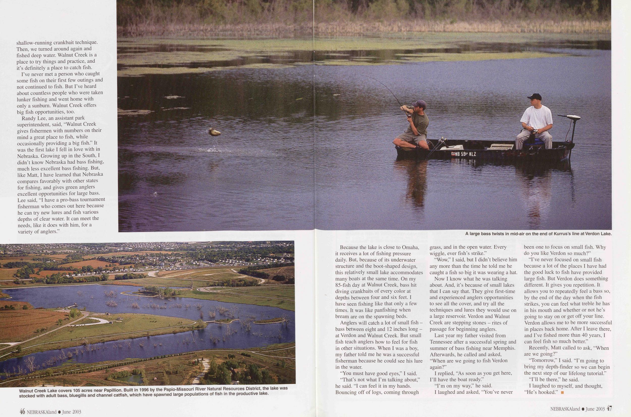 shallow-running crankbait technique.
Then, we turned around again and
fished deep water. Walnut Creek is a
place to try things and practice, and
it's definitely a place to catch fish.
shallow-running crankbait technique.
Then, we turned around again and
fished deep water. Walnut Creek is a
place to try things and practice, and
it's definitely a place to catch fish.
I've never met a person who caught some fish on their first few outings and not continued to fish. But I've heard about countless people who were taken lunker fishing and went home with only a sunburn. Walnut Creek offers big fish opportunities, too.
Randy Lee, an assistant park superintendent, said, "Walnut Creek gives fishermen with numbers on their mind a great place to fish, while occasionally providing a big fish." It was the first lake I fell in love with in Nebraska. Growing up in the South, I didn't know Nebraska had bass fishing, much less excellent bass fishing. But, like Matt, I have learned that Nebraska compares favorably with other states for fishing, and gives green anglers excellent opportunities for large bass. Lee said, "I have a pro-bass tournament fisherman who comes out here because he can try new lures and fish various depths of clear water. It can meet the needs, like it does with him, for a variety of anglers."
Because the lake is close to Omaha, it receives a lot of fishing pressure daily. But, because of its underwater structure and the boot-shaped design, this relatively small lake accommodates many boats at the same time. On my 85-fish day at Walnut Creek, bass hit diving crankbaits of every color at depths between four and six feet. I have seen fishing like that only a few times. It was like panfishing when bream are on the spawning beds.
Anglers will catch a lot of small fish bass between eight and 12 inches long at Verdon and Walnut Creek. But small fish teach anglers how to feel for fish in other situations. When I was a boy, my father told me he was a successful fisherman because he could see his lure in the water.
"You must have good eyes," I said.
"That's not what I'm talking about," he said. "I can feel it in my hands. Bouncing off of logs, coming through grass, and in the open water. Every wiggle, ever fish's strike."
"Wow," I said, but I didn't believe him any more than the time he told me he caught a fish so big it was wearing a hat.
Now I know what he was talking about. And, it's because of small lakes that I can say that. They give first-time and experienced anglers opportunities to see all the cover, and try all the techniques and lures they would use on a large reservoir. Verdon and Walnut Creek are stepping stones - rites of passage for beginning anglers.
Last year my father visited from Tennessee after a successful spring and summer of bass fishing near Memphis. Afterwards, he called and asked, "When are we going to fish Verdon again /
I replied, "As soon as you get here, I'll have the boat ready."
"I'm on my way," he said.
I laughed and asked, "You've never been one to focus on small fish. Why do you like Verdon so much?"
"I've never focused on small fish because a lot of the places I have had the good luck to fish have provided large fish. But Verdon does something different. It gives you repetition. It allows you to repeatedly feel a bass so, by the end of the day when the fish strikes, you can feel what treble he has in his mouth and whether or not he's going to stay on or get off your line. Verdon allows me to be more successful in places back home. After I leave there, and I've fished more than 40 years, I can feel fish so much better."
Recently, Matt called to ask, "When are we going?"
"Tomorrow," I said. "I'm going to bring my depth-finder so we can begin the next step of our lifelong tutorial."
"I'll be there," he said.
I laughed to myself, and thought, "He's hooked."
NEBRASKAland • June 2003 47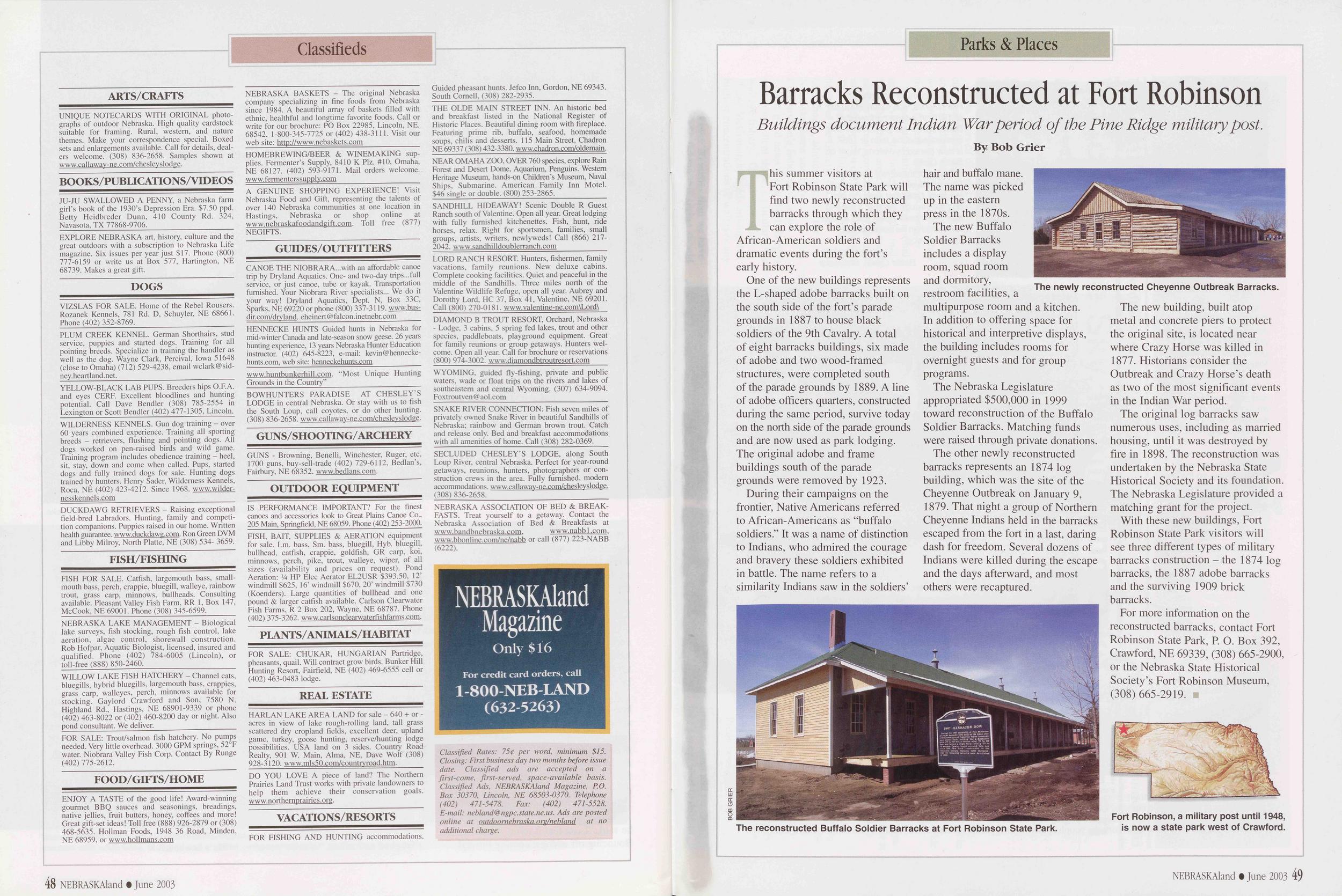
Classifieds
ARTS/CRAFTSUNIQUE NOTECARDS WITH ORIGINAL photographs of outdoor Nebraska. High quality card stock suitable for framing. Rural, western, and nature themes. Make your correspondence special. Boxed sets and enlargements available. Call for details, dealers welcome. (308) 836-2658. Samples shown at www.callaway-ne.com/chesleyslodge.
BOOKS/PUBLICATIQNS/VIDEOSJU-JU SWALLOWED A PENNY, a Nebraska farm girl's book of the 1930's Depression Era. $7.50 ppd. Betty Heidbreder Dunn, 410 County Rd. 324, Navasota, TX 77868-9706.______________________
EXPLORE NEBRASKA art, history, culture and the great outdoors with a subscription to Nebraska Life magazine. Six issues per year just $17. Phone (800) 777-6159 or write us at Box 577, Hartington, NE 68739. Makes a great gift.
_____________DOGS_____________VIZSLAS FOR SALE. Home of the Rebel Rousers. Rozanek Kennels, 781 Rd. D, Schuyler, NE 68661. Phone (402) 352-8769._________________________
PLUM CREEK KENNEL. German Shorthairs, stud service, puppies and started dogs. Training for all pointing breeds. Specialize in training the handler as well as the dog. Wayne Clark, Percival, Iowa 51648 (close to Omaha) (712) 529-4238, email wclark@sidney.heartland.net._____________________________
YELLOW-BLACK LAB PUPS. Breeders hips O.F.A. and eyes CERE Excellent bloodlines and hunting potential. Call Dave Bendler (308) 785-2554 in Lexington or Scott Bendler (402) 477-1305, Lincoln.
WILDERNESS KENNELS. Gun dog training - over 60 years combined experience. Training all sporting breeds - retrievers, flushing and pointing dogs. All dogs worked on pen-raised birds and wild game. Training program includes obedience training - heel, sit, stay, down and come when called. Pups, started dogs and fully trained dogs for sale. Hunting dogs trained by hunters. Henry Sader, Wilderness Kennels, Roca, NE (402) 423-4212. Since 1968. www.wildernesskennels.com______________________________
DUCKDAWG RETRIEVERS - Raising exceptional field-bred Labradors. Hunting, family and competition companions. Puppies raised in our home. Written health guarantee, www.duckdawg.com. Ron Green DVM and Libby Milroy, North Platte, NE (308) 534- 3659.
FISH/FISHINGFISH FOR SALE. Catfish, largemouth bass, smallmouth bass, perch, crappie, bluegill, walleye, rainbow trout, grass carp, minnows, bullheads. Consulting available. Pleasant Valley Fish Farm, RR 1, Box 147, McCook, NE 69001. Phone (308) 345-6599._______
NEBRASKA LAKE MANAGEMENT - Biological lake surveys, fish stocking, rough fish control, lake aeration, algae control, shorewall construction. Rob Hofpar, Aquatic Biologist, licensed, insured and qualified. Phone (402) 784-6005 (Lincoln), or toll-free (888) 850-2460._______________________
WILLOW LAKE FISH HATCHERY - Channel cats, bluegills, hybrid bluegills, largemouth bass, crappies, grass carp, walleyes, perch, minnows available for stocking. Gaylord Crawford and Son, 7580 N. Highland Rd., Hastings, NE 68901-9339 or phone (402) 463-8022 or (402) 460-8200 day or night. Also pond consultant. We deliver.___________________
FOR SALE: Trout/salmon fish hatchery. No pumps needed. Very little overhead. 3000 GPM springs, 52°F water. Niobrara Valley Fish Corp. Contact By Runge (402) 775-2612.
FOOD/GIFTS/HOMEENJOY A TASTE of the good life! Award-winning gourmet BBQ sauces and seasonings, breadings, native jellies, fruit butters, honey, coffees and more! Great gift-set ideas! Toll free (888) 926-2879 or (308) 468-5635. Hollman Foods, 1948 36 Road, Minden, NE 68959, or www.hollmans.com
NEBRASKA BASKETS - The original Nebraska company specializing in fine foods from Nebraska since 1984. A beautiful array of baskets filled with ethnic, healthful and longtime favorite foods. Call or write for our brochure: PO Box 22985, Lincoln, NE. 68542. 1-800-345-7725 or (402) 438-3111. Visit our web site: http://www.nebaskets.com______________
HOMEBREWING/BEER & WINEMAKING sup- plies. Fermenter's Supply, 8410 K Plz. #10, Omaha, NE 68127. (402) 593-9171. Mail orders welcome. www.fermenterssupply.com_____________________
A GENUINE SHOPPING EXPERIENCE! Visit Nebraska Food and Gift, representing the talents of over 140 Nebraska communities at one location in Hastings, Nebraska or shop online at www.nebraskafoodandgift.com. Toll free (877) NEGIFTS.
GUIDES/OUTFITTERSCANOE THE NIOBRARA...with an affordable canoe trip by Dryland Aquatics. One- and two-day trips...full service, or just canoe, tube or kayak. Transportation furnished. Your Niobrara River specialists... We do it your way! Dryland Aquatics, Dept. N, Box 33C, Sparks, NE 69220 or phone (800) 337-3119. www.busdir.com/dryland. eheinert@falcon.inetnebr.com______
HENNECKE HUNTS Guided hunts in Nebraska for mid-winter Canada and late-season snow geese. 26 years hunting experience, 13 years Nebraska Hunter Education instructor. (402) 645-8223, e-mail: kevin@henneckehunts.com, web site: henneckehunts.com____________
www.huntbunkerhill.com. "Most Unique Hunting Grounds in the Country"_______________________
BOWHUNTERS PARADISE AT CHESLEY'S LODGE in central Nebraska. Or stay with us to fish the South Loup, call coyotes, or do other hunting. (308) 836-2658. www.callaway-ne.com/cheslevslodge.
GUNS/SHOOTING/ARCHERYGUNS - Browning, Benelli, Winchester, Ruger, etc. 1700 guns, buy-sell-trade (402) 729-6112, Bedlan's, Fairbury, NE 68352. www.bedlans.com.
OUTDOOR EQUIPMENTIS PERFORMANCE IMPORTANT? For the finest canoes and accessories look to Great Plains Canoe Co., 205 Main, Springfield, NE 68059. Phone (402) 253-2000.
FISH, BAIT, SUPPLIES & AERATION equipment for sale. Lm. bass, Sm. bass, bluegill, Hyb. bluegill, bullhead, catfish, crappie, goldfish, GR carp, koi, minnows, perch, pike, trout, walleye, wiper, of all sizes (availability and prices on request). Pond Aeration: Va HP Elec Aerator EL2USR $393.50, 12' windmill $625, 16" windmill $670, 20' windmill $730 (Koenders). Large quantities of bullhead and one pound & larger catfish available. Carlson Clearwater Fish Farms, R 2 Box 202, Wayne, NE 68787. Phone (402) 375-3262. www.carlsonclearwaterfishfarms.com.
PLANTS/ANIMALS/HABITATFOR SALE: CHUKAR, HUNGARIAN Partridge, pheasants, quail. Will contract grow birds. Bunker Hill Hunting Resort, Fairfield, NE (402) 469-6555 cell or (402) 463-0483 lodge.
REAL ESTATEHARLAN LAKE AREA LAND for sale - 640 + or - acres in view of lake rough-rolling land, tall grass scattered dry cropland fields, excellent deer, upland game, turkey, goose hunting, reserve/hunting lodge possibilities. USA land on 3 sides. Country Road Realty, 901 W. Main, Alma, NE, Dave Wolf (308) 928-3120. www.mls50.com/countryroad.htm._______
DO YOU LOVE A piece of land? The Northern Prairies Land Trust works with private landowners to help them achieve their conservation goals. www.northernprairies.org.
VACATIONS/RESORTSFOR FISHING AND HUNTING accommodations. Guided pheasant hunts. Jefco Inn, Gordon, NE 69343. South Cornell, (308) 282-2935.__________________
THE OLDE MAIN STREET INN. An historic bed and breakfast listed in the National Register of Historic Places. Beautiful dining room with fireplace. Featuring prime rib, buffalo, seafood, homemade soups, chilis and desserts. 115 Main Street, Chadron NE 69337 (308) 432-3380. www.chadron.com/oldemain.
NEAR OMAHA ZOO, OVER 760 species, explore Rain Forest and Desert Dome, Aquarium, Penguins. Western Heritage Museum, hands-on Children's Museum, Naval Ships, Submarine. American Family Inn Motel. $46 single or double. (800) 253-2865._____________
SANDHILL HIDEAWAY! Scenic Double R Guest Ranch south of Valentine. Open all year. Great lodging with fully furnished kitchenettes. Fish, hunt, ride horses, relax. Right for sportsmen, families, small groups, artists, writers, newly weds! Call (866) 217-2042. www.sandhilldoublerranch.com_____________
LORD RANCH RESORT. Hunters, fishermen, family vacations, family reunions. New deluxe cabins. Complete cooking facilities. Quiet and peaceful in the middle of the Sandhills. Three miles north of the Valentine Wildlife Refuge, open all year. Aubrey and Dorothy Lord, HC 37, Box 41, Valentine, NE 69201. Call (800) 270-0181. www.valentine-ne.com\Lord\
DIAMOND B TROUT RESORT, Orchard, Nebraska - Lodge, 3 cabins, 5 spring fed lakes, trout and other species, paddleboats, playground equipment. Great for family reunions or group getaways. Hunters welcome. Open all year. Call for brochure or reservations (800) 974-3002. www.diamondbtroutresort.com
WYOMING, guided fly-fishing, private and public waters, wade or float trips on the rivers and lakes of southeastern and central Wyoming. (307) 634-9094. Foxtroutven @ aol .com
SNAKE RIVER CONNECTION: Fish seven miles of privately owned Snake River in beautiful Sandhills of Nebraska; rainbow and German brown trout. Catch and release only. Bed and breakfast accommodations with all amenities of home. Call (308) 282-0369.
SECLUDED CHESLEY'S LODGE, along South Loup River, central Nebraska. Perfect for year-round getaways, reunions, hunters, photographers or construction crews in the area. Fully furnished, modern accommodations, www.callaway-ne.com/chesleyslodge. (308) 836-2658.______________________________
NEBRASKA ASSOCIATION OF BED & BREAKFASTS. Treat yourself to a getaway. Contact the Nebraska Association of Bed & Breakfasts at www.bandbnebraska.com. www.nabbl.cornwww, bbonline.com/ne/nabb or call (877) 223-NABB (6222).
NEBRASKAland Only $ 16 For credit card orders, call 1-800-iNEB-LAND (632-5263) Classified Rates: 75$ per word, minimum $15. Closing: First business day two months before issue date. Classified ads are accepted on a first-come, first-served, space-available basis. Classified Ads, NEBRASKAland Magazine, P.O. Box 30370, Lincoln, NE 68503-0370. Telephone (402) 471-5478. Fax: (402) 471-5528. E-mail: nebland@ngpc.state.ne.us. Ads are posted online at outdoornebraska.org/nebland at no additional charge. 48 NEBRASKAland • June 2003Parks & Places
Barracks Reconstructed at Fort Robinson
Buildings document Indian War period of the Pine Ridge military post. By Bob GrierThis summer visitors at Fort Robinson State Park will find two newly reconstructed barracks through which they can explore the role of African-American soldiers and dramatic events during the fort's early history.
One of the new buildings represents the L-shaped adobe barracks built on the south side of the fort's parade grounds in 1887 to house black soldiers of the 9th Cavalry. A total of eight barracks buildings, six made of adobe and two wood-framed structures, were completed south of the parade grounds by 1889. A line of adobe officers quarters, constructed during the same period, survive today on the north side of the parade grounds and are now used as park lodging. The original adobe and frame buildings south of the parade grounds were removed by 1923.
During their campaigns on the frontier, Native Americans referred to African-Americans as "buffalo soldiers." It was a name of distinction to Indians, who admired the courage and bravery these soldiers exhibited in battle. The name refers to a similarity Indians saw in the soldiers' hair and buffalo mane. The name was picked up in the eastern press in the 1870s.
The new Buffalo Soldier Barracks includes a display room, squad room and dormitory, restroom facilities, a multipurpose room and a kitchen. In addition to offering space for historical and interpretive displays, the building includes rooms for overnight guests and for group programs.
The Nebraska Legislature appropriated $500,000 in 1999 toward reconstruction of the Buffalo Soldier Barracks. Matching funds were raised through private donations.
The other newly reconstructed barracks represents an 1874 log building, which was the site of the Cheyenne Outbreak on January 9, 1879. That night a group of Northern Cheyenne Indians held in the barracks escaped from the fort in a last, daring dash for freedom. Several dozens of Indians were killed during the escape and the days afterward, and most others were recaptured.
The new building, built atop metal and concrete piers to protect the original site, is located near where Crazy Horse was killed in 1877. Historians consider the Outbreak and Crazy Horse's death as two of the most significant events in the Indian War period.
The original log barracks saw numerous uses, including as married housing, until it was destroyed by fire in 1898. The reconstruction was undertaken by the Nebraska State Historical Society and its foundation. The Nebraska Legislature provided a matching grant for the project.
With these new buildings, Fort Robinson State Park visitors will see three different types of military barracks construction - the 1874 log barracks, the 1887 adobe barracks and the surviving 1909 brick barracks.
For more information on the reconstructed barracks, contact Fort Robinson State Park, P. O. Box 392, Crawford, NE 69339, (308) 665-2900, or the Nebraska State Historical Society's Fort Robinson Museum, (308)665-2919.
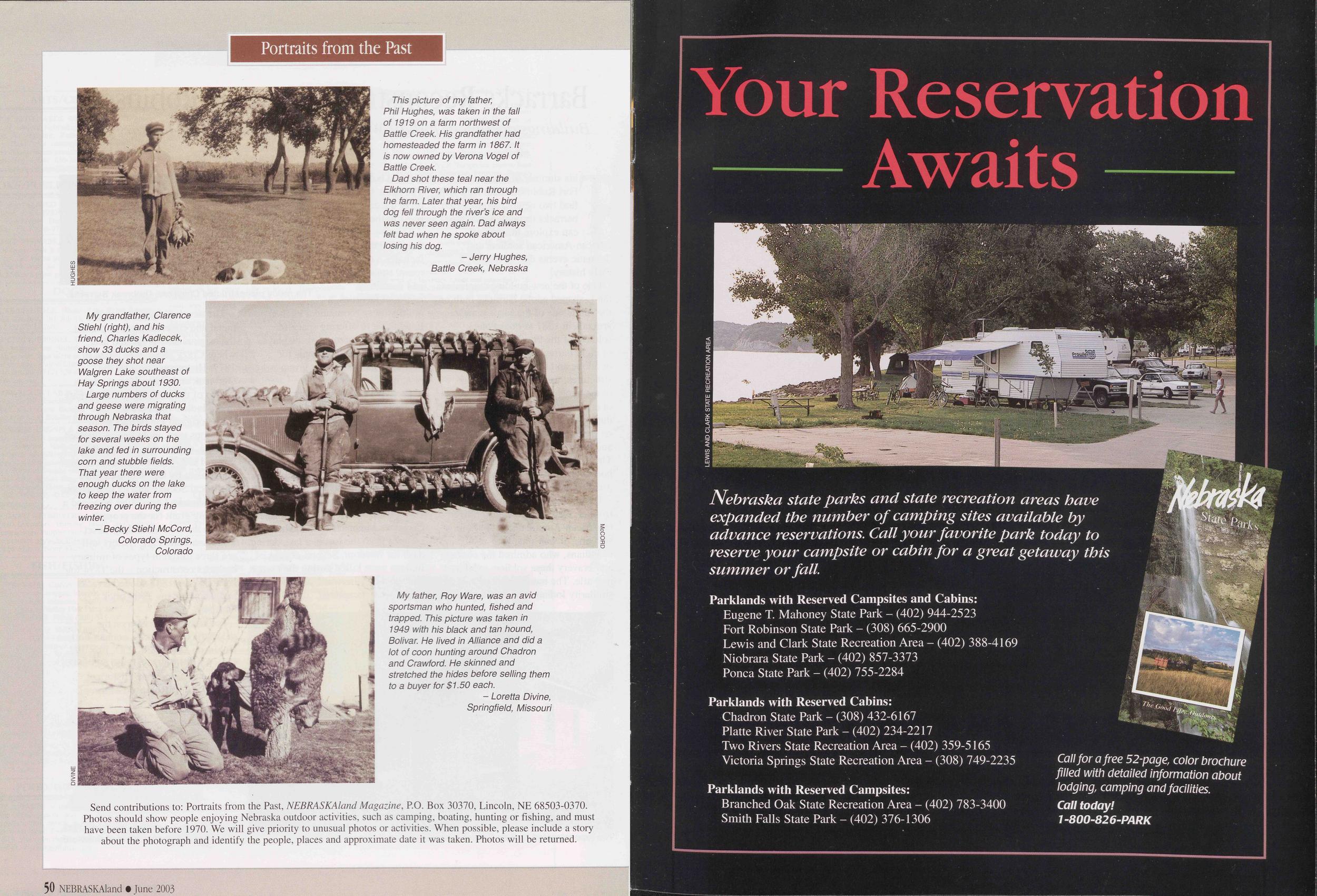
Portraits from the Past
This picture of my father, Phil Hughes, was taken in the fall of 1919 on a farm northwest of Battle Creek. His grandfather had homesteaded the farm in 1867. It is now owned by Verona Vogel of Battle Creek.
Dad shot these teal near the Elkhorn River, which ran through the farm. Later that year, his bird dog fell through the river's ice and was never seen again. Dad always felt bad when he spoke about losing his dog.
- Jerry Hughes, Battle Creek, NebraskaMy grandfather, Clarence Stiehl (right), and his friend, Charles Kadlecek, show 33 ducks and a goose they shot near Walgren Lake southeast of Hay Springs about 1930.
Large numbers of ducks and geese were migrating through Nebraska that season. The birds stayed for several weeks on the lake and fed in surrounding corn and stubble fields. That year there were enough ducks on the lake to keep the water from freezing over during the winter.
- Becky Stiehl McCord, Colorado Springs, ColoradoMy father, Roy Ware, was an avid sportsman who hunted, fished and trapped. This picture was taken in 1949 with his black and tan hound, Bolivar. He lived in Alliance and did a lot of coon hunting around Chadron and Crawford. He skinned and stretched the hides before selling them to a buyer for $1.50 each.
- Loretta Divine, Springfield, MissouriSend contributions to: Portraits from the Past, NEBRASKAland Magazine, P.O. Box 30370, Lincoln, NE 68503-0370. Photos should show people enjoying Nebraska outdoor activities, such as camping, boating, hunting or fishing, and must have been taken before 1970. We will give priority to unusual photos or activities. When possible, please include a story about the photograph and identify the people, places and approximate date it was taken. Photos will be returned.
50 NEBRASKAland • June 2003 Your Reservation Awaits Nebraska state parks and state recreation areas have expanded the number of camping sites available by advance reservations. Call your favorite park today to reserve your campsite or cabin for a great getaway this summer or fall. Parklands with Reserved Campsites and Cabins: Eugene T. Mahoney State Park - (402) 944-2523 Fort Robinson State Park - (308) 665-2900 Lewis and Clark State Recreation Area - (402) 388-4169 Niobrara State Park - (402) 857-3373 Ponca State Park - (402) 755-2284 Parklands with Reserved Cabins: Chadron State Park - (308) 432-6167 Platte River State Park - (402) 234-2217 Two Rivers State Recreation Area - (402) 359-5165 Victoria Springs State Recreation Area - (308) 749-2235 Parklands with Reserved Campsites: Branched Oak State Recreation Area - (402) 783-3400 Smith Falls State Park - (402) 376-1306 Call for a free 52-page, color brochure filled with detailed information about lodging, camping and facilities. Call today! 1-800-826-PARK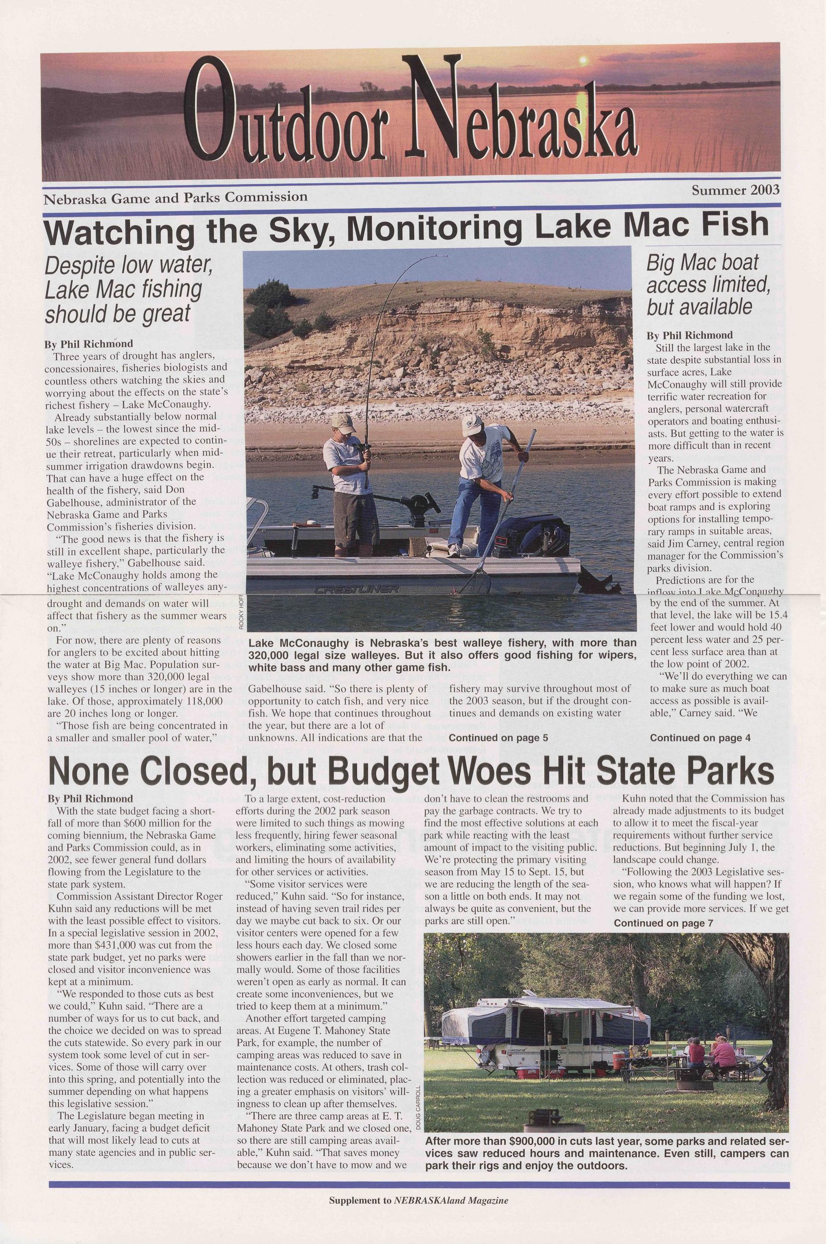
Position: 769 (14 views)