Volume 76, Issue 5, 1998
NEBRASKAland
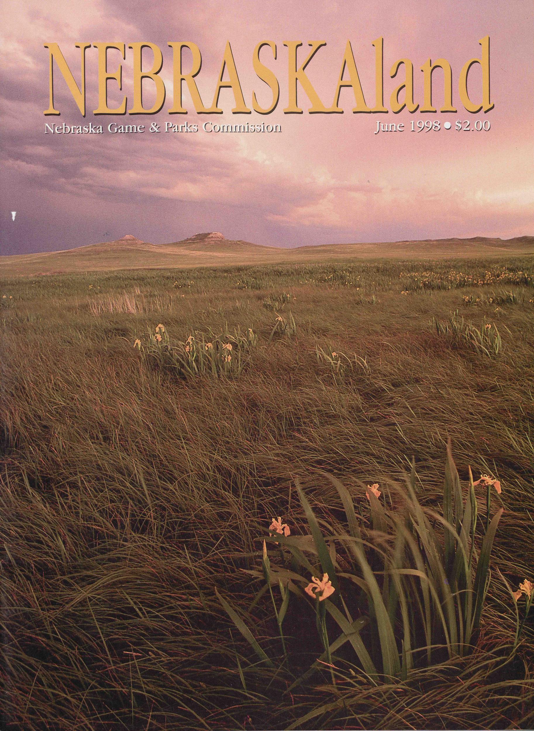
Nebraska Game & Parks Commission June 1993 $2.00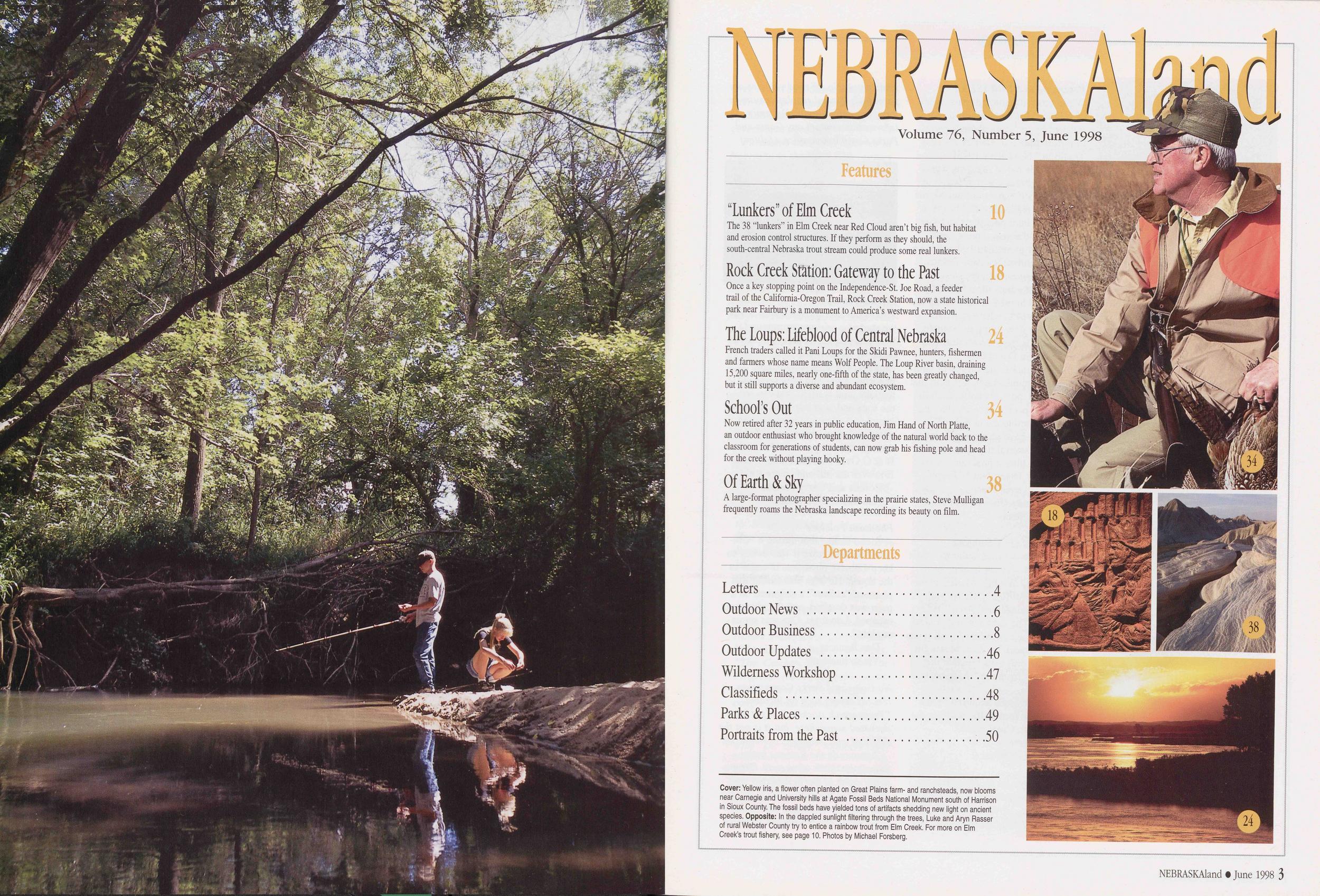
NEBRASKAland
Volume 76, Number 5, June 1998 Features "Lunkers" of Elm Creek 10 The 38 "lunkers" in Elm Creek near Red Cloud aren't big fish, but habitat and erosion control structures. If they perform as they should, the south-central Nebraska trout stream could produce some real lunkers. Rock Creek Station: Gateway to the Past 18 Once a key stopping point on the Independence-St. Joe Road, a feeder trail of the California-Oregon Trail, Rock Creek Station, now a state historical park near Fairbury is a monument to America's westward expansion. The Loups: Lifeblood of Central Nebraska 24 French traders called it Pani Loups for the Skidi Pawnee, hunters, fishermen and farmers whose name means Wolf People. The Loup River basin, draining 15,200 square miles, nearly one-fifth of the state, has been greatly changed, but it still supports a diverse and abundant ecosystem. School's Out 34 Now retired after 32 years in public education, Jim Hand of North Platte, an outdoor enthusiast who brought knowledge of the natural world back to the classroom for generations of students, can now grab his fishing pole and head for the creek without playing hooky. Of Earth & Sky 38 A large-format photographer specializing in the prairie states, Steve Mulligan frequently roams the Nebraska landscape recording its beauty on film. Departments Letters 4 Outdoor News 6 Outdoor Business 8 Outdoor Updates 46 Wilderness Workshop 47 Classifieds 48 Parks & Places 49 Portraits from the Past 50 Cover: Yellow iris, a flower often planted on Great Plains farm- and ranchsteads, now blooms near Carnegie and University hills at Agate Fossil Beds National Monument south of Harrison in Sioux County. The fossil beds have yielded tons of artifacts shedding new light on ancient species. Opposite: In the dappled sunlight filtering through the trees, Luke and Aryn Rasser of rural Webster County try to entice a rainbow trout from Elm Creek. For more on Elm Creek's trout fishery, see page 10. Photos by Michael Forsberg.34
18
38
24
Letters
Returning to NEBRASKAlandWhile browsing through past issues of NEBRASKAland Magazine, I was touched by the story about a group of out-of-state hunters ["A 20-Year Tradition," November 1995].
It reminds me of my own experiences in Nebraska, which began in November 1969 and continue to this day. I have made almost 40 trips in 29 years to hunt pheasants and visit.
Through the years, my groups have totaled more than 100 and have included contractors, car salesmen, lawyers, businessmen and women, teachers and others, deer hunters as well as bird hunters. In the group are Bill and Carol Lawler, expatriate Nebraskans now living in Humble, Texas. Bill is from Scottsbluff and Carol is from David City.
Ah! Nebraska: the variety of landscape (it reminds me of Texas in that regard) and the remarkable friendliness of the people have created the most pleasurable memories.
My boys have grown up looking forward to several trips per year due to the most liberal pheasant season imaginable. Thank you Nebraska. Please don't ever change.
The Rodney Goss Family Humble, Texas Foot Traffic Only HuntingI was pleased to read about the "foot traffic" only area for hunting at Cedar Valley Wildlife Management Area near Wellfleet ["Cedar Valley Wildlife Management Area," January 1998]. The canyons in that area of the state are excellent for all types of game, especially deer. Making it foot traffic only will separate the real hunters from the "truck-heater hunters."
I hope all lands acquired by the state will be foot traffic only for the same reason. Great article.
Ken Pargett Syracuse, Nebraska Vehicle traffic on all Nebraska wildlife management areas is limited to roadways, parking areas and trails specifically designated for vehicle use. No off-road vehicles are permitted. Special regulations are in force on certain areas. For more information contact any Game and Parks Commission office. (Editor)This is our lake at Henderson where we started a private campground four years ago. The photograph was taken by Gordon Will, one of our campers. The area is quiet and peaceful. Trees and hills surround the lake, and at night you can see the stars and hear coyotes. We have raised and released pheasants and quail, and deer sometimes wander through the campground. We call it B & G Over the Hill Campground. It is over the hill and so are we.
Bonnie and Garry Freisen Henderson, Nebraska Pheasant FolkloreA friend claims that during a "Chinese" fashion craze it was trendy to keep Chinese pheasants in cages in the house. He says that during that phase of "culture" a shipment on a train was derailed, and the pheasants escaped. I doubt it. Can you set us straight?
Dan Bennett Via in Internet No Game and Parks Commission records report such an incident. ''Train-wreck stocking'' might have occurred somewhere, but it is not the origin of wild pheasants in Nebraska. Apparently the Romans introduced pheasants to western Europe. A few came to North America with colonists in the 18th century, but the first serious stocking is said to have occurred in the Willamette Valley of 4 NEBRASKAland • June 1998 Oregon in 1881. Since then, they have been propagated and released by individuals, organizations and government agencies. Pheasants were first reported in Nebraska in the early 20th century when a few birds, perhaps from a stocking program in Kansas, were shot in southeastern Nebraska. It is possible that organizations or individuals released birds earlier, but the first stocking by this agency, then called the Game and Fish Commission, took place in 1915. Possibly your friend is remembering a similar stocking incident in Nebraska. In 1873, a train carrying fish from New Hampshire and Massachusetts to California for stocking by the U.S. Fish Commission derailed on an Elkhorn River bridge near Fremont, spilling 300,000 fish into the river. Although it was an accident, that stocking often is cited as the first in the state. (Editor) Editor's Note We regret to inform readers of the death on May 1, 1998, of Polly Spence Richardson of Crawford, a frequent contributor to NEBRASKAland Magazine. Her reminiscences of life in the Pine Ridge area in the 1930s, '40s and '50s have been a regular feature since 1992. Correction The Cowboy Recreation and Nature Trail passes through four Nebraska legislative districts. "The Cowboy Trail: A Work in Progress" (May 1998) incorrectly stated that it passes through four congressional districts. Write to: Letters, NEBRASKAland Magazine, P.O. Box 30370, Lincoln, NE 68503. Fax: (402) 471-5528. E-mail: nebland@ngp sun. ngpc. state, ne. us. Please include your postal address and telephone number. Letters may be condensed and edited for clarity. Photographs are welcome.
Outdoor News
Scottsbluff Men Honored for Anti-Poaching Law SupportTwo Scottsbluff men were honored May 14 by the Nebraska Game and Parks Commission and Operation Game Thief for their support of the state's new anti-poaching law.
Lynn Herdt and Don Stubby, founders of an organization called You Can Help Stop Poaching, were recognized by Operation Game Thief as Sportsmen of the Year at the Commission's meeting in Ogallala.
For five years, Herdt and Stubby worked tirelessly and spent thousands of dollars to convince lawmakers to stiffen penalties against game poachers.
Their efforts were successful earlier this year when the state Legislature passed an anti-poaching law that increases the monetary value of wildlife and fish when liquidated damages are assessed and allows the revocation of convicted poachers' hunting and fishing permits.
Operation Game Thief also named the outstanding conservation officer of the year. Conservation Officer Rich Routh of Republican City received the award named for late Conservation Officer Ken Adkisson.
Operation Game Thief, a cooperative wildlife law enforcement program sponsored by the Game and Parks Commission and the Nebraska Wildlife Protectors Association, sponsors a hotline that allows people who witness or have knowledge of a game violation to report it anonymously and in some cases to receive a reward. The hotline number is (800) 742-7627.
The Commissioners also:
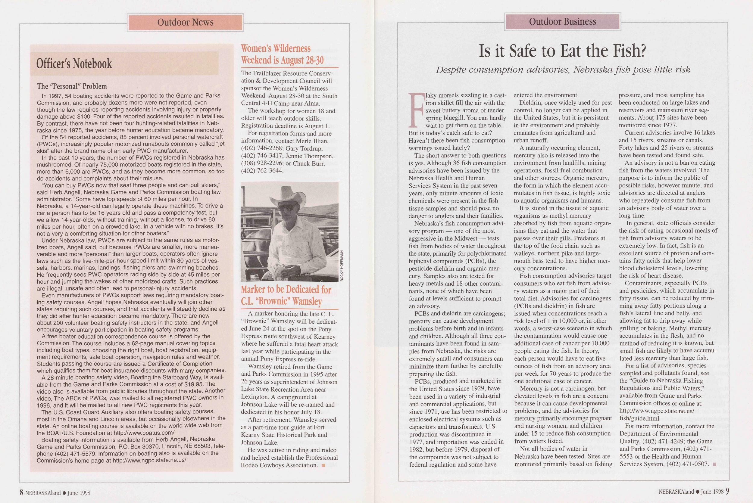
• Amended state park regulations to permit the legal taking of mountain sheep and elk within the boundaries of Fort Robinson State Park. • Set public hearings on July 24 to establish hunting seasons for mourning dove, snipe, rail, woodcock, grouse, pheasants, quail, partridge, furbearers, fall turkey and jackrabbit; to enact regulations governing procedures for vendors who issue permits and stamps; and to alter fisheries and wildlife regulations to harmonize the regulations with the provisions of Legislative Bill 922. • Approved the acquisition of the Martinson Tract, an 80-acre tract of wildlife land in Saunders County as an addition to Jack Sinn Wildlife Management Area. • Approved a memorandum of understanding with the Corps of Engineers to transfer public use and land management responsibilities on the 1,544 acre Hamburg Bend Wildlife Management Area in Otoe County to the Commission.The Niobrara Council has adopted a conduct code for Niobrara National Scenic River users. The council, formed in 1997, manages the river in cooperation with the National Park Service through an agreement with Brown, Cherry, Keya Paha and Rock counties.
The Outfitters Association, the National Park Service, the U.S. Fish and Wildlife Service and the Nebraska Game and Parks Commission all have endorsed the new standards.
The conduct code was created to help ensure the safety of river users while promoting top-quality canoeing, floating and sightseeing. Among the standards, which will be strongly enforced this season, is the council's
6 NEBRASKAland • June 1998 Outdoor Newsendorsement of state and federal laws that prohibit the use of alcohol and controlled substances. Existing laws also prohibit disturbing the peace, using firearms or fireworks and littering.
The Outfitters Association has agreed to assign numbers to their rental canoes and tubes and to log customers so that unlawful behavior can be reported easily.
For safety, the conduct code also recommends that canoes not be tied together, that no more than five tubes be tied together (including cooler tubes), that river users heed life jacket regulations and carry identification.
Copies of the conduct code are available from Niobrara River outfitters, the National Park Service and the Game and Parks Commission. Copies also are posted at river access sites.
In 1997, nearly 50,000 canoeists and tubers floated the Niobrara National Scenic River, and 74,000 visitors were logged at Smith Falls State Park.
Fremont Lakes SRA to be Rededicated June 20Fremont Lakes State Recreation Area west of Fremont in Dodge County will be rededicated June 20 to celebrate the completion of $2.5 million in improvements, including a new campground, kiosks, shower buildings, picnic shelters, wheel-chair-accessible fishing pier and paved roads.
The area, with 401 land acres and 269 water acres in 20 sandpit lakes, is a favorite with campers, picnickers, swimmers and boaters. The swimming beach is unsupervised.
Among scheduled events are a water skiing show, volksmarch, youth fishing seminars, food and live entertainment.
For more information, contact Fremont Lakes State Recreation Area, 2351 County Road 18, Ames, NE 68621 or call (402) 727-3290.
Outdoor News
Officer's Notebook
The "Personal" ProblemIn 1997, 54 boating accidents were reported to the Game and Parks Commission, and probably dozens more were not reported, even though the law requires reporting accidents involving injury or property damage above $100. Four of the reported accidents resulted in fatalities. By contrast, there have not been four hunting-related fatalities in Nebraska since 1975, the year before hunter education became mandatory.
Of the 54 reported accidents, 85 percent involved personal watercraft (PWCs), increasingly popular motorized runabouts commonly called "jet skis" after the brand name of an early PWC manufacturer.
In the past 10 years, the number of PWCs registered in Nebraska has mushroomed. Of nearly 75,000 motorized boats registered in the state, more than 6,000 are PWCs, and as they become more common, so too do accidents and complaints about their misuse.
"You can buy PWCs now that seat three people and can pull skiers," said Herb Angell, Nebraska Game and Parks Commission boating law administrator. "Some have top speeds of 60 miles per hour. In Nebraska, a 14-year-old can legally operate these machines. To drive a car a person has to be 16 years old and pass a competency test, but we allow 14-year-olds, without training, without a license, to drive 60 miles per hour, often on a crowded lake, in a vehicle with no brakes. It's not a very a comforting situation for other boaters."
Under Nebraska law, PWCs are subject to the same rules as motorized boats, Angell said, but because PWCs are smaller, more maneuverable and more "personal" than larger boats, operators often ignore laws such as the five-mile-per-hour speed limit within 30 yards of vessels, harbors, marinas, landings, fishing piers and swimming beaches. He frequently sees PWC operators racing side by side at 45 miles per hour and jumping the wakes of other motorized crafts. Such practices are illegal, unsafe and often lead to personal-injury accidents.
Even manufacturers of PWCs support laws requiring mandatory boating safety courses. Angell hopes Nebraska eventually will join other states requiring such courses, and that accidents will steadily decline as they did after hunter education became mandatory. There are now about 200 volunteer boating safety instructors in the state, and Angell encourages voluntary participation in boating safety programs.
A free boater education correspondence course is offered by the Commission. The course includes a 62-page manual covering topics including boat types, choosing the right boat, boat registration, equipment requirements, safe boat operation, navigation rules and weather. Students passing the course are issued a Certificate of Completion which qualifies them for boat insurance discounts with many companies.
A 28-minute boating safety video, Boating the Starboard Way, is available from the Game and Parks Commission at a cost of $19.95. The video also is available from public libraries throughout the state. Another video, The ABCs of PWCs, was mailed to all registered PWC owners in 1996, and it will be mailed to all new PWC registrants this year.
The U.S. Coast Guard Auxiliary also offers boating safety courses, most in the Omaha and Lincoln areas, but occasionally elsewhere in the state. An online boating course is available on the world wide web from the BOAT/U.S. Foundation at http://www.boatus.com/
Boating safety information is available from Herb Angell, Nebraska Game and Parks Commission, P.O. Box 30370, Lincoln, NE 68503, telephone (402) 471-5579. Information on boating also is available on the Commission's home page at http://www.ngpc.state.ne.us/
The Trailblazer Resource Conservation & Development Council will sponsor the Women's Wilderness Weekend August 28-30 at the South Central 4-H Camp near Alma.
The workshop for women 18 and older will teach outdoor skills. Registration deadline is August 1.
For registration forms and more information, contact Merle Illian, (402) 746-2268; Gary Tordrup, (402) 746-3417; Jennie Thompson, (308) 928-2296; or Chuck Burr, (402) 762-3644.
A marker honoring the late C. L. "Brownie" Wamsley will be dedicated June 24 at the spot on the Pony Express route southwest of Kearney where he suffered a fatal heart attack last year while participating in the annual Pony Express re-ride.
Wamsley retired from the Game and Parks Commission in 1995 after 26 years as superintendent of Johnson Lake State Recreation Area near Lexington. A campground at Johnson Lake will be re-named and dedicated in his honor July 18.
After retirement, Wamsley served as a part-time tour guide at Fort Kearny State Historical Park and Johnson Lake.
He was active in riding and rodeo and helped establish the Professional Rodeo Cowboys Association.
8 NEBRASKAland • June 1998Outdoor Business
Is it Safe to Eat the Fish?
Despite consumption advisories, Nebraska fish pose little riskFlaky morsels sizzling in a castiron skillet fill the air with the sweet buttery aroma of tender spring bluegill. You can hardly wait to get them on the table. But is today's catch safe to eat? Haven't there been fish consumption warnings issued lately?
The short answer to both questions is yes. Although 36 fish consumption advisories have been issued by the Nebraska Health and Human Services System in the past seven years, only minute amounts of toxic chemicals were present in the fish tissue samples and should pose no danger to anglers and their families.
Nebraska's fish consumption advisory program — one of the most aggressive in the Midwest — tests fish from bodies of water throughout the state, primarily for polychlorinated biphenyl compounds (PCBs), the pesticide dieldrin and organic mercury. Samples also are tested for heavy metals and 18 other contaminants, none of which have been found at levels sufficient to prompt an advisory.
PCBs and dieldrin are carcinogens; mercury can cause development problems before birth and in infants and children. Although all three contaminants have been found in samples from Nebraska, the risks are extremely small and consumers can minimize them further by carefully preparing the fish.
PCBs, produced and marketed in the United States since 1929, have been used in a variety of industrial and commercial applications, but since 1971, use has been restricted to enclosed electrical systems such as capacitors and transformers. U.S. production was discontinued in 1977, and importation was ended in 1982, but before 1979, disposal of the compounds was not subject to federal regulation and some have entered the environment.
Dieldrin, once widely used for pest control, no longer can be applied in the United States, but it is persistent in the environment and probably emanates from agricultural and urban runoff.
A naturally occurring element, mercury also is released into the environment from landfills, mining operations, fossil fuel combustion and other sources. Organic mercury, the form in which the element accumulates in fish tissue, is highly toxic to aquatic organisms and humans.
It is stored in the tissue of aquatic organisms as methyl mercury absorbed by fish from aquatic organisms they eat and the water that passes over their gills. Predators at the top of the food chain such as walleye, northern pike and largemouth bass tend to have higher mercury concentrations.
Fish consumption advisories target consumers who eat fish from advisory waters as a major part of their total diet. Advisories for carcinogens (PCBs and dieldrin) in fish are issued when concentrations reach a risk level of 1 in 10,000 or, in other words, a worst-case scenario in which the contamination would cause one additional case of cancer per 10,000 people eating the fish. In theory, each person would have to eat five ounces of fish from an advisory area per week for 70 years to produce the one additional case of cancer.
Mercury is not a carcinogen, but elevated levels in fish are a concern because it can cause developmental problems, and the advisories for mercury primarily encourage pregnant and nursing women, and children under 15 to reduce fish consumption from waters listed.
Not all bodies of water in Nebraska have been tested. Sites are monitored primarily based on fishing pressure, and most sampling has been conducted on large lakes and reservoirs and mainstem river segments. About 175 sites have been monitored since 1977.
Current advisories involve 16 lakes and 15 rivers, streams or canals. Forty lakes and 25 rivers or streams have been tested and found safe.
An advisory is not a ban on eating fish from the waters involved. The purpose is to inform the public of possible risks, however minute, and advisories are directed at anglers who repeatedly consume fish from an advisory body of water over a long time.
In general, state officials consider the risk of eating occasional meals of fish from advisory waters to be extremely low. In fact, fish is an excellent source of protein and contains fatty acids that help lower blood cholesterol levels, lowering the risk of heart disease.
Contaminants, especially PCBs and pesticides, which accumulate in fatty tissue, can be reduced by trimming away fatty portions along a fish's lateral line and belly, and allowing fat to drip away while grilling or baking. Methyl mercury accumulates in the flesh, and no method of reducing it is known, but small fish are likely to have accumulated less mercury than large fish.
For a list of advisories, species sampled and pollutants found, see the "Guide to Nebraska Fishing Regulations and Public Waters," available from Game and Parks Commission offices or online at: http://www.ngpc.state.ne.us/ fish/guide.html
For more information, contact the Department of Environmental Quality, (402) 471-4249; the Game and Parks Commission, (402) 471-5553 or the Health and Human Services System, (402)471-0507.
NEBRASKAland • June 1998 9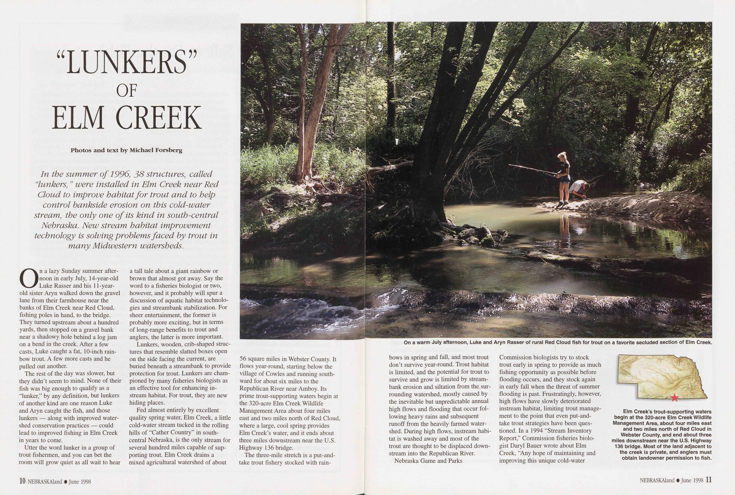
"LUNKERS" OF ELM CREEK
Photos and text by Michael Forsberg In the summer of 1996, 38 structures, called "lunkers, " were installed in Elm Creek near Red Cloud to improve habitat for trout and to help control hankside erosion on this cold-water stream, the only one of its kind in south-central Nebraska. New stream habitat improvement technology is solving problems faced by trout in many Midwestern watersheds.On a lazy Sunday summer afternoon in early July, 14-year-old Luke Rasser and his 11-year-old sister Aryn walked down the gravel lane from their farmhouse near the banks of Elm Creek near Red Cloud, fishing poles in hand, to the bridge. They turned upstream about a hundred yards, then stopped on a gravel bank near a shadowy hole behind a log jam on a bend in the creek. After a few casts, Luke caught a fat, 10-inch rainbow trout. A few more casts and he pulled out another.
The rest of the day was slower, but they didn't seem to mind. None of their fish was big enough to qualify as a "lunker," by any definition, but lunkers of another kind are one reason Luke and Aryn caught the fish, and those lunkers — along with improved watershed conservation practices — could lead to improved fishing in Elm Creek in years to come.
Utter the word lunker in a group of trout fishermen, and you can bet the room will grow quiet as all wait to hear a tall tale about a giant rainbow or brown that almost got away. Say the word to a fisheries biologist or two, however, and it probably will spur a discussion of aquatic habitat technologies and streambank stabilization. For sheer entertainment, the former is probably more exciting, but in terms of long-range benefits to trout and anglers, the latter is more important.
Lunkers, wooden, crib-shaped structures that resemble slatted boxes open on the side facing the current, are buried beneath a streambank to provide protection for trout. Lunkers are championed by many fisheries biologists as an effective tool for enhancing instream habitat. For trout, they are new hiding places.
Fed almost entirely by excellent quality spring water, Elm Creek, a little cold-water stream tucked in the rolling hills of "Cather Country" in south-central Nebraska, is the only stream for several hundred miles capable of supporting trout. Elm Creek drains a mixed agricultural watershed of about 56 square miles in Webster County. It flows year-round, starting below the village of Cowles and running southward for about six miles to the Republican River near Amboy. Its prime trout-supporting waters begin at the 320-acre Elm Creek Wildlife Management Area about four miles east and two miles north of Red Cloud, where a large, cool spring provides Elm Creek's water, and it ends about three miles downstream near the U.S. Highway 136 bridge.
The three-mile stretch is a put-and-take trout fishery stocked with rainbows
10 NEBRASKAland • June 1998On a warm July afternoon, Luke and Aryn Rasser of rural Red Cloud fish for trout on a favorite secluded section of Elm Creek.
in spring and fall, and most trout don't survive year-round. Trout habitat is limited, and the potential for trout to survive and grow is limited by stream-bank erosion and siltation from the surrounding watershed, mostly caused by the inevitable but unpredictable annual high flows and flooding that occur following heavy rains and subsequent runoff from the heavily farmed watershed. During high flows, instream habitat is washed away and most of the trout are thought to be displaced down-stream into the Republican River.
Nebraska Game and Parks Commission biologists try to stock trout early in spring to provide as much fishing opportunity as possible before flooding occurs, and they stock again in early fall when the threat of summer flooding is past. Frustratingly, however, high flows have slowly deteriorated instream habitat, limiting trout management to the point that even put-and-take trout strategies have been questioned. In a 1994 "Stream Inventory Report," Commission fisheries biologist Daryl Bauer wrote about Elm Creek, "Any hope of maintaining and improving this unique cold-water
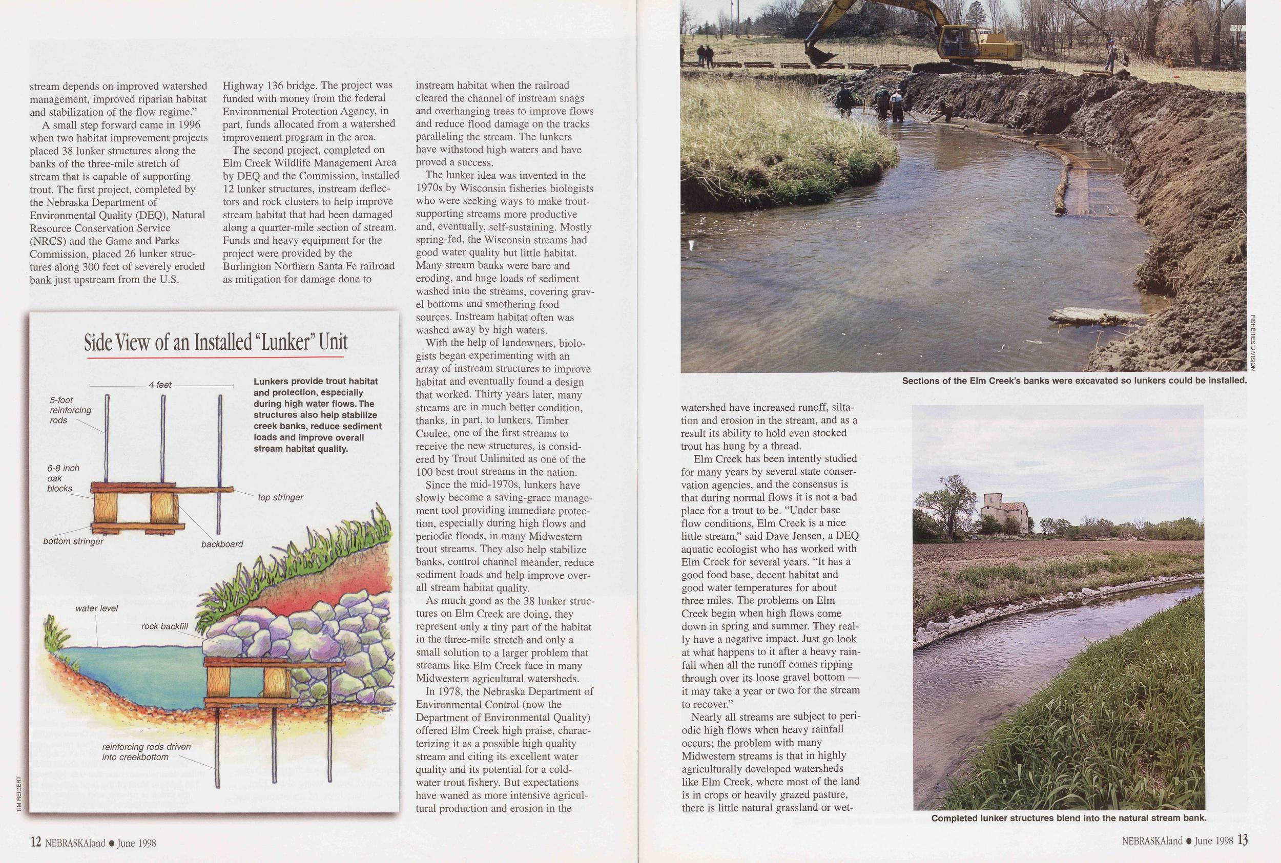
Elm Creek's trout-supporting waters begin at the 320-acre Elm Creek Wildlife Management Area, about four miles east and two miles north of Red Cloud in Webster County, and end about three miles downstream near the U.S. Highway 136 bridge. Most of the land adjacent to the creek is private, and anglers must obtain landowner permission to fish.
stream depends on improved watershed management, improved riparian habitat and stabilization of the flow regime."
A small step forward came in 1996 when two habitat improvement projects placed 38 lunker structures along the banks of the three-mile stretch of stream that is capable of supporting trout. The first project, completed by the Nebraska Department of Environmental Quality (DEQ), Natural Resource Conservation Service (NRCS) and the Game and Parks Commission, placed 26 lunker structures along 300 feet of severely eroded bank just upstream from the U.S. Highway 136 bridge. The project was funded with money from the federal Environmental Protection Agency, in part, funds allocated from a watershed improvement program in the area.
The second project, completed on Elm Creek Wildlife Management Area by DEQ and the Commission, installed 12 lunker structures, instream deflectors and rock clusters to help improve stream habitat that had been damaged along a quarter-mile section of stream. Funds and heavy equipment for the project were provided by the Burlington Northern Santa Fe railroad as mitigation for damage done to instream habitat when the railroad cleared the channel of instream snags and overhanging trees to improve flows and reduce flood damage on the tracks paralleling the stream. The lunkers have withstood high waters and have proved a success.
The lunker idea was invented in the 1970s by Wisconsin fisheries biologists who were seeking ways to make trout-supporting streams more productive and, eventually, self-sustaining. Mostly spring-fed, the Wisconsin streams had good water quality but little habitat. Many stream banks were bare and eroding, and huge loads of sediment washed into the streams, covering gravel bottoms and smothering food sources. Instream habitat often was washed away by high waters.
With the help of landowners, biologists began experimenting with an array of instream structures to improve habitat and eventually found a design that worked. Thirty years later, many streams are in much better condition, thanks, in part, to lunkers. Timber Coulee, one of the first streams to receive the new structures, is considered by Trout Unlimited as one of the 100 best trout streams in the nation.
Since the mid-1970s, lunkers have slowly become a saving-grace management tool providing immediate protection, especially during high flows and periodic floods, in many Midwestern trout streams. They also help stabilize banks, control channel meander, reduce sediment loads and help improve overall stream habitat quality.
As much good as the 38 lunker structures on Elm Creek are doing, they represent only a tiny part of the habitat in the three-mile stretch and only a small solution to a larger problem that streams like Elm Creek face in many Midwestern agricultural watersheds.
In 1978, the Nebraska Department of Environmental Control (now the Department of Environmental Quality) offered Elm Creek high praise, characterizing it as a possible high quality stream and citing its excellent water quality and its potential for a cold-water trout fishery. But expectations have waned as more intensive agricultural production and erosion in the
Side View of an Installed "Lunker" Unit
Sections of the Elm Creek's banks were excavated so lunkers could be installed.
FISHERIES DIVISIONwatershed have increased runoff, siltation and erosion in the stream, and as a result its ability to hold even stocked trout has hung by a thread.
Elm Creek has been intently studied for many years by several state conservation agencies, and the consensus is that during normal flows it is not a bad place for a trout to be. "Under base flow conditions, Elm Creek is a nice little stream," said Dave Jensen, a DEQ aquatic ecologist who has worked with Elm Creek for several years. "It has a good food base, decent habitat and good water temperatures for about three miles. The problems on Elm Creek begin when high flows come down in spring and summer. They really have a negative impact. Just go look at what happens to it after a heavy rainfall when all the runoff comes ripping through over its loose gravel bottom — it may take a year or two for the stream to recover."
Nearly all streams are subject to periodic high flows when heavy rainfall occurs; the problem with many Midwestern streams is that in highly agriculturally developed watersheds like Elm Creek, where most of the land is in crops or heavily grazed pasture, there is little natural grassland or wetland
Completed lunker structures blend into the natural stream bank.
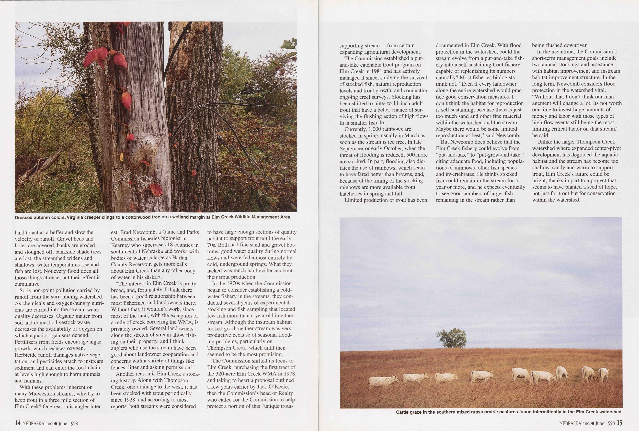
Dressed autumn colors, Virginia creeper clings to a Cottonwood tree on a wetland margin at Elm Creek Wildlife Management Area.
to act as a buffer and slow the velocity of runoff. Gravel beds and holes are covered, banks are eroded and sloughed off, bankside shade trees are lost, the streambed widens and shallows, water temperatures rise and fish are lost. Not every flood does all those things at once, but their effect is cumulative.
So is non-point pollution carried by runoff from the surrounding watershed. As chemicals and oxygen-hungry nutrients are carried into the stream, water quality decreases. Organic matter from soil and domestic livestock waste decreases the availability of oxygen on which aquatic organisms depend. Fertilizers from fields encourage algae growth, which reduces oxygen. Herbicide runoff damages native vegetation, and pesticides attach to instream sediment and can enter the food chain at levels high enough to harm animals and humans.
With these problems inherent on many Midwestern streams, why try to keep trout in a three mile section of Elm Creek? One reason is angler interest. Brad Newcomb, a Game and Parks Commission fisheries biologist in Kearney who supervises 18 counties in south-central Nebraska and works with bodies of water as large as Harlan County Reservoir, gets more calls about Elm Creek than any other body of water in his district.
"The interest in Elm Creek is pretty broad, and, fortunately, I think there has been a good relationship between most fishermen and landowners there. Without that, it wouldn't work, since most of the land, with the exception of a mile of creek bordering the WMA, is privately owned. Several landowners along the stretch of stream allow fishing on their property, and I think anglers who use the stream have been good about landowner cooperation and concerns with a variety of things like fences, litter and asking permission."
Another reason is Elm Creek's stocking history. Along with Thompson Creek, one drainage to the west, it has been stocked with trout periodically since 1928, and according to most reports, both streams were considered to have large enough sections of quality habitat to support trout until the early 70s. Both had fine sand and gravel bottoms, good water quality during normal flows and were fed almost entirely by cold, underground springs. What they lacked was much hard evidence about their trout production.
In the 1970s when the Commission began to consider establishing a cold-water fishery in the streams, they conducted several years of experimental stocking and fish sampling that located few fish more than a year old in either stream. Although the instream habitat looked good, neither stream was very productive because of seasonal flooding problems, particularly on Thompson Creek, which until then seemed to be the most promising.
The Commission shifted its focus to Elm Creek, purchasing the first tract of the 320-acre Elm Creek WMA in 1978, and taking to heart a proposal outlined a few years earlier by Jack O'Keefe, then the Commission's head of Realty who called for the Commission to help protect a portion of this "unique trout-
14 NEBRASKAland • June 1998supporting stream ... from certain expanding agricultural development."
The Commission established a put-and-take catchable trout program on Elm Creek in 1981 and has actively managed it since, studying the survival of stocked fish, natural reproduction levels and trout growth, and conducting ongoing creel surveys. Stocking has been shifted to nine- to 11-inch adult trout that have a better chance of surviving the flushing action of high flows than smaller fish do.
Currently, 1,000 rainbows are stocked in spring, usually in March as soon as the stream is ice free. In late September or early October, when the threat of flooding is reduced, 500 more are stocked. In part, flooding also dictates the use of rainbows, which seem to have fared better than browns, and, because of the timing of the stocking, rainbows are more available from hatcheries in spring and fall.
Limited production of trout has been documented in Elm Creek. With flood protection in the watershed, could the stream evolve from a put-and-take fishery into a self-sustaining trout fishery capable of replenishing its numbers naturally? Most fisheries biologists think not. "Even if every landowner along the entire watershed would practice good conservation measures, I don't think the habitat for reproduction is self sustaining, because there is just too much sand and other fine material within the watershed and the stream. Maybe there would be some limited reproduction at best," said Newcomb.
But Newcomb does believe that the Elm Creek fishery could evolve from "put-and-take" to "put-grow-and-take," citing adequate food, including populations of minnows, other fish species and invertebrates. He thinks stocked fish could remain in the stream for a year or more, and he expects eventually to see good numbers of larger fish remaining in the stream rather than being flushed downriver.
In the meantime, the Commission's short-term management goals include two annual stockings and assistance with habitat improvement and instream habitat improvement structure. In the long term, Newcomb considers flood protection in the watershed vital. "Without that, I don't think our management will change a lot. Its not worth our time to invest huge amounts of money and labor with those types of high flow events still being the most limiting critical factor on that stream," he said.
Unlike the larger Thompson Creek watershed where expanded center-pivot development has degraded the aquatic habitat and the stream has become too shallow, sandy and warm to support trout, Elm Creek's future could be bright, thanks in part to a project that seems to have planted a seed of hope, not just for trout but for conservation within the watershed.
Cattle graze in the southern mixed grass prairie pastures found intermittently in the Elm Creek watershed.
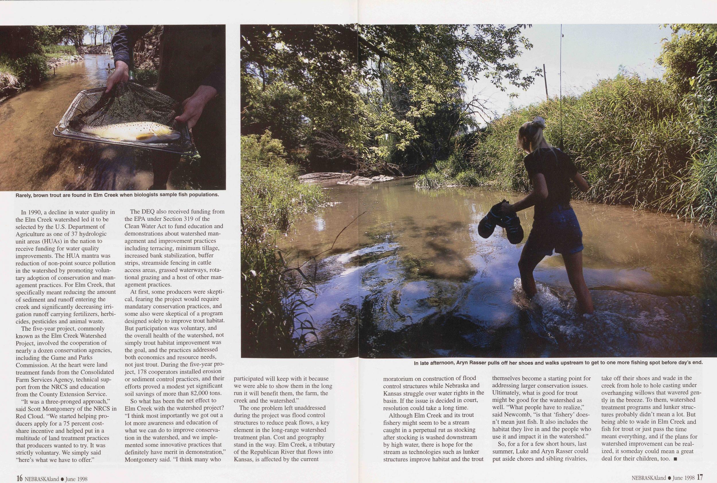
Rarely, brown trout are found in Elm Creek when biologists sample fish populations.
In 1990, a decline in water quality in the Elm Creek watershed led it to be selected by the U.S. Department of Agriculture as one of 37 hydrologic unit areas (HUAs) in the nation to receive funding for water quality improvements. The HUA mantra was reduction of non-point source pollution in the watershed by promoting voluntary adoption of conservation and management practices. For Elm Creek, that specifically meant reducing the amount of sediment and runoff entering the creek and significantly decreasing irrigation runoff carrying fertilizers, herbicides, pesticides and animal waste.
The five-year project, commonly known as the Elm Creek Watershed Project, involved the cooperation of nearly a dozen conservation agencies, including the Game and Parks Commission. At the heart were land treatment funds from the Consolidated Farm Services Agency, technical support from the NRCS and education from the County Extension Service.
"It was a three-pronged approach," said Scott Montgomery of the NRCS in Red Cloud. "We started helping producers apply for a 75 percent cost-share incentive and helped put in a multitude of land treatment practices that producers wanted to try. It was strictly voluntary. We simply said "here's what we have to offer."
The DEQ also received funding from the EPA under Section 319 of the Clean Water Act to fund education and demonstrations about watershed management and improvement practices including terracing, minimum tillage, increased bank stabilization, buffer strips, streamside fencing in cattle access areas, grassed waterways, rotational grazing and a host of other management practices.
At first, some producers were skeptical, fearing the project would require mandatary conservation practices, and some also were skeptical of a program designed solely to improve trout habitat. But participation was voluntary, and the overall health of the watershed, not simply trout habitat improvement was the goal, and the practices addressed both economics and resource needs, not just trout. During the five-year project, 178 cooperators installed erosion or sediment control practices, and their efforts proved a modest yet significant soil savings of more than 82,000 tons.
So what has been the net effect to Elm Creek with the watershed project? "I think most importantly we got out a lot more awareness and education of what we can do to improve conservation in the watershed, and we implemented some innovative practices that definitely have merit in demonstration," Montgomery said. "I think many who
In late afternoon, Aryn Rasser pulls off her shoes and walks upstream to get to one more fishing spot before day's end.
participated will keep with it because we were able to show them in the long run it will benefit them, the farm, the creek and the watershed."
The one problem left unaddressed during the project was flood control structures to reduce peak flows, a key element in the long-range watershed treatment plan. Cost and geography stand in the way. Elm Creek, a tributary of the Republican River that flows into Kansas, is affected by the current
16 NEBRASKAland • June 1998moratorium on construction of flood control structures while Nebraska and Kansas struggle over water rights in the basin. If the issue is decided in court, resolution could take a long time.
Although Elm Creek and its trout fishery might seem to be a stream caught in a perpetual rut as stocking after stocking is washed downstream by high water, there is hope for the stream as technologies such as lunker structures improve habitat and the trout themselves become a starting point for addressing larger conservation issues. Ultimately, what is good for trout might be good for the watershed as well. "What people have to realize," said Newcomb, "is that 'fishery' doesn't mean just fish. It also includes the habitat they live in and the people who use it and impact it in the watershed."
So, for a for a few short hours, last summer, Luke and Aryn Rasser could put aside chores and sibling rivalries, take off their shoes and wade in the creek from hole to hole casting under overhanging willows that wavered gently in the breeze. To them, watershed treatment programs and lunker structures probably didn't mean a lot. But being able to wade in Elm Creek and fish for trout or just pass the time meant everything, and if the plans for watershed improvement can be realized, it someday could mean a great deal for their children, too.
NEBRASKAland • June 1998 17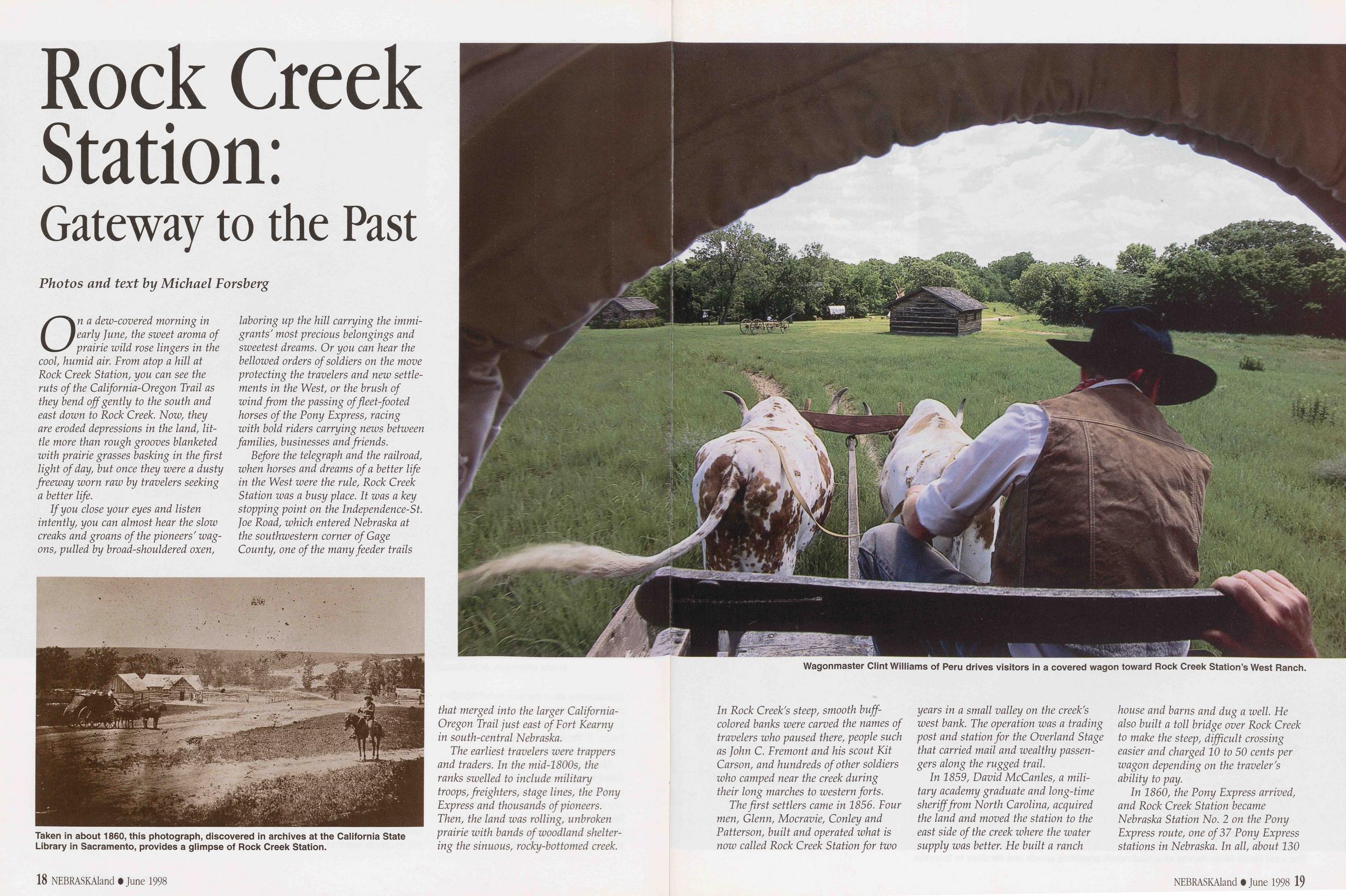
Rock Creek Station: Gateway to the Past
Photos and text by Michael ForsbergOn a dew-covered morning in early June, the sweet aroma of prairie wild rose lingers in the cool, humid air. From atop a hill at Rock Creek Station, you can see the ruts of the California-Oregon Trail as they bend off gently to the south and east down to Rock Creek. Now, they are eroded depressions in the land, little more than rough grooves blanketed with prairie grasses basking in the first light of day, but once they were a dusty freeway worn raw by travelers seeking a better life.
If you close your eyes and listen intently, you can almost hear the slow creaks and groans of the pioneers' wagons, pulled by broad-shouldered oxen, laboring up the hill carrying the immigrants' most precious belongings and sweetest dreams. Or you can hear the bellowed orders of soldiers on the move protecting the travelers and new settlements in the West, or the brush of wind from the passing of fleet-footed horses of the Pony Express, racing with bold riders carrying news between families, businesses and friends.
Before the telegraph and the railroad, when horses and dreams of a better life in the West were the rule, Rock Creek Station was a busy place. It was a key stopping point on the Independence-St. Joe Road, which entered Nebraska at the southwestern corner of Gage County, one of the many feeder trails
Taken in about 1860, this photograph, discovered in archives at the California State Library in Sacramento, provides a glimpse of Rock Creek Station.
that merged into the larger California-Oregon Trail just east of Fort Kearny in south-central Nebraska.
The earliest travelers were trappers and traders. In the mid-1800s, the ranks swelled to include military troops, freighters, stage lines, the Pony Express and thousands of pioneers. Then, the land was rolling, unbroken prairie with bands of woodland sheltering the sinuous, rocky-bottomed creek.
18 NEBRASKAland • June 1998Wagonmaster Clint Williams of Peru drives visitors in a covered wagon toward Rock Creek Station's West Ranch.
In Rock Creek's steep, smooth buff-colored banks were carved the names of travelers who paused there, people such as John C. Fremont and his scout Kit Carson, and hundreds of other soldiers who camped near the creek during their long marches to western forts.
The first settlers came in 1856. Four men, Glenn, Mocravie, Conley and Patterson, built and operated what is now called Rock Creek Station for two years in a small valley on the creek's west bank. The operation was a trading post and station for the Overland Stage that carried mail and wealthy passengers along the rugged trail.
In 1859, David McCanles, a military academy graduate and long-time sheriff from North Carolina, acquired the land and moved the station to the east side of the creek where the water supply was better. He built a ranch house and barns and dug a well. He also built a toll bridge over Rock Creek to make the steep, difficult crossing easier and charged 10 to 50 cents per wagon depending on the traveler's ability to pay.
In 1860, the Pony Express arrived, and Rock Creek Station became Nebraska Station No. 2 on the Pony Express route, one of 37 Pony Express stations in Nebraska. In all, about 130
NEBRASKAland • June 1998 19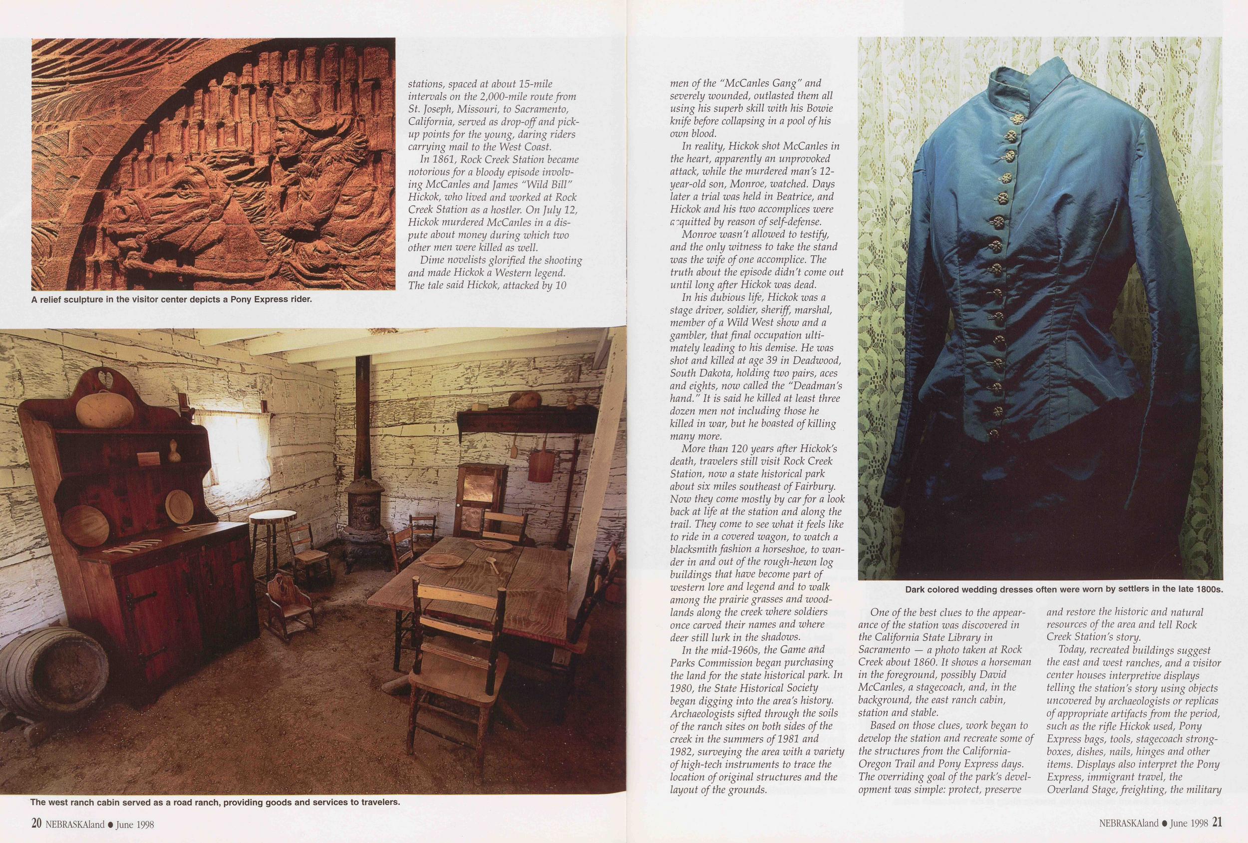
A relief sculpture in the visitor center depicts a Pony Express rider.
stations, spaced at about 15-mile intervals on the 2,000-mile route from St. Joseph, Missouri, to Sacramento, California, served as drop-off and pickup points for the young, daring riders carrying mail to the West Coast.
In 1861, Rock Creek Station became notorious for a bloody episode involving McCanles and James "Wild Bill" Hickok, who lived and worked at Rock Creek Station as a hostler. On July 12, Hickok murdered McCanles in a dispute about money during which two other men were killed as well.
Dime novelists glorified the shooting and made Hickok a Western legend. The tale said Hickok, attacked by 10
The west ranch cabin served as a road ranch, providing goods and services to travelers.
men of the "McCanles Gang" and severely wounded, outlasted them all using his superb skill with his Bowie knife before collapsing in a pool of his own blood.
In reality, Hickok shot McCanles in the heart, apparently an unprovoked attack, while the murdered man's 12-year-old son, Monroe, watched. Days later a trial was held in Beatrice, and Hickok and his two accomplices were acquitted by reason of self-defense.
Monroe wasn't allowed to testify, and the only witness to take the stand was the wife of one accomplice. The truth about the episode didn't come out until long after Hickok was dead.
In his dubious life, Hickok was a stage driver, soldier, sheriff, marshal, member of a Wild West show and a gambler, that final occupation ultimately leading to his demise. He was shot and killed at age 39 in Deadwood, South Dakota, holding two pairs, aces and eights, now called the "Deadman's hand." It is said he killed at least three dozen men not including those he killed in war, but he boasted of killing many more.
More than 120 years after Hickok's death, travelers still visit Rock Creek Station, now a state historical park about six miles southeast of Fairbury. Now they come mostly by car for a look back at life at the station and along the trail. They come to see what it feels like to ride in a covered wagon, to watch a blacksmith fashion a horseshoe, to wander in and out of the rough-hewn log buildings that have become part of western lore and legend and to walk among the prairie grasses and woodlands along the creek where soldiers once carved their names and where deer still lurk in the shadows.
In the mid-1960s, the Game and Parks Commission began purchasing the land for the state historical park. In 1980, the State Historical Society began digging into the area's history. Archaeologists sifted through the soils of the ranch sites on both sides of the creek in the summers of 1981 and 1982, surveying the area with a variety of high-tech instruments to trace the location of original structures and the layout of the grounds.
Dark colored wedding dresses often were worn by settlers in the late 1800s.
One of the best clues to the appearance of the station was discovered in the California State Library in Sacramento — a photo taken at Rock Creek about 1860. It shows a horseman in the foreground, possibly David McCanles, a stagecoach, and, in the background, the east ranch cabin, station and stable.
Based on those clues, work began to develop the station and recreate some of the structures from the California-Oregon Trail and Pony Express days. The overriding goal of the park's development was simple: protect, preserve and restore the historic and natural resources of the area and tell Rock Creek Station's story.
Today, recreated buildings suggest the east and west ranches, and a visitor center houses interpretive displays telling the station's story using objects uncovered by archaeologists or replicas of appropriate artifacts from the period, such as the rifle Hickok used, Pony Express bags, tools, stagecoach strong-boxes, dishes, nails, hinges and other items. Displays also interpret the Pony Express, immigrant travel, the Overland Stage, freighting, the military
NEBRASKAland • June 1998 21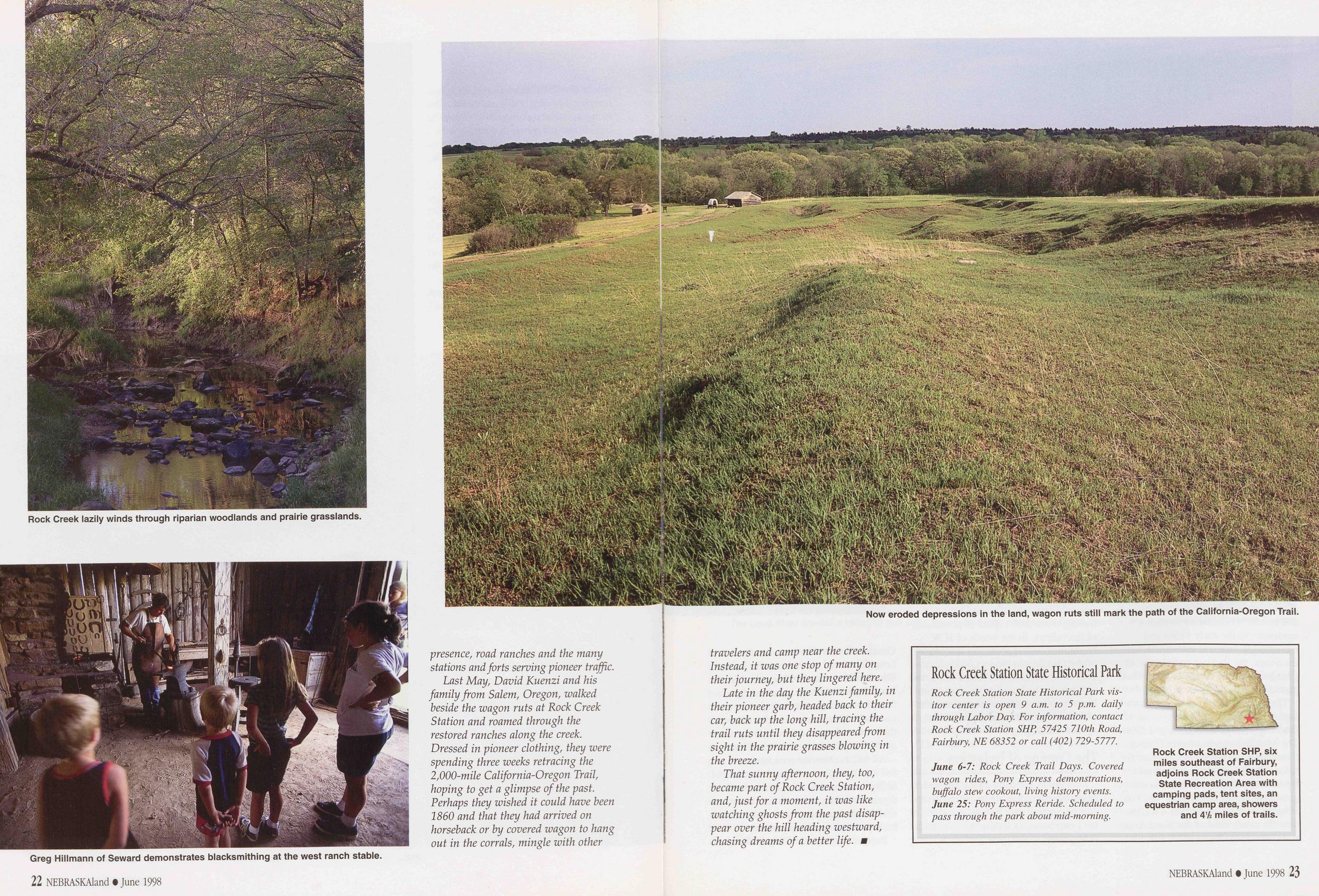
Rock Creek lazily winds through riparian woodlands and prairie grasslands.
Greg Hillmann of Seward demonstrates blacksmithing at the west ranch stable.
presence, road ranches and the many stations and forts serving pioneer traffic.
Last May, David Kuenzi and his family from Salem, Oregon, walked beside the wagon ruts at Rock Creek Station and roamed through the restored ranches along the creek. Dressed in pioneer clothing, they were spending three weeks retracing the 2,000-mile California-Oregon Trail, hoping to get a glimpse of the past. Perhaps they wished it could have been I860 and that they had arrived on horseback or by covered wagon to hang out in the corrals, mingle with other
22 NEBRASKAland • June 1998Now eroded depressions in the land, wagon ruts still mark the path of the California-Oregon Trail.
travelers and camp near the creek. Instead, it was one stop of many on their journey, but they lingered here.
Late in the day the Kuenzi family, in their pioneer garb, headed back to their car, back up the long hill, tracing the trail ruts until they disappeared from sight in the prairie grasses blowing in the breeze.
That sunny afternoon, they, too, became part of Rock Creek Station, and, just for a moment, it was like watching ghosts from the past disappear over the hill heading westward, chasing dreams of a better life.
Rock Creek Station State Historical Park
Rock Creek Station State Historical Park visitor center is open 9 a.m. to 5 p.m. daily through Labor Day. For information, contact Rock Creek Station SHP, 57425 710th Road, Fairbury, NE 68352 or call (402) 729-5777.
June 6-7: Rock Creek Trail Days. Covered wagon rides, Pony Express demonstrations, buffalo stew cookout, living history events. June 25: Pony Express Reride. Scheduled to pass through the park about mid-morning.
Rock Creek Station SHP, six miles southeast of Fairbury, adjoins Rock Creek Station State Recreation Area with camping pads, tent sites, an equestrian camp area, showers and 4 1/2 miles of trails.
The Loups
Lifeblood of Central Nebraska By Gerry Steinauer, Botanist Photos by Jon Farrar "Hill and valley were inviting and rich with an almost profligate abundance of natural wealth. Nature awaited only the hand of civilized man to turn it all to practical uses. And he was coming." — "Trail of the Loup," H. W. Foght, 1906To the Skidi Pawnee, the Loup was Its Karl Kitsu or "Plenty Potatoes River," named for the abundant edible tubers growing in its valley. The Skidi, a name meaning "Wolf People," were hunters, fishermen and farmers, who for seven months of the year roamed the plains hunting bison. In spring and fall they lived in earthlodges, mainly along the lower Loup River where they grew pumpkins, squash, beans and corn in bottomland fields and harvested small game, fish and mussels.
When French traders entered the Loup valley in the late 1700s, the Skidi had occupied it for nearly 300 years. The French translated "Wolf People" to "Pani Loups" from which the river's name was derived. Reduced in strength and numbers because of smallpox epidemics in the early 1800s and increasingly vulnerable to attack by the Sioux, the Pawnee ceded most of their lands on the Loups to the federal government in 1857.
The threat of Sioux raiding parties kept all but the boldest settlers out of the Loup valleys until the mid-1870s. The Middle Loup and lower Dismal rivers were among the last retreats for bison, elk and antelope in Nebraska. By the early 1870s, bison herds were gone from the Loup country. The last straggler was found dead in a wallow near the confluence of the North Loup and Calamus rivers in 1875. Elk persisted to the end of the decade.
By 1877, the Indian scares ceased, and homesteaders poured into the Loup valley planting corn in meadows and grazing their livestock on adjacent bluffs. The upper reaches of the drainage remained the domain of large cattle ranches. The population of the lower Loup basin increased rapidly through the late 1870s and 1880s, and homesteads spilled across the uplands and moved upstream into Sandhills valleys.
In 1890, drought set in, lasting until 1896. Dry winds wilted fodder and grain crops, and some farmers were forced to sell their cattle at low prices; some shot their hogs rather than allow them to starve. Those who had borrowed heavily to establish homesteads faced financial crisis. Many sold their land, leaving those with capital in possession of the valleys. In the words of H.W. Foght, who wrote about the settlement of the Middle and North Loup valleys in Trail of the Loups (1906), "Six years of adversity had taught two important lessons — the value of money and the imperative need of a more intensive system of farming."
The Coming of IrrigationDrought in the early 1890s spurred development of private irrigation diversion projects across Nebraska and in the Loup basin, including the Lee Ditch at Brownlee (1894) and Tzschuck
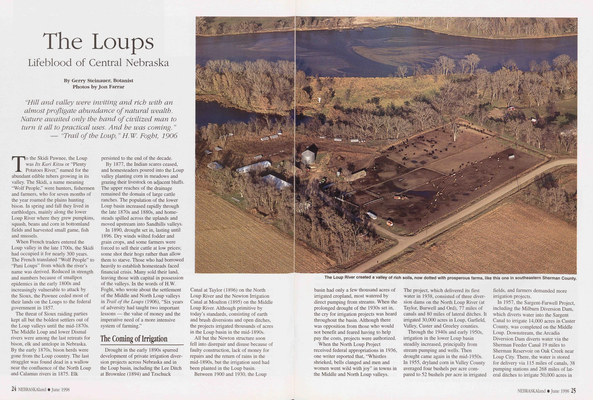
The Loup River created a valley of rich soils, now dotted with prosperous farms, like this one in southeastern Sherman County.
Canal at Taylor (1896) on the North Loup River and the Newton Irrigation Canal at Moulton (1895) on the Middle Loup River. Although primitive by today's standards, consisting of earth and brush diversions and open ditches, the projects irrigated thousands of acres in the Loup basin in the mid-1890s.
All but the Newton structure soon fell into disrepair and disuse because of faulty construction, lack of money for repairs and the return of rains in the mid-1890s, but the irrigation seed had been planted in the Loup basin.
Between 1900 and 1930, the Loup
24 NEBRASKAland • June 1998basin had only a few thousand acres of irrigated cropland, most watered by direct pumping from streams. When the prolonged drought of the 1930s set in, the cry for irrigation projects was heard throughout the basin. Although there was opposition from those who would not benefit and feared having to help pay the costs, projects were authorized.
When the North Loup Project received federal appropriations in 1936, one writer reported that, "Whistles shrieked, bells clanged and men and women went wild with joy" in towns in the Middle and North Loup valleys. The project, which delivered its first water in 1938, consisted of three diversion dams on the North Loup River (at Taylor, Burwell and Ord), 77 miles of canals and 80 miles of lateral ditches. It irrigated 30,000 acres in Loup, Garfield, Valley, Custer and Greeley counties.
Through the 1940s and early 1950s, irrigation in the lower Loup basin steadily increased, principally from stream pumping and wells. Then drought came again in the mid-1950s. In 1955, dryland corn in Valley County averaged four bushels per acre compared to 52 bushels per acre in irrigated fields, and farmers demanded more irrigation projects.
In 1957, the Sargent-Farwell Project, including the Milburn Diversion Dam, which diverts water into the Sargent Canal to irrigate 14,000 acres in Custer County, was completed on the Middle Loup. Downstream, the Arcadia Diversion Dam diverts water via the Sherman Feeder Canal 19 miles to Sherman Reservoir on Oak Creek near Loup City. There, the water is stored for delivery via 115 miles of canals, 38 pumping stations and 268 miles of lateral ditches to irrigate 50,000 acres in
NEBRASKAland • June 1998 25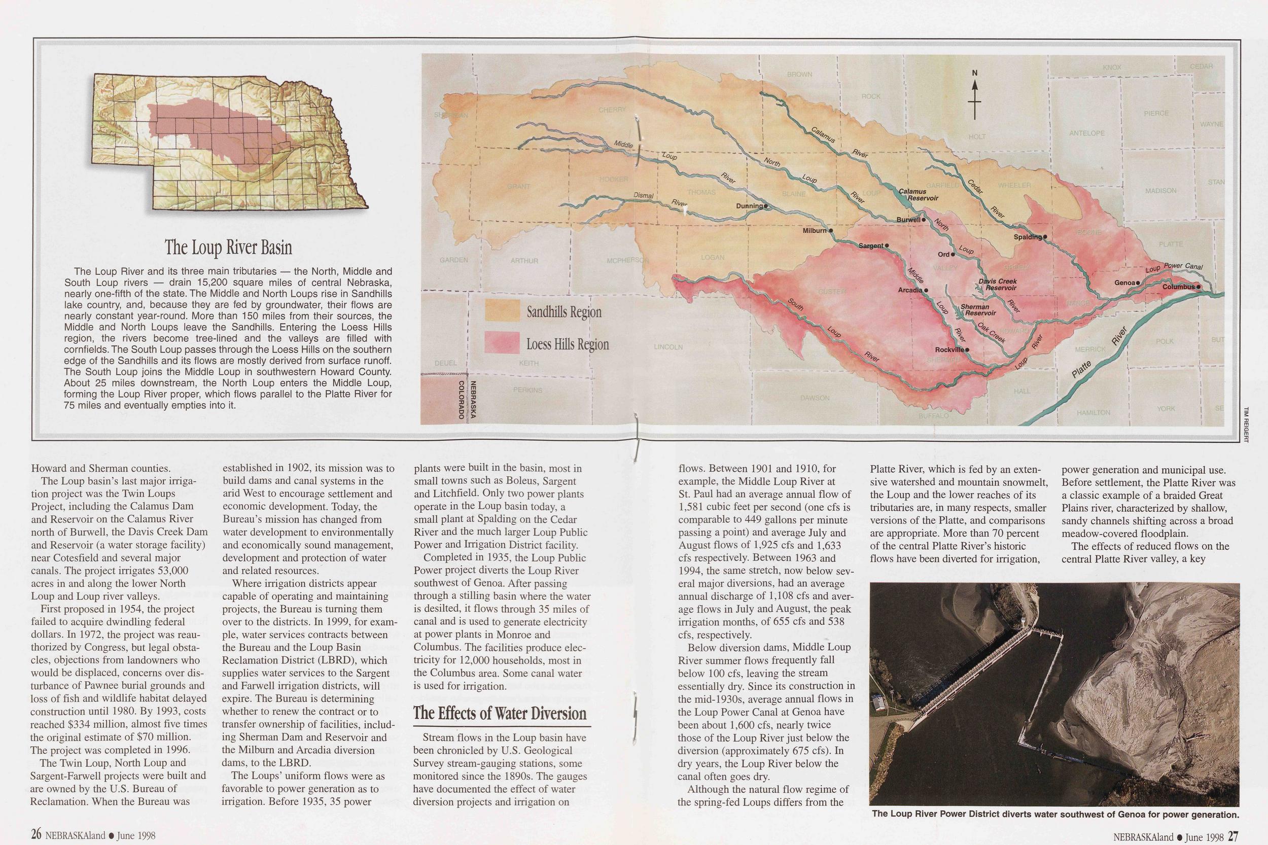
The Loup River Basin The Loup River and its three main tributaries — the North, Middle and South Loup rivers — drain 15,200 square miles of central Nebraska, nearly one-fifth of the state. The Middle and North Loups rise in Sandhills lake country, and, because they are fed by groundwater, their flows are nearly constant year-round. More than 150 miles from their sources, the Middle and North Loups leave the Sandhills. Entering the Loess Hills region, the rivers become tree-lined and the valleys are filled with cornfields. The South Loup passes through the Loess Hills on the southern edge of the Sandhills and its flows are mostly derived from surface runoff. The South Loup joins the Middle Loup in southwestern Howard County. About 25 miles downstream, the North Loup enters the Middle Loup, forming the Loup River proper, which flows parallel to the Platte River for 75 miles and eventually empties into it. Sandhills Region Loess Hills Region
Howard and Sherman counties.
The Loup basin's last major irrigation project was the Twin Loups Project, including the Calamus Dam and Reservoir on the Calamus River north of Burwell, the Davis Creek Dam and Reservoir (a water storage facility) near Cotesfield and several major canals. The project irrigates 53,000 acres in and along the lower North Loup and Loup river valleys.
First proposed in 1954, the project failed to acquire dwindling federal dollars. In 1972, the project was reauthorized by Congress, but legal obstacles, objections from landowners who would be displaced, concerns over disturbance of Pawnee burial grounds and loss of fish and wildlife habitat delayed construction until 1980. By 1993, costs reached $334 million, almost five times the original estimate of $70 million. The project was completed in 1996.
The Twin Loup, North Loup and Sargent-Farwell projects were built and are owned by the U.S. Bureau of Reclamation. When the Bureau was established in 1902, its mission was to build dams and canal systems in the arid West to encourage settlement and economic development. Today, the Bureau's mission has changed from water development to environmentally and economically sound management, development and protection of water and related resources.
Where irrigation districts appear capable of operating and maintaining projects, the Bureau is turning them over to the districts. In 1999, for example, water services contracts between the Bureau and the Loup Basin Reclamation District (LBRD), which supplies water services to the Sargent and Farwell irrigation districts, will expire. The Bureau is determining whether to renew the contract or to transfer ownership of facilities, including Sherman Dam and Reservoir and the Milburn and Arcadia diversion dams, to the LBRD.
The Loups' uniform flows were as favorable to power generation as to irrigation. Before 1935, 35 power plants were built in the basin, most in small towns such as Boleus, Sargent and Litchfield. Only two power plants operate in the Loup basin today, a small plant at Spalding on the Cedar River and the much larger Loup Public Power and Irrigation District facility.
Completed in 1935, the Loup Public Power project diverts the Loup River southwest of Genoa. After passing through a stilling basin where the water is desilted, it flows through 35 miles of canal and is used to generate electricity at power plants in Monroe and Columbus. The facilities produce electricity for 12,000 households, most in the Columbus area. Some canal water is used for irrigation.
The Effects of Water DiversionStream flows in the Loup basin have been chronicled by U.S. Geological Survey stream-gauging stations, some monitored since the 1890s. The gauges have documented the effect of water diversion projects and irrigation on
26 NEBRASKAland • June 1998flows. Between 1901 and 1910, for example, the Middle Loup River at St. Paul had an average annual flow of 1,581 cubic feet per second (one cfs is comparable to 449 gallons per minute passing a point) and average July and August flows of 1,925 cfs and 1,633 cfs respectively. Between 1963 and 1994, the same stretch, now below several major diversions, had an average annual discharge of 1,108 cfs and average flows in July and August, the peak irrigation months, of 655 cfs and 538 cfs, respectively.
Below diversion dams, Middle Loup River summer flows frequently fall below 100 cfs, leaving the stream essentially dry. Since its construction in the mid-1930s, average annual flows in the Loup Power Canal at Genoa have been about 1,600 cfs, nearly twice those of the Loup River just below the diversion (approximately 675 cfs). In dry years, the Loup River below the canal often goes dry.
Although the natural flow regime of the spring-fed Loups differs from the Platte River, which is fed by an extensive watershed and mountain snowmelt, the Loup and the lower reaches of its tributaries are, in many respects, smaller versions of the Platte, and comparisons are appropriate. More than 70 percent of the central Platte River's historic flows have been diverted for irrigation, power generation and municipal use. Before settlement, the Platte River was a classic example of a braided Great Plains river, characterized by shallow, sandy channels shifting across a broad meadow-covered floodplain.
The effects of reduced flows on the central Platte River valley, a key
The Loup River Power District diverts water southwest of Genoa for power generation.
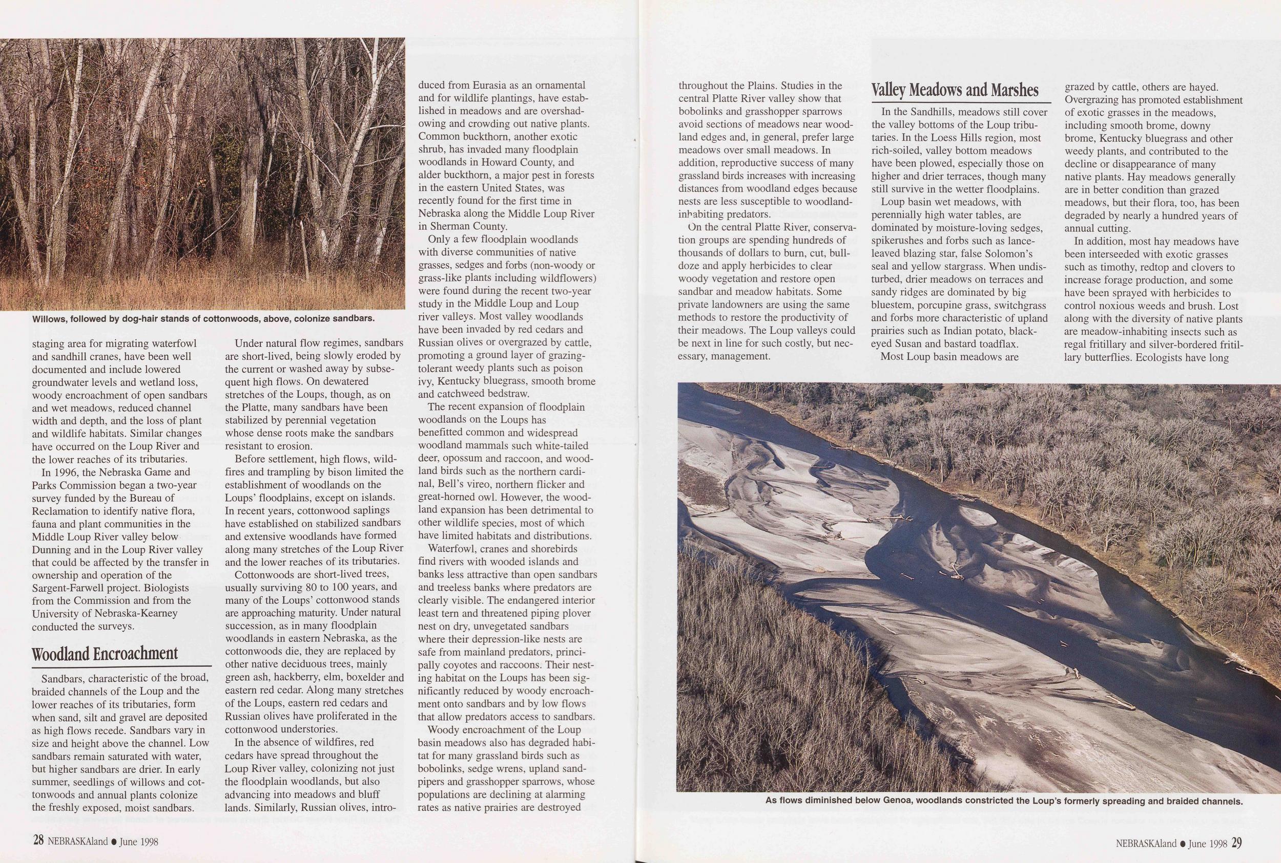
Willows, followed by dog-hair stands of cottonwoods, above, colonize sandbars.
staging area for migrating waterfowl and sandhill cranes, have been well documented and include lowered groundwater levels and wetland loss, woody encroachment of open sandbars and wet meadows, reduced channel width and depth, and the loss of plant and wildlife habitats. Similar changes have occurred on the Loup River and the lower reaches of its tributaries.
In 1996, the Nebraska Game and Parks Commission began a two-year survey funded by the Bureau of Reclamation to identify native flora, fauna and plant communities in the Middle Loup River valley below Dunning and in the Loup River valley that could be affected by the transfer in ownership and operation of the Sargent-Farwell project. Biologists from the Commission and from the University of Nebraska-Kearney conducted the surveys.
Woodland EncroachmentSandbars, characteristic of the broad, braided channels of the Loup and the lower reaches of its tributaries, form when sand, silt and gravel are deposited as high flows recede. Sandbars vary in size and height above the channel. Low sandbars remain saturated with water, but higher sandbars are drier. In early summer, seedlings of willows and cottonwoods and annual plants colonize the freshly exposed, moist sandbars.
Under natural flow regimes, sandbars are short-lived, being slowly eroded by the current or washed away by subsequent high flows. On dewatered stretches of the Loups, though, as on the Platte, many sandbars have been stabilized by perennial vegetation whose dense roots make the sandbars resistant to erosion.
Before settlement, high flows, wildfires and trampling by bison limited the establishment of woodlands on the Loups' floodplains, except on islands. In recent years, cottonwood saplings have established on stabilized sandbars and extensive woodlands have formed along many stretches of the Loup River and the lower reaches of its tributaries.
Cottonwoods are short-lived trees, usually surviving 80 to 100 years, and many of the Loups' cottonwood stands are approaching maturity. Under natural succession, as in many floodplain woodlands in eastern Nebraska, as the cottonwoods die, they are replaced by other native deciduous trees, mainly green ash, hackberry, elm, boxelder and eastern red cedar. Along many stretches of the Loups, eastern red cedars and Russian olives have proliferated in the cottonwood understories.
In the absence of wildfires, red cedars have spread throughout the Loup River valley, colonizing not just the floodplain woodlands, but also advancing into meadows and bluff lands. Similarly, Russian olives, introduced from Eurasia as an ornamental and for wildlife plantings, have established in meadows and are overshadowing and crowding out native plants. Common buckthorn, another exotic shrub, has invaded many floodplain woodlands in Howard County, and alder buckthorn, a major pest in forests in the eastern United States, was recently found for the first time in Nebraska along the Middle Loup River in Sherman County.
Only a few floodplain woodlands with diverse communities of native grasses, sedges and forbs (non-woody or grass-like plants including wildflowers) were found during the recent two-year study in the Middle Loup and Loup river valleys. Most valley woodlands have been invaded by red cedars and Russian olives or overgrazed by cattle, promoting a ground layer of grazing-tolerant weedy plants such as poison ivy, Kentucky bluegrass, smooth brome and catchweed bedstraw.
The recent expansion of floodplain woodlands on the Loups has benefitted common and widespread woodland mammals such white-tailed deer, opossum and raccoon, and woodland birds such as the northern cardinal, Bell's vireo, northern flicker and great-horned owl. However, the woodland expansion has been detrimental to other wildlife species, most of which have limited habitats and distributions.
Waterfowl, cranes and shorebirds find rivers with wooded islands and banks less attractive than open sandbars and treeless banks where predators are clearly visible. The endangered interior least tern and threatened piping plover nest on dry, unvegetated sandbars where their depression-like nests are safe from mainland predators, principally coyotes and raccoons. Their nesting habitat on the Loups has been significantly reduced by woody encroachment onto sandbars and by low flows that allow predators access to sandbars.
Woody encroachment of the Loup basin meadows also has degraded habitat for many grassland birds such as bobolinks, sedge wrens, upland sandpipers and grasshopper sparrows, whose populations are declining at alarming rates as native prairies are destroyed
28 NEBRASKAland • June 1998throughout the Plains. Studies in the central Platte River valley show that bobolinks and grasshopper sparrows avoid sections of meadows near woodland edges and, in general, prefer large meadows over small meadows. In addition, reproductive success of many grassland birds increases with increasing distances from woodland edges because nests are less susceptible to woodland- inhabiting predators.
On the central Platte River, conservation groups are spending hundreds of thousands of dollars to burn, cut, bulldoze and apply herbicides to clear woody vegetation and restore open sandbar and meadow habitats. Some private landowners are using the same methods to restore the productivity of their meadows. The Loup valleys could be next in line for such costly, but necessary, management.
Valley Meadows and MarshesIn the Sandhills, meadows still cover the valley bottoms of the Loup tributaries. In the Loess Hills region, most rich-soiled, valley bottom meadows have been plowed, especially those on higher and drier terraces, though many still survive in the wetter floodplains.
Loup basin wet meadows, with perennially high water tables, are dominated by moisture-loving sedges, spikerushes and forbs such as lance-leaved blazing star, false Solomon's seal and yellow stargrass. When undisturbed, drier meadows on terraces and sandy ridges are dominated by big bluestem, porcupine grass, switchgrass and forbs more characteristic of upland prairies such as Indian potato, black-eyed Susan and bastard toadflax.
Most Loup basin meadows are grazed by cattle, others are hayed. Overgrazing has promoted establishment of exotic grasses in the meadows, including smooth brome, downy brome, Kentucky bluegrass and other weedy plants, and contributed to the decline or disappearance of many native plants. Hay meadows generally are in better condition than grazed meadows, but their flora, too, has been degraded by nearly a hundred years of annual cutting.
In addition, most hay meadows have been interseeded with exotic grasses such as timothy, redtop and clovers to increase forage production, and some have been sprayed with herbicides to control noxious weeds and brush. Lost along with the diversity of native plants are meadow-inhabiting insects such as regal fritillary and silver-bordered fritillary butterflies. Ecologists have long
As flows diminished below Genoa, woodlands constricted the Loup's formerly spreading and braided channels.
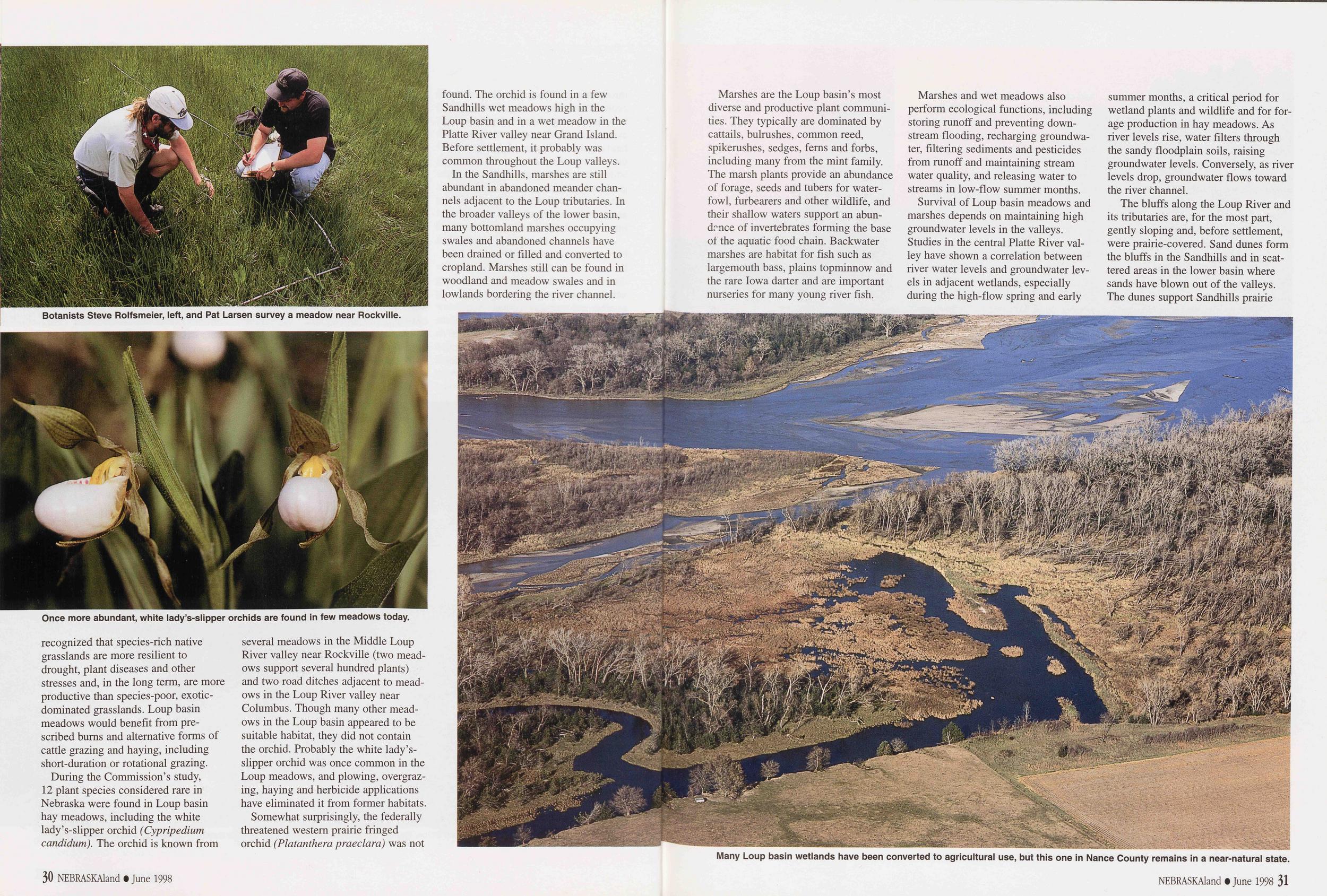
Botanists Steve Rolfsmeier, left, and Pat Larsen survey a meadow near Rockville.
Once more abundant, white lady's-slipper orchids are found in few meadows today.
recognized that species-rich native grasslands are more resilient to drought, plant diseases and other stresses and, in the long term, are more productive than species-poor, exotic-dominated grasslands. Loup basin meadows would benefit from prescribed burns and alternative forms of cattle grazing and haying, including short-duration or rotational grazing.
During the Commission's study, 12 plant species considered rare in Nebraska were found in Loup basin hay meadows, including the white lady's-slipper orchid (Cypripedium candidum). The orchid is known from several meadows in the Middle Loup River valley near Rockville (two meadows support several hundred plants) and two road ditches adjacent to meadows in the Loup River valley near Columbus. Though many other meadows in the Loup basin appeared to be suitable habitat, they did not contain the orchid. Probably the white lady's-slipper orchid was once common in the Loup meadows, and plowing, overgrazing, haying and herbicide applications have eliminated it from former habitats.
Somewhat surprisingly, the federally threatened western prairie fringed orchid (Platanthera praeclara) was not found. The orchid is found in a few Sandhills wet meadows high in the Loup basin and in a wet meadow in the Platte River valley near Grand Island. Before settlement, it probably was common throughout the Loup valleys.
In the Sandhills, marshes are still abundant in abandoned meander channels adjacent to the Loup tributaries. In the broader valleys of the lower basin, many bottomland marshes occupying swales and abandoned channels have been drained or filled and converted to cropland. Marshes still can be found in woodland and meadow swales and in lowlands bordering the river channel.
Many Loup basin wetlands have been converted to agricultural use, but this one in Nance County remains in a near-natural state.
Marshes are the Loup basin's most diverse and productive plant communities. They typically are dominated by cattails, bulrushes, common reed, spikerushes, sedges, ferns and forbs, including many from the mint family. The marsh plants provide an abundance of forage, seeds and tubers for waterfowl, furbearers and other wildlife, and their shallow waters support an abundance of invertebrates forming the base ot the aquatic food chain. Backwater marshes are habitat for fish such as largemouth bass, plains topminnow and the rare Iowa darter and are important nurseries for many young river fish.
Marshes and wet meadows also perform ecological functions, including storing runoff and preventing down-stream flooding, recharging groundwater, filtering sediments and pesticides from runoff and maintaining stream water quality, and releasing water to streams in low-flow summer months.
Survival of Loup basin meadows and marshes depends on maintaining high groundwater levels in the valleys. Studies in the central Platte River valley have shown a correlation between river water levels and groundwater levels in adjacent wetlands, especially during the high-flow spring and early summer months, a critical period for wetland plants and wildlife and for forage production in hay meadows. As river levels rise, water filters through the sandy floodplain soils, raising groundwater levels. Conversely, as river levels drop, groundwater flows toward the river channel.
The bluffs along the Loup River and its tributaries are, for the most part, gently sloping and, before settlement, were prairie-covered. Sand dunes form the bluffs in the Sandhills and in scattered areas in the lower basin where sands have blown out of the valleys. The dunes support Sandhills prairie
NEBRASKAland • June 1998 31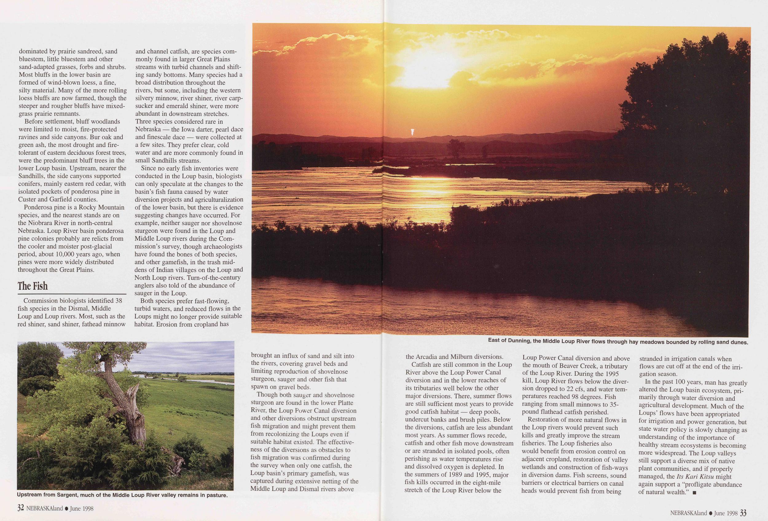
dominated by prairie sandreed, sand bluestem, little bluestem and other sand-adapted grasses, forbs and shrubs. Most bluffs in the lower basin are formed of wind-blown loess, a fine, silty material. Many of the more rolling loess bluffs are now farmed, though the steeper and rougher bluffs have mixed-grass prairie remnants.
Before settlement, bluff woodlands were limited to moist, fire-protected ravines and side canyons. Bur oak and green ash, the most drought and fire-tolerant of eastern deciduous forest trees, were the predominant bluff trees in the lower Loup basin. Upstream, nearer the Sandhills, the side canyons supported conifers, mainly eastern red cedar, with isolated pockets of ponderosa pine in Custer and Garfield counties.
Ponderosa pine is a Rocky Mountain species, and the nearest stands are on the Niobrara River in north-central Nebraska. Loup River basin ponderosa pine colonies probably are relicts from the cooler and moister post-glacial period, about 10,000 years ago, when pines were more widely distributed throughout the Great Plains.
The FishCommission biologists identified 38 fish species in the Dismal, Middle Loup and Loup rivers. Most, such as the red shiner, sand shiner, fathead minnow and channel catfish, are species commonly found in larger Great Plains streams with turbid channels and shifting sandy bottoms. Many species had a broad distribution throughout the rivers, but some, including the western silvery minnow, river shiner, river carp-sucker and emerald shiner, were more abundant in downstream stretches. Three species considered rare in Nebraska — the Iowa darter, pearl dace and finescale dace — were collected at a few sites. They prefer clear, cold water and are more commonly found in small Sandhills streams.
Since no early fish inventories were conducted in the Loup basin, biologists can only speculate at the changes to the basin's fish fauna caused by water diversion projects and agriculturalization of the lower basin, but there is evidence suggesting changes have occurred. For example, neither sauger nor shovelnose sturgeon were found in the Loup and Middle Loup rivers during the Commission's survey, though archaeologists have found the bones of both species, and other gamefish, in the trash middens of Indian villages on the Loup and North Loup rivers. Turn-of-the-century anglers also told of the abundance of sauger in the Loup.
Both species prefer fast-flowing, turbid waters, and reduced flows in the Loups might no longer provide suitable habitat. Erosion from cropland has
East of Dunning, the Middle Loup River flows through hay meadows bounded by rolling sand dunes.
Upstream from Sargent, much of the Middle Loup River valley remains in pasture.
brought an influx of sand and silt into the rivers, covering gravel beds and limiting reproduction of shovelnose sturgeon, sauger and other fish that spawn on gravel beds.
Though both sauger and shovelnose sturgeon are found in the lower Platte River, the Loup Power Canal diversion and other diversions obstruct upstream fish migration and might prevent them from recolonizing the Loups even if suitable habitat existed. The effectiveness of the diversions as obstacles to fish migration was confirmed during the survey when only one catfish, the Loup basin's primary gamefish, was captured during extensive netting of the Middle Loup and Dismal rivers above
32 NEBRASKAland • June 1998the Arcadia and Milburn diversions.
Catfish are still common in the Loup River above the Loup Power Canal diversion and in the lower reaches of its tributaries well below the other major diversions. There, summer flows are still sufficient most years to provide good catfish habitat — deep pools, undercut banks and brush piles. Below the diversions, catfish are less abundant most years. As summer flows recede, catfish and other fish move downstream or are stranded in isolated pools, often perishing as water temperatures rise and dissolved oxygen is depleted. In the summers of 1989 and 1995, major fish kills occurred in the eight-mile stretch of the Loup River below the Loup Power Canal diversion and above the mouth of Beaver Creek, a tributary of the Loup River. During the 1995 kill, Loup River flows below the diversion dropped to 22 cfs, and water temperatures r eached 98 degrees. Fish ranging from small minnows to 35-pound flathead catfish perished.
Restoration of more natural flows in the Loup rivers would prevent such kills and greatly improve the stream fisheries. The Loup fisheries also would benefit from erosion control on adjacent cropland, restoration of valley wetlands and construction of fish-ways in diversion dams. Fish screens, sound barriers or electrical barriers on canal heads would prevent fish from being stranded in irrigation canals when flows are cut off at the end of the irrigation season.
In the past 100 years, man has greatly altered the Loup basin ecosystem, primarily through water diversion and agricultural development. Much of the Loups' flows have been appropriated for irrigation and power generation, but state water policy is slowly changing as understanding of the importance of healthy stream ecosystems is becoming more widespread. The Loup valleys still support a diverse mix of native plant communities, and if properly managed, the Its Karl Kitsu might again support a "profligate abundance of natural wealth."
NEBRASKAland • June 1998 33
School's Out
Photos and text by Rocky Hoffmann In his 32-year career as a school teacher and administrator, Jim Hand of North Platte brought outdoors activities into the classroom, establishing in-school hunter education and helping students understand the role of hunting and trapping in maintaining healthy wildlife populations. Now retired, he remains committed to outdoor education.Like a truant school kid, Jim Hand can now grab his fishing pole and head for the creek whenever he wants. After 32 years in public education, the final bell has rung for the 66-year-old educator who retired in May 1994 after 19 years as principal at McDonald Elementary School in North Platte. No longer a part-timer in the outdoors, Hand maintains a busy schedule that focuses on hunting, fishing, trapping, conservation and bird watching.
From his backyard bird feeders to his beaver sets on Whitehorse Creek, Hand is living his retirement dreams, and he is emphatic about his choice of retirement style. "No snowbirding for me," Hand said. "You won't find me running off to Scottsdale when the Platte River turns to ice. I'll be in coveralls and waders lugging steel over my shoulders while searching for signs of mink, muskrats and beaver."
A High Plains youngster from Kansas, Hand graduated from North Platte High School in 1949, served four years in the Navy, received an undergraduate teaching degree from Kearney State College and a masters degree in education administration, played baseball and started teaching at Elk Creek in 1962. After only a year or two in the classroom, he became principal at Imperial, and by 1970 he was assistant principal at his alma mater in North Platte. In 1975, Hand was named principal at McDonald Elementary School, a position he held until his retirement.
As a child, Hand hunted with his father in Kansas, mostly chasing rabbits and squirrels with a black-and-white dog, and he spent some of his teenage years adapting to pheasants and waterfowl in Nebraska, but he hadn't set a trap until his first teaching job at Elm Creek when he and the school's football coach, Joe Jack, who had done some trapping, agreed to team up on a trapline.
"I've trapped ever since and continue to learn each time out," Hand said. "I had to work through college by cutting meat at a butcher shop for 60 cents an hour, and I thought I'd just as well be trapping and selling fur for extra spending money. I probably made more money as a butcher than on my trapline, but I was outdoors, and that's job satisfaction."
Trapping involves long hours of preparation and work, so it isn't a weekend sport, and since furbearer seasons are during school seasons, Hand had to make lifestyle adjustments.
"There were periods throughout my teaching career when I would get up at 3:30 in the morning and run my trapline in the dark. Then I would head home and change clothes for work," he
Jim Hand of North Platte has outdoor activities, including pheasant hunting with black Lab, Moose, for every season.
said. "At McDonald, I had some close-to-school sets that I could check during the lunch hour in my coat and tie."
Hand's life as a principal with a trapline didn't remain a secret, nor did he intend secrecy about his hobby. Instead, he brought outdoors activities into the classroom, helped the Game and Parks Commission establish in-school hunter education courses and displayed his antique trap collection in the library.
"I sat on the floor surrounded by kids
34 NEBRASKAland • June 1998and showed them some furs and the traps I use as well as traps used in the past. I have about 175 collector pieces and about 200 users," Hand said. "I explained to the students why I like to trap, why it is OK and that leg-hold traps are just that — they hold animals, not mangle them. I explained that trapping, when done correctly, helps manage wild animal populations in a humane way and that Mother Nature will manage wildlife populations with or without my help, but if you think my tactics are harsh, you should see hers."
Hand said he agrees with the Nebraska Trappers Association's decision to change its name to the Nebraska Fur Harvesters Association. "I like to call myself a fur harvester because I attempt to harvest a surplus of furbearers that would die with or without what I'm doing," he said. "It is evident that I'm not hurting the populations. I'm still trapping the same areas I trapped in 1970, and I'm catching as many or more furbearers as I did then."
Careful not to over-harvest, Hand has on occasion told landowners who want all the beavers removed from an area that some should be left for their contributions to the environment. Hand said beavers create useful wetlands, but too often their handiwork floods valuable hay meadows. "I've had ranchers stop me and ask if I caught all the coyotes off their land," he said. "'Heavens no,' I answer, 'just enough.'"
Hand says his sport demands responsibility and ethics, and it is important
NEBRASKAland • June 1998 35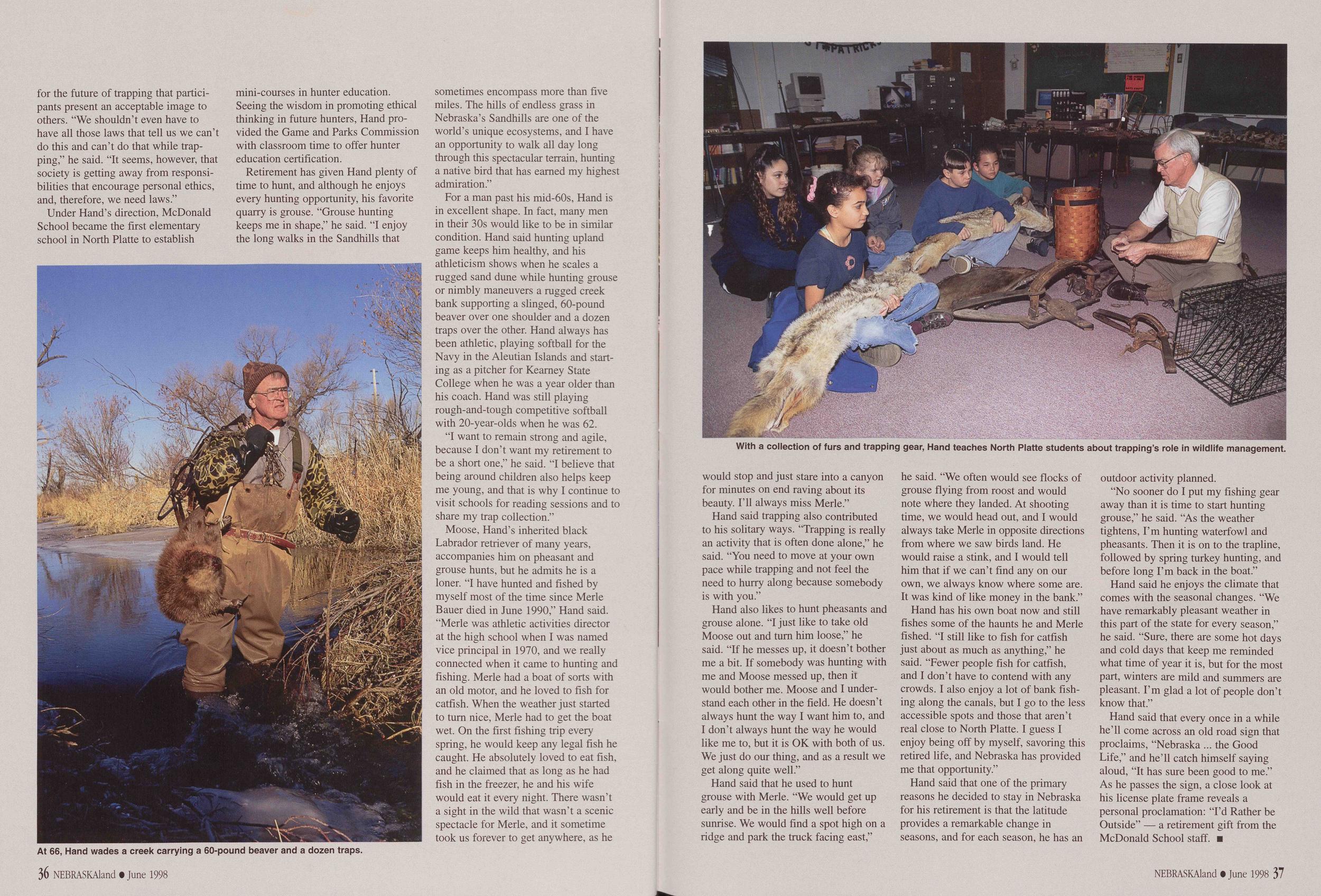
for the future of trapping that participants present an acceptable image to others. "We shouldn't even have to have all those laws that tell us we can't do this and can't do that while trapping," he said. "It seems, however, that society is getting away from responsibilities that encourage personal ethics, and, therefore, we need laws."
Under Hand's direction, McDonald School became the first elementary school in North Platte to establish
At 66, Hand wades a creek carrying a 60-pound beaver and a dozen traps.
mini-courses in hunter education. Seeing the wisdom in promoting ethical thinking in future hunters, Hand provided the Game and Parks Commission with classroom time to offer hunter education certification.
Retirement has given Hand plenty of time to hunt, and although he enjoys every hunting opportunity, his favorite quarry is grouse. "Grouse hunting keeps me in shape," he said. "I enjoy the long walks in the Sandhills that sometimes encompass more than five miles. The hills of endless grass in Nebraska's Sandhills are one of the world's unique ecosystems, and I have an opportunity to walk all day long through this spectacular terrain, hunting a native bird that has earned my highest admiration."
For a man past his mid-60s, Hand is in excellent shape. In fact, many men in their 30s would like to be in similar condition. Hand said hunting upland game keeps him healthy, and his athleticism shows when he scales a rugged sand dune while hunting grouse or nimbly maneuvers a rugged creek bank supporting a slinged, 60-pound beaver over one shoulder and a dozen traps over the other. Hand always has been athletic, playing Softball for the Navy in the Aleutian Islands and starting as a pitcher for Kearney State College when he was a year older than his coach. Hand was still playing rough-and-tough competitive softball with 20-year-olds when he was 62.
"I want to remain strong and agile, because I don't want my retirement to be a short one," he said. "I believe that being around children also helps keep me young, and that is why I continue to visit schools for reading sessions and to share my trap collection."
Moose, Hand's inherited black Labrador retriever of many years, accompanies him on pheasant and grouse hunts, but he admits he is a loner. "I have hunted and fished by myself most of the time since Merle Bauer died in June 1990," Hand said. "Merle was athletic activities director at the high school when I was named vice principal in 1970, and we really connected when it came to hunting and fishing. Merle had a boat of sorts with an old motor, and he loved to fish for catfish. When the weather just started to turn nice, Merle had to get the boat wet. On the first fishing trip every spring, he would keep any legal fish he caught. He absolutely loved to eat fish, and he claimed that as long as he had fish in the freezer, he and his wife would eat it every night. There wasn't a sight in the wild that wasn't a scenic spectacle for Merle, and it sometime took us forever to get anywhere, as he
36 NEBRASKAland • June 1998With a collection of furs and trapping gear, Hand teaches North Platte students about trapping's role in wildlife management.
would stop and just stare into a canyon for minutes on end raving about its beauty. I'll always miss Merle."
Hand said trapping also contributed to his solitary ways. "Trapping is really an activity that is often done alone," he said. "You need to move at your own pace while trapping and not feel the need to hurry along because somebody is with you."
Hand also likes to hunt pheasants and grouse alone. "I just like to take old Moose out and turn him loose," he said. "If he messes up, it doesn't bother me a bit. If somebody was hunting with me and Moose messed up, then it would bother me. Moose and I understand each other in the field. He doesn't always hunt the way I want him to, and I don't always hunt the way he would like me to, but it is OK with both of us. We just do our thing, and as a result we get along quite well."
Hand said that he used to hunt grouse with Merle. "We would get up early and be in the hills well before sunrise. We would find a spot high on a ridge and park the truck facing east," he said. "We often would see flocks of grouse flying from roost and would note where they landed. At shooting time, we would head out, and I would always take Merle in opposite directions from where we saw birds land. He would raise a stink, and I would tell him that if we can't find any on our own, we always know where some are. It was kind of like money in the bank."
Hand has his own boat now and still fishes some of the haunts he and Merle fished. "I still like to fish for catfish just about as much as anything," he said. "Fewer people fish for catfish, and I don't have to contend with any crowds. I also enjoy a lot of bank fishing along the canals, but I go to the less accessible spots and those that aren't real close to North Platte. I guess I enjoy being off by myself, savoring this retired life, and Nebraska has provided me that opportunity."
Hand said that one of the primary reasons he decided to stay in Nebraska for his retirement is that the latitude provides a remarkable change in seasons, and for each season, he has an outdoor activity planned.
"No sooner do I put my fishing gear away than it is time to start hunting grouse," he said. "As the weather tightens, I'm hunting waterfowl and pheasants. Then it is on to the trapline, followed by spring turkey hunting, and before long I'm back in the boat."
Hand said he enjoys the climate that comes with the seasonal changes. "We have remarkably pleasant weather in this part of the state for every season," he said. "Sure, there are some hot days and cold days that keep me reminded what time of year it is, but for the most part, winters are mild and summers are pleasant. I'm glad a lot of people don't know that."
Hand said that every once in a while he'll come across an old road sign that proclaims, "Nebraska ... the Good Life," and he'll catch himself saying aloud, "It has sure been good to me." As he passes the sign, a close look at his license plate frame reveals a personal proclamation: "I'd Rather be Outside" — a retirement gift from the McDonald School staff.
NEBRASKAland • June 1998 37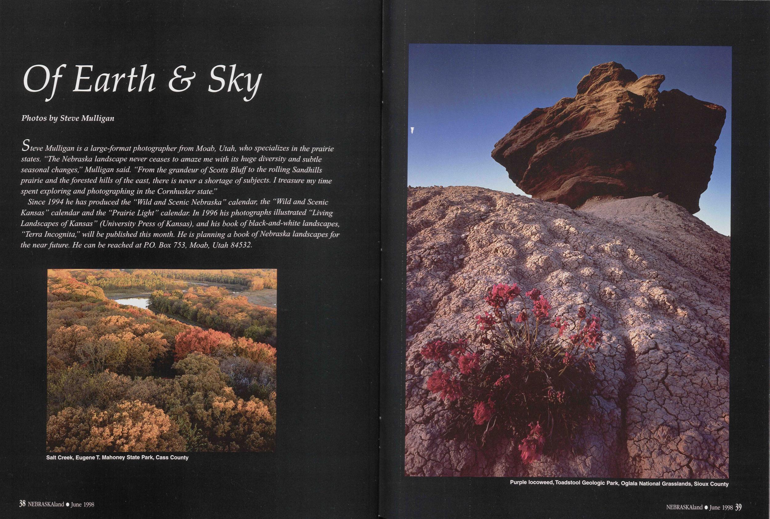
Of Earth & Sky
Photos by Steve Mulligan Steve Mulligan is a large format photographer from Moab, Utah, who specializes in the prairie states. "The Nebraska landscape never ceases to amaze me with its huge diversity and subtle seasonal changes," Mulligan said. "From the grandeur of Scotts Bluff to the rolling Sandhills prairie and the forested hills of the east, there is never a shortage of subjects. I treasure my time spent exploring and photographing in the Cornhusker state." Since 1994 he has produced the "Wild and Scenic Nebraska " calendar, the "Wild and Scenic Kansas" calendar and the "Prairie Light" calendar. In 1996 his photographs illustrated "Living Landscapes of Kansas " (University Press of Kansas), and his book of black-and-white landscapes, "Terra Incognita," will be published this month. He is planning a book of Nebraska landscapes for the near future. He can be reached at P.O. Box 753, Moab, Utah 84532.Salt Creek, Eugene T. Mahoney State Park, Cass County
Purple locoweed, Toadstool Geologic Park, Oglala National Grasslands, Sioux County
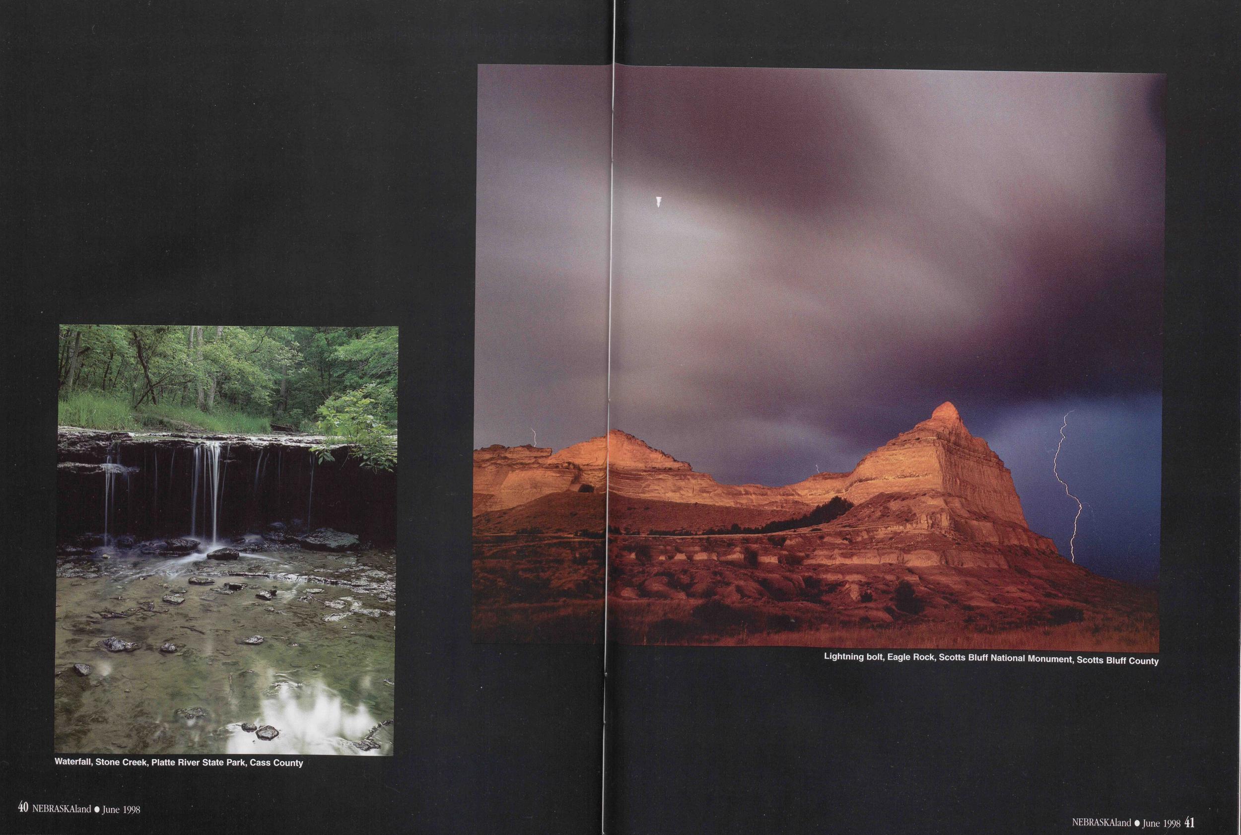
Waterfall, Stone Creek, Platte River State Park, Cass County
Lightning bolt, Eagle Rock, Scotts Bluff National Monument, Scotts Bluff County
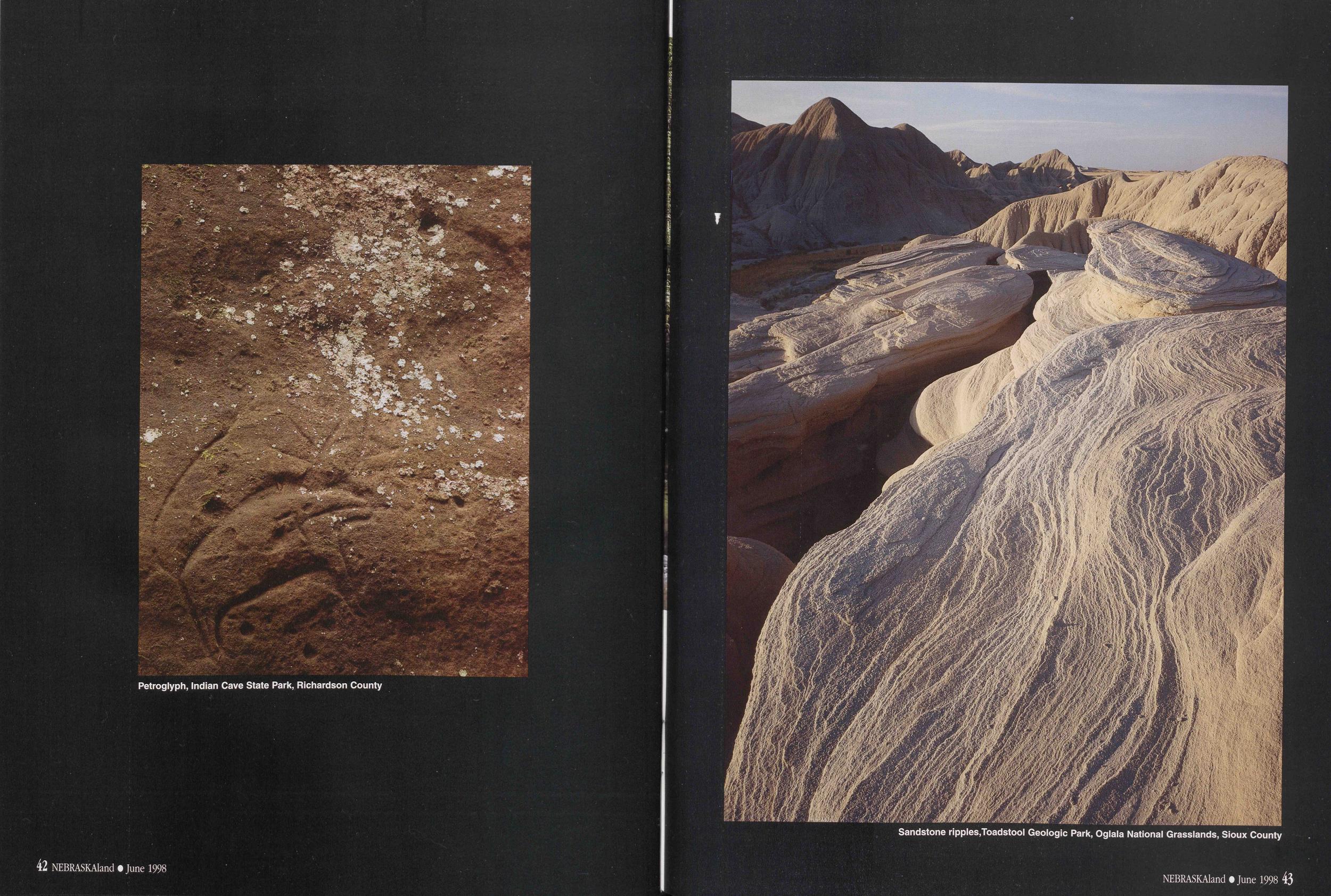
Petroglyph, Indian Cave State Park, Richardson County
Sandstone ripples, Toadstool Geologic Park, Oglala National Grasslands, Sioux County
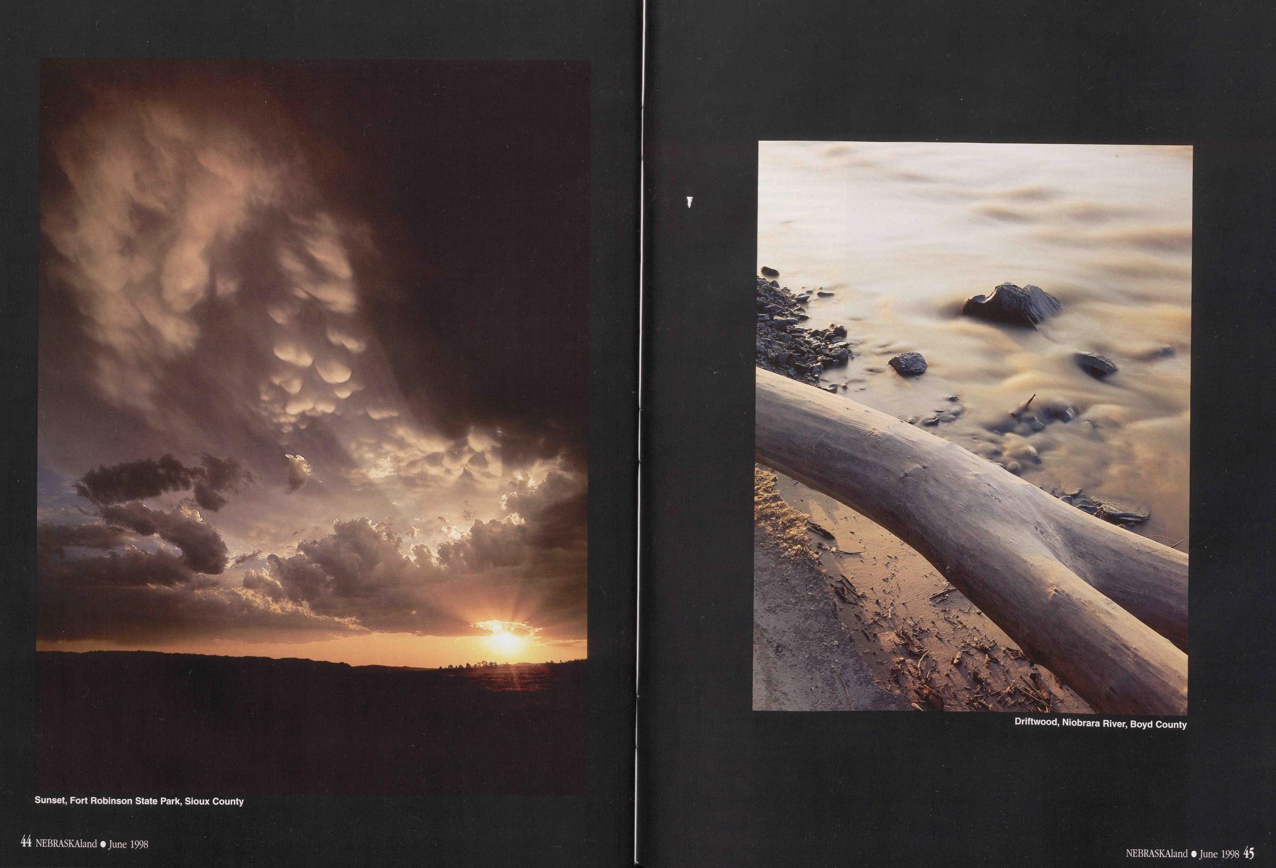
Sunset, Fort Robinson State Park, Sioux County
Driftwood, Niobrara River, Boyd County
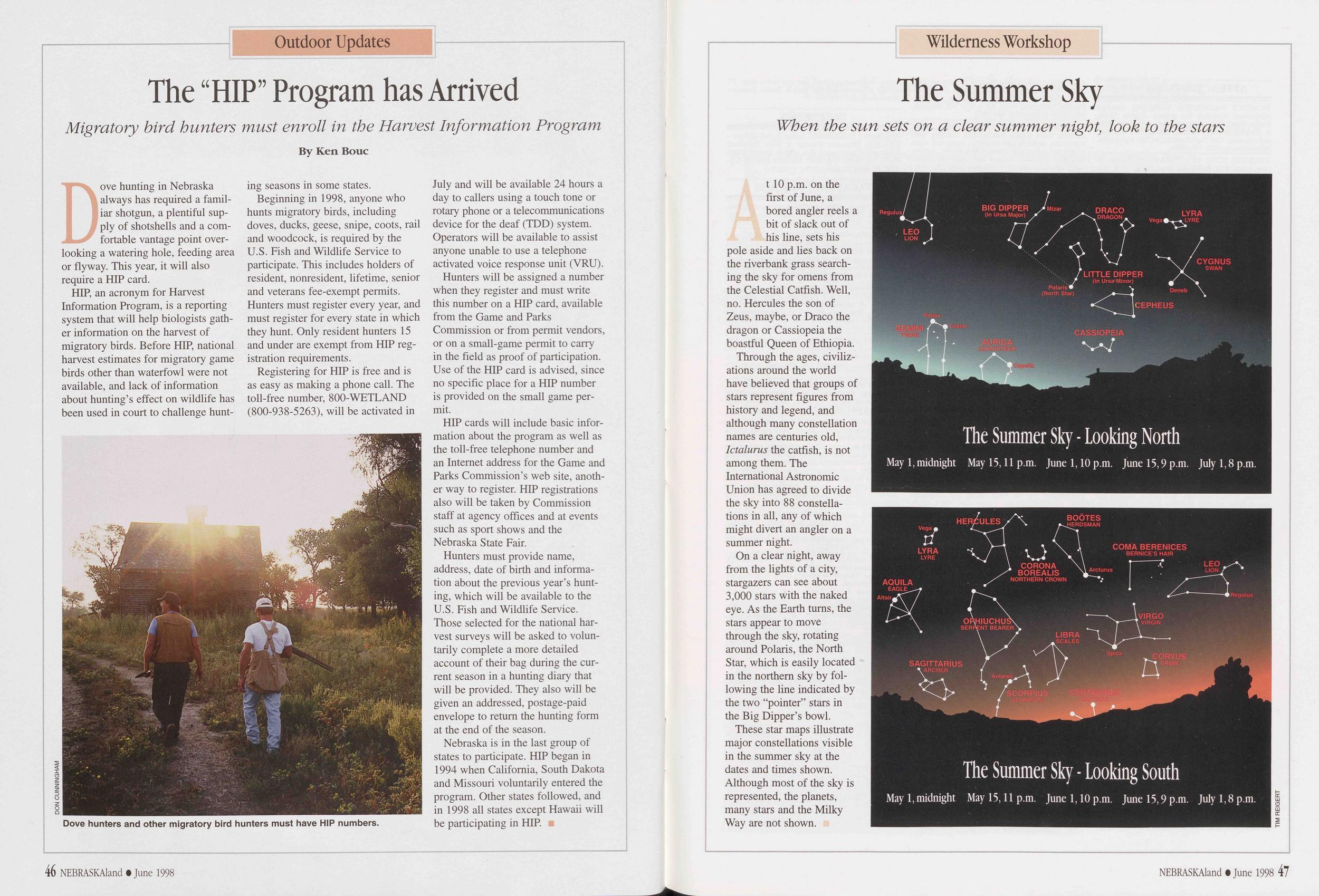
Outdoor Updates
The "HIP" Program has Arrived
Migratory bird hunters must enroll in the Harvest Information Program By Ken BoucDove hunting in Nebraska always has required a familiar shotgun, a plentiful supply of shotshells and a comfortable vantage point overlooking a watering hole, feeding area or flyway. This year, it will also require a HIP card.
HIP, an acronym for Harvest Information Program, is a reporting system that will help biologists gather information on the harvest of migratory birds. Before HIP, national harvest estimates for migratory game birds other than waterfowl were not available, and lack of information about hunting's effect on wildlife has been used in court to challenge hunting seasons in some states.
Beginning in 1998, anyone who hunts migratory birds, including doves, ducks, geese, snipe, coots, rail and woodcock, is required by the U.S. Fish and Wildlife Service to participate. This includes holders of resident, nonresident, lifetime, senior and veterans fee-exempt permits. Hunters must register every year, and must register for every state in which they hunt. Only resident hunters 15 and under are exempt from HIP registration requirements.
Registering for HIP is free and is as easy as making a phone call. The toll-free number, 800-WETLAND (800-938-5263), will be activated in
Dove hunters and other migratory bird hunters must have HIP numbers.
DON CUNNINGHAMJuly and will be available 24 hours a day to callers using a touch tone or rotary phone or a telecommunications device for the deaf (TDD) system. Operators will be available to assist anyone unable to use a telephone activated voice response unit (VRU).
Hunters will be assigned a number when they register and must write this number on a HIP card, available from the Game and Parks Commission or from permit vendors, or on a small-game permit to carry in the field as proof of participation. Use of the HIP card is advised, since no specific place for a HIP number is provided on the small game permit.
HIP cards will include basic information about the program as well as the toll-free telephone number and an Internet address for the Game and Parks Commission's web site, another way to register. HIP registrations also will be taken by Commission staff at agency offices and at events such as sport shows and the Nebraska State Fair.
Hunters must provide name, address, date of birth and information about the previous year's hunting, which will be available to the U.S. Fish and Wildlife Service. Those selected for the national harvest surveys will be asked to voluntarily complete a more detailed account of their bag during the current season in a hunting diary that will be provided. They also will be given an addressed, postage-paid envelope to return the hunting form at the end of the season.
Nebraska is in the last group of states to participate. HIP began in 1994 when California, South Dakota and Missouri voluntarily entered the program. Other states followed, and in 1998 all states except Hawaii will be participating in HIP.
46 NEBRASKAland • June 1998Wilderness Workshop
The Summer Sky
When the sun sets on a clear summer night, look to the starsAt 10 p.m. on the first of June, a bored angler reels a bit of slack out of his line, sets his pole aside and lies back on the riverbank grass searching the sky for omens from the Celestial Catfish. Well, no. Hercules the son of Zeus, maybe, or Draco the dragon or Cassiopeia the boastful Queen of Ethiopia.
Through the ages, civilizations around the world have believed that groups of stars represent figures from history and legend, and although many constellation names are centuries old, Ictalurus the catfish, is not among them. The International Astronomic Union has agreed to divide the sky into 88 constellations in all, any of which might divert an angler on a summer night.
On a clear night, away from the lights of a city, stargazers can see about 3,000 stars with the naked eye. As the Earth turns, the stars appear to move through the sky, rotating around Polaris, the North Star, which is easily located in the northern sky by following the line indicated by the two "pointer" stars in the Big Dipper's bowl.
These star maps illustrate major constellations visible in the summer sky at the dates and times shown. Although most of the sky is represented, the planets, many stars and the Milky Way are not shown.
Regulus BIG DIPPER (in Ursa Major) DRACO DRAGON LYRA LYRE Vega LEO LION LITTLE DIPPER (in Ursa-Minor) CYGNUS SWAN Polaris (North Star) Deneb CEPHEUS TOP El The Summer Sky - Looking North May 1, midnight May 15,11 p.m. June 1,10 p.m. June 15,9 p.m. July 1,8 p.m.
HERCULES BOOTES HERDSMAN LYRA LYRE COMA BERENICES BERNICE'S HAIR AQUILA EAGLE CORONA BOREALIS NORTHERN CROWN Arcturus LEO VIRG SERPENT BEARER LIBBA SAGITTARIUS ARCHER The Summer Sky -Looking South May 1, midnight May 15,11 p.m. June 1,10 p.m. June 15,9 p.m. July 1,8 p.m.
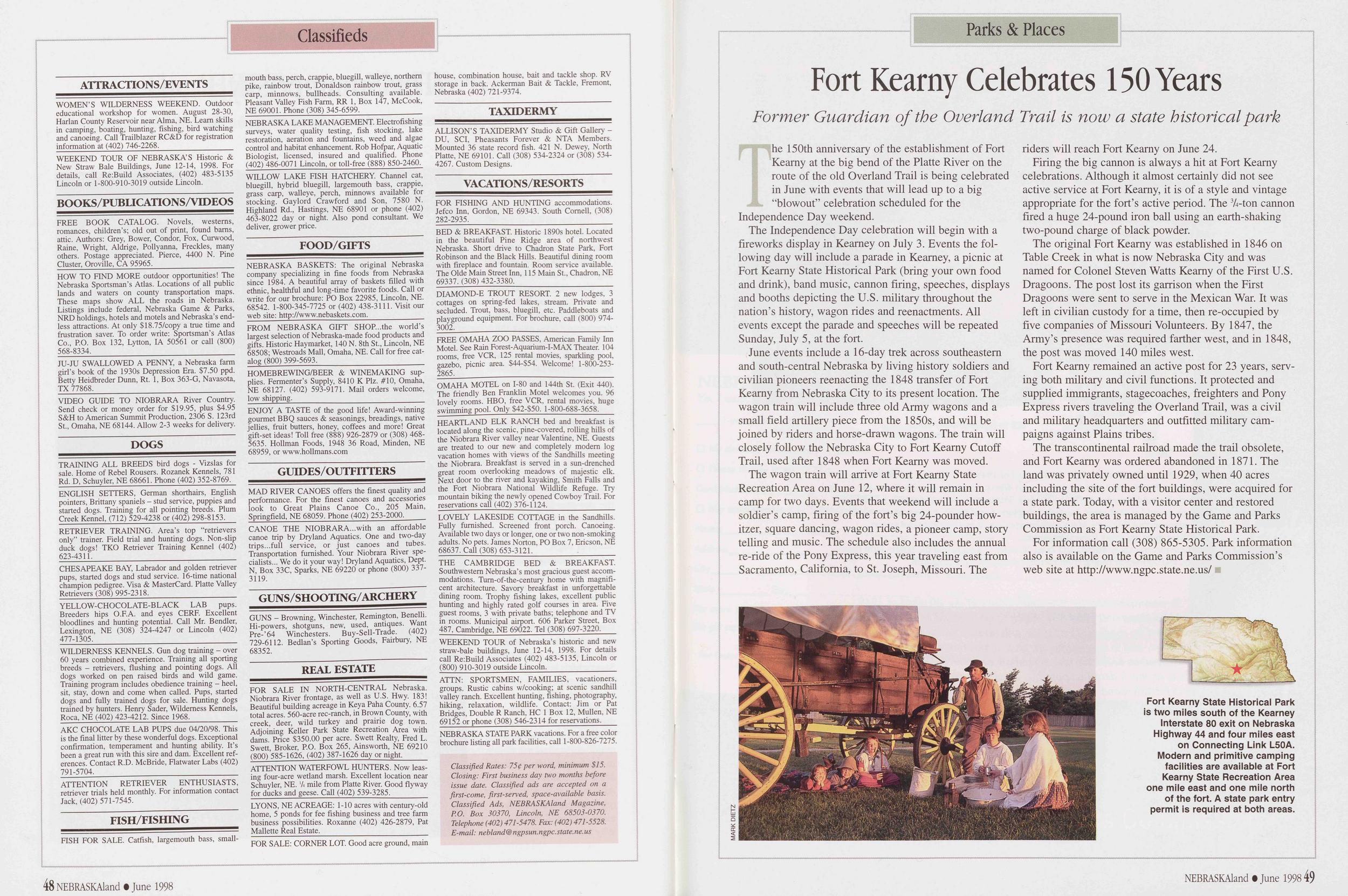
Classifieds
ATTRACTIONS/EVENTS WOMEN'S WILDERNESS WEEKEND. Outdoor educational workshop for women. August 28-30, Harlan County Reservoir near Alma, NE. Learn skills in camping, boating, hunting, fishing, bird watching and canoeing. Call Trailblazer RC&D for registration information at (402) 746-2268. WEEKEND TOUR OF NEBRASKA'S Historic & New Straw Bale Buildings, June 12-14, 1998. For details, call Re:Build Associates, (402) 483-5135 Lincoln or 1-800-910-3019 outside Lincoln. BOOKS/PUBUCATIONS/VIDEOS FREE BOOK CATALOG. Novels, westerns, romances, children's; old out of print, found barns, attic. Authors: Grey, Bower, Condor, Fox, Curwood, Raine, Wright, Aldrige, Pollyanna, Freckles, many others. Postage appreciated. Pierce, 4400 N. Pine Cluster, Provide, CA 95965. HOW TO FIND MORE outdoor opportunities! The Nebraska Sportsman's Atlas. Locations of all public lands and waters on county transportation maps. These maps show ALL the roads in Nebraska. Listings include federal, Nebraska Game & Parks, NRD holdings, hotels and motels and Nebraska's endless attractions. At only $18.75/copy a true time and frustration saver. To order write: Sportsman's Atlas Co., P.O. Box 132, Lytton, IA 50561 or call (800) 568-8334. JU-JU SWALLOWED A PENNY, a Nebraska farm girl's book of the 1930s Depression Era. $7.50 ppd. Betty Heidbreder Dunn, Rt. 1, Box 363-G, Navasota, TX 77868. VIDEO GUIDE TO NIOBRARA River Country. Send check or money order for $19.95, plus $4.95 S&H to American Summit Production, 2306 S. 123rd St., Omaha, NE 68144. Allow 2-3 weeks for delivery. DOGS TRAINING ALL BREEDS bird dogs - Vizslas for sale. Home of Rebel Rousers. Rozanek Kennels, 781 Rd. D, Schuyler, NE 68661. Phone (402) 352-8769. ENGLISH SETTERS, German shorthairs, English pointers, Brittany spaniels - stud service, puppies and started dogs. Training for all pointing breeds. Plum Creek Kennel, (712) 529-4238 or (402) 298-8153. RETRIEVER TRAINING. Area's top "retrievers only" trainer. Field trial and hunting dogs. Non-slip duck dogs! TKO Retriever Training Kennel (402) 623-4311. CHESAPEAKE BAY, Labrador and golden retriever pups, started dogs and stud service. 16-time national champion pedigree. Visa & MasterCard. Platte Valley Retrievers (308) 995-2318. YELLOW-CHOCOLATE-BLACK LAB pups. Breeders hips O.F.A. and eyes CERE. Excellent bloodlines and hunting potential. Call Mr. Bendler, Lexington, NE (308) 324-4247 or Lincoln (402) 477-1305. WILDERNESS KENNELS. Gun dog training - over 60 years combined experience. Training all sporting breeds - retrievers, flushing and pointing dogs. All dogs worked on pen raised birds and wild game. Training program includes obedience training - heel, sit, stay, down and come when called. Pups, started dogs and fully trained dogs for sale. Hunting dogs trained by hunters. Henry Sader, Wilderness Kennels, Roca, NE (402) 423-4212. Since 1968. AKC CHOCOLATE LAB PUPS due 04/20/98. This is the final litter by these wonderful dogs. Exceptional confirmation, temperament and hunting ability. It's been a great run with this sire and dam. Excellent references. Contact R.D. McBride, Flatwater Labs (402) 791-5704. ATTENTION RETRIEVER ENTHUSIASTS, retriever trials held monthly. For information contact Jack, (402) 571-7545. FISH/FISHING FISH FOR SALE. Catfish, largemouth bass, smallmouth bass, perch, crappie, bluegill, walleye, northern pike, rainbow trout, Donaldson rainbow trout, grass carp, minnows, bullheads. Consulting available. Pleasant Valley Fish Farm, RR 1, Box 147, McCook, NE 69001. Phone (308) 345-6599. NEBRASKA LAKE MANAGEMENT. Electrofishing surveys, water quality testing, fish stocking, lake restoration, aeration and fountains, weed and algae control and habitat enhancement. Rob Hofpar, Aquatic Biologist, licensed, insured and qualified. Phone (402) 486-0071 Lincoln, or toll-free (888) 850-2460. WILLOW LAKE FISH HATCHERY. Channel cat, bluegill, hybrid bluegill, largemouth bass, crappie, grass carp, walleye, perch, minnows available for stocking. Gaylord Crawford and Son, 7580 N. Highland Rd., Hastings, NE 68901 or phone (402) 463-8022 day or night. Also pond consultant. We deliver, grower price. FOOD/GIFTS NEBRASKA BASKETS: The original Nebraska company specializing in fine foods from Nebraska since 1984. A beautiful array of baskets filled with ethnic, healthful and long-time favorite foods. Call or write for our brochure: PO Box 22985, Lincoln, NE. 68542. 1-800-345-7725 or (402) 438-3111. Visit our web site: http://www.nebaskets.com. FROM NEBRASKA GIFT SHOP..the world's largest selection of Nebraska-made food products and gifts. Historic Haymarket, 140 N. 8th St., Lincoln, NE 68508; Westroads Mall, Omaha, NE. Call for free catalog (800) 399-5693. HOMEBREWLNG/BEER & WINEMAKING sup- plies. Fermenter's Supply, 8410 K Plz. #10, Omaha, NE 68127. (402) 593-9171. Mail orders welcome, low shipping. ENJOY A TASTE of the good life! Award-winning gourmet BBQ sauces & seasonings, breadings, native jellies, fruit butters, honey, coffees and more! Great gift-set ideas! Toll free (888) 926-2879 or (308) 468-5635. Hollman Foods, 1948 36 Road, Minden, NE 68959, or www.hollmans.com GUIDES/OUTFITTERS MAD RIVER CANOES offers the finest quality and performance. For the finest canoes and accessories look to Great Plains Canoe Co., 205 Main, Springfield, NE 68059. Phone (402) 253-2000. CANOE THE NIOBRARA...with an affordable canoe trip by Dryland Aquatics. One and two-day trips...full service, or just canoes and tubes. Transportation furnished. Your Niobrara River specialists... We do it your way! Dryland Aquatics, Dept. N, Box 33C, Sparks, NE 69220 or phone (800) 337-3119. GUNS/SHOOTING/ARCHERY GUNS - Browning, Winchester, Remington, Benelh. Hi-powers, shotguns, new, used, antiques. Want Pre-'64 Winchesters. Buy-Sell-Trade. (402) 729-6112. Bedlan's Sporting Goods, Fairbury, NE 68352. REAL ESTATE FOR SALE IN NORTH-CENTRAL Nebraska. Niobrara River frontage, as well as U.S. Hwy. 183! Beautiful building acreage in Keya Paha County. 6.57 total acres. 560-acre rec-ranch, in Brown County, with creek, deer, wild turkey and prairie dog town. Adjoining Keller Park State Recreation Area with dams. Price $350.00 per acre. Swett Realty, Fred L. Swett, Broker, P.O. Box 265, Ainsworth, NE 69210 (800) 585-1626, (402) 387-1626 day or night. ATTENTION WATERFOWL HUNTERS. Now leas-ing four-acre wetland marsh. Excellent location near Schuyler, NE. 'A mile from Platte River. Good flyway for ducks and geese. Call (402) 539-3285. LYONS, NE ACREAGE: 1-10 acres with century-old home, 5 ponds for fee fishing business and tree farm business possibilities. Roxanne (402) 426-2879, Pat Mallette Real Estate. FOR SALE: CORNER LOT. Good acre ground, main house, combination house, bait and tackle shop. RV storage in back. Ackerman Bait & Tackle, Fremont, Nebraska (402) 721-9374. TAXIDERMY ALLISON'S TAXIDERMY Studio & Gift Gallery - DU, SCI, Pheasants Forever & NTA Members. Mounted 36 state record fish. 421 N. Dewey, North Platte, NE 69101. Call (308) 534-2324 or (308) 534-4267. Custom Designs. VACATIONS/RESORTS FOR FISHING AND HUNTING accommodations. Jefco Inn, Gordon, NE 69343. South Cornell, (308) 282-2935. BED & BREAKFAST. Historic 1890s hotel. Located in the beautiful Pine Ridge area of northwest Nebraska. Short drive to Chadron State Park, Fort Robinson and the Black Hills. Beautiful dining room with fireplace and fountain. Room service available. The Olde Main Street Inn, 115 Main St., Chadron, NE 69337. (308) 432-3380. DIAMOND-E TROUT RESORT 2 new lodges, 3 cottages on spring-fed lakes, stream. Private and secluded. Trout, bass, bluegill, etc. Paddleboats and playground equipment. For brochure, call (800) 974-3002. FREE OMAHA ZOO PASSES, American Family Inn Motel. See Rain Forest-Aquarium-I-MAX Theater. 104 rooms, free VCR, 125 rental movies, sparkling pool, gazebo, picnic area. $44-$54. Welcome! 1-800-253-2865. OMAHA MOTEL on 1-80 and 144th St. (Exit 440). The friendly Ben Franklin Motel welcomes you. 96 lovely rooms. HBO, free VCR, rental movies, huge swimming pool. Only $42-$50. 1-800-688-3658. HEARTLAND ELK RANCH bed and breakfast is located along the scenic, pine-covered, rolling hills of the Niobrara River valley near Valentine, NE. Guests are treated to our new and completely modern log vacation homes with views of the Sandhills meeting the Niobrara. Breakfast is served in a sun-drenched great room overlooking meadows of majestic elk. Next door to the river and kayaking, Smith Falls and the Fort Niobrara National Wildlife Refuge. Try mountain biking the newly opened Cowboy Trail. For reservations call (402) 376-1124. LOVELY LAKESIDE COTTAGE in the Sandhills. Fully furnished. Screened front porch. Canoeing. Available two days or longer, one or two non-smoking adults. No pets. James Norton, PO Box 7, Ericson, NE 68637. Call (308) 653-3121. THE CAMBRIDGE BED & BREAKFAST. Southwestern Nebraska's most gracious guest accommodations. Turn-of-the-century home with magnificent architecture. Savory breakfast in unforgettable dining room. Trophy fishing lakes, excellent public hunting and highly rated golf courses in area. Five guest rooms, 3 with private baths; telephone and TV in rooms. Municipal airport. 606 Parker Street, Box 487, Cambridge, NE 69022. Tel (308) 697-3220. WEEKEND TOUR of Nebraska's historic and new straw-bale buildings, June 12-14, 1998. For details call Re:Build Associates (402) 483-5135, Lincoln or (800) 910-3019 outside Lincoln. ATTN: SPORTSMEN, FAMILIES, vacationers, groups. Rustic cabins w/cooking; at scenic sandhill valley ranch. Excellent hunting, fishing, photography, hiking, relaxation, wildlife. Contact: Jim or Pat Bridges, Double R Ranch, HC 1 Box 12, Mullen, NE 69152 or phone (308) 546-2314 for reservations. NEBRASKA STATE PARK vacations. For a free color brochure listing all park facilities, call 1-800-826-7275. Classified Rates: 75$ per word, minimum $15. Closing: First business day two months before issue date. Classified ads are accepted on a first-come, first-served, space-available basis. Classified Ads, NEBRASKAland Magazine, P.O. Box 30370, Lincoln, NE 68503-0370. Telephone (402) 471-5478. Fax: (402) 471-5528. E-mail: nebland® ngpsun. ngpc.state, ne. us 48 NEBRASKAland • June 1998Parks& Places
Fort Kearny Celebrates 150 Years
Former Guardian of the Overland Trail is now a state historical parkThe 150th anniversary of the establishment of Fort Kearny at the big bend of the Platte River on the route of the old Overland Trail is being celebrated in June with events that will lead up to a big "blowout" celebration scheduled for the Independence Day weekend.
The Independence Day celebration will begin with a fireworks display in Kearney on July 3. Events the following day will include a parade in Kearney, a picnic at Fort Kearny State Historical Park (bring your own food and drink), band music, cannon firing, speeches, displays and booths depicting the U.S. military throughout the nation's history, wagon rides and reenactments. All events except the parade and speeches will be repeated Sunday, July 5, at the fort.
June events include a 16-day trek across southeastern and south-central Nebraska by living history soldiers and civilian pioneers reenacting the 1848 transfer of Fort Kearny from Nebraska City to its present location. The wagon train will include three old Army wagons and a small field artillery piece from the 1850s, and will be joined by riders and horse-drawn wagons. The train will closely follow the Nebraska City to Fort Kearny Cutoff Trail, used after 1848 when Fort Kearny was moved.
The wagon train will arrive at Fort Kearny State Recreation Area on June 12, where it will remain in camp for two days. Events that weekend will include a soldier's camp, firing of the fort's big 24-pounder howitzer, square dancing, wagon rides, a pioneer camp, story telling and music. The schedule also includes the annual re-ride of the Pony Express, this year traveling east from Sacramento, California, to St. Joseph, Missouri. The riders will reach Fort Kearny on June 24.
Firing the big cannon is always a hit at Fort Kearny celebrations. Although it almost certainly did not see active service at Fort Kearny, it is of a style and vintage appropriate for the fort's active period. The 3A-ton cannon fired a huge 24-pound iron ball using an earth-shaking two-pound charge of black powder.
The original Fort Kearny was established in 1846 on Table Creek in what is now Nebraska City and was named for Colonel Steven Watts Kearny of the First U.S. Dragoons. The post lost its garrison when the First Dragoons were sent to serve in the Mexican War. It was left in civilian custody for a time, then re-occupied by five companies of Missouri Volunteers. By 1847, the Army's presence was required farther west, and in 1848, the post was moved 140 miles west.
Fort Kearny remained an active post for 23 years, serving both military and civil functions. It protected and supplied immigrants, stagecoaches, freighters and Pony Express rivers traveling the Overland Trail, was a civil and military headquarters and outfitted military campaigns against Plains tribes.
The transcontinental railroad made the trail obsolete, and Fort Kearny was ordered abandoned in 1871. The land was privately owned until 1929, when 40 acres including the site of the fort buildings, were acquired for a state park. Today, with a visitor center and restored buildings, the area is managed by the Game and Parks Commission as Fort Kearny State Historical Park.
For information call (308) 865-5305. Park information also is available on the Game and Parks Commission's web site at http://www.ngpc.state.ne.us/
Fort Kearny State Historical Park is two miles south of the Kearney Interstate 80 exit on Nebraska Highway 44 and four miles east on Connecting Link L50A. Modern and primitive camping facilities are available at Fort Kearny State Recreation Area one mile east and one mile north of the fort. A state park entry permit is required at both areas.
Portaits from the Past

Position: 26 (296 views)