Volume 73, Issue 3, 1995
NEBRASKAland
APRIL 1995 $2.00
NEBRASKAland
VOL. 73 / NO. 3 APRIL 1995 Published by the Nebraska Game and Parks Commission Director: Rex Amack Assistant Directors: Wesley Sheets Noelyn Isom Roger Kuhn Staff Administrator, Information & Education: Paul Horton Editor: Don Cunningham Senior Editors: Jon Farrar, Ken Bouc Regional Editors: Bob Grier, Rocky Hoffmann, Tom Keith, Mike Forsberg Production Manager: Troy Kroeger Art Director: Steve O'Hare Layout, Design and Illustration : Tim Reigert Circulation: Pat Frahm Commissioners Chairman: Charles E. Wright, Lincoln Vice Chairman: Bill Grewcock, Omaha 2nd Vice Chairman: Dr. Charles Blaha, Ord Dr. Tim Biga, Norfolk Tom J. Plummer, Brule Dan Wallen, McCook William Berryman, Kearney NEBRASKAland ISSN:0028-1964 VOL. 73 / NO. 3 APRIL 1995 Published monthly, except for Jan./Feb. and Aug./Sept. issues, by the Nebraska Game and Parks Commission, 2200 N. 33rd St., Lincoln. NE. Copyright 1995, all rights reserved Please address comments or questions to this address. Second-class postage paid at Lincoln, Nebraska. POSTMASTER: Send all address changes to NEBRASKAland, P.O. Box 30370, Lincoln, NE 68503-0370. Rates: $14 for one year; $27 for two years. Address submissions to: The Editor, NEBRASKAland Magazine, P.O. Box 30370, Lincoln, NE 68503. Include a stamped, self-addressed return envelope. The publisher assumes no responsibility for unsolicited material. NEBRASKAland is available on audio cassette from the Nebraska Library Commission Talking Book and Braille Service. Call (402) 471-4038, or toll-free (800) 742-7691.
Letters
Nebraska Game and Parks Commission District Offices Headquarters 2200 North 33rd Street Lincoln, NE 68503 Phone (402)471-0641 District Office I Box 725 Alliance, NE 69301 Phone (308)762-5605 District Office II Box 508 Bassett, NE 68714 Phone (402)684-2921 District Office III Box 934 Norfolk, NE 68702 Phone (402)370-3374 District Office IV Route 4, Box 36 North Platte, NE 69101 Phone (308)535-8025 District Office V 2200 North 33rd Street Lincoln, NE 68503 Phone (402)471-5558 Omaha Office 1212 Deer Park Blvd. Omaha, NE 68108 Phone (402) 595-2144 Ak-Sar-Ben Aquarium 21502 West Highway 31 Gretna, NE 68028 Phone (402) 332-3901 Conservation Officers by Region Panhandle Southeast Officer City Phone (308) Officer City Phone (402) Richard Furley (Supv) Alliance 762-2024 Dick Turpin (Adrr i) Lincoln 471-5531 Walt Meyer Chadron 432-4398 Ted Blume (Asst Adm) Lincoln 483-5643 John Murphy Crawford 665-2021 Dan Klammer Lincoln 471-5003 Jim Zimmerman Gering 436-7561 Roger Guenther (Supv) Lincoln 423-5671 Marvin Kampbell Hay Springs 638-7527 Murray Johnson Lincoln 488-2923 Dennis Thompson Ogaliala 284-6450 William Krause Auburn 274-3789 Dan Zuehlke Ogallala 284-4815 Dan Evasco Beatrice 228-5935 Don Hunt Oshkosh 772-3697 Douglas Kramer Lincoln 466-9001 Scott Brandt Scottsbluff 635-1277 Dina Barta Lincoln 483-2358 Raymond Still Bridgeport 262-1075 Levi Krause Louisville 234-2212 Russell Mort Nebr. City 873-5684 Northeast Duane Arp Gretna 332-4954 Officer City Phone (402) Larry Elston Omaha 292-4910 Tom Zimmer (Supv) Norfolk 371-6625 Craig Stover Waterlou 359-2833 Robert Kelly Albion 395-2538 Mike Luben Colon 443-4278 Ross Oestmann Bloomfield 373-4412 L.A. Wilkinson Columbus 564-4375 Sandhills Gary Ralston Creighton 847-3284 Officer City Phone (402) Daniel Roberts Fremont 721-7852 Bruce Wiebe (Supv) Bassett 684-3867 Randy Pomplun Fullerton (308) 536-2987 Max Showalter Ainsworth 387-1960 Jon Reeves Kennard 427-7378 Larry Bauman Atkinson 925-5569 Marion Shafer Norfolk 371-2031 Richard Seward Ord (308) 728-5338 Eric Wiebe Ponca 755-2566 Mick Gray Valentine 376-3136 Steve Oberg West Point 372-3062 Ray Dierking Brkn. Bow (308) 872-3078 South-Central Southwest Officer City Phone (402) Officer City Phone (308) Jerry Pecha (Supv) York 362-5707 George Sund Cambridge 697-4629 Terry Brentze! Grand Isl. (308) 384-8296 Matt Andrews Elwood 785-3025 Dale Johnson Hebron 768-7363 Jack Henderson Gothenburg 537-7483 Dayton Shultis Kearney (308) 234-3349 Dirk Greene Imperial 882-5328 Mark Reeves Loup City (308)745-1126 Virgil Gosch McCook 345-2185 Robert Finke Milford 761-3537 Dwight Allbery N. Platte 532-2753 Tim Williams Hastings 463-2535 Roger Thompson(Sup) N. Platte 532-9175 Rich Routh Republican City 799-2085 Operation Game Thief (800) 742-7627 The Road Home: The Best Yet.Just a quick note to compliment you on "The Road Home" [Jan.-Feb. 1995]. I've seen a lot of nice magazines and special issues from NEBRASKAland, but "The Road Home" is by far the best yet. Please pass on my compliments to your entire staff. This edition was simply outstanding.
Tom Lanz Lincoln, Nebraska DisappointingWhat a disappointment and waste of time "The Road Home" was after last year's excellent annual, "The Cellars of Time." If you can't do any better next year don't waste the postage mailing me one, as it will just go in the dumpster like "The Road Home" went.
Monroe Brunt Lewellen, Nebraska You Left Out My Favorite PlaceI've never been more disappointed in your magazine. Three of the most famous landmarks in the entire state are in our Panhandle — Courthouse and Jail rocks, Chimney Rock and Scotts Bluff. Besides not having pictures of any of the three, not one of them got even honorable mention. Shame on you.
Virginia Loxterkamp Gering, NebraskaYour marvelous magazine, "The Road Home," is a real treasure. But you seem to think the southwestern part of the state is nonexistent. Do you think it has seceded into Kansas or Colorado? You do a marvelous job at NEBRASKAland. Rarely does any other state magazine come up to your quality.
Maxine Trively Highlands, North CarolinaI just finished reading "The Road Home," and it is a wonderful book. What is the matter with us folks here in northeastern Nebraska? Don't we count? There is a glaring omission. Why isn't Dixon County, established in 1858, included?
Chuck Harvey Ponca, Nebraska 4 NEBRASKAlandOur copy of "The Road Home" and a renewal notice came in the same mail. After looking through the book we are surprised that you want our subscription. Apparently you aren't aware that Table Rock is in Nebraska—in Pawnee County. We challenge you to bring your camera and lots of film and come to Table Rock.
Lawrence and Nettie Stehlik Table Rock, Nebraska Nebraska MemoriesThe two most recent issues bring back many memories of Nebraska, our home for 45 years. I spent three beautiful years working for the U.S. Geological Survey, and I saw Nebraska from a surveyor's map table. "The Road Home" brings to mind the roads in Wayne, Madison, Stanton, Pierce and Colfax counties, the hills along the Missouri River in the north border counties, the grasslands of the Sandhills, the canyon country of the Pine Ridge and the country around North Platte and Ogallala along the Platte.
The trapshooting article in the March issue ["Cornhusker Trapshoot"] was an excellent reply to those who attack the Second Amendment. It was a beautifully done article and very timely.
I enjoyed both issues. Keep it up.
Paul Pasewalk Vancouver, Washington Fishing FeesI am concerned about the Aquatic Habitat Stamp proposal in the March Outdoor Nebraska. Hunting and fishing used to be a poor man's sport. I'm 56 years old, and over the years I've watched license and other fees take over hunting and fishing.
Last year I paid over $55 in fees. I don't mind paying some, but there has to be an end somewhere. As a young boy I could take my .22 or 12-gauge to go hunting, or my fishing pole, or set a few throw lines, and it didn't cost me a cent. I don't mind paying some for these privileges, but enough is enough. It's getting to the point that only the wealthy will be able to afford it. I would hate to see that happen.
James C. Courtney Nemaha, NebraskaDon Gabelhouse, Game and Parks Commission Fisheries Division administrator, replies: Although it certainly costs more to hunt and fish now than it did 40 years ago, it's safe to say that hunting and fishing opportunities have increased since then. Permit prices have increased to provide more opportunities, facilities and access, and to pay for management of our lands and waters.
Fishing permit costs have not risen since J 988, but the cost of doing business has increased. The result is that we have been able to accomplish less. This is now a great concern because many artificial impoundments that once produced good fishing no longer do. Silt has accumulated, shorelines have eroded and water quality has declined. As a result, the fish species present also have changed. Fish that once could be caught from shore, like largemouth bass, bluegill, crappie and northern pike, are no longer abundant, and we must depend more on walleye, white bass and wipers.
If LB338 passes, and the Aquatic Habitat Stamp is established, the money will be used to dredge lakes, stabilize shorelines and construct islands and jetties, enhancing shoreline habitat so species that can be caught from the shore will once again thrive. We want to provide high-quality fishing for children and adults —fishing that doesn't require a boat—for about the price per year of two lures or seven pints of outboard motor oil or eight dozen minnows. Revenues would also be used to improve stream and river habitat and to acquire fishing access to lakes, streams and rivers.
We want to do everything we can to provide fishing opportunities to all anglers, regardless of income. With funds from the Aquatic Habitat Stamp we hope to provide benefits that far outweigh the cost of the stamp.
Write to Letters, NEBRASKAland Magazine, P.O. Box 30370, Lincoln, NE 68503-0370, or fax (402) 471-5528. Photos are also welcome and will be returned. Letters may be condensed or edited for clarity.
Now Available in Hardcover The Road Home NLHRASKAIaml Magazaies THE ROAD HOME Now in hardcover NEBRASKAland Magazines The Road Home: A Photographic Journey. A nostalgic trip along the back roads and byways of Nebraska, The Road Home is a unique "family album" for the state. Hardcover edition only $24.95 State Zip Method of payment: Check VisaD MasterCardD Card No. Expr. Date Enclose $24.95 - Nebraska residents please include sales tax. Send to: NEBRASKAland Magazine, P.O. Box 30370, Lincoln, NE 68503 To order by phone (Visa/MasterCard only) call 1-800-NEB-LAND (1-800-632-5263) APRIL 1995 5
Notes from the field
PHEASANTS Nebraska Pheasants Forever Chapters are working with farmers and landowners to establish wildlife habitat. The goal of Pheasants Forever is to restore pheasant populations through quality habitat. We are paying landowners to plant food plots, nesting cover, shelterbelts and other quality habitat. Nebraska currently has chapters throughout the state looking to work with local farmers and landowners for the benefit of all upland game. For help planting wildlife habitat or more information about Pheasants Forever, contact Peter Berthelsen at (308) 384-8355 or write to: Pheasants Forever Rt. 1, Box 77B Chapman, NE 68827 Road Trips and BoundariesIt was one of those April weekend days when no yard is wide enough, no city park is long enough and no paved road mysterious enough. It was one of those April days when the air crackles with promises, and the breeze seems to carry invitations from all comers of the state: You think you catch a hint of the musty scent of white fawn lilies pushing up through warming leaf mold on a variegated slope at Indian Cave State Park, or hear the throaty boom of prairie chickens at the Bowring Ranch.
On those spring days when no horizon interrupted by a city skyline will do, the best remedy is a road trip, so we filled the thermos, tossed our boots behind the seat and stopped for bread and cheese and hard salami on the way out of town. "We'll eat in well, where?" we asked ourselves. "We don't know where we're going. We'll eat somewhere in Nebraska."
We decided to strike out south. Once out of sight of town, we'd steer for landmarks — a small-town watertower, a grain elevator, a grove of trees and if we changed our minds before we got there, if a new, seductive siren lured us off our course, who'd care? We'd follow our noses, our muses, a whim, or that big turkey vulture over there, circling high above the hills.
"Do you think he's in another county?"
"I don't know what county we're in."
"Do you think he's in Nebraska?"
"I don't even know if we're in Nebraska."
We knew that we were somewhere else, though. Somewhere else from where we'd been two hours before, that is. The signs were everywhere: Scarred limestone slabs lay in the ditches where they'd fallen from the road-cut banks. Rocky hillside pastures rose over creekbottom cornfields, and in the exposed soil were bands of rusty-rose clay. We pulled over to see what it felt like. It was clinging, slick and kneadable, not at all like the soil at home.
Two hours before, we'd been in black dirt country, crumbly dark and fragrant, and no sharp banks or outcrops. We also knew that we were somewhere else because we'd traversed at least three different bam builders' territories. Now we were seeing gable roofs and vertical board-and-batten siding. We'd left home in lap-sided, gambrel-roof country and had passed through an out-break of tall, narrow bams with curved, Gothic roof lines so much alike they had to be an artist's signature.
We were almost far enough from home to make it worthwhile going back again, and it was finally time to find a proper lunch spot.
"Let's follow this creek and see if it drains into a river, and if it does, let's find a bridge, and have lunch on the high ground on the other side."
"Good plan."
It was a good plan. There was a river, there was a bridge, there was a hogback ridge, and high on the hogback ridge there was a windblown cemetery shaded by a dozen ragged cedars. Sitting in the car at the high end of the cemetery we ate lunch looking back north across the river over the river valley, over the rocky pastures toward home. We couldn't see all the way home, of course, but we looked in the
That we didn't know, exactly. We knew we were four hours away, if we retraced our route (and took time to stop and feel the clay again). So, after lunch, we headed for a nearby water-tower to find a name for where we were. It was somewhere, Kansas. I've forgotten exactly where.
"I didn't notice us leaving Nebraska. Did you?"
"No. Things changed so gradually, I'm not sure when it happened. You need road signs to know that kind of thing, and we weren't on the kind of roads where they put that kind of sign."
We stopped at a downtown cafe, a cafe with a pie case, to refill our travel mugs (we aren't particularly loyal to the brand of travel mug we happen to have) and ask the best route home so we wouldn't accidentally take it. Our idea was that we would tack back upwind for a few hours — roughly northwest — then run with the wind for the final leg home.
The upwind leg brought us to another river course, a lazy, sandy valley with a lazy, sandy river in it, and along the river road the landscape changed so gradually we scarcely noticed the broad riverbottom cornfields giving way again to limestone outcrops (and Gothic lines to yet another paradigm for bams and out buildings: red brick;— stark, square and plumb, with gabled roofs).
By dead reckoning, we made a port close reach across the wind, lest, before we knew exactly what we'd done, we'd tacked lazily all the way into the Pine Ridge, there to be becalmed, perhaps, forever. The very thought brought on a bout of homesickness, and we had to stop for pie again.
Trailing a dozen mallards who seemed to know where they were going, we climbed out of the valley, crossed the divide and found that we were somewhere else again, a gently undulating plain pockmarked with cattail marshes abuzz with waterfowl.
'Where do you think we are?"
'I make it west. Almost due west. Maybe west-southwest."
"West or west-southwest of what?"
"Of where we started — home."
"Nebraska?"
"Almost certainly."
By then the sun was at horizon level and bigger than the rear view mirror ("Objects in the mirror are closer than they appear," I read) and we agreed that we would compromise no important principles by taking the pavement home. It wasn't long before city glow in the eastern sky matched twilight glow in the west.
Minutes later we confirmed that, contrary to the unspoken, primal fear that haunts us every time we take a road trip, our street was not blocked by fire trucks playing a last stream of water over the smoldering remains of our house, and from the oddly foreign feel of the living room, empty all day long, we knew that we really had been somewhere else.
Somewhere else: Along rivers, over ridges, across hills and canyons, past marshes, through the gradually changing countryside. Our loyalty to home stayed strong all day, of course. That small, fierce pride, irrational but understood, is like the larger loyalty to country — one rises from shared large experience, the other from familiarity. But what about the subdivisions in between? We understand state loyalty, even though the landscape makes us know the boundaries are artificial, and it requires a constant reinforcement the exploits of a football team, perhaps — to keep it active.
County pride is the oddest one of all, unjustified by anything in the landscape, and by very little in experience. This loyalty to numbers on a license plate seems as insubstantial as loyalty to a zip code — functional administratively, but hardly awe-inspiring — perhaps an aberration that requires an April weekend road trip for a cure.
Don Cunningham NEBRASKAland Magazine Special Issue Warehouse Sale! NEBRASKAland special issues from past years: One for $3.50, two or more to the same address, $3 each. Country Cookbook readers' favorite wild game recipes. Photographing Nebraska a manual of outdoor photography and an album of Nebraska photos. Walk in the Woods Nebraska's forests and trees. Wildflower Year wildflowers through the seasons. Historic Places sites on the National Register of Historic Places. Special Issue Offer Name Address City State Zip Check VisaLZI MasterCard Card number Expr. date Number of copies. Country Cookbook. A Wildflower Year Photographing Nebraska Historic Places Walk in the Woods Enclose $3.50 for one book, $3.00 each for two or more books to the same address (price includes postage in the U.S.). Nebraska residents please include appropriate sales tax. Mail to: NEBRASKAland Magazine, P.O. Box 30370, Lincoln NE 68503-0370 Phone orders (Visa and MasterCard) 1-800-NEB-LAND (632-5263) APRIL 1995 7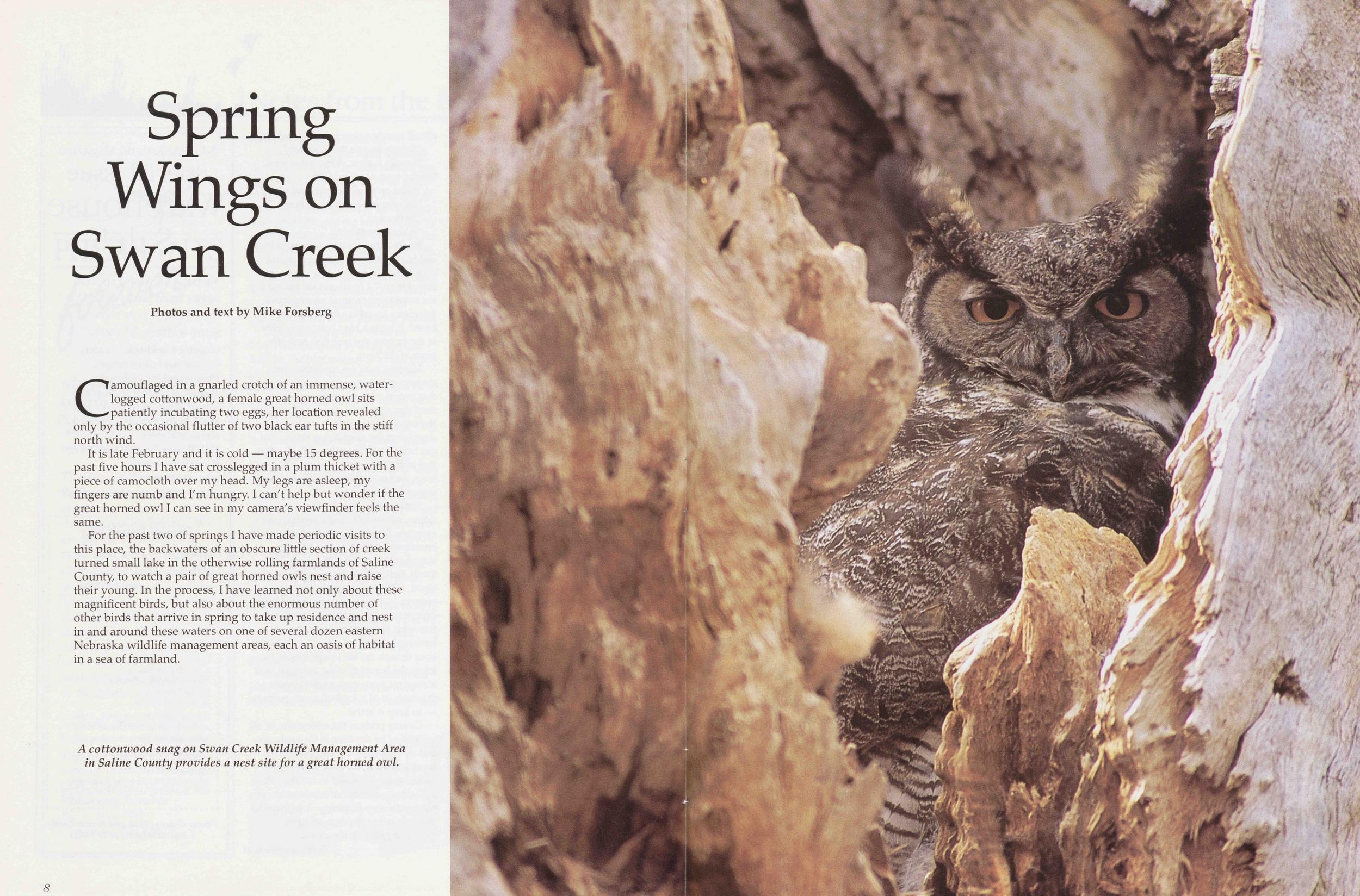
Spring Wings on Swan Creek
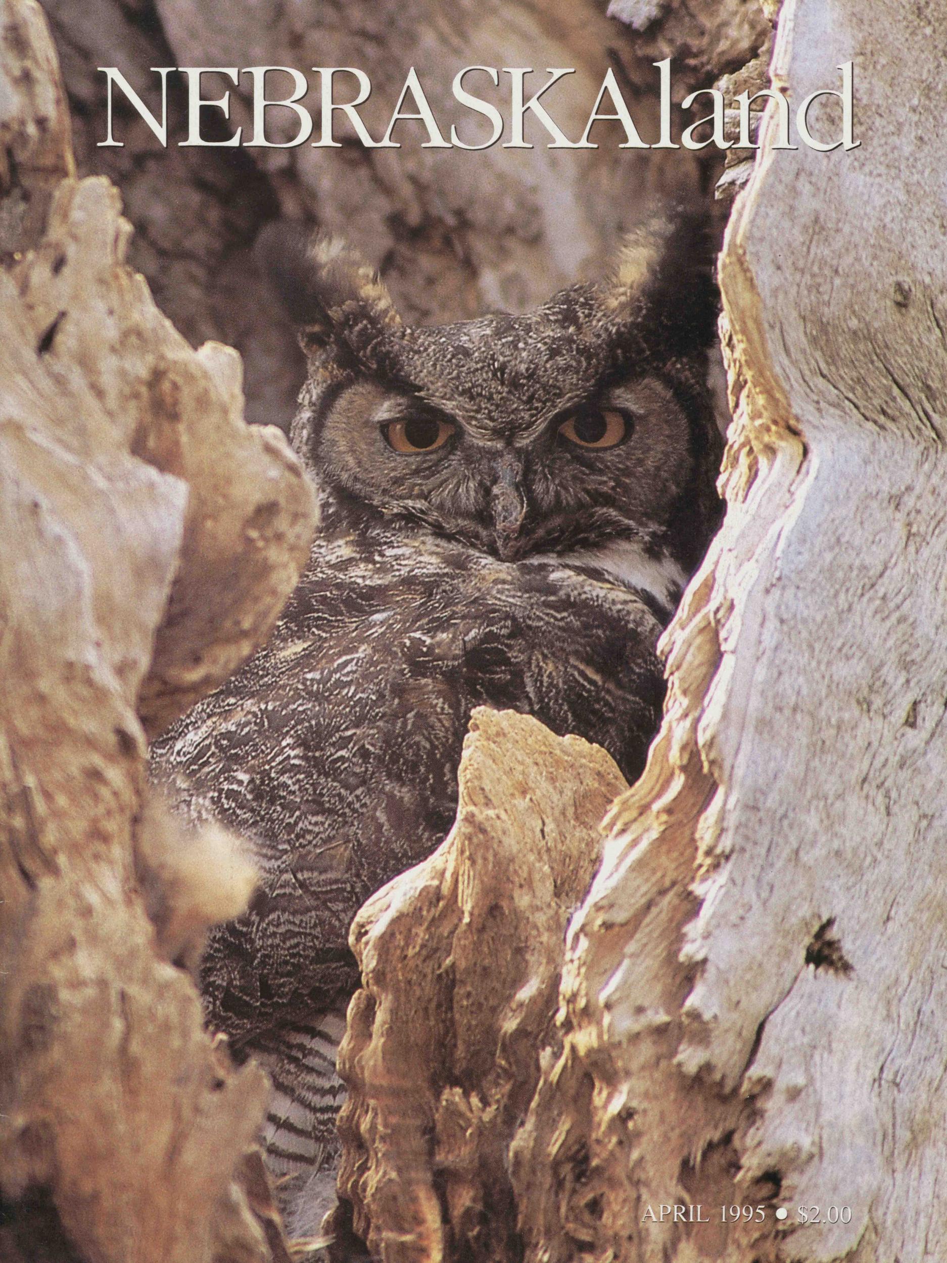
Photos and text by Mike ForsbergCamouflaged in a gnarled crotch of an immense, waterlogged cottonwood, a female great horned owl sits patiently incubating two eggs, her location revealed only by the occasional flutter of two black ear tufts in the stiff north wind.
It is late February and it is cold maybe 15 degrees. For the past five hours I have sat crosslegged in a plum thicket with a piece of camocloth over my head. My legs are asleep, my ringers are numb and I'm hungry. I can't help but wonder if the great horned owl I can see in my camera's viewfinder feels the same.
For the past two of springs I have made periodic visits to this place, the backwaters of an obscure little section of creek turned small lake in the otherwise rolling farmlands of Saline County, to watch a pair of great horned owls nest and raise their young. In the process, I have learned not only about these magnificent birds, but also about the enormous number of other birds that arrive in spring to take up residence and nest in and around these waters on one of several dozen eastern Nebraska wildlife management areas, each an oasis of habitat in a sea of farmland.
8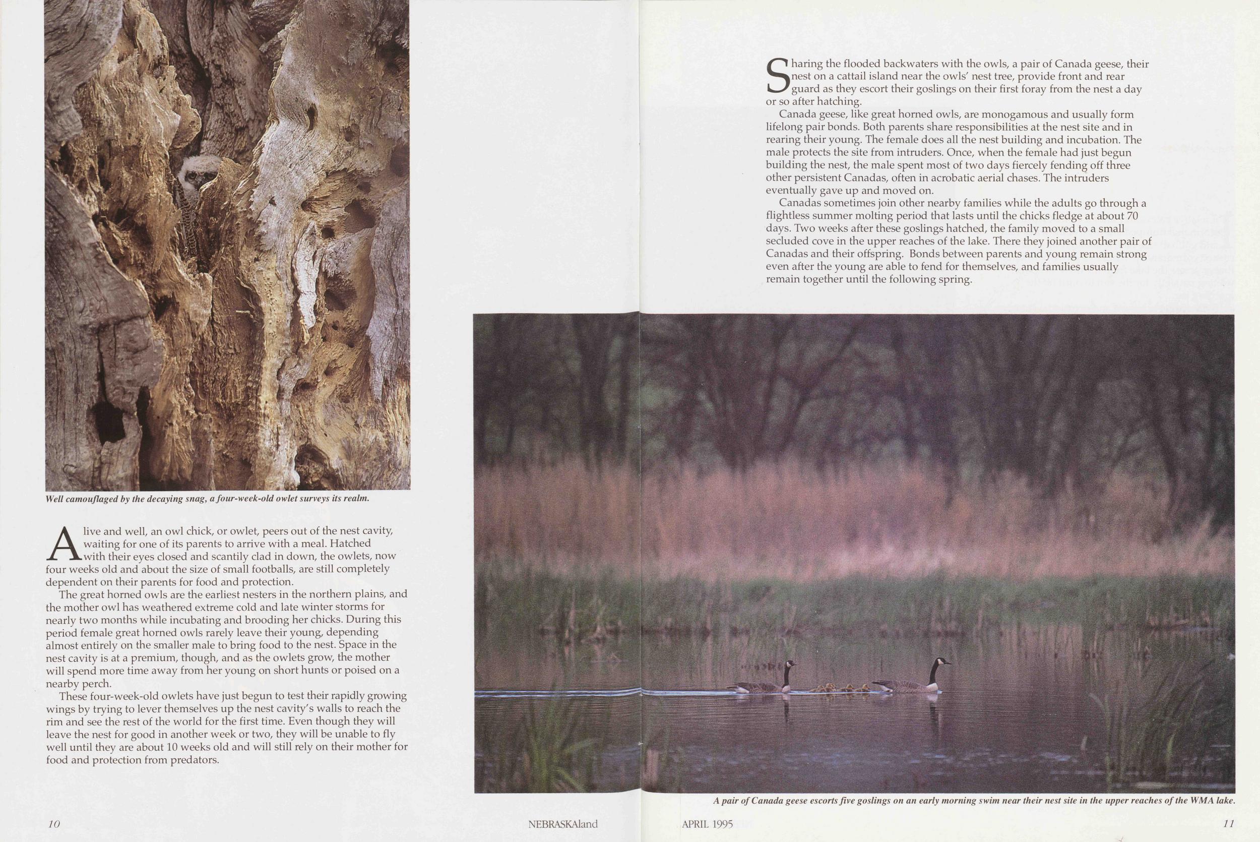
Alive and well, an owl chick, or owlet, peers out of the nest cavity, waiting for one of its parents to arrive with a meal. Hatched with their eyes closed and scantily clad in down, the owlets, now four weeks old and about the size of small footballs, are still completely dependent on their parents for food and protection.
The great horned owls are the earliest nesters in the northern plains, and the mother owl has weathered extreme cold and late winter storms for nearly two months while incubating and brooding her chicks. During this period female great horned owls rarely leave their young, depending almost entirely on the smaller male to bring food to the nest. Space in the nest cavity is at a premium, though, and as the owlets grow, the mother will spend more time away from her young on short hunts or poised on a nearby perch.
These four-week-old owlets have just begun to test their rapidly growing wings by trying to lever themselves up the nest cavity's walls to reach the rim and see the rest of the world for the first time. Even though they will leave the nest for good in another week or two, they will be unable to fly well until they are about 10 weeks old and will still rely on their mother for food and protection from predators.
10 NEBRASKAlandSharing the flooded backwaters with the owls, a pair of Canada geese, their nest on a cattail island near the owls' nest tree, provide front and rear guard as they escort their goslings on their first foray from the nest a day or so after hatching.
Canada geese, like great horned owls, are monogamous and usually form lifelong pair bonds. Both parents share responsibilities at the nest site and in rearing their young. The female does all the nest building and incubation. The male protects the site from intruders. Once, when the female had just begun building the nest, the male spent most of two days fiercely fending off three other persistent Canadas, often in acrobatic aerial chases. The intruders eventually gave up and moved on.
Canadas sometimes join other nearby families while the adults go through a flightless summer molting period that lasts until the chicks fledge at about 70 days. Two weeks after these goslings hatched, the family moved to a small secluded cove in the upper reaches of the lake. There they joined another pair of Canadas and their offspring. Bonds between parents and young remain strong even after the young are able to fend for themselves, and families usually remain together until the following spring.
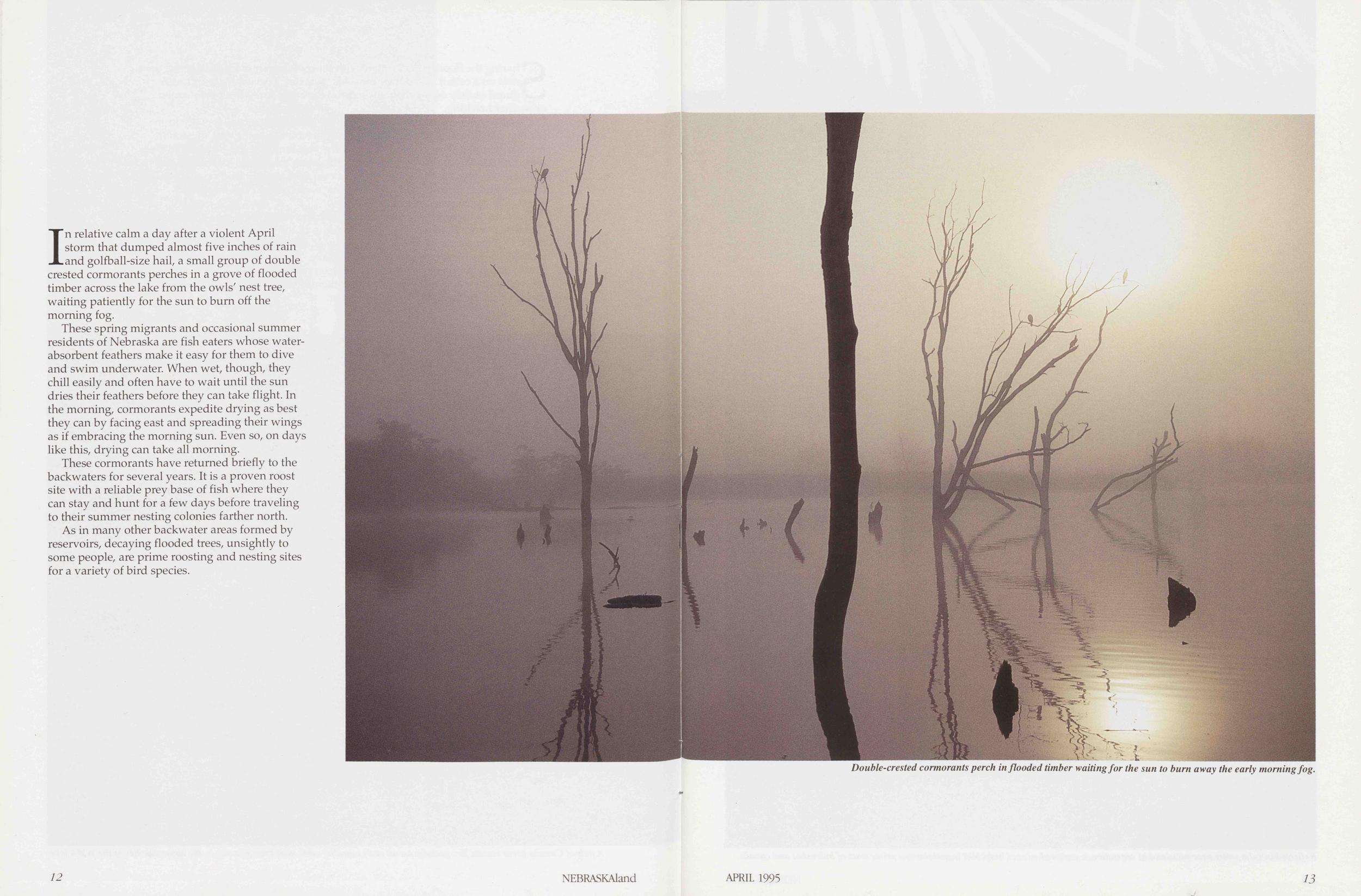
In relative calm a day after a violent April storm that dumped almost five inches of rain and golfball-size hail, a small group of double crested cormorants perches in a grove of flooded timber across the lake from the owls' nest tree, waiting patiently for the sun to burn off the morning fog.
These spring migrants and occasional summer residents of Nebraska are fish eaters whose water-absorbent feathers make it easy for them to dive and swim underwater. When wet, though, they chill easily and often have to wait until the sun dries their feathers before they can take flight. In the morning, cormorants expedite drying as best they can by facing east and spreading their wings as if embracing the morning sun. Even so, on days like this, drying can take all morning.
These cormorants have returned briefly to the backwaters for several years. It is a proven roost site with a reliable prey base of fish where they can stay and hunt for a few days before traveling to their summer nesting colonies farther north.
As in many other backwater areas formed by reservoirs, decaying flooded trees, unsightly to some people, are prime roosting and nesting sites for a variety of bird species.
12 NEBRASKAland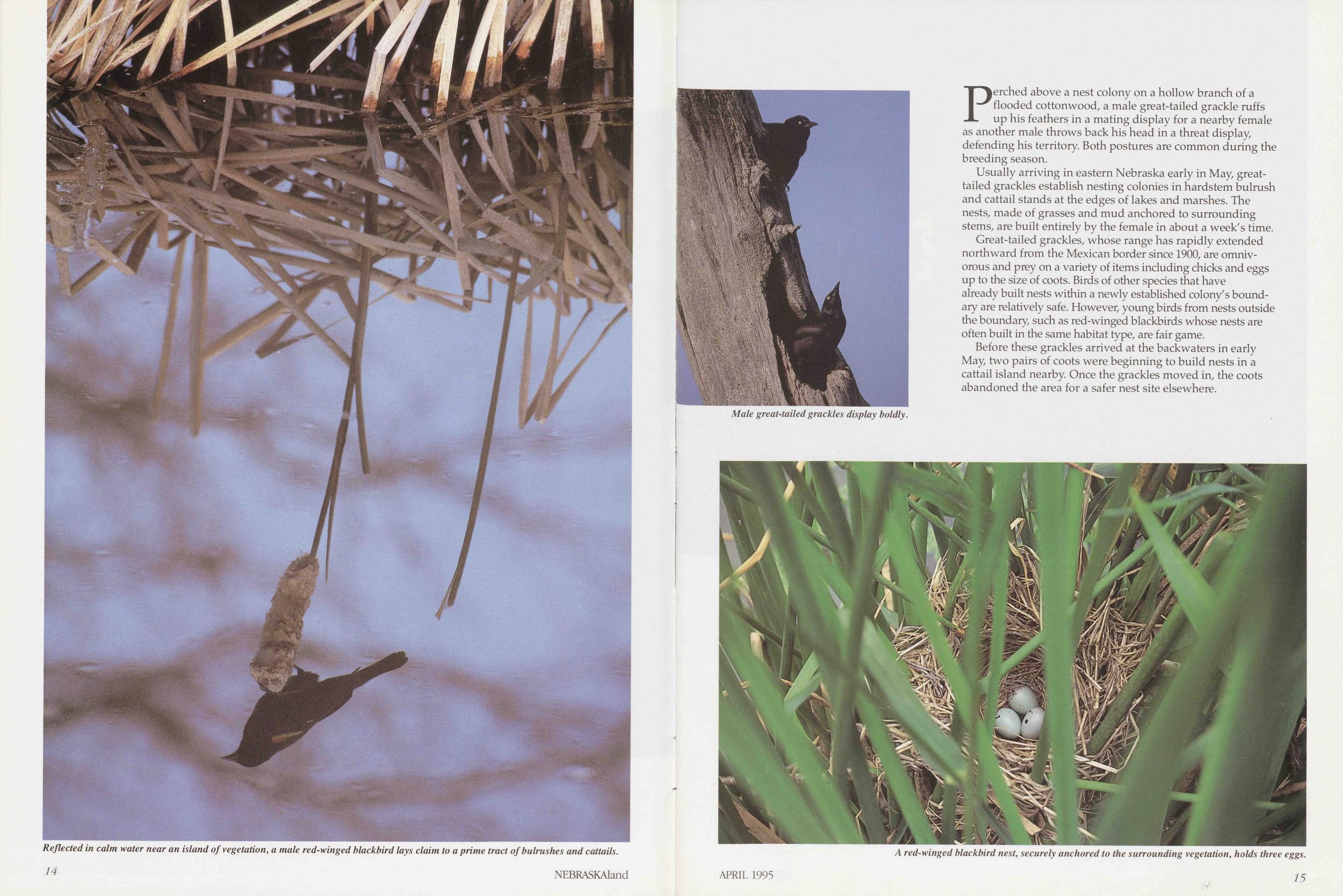
Perched above a nest colony on a hollow branch of a flooded cottonwood, a male great-tailed grackle ruffs up his feathers in a mating display for a nearby female as another male throws back his head in a threat display, defending his territory. Both postures are common during the breeding season.
Usually arriving in eastern Nebraska early in May, great-tailed grackles establish nesting colonies in hardstem bulrush and cattail stands at the edges of lakes and marshes. The nests, made of grasses and mud anchored to surrounding stems, are built entirely by the female in about a week's time.
Great-tailed grackles, whose range has rapidly extended northward from the Mexican border since 1900, are omnivorous and prey on a variety of items including chicks and eggs up to the size of coots. Birds of other species that have already built nests within a newly established colony's boundary are relatively safe. However, young birds from nests outside the boundary, such as red-winged blackbirds whose nests are often built in the same habitat type, are fair game.
Before these grackles arrived at the backwaters in early May, two pairs of coots were beginning to build nests in a cattail island nearby. Once the grackles moved in, the coots abandoned the area for a safer nest site elsewhere.
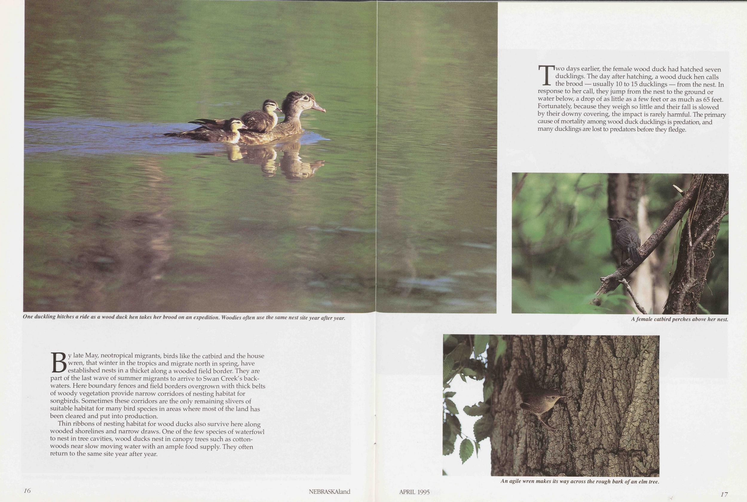
By late May, neotropical migrants, birds like the catbird and the house wren, that winter in the tropics and migrate north in spring, have established nests in a thicket along a wooded field border. They are part of the last wave of summer migrants to arrive to Swan Creek's backwaters. Here boundary fences and field borders overgrown with thick belts of woody vegetation provide narrow corridors of nesting habitat for songbirds. Sometimes these corridors are the only remaining slivers of suitable habitat for many bird species in areas where most of the land has been cleared and put into production.
Thin ribbons of nesting habitat for wood ducks also survive here along wooded shorelines and narrow draws. One of the few species of waterfowl to nest in tree cavities, wood ducks nest in canopy trees such as cottonwoods near slow moving water with an ample food supply. They often return to the same site year after year.
16 NEBRASKAlandTwo days earlier, the female wood duck had hatched seven ducklings. The day after hatching, a wood duck hen calls the brood — usually 10 to 15 ducklings — from the nest. In response to her call, they jump from the nest to the ground or water below, a drop of as little as a few feet or as much as 65 feet. Fortunately, because they weigh so little and their fall is slowed by their downy covering, the impact is rarely harmful. The primary cause of mortality among wood duck ducklings is predation, and many ducklings are lost to predators before they fledge.
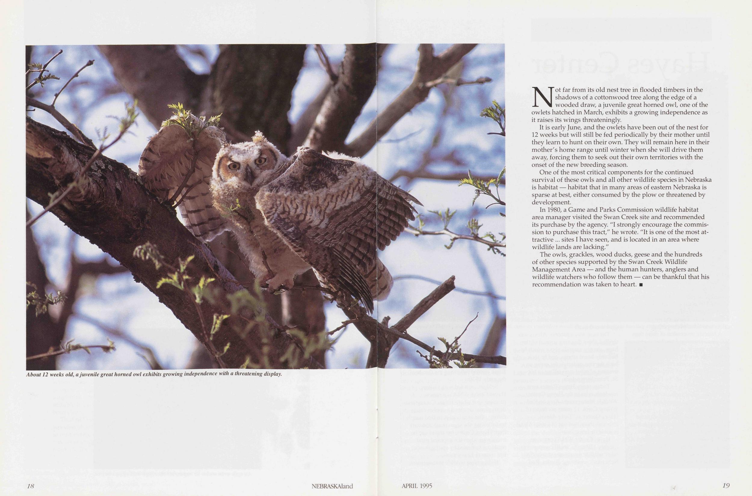
Not far from its old nest tree in flooded timbers in the shadows of a cottonwood tree along the edge of a wooded draw, a juvenile great horned owl, one of the owlets hatched in March, exhibits a growing independence as it raises its wings threateningly.
It is early June, and the owlets have been out of the nest for 12 weeks but will still be fed periodically by their mother until they learn to hunt on their own. They will remain here in their mother's home range until winter when she will drive them away, forcing them to seek out their own territories with the onset of the new breeding season.
One of the most critical components for the continued survival of these owls and all other wildlife species in Nebraska is habitat — habitat that in many areas of eastern Nebraska is sparse at best, either consumed by the plow or threatened by development.
In 1980, a Game and Parks Commission wildlife habitat area manager visited the Swan Creek site and recommended its purchase by the agency. "I strongly encourage the commission to purchase this tract," he wrote. "It is one of the most attractive ... sites I have seen, and is located in an area where wildlife lands are lacking."
The owls, grackles, wood ducks, geese and the hundreds of other species supported by the Swan Creek Wildlife Management Area — and the human hunters, anglers and wildlife watchers who follow them — can be thankful that his recommendation was taken to heart.
APRIL 1995 19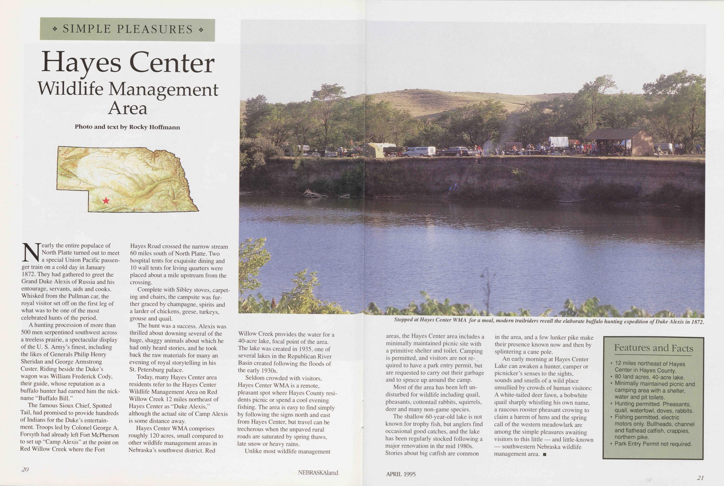
SIMPLE PLEASURES
Hayes Center Wildlife Management Area
Photo and text by Rocky HoffmannNearly the entire populace of North Platte turned out to meet a special Union Pacific passenger train on a cold day in January 1872. They had gathered to greet the Grand Duke Alexis of Russia and his entourage, servants, aids and cooks. Whisked from the Pullman car, the royal visitor set off on the first leg of what was to be one of the most celebrated hunts of the period.
A hunting procession of more than 500 men serpentined southwest across a treeless prairie, a spectacular display of the U. S. Army's finest, including the likes of Generals Philip Henry Sheridan and George Armstrong Custer. Riding beside the Duke's wagon was William Frederick Cody, their guide, whose reputation as a buffalo hunter had earned him the nickname "Buffalo Bill."
The famous Sioux Chief, Spotted Tail, had promised to provide hundreds of Indians for the Duke's entertainment. Troops led by Colonel George A. Forsyth had already left Fort McPherson to set up "Camp Alexis" at the point on Red Willow Creek where the Fort Hayes Road crossed the narrow stream 60 miles south of North Platte. Two hospital tents for exquisite dining and 10 wall tents for living quarters were placed about a mile upstream from the crossing.
Complete with Sibley stoves, carpeting and chairs, the campsite was further graced by champagne, spirits and a larder of chickens, geese, turkeys, grouse and quail.
The hunt was a success. Alexis was thrilled about downing several of the huge, shaggy animals about which he had only heard stories, and he took back the raw materials for many an evening of royal storytelling in his St. Petersburg palace.
Today, many Hayes Center area residents refer to the Hayes Center Wildlife Management Area on Red Willow Creek 12 miles northeast of Hayes Center as "Duke Alexis," although the actual site of Camp Alexis is some distance away.
Hayes Center WMA comprises roughly 120 acres, small compared to other wildlife management areas in Nebraska's southwest district. Red I Willow Creek provides the water for a 40-acre lake, focal point of the area. The lake was created in 1935, one of several lakes in the Republican River Basin created following the floods of the early 1930s.
Seldom crowded with visitors, Hayes Center WMA is a remote, pleasant spot where Hayes County residents picnic or spend a cool evening fishing. The area is easy to find simply by following the signs north and east from Hayes Center, but travel can be trecherous when the unpaved rural roads are saturated by spring thaws, late snow or heavy rains.
Unlike most wildlife management 20 NEBRASKAland
Most of the area has been left undisturbed for wildlife including quail, pheasants, cottontail rabbits, squirrels, deer and many non-game species.
The shallow 60-year-old lake is not known for trophy fish, but anglers find occasional good catches, and the lake has been regularly stocked following a major renovation in the mid 1980s. Stories about big catfish are common in the area, and a few lunker pike make their presence known now and then by splintering a cane pole.
An early morning at Hayes Center Lake can awaken a hunter, camper or picnicker's senses to the sights, sounds and smells of a wild place unsullied by crowds of human visitors: A white-tailed deer fawn, a bobwhite quail sharply whistling his own name, a raucous rooster pheasant crowing to claim a harem of hens and the spring call of the western meadowlark are among the simple pleasures awaiting visitors to this little — and little-known — southwestern Nebraska wildlife management area.
Features and Facts12 miles northeast of Hayes Center in Hayes County.
80 land acres, 40-acre lake.
Minimally maintained picnic and camping area with a shelter, water and pit toilets.
Hunting permitted. Pheasants, quail, waterfowl, doves, rabbits.
Fishing permitted, electric motors only. Bullheads, channel and flathead catfish, crappies, northern pike.
Park Entry Permit not required.
APRIL 1995 21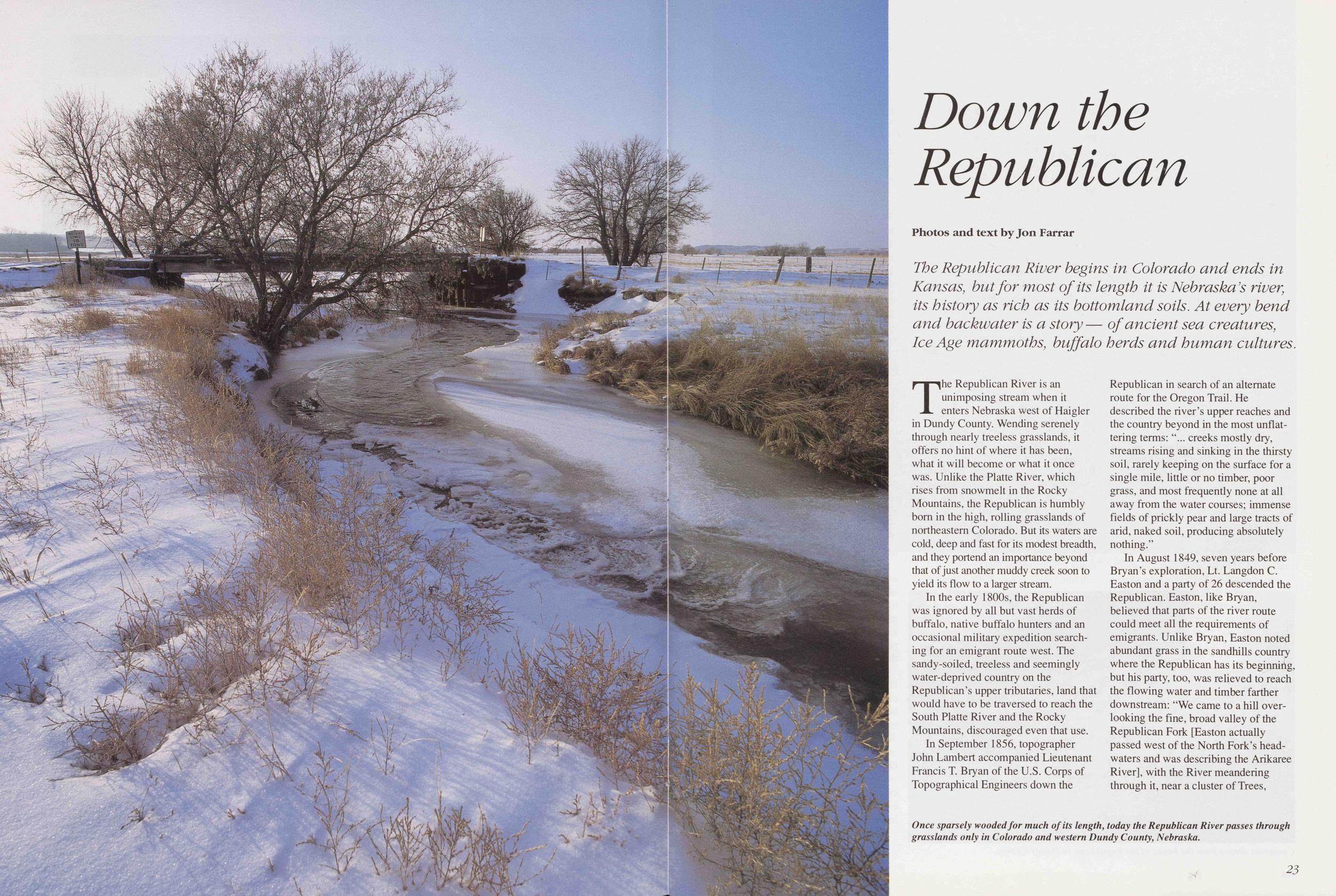
Down the Republican
Photos and text by Jon Farrar The Republican River begins in Colorado and ends in Kansas, but for most of its length it is Nebraska's river, its history as rich as its bottomland soils. At every bend and backwater is a story— of ancient sea creatures, Ice Age mammoths, buffalo herds and human cultures.The Republican River is an unimposing stream when it enters Nebraska west of Haigler in Dundy County. Wending serenely through nearly treeless grasslands, it offers no hint of where it has been, what it will become or what it once was. Unlike the Platte River, which rises from snowmelt in the Rocky Mountains, the Republican is humbly born in the high, rolling grasslands of northeastern Colorado. But its waters are cold, deep and fast for its modest breadth, and they portend an importance beyond that of just another muddy creek soon to yield its flow to a larger stream.
In the early 1800s, the Republican was ignored by all but vast herds of buffalo, native buffalo hunters and an occasional military expedition searching for an emigrant route west. The sandy-soiled, treeless and seemingly water-deprived country on the Republican's upper tributaries, land that would have to be traversed to reach the South Platte River and the Rocky Mountains, discouraged even that use.
In September 1856, topographer John Lambert accompanied Lieutenant Francis T. Bryan of the U.S. Corps of Topographical Engineers down the Republican in search of an alternate route for the Oregon Trail. He described the river's upper reaches and the country beyond in the most unflattering terms: " creeks mostly dry, streams rising and sinking in the thirsty soil, rarely keeping on the surface for a single mile, little or no timber, poor grass, and most frequently none at all away from the water courses; immense fields of prickly pear and large tracts of arid, naked soil, producing absolutely nothing."
In August 1849, seven years before
Bryan's exploration, Lt. Langdon C.
Easton and a party of 26 descended the
Republican. Easton, like Bryan,
believed that parts of the river route
could meet all the requirements of
emigrants. Unlike Bryan, Easton noted
abundant grass in the sandhills country
where the Republican has its beginning,
but his party, too, was relieved to reach
the flowing water and timber farther
downstream: "We came to a hill overlooking the fine, broad valley of the
Republican Fork [Easton actually
passed west of the North Fork's headwaters and was describing the Arikaree
River], with the River meandering
through it, near a cluster of Trees,
23
 which afforded us the prospect of an
abundance of Wood. We had been four
days without seeing a Stream of Water
or a stick of Timber, and suddenly coming on both, put the whole party in
good spirits, heightened by a burst of
laughter at the irresistible expression of
an Irishman, who with evident earnestness and great joy exclaimed 'Be Jesus
we're in sight of land again."
which afforded us the prospect of an
abundance of Wood. We had been four
days without seeing a Stream of Water
or a stick of Timber, and suddenly coming on both, put the whole party in
good spirits, heightened by a burst of
laughter at the irresistible expression of
an Irishman, who with evident earnestness and great joy exclaimed 'Be Jesus
we're in sight of land again."
Were Easton and Bryan to retrace their routes today, they probably would not recognize the headwaters of the Republican. On August 13, 1849, Easton wrote in his journal that they "found but very little muddy water remaining in the tracks made by Buffalo in passing through." Today, water sprays from the nozzles of thousands of centerpivot irrigation systems over fields producing up to 200 bushels of corn per acre. They would surely note, too, that the Arikaree, the Republican forks and Frenchman Creek, a tributary to the north, are but shadows of what they once were, that their headwaters are shrinking ever eastward, their flows are much diminished, and many of the springs which once fed them are dry.
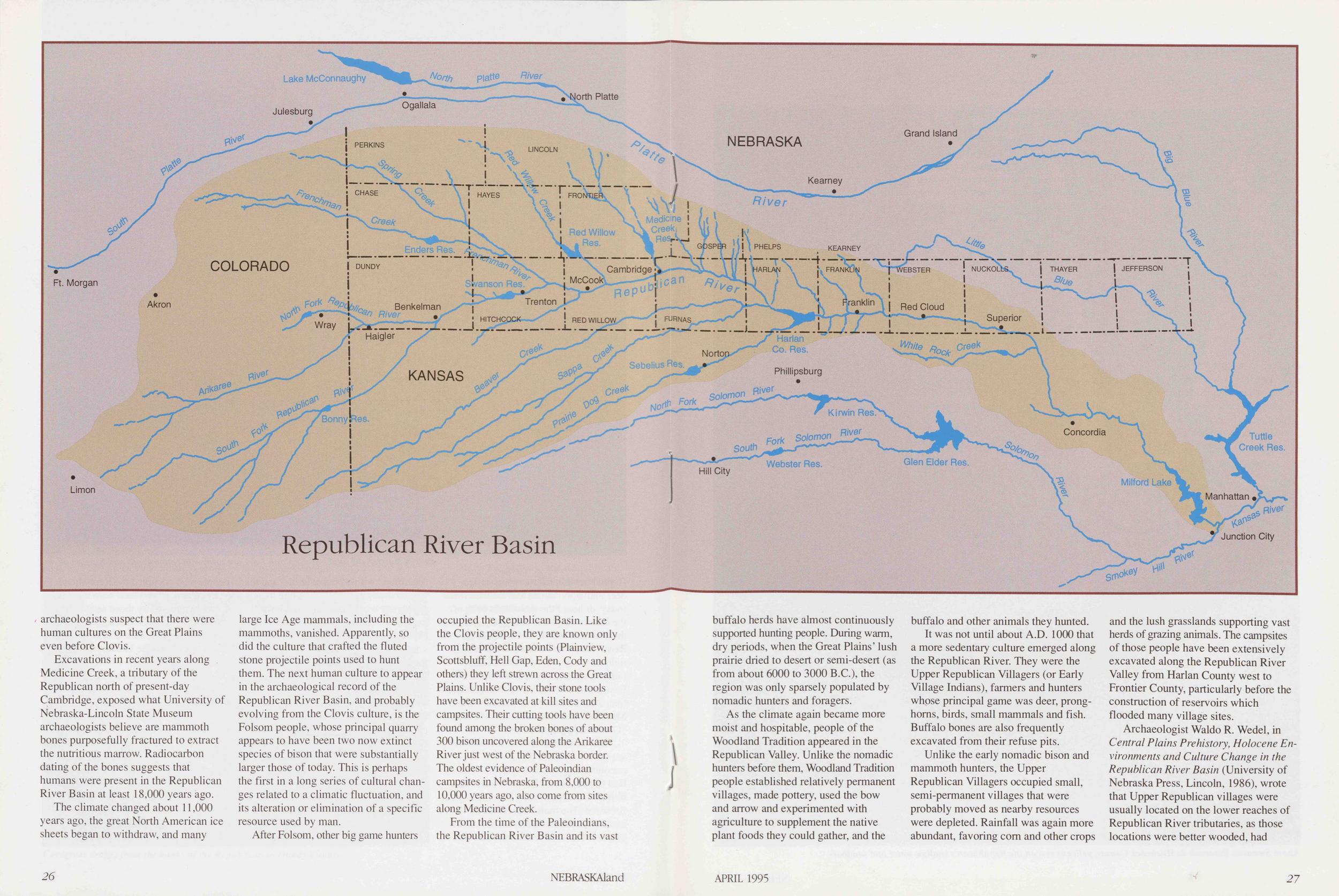
The Republican BasinThe Republican River drains a basin of more than 26,000 square miles, roughly 360 miles long from west to east, and 120 miles wide north to south at its widest along the Nebraska-Colorado border. Both its headwaters and mouth lie outside Nebraska, and rights to its water are subject to legal tugging and pulling not only within, but among states. The Republican, though, is mostly a Nebraska river. About 40 percent of its basin and 250 river miles of its channels are within Nebraska's boundaries; it flows through Colorado for 150 miles and passes through Kansas for less than 200 miles before it flows into the Smokey Hill River, which joins the Kansas River and finally the Missouri River at Kansas City.
The Republican begins as three streams rising in the saturated, grasscovered sands of northeastern Colorado. From west of Haigler comes the North Fork, and from the southwest, barely passing through the northwest corner of Kansas, comes the Arikaree (the "Middle Fork" if logic ruled in naming streams), which flows into the North Fork a few miles after entering Nebraska. Near Benkelman, 30 miles farther east, the South Fork of the Republican, a tributary also rising in Colorado that cuts diagonally across the corner of Kansas, merges with the North Fork. Downstream, the Republican River arches across Nebraska's southern tier of counties, its flows swollen by the contributions of many small streams that come to it from both sides like the ray bones of a fish to its spine.
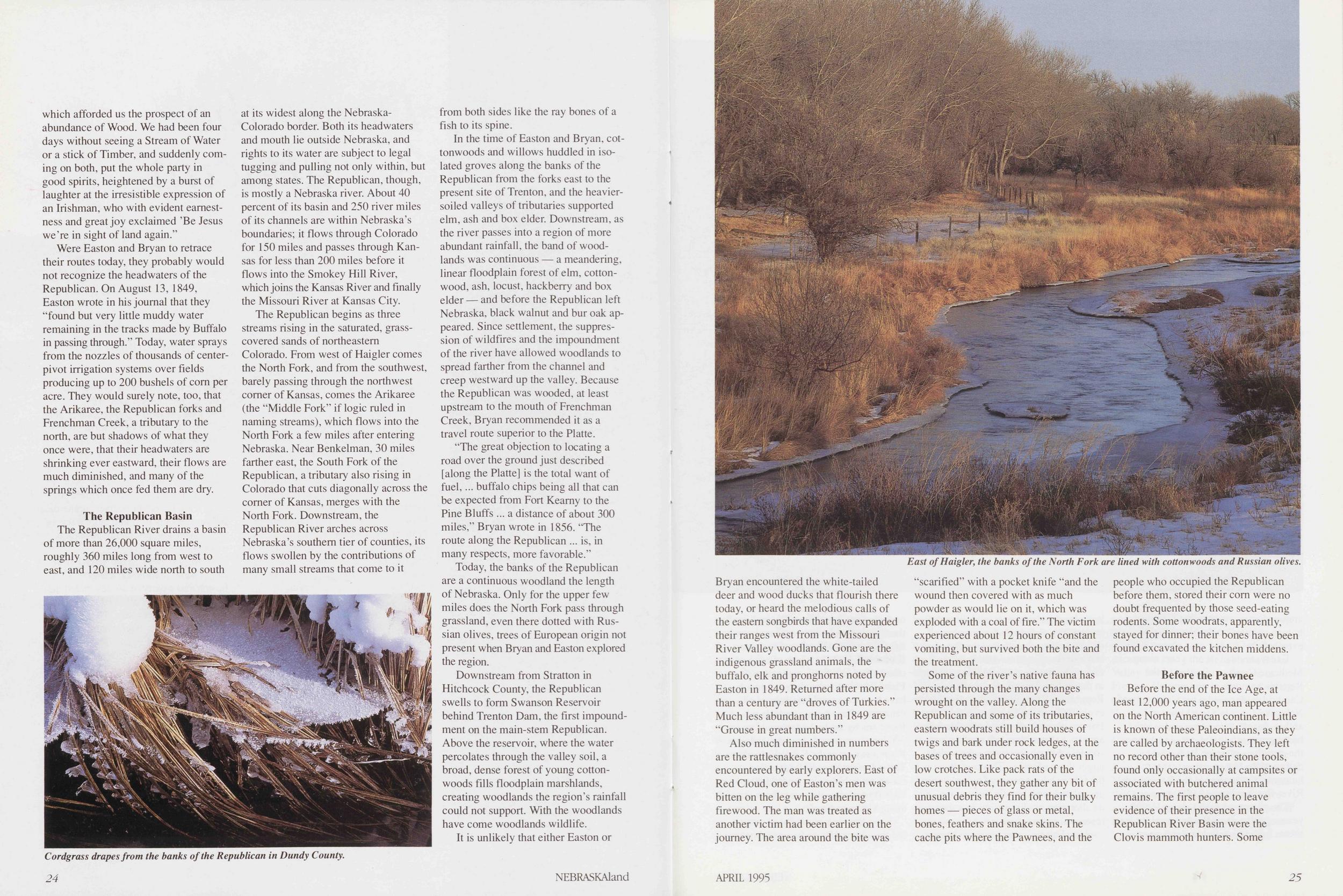
In the time of Easton and Bryan, cottonwoods and willows huddled in isolated groves along the banks of the Republican from the forks east to the present site of Trenton, and the heaviersoiled valleys of tributaries supported elm, ash and box elder. Downstream, as the river passes into a region of more abundant rainfall, the band of woodlands was continuous — a meandering, linear floodplain forest of elm, cottonwood, ash, locust, hackberry and box elder — and before the Republican left Nebraska, black walnut and bur oak appeared. Since settlement, the suppression of wildfires and the impoundment of the river have allowed woodlands to spread farther from the channel and creep westward up the valley. Because the Republican was wooded, at least upstream to the mouth of Frenchman Creek, Bryan recommended it as a travel route superior to the Platte.
"The great objection to locating a road over the ground just described [along the Platte] is the total want of fuel, buffalo chips being all that can be expected from Fort Kearny to the Pine Bluffs a distance of about 300 miles," Bryan wrote in 1856. "The route along the Republican is, in many respects, more favorable."
Today, the banks of the Republican are a continuous woodland the length of Nebraska. Only for the upper few miles does the North Fork pass through grassland, even there dotted with Russian olives, trees of European origin not present when Bryan and Easton explored the region.
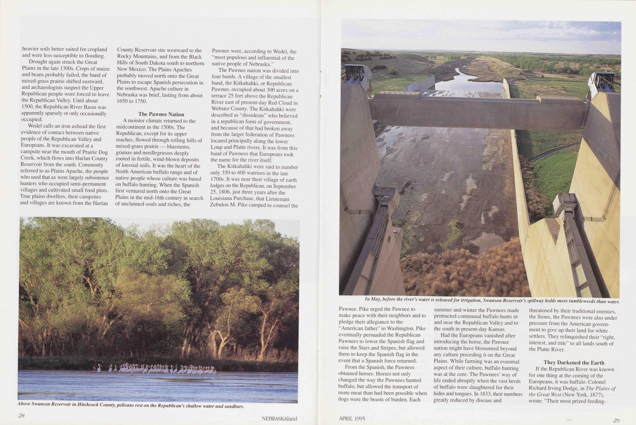
Downstream from Stratton in Hitchcock County, the Republican swells to form Swanson Reservoir behind Trenton Dam, the first impoundment on the main-stem Republican. Above the reservoir, where the water percolates through the valley soil, a broad, dense forest of young cottonwoods fills floodplain marshlands, creating woodlands the region's rainfall could not support. With the woodlands have come woodlands wildlife.
It is unlikely that either Easton or
Also much diminished in numbers are the rattlesnakes commonly encountered by early explorers. East of Red Cloud, one of Easton's men was bitten on the leg while gathering firewood. The man was treated as another victim had been earlier on the journey. The area around the bite was "scarified" with a pocket knife "and the wound then covered with as much powder as would lie on it, which was exploded with a coal of fire." The victim experienced about 12 hours of constant vomiting, but survived both the bite and the treatment.
Some of the river's native fauna has persisted through the many changes wrought on the valley. Along the Republican and some of its tributaries, eastern woodrats still build houses of twigs and bark under rock ledges, at the bases of trees and occasionally even in low crotches. Like pack rats of the desert southwest, they gather any bit of unusual debris they find for their bulky homes — pieces of glass or metal, bones, feathers and snake skins. The cache pits where the Pawnees, and the people who occupied the Republican before them, stored their corn were no doubt frequented by those seed-eating rodents. Some woodrats, apparently, stayed for dinner; their bones have been found excavated the kitchen middens.
Before the PawneeBefore the end of the Ice Age, at
least 12,000 years ago, man appeared
on the North American continent. Little
is known of these Paleoindians, as they
are called by archaeologists. They left
no record other than their stone tools,
found only occasionally at campsites or
associated with butchered animal
remains. The first people to leave
evidence of their presence in the
Republican River Basin were the
Clovis mammoth hunters. Some
APRIL 1995
25
Excavations in recent years along . Medicine Creek, a tributary of the Republican north of present-day Cambridge, exposed what University of Nebraska-Lincoln State Museum archaeologists believe are mammoth bones purposefully fractured to extract the nutritious marrow. Radiocarbon dating of the bones suggests that humans were present in the Republican River Basin at least 18,000 years ago.
The climate changed about 11,000 years ago, the great North American ice sheets began to withdraw, and many large Ice Age mammals, including the mammoths, vanished. Apparently, so did the culture that crafted the fluted stone projectile points used to hunt them. The next human culture to appear in the archaeological record of the Republican River Basin, and probably evolving from the Clovis culture, is the Folsom people, whose principal quarry appears to have been two now extinct species of bison that were substantially larger those of today. This is perhaps the first in a long series of cultural changes related to a climatic fluctuation, and its alteration or elimination of a specific resource used by man.
After Folsom, other big game hunters occupied the Republican Basin. Like the Clovis people, they are known only from the projectile points (Plainview, Scottsbluff, Hell Gap, Eden, Cody and others) they left strewn across the Great Plains. Unlike Clovis, their stone tools have been excavated at kill sites and campsites. Their cutting tools have been found among the broken bones of about 300 bison uncovered along the Arikaree River just west of the Nebraska border. The oldest evidence of Paleoindian campsites in Nebraska, from 8,000 to 10,000 years ago, also come from sites along Medicine Creek.
From the time of the Paleoindians, the Republican River Basin and its vast 26 NEBRASKAland buffalo herds have almost continuously supported hunting people. During warm, dry periods, when the Great Plains' lush prairie dried to desert or semi-desert (as from about 6000 to 3000 B.C.), the region was only sparsely populated by nomadic hunters and foragers.
As the climate again became more moist and hospitable, people of the Woodland Tradition appeared in the Republican Valley. Unlike the nomadic hunters before them, Woodland Tradition people established relatively permanent villages, made pottery, used the bow and arrow and experimented with agriculture to supplement the native plant foods they could gather, and the buffalo and other animals they hunted.
It was not until about A.D. 1000 that a more sedentary culture emerged along the Republican River. They were the Upper Republican Villagers (or Early Village Indians), farmers and hunters whose principal game was deer, pronghorns, birds, small mammals and fish. Buffalo bones are also frequently excavated from their refuse pits.
Unlike the early nomadic bison and mammoth hunters, the Upper Republican Villagers occupied small, semi-permanent villages that were probably moved as nearby resources were depleted. Rainfall was again more abundant, favoring com and other crops and the lush grasslands supporting vast herds of grazing animals. The campsites of those people have been extensively excavated along the Republican River Valley from Harlan County west to Frontier County, particularly before the construction of reservoirs which flooded many village sites.
Archaeologist Waldo R. Wedel, in
Central Plains Prehistory, Holocene Environments and Culture Change in the
Republican River Basin (University of
Nebraska Press, Lincoln, 1986), wrote
that Upper Republican villages were
usually located on the lower reaches of
Republican River tributaries, as those
locations were better wooded, had
APRIL 1995
27
 heavier soils better suited for cropland
and were less susceptible to flooding.
heavier soils better suited for cropland
and were less susceptible to flooding.
Drought again struck the Great Plains in the late 1300s. Crops of maize and beans probably failed, the band of mixed-grass prairie shifted eastward, and archaeologists suspect the Upper Republican people were forced to leave the Republican Valley. Until about 1500, the Republican River Basin was apparently sparsely or only occasionally occupied.
Wedel calls an iron axhead the first evidence of contact between native people of the Republican Valley and Europeans. It was excavated at a campsite near the mouth of Prairie Dog Creek, which flows into Harlan County Reservoir from the south. Commonly referred to as Plains Apache, the people who used that ax were largely subsistence hunters who occupied semi-permanent villages and cultivated small food plots. True plains dwellers, their campsites and villages are known from the Harlan County Reservoir site westward to the Rocky Mountains, and from the Black Hills of South Dakota south to northern New Mexico. The Plains Apaches probably moved north onto the Great Plains to escape Spanish persecution in the southwest. Apache culture in Nebraska was brief, lasting from about 1650 to 1750.
The Pawnee NationA moister climate returned to the midcontinent in the 1500s. The Republican, except for its upper reaches, flowed through rolling hills of mixed-grass prairie — bluestems, gramas and needlegrasses deeply rooted in fertile, wind-blown deposits of loessial soils. It was the heart of the North American buffalo range and of native people whose culture was based on buffalo hunting. When the Spanish first ventured north onto the Great Plains in the mid-16th century in search of unclaimed souls and riches, the Pawnee were, according to Wedel, the "most populous and influential of the native people of Nebraska."
The Pawnee nation was divided into four bands. A village of the smallest band, the Kitkahahki, or Republican Pawnee, occupied about 300 acres on a terrace 25 feet above the Republican River east of present-day Red Cloud in Webster County. The Kitkahahki were described as "dissidents" who believed in a republican form of government, and because of that had broken away from the larger federation of Pawnees located principally along the lower Loup and Platte rivers. It was from this band of Pawnees that Europeans took the name for the river itself.
The Kitkahahki were said to number only 350 to 400 warriors in the late 1700s. It was near their village of earth lodges on the Republican, on September 25, 1806, just three years after the Louisiana Purchase, that Lieutenant Zebulon M. Pike camped to counsel the
From the Spanish, the Pawnees obtained horses. Horses not only changed the way the Pawnees hunted buffalo, but allowed the transport of more meat than had been possible when dogs were the beasts of burden. Each summer and winter the Pawnees made protracted communal buffalo hunts in and near the Republican Valley and to the south in present-day Kansas.
Had the Europeans vanished after introducing the horse, the Pawnee nation might have blossomed beyond any culture preceding it on the Great Plains. While farming was an essential aspect of their culture, buffalo hunting was at the core. The Pawnees' way of life ended abruptly when the vast herds of buffalo were slaughtered for their hides and tongues. In 1833, their numbers greatly reduced by disease and threatened by their traditional enemies, the Sioux, the Pawnees were also under pressure from the American government to give up their land for white settlers. They relinquished their "right, interest, and title" to all lands south of the Platte River.
They Darkened the EarthIf the Republican River was known
for one thing at the coming of the
Europeans, it was buffalo. Colonel
Richard Irving Dodge, in The Plains of
the Great West (New York, 1877),
wrote: "Their most prized feeding-
APRIL 1995
29
On his journey down the Republican in 1849, above the present-day town of Haigler, Easton wrote: "During our march of Seven days we were never out of sight of them, except when the darkness of Night veiled them from our view, and even then we were constantly reminded of their close proximity, and vast numbers, by the continued bellowing of the Bulls." Near present-day Trenton, he wrote that the grass had provided poor grazing for the previous two days, "this portion of the valley being much frequented by immense herds of Buffalo, which have eaten it out or trampelled it down."
The slaughter of buffalo for their hides and tongues in Kansas and southern Nebraska reached its height between 1871 and 1873. In August 1873, a Pawnee hunting party of 350 to 400 people from their reservation at Genoa in Nance County, accompanied by Indian agents, made the last traditional summer hunt on Prairie Dos; and Beaver creeks southwest of present-day Harlan County Reservoir. Hunting had been good. About 800 buffalo had been killed, and the Pawnees' horses were laden with dried meat and hides. They had turned north toward the Republican near present-day Trenton when 600 to 1,000 Oglala and Brule Sioux who were also hunting in the area swooped down on them. At least 69 Pawnees were killed, and all of the buffalo hides and meat taken. It was the last of many setbacks, and the Pawnee Nation never recovered. In the summer of 1875, the Pawnee relinquished their last claims to land in Nebraska and moved to Indian Territory in Oklahoma.
In the fall of 1873, hide hunters were also working the Republican River herds, and local legend tells of William F. "Doc" Carver engaging in a competition with hide hunter Jack ''Buffalo 30 NEBRASKAland Curly" McCall (who later shot "Wild Bill" Hickok) on the upper reaches of the Republican. Each hunter was to ride into the herd and shoot as many as possible before his horse collapsed. Carver's horse lasted longer, and he won easily, killing 160.
By 1874, the seemingly limitless herds of buffalo were essentially gone, and hunters moved south to clean up what remained of the animals in Texas. During the winter of 1883-84 the last of America's large buffalo herds were killed in Montana.
Shrinking ChannelsWith the buffalo and the Indians who had hunted them gone by the mid-1870s, cattlemen moved their stock to the Republican River grasslands. From 1880 through 1886, Texas cattle were trailed north to Ogallala through Dundy County west of Benkelman — 150,000 in 1886 alone, the last year of the trail drives. From cattle brought north on those drives, the first ranches were organized on open range in south- western Nebraska.
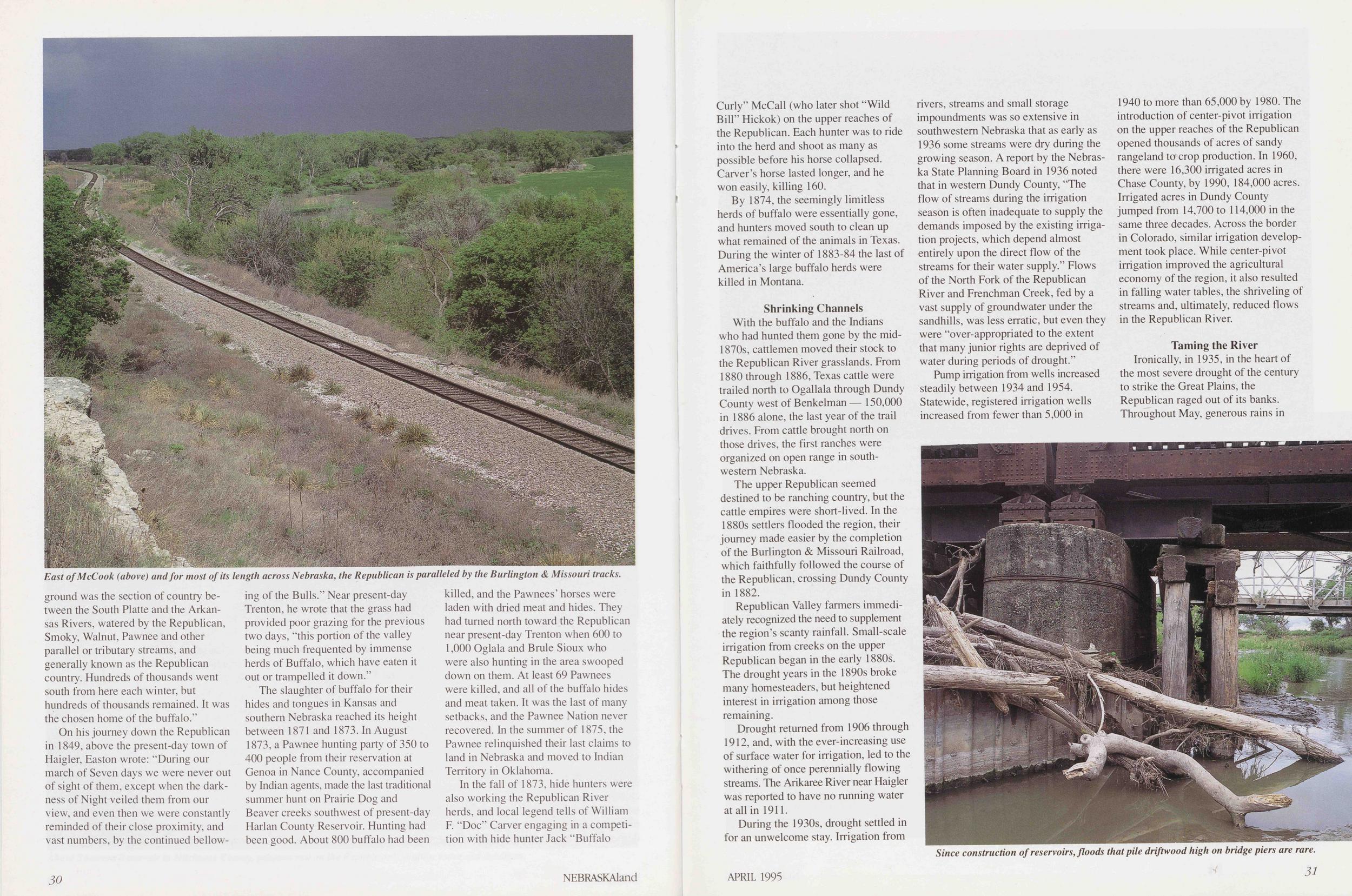
The upper Republican seemed destined to be ranching country, but the cattle empires were short-lived. In the 1880s settlers flooded the region, their journey made easier by the completion of the Burlington & Missouri Railroad, which faithfully followed the course of the Republican, crossing Dundy County in 1882.
Republican Valley farmers immediately recognized the need to supplement the region's scanty rainfall. Small-scale irrigation from creeks on the upper Republican began in the early 1880s. The drought years in the 1890s broke many homesteaders, but heightened interest in irrigation among those remaining.
Drought returned from 1906 through 1912, and, with the ever-increasing use of surface water for irrigation, led to the withering of once perennially flowing streams. The Arikaree River near Haigler was reported to have no running water at all in 1911.
During the 1930s, drought settled in for an unwelcome stay. Irrigation from rivers, streams and small storage impoundments was so extensive in southwestern Nebraska that as early as 1936 some streams were dry during the growing season. A report by the Nebraska State Planning Board in 1936 noted that in western Dundy County, "The flow of streams during the irrigation season is often inadequate to supply the demands imposed by the existing irrigation projects, which depend almost entirely upon the direct flow of the streams for their water supply." Flows of the North Fork of the Republican River and Frenchman Creek, fed by a vast supply of groundwater under the sandhills, was less erratic, but even they were "over-appropriated to the extent that many junior rights are deprived of water during periods of drought."
Pump irrigation from wells increased steadily between 1934 and 1954. Statewide, registered irrigation wells increased from fewer than 5,000 in 1940 to more than 65,000 by 1980. The introduction of center-pivot irrigation on the upper reaches of the Republican opened thousands of acres of sandy rangeland to crop production. In 1960, there were 16,300 irrigated acres in Chase County, by 1990, 184,000 acres. Irrigated acres in Dundy County jumped from 14,700 to 114,000 in the same three decades. Across the border in Colorado, similar irrigation development took place. While center-pivot irrigation improved the agricultural economy of the region, it also resulted in falling water tables, the shriveling of streams and, ultimately, reduced flows in the Republican River.
Taming the RiverIronically, in 1935, in the heart of the most severe drought of the century to strike the Great Plains, the Republican raged out of its banks. Throughout May, generous rains in
On Memorial Day the sky again opened and heavy rains fell in northeastern Colorado, then in southwestern Nebraska, swelling streams feeding the Republican River. On the South Fork of the Republican, an estimated 24 inches of rain fell in a 24-hour period, and an average of nine inches fell in the upper Republican River Basin.
As the runoff from the North and South forks, the Arikaree, the Frenchman and smaller tributaries reached the main-stem Republican, a wall of water reported to be eight to 10 feet high raged downstream. At the height of the flood, on June 1 and 2, the river was reported to have reached depths of 20 feet and to have been two miles wide, spanning the valley from bluff to bluff. The state hydrographer reported that 200 times the flow normal for that time of the year passed McCook. Just when everyone believed the flooding was over, the river again left its banks on May 28 and June 16.
Estimates of the loss of life and property vary. Most counts place the number drowned between 94 and 135, and some bodies were never recovered. Livestock losses were estimated at more than 20,000 head. The flood destroyed 515 bridges, and 275,000 acres of farmland were temporarily taken out of production. Property damage was estimated at $9 million. Entire families died, babies were swept from the arms of their fathers, and people huddled in the upper floors of houses and buildings, often sharing their dry space with rattlesnakes and other wild creatures.
The devastation of the 1935 Republican River flood and its psychological impact on the survivors cannot be minimized, but it is difficult not to think of what Wedel wrote, that every known village in the Republican River Valley before the time of European settlement, without exception, had been "situated on high ground, well beyond reach of any conceivable flooding."
The flood water had hardly begun to recede before the young publisher of the McCook Daily Gazette, Harry Strunk, initiated a campaign to prevent a reoccurrence. He organized the Republican Valley Conservation Association and relentlessly pushed and cajoled federal officials for floodcontrol impoundments on the Republican. His persistence began to pay off with the construction of a dam across Medicine Creek in 1949, forming a reservoir which bears his name.
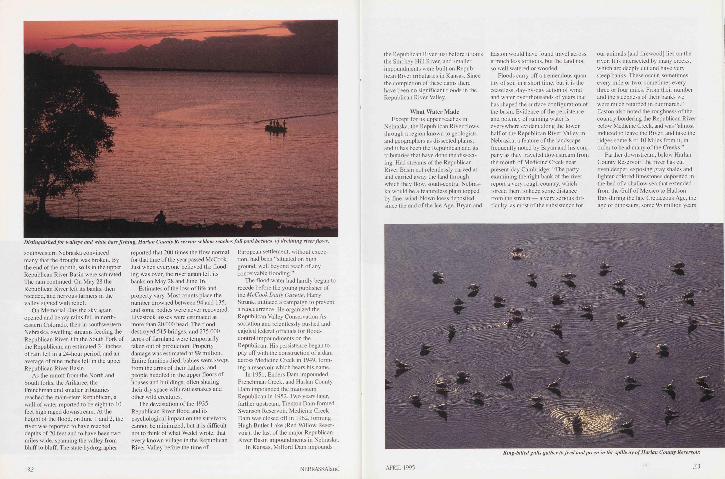
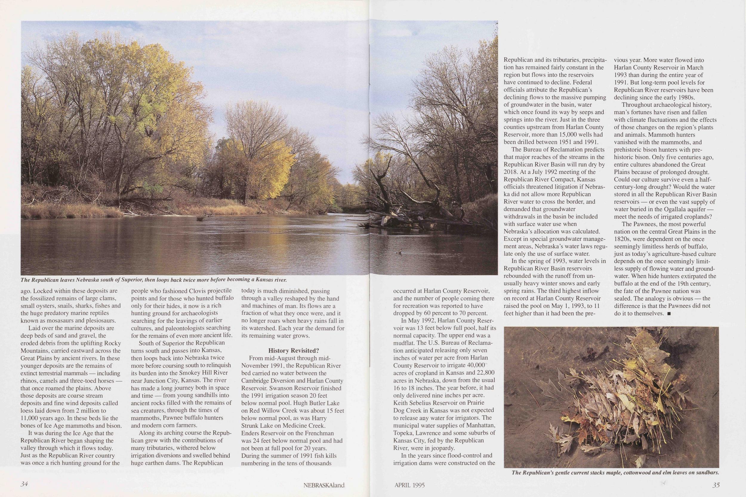
In 1951, Enders Dam impounded Frenchman Creek, and Harlan County Dam impounded the main-stem Republican in 1952. Two years later, farther upstream, Trenton Dam formed Swanson Reservoir. Medicine Creek Dam was closed off in 1962, forming Hugh Butler Lake (Red Willow Reservoir), the last of the major Republican River Basin impoundments in Nebraska.
In Kansas, Milford Dam impounds 32 NEBRASKAland the Republican River just before it joins the Smokey Hill River, and smaller impoundments were built on Republican River tributaries in Kansas. Since the completion of these dams there have been no significant floods in the Republican River Valley.
What Water MadeExcept for its upper reaches in Nebraska, the Republican River flows through a region known to geologists and geographers as dissected plains, and it has been the Republican and its tributaries that have done the dissecting. Had streams of the Republican River Basin not relentlessly carved at and carried away the land through which they flow, south-central Nebraska would be a featureless plain topped by fine, wind-blown loess deposited since the end of the Ice Age. Bryan and Easton would have found travel across it much less tortuous, but the land not so well watered or wooded.
Floods cany off a tremendous quantity of soil in a short time, but it is the ceaseless, day-by-day action of wind and water over thousands of years that has shaped the surface configuration of the basin. Evidence of the persistence and potency of running water is everywhere evident along the lower half of the Republican River Valley in Nebraska, a feature of the landscape frequently noted by Bryan and his company as they traveled downstream from the mouth of Medicine Creek near present-day Cambridge: "The party examining the right bank of the river report a very rough country, which forced them to keep some distance from the stream — a very serious difficulty, as most of the subsistence for our animals [and firewood] lies on the river. It is intersected by many creeks, which are deeply cut and have very steep banks. These occur, sometimes every mile or two; sometimes every three or four miles. From their number and the steepness of their banks we were much retarded in our march." Easton also noted the roughness of the country bordering the Republican River below Medicine Creek, and was "almost induced to leave the River, and take the ridges some 8 or 10 Miles from it, in order to head many of the Creeks."
Farther downstream, below Harlan County Reservoir, the river has cut even deeper, exposing gray shales and lighter-colored limestones deposited in the bed of a shallow sea that extended from the Gulf of Mexico to Hudson Bay during the late Cretaceous Age, the age of dinosaurs, some 95 million years
Laid over the marine deposits are deep beds of sand and gravel, the eroded debris from the uplifting Rocky Mountains, carried eastward across the Great Plains by ancient rivers. In these younger deposits are the remains of extinct terrestrial mammals — including rhinos, camels and three-toed horses that once roamed the plains. Above those deposits are coarse stream deposits and fine wind deposits called loess laid down from 2 million to 11,000 years ago. In these beds lie the bones of Ice Age mammoths and bison.
It was during the Ice Age that the Republican River began shaping the valley through which it flows today. Just as the Republican River country was once a rich hunting ground for the people who fashioned Clovis projectile points and for those who hunted buffalo only for their hides, it now is a rich hunting ground for archaeologists searching for the leavings of earlier cultures, and paleontologists searching for the remains of even more ancient life.
South of Superior the Republican turns south and passes into Kansas, then loops back into Nebraska twice more before coursing south to relinquish its burden into the Smokey Hill River near Junction City, Kansas. The river has made a long journey both in space and time — from young sandhills into ancient rocks filled with the remains of sea creatures, through the times of mammoths, Pawnee buffalo hunters and modern corn farmers.
Along its arching course the Republican grew with the contributions of many tributaries, withered below irrigation diversions and swelled behind huge earthen dams. The Republican today is much diminished, passing through a valley reshaped by the hand and machines of man. Its flows are a fraction of what they once were, and it no longer roars when heavy rains fall in its watershed. Each year the demand for its remaining water grows.
History Revisited?From mid-August through mid-November 1991, the Republican River bed carried no water between the Cambridge Diversion and Harlan County Reservoir. Swanson Reservoir finished the 1991 irrigation season 20 feet below normal pool. Hugh Butler Lake on Red Willow Creek was about 15 feet below normal pool, as was Harry Strunk Lake on Medicine Creek. Enders Reservoir on the Frenchman was 24 feet below normal pool and had not been at full pool for 20 years. During the summer of 1991 fish kills numbering in the tens of thousands 34 NEBRASKAland occurred at Harlan County Reservoir, and the number of people coming there for recreation was reported to have dropped by 60 percent to 70 percent.
In May 1992, Harlan County Reservoir was 13 feet below full pool, half its normal capacity. The upper end was a mudflat. The U.S. Bureau of Reclamation anticipated releasing only seven inches of water per acre from Harlan County Reservoir to irrigate 40,000 acres of cropland in Kansas and 22,800 acres in Nebraska, down from the usual 16 to 18 inches. The year before, it had only delivered nine inches per acre. Keith Sebelius Reservoir on Prairie Dog Creek in Kansas was not expected to release any water for irrigators. The municipal water supplies of Manhattan, Topeka, Lawrence and some suburbs of Kansas City, fed by the Republican River, were in jeopardy.
In the years since flood-control and irrigation dams were constructed on the Republican and its tributaries, precipitation has remained fairly constant in the region but flows into the reservoirs have continued to decline. Federal officials attribute the Republican's declining flows to the massive pumping of groundwater in the basin, water which once found its way by seeps and springs into the river. Just in the three counties upstream from Harlan County Reservoir, more than 15,000 wells had been drilled between 1951 and 1991.
The Bureau of Reclamation predicts that major reaches of the streams in the Republican River Basin will run dry by 2018. At a July 1992 meeting of the Republican River Compact, Kansas officials threatened litigation if Nebraska did not allow more Republican River water to cross the border, and demanded that groundwater withdrawals in the basin be included with surface water use when Nebraska's allocation was calculated. Except in special groundwater management areas, Nebraska's water laws regulate only the use of surface water.
In the spring of 1993, water levels in Republican River Basin reservoirs rebounded with the runoff from unusually heavy winter snows and early spring rains. The third highest inflow on record at Harlan County Reservoir raised the pool on May 1, 1993, to 11 feet higher than it had been the previous year. More water flowed into Harlan County Reservoir in March 1993 than during the entire year of 1991. But long-term pool levels for Republican River reservoirs have been declining since the early 1980s.
Throughout archaeological history, man's fortunes have risen and fallen with climate fluctuations and the effects of those changes on the region's plants and animals. Mammoth hunters vanished with the mammoths, and prehistoric bison hunters with prehistoric bison. Only five centuries ago, entire cultures abandoned the Great Plains because of prolonged drought. Could our culture survive even a halfcentury-long drought? Would the water stored in all the Republican River Basin reservoirs — or even the vast supply of water buried in the Ogallala aquifer meet the needs of irrigated croplands?
The Pawnees, the most powerful nation on the central Great Plains in the 1820s, were dependent on the once seemingly limitless herds of buffalo, just as today's agriculture-based culture depends on the once seemingly limitless supply of flowing water and groundwater. When hide hunters extirpated the buffalo at the end of the 19th century, the fate of the Pawnee nation was sealed. The analogy is obvious the difference is that the Pawnees did not do it to themselves.
Life In Dead Trees
Photo and Text by Mike ForsbergI have become enamored with dead trees. It is a strange affection that some might say results from being out in the woods too long. If that is true, so be it. There are certainly worse afflictions.
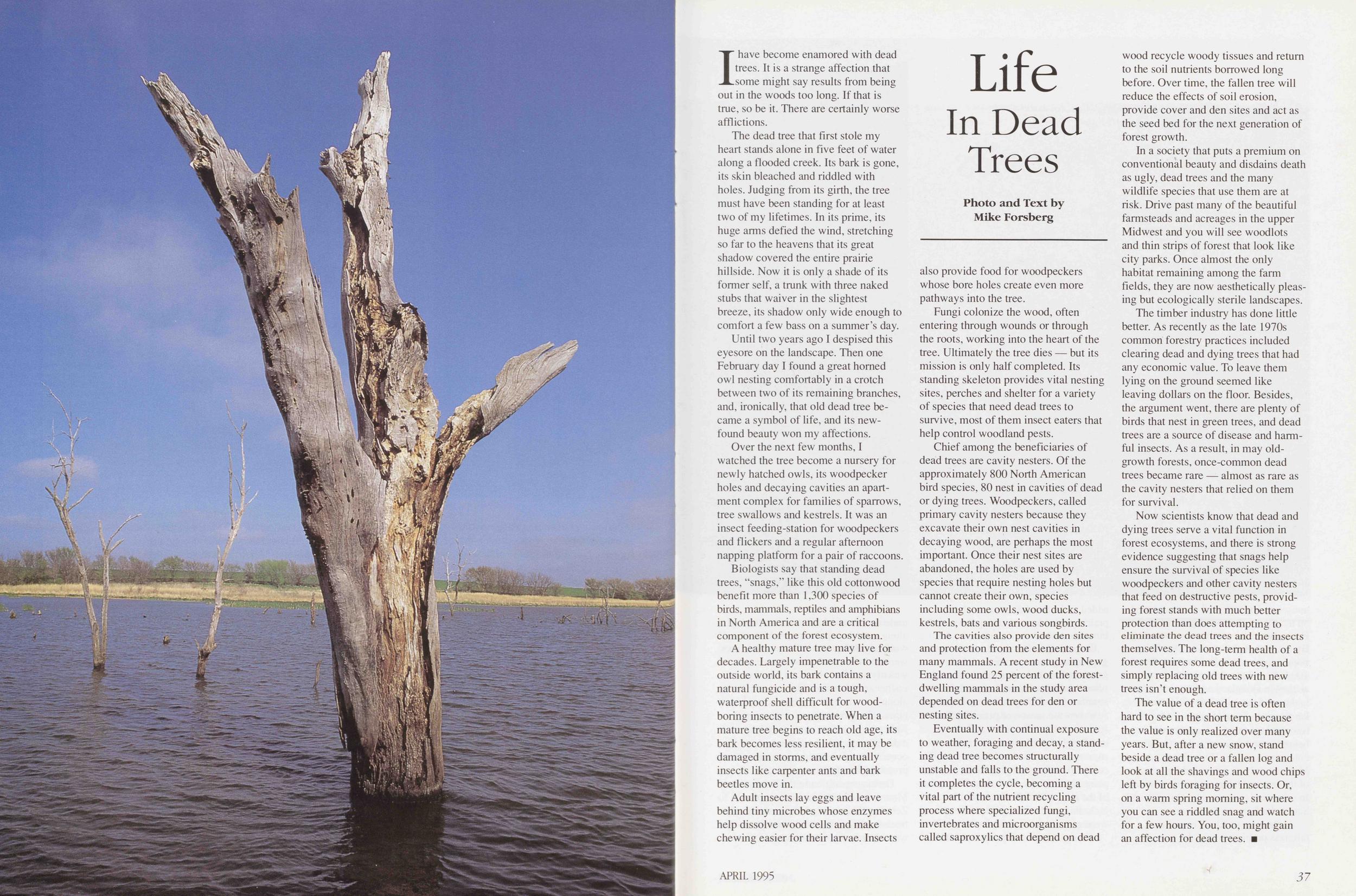
The dead tree that first stole my heart stands alone in five feet of water along a flooded creek. Its bark is gone, its skin bleached and riddled with holes. Judging from its girth, the tree must have been standing for at least two of my lifetimes. In its prime, its huge arms defied the wind, stretching so far to the heavens that its great shadow covered the entire prairie hillside. Now it is only a shade of its former self, a trunk with three naked stubs that waiver in the slightest breeze, its shadow only wide enough to comfort a few bass on a summer's day.
Until two years ago I despised this eyesore on the landscape. Then one February day I found a great horned owl nesting comfortably in a crotch between two of its remaining branches, and, ironically, that old dead tree became a symbol of life, and its newfound beauty won my affections.
Over the next few months, I watched the tree become a nursery for newly hatched owls, its woodpecker holes and decaying cavities an apartment complex for families of sparrows, tree swallows and kestrels. It was an insect feeding-station for woodpeckers and flickers and a regular afternoon napping platform for a pair of raccoons.
Biologists say that standing dead trees, "snags," like this old cottonwood benefit more than 1,300 species of birds, mammals, reptiles and amphibians in North America and are a critical component of the forest ecosystem.
A healthy mature tree may live for decades. Largely impenetrable to the outside world, its bark contains a natural fungicide and is a tough, waterproof shell difficult for woodboring insects to penetrate. When a mature tree begins to reach old age, its bark becomes less resilient, it may be damaged in storms, and eventually insects like carpenter ants and bark beetles move in.
Adult insects lay eggs and leave behind tiny microbes whose enzymes help dissolve wood cells and make chewing easier for their larvae. Insects also provide food for woodpeckers whose bore holes create even more pathways into the tree.
Fungi colonize the wood, often entering through wounds or through the roots, working into the heart of the tree. Ultimately the tree dies — but its mission is only half completed. Its standing skeleton provides vital nesting sites, perches and shelter for a variety of species that need dead trees to survive, most of them insect eaters that help control woodland pests.
Chief among the beneficiaries of dead trees are cavity nesters. Of the approximately 800 North American bird species, 80 nest in cavities of dead or dying trees. Woodpeckers, called primary cavity nesters because they excavate their own nest cavities in decaying wood, are perhaps the most important. Once their nest sites are abandoned, the holes are used by species that require nesting holes but cannot create their own, species including some owls, wood ducks, kestrels, bats and various songbirds.
The cavities also provide den sites and protection from the elements for many mammals. A recent study in New England found 25 percent of the forestdwelling mammals in the study area depended on dead trees for den or nesting sites.
Eventually with continual exposure to weather, foraging and decay, a standing dead tree becomes structurally unstable and falls to the ground. There it completes the cycle, becoming a vital part of the nutrient recycling process where specialized fungi, invertebrates and microorganisms called saproxylics that depend on dead wood recycle woody tissues and return to the soil nutrients borrowed long before. Over time, the fallen tree will reduce the effects of soil erosion, provide cover and den sites and act as the seed bed for the next generation of forest growth.
In a society that puts a premium on conventional beauty and disdains death as ugly, dead trees and the many wildlife species that use them are at risk. Drive past many of the beautiful farmsteads and acreages in the upper Midwest and you will see woodlots and thin strips of forest that look like city parks. Once almost the only habitat remaining among the farm fields, they are now aesthetically pleasing but ecologically sterile landscapes.
The timber industry has done little better. As recently as the late 1970s common forestry practices included clearing dead and dying trees that had any economic value. To leave them lying on the ground seemed like leaving dollars on the floor. Besides, the argument went, there are plenty of birds that nest in green trees, and dead trees are a source of disease and harmful insects. As a result, in may oldgrowth forests, once-common dead trees became rare — almost as rare as the cavity nesters that relied on them for survival.
Now scientists know that dead and dying trees serve a vital function in forest ecosystems, and there is strong evidence suggesting that snags help ensure the survival of species like woodpeckers and other cavity nesters that feed on destructive pests, providing forest stands with much better protection than does attempting to eliminate the dead trees and the insects themselves. The long-term health of a forest requires some dead trees, and simply replacing old trees with new trees isn't enough.
The value of a dead tree is often hard to see in the short term because the value is only realized over many years. But, after a new snow, stand beside a dead tree or a fallen log and look at all the shavings and wood chips left by birds foraging for insects. Or, on a warm spring morning, sit where you can see a riddled snag and watch for a few hours. You, too, might gain an affection for dead trees.
APRIL 1995 37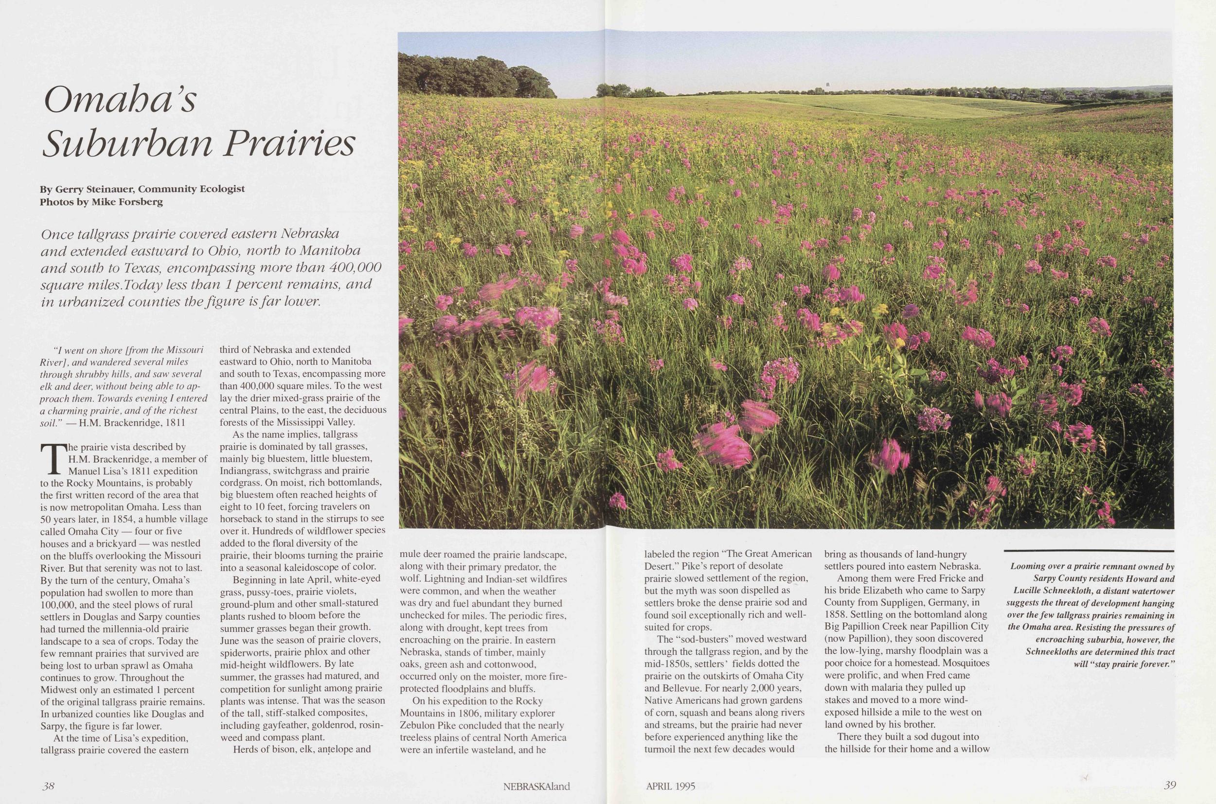
Omaha's Suburban Prairies
By Gerry Steinauer, Community Ecologist Photos by Mike Forsberg Once tallgrass prairie covered eastern Nebraska and extended eastward to Ohio, north to Manitoba and south to Texas, encompassing more than 400,000 square miles. Today less than 1 percent remains, and in urbanized counties the figure is far lower."I went on shore [from the Missouri River], and wandered several miles through shrubby hills, and saw several elk and deer, without being able to approach them. Towards evening I entered a charming prairie, and of the richest soil."
—H.M. Brackenridge, 1811The prairie vista described by H.M. Brackenridge, a member of Manuel Lisa's 1811 expedition to the Rocky Mountains, is probably the first written record of the area that is now metropolitan Omaha. Less than 50 years later, in 1854, a humble village called Omaha City — four or five houses and a brickyard — was nestled on the bluffs overlooking the Missouri River. But that serenity was not to last. By the turn of the century, Omaha's population had swollen to more than 100,000, and the steel plows of rural settlers in Douglas and Sarpy counties had turned the millennia-old prairie landscape to a sea of crops. Today the few remnant prairies that survived are being lost to urban sprawl as Omaha continues to grow. Throughout the Midwest only an estimated 1 percent of the original tallgrass prairie remains. In urbanized counties like Douglas and Sarpy, the figure is far lower.
At the time of Lisa's expedition, tallgrass prairie covered the eastern third of Nebraska and extended eastward to Ohio, north to Manitoba and south to Texas, encompassing more than 400,000 square miles. To the west lay the drier mixed-grass prairie of the central Plains, to the east, the deciduous forests of the Mississippi Valley.
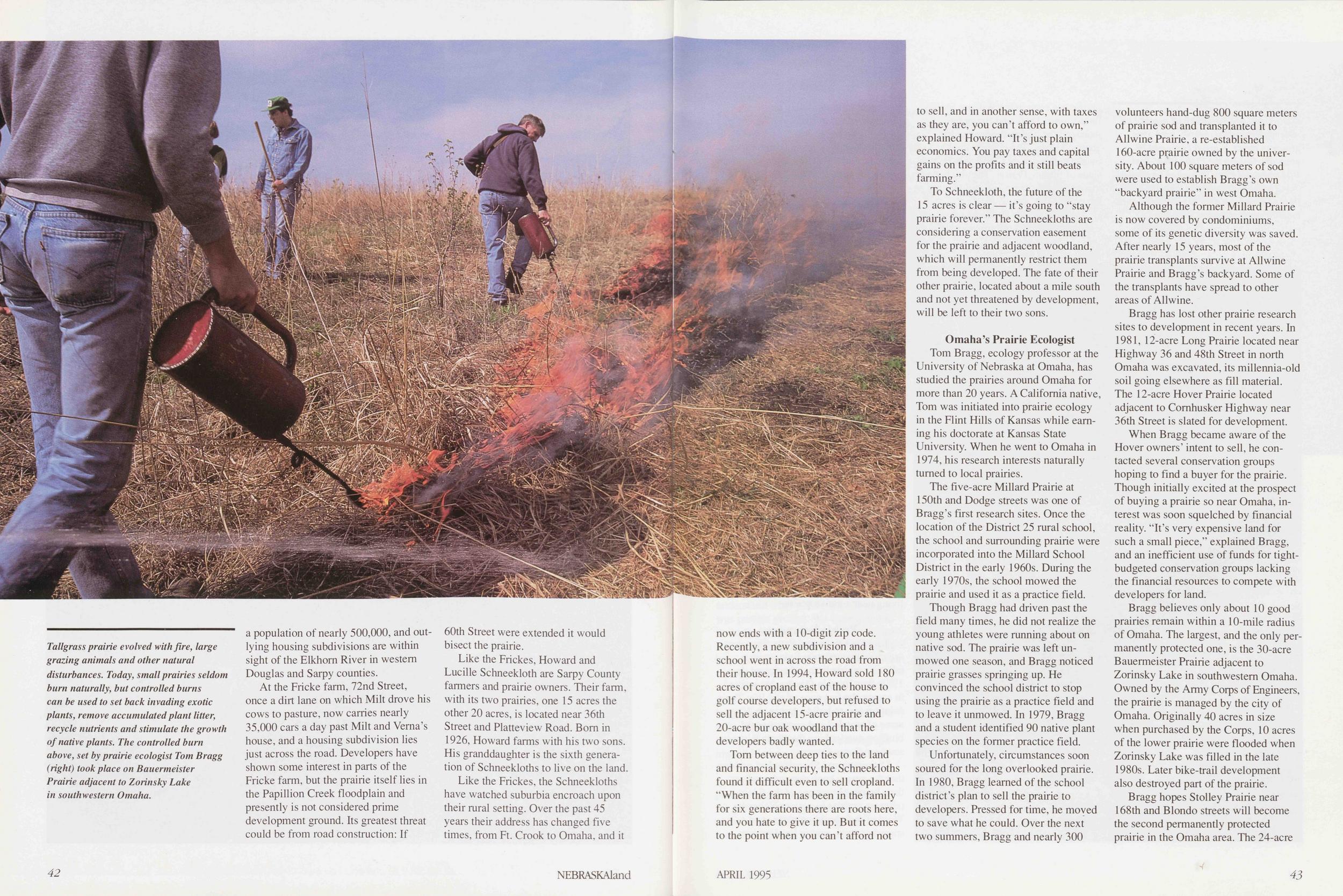
As the name implies, tallgrass prairie is dominated by tall grasses, mainly big bluestem, little bluestem, Indiangrass, switchgrass and prairie cordgrass. On moist, rich bottomlands, big bluestem often reached heights of eight to 10 feet, forcing travelers on horseback to stand in the stirrups to see over it. Hundreds of wildflower species added to the floral diversity of the prairie, their blooms turning the prairie into a seasonal kaleidoscope of color.
Beginning in late April, white-eyed grass, pussy-toes, prairie violets, ground-plum and other small-statured plants rushed to bloom before the summer grasses began their growth. June was the season of prairie clovers, spiderworts, prairie phlox and other mid-height wildtlowers. By late summer, the grasses had matured, and competition for sunlight among prairie plants was intense. That was the season of the tall, stiff-stalked composites, including gayfeather, goldenrod, rosinweed and compass plant.
Herds of bison, elk, antelope and mule deer roamed the prairie landscape, along with their primary predator, the wolf. Lightning and Indian-set wildfires were common, and when the weather was dry and fuel abundant they burned unchecked for miles. The periodic fires, along with drought, kept trees from encroaching on the prairie. In eastern Nebraska, stands of timber, mainly oaks, green ash and cottonwood, occurred only on the moister, more fire-protected floodplains and bluffs.
On his expedition to the Rocky Mountains in 1806, military explorer Zebulon Pike concluded that the nearly treeless plains of central North America were an infertile wasteland, and he 38 NEBRASKAland labeled the region 'The Great American Desert." Pike's report of desolate prairie slowed settlement of the region, but the myth was soon dispelled as settlers broke the dense prairie sod and found soil exceptionally rich and wellsuited for crops.
The "sod-busters" moved westward through the tallgrass region, and by the mid-1850s, settlers' fields dotted the prairie on the outskirts of Omaha City and Bellevue. For nearly 2,000 years, Native Americans had grown gardens of corn, squash and beans along rivers and streams, but the prairie had never before experienced anything like the turmoil the next few decades would bring as thousands of land-hungry settlers poured into eastern Nebraska.
Among them were Fred Fricke and his bride Elizabeth who came to Sarpy County from Suppligen, Germany, in 1858. Settling on the bottomland along Big Papillion Creek near Papillion City (now Papillion), they soon discovered the low-lying, marshy floodplain was a poor choice for a homestead. Mosquitoes were prolific, and when Fred came down with malaria they pulled up stakes and moved to a more windexposed hillside a mile to the west on land owned by his brother.
There they built a sod dugout into the hillside for their home and a willow
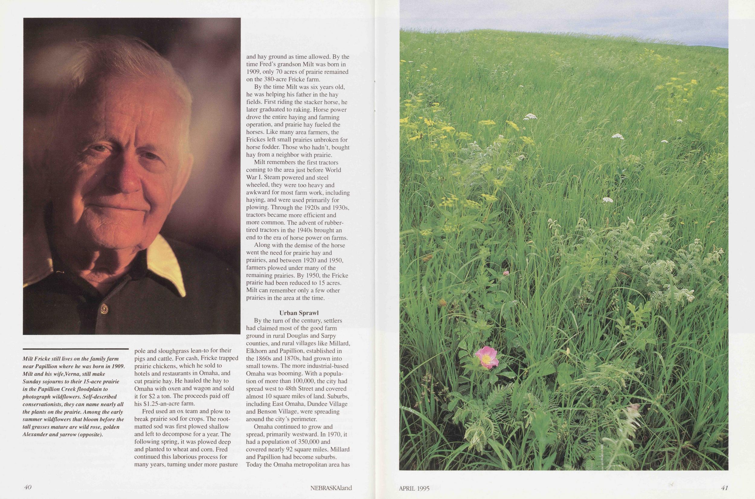
Fred used an ox team and plow to break prairie sod for crops. The rootmatted sod was first plowed shallow and left to decompose for a year. The following spring, it was plowed deep and planted to wheat and corn. Fred continued this laborious process for many years, turning under more pasture and hay ground as time allowed. By the time Fred's grandson Milt was born in 1909, only 70 acres of prairie remained on the 380-acre Fricke farm.
By the time Milt was six years old, he was helping his father in the hay fields. First riding the stacker horse, he later graduated to raking. Horse power drove the entire haying and farming operation, and prairie hay fueled the horses. Like many area farmers, the Frickes left small prairies unbroken for horse fodder. Those who hadn't, bought hay from a neighbor with prairie.
Milt remembers the first tractors coming to the area just before World War I. Steam powered and steel wheeled, they were too heavy and awkward for most farm work, including haying, and were used primarily for plowing. Through the 1920s and 1930s, tractors became more efficient and more common. The advent of rubbertired tractors in the 1940s brought an end to the era of horse power on farms.
Along with the demise of the horse went the need for prairie hay and prairies, and between 1920 and 1950, farmers plowed under many of the remaining prairies. By 1950, the Fricke prairie had been reduced to 15 acres. Milt can remember only a few other prairies in the area at the time.
Urban SprawlBy the turn of the century, settlers had claimed most of the good farm ground in rural Douglas and Sarpy counties, and rural villages like Millard, Elkhorn and Papillion, established in the 1860s and 1870s, had grown into small towns. The more industrial-based Omaha was booming. With a population of more than 100,000, the city had spread west to 48th Street and covered almost 10 square miles of land. Suburbs, including East Omaha, Dundee Village and Benson Village, were spreading around the city's perimeter.
Omaha continued to grow and spread, primarily westward. In 1970, it had a population of 350,000 and covered nearly 92 square miles. Millard and Papillion had become suburbs. Today the Omaha metropolitan area has 40 NEBRASKAland
At the Fricke farm, 72nd Street, once a dirt lane on which Milt drove his cows to pasture, now carries nearly 35,000 cars a day past Milt and Verna's house, and a housing subdivision lies just across the road. Developers have shown some interest in parts of the Fricke farm, but the prairie itself lies in the Papillion Creek floodplain and presently is not considered prime development ground. Its greatest threat could be from road construction: If 60th Street were extended it would bisect the prairie.
Like the Fricke s, Howard and Lucille Schneekloth are Sarpy County farmers and prairie owners. Their farm, with its two prairies, one 15 acres the other 20 acres, is located near 36th Street and Platteview Road. Born in 1926, Howard farms with his two sons. His granddaughter is the sixth generation of Schneekloths to live on the land.
Like the Frickes, the Schneekloths have watched suburbia encroach upon their rural setting. Over the past 45 years their address has changed five times, from Ft. Crook to Omaha, and it 42 NEBRASKAland now ends with a 10-digit zip code. Recently, a new subdivision and a school went in across the road from their house. In 1994, Howard sold 180 acres of cropland east of the house to golf course developers, but refused to sell the adjacent 15-acre prairie and 20-acre bur oak woodland that the developers badly wanted.
Torn between deep ties to the land and financial security, the Schneekloths found it difficult even to sell cropland. "When the farm has been in the family for six generations there are roots here, and you hate to give it up. But it comes to the point when you can't afford not to sell, and in another sense, with taxes as they are, you can't afford to own," explained Howard. "It's just plain economics. You pay taxes and capital gains on the profits and it still beats farming."
To Schneekloth, the future of the 15 acres is clear — it's going to "stay prairie forever." The Schneekloths are considering a conservation easement for the prairie and adjacent woodland, which will permanently restrict them from being developed. The fate of their other prairie, located about a mile south and not yet threatened by development, will be left to their two sons.
Omaha's Prairie EcologistTom Bragg, ecology professor at the University of Nebraska at Omaha, has studied the prairies around Omaha for more than 20 years. A California native, Tom was initiated into prairie ecology in the Flint Hills of Kansas while earning his doctorate at Kansas State University. When he went to Omaha in 1974, his research interests naturally turned to local prairies.
The five-acre Millard Prairie at 150th and Dodge streets was one of Bragg's first research sites. Once the location of the District 25 rural school, the school and surrounding prairie were incorporated into the Millard School District in the early 1960s. During the early 1970s, the school mowed the prairie and used it as a practice field.
Though Bragg had driven past the field many times, he did not realize the young athletes were running about on native sod. The prairie was left unmowed one season, and Bragg noticed prairie grasses springing up. He convinced the school district to stop using the prairie as a practice field and to leave it unmowed. In 1979, Bragg and a student identified 90 native plant species on the former practice field.
Unfortunately, circumstances soon soured for the long overlooked prairie. In 1980, Bragg learned of the school district's plan to sell the prairie to developers. Pressed for time, he moved to save what he could. Over the next two summers, Bragg and nearly 300 volunteers hand-dug 800 square meters of prairie sod and transplanted it to Allwine Prairie, a re-established 160-acre prairie owned by the university. About 100 square meters of sod were used to establish Bragg's own "backyard prairie" in west Omaha.
Although the former Millard Prairie is now covered by condominiums, some of its genetic diversity was saved. After nearly 15 years, most of the prairie transplants survive at Allwine Prairie and Bragg's backyard. Some of the transplants have spread to other areas of Allwine.
Bragg has lost other prairie research sites to development in recent years. In 1981, 12-acre Long Prairie located near Highway 36 and 48th Street in north Omaha was excavated, its millennia-old soil going elsewhere as fill material. The 12-acre Hover Prairie located adjacent to Cornhusker Highway near 36th Street is slated for development.
When Bragg became aware of the Hover owners' intent to sell, he contacted several conservation groups hoping to find a buyer for the prairie. Though initially excited at the prospect of buying a prairie so near Omaha, interest was soon squelched by financial reality. "It's very expensive land for such a small piece," explained Bragg, and an inefficient use of funds for tight-budgeted conservation groups lacking the financial resources to compete with developers for land.
Bragg believes only about 10 good prairies remain within a 10-mile radius of Omaha. The largest, and the only permanently protected one, is the 30-acre Bauermeister Prairie adjacent to Zorinsky Lake in southwestern Omaha. Owned by the Army Corps of Engineers, the prairie is managed by the city of Omaha. Originally 40 acres in size when purchased by the Corps, 10 acres of the lower prairie were flooded when Zorinsky Lake was filled in the late 1980s. Later bike-trail development also destroyed part of the prairie.
Bragg hopes Stolley Prairie near
168th and Blondo streets will become
the second permanently protected
prairie in the Omaha area. The 24-acre
APRIL 1995
43
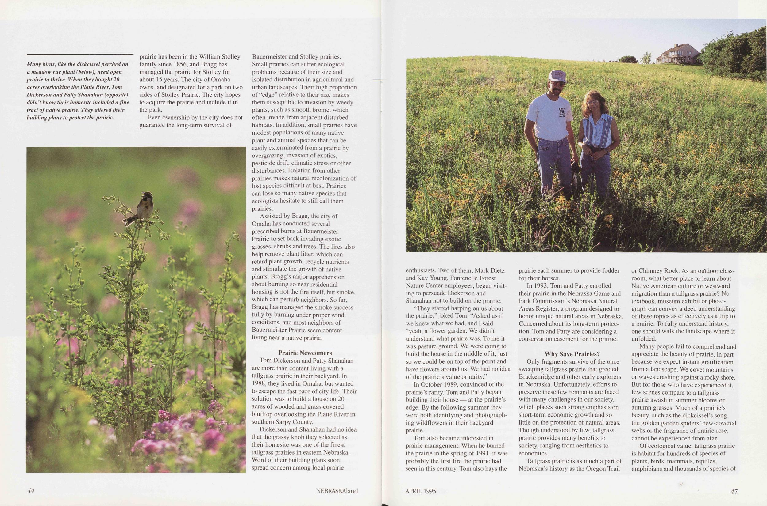
Even ownership by the city does not guarantee the long-term survival of Bauermeister and Stolley prairies. Small prairies can suffer ecological problems because of their size and isolated distribution in agricultural and urban landscapes. Their high proportion of "edge" relative to their size makes them susceptible to invasion by weedy plants, such as smooth brome, which often invade from adjacent disturbed habitats. In addition, small prairies have modest populations of many native plant and animal species that can be easily exterminated from a prairie by overgrazing, invasion of exotics, pesticide drift, climatic stress or other disturbances. Isolation from other prairies makes natural recolonization of lost species difficult at best. Prairies can lose so many native species that ecologists hesitate to still call them prairies.
Assisted by Bragg, the city of Omaha has conducted several prescribed burns at Bauermeister Prairie to set back invading exotic grasses, shrubs and trees. The fires also help remove plant litter, which can retard plant growth, recycle nutrients and stimulate the growth of native plants. Bragg's major apprehension about burning so near residential housing is not the fire itself, but smoke, which can perturb neighbors. So far, Bragg has managed the smoke successfully by burning under proper wind conditions, and most neighbors of Bauermeister Prairie seem content living near a native prairie.
Prairie NewcomersTom Dickerson and Patty Shanahan are more than content living with a tallgrass prairie in their backyard. In 1988, they lived in Omaha, but wanted to escape the fast pace of city life. Their solution was to build a house on 20 acres of wooded and grass-covered blufftop overlooking the Platte River in southern Sarpy County.
Dickerson and Shanahan had no idea that the grassy knob they selected as their homesite was one of the finest tallgrass prairies in eastern Nebraska. Word of their building plans soon spread concern among local prairie
"They started harping on us about the prairie," joked Tom. "Asked us if we knew what we had, and I said "yeah, a flower garden. We didn't understand what prairie was. To me it was pasture ground. We were going to build the house in the middle of it, just so we could be on top of the point and have flowers around us. We had no idea of the prairie's value or rarity."
In October 1989, convinced of the prairie's rarity, Tom and Patty began building their house — at the prairie's edge. By the following summer they were both identifying and photographing wildflowers in their backyard prairie.
Tom also became interested in prairie management. When he burned the prairie in the spring of 1991, it was probably the first fire the prairie had seen in this century. Tom also hays the prairie each summer to provide fodder for their horses.
In 1993, Tom and Patty enrolled their prairie in the Nebraska Game and Park Commission's Nebraska Natural Areas Register, a program designed to honor unique natural areas in Nebraska. Concerned about its long-term protection, Tom and Patty are considering a conservation easement for the prairie.
Why Save Prairies?Only fragments survive of the once sweeping tallgrass prairie that greeted Brackenridge and other early explorers in Nebraska. Unfortunately, efforts to preserve these few remnants are faced with many challenges in our society, which places such strong emphasis on short-term economic growth and so little on the protection of natural areas. Though understood by few, tallgrass prairie provides many benefits to society, ranging from aesthetics to economics.
Tallgrass prairie is as much a part of Nebraska's history as the Oregon Trail or Chimney Rock. As an outdoor classroom, what better place to learn about Native American culture or westward migration than a tallgrass prairie? No textbook, museum exhibit or photograph can convey a deep understanding of these topics as effectively as a trip to a prairie. To fully understand history, one should walk the landscape where it unfolded.
Many people fail to comprehend and appreciate the beauty of prairie, in part because we expect instant gratification from a landscape. We covet mountains or waves crashing against a rocky shore. But for those who have experienced it, few scenes compare to a tallgrass prairie awash in summer blooms or autumn grasses. Much of a prairie's beauty, such as the dickcissel's song, the golden garden spiders' dew-covered webs or the fragrance of prairie rose, cannot be experienced from afar.
Of ecological value, tallgrass prairie
is habitat for hundreds of species of
plants, birds, mammals, reptiles,
amphibians and thousands of species of
APRIL 1995
45
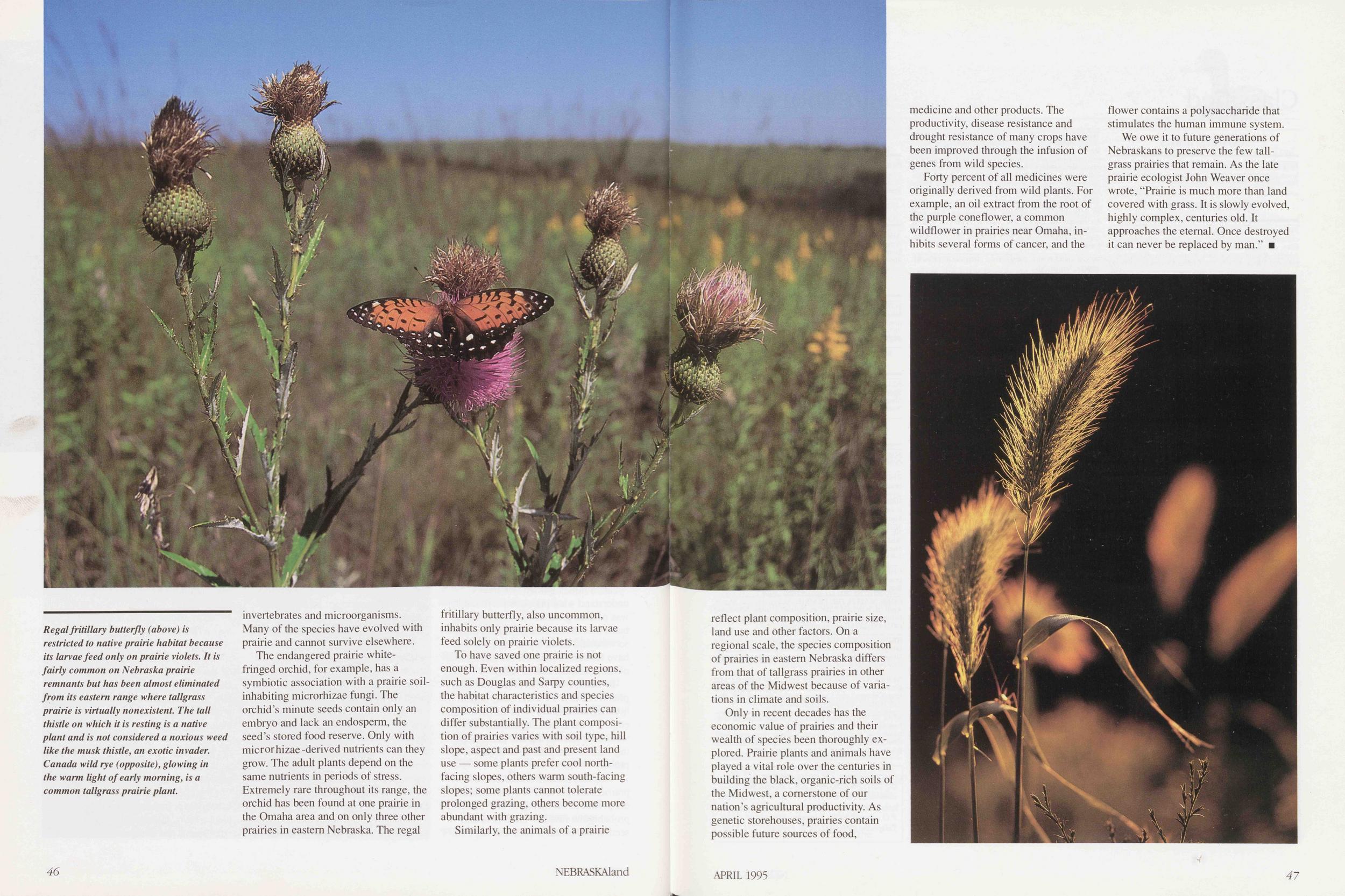
The endangered prairie whitefringed orchid, for example, has a symbiotic association with a prairie soilinhabiting microrhizae fungi. The orchid's minute seeds contain only an embryo and lack an endosperm, the seed's stored food reserve. Only with microrhizae-derived nutrients can they grow. The adult plants depend on the same nutrients in periods of stress. Extremely rare throughout its range, the orchid has been found at one prairie in the Omaha area and on only three other prairies in eastern Nebraska. The regal fritillary butterfly, also uncommon, inhabits only prairie because its larvae feed solely on prairie violets.
To have saved one prairie is not enough. Even within localized regions, such as Douglas and Sarpy counties, the habitat characteristics and species composition of individual prairies can differ substantially. The plant composition of prairies varies with soil type, hill slope, aspect and past and present land use — some plants prefer cool northfacing slopes, others warm south-facing slopes; some plants cannot tolerate prolonged grazing, others become more abundant with grazing.
Similarly, the animals of a prairie 46 NEBRASKAland reflect plant composition, prairie size, land use and other factors. On a regional scale, the species composition of prairies in eastern Nebraska differs from that of tallgrass prairies in other areas of the Midwest because of variations in climate and soils.
Only in recent decades has the economic value of prairies and their wealth of species been thoroughly explored. Prairie plants and animals have played a vital role over the centuries in building the black, organic-rich soils of the Midwest, a cornerstone of our nation's agricultural productivity. As genetic storehouses, prairies contain possible future sources of food, medicine and other products. The productivity, disease resistance and drought resistance of many crops have been improved through the infusion of genes from wild species.
Forty percent of all medicines were originally derived from wild plants. For example, an oil extract from the root of the purple coneflower, a common wildflower in prairies near Omaha, inhibits several forms of cancer, and the flower contains a polysaccharide that stimulates the human immune system.
We owe it to future generations of Nebraskans to preserve the few tailgrass prairies that remain. As the late prairie ecologist John Weaver once wrote, "Prairie is much more than land covered with grass. It is slowly evolved, highly complex, centuries old. It approaches the eternal. Once destroyed it can never be replaced by man."
Classified
ANIMALS/BIRDSLLAMAS - Affectionate, gentle animal for any animal lover. Easy keepers. Contact Oak Ridge Llamas, Box 665, Fullerton, NE 68638. (308) 536-3203.
BOOKS/PRINTINGFREE BOOK CATALOG. Novels, westerns, romances, children's; old out of print, found bams, attic. Authors: Grey, Bower, Connor, Fox, Curwood, Raine, Wright, Aldrige, Pollyanna, Freckles, many others. Postage appreciated. Pierce, 4400 N. Pine Cluster, Oroville, CA95965.
HOW TO FIND MORE OUTDOOR OPPORTUNITIES!! The Nebraska Sportsman's Atlas. Locations of all public lands and waters on county transportation maps. These maps show ALL the roads in Nebraska. Listings include federal, Nebraska Game & Parks, NRD holdings, hotels and motels and Nebraska's endless attractions. At only $18.75/copy a true time and frustration saver. To order write: Sportsman's Atlas Co., PO Box 132, Lytton, IA 50561 or call 1-800-568-8334.
ACREAGE ADVISOR—Nebraska's how-to magazine for creating your ideal acreage will entertain and inspire you. 15400 N. 56th, Lincoln, NE 68514. Free sample issue (send 75# postage). One year—$9.95.
ALPHA * OMEGA PUBLISHERS OF LINCOLN: Con- sultants in support of self-publishing. Experienced advice and support to writers who wish to publish their own works. For brochure write to 811 Mulder Dr., Lincoln, NE 68510.
DOGSENGLISH COCKER pups, imported stock, British FTC bloodlines. Many colors available. Featured in NEBR ASK Aland November 1991. Sawtooth Oaks, Box 443, Orleans, NE 68966. Phone (308) 473-5265.
YELLOW-BLACK Lab pups. FC-AFC sired. AKC. Hips OFA certified. Dew claws removed. Excellent hunting potential. Contact Bob Bendler, Lexington, NE (308) 324-4247.
TRAINING ALL BREEDS bird dogs — Vizslas and English Pointers for sale. Rozanek Kennels, RR 2, Schuyler, NE 68661. Phone (402) 352-8769.
RETRIEVER TRAINING. Area's top "retrievers only" trainer. Field trial and hunting dogs. Non-slip duck dogs! TKO RETRIEVER TRAINING KENNEL (402) 623-4311.
CHESAPEAKE BAY, LABRADOR and GOLDEN RETRIEVER pups, started dogs and stud service. 16 time national champion pedigre. Platte Valley Retrievers (308) 995-2318.
ENGLISH SETTER AND LABRADORS from outstanding lines. Bred for hunters who appreciate fine bird dogs! Wind Fall Gun Dogs, (402) 421-4693.
WILDERNESS KENNELS. Gun dog training - over 60 years combined experience. Training all sporting breeds Retrievers. Flushing and pointing dogs. All dogs worked on pen raised birds and wild game. Training program includes obedience training — heel, sit, stay, down and come when called. Pups, started dogs and fully trained dogs for sale. HUNTING DOGS TRAINED BY HUNTERS. Henry Sader, Wilderness Kennels, Roca, NE (402) 423-4212. Since 1968.
FLATWATER LABRADORS AKC chocolate Labs bred for exceptional temperament, conformation and hunting ability. Litter due approximately April 23. See both sire and dam. Excellent references. R.D. McBride, (402) 791-5704. Firth, NE.
40'x20'x6' KENNEL, 2 dog houses. (402) 993-7719. A. M. Jarecke, Genoa, NE.
AKC ENGLISH SPRINGER spaniel pups. AFC-NFC champion bloodline. Phone (402) 924-3423.
FISH/FISHINGFISH FOR SALE. Catfish, largemouth bass, smallmouth bass, perch, crappie, bluegill, walleye, northern pike, rainbow trout, Donaldson rainbow trout, grass carp, minnows, bullheads. Consulting available. Pleasant Valley Fish Farm. RR 1, Box 147, McCook, NE 69001. Phone (308) 345- 6599.
WILLOW LAKE FISH HATCHERY. Channel cat, bluegill, hybrid, bluegill, largemouth bass, crappie, triploid grass carp, walleye, perch, minnows available for stocking. Gaylord Crawford, Rt. 3 Box 46, Hastings, NE 68901 or phone (402) 463-8022 day or night. Also pond consultant. We del, grower price.
FOODNEBRASKA BASKETS: The original Nebraska company specializing in fine foods from Nebraska. A beautiful array of baskets filled with ethnic, healthful and long-time favorite foods. Call or write for our brochure: P.O. Box 98, McCook, NE 69001. 1-800-345-7725.
BEER & WINEMAKING SUPPLIES — Fermenter's Supply & Equipment, 4472 S. 84th St., Omaha, NE 68127. (402) 593-9171. Mail order or visit our store.
GUIDES/OUTFUTERSMAD RIVER CANOES offers the finest quality and performance. For the finest canoes and accessories look to Great Plains Canoe Co., 205 Main, Springfield, NE Phone (402)253-2001.
DISMAL RIVER/MIDDLE LOUP RIVER canoe/kayak trips. Powderhorn Outfitters - Thedford, NE 69166 - 1-800-Dismal6.
Don't Miss a Single Issue! Get NEBRASKAland for yourself or give it as a gift —just $14 a year! 1-Year $14 2-Years $27 Name Address. City State Zip Mail check or money order to NEBRASKAland Magazine P.O. Box 30370, Lincoln, Nebraska 68503 or call Toll Free 1-800-632-5263 To Place Credit Card Orders by Phone Call Toll Free 1-800-NEB-LAND (632-5263) GUNS/SHOOTING/ARCHERYGUNS — Browning, Winchester, Remington, others. Hi-powers, shotguns, new. used, antiques. Want Pre-'64 Winchesters. Buy-Sell-Trade. (402) 729-6112. Bedlan's Sporting Goods, Fairbury, NE 68352.
OUTDOOR EQUIPMENTAIR GUNS REPAIRED Benjamin, Crosman, Daisy, other American made. Restoration; old guns wanted. Jack's Air Guns, 1225 N. 46th, Lincoln, NE 68503. Phone (402) 466-9223.
REAL ESTATEFOR SALE: One of Nebraska's top fishing-recreational-hunting resorts with home, cabins, store and all equipment needed goes. Set on very large lake. Call Swett Realty. (402) 387-1626, Fred Swett, Broker, PO Box 265, Ainsworth, NE 69210.
TAXIDERMYALLISON'S TAXIDERMY STUDIO & GIFT GALLERY. Specializing in fish, birds and small game. Mounted 35 State Record Fish. Pheasant mounts for sale. 421 N. Dewey. North Platte,NE69101. (308)534-2324or(308)534-4267.
VACATION/RESORTSFOR FISHING and hunting accommodations. Jefco Inn, Gordon, NE 69343. South Cornell, (308) 282-2935.
BED & BREAKFAST. Historic 1890s hotel. Located in the beautiful Pine Ridge area of Northwest Nebraska. Short drive to Chadron State Park, Fort Robinson and the Black Hills. Beautiful dining room with fireplace and fountain. Room service available. The Olde Main Street Inn, 115 Main St., Chadron, NE 69337 (308) 432-3380.
NE NEBRASKA TROUT FISHING. Mon-Thurs or Fri- Sun. 3 modern cottages, 5 spring-fed lakes. Trout, bass and bluegill. Diamond E. Trout Resort, Box B, Orchard, NE 1-800-658-3244.
CHESLEY'S LODGE Hunting accommodations. Rooms year round. Great getaway in historic, scenic area. RR 1, Box 76, Callaway, NE 68825. (308) 836-2658.
COME WATCH THE PRAIRIE chickens in Feb.. March. April at Burchard Lake in Pawnee County, NE. Good fishing there and at Ironhorse Lake. Call (402) 852-3131 or (402) 852-2973 for more information.
BRING YOUR FAMILY to Pawnee County and pick up a self-guided tour brochure and see our historical buildings, lakes, ostrich farm and do some shopping in historic Pawnee City and Table Rock. (402) 852-3131.
NEBRASKA'S BIG RODEO July 27-29 featuring wild horse races, chuckwagon races, county fair. Located 5 miles from Calamus Lake. Camping, fishing. Burwell. NE. Box 711, Burwell, NE 68823. (308) 346-5210.
STAY AT THE Twisted Pine Ranch Bed & Breakfast overlooking the scenic Niobrara River. We have a modern bunkhouse or a rustic log cabin. Great view, great food. Contact: Ken and Sharon Moreland, Twisted Pine Ranch. Box 84, Merriman. NE 69218. (308) 684-3482.
Classified rates: 75$ I word, minimum $15. Closing date: First business day 2 months preceding issue date. Ads accepted first-come-first-served, space-available. NEBRASKAland Magazine, P.O. Box 30370, Lincoln, NE 68503-0370. Telephone (402)471-5478. Fax(402)471-5528. 48 NEBRASKAlandPage forty-nine
Buried TreasureI can never be sure if the news will come as a telephone call or as an actual, in-the-flesh visitation, but as the days lengthen and the buds swell, it is bound to happen: As surely as the newspapers that missed the porch will appear when the ice under the spirea finally melts, as unremarkable as rust on a Ford, as predictable as rollerskates on the sidewalk in April, Athol will have a new enthusiasm.
This year it came as a call and a visit, simultaneously. Athol is always in midsentence when you pick up the phone. It would be an unfortunate habit in a softspoken conversationalist, or a succinct one. With Athol it doesn't matter. You can understand him at arm's length, and his peroration is long enough for you to save the document you're working on and get a hand of solitaire up on the screen.
" grab your gumboots, Buckaroo," the receiver was droning in a tinny buzz as I raised it to my ear, "the ground's soft a foot down, the grass is flat and the pulltabs are glistenin' like the bright lights of Denver. Let's DEE-TECT!"
In the background I hear the familiar thunk of the Atholmobile's trailer hitch punching through a chrome bumper, and my dog slinks into the closet and crouchs behind the vacuum cleaner. "Well," I say, listening to the brimstone screech of rusty rims against the curb and wondering why I'm hearing it in both ears, "where are you Athol?"
"I park in front of my own house," Athol hoots, "and you park in front of your own house. So what's this boat doing here?"
With a sinking feeling, I stretch the phone cord taut, and through the living room window I can see Athol standing in my front yard, one hand up to his ear, glaring at a white Mercedes with a crease in the front bumper and a Trial Lawyers Association of America sticker in the windshield. Of course. Cellular phone. Why not? Athol's a one-handed driver anyway. "Where am I, Tiger, where am I?" he chortles into the cellular as he ambles up the walk, "I'm on your porch, Big Guy!"
"Come in, Athol," I say into my phone, but he already is in.
"So," Athol brays, following me across the living room, "whaddya say, Chief? Slide into your boots and grab your thermos. It's time to DEE-TECT!"
"Hang up, Athol," I tell him. "you're in my kitchen." He punches a button, slaps the little telephone shut and slides it into a coat pocket, smirking. "What do you mean, 'detect?'" I ask him.
"Treasure, Bucko, treasure," roars Athol. "Coins. Indian-head pennies, buffalo nickels, Mercury dimes, Barber halves! Standing Liberty, seated Liberty, Liberty skipping through the pea patch. Mason jars full of silver dollars! Spanish reales. Doubloons! Nuggets," he adds, warming to the subject. "Gold, Matey, gold! Double eagles! Wells-Fargo strongboxes chockerblock with bullion. Artifacts: Cavalry sabers, Navy Colts, Bowie knives, Hawken rifles!"
I take a wild guess: "Buy a metal detector?"
"Way beyond metal detector, Old Hoss," he booms as we walk out to his truck. "Do I look like a geezer in a nail apron picking up car keys on the parkway? I'm talking about a new era. I'm talking about piezo-transducer, zero-discrimination, pulse-induction, high-resolution ground-balance, user-programmable, subsurface object detection."
With a dramatic flourish he flings open a plastic case. "Doff the old chapeau, Pal, you're standing in the presence of the newest Tetron UltraInfinity Signature Series II! Costs pretty close to a grand, but its the best. The best." Gleaming and mirror black, it looks like a high-tech aluminum crutch with a tiny TV screen and the control panel from an F-16.
"Impressive," I say, "but what makes you think there are any desirable subsurface objects out there? This is the middle of Nebraska."
"Think about it, Cowboy! Within a couple hundred miles —just for starters — you've got the Oregon Trail and the Pony Express route. You've got Rock Creek Station where Dillinger killed Hickock..."
"Hickock killed McCandles."
"Whatever. You've got Fort Atkinson, the largest American military post in the 1820s, you've got the old Pawnee reservation, you've got Buffalo Bill's ranch, you've got hundreds of frontier townsites, and you've got jillions of homestead sites.
'You can't...," I start to say.
'Don't worry," he interrupts, "we won't be using this baby in any parks. Do you think those guys back then just sat around the fort waiting for somebody to invent bottled beer? No, Sport, no. They were all over the place, dropping coins and loosing their pistols and forgetting where they hid the gold. And we won't be trespassing, either, if that's what you're thinking. I've got profitsharing deals with landowners in all 93 counties. "Fascinating," I say. "Love to go along and all, but..."
"OK, OK," Athol says, snapping the case shut and hopping behind the wheel. "Never say I didn't offer to cut you in. I'll show you the loot tonight."
The loot was pretty interesting, actually, especially the oval rusty iron thing and the broken squarish rusty iron thing. I don't know how a brass chain with a hard rubber bathtub stopper on it could have gotten buried in a Seward County bean field, and its been a long time since I've seen a Jiggs and Maggie ring from Pep breakfast cereal (if that's what the little bent rusty thing really is).
The way I figure it, if Athol didn't pay more than list price for the Tetron Ultra-Infinity Signature Series II, and if he uses it every weekend the weather allows, and if every time he uses it he finds something as useful as the prize of this trip (a chuck key for a 443-inch electric drill that ought to clean up pretty well) it'll be well on the way to paying for itself (not counting mileage and depreciation) by the year 2029.
Don Cunningham APRIL 1995 49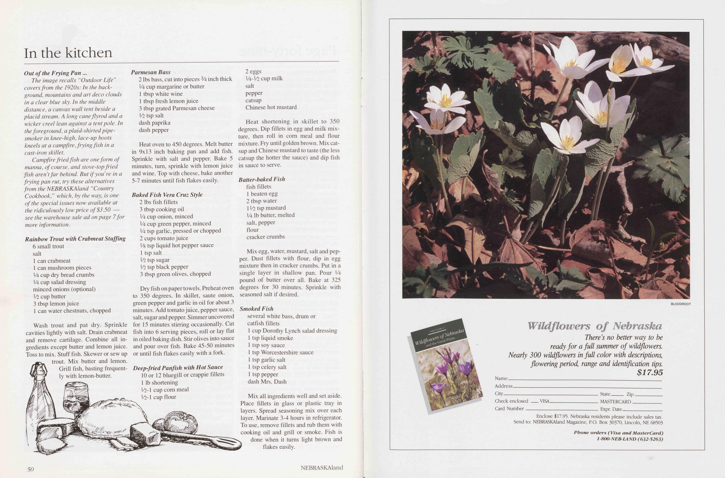
In the kitchen
Out of the Frying PanThe image recalls "Outdoor Life" covers from the 1920s: In the background, mountains and art deco clouds in a clear blue sky. In the middle distance, a canvas wall tent beside a placid stream. A long cane fly rod and a wicker creel lean against a tent pole. In the foreground, a plaid-shirt ed pipe smoker in knee-high, lace-up boots kneels at a campfire, frying fish in a cast-iron skillet.
Campfire fried fish are one form of manna, of course, and stove-top fried fish aren't far behind. But if you're in a frying pan rut, try these alternatives from the NEBRASKAland "Country Cookbook," which, by the way, is one of the special issues now available at the ridiculously low price of $3.50 see the warehouse sale ad on page 7 for more information.
Rainbow Trout with Crabmeat Stuffing 6 small trout salt 1 can crabmeat 1 can mushroom pieces Va cup dry bread crumbs Va cup salad dressing minced onions (optional) l/l cup butter 3 tbsp lemon juice 1 can water chestnuts, chopped Wash trout and pat dry. Sprinkle cavities lightly with salt. Drain crabmeat and remove cartilage. Combine all ingredients except butter and lemon juice. Toss to mix. Stuff fish. Skewer or sew up trout. Mix butter and lemon. Grill fish, basting frequently with lemon-butter.
Position: 511 (21 views)