Volume 72, Issue 5, 1994
NEBRASKAland
June 1994 $1.50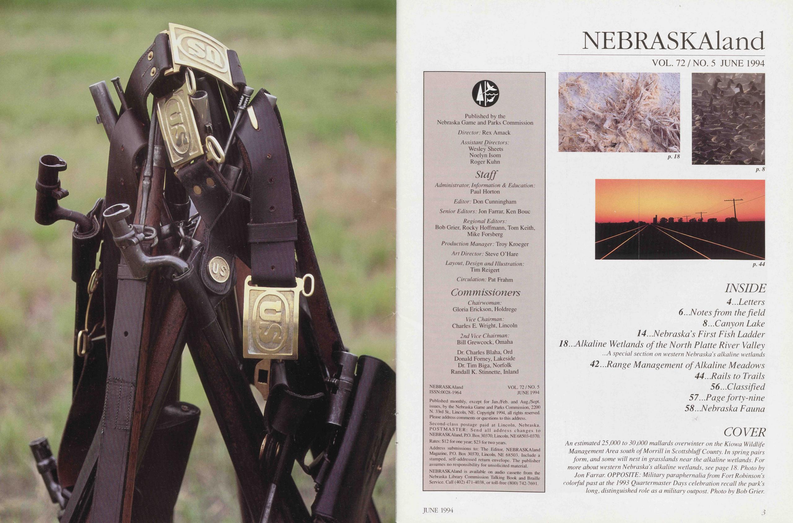
Published monthly, except for Jan./Feb. and Aug./Sept. issues, by the Nebraska Game and Parks Commission, 2200 N. 33rd St, Lincoln, NE. Copyright 1994, all rights reserved. Plcase address comments or qucstions to this address. Second-class postage paid at Lincoln, Nebraska. POSTMASTER: Send all address changes to NEBRASKAland, PO. Box 30370, Lincoln, NE 68503-0370. Rates: $ 12 for one year; $23 for two years. Address submissions to: The Editor, NEBRASKAland Magazine, PO. Box 30370, Lincoln, NE 68503. Include a stamped, self-addressed return envelope. The publisher assumes no responsibility for unsolicited material. NEBRASKAland is available on audio cassette from the Nebraska Library Commission Talking Book and Braille Service. Call (402) 471 -4038, or toll-free (800) 742-7691.
NEBRASKAland VOL. 72/NO. 5 JUNE 1994
p. 18
p.8
p. 44
INSIDE 4...Letters 6...Notes from the field 8...Canyon Lake 14...Nebraska’s First Fish Ladder 18..Alkaline Wetlands of the North Platte River Valley ...A special section on Western Nebraska s alkaline wetlands 42...Range Management of Alkaline Meadows 44...Rails to Trails 56...Classified 57 ...Page forty-nine 58...Nebraska Fauna
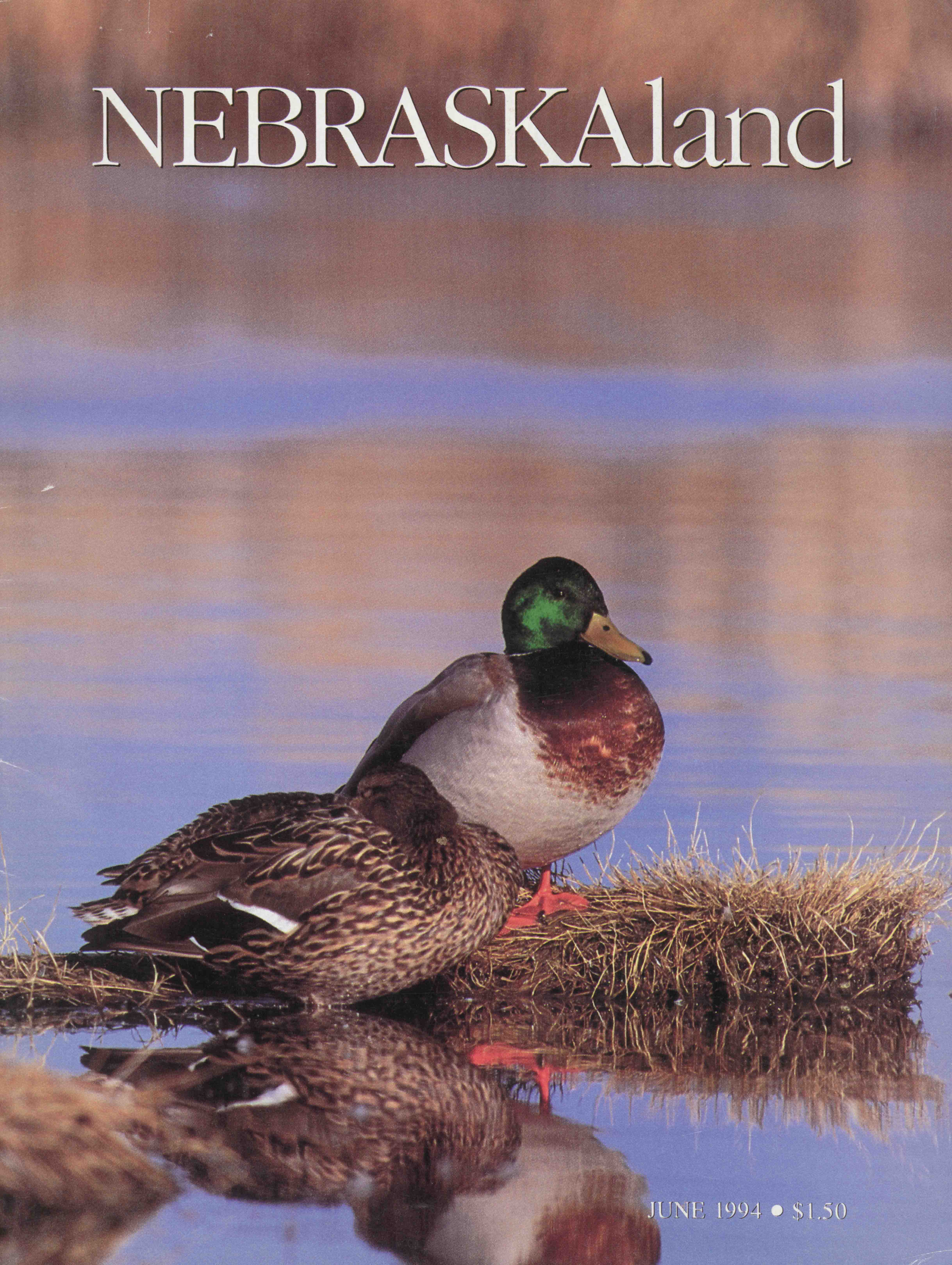
COVER An estimated 25,000 to 30,000 mallards overwinter on the Kiowa Wildlife Management Area south ofMorrill in Scottsbluff County. In spring pairs form, and some will nest in grasslands near the alkaline wetlands. For more about Western Nebraskas alkaline wetlands, see page 18. Photo by Jon Farrar. OPPOSITE: Military paraphernalia from Fort Robinson's colorful past at the 1993 Quartermaster Days celebration recall the park's long, distinguished role as a military outpost. Photo by Bob Grien
Letters
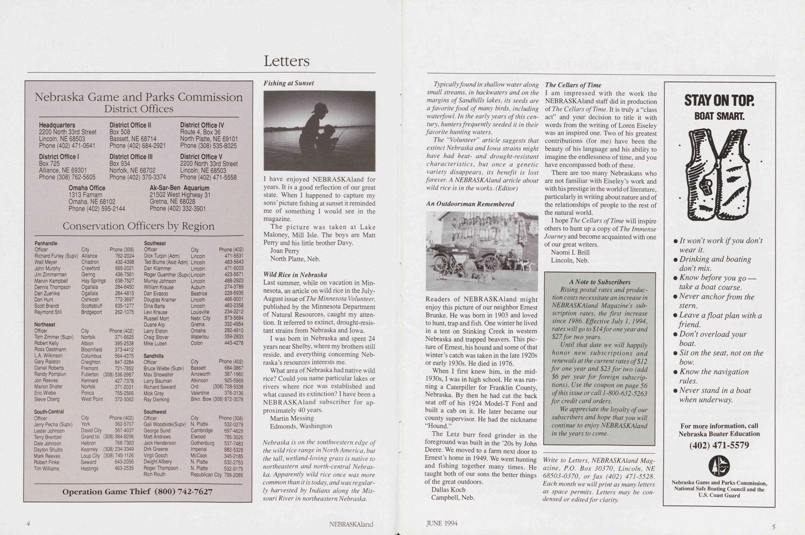
Fishing at SunsetI have enjoyed NEBRASKAland for years. It is a good reflection of our great state. When I happened to capture my sons' picture fishing at sunset it reminded me of something I would see in the magazine.
The picture was taken at Lake Maloney, Mill Isle. The boys are Matt Perry and his little brother Davy.
Joan Perry North Platte, Neb. Wild Rice in NebraskaLast summer, while on vacation in Minnesota, an article on wild rice in the July- August issue of The Minnesota Volunteer, published by the Minnesota Department of Natural Resources, caught my attention. It referred to extinct, drought-resis- tant strains from Nebraska and Iowa.
I was bom in Nebraska and spent 24 years near Shelby, where my brothers still reside, and everything conceming Nebraska’s resources interests me.
What area of Nebraska had native wild rice? Could you name particular lakes or rivers where rice was established and what caused its extinction? I have been a NEBRASKAland subscriber for ap- proximately 40 years.
Martin Messing Edmonds, WashingtonNebraska is on the southwestern edge of the wild rice ränge in North America, but the tall, wetland-loving grass is native to northeastern and north-central Nebraska. Apparently wild rice once was more common than it is today, and was regularly harvested by Indians along the Mis- souri River in northeastern Nebraska.
4 NEBRASKAlandTypically found in shallow water along small streams, in backwaters and on the margins of Sandhills lakes, its seeds are a favorite food of many birds, including waterfowl. In the early years ofthis Century, hunters frequently seeded it in their favorite hunting waters.
The “Volunteer” article suggests that extinct Nebraska and Iowa strains might have had heat- and drought-resistant characteristics, but once a genetic variety disappears, its benefit is lost forever. A NEBRASKAland article about wild rice is in the works. (Editor)
An Outdoorsman RememberedReaders of NEBRASKAland might enjoy this picture of our neighbor Ernest Brunke. He was bom in 1903 and loved to hunt, trap and fish. One winter he lived in a tent on Stinking Creek in westem Nebraska and trapped beavers. This picture of Ernest, his hound and some of that winter’s catch was taken in the late 1920s or early 1930s. He died in 1976.
When I first knew him, in the mid-1930s, I was in high school. He was running a Caterpiller for Franklin County, Nebraska. By then he had cut the back seat off of his 1924 Model-T Ford and built a cab on it. He later became our county Supervisor. He had the nickname “Hound.”
The Letz burr feed grinder in the foreground was built in the ’20s by John Deere. We moved to a farm next door to Ernest’s home in 1949. We went hunting and fishing together many times. He taught both of our sons the better things of the great outdoors.
Dallas Koch Campbell, Neb. The Cellars of TimeI am impressed with the work the NEBRASKAland staff did in production of The Cellars of Time. It is truly a “class act” and your decision to title it with words from the writing of Loren Eiseley was an inspired one. Two of his greatest contributions (for me) have been the beauty of his language and his ability to imagine the endlessness of time, and you have encompassed both of these.
There are too many Nebraskans who are not familiär with Eiseley’s work and with his prestige in the world of literature, particularly in writing about nature and of the relationships of people to the rest of the natural world.
I hope The Cellars of Time will inspire others to hunt up a copy of The Immense Journey and become acquainted with one of our great writers.
Naomi I. Brill Lincoln, Neb. A Note to SubscribersRising postal rates and produc- tion costs necessitate an increase in NEBRASKAland Magazine's sub- scription rates, the first increase since 1986. Effective July 1, 1994, rates will go to $14 for one yea rand $27for two years.
Until that date we will happily honor new subscriptions and re new als at the current rates of$12 for one year and $23 for two (add $6 per year for foreign subscrip- tions). Use the Coupon on page 56 ofthis issue or call 1 -800-632-5263 for credit card Orders.
We appreciate the loyalty ofour subscribers and hope that you will continue to enjoy NEBRASKAland in the years to come.
Write to Letters, NEBRASKAland Magazine, P.O. Box 30370, Lincoln, NE 68503-0370, or fax (402) 471-5528. Each month we will print as many letters as space permits. Letters may be Condensed or edited for clarity.
Notes from the field
Sitting Still Sitting still and doing nothing is nearly a lost art in America, but it does have its rewards. A few years ago, for example, I was doing just that on a little sidehill of sandsage prairie overlooking a prairie dog town in northem Dundy County. I had a camera with a remote tripping device set up on a prairie dog mound, and I was watching from a distance through a spotting scope. The litter of young prairie dogs had suddenly grown shy, seldom did a nose appear above ground, and so I was mostly en- joying the moming under the pretense of producing a usable photo or two. I’d been sitting there about a hour when two omate box turtles, one about a foot ahead of the other, came scuttling through the grass toward me. Omate box turtles are Nebraska’s only land turtles. Once they were found throughout Nebraska except in the northwestem counties and the tallgrass counties of eastem Nebraska. They are especially at home on sandy soils and are most common in the Sandhills region of north-central Nebraska and in the sandy-soil counties in the Southwest. The carapace (the upper shell) is high-domed, brownish black and prominently marked with yellow bars. The sexes are easily distinguished in the hand as the males have red eyes and females yellow-brown eyes. Adults may attain a shell length of nearly five inches and some individuals may live to be decades old. The lead turtle paused long enough for the one behind to catch up, and he (I have to assume) awkwardly clambered up on the rear of the lead turtle’s shell. Some herpetologists have noted that the plastron (the lower shell) of males is concave to improve their chances of remaining atop the female long enough to accomplish mating, but this may not always be evident. While I could see neither eyes nor plastrons at 10 feet, it required little Imagination to comprehend that at least one of those turtles was contemplating the perpetuation of their kind. Contrary to the populär perception of turtles as ploddingly sluggish creatures, these two were feeling quite frisky. And, if I might be allowed a bit of anthropomorphic language to describe the event I observed, the female was behaving quite coyly. No sooner had the male mounted than the female squirted out from under him and made a run for it. After only four feet, the female suddenly reversed directions and paused — a bit of flirting it seemed to me. The male tried again, hastily from the side, and shuffled around to the rear of her shell where he rocked back and forth for about 10 seconds before she again walked out from under him. This time she did not go far. The male approached her, nosing under the rear of her shell, and again mounted. Once more the female slipped away and tumed to face the male. Then, quite deliberately, and, it seemed, calculatingly, she backed into a dense clump of sand sagebrush. I could almost sense the male’s bewilderment and frustration with her behavior. Herpetological literature States that males do not reach maturity until eight or nine years, females when they are 10 or 11 years old. I assumed the male was thinking, “I’ve been waiting all these years for this?” Finally the male circled the clump of Vegetation, an obvious flanking maneuver, but the sage (and I suppose it increasingly seemed to the male, the female) was impenetrable. It was a box turtle standoff, but lasted only briefly before the female made a break for the open country. The last I saw of them the male was still in hot pursuit. I suppose there is not much for box turtles to do throughout the summer, except forage on insects and bits of succulent Vegetation (I once watched one eat half a dozen penstemon blossoms that had fallen to the ground), and pursue amorous adventures. It had been a fruitful moming, if not for that particular pair of box turtles, at least for one of the humankind who had mastered the art of sitting still. Jon Farrar 6 NEBRASKAland More MapsIf you subscribe to the “there’s-no- such-thing-as-too-many-maps” principle (a central point of faith for most of us who hunt, fish, hike or lie in the grass and look at the clouds on public areas, as well as for an enormous congregation of crossroads connoisseurs, one-lane Wanderers and minimum- maintenance meanderers) you probably already have a set or two of moldering, carefully annotated Department of Roads county maps kicking around the car. If you’re new to the game, however, or if it’s time to transfer your painstakingly collected marginal archives to a new set of maps, a new atlas from the Sportsman’s Atlas Company in Lytton, Iowa, might be just what you need.
Their Nebraska Sportsman's Atlas: Back Roads & Outdoor Recreation is a useful addition to your map library. The ll-by-16-inch, spiral-bound book includes all 93 Nebraska county maps, with virtually all the public land in the state marked in red. Included are state parks, recreation areas and wildlife management areas, federal waterfowl production areas, natural resources district areas and other public land such as national forests and monuments.
Also included are summary descriptions of the public use areas shown. Private attractions, campgrounds, hotels and motels are also listed. Locator maps of the entire state show where the featured county is located.
The book is easy to use in spite of the eye-straining small type on the county base maps. Counties are numbered east-to-west and north-to-south, so adjoining counties are on adjoining or facing pages. Counties are also listed alphabetically, and the book includes a full state map and an index.
The Nebraska Sportsmans Atlas sells for $18.75 at many bookstores and outdoor supply Stores or from the publisher, Sportsman’s Atlas Co., P.O. Box 132, Lytton, IA 50561-0132. Telephone Orders, 1-800-568-8334.
Don Cunningham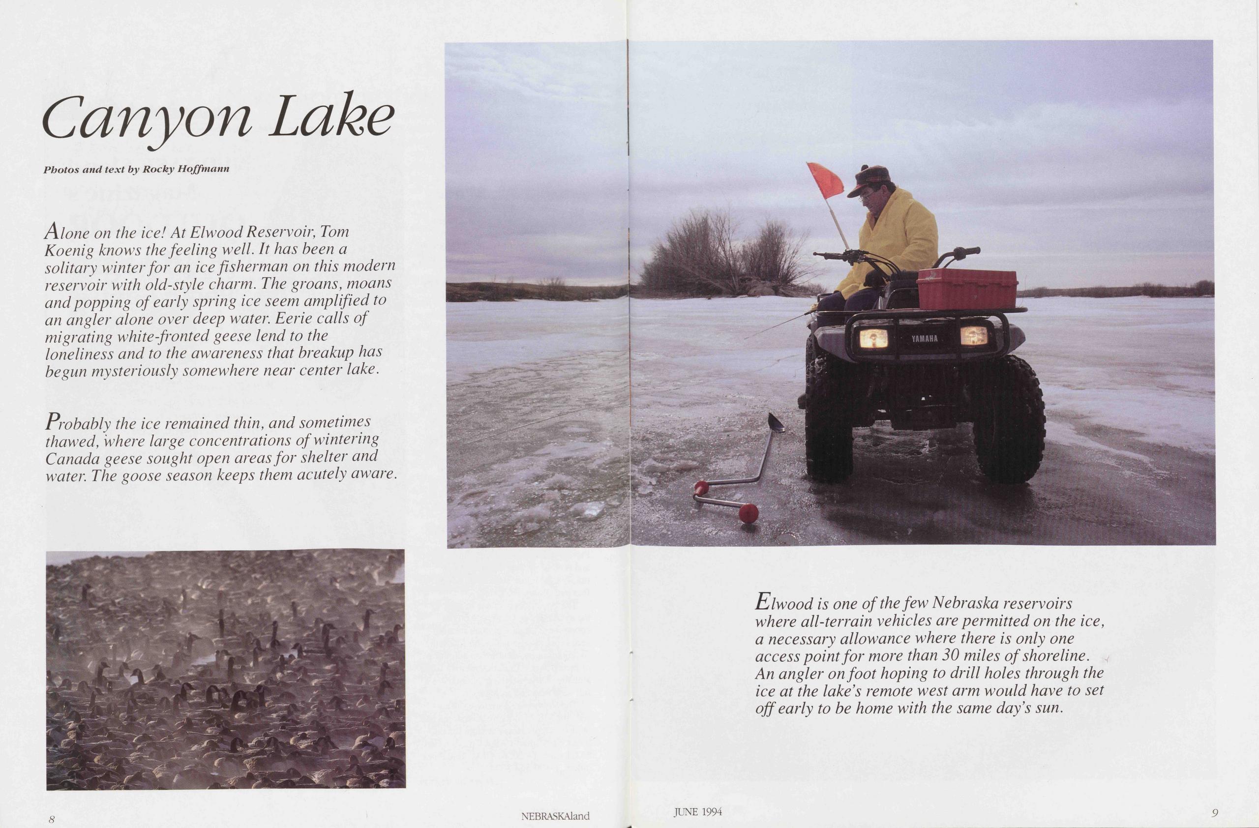
Canyon Lake
Alone on the ice! At Elwood Reservoir, Tom Koenig knows thefeeling well. It has been a solitary winter for an ice fisherman on this modern reservoir with old-style charm. The groans, moans and popping of early spring ice seem amplified to an angier alone over deep water. Eerie calls of migrating white-fronted geese lend to the loneliness and to the awareness that breakup has begun mysteriously somewhere near center lake.
Probably the ice remained thin, and sometimes thawed, where large concentrations ofwintering Canada geese sought open areasfor shelter and water. The goose season keeps them acutely aware.
Elwood is one of the few Nebraska reservoirs where all-terrain vehicles are permitted on the ice, a necessary allowance where there is only one access point for more than 30 miles of shoreline. An angier onfoot hoping to drill holes through the ice at the lakes remote west arm would have to set off early to be home with the same day’s sun.
JUNE 1994 9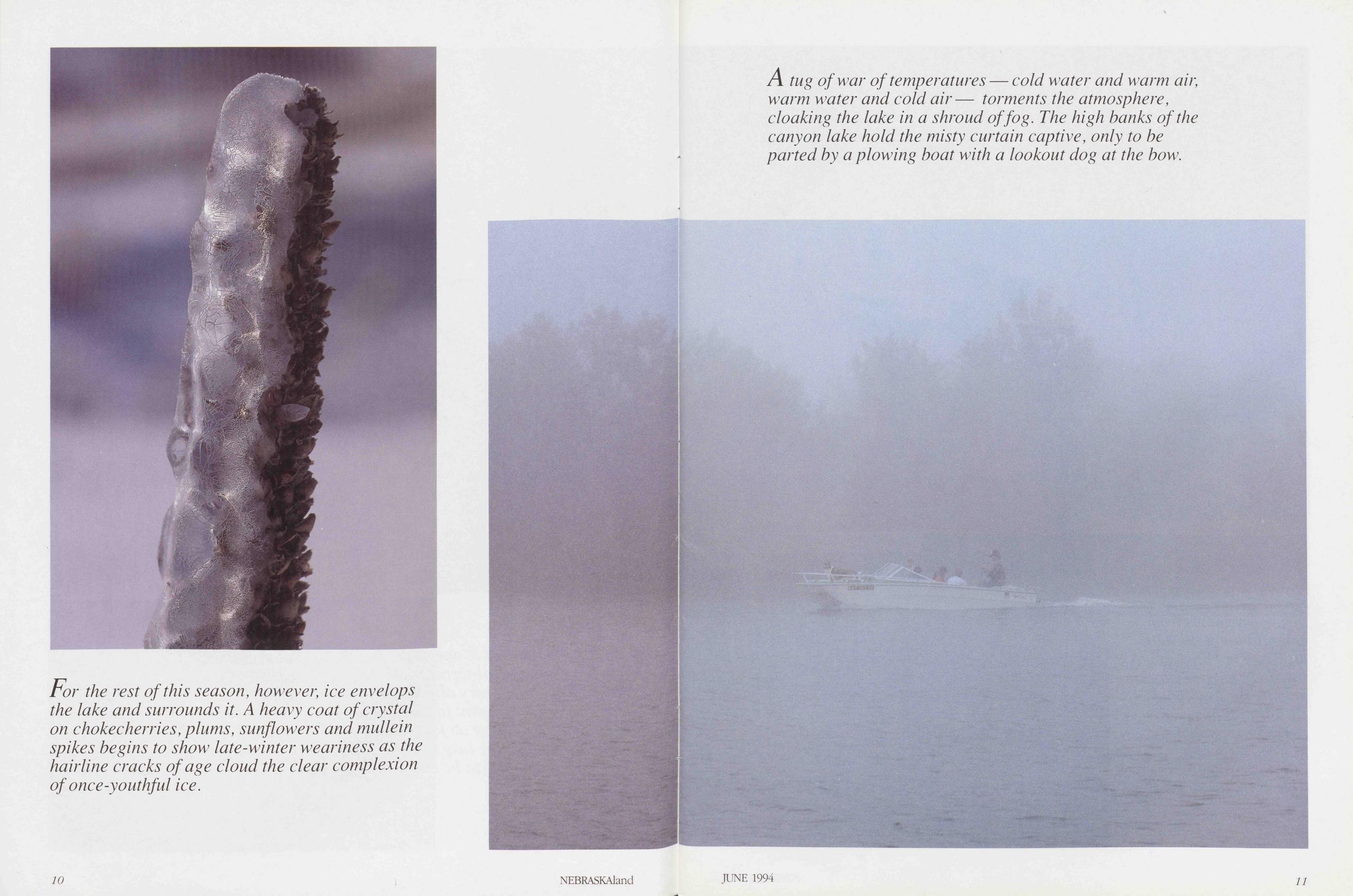
For the rest of this season, however, ice envelops the lake and surrounds it. A heavy coat of crystal on chokecherries, plums, sunflowers and mullein spikes begins to show late-winter weariness as the hairline cracks of age cloud the clear complexion of once-youthful ice.
NEBRASKAland 10A tug of war of temperatures — cold water and warm air, warm water and cold air— torments the atmosphere, cloaking the lake in a shroud offog. The high hanks ofthe canyon lake hold the misty curtain captive, only to he parted by a plowing boat with a lookout dog at the bow.
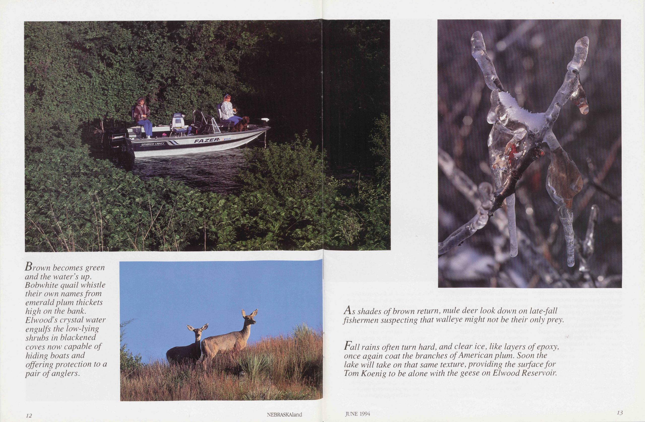
Brown becomes green and the water 's up. Bobwhite quail whistle their own namesfrom emerald plum thickets high on the bank. Elwood’s crystal water engulfs the low-lying shrubs in blackened coves now capable of hi ding boats and offering protection to a pair of anglers.
As shades ofbrown return, mule deer look down on late-fall fishermen suspecting that walleye might not be their only prey.
Fall rains offen turn hard, and clear ice, like layers of epoxy, once again coat the brauches of American plum. Soon the labe will take on that same texture, providing the surfacefor Tom Koenig to be alone with the geese on Elwood Reservoir.
JUNE 1994 13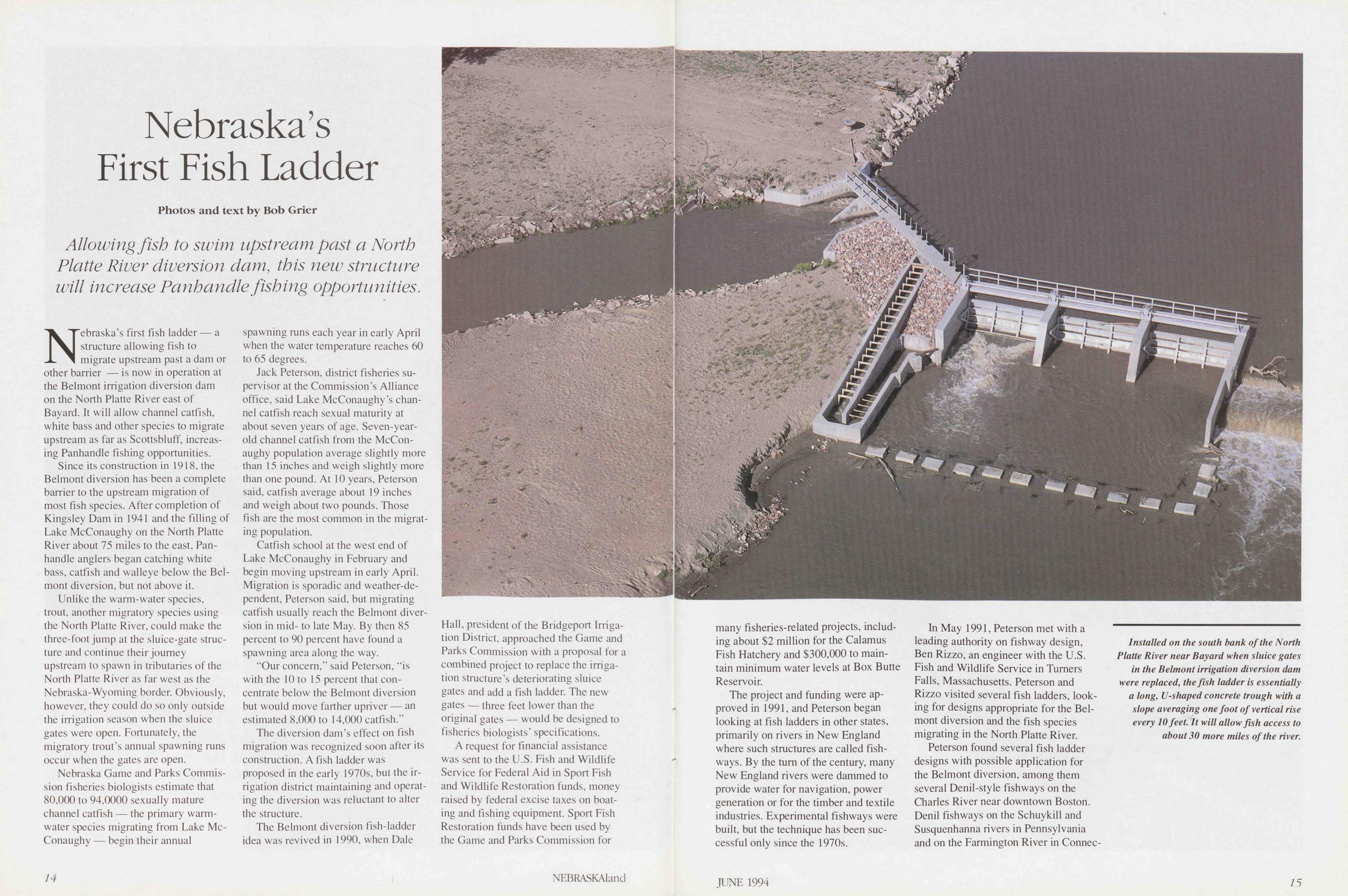
Nebraska’s First Fish Ladder
Allowing fish to swim upstream past a North Platte River diversion dam, this new structure will increase Panhandle fishing opportunities.
Nebraska’s first fish ladder — a structure allowing fish to migrate upstream past a dam or other barrier — is now in Operation at the Belmont Irrigation diversion dam on the North Platte River east of Bayard. It will allow channel catfish, white bass and other species to migrate upstream as far as Scottsbluff, increasing Panhandle fishing opportunities.
Since its construction in 1918, the Belmont diversion has been a complete barrier to the upstream Migration of most fish species. After completion of Kingsley Dam in 1941 and the filling of Lake McConaughy on the North Platte River about 75 miles to the east, Panhandle anglers began catching white bass, catfish and walleye below the Belmont diversion. but not above it.
Unlike the warm-water species, trout, another migratory species using the North Platte River, could make the three-foot jump at the sluice-gate structure and continue their joumey upstream to spawn in tributaries of the North Platte River as far west as the Nebraska-Wyoming border. Obviously, however, they could do so only outside the Irrigation season when the sluice gates were open. Fortunately, the migratory trout’s annual spawning runs occur when the gates are open.
Nebraska Game and Parks Commission fisheries biologists estimate that 80,000 to 94,0000 sexually mature channel catfish — the primary warm-water species migrating from Lake McConaughy — begin their annual spawning runs each year in early April when the water temperature reaches 60 to 65 degrees.
Jack Peterson, district fisheries Supervisor at the Commission’s Alliance office, said Lake McConaughy’s channel catfish reach sexual maturity at about seven years of age. Seven-year- old channel catfish from the McConaughy population average slightly more than 15 inches and weigh slightly more than one pound. At 10 years, Peterson said, catfish average about 19 inches and weigh about two pounds. Those fish are the most common in the migrating population.
Catfish school at the west end of Lake McConaughy in February and begin moving upstream in early April. Migration is sporadic and weather-dependent, Peterson said, but migrating catfish usually reach the Belmont diversion in mid- to late May. By then 85 percent to 90 percent have found a spawning area along the way.
“Our concern,” said Peterson, “is with the 10 to 15 percent that con- centrate below the Belmont diversion but would move farther upriver — an estimated 8,000 to 14,000 catfish.”
The diversion dam’s effect on fish Migration was recognized soon after its construction. A fish ladder was proposed in the early 1970s, but the Irrigation district maintaining and operating the diversion was reluctant to alter the structure.
The Belmont diversion fish-ladder idea was revived in 1990, when Dale Hall, President of the Bridgeport Irrigation District, approached the Game and Parks Commission with a proposal for a combined project to replace the Irrigation structure’s deteriorating sluice gates and add a fish ladder. The new gates — three feet lower than the original gates — would be designed to fisheries biologists’ specifications.
A request for financial assistance was sent to the U.S. Fish and Wildlife Service for Federal Aid in Sport Fish and Wildlife Restoration funds, money raised by federal excise taxes on boating and fishing equipment. Sport Fish Restoration funds have been used by the Game and Parks Commission for 14 NEBRASKAland many fisheries-related projects, including about $2 Million for the Calamus Fish Hatchery and $300,000 to main- tain Minimum water levels at Box Butte Reservoir.
The project and funding were ap- proved in 1991, and Peterson began looking at fish ladders in other States, primarily on rivers in New England where such structures are called fishways. By the tum of the Century, many New England rivers were dammed to provide water for navigation, power generation or for the timber and textile Industries. Experimental fishways were built, but the technique has been successful only since the 1970s.
In May 1991, Peterson met with a leading authority on fishway design, Ben Rizzo, an engineer with the U.S. Fish and Wildlife Service in Turners Falls, Massachusetts. Peterson and Rizzo visited several fish ladders, looking for designs appropriate for the Belmont diversion and the fish species migrating in the North Platte River.
Peterson found several fish ladder designs with possible application for the Belmont diversion, among them several Denil-style fishways on the Charles River near downtown Boston. Denil fishways on the Schuykill and Susquenhanna rivers in Pennsylvania and on the Farmington River in Connecticut
Installed on the south bank of the North Platte River near Bayard when sluice gates in the Belmont irrigation diversion dam were replaced, the fish ladder is essentially a long, U-shaped concrete trough with a slope averaging one foot of vertical rise every 10 feet. It will allow fish access to about 30 more miles of the river.
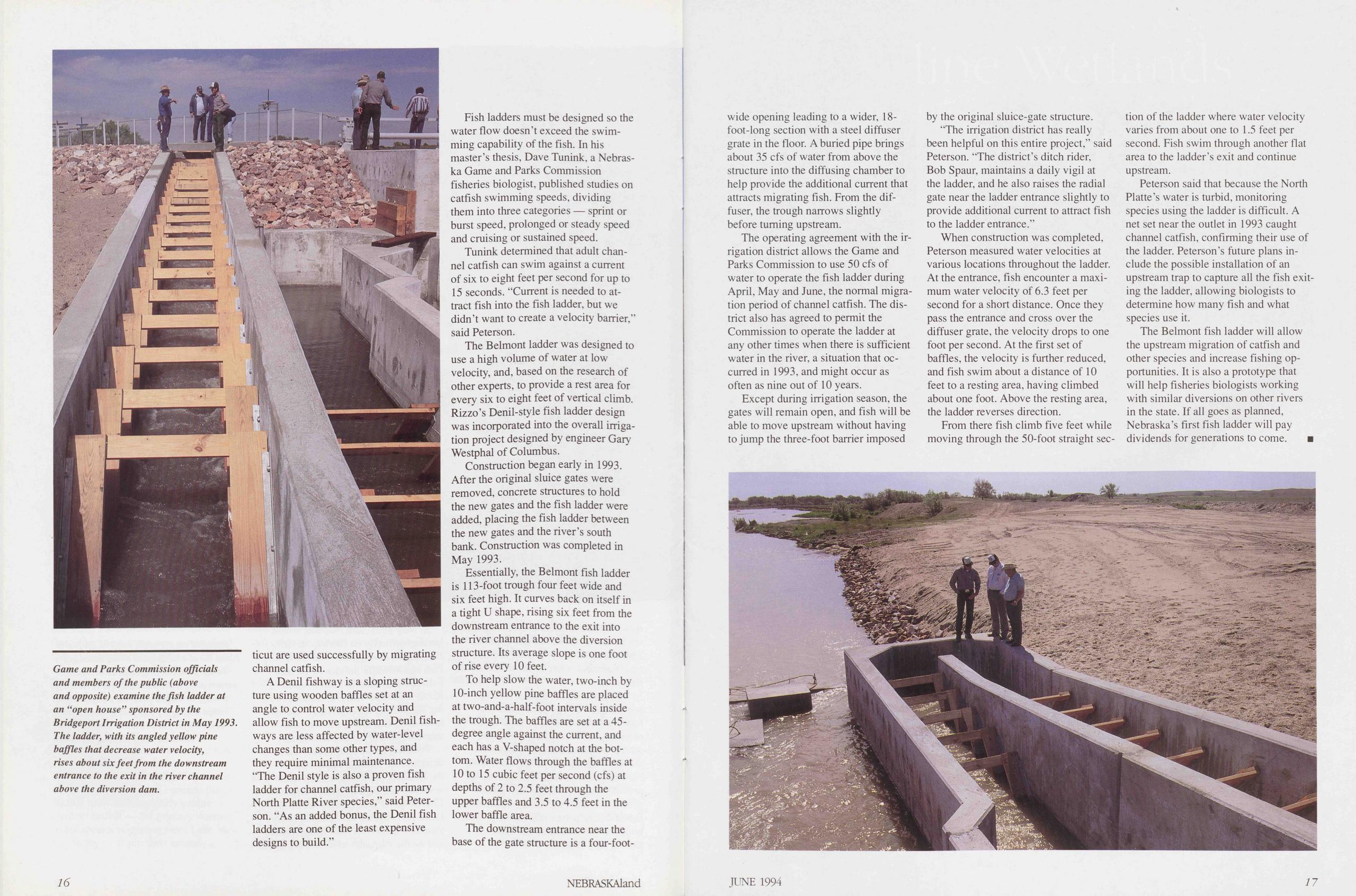
Game and Parks Commission officials and members of the public (above and opposite) examine the fish ladder at an “open house” sponsored by the Bridgeport Irrigation District in May 1993. The ladder, with its angled yellow pine baffles that decrease water velocity, rises about six feet from the downstream entrance to the exit in the river channel above the diversion dam.
are used successfully by migrating channel catfish.
A Denil fishway is a sloping structure using wooden baffles set at an angle to control water velocity and allow fish to move upstream. Denil fishways are less affected by water-level changes than some other types, and they require minimal maintenance. “The Denil style is also a proven fish ladder for channel catfish, our primary North Platte River species," said Peterson. “As an added bonus, the Denil fish ladders are one of the least expensive designs to build.”
Fish ladders must be designed so the water flow doesn’t exceed the swimming capability of the fish. In his master’s thesis, Dave Tunink, a Nebraska Game and Parks Commission fisheries biologist, published Studies on catfish swimming speeds, dividing them into three categories — sprint or bürst speed, prolonged or steady speed and cruising or sustained speed.
Tunink determined that adult channel catfish can swim against a current of six to eight feet per second for up to 15 seconds. “Current is needed to attract fish into the fish ladder, but we didn’t want to create a velocity barrier,” said Peterson.
The Belmont ladder was designed to use a high volume of water at low velocity, and, based on the research of other experts, to provide a rest area for every six to eight feet of vertical climb. Rizzo’s Denil-style fish ladder design was incorporated into the overall Irrigation project designed by engineer Gary Westphal of Columbus.
Construction began early in 1993. After the original sluice gates were removed, concrete structures to hold the new gates and the fish ladder were added, placing the fish ladder between the new gates and the river’s south bank. Construction was completed in May 1993.
Essentially, the Belmont fish ladder is 113-foot trough four feet wide and six feet high. It curves back on itself in a tight U shape, rising six feet from the downstream entrance to the exit into the river channel above the diversion structure. Its average slope is one foot of rise every 10 feet.
To help slow the water, two-inch by 10-inch yellow pine baffles are placed at two-and-a-half-foot intervals inside the trough. The baffles are set at a 45-degree angle against the current, and each has a V-shaped notch at the bottom. Water flows through the baffles at 10 to 15 cubic feet per second (cfs) at depths of 2 to 2.5 feet through the upper baffles and 3.5 to 4.5 feet in the lower baffle area.
The downstream entrance near the base of the gate structure is a four-foot- 16 NEBRASKAland wide opening leading to a wider, 18- foot-long section with a Steel diffuser grate in the floor. A buried pipe brings about 35 cfs of water from above the structure into the diffusing chamber to help provide the additional current that attracts migrating fish. From the diffuser, the trough narrows slightly before tuming upstream.
The operating agreement with the Irrigation district allows the Game and Parks Commission to use 50 cfs of water to operate the fish ladder during April, May and June, the normal migration period of channel catfish. The district also has agreed to permit the Commission to operate the ladder at any other times when there is sufficient water in the river, a Situation that occurred in 1993, and might occur as often as nine out of 10 years.
Except during Irrigation season, the gates will remain open, and fish will be able to move upstream without having to jump the three-foot barrier imposed by the original sluice-gate structure.
“The Irrigation district has really been helpful on this entire project,” said Peterson. “The district’s ditch rider, Bob Spaur, maintains a daily vigil at the ladder, and he also raises the radial gate near the ladder entrance slightly to provide additional current to attract fish to the ladder entrance.”
When construction was completed, Peterson measured water velocities at various locations throughout the ladder. At the entrance, fish encounter a maximum water velocity of 6.3 feet per second for a short distance. Once they pass the entrance and cross over the diffuser grate, the velocity drops to one foot per second. At the first set of baffles, the velocity is further reduced, and fish swim about a distance of 10 feet to a resting area, having climbed about one foot. Above the resting area, the ladder reverses direction.
From there fish climb five feet while moving through the 50-foot Straight section of the ladder where water velocity varies from about one to 1.5 feet per second. Fish swim through another flat area to the ladder’s exit and continue upstream.
Peterson said that because the North Platte’s water is turbid, monitoring species using the ladder is difficult. A net set near the outlet in 1993 caught channel catfish, confirming their use of the ladder. Peterson’s future plans include the possible Installation of an upstream trap to capture all the fish exiting the ladder, allowing biologists to determine how many fish and what species use it.
The Belmont fish ladder will allow the upstream migration of catfish and other species and increase fishing opportunities. It is also a prototype that will help fisheries biologists working with similar diversions on other rivers in the state. If all goes as planned, Nebraska’s first fish ladder will pay dividends for generations to come. ■
Alkaline Wetlands of the North Platte River Valley
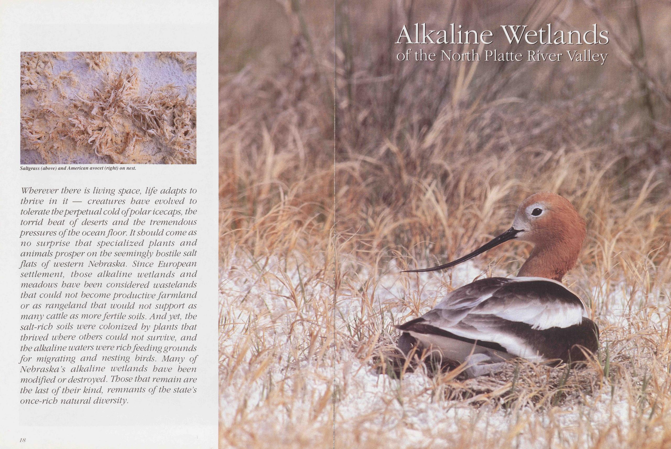
Saltgrass (above) and American avocet (right) on nest.
Wherever there is living space, life adapts to thrive in it — creatures have evolved to tolerate theperpetual cold of polar icecaps, the torrid heat of deserts and the tremendous pressures of the ocean floor. Itshould come as no surprise that specialized plants and animalsprosper on the seemingly hostile salt flats of Western Nebraska. Since European settlement, those alkaline wetlands and meadows have been considered wastelands that could not become productive farmland or as rangeland that would not support as many cattle as more fertile soils. Andyet, the salt-rich soils were colonized by plants that thrived where others could not survive, and the alkaline waters were rieh feeding grounds for migrating and nesting birds. Many of Nebraska's alkaline wetlands have been modified or destroyed. Tbose that remain are the last of their kind, remnants of the state’s once-rich natural diversity.
18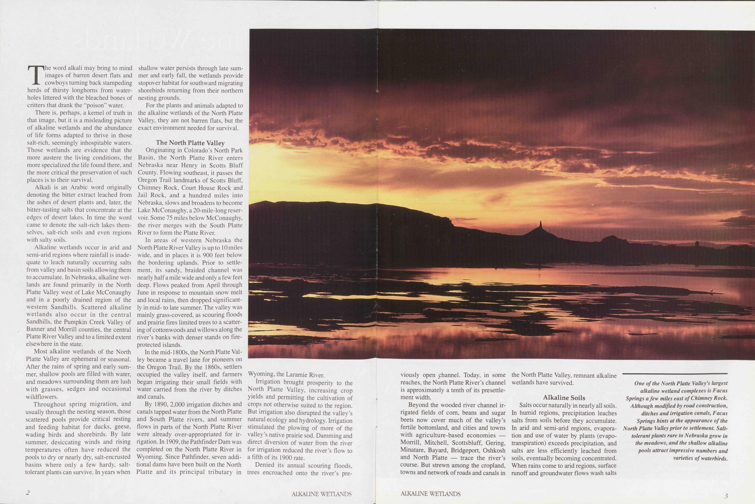
The word alkali may bring to mind images of darren desert flats and cowboys tuming back stampeding herds of thirsty longhorns from waterholes littered with the bleached bones of critters that drank the “poison” water.
There is, perhaps, a kerne! of truth in that image, but it is a misleading picture of alkaline wetlands and the abundance of life forms adapted to thrive in those salt-rich, seemingly inhospitable waters. Those wetlands are evidence that the more austere the living conditions, the more specialized the life found there, and the more critical the preservation of such places is to their survival.
Alkali is an Arabic word originally denoting the bitter extract leached from the ashes of desert plants and, later, the bitter-tasting salts that concentrate at the edges of desert lakes. In time the word came to denote the salt-rich lakes themselves, salt-rich soils and even regions with salty soils.
Alkaline wetlands occur in arid and semi-arid regions where rainfall is inadequate to leach naturally occurring salts from valley and basin soils allowing them to accumulate. In Nebraska, alkaline wetlands are found primarily in the North Platte Valley west of Lake McConaughy and in a poorly drained region of the western Sandhills. Scattered alkaline wetlands also occur in the central Sandhills, the Pumpkin Creek Valley of Banner and Morrill counties, the central Platte River Valley and to a limited extent elsewhere in the state.
Most alkaline wetlands of the North Platte Valley are ephemeral or seasonal. After the rains of spring and early Summer, shallow pools are filled with water, and meadows surrounding them are lush with grasses, sedges and occasional wildflowers.
Throughout spring migration, and usually through the nesting season, those scattered pools provide critical resting and feeding habitat for ducks, geese, wading birds and shorebirds. By late summer, desiccating winds and rising temperatures often have reduced the pools to dry or nearly dry, salt-encrusted basins where only a few hardy, salt-tolerant plants can survive. In years when shallow water persists through late summer and early fall, the wetlands provide Stopover habitat for southward migrating shorebirds returning from their northern nesting grounds.
For the plants and animals adapted to the alkaline wetlands of the North Platte Valley, they are not darren flats, but the exact environment needed for survival.
The North Platte ValleyOriginating in Colorado's North Park Basin, the North Platte River enters Nebraska ne ar Henry in Scotts Bluff County. Flowing southeast, it passes the Oregon Trail landmarks of Scotts Bluff, Chimney Rock, Court House Rock and Jail Rock, and a hundred miles into Nebraska, slows and broadens to become Lake McConaughy, a 20-mile-long reservoir. Some 75 miles below McConaughy, the river merges with the South Platte River to form the Platte River.
In areas of western Nebraska the North Platte River Valley is up to 10 miles wide, and in places it is 900 feet below the bordering uplands. Prior to Settlement, its sandy, braided channel was nearly half a mile wide and only a few feet deep. Flows peaked from April through June in response to mountain snow melt and local rains, then dropped significantly in mid- to late summer. The valley was mainly grass-covered, as scouring floods and prairie fires limited trees to a Scattering of cottonwoods and willows along the river’s banks with denser Stands on fire-protected Islands.
In the mid-1800s, the North Platte Valley became a travel lane for pioneers on the Oregon Trail. By the 1860s, settlers occupied the valley itself, and farmers began irrigating their small fields with water carried from the river by ditches and canals.
By 1890, 2,000 Irrigation ditches and canals tapped water from the North Platte and South Platte rivers, and summer flows in parts of the North Platte River were already over-appropriated for Irrigation. In 1909, the Pathfinder Dam was completed on the North Platte River in Wyoming. Since Pathfinder, seven additional dams have been built on the North Platte and its principal tributary in Wyoming, the Laramie River.
Irrigation brought prosperity to the North Platte Valley, increasing crop yields and permitting the cultivation of crops not otherwise suited to the region. But Irrigation also disrupted the valley’s natural ecology and hydrology. Irrigation stimulated the plowing of more of the valley’s native prairie sod. Damming and direct diversion of water from the river for irrigation reduced the river’s flow to afifth of its 1900 rate.
Denied its annual scouring floods, trees encroached onto the river’s previously 2 ALKALINE WETLANDS open channel. Today, in some reaches, the North Platte River’s channel is approximately a tenth of its presettlement width.
Beyond the wooded river channel irrigated fields of com, beans and sugar beets now cover much of the valley’s fertile bottomland, and cities and towns with agriculture-based economies — Morrill, Mitchell, Scottsbluff, Gering, Minatare, Bayard, Bridgeport, Oshkosh and North Platte — trace the river’s course. But strewn among the cropland, towns and network of roads and canals in the North Platte Valley, remnant alkaline wetlands have survived.
Alkaline SoilsSalts occur naturally in nearly all soils. In humid regions, precipitation leaches salts from soils before they accumulate. In arid and semi-arid regions, evaporation and use of water by plants (evapo- transpiration) exceeds precipitation, and salts are less efficiently leached from soils, eventually becoming concentrated. When rains come to arid regions, surface runoff and groundwater flows wash salts
One of the North Platte Valley’s largest alkaline wetland complexes is Facus Springs a few miles east of Chimney Rock. Although modified by road construction, ditches and irrigation canals, Facus Springs hints at the appearance of the North Platte Valley prior to settlement. Salt-tolerant plants rare to Nebraska grow in the meadows, and the shallow alkaline pools attract impressive numbers and varieties of waterbirds.
into basins or valleys. Düring hundreds of years of repeated wetting and drying, evapotranspiration further concentrates the salts in upper soil layers.
Many wetlands in the North Platte River Valley are considered alkaline because of their high concentration of salts, principally sodium carbonate and calcium carbonate. The distinction between alkaline and sahne soils is principally a distinction of Chemical composition and concentration. Saline soils, like alkaline soils, contain high levels of salt, but usually Chloride salts, sulfate salts or both. Alkaline soils are generally “hotter” than saline soils. That is, they have a higher pH. Typically, alkaline soils have a pH above 8.5, but saline soils usually have a pH between 7 and 8.5 (neutral Solutions have a pH of 7).
Nebraska’s only significant saline wetland complex occurs in the floodplain of Sait Creek and its tributaries in Lancaster and Southern Saunders counties [See “Nebraska Sait Marshes: Last of the Least,” NEBRASKAland, July 1991].
Alkaline soils are fairly common in westem Nebraska, occupying 4 percent of Garden County, 7 percent of Morrill County and 9 percent of Scotts Bluff County. Most of those alkaline soils are in the North Platte Valley.
Not all North Platte Valley alkaline soils are wetland soils, however. In some alkaline meadows the water table typically remains a few feet below the soil surface even during wet periods, and technically such meadows are not wetlands. In Garden County, a few alkaline
ALKALINE WETLANDS 4meadows are several thousand acres in size, the largest being 6,000 acres. Most alkaline wetlands are smaller than the meadows, ranging from only a few to several hundred acres.
In the North Platte Valley, alkaline wetlands form where groundwater levels are high and soil drainage is poor. Alkaline wetlands do not develop immediately adjacent to the river where sandy, porous soils are flushed of salts. Typically, they form farther from the river channel where the more clayey and loamy soils impede leaching. The soils are often underlain by dense clay pans that further inhibit drainage and cause surface water to pond. The valley’s most alkaline soils form in shallow depressions where salts accumulate and high water tables promote salt concentration through evapotranspiration.
In summer, as surface water evaporates, dissolved salts crystalize, forming a whitish crust on the surface. Salt crusts continue to form even after surface water has evaporated, as alkaline groundwater is “wicked” to the surface. The thickest deposits usually form where groundwater is ne ar the surface. In late summer or fall, crusts i/4-inch thick or thicker can coat soils, greatly increasing soil surface alkalinity. When rains come, salt crusts dissolve and the salts leach back into the soil, temporarily reducing its surface alkalinity.
In general, the wetland soils in the valley’s Western counties (Scotts Bluff and Morrill) are more alkaline than those to the east, possibly in part a result of slightly increased aridity in the west. The principal explanation, though, may be the alteration of the valley’s groundwater
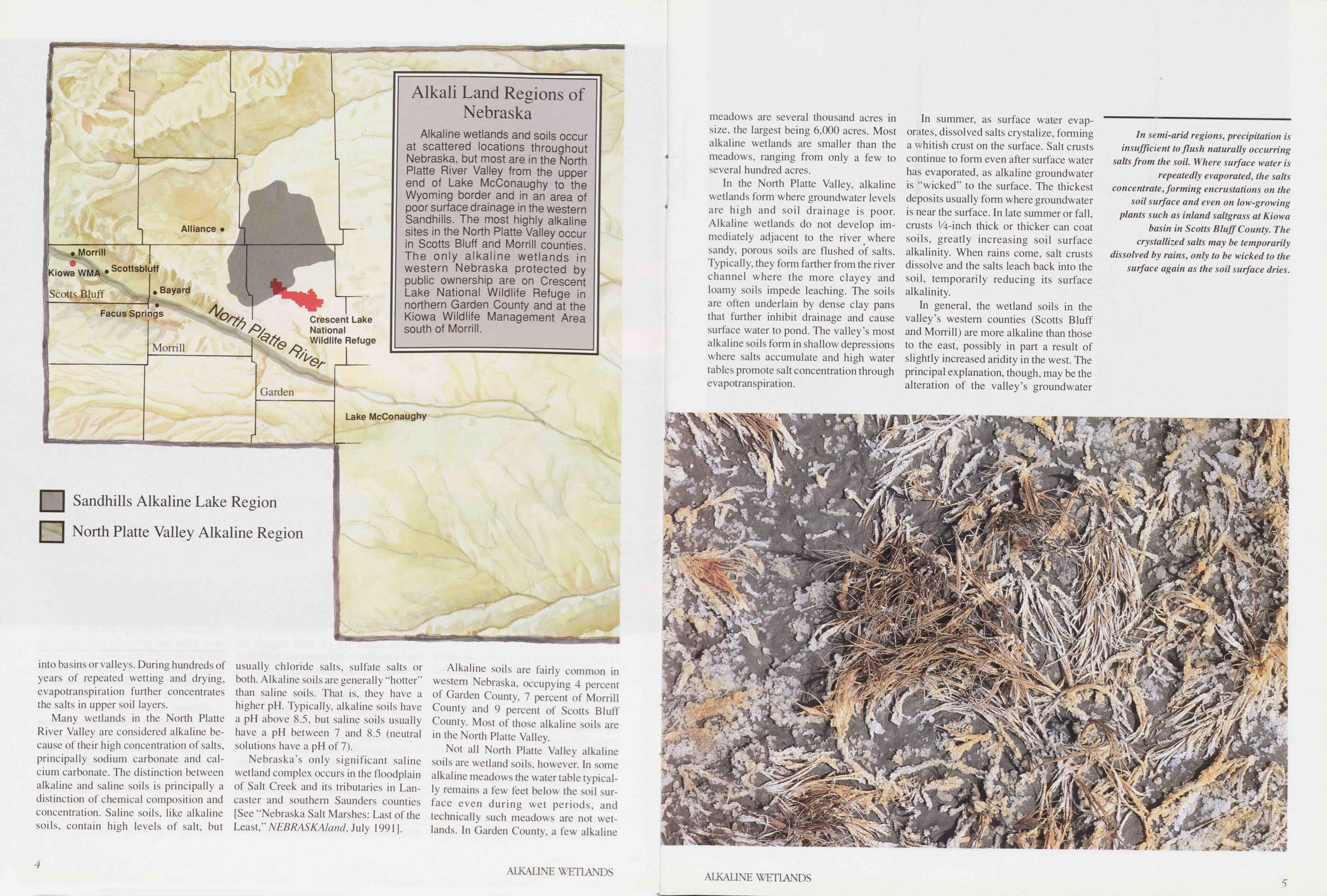
In semi-arid regions, precipitation is insufficient to flush naturally occurring salts from the soil. Where surface water is repeatedly evaporated, the salts concentrate, forming encrustations on the soil surface and even on low-growing plants such as Inland saltgrass at Kiowa basin in Scotts Bluff County. The crystallized salts may be temporarily dissolved by rains, only to be wicked to the surface again as the soil surface dries.
hydrology by more than a Century of Irrigation agriculture, more common in westem counties.
In summer, groundwater levels in parts of the valley rise, the result of seepage from unlined irrigation ditches and canals (estimated to be as much as 50 percent of the water they carry). Those high groundwater levels and irrigation runoff may increase soil alkalinity in some wetlands. With more water for evaporation available near or on the soil surface, more salts are concentrated in the upper soil profile.
The alkalinity of soils adjacent to irrigated cropland sometimes decreases as salts are flushed away by irrigation runoff, but down-slope fields increase in alkalinity through the lateral movement of groundwater containing the flushed salts. This phenomenon is accentuated in dry years when more irrigation water is applied to crops.
Alkaline Wetland PlantsUntil recently, the North Platte Valley alkaline wetlands were almost ignored by botanists. P.A. Rydberg briefly mentioned the wetland plant life in the report of his botanical expedition to Western Nebraska for the U.S. Department of Agriculture in 1891. University of Nebraska botanists Roscoe Pound and Frederic Clements’ 1898 classic, Phytogeography of Nebraska, mentioned the contrast between the Vegetation of the "salt marshes” of Scotts Bluff County and Deuel County (which then included present Garden County) and the Vegetation of salt marshes in Lancaster County. Interest in the North Platte’s alkaline wetlands was rekindled in 1992, when
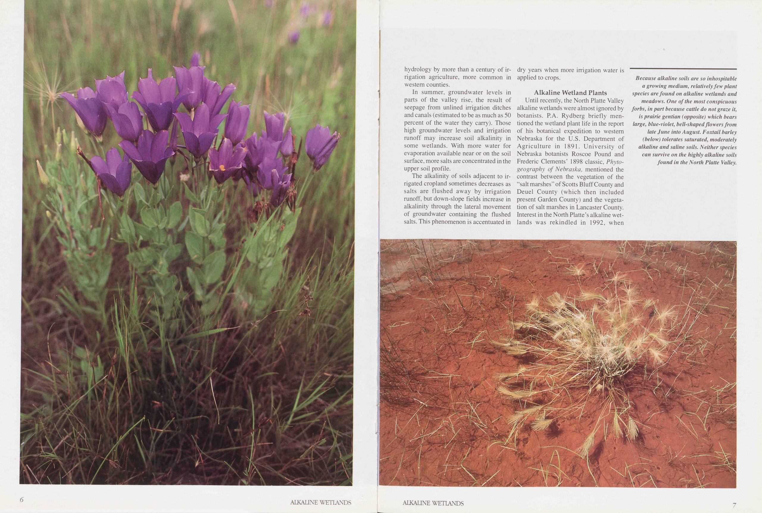
Because alkaline soils are so inhospitable a growing medium, relatively few plant species are found on alkaline wetlands and meadows. One of the most conspicuous forbs, in part because cattle do not graze it, is prairie gentian (opposite) which bears large, blue-violet, bell-shapedflowers from late June into August. Foxtail barley (below) tolerates saturated, moderately alkaline and saline soils. Neither species can survive on the highly alkaline soils found in the North Platte Valley.
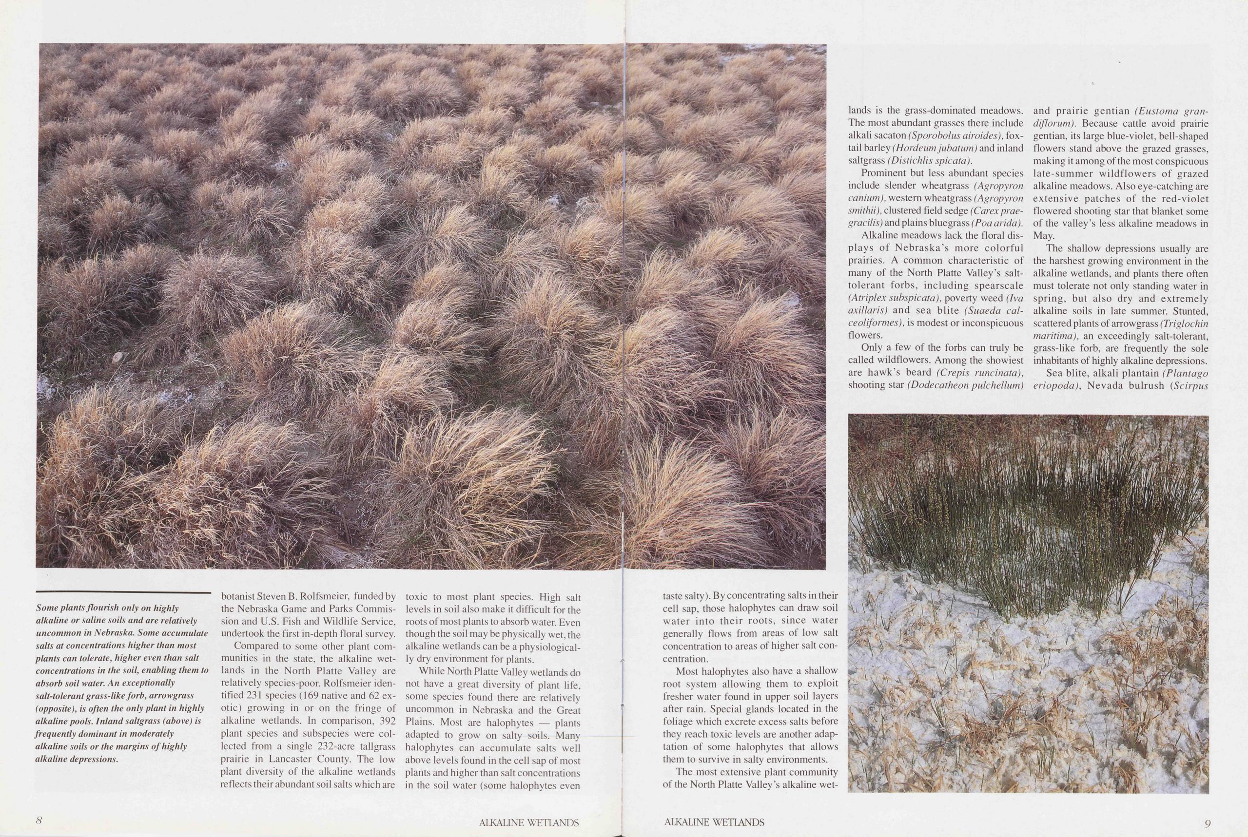
Some plants flourish only on highly alkaline or saline soils and are relatively uncommon in Nebraska. Some accumulate salts at concentrations higher than most plants can tolerate, higher even than salt concentrations in the soil, enabling them to absorb soil water. An exceptionally salt-tolerant grass-like forb, arrowgrass (opposite), is often the only plant in highly alkaline pools. Inland saltgrass (above) is frequently dominant in moderately alkaline soils or the margins of highly alkaline depressions.
botanist Steven B. Rolfsmeier, funded by the Nebraska Game and Parks Commission and U.S. Fish and Wildlife Service, undertook the first in-depth floral survey.
Compared to some other plant communities in the state, the alkaline wetlands in the North Platte Valley are relatively species-poor. Rolfsmeier identified 231 species (169 native and 62 exotic) growing in or on the fringe of alkaline wetlands. In comparison, 392 plant species and subspecies were collected from a single 232-acre tallgrass prairie in Lancaster County. The low plant diversity of the alkaline wetlands reflects their abundant soil salts which are toxic to most plant species. High salt levels in soil also make it difficult for the roots of most plants to absorb water. Even though the soil may be physically wet, the alkaline wetlands can be a physiologically dry environment for plants.
While North Platte Valley wetlands do not have a great diversity of plant life, some species found there are relatively uncommon in Nebraska and the Great Plains. Most are halophytes — plants adapted to grow on salty soils. Many halophytes can accumulate salts well above levels found in the cell sap of most plants and higher than salt concentrations in the soil water (some halophytes even 8 ALKALINE WETLANDS taste salty). By concentrating salts in their cell sap, those halophytes can draw soil water into their roots, since water generally flows from areas of low salt concentration to areas of higher salt concentration.
Most halophytes also have a shallow root System allowing them to exploit fresher water found in upper soil layers after rain. Special glands located in the foliage which excrete excess salts before they reach toxic levels are another adaptation of some halophytes that allows them to survive in salty environments.
The most extensive plant community of the North Platte Valley’s alkaline wetlands is the grass-dominated meadows. The most abundant grasses there include alkali sacaton (Sporobolus airoides), foxtail barley (Hordeum jubatum) and inland saltgrass (Distichlis spicata).
Prominent but less abundant species include slender wheatgrass (Agropyron canium), Western wheatgrass (Agropyron smithii), clustered field sedge (Carex praegracilis) and plains bluegrass (Poa arida).
Alkaline meadows lack the floral (Displays of Nebraska’s more colorful prairies. A common characteristic of many of the North Platte Valley’s salt-tolerant forbs, including spearscale (Atriplex subspicata), poverty weed (Iva axillaris) and sea blite (Suaeda calceoliformes), is modest or inconspicuous flowers.
Only a few of the forbs can truly be called wildflowers. Among the showiest are hawk’s beard (Crepis runcinata), shooting star (Dodecatheon pulchellum) and prairie gentian (Eustoma gran- diflorum). Because cattle avoid prairie gentian, its large blue-violet, bell-shaped flowers stand above the grazed grasses, making it among of the most conspicuous late-summer wildflowers of grazed alkaline meadows. Also eye-catching are extensive patches of the red-violet flowered shooting star that blanket some of the valley’s less alkaline meadows in May.
The shallow depressions usually are the harshest growing environment in the alkaline wetlands, and plants there often must tolerate not only Standing water in spring, but also dry and extremely alkaline soils in late summer. Stunted, scattered plants of arrowgrass (Triglochin maritima), an exceedingly salt-tolerant, grass-like forb, are frequently the sole inhabitants of highly alkaline depressions. Sea blite, alkali plantain (Plantago eriopoda), Nevada bulrush (Scirpus
ALKALINE WETIANDS 9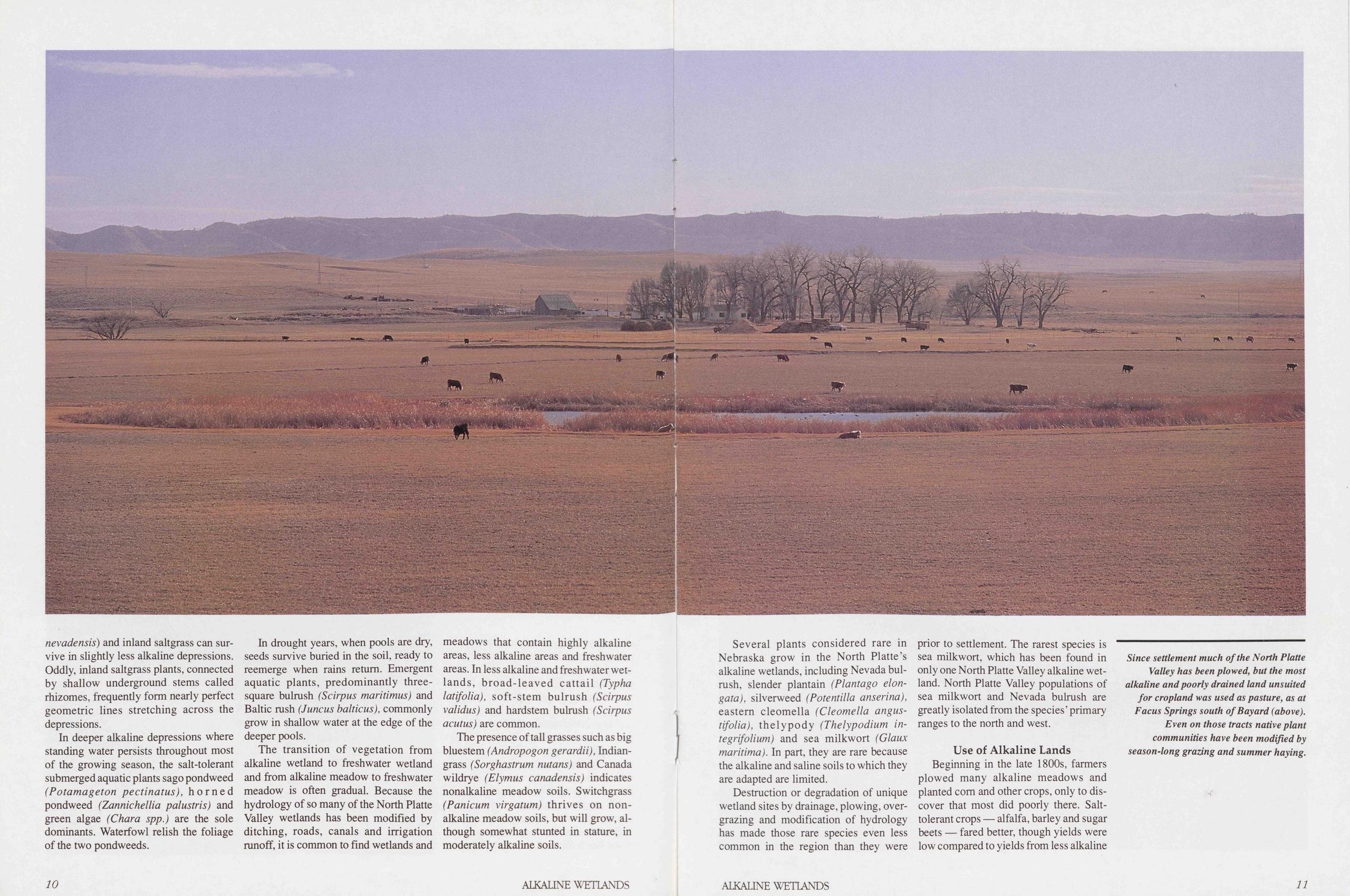
nevadensis) and inland saltgrass can survive in slightly less alkaline depressions. Oddly, inland saltgrass plants, connected by shallow Underground stems called rhizomes, frequently form nearly perfect geometric lines Stretching across the depressions.
In deeper alkaline depressions where Standing water persists throughout most of the growing season, the salt-tolerant submerged aquatic plants sago pondweed (Potamageton pectinatus), horned pondweed (Zannichellia palustris) and green algae (Chara spp.) are the sole dominants. Waterfowl relish the foliage of the two pondweeds.
In drought years, when pools are dry, seeds survive buried in the soil, ready to reemerge when rains retum. Emergent aquatic plants, predominantly three-square bulrush (Scirpus maritimus) and Baltic rush (Juncus balticus), commonly grow in shallow water at the edge of the deeper pools.
The transition of Vegetation from alkaline wetland to freshwater wetland and from alkaline meadow to freshwater meadow is often gradual. Because the hydrology of so many of the North Platte Valley wetlands has been modified by ditching, roads, canals and Irrigation runoff, it is common to find wetlands and meadows that contain highly alkaline areas, less alkaline areas and freshwater areas. In less alkaline and freshwater wetlands, broad-leaved cattail (Typha latifolia), soft-stem bulrush (Scirpus validus) and hardstem bulrush (Scirpus acutus) are common.
The presence of tall grasses such as big bluestem (Andropogon gerardii), Indiangrass (Sorghastrum nutans) and Canada wildrye (Elymus canadensis) indicates nonalkaline meadow soils. Switchgrass (Panicum virgatum) thrives on non-alkaline meadow soils, but will grow, although somewhat stunted in stature, in moderately alkaline soils.
10 ALKALINE WETLANDSSeveral plants considered rare in Nebraska grow in the North Platte’s alkaline wetlands, including Nevada bulrush, slender plantain (Plantago elongata), silverweed (Potentilla anserina), eastern cleomella (Cleomella angustifolia), thelypody (Thelypodium integrifolium) and sea milkwort (Glaux maritima). In part, they are rare because the alkaline and sahne soils to which they are adapted are limited.
Destruction or degradation of unique wetland sites by drainage, plowing, overgrazing and modification of hydrology has made those rare species even less common in the region than they were prior to Settlement. The rarest species is sea milkwort, which has been found in only one North Platte Valley alkaline wetland. North Platte Valley populations of sea milkwort and Nevada bulrush are greatly isolated from the species’ primary ranges to the north and west.
Use of Alkaline LandsBeginning in the late 1800s, farmers plowed many alkaline meadows and planted com and other crops, only to discover that most did poorly there. Salt-tolerant crops — alfalfa, barley and sugar beets — fared better, though yields were low compared to yields from less alkaline
Since Settlement much of the North Platte Valley has been plowed, but the most alkaline and poorly drained land unsuited for cropland was used as pasture, as at Facus Springs south of Bayard (above). Even on those tracts native plant communities have been modified by season-long grazing and summer haying.
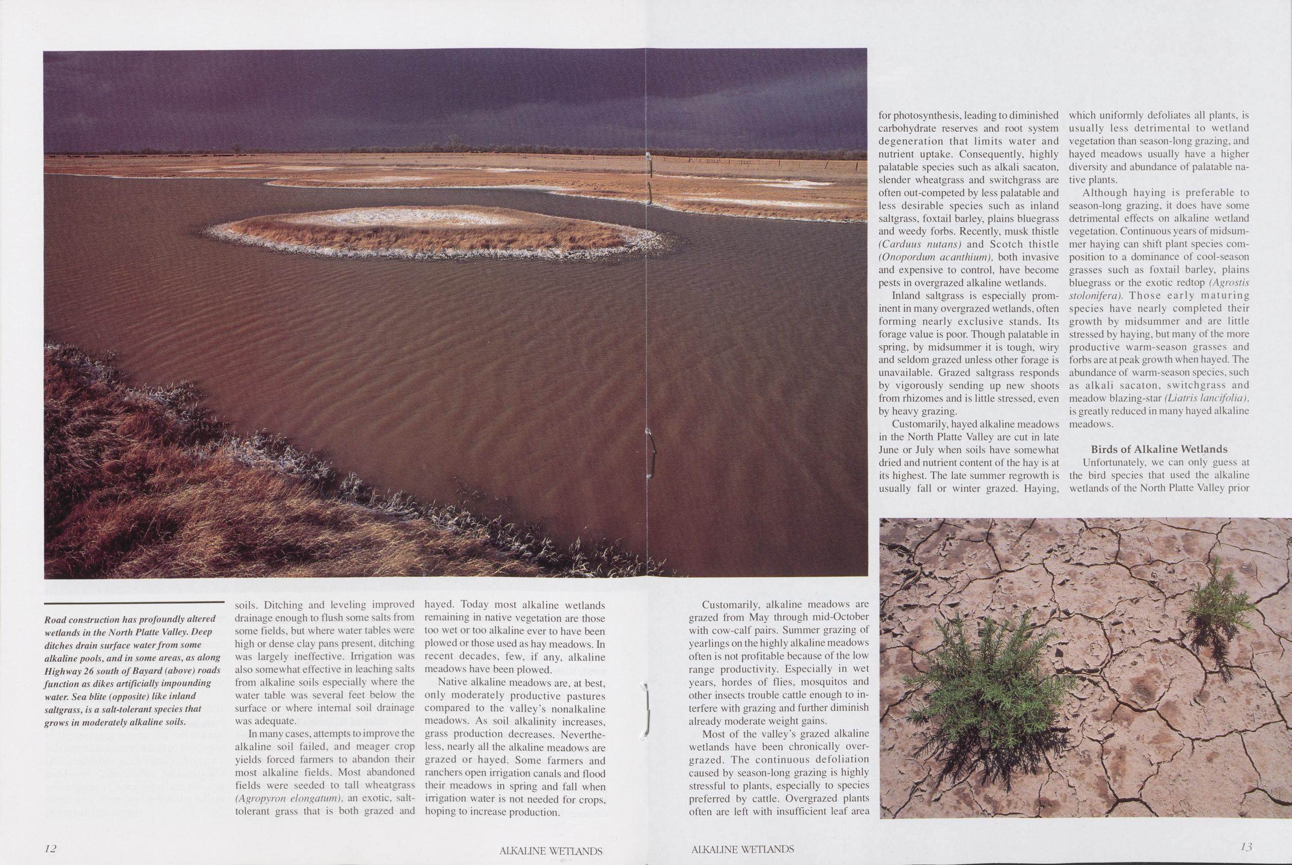
Road construction has profoundly altered wetlands in the North Platte Valley. Deep ditches drain surface water from some alkaline pools, and in some areas, as along Highway 26 south of Bayard (above) roads function as dikes artiflcially impounding water. Sea blite (opposite) like Inland saltgrass, is a salt-tolerant species that grows in moderately alkaline soils.
soils. Ditching and leveling improved drainage enough to flush some salts from some fields, but where water tables were high or dense clay pans present, ditching was largely ineffective. Irrigation was also somewhat effective in leaching salts from alkaline soils especially where the water table was several feet below the surface or where internal soil drainage was adequate.
In many cases, attempts to improve the alkaline soil failed, and meager crop yields forced farmers to abandon their most alkaline fields. Most abandoned fields were seeded to tall wheatgrass (Agropyron elongatum), an exotic, salt-tolerant grass that is both grazed and hayed. Today most alkaline wetlands remaining in native Vegetation are those too wet or too alkaline ever to have been plowed or those used as hay meadows. In recent decades, few, if any, alkaline meadows have been plowed.
Native alkaline meadows are, at best, only moderately productive pastures compared to the valley’s nonalkaline meadows. As soil alkalinity increases, grass production decreases. Nevertheless, nearly all the alkaline meadows are grazed or hayed. Some farmers and ranchers open irrigation canals and flood their meadows in spring and fall when irrigation water is not needed for crops, hoping to increase production.
Customarily, alkaline meadows are grazed from May through mid-October with cow-calf pairs. Summer grazing of yearlings on the highly alkaline meadows often is not profitable because of the low range productivity. Especially in wet years, hordes of flies, mosquitos and other insects trouble cattle enough to in- terfere with grazing and further diminish already moderate weight gains.
Most of the valley’s grazed alkaline wetlands have been chronically over- grazed. The continuous defoliation caused by season-long grazing is highly stressful to plants, especially to species preferred by cattle. Overgrazed plants often are left with insufficient leaf area for photosynthesis, leading to diminished carbohydrate reserves and root system degeneration that limits water and nutrient uptake. Consequently, highly palatable species such as alkali sacaton, slender wheatgrass and switchgrass are often out-competed by less palatable and less desirable species such as inland saltgrass, foxtail barley, plains bluegrass and weedy forbs. Recently, musk thistle (Carduus nutans) and Scotch thistle (Onopordum acanthium), both invasive and expensive to control, have become pests in overgrazed alkaline wetlands.
Inland saltgrass is especially prom- inent in many overgrazed wetlands, often forming nearly exclusive stands. Its forage value is poor. Though palatable in spring, by midsummer it is tough, wiry and seldom grazed unless other forage is unavailable. Grazed saltgrass responds by vigorously sending up new shoots from rhizomes and is little stressed, even by heavy grazing.
Customarily, hayed alkaline meadows in the North Platte Valley are cut in late June or July when soils have somewhat dried and nutrient content of the hay is at its highest. The late summer regrowth is usually fall or winter grazed. Haying, which uniformly defoliates all plants, is usually less detrimental to wetland vegetation than season-long grazing, and hayed meadows usually have a higher diversity and abundance of palatable na- tive plants.
Although haying is preferable to season-long grazing, it does have some detrimental effects on alkaline wetland vegetation. Continuous years of midsum- mer haying can shift plant species com- position to a dominance of cool-season grasses such as foxtail barley, plains bluegrass or the exotic redtop (Agrostis stolonifera). Those early maturing species have nearly completed their growth by midsummer and are little stressed by haying, but many of the more productive warm-season grasses and forbs are at peak growth when hayed. The abundance of warm-season species, such as alkali sacaton, switchgrass and meadow blazing-star (Liatris lancifolia), is greatly reduced in many hayed alkaline meadows.
Birds of Alkaline WetlandsUnfortunately, we can only guess at the bird species that used the alkaline wetlands of the North Platte Valley prior
12 ALKALINE WETLANDS ALKALINE WETIANDS 13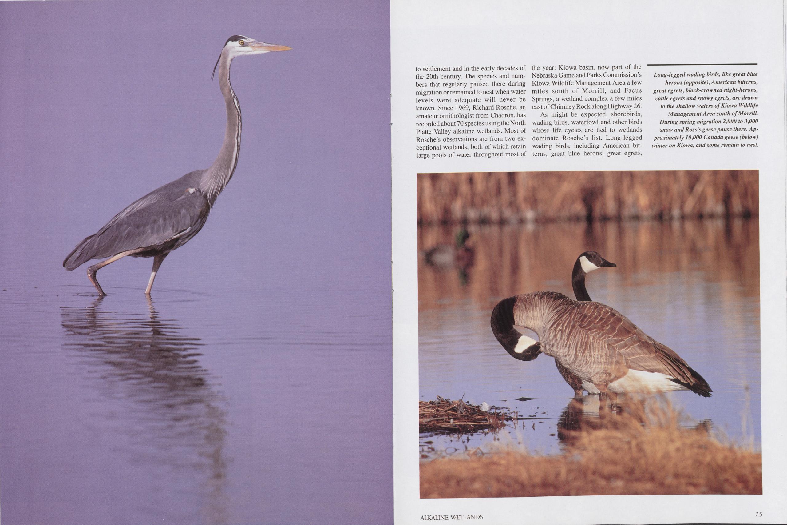
to settlement and in the early decades of the 20th Century. The species and numbers that regularly paused there during migration or remained to nest when water levels were adequate will never be known. Since 1969, Richard Rosche, an amateur omithologist from Chadron, has recorded about 70 species using the North Platte Valley alkaline wetlands. Most of Rosche’s observations are from two exceptional wetlands, both of which retain large pools of water throughout most of the year: Kiowa basin, now part of the Nebraska Game and Parks Commission’s Kiowa Wildlife Management Area a few miles south of Morrill, and Facus Springs, a wetland complex a few miles east of Chimney Rock along Highway 26.
As might be expected, shorebirds, wading birds, waterfowl and other birds whose life cycles are tied to wetlands dominate Rosche’s list. Long-legged wading birds, including American bittems, great blue herons, great egrets,
Long-legged wading birds, like great blue herons (opposite), American bitterns, great egrets, black-crowned night-herons, cattle egrets and snowy egrets, are drawn to the shallow waters of Kiowa Wildlife Management Area south of Morrill. During spring migration 2,000 to 3,000 snow and Ross’s geese pause there. Approximately 10,000 Canada geese (below) winter on Kiowa, and some remain to nest.
Sandhills Alkaline Wetlands
The Nebraska Sandhills, North Americas largest dune field renowned for its extensive freshwater aquifers, also contains some of the world’s most alkaline wet- lands and lakes. Some 98 percent of the Sandhill’s hyperalkaline lakes are in the “closed basin” region of Garden, Sheridan and Morri» counties in the western Sandhills — an area of poor drainage and few outlet streams. Among the “hottest” is Sand Lake in Garden County. Its alkalinity was once measured at 136,000 milligrams/liter (mg/l). Forcomparison, the freshwater Pelican Lake onthe Valentine National Wildlife Refuge has an alkalinity around 250 mg/l.
In the Sandhills, wetlands and lakes form in interdunal basins and valleys where groundwater seepage from aquifers below the dunes is abundant. Alkaline wetlands and lakes typically develop in basins with no outlet streams and poor subsurface drainage, preventing saltsfrom escaping through outflowand seepage into subsurface waters. Over time, surface water evaporation increases the salt concentrations.
The most abundant salts in Sandhills alkaline wetlands and lakes are sodium and potassium carbonates. Common but less abundant are calcium and magnesium carbonates. The salts commonly accumulate as evaporite on shorelines, aquatic Vegetation and at times, as a thin film on the water surface. With decreasing temperatures, the water’s ability to suspend soluble salts decreases and precipitates offen form and settle, covering the lake bottom with whitish ooze.
An interesting piece of Sandhills history involving these salt precipitates is the mining of potash (potassium salts) from Sandhills alkaline lake bottoms for use as agricultural fertilizers. The first serious attempt to mine the Sandhills’ potash was undertaken in 1912, when the Potash Reduction Company was established on the shore of Jesse Lake five miles northwest of Antioch. At peak production, 10 Companies were mining 100 tons of potash per day in and around Southern Sheridan County. However, soon after World War I, the availability of less expensive German potash brought an end to the Sandhill’s short-lived potash industry. Remains of several old potash plants can still been in the Lakeside and Antioch area.
The diversity of plant and animal life in the strongly alkaline Sandhills wetlands and lakes is low compared to the region’s slightly alkaline and freshwater wetlands and lakes. The salt-tolerant emergent plants inland saltgrass, chair-maker’s rush (Scirpus americanus) and hardstem bulrush (Scirpus acutus) and the submergent plants widgeon grass (Fluppia maritima) and sage pondweed are offen the only plants growing the highly alkaline wetlands. The submergents usually cannot survive in waters with alkalinities greater than 10,000 mg/l, and hyperalkaline wetlands are offen totally devoid of plant life.
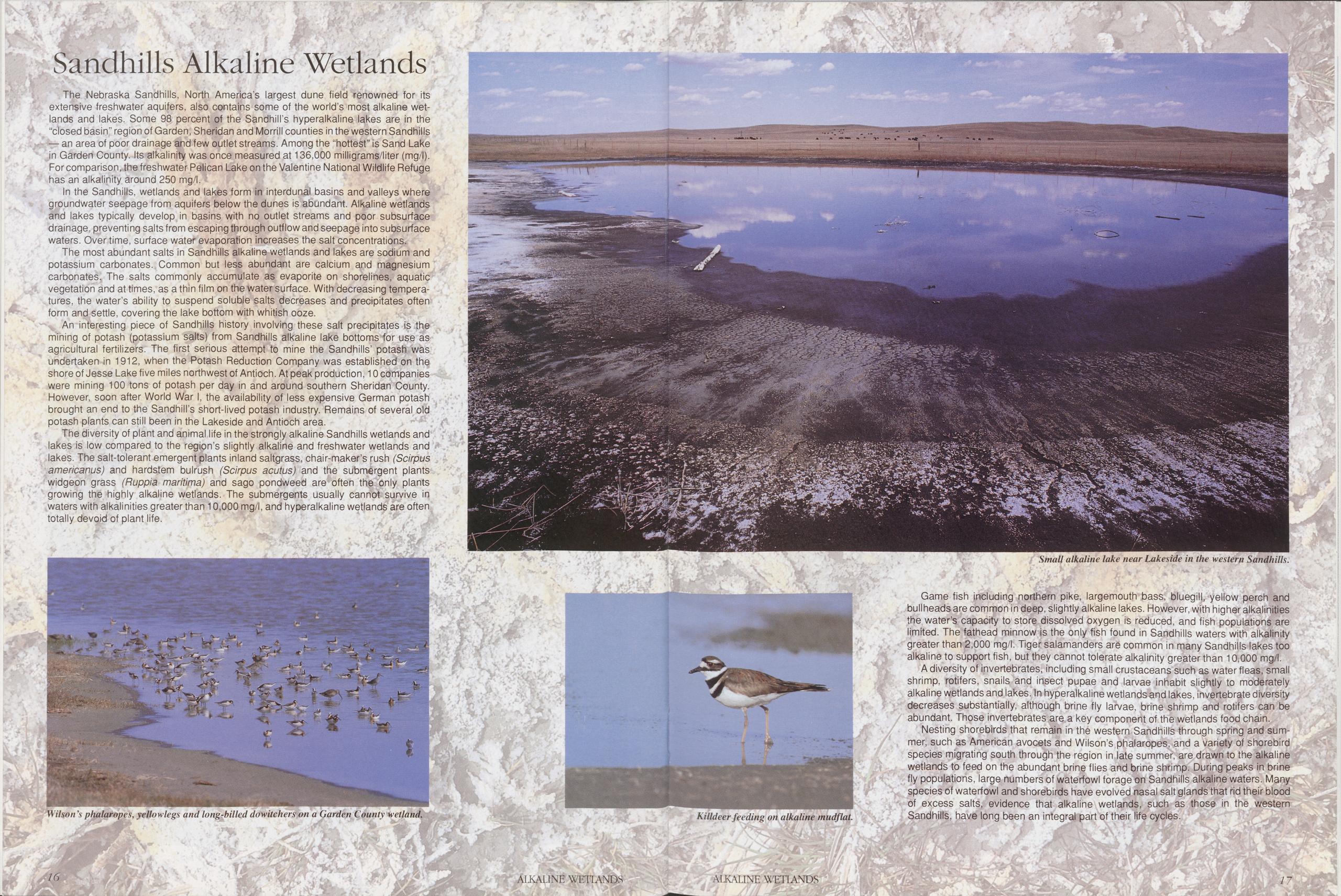
Wilson’s phalaropes, yellowlegs and long-billed dowitchers on a Garden County wetland.
Killdeer feeding on alkaline mudflat.
Small alkaline lake near Lakeside in the Western Sandhills.
Game fish including northern pike, largemouth bass, bluegill, yellow perch and bullheads are common in deep, slightly alkaline lakes. However, with higher alkalinities the water’s capacity to störe dissolved oxygen is reduced, and fish populations are limited. The fathead minnow is the only fish found in Sandhills waters with alkalinity greater than 2,000 mg/l. Tiger Salamanders are common in many Sandhills lakes too alkaline to Support fish, but they cannot tolerate alkalinity greater than 10,000 mg/l.
A diversity of invertebrates, including small crustaceans such as water fleas, small shrimp, rotifers, snails and insect pupae and larvae inhabit slightly to moderately alkaline wetlands and lakes. In hyperalkaline wetlands and lakes, invertebrate diversity decreases substantially, although brine fly larvae, brine shrimp and rotifers can be abundant. Those invertebrates are a key component of the wetlands food chain.
Nesting shorebirds that remain in the Western Sandhills through spring and Summer, such as American avocets and Wilson’s phalaropes, and a variety of shorebird species migrating south through the region in late summer, are drawn to the alkaline wetlands to feed on the abundant brine flies and brine shrimp. Düring peaks in brine fly populations, large numbers of waterfowl forage on Sandhills alkaline waters. Many species of waterfowl and shorebirds have evolved nasal salt glands that rid their blood of excess salts, evidence that alkaline wetlands, such as those in the Western Sandhills, have long been an integral part of their life cycles.
17 ALKALINE WETLANDS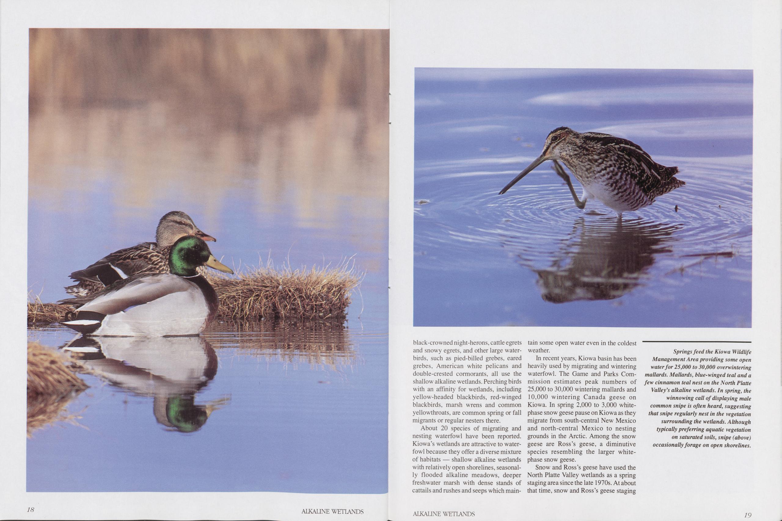
black-crowned night-herons, cattle egrets and snowy egrets, and other large water- birds, such as pied-billed grebes, eared grebes, American white pelicans and double-crested cormorants, all use the shallow alkaline wetlands. Perching birds with an affinity for wetlands, including yellow-headed blackbirds, red-winged blackbirds, marsh wrens and common yellowthroats, are common spring or fall migrants or regular nesters there.
About 20 species of migrating and nesting waterfowl have been reported. Kiowa’s wetlands are attractive to water- fowl because they offer a diverse mixture of habitats — shallow alkaline wetlands with relatively open shorelines, seasonal- ly flooded alkaline meadows, deeper freshwater marsh with dense stands of cattails and rushes and seeps which main- tain some open water even in the coldest weather.
In recent years, Kiowa basin has been heavily used by migrating and wintering waterfowl. The Game and Parks Com- mission estimates peak numbers of 25,000 to 30,000 wintering mallards and 10,000 wintering Canada geese on Kiowa. In spring 2,000 to 3,000 white- phase snow geese pause on Kiowa as they migrate from south-central New Mexico and north-central Mexico to nesting grounds in the Arctic. Among the snow geese are Ross’s geese, a diminutive species resembling the larger white- phase snow geese.
Snow and Ross’s geese have used the North Platte Valley wetlands as a spring staging area since the late 1970s. At about that time, snow and Ross’s geese staging
Springs feed the Kiowa Wildlife Management Area providing some open water for 25,000 to 30,000 overwintering mallards. Mallards, blue-winged teal and a few cinnamon teal nest on the North Platte Valley's alkaline wetlands. In spring, the winnowing call of displaying male common snipe is often heard, suggesting that snipe regularly nest in the vegetation surrounding the wetlands. Although typically preferring aquatic vegetation on saturated soils, snipe (above) occasionally forage on open shorelines.
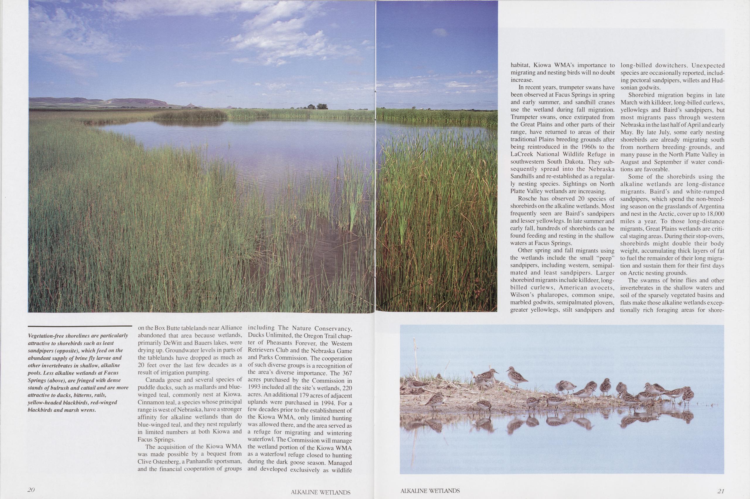
Vegetation-free shorelines are particularly attractive to shorebirds such as least sandpipers (opposite), which feed on the abundant supply of brine fly larvae and other invertebrates in shallow, alkaline pools. Less alkaline wetlands at Facus Springs (above), are fringed with dense stands of bulrush and cattail and are more attractive to ducks, bitterns, rails, yellow-headed blackbirds, red-winged blackbirds and marsh wrens.
on the Box Butte tablelands near Alliance abandoned that area because wetlands, primarily DeWitt and Bauers lakes, were drying up. Groundwater levels in parts of the tablelands have dropped as much as 20 feet over the last few decades as a result of irrigation pumping.
Canada geese and several species of puddle ducks, such as mallards and blue- winged teal, commonly nest at Kiowa. Cinnamon teal, a species whose principal range is west of Nebraska, have a stronger affinity for alkaline wetlands than do blue-winged teal, and they nest regularly in limited numbers at both Kiowa and Facus Springs.
The acquisition of the Kiowa WMA was made possible by a bequest from Clive Ostenberg, a Panhandle sportsman, and the financial cooperation of groups including The Nature Conservancy, Ducks Unlimited, the Oregon Trail chap- ter of Pheasants Forever, the Western Retrievers Club and the Nebraska Game and Parks Commission. The cooperation of such diverse groups is a recognition of the area’s diverse importance. The 367 acres purchased by the Commission in 1993 included all the site’s wetlands, 220 acres. An additional 179 acres of adjacent uplands were purchased in 1994. For a few decades prior to the establishment of the Kiowa WMA, only limited hunting was allowed there, and the area served as a refuge for migrating and wintering waterfowl. The Commission will manage the wetland portion of the Kiowa WMA as a waterfowl refuge closed to hunting during the dark goose season. Managed and developed exclusively as wildlife habitat, Kiowa WMA’s importance to migrating and nesting birds will no doubt increase.
In recent years, trumpeter swans have been observed at Facus Springs in spring and early summer, and sandhill cranes use the wetland during fall migration. Trumpeter swans, once extirpated from the Great Plains and other parts of their range, have returned to areas of their traditional Plains breeding grounds after being reintroduced in the 1960s to the LaCreek National Wildlife Refuge in southwestern South Dakota. They sub- sequently spread into the Nebraska Sandhills and re-established as a regular- ly nesting species. Sightings on North Platte Valley wetlands are increasing.
Rosche has observed 20 species of shorebirds on the alkaline wetlands. Most frequently seen are Baird’s sandpipers and lesser yellowlegs. In late summer and early fall, hundreds of shorebirds can be found feeding and resting in the shallow waters at Facus Springs.
Other spring and fall migrants using the wetlands include the small "peep” sandpipers, including western, semipal- mated and least sandpipers. Larger shorebird migrants include killdeer, long- billed curlews, American avocets, Wilson’s phalaropes, common snipe, marbled godwits, semipalmated plovers, greater yellowlegs, stilt sandpipers and long-billed dowitchers. Unexpected species are occasionally reported, includ- ing pectoral sandpipers, willets and Hud- sonian godwits.
Shorebird migration begins in late March with killdeer, long-billed curlews, yellowlegs and Baird’s sandpipers, but most migrants pass through western Nebraska in the last half of April and early May. By late July, some early nesting shorebirds are already migrating south from northern breeding- grounds, and many pause in the North Platte Valley in August and September if water condi- tions are favorable.
Some of the shorebirds using the alkaline wetlands are long-distance migrants. Baird’s and white-rumped sandpipers, which spend the non-breed- ing season on the grasslands of Argentina and nest in the Arctic, cover up to 18,000 miles a year. To those long-distance migrants, Great Plains wetlands are criti- cal staging areas. During their stop-overs, shorebirds might double their body weight, accumulating thick layers of fat to fuel the remainder of their long migra- tion and sustain them for their first days on Arctic nesting grounds.
The swarms of brine flies and other invertebrates in the shallow waters and soil of the sparsely vegetated basins and flats make those alkaline wetlands excep- tionally rich foraging areas for shore-
20 ALKALINE WETLANDS ALKALINE WETLANDS 21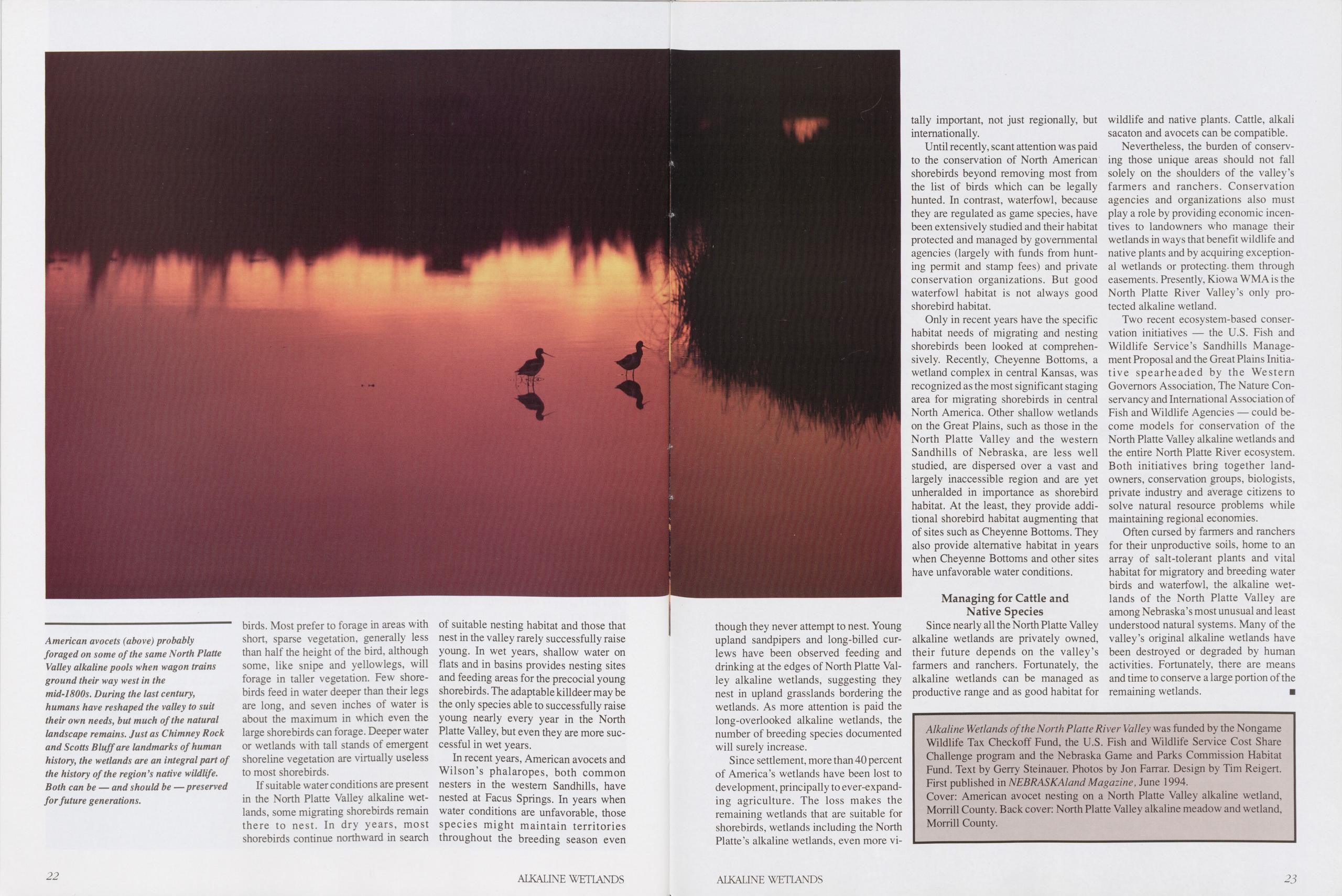
American avocets (above) probably foraged on some of the same North Platte Valley alkaline pools when wagon trains ground their way west in the mid-1800s. During the last century, humans have reshaped the valley to suit their own needs, but much of the natural landscape remains. Just as Chimney Rock and Scotts Bluff are landmarks of human history, the wetlands are an integral part of the history of the region’s native wildlife. Both can be — and should be — preserved for future generations.
birds. Most prefer to forage in areas with short, sparse vegetation, generally less than half the height of the bird, although some, like snipe and yellowlegs, will forage in taller vegetation. Few shore- birds feed in water deeper than their legs are long, and seven inches of water is about the maximum in which even the large shorebirds can forage. Deeper water or wetlands with tall stands of emergent shoreline vegetation are virtually useless to most shorebirds.
If suitable water conditions are present in the North Platte Valley alkaline wet- lands, some migrating shorebirds remain there to nest. In dry years, most shorebirds continue northward in search of suitable nesting habitat and those that nest in the valley rarely successfully raise young. In wet years, shallow water on flats and in basins provides nesting sites and feeding areas for the precocial young shorebirds. The adaptable killdeer may be the only species able to successfully raise young nearly every year in the North Platte Valley, but even they are more suc- cessful in wet years.
In recent years, American avocets and Wilson’s phalaropes, both common nesters in the western Sandhills, have nested at Facus Springs. In years when water conditions are unfavorable, those species might maintain territories throughout the breeding season even
though they never attempt to nest. Young upland sandpipers and long-billed curlews have been observed feeding and drinking at the edges of North Platte Valley alkaline wetlands, suggesting they nest in upland grasslands bordering the wetlands. As more attention is paid the long-overlooked alkaline wetlands, the number of breeding species documented will surely increase.
Since Settlement, more than 40 percent of America’s wetlands have been lost to development, principally to ever-expanding agriculture. The loss makes the remaining wetlands that are suitable for shorebirds, wetlands including the North Platte’s alkaline wetlands, even more vitally important, not just regionally, but intemationally.
Until recently, scant attention was paid to the Conservation of North American shorebirds beyond removing most from the list of birds which can be legally hunted. In contrast, waterfowl, because they are regulated as game species, have been extensively studied and their habitat protected and managed by governmental agencies (largely with funds from hunting permit and stamp fees) and private Conservation organizations. But good waterfowl habitat is not always good shorebird habitat.
Only in recent years have the specific habitat needs of migrating and nesting shorebirds been looked at comprehensively. Recently, Cheyenne Bottoms, a wetland complex in central Kansas, was recognized as the most significant Staging area for migrating shorebirds in central North America. Other shallow wetlands on the Great Plains, such as those in the North Platte Valley and the Western Sandhills of Nebraska, are less well studied, are dispersed over a vast and largely inaccessible region and are yet unheralded in importance as shorebird habitat. At the least, they provide additional shorebird habitat augmenting that of sites such as Cheyenne Bottoms. They also provide alternative habitat in years when Cheyenne Bottoms and other sites have unfavorable water conditions.
Managing for Cattle and Native SpeciesSince nearly all the North Platte Valley alkaline wetlands are privately owned, their future depends on the valley’s farmers and ranchers. Fortunately, the alkaline wetlands can be managed as productive ränge and as good habitat for wildlife and native plants. Cattle, alkali sacaton and avocets can be compatible.
Nevertheless, the bürden of conserving those unique areas should not fall solely on the shoulders of the valley’s farmers and ranchers. Conservation agencies and organizations also must play a role by providing economic incentives to landowners who manage their wetlands in ways that bene fit wildlife and native plants and by acquiring exceptional wetlands or protecting them through easements. Presently, Kiowa WMA is the North Platte River Valley’s only protected alkaline wetland.
Two recent ecosystem-based Conservation initiatives — the U.S. Fish and Wildlife Service’s Sandhills Management Proposal and the Great Plains Initiative spearheaded by the Western Governors Association, The Nature Conservancy and International Association of Fish and Wildlife Agencies — could become models for Conservation of the North Platte Valley alkaline wetlands and the entire North Platte River ecosystem. Both initiatives bring together land- owners, Conservation groups, biologists, private industry and average citizens to solve natural resource problems while maintaining regional economies.
Often cursed by farmers and ranchers for their unproductive soils, home to an array of salt-tolerant plants and vital habitat for migratory and breeding water birds and waterfowl, the alkaline wetlands of the North Platte Valley are among Nebraska’s most unusual and least understood natural Systems. Many of the valley’s original alkaline wetlands have been destroyed or degraded by human activities. Fortunately, there are means and time to conserve a large portion of the remaining wetlands. ■
Alkaline Wetlands ofthe North Platte River Valley was funded by the Nongame Wildlife Tax Checkoff Fund, the U.S. Fish and Wildlife Service Cost Share Challenge program and the Nebraska Game and Parks Commission Habitat Fund. Text by Gerry Steinauer. Photos by Jon Farrar. Design by Tim Reigen. First published in NEBRASKAland Magazine, June 1994. Cover: American avocet nesting on a North Platte Valley alkaline wetland, Morrill County. Back cover: North Platte Valley alkaline meadow and wetland, Morrill County. 22 ALKALINE WETLANDS ALKALINE WETLANDS 23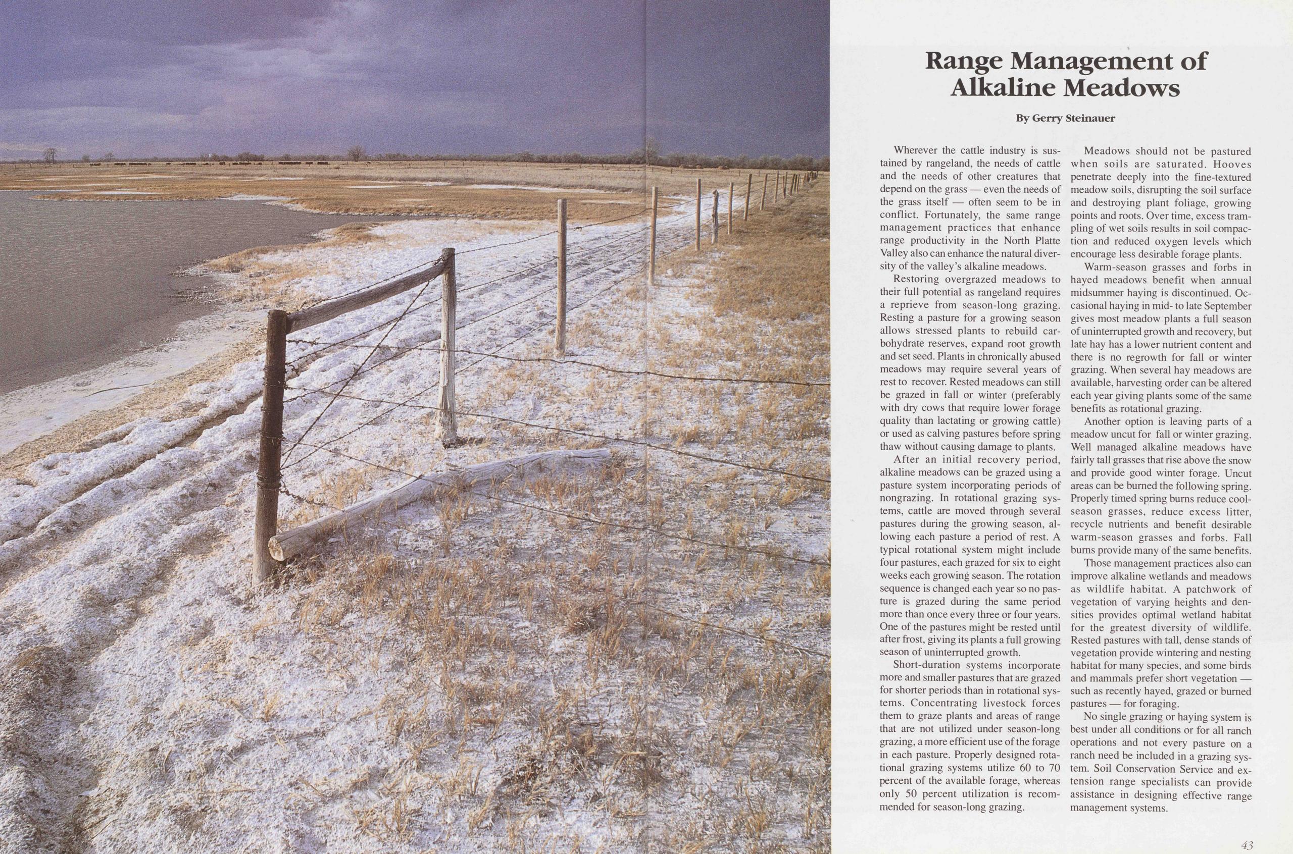
Range Management of Alkaline Meadows
Wherever the cattle industry is sustained by rangeland, the needs of cattle and the needs of other creatures that depend on the grass — even the needs of the grass itself — often seem to be in conflict. Fortunately, the same range management practices that enhance ränge productivity in the North Platte Valley also can enhance the natural diversity of the valley’s alkaline meadows.
Restoring overgrazed meadows to their full potential as rangeland requires a reprieve from season-long grazing. Resting a pasture for a growing season allows stressed plants to rebuild carbohydrate reserves, expand root growth and set seed. Plants in chronically abused meadows may require several years of rest to recover. Rested meadows can still be grazed in fall or winter (preferably with dry cows that require lower forage quality than lactating or growing cattle) or used as calving pastures before spring thaw without causing damage to plants.
After an initial recovery period, alkaline meadows can be grazed using a pasture System incorporating periods of nongrazing. In relational grazing Systems, cattle are moved through several pastures during the growing season, allowing each pasture a period of rest. A typical relational System might include four pastures, each grazed for six to eight weeks each growing season. The rotation sequence is changed each year so no pasture is grazed during the same period more than once every three or four years. One of the pastures might be rested until after frost, giving its plants a full growing season of uninterrupted growth.
Short-duration Systems incorporate more and smaller pastures that are grazed for shorter periods than in relational Systems. Concentrating livestock forces them to graze plants and areas of range that are not utilized under season-long grazing, a more efficient use of the forage in each pasture. Properly designed relational grazing Systems utilize 60 to 70 percent of the available forage, whereas only 50 percent utilization is recom- mended for season-long grazing.
Meadows should not be pastured when soils are saturated. Hooves penetrate deeply inte the fine-textured meadow soils, disrupting the seil surface and destroying plant foliage, growing points and roots. Over time, excess trampling of wet soils results in seil compaction and reduced oxygen levels which encourage less desirable forage plants.
Warm-season grasses and forbs in hayed meadows benefit when annual midsummer haying is discontinued. Oc- casional haying in mid- to late September gives most meadow plants a full season of uninterrupted growth and recovery, but late hay has a lower nutrient content and there is no regrowth for fall or winter grazing. When several hay meadows are available, harvesting Order can be altered each year giving plants some of the same benefits as relational grazing.
Another Option is leaving parts of a meadow uncut for fall or winter grazing. Well managed alkaline meadows have fairly tall grasses that rise above the snow and provide good winter forage. Uncut areas can be bumed the following spring. Properly timed spring bums reduce cool-season grasses, reduce excess litter, recycle nutrients and benefit desirable warm-season grasses and forbs. Fall bums provide many of the same benefits.
These management practices also can improve alkaline wetlands and meadows as wildlife habitat. A patchwork of Vegetation of varying heights and densities provides optimal wetland habitat for the greatest diversity of wildlife. Rested pastures with tall, dense Stands of Vegetation provide wintering and nesting habitat for many species, and some birds and mammals prefer short Vegetation — such as recently hayed, grazed or bumed pastures — for foraging.
No single grazing or haying System is best under all conditions or for all ranch operations and not every pasture on a ranch need be included in a grazing System. Soil Conservation Service and extension range specialists can provide assistance in designing effective ränge management Systems.
43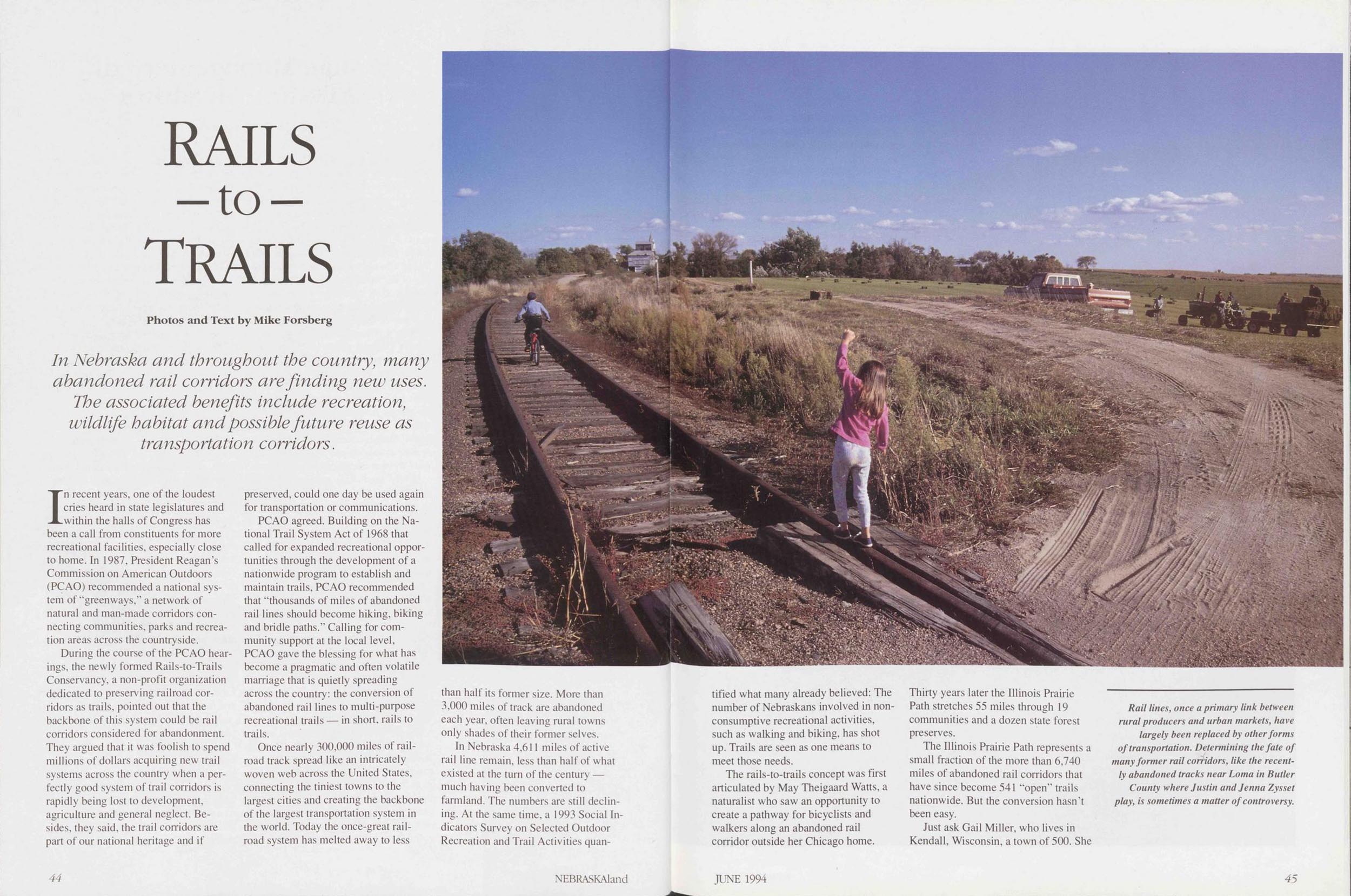
RAILS to Trails
In Nebraska and throughout tbe country, many abandoned rail corridors are finding new uses. Tbe associated benefits include recreation, wildlife habitat andpossible future reuse as transportation corridors.
In recent years, one of the loudest cries heard in state legislatures and within the halls of Congress has been a call from constituents for more recreational facilities, especially close to home. In 1987, President Reagan’s Commission on American Outdoors (PCAO) recommended a national System of “greenways,” a network of natural and man-made corridors connecting communities, parks and recreation areas across the countryside.
During the course of the PCAO hearings, the newly formed Rails-to-Trails Conservancy, a non-profit Organization dedicated to preserving railroad corridors as trails, pointed out that the backbone of this System could be rail corridors considered for abandonment. They argued that it was foolish to spend miIlions of dollars acquiring new trail Systems across the country when a perfectly good System of trail corridors is rapidly being lost to development, agriculture and general neglect. Besides, they said, the trail corridors are part of our national heritage and if preserved, could one day be used again for transportation or Communications.
PCAO agreed. Building on the National Trail System Act of 1968 that called for expanded recreational opportunstes through the development of a nationwide program to establish and maintain trails, PCAO recommended that “thousands of miles of abandoned rail lines should become hiking, biking and bridle paths.” Calling for Community support at the local level, PCAO gave the blessing for what has become a pragmatic and often volatile marriage that is quietly spreading across the country: the conversion of abandoned rail lines to multi-purpose recreational trails — in short, rails to trails.
Once nearly 300,000 miles of railroad track spread like an intricately woven web across the United States, connecting the tiniest towns to the largest cities and creating the backbone of the largest transportation System in the world. Today the once-great railroad System has melted away to less than half its former size. More than 3,000 miles of track are abandoned each year, often leaving rural towns only shades of their former selves.
In Nebraska 4,611 miles of active rail line remain, less than half of what existed at the turn of the Century — much having been converted to farm land. The numbers are still declin- ing. At the same time, a 1993 Social Indicators Survey on Selected Outdoor Recreation and Trail Activities quan- tified 44 NEBRASKAland what many already believed: The number of Nebraskans involved in non-consumptive recreational activities, such as walking and biking, has shot up. Trails are seen as one means to meet those needs.
The rails-to-trails concept was first articulated by May Theigaard Watts, a naturalist who saw an opportunity to create a pathway for bicyclists and walkers along an abandoned rail corridor outside her Chicago home. Thirty years later the Illinois Prairie Path Stretches 55 miles through 19 communities and a dozen state forest preserves.
The Illinois Prairie Path represents a small fraction of the more than 6,740 miles of abandoned rail corridors that have since become 541 “open” trails nationwide. But the conversion hasn’t been easy.
Just ask Gail Miller, who lives in Kendall, Wisconsin, a town of 500. She
Rail lines, once a primary link between rural producers and urban markets, have largely been replaced by other forms of transportation. Determining thefate of many former rail corridors, like the recently abandoned tracks ne ar Loma in Butler County where Justin and Jenna Zysset play, is sometimes a matter of controversy.
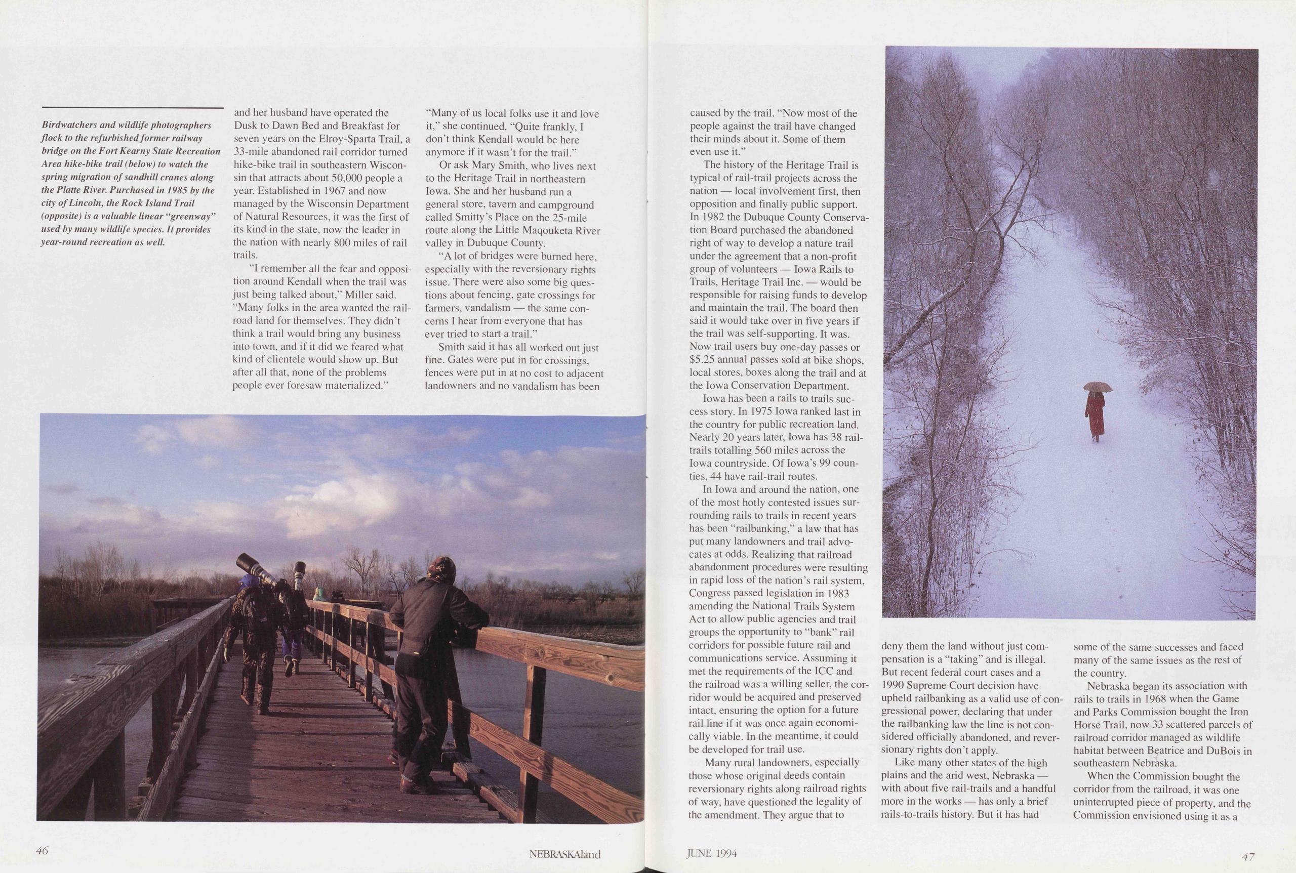
Birdwatchers and wildlife photographers flock to the refurbished former railway bridge on the Fort Kearny State Recreation Area hike-bike trail (below) to watch the spring migration of sandhill cranes along the Platte River. Purchased in 1985 by the city of Lincoln, the Rock Island Trail (opposite) is a valuable linear “greenway” used by many wildlife species. It provides year-round recreation as well.
and her husband have operated the Dusk to Dawn Bed and Breakfast for seven years on the Elroy-Sparta Trail, a 33-mile abandoned rail corridor tumed hike-bike trail in southeastem Wisconsin that attracts about 50,000 people a year. Established in 1967 and now managed by the Wisconsin Department of Natural Resources, it was the first of its kind in the state, now the leader in the nation with nearly 800 miles of rail trails.
“I remember all the fear and Opposition around Kendal 1 when the trail was just being talked about,” Miller said. “Many folks in the area wanted the railroad land for themselves. They didn’t think a trail would bring any business into town, and if it did we feared what kind of clientele would show up. But after all that, none of the problems people ever foresaw materialized.” “Many of us local folks use it and love it,” she continued. “Quite frankly, I don’t think Kendall would be here anymore if it wasn’t for the trail.”
Or ask Mary Smith, who lives next to the Heritage Trail in northeastem Iowa. She and her husband run a general störe, tavem and campground called Smitty’s Place on the 25-mile route along the Little Maqouketa River valley in Dubuque County.
“A lot of bridges were bumed here, especially with the reversionary rights issue. There were also some big questions about fencing, gate crossings for farmers, vandalism — the same concerns I hear from everyone that has ever tried to start a trail.”
Smith said it has all worked out just fine. Gates were put in for crossings, fences were put in at no cost to adjacent landowners and no vandalism has been 46 NEBRASKAland caused by the trail. “Now most of the people against the trail have changed their minds about it. Some of them even use it.”
The history of the Heritage Trail is typical of rail-trail projects across the nation — local involvement first, then Opposition and finally public support. In 1982 the Dubuque County Conservation Board purchased the abandoned right of way to develop a nature trail under the agreement that a non-profit group of volunteers — Iowa Rails to Trails, Heritage Trail Inc. — would be responsible for raising funds to develop and maintain the trail. The board then said it would take over in five years if the trail was self-supporting. It was. Now trail users buy one-day passes or $5.25 annual passes sold at bike shops, local Stores, boxes along the trail and at the Iowa Conservation Department.
Iowa has been a rails to trails success story. In 1975 Iowa ranked last in the country for public recreation land. Nearly 20 years later, Iowa has 38 rail-trails totalling 560 miles across the Iowa countryside. Of lowa’s 99 counties, 44 have rail-trail routes.
In Iowa and around the nation, one of the most hotly contested issues surrounding rails to trails in recent years has been “railbanking,” a law that has put many landowners and trail advocates at odds. Realizing that railroad abandonment procedures were resulting in rapid loss of the nation’s rail System, Congress passed legislation in 1983 amending the National Trails System Act to allow public agencies and trail groups the opportunity to “bank” rail corridors for possible future rail and Communications Service. Assuming it met the requirements of the ICC and the railroad was a willing seiler, the corridor would be acquired and preserved intact, ensuring the Option for a future rail line if it was once again economically viable. In the meantime, it could be developed for trail use.
Many rural landowners, especially those whose original deeds contain reversionary rights along railroad rights of way, have questioned the legality of the amendment. They argue that to deny them the land without just compensation is a “taking” and is illegal. But recent federal court cases and a 1990 Supreme Court decision have upheld railbanking as a valid use of congressional power, declaring that under the railbanking law the line is not considered officially abandoned, and reversionary rights don’t apply.
Like many other States of the high plains and the arid west, Nebraska — with about five rail-trails and a handful more in the works — has only a brief rails-to-trails history. But it has had some of the same successes and faced many of the same issues as the re st of the country.
Nebraska began its association with rails to trails in 1968 when the Game and Parks Commission bought the Iron Horse Trail, now 33 scattered parcels of railroad corridor managed as wildlife habitat between Beatrice and DuBois in southeastem Nebraska.
When the Commission bought the corridor from the railroad, it was one uninterrupted piece of property, and the Commission envisioned using it as a
JUNE 1994 47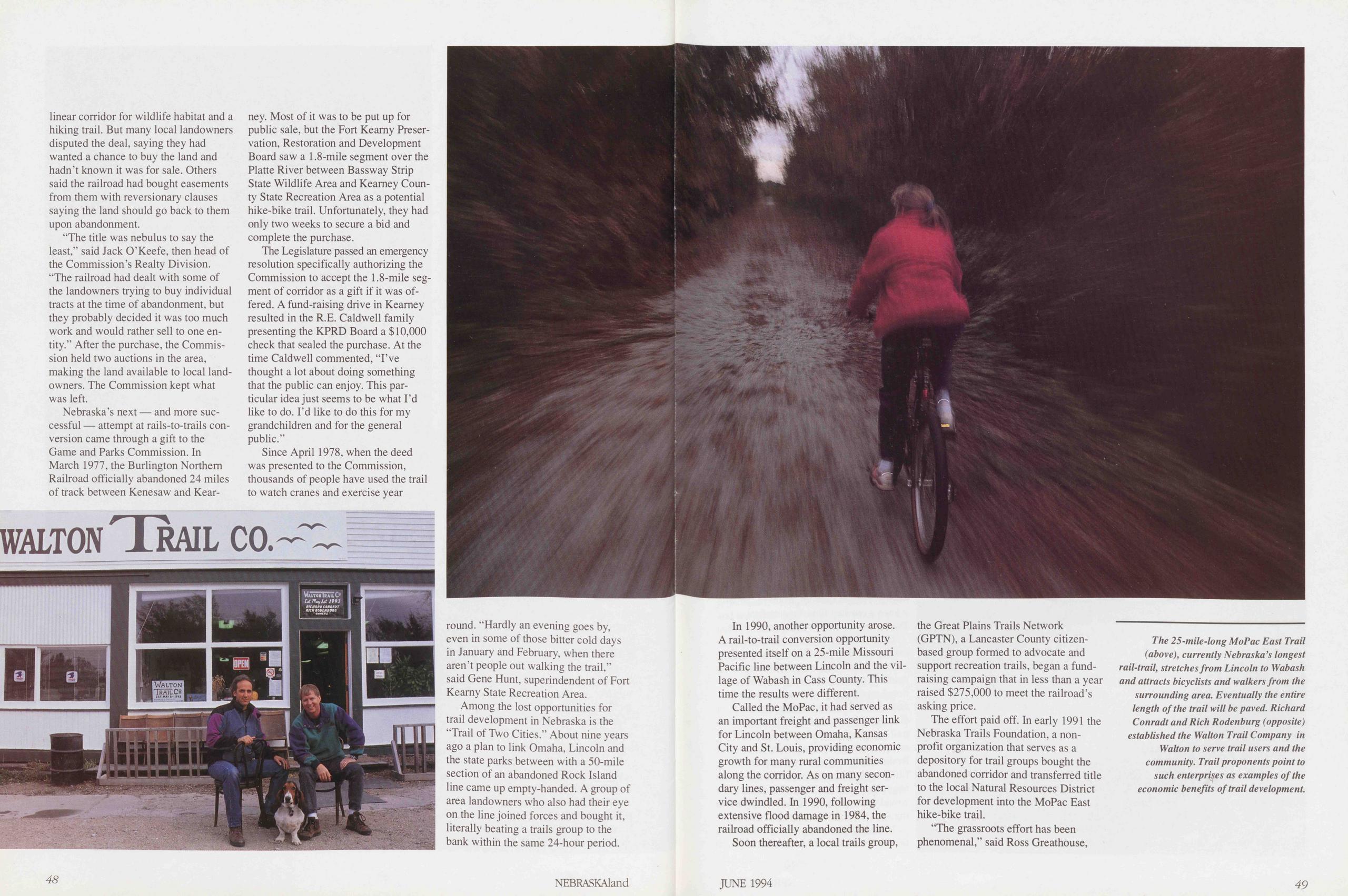
linear corridor for wildlife habitat and a hiking trail. But many local landowners disputed the deal, saying they had wanted a chance to buy the land and hadn’t known it was for sale. Others said the railroad had bought easements from them with reversionary clauses saying the land should go back to them upon abandonment.
“The title was nebulus to say the least,” said Jack O’Keefe, then head of the Commission’s Realty Division. “The railroad had dealt with some of the landowners trying to buy individual tracts at the time of abandonment, but they probably decided it was too much work and would rather seil to one en- tity.” After the purchase, the Commission held two auctions in the area, making the land available to local land-owners. The Commission kept what was left.
Nebraska’s next — and more successful — attempt at rails-to-trails conversion came through a gift to the Game and Parks Commission. In March 1977, the Burlington Northern Railroad officially abandoned 24 miles of track between Kenesaw and Kearney. Most of it was to be put up for public sale, but the Fort Kearny Preservation, Restoration and Development Board saw a 1.8-mile segment over the Platte River between Bassway Strip State Wildlife Area and Kearney County State Recreation Area as a potential hike-bike trail. Unfortunately, they had only two weeks to secure a bid and complete the purchase.
The Legislature passed an emergency resolution specifically authorizing the Commission to accept the 1.8-mile Segment of corridor as a gift if it was offered. A fund-raising drive in Kearney resulted in the R.E. Caidwell family presenting the KPRD Board a $10,000 check that sealed the purchase. At the time Caidwell commented, “I’ve thought a lot about doing something that the public can enjoy. This particular idea just seems to be what I’d like to do. I’d like to do this for my grandchildren and for the general public.”
Since April 1978, when the deed was presented to the Commission, thousands of people have used the trail to watch cranes and exercise year
Among the lost opportunities for trail development in Nebraska is the “Trail of Two Cities.” About nine years ago a plan to link Omaha, Lincoln and the state parks between with a 50-mile section of an abandoned Rock Island line came up empty-handed. A group of area landowners who also had their eye on the line joined forces and bought it, literally beating a trails group to the bank within the same 24-hour period.
48 NEBRASKAlandIn 1990, another opportunity arose. A rail-to-trail conversion opportunity presented itself on a 25-mile Missouri Pacific line between Lincoln and the village of Wabash in Cass County. This time the results were different.
Called the MoPac, it had served as an important freight and passenger link for Lincoln between Omaha, Kansas City and St. Louis, providing economic growth for many rural communities along the corridor. As on many secondary lines, passenger and freight Service dwindled. In 1990, following extensive flood damage in 1984, the railroad officially abandoned the line.
Soon thereafter, a local trails group, the Great Plains Trails Network (GPTN), a Lancaster County citizen-based group formed to advocate and support recreation trails, began a fund- raising campaign that in less than a year raised $275,000 to meet the railroad’s asking price.
The effort paid off. In early 1991 the Nebraska Trails Foundation, a non-profit Organization that serves as a depository for trail groups bought the abandoned corridor and transferred title to the local Natural Resources District for development into the MoPac East hike-bike trail.
“The grassroots effort has been phenomenal,” said Ross Greathouse,
The 25-mile-long MoPac East Trail (above), currently Nebraska’s langest rail-trail, Stretches from Lincoln to Wabash and attracts bicyclists and walkers from the surrounding area. Eventually the entire length of the trail will be paved. Richard Conradt and Rich Rodenburg (opposite) established the Walton Trail Company in Walton to serve trail users and the community. Trail proponents point to such enterprises as examples of the economic benefits of trail development.
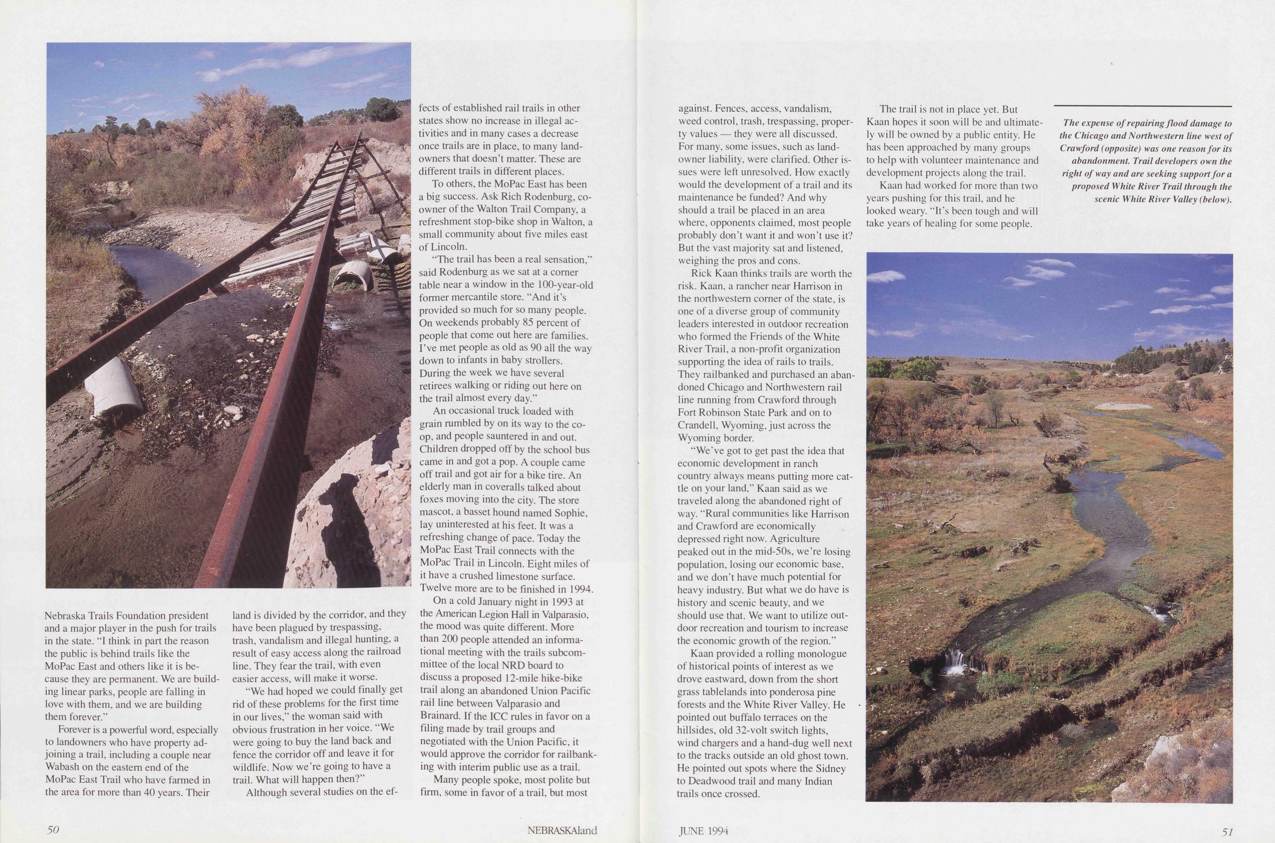
Nebraska Trails Foundation President and a major player in the push for trails in the state. "I think in part the reason the public is behind trails like the MoPac East and others like it is because they are permanent. We are building linear parks, people are falling in love with them, and we are building them forever.”
Forever is a powerful word, especially to landowners who have property adjoining a trail, including a couple ne ar Wabash on the eastem end of the MoPac East Trail who have farmed in the area for more than 40 years. Their land is divided by the corridor, and they have been plagued by trespassing, trash, vandalism and illegal hunting, a result of easy access along the railroad line. They fear the trail, with even easier access, will make it worse.
“We had hoped we could finally get rid of these problems for the first time in our lives," the woman said with obvious frustration in her voice. “We were going to buy the land back and fence the corridor off and leave it for wildlife. Now we’re going to have a trail. What will happen then?”
Although several studies on the effects of established rail trails in other States show no increase in illegal ac- tivities and in many cases a decrease once trails are in place, to many land- owners that doesn’t matter. These are different trails in different places.
To others, the MoPac East has been a big success. Ask Rich Rodenburg, co-owner of the Walton Trail Company, a refreshment stop-bike shop in Walton, a small community about five miles east of Lincoln.
“The trail has been a real Sensation,” said Rodenburg as we sat at a comer table near a window in the 100-year-old former mercantile störe. “And it’s provided so much for so many people. On weekends probably 85 percent of people that come out here are families. I’ve met people as old as 90 all the way down to infants in baby strollers. Düring the week we have several retirees walking or riding out here on the trail almost every day.”
An occasional truck loaded with grain rumbled by on its way to the co-op, and people sauntered in and out. Children dropped off by the school bus came in and got a pop. A couple came off trail and got air for a bike tire. An elderly man in coveralls talked about foxes moving into the city. The store mascot, a hasset hound named Sophie, lay uninterested at his feet. It was a refreshing change of pace. Today the MoPac East Trail connects with the MoPac Trail in Lincoln. Eight miles of it have a crushed limestone surface. Twelve more are to be finished in 1994.
On a cold January night in 1993 at the American Legion Hall in Valparasio, the mood was quite different. More than 200 people attended an informa- tional meeting with the trails subcom- mittee of the local NRD board to discuss a proposed 12-mile hike-bike trail along an abandoned Union Pacific rail line between Valparasio and Brainard. If the ICC rules in favor on a filing made by trail groups and negotiated with the Union Pacific, it would approve the corridor for railbanking with interim public use as a trail.
Many people spoke, most polite but firm, some in favor of a trail, but most 50 NEBRASKAland against. Fences, access, vandalism, weed control, trash, trespassing, property values — they were all discussed. For many, some issues, such as landowner liability, were clarified. Other issues were left unresolved. How exactly would the development of a trail and its maintenance be funded? And why should a trail be placed in an area where, opponents claimed, most people probably don’t want it and won’t use it? But the vast majority sat and listened, weighing the pros and cons.
Rick Kaan thinks trails are worth the risk. Kaan, a rancher near Harrison in the northwestern comer of the state, is one of a diverse group of community leaders interested in outdoor recreation who formed the Friends of the White River Trail, a non-profit Organization supporting the idea of rails to trails. They railbanked and purchased an abandoned Chicago and Northwestern rail line running from Crawford through Fort Robinson State Park and on to Crandell, Wyoming, just across the Wyoming border.
“We’ve got to get past the idea that economic development in ranch country always means putting more cattle on your land,” Kaan said as we traveled along the abandoned right of way. “Rural communities like Harrison and Crawford are economically depressed right now. Agriculture peaked out in the mid-50s, we’re losing population, losing our economic base, and we don’t have much potential for heavy industry. But what we do have is history and scenic beauty, and we should use that. We want to utilize outdoor recreation and tourism to increase the economic growth of the region.”
Kaan provided a rolling monologue of historical points of interest as we drove eastward, down from the short grass tablelands into ponderosa pine forests and the White River Valley. He pointed out buffalo terraces on the hillsides, old 32-volt switch lights, wind chargers and a hand-dug well next to the tracks outside an old ghost town. He pointed out spots where the Sidney to Deadwood trail and many Indian trails once crossed.
The trail is not in place yet. But Kaan hopes it soon will be and ultimately will be owned by a public entity. He has been approached by many groups to help with volunteer maintenance and development projects along the trail.
Kaan had worked for more than two years pushing for this trail, and he looked weary. “It’s been tough and will take years of healing for some people.
The expense of repairing flood damage to the Chicago and Northwestern line west of Crawford (opposite) was one reason for its ahandonment. Trail developers own the right of way and are seeking support for a proposed White River Trail through the scenic White River Valley (below).
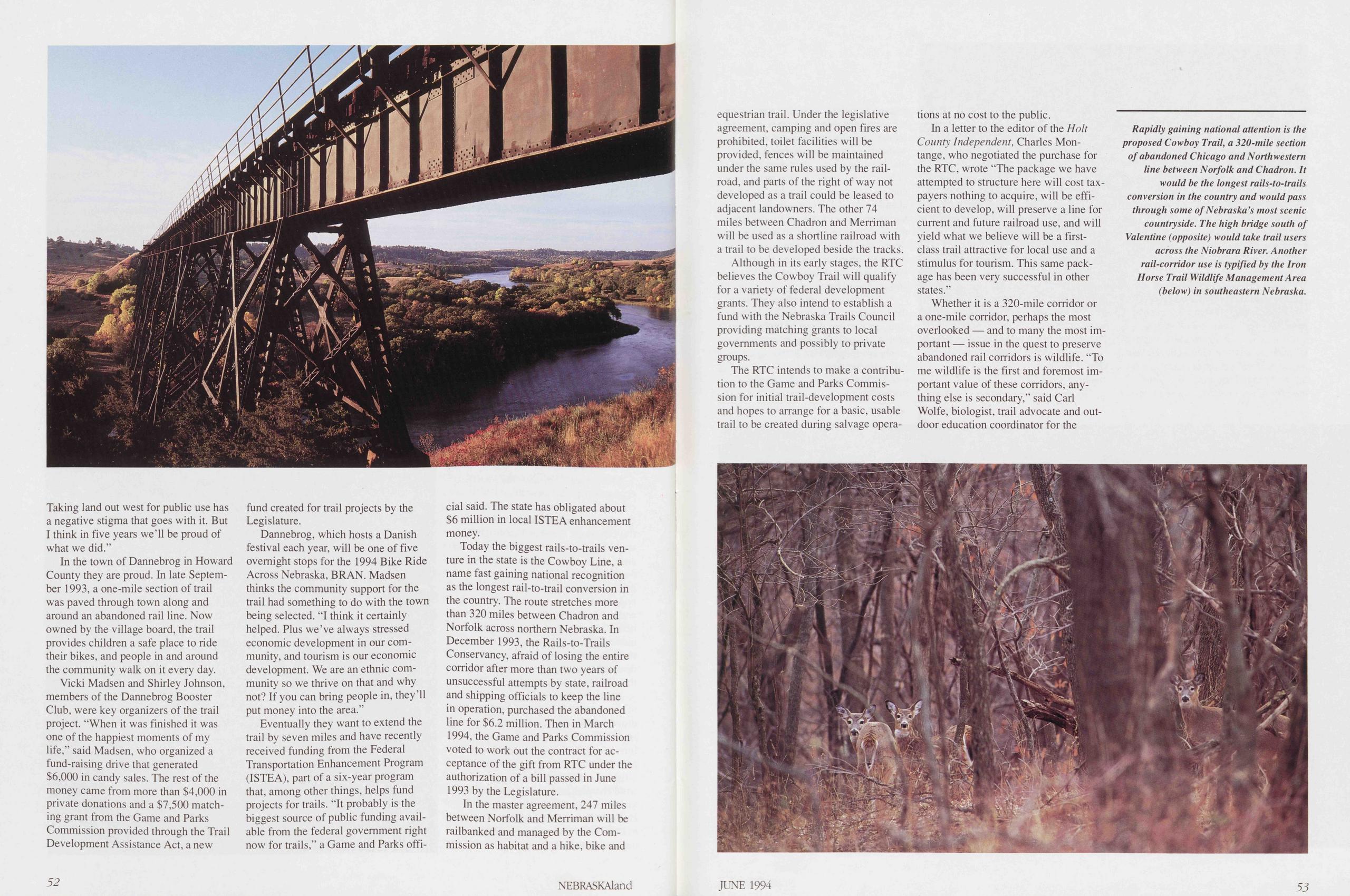
Taking land out west for public use has a negative Stigma that goes with it. But I think in five years we’ll be proud of what we did.”
In the town of Dannebrog in Howard County they are proud. In late Septem- ber 1993, a one-mile section of trail was paved through town along and around an abandoned rail line. Now owned by the village board, the trail provides children a safe place to ride their bikes, and people in and around the community walk on it every day.
Vicki Madsen and Shirley Johnson, members of the Dannebrog Booster Club, were key Organizers of the trail project. “When it was finished it was one of the happiest moments of my life,” said Madsen, who organized a fund-raising drive that generated $6,000 in candy sales. The rest of the money came from more than $4,000 in private donations and a $7,500 matching grant from the Game and Parks Commission provided through the Trail Development Assistance Act, a new fund created for trail projects by the Legislature.
Dannebrog, which hosts a Danish festival each year, will be one of five ovemight stops for the 1994 Bike Ride Across Nebraska, BRAN. Madsen thinks the community support for the trail had something to do with the town being selected. "I think it certainly helped. Plus we’ve always stressed economic development in our community, and tourism is our economic development. We are an ethnic community so we thrive on that and why not? If you can bring people in, they’ll put money into the area.”
Eventually they want to extend the trail by seven miles and have recently received funding from the Federal Transportation Enhancement Program (ISTEA), part of a six-year program that, among other things, helps fund projects for trails. “It probably is the biggest source of public funding available from the federal govemment right now for trails,” a Game and Parks official said. The state has obligated about $6 million in local ISTEA enhancement money.
Today the biggest rails-to-trails venture in the state is the Cowboy Line, a name fast gaining national recognition as the longest rail-to-trail conversion in the country. The route Stretches more than 320 miles between Chadron and Norfolk across northern Nebraska. In December 1993, the Rails-to-Trails Conservancy, afraid of losing the entire corridor after more than two years of unsuccessful attempts by state, railroad and shipping officials to keep the line in Operation, purchased the abandoned line for $6.2 million. Then in March 1994, the Game and Parks Commission voted to work out the contract for acceptance of the gift from RTC under the authorization of a bill passed in June 1993 by the Legislature.
In the master agreement, 247 miles between Norfolk and Merriman will be railbanked and managed by the Commission as habitat and a hike, bike and 52 NEBRASKAland equestrian trail. Under the legislative agreement, camping and open fires are prohibited, toilet facilities will be provided, fences will be maintained under the same rules used by the railroad, and parts of the right of way not developed as a trail could be leased to adjacent landowners. The other 74 miles between Chadron and Merriman will be used as a shonline railroad with a trail to be developed beside the tracks.
Although in its early stages, the RTC believes the Cowboy Trail will qualify for a variety of federal development grants. They also intend to establish a fund with the Nebraska Trails Council providing matching grants to local governments and possibly to private groups.
The RTC intends to make a contribution to the Game and Parks Commission for initial trail-development costs and hopes to arrange for a basic, usable trail to be created during salvage operations at no cost to the public.
In a letter to the editor of the Holt County Independent, Charles Montange, who negotiated the purchase for the RTC, wrote “The package we have attempted to structure here will cost taxpayers nothing to acquire, will be efficient to develop, will preserve a line for current and future railroad use, and will yield what we believe will be a first-class trail attractive for local use and a Stimulus for tourism. This same package has been very successful in other States.”
Whether it is a 320-mile corridor or a one-mile corridor, perhaps the most overlooked — and to many the most important — issue in the quest to preserve abandoned rail corridors is wildlife. “To me wildlife is the first and foremost im- portant value of these corridors, anything eise is secondary,” said Carl Wolfe, biologist, trail advocate and outdoor education coordinator for the
Rapidly gaining national attention is the proposed Cowboy Trail, a 320-mile section of abandoned Chicago and Northwestern line between Norfolk and Chadron. It would be the longest rails-to-trails conversion in the country and wouldpass through some of Nebraska’s most scenic countryside. The high bridge south of Valentine (opposite) would take trail users across the Niobrara River. Another rail-corridor use is typified by the Iron Horse Trail Wildlife Management Area (below) in southeastern Nebraska.
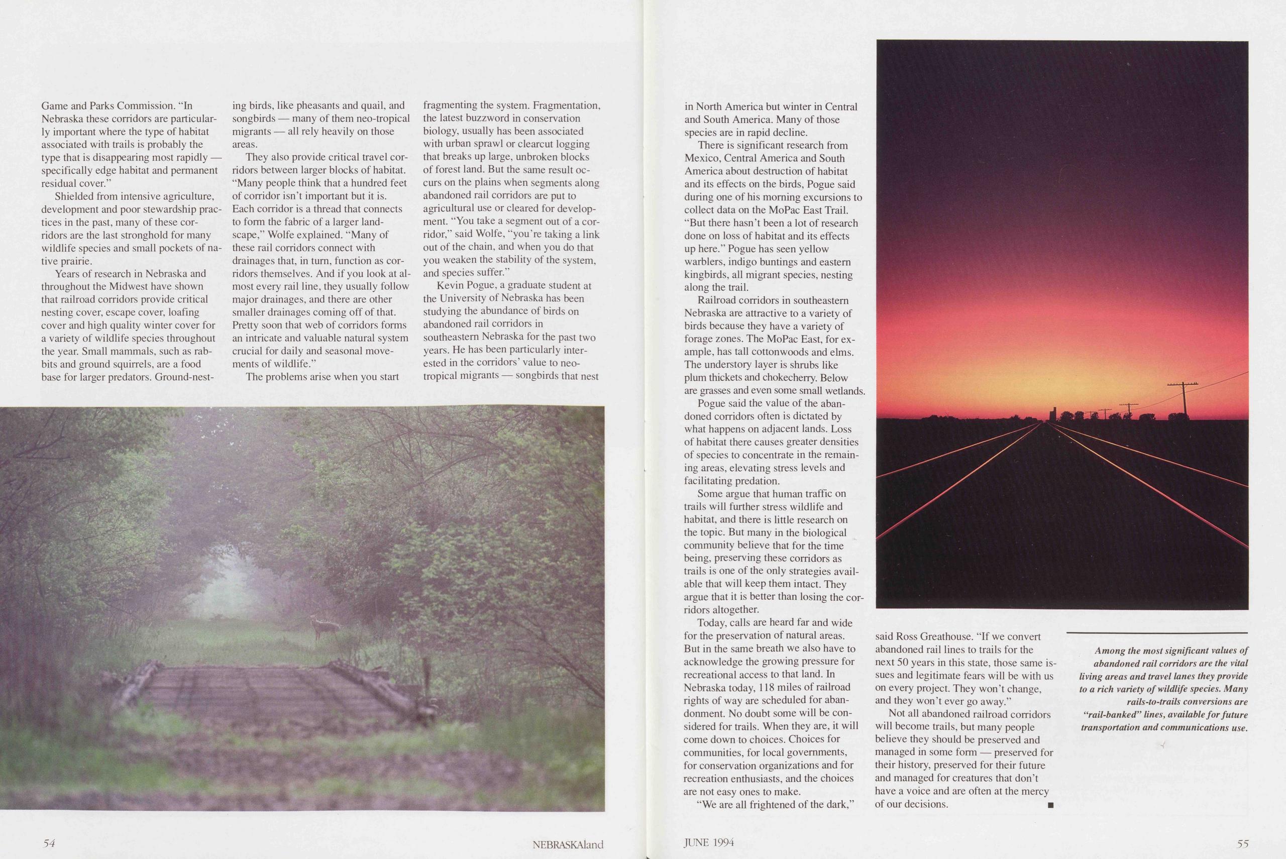
Game and Parks Commission. "In Nebraska these corridors are particularly important where the type of habitat associated with trails is probably the type that is disappearing most rapidly — specifically edge habitat and permanent residual eover."
Shielded from intensive agriculture, development and poor stewardship practices in the past, many of these corridors are the last stronghold for many wildlife species and small pockets of native prairie.
Years of research in Nebraska and throughout the Midwest have shown that railroad corridors provide critical nesting cover, escape cover, loafing cover and high quality winter cover for a variety of wildlife species throughout the year. Small mammals, such as rabbits and ground squirrels, are a food base for larger predators. Ground-nesting birds, like pheasants and quail, and songbirds — many of them neo-tropical migrants — all rely heavily on those areas.
They also provide critical travel corridors between larger blocks of habitat. "Many people think that a hundred feet of corridor isn’t important but it is. Each corridor is a thread that connects to form the fabric of a larger landscape,” Wolfe explained. "Many of these rail corridors connect with drainages that, in tum, function as cor- ridors themselves. And if you look at almost every rail line, they usually follow major drainages, and there are other smaller drainages coming off of that. Pretty soon that web of corridors forms an intricate and valuable natural System crucial for daily and seasonal movements of wildlife.”
The problems arise when you start fragmenting the System. Fragmentation, the latest buzzword in Conservation biology, usually has been associated with urban sprawl or clearcut logging that breaks up large, unbroken blocks of forest land. But the same result occurs on the plains when segments along abandoned rail corridors are put to agricultural use or cleared for development. "You take a segment out of a corridor,” said Wolfe, "you re taking a link out of the chain, and when you do that you weaken the stabil ity of the System, and species suffer.”
Kevin Pogue, a graduate Student at the University of Nebraska has been studying the abundance of birds on abandoned rail corridors in southeastem Nebraska for the past two years. He has been particularly interested in the corridors’ value to neotropical migrants — songbirds that nest
There is significant research from Mexico, Central America and South America about destruction of habitat and its effects on the birds, Pogue said during one of his moming excursions to collect data on the MoPac East Trail. "But there hasn’t been a lot of research done on loss of habitat and its effects up here.” Pogue has seen yellow warblers, indigo buntings and eastem kingbirds, all migrant species, nesting along the trail.
Railroad corridors in southeastem Nebraska are attractive to a variety of birds because they have a variety of forage zones. The MoPac East, for example, has tall cottonwoods and elms. The understory layer is shrubs like plum thickets and chokecherry. Below are grasses and even some small wetlands.
Pogue said the value of the abandoned corridors often is dictated by what happens on adjacent lands. Loss of habitat there causes greater densities of species to concentrate in the remaining areas, elevating stress levels and facilitating predation.
Some argue that human traffic on trails will further stress wildlife and habitat, and there is little research on the topic. But many in the biological community believe that for the time being, preserving these corridors as trails is one of the only strategies available that will keep them intact. They argue that it is better than losing the corridors altogether.
Today, calls are heard far and wide for the preservation of natural areas. But in the same breath we also have to acknowledge the growing pressure for recreational access to that land. In Nebraska today, 118 miles of railroad rights of way are scheduled for aban- donment. No doubt some will be con- sidered for trails. When they are, it will come down to choices. Choices for communities, for local govemments, for Conservation organizations and for recreation enthusiasts, and the choices are not easy ones to make.
"We are all frightened of the dark,” said Ross Greathouse. "If we convert abandoned rail lines to trails for the next 50 years in this state, those same issues and legitimate fears will be with us on every project. They won’t change, and they won’t ever go away.”
Not all abandoned railroad corridors will become trails, but many people believe they should be preserved and managed in some form — preserved for their history, preserved for their future and managed for creatures that don’t have a voice and are often at the mercy of our decisions. ■
Among the most significant values of abandoned rail corridors are the vital living areas and travel lanes they provide to a rieh variety of wildlife species. Many rails-to-trails conversions are “rail-banked” lines, available for future transportation and Communications use.
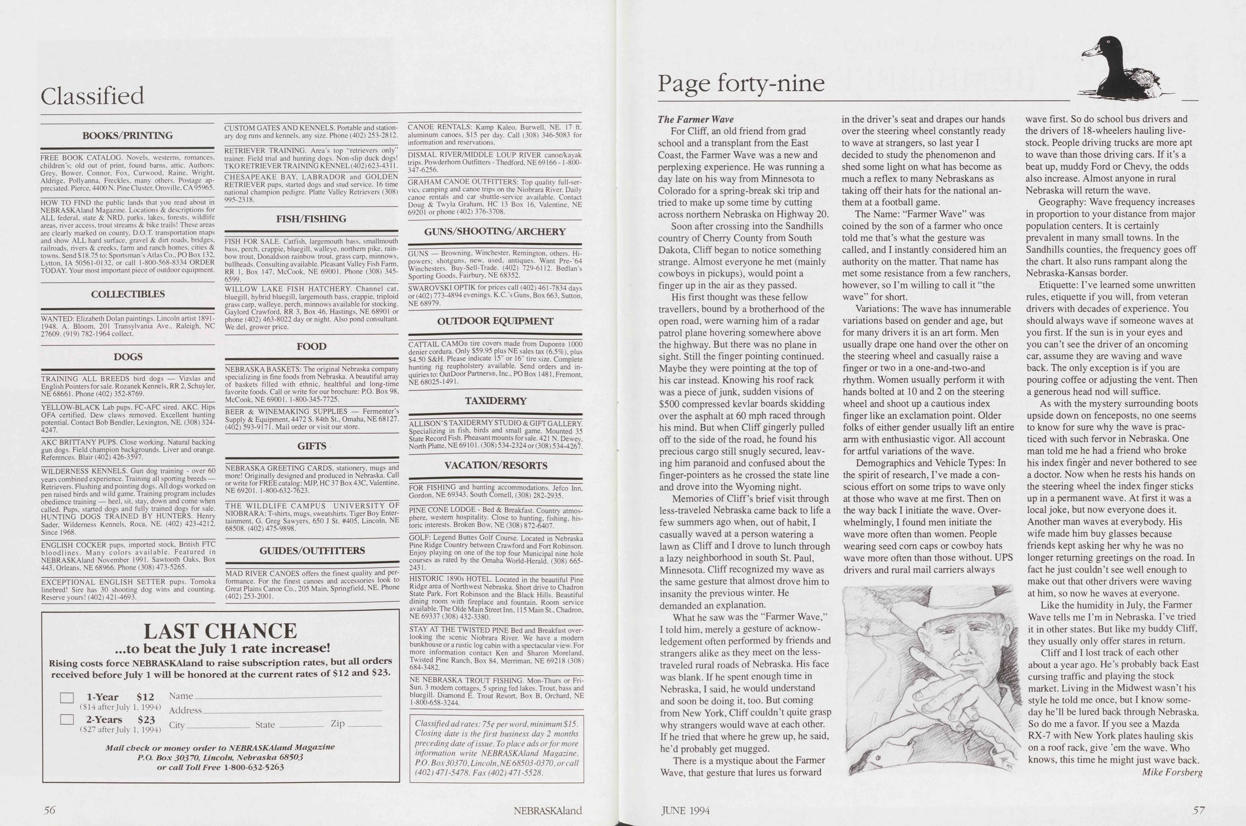
Classified
BOOKS/PRINTING FREE BOOK CATALOG. Novels, westerns, romances, children’s; old out of print. found barns, attic. Authors: Grey. Bower, Connor. Fox, Gurwood, Raine, Wright, Aldrige, Pollyanna, Freckles. many others. Postage ap- preciated. Pierce, 4400 N. Pine Cluster, Oroville,CA95965. HOW TO FIND the public lands that you read about in NEBRASKAIand Magazine. Locations & descriptions for ALL federal, state & NRD. parks, lakes, forests, wildlife areas, river access, trout streams & bike trails! These areas are clearly marked on county, D.O.T. transportation maps and show ALL hard surface. gravei & dirt roads, bridges, railroads, rivers & creeks, farm and ranch homes. cities & towns. Send $18.75 to: Sportsman s Atlas Go., PO Box 132, Lytton, IA 50561-0132, or call 1-800-568-8334 ORDER TODAY. Your most important piece of outdoor equipment. COLLECTIBLES WANTED: Elizabeth Dolan paintings. Lincoln artist 1891- 1948. A. Bloom, 201 Transylvania Ave., Raleigh, NC 27609. (919) 782-1964 collect. DOGS TRAINING ALL BREEDS bird dogs — Vizslas and English Pointers for sale. Rozanek Kennels, RR 2. Schuyler, NE 68661. Phone (402) 352-8769. YELLOW-BLACK Lab pups. FC-AFC sired. AKC. Hips OFA certified. Dew claws removed. Excellent hunting potential. Contact Bob Bendler, Lexington, NE. (308) 324- 4247. AKC BRITTANY PUPS. Close working. Natural backing gun dogs. Field Champion backgrounds. Liver and orange. References. Blair (402) 426-3597. WILDERNESS KENNELS. Gun dog training - over 60 years combined experience. Training all sporting breeds — Retrievers. Flushing and pointing dogs. All dogs worked on pen raised birds and wild game. Training program includes obedience training — heel, sit, stay, down and come when called. Pups, started dogs and fully trained dogs for sale. HUNTING DOGS TRAINED BY HUNTERS. Henry Sader, Wilderness Kennels, Roca, NE. (402) 423-4212. Since 1968. ENGLISH COCKER pups, imported stock. British FTC bloodlines. Many colors available. Featured in NEBRASKAIand November 1991. Sawtooth Oaks, Box 443, Orleans, NE 68966. Phone (308) 473-5265. EXCEPTIONAL ENGLISH SETTER pups. Tomoka linebred! Sire has 30 shooting dog wins and counting. Reserve yours! (402) 421-4693. LAST CHANCE ...to beat the July 1 rate increase! Rising costs force NEBRASKAIand to raise subscription rates, but all Orders received before July 1 will be honored at the current rates of $12 and $23. 1-Year $12 Name ($14 after July 1, 1994) Address 2-Years $23 ($27 after July 1, 1994) City State Zip Mail check or money order to NEBRASKAIand Magazine P.O. Box 3O37O, Lincoln, Nebraska 68503 or call Toll Free 1-800-632-5263 CUSTOM GATES AND KENNELS. Portable and station- ary dog runs and kennels, any size. Phone (402) 253-2812. RETRIEVER TRAINING. Area s top “retrievers only” trainer. Field trial and hunting dogs. Non-slip duck dogs! TKO RETRIEVER TRAINING KENNEL (402) 623-4311. CHESAPEAKE BAY. LABRADOR and GOLDEN RETRIEVER pups, started dogs and stud service. 16 time national Champion pedigre. Platte Valley Retrievers (308) 995-2318. FISH/FISHING FISH FOR SALE. Catfish, largemouth bass, smallmouth bass, perch, crappie, bluegill, walleye, northem pike, rain- bow trout, Donaldson rainbow trout, grass carp. minnows, bullheads. Consulting available. Pleasant Valley Fish Farm, RR 1, Box 147, McCook, NE 69001. Phone (308) 345- 6599. WILLOW LAKE FISH HATCHERY. Channel cat. bluegill, hybrid bluegill. largemouth bass, crappie, triploid grass carp, walleye. perch, minnows available for stocking. Gaylord Crawford, RR 3, Box 46, Hastings, NE 68901 or phone (402) 463-8022 day or night. Also pond Consultant. We del, grower price. FOOD NEBRASKA BASKETS: The original Nebraska Company specializing in fine foods from Nebraska. A beautiful array of baskets filled with ethnic, healthful and long-time favorite foods. Call or write for our brochure: PO. Box 98, McCook, NE 69001. 1-800-345-7725. BEER & WINEMAK1NG SUPPLIES — Fermenter’s Supply & Equipment, 4472 S. 84th St., Omaha, NE 68127. (402) 593-9171. Mail order or visit our störe. GIFTS NEBRASKA GREETING CARDS, stationery, mugs and more! Originally designed and produced in Nebraska. Call or write for FREEcatalog: MJP. HC 37 Box 43C, Valentine, NE 69201. 1-800-632-7623. THE WILDLIFE CAMPUS UN1VERSITY OF NIOBRARA: T-shirts, mugs, sweatshirts. Tiger Boy Enter- tainment, G. Greg Sawyers, 650 J St. #405, Lincoln, NE 68508. (402) 475-9898. GUIDES/OUTFITTERS MAD RIVER C ANOES öfters the fine st quality and per- formance. For the finest canoes and accessories look to Great Plains Canoe Co., 205 Main, Springfield, NE. Phone (402)253-2001. CANOE RENTALS: Kamp Kaleo, Burwell, NE. 17 ft. aluminum canoes, $15 per day. Call (308) 346-5083 for Information and reservations. DISMAL RIVER/MIDDLE LOUP RIVER canoe/kayak trips. Powderhom Outfitters - Thedford, NE 69166 -1 -800- 347-6256. GRAHAM CANOE OUTFITTERS: Top quality full-ser- vicc camping and canoe trips on the Niobrara River. Daily canoe rentals and car shuttle-service available. Contact Doug & Twyla Graham, HC 13 Box 16, Valentine, NE 69201 or phone (402) 376-3708. GUNS/SHOOTIN G/ARCHERY GUNS — Browning, Winchester, Remington, others. Hi- powers; shotguns, new, used, antiques. Want Pre-'64 Winchesters. Buy-Sell-Trade. (402) 729-6112. Bedlan’s Sporting Goods, Fairbury, NE 68352. SWAROVSKI OPTIK for prices call (402) 461-7834 days or (402) 773-4894 evenings. K.C. ’s Guns, Box 663, Sutton, NE 68979. OUTDOOR EQUIPMENT CATTAIL CAMO® tire covers made from Dupont® 1000 denier cordura. Only $59.95 plus NE sales tax (6.5%), plus $4.50 S&H. Please indicate 15" or 16" tire size. Complete hunting rig reupholstery available. Send Orders and in- quiries to: OutDoor Partners®, Inc., PO Box 1481, Fremont, NE 68025-1491. TAXIDERMY ALLISON’S TAXIDERMY STUDIO & GIFT GALLERY. Specializing in fish, birds and small game. Mounted 35 State Record Fish. Pheasant mounts for sale. 421 N. Dewey. North Platte, NE 69101. (308) 534-2324or (308) 534-4267. VACATION/RESORTS FOR FISHING and hunting accommodations. Jefco Inn. Gordon, NE 69343. South Cornell, (308) 282-2935. PINE CONE LODGE - Bed & Breakfast. Country atmos- phere, westem hospitality. Close to hunting, fishing, his- toric interests. Broken Bow, NE (308) 872-6407. GOLF: Legend Buttes Golf Course. Located in Nebraska Pine Ridge Country between Crawford and Fort Robinson. Enjoy playing on one of the top four Municipal nine hole courses as rated by the Omaha World-Herald. (308) 665- 2431. HISTORIC 1890s HOTEL. Located in the beautiful Pine Ridge area of Northwest Nebraska. Short drive to Chadron State Park. Fort Robinson and the Black Hills. Beautiful dining room with fireplace and fountain. Room service available. The Olde Main Street Inn. 115 Main St., Chadron, NE 69337 (308)432-3380. STAY AT THE TWISTED PINE Bed and Breakfast over- looking the scenic Niobrara River. We have a modern bunkhouse or a rustic log cabin with a spectacular view. For more Information contact Ken and Sharon More land, Twisted Pine Ranch, Box 84, Merriman, NE 69218 (308) 684-3482. NE NEBRASKA TROUT FISHING. Mon-Thurs or Fri- Sun. 3 modern cottages, 5 spring fed lakes. Trout, bass and bluegill. Diamond E. Trout Resort. Box B, Orchard, NE 1-800-658-3244. Classified ad rates: 75c per ward, minimum $15. Closing date is the first business day 2 months preceding date ofissue. To place ads orfor more Information write NEBRASKAIand Magazine, P.O. Box30370, Lincoln,NE68503-0370, orcall (402) 471-5478. Fax (402) 471-5528. 56 NEBRASKAIandPage forty-nine
The Farmer Wave
For Cliff, an old friend from grad school and a transplant from the East Coast, the Farmer Wave was a new and perplexing experience. He was running a day late on his way from Minnesota to Colorado for a spring-break ski trip and tried to make up some time by cutting across northem Nebraska on Highway 20.
Soon after Crossing into the Sandhills country of Cherry County from South Dakota, Cliff began to notice something stränge. Almost everyone he met (mainly cowboys in pickups), would point a finger up in the air as they passed.
His first thought was these fellow traveIlers, bound by a brotherhood of the open road, were waming him of a radar patrol plane hovering somewhere above the highway. But there was no plane in sight. Still the finger pointing continued. Maybe they were pointing at the top of his car instead. Knowing his roof rack was a piece of junk, sudden visions of $500 compressed kevlar boards skidding over the asphalt at 60 mph raced through his mind. But when Cliff gingerly pulled off to the side of the road, he found his precious cargo still snugly secured, leaving him paranoid and confused about the finger-pointers as he crossed the state line and drove into the Wyoming night.
Memories of Cliff’s brief visit through less-traveled Nebraska came back to life a few summers ago when, out of habit, I casually waved at a person watering a lawn as Cliff and I drove to lunch through a lazy neighborhood in south St. Paul, Minnesota. Cliff recognized my wave as the same gesture that almost drove him to insanity the previous winter. He demanded an explanation.
What he saw was the “Farmer Wave,” I told him, merely a gesture of acknowledgement often performed by friends and strangers alike as they meet on the less-traveled rural roads of Nebraska. His face was blank. If he spent enough time in Nebraska, I said, he would understand and soon be doing it, too. But coming from New York, Cliff couldn’t quite grasp why strangers would wave at each other. If he tried that where he grew up, he said, he’d probably get mugged.
There is a mystique about the Farmer Wave, that gesture that lures us forward in the driver’s seat and drapes our hands over the steering wheel constantly ready to wave at strangers, so last year I decided to study the phenomenon and shed some light on what has become as much a reflex to many Nebraskans as taking off their hats for the national anthem at a football game.
The Name: “Farmer Wave” was coined by the son of a farmer who once told me that’s what the gesture was called, and I instantly considered him an authority on the matter. That name has met some resistance from a few ranchers, however, so I’m willing to call it “the wave” for short.
Variations: The wave has innumerable variations based on gender and age, but for many drivers it is an art form. Men usually drape one hand over the other on the steering wheel and casually raise a finger or two in a one-and-two-and rhythm. Women usually perform it with hands bolted at 10 and 2 on the steering wheel and shoot up a cautious index finger like an exclamation point. Older folks of either gender usually lift an entire arm with enthusiastic vigor. All account for artful variations of the wave.
Demographics and Vehicle Types: In the spirit of research, I’ve made a conscious effort on some trips to wave only at those who wave at me first. Then on the way back I initiate the wave. Overwhelmingly, I found men initiate the wave more often than women. People wearing seed com caps or cowboy hats wave more often than those without. UPS drivers and rural mail carriers always wave first. So do school bus drivers and the drivers of 18-wheelers hauling livestock. People driving trucks are more apt to wave than those driving cars. If it’s a beat up, muddy Ford or Chevy, the odds also increase. Almost anyone in rural Nebraska will retum the wave.
Geography: Wave frequency increases in proportion to your distance from major population centers. It is certainly prevalent in many small towns. In the Sandhills counties, the frequency goes off the chart. It also runs rampant along the Nebraska-Kansas border.
Etiquette: I’ve leamed some unwritten rules, etiquette if you will, from veteran drivers with decades of experience. You should always wave if someone waves at you first. If the sun is in your eyes and you can’t see the driver of an oncoming car, assume they are waving and wave back. The only exception is if you are pouring coffee or adjusting the vent. Then a generous head nod will suffice.
As with the mystery surrounding boots upside down on fenceposts, no one seems to know for sure why the wave is prac- ticed with such fervor in Nebraska. One man told me he had a friend who broke his index finger and never bothered to see a doctor. Now when he rests his hands on the steering wheel the index finger sticks up in a permanent wave. At first it was a local joke, but now everyone does it. Another man waves at everybody. His wife made him buy glasses because friends kept asking her why he was no longer retuming greetings on the road. In fact he just couldn’t see well enough to make out that other drivers were waving at him, so now he waves at everyone.
Like the humidity in July, the Farmer Wave teils me I’m in Nebraska. I’ve tried it in other States. But like my buddy Cliff, they usually only offer Stares in retum.
Cliff and I lost track of each other about a year ago. He’s probably back East cursing traffic and playing the stock market. Living in the Midwest wasn’t his style he told me once, but I know someday he’ll be lured back through Nebraska. So do me a favor. If you see a Mazda RX-7 with New York plates hauling skis on a roof rack, give ’em the wave. Who knows, this time he might just wave back.
JUNE 1994 57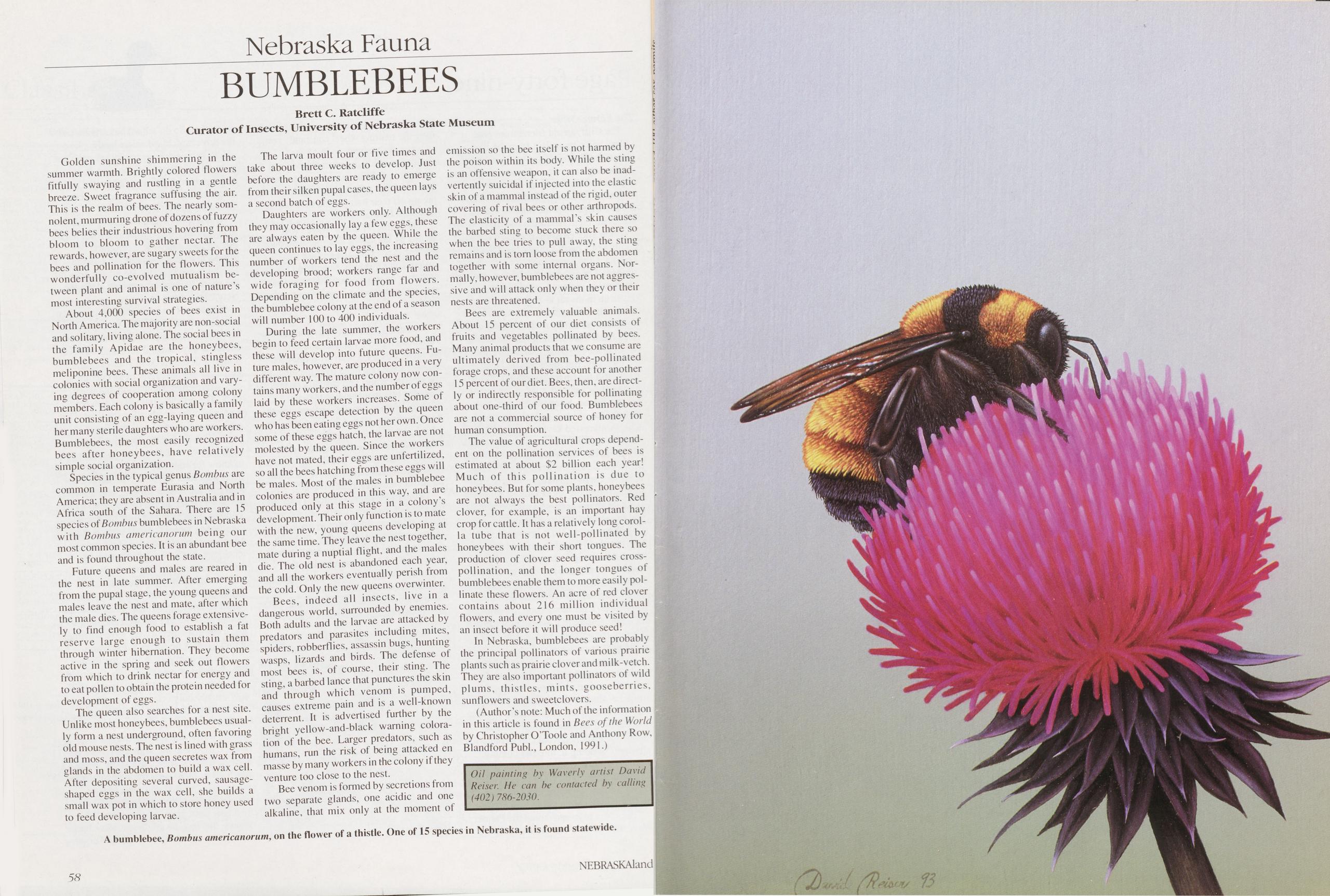
Nebraska Fauna BUMBLEBEES
Golden sunshine shimmering in the summer warmth. Brightly colored flowers fitfully swaying and rustling in a gentle breeze. Sweet fragrance suffusing the air. This is the realm of bees. The nearly somnolent, murmuring drone of dozens of fuzzy bees belies their industrious hovering from bloom to bloom to gather nectar. The rewards, however, are sugary sweets for the bees and pollination for the flowers. This wonderfully co-evolved mutualism between plant and animal is one of nature’s most interesting survival strategies.
About 4,000 species of bees exist in North America. The majority are non-social and solitary, living alone. The social bees in the family Apidae are the honeybees, bumblebees and the tropical, stingless meliponine bees. These animals all live in colonies with social Organization and varying degrees of Cooperation among colony members. Each colony is basically a family unit consisting of an egg-laying queen and hermany sterile daughters who are workers. Bumblebees, the most easily recognized bees after honeybees, have relatively simple social Organization.
Species in the typical genus Bambus are common in temperate Eurasia and North America; they are absent in Australia and in Africa south of the Sahara. There are 15 species of Bambus bumblebees in Nebraska with Bambus americanorum being our most common species. It is an abundant bee and is found throughout the state.
Future queens and males are reared in the ne st in late summer. After emerging from the pupal stage, the young queens and males leave the ne st and mate, after which the male dies. The queens forage extensively to find enough food to establish a fat reserve large enough to sustain them through winter hibernation. They become active in the spring and seek out flowers from which to drink nectar for energy and to eat pollen to obtain the protein needed for development of eggs.
The queen also searches for a ne st site. Unlike most honeybees, bumblebees usually form a nest Underground, offen favoring old mouse nests. The nest is lined with grass and moss, and the queen secretes wax from glands in the abdomen to build a wax cell. After depositing several curved, sausage-shaped eggs in the wax cell, she builds a small wax pot in which to störe honey used to feed developing larvae.
The larva moult four or five times and take about three weeks to develop. Just betöre the daughters are ready to emerge from their silken pupal cases, the queen lays a second batch of eggs.
Daughters are workers only. Although they may occasionally lay a few eggs, these are always eaten by the queen. While the queen continues to lay eggs, the increasing number of workers tend the nest and the developing brood; workers ränge far and wide foraging for food from flowers. Depending on the climate and the species, the bumblebee colony at the end of a season will number 100 to 400 individuals.
During the late summer, the workers begin to feed certain larvae more food, and these will develop into future queens. Future males, however, are produced in a very different way. The mature colony now contains many workers, and the number of eggs laid by these workers increases. Some of these eggs escape detection by the queen who has been eating eggs not her own. Once some of these eggs hatch, the larvae are not molested by the queen. Since the workers have not mated, their eggs are unfertilized, so all the bees hatching from these eggs will be males. Most of the males in bumblebee colonies are produced in this way, and are produced only at this stage in a colony’s development. Their only function is to mate with the new, young queens developing at the same time. They leave the nest together, mate during a nuptial flight, and the males die. The old nest is abandoned each year, and all the workers eventually perish from the cold. Only the new queens overwinter.
Bees, indeed all insects, live in a dangerous world, surrounded by enemies. Both adults and the larvae are attacked by predators and parasites including mites, spiders, robberflies, assassin bugs, hunting wasps, lizards and birds. The defense of most bees is, of course, their sting. The sting, a barbed lance that punctures the skin and through which venom is pumped, causes extreme pain and is a well-known deterrent. It is advertised further by the bright yellow-and-black waming coloration of the bee. Larger predators, such as humans, run the risk of being attacked en mässe by many workers in the colony if they venture too dose to the nest.
Bee venom is formed by secretions from two separate glands, one acidic and one alkaline, that mix only at the moment of emission so the bee itself is not harmed by the poison within its body. While the sting is an offensive weapon, it can also be inadvertently suicidal if injected into the elastic skin of a mammal instead of the rigid, outer covering of rival bees or other arthropods. The elasticity of a mammal's skin causes the barbed sting to become stuck there so when the bee tries to pull away, the sting remains and is torn loose from the abdomen together with some internal organs. Normally, however, bumblebees are not aggressive and will attack only when they or their nests are threatened.
Bees are extremely valuable animals. About 15 percent of our diet consists of fruits and vegetables pollinated by bees. Many animal products that we consume are ultimately derived from bee-pollinated forage crops, and these account for another 15 percent of our diet. Bees, then, are directly or indirectly responsible for pollinating about one-third of our food. Bumblebees are not a commercial source of honey for human consumption.
The value of agricultural crops dependent on the pollination Services of bees is estimated at about $2 billion each year! Much of this pollination is due to honeybees. But for some plants, honeybees are not always the best pollinators. Red clover, for example, is an important hay crop for cattle. It has a relatively long corolla tube that is not well-pollinated by honeybees with their short tongues. The production of clover seed requires cross- pollination, and the longer tongues of bumblebees enable them to more easily pollinate these flowers. An acre of red clover contains about 216 million individual flowers, and every one must be visited by an insect betöre it will produce seed!
In Nebraska, bumblebees are probably the principal pollinators of various prairie plants such as prairie clover and milk-vetch. They are also important pollinators of wild plums, thistles, mints, gooseberries, sunflowers and sweetclovers.
(Author’s note: Much of the Information in this article is found in Bees of the World by Christopher O’Toole and Anthony Row, Blandford PubL, London, 1991.)
58 NEBRASKAlandA bumblebee, Bambus americanorum, on the flower of a thistle. One of 15 species in Nebraska, it is found statewide.
Position: 373 (26 views)