Volume 64, Issue 1, 1986
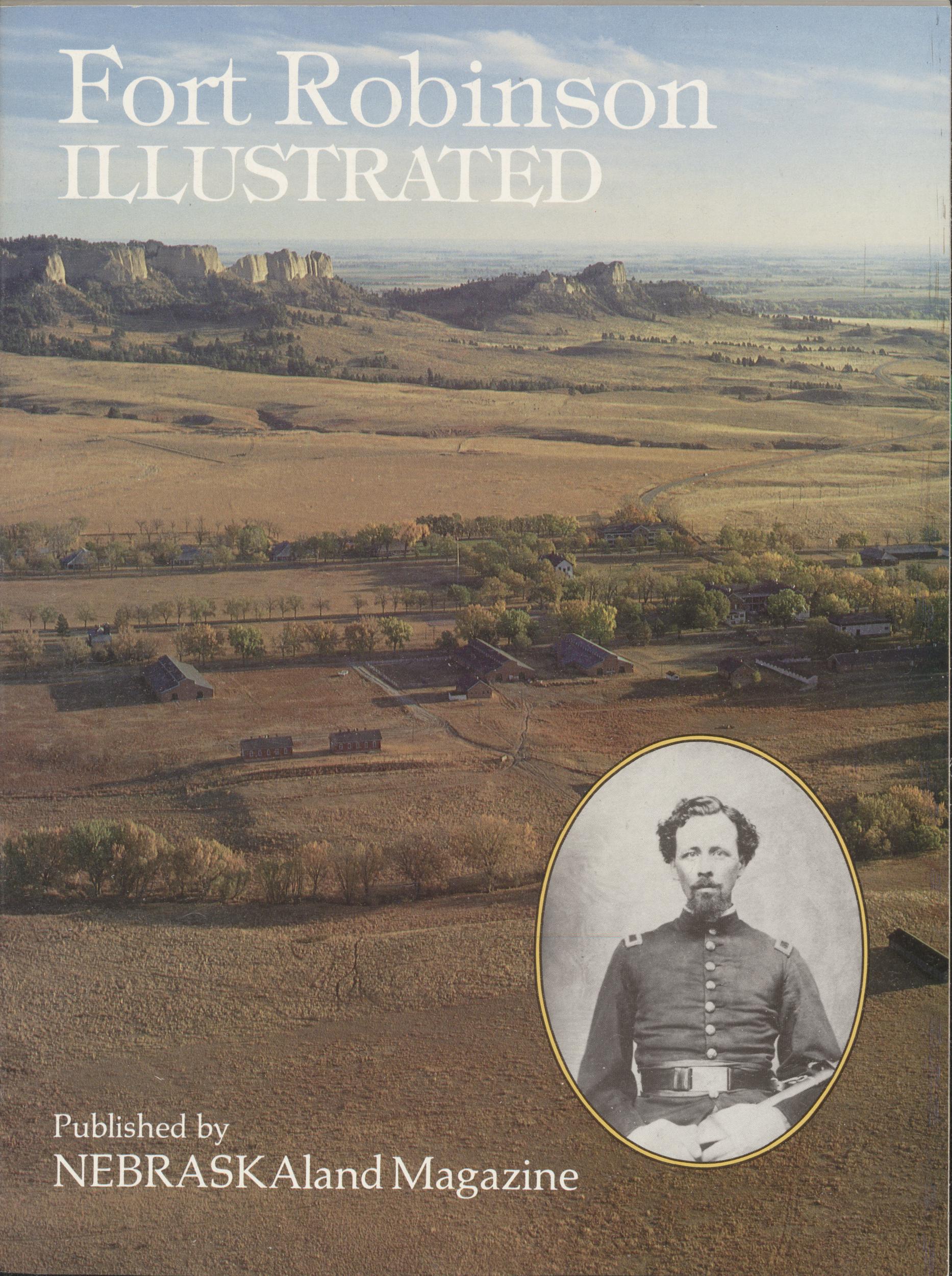
Fort Robinson ILLUSTRATED
Published by NEBRASKAland Magazine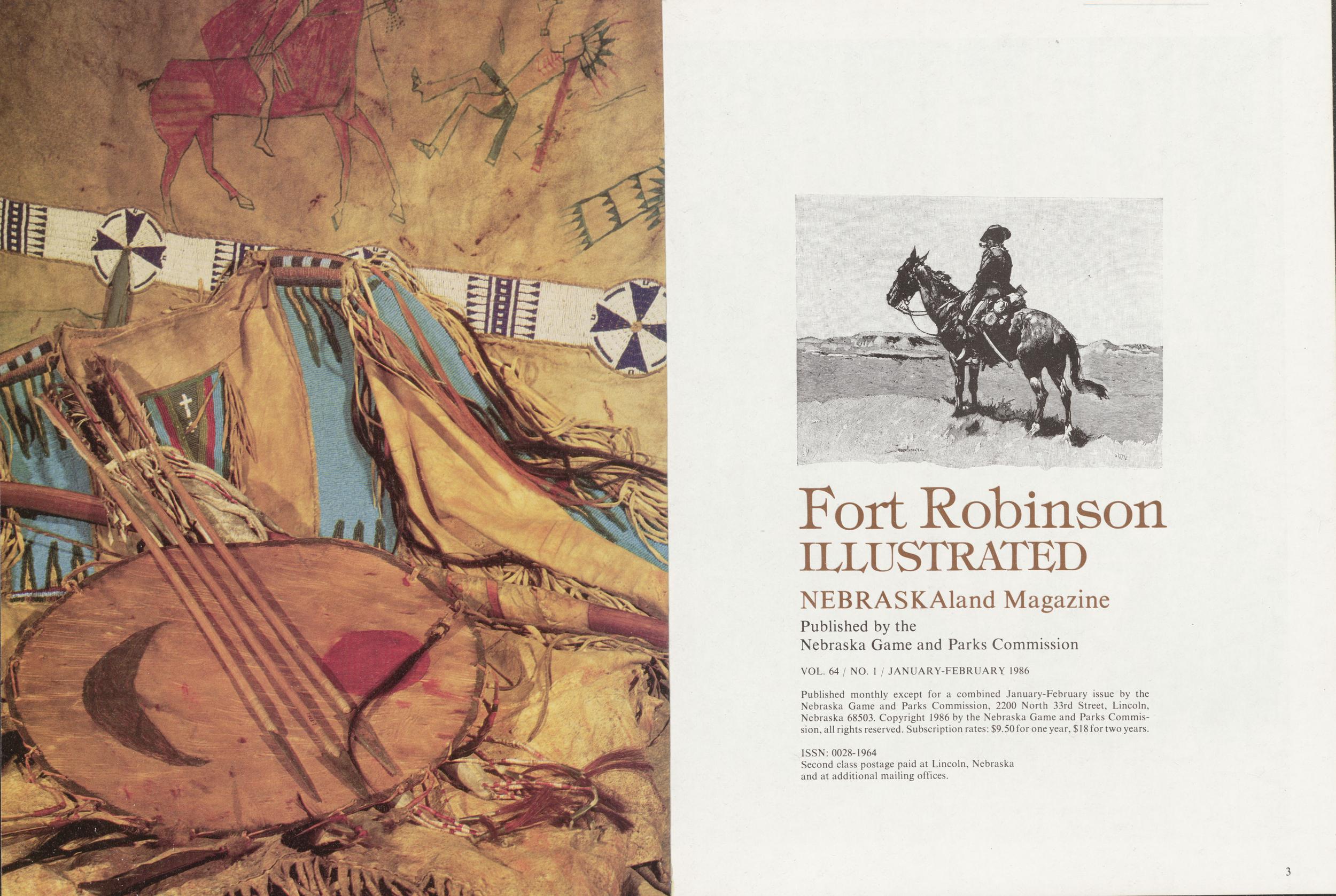
Fort Robinson ILLUSTRATED
NEBRASKAland Magazine Published by the Nebraska Game and PArks Commission VOL. 64 / NO. 1 / JANUARY-FEBRUARY 1986 Published monthly except for a combined January-February issue by the Nebraska Game and Parks Commission, 2200 North 33rd Street, Lincoln, Nebraska 68503. Copyright 1986 by the Nebraska Game and Parks Commis- sion, all rights reserved. Subscription rates: $9.50 for one year, $ 18 for two years. ISSN: 0028-1964 Second class postage paid at Lincoln, Nebraska and at additional mailing offices. 3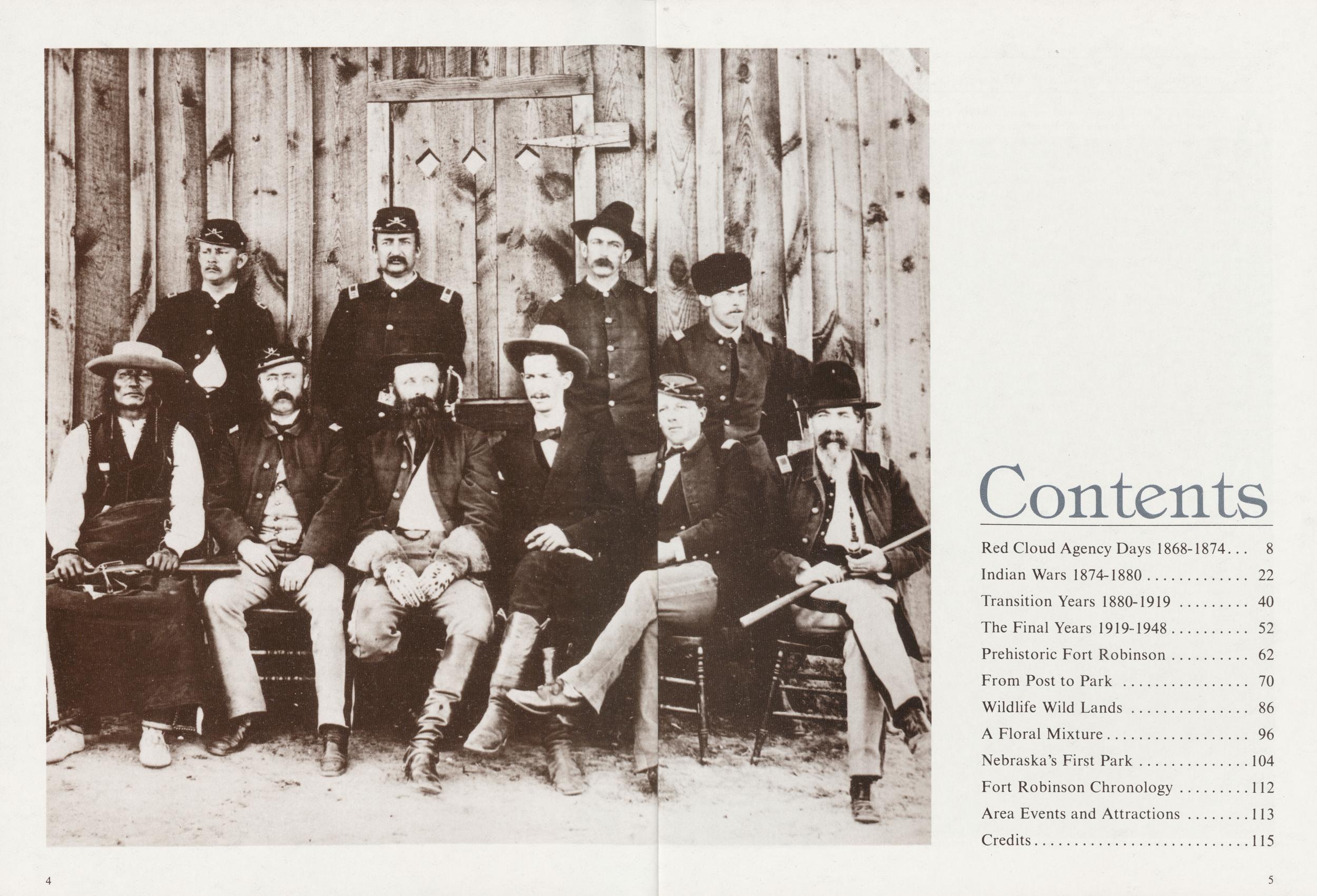
AS A LITTLE BOY growing up in Chadron, Nebraska, near Fort Robinson, my favorite diversion was gazing at the collection in the window of Joe Lichty's barber shop. Arranged in a wonderful mess were guns, bows, arrows, knives, war clubs and other deadly weapons confiscated or captured by Fort Robinson soldiers from courageous Sioux, Cheyenne and Arapaho warriors who had fought so fiercely to save their homeland.
There were other reminders of the old Fort everywhere—wood stoves marked "US" in homes, tangles of G.I. horse harness hanging in farmers' barns, and even an occasional Eskimostyle dog sled stamped with military nomenclature identifying it with Fort Robinson's role as a K-9 training center. There were human reminders, too: local people who had worked there; ranchers who had sold horses that went to war as Cavalry mounts; old soldiers who came back to see the place where their Army career started or advanced or ended; history buffs who wanted to see the place where the Cheyenne fought, Red Cloud lived, Crazy Horse died, and Walter Reed practiced medicine; and even a few German Afrika Corps veterans who felt compelled to visit the place where they sat out World War II as prisoners.
But the old Fort itself was its own best reminder. It had survived far longer than most Army forts by taking on new roles. First it provided a base during the Indian Wars for troops protecting the Red Cloud Indian Agency. After the Indians were removed to reservations in South Dakota, settlers streamed into northwest Nebraska, and the railroads snaked tracks through the region. The Fort came to be the border guardian, keeping whites and Indians apart and maintaining an uneasy peace. In following years, it was a bustling center for the acquisition, breeding, and training of Cavalry horses. After World War I, Fort Robinson served as a training center for Olympics equestrian teams, and, during the Great Depression, by furnishing supervision cadres to operate and maintain Civilian Conservation Corps camps at many locations in the West. When the horror of World War II began, the horse was no longer essential to the Army, but Fort Robinson performed an important role in the war effort by training dogs for military use and guarding Axis prisoners.
When the war ended, the Fort was demobilized along with millions of returning servicemen. The moveable property was disposed of at seemingly endless public auctions—Indian weapons, McClellan saddles, furniture and the Fort stood empty, but full of history's ghosts. Finally the wrecking crews came, and how sad I felt as they smashed down building after building. It seemed that nothing but memories would remain of such a grand place.
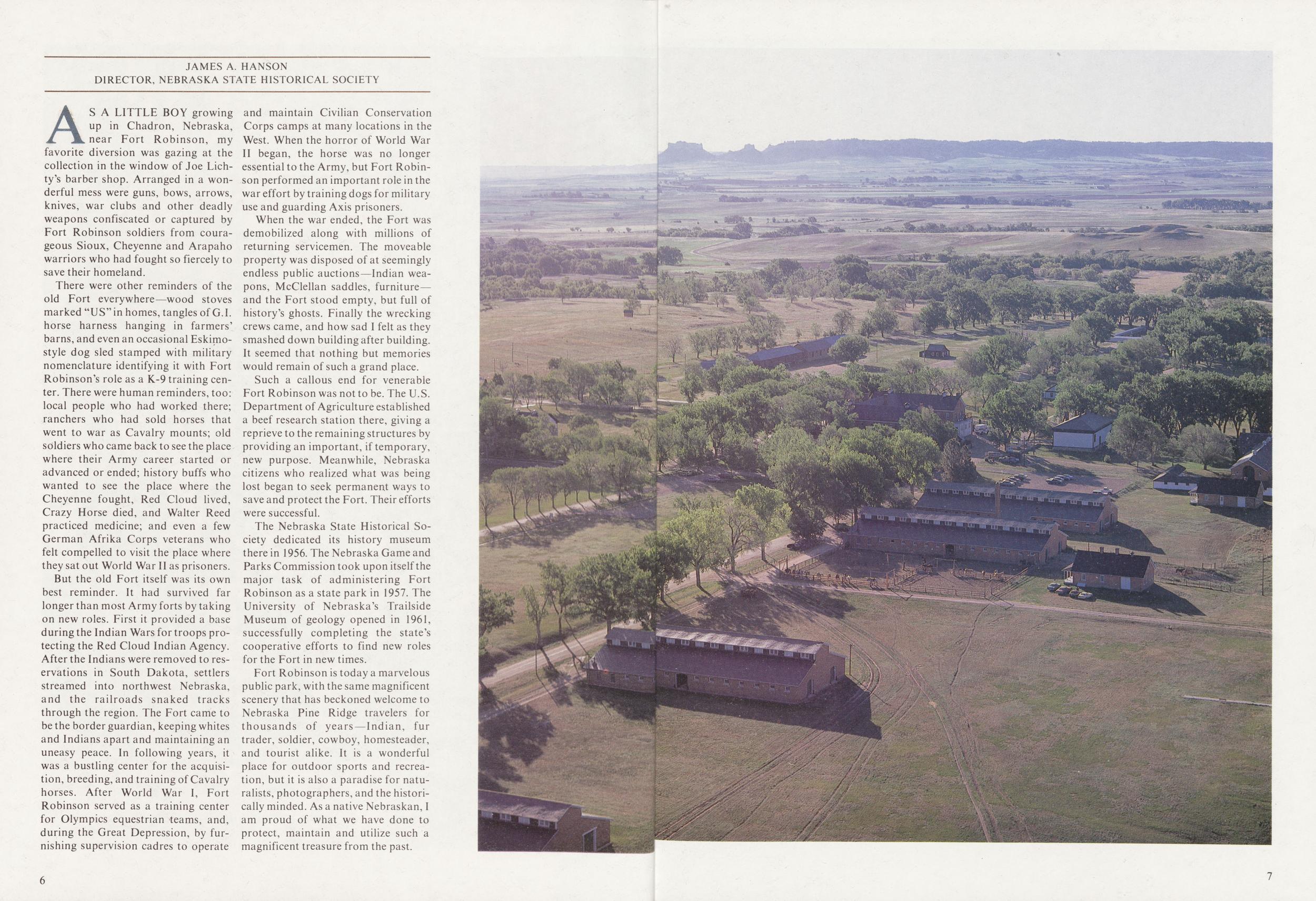
Such a callous end for venerable Fort Robinson was not to be. The U.S. Department of Agriculture established a beef research station there, giving a reprieve to the remaining structures by providing an important, if temporary, new purpose. Meanwhile, Nebraska citizens who realized what was being lost began to seek permanent ways to save and protect the Fort. Their efforts were successful.
The Nebraska State Historical Society dedicated its history museum there in 1956. The Nebraska Game and Parks Commission took upon itself the major task of administering Fort Robinson as a state park in 1957. The University of Nebraska's Trailside Museum of geology opened in 1961, successfully completing the state's cooperative efforts to find new roles for the Fort in new times.
Fort Robinson is today a marvelous public park, with the same magnificent scenery that has beckoned welcome to Nebraska Pine Ridge travelers for thousands of years—Indian, fur trader, soldier, cowboy, homesteader, and tourist alike. It is a wonderful place for outdoor sports and recreation, but it is also a paradise for naturalists, photographers, and the historically minded. As a native Nebraskan, I am proud of what we have done to protect, maintain and utilize such a magnificent treasure from the past.
6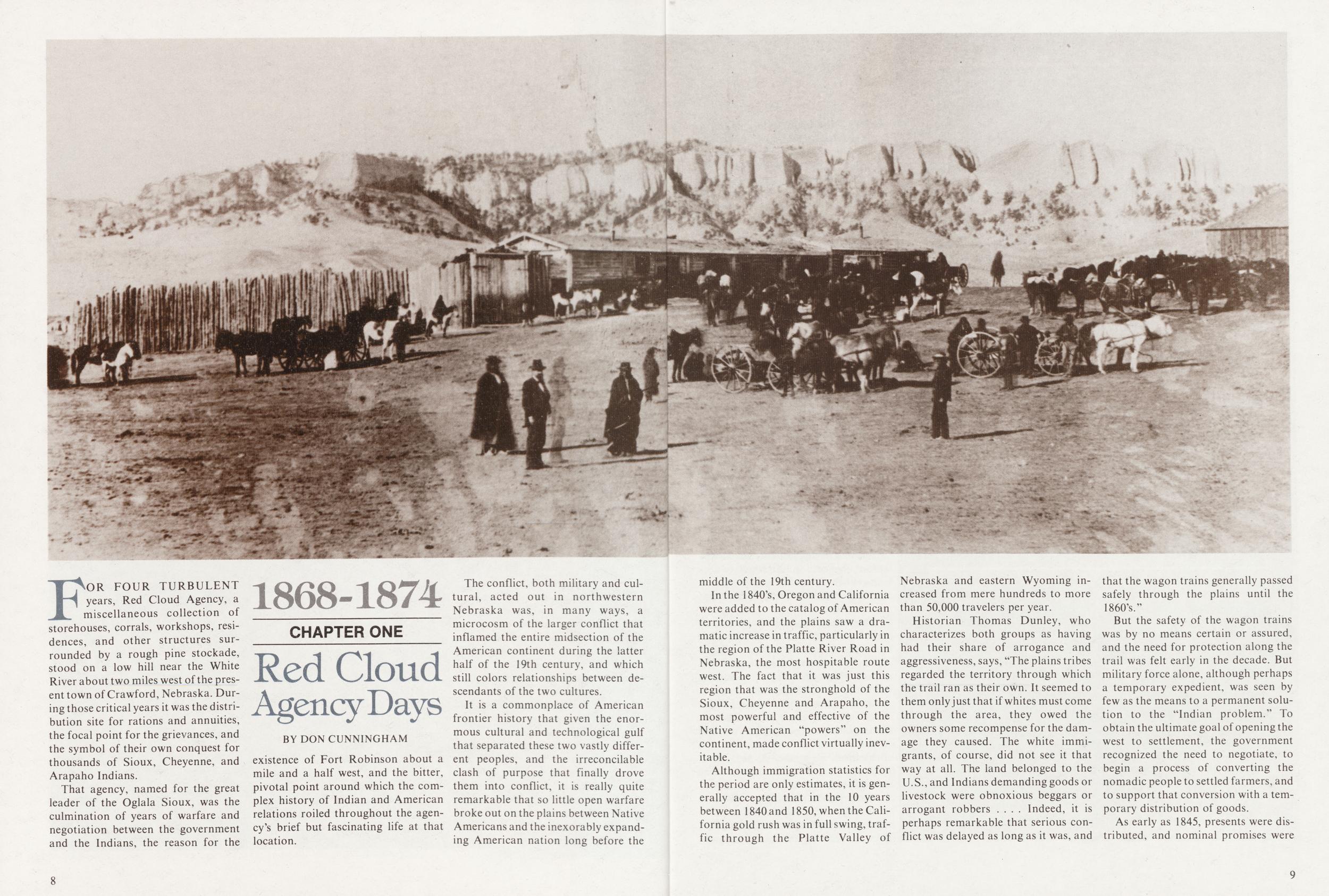
1868-1874 CHAPTER ONE Red Cloud Agency Days
BY DON CUNNINGHAMFOR FOUR TURBULENT years, Red Cloud Agency, a miscellaneous collection of storehouses, corrals, workshops, residences, and other structures surrounded by a rough pine stockade, stood on a low hill near the White River about two miles^west of the present town of Crawford, Nebraska. During those critical years it was the distribution site for rations and annuities, the focal point for the grievances, and the symbol of their own conquest for thousands of Sioux, Cheyenne, and Arapaho Indians.
That agency, named for the great leader of the Oglala Sioux, was the culmination of years of warfare and negotiation between the government and the Indians, the reason for the existence of Fort Robinson about a mile and a half west, and the bitter, pivotal point around which the complex history of Indian and American relations roiled throughout the agency's brief but fascinating life at that location.
The conflict, both military and cultural, acted out in northwestern Nebraska was, in many ways, a microcosm of the larger conflict that inflamed the entire midsection of the American continent during the latter half of the 19th century, and which still colors relationships between descendants of the two cultures.
It is a commonplace of American frontier history that given the enormous cultural and technological gulf that separated these two vastly different peoples, and the irreconcilable clash of purpose that finally drove them into conflict, it is really quite remarkable that so little open warfare broke out on the plains between Native Americans and the inexorably expanding American nation long before the 8 middle of the 19th century.
In the 1840's, Oregon and California were added to the catalog of American territories, and the plains saw a dramatic increase in traffic, particularly in the region of the Platte River Road in Nebraska, the most hospitable route west. The fact that it was just this region that was the stronghold of the Sioux, Cheyenne and Arapaho, the most powerful and effective of the Native American "powers" on the continent, made conflict virtually inevitable.
Although immigration statistics for the period are only estimates, it is generally accepted that in the 10 years between 1840 and 1850, when the California gold rush was in full swing, traffic through the Platte Valley of Nebraska and eastern Wyoming increased from mere hundreds to more than 50,000 travelers per year.
Historian Thomas Dunley, who characterizes both groups as having had their share of arrogance and aggressiveness, says, "The plains tribes regarded the territory through which the trail ran as their own. It seemed to them only just that if whites must come through the area, they owed the owners some recompense for the damage they caused. The white immigrants, of course, did not see it that way at all. The land belonged to the U.S., and Indians demanding goods or livestock were obnoxious beggars or arrogant robbers .... Indeed, it is perhaps remarkable that serious conflict was delayed as long as it was, and that the wagon trains generally passed safely through the plains until the 1860's."
But the safety of the wagon trains was by no means certain or assured, and the need for protection along the trail was felt early in the decade. But military force alone, although perhaps a temporary expedient, was seen by few as the means to a permanent solution to the "Indian problem." To obtain the ultimate goal of opening the west to settlement, the government recognized the need to negotiate, to begin a process of converting the nomadic people to settled farmers, and to support that conversion with a temporary distribution of goods.
As early as 1845, presents were distributed, and nominal promises were
9
 exchanged between Indians and government representatives, but experienced plainsmen
foresaw imminent
conflict. A treaty council in 1851 saw
some 10,000 Indians gather on Horse
Creek near Henry, Nebraska, to make
peace among the tribes and grant the
government the right to establish
roads and forts. In return, the government pledged to protect the Indians
from depredations by whites, and to
distribute $50,000 a year in "provisions, merchandise, domestic animals,
and agricultural implements."
exchanged between Indians and government representatives, but experienced plainsmen
foresaw imminent
conflict. A treaty council in 1851 saw
some 10,000 Indians gather on Horse
Creek near Henry, Nebraska, to make
peace among the tribes and grant the
government the right to establish
roads and forts. In return, the government pledged to protect the Indians
from depredations by whites, and to
distribute $50,000 a year in "provisions, merchandise, domestic animals,
and agricultural implements."
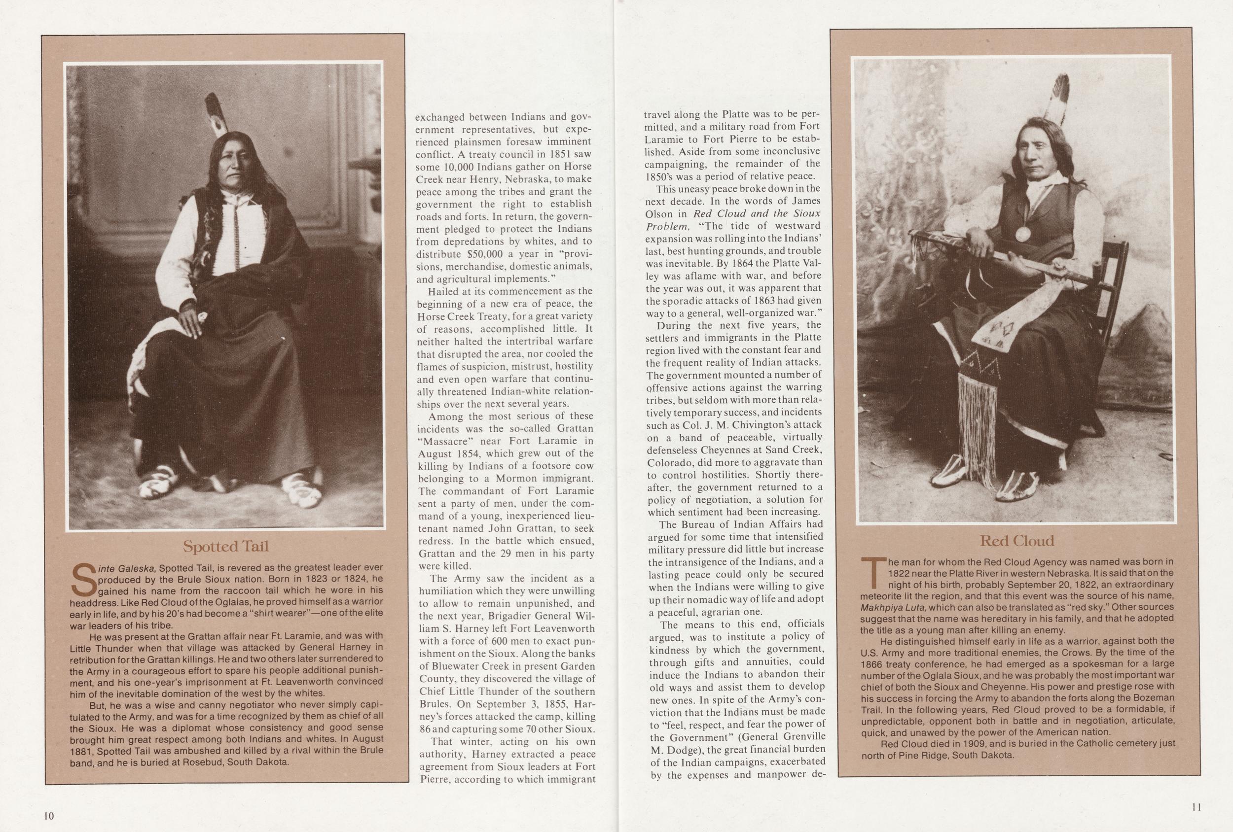
Sinte Galeska, Spotted Tail, is revered as the greatest leader ever produced by the Brule Sioux nation. Born in 1823 or 1824, he gained his name from the raccoon tail which he wore in his headdress. Like Red Cloud of the Oglalas, he proved himself as a warrior early in life, and by his 20's had become a "shirt wearer"—one of the elite war leaders of his tribe.
He was present at the Grattan affair near Ft. Laramie, and was with Little Thunder when that village was attacked by General Harney in retribution for the Grattan killings. He and two others later surrendered to the Army in a courageous effort to spare his people additional punishment, and his one-year's imprisonment at Ft. Leavenworth convinced him of the inevitable domination of the west by the whites.
But, he was a wise and canny negotiator who never simply capitulated to the Army, and was for a time recognized by them as chief of all the Sioux. He was a diplomat whose consistency and good sense brought him great respect among both Indians and whites. In August 1881, Spotted Tail was ambushed and killed by a rival within the Brule band, and he is buried at Rosebud, South Dakota.
Hailed at its commencement as the beginning of a new era of peace, the Horse Creek Treaty, for a great variety of reasons, accomplished little. It neither halted the intertribal warfare that disrupted the area, nor cooled the flames of suspicion, mistrust, hostility and even open warfare that continually threatened Indian-white relationships over the next several years.
Among the most serious of these incidents was the so-called Grattan "Massacre" near Fort Laramie in August 1854, which grew out of the killing by Indians of a footsore cow belonging to a Mormon immigrant. The commandant of Fort Laramie sent a party of men, under the command of a young, inexperienced lieutenant named John Grattan, to seek redress. In the battle which ensued, Grattan and the 29 men in his party were killed.
The Army saw the incident as a humiliation which they were unwilling to allow to remain unpunished, and the next year, Brigadier General William S. Harney left Fort Leavenworth with a force of 600 men to exact punishment on the Sioux. Along the banks of Bluewater Creek in present Garden County, they discovered the village of Chief Little Thunder of the southern Brules. On September 3, 1855, Harney's forces attacked the camp, killing 86 and capturing some 70 other Sioux.
That winter, acting on his own authority, Harney extracted a peace agreement from Sioux leaders at Fort Pierre, according to which immigrant 10 travel along the Platte was to be permitted, and a military road from Fort Laramie to Fort Pierre to be established. Aside from some inconclusive campaigning, the remainder of the 1850's was a period of relative peace.
This uneasy peace broke down in the next decade. In the words of James Olson in Red Cloud and the Sioux Problem, "The tide of westward expansion was rolling into the Indians' last, best hunting grounds, and trouble was inevitable. By 1864 the Platte Valley was aflame with war, and before the year was out, it was apparent that the sporadic attacks of 1863 had given way to a general, well-organized war."
During the next five years, the settlers and immigrants in the Platte region lived with the constant fear and the frequent reality of Indian attacks. The government mounted a number of offensive actions against the warring tribes, but seldom with more than relatively temporary success, and incidents such as Col. J. M. Chivington's attack on a band of peaceable, virtually defenseless Cheyennes at Sand Creek, Colorado, did more to aggravate than to control hostilities. Shortly thereafter, the government returned to a policy of negotiation, a solution for which sentiment had been increasing.
The Bureau of Indian Affairs had argued for some time that intensified military pressure did little but increase the intransigence of the Indians, and a lasting peace could only be secured when the Indians were willing to give up their nomadic way of life and adopt a peaceful, agrarian one.
The means to this end, officials argued, was to institute a policy of kindness by which the government, through gifts and annuities, could induce the Indians to abandon their old ways and assist them to develop new ones. In spite of the Army's conviction that the Indians must be made to "feel, respect, and fear the power of the Government" (General Grenville M. Dodge), the great financial burden of the Indian campaigns, exacerbated by the expenses and manpower demands of the Civil War and the scandal of incidents such as Chivington's Sand Creek debacle, propelled the policy makers toward negotiation, the solution favored by Bureau officials.
Red CloudThe man for whom the Red Cloud Agency was named was born in 1822 near the Platte River in western Nebraska. It is said that on the night of his birth, probably September 20,1822, an extraordinary meteorite lit the region, and that this event was the source of his name, Makhpiya Luta, which can also be translated as "red sky." Other sources suggest that the name was hereditary in his family, and that he adopted the title as a young man after killing an enemy.
He distinguished himself early in life as a warrior, against both the U.S. Army and more traditional enemies, the Crows. By the time of the 1866 treaty conference, he had emerged as a spokesman for a large number of the Oglala Sioux, and he was probably the most important war chief of both the Sioux and Cheyenne. His power and prestige rose with his success in forcing the Army to abandon the forts along the Bozeman Trail. In the following years, Red Cloud proved to be a formidable, if unpredictable, opponent both in battle and in negotiation, articulate, quick, and unawed by the power of the American nation.
Red Cloud died in 1909, and is buried in the Catholic cemetery just north of Pine Ridge, South Dakota.
11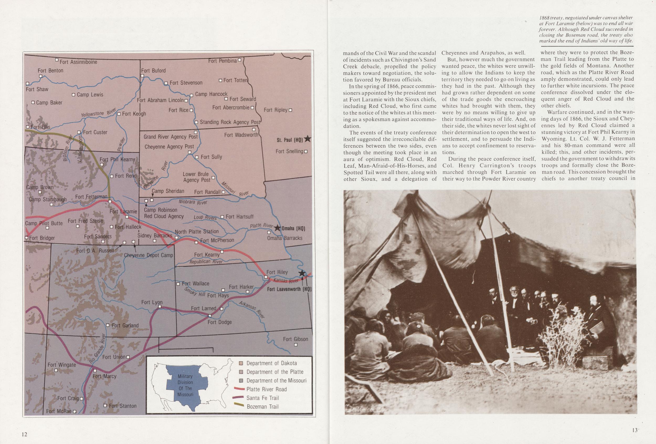
In the spring of 1866, peace commissioners appointed by the president met at Fort Laramie with the Sioux chiefs, including Red Cloud, who first came to the notice of the whites at this meeting as a spokesman against accommodation.
The events of the treaty conference itself suggested the irreconcilable differences between the two sides, even though the meeting took place in an aura of optimism. Red Cloud, Red Leaf, Man-Afraid-of-His-Horses, and Spotted Tail were all there, along with other Sioux, and a delegation of Cheyennes and Arapahos, as well.
But, however much the government wanted peace, the whites were unwilling to allow the Indians to keep the territory they needed to go on living as they had in the past. Although they had grown rather dependent on some of the trade goods the encroaching whites had brought with them, they were by no means willing to give up their traditional ways of life. And, on their side, the whites never lost sight of their determination to open the west to settlement, and to persuade the Indians to accept confinement to reservations.
During the peace conference itself, Col. Henry Carrington's troops marched through Fort Laramie on their way to the Powder River country where they were to protect the Bozeman Trail leading from the Platte to the gold fields of Montana. Another road, which as the Platte River Road amply demonstrated, could only lead to further white incursions. The peace conference dissolved under the eloquent anger of Red Cloud and the other chiefs.
Warfare continued, and in the waning days of 1866, the Sioux and Cheyennes led by Red Cloud claimed a stunning victory at Fort Phil Kearny in Wyoming. Lt. Col. W. J. Fetterman and his 80-man command were all killed; this, and other incidents, persuaded the government to withdraw its troops and formally close the Bozeman road. This concession brought the chiefs to another treaty council in
Nevertheless, although the Treaty of 1868 signaled the end of the old way of life for the Indians, it was in many ways the most generous treaty yet offered them. Besides calling for the abandonment of the Powder River forts, it provided for the establishment of a reservation extending from the Missouri River on the east to the Big Horn Mountains on the west, and from the 43rd parallel on the south (Nebraska's northern boundary) to the 46th parallel on the north. Additionally, it provided the Indians the right to hunt on the Republican River and on any lands north of the North Platte. Rations and annuities were to be distributed for a 30-year period to ease the transition to the more sedentary way of life.
The Peace Commission selected Fort Randall on the Missouri River as the site of the agency from which goods would be distributed, the convenience of river transportation being more important than the wishes of the Indians to whom this gameless, unfamiliar area was totally unacceptable. A few of the friendly Indians were convinced to go there when their subsistence on the Platte was cut off, but most did not, and it soon became clear that Red Cloud's principal objective in the negotiations was to find a way to continue living and trading in the Fort Laramie vicinity.
Red Cloud's adamant refusal to go to the reservation if trading rights in the west were not granted, seemed an insoluble problem, and two years of see-saw negotiations, visits to Washington by delegations of Indians, and proposals and counter proposals by peace commissioners, followed.
Finally, in the fall of 1870, Peace Commissioners came to Fort Laramie to meet with Red Cloud and negotiate a final settlement. The government representatives, still mindful of the objective to keep the Indians out of the Platte Valley, proposed locating the agency near Rawhide Buttes, some 40 miles north of Fort Laramie. Red Cloud refused to compromise; the agency was to be on the Platte. Finally, with Red Cloud gone, the other chiefs agreed, and the government acquiesced; a temporary agency was located about 32 miles downstream from Fort Laramie, about a mile west of the present Nebraska-Wyoming border near the present town of Henry.
It was not an easy winter at the new agency. Fuel in the relatively barren area was a constant problem, and the proximity of the temporary agency to 14 the fort, and to the relative congestion of the Platte Valley, made many of the evils of white society, especially alcohol, too easily available. In February of 1872, agent J. W. Daniels wrote: "The more sensible portion of the Sioux are disposed to believe that the Agency must be moved to a more favorable place."
The following month, Red Cloud and his band, who had never previously come in to the agency, arrived. Red Cloud agreed that the location of the agency was a prime cause of unrest, but still could not be convinced to accept a new location. Meanwhile, the some 7,000 Indians at the agency kept tensions high.
Finally, at an assembly in April, not attended by Red Cloud, the chiefs agreed to move to the White River. A scouting party including agent Daniels, Red Dog, and others went to the White River in northwest Nebraska to select a site for the new agency, and they settled on a low bluff overlooking the White River Valley about a mile southwest of the present town of Crawford.
More negotiations and another trip to Washington by Red Cloud and others followed, and finally, in August of 1873, the 75-mile march to the new agency site in northwest Nebraska began.
The new location had numerous advantages over the old: there was plentiful timber, good, free-flowing springs, excellent grazing land, and the huge, sheltering bluffs to the north. It was a far more satisfactory location for the Indians, and the whites hoped that here, at some distance from the major transcontinental routes, the "Indian problem" would be at least held in abeyance, if not solved.
Shortly after their arrival at the White River site, agent Daniels was replaced by Dr. John J. Saville, whose duty it became to oversee the building and reorganization of the agency, and managing its restless, dislocated, unwilling wards. Saville engaged his brother-in-law, A. R. Appleton, and they drew up plans and began construction
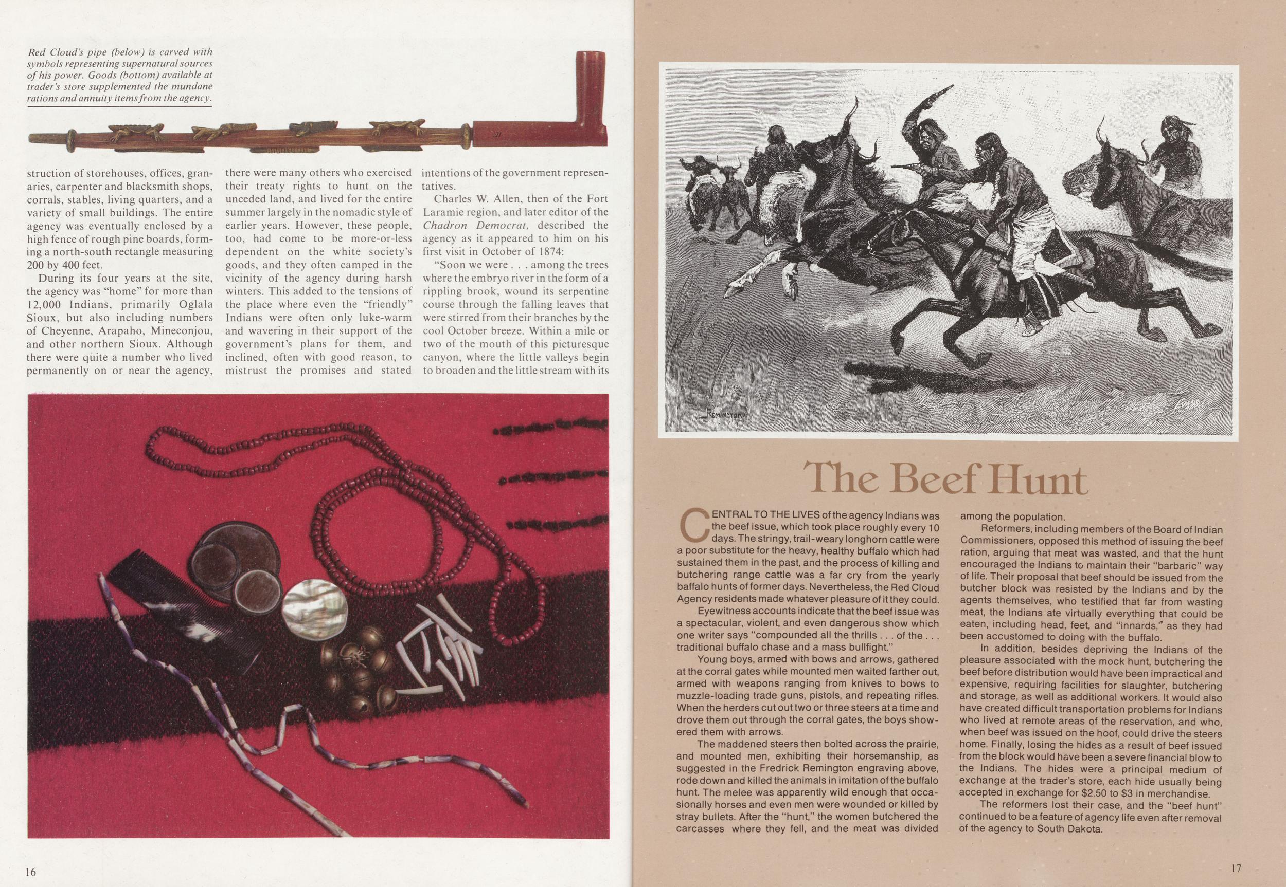
During its four years at the site, the agency was "home" for more than 12,000 Indians, primarily Oglala Sioux, but also including numbers of Cheyenne, Arapaho, Mineconjou, and other northern Sioux. Although there were quite a number who lived permanently on or near the agency, there were many others who exercised their treaty rights to hunt on the unceded land, and lived for the entire summer largely in the nomadic style of earlier years. However, these people, too, had come to be more-or-less dependent on the white society's goods, and they often camped in the vicinity of the agency during harsh winters. This added to the tensions of the place where even the "friendly" Indians were often only luke-warm and wavering in their support of the government's plans for them, and inclined, often with good reason, to mistrust the promises and stated intentions of the government representatives.
Charles W. Allen, then of the Fort Laramie region, and later editor of the Chadron Democrat, described the agency as it appeared to him on his first visit in October of 1874:
"Soon we were . . . among the trees where the embryo river in the form of a rippling brook, wound its serpentine course through the falling leaves that were stirred from their branches by the cool October breeze. Within a mile or two of the mouth of this picturesque canyon, where the little valleys begin to broaden and the little stream with its numerous springs gradually deepened into the White River, the road left its banks and rose to the top of a hill at the edge of an extensive valley surrounded by irregular pine ridges. In front of us, on either side of the road, a large Arapahoe village met our gaze . . still farther to the north was a large Cheyenne village. In plain view to the east was a cluster of buildings, and from the front of one rose a crude miniature tower with portico attachments which, through the haze of morning were suggestive of some ancient feudal castle. This was the Red Cloud agency, and round about it, up the rivulets that came out of the hills, camps of family groups of lodges were scattered in every direction. However, Red Cloud's main camp of thousands a little farther to the east was obscured by a low chain of grass-covered hills.
CENTRAL TO THE LIVES of the agency Indians was the beef issue, which took place roughly every 10 days. The stringy, trail-weary longhorn cattle were a poor substitute for the heavy, healthy buffalo which had sustained them in the past, and the process of killing and butchering range cattle was a far cry from the yearly baffalo hunts of former days. Nevertheless, the Red Cloud Agency residents made whatever pleasure of it they could.
Eyewitness accounts indicate that the beef issue was a spectacular, violent, and even dangerous show which one writer says "compounded all the thrills of the traditional buffalo chase and a mass bullfight."
Young boys, armed with bows and arrows, gathered at the corral gates while mounted men waited farther out, armed with weapons ranging from knives to bows to muzzle-loading trade guns, pistols, and repeating rifles. When the herders cut out two or three steers at a time and drove them out through the corral gates, the boys showered them with arrows.
The maddened steers then bolted across the prairie, and mounted men, exhibiting their horsemanship, as suggested in the Fredrick Remington engraving above, rode down and killed the animals in imitation of the buffalo hunt. The melee was apparently wild enough that occasionally horses and even men were wounded or killed by stray bullets. After the "hunt," the women butchered the carcasses where they fell, and the meat was divided among the population.
Reformers, including members of the Board of Indian Commissioners, opposed this method of issuing the beef ration, arguing that meat was wasted, and that the hunt encouraged the Indians to maintain their "barbaric" way of life. Their proposal that beef should be issued from the butcher block was resisted by the Indians and by the agents themselves, who testified that far from wasting meat, the Indians ate virtually everything that could be eaten, including head, feet, and "innards," as they had been accustomed to doing with the buffalo.
In addition, besides depriving the Indians of the pleasure associated with the mock hunt, butchering the beef before distribution would have been impractical and expensive, requiring facilities for slaughter, butchering and storage, as well as additional workers. It would also have created difficult transportation problems for Indians who lived at remote areas of the reservation, and who, when beef was issued on the hoof, could drive the steers home. Finally, losing the hides as a result of beef issued from the block would have been a severe financial blow to the Indians. The hides were a principal medium of exchange at the trader's store, each hide usually being accepted in exchange for $2.50 to $3 in merchandise.
The reformers lost their case, and the "beef hunt" continued to be a feature of agency life even after removal of the agency to South Dakota.
17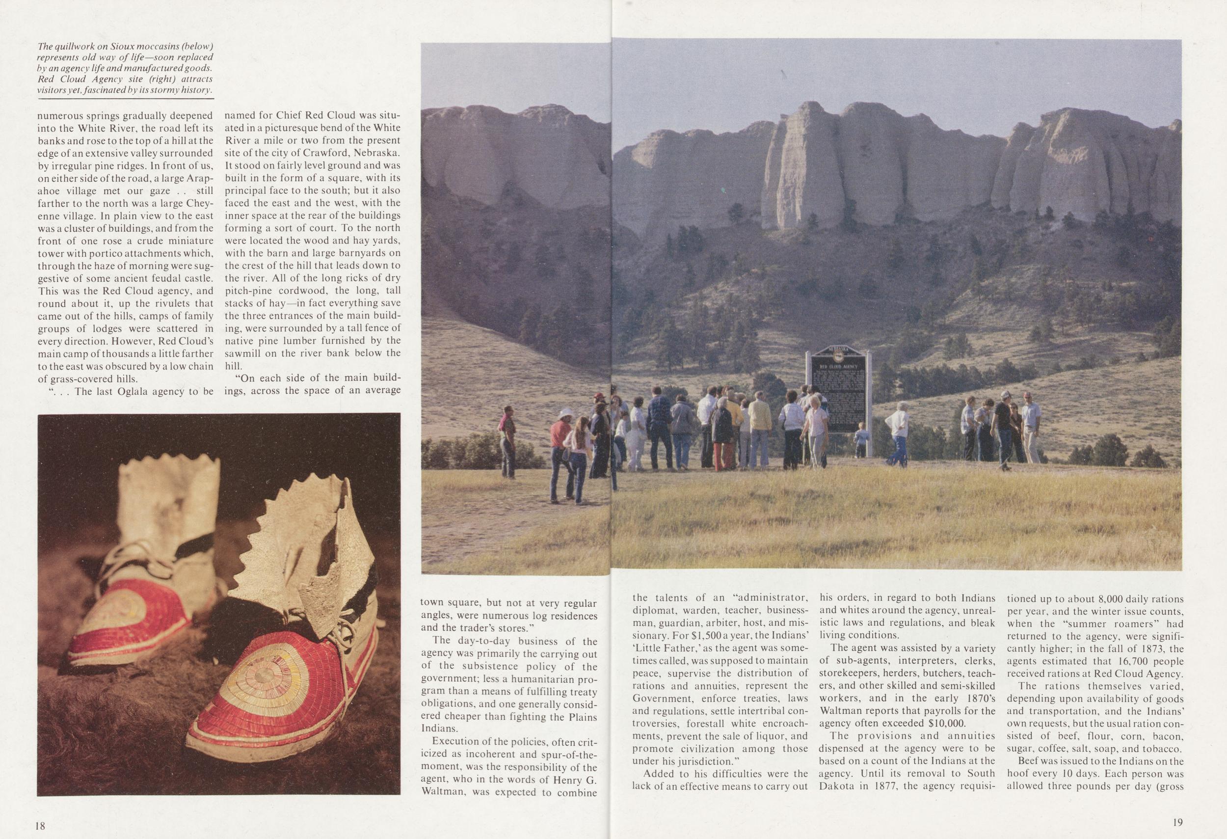
". . . The last Oglala agency to be named for Chief Red Cloud was situated in a picturesque bend of the White River a mile or two from the present site of the city of Crawford, Nebraska. It stood on fairly level ground and was built in the form of a square, with its principal face to the south; but it also faced the east and the west, with the inner space at the rear of the buildings forming a sort of court. To the north were located the wood and hay yards, with the barn and large barnyards on the crest of the hill that leads down to the river. All of the long ricks of dry pitch-pine cordwood, the long, tall stacks of hay—in fact everything save the three entrances of the main building, were surrounded by a tall fence of native pine lumber furnished by the sawmill on the river bank below the hill.
"On each side of the main buildings, across the space of an average town square, but not at very regular angles, were numerous log residences and the trader's stores."
The day-to-day business of the agency was primarily the carrying out of the subsistence policy of the government; less a humanitarian program than a means of fulfilling treaty obligations, and one generally considered cheaper than fighting the Plains Indians.
Execution of the policies, often criticized as incoherent and spur-of-the-moment, was the responsibility of the agent, who in the words of Henry G. Waltman, was expected to combine 18 the talents of an "administrator, diplomat, warden, teacher, businessman, guardian, arbiter, host, and missionary. For $1,500 a year, the Indians' 'Little Father,' as the agent was sometimes called, was supposed to maintain peace, supervise the distribution of rations and annuities, represent the Government, enforce treaties, laws and regulations, settle intertribal controversies, forestall white encroachments, prevent the sale of liquor, and promote civilization among those under his jurisdiction."
Added to his difficulties were the lack of an effective means to carry out his orders, in regard to both Indians and whites around the agency, unrealistic laws and regulations, and bleak living conditions.
The agent was assisted by a variety of sub-agents, interpreters, clerks, storekeepers, herders, butchers, teachers, and other skilled and semi-skilled workers, and in the early 1870's Waltman reports that payrolls for the agency often exceeded $10,000.
The provisions and annuities dispensed at the agency were to be based on a count of the Indians at the agency. Until its removal to South Dakota in 1877, the agency requisitioned up to about 8,000 daily rations per year, and the winter issue counts, when the "summer roamers" had returned to the agency, were significantly higher; in the fall of 1873, the agents estimated that 16,700 people received rations at Red Cloud Agency.
The rations themselves varied, depending upon availability of goods and transportation, and the Indians' own requests, but the usual ration consisted of beef, flour, corn, bacon, sugar, coffee, salt, soap, and tobacco.
Beef was issued to the Indians on the
hoof every 10 days. Each person was
allowed three pounds per day (gross
19
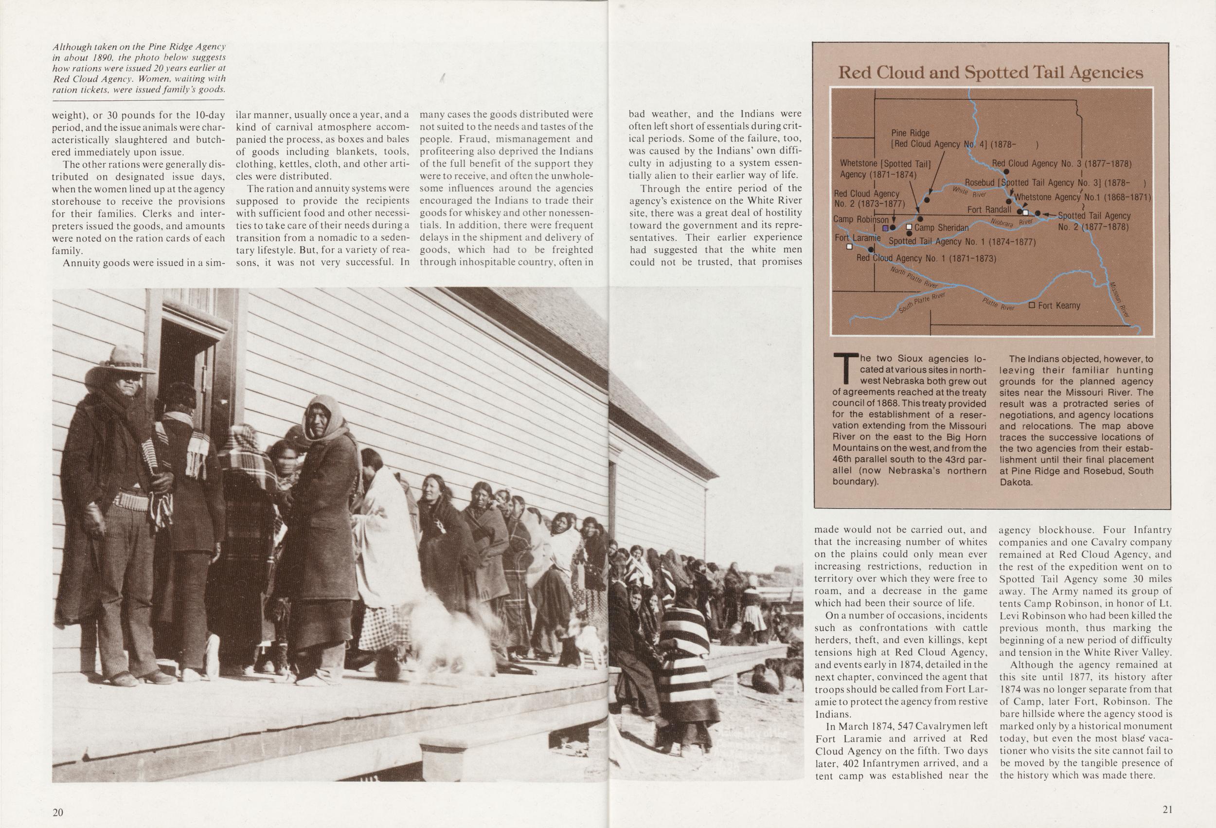
The other rations were generally distributed on designated issue days, when the women lined up at the agency storehouse to receive the provisions for their families. Clerks and interpreters issued the goods, and amounts were noted on the ration cards of each family.
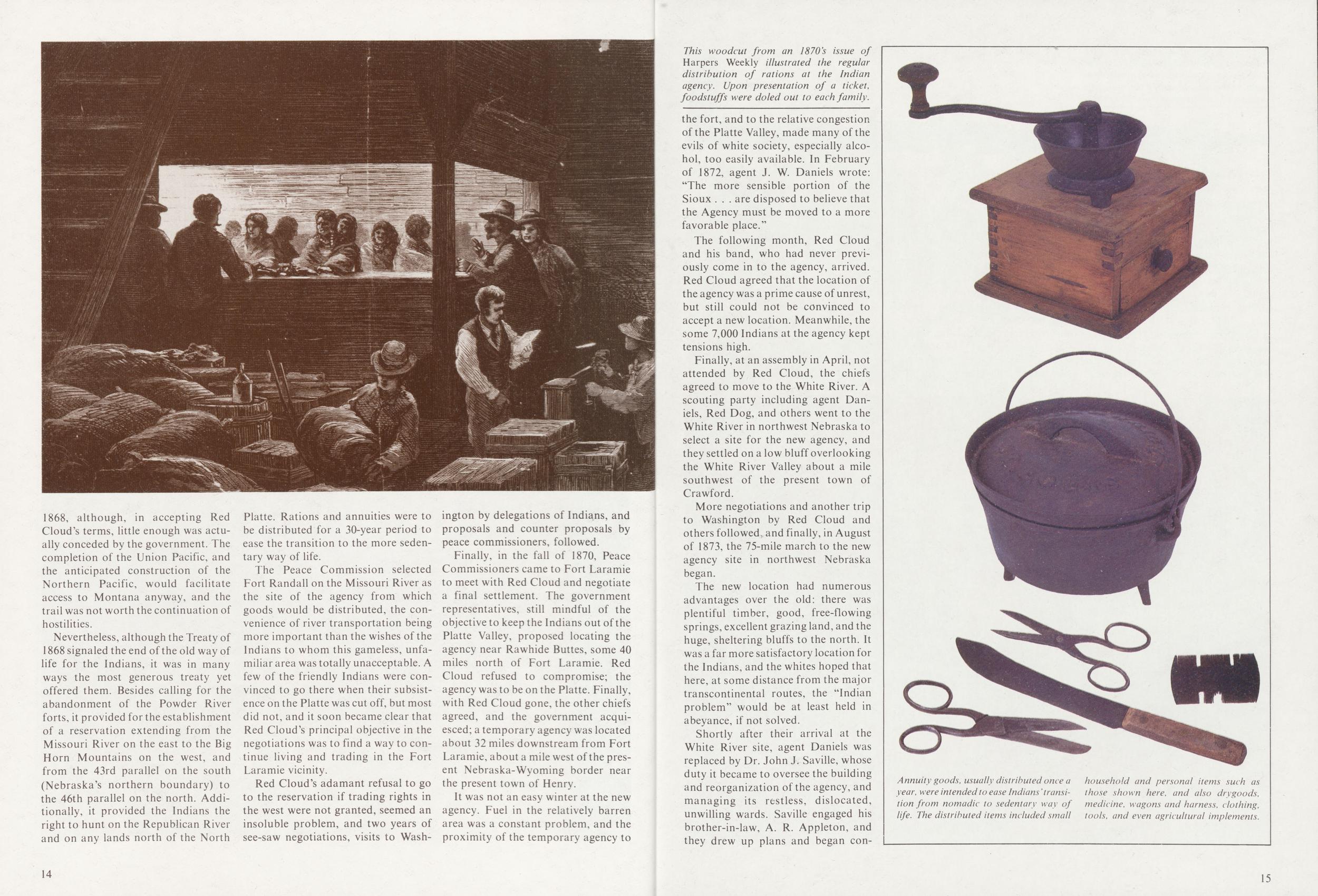
Annuity goods were issued in a similar manner, usually once a year, and a kind of carnival atmosphere accompanied the process, as boxes and bales of goods including blankets, tools, clothing, kettles, cloth, and other articles were distributed.
The ration and annuity systems were supposed to provide the recipients with sufficient food and other necessities to take care of their needs during a transition from a nomadic to a sedentary lifestyle. But, for a variety of reasons, it was not very successful. In many cases the goods distributed were not suited to the needs and tastes of the people. Fraud, mismanagement and profiteering also deprived the Indians of the full benefit of the support they were to receive, and often the unwholesome influences around the agencies encouraged the Indians to trade their goods for whiskey and other nonessentials. In addition, there were frequent delays in the shipment and delivery of goods, which had to be freighted through inhospitable country, often in 20 bad weather, and the Indians were often left short of essentials during critical periods. Some of the failure, too, was caused by the Indians' own difficulty in adjusting to a system essentially alien to their earlier way of life.
Through the entire period of the agency's existence on the White River site, there was a great deal of hostility toward the government and its representatives. Their earlier experience had suggested that the white men could not be trusted, that promises made would not be carried out, and that the increasing number of whites on the plains could only mean ever increasing restrictions, reduction in territory over which they were free to roam, and a decrease in the game which had been their source of life.
Red Cloud and Spotted Tall AgenciesThe two Sioux agencies located at various sites in northwest Nebraska both grew out of agreements reached at the treaty council of 1868. This treaty provided for the establishment of a reservation extending from the Missouri River on the east to the Big Horn Mountains on the west, and from the 46th parallel south to the 43rd parallel (now Nebraska's northern boundary).
The Indians objected, however, to leaving their familiar hunting grounds for the planned agency sites near the Missouri River. The result was a protracted series of negotiations, and agency locations and relocations. The map above traces the successive locations of the two agencies from their establishment until their final placement at Pine Ridge and Rosebud, South Dakota.
On a number of occasions, incidents such as confrontations with cattle herders, theft, and even killings, kept tensions high at Red Cloud Agency, and events early in 1874, detailed in the next chapter, convinced the agent that troops should be called from Fort Laramie to protect the agency from restive Indians.
In March 1874, 547 Cavalrymen left Fort Laramie and arrived at Red Cloud Agency on the fifth. Two days later, 402 Infantrymen arrived, and a tent camp was established near the agency blockhouse. Four Infantry companies and one Cavalry company remained at Red Cloud Agency, and the rest of the expedition went on to Spotted Tail Agency some 30 miles away. The Army named its group of tents Camp Robinson, in honor of Lt. Levi Robinson who had been killed the previous month, thus marking the beginning of a new period of difficulty and tension in the White River Valley.
Although the agency remained at this site until 1877, its history after 1874 was no longer separate from that of Camp, later Fort, Robinson. The bare hillside where the agency stood is marked only by a historical monument today, but even the most blasd vacationer who visits the site cannot fail to be moved by the tangible presence of the history which was made there.
21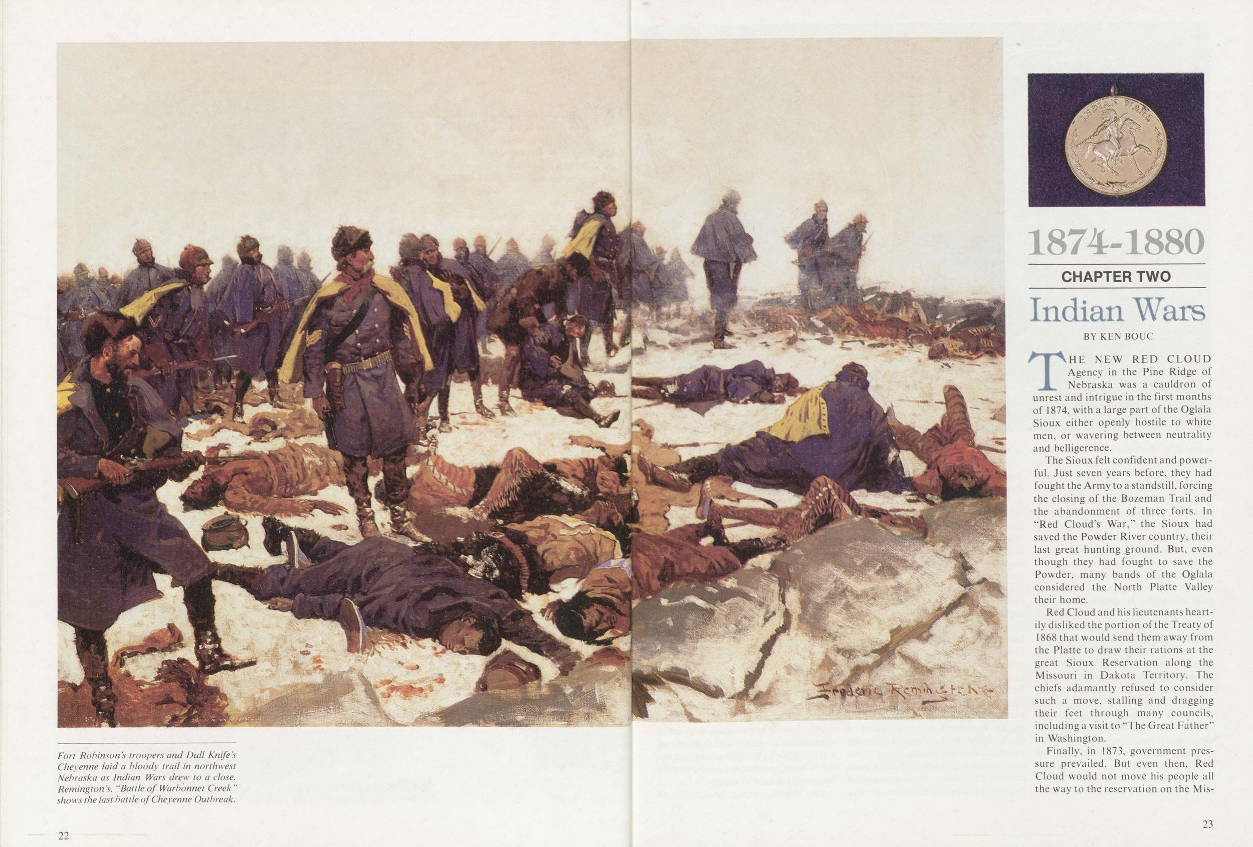
1874-1880 CHAPTER TWO Indian Wars
BY KEN BOUCTHE NEW RED CLOUD Agency in the Pine Ridge of Nebraska was a cauldron of unrest and intrigue in the first months of 1874, with a large part of the Oglala Sioux either openly hostile to white men, or wavering between neutrality and belligerence.
The Sioux felt confident and powerful. Just seven years before, they had fought the Army to a standstill, forcing the closing of the Bozeman Trail and the abandonment of three forts. In "Red Cloud's War," the Sioux had saved the Powder River country, their last great hunting ground. But, even though they had fought to save the Powder, many bands of the Oglala considered the North Platte Valley their home.
Red Cloud and his lieutenants heartily disliked the portion of the Treaty of 1868 that would send them away from the Platte to draw their rations at the great Sioux Reservation along the Missouri in Dakota Territory. The chiefs adamantly refused to consider such a move, stalling and dragging their feet through many councils, including a visit to "The Great Father" in Washington.
Finally, in 1873, government pressure prevailed. But even then, Red
Cloud would not move his people all
the way to the reservation on the Missouri.
23
Still, the move irritated the proud Oglalas. And, many Sioux from the untamed northern Oglala bands, as well as Minneconjous, Hunkpapas, Sans Arcs, plus Northern Cheyennes and Arapahos, were staying at Red Cloud to winter on government rations, while at the same time inciting even greater unrest. By February of 1874, the Red Cloud Agency was like a powder keg with a burning fuse, and a short fuse at that.
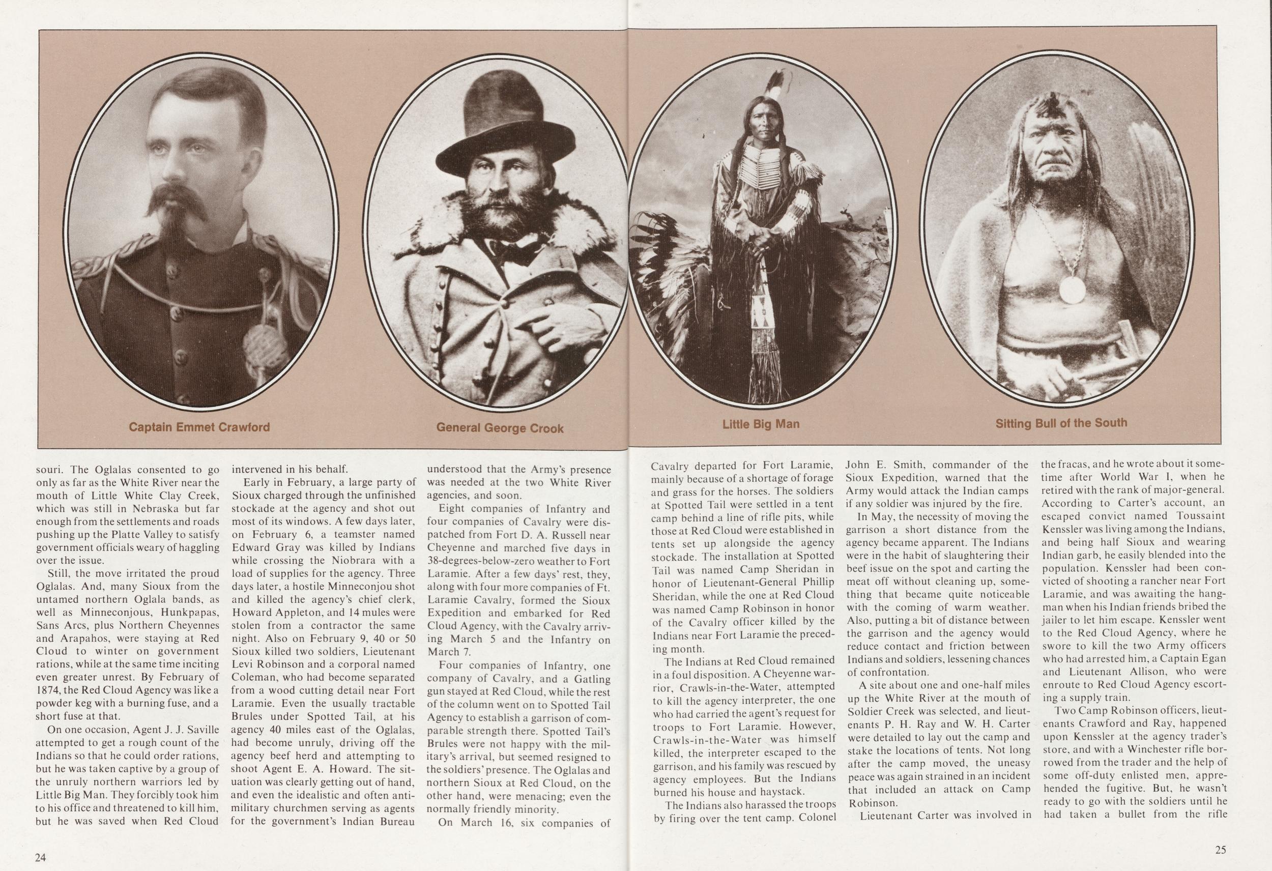
On one occasion, Agent J. J. Saville attempted to get a rough count of the Indians so that he could order rations, but he was taken captive by a group of the unruly northern warriors led by Little Big Man. They forcibly took him to his office and threatened to kill him, but he was saved when Red Cloud intervened in his behalf.
Early in February, a large party of Sioux charged through the unfinished stockade at the agency and shot out most of its windows. A few days later, on February 6, a teamster named Edward Gray was killed by Indians while crossing the Niobrara with a load of supplies for the agency. Three days later, a hostile Minneconjou shot and killed the agency's chief clerk, Howard Appleton, and 14 mules were stolen from a contractor the same night. Also on February 9, 40 or 50 Sioux killed two soldiers, Lieutenant Levi Robinson and a corporal named Coleman, who had become separated from a wood cutting detail near Fort Laramie. Even the usually tractable Brules under Spotted Tail, at his agency 40 miles east of the Oglalas, had become unruly, driving off the agency beef herd and attempting to shoot Agent E. A. Howard. The situation was clearly getting out of hand, and even the idealistic and often antimilitary churchmen serving as agents for the government's Indian Bureau understood that the Army's presence was needed at the two White River agencies, and soon.
Eight companies of Infantry and four companies of Cavalry were dispatched from Fort D. A. Russell near Cheyenne and marched five days in 38-degrees-below-zero weather to Fort Laramie. After a few days' rest, they, along with four more companies of Ft. Laramie Cavalry, formed the Sioux Expedition and embarked for Red Cloud Agency, with the Cavalry arriving March 5 and the Infantry on March 7.
Four companies of Infantry, one company of Cavalry, and a Gatling gun stayed at Red Cloud, while the rest of the column went on to Spotted Tail Agency to establish a garrison of comparable strength there. Spotted Tail's Brules were not happy with the military's arrival, but seemed resigned to the soldiers' presence. The Oglalas and northern Sioux at Red Cloud, on the other hand, were menacing; even the normally friendly minority.
On March 16, six companies of 24
The Indians at Red Cloud remained in a foul disposition. A Cheyenne warrior, Crawls-in-the-Water, attempted to kill the agency interpreter, the one who had carried the agent's request for troops to Fort Laramie. However, Crawls-in-the-Water was himself killed, the interpreter escaped to the garrison, and his family was rescued by agency employees. But the Indians burned his house and haystack.
The Indians also harassed the troops by firing over the tent camp. Colonel John E. Smith, commander of the Sioux Expedition, warned that the Army would attack the Indian camps if any soldier was injured by the fire.
In May, the necessity of moving the garrison a short distance from the agency became apparent. The Indians were in the habit of slaughtering their beef issue on the spot and carting the meat off without cleaning up, something that became quite noticeable with the coming of warm weather. Also, putting a bit of distance between the garrison and the agency would reduce contact and friction between Indians and soldiers, lessening chances of confrontation.
A site about one and one-half miles up the White River at the mouth of Soldier Creek was selected, and lieutenants P. H. Ray and W. H. Carter were detailed to lay out the camp and stake the locations of tents. Not long after the camp moved, the uneasy peace was again strained in an incident that included an attack on Camp Robinson.
Lieutenant Carter was involved in the fracas, and he wrote about it sometime after World War I, when he retired with the rank of major-general. According to Carter's account, an escaped convict named Toussaint Kenssler was living among the Indians, and being half Sioux and wearing Indian garb, he easily blended into the population. Kenssler had been convicted of shooting a rancher near Fort Laramie, and was awaiting the hangman when his Indian friends bribed the jailer to let him escape. Kenssler went to the Red Cloud Agency, where he swore to kill the two Army officers who had arrested him, a Captain Egan and Lieutenant Allison, who were enroute to Red Cloud Agency escorting a supply train.
Two Camp Robinson officers, lieutenants Crawford and Ray, happened
upon Kenssler at the agency trader's
store, and with a Winchester rifle borrowed from the trader and the help of
some off-duty enlisted men, apprehended the fugitive. But, he wasn't
ready to go with the soldiers until he
had taken a bullet from the rifle
25
"Before they arrived, the camp was aroused by the rushing of the pony herds of the Indians which had been sent out beyond our camp to graze," Carter wrote. "The Indian boys who were in charge of the herd were summoned by signals made by small mirrors, and dashed by our tents at great speed. We looked toward the agency and saw the tepees going down, apparently preparatory to a sudden move of their villages."
The soldiers fully expected the Indians to rush the camp in an attempt to rescue Kenssler, but nothing happened until about midnight. Then, a party of Indians began firing on the camp from behind the tents, and the soldiers rushed out to meet the threat. As the attackers withdrew, the soldiers also fell back, expecting another attack. Instead, they discovered that another party had slipped into the post during the engagement and driven off the entire beef herd. The Cavalry was sent in pursuit, and recovered most of the herd along the White River.
After that affair, there was a period of relative calm. The Army had shown its resolve during the Kenssler affair, and later had demonstrated its military power with target practice and Gatling gun drills that impressed the Indians. Also, the volatile northern Sioux element had left the agency for the hunting grounds in the Powder River country. That left the soldiers time to build some log barracks and other more or less permanent buildings.
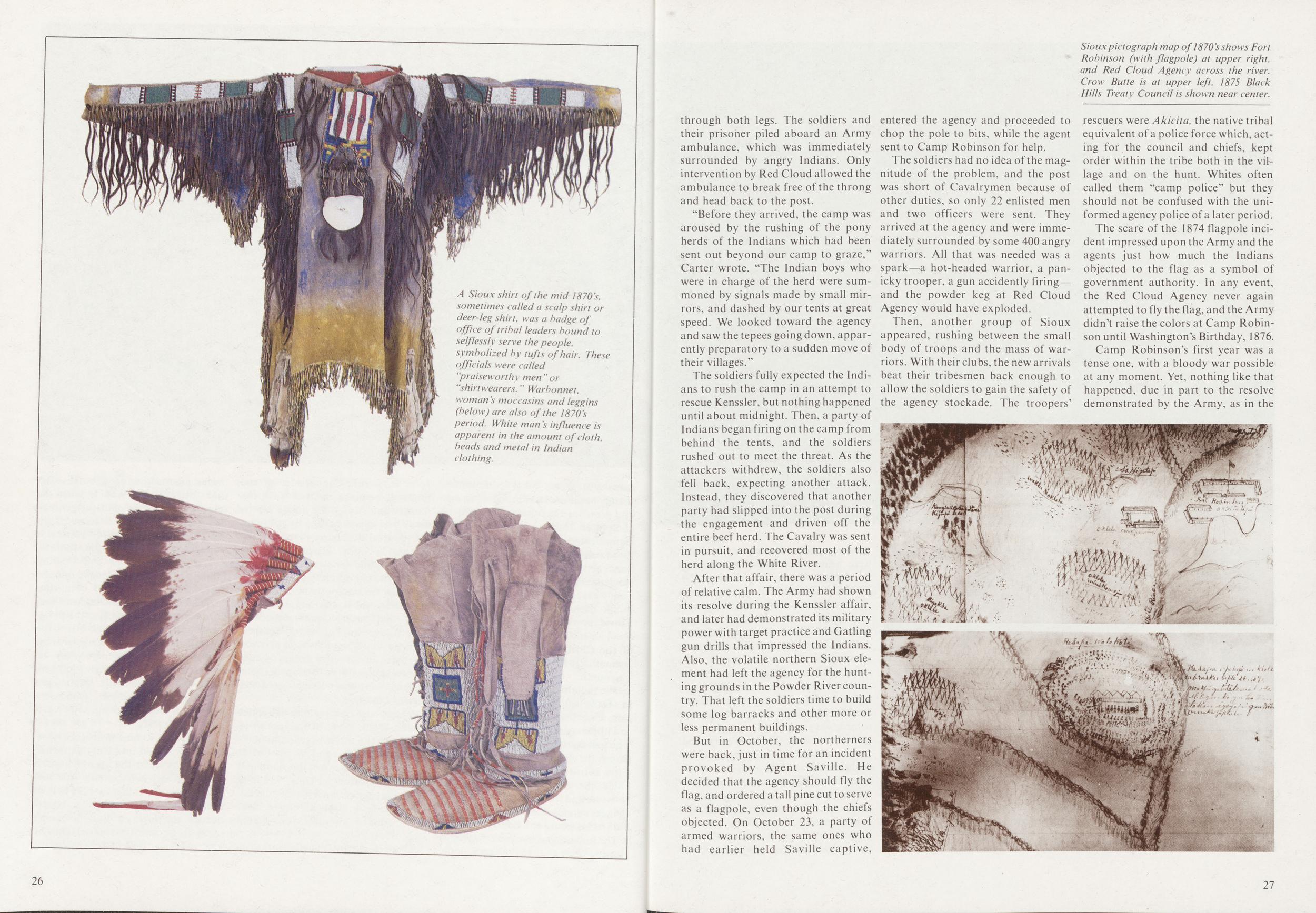
But in October, the northerners were back, just in time for an incident provoked by Agent Saville. He decided that the agency should fly the flag, and ordered a tall pine cut to serve as a flagpole, even though the chiefs objected. On October 23, a party of armed warriors, the same ones who had earlier held Saville captive, entered the agency and proceeded to chop the pole to bits, while the agent sent to Camp Robinson for help.
The soldiers had no idea of the magnitude of the problem, and the post was short of Cavalrymen because of other duties, so only 22 enlisted men and two officers were sent. They arrived at the agency and were immediately surrounded by some 400 angry warriors. All that was needed was a spark—a hot-headed warrior, a panicky trooper, a gun accidently firing and the powder keg at Red Cloud Agency would have exploded.
Then, another group of Sioux appeared, rushing between the small body of troops and the mass of warriors. With their clubs, the new arrivals beat their tribesmen back enough to allow the soldiers to gain the safety of the agency stockade. The troopers' rescuers were Akicita, the native tribal equivalent of a police force which, acting for the council and chiefs, kept order within the tribe both in the village and on the hunt. Whites often called them "camp police" but they should not be confused with the uniformed agency police of a later period.
The scare of the 1874 flagpole incident impressed upon the Army and the agents just how much the Indians objected to the flag as a symbol of government authority. In any event, the Red Cloud Agency never again attempted to fly the flag, and the Army didn't raise the colors at Camp Robinson until Washington's Birthday, 1876.
Camp Robinson's first year was a tense one, with a bloody war possible at any moment. Yet, nothing like that happened, due in part to the resolve demonstrated by the Army, as in the
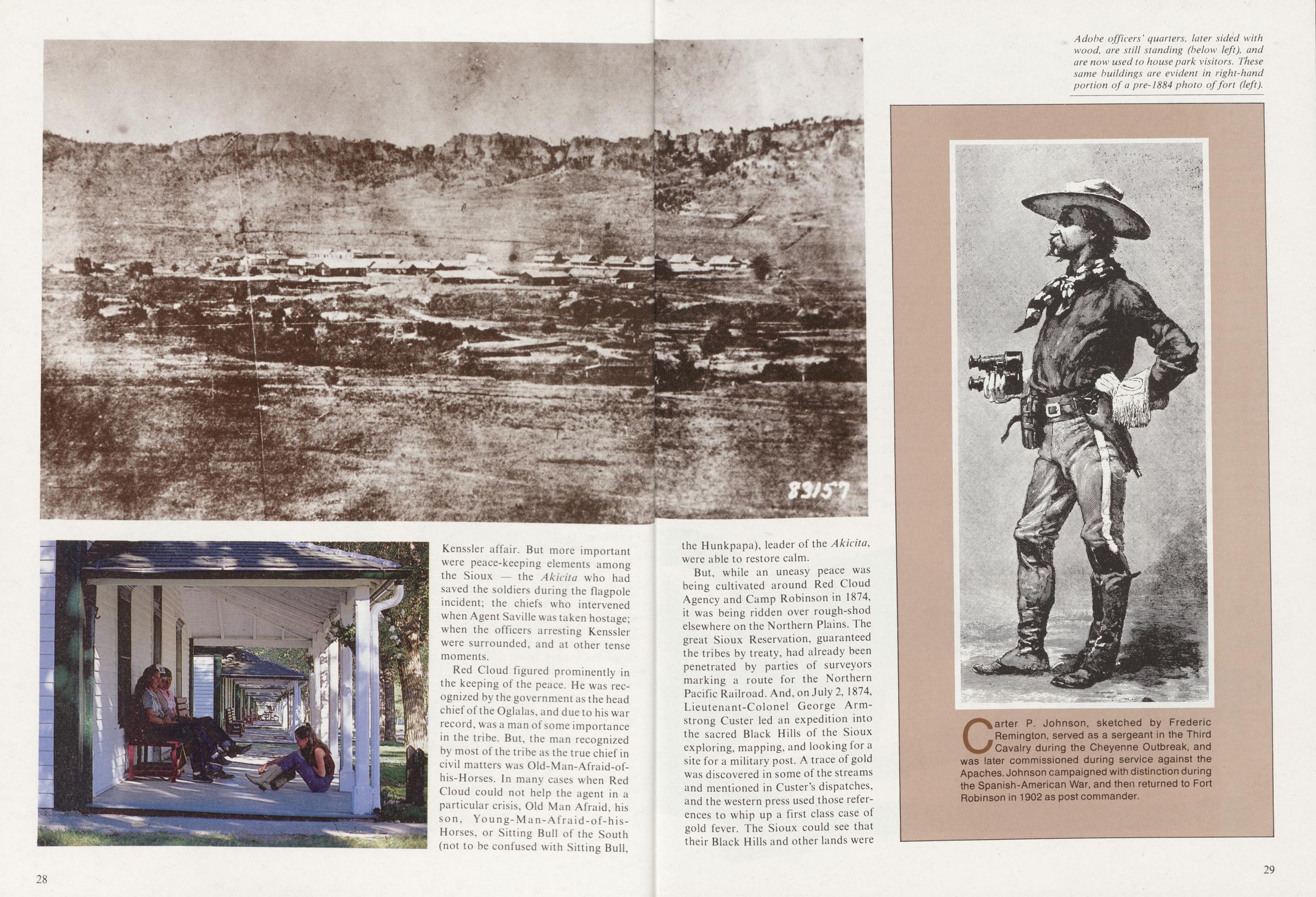
Red Cloud figured prominently in the keeping of the peace. He was recognized by the government as the head chief of the Oglalas, and due to his war record, was a man of some importance in the tribe. But, the man recognized by most of the tribe as the true chief in civil matters was Old-Man-Afraid-of-his-Horses. In many cases when Red Cloud could not help the agent in a particular crisis, Old Man Afraid, his son, Young-Man-Afraid-of-his-Horses, or Sitting Bull of the South (not to be confused with Sitting Bull, the Hunkpapa), leader of the Akicita, were able to restore calm.
But, while an uneasy peace was being cultivated around Red Cloud Agency and Camp Robinson in 1874, it was being ridden over rough-shod elsewhere on the Northern Plains. The great Sioux Reservation, guaranteed the tribes by treaty, had already been penetrated by parties of surveyors marking a route for the Northern Pacific Railroad. And, on July 2, 1874, Lieutenant-Colonel George Armstrong Custer led an expedition into the sacred Black Hills of the Sioux exploring, mapping, and looking for a site for a military post. A trace of gold was discovered in some of the streams and mentioned in Custer's dispatches, and the western press used those references to whip up a first class case of gold fever. The Sioux could see that their Black Hills and other lands were
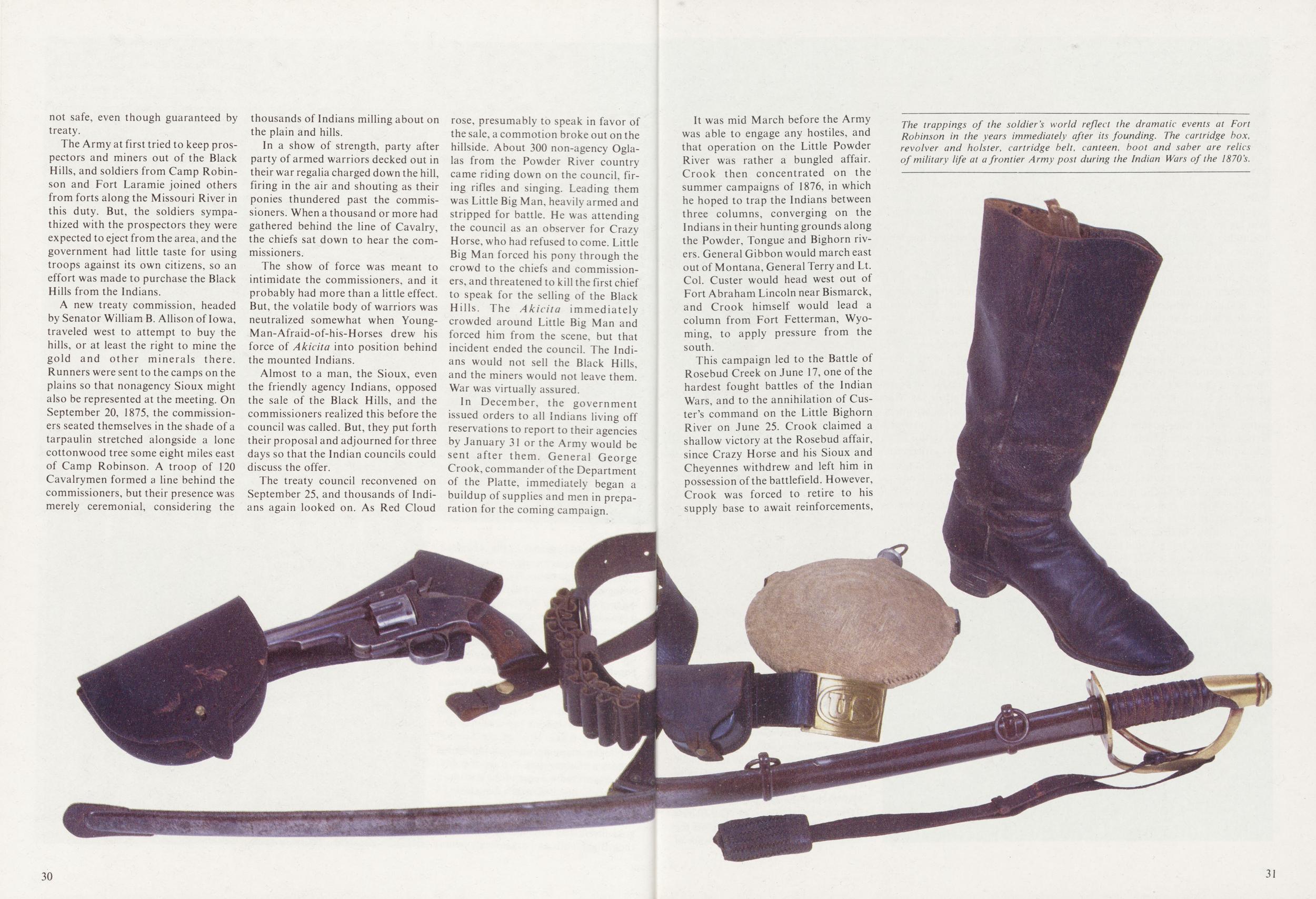 not safe, even though guaranteed by
treaty.
not safe, even though guaranteed by
treaty.
The Army at first tried to keep prospectors and miners out of the Black Hills, and soldiers from Camp Robinson and Fort Laramie joined others from forts along the Missouri River in this duty. But, the soldiers sympathized with the prospectors they were expected to eject from the area, and the government had little taste for using troops against its own citizens, so an effort was made to purchase the Black Hills from the Indians.
A new treaty commission, headed by Senator William B. Allison of Iowa, traveled west to attempt to buy the hills, or at least the right to mine the gold and other minerals there. Runners were sent to the camps on the plains so that nonagency Sioux might also be represented at the meeting. On September 20, 1875, the commissioners seated themselves in the shade of a tarpaulin stretched alongside a lone cottonwood tree some eight miles east of Camp Robinson. A troop of 120 Cavalrymen formed a line behind the commissioners, but their presence was merely ceremonial, considering the thousands of Indians milling about on the plain and hills.
In a show of strength, party after party of armed warriors decked out in their war regalia charged down the hill, firing in the air and shouting as their ponies thundered past the commissioners. When a thousand or more had gathered behind the line of Cavalry, the chiefs sat down to hear the commissioners.
The show of force was meant to intimidate the commissioners, and it probably had more than a little effect. But, the volatile body of warriors was neutralized somewhat when Young-Man-Afraid-of-his-Horses drew his force of Akicita into position behind the mounted Indians.
Almost to a man, the Sioux, even the friendly agency Indians, opposed the sale of the Black Hills, and the commissioners realized this before the council was called. But, they put forth their proposal and adjourned for three days so that the Indian councils could discuss the offer.
The treaty council reconvened on September 25, and thousands of Indians again looked on. As Red Cloud rose, presumably to speak in favor of the sale, a commotion broke out on the hillside. About 300 non-agency Oglalas from the Powder River country came riding down on the council, firing rifles and singing. Leading them was Little Big Man, heavily armed and stripped for battle. He was attending the council as an observer for Crazy Horse, who had refused to come. Little Big Man forced his pony through the crowd to the chiefs and commissioners, and threatened to kill the first chief to speak for the selling of the Black Hills. The Akicita immediately crowded around Little Big Man and forced him from the scene, but that incident ended the council. The Indians would not sell the Black Hills, and the miners would not leave them. War was virtually assured.
In December, the government issued orders to all Indians living off reservations to report to their agencies by January 31 or the Army would be sent after them. General George Crook, commander of the Department of the Platte, immediately began a buildup of supplies and men in preparation for the coming campaign.
30It was mid March before the Army was able to engage any hostiles, and that operation on the Little Powder River was rather a bungled affair. Crook then concentrated on the summer campaigns of 1876, in which he hoped to trap the Indians between three columns, converging on the Indians in their hunting grounds along the Powder, Tongue and Bighorn rivers. General Gibbon would march east out of Montana, General Terry and Lt. Col. Custer would head west out of Fort Abraham Lincoln near Bismarck, and Crook himself would lead a column from Fort Fetterman, Wyoming, to apply pressure from the south.
This campaign led to the Battle of
Rosebud Creek on June 17, one of the
hardest fought battles of the Indian
Wars, and to the annihilation of Custer's command on the Little Bighorn
River on June 25. Crook claimed a
shallow victory at the Rosebud affair,
since Crazy Horse and his Sioux and
Cheyennes withdrew and left him in
possession of the battlefield. However,
Crook was forced to retire to his
supply base to await reinforcements,
31
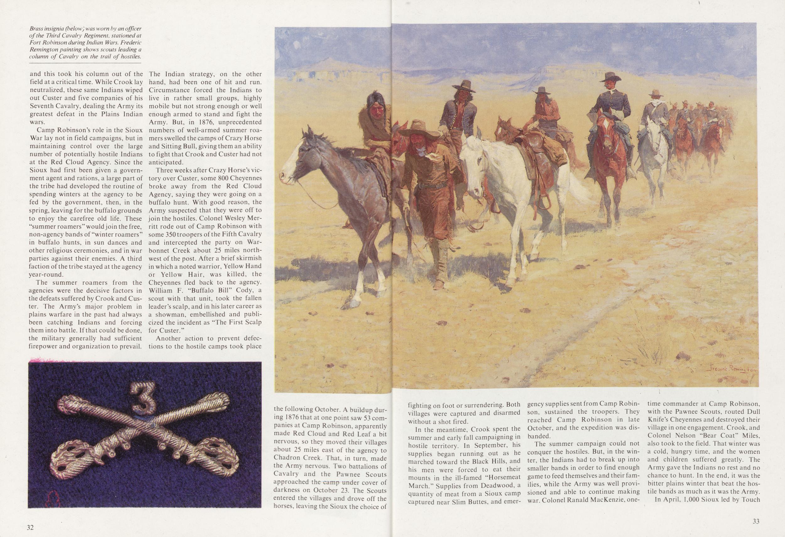
Camp Robinson's role in the Sioux War lay not in field campaigns, but in maintaining control over the large number of potentially hostile Indians at the Red Cloud Agency. Since the Sioux had first been given a government agent and rations, a large part of the tribe had developed the routine of spending winters at the agency to be fed by the government, then, in the spring, leaving for the buffalo grounds to enjoy the carefree old life. These "summer roamers" would join the free, non-agency bands of "winter roamers" in buffalo hunts, in sun dances and other religious ceremonies, and in war parties against their enemies. A third faction of the tribe stayed at the agency year-round.
The summer roamers from the agencies were the decisive factors in the defeats suffered by Crook and Custer. The Army's major problem in plains warfare in the past had always been catching Indians and forcing them into battle. If that could be done, the military generally had sufficient firepower and organization to prevail. The Indian strategy, on the other hand, had been one of hit and run. Circumstance forced the Indians to live in rather small groups, highly mobile but not strong enough or well enough armed to stand and fight the Army. But, in 1876, unprecedented numbers of well-armed summer roamers swelled the camps of Crazy Horse and Sitting Bull, giving them an ability to fight that Crook and Custer had not anticipated.
Three weeks after Crazy Horse's victory over Custer, some 800 Cheyennes broke away from the Red Cloud Agency, saying they were going on a buffalo hunt. With good reason, the Army suspected that they were off to join the hostiles. Colonel Wesley Merritt rode out of Camp Robinson with some 350troopers of the Fifth Cavalry and intercepted the party on Warbonnet Creek about 25 miles northwest of the post. After a brief skirmish in which a noted warrior, Yellow Hand or Yellow Hair, was killed, the Cheyennes fled back to the agency. William F. "Buffalo Bill" Cody, a scout with that unit, took the fallen leader's scalp, and in his later career as a showman, embellished and publicized the incident as "The First Scalp for Custer."
Another action to prevent defections to the hostile camps took place the following October. A buildup during 1876 that at one point saw 53 companies at Camp Robinson, apparently made Red Cloud and Red Leaf a bit nervous, so they moved their villages about 25 miles east of the agency to Chadron Creek. That, in turn, made the Army nervous. Two battalions of Cavalry and the Pawnee Scouts approached thexamp under cover of darkness on October 23. The Scouts entered the villages and drove off the horses, leaving the Sioux the choice of 32 fighting on foot or surrendering. Both villages were captured and disarmed without a shot fired.
In the meantime, Crook spent the summer and early fall campaigning in hostile territory. In September, his supplies began running out as he marched toward the Black Hills, and his men were forced to eat their mounts in the ill-famed "Horsemeat March." Supplies from Deadwood, a quantity of meat from a Sioux camp captured near Slim Buttes, and emergency supplies sent from Camp Robinson, sustained the troopers. They reached Camp Robinson in late October, and the expedition was disbanded.
The summer campaign could not conquer the hostiles. But, in the winter, the Indians had to break up into smaller bands in order to find enough game to feed themselves and their families, while the Army was well provisioned and able to continue making war. Colonel Ranald MacKenzie, one32 time commander at Camp Robinson, with the Pawnee Scouts, routed Dull Knife's Cheyennes and destroyed their village in one engagement. Crook, and Colonel Nelson "Bear Coat" Miles, also took to the field. That winter was a cold, hungry time, and the women and children suffered greatly. The Army gave the Indians no rest and no chance to hunt. In the end, it was the bitter plains winter that beat the hostile bands as much as it was the Army.
In April, 1,000 Sioux led by Touch
33
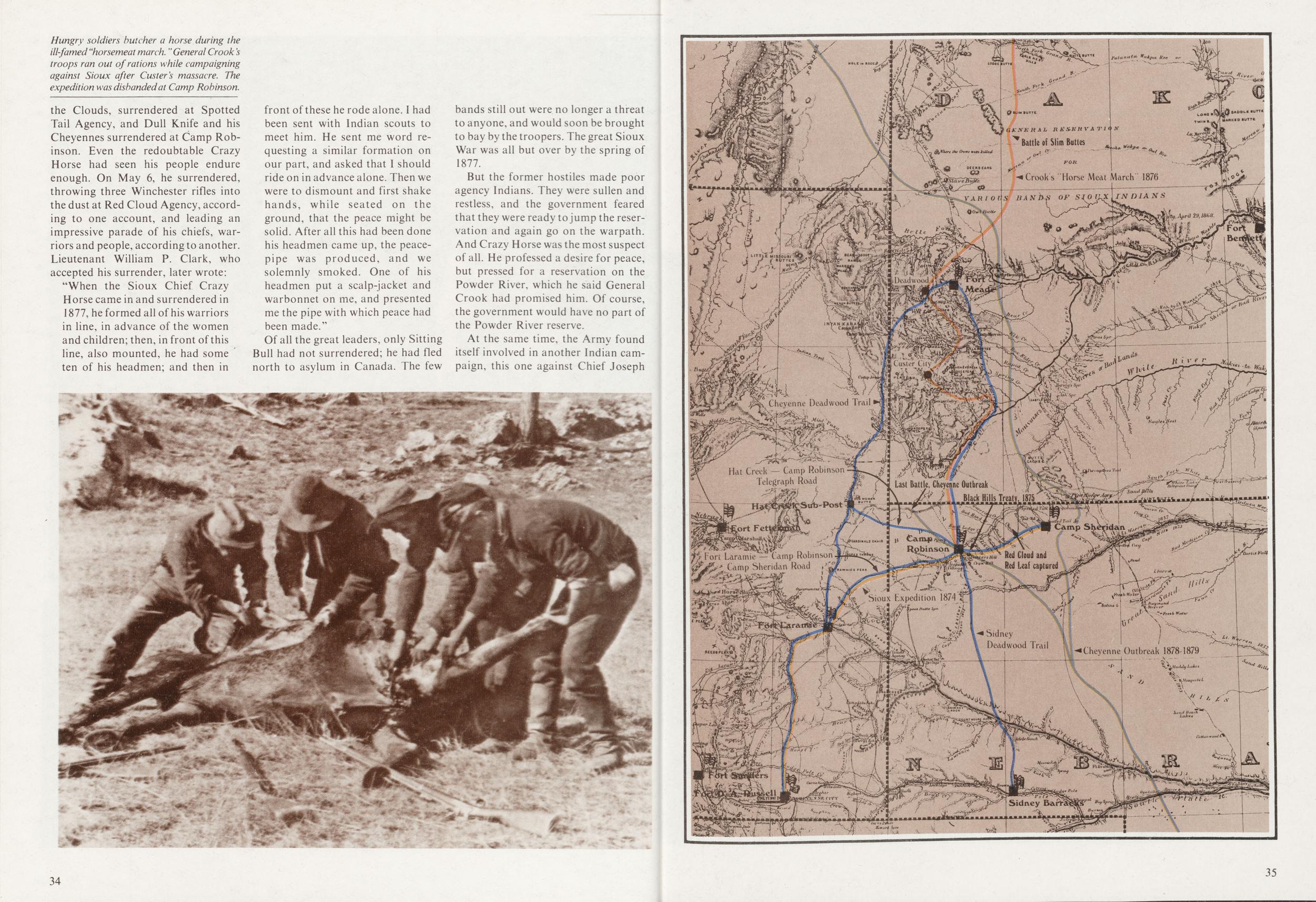
"When the Sioux Chief Crazy Horse came in and surrendered in 1877, he formed all of his warriors in line, in advance of the women and children; then, in front of this line, also mounted, he had some ten of his headmen; and then in front of these he rode alone. I had been sent with Indian scouts to meet him. He sent me word re- questing a similar formation on our part, and asked that I should ride on in advance alone. Then we were to dismount and first shake hands, while seated on the ground, that the peace might be solid. After all this had been done his headmen came up, the peacepipe was produced, and we solemnly smoked. One of his headmen put a scalp-jacket and warbonnet on me, and presented me the pipe with which peace had been made."
Of all the great leaders, only Sitting Bull had not surrendered; he had fled north to asylum in Canada. The few bands still out were no longer a threat to anyone, and would soon be brought to bay by the troopers. The great Sioux War was all but over by the spring of 1877.
But the former hostiles made poor agency Indians. They were sullen and restless, and the government feared that they were ready to jump the reservation and again go on the warpath. And Crazy Horse was the most suspect of all. He professed a desire for peace, but pressed for a reservation on the Powder River, which he said General Crook had promised him. Of course, the government would have no part of the Powder River reserve.
At the same time, the Army found itself involved in another Indian campaign, this one against Chief Joseph 34
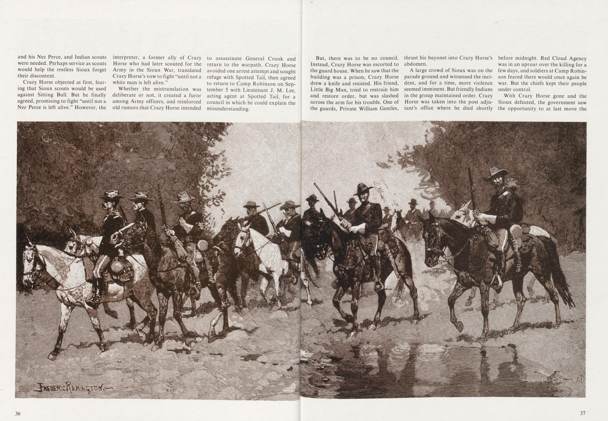 and his Nez Perce, and Indian scouts
were needed. Perhaps service as scouts
would help the restless Sioux forget
their discontent.
and his Nez Perce, and Indian scouts
were needed. Perhaps service as scouts
would help the restless Sioux forget
their discontent.
Crazy Horse objected at first, fearing that Sioux scouts would be used against Sitting Bull. But he finally agreed, promising to fight "until not a Nez Perce is left alive." However, the interpreter, a former ally of Crazy Horse who had later scouted for the Army in the Sioux War, translated Crazy Horse's vow to fight "until not a white man is left alive."
Whether the mistranslation was deliberate or not, it created a furor among Army officers, and reinforced old rumors that Crazy Horse intended to assassinate General Crook and return to the warpath. Crazy Horse avoided one arrest attempt and sought refuge with Spotted Tail, then agreed to return to Camp Robinson on September 5 with Lieutenant J. M. Lee, acting agent at Spotted Tail, for a council in which he could explain the misunderstanding.
But, there was to be no council. Instead, Crazy Horse was escorted to the guard house. When he saw that the building was a prison, Crazy Horse drew a knife and resisted. His friend, Little Big Man, tried to restrain him and restore order, but was slashed across the arm for his trouble. One of the guards, Private William Gentles, thrust his bayonet into Crazy Horse's abdomen.
A large crowd of Sioux was on the parade ground and witnessed the incident, and for a time, more violence seemed imminent. But friendly Indians in the group maintained order. Crazy Horse was taken into the post adjutant's office where he died shortly before midnight. Red Cloud Agency was in an uproar over the killing for a few days, and soldiers at Camp Robinson feared there would once again be war. But the chiefs kept their people under control.
With Crazy Horse gone and the
Sioux defeated, the government saw
the opportunity to at last move the
37
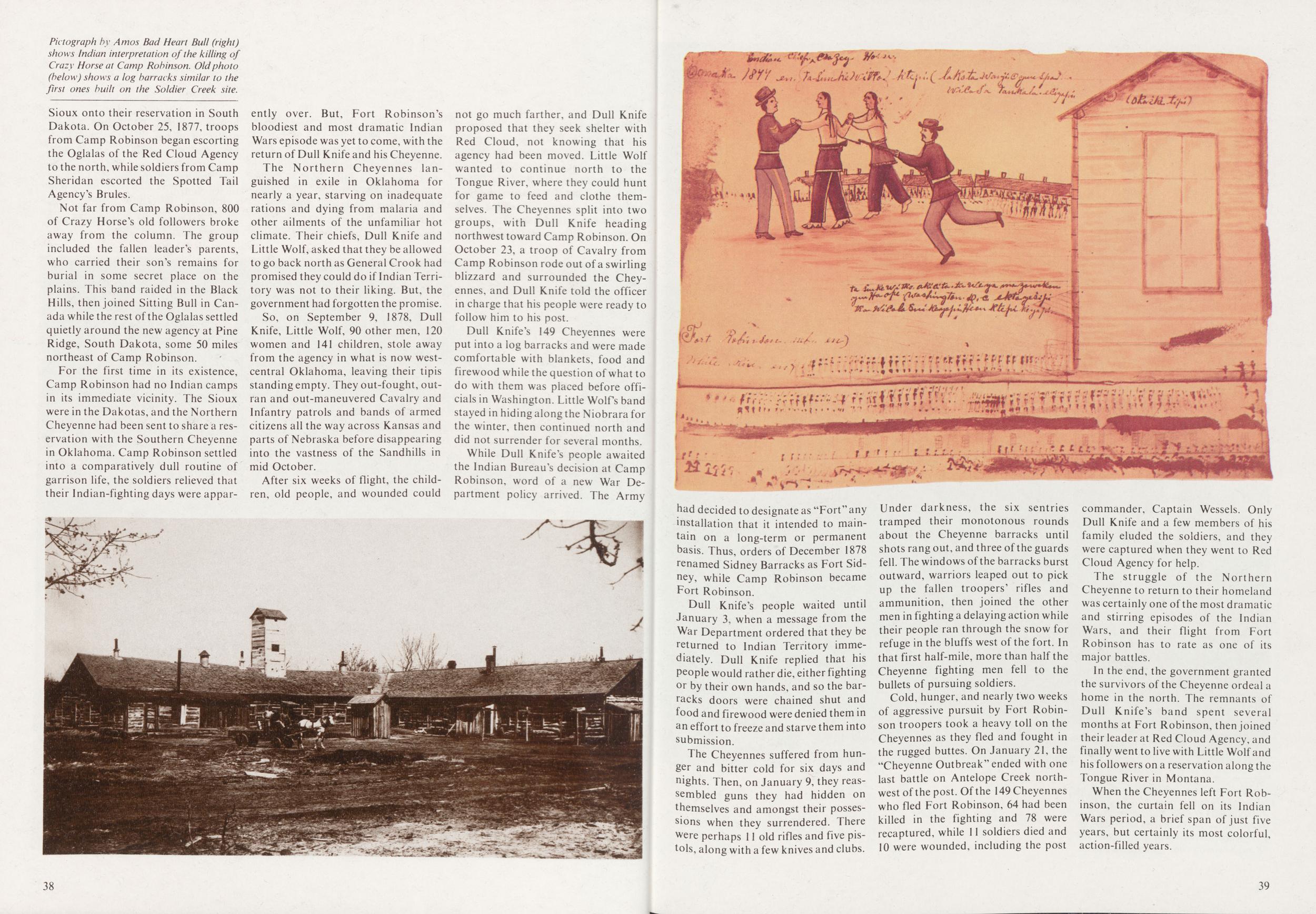
Not far from Camp Robinson, 800 of Crazy Horse's old followers broke away from the column. The group included the fallen leader's parents, who carried their son's remains for burial in some secret place on the plains. This band raided in the Black Hills, then joined Sitting Bull in Canada while the rest of the Oglalas settled quietly around the new agency at Pine Ridge, South Dakota, some 50 miles northeast of Camp Robinson.
For the first time in its existence, Camp Robinson had no Indian camps in its immediate vicinity. The Sioux were in the Dakotas, and the Northern Cheyenne had been sent to share a reservation with the Southern Cheyenne in Oklahoma. Camp Robinson settled into a comparatively dull routine of garrison life, the soldiers relieved that their Indian-fighting days were apparently over. But, Fort Robinson's bloodiest and most dramatic Indian Wars episode was yet to come, with the return of Dull Knife and his Cheyenne.
The Northern Cheyennes languished in exile in Oklahoma for nearly a year, starving on inadequate rations and dying from malaria and other ailments of the unfamiliar hot climate. Their chiefs, Dull Knife and Little Wolf, asked that they be allowed to go back north as General Crook had promised they could do if Indian Territory was not to their liking. But, the government had forgotten the promise.
So, on September 9, 1878, Dull Knife, Little Wolf, 90 other men, 120 women and 141 children, stole away from the agency in what is now westcentral Oklahoma, leaving their tipis standing empty. They out-fought, outran and out-maneuvered Cavalry and Infantry patrols and bands of armed citizens all the way across Kansas and parts of Nebraska before disappearing into the vastness of the Sandhills in mid October.
After six weeks of flight, the children, old people, and wounded could not go much farther, and Dull Knife proposed that they seek shelter with Red Cloud, not knowing that his agency had been moved. Little Wolf wanted to continue north to the Tongue River, where they could hunt for game to feed and clothe themselves. The Cheyennes split into two groups, with Dull Knife heading northwest toward Camp Robinson. On October 23, a troop of Cavalry from Camp Robinson rode out of a swirling blizzard and surrounded the Cheyennes, and Dull Knife told the officer in charge that his people were ready to follow him to his post.
Dull Knife's 149 Cheyennes were put into a log barracks and were made comfortable with blankets, food and firewood while the question of what to do with them was placed before officials in Washington. Little Wolf's band stayed in hiding along the Niobrara for the winter, then continued north and did not surrender for several months.
While Dull Knife's people awaited the Indian Bureau's decision at Camp Robinson, word of a new War Department policy arrived. The Army 38 had decided to designate as "Fort" any installation that it intended to maintain on a long-term or permanent basis. Thus, orders of December 1878 renamed Sidney Barracks as Fort Sidney, while Camp Robinson became Fort Robinson.
Dull Knife's people waited until January 3, when a message from the War Department ordered that they be returned to Indian Territory immediately. Dull Knife replied that his people would rather die, either fighting or by their own hands, and so the barracks doors were chained shut and food and firewood were denied them in an effort to freeze and starve them into submission.
The Cheyennes suffered from hunger and bitter cold for six days and nights. Then, on January 9, they reassembled guns they had hidden on themselves and amongst their possessions when they surrendered. There were perhaps 11 old rifles and five pistols, along with a few knives and clubs. Under darkness, the six sentries tramped their monotonous rounds about the Cheyenne barracks until shots rang out, and three of the guards fell. The windows of the barracks burst outward, warriors leaped out to pick up the fallen troopers' rifles and ammunition, then joined the other men in fighting a delaying action while their people ran through the snow for refuge in the bluffs west of the fort. In that first half-mile, more than half the Cheyenne fighting men fell to the bullets of pursuing soldiers.
Cold, hunger, and nearly two weeks of aggressive pursuit by Fort Robinson troopers took a heavy toll on the Cheyennes as they fled and fought in the rugged buttes. On January 21, the "Cheyenne Outbreak" ended with one last battle on Antelope Creek northwest of the post. Of the 149 Cheyennes who fled Fort Robinson, 64 had been killed in the fighting and 78 were recaptured, while 11 soldiers died and 10 were wounded, including the post commander. Captain Wessels. Only Dull Knife and a few members of his family eluded the soldiers, and they were captured when they went to Red Cloud Agency for help.
The struggle of the Northern Cheyenne to return to their homeland was certainly one of the most dramatic and stirring episodes of the Indian Wars, and their flight from Fort Robinson has to rate as one of its major battles.
In the end, the government granted the survivors of the Cheyenne ordeal a home in the north. The remnants of Dull Knife's band spent several months at Fort Robinson, then joined their leader at Red Cloud Agency, and finally went to live with Little Wolf and his followers on a reservation along the Tongue River in Montana.
When the Cheyennes left Fort Robinson, the curtain fell on its Indian Wars period, a brief span of just five years, but certainly its most colorful, action-filled years.
39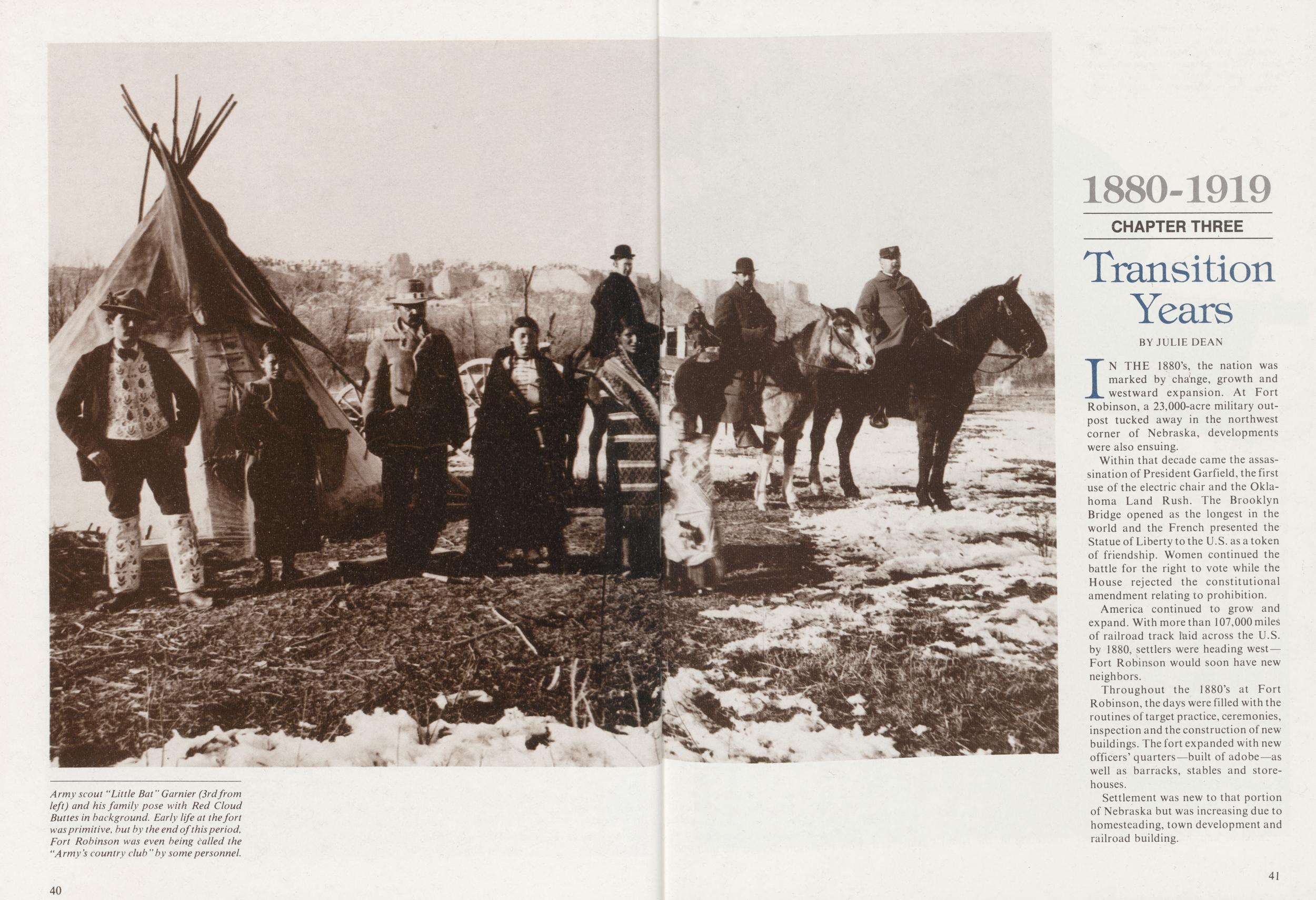
1880-1919 CHAPTER THREE Transition Years
BY JULIE DEANIN THE 1880's, the nation was marked by cha'nge, growth and westward expansion. At Fort Robinson, a 23,000-acre military outpost tucked away in the northwest corner of Nebraska, developments were also ensuing.
Within that decade came the assassination of President Garfield, the first use of the electric chair and the Oklahoma Land Rush. The Brooklyn Bridge opened as the longest in the world and the French presented the Statue of Liberty to the U.S. as a token of friendship. Women continued the battle for the right to vote while the House rejected the constitutional amendment relating to prohibition.
America continued to grow and expand. With more than 107,000 miles of railroad track laid across the U.S. by 1880, settlers were heading west Fort Robinson would soon have new neighbors.
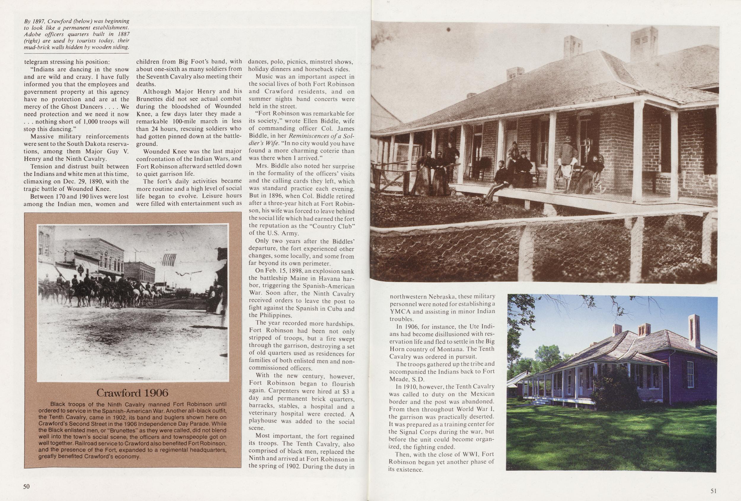
Throughout the 1880's at Fort Robinson, the days were filled with the routines of target practice, ceremonies, inspection and the construction of new buildings. The fort expanded with new officers' quarters—built of adobe—as well as barracks, stables and storehouses.
Settlement was new to that portion of Nebraska but was increasing due to homesteading, town development and railroad building.
41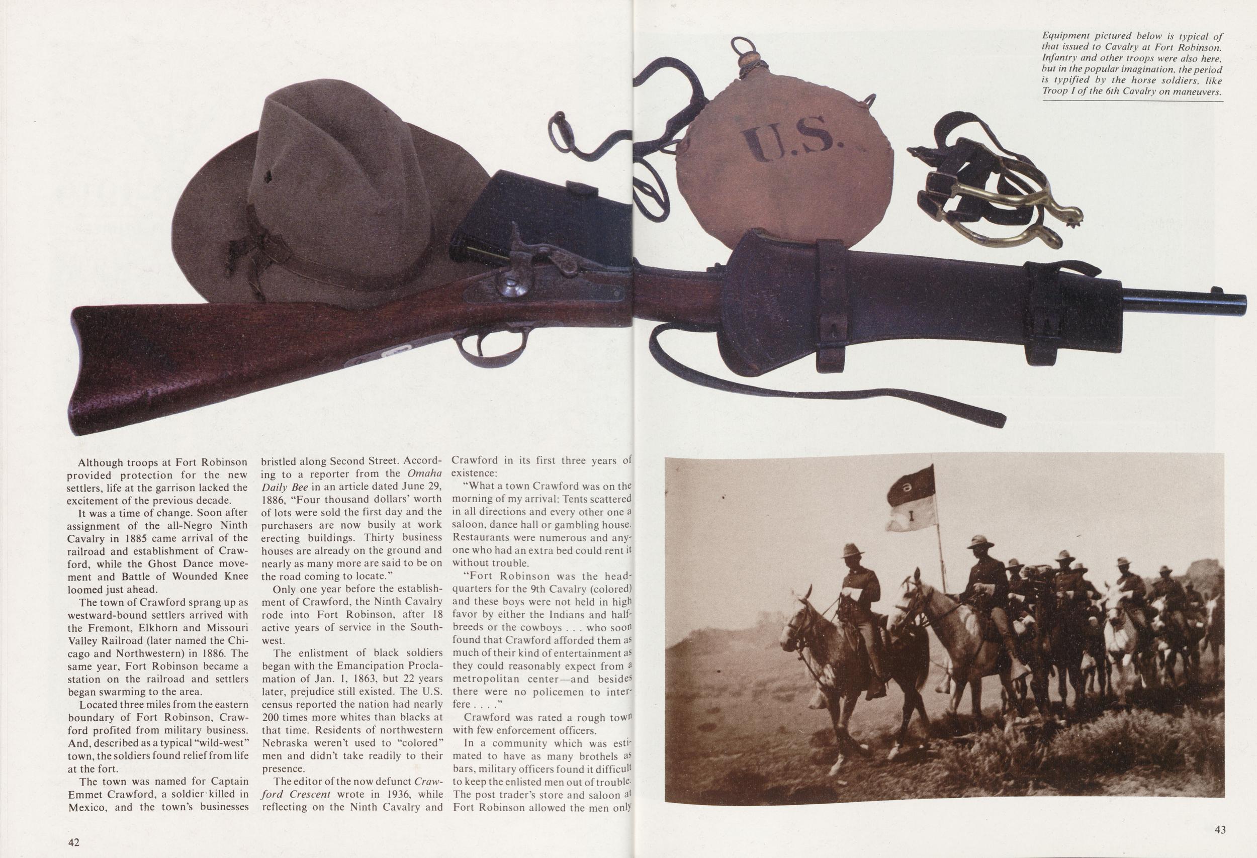
Although troops at Fort Robinson provided protection for the new settlers, life at the garrison lacked the excitement of the previous decade.
It was a time of change. Soon after assignment of the all-Negro Ninth Cavalry in 1885 came arrival of the railroad and establishment of Crawford, while the Ghost Dance movement and Battle of Wounded Knee loomed just ahead.
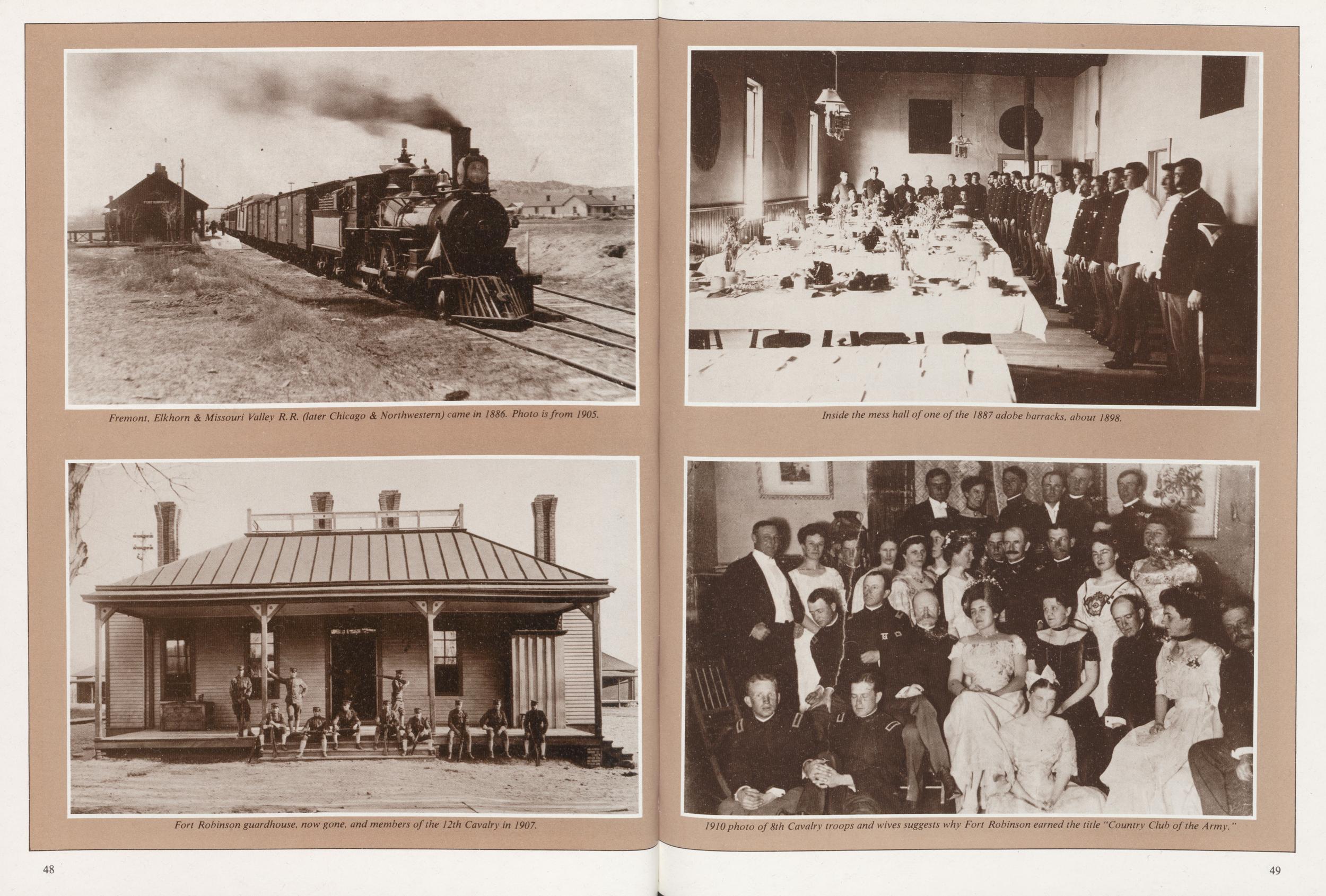
The town of Crawford sprang up as westward-bound settlers arrived with the Fremont, Elkhorn and Missouri Valley Railroad (later named the Chicago and Northwestern) in 1886. The same year, Fort Robinson became a station on the railroad and settlers began swarming to the area.
Located three miles from the eastern boundary of Fort Robinson, Crawford profited from military business. And, described as a typical "wild-west town, the soldiers found relief from life at the fort.
The town was named for Captain Emmet Crawford, a soldier killed in Mexico, and the town's businesses bristled along Second Street. According to a reporter from the Omaha Daily Bee in an article dated June 29, 1886, "Four thousand dollars' worth of lots were sold the first day and the purchasers are now busily at work erecting buildings. Thirty business houses are already on the ground and nearly as many more are said to be on the road coming to locate."
Only one year before the establishment of Crawford, the Ninth Cavalry rode into Fort Robinson, after 18 active years of service in the Southwest.
The enlistment of black soldiers began with the Emancipation Proclamation of Jan. 1, 1863, but 22 years later, prejudice still existed. The U.S. census reported the nation had nearly 200 times more whites than blacks at that time. Residents of northwestern Nebraska weren't used to "colored" men and didn't take readily to their presence.
The editor of the now defunct Crawford Crescent wrote in 1936, while reflecting on the Ninth Cavalry and existence:
"What a town Crawford was on the morning of my arrival: Tents scattered in all directions and every other one a saloon, dance hall or gambling house. Restaurants were numerous and anyone who had an extra bed could rent it without trouble.
"Fort Robinson was the headquarters for the 9th Cavalry (colored) and these boys were not held in high favor by either the Indians and halfbreeds or the cowboys who soon found that Crawford afforded them as much of their kind of entertainment as they could reasonably expect from metropolitan center—and besides there were no policemen to interfere...."
Crawford was rated a rough tow with few enforcement officers.
In a community which was estimated to have as many brothels as bars, military officers found it difficult to keep the enlisted men out of troubleThe post trader's store and saloon at Fort Robinson allowed the men only
42 43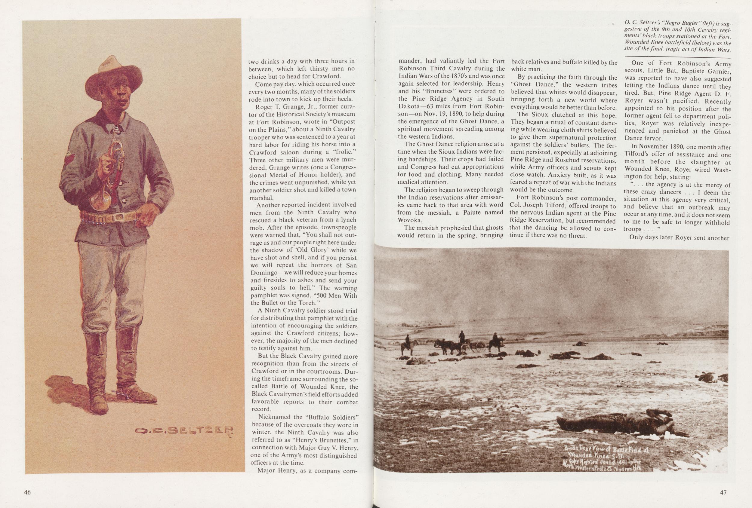
Dr. Walter Reed, Fort Robinson's post surgeon from 1884 to 1887, later gained international renown for his work in helping to conquer the scourge of yellow fever, and gave his name to the Walter Reed Army Medical Center in Washington, D.C.
Born in Virginia in 1851, Reed entered the Medical Corps of the U.S. Army in 1875. Following service in the east and southwest, Reed was transferred in 1882 to Fort Omaha, Nebraska, and in 1883 was made surgeonin-charge of Fort Sydney. In August 1884, he was transferred again, this time to Fort Robinson.
For the most part his work was routine, but as the only physician for hundreds of miles, Reed was kept busy treating injuries and illnesses not only for the soldiers of the post, but also for settlers in the region. Among his most famous patients was an 18-year-old Swiss immigrant with a crushed ankle. Reed succeeded in repairing the badly crushed and infected joint, and the patient survived to gain his own fame as "Old Jules" Sandoz.
Among the colorful frontier characters associated with Fort Robinson, one of the most famous was Baptiste "Little Bat" Gamier. He was born in 1854 of an Oglala Sioux mother and a father of French descent. He is reported to have been an expert hunter and tracker with an uncanny sense of direction, and from 1873 when he was appointed a scout by the Army until his murder in 1900, he was known as a fearless, brave, and reliable scout, and a trustworthy interpreter.
He was General Crook's most trusted scout in all his campaigns, and it was Little Bat who guided the troops that captured Geronimo. He was with the troops, unarmed and acting as interpreter, at the camp of Big Foot's band of Sioux on December 29, 1890, the day of the Wounded Knee massacre. He was killed in December of 1900 by a bartender in Crawford named Jim Haguewood over a trifling matter, and although there was a good deal of anger over the incident, Haguewood was aquitted. Little Bat was buried in the Fort Robinson cemetery, and later reinterred at Fort McPherson.
44Charles Young, author, musician, playwright, mapmaker, linguist and first black colonel in the U.S. Army, began his military career as a second lieutenant at Fort Robinson. Born in a log cabin in Kentucky in 1864, the son of former slaves, he was gifted in music and languages. In 1883 he was encouraged to take the competitive examination for appointment to the U.S. military academy at West Point.
He entered the academy in 1884, the ninth black man to be appointed and the third to graduate, after which he was assigned to Fort Robinson. After serving at several other posts, he became a captain in 1901 and earned the nickname "Follow Me" from his men in the jungles of the Philippines. In 1904 he went to Haiti, the first black in U.S. history to be appointed as a military attachd. He served in the same capacity in Liberia, and in 1916-17 commanded a Cavalry squadron during the "punitive expedition" in Mexico. He missed service in World War I because of a bitterly disputed judgment that he was physically unfit. He died in 1922, and is buried in Arlington National Cemetery.
Guy V. Henry was born to military service, the son of a West Point graduate, the father of another, and a graduate of the Academy himself. In the Civil War, he earned a Medal of Honor and the brevet rank of colonel at age 23, and after the conflict, served on the untamed frontier. At the Battle of the Rosebud, a bullet smashed into Henry's face as his troops fell back before onrushing Sioux, but a gallant stand by a few Shoshone scouts saved the fallen officer. Henry was not expected to survive the night, yet he hung on, then endured an agonizing 200-mile march on a mule-borne litter. During the Ghost Dance troubles, Colonel Henry led his all-black Ninth Cavalry on a 34-hour, 108-mile march into two engagements. One of those actions rescued the Seventh Cavalry, which once again found itself surrounded and outnumbered by angry Sioux. In 1891, Henry was commanding officer of Fort Robinson. After the Spanish-American War, he served as military governor of Puerto Rico, an assignment in a climate which broke his health. Brigadier General Guy Henry died on October 27, 1899.
45telegram stressing his position:
"Indians are dancing in the snow and are wild and crazy. I have fully informed you that the employees and government property at this agency have no protection and are at the mercy of the Ghost Dancers We need protection and we need it now . . . nothing short of 1,000 troops will stop this dancing."
Massive military reinforcements were sent to the South Dakota reservations, among them Major Guy V. Henry and the Ninth Cavalry.
Tension and distrust built between the Indians and white men at this time, climaxing on Dec. 29, 1890, with the tragic battle of Wounded Knee.
Between 170 and 190 lives were lost among the Indian men, women and children from Big Foot's band, with about one-sixth as many soldiers from the Seventh Cavalry also meeting their deaths.
Although Major Henry and his Brunettes did not see actual combat during the bloodshed of Wounded Knee, a few days later they made a remarkable 100-mile march in less than 24 hours, rescuing soldiers who had gotten pinned down at the battleground.
Wounded Knee was the last major confrontation of the Indian Wars, and Fort Robinson afterward settled down to quiet garrison life.
The fort's daily activities became more routine and a high level of social life began to evolve. Leisure hours were filled with entertainment such as dances, polo, picnics, minstrel shows, holiday dinners and horseback rides.
Crawford 1906Black troops of the Ninth Cavalry manned Fort Robinson until ordered to service in the Spanish-American War. Another all-black outfit, the Tenth Cavalry, came in 1902, its band and buglers shown here on Crawford's Second Street in the 1906 Independence Day Parade. While the Black enlisted men, or "Brunettes" as they were called, did not blend well into the town's social scene* the officers and townspeople got on well together. Railroad service to Crawford also benefited Fort Robinson, and the presence of the Fort, expanded to a regimental headquarters, greatly benefited Crawford's economy.
Music was an important aspect in the social lives of both Fort Robinson and Crawford residents, and on summer nights band concerts were held in the street.
"Fort Robinson was remarkable for its society," wrote Ellen Biddle, wife of commanding officer Col. James Biddle, in her Reminiscences of a Soldier 's Wife. "In no city would you have found a more charming coterie than was there when I arrived."
Mrs. Biddle also noted her surprise in the formality of the officers' visits and the calling cards they left, which was standard practice each evening. But in 1896, when Col. Biddle retired after a three-year hitch at Fort Robinson, his wife was forced to leave behind the social life which had earned the fort the reputation as the "Country Club" of the U.S. Army.
Only two years after the Biddies' departure, the fort experienced other changes, some locally, and some from far beyond its own perimeter.
On Feb. 15, 1898, an explosion sank the battleship Maine in Havana harbor, triggering the Spanish-American War. Soon after, the Ninth Cavalry received orders to leave the post to fight against the Spanish in Cuba and the Philippines.
The year recorded more hardships. Fort Robinson had been not only stripped of troops, but a fire swept through the garrison, destroying a set of old quarters used as residences for families of both enlisted men and noncommissioned officers.
With the new century, however, Fort Robinson began to flourish again. Carpenters were hired at $3 day and permanent brick quarters, barracks, stables, a hospital and veterinary hospital were erected. playhouse was added to the social scene.
Most important, the fort regained its troops. The Tenth Cavalry, also comprised of black men, replaced the Ninth and arrived at Fort Robinson in the spring of 1902. During the duty in 50 northwestern Nebraska, these military personnel were noted for establishing a YMCA and assisting in minor Indian troubles.
In 1906, for instance, the Ute Indians had become disillusioned with reservation life and fled to settle in the Big Horn country of Montana. The Tenth Cavalry was ordered in pursuit.
The troops gathered up the tribe and accompanied the Indians back to Fort Meade, S.D.
In 1910, however, the Tenth Cavalry was called to duty on the Mexican border and the post was abandoned. From then throughout World War I, the garrison was practically deserted. It was prepared as a training center for the Signal Corps during the war, but before the unit could become organized, the fighting ended.
Then, with the close of WW1, Fort Robinson began yet another phase of its existence.
1919-1948 CHAPTER FOUR The Final Years
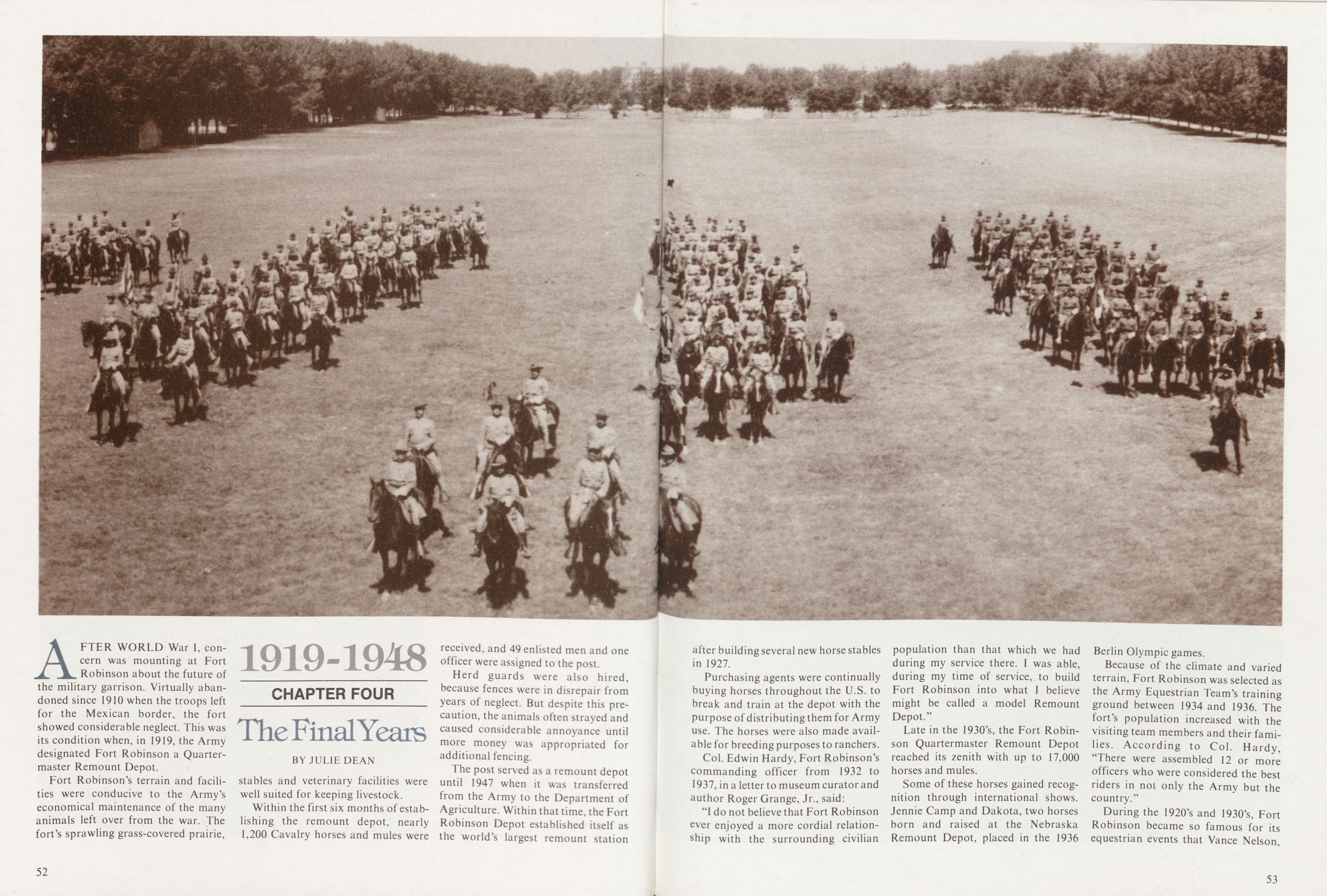
BY JULIE DEANAFTER WORLD War I, concern was mounting at Fort Robinson about the future of the military garrison. Virtually abandoned since 1910 when the troops left for the Mexican border, the fort showed considerable neglect. This was its condition when, in 1919, the Army designated Fort Robinson a Quartermaster Remount Depot.
Fort Robinson's terrain and facilities were conducive to the Army's economical maintenance of the many animals left over from the war. The fort's sprawling grass-covered prairie, stables and veterinary facilities were well suited for keeping livestock.
Within the first six months of establishing the remount depot, nearly 1,200 Cavalry horses and mules were received, and 49 enlisted men and one officer were assigned to the post.
Herd guards were also hired, because fences were in disrepair from years of neglect. But despite this precaution, the animals often strayed and caused considerable annoyance until more money was appropriated for additional fencing.
The post served as a remount depot until 1947 when it was transferred from the Army to the Department of Agriculture. Within that time, the Fort Robinson Depot established itself as the world's largest remount station 52 after building several new horse stables in 1927.
Purchasing agents were continually buying horses throughout the U.S. to break and train at the depot with the purpose of distributing them for Army use. The horses were also made available for breeding purposes to ranchers.
Col. Edwin Hardy, Fort Robinson's commanding officer from 1932 to 1937, in a letter to museum curator and author Roger Grange, Jr., said:
"I do not believe that Fort Robinson ever enjoyed a more cordial relationship with the surrounding civilian population than that which we had during my service there. I was able, during my time of service, to build Fort Robinson into what I believe might be called a model Remount Depot."
Late in the 1930's, the Fort Robinson Quartermaster Remount Depot reached its zenith with up to 17,000 horses and mules.
Some of these horses gained recognition through international shows. Jennie Camp and Dakota, two horses born and raised at the Nebraska Remount Depot, placed in the 1936 Berlin Olympic games.
Because of the climate and varied terrain, Fort Robinson was selected as the Army Equestrian Team's training ground between 1934 and 1936. The fort's population increased with the visiting team members and their families. According to Col. Hardy, "There were assembled 12 or more officers who were considered the best riders in not only the Army but the country."
During the 1920's and 1930's, Fort
Robinson became so famous for its
equestrian events that Vance Nelson,
53
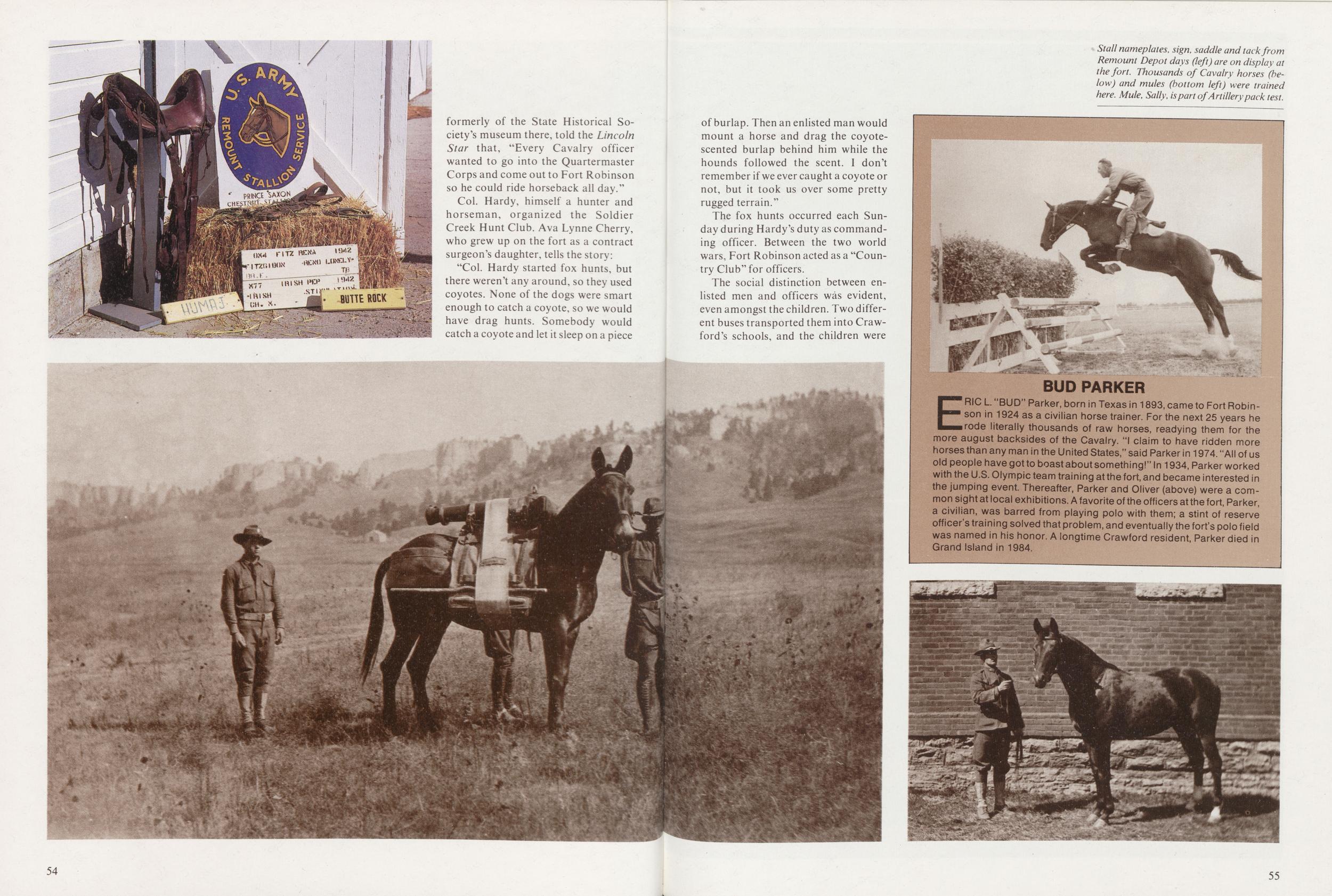
Col. Hardy, himself a hunter and horseman, organized the Soldier Creek Hunt Club. Ava Lynne Cherry, who grew up on the fort as a contract surgeon's daughter, tells the story:
"Col. Hardy started fox hunts, but there weren't any around, so they used coyotes. None of the dogs were smart enough to catch a coyote, so we would have drag hunts. Somebody would catch a coyote and let it sleep on a piece 54 of burlap. Then an enlisted man would mount a horse and drag the coyote-scented burlap behind him while the hounds followed the scent. I don't remember if we ever caught a coyote or not, but it took us over some pretty rugged terrain."
The fox hunts occurred each Sunday during Hardy's duty as commanding officer. Between the two world wars, Fort Robinson acted as a "Country Club" for officers.
The social distinction between enlisted men and officers was evident, even amongst the children. Two different buses transported them into Crawford's schools, and the children were told not to socialize.
ERIC L "BUD" Parker, born in Texas in 1893, came to Fort Robinson in 1924 as a civilian horse trainer. For the next 25 years he rode literally thousands of raw horses, readying them for the more august backsides of the Cavalry. "I claim to have ridden more horses than any man in the United States," said Parker in 1974. "All of us old people have got to boast about something!" In 1934, Parker worked with the U.S. Olympic team training at the fort, and became interested in the jumping event. Thereafter, Parker and Oliver (above) were a common sight at local exhibitions. A favorite of the officers at the fort, Parker, a civilian, was barred from playing polo with them; a stint of reserve officer's training solved that problem, and eventually the fort's polo field was named in his honor. A longtime Crawford resident, Parker died in Grand Island in 1984.
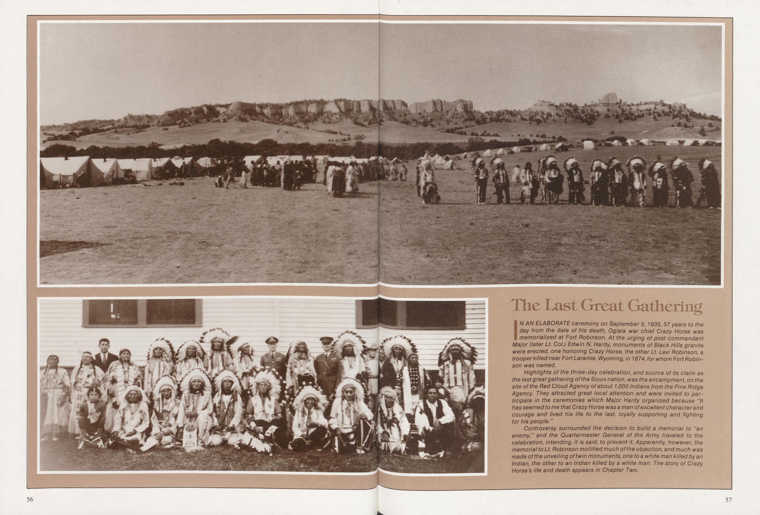
IN AN ELABORATE ceremony on September 5, 1935, 57 years to the day from the date of his death, Oglala war chief Crazy Horse was memorialized at Fort Robinson. At the urging of post commandant Major (later Lt. Col.) Edwin N. Hardy, monuments of Black Hills granite were erected, one honoring Crazy Horse, the other Lt. Levi Robinson, a trooper killed near Fort Laramie, Wyoming, in 1874, for whom Fort Robinson was named.
Highlights of the three-day celebration, and source of its claim as the last great gathering of the Sioux nation, was the encampment, on the site of the Red Cloud Agency of about 1,000 Indians from the Pine Ridge Agency. They attracted great local attention and were invited to participate in the ceremonies which Major Hardy organized because "It has seemed to me that Crazy Horse was a man of excellent character and courage and lived his life to the last, loyally supporting and fighting for his people."
Controversy surrounded the decision to build a memorial to "an enemy," and the Quartermaster General of the Army traveled to the celebration, intending, it is said, to prevent it. Apparently, however, the memorial to Lt. Robinson mollified much of the objection, and much was made of the unveiling of twin monuments, one to a white man killed by an Indian, the other to an Indian killed by a white man. The story of Crazy Horse's life and death appears in Chapter Two.
57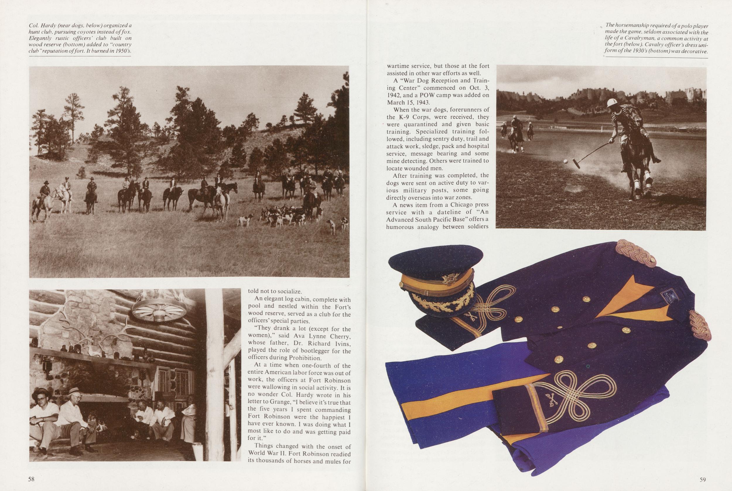
An elegant log cabin, complete with pool and nestled within the Fort's wood reserve, served as a club for the officers' special parties.
"They drank a lot (except for the women)," said Ava Lynne Cherry, whose father, Dr. Richard Ivins, played the role of bootlegger for the officers during Prohibition.
At a time when one-fourth of the entire American labor force was out of work, the officers at Fort Robinson were wallowing in social activity. It is no wonder Col. Hardy wrote in his letter to Grange, "I believe it's true that the five years I spent commanding Fort Robinson were the happiest 1 have ever known. I was doing what I most like to do and was getting paid for it."
Things changed with the onset of World War II. Fort Robinson readied its thousands of horses and mules for 58
A "War Dog Reception and Training Center" commenced on Oct. 3, 1942, and a POW camp was added on March 15, 1943.
When the war dogs, forerunners of the K-9 Corps, were received, they ' were quarantined and given basic training. Specialized training followed, including sentry duty, trail and attack work, sledge, pack and hospital service, message bearing and some mine detecting. Others were trained to locate wounded men.
After training was completed, the dogs were sent on active duty to various military posts, some going directly overseas into war zones.
A news item from a Chicago press
service with a dateline of "An
Advanced South Pacific Base" offers a
humorous analogy between soldiers
59
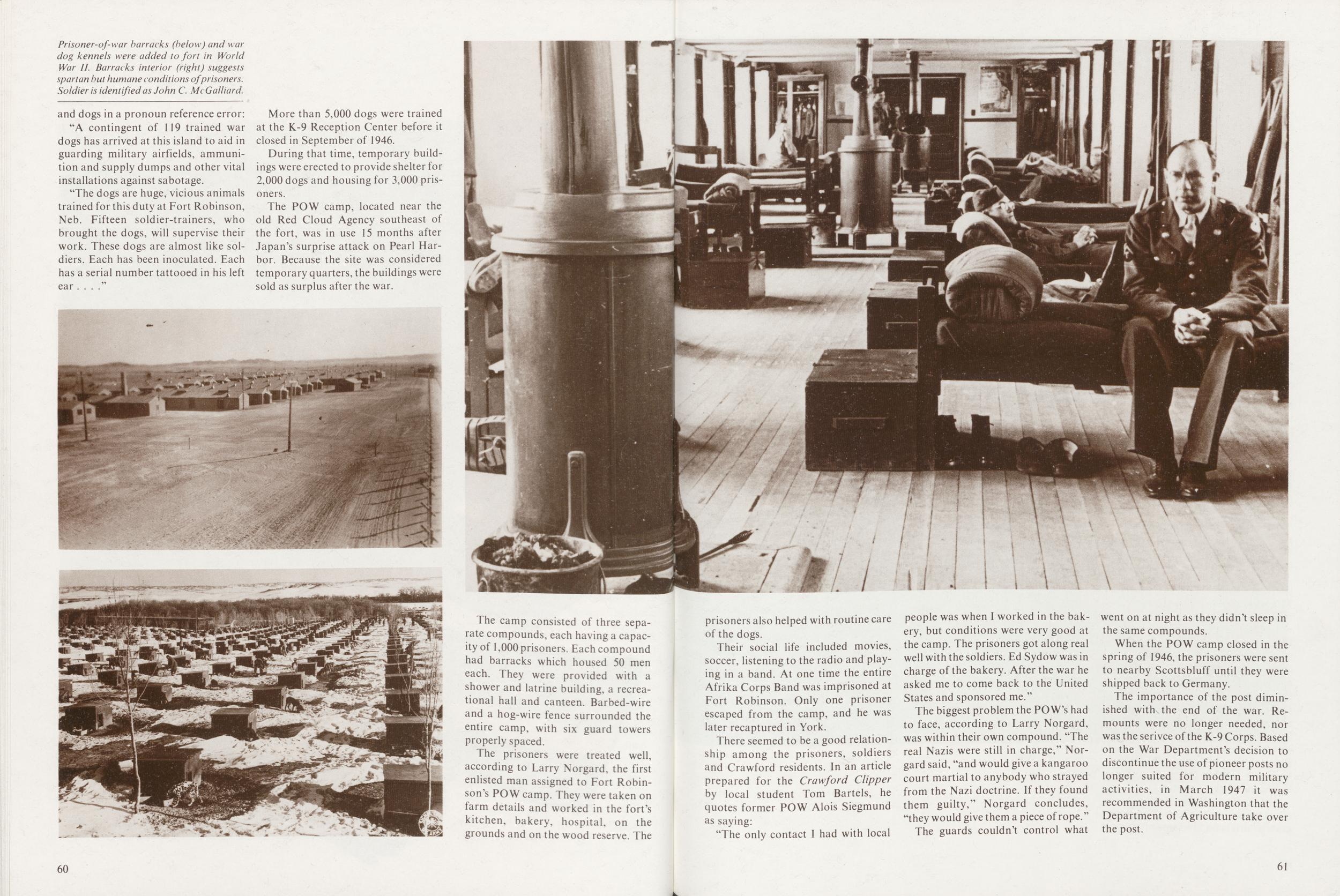
"A contingent of 119 trained war dogs has arrived at this island to aid in guarding military airfields, ammunition and supply dumps and other vital installations against sabotage.
"The dogs are huge, vicious animals trained for this duty at Fort Robinson, Neb. Fifteen soldier-trainers, who brought the dogs, will supervise their work. These dogs are almost like soldiers. Each has been inoculated. Each has a serial number tattooed in his left ear ...."
More than 5,000 dogs were trained at the K-9 Reception Center before it closed in September of 1946.
During that time, temporary buildings were erected to provide shelter for 2,000 dogs and housing for 3,000 prisoners.
The POW camp, located near the old Red Cloud Agency southeast of the fort, was in use 15 months after Japan's surprise attack on Pearl Harbor. Because the site was considered temporary quarters, the buildings were sold as surplus after the war.
The camp consisted of three separate compounds, each having a capacity of 1,000 prisoners. Each compound had barracks which housed 50 men each. They were provided with a shower and latrine building, a recreational hall and canteen. Barbed-wire and a hog-wire fence surrounded the entire camp, with six guard towers properly spaced.
The prisoners were treated well, according to Larry Norgard, the first enlisted man assigned to Fort Robinson's POW camp. They were taken on farm details and worked in the fort's kitchen, bakery, hospital, on the grounds and on the wood reserve. The 60
Their social life included movies, soccer, listening to the radio and playing in a band. At one time the entire Afrika Corps Band was imprisoned at Fort Robinson. Only one prisoner escaped from the camp, and he was later recaptured in York.
There seemed to be a good relationship among the prisoners, soldiers and Crawford residents. In an article prepared for the Crawford Clipper by local student Tom Bartels, he quotes former POW Alois Siegmund as saying:
"The only contact I had with local people was when I worked in the bakery, but conditions were very good at the camp. The prisoners got along real well with the soldiers. Ed Sydow was in charge of the bakery. After the war he asked me to come back to the United States and sponsored me."
The biggest problem the PO W's had to face, according to Larry Norgard, was within their own compound. "The real Nazis were still in charge," Norgard said, "and would give a kangaroo court martial to anybody who strayed from the Nazi doctrine. If they found them guilty," Norgard concludes, "they would give them a piece of rope."
The guards couldn't control what went on at night as they didn't sleep in the same compounds.
When the POW camp closed in the spring of 1946, the prisoners were sent to nearby Scottsbluff until they were shipped back to Germany.
The importance of the post diminished with the end of the war. Remounts were no longer needed, nor was the serivce of the K-9 Corps. Based on the War Department's decision to discontinue the use of pioneer posts no longer suited for modern military activities, in March 1947 it was recommended in Washington that the Department of Agriculture take over the post.
61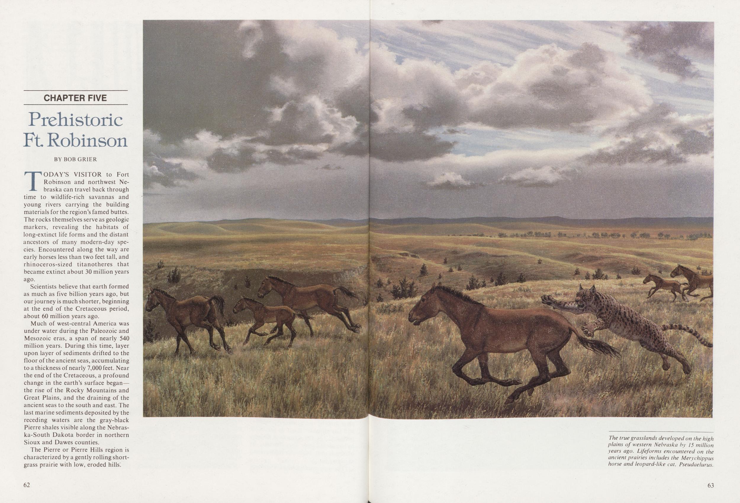
CHAPTER FIVE Prehistoric Ft Robinson
BY BOBGRIERTODAY'S VISITOR to Fort Robinson and northwest Nebraska can travel back through time to wildlife-rich savannas and young rivers carrying the building materials for the region's famed buttes. The rocks themselves serve as geologic markers, revealing the habitats of long-extinct life forms and the distant ancestors of many modern-day species. Encountered along the way are early horses less than two feet tall, and rhinoceros-sized titanotheres that became extinct about 30 million years ago.
Scientists believe that earth formed as much as five billion years ago, but our journey is much shorter, beginning at the end of the Cretaceous period, about 60 million years ago.
Much of west-central America was under water during the Paleozoic and Mesozoic eras, a span of nearly 540 million years. During this time, layer upon layer of sediments drifted to the floor of the ancient seas, accumulating to a thickness of nearly 7,000 feet. Near the end of the Cretaceous, a profound change in the earth's surface began the rise of the Rocky Mountains and Great Plains, and the draining of the ancient seas to the south and east. The last marine sediments deposited by the receding waters are the gray-black Pierre shales visible along the Nebraska-South Dakota border in northern Sioux and Dawes counties.
The Pierre or Pierre Hills region is characterized by a gently rolling shortgrass prairie with low, eroded hills.
62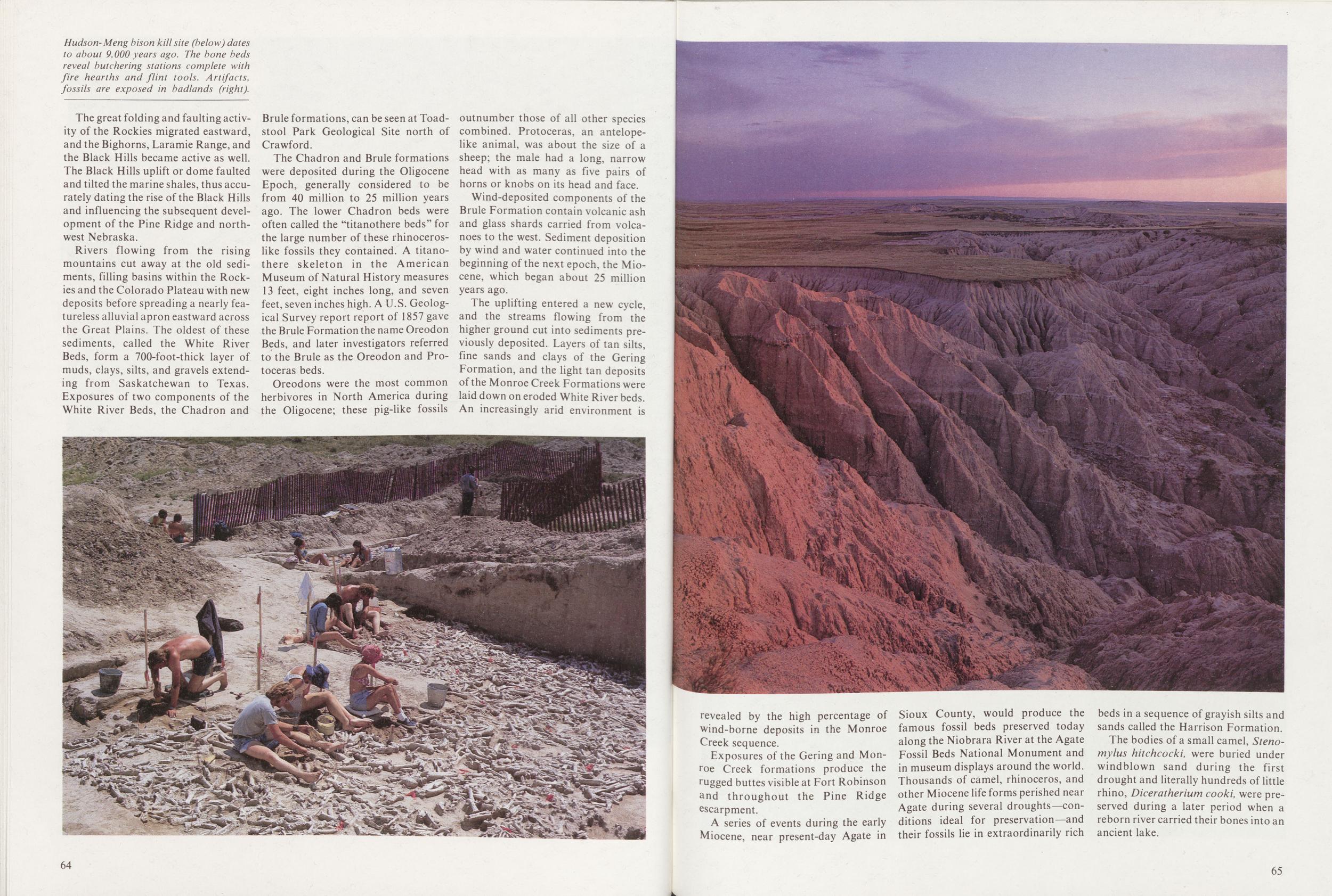
The great folding and faulting activity of the Rockies migrated eastward, and the Bighorns, Laramie Range, and the Black Hills became active as well. The Black Hills uplift or dome faulted and tilted the marine shales, thus accurately dating the rise of the Black Hills and influencing the subsequent development of the Pine Ridge and northwest Nebraska.
Rivers flowing from the rising mountains cut away at the old sediments, filling basins within the Rockies and the Colorado Plateau with new deposits before spreading a nearly featureless alluvial apron eastward across the Great Plains. The oldest of these sediments, called the White River Beds, form a 700-foot-thick layer of muds, clays, silts, and gravels extending from Saskatchewan to Texas. Exposures of two components of the White River Beds, the Chadron and Brule formations, can be seen at Toadstool Park Geological Site north of Crawford.
The Chadron and Brule formations were deposited during the Oligocene Epoch, generally considered to be from 40 million to 25 million years ago. The lower Chadron beds were often called the "titanothere beds" for the large number of these rhinoceroslike fossils they contained. A titanothere skeleton in the American Museum of Natural History measures 13 feet, eight inches long, and seven feet, seven inches high. A U.S. Geological Survey report report of 1857 gave the Brule Formation the name Oreodon Beds, and later investigators referred to the Brule as the Oreodon and Protoceras beds.
Oreodons were the most common herbivores in North America during the Oligocene; these pig-like fossils outnumber those of all other species combined. Protoceras, an antelopelike animal, was about the size of a sheep; the male had a long, narrow head with as many as five pairs of horns or knobs on its head and face.
Wind-deposited components of the Brule Formation contain volcanic ash and glass shards carried from volcanoes to the west. Sediment deposition by wind and water continued into the beginning of the next epoch, the Miocene, which began about 25 million years ago.
The uplifting entered a new cycle, and the streams flowing from the higher ground cut into sediments previously deposited. Layers of tan silts, fine sands and clays of the Gering Formation, and the light tan deposits of the Monroe Creek Formations were laid down on eroded White River beds. An increasingly arid environment is
Exposures of the Gering and Monroe Creek formations produce the rugged buttes visible at Fort Robinson and throughout the Pine Ridge escarpment.
A series of events during the early Miocene, near present-day Agate in Sioux County, would produce the famous fossil beds preserved today along the Niobrara River at the Agate Fossil Beds National Monument and in museum displays around the world. Thousands of camel, rhinoceros, and other Miocene life forms perished near Agate during several droughts—conditions ideal for preservation—and their fossils lie in extraordinarily rich beds in a sequence of grayish silts and sands called the Harrison Formation.
The bodies of a small camel, Stenomylus hitchcocki, were buried under windblown sand during the first drought and literally hundreds of little rhino, Diceratherium cooki, were preserved during a later period when a reborn river carried their bones into an ancient lake.
65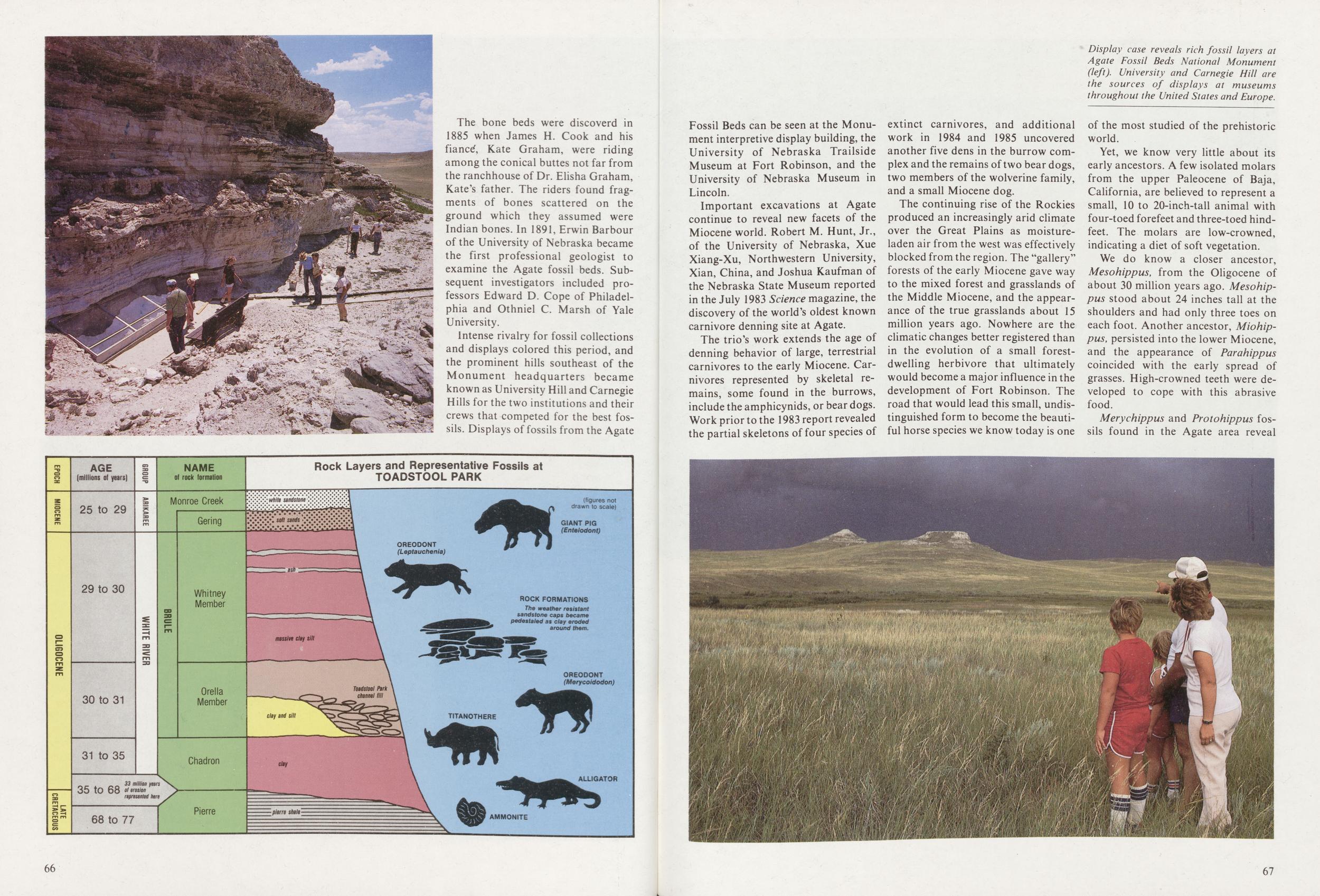
The bone beds were discoverd in 1885 when James H. Cook and his fiance*, Kate Graham, were riding among the conical buttes not far from the ranchhouse of Dr. Elisha Graham, Kate's father. The riders found fragments of bones scattered on the ground which they assumed were Indian bones. In 1891, Erwin Barbour of the University of Nebraska became the first professional geologist to examine the Agate fossil beds. Subsequent investigators included professors Edward D. Cope of Philadelphia and Othniel C. Marsh of Yale University.
Intense rivalry for fossil collections and displays colored this period, and the prominent hills southeast of the Monument headquarters became known as University Hill and Carnegie Hills for the two institutions and their crews that competed for the best fossils. Displays of fossils from the Agate Fossil Beds can be seen at the Monument interpretive display building, the University of Nebraska Trailside Museum at Fort Robinson, and the University of Nebraska Museum in Lincoln.
Important excavations at Agate continue to reveal new facets of the Miocene world. Robert M. Hunt, Jr., of the University of Nebraska, Xue Xiang-Xu, Northwestern University, Xian, China, and Joshua Kaufman of the Nebraska State Museum reported in the July 1983 Science magazine, the discovery of the world's oldest known carnivore denning site at Agate.
The trio's work extends the age of denning behavior of large, terrestrial carnivores to the early Miocene. Carnivores represented by skeletal remains, some found in the burrows include the amphicynids, or bear dogs. Work prior to the 1983 report revealed the partial skeletons of four species of extinct carnivores, and additional work in 1984 and 1985 uncovered another five dens in the burrow complex and the remains oftwo bear dogs, two members of the wolverine family, and a small Miocene dog.
The continuing rise of the Rockies produced an increasingly arid climate over the Great Plains as moistureladen air from the west was effectively blocked from the region. The "gallery" forests of the early Miocene gave way to the mixed forest and grasslands of the Middle Miocene, and the appearance of the true grasslands about 15 million years ago. Nowhere are the climatic changes better registered than in the evolution of a small forestdwelling herbivore that ultimately would become a major influence in the development of Fort Robinson. The road that would lead this small, undistinguished form to become the beautiful horse species we know today is one of the most studied of the prehistoric world.
Yet, we know very little about its early ancestors. A few isolated molars from the upper Paleocene of Baja, California, are believed to represent a small, 10 to 20-inch-tall animal with four-toed forefeet and three-toed hindfeet. The molars are low-crowned, indicating a diet of soft vegetation.
We do know a closer ancestor, Mesohippus, from the Oligocene of about 30 million years ago. Mesohippus stood about 24 inches tall at the shoulders and had only three toes on each foot. Another ancestor, Miohippus, persisted into the lower Miocene, and the appearance of Parahippus coincided with the early spread of grasses. High-crowned teeth were developed to cope with this abrasive food.
Merychippus and Protohippus fossils found in the Agate area reveal
67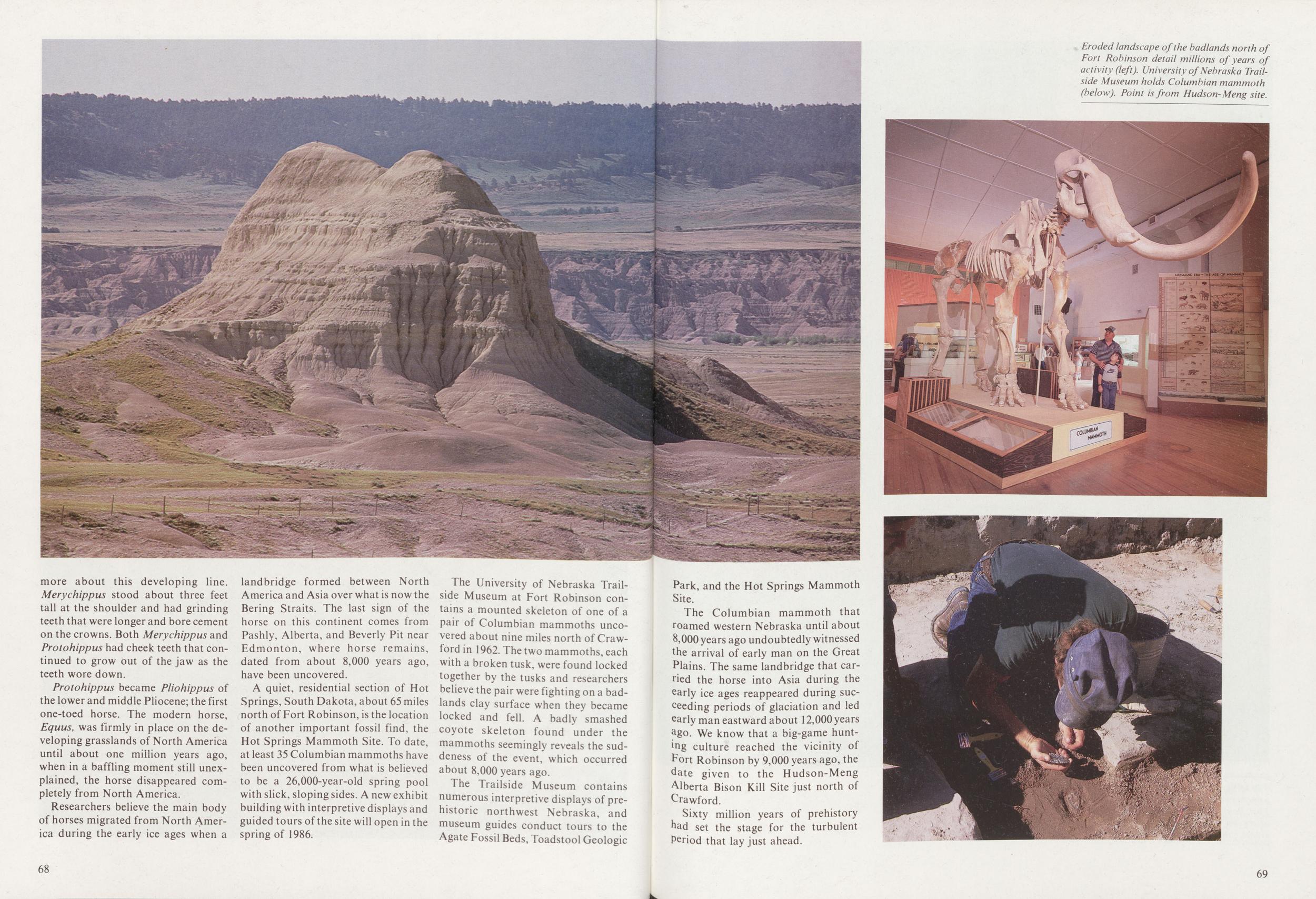
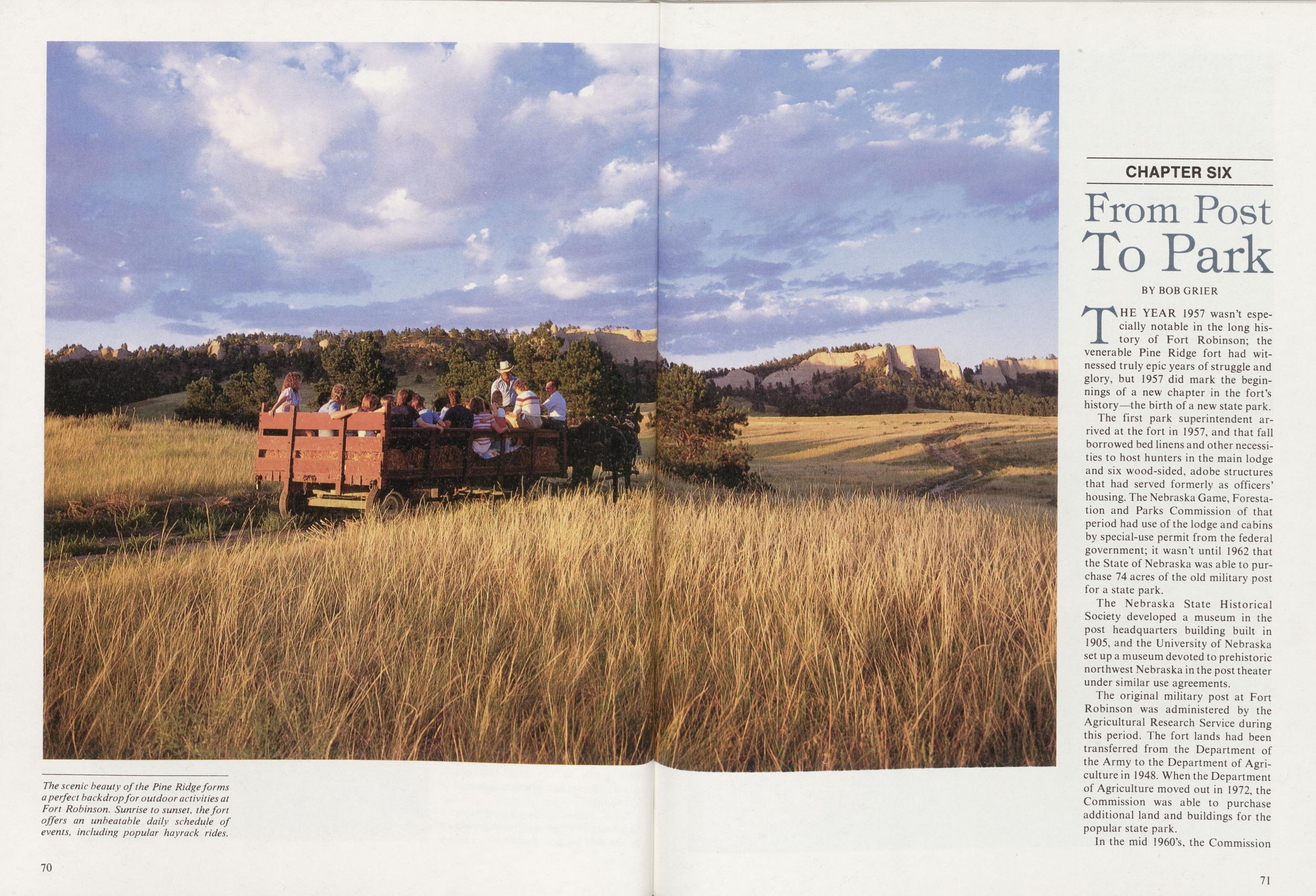
CHAPTER SIX From Post To Park
BY BOB GRIERTHE YEAR 1957 wasn't especially notable in the long history of Fort Robinson; the venerable Pine Ridge fort had witnessed truly epic years of struggle and glory, but 1957 did mark the beginnings of a new chapter in the fort's history—the birth of a new state park.
The first park superintendent arrived at the fort in 1957, and that fall borrowed bed linens and other necessities to host hunters in the main lodge and six wood-sided, adobe structures that had served formerly as officers' housing. The Nebraska Game, Forestation and Parks Commission of that period had use of the lodge and cabins by special-use permit from the federal government; it wasn't until 1962 that the State of Nebraska was able to purchase 74 acres of the old military post for a state park.
The Nebraska State Historical Society developed a museum in the post headquarters building built in 1905, and the University of Nebraska set up a museum devoted to prehistoric northwest Nebraska in the post theater under similar use agreements.
The original military post at Fort Robinson was administered by the Agricultural Research Service during this period. The fort lands had been transferred from the Department of the Army to the Department of Agriculture in 1948. When the Department of Agriculture moved out in 1972, the Commission was able to purchase additional land and buildings for the popular state park.
In the mid 1960's, the Commission
71
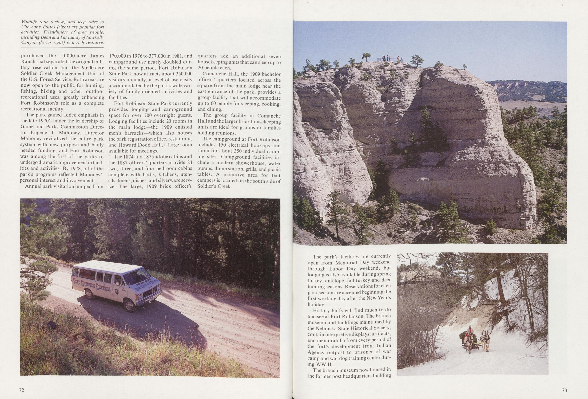
The park gained added emphasis in the late 1970's under the leadership of Game and Parks Commission Director Eugene T. Mahoney. Director Mahoney revitalized the entire park system with new purpose and badly needed funding, and Fort Robinson was among the first of the parks to undergo dramatic improvement in facilities and activities. By 1978, all of the park's programs reflected Mahoney's personal interest and involvement.
Annual park visitation jumped from 170,000in 1976to 377,000in 1981, and campground use nearly doubled during the same period. Fort Robinson State Park now attracts about 350,000 visitors annually, a level of use easily accommodated by the park's wide variety of family-oriented activities and facilities.
Fort Robinson State Park currently provides lodging and campground space for over 700 overnight guests. Lodging facilities include 23 rooms in the main lodge—the 1909 enlisted men's barracks—which also houses the park registration office, restaurant, and Howard Dodd Hall, a large room available for meetings.
The 1874and 1875 adobe cabins and the 1887 officers' quarters provide 24 two, three, and four-bedroom cabins complete with baths, kitchens, utensils, linens, dishes, and silverware service. The large, 1909 brick officer's quarters add an additional seven housekeeping units that can sleep up to 20 people each.
Comanche Hall, the 1909 bachelor officers' quarters located across the square from the main lodge near the east entrance of the park, provides a group facility that will accommodate up to 60 people for sleeping, cooking, and dining.
The group facility in Comanche Hall and the larger brick housekeeping units are ideal for groups or families holding reunions.
The campground at Fort Robinson includes 150 electrical hookups and room for about 350 individual camping sites. Campground facilities include a modern showerhouse, water pumps, dump station, grills, and picnic tables. A primitive area for tent campers is located on the south side of Soldier's Creek.
72The park's facilities are currently open from Memorial Day weekend through Labor Day weekend, but lodging is also available during spring turkey, antelope, fall turkey and deer hunting seasons. Reservations for each park season are accepted beginning the first working day after the New Year's holiday.
History buffs will find much to do and see at Fort Robinson. The branch museum and buildings maintained by the Nebraska State Historical Society, contain interpretive displays, artifacts, and memorabilia from every period of the fort's development from Indian Agency outpost to prisoner of war camp and war dog training center during WW II.
The branch museum now housed in
the former post headquarters building
73
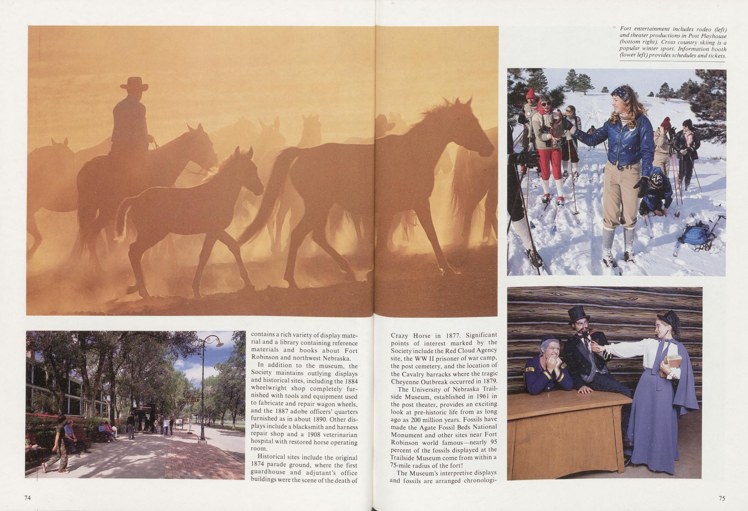
In addition to the museum, the Society maintains outlying displays and historical sites, including the 1884 wheelwright shop completely furnished with tools and equipment used to fabricate and repair wagon wheels, and the 1887 adobe officers' quarters furnished as in about 1890. Other displays include a blacksmith and harness repair shop and a 1908 veterinarian hospital with restored horse operating room.
Historical sites include the original 1874 parade ground, where the first guardhouse and adjutant's office buildings were the scene of the death of 74 Crazy Horse in 1877. Significant points of interest marked by the Society include the Red Cloud Agency site, the WW II prisoner of war camp, the post cemetery, and the location of the Cavalry barracks where the tragic Cheyenne Outbreak occurred in 1879.
The University of Nebraska Trailside Museum, established in 1961 in the post theater, provides an exciting look at pre-historic life from as long ago as 200 million years. Fossils have made the Agate Fossil Beds National Monument and other sites near Fort Robinson world famous—nearly 95 percent of the fossils displayed at the Trailside Museum come from within a 75-mile radius of the fort!
The Museum's interpretive displays and fossils are arranged chronologically
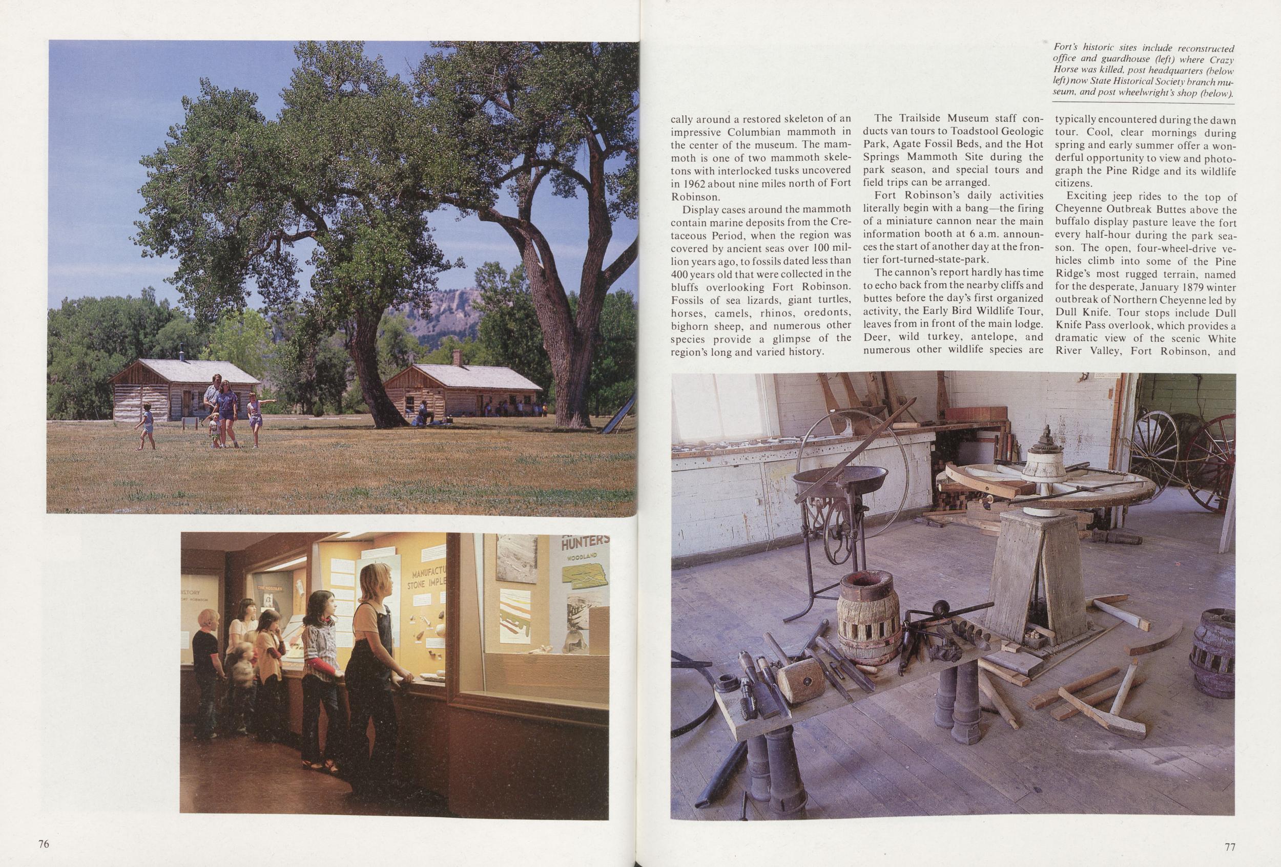
Display cases around the mammoth contain marine deposits from the Cretaceous Period, when the region was covered by ancient seas over 100 million years ago, to fossils dated less than 400 years old that were collected in the bluffs overlooking Fort Robinson. Fossils of sea lizards, giant turtles, horses, camels, rhinos, oredonts, bighorn sheep, and numerous other species provide a glimpse of the region's long and varied history.
The Trailside Museum staff conducts van tours to Toadstool Geologic Park, Agate Fossil Beds, and the Hot Springs Mammoth Site during the park season, and special tours and field trips can be arranged.
Fort Robinson's daily activities literally begin with a bang—the firing of a miniature cannon near the main information booth at 6 a.m. announces the start of another day at the frontier fort-turned-state-park.
The cannon's report hardly has time to echo back from the nearby cliffs and buttes before the day's first organized activity, the Early Bird Wildlife Tour, leaves from in front of the main lodge. Deer, wild turkey, antelope, and numerous other wildlife species are typically encountered during the dawn tour. Cool, clear mornings during spring and early summer offer a wonderful opportunity to view and photograph the Pine Ridge and its wildlife citizens.
Exciting jeep rides to the top of Cheyenne Outbreak Buttes above the buffalo display pasture leave the fort every half-hour during the park season. The open, four-wheel-drive vehicles climb into some of the Pine Ridge's most rugged terrain, named for the desperate, January 1879 winter outbreak of Northern Cheyenne led by Dull Knife. Tour stops include Dull Knife Pass overlook, which provides a dramatic view of the scenic White River Valley, Fort Robinson, and
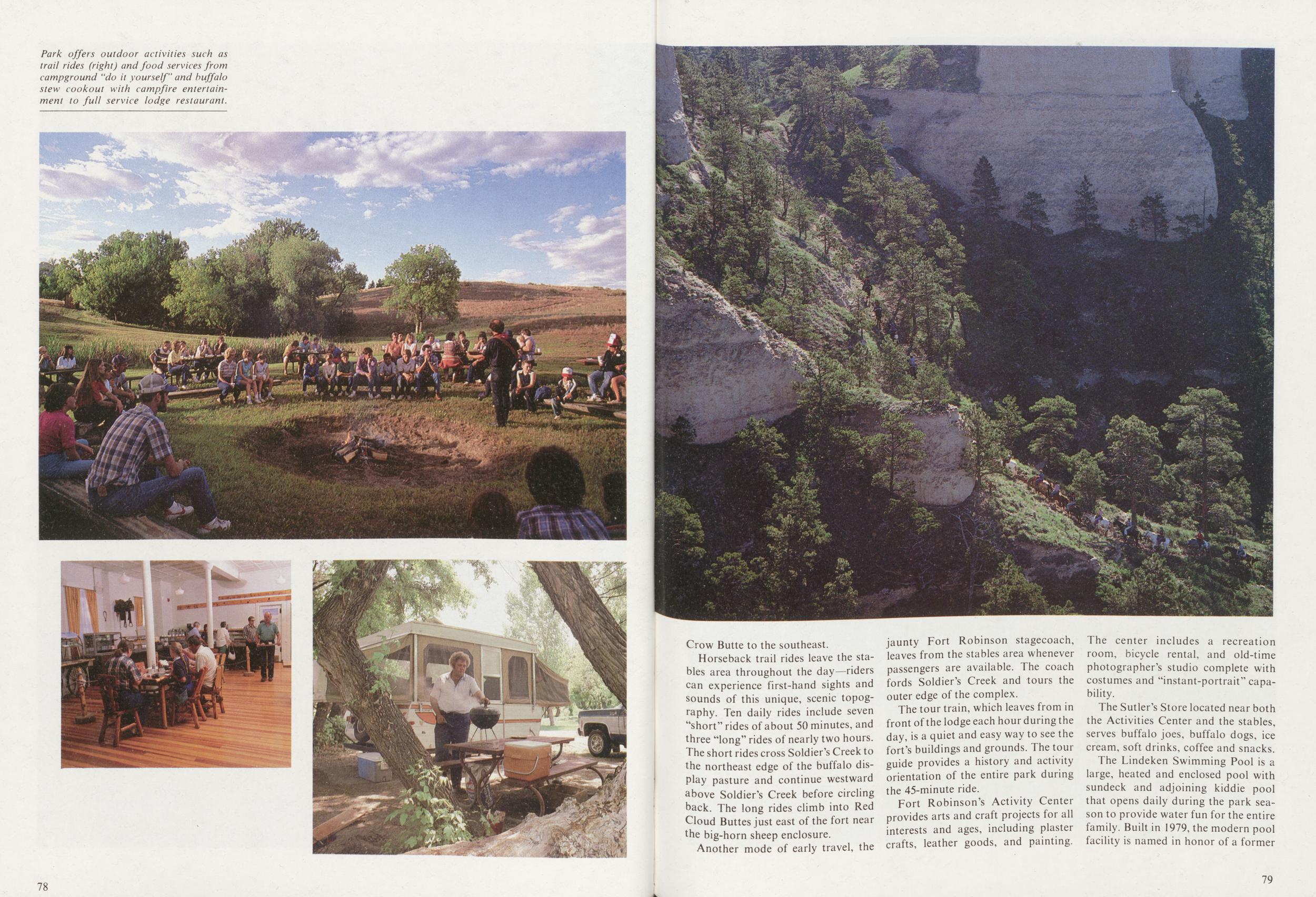
Horseback trail rides leave the stables area throughout the day—riders can experience first-hand sights and sounds of this unique, scenic topography. Ten daily rides include seven "short" rides of about 50 minutes, and three "long" rides of nearly two hours. The short rides cross Soldier's Creek to the northeast edge of the buffalo display pasture and continue westward above Soldier's Creek before circling back. The long rides climb into Red Cloud Buttes just east ofthe fort near the big-horn sheep enclosure.
Another mode of early travel, the jaunty Fort Robinson stagecoach, leaves from the stables area whenever passengers are available. The coach fords Soldier's Creek and tours the outer edge of the complex.
The tour train, which leaves from in front ofthe lodge each hour during the day, is a quiet and easy way to see the fort's buildings and grounds. The tour guide provides a history and activity orientation of the entire park during the 45-minute ride.
Fort Robinson's Activity Center provides arts and craft projects for all interests and ages, including plaster crafts, leather goods, and painting. The center includes a recreation room, bicycle rental, and old-time photographer's studio complete with costumes and "instant-portrait" capability.
The Sutler's Store located near both the Activities Center and the stables, serves buffalo joes, buffalo dogs, ice cream, soft drinks, coffee and snacks.
The Lindeken Swimming Pool is a
large, heated and enclosed pool with
sundeck and adjoining kiddie pool
that opens daily during the park season to provide water fun for the entire
family. Built in 1979, the modern pool
facility is named in honor of a former
79
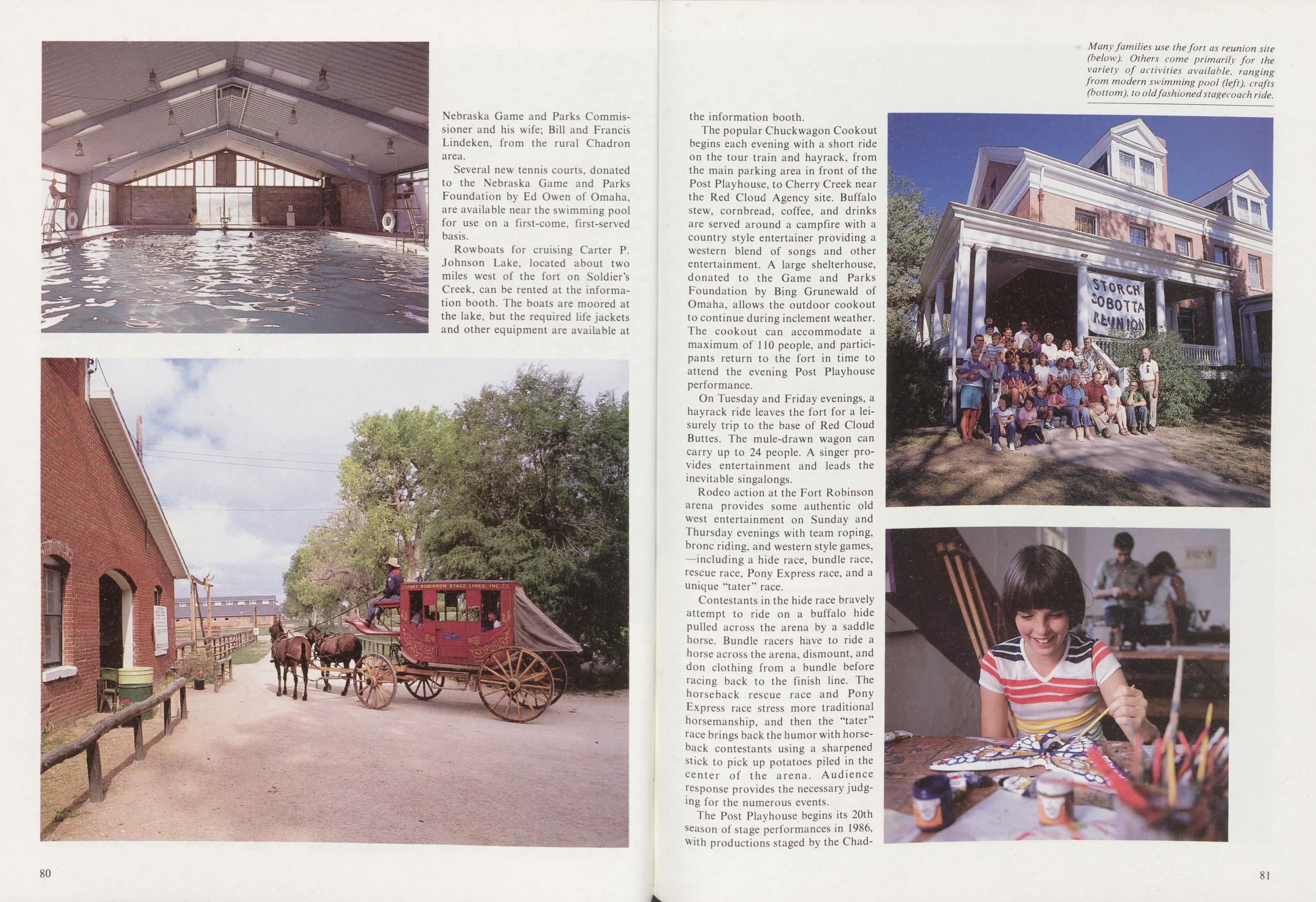
Several new tennis courts, donated to the Nebraska Game and Parks Foundation by Ed Owen of Omaha, are available near the swimming pool for use on a first-come, first-served basis.
Rowboats for cruising Carter P. Johnson Lake, located about two miles west of the fort on Soldier's Creek, can be rented at the information booth. The boats are moored at the lake, but the required life jackets and other equipment are available at 80
The popular Chuckwagon Cookout begins each evening with a short ride on the tour train and hayrack, from the main parking area in front of the Post Playhouse, to Cherry Creek near the Red Cloud Agency site. Buffalo stew, cornbread, coffee, and drinks are served around a campfire with a country style entertainer providing a western blend of songs and other entertainment. A large shelterhouse, donated to the Game and Parks Foundation by Bing Grunewald of Omaha, allows the outdoor cookout to continue during inclement weather. The cookout can accommodate a maximum of 110 people, and participants return to the fort in time to attend the evening Post Playhouse performance.
On Tuesday and Friday evenings, a hayrack ride leaves the fort for a leisurely trip to the base of Red Cloud Buttes. The mule-drawn wagon can carry up to 24 people. A singer provides entertainment and leads the inevitable singalongs.
Rodeo action at the Fort Robinson arena provides some authentic old west entertainment on Sunday and Thursday evenings with team roping, bronc riding, and western style games, including a hide race, bundle race, rescue race, Pony Express race, and a unique "tater" race.
Contestants in the hide race bravely attempt to ride on a buffalo hide pulled across the arena by a saddle horse. Bundle racers have to ride a horse across the arena, dismount, and don clothing from a bundle before racing back to the finish line. The horseback rescue race and Pony Express race stress more traditional horsemanship, and then the "tater" race brings back the humor with horseback contestants using a sharpened stick to pick up potatoes piled in the center of the arena. Audience response provides the necessary judging for the numerous events.
The Post Playhouse begins its 20th
season of stage performances in 1986,
with productions staged by the Chadron
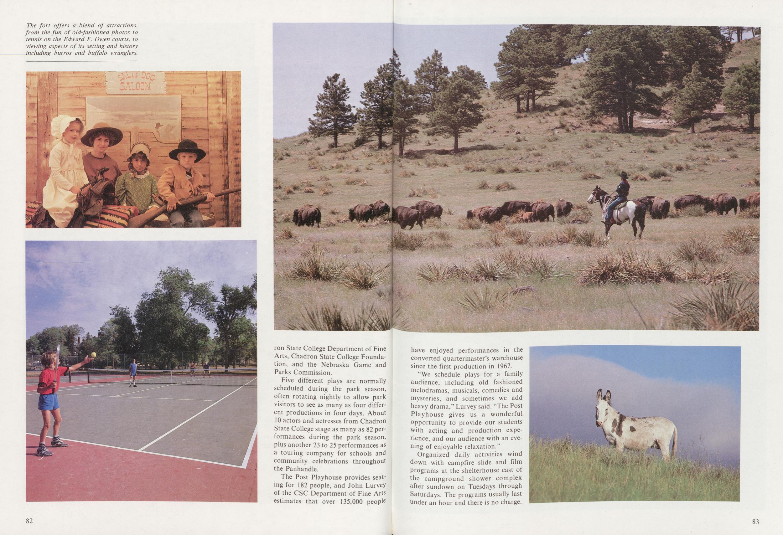
Five different plays are normally scheduled during the park season, often rotating nightly to allow park visitors to see as many as four different productions in four days. About 10 actors and actresses from Chadron State College stage as many as 82 performances during the park season, plus another 23 to 25 performances as a touring company for schools and community celebrations throughout the Panhandle.
The Post Playhouse provides seating for 182 people, and John Lurvey of the CSC Department of Fine Arts estimates that over 135,000 people 82
"We schedule plays for a family audience, including old fashioned melodramas, musicals, comedies and mysteries, and sometimes we add heavy drama," Lurvey said. "The Post Playhouse gives us a wonderful opportunity to provide our students with acting and production experience, and our audience with an evening of enjoyable relaxation."
Organized daily activities wind down with campfire slide and film Programs at the shelterhouse east of the campground shower complex after sundown on Tuesdays through Saturdays. The programs usually last nnder an hour and there is no charge.
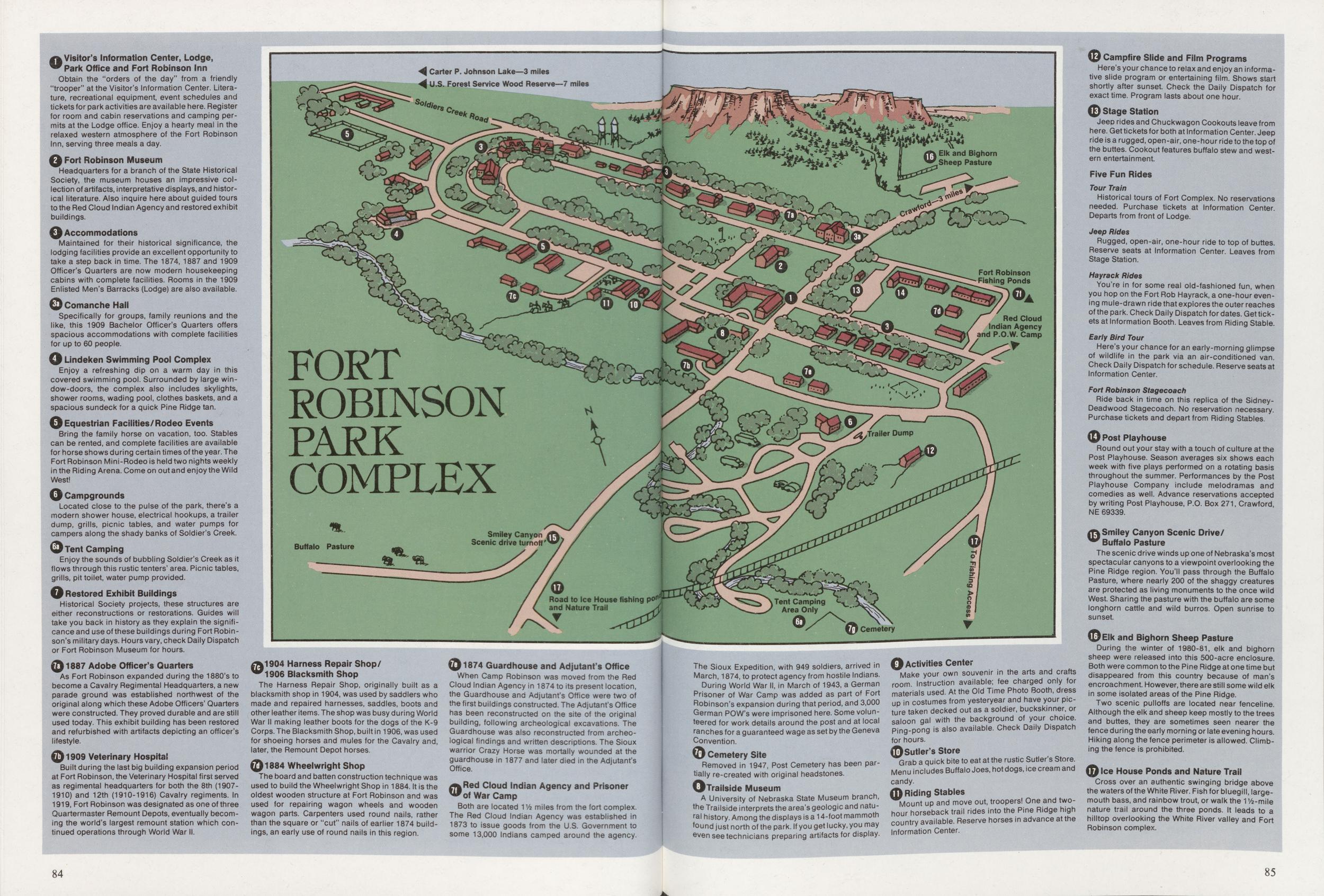
FORT ROBINSON PARK COMPLEX
1 Visitor's Information Center, Lodge, Park Office and Fort Robinson InnObtain the "orders of the day" from a friendly "trooper" at the Visitor's Information Center. Literature, recreational equipment, event schedules and tickets for park activities are available here. Register for room and cabin reservations and camping permits at the Lodge office. Enjoy a hearty meal in the relaxed western atmosphere of the Fort Robinson Inn, serving three meals a day.
2 Fori Robinson MuseumHeadquarters for a branch of the State Historical Society, the museum houses an impressive col- lection of artifacts, interpretative displays, and historical literature. Also inquire here about guided tours to the Red Cloud Indian Agency and restored exhibit buildings.
3 AccommodationsMaintained for their historical significance, the lodging facilities provide an excellent opportunity to take a step back in time. The 1874, 1887 and 1909 Officer's Quarters are now modern housekeeping cabins with complete facilities. Rooms in the 1909 Enlisted Men's Barracks (Lodge) are also available.
3a Comanche HailSpecifically for groups, family reunions and the like, this 1909 Bachelor Officer's Quarters offers spacious accommodations with complete facilities for up to 60 people.
4 Lindeken Swimming Pool ComplexEnjoy a refreshing dip on a warm day in this covered swimming pool. Surrounded by large window-doors, the complex also includes skylights, shower rooms, wading pool, clothes baskets, and a spacious sundeck for a quick Pine Ridge tan.
5 Equestrian Facilities/Rodeo EventsBring the family horse on vacation, too. Stables can be rented, and complete facilities are available for horse shows during certain times of the year. The Fort Robinson Mini-Rodeo is held two nights weekly in the Riding Arena. Come on out and enjoy the Wild West!
6 CampgroundsLocated close to the pulse of the park, there's a modern shower house, electrical hookups, a trailer dump, grills, picnic tables, and water pumps for campers along the shady banks of Soldier's Creek.
6a Tent CampingEnjoy the sounds of bubbling Soldier's Creek as it flows through this rustic tenters' area. Picnic tables, grills, pit toilet, water pump provided.
7 Restored Exhibit BuildingsHistorical Society projects, these structures are either reconstructions or restorations. Guides will take you back in history as they explain the significance and use of these buildings during Fort Robinson's military days. Hours vary, check Daily Dispatch or Fort Robinson Museum for hours.
7a 1887 Adobe Officer's QuartersAs Fort Robinson expanded during the 1880's to become a Cavalry Regimental Headquarters, a new parade ground was established northwest of the original along which these Adobe Officers' Quarters were constructed. They proved durable and are still used today. This exhibit building has been restored and refurbished with artifacts depicting an officer's lifestyle.
7b 1909 Veterinary HospitalBuilt during the last big building expansion period at Fort Robinson, the Veterinary Hospital first served as regimental headquarters for both the 8th (1907-1910) and 12th (1910-1916) Cavalry regiments. In 1919, Fort Robinson was designated as one of three Quartermaster Remount Depots, eventually becoming the world's largest remount station which continued operations through World War II.
7c 1904 Harness Repair Shop 1906 Blacksmith ShopThe Harness Repair Shop, originally built as a blacksmith shop in 1904, was used by saddlers who made and repaired harnesses, saddles, boots and other leather items. The shop was busy during World War II making leather boots for the dogs of the K-9 Corps. The Blacksmith Shop, built in 1906, was used for shoeing horses and mules for the Cavalry and, later, the Remount Depot horses.
7d 1884 Wheelwright ShopThe board and batten construction technique was used to build the Wheelwright Shop in 1884. It is the oldest wooden structure at Fort Robinson and was used for repairing wagon wheels and wooden wagon parts. Carpenters used round nails, rather than the square or "cut" nails of earlier 1874 buildings, an early use of round nails in this region.
7e 1874 Guardhouse and Adjutant's OfficeWhen Camp Robinson was moved from the Red Cloud Indian Agency in 1874 to its present location, the Guardhouse and Adjutant's Office were two of the first buildings constructed. The Adjutant's Office has been reconstructed on the site of the original building, following archeological excavations. The Guardhouse was also reconstructed from archeological findings and written descriptions. The Sioux warrior Crazy Horse was mortally wounded at the guardhouse in 1877 and later died in the Adjutant's Office.
7f Red Cloud Indian Agency and Prisoner Vof war CampBoth are located 1 Vz miles from the fort complex. The Red Cloud Indian Agency was established in 1873 to issue goods from the U.S. Government to some 13,000 Indians camped around the agency. 84 The Sioux Expedition, with 949 soldiers, arrived in March, 1874, to protect agency from hostile Indians.
During World War II, in March of 1943, a German Prisoner of War Camp was added as part of Fort Robinson's expansion during that period, and 3,000 German POW's were imprisoned here. Some volunteered for work details around the post and at local ranches for a guaranteed wage as set by the Geneva Convention.
7g Cemetery SiteRemoved in 1947, Post Cemetery has been partially re-created with original headstones.
8 Trailside MuseumA University of Nebraska State Museum branch, the Trailside interprets the area's geologic and natural history. Among the displays is a 14-foot mammoth found just north of the park. If you get lucky, you may even see technicians preparing artifacts for display.
9 Activities CenterMake your own souvenir in the arts and crafts room, instruction available; fee charged only for materials used. At the Old Time Photo Booth, dress up in costumes from yesteryear and have your picture taken decked out as a soldier, buckskinner, or saloon gal with the background of your choice. Ping-pong is also available. Check Daily Dispatch for hours.
10 Sutler's StoreGrab a quick bite to eat at the rustic Sutler's Store. Menu includes Buffalo Joes, hot dogs, ice cream and candy.
11 Riding StablesMount up and move out, troopers! One and two hour horseback trail rides into the Pine Ridge high country available. Reserve horses in advance at the Information Center.
12 Campfire Slide and Film ProgramsHere's your chance to relax and enjoy an informative slide program or entertaining film. Shows start shortly after sunset. Check the Daily Dispatch for exact time. Program lasts about one hour.
13 Stage StationJeep rides and Chuckwagon Cookouts leave from here. Get tickets for both at Information Center. Jeep ride is a rugged, open-air, one-hour ride to the top of the buttes. Cookout features buffalo stew and western entertainment.
Five Fun Rides Tour TrainHistorical tours of Fort Complex. No reservations needed. Purchase tickets at Information Center. Departs from front of Lodge.
Jeep RidesRugged, open-air, one-hour ride to top of buttes. Reserve seats at Information Center. Leaves from Stage Station.
Hayrack RidesYou're in for some real old-fashioned fun, when you hop on the Fort Rob Hayrack, a one-hour evening mule-drawn ride that explores the outer reaches of the park. Check Daily Dispatch for dates. Get tickets at Information Booth. Leaves from Riding Stable.
Early Bird TourHere's your chance for an early-morning glimpse of wildlife in the park via an air-conditioned van. Check Daily Dispatch for schedule. Reserve seats at Information Center.
Fort Robinson StagecoachRide back in time on this replica of the SidneyDeadwood Stagecoach. No reservation necessary. Purchase tickets and depart from Riding Stables
14 Post PlayhouseRound out your stay with a touch of culture at the Post Playhouse. Season averages six shows each week with five plays performed on a rotating basis throughout the summer. Performances by the Post Playhouse Company include melodramas and comedies as well. Advance reservations accepted by writing Post Playhouse, P.O. Box 271, Crawford, NE 69339.
15 Smiley Canyon Scenic Drive Buffalo PastureThe scenic drive winds up one of Nebraska's most spectacular canyons to a viewpoint overlooking the Pine Ridge region. You'll pass through the Buffalo Pasture, where nearly 200 of the shaggy creatures are protected as living monuments to the once wild West. Sharing the pasture with the buffalo are some longhorn cattle and wild burros. Open sunrise to sunset.
16 Elk and Bighorn Sheep PastureDuring the winter of 1980-81, elk and bighorn sheep were released into this 500-acre enclosure. Both were common to the Pine Ridge at one time but disappeared from this country because of man's encroachment. However, there are still some wild elk in some isolated areas of the Pine Ridge.
Two scenic pulloffs are located near fenceline. Although the elk and sheep keep mostly to the trees and buttes, they are sometimes seen nearer the fence during the early morning or late evening hours. Hiking along the fence perimeter is allowed. Climbing the fence is prohibited.
17 Ice House Ponds and Nature TrailCross over an authentic swinging bridge above the waters of the White River. Fish for bluegill, largemouth bass, and rainbow trout, or walk the IVb-mile nature trail around the three ponds. It leads to a hilltop overlooking the White River valley and Fort Robinson complex.
85
CHAPTER SEVEN Wildlife Wild Lands
BY BOB GRIERTHERE ARE special moments; moments of exhileration, even excitement, when nature proclaims the stage is set, preparations are complete. Such moments may occur when a quieting wind lets the surface of Lake Carter P. Johnson become as smooth as glass, or allows the purposeful call of a turkey gobbler to carry the length of a wooded ravine. These are the special moments that bring the trout angler, the turkey hunter, the outdoor enthusiast, to Fort Robinson.
The scenic beauty and diversity of the Pine Ridge and northwest Nebraska are matched by a wealth of state and federal lands available to the public for all types of outdoor recreation. Including Fort Robinson, the Nebraska Game and Parks Commission and the U.S. Forest Service administer nearly 200,000 acres of Pine Ridge and grasslands that are open for hunting, fishing, hiking, camping, nature study, and other recreational uses.
The diversity of habitat types and land-use patterns of the Pine Ridge and northwest Nebraska, is reflected by the variety of wildlife species that inhabit this region. Collectively, wildlife, both game and non-game, is an important resource, complementing Fort Robinson's history and activities.
The Pierre Hills area north of the Pine Ridge escarpment is characterized by a rolling, short-grass prairie laced with narrow creeks and badlands outcroppings of ancient muds and shales. The short-grass rangeland supports the highest density of pronghorn antelope in Nebraska; their speed, 86
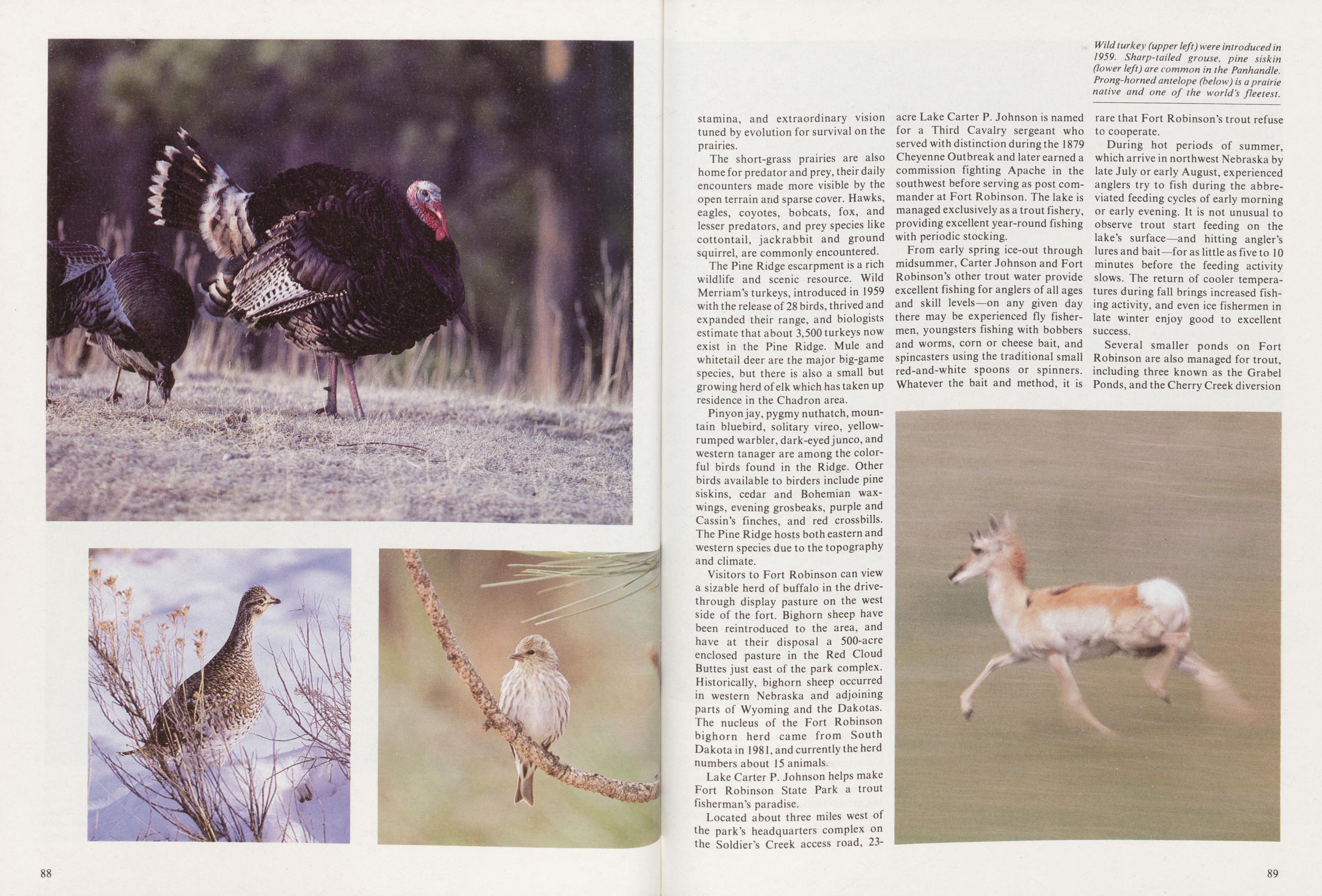
The short-grass prairies are also home for predator and prey, their daily encounters made more visible by the open terrain and sparse cover. Hawks, eagles, coyotes, bobcats, fox, and lesser predators, and prey species like cottontail, jackrabbit and ground squirrel, are commonly encountered.
The Pine Ridge escarpment is a rich wildlife and scenic resource. Wild Merriam's turkeys, introduced in 1959 with the release of 28 birds, thrived and expanded their range, and biologists estimate that about 3,500 turkeys now exist in the Pine Ridge. Mule and whitetail deer are the major big-game species, but there is also a small but growing herd of elk which has taken up residence in the Chadron area.
Pinyon jay, pygmy nuthatch, mountain bluebird, solitary vireo, yellowrumped warbler, dark-eyed junco, and western tanager are among the colorful birds found in the Ridge. Other birds available to birders include pine siskins, cedar and Bohemian waxwings, evening grosbeaks, purple and Cassin's finches, and red crossbills. The Pine Ridge hosts both eastern and western species due to the topography and climate.
Visitors to Fort Robinson can view a sizable herd of buffalo in the drivethrough display pasture on the west side of the fort. Bighorn sheep have been reintroduced to the area, and have at their disposal a 500-acre enclosed pasture in the Red Cloud Buttes just east of the park complex. Historically, bighorn sheep occurred in western Nebraska and adjoining parts of Wyoming and the Dakotas. The nucleus of the Fort Robinson bighorn herd came from South Dakota in 1981, and currently the herd numbers about 15 animals.
Lake Carter P. Johnson helps make Fort Robinson State Park a trout fisherman's paradise.
Located about three miles west of the park's headquarters complex on the Soldier's Creek access road, 23-acre Lake Carter P. Johnson is named for a Third Cavalry sergeant who served with distinction during the 1879 Cheyenne Outbreak and later earned a commission fighting Apache in the southwest before serving as post commander at Fort Robinson. The lake is managed exclusively as a trout fishery, providing excellent year-round fishing with periodic stocking.
From early spring ice-out through midsummer, Carter Johnson and Fort Robinson's other trout water provide excellent fishing for anglers of all ages and skill levels—on any given day there may be experienced fly fishermen, youngsters fishing with bobbers and worms, corn or cheese bait, and spincasters using the traditional small red-and-white spoons or spinners. Whatever the bait and method, it is rare that Fort Robinson's trout refuse to cooperate.
During hot periods of summer, which arrive in northwest Nebraska by late July or early August, experienced anglers try to fish during the abbreviated feeding cycles of early morning or early evening. It is not unusual to observe trout start feeding on the lake's surface—and hitting angler's lures and bait—for as little as five to 10 minutes before the feeding activity slows. The return of cooler temperatures during fall brings increased fishing activity, and even ice fishermen in late winter enjoy good to excellent success.
Several smaller ponds on Fort Robinson are also managed for trout, including three known as the Grabel Ponds, and the Cherry Creek diversion
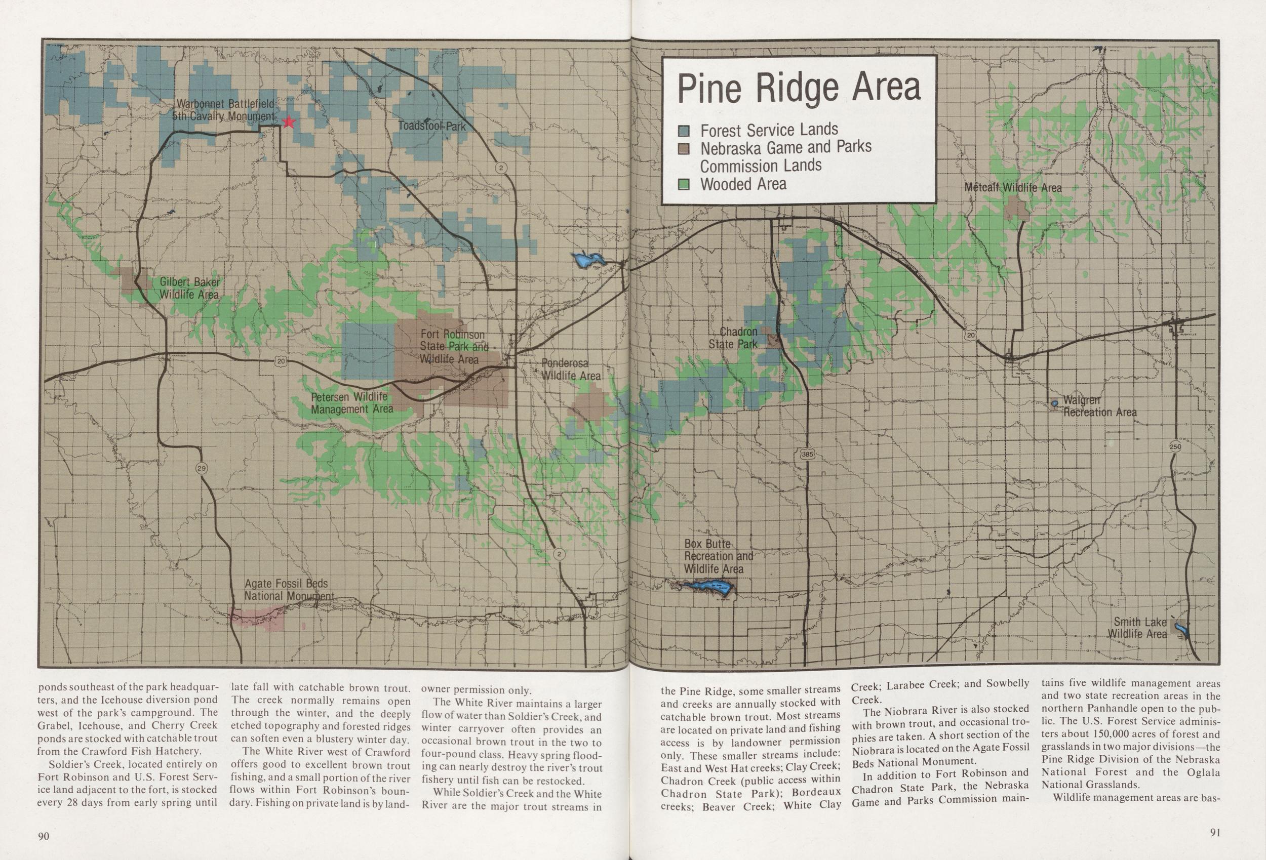
Soldier's Creek, located entirely on Fort Robinson and U.S. Forest Service land adjacent to the fort, is stocked every 28 days from early spring until 90 late fall with catchable brown trout. The creek normally remains open through the winter, and the deeply etched topography and forested ridges can soften even a blustery winter day.
The White River west of Crawford offers good to excellent brown trout fishing, and a small portion of the river flows within Fort Robinson's boundary. Fishing on private land is by landowner permission only.
The White River maintains a larger flow of water than Soldier's Creek, and winter carryover often provides an occasional brown trout in the two to four-pound class. Heavy spring flooding can nearly destroy the river's trout fishery until fish can be restocked.
While Soldier's Creek and the White River are the major trout streams in 90 the Pine Ridge, some smaller streams and creeks are annually stocked with catchable brown trout. Most streams are located on private land and fishing access is by landowner permission only. These smaller streams include: East and West Hat creeks; Clay Creek; Chadron Creek (public access within Chadron State Park); Bordeaux creeks; Beaver Creek; White Clay Creek; Larabee Creek; and Sowbelly Creek.
The Niobrara River is also stocked with brown trout, and occasional trophies are taken. A short section of the Niobrara is located on the Agate Fossil Beds National Monument.
In addition to Fort Robinson and Chadron State Park, the Nebraska Game and Parks Commission maintains five wildlife management areas and two state recreation areas in the northern Panhandle open to the public. The U.S. Forest Service administers about 150,000 acres of forest and grasslands in two major divisions—the Pine Ridge Division of the Nebraska National Forest and the Oglala National Grasslands.
Wildlife management areas are basically
91
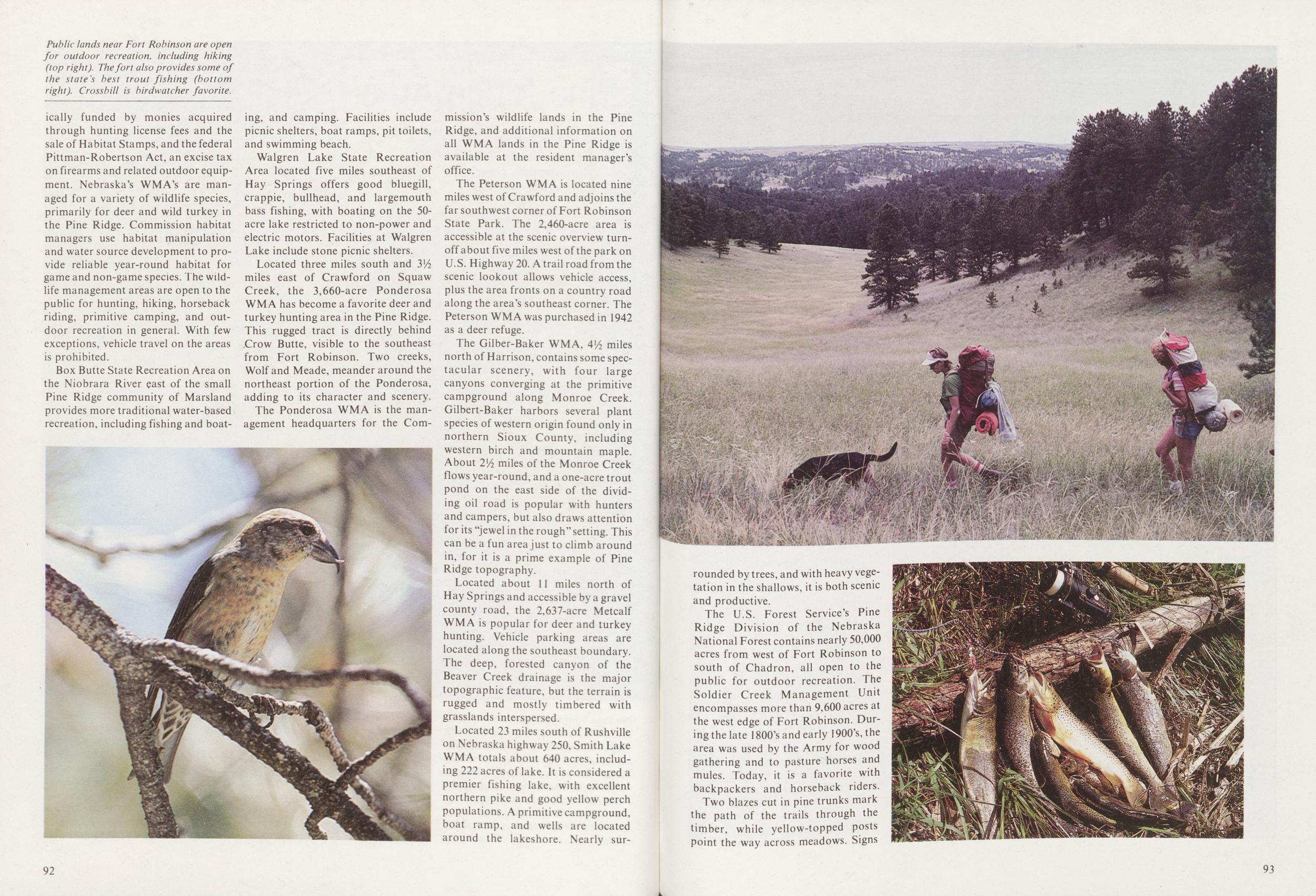
Box Butte State Recreation Area on the Niobrara River east of the small Pine Ridge community of Marsland provides more traditional water-based recreation, including fishing and boating, and camping. Facilities include picnic shelters, boat ramps, pit toilets, and swimming beach.
Walgren Lake State Recreation Area located five miles southeast of Hay Springs offers good bluegill, crappie, bullhead, and largemouth bass fishing, with boating on the 50-acre lake restricted to non-power and electric motors. Facilities at Walgren Lake include stone picnic shelters.
Located three miles south and VA miles east of Crawford on Squaw Creek, the 3,660-acre Ponderosa WM A has become a favorite deer and turkey hunting area in the Pine Ridge. This rugged tract is directly behind .Crow Butte, visible to the southeast from Fort Robinson. Two creeks, Wolf and Meade, meander around the northeast portion of the Ponderosa, adding to its character and scenery.
The Ponderosa WMA is the management headquarters for the Commission's wildlife lands in the Pine Ridge, and additional information on all WMA lands in the Pine Ridge is available at the resident manager's office.
The Peterson WMA is located nine miles west of Crawford and adjoins the far southwest corner of Fort Robinson State Park. The 2,460-acre area is accessible at the scenic overview turnoff about five miles west of the park on U.S. Highway 20. A trail road from the scenic lookout allows vehicle access, plus the area fronts on a country road along the area's southeast corner. The Peterson WMA was purchased in 1942 as a deer refuge.
The Gilber-Baker WMA, 4'/2 miles north of Harrison, contains some spectacular scenery, with four large canyons converging at the primitive campground along Monroe Creek. Gilbert-Baker harbors several plant species of western origin found only in northern Sioux County, including western birch and mountain maple. About 2i/2 miles of the Monroe Creek flows year-round, and a one-acre trout pond on the east side of the dividing oil road is popular with hunters and campers, but also draws attention for its "jewel in the rough" setting. This can be a fun area just to climb around in, for it is a prime example of Pine Ridge topography.
Located about 11 miles north of Hay Springs and accessible by a gravel county road, the 2,637-acre Metcalf WMA is popular for deer and turkey hunting. Vehicle parking areas are located along the southeast boundary. The deep, forested canyon of the Beaver Creek drainage is the major topographic feature, but the terrain is rugged and mostly timbered with grasslands interspersed.
Located 23 miles south of Rushville on Nebraska highway 250, Smith Lake WMA totals about 640 acres, including 222 acres of lake. It is considered a premier fishing lake, with excellent northern pike and good yellow perch populations. A primitive campground, boat ramp, and wells are located around the lakeshore. Nearly surrounded 92
The U.S. Forest Service's Pine Ridge Division of the Nebraska National Forest contains nearly 50,000 acres from west of Fort Robinson to south of Chadron, all open to the public for outdoor recreation. The Soldier Creek Management Unit encompasses more than 9,600 acres at the west edge of Fort Robinson. During the late 1800's and early 1900's,the area was used by the Army for wood gathering and to pasture horses and mules. Today, it is a favorite with backpackers and horseback riders.
Two blazes cut in pine trunks mark
the path of the trails through the
timber, while yellow-topped posts
point the way across meadows. Signs
93
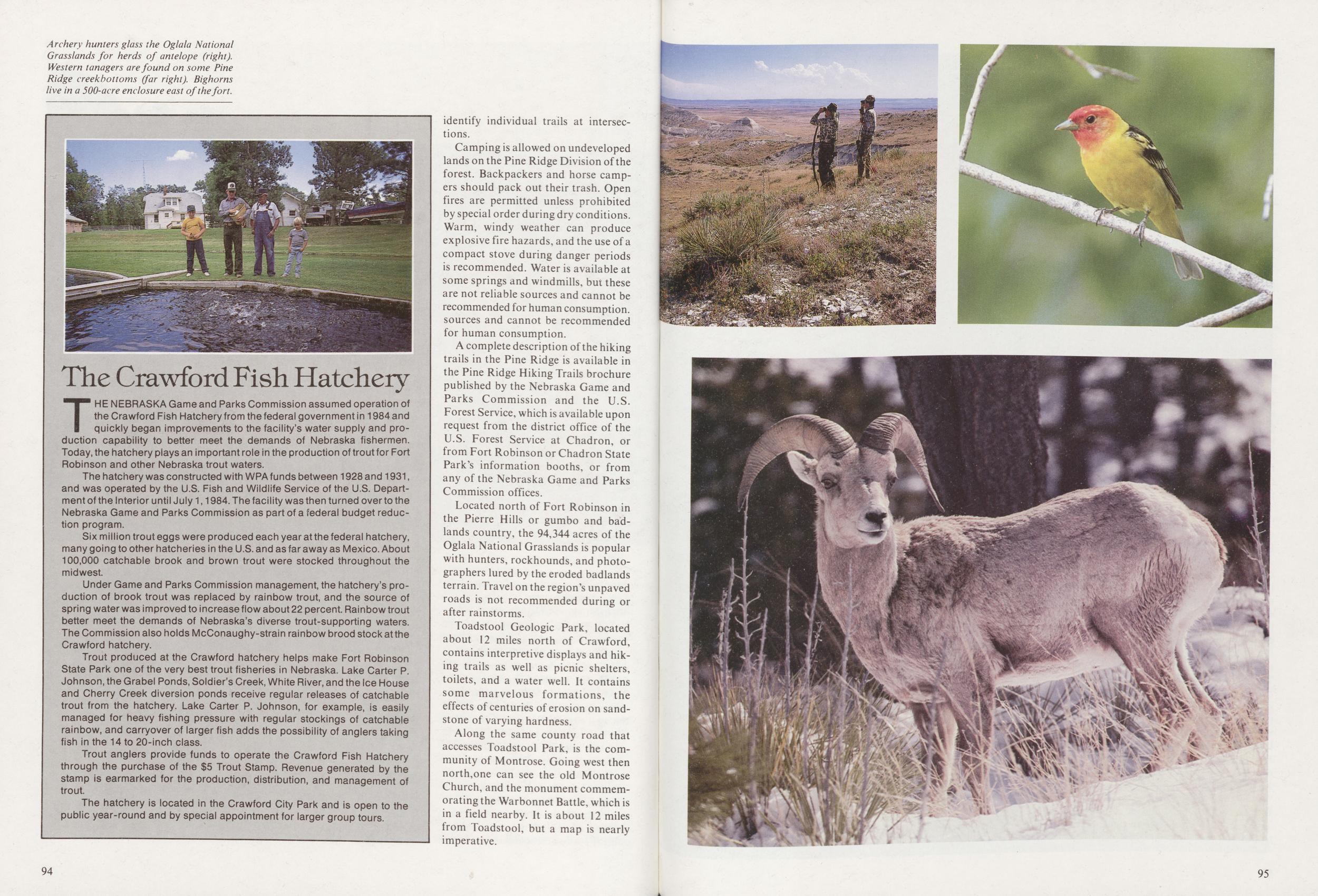
Camping is allowed on undeveloped lands on the Pine Ridge Division of the forest. Backpackers and horse campers should pack out their trash. Open fires are permitted unless prohibited by special order during dry conditions. Warm, windy weather can produce explosive fire hazards, and the use of a compact stove during danger periods is recommended. Water is available at some springs and windmills, but these are not reliable sources and cannot be recommended for human consumption, sources and cannot be recommended for human consumption.
A complete description of the hiking trails in the Pine Ridge is available in the Pine Ridge Hiking Trails brochure published by the Nebraska Game and Parks Commission and the U.S. Forest Service, which is available upon request from the district office of the U.S. Forest Service at Chadron, or from Fort Robinson or Chadron State Park's information booths, or from any of the Nebraska Game and Parks Commission offices.
Located north of Fort Robinson in the Pierre Hills or gumbo and badlands country, the 94,344 acres of the Oglala National Grasslands is popular with hunters, rockhounds, and photographers lured by the eroded badlands terrain. Travel on the region's unpaved roads is not recommended during or after rainstorms.
Toadstool Geologic Park, located about 12 miles north of Crawford, contains interpretive displays and hiking trails as well as picnic shelters, toilets, and a water well. It contains some marvelous formations, the effects of centuries of erosion on sandstone of varying hardness.
Along the same county road that accesses Toadstool Park, is the community of Montrose. Going west then north,one can see the old Montrose Church, and the monument commemorating the Warbonnet Battle, which is in a field nearby. It is about 12 miles from Toadstool, but a map is nearly imperative.
The Crawford Fish HatcheryTHE NEBRASKA Game and Parks Commission assumed operation of the Crawford Fish Hatchery from the federal government in 1984 and quickly began improvements to the facility's water supply and production capability to better meet the demands of Nebraska fishermen. Today, the hatchery plays an important role in the production of trout for Fort Robinson and other Nebraska trout waters.
The hatchery was constructed with WPA funds between 1928 and 1931, and was operated by the U.S. Fish and Wildlife Service of the U.S. Department of the Interior until July 1,1984. The facility was then turned over to the Nebraska Game and Parks Commission as part of a federal budget reduction program.
Six million trout eggs were produced each year at the federal hatchery, many going to other hatcheries in the U.S. and as far away as Mexico. About 100,000 catchable brook and brown trout were stocked throughout the midwest.
Under Game and Parks Commission management, the hatchery's production of brook trout was replaced by rainbow trout, and the source of spring water was improved to increase flow about 22 percent. Rainbow trout better meet the demands of Nebraska's diverse trout-supporting waters. The Commission also holds McConaughy-strain rainbow brood stock at the Crawford hatchery.
Trout produced at the Crawford hatchery helps make Fort Robinson State Park one of the very best trout fisheries in Nebraska. Lake Carter P. Johnson, the Grabel Ponds, Soldier's Creek, White River, and the Ice House and Cherry Creek diversion ponds receive regular releases of catchable trout from the hatchery. Lake Carter P. Johnson, for example, is easily managed for heavy fishing pressure with regular stockings of catchable rainbow, and carryover of larger fish adds the possibility of anglers taking fish in the 14 to 20-inch class.
Trout anglers provide funds to operate the Crawford Fish Hatchery through the purchase of the $5 Trout Stamp. Revenue generated by the stamp is earmarked for the production, distribution, and management of trout.
The hatchery is located in the Crawford City Park and is open to the public year-round and by special appointment for larger group tours.
94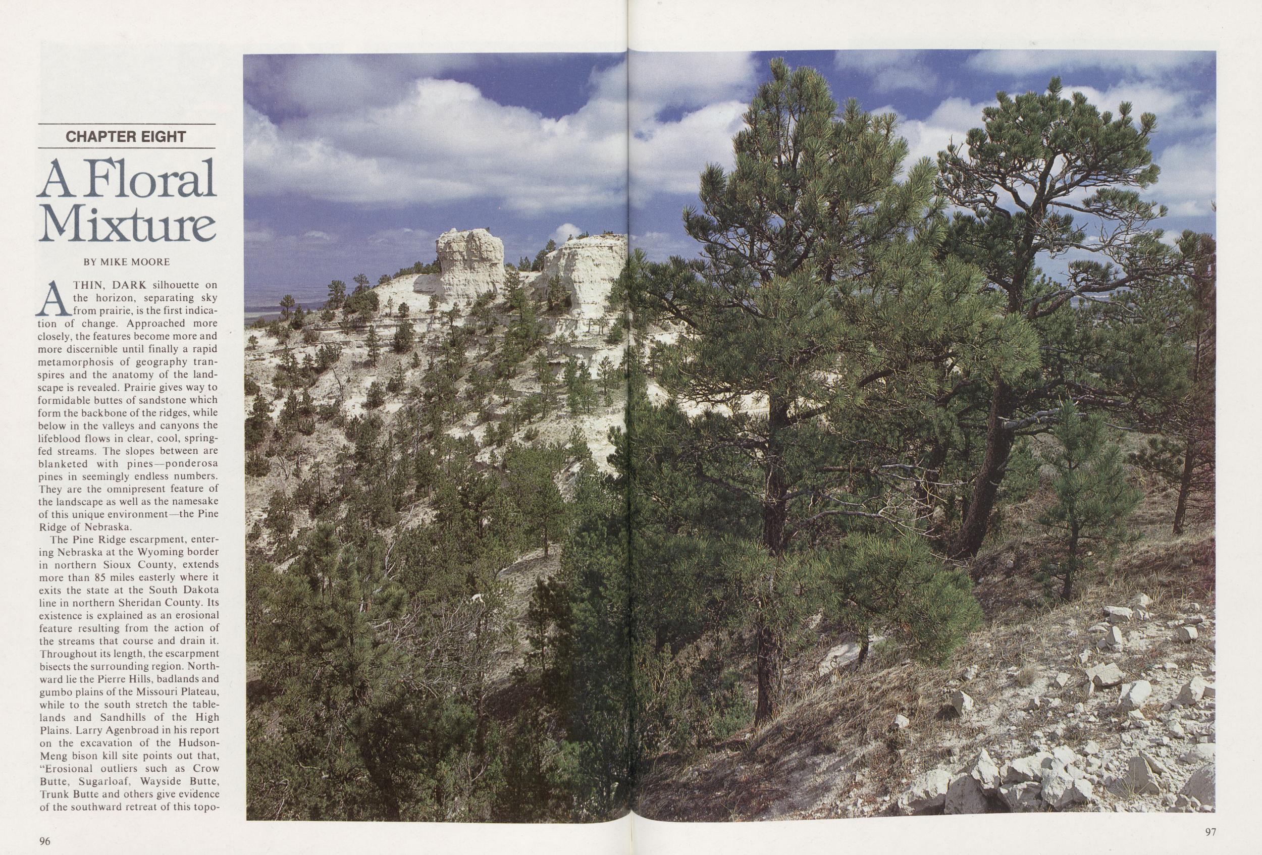
CHAPTER EIGHT A Floral Mixture
BY MIKE MOOREA THIN, DARK silhouette on the horizon, separating sky from prairie, is the first indication of change. Approached more closely, the features become more and more discernible until finally a rapid metamorphosis of geography transpires and the anatomy of the landscape is revealed. Prairie gives way to formidable buttes of sandstone which form the backbone of the ridges, while below in the valleys and canyons the lifeblood flows in clear, cool, springfed streams. The slopes between are blanketed with pines—ponderosa pines in seemingly endless numbers. They are the omnipresent feature of the landscape as well as the namesake of this unique environment-—the Pine Ridge of Nebraska.
The Pine Ridge escarpment, entering Nebraska at the Wyoming border in northern Sioux County, extends more than 85 miles easterly where it exits the state at the South Dakota line in northern Sheridan County. Its existence is explained as an erosional feature resulting from the action of the streams that course and drain it. Throughout its length, the escarpment bisects the surrounding region. Northward lie the Pierre Hills, badlands and gumbo plains of the Missouri Plateau, while to the south stretch the tablelands and Sandhills of the High Plains. Larry Agenbroad in his report on the excavation of the HudsonMeng bison kill site points out that, "Erosional outliers such as Crow Butte, Sugarloaf, Wayside Butte, Trunk Butte and others give evidence of the southward retreat of this topographic 96
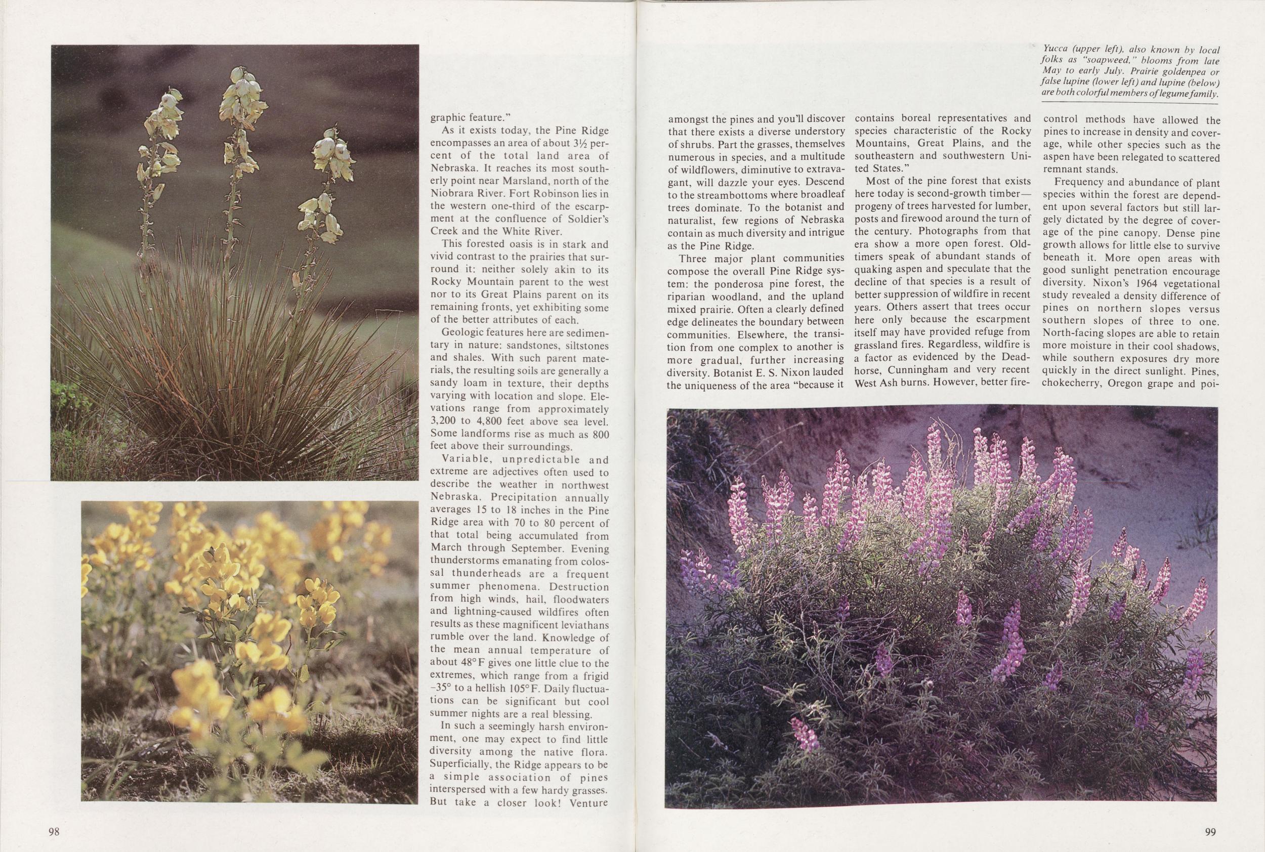
As it exists today, the Pine Ridge encompasses an area of about 3/2 percent of the total land area of Nebraska. It reaches its most southerly point near Marsland, north of the Niobrara River. Fort Robinson lies in the western one-third of the escarpment at the confluence of Soldier's Creek and the White River.
This forested oasis is in stark and vivid contrast to the prairies that surround it: neither solely akin to its Rocky Mountain parent to the west nor to its Great Plains parent on its remaining fronts, yet exhibiting some of the better attributes of each.
Geologic features here are sedimentary in nature: sandstones, siltstones and shales. With such parent materials, the resulting soils are generally a sandy loam in texture, their depths varying with location and slope. Elevations range from approximately 3,200 to 4,800 feet above sea level. Some landforms rise as much as 800 feet above their surroundings.
Variable, unpredictable and extreme are adjectives often used to describe the weather in northwest Nebraska. Precipitation annually averages 15 to 18 inches in the Pine Ridge area with 70 to 80 percent of that total being accumulated from March through September. Evening thunderstorms emanating from colossal thunderheads are a frequent summer phenomena. Destruction from high winds, hail, floodwaters and lightning-caused wildfires often results as these magnificent leviathans rumble over the land. Knowledge of the mean annual temperature of about 48° F gives one little clue to the extremes, which range from a frigid -35° to a hellish 105° F. Daily fluctuations can be significant but cool summer nights are a real blessing.
In such a seemingly harsh environment, one may expect to find little diversity among the native flora. Superficially, the Ridge appears to be a simple association of pines interspersed with a few hardy grasses. But take a closer look! Venture 98 amongst the pines and you'll discover that there exists a diverse understory of shrubs. Part the grasses, themselves numerous in species, and a multitude of wildflowers, diminutive to extravagant, will dazzle your eyes. Descend to the streambottoms where broadleaf trees dominate. To the botanist and naturalist, few regions of Nebraska contain as much diversity and intrigue as the Pine Ridge.
Three major plant communities compose the overall Pine Ridge system: the ponderosa pine forest, the riparian woodland, and the upland mixed prairie. Often a clearly defined edge delineates the boundary between communities. Elsewhere, the transition from one complex to another is more gradual, further increasing diversity. Botanist E. S. Nixon lauded the uniqueness of the area "because it contains boreal representatives and species characteristic of the Rocky Mountains, Great Plains, and the southeastern and southwestern United States."
Most of the pine forest that exists here today is second-growth timberprogeny of trees harvested for lumber, posts and firewood around the turn of the century. Photographs from that era show a more open forest. Oldtimers speak of abundant stands of quaking aspen and speculate that the decline of that species is a result of better suppression of wildfire in recent years. Others assert that trees occur here only because the escarpment itself may have provided refuge from grassland fires. Regardless, wildfire is a factor as evidenced by the Deadhorse, Cunningham and very recent West Ash burns. However, better fire-control methods have allowed the pines to increase in density and coverage, while other species such as the aspen have been relegated to scattered remnant stands.
Frequency and abundance of plant species within the forest are dependent upon several factors but still largely dictated by the degree of coverage of the pine canopy. Dense pine growth allows for little else to survive beneath it. More open areas with good sunlight penetration encourage diversity. Nixon's 1964 vegetational study revealed a density difference of pines on northern slopes versus southern slopes of three to one. North-facing slopes are able to retain more moisture in their cool shadows, while southern exposures dry more quickly in the direct sunlight. Pines, chokecherry, Oregon grape and poison
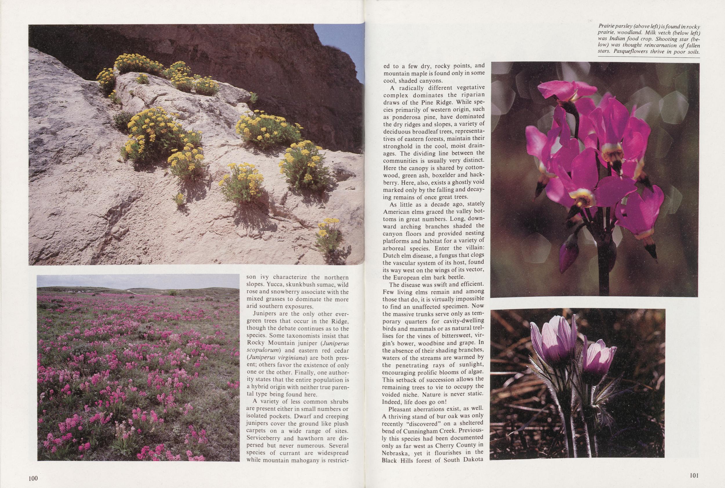
Junipers are the only other evergreen trees that occur in the Ridge, though the debate continues as to the species. Some taxonomists insist that Rocky Mountain juniper (Juniperus scopulorum) and eastern red cedar (Juniperus virginiana) are both present; others favor the existence of only one or the other. Finally, one authority states that the entire population is a hybrid origin with neither true parental type being found here.
A variety of less common shrubs are present either in small numbers or isolated pockets. Dwarf and creeping junipers cover the ground like plush carpets on a wide range of sites. Serviceberry and hawthorn are dispersed but never numerous. Several species of currant are widespread while mountain mahogany is restricted 100 to a few dry, rocky points, and mountain maple is found only in some cool, shaded canyons.
A radically different vegetative complex dominates the riparian draws of the Pine Ridge. While species primarily of western origin, such as ponderosa pine, have dominated the dry ridges and slopes, a variety of deciduous broadleaf trees, representatives of eastern forests, maintain their stronghold in the cool, moist drainages. The dividing line between the communities is usually very distinct. Here the canopy is shared by cottonwood, green ash, boxelder and hackberry. Here, also, exists a ghostly void marked only by the falling and decaying remains of once great trees.
As little as a decade ago, stately American elms graced the valley bottoms in great numbers. Long, downward arching branches shaded the canyon floors and provided nesting platforms and habitat for a variety of arboreal species. Enter the villain: Dutch elm disease, a fungus that clogs the vascular system of its host, found its way west on the wings of its vector, the European elm bark beetle.
The disease was swift and efficient. Few living elms remain and among those that do, it is virtually impossible to find an unaffected specimen. Now the massive trunks serve only as temporary quarters for cavity-dwelling birds and mammals or as natural trellises for the vines of bittersweet, virgin's bower, woodbine and grape. In the absence of their shading branches, waters of the streams are warmed by the penetrating rays of sunlight, encouraging prolific blooms of algae. This setback of succession allows the remaining trees to vie to occupy the voided niche. Nature is never static. Indeed, life does go on!
Pleasant aberrations exist, as well. A thriving stand of bur oak was only recently "discovered" on a sheltered bend of Cunningham Creek. Previously this species had been documented only as far west as Cherry County in Nebraska, yet it flourishes in the Black Hills forest of South Dakota
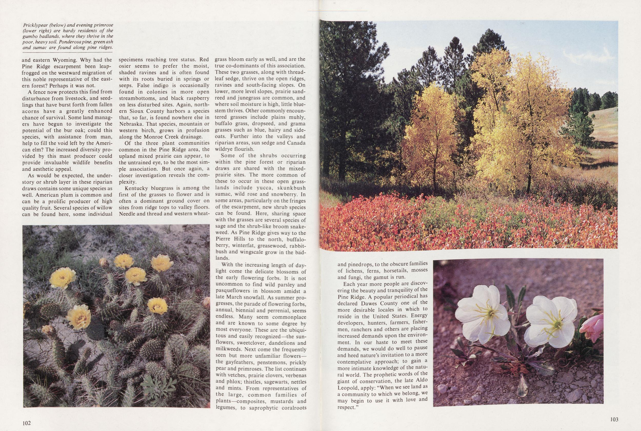
A fence now protects this find from disturbance from livestock, and seedlings that have burst forth from fallen acorns have a greatly enhanced chance of survival. Some land managers have begun to investigate the potential of the bur oak; could this species, with assistance from man, help to fill the void left by the American elm? The increased diversity provided by this mast producer could provide invaluable wildlife benefits and aesthetic appeal.
As would be expected, the understory or shrub layer in these riparian draws contains some unique species as well. American plum is common and can be a prolific producer of high quality fruit. Several species of willow can be found here, some individual specimens reaching tree status. Red osier seems to prefer the moist, shaded ravines and is often found with its roots buried in springs or seeps. False indigo is occasionally found in colonies in more open streambottoms, and black raspberry on less disturbed sites. Again, northern Sioux County harbors a species that, so far, is found nowhere else in Nebraska. That species, mountain or western birch, grows in profusion along the Monroe Creek drainage.
Of the three plant communities common in the Pine Ridge area, the upland mixed prairie can appear, to the untrained eye, to be the most simple association. But once again, a closer investigation reveals the complexity.
Kentucky bluegrass is among the first of the grasses to flower and is often a dominant ground cover on sites from ridge tops to valley floors. Needle and thread and western wheatgrass bloom early as well, and are the true co-dominants of this association. These two grasses, along with threadleaf sedge, thrive on the open ridges, ravines and south-facing slopes. On lower, more level slopes, prairie sandreed and junegrass are common, and where soil moisture is high, little bluestem thrives. Other commonly encountered grasses include plains muhly, buffalo grass, dropseed, and grama grasses such as blue, hairy and sideoats. Further into the valleys and riparian areas, sun sedge and Canada wildrye flourish.
Some of the shrubs occurring within the pine forest or riparian draws are shared with the mixedprairie sites. The more common of these to occur in these open grasslands include yucca, skunkbush sumac, wild rose and snowberry. In some areas, particularly on the fringes of the escarpment, new shrub species can be found. Here, sharing space with the grasses are several species of sage and the shrub-like broom snakeweed. As Pine Ridge gives way to the Pierre Hills to the north, buffaloberry, winterfat, greasewood, rabbitbush and wingscale grow in the badlands.
With the increasing length of daylight come the delicate blossoms of the early flowering forbs. It is not uncommon to find wild parsley and pasqueflowers in blossom amidst a late March snowfall. As summer progresses, the parade of flowering forbs, annual, biennial and perrenial, seems endless. Many seem commonplace and are known to some degree by most everyone. These are the ubiquitous and easily recognized—the sunflowers, sweetclover, dandelions and milkweeds. Next come the frequently seen but more unfamiliar flowers the gayfeathers, penstemons, prickly pear and primroses. The list continues with vetches, prairie clovers, verbenas and phlox; thistles, sagewarts, nettles and mints. From representatives of the large, common families of plants—composites, mustards and legumes, to saprophytic coralroots 102
Each year more people are discovering the beauty and tranquility of the Pine Ridge. A popular periodical has declared Dawes County one of the more desirable locales in which to reside in the United States. Energy developers, hunters, farmers, fishermen, ranchers and others are placing increased demands upon the environment. In our haste to meet these demands, we would do well to pause and heed nature's invitation to a more contemplative approach; to gain a more intimate knowledge of the natural world. The prophetic words of the giant of conservation, the late Aldo Leopold, apply: "When we see land as a community to which we belong, we may begin to use it with love and respect."
103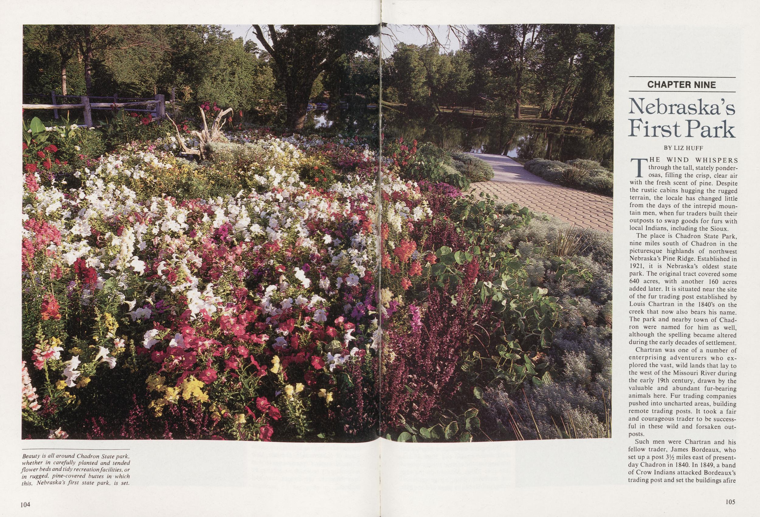
CHAPTER NINE Nebraska's First Park
BY LIZ HUFFTHE WIND WHISPERS through the tall, stately ponderosas, filling the crisp, clear air with the fresh scent of pine. Despite the rustic cabins hugging the rugged terrain, the locale has changed little from the days of the intrepid mountain men, when fur traders built their outposts to swap goods for furs with local Indians, including the Sioux.
The place is Chadron State Park, nine miles south of Chadron in the picturesque highlands of northwest Nebraska's Pine Ridge. Established in 1921, it is Nebraska's oldest state park. The original tract covered some 640 acres, with another 160 acres added later. It is situated near the site of the fur trading post established by Louis Chartran in the 1840's on the creek that now also bears his name. The park and nearby town of Chadron were named for him as well, although the spelling became altered during the early decades of settlement.
Chartran was one of a number of enterprising adventurers who explored the vast, wild lands that lay to the west of the Missouri River during the early 19th century, drawn by the valuable and abundant fur-bearing animals here. Fur trading companies pushed into uncharted areas, building remote trading posts. It took a fair and courageous trader to be successful in these wild and forsaken outposts.
Such men were Chartran and his
fellow trader, James Bordeaux, who
set up a post Vh miles east of presentday Chadron in 1840. In 1849, a band
of Crow Indians attacked Bordeaux's
trading post and set the buildings afire
105
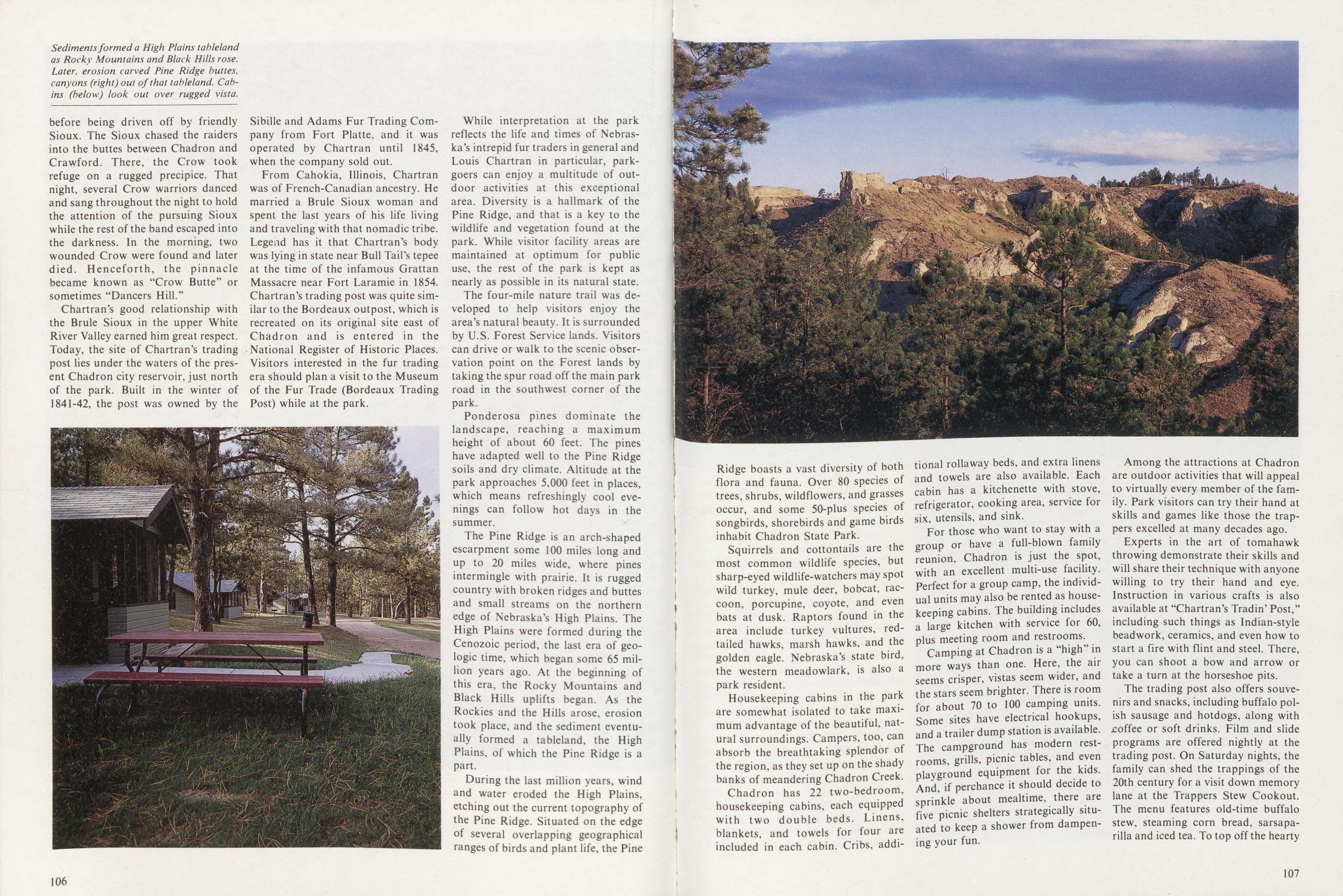
Chartran's good relationship with the Brule Sioux in the upper White River Valley earned him great respect. Today, the site of Chartran's trading post lies under the waters of the present Chadron city reservoir, just north of the park. Built in the winter of 1841-42, the post was owned by the Sibille and Adams Fur Trading Company from Fort Platte, and it was operated by Chartran until 1845, when the company sold out.
From Cahokia, Illinois, Chartran was of French-Canadian ancestry. He married a Brule Sioux woman and spent the last years of his life living and traveling with that nomadic tribe. Legend has it that Chartran's body was lying in state near Bull Tail's tepee at the time of the infamous Grattan Massacre near Fort Laramie in 1854. Chartran's trading post was quite similar to the Bordeaux outpost, which is recreated on its original site east of Chadron and is entered in the National Register of Historic Places. Visitors interested in the fur trading era should plan a visit to the Museum of the Fur Trade (Bordeaux Trading Post) while at the park.
While interpretation at the park reflects the life and times of Nebraska's intrepid fur traders in general and Louis Chartran in particular, parkgoers can enjoy a multitude of outdoor activities at this exceptional area. Diversity is a hallmark of the Pine Ridge, and that is a key to the wildlife and vegetation found at the park. While visitor facility areas are maintained at optimum for public use, the rest of the park is kept as nearly as possible in its natural state.
The four-mile nature trail was developed to help visitors enjoy the area's natural beauty. It is surrounded by U.S. Forest Service lands. Visitors can drive or walk to the scenic observation point on the Forest lands by taking the spur road off the main park road in the southwest corner of the park.
Ponderosa pines dominate the landscape, reaching a maximum height of about 60 feet. The pines have adapted well to the Pine Ridge soils and dry climate. Altitude at the park approaches 5,000 feet in places, which means refreshingly cool evenings can follow hot days in the summer.
The Pine Ridge is an arch-shaped escarpment some 100 miles long and up to 20 miles wide, where pines intermingle with prairie. It is rugged country with broken ridges and buttes and small streams on the northern edge of Nebraska's High Plains. The High Plains were formed during the Cenozoic period, the last era of geologic time, which began some 65 million years ago. At the beginning of this era, the Rocky Mountains and Black Hills uplifts began. As the Rockies and the Hills arose, erosion took place, and the sediment eventually formed a tableland, the High Plains, of which the Pine Ridge is a part.
During the last million years, wind and water eroded the High Plains, etching out the current topography of the Pine Ridge. Situated on the edge of several overlapping geographical ranges of birds and plant life, the Pine 106 Ridge boasts a vast diversity of both flora and fauna. Over 80 species of trees, shrubs, wildflowers, and grasses occur, and some 50-plus species of songbirds, shorebirds and game birds inhabit Chadron State Park.
Squirrels and cottontails are the most common wildlife species, but sharp-eyed wildlife-watchers may spot wild turkey, mule deer, bobcat, raccoon, porcupine, coyote, and even bats at dusk. Raptors found in the area include turkey vultures, redtailed hawks, marsh hawks, and the golden eagle. Nebraska's state bird, the western meadowlark, is also a park resident.
Housekeeping cabins in the park are somewhat isolated to take maximum advantage of the beautiful, natural surroundings. Campers, too, can absorb the breathtaking splendor of the region, as they set up on the shady banks of meandering Chadron Creek.
Chadron has 22 two-bedroom, housekeeping cabins, each equipped with two double beds. Linens, blankets, and towels for four are included in each cabin. Cribs, additional rollaway beds, and extra linens and towels are also available. Each cabin has a kitchenette with stove, refrigerator, cooking area, service for six, utensils, and sink.
For those who want to stay with a group or have a full-blown family reunion, Chadron is just the spot, with an excellent multi-use facility. Perfect for a group camp, the individual units may also be rented as housekeeping cabins. The building includes a large kitchen with service for 60, plus meeting room and restrooms.
Camping at Chadron is a "high" in more ways than one. Here, the air seems crisper, vistas seem wider, and the stars seem brighter. There is room for about 70 to 100 camping units. Some sites have electrical hookups, and a trailer dump station is available. The campground has modern restrooms, grills, picnic tables, and even playground equipment for the kids. And, if perchance it should decide to sprinkle about mealtime, there are five picnic shelters strategically situated to keep a shower from dampening your fun.
Among the attractions at Chadron are outdoor activities that will appeal to virtually every member the family. Park visitors can try their hand at skills and games like those the trappers excelled at many decades ago.
Experts in the art of tomahawk throwing demonstrate their skills and will share their technique with anyone willing to try their hand and eye. Instruction in various crafts is also available at "Chartran's Tradin' Post," including such things as Indian-style beadwork, ceramics, and even how to start a fire with flint and steel. There, you can shoot a bow and arrow or take a turn at the horseshoe pits.
The trading post also offers souvenirs and snacks, including buffalo polish sausage
and hotdogs, along with
.coffee or soft drinks. Film and slide
programs are offered nightly at the
trading post. On Saturday nights, the
family can shed the trappings of the
20th century for a visit down memory
lane at the Trappers Stew Cookout.
The menu features old-time buffalo
stew, steaming corn bread, sarsaparilla and iced tea. To top off the hearty
107
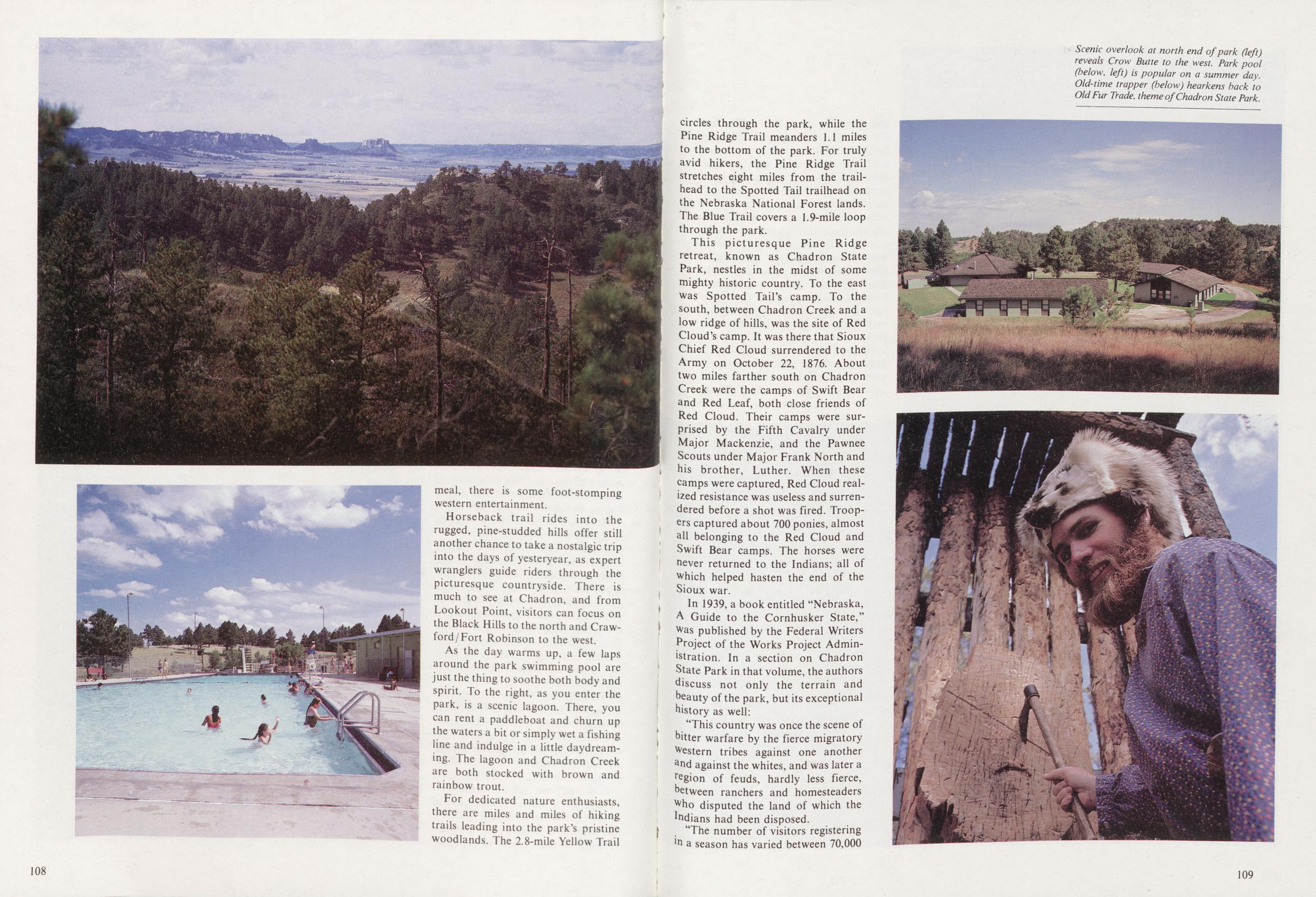
Horseback trail rides into the rugged, pine-studded hills offer still another chance to take a nostalgic trip into the days of yesteryear, as expert wranglers guide riders through the picturesque countryside. There is much to see at Chadron, and from Lookout Point, visitors can focus on the Black Hills to the north and Crawford/Fort Robinson to the west.
As the day warms up, a few laps around the park swimming pool are just the thing to soothe both body and spirit. To the right, as you enter the park, is a scenic lagoon. There, you can rent a paddleboat and churn up the waters a bit or simply wet a fishing line and indulge in a little daydreaming. The lagoon and Chadron Creek are both stocked with brown and rainbow trout.
For dedicated nature enthusiasts, there are miles and miles of hiking trails leading into the park's pristine woodlands. The 2.8-mile Yellow Trail 108 circles through the park, while the Pine Ridge Trail meanders 1.1 miles to the bottom of the park. For truly avid hikers, the Pine Ridge Trail stretches eight miles from the trailhead to the Spotted Tail trailhead on the Nebraska National Forest lands. The Blue Trail covers a 1.9-mile loop through the park.
This picturesque Pine Ridge retreat, known as Chadron State Park, nestles in the midst of some mighty historic country. To the east was Spotted Tail's camp. To the south, between Chadron Creek and a low ridge of hills, was the site of Red Cloud's camp. It was there that Sioux Chief Red Cloud surrendered to the Army on October 22, 1876. About two miles farther south on Chadron Creek were the camps of Swift Bear and Red Leaf, both close friends of Red Cloud. Their camps were surprised by the Fifth Cavalry under Major Mackenzie, and the Pawnee Scouts under Major Frank North and his brother, Luther. When these camps were captured, Red Cloud realized resistance was useless and surrendered before a shot was fired. Troopers captured about 700 ponies, almost all belonging to the Red Cloud and Swift Bear camps. The horses were never returned to the Indians; all of which helped hasten the end of the Sioux war.
In 1939, a book entitled "Nebraska, A Guide to the Cornhusker State," Was published by the Federal Writers Project of the Works Project Administration. In a section on Chadron State Park in that volume, the authors discuss not only the terrain and heauty of the park, but its exceptional history as well:
'This country was once the scene of hitter warfare by the fierce migratory Western tribes against one another and against the whites, and was later a region of feuds, hardly less fierce, hetween ranchers and homesteaders who disputed the land of which the mdians had been disposed.
"The number of visitors registering ln a season has varied between 70,000
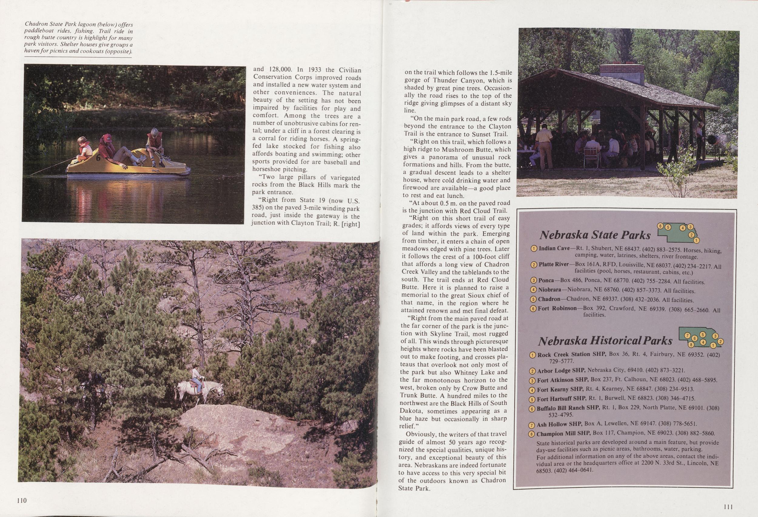
"Two large pillars of variegated rocks from the Black Hills mark the park entrance.
"Right from State 19 (now U.S. 385) on the paved 3-mile winding park road, just inside the gateway is the junction with Clayton Trail; R. [right] 110 on the trail which follows the 1.5-mile gorge of Thunder Canyon, which is shaded by great pine trees. Occasionally the road rises to the top of the ridge giving glimpses of a distant sky line.
"On the main park road, a few rods beyond the entrance to the Clayton Trail is the entrance to Sunset Trail.
"Right on this trail, which follows a high ridge to Mushroom Butte, which gives a panorama of unusual rock formations and hills. From the butte, a gradual descent leads to a shelter house, where cold drinking water and firewood are available—a good place to rest and eat lunch.
"At about 0.5 m. on the paved road is the junction with Red Cloud Trail.
"Right on this short trail of easy grades; it affords views of every type of land within the park. Emerging from timber, it enters a chain of open meadows edged with pine trees. Later it follows the crest of a 100-foot cliff that affords a long view of Chadron Creek Valley and the tablelands to the south. The trail ends at Red Cloud Butte. Here it is planned to raise a memorial to the great Sioux chief of that name, in the region where he attained renown and met final defeat.
"Right from the main paved road at the far corner of the park is the junction with Skyline Trail, most rugged of all. This winds through picturesque heights where rocks have been blasted out to make footing, and crosses plateaus that overlook not only most of the park but also Whitney Lake and the far monotonous horizon to the west, broken only by Crow Butte and Trunk Butte. A hundred miles to the northwest are the Black Hills of South Dakota, sometimes appearing as a blue haze but occasionally in sharp relief."
Obviously, the writers of that travel guide of almost 50 years ago recognized the special qualities, unique history, and exceptional beauty of this area. Nebraskans are indeed fortunate to have access to this very special bit of the outdoors known as Chadron State Park.
State historical parks are developed around a main feature, but provide day-use facilities such as picnic areas, bathrooms, water, parking. For additional information on any of the above areas, contact the individual area or the headquarters office at 2200 N. 33rd St., Lincoln, NE 68503.(402)464-0641.
111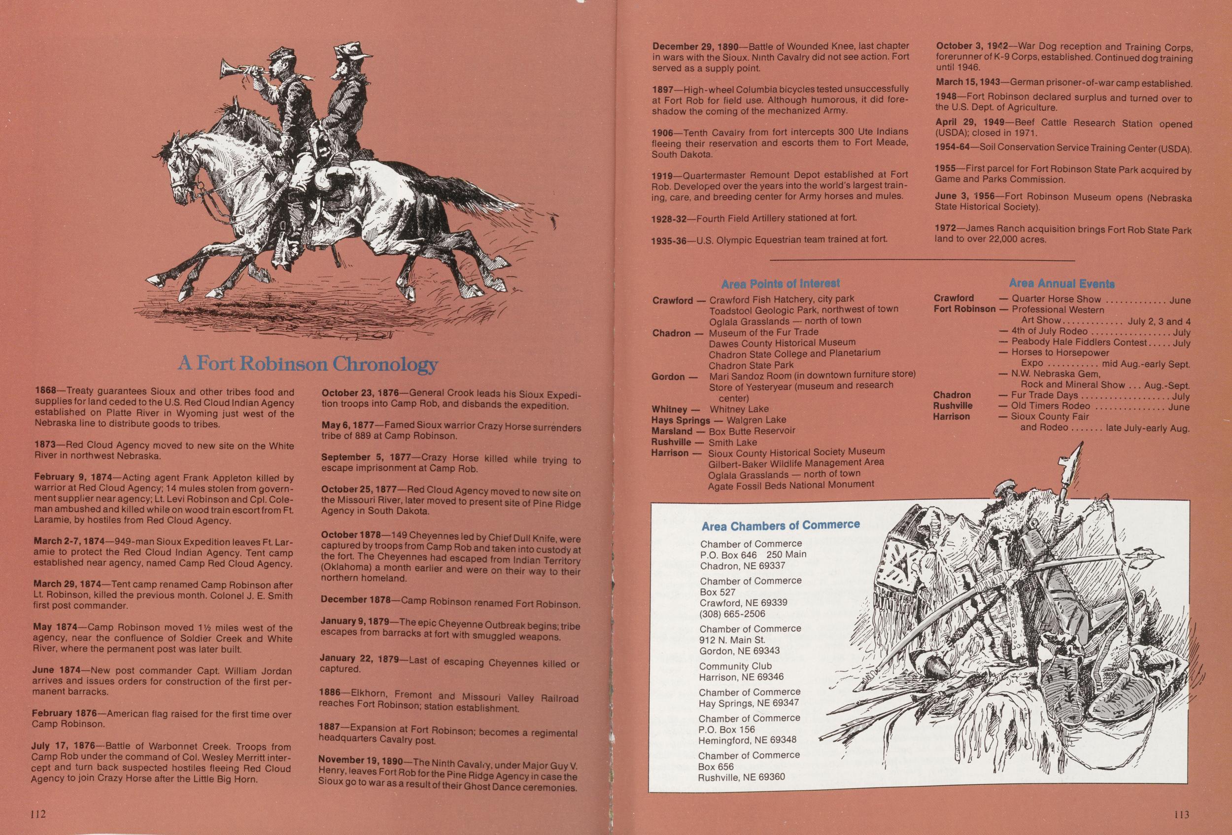
A Fort Robinson Chronology
1868—Treaty guarantees Sioux and other tribes food and supplies for land ceded to the U.S. Red Cloud Indian Agency established on Platte River in Wyoming just west of the Nebraska line to distribute goods to tribes. 1873—Red Cloud Agency moved to new site on the White River in northwest Nebraska. February 9, 1874—Acting agent Frank Appleton killed by warrior at Red Cloud Agency; 14 mules stolen from government supplier near agency; Lt. Levi Robinson and Cpl. Coleman ambushed and killed while on wood train escort from Ft. Laramie, by hostiles from Red Cloud Agency. March 2-7,1874—949-man Sioux Expedition leaves Ft. Laramie to protect the Red Cloud Indian Agency. Tent camp established near agency, named Camp Red Cloud Agency. March 29,1874—Tent camp renamed Camp Robinson after Lt. Robinson, killed the previous month. Colonel J. E. Smith first post commander. May 1874—Camp Robinson moved Vh miles west of the agency, near the confluence of Soldier Creek and White River, where the permanent post was later built. June 1874—New post commander Capt. William Jordan arrives and issues orders for construction of the first permanent barracks. February 1876—American flag raised for the first time over Camp Robinson. July 17, 1876—Battle of Warbonnet Creek. Troops from Camp Rob under the command of Col. Wesley Merritt intercept and turn back suspected hostiles fleeing Red Cloud Agency to join Crazy Horse after the Little Big Horn. October 23,1876—General Crook leads his Sioux Expedition troops into Camp Rob, and disbands the expedition. May 6,1877—Famed Sioux warrior Crazy Horse surrenders tribe of 889 at Camp Robinson. September 5, 1877—Crazy Horse killed while trying to escape imprisonment at Camp Rob. October 25,1877—Red Cloud Agency moved to new site on the Missouri River, later moved to present site of Pine Ridge Agency in South Dakota. October 1878—149 Cheyennes led by Chief Dull Knife were captured by troops from Camp Rob and taken into custody at the fort. The Cheyennes had escaped from Indian Territory (Oklahoma) a month earlier and were on their way to their northern homeland. December 1878-Camp Robinson renamed Fort Rob January 9,1879-The epic Cheyenne Outbreak begins; tribe escapes from barracks at fort with smuggled weapons. caJtSed22, 1879~Last of escaping Cheyennes killed or profit and MiSSOuri Valley Railroad The Ninth Cavalry, under Major Guy V. for the Pjne Rid9e Agency in case the Sioux go to war as a result of their Ghost Dance ceremonies. 112 December 29,1890—Battle of Wounded Knee, last chapter in wars with the Sioux. Ninth Cavalry did not see action. Fort served as a supply point. 1897—High-wheel Columbia bicycles tested unsuccessfully at Fort Rob for field use. Although humorous, it did foreshadow the coming of the mechanized Army. 1906—Tenth Cavalry from fort intercepts 300 Ute Indians fleeing their reservation and escorts them to Fort Meade, South Dakota. 1919—Quartermaster Remount Depot established at Fort Rob. Developed over the years into the world's largest training, care, and breeding center for Army horses and mules. 1928-32—Fourth Field Artillery stationed at fort. 1935-36—U.S. Olympic Equestrian team trained at fort. October 3, 1942—War Dog reception and Training Corps, forerunner of K-9 Corps, established. Continued dog training until 1946. March 15,1943—German prisoner-of-war camp established. 1948—Fort Robinson declared surplus and turned over to the U.S. Dept. of Agriculture. April 29, 1949—Beef Cattle Research Station opened (USDA); closed in 1971. 1954-64—Soil Conservation Service Training Center (USDA). 1955—First parcel for Fort Robinson State Park acquired by Game and Parks Commission. June 3, 1956—Fort Robinson Museum opens (Nebraska State Historical Society). 1972—James Ranch acquisition brings Fort Rob State Park land to over 22,000 acres. Area Points of Interest Crawford Crawford Fish Hatchery, city park Toadstool Geologic Park, northwest of town Oglala Grasslands — north of town Chadron — Museum of the Fur Trade Dawes County Historical Museum Chadron State College and Planetarium Chadron State Park Gordon — Mari Sandoz Room (in downtown furniture store) Store of Yesteryear (museum and research center) Whitney — Whitney Lake Hays Springs — Walgren Lake Marsland — Box Butte Reservoir Rushville — Smith Lake Harrison — Sioux County Historical Society Museum Gilbert-Baker Wildlife Management Area Oglala Grasslands — north of town Agate Fossil Beds National Monument Area Annual Events Crawford Fort Robinson Chadron Rushville Harrison Quarter Horse Show June Professional Western Art Show July 2, 3 and 4 4th of July Rodeo July Peabody Hale Fiddlers Contest July Horses to Horsepower Expo mid Aug.-early Sept. N.W Nebraska Gem, Rock and Mineral Show Aug.-Sept. Fur Trade Days July Old Timers Rodeo June Sioux County Fair and Rodeo late July-early Aug. Area Chambers of Commerce Chamber of Commerce P.O. Box 646 250 Main Chadron, NE 69337 Chamber of Commerce Box 527 Crawford, NE 69339 (308) 665-2506 Chamber of Commerce 912 N. Main St. Gordon, NE 69343 Community Club Harrison, NE 69346 Chamber of Commerce Hay Springs, NE 69347 Chamber of Commerce P.O. Box 156 Hemingford, NE 69348 Chamber of Commerce Box 656 Rushville, NE 69360 113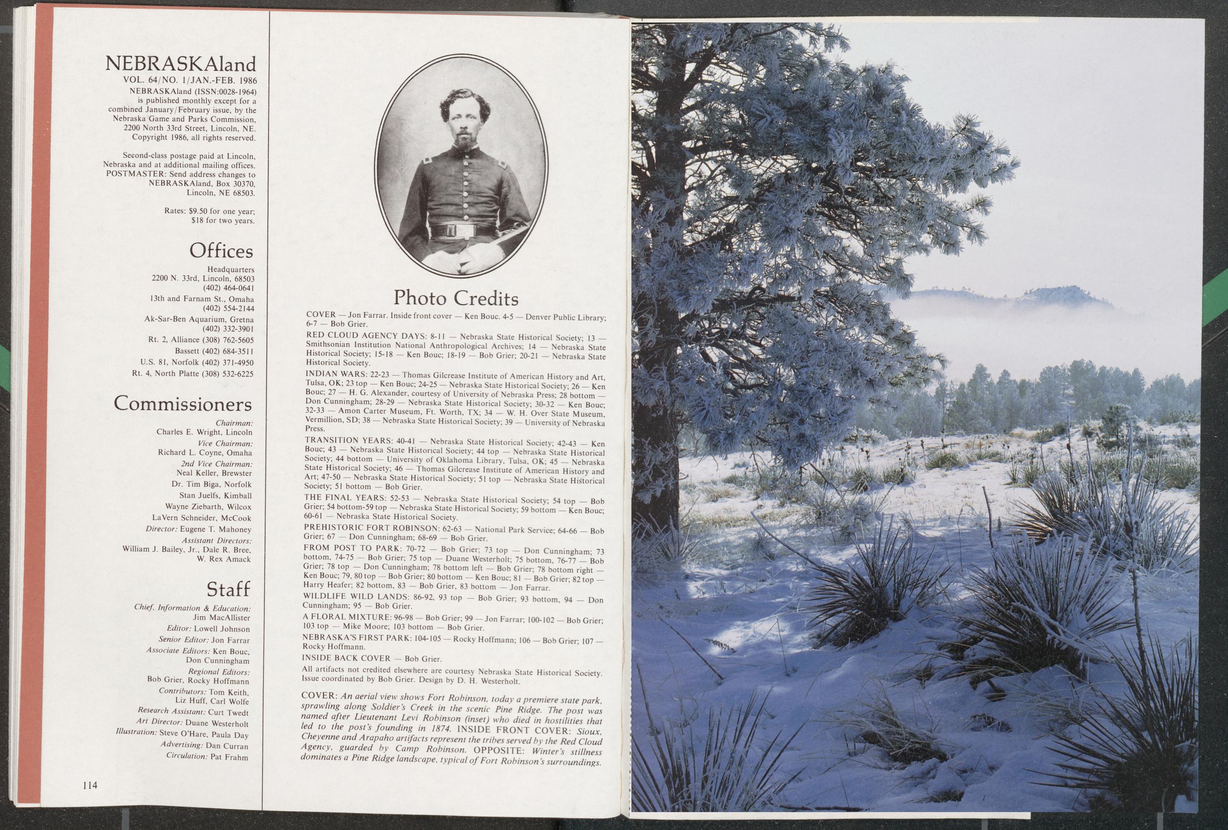
NEBRASKAland
VOL. 64/NO. l/JAN.-FEB. 1986 NEBRASKAland (ISSN:0028-1964) is published monthly except for a combined January/February issue, by the Nebraska Game and Parks Commission, 2200 North 33rd Street, Lincoln, NE. Copyright 1986, all rights reserved. Second-class postage paid at Lincoln, Nebraska and at additional mailing offices. POSTMASTER: Send address changes to NEBRASKAland, Box 30370, Lincoln, NE 68503. Rates: $9.50 for one year; $18 for two years. Offices Headquarters 2200 N. 33rd, Lincoln, 68503 (402) 464-0641 13th and Farnam St., Omaha (402) 554-2144 Ak-Sar-Ben Aquarium, Gretna (402) 332-3901 Rt. 2, Alliance (308) 762-5605 Bassett (402) 684-3511 U.S. 81, Norfolk (402) 371-4950 Rt. 4, North Platte (308) 532-6225 Commissioners Chairman: Charles E. Wright, Lincoln Vice Chairman: Richard L. Coyne, Omaha 2nd Vice Chairman: Neal Keller, Brewster Dr. Tim Biga, Norfolk Stan Juelfs, Kimball Wayne Ziebarth, Wilcox LaVern Schneider, McCook Director: Eugene T Mahoney Assistant Directors: William J. Bailey, Jr., Dale R. Bree, W. Rex Amack Staff Chief, Information & Education: Jim MacAllister Editor: Lowell Johnson Senior Editor: Jon Farrar Associate Editors: Ken Bouc, Don Cunningham Regional Editors: Bob Grier, Rocky Hoffmann Contributors: Tom Keith, Liz Huff, Carl Wolfe Research Assistant: Curt Twedt Art Director: Duane Westerholt Illustration: Steve O'Hare, Paula Day Advertising: Dan Curran Circulation: Pat Frahm
Position: 553 (19 views)