Volume 62, Issue 6, 1984
NEBRASKAland
July 1984 $1
NEBRASKAland
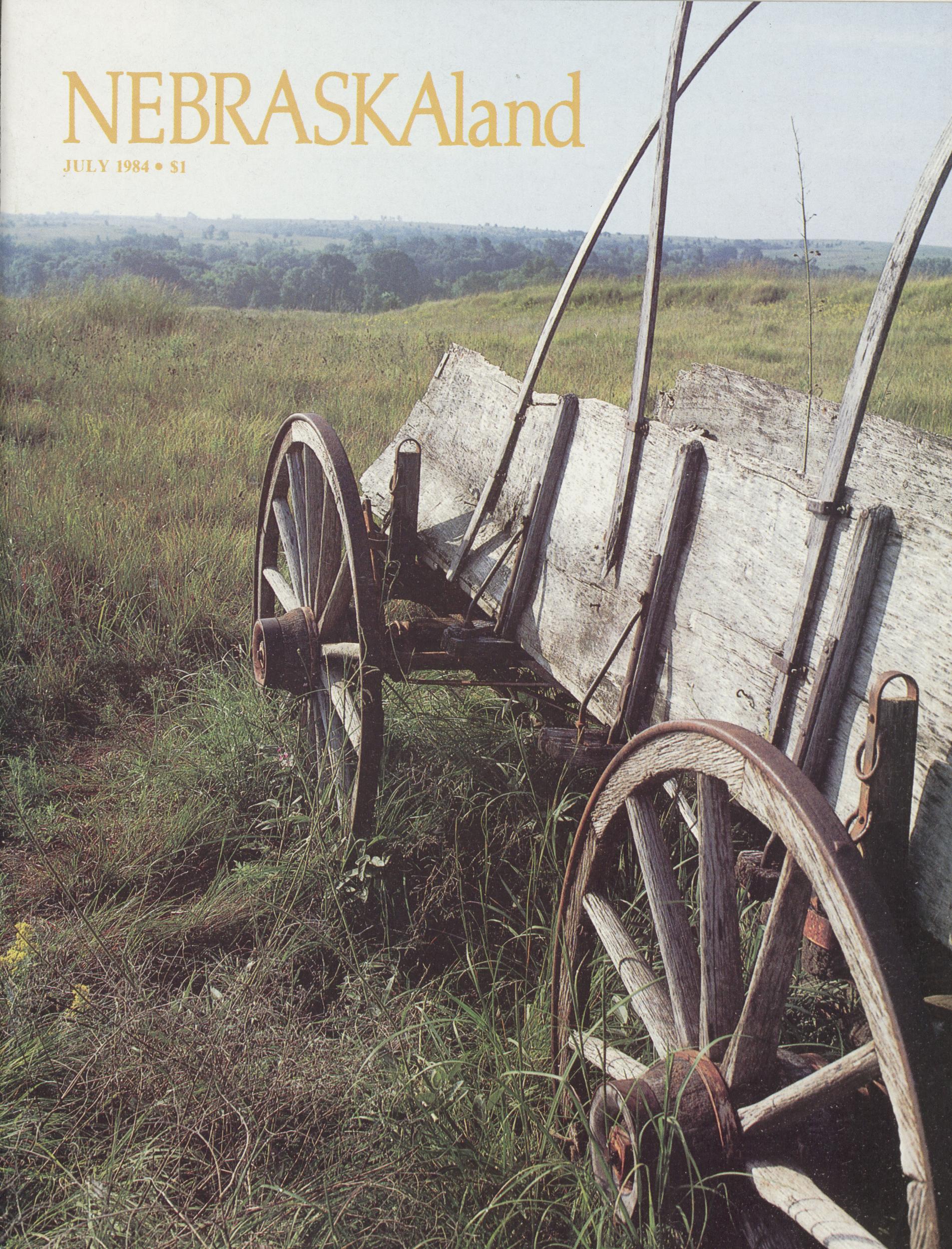
Published by the Nebraska Game and Parks Commission VOL. 62 / NO. 6 / JULY 1984 NEBRASKAland (ISSN:0028-1964) is published monthly except for a combined January/ February issue, by the Nebraska Game and Parks Commission, 2200 North 33rd Street, Lincoln, NE. Copyright 1984, all rights reserved. Second-class postage paid at Lincoln, Nebraska and at additional mailing offices. POSTMASTER: Send address changes to NEBRASKAland, Box 30370, Lincoln, NE 68503. Rates: $9.50 for 12 mos.; $14 for 18 mos.; $23 for 30 mos. Single copy price, $1. Offices Headquarters 2200 N. 33rd, Lincoln, 68503 (402) 464-0641 13th and Farnam St., Omaha (402) 554-2144 Ak-Sar-Ben Aquarium, Gretna (402) 332-3901 Rt. 2, Alliance (308) 762-5605 Bassett (402) 684-3511 U.S. 81, Norfolk (402) 371-4950 Rt. 4, North Platte (308) 532-6225 Commissioners Chairman: Earl Hultman, Sutton Vice Chairman: Richard Prasch, Lexington 2nd Vice Chairman: Charles E. Wright, Lincoln Neal Keller, Brewster Dr. Tim Biga, Norfolk Stan Juelfs, Kimball Richard L. Coyne, Omaha Director: Eugene T. Ma honey Assistant Directors: William J. Bailey, Jr., Dale R. Bree W. Rex Amack Staff Chief, Information & Education: Jim MacAllister Editor: Lowell Johnson Senior Editor: Jon Farrar Associate Editors: Ken Bouc, Don Cunningham Regional Editors: Bob Grier, Rocky Hoffmann Contributors: Tom Keith, Liz Huff, Carl Wolfe Research Assistant: Curt Twedt Art Director: Duane Westerholt Illustration: Steve O'Hare, Paula Day, Dan Curran Circulation: Juanita Stefkovich Contents Features A NEIGHBORHOOD LAKE 8 THE ISLAND 12 RIDE WITH THE OLD BUNCH 14 TRAGEDY ON THE TRAIL 18 ROCK CREEK STATION STATE HISTORICAL PARK A special 16-page color section on a scenic and historical spot in southeast Nebraska 19 ROCK CREEK'S PRAIRIE 35 MASSACRE ON PLUM CREEK 36 TIN CAMP WRITERS' PICNIC 40 Departments SPEAK UP 4 IN THE KITCHEN 47 BOOKSHELF 48 TRADING POST 49 COVER: On a feeder route of the Oregon Trail, Nebraska's Rock Creek Station is now a state historical park with a new visitor center. Just southeast of Fairbury and northeast of Endicott, it is expected to draw history buffs and picnickers to its 400 acres of rolling*hills. A special section on Rock Creek begins on page 19. Photo by Jack Curran. OPPOSITE: The rugged canyon country of various sections of the state have much in common, yet each is different. This stretch of North Platte River Valley offers a range of vegetation and its own brand of splendor. Photo by Bob Grier. 3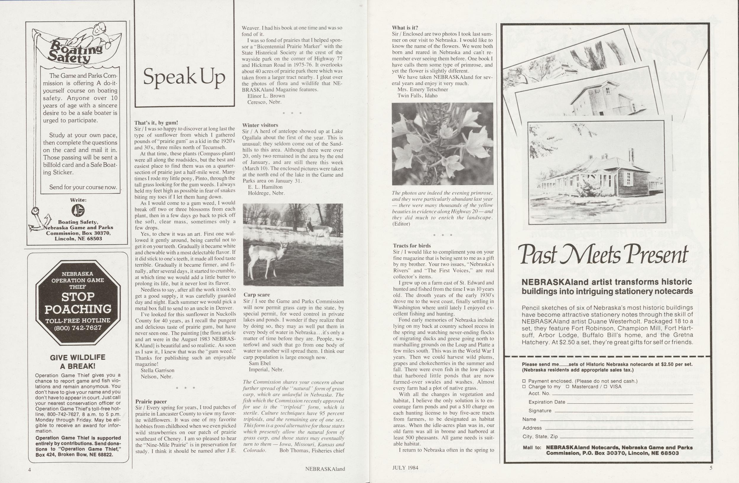
Speak Up
That's it, by gum!Sir /I was so happy to discover at long last the type of sunflower from which I gathered pounds of "prairie gum" as a kid in the 1920's and 30's, three miles north of Tecumseh.
At that time, these plants (Compass-plant) were all along the roadsides, but the best and easiest place to find them was on a quarter-section of prairie just a half-mile west. Many times I rode my little pony, Pinto, through the tall grass looking for the gum weeds. I always held my feet high as possible in fear of snakes biting my toes if I let them hang down.
As I would come to a gum weed, I would break off two or three blossoms from each plant, then in a few days go back to pick off the soft, clear mass, sometimes only a few drops.
Yes, to chew it was an art. First one wallowed it gently around, being careful not to get it on your teeth. Gradually it became white and chewable with a most delectable flavor. If it did stick to one s teeth, it made all food taste terrible. Gradually it became firmer, and finally, after several days, it started to crumble, at which time we would add a little butter to prolong its life, but it never lost its flavor.
Needless to say, after all the work it took to get a good supply, it was carefully guarded day and night. Each summer we would pick a metal box full to send to an uncle in Denver.
I've looked for this sunflower in Nuckolls County for 40 years, as I recall the pungent and delicious taste of prairie gum, but have never seen one. The painting [the flora article and art were in the August 1983 NEBRASKAland] is beautiful and so realistic. As soon as I saw it, I knew that was the "gum weed." Thanks for publishing such an enjoyable magazine!
Stella Garrison Nelson, Nebr. Prairie pacerSir / Every spring for years, I trod patches of prairie in Lancaster County to view my favorite wildflowers. It was one of my favorite hobbies from childhood when we even picked wild strawberries on our patch of prairie southeast of Cheney. I am so pleased to hear the "Nine-Mile Prairie,, is in preservation for study. I think it should be named after J.E. Weaver. I had his book at one time and was so fond of it.
I was so fond of prairies that I helped sponsor a "Bicentennial Prairie Marker" with the State Historical Society at the crest of the wayside park on the corner of Highway 77 and Hickman Road in 1975-76. It overlooks about 40 acres of prairie park there which was taken from a larger tract nearby. I gloat over the photos of flora and wildlife that NEBRASKAland Magazine features.
Elinor L. Brown Ceresco, Nebr. Winter visitorsSir / A herd of antelope showed up at Lake Ogallala about the first of the year. This is unusual; they seldom come out of the Sandhills to this area. Although there were over 20, only two remained in the area by the end of January, and are still there this week (March 10). The enclosed pictures were taken at the north end of the lake in the Game and Parks area on January 31.
E. L. Hamilton Holdrege, Nebr.Sir / I see the Game and Parks Commission will now permit grass carp in the state, by special permit, for weed control in private lakes and ponds. I wonder if they realize that by doing so, they may as well put them in every body of water in Nebraska...if s only a matter of time before they are. People, waterfowl and such that go from one body of water to another will spread them. I think our carp population is large enough now.
Sam Ebel Imperial, Nebr. The Commission shares your concern about further spread of the "natural" form of grass carp, which are unlawful in Nebraska. The fish which the Commission recently approved for use is the 'triploid' form, which is sterile. Culture techniques have 95 percent triploids, and the remaining are of one sex. This form is a good alternative for those states which presently allow the natural form of grass carp, and those states may eventually turn to them — Iowa, Missouri, Kansas and Colorado. Bob Thomas, Fisheries chief 4 NEBRASKAland What is it?Sir / Enclosed are two photos I took last summer on our visit to Nebraska. I would like to know the name of the flowers. We were both born and reared in Nebraska and cant remember ever seeing them before. One book I have calls them some type of primrose, and yet the flower is slightly different.
We have taken NEBRASKAland for several years and enjoy it very much.
Mrs. Emery Tetschner Twin Falls, IdahoThe photos are indeed the evening primrose, and they were particularly abundant last year — there were many thousands of the yellow beauties in evidence along Highway 20 — and they did much to enrich the landscape.
Sir /1 would like to compliment you on your fine magazine that is being sent to me as a gift by my brother. Your two issues, "Nebraska's Rivers" and "The First Voices," are real collector's items.
I grew up on a farm east of St. Edward and hunted and fished from the time I was 10 years old. The drouth years of the early 1930's drove me to the west coast, finally settling in Washington where until lately I enjoyed excellent fishing and hunting.
Fond early memories of Nebraska include lying on my back at country school recess in the spring and watching never-ending flocks of migrating ducks and geese going north to marshalling grounds on the Loup and Platte a few miles south. This was in the World War I years. Then we could harvest wild plums, grapes and chokecherries in the summer and fall. There were even fish in the low places that harbored little ponds that are now farmed-over swales and washes. Almost every farm had a plot of native grass.
With all the changes in vegetation and habitat, I believe the only solution is to encourage farm ponds and put a $ 10 charge on each hunting license to buy five-acre tracts from farmers, to be designated as habitat areas. When the idle-acres plan was in, our old farm was all in brome and harbored at least 500 pheasants. All game needs is suitable habitat.
I return to Nebraska often in the spring to
wander through my beloved Sandhills and to hunt Indian artifacts with my niece's husband, Ron Cruise. My last visit produced a 9,000-year-old Meserve point as a special prize.
May the short-sighted people who are plowing up the Sandhills to plant corn receive their reward in the next world.
Kenneth Matzen Seattle, Wash. Data doubterSir /I read "our" magazine each month from cover to cover and enjoy it very much, so keep up the good work.
I am at odds with the article on muzzle-loading and the balistics you quoted (September 1983). I use a Thompsen Center .50 caliber rifle for deer. I use a charge of 110 grains of FFG powder. The muzzle velocity is 2135 FPS and energy is 1883 foot-pounds. This is with a 175-grain round ball with patch.
In comparison, my 30-06 has a muzzle velocity of 2770 FPS and 2913 foot-pounds using a Super-X, 180-grain PP(Sp).
I have bagged two deer in three years with my Hawken, and both were approaching 100 yards. My last shot took out two ribs, one on each side of a large mule doe, and kept on going.
So, your figures of 455 foot-pounds at 100 yards is about 500 too low, at least for a .50 caliber with 110 grains of FFG. Also, I do not use more powder than this because it will distort the accuracy greatly.
Tim Donahue Omaha, Nebr. Good memoriesSir / After receiving NEBRASKAland, I started reading the Speak Up section; reading the letters from other readers letting their thoughts and feelings be known. Well, I really cherish your magazine. You bring back fond memories of my childhood, especially in your March 1984 issue. The article about Dead Timber Lake, the old Elkhorn River oxbow.
I used to live in Nebraska for a good many years as a child, and I have a lot of memories of the beautiful land Nebraska has to offer.
This particular article brought back some of those memories I cherish. I always spent my summers at Dead Timber and want to thank you for replenishing a homesick heart. Thank you for bringing back my childhood happiness again.
Mrs. Tammy Call Seattle, Wash. NEBRASKAland Magazine invites all readers to submit their comments, suggestions, and gripes to Speak Up. Each month the magazine will publish as many letters as space permits. Pictures are also welcome. NEBRASKAland does reserve the right to edit and condense letters. (Editor)Our name only mentions ducks. But the marshlands that we protect and restore are homes and breeding grounds for over 300 wildlife species —for many birds, fish, and mammals on the Endangered Species List.
Ducks Unlimited has preserved over 2.6 million acres of habitat—more than any other private wildlife organization. Most of our work is done in Canada, where United States Federal funds don't reach. And where 70% of North America's waterfowl are hatched.
Today, the impact of people and pollution makes our work more vital than ever. We're literally racing against time to provide perpetual habitats for North American wildlife. Please help Ducks Unlimited. We need your dollars... to help a lot more than ducks.
A minimum ten dollar tax deductible contribution to Ducks Unlimited', Inc. entitles you to a membership card, six issues of the colorful DU magazine, a Ducks Unlimited window decal, and an illustrated waterfowl identification booklet. Send your contribution to Ducks Unlimited, Inc., P.O. Box 66300, Chicago, Illinois 60666. DUCKS UNLIMITED We need your help. Now.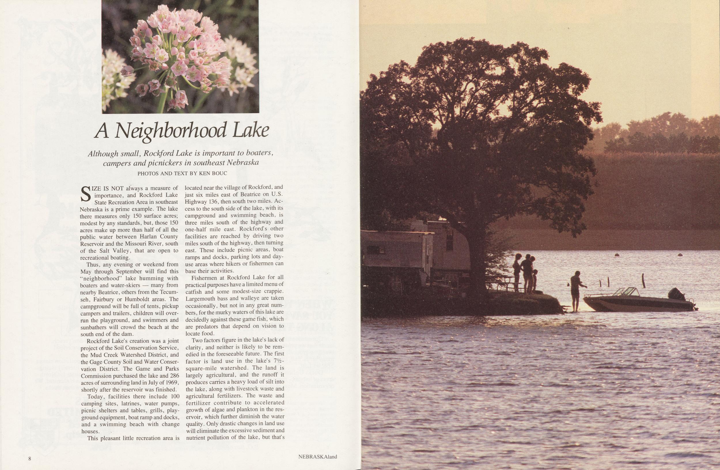
A Neighborhood Lake
Although small, Rockford Lake is important to boaters, campers and picnickers in southeast Nebraska PHOTOS AND TEXT BY KEN BOUCSIZE IS NOT always a measure of importance, and Rockford Lake State Recreation Area in southeast Nebraska is a prime example. The lake there measures only 150 surface acres; modest by any standards, but, those 150 acres make up more than half of all the public water between Harlan County Reservoir and the Missouri River, south of the Salt Valley, that are open to recreational boating.
Thus, any evening or weekend from May through September will find this "neighborhood" lake humming with boaters and water-skiers — many from nearby Beatrice, others from the Tecumseh, Fairbury or Humboldt areas. The campground will be full of tents, pickup campers and trailers, children will overrun the playground, and swimmers and sunbathers will crowd the beach at the south end of the dam.
Rockford Lake's creation was a joint project of the Soil Conservation Service, the Mud Creek Watershed District, and the Gage County Soil and Water Conservation District. The Game and Parks Commission purchased the lake and 286 acres of surrounding land in July of 1969, shortly after the reservoir was finished.
Today, facilities there include 100 camping sites, latrines, water pumps, picnic shelters and tables, grills, playground equipment, boat ramp and docks, and a swimming beach with change houses.
This pleasant little recreation area is located near the village of Rockford, and just six miles east of Beatrice on U.S. Highway 136, then south two miles. Access to the south side of the lake, with its campground and swimming beach, is three miles south of the highway and one-half mile east. Rockford's other facilities are reached by driving two miles south of the highway, then turning east. These include picnic areas, boat ramps and docks, parking lots and day-use areas where hikers or fishermen can base their activities.
Fishermen at Rockford Lake for all practical purposes have a limited menu of catfish and some modest-size crappie. Largemouth bass and walleye are taken occasionally, but not in any great numbers , for the murky waters of this lake are decidedly against these game fish, which are predators that depend on vision to locate food.
Two factors figure in the lake's lack of clarity, and neither is likely to be remedied in the foreseeable future. The first factor is land use in the lake's 7%-square-mile watershed. The land is largely agricultural, and the runoff it produces carries a heavy load of silt into the lake, along with livestock waste and agricultural fertilizers. The waste and fertilizer contribute to accelerated growth of algae and plankton in the reservoir, which further diminish the water quality. Only drastic changes in land use will eliminate the excessive sediment and nutrient pollution of the lake, but that's
8 NEBRASKAland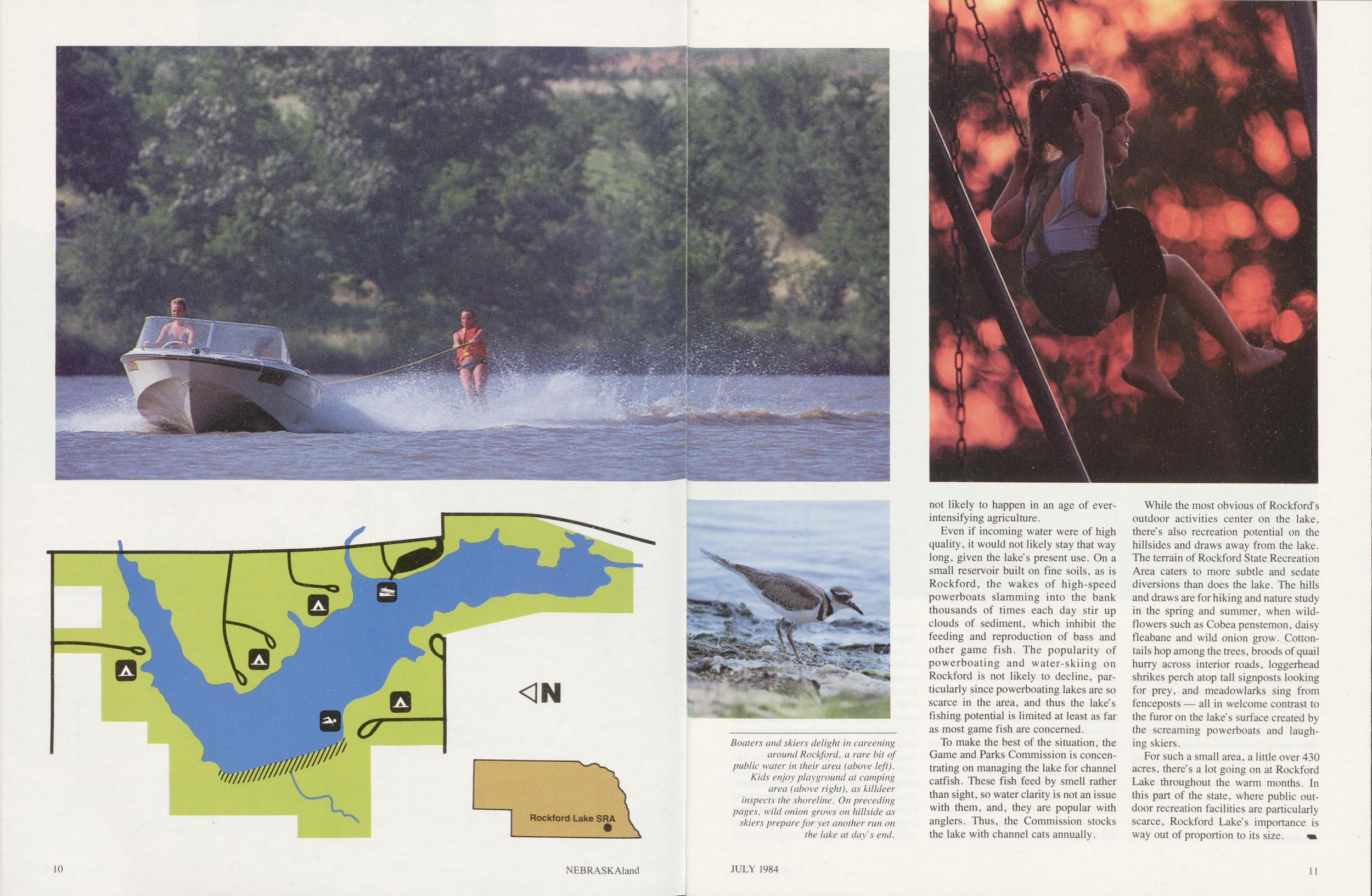
not likely to happen in an age of ever-intensifying agriculture.
Even if incoming water were of high quality, it would not likely stay that way long, given the lake's present use. On a small reservoir built on fine soils, as is Rockford, the wakes of high-speed powerboats slamming into the bank thousands of times each day stir up clouds of sediment, which inhibit the feeding and reproduction of bass and other game fish. The popularity of powerboating and water-skiing on Rockford is not likely to decline, particularly since powerboating lakes are so scarce in the area, and thus the lake's fishing potential is limited at least as far as most game fish are concerned.
To make the best of the situation, the Game and Parks Commission is concentrating on managing the lake for channel catfish. These fish feed by smell rather than sight, so water clarity is not an issue with them, and, they are popular with anglers. Thus, the Commission stocks the lake with channel cats annually.
While the most obvious of Rockford's outdoor activities center on the lake, there's also recreation potential on the hillsides and draws away from the lake. The terrain of Rockford State Recreation Area caters to more subtle and sedate diversions than does the lake. The hills and draws are for hiking and nature study in the spring and summer, when wildflowers such as Cobea penstemon, daisy fleabane and wild onion grow. Cottontails hop among the trees, broods of quail hurry across interior roads, loggerhead shrikes perch atop tall signposts looking for prey, and meadowlarks sing from fenceposts — all in welcome contrast to the furor on the lake's surface created by the screaming powerboats and laughing skiers.
For such a small area, a little over 430 acres, there's a lot going on at Rockford Lake throughout the warm months. In this part of the state, where public outdoor recreation facilities are particularly scarce, Rockford Lake's importance is way out of proportion to its size.
JULY 1984 11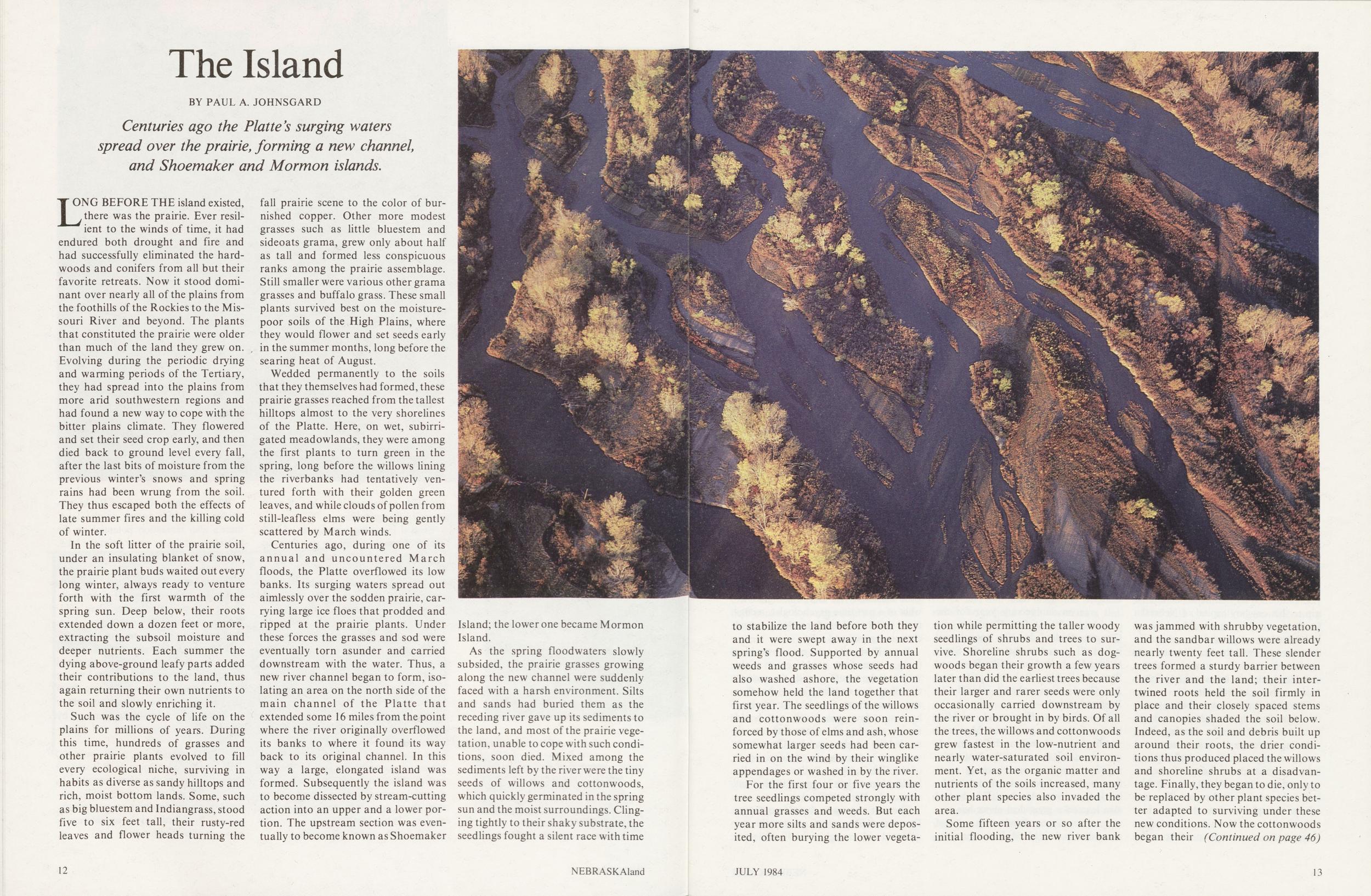
The Island
BY PAUL A. JOHNSGARD Centuries ago the Platte's surging waters spread over the prairie, forming a new channel, and Shoemaker and Mormon islands.LONG BEFORE THE island existed, there was the prairie. Ever resilient to the winds of time, it had endured both drought and fire and had successfully eliminated the hardwoods and conifers from all but their favorite retreats. Now it stood dominant over nearly all of the plains from the foothills of the Rockies to the Missouri River and beyond. The plants that constituted the prairie were older than much of the land they grew on. Evolving during the periodic drying and warming periods of the Tertiary, they had spread into the plains from more arid southwestern regions and had found a new way to cope with the bitter plains climate. They flowered and set their seed crop early, and then died back to ground level every fall, after the last bits of moisture from the previous winter's snows and spring rains had been wrung from the soil. They thus escaped both the effects of late summer fires and the killing cold of winter.
In the soft litter of the prairie soil, under an insulating blanket of snow, the prairie plant buds waited out every long winter, always ready to venture forth with the first warmth of the spring sun. Deep below, their roots extended down a dozen feet or more, extracting the subsoil moisture and deeper nutrients. Each summer the dying above-ground leafy parts added their contributions to the land, thus again returning their own nutrients to the soil and slowly enriching it.
Such was the cycle of life on the plains for millions of years. During this time, hundreds of grasses and other prairie plants evolved to fill every ecological niche, surviving in habits as diverse as sandy hilltops and rich, moist bottom lands. Some, such as big bluestem and Indiangrass, stood five to six feet tall, their rusty-red leaves and flower heads turning the fall prairie scene to the color of burnished copper. Other more modest grasses such as little bluestem and sideoats grama, grew only about half as tall and formed less conspicuous ranks among the prairie assemblage. Still smaller were various other grama grasses and buffalo grass. These small plants survived best on the moisture-poor soils of the High Plains, where they would flower and set seeds early in the summer months, long before the searing heat of August.
Wedded permanently to the soils that they themselves had formed, these prairie grasses reached from the tallest hilltops almost to the very shorelines of the Platte. Here, on wet, subirrigated meadowlands, they were among the first plants to turn green in the spring, long before the willows lining the riverbanks had tentatively ventured forth with their golden green leaves, and while clouds of pollen from still-leafless elms were being gently scattered by March winds.
Centuries ago, during one of its annual and uncountered March floods, the Platte overflowed its low banks. Its surging waters spread out aimlessly over the sodden prairie, carrying large ice floes that prodded and ripped at the prairie plants. Under these forces the grasses and sod were eventually torn asunder and carried downstream with the water. Thus, a new river channel began to form, isolating an area on the north side of the main channel of the Platte that extended some 16 miles from the point where the river originally overflowed its banks to where it found its way back to its original channel. In this way a large, elongated island was formed. Subsequently the island was to become dissected by stream-cutting action into an upper and a lower portion. The upstream section was eventually to become known as Shoemaker Island; the lower one became Mormon Island.
As the spring floodwaters slowly subsided, the prairie grasses growing along the new channel were suddenly faced with a harsh environment. Silts and sands had buried them as the receding river gave up its sediments to the land, and most of the prairie vegetation, unable to cope with such conditions, soon died. Mixed among the sediments left by the river were the tiny seeds of willows and cottonwoods, which quickly germinated in the spring sun and the moist surroundings. Clinging tightly to their shaky substrate, the seedlings fought a silent race with time
12 NEBRASKAlandto stabilize the land before both they and it were swept away in the next spring's flood. Supported by annual weeds and grasses whose seeds had also washed ashore, the vegetation somehow held the land together that first year. The seedlings of the willows and cottonwoods were soon reinforced by those of elms and ash, whose somewhat larger seeds had been carried in on the wind by their winglike appendages or washed in by the river.
For the first four or five years the tree seedlings competed strongly with annual grasses and weeds. But each year more silts and sands were deposited, often burying the lower vegetation while permitting the taller woody seedlings of shrubs and trees to survive. Shoreline shrubs such as dog- woods began their growth a few years later than did the earliest trees because their larger and rarer seeds were only occasionally carried downstream by the river or brought in by birds. Of all the trees, the willows and cottonwoods grew fastest in the low-nutrient and nearly water-saturated soil environment. Yet, as the organic matter and nutrients of the soils increased, many other plant species also invaded the area.
Some fifteen years or so after the initial flooding, the new river bank was jammed with shrubby vegetation, and the sandbar willows were already nearly twenty feet tall. These slender trees formed a sturdy barrier between the river and the land; their intertwined roots held the soil firmlv in place and their closely spaced stems and canopies shaded the soil below. Indeed, as the soil and debris built up around their roots, the drier conditions thus produced placed the willows and shoreline shrubs at a disadvantage. Finally, they began to die, only to be replaced by other plant species better adapted to surviving under these new conditions. Now the cottonwoods began their
(Continued on page 46) JULY 1984 13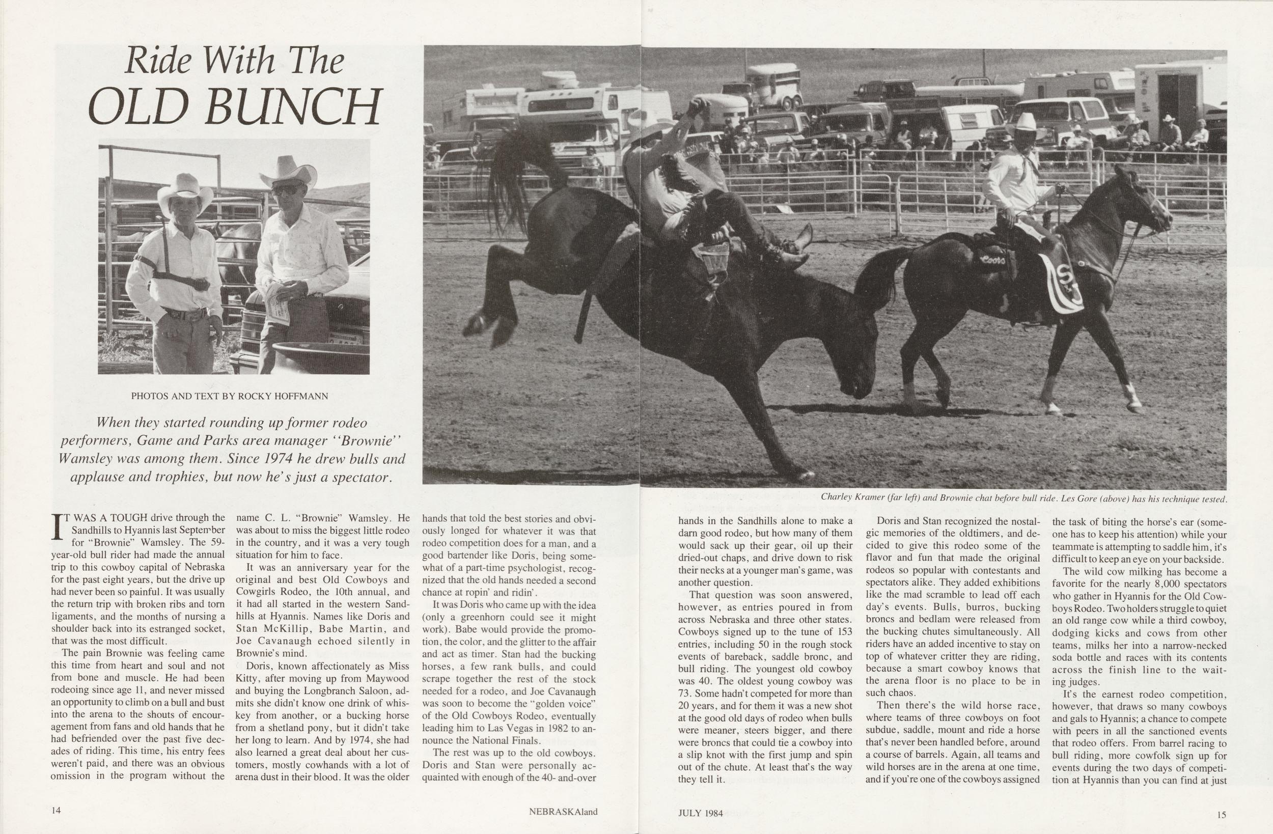
Ride With The OLD BUNCH
When they started rounding up former rodeo performers, Game and Parks area manager "Brownie" Wamsley was among them. Since 1974 he drew bulls and applause and trophies, but now he s just a spectator.
IT WAS A TOUGH drive through the Sandhills to Hyannis last September for "Brownie" Wamsley. The 59-year-old bull rider had made the annual trip to this cowboy capital of Nebraska for the past eight years, but the drive up had never been so painful. It was usually the return trip with broken ribs and torn ligaments, and the months of nursing a shoulder back into its estranged socket, that was the most difficult.
The pain Brownie was feeling came this time from heart and soul and not from bone and muscle. He had been rodeoing since age 11, and never missed an opportunity to climb on a bull and bust into the arena to the shouts of encouragement from fans and old hands that he had befriended over the past five decades of riding. This time, his entry fees weren't paid, and there was an obvious omission in the program without the name C. L. "Brownie" Wamsley. He was about to miss the biggest little rodeo in the country, and it was a very tough situation for him to face.
It was an anniversary year for the original and best Old Cowboys and Cowgirls Rodeo, the 10th annual, and it had all started in the western Sandhills at Hyannis. Names like Doris and Stan McKillip, Babe Martin, and Joe Cavanaugh echoed silently in Brownie's mind.
Doris, known affectionately as Miss Kitty, after moving up from May wood and buying the Longbranch Saloon, admits she didn't know one drink of whiskey from another, or a bucking horse from a Shetland pony, but it didn't take her long to learn. And by 1974, she had also learned a great deal about her customers, mostly cowhands with a lot of arena dust in their blood. It was the older hands that told the best stories and obviously longed for whatever it was that rodeo competition does for a man, and a good bartender like Doris, being somewhat of a part-time psychologist, recognized that the old hands needed a second chance at ropin' and ridin'.
It was Doris who came up with the idea (only a greenhorn could see it might work). Babe would provide the promotion, the color, and the glitter to the affair and act as timer. Stan had the bucking horses, a few rank bulls, and could scrape together the rest of the stock needed for a rodeo, and Joe Cavanaugh was soon to become the "golden voice" of the Old Cowboys Rodeo, eventually leading him to Las Vegas in 1982 to announce the National Finals.
The rest was up to the old cowboys. Doris and Stan were personally acquainted with enough of the 40- and-over
14 NEBRASKAlandCharley Kramer (far left) and Brownie chat before bull ride. Les Gore (above) has his technique tested.
hands in the Sandhills alone to make a darn good rodeo, but how many of them would sack up their gear, oil up their dried-out chaps, and drive down to risk their necks at a younger man's game, was another question.
That question was soon answered, however, as entries poured in from across Nebraska and three other states. Cowboys signed up to the tune of 153 entries, including 50 in the rough stock events of bareback, saddle bronc, and bull riding. The youngest old cowboy was 40. The oldest young cowboy was 73. Some hadn't competed for more than 20 years, and for them it was a new shot at the good old days of rodeo when bulls were meaner, steers bigger, and there were broncs that could tie a cowboy into a slip knot with the first jump and spin out of the chute. At least that's the way they tell it.
Doris and Stan recognized the nostalgic memories of the oldtimers, and decided to give this rodeo some of the flavor and fun that made the original rodeos so popular with contestants and spectators alike. They added exhibitions like the mad scramble to lead off each day's events. Bulls, burros, bucking broncs and bedlam were released from the bucking chutes simultaneously. All riders have an added incentive to stay on top of whatever critter they are riding, because a smart cowboy knows that the arena floor is no place to be in such chaos.
Then there's the wild horse race, where teams of three cowboys on foot subdue, saddle, mount and ride a horse that's never been handled before, around a course of barrels. Again, all teams and wild horses are in the arena at one time, and if you're one of the cowboys assigned the task of biting the horse's ear (someone has to keep his attention) while your teammate is attempting to saddle him, it's difficult to keep an eye on your backside.
The wild cow milking has become a favorite for the nearly 8,000 spectators who gather in Hyannis for the Old Cowboys Rodeo. Two holders struggle to quiet an old range cow while a third cowboy, dodging kicks and cows from other teams, milks her into a narrow-necked soda bottle and races with its contents across the finish line to the waiting judges.
It's the earnest rodeo competition, however, that draws so many cowboys and gals to Hyannis; a chance to compete with peers in all the sanctioned events that rodeo offers. From barrel racing to bull riding, more cowfolk sign up for events during the two days of competition at Hyannis than you can find at just
JULY 1984 15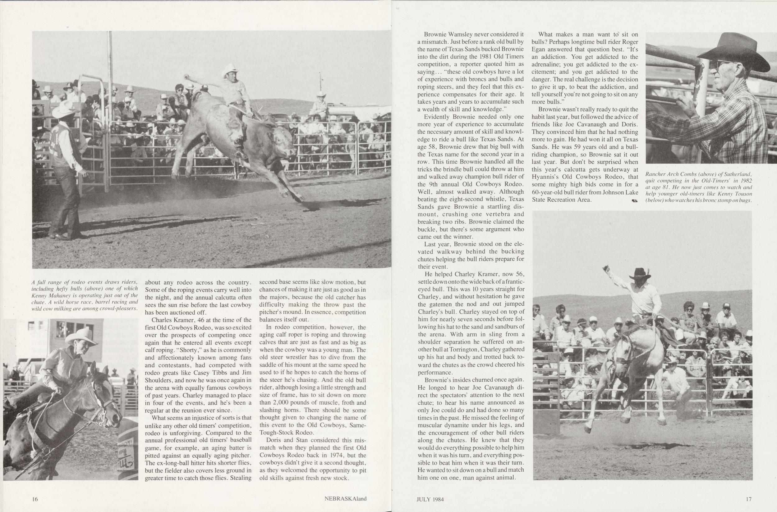
A full range of rodeo events draws riders, including hefty bulls (above) one of which Kenny Mahaney is operating just out of the chute. A wild horse race, barrel racing and wild cow milking are among crowd-pleasers.
about any rodeo across the country. Some of the roping events carry well into the night, and the annual Calcutta often sees the sun rise before the last cowboy has been auctioned off.
Charles Kramer, 46 at the time of the first Old Cowboys Rodeo, was so excited over the prospects of competing once again that he entered all events except calf roping. " Shorty," as he is commonly and affectionately known among fans and contestants, had competed with rodeo greats like Casey Tibbs and Jim Shoulders, and now he was once again in the arena with equally famous cowboys of past years. Charley managed to place in four of the events, and he's been a regular at the reunion ever since.
What seems an injustice of sorts is that unlike any other old timers' competition, rodeo is unforgiving. Compared to the annual professional old timers' baseball game, for example, an aging batter is pitted against an equally aging pitcher. The ex-long-ball hitter hits shorter flies, but the fielder also covers less ground in greater time to catch those flies. Stealing second base seems like slow motion, but chances of making it are just as good as in the majors, because the old catcher has difficulty making the throw past the pitcher's mound. In essence, competition balances itself out.
In rodeo competition, however, the aging calf roper is roping and throwing calves that are just as fast and as big as when the cowboy was a young man. The old steer wrestler has to dive from the saddle of his mount at the same speed he used to if he hopes to catch the horns of the steer he's chasing. And the old bull rider, although losing a little strength and size of frame, has to sit down on more than 2,000 pounds of muscle, froth and slashing horns. There should be some thought given to changing the name of this event to the Old Cowboys, Same-Tough-Stock Rodeo.
Doris and Stan considered this mismatch when they planned the first Old Cowboys Rodeo back in 1974, but the cowboys didn t give it a second thought, as they welcomed the opportunity to pit old skills against fresh new stock.
16 NEBRASKAlandBrownie Wamsley never considered it a mismatch. Just before a rank old bull by the name of Texas Sands bucked Brownie into the dirt during the 1981 Old Timers competition, a reporter quoted him as saying... "these old cowboys have a lot of experience with broncs and bulls and roping steers, and they feel that this experience compensates for their age. It takes years and years to accumulate such a wealth of skill and knowledge."
Evidently Brownie needed only one more year of experience to accumulate the necessary amount of skill and knowledge to ride a bull like Texas Sands. At age 58, Brownie drew that big bull with the Texas name for the second year in a row. This time Brownie handled all the tricks the brindle bull could throw at him and walked away champion bull rider of the 9th annual Old Cowboys Rodeo. Well, almost walked away. Although beating the eight-second whistle, Texas Sands gave Brownie a startling dismount, crushing one vertebra and breaking two ribs. Brownie claimed the buckle, but there's some argument who came out the winner.
Last year, Brownie stood on the elevated walkway behind the bucking chutes helping the bull riders prepare for their event.
He helped Charley Kramer, now 56, settle down onto the wide back of a frantic-eyed bull. This was 10 years straight for Charley, and without hesitation he gave the gatemen the nod and out jumped Charley's bull. Charley stayed on top of him for nearly seven seconds before following his hat to the sand and sandburs of the arena. With arm in sling from a shoulder separation he suffered on another bull at Torrington, Charley gathered up his hat and body and trotted back toward the chutes as the crowd cheered his performance.
Brownie's insides churned once again. He longed to hear Joe Cavanaugh direct the spectators' attention to the next chute; to hear his name announced as only Joe could do and had done so many times in the past. He missed the feeling of muscular dynamite under his legs, and the encouragement of other bull riders along the chutes. He knew that they would do everything possible to help him when it was his turn, and everything possible to beat him when it was their turn. He wanted to sit down on a bull and match him one on one, man against animal.
What makes a man want to sit on bulls? Perhaps longtime bull rider Roger Egan answered that question best. "It's an addiction. You get addicted to the adrenaline; you get addicted to the excitement; and you get addicted to the danger. The real challenge is the decision to give it up, to beat the addiction, and tell yourself you're not going to sit on any more bulls."
Brownie wasn't really ready to quit the habit last year, but followed the advice of friends like Joe Cavanaugh and Doris. They convinced him that he had nothing more to gain. He had won it all on Texas Sands. He was 59 years old and a bull-riding champion, so Brownie sat it out last year. But don't be surprised when this year's Calcutta gets underway at Hyannis's Old Cowboys Rodeo, that some mighty high bids come in for a 60-year-old bull rider from Johnson Lake State Recreation Area.
Tragedy on the Trail
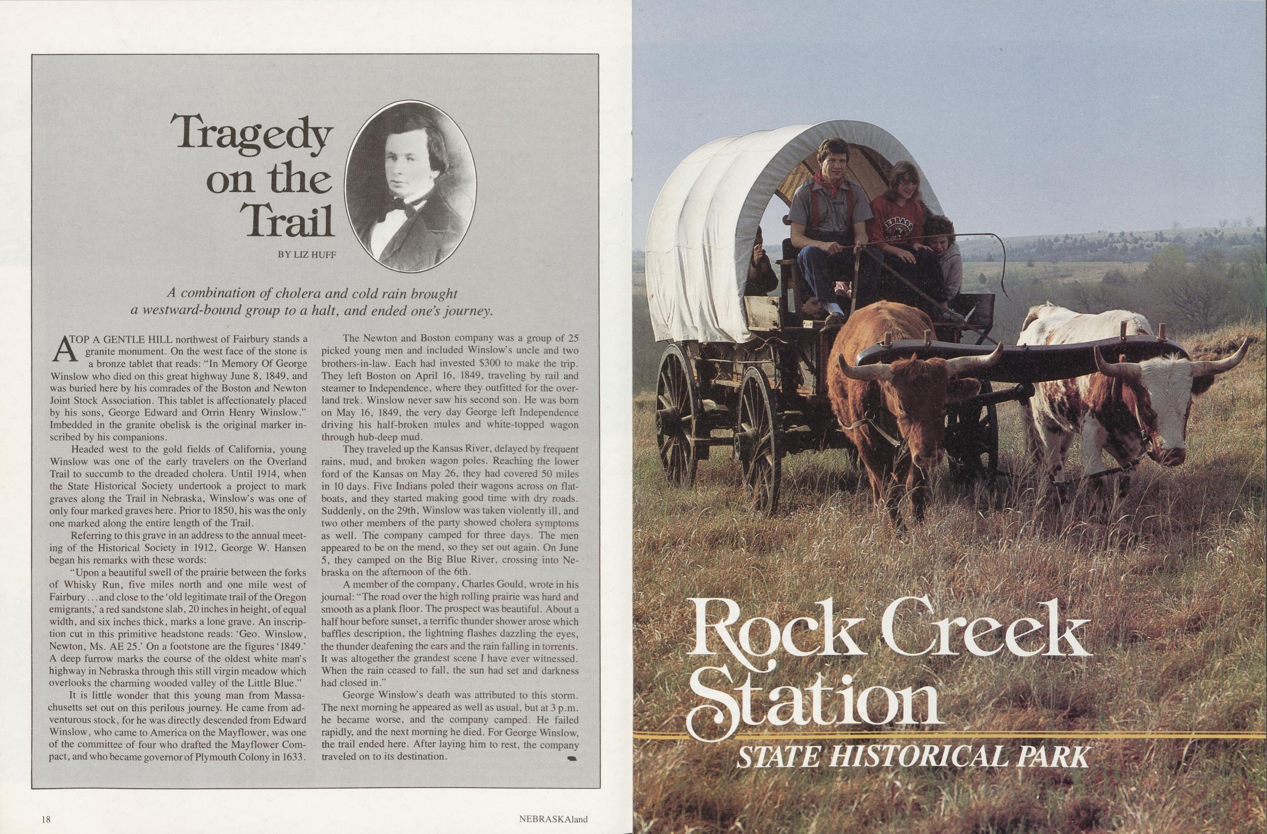
BY LIZ HUFF A combination of cholera and cold rain brought a westward-bound group to a halt, and ended ones journey.ATOP A GENTLE HILL northwest of Fairbury stands a granite monument. On the west face of the stone is a bronze tablet that reads: "In Memory Of George Winslow who died on this great highway June 8, 1849, and was buried here by his comrades of the Boston and Newton Joint Stock Association. This tablet is affectionately placed by his sons, George Edward and Orrin Henry Winslow." Imbedded in the granite obelisk is the original marker inscribed by his companions.
Headed west to the gold fields of California, young Winslow was one of the early travelers on the Overland Trail to succumb to the dreaded cholera. Until 1914, when the State Historical Society undertook a project to mark graves along the Trail in Nebraska, Winslow's was one of only four marked graves here. Prior to 1850, his was the only one marked along the entire length of the Trail. Referring to this grave in an address to the annual meeting of the Historical Society in 1912, George W. Hansen began his remarks with these words:
"Upon a beautiful swell of the prairie between the forks of Whisky Run, five miles north and one mile west of Fairbury... and close to the 4old legitimate trail of the Oregon emigrants,' a red sandstone slab, 20 inches in height, of equal width, and six inches thick, marks a lone grave. An inscription cut in this primitive headstone reads: 'Geo. Winslow, Newton, Ms. AE 25.' On a footstone are the figures '1849.' A deep furrow marks the course of the oldest white man's highway in Nebraska through this still virgin meadow which overlooks the charming wooded valley of the Little Blue."
It is little wonder that this young man from Massachusetts set out on this perilous journey. He came from adventurous stock, for he was directly descended from Edward Winslow, who came to America on the Mayflower, was one of the committee of four who drafted the Mayflower Compact, and who became governor of Plymouth Colony in 1633.
The Newton and Boston company was a group of 25 picked young men and included Winslow's uncle and two brothers-in-law. Each had invested $300 to make the trip. They left Boston on April 16, 1849, traveling by rail and steamer to Independence, where they outfitted for the overland trek. Winslow never saw his second son. He was born on May 16, 1849, the very day George left Independence driving his half-broken mules and white-topped wagon through hub-deep mud.
They traveled up the Kansas River, delayed by frequent rains, mud, and broken wagon poles. Reaching the lower ford of the Kansas on May 26, they had covered 50 miles in 10 days. Five Indians poled their wagons across on flatboats, and they started making good time with dry roads. Suddenly, on the 29th, Winslow was taken violently ill, and two other members of the party showed cholera symptoms as well. The company camped for three days. The men appeared to be on the mend, so they set out again. On June 5, they camped on the Big Blue River, crossing into Nebraska on the afternoon of the 6th.
A member of the company, Charles Gould, wrote in his journal: "The road over the high rolling prairie was hard and smooth as a plank floor. The prospect was beautiful. About a half hour before sunset, a terrific thunder shower arose which baffles description, the lightning flashes dazzling the eyes, the thunder deafening the ears and the rain falling in torrents. It was altogether the grandest scene I have ever witnessed. When the rain ceased to fall, the sun had set and darkness had closed in."
George Winslow's death was attributed to this storm. The next morning he appeared as well as usual, but at 3 p.m. he became worse, and the company camped. He failed rapidly, and the next morning he died. For George Winslow, the trail ended here. After laying him to rest, the company traveled on to its destination.
18 NEBRASKAlandRock Creek Station
State Historical Park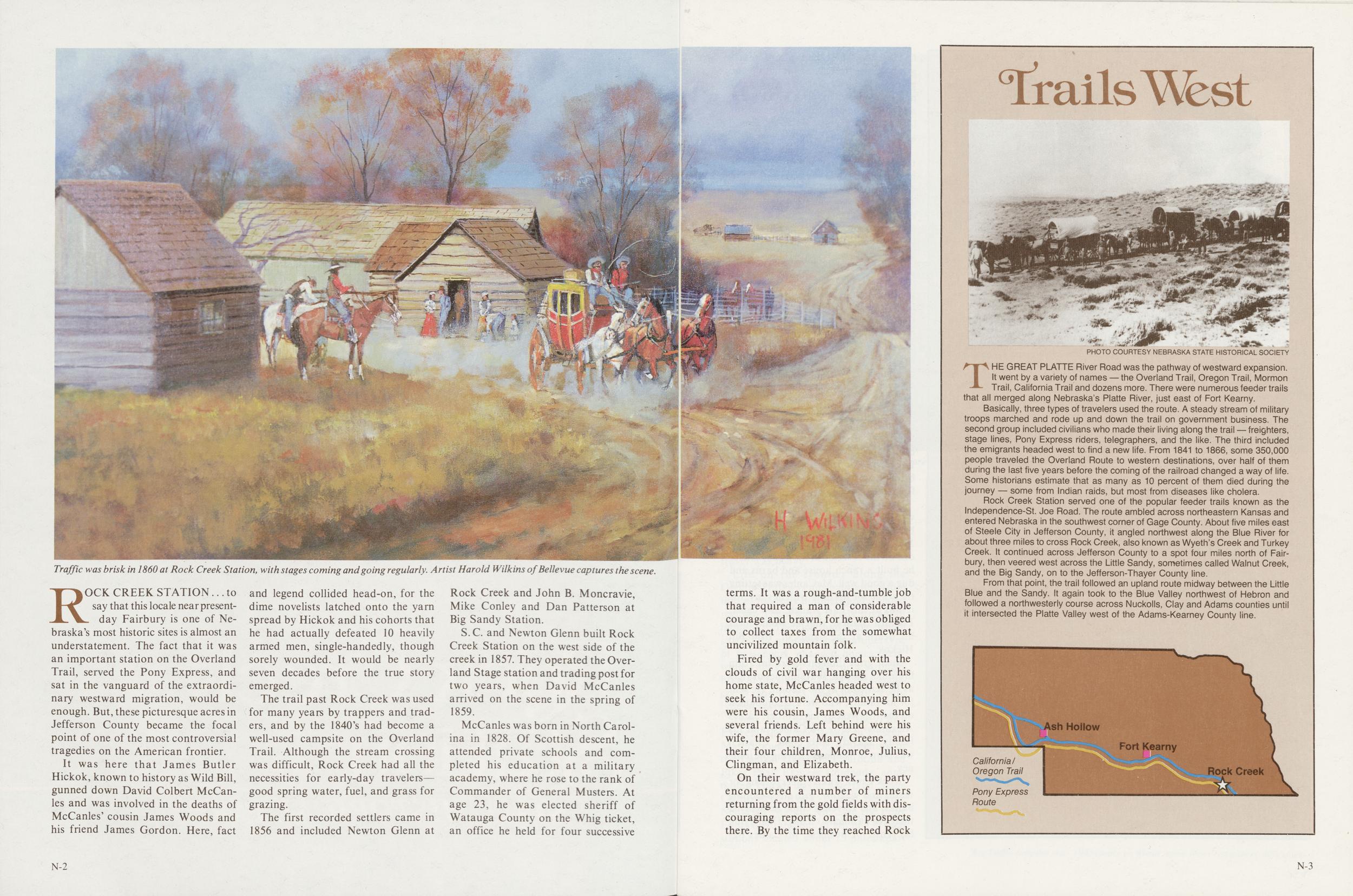
Traffic was brisk in 1860 at Rock Creek Station, with stages coming and going regularly. Artist Harold Wilkins of Bellevue captures the scene.
ROCK CREEK STATION ... to say that this locale near present-day Fairbury is one of Nebraska's most historic sites is almost an understatement. The fact that it was an important station on the Overland Trail, served the Pony Express, and sat in the vanguard of the extraordinary westward migration, would be enough. But, these picturesque acres in Jefferson County became the focal point of one of the most controversial tragedies on the American frontier.
It was here that James Butler Hickok, known to history as Wild Bill, gunned down David Colbert McCanles and was involved in the deaths of McCanles' cousin James Woods and his friend James Gordon. Here, fact and legend collided head-on, for the dime novelists latched onto the yarn spread by Hickok and his cohorts that he had actually defeated 10 heavily armed men, single-handedly, though sorely wounded. It would be nearly seven decades before the true story emerged.
The trail past Rock Creek was used for many years by trappers and traders, and by the 1840's had become a well-used campsite on the Overland Trail. Although the stream crossing was difficult, Rock Creek had all the necessities for early-day travelers—good spring water, fuel, and grass for grazing.
The first recorded settlers came in 1856 and included Newton Glenn at Rock Creek and John B. Moncravie, Mike Conley and Dan Patterson at Big Sandy Station.
S.C. and Newton Glenn built Rock Creek Station on the west side of the creek in 1857. They operated the Overland Stage station and trading post for two years, when David McCanles arrived on the scene in the spring of 1859.
McCanles was born in North Carolina in 1828. Of Scottish descent, he attended private schools and completed his education at a military academy, where he rose to the rank of Commander of General Musters. At age 23, he was elected sheriff of Watauga County on the Whig ticket, an office he held for four successive
N-2terms. It was a rough-and-tumble job that required a man of considerable courage and brawn, for he was obliged to collect taxes from the somewhat uncivilized mountain folk.
Fired by gold fever and with the clouds of civil war hanging over his home state, McCanles headed west to seek his fortune. Accompanying him were his cousin, James Woods, and several friends. Left behind were his wife, the former Mary Greene, and their four children, Monroe, Julius, Clingman, and Elizabeth.
On their westward trek, the party encountered a number of miners returning from the gold fields with discouraging reports on the prospects there. By the time they reached Rock
THE GREAT PLATTE River Road was the pathway of westward expansion. It went by a variety of names — the Overland Trail, Oregon Trail, Mormon Trail, California Trail and dozens more. There were numerous feeder trails that all merged along Nebraska's Platte River, just east of Fort Kearny.
Basically, three types of travelers used the route. A steady stream of military troops marched and rode up and down the trail on government business. The second group included civilians who made their living along the trail — freighters, stage lines, Pony Express riders, telegraphers, and the like. The third included the emigrants headed west to find a new life. From 1841 to 1866, some 350,000 people traveled the Overland Route to western destinations, over half of them during the last five years before the coming of the railroad changed a way of life. Some historians estimate that as many as 10 percent of them died during the journey — some from Indian raids, but most from diseases like cholera.
Rock Creek Station served one of the popular feeder trails known as the Independence-St. Joe Road. The route ambled across northeastern Kansas and entered Nebraska in the southwest corner of Gage County. About five miles east of Steele City in Jefferson County, it angled northwest along the Blue River for about three miles to cross Rock Creek, also known as Wyeth's Creek and Turkey Creek. It continued across Jefferson County to a spot four miles north of Fairbury, then veered west across the Little Sandy, sometimes called Walnut Creek, and the Big Sandy, on to the Jefferson-Thayer County line.
From that point, the trail followed an upland route midway between the Little Blue and the Sandy. It again took to the Blue Valley northwest of Hebron and followed a northwesterly course across Nuckolls, Clay and Adams counties until it intersected the Platte Valley west of the Adams-Kearney County line.
Ash Hollow California/ Oregon Trail Pony Express Route Fort Kearny Rock Creek
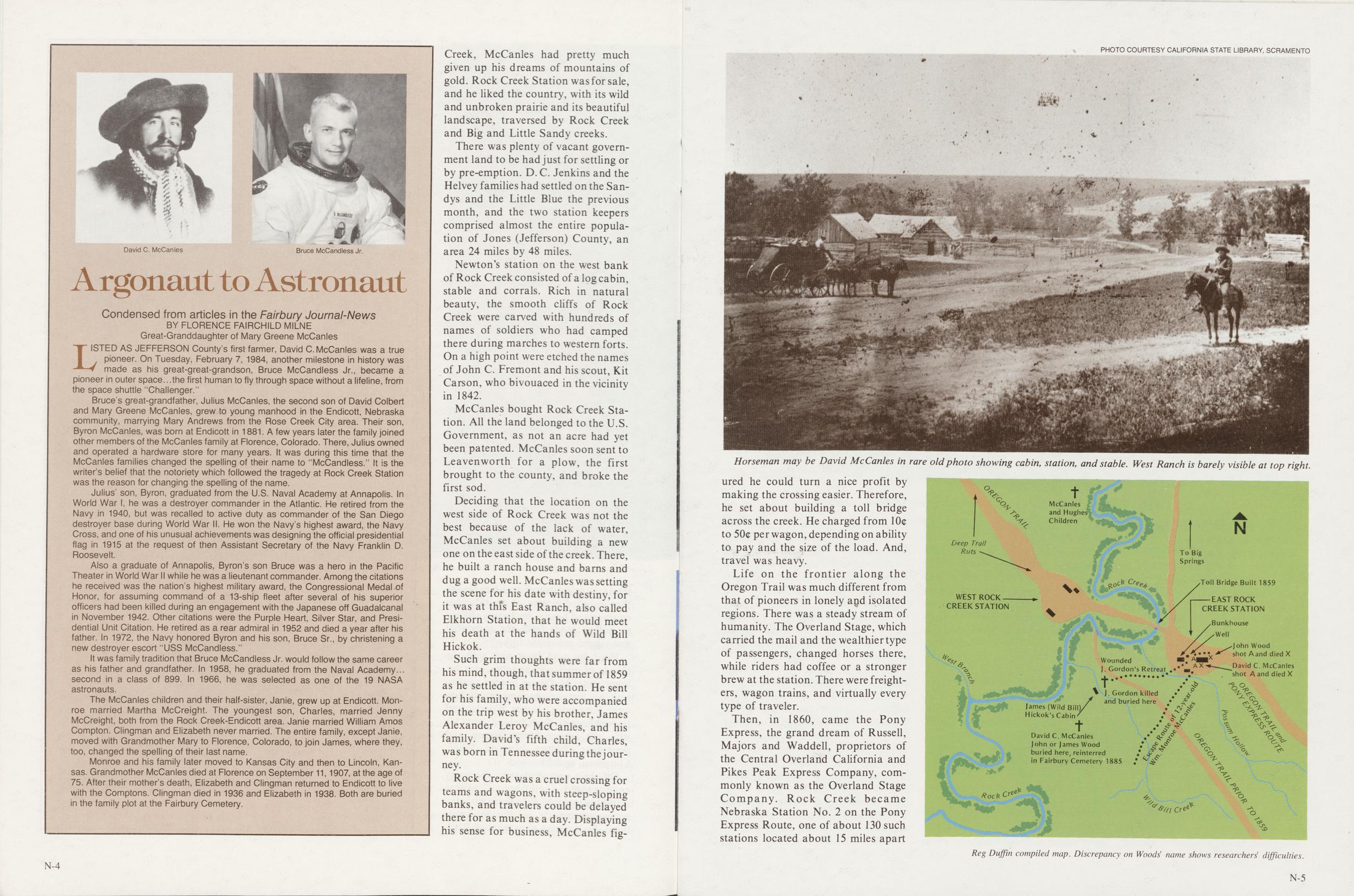
David C. McCanles
Bruce McCandless Jr.
LISTED AS JEFFERSON County's first farmer, David C. McCanles was a true pioneer. On Tuesday, February 7, 1984, another milestone in history was made as his great-great-grandson, Bruce McCandless Jr., became a pioneer in outer space...the first human to fly through space without a lifeline, from the space shuttle "Challenger."
Bruce's great-grandfather, Julius McCanles, the second son of David Colbert and Mary Greene McCanles, grew to young manhood in the Endicott, Nebraska community, marrying Mary Andrews from the Rose Creek City area. Their son, Byron McCanles, was born at Endicott in 1881. A few years later the family joined other members of the McCanles family at Florence, Colorado. There, Julius owned and operated a hardware store for many years. It was during this time that the McCanles families changed the spelling of their name to "McCandless." It is the writer's belief that the notoriety which followed the tragedy at Rock Creek Station was the reason for changing the spelling of the name.
Julius' son, Byron, graduated from the U.S. Naval Academy at Annapolis. In World War I, he was a destroyer commander in the Atlantic. He retired from the Navy in 1940, but was recalled to active duty as commander of the San Diego destroyer base during World War II. He won the Navy's highest award, the Navy Cross, and one of his unusual achievements was designing the official presidential flag in 1915 at the request of then Assistant Secretary of the Navy Franklin D. Roosevelt.
Also a graduate of Annapolis, Byron's son Bruce was a hero in the Pacific Theater in World War II while he was a lieutenant commander. Among the citations he received was the nation's highest military award, the Congressional Medal of Honor, for assuming command of a 13-ship fleet after several of his superior officers had been killed during an engagement with the Japanese off Guadalcanal in November 1942. Other citations were the Purple Heart, Silver Star, and Presidential Unit Citation. He retired as a rear admiral in 1952 and died a year after his father. In 1972, the Navy honored Byron and his son, Bruce Sr., by christening a new destroyer escort "USS McCandless."
It was family tradition that Bruce McCandless Jr. would follow the same career as his father and grandfather. In 1958, he graduated from the Naval Academy... second in a class of 899. In 1966, he was selected as one of the 19 NASA astronauts.
The McCanles children and their half-sister, Janie, grew up at Endicott. Monroe married Martha McCreight. The youngest son, Charles, married Jenny McCreight, both from the Rock Creek-Endicott area. Janie married William Amos Compton. Clingman and Elizabeth never married. The entire family, except Janie, moved with Grandmother Mary to Florence, Colorado, to join James, where they, too, changed the spelling of their last name.
Monroe and his family later moved to Kansas City and then to Lincoln, Kansas. Grandmother McCanles died at Florence on September 11,1907, at the age of 75. After their mother's death, Elizabeth and Clingman returned to Endicott to live with the Comptons. Clingman died in 1936 and Elizabeth in 1938. Both are buried in the family plot at the Fairbury Cemetery.
Creek, McCanles had pretty much given up his dreams of mountains of gold. Rock Creek Station was for sale, and he liked the country, with its wild and unbroken prairie and its beautiful landscape, traversed by Rock Creek and Big and Little Sandy creeks.
There was plenty of vacant government land to be had just for settling or by pre-emption. D. C. Jenkins and the Helvey families had settled on the Sandys and the Little Blue the previous month, and the two station keepers comprised almost the entire population of Jones (Jefferson) County, an area 24 miles by 48 miles.
Newton's station on the west bank of Rock Creek consisted of a log cabin, stable and corrals. Rich in natural beauty, the smooth cliffs of Rock Creek were carved with hundreds of names of soldiers who had camped there during marches to western forts. On a high point were etched the names of John C. Fremont and his scout, Kit Carson, who bivouaced in the vicinity in 1842.
McCanles bought Rock Creek Station. All the land belonged to the U.S. Government, as not an acre had yet been patented. McCanles soon sent to Leavenworth for a plow, the first brought to the county, and broke the first sod.
Deciding that the location on the west side of Rock Creek was not the best because of the lack of water, McCanles set about building a new one on the east side of the creek. There, he built a ranch house and barns and dug a good well. McCanles was setting the scene for his date with destiny, for it was at this East Ranch, also called Elkhorn Station, that he would meet his death at the hands of Wild Bill Hickok.
Such grim thoughts were far from his mind, though, that summer of 1859 as he settled in at the station. He sent for his family, who were accompanied on the trip west by his brother, James Alexander Leroy McCanles, and his family. David's fifth child, Charles, was born in Tennessee during the journey.
Rock Creek was a cruel crossing for teams and wagons, with steep-sloping banks, and travelers could be delayed there for as much as a day. Displaying his sense for business, McCanles figured
N-4 PHOTO COURTESY CALIFORNIA STATE LIBRARY, SCRAMENTOHorseman may be David McCanles in rare old photo showing cabin, station, and stable. West Ranch is barely visible at top right.
he could turn a nice profit by making the crossing easier. Therefore, he set about building a toll bridge across the creek. He charged from 10c to 50c per wagon, depending on ability to pay and the size of the load. And, travel was heavy.
Life on the frontier along the Oregon Trail was much different from that of pioneers in lonely and isolated regions. There was a steady stream of humanity. The Overland Stage, which carried the mail and the wealthier type of passengers, changed horses there, while riders had coffee or a stronger brew at the station. There were freighters, wagon trains, and virtually every type of traveler.
Then, in 1860, came the Pony Express, the grand dream of Russell, Majors and Waddell, proprietors of the Central Overland California and Pikes Peak Express Company, commonly known as the Overland Stage Company. Rock Creek became Nebraska Station No. 2 on the Pony Express Route, one of about 130 such stations located about 15 miles apart
McCanles and Hughes Children Deep Trail Ruts To Big Springs WEST ROCK CREEK STATION James (Wild Bill), Hickok's Cabin Wounded Gordon's Retreat J. Gordon killed and buried here Toll Bridge Built 1859 EAST ROCK CREEK STATION Bunkhouse Well shot A and died X David C McCanles shot A and died David C McCanles John or James Wood buried here, reinterred in Fairbury Cemetery 1885 Reg Duffin compiled map. Discrepancy on Woods name shows researchers difficulties.
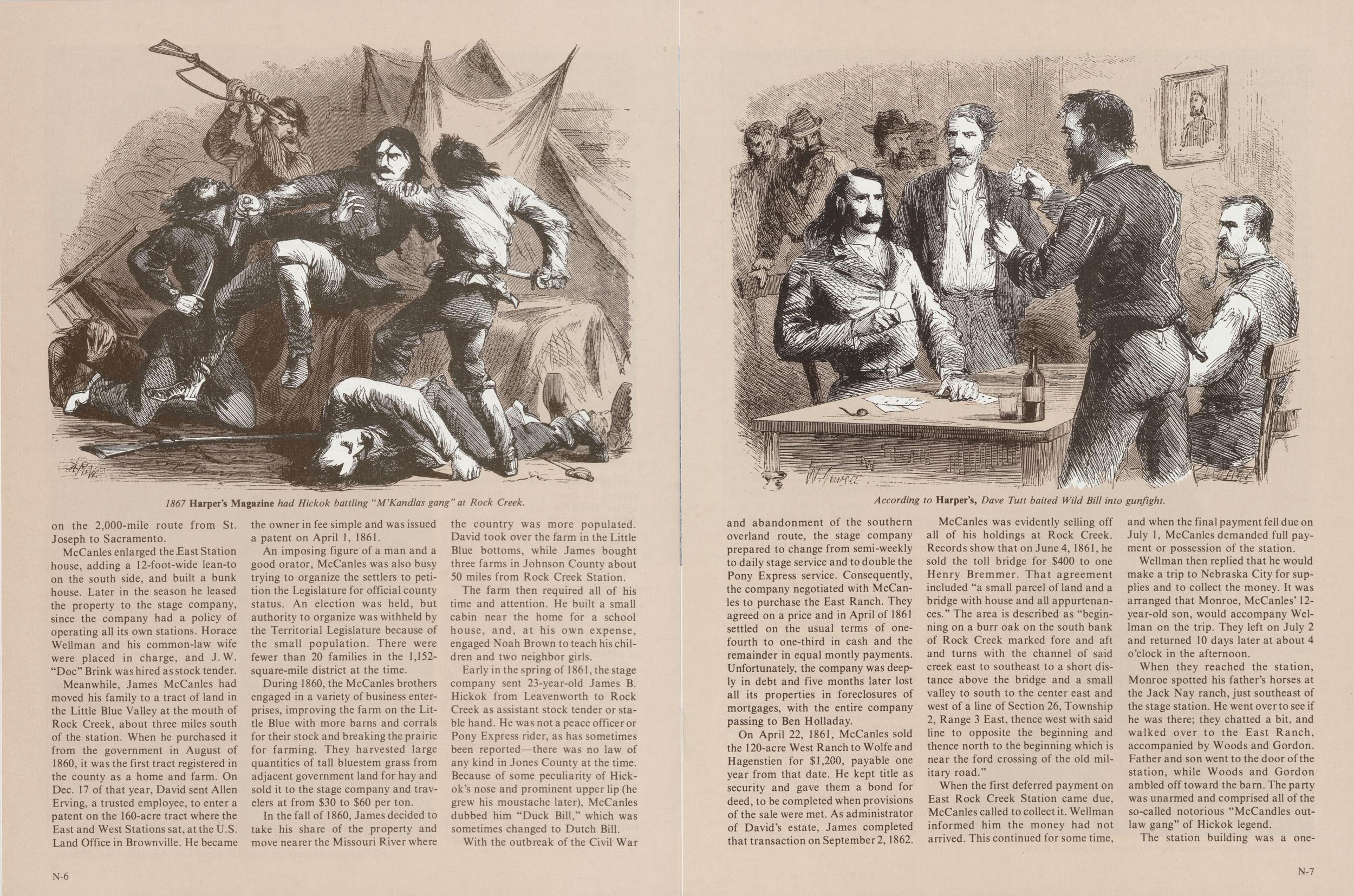
1867 Harper's Magazine had Hickok battling "M'Kandlas gang" at Rock Creek.
on the 2,000-mile route from St. Joseph to Sacramento.
McCanles enlarged the East Station house, adding a 12-foot-wide lean-to on the south side, and built a bunk house. Later in the season he leased the property to the stage company, since the company had a policy of operating all its own stations. Horace Wellman and his common-law wife were placed in charge, and J.W. "Doc" Brink was hired as stock tender.
Meanwhile, James McCanles had moved his family to a tract of land in the Little Blue Valley at the mouth of Rock Creek, about three miles south of the station. When he purchased it from the government in August of 1860, it was the first tract registered in the county as a home and farm. On Dec. 17 of that year, David sent Allen Erving, a trusted employee, to enter a patent on the 160-acre tract where the East and West Stations sat, at the U.S. Land Office in Brownville. He became the owner in fee simple and was issued a patent on April 1, 1861.
An imposing figure of a man and a good orator, McCanles was also busy trying to organize the settlers to petition the Legislature for official county status. An election was held, but authority to organize was withheld by the Territorial Legislature because of the small population. There were fewer than 20 families in the 1,152-square-mile district at the time.
During 1860, the McCanles brothers engaged in a variety of business enterprises, improving the farm on the Little Blue with more barns and corrals for their stock and breaking the prairie for farming. They harvested large quantities of tall bluestem grass from adjacent government land for hay and sold it to the stage company and travelers at from $30 to $60 per ton.
In the fall of 1860, James decided to take his share of the property and move nearer the Missouri River where the country was more populated. David took over the farm in the Little Blue bottoms, while James bought three farms in Johnson County about 50 miles from Rock Creek Station. The farm then required all of his time and attention. He built a small cabin near the home for a school house, and, at his own expense, engaged Noah Brown to teach his children and two neighbor girls.
Early in the spring of 1861, the stage company sent 23-year-old James B. Hickok from Leavenworth to Rock Creek as assistant stock tender or stable hand. He was not a peace officer or Pony Express rider, as has sometimes been reported—there was no law of any kind in Jones County at the time. Because of some peculiarity of Hickok's nose and prominent upper lip (he grew his moustache later), McCanles dubbed him "Duck Bill," which was sometimes changed to Dutch Bill.
With the outbreak of the Civil War
N-6According to Harper's, Dave Tutt baited Wild Bill into gunfight.
and abandonment of the southern overland route, the stage company prepared to change from semi-weekly to daily stage service and to double the Pony Express service. Consequently, the company negotiated with McCanles to purchase the East Ranch. They agreed on a price and in April of 1861 settled on the usual terms of one-fourth to one-third in cash and the remainder in equal montly payments. Unfortunately, the company was deeply in debt and five months later lost all its properties in foreclosures of mortgages, with the entire company passing to Ben Holladay.
On April 22, 1861, McCanles sold the 120-acre West Ranch to Wolfe and Hagenstien for $1,200, payable one year from that date. He kept title as security and gave them a bond for deed, to be completed when provisions of the sale were met. As administrator of David's estate, James completed that transaction on September 2,1862.
McCanles was evidently selling off all of his holdings at Rock Creek. Records show that on June 4, 1861, he sold the toll bridge for $400 to one Henry Bremmer. That agreement included "a small parcel of land and a bridge with house and all appurtenances." The area is described as "beginning on a burr oak on the south bank of Rock Creek marked fore and aft and turns with the channel of said creek east to southeast to a short distance above the bridge and a small valley to south to the center east and west of a line of Section 26, Township 2, Range 3 East, thence west with said line to opposite the beginning and thence north to the beginning which is near the ford crossing of the old military road."
When the first deferred payment on East Rock Creek Station came due, McCanles called to collect it. Wellman informed him the money had not arrived. This continued for some time, and when the final payment fell due on July 1, McCanles demanded full payment or possession of the station.
Wellman then replied that he would make a trip to Nebraska City for supplies and to collect the money. It was arranged that Monroe, McCanles' 12-year-old son, would accompany Wellman on the trip. They left on July 2 and returned 10 days later at about 4 o'clock in the afternoon.
When they reached the station, Monroe spotted his father's horses at the Jack Nay ranch, just southeast of the stage station. He went over to see if he was there; they chatted a bit, and walked over to the East Ranch, accompanied by Woods and Gordon. Father and son went to the door of the station, while Woods and Gordon ambled off toward the barn. The party was unarmed and comprised all of the so-called notorious "McCandles outlaw gang" of Hickok legend.
The station building was a one-room
N-7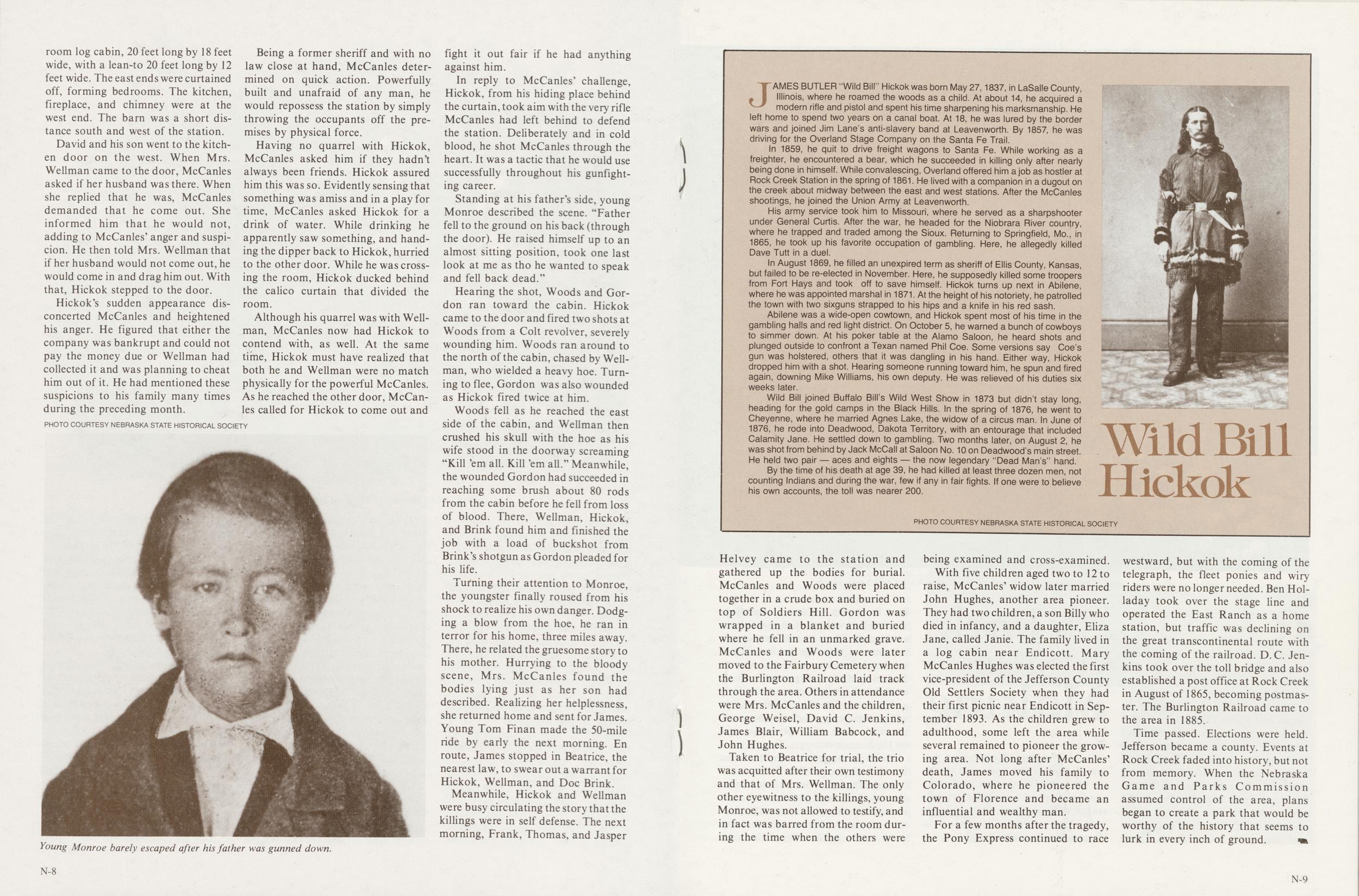
log cabin, 20 feet long by 18 feet wide, with a lean-to 20 feet long by 12 feet wide. The east ends were curtained off, forming bedrooms. The kitchen, fireplace, and chimney were at the west end. The barn was a short distance south and west of the station.
David and his son went to the kitchen door on the west. When Mrs. Wellman came to the door, McCanles asked if her husband was there. When she replied that he was, McCanles demanded that he come out. She informed him that he would not, adding to McCanles' anger and suspicion. He then told Mrs. Wellman that if her husband would not come out, he would come in and drag him out. With that, Hickok stepped to the door.
Hickok's sudden appearance disconcerted McCanles and heightened his anger. He figured that either the company was bankrupt and could not pay the money due or Wellman had collected it and was planning to cheat him out of it. He had mentioned these suspicions to his family many times during the preceding month.
Young Monroe barely escaped after his father was gunned down.
Being a former sheriff and with no law close at hand, McCanles determined on quick action. Powerfully built and unafraid of any man, he would repossess the station by simply throwing the occupants off the premises by physical force.
Having no quarrel with Hickok, McCanles asked him if they hadn't always been friends. Hickok assured him this was so. Evidently sensing that something was amiss and in a play for time, McCanles asked Hickok for a drink of water. While drinking he apparently saw something, and handing the dipper back to Hickok, hurried to the other door. While he was crossing the room, Hickok ducked behind the calico curtain that divided the room.
Although his quarrel was with Wellman, McCanles now had Hickok to contend with, as well. At the same time, Hickok must have realized that both he and Wellman were no match physically for the powerful McCanles. As he reached the other door, McCanles called for Hickok to come out and fight it out fair if he had anything against him.
In reply to McCanles' challenge, Hickok, from his hiding place behind the curtain, took aim with the very rifle McCanles had left behind to defend the station. Deliberately and in cold blood, he shot McCanles through the heart. It was a tactic that he would use successfully throughout his gunfighting career.
Standing at his fathers side, young Monroe described the scene. "Father fell to the ground on his back (through the door). He raised himself up to an almost sitting position, took one last look at me as tho he wanted to speak and fell back dead."
Hearing the shot, Woods and Gordon ran toward the cabin. Hickok came to the door and fired two shots at Woods from a Colt revolver, severely wounding him. Woods ran around to the north of the cabin, chased by Wellman, who wielded a heavy hoe. Turning to flee, Gordon was also wounded as Hickok fired twice at him.
Woods fell as he reached the east side of the cabin, and Wellman then crushed his skull with the hoe as his wife stood in the doorway screaming "Kill 'em all. Kill 'em all." Meanwhile, the wounded Gordon had succeeded in reaching some brush about 80 rods from the cabin before he fell from loss of blood. There, Wellman, Hickok, and Brink found him and finished the job with a load of buckshot from Brink's shotgun as Gordon pleaded for his life.
Turning their attention to Monroe, the youngster finally roused from his shock to realize his own danger. Dodging a blow from the hoe, he ran in terror for his home, three miles away. There, he related the gruesome story to his mother. Hurrying to the bloody scene, Mrs. McCanles found the bodies lying just as her son had described. Realizing her helplessness, she returned home and sent for James. Young Tom Finan made the 50-mile ride by early the next morning. En route, James stopped in Beatrice, the nearest law, to swear out a warrant for Hickok, Wellman, and Doc Brink.
Meanwhile, Hickok and Wellman were busy circulating the story that the killings were in self defense. The next morning, Frank, Thomas, and Jasper
N-8Wild Bill Hickok
PHOTO COURTESY NEBRASKA STATE HISTORICAL SOCIETYJAMES BUTLER "Wild Bill" Hickok was born May 27,1837, in LaSalle County, Illinois, where he roamed the woods as a child. At about 14, he acquired a modern rifle and pistol and spent his time sharpening his marksmanship. He left home to spend two years on a canal boat. At 18, he was lured by the border wars and joined Jim Lane's anti-slavery band at Leavenworth. By 1857, he was driving for the Overland Stage Company on the Santa Fe Trail.
In 1859, he quit to drive freight wagons to Santa Fe. While working as a freighter, he encountered a bear, which he succeeded in killing only after nearly being done in himself. While convalescing, Overland offered him a job as hostler at Rock Creek Station in the spring of 1861. He lived with a companion in a dugout on the creek about midway between the east and west stations. After the McCanles shootings, he joined the Union Army at Leavenworth.
His army service took him to Missouri, where he served as a sharpshooter under General Curtis. After the war, he headed for the Niobrara River country, where he trapped and traded among the Sioux. Returning to Springfield, Mo., in 1865, he took up his favorite occupation of gambling. Here, he allegedly killed Dave Tutt in a duel.
In August 1869, he filled an unexpired term as sheriff of Ellis County, Kansas, but failed to be re-elected in November. Here, he supposedly killed some troopers from Fort Hays and took off to save himself. Hickok turns up next in Abilene, where he was appointed marshal in 1871. At the height of his notoriety, he patrolled the town with two sixguns strapped to his hips and a knife in his red sash.
Abilene was a wide-open cowtown, and Hickok spent most of his time in the gambling halls and red light district. On October 5, he warned a bunch of cowboys to simmer down. At his poker table at the Alamo Saloon, he heard shots and plunged outside to confront a Texan named Phil Coe. Some versions say Coe's gun was holstered, others that it was dangling in his hand. Either way, Hickok dropped him with a shot. Hearing someone running toward him, he spun and fired again, downing Mike Williams, his own deputy. He was relieved of his duties six weeks later.
Wild Bill joined Buffalo Bill's Wild West Show in 1873 but didn't stay long, heading for the gold camps in the Black Hills. In the spring of 1876, he went to Cheyenne, where he married Agnes Lake, the widow of a circus man. In June of 1876, he rode into Deadwood, Dakota Territory, with an entourage that included Calamity Jane. He settled down to gambling. Two months later, on August 2, he was shot from behind by Jack McCall at Saloon No. 10 on Deadwood's main street. He held two pair — aces and eights — the now legendary "Dead Man's" hand. By the time of his death at age 39, he had killed at least three dozen men, not counting Indians and during the war, few if any in fair fights. If one were to believe his own accounts, the toll was nearer 200.
Helvey came to the station and gathered up the bodies for burial. McCanles and Woods were placed together in a crude box and buried on top of Soldiers Hill. Gordon was wrapped in a blanket and buried where he fell in an unmarked grave. McCanles and Woods were later moved to the Fairbury Cemetery when the Burlington Railroad laid track through the area. Others in attendance were Mrs. McCanles and the children, George Weisel, David C. Jenkins, James Blair, William Babcock, and John Hughes.
Taken to Beatrice for trial, the trio was acquitted after their own testimony and that of Mrs. Wellman. The only other eyewitness to the killings, young Monroe, was not allowed to testify, and in fact was barred from the room during the time when the others were being examined and cross-examined.
With five children aged two to 12 to raise, McCanles' widow later married John Hughes, another area pioneer. They had two children, a son Billy who died in infancy, and a daughter, Eliza Jane, called Janie. The family lived in a log cabin near Endicott. Mary McCanles Hughes was elected the first vice-president of the Jefferson County Old Settlers Society when they had their first picnic near Endicott in September 1893. As the children grew to adulthood, some left the area while several remained to pioneer the growing area. Not long after McCanles' death, James moved his family to Colorado, where he pioneered the town of Florence and became an influential and wealthy man.
For a few months after the tragedy, the Pony Express continued to race westward, but with the coming of the telegraph, the fleet ponies and wiry riders were no longer needed. Ben Holladay took over the stage line and operated the East Ranch as a home station, but traffic was declining on the great transcontinental route with the coming of the railroad. D.C. Jenkins took over the toll bridge and also established a post office at Rock Creek in August of 1865, becoming postmaster. The Burlington Railroad came to the area in 1885.
Time passed. Elections were held. Jefferson became a county. Events at Rock Creek faded into history, but not from memory. When the Nebraska Game and Parks Commission assumed control of the area, plans began to create a park that would be worthy of the history that seems to lurk in every inch of ground.
N-9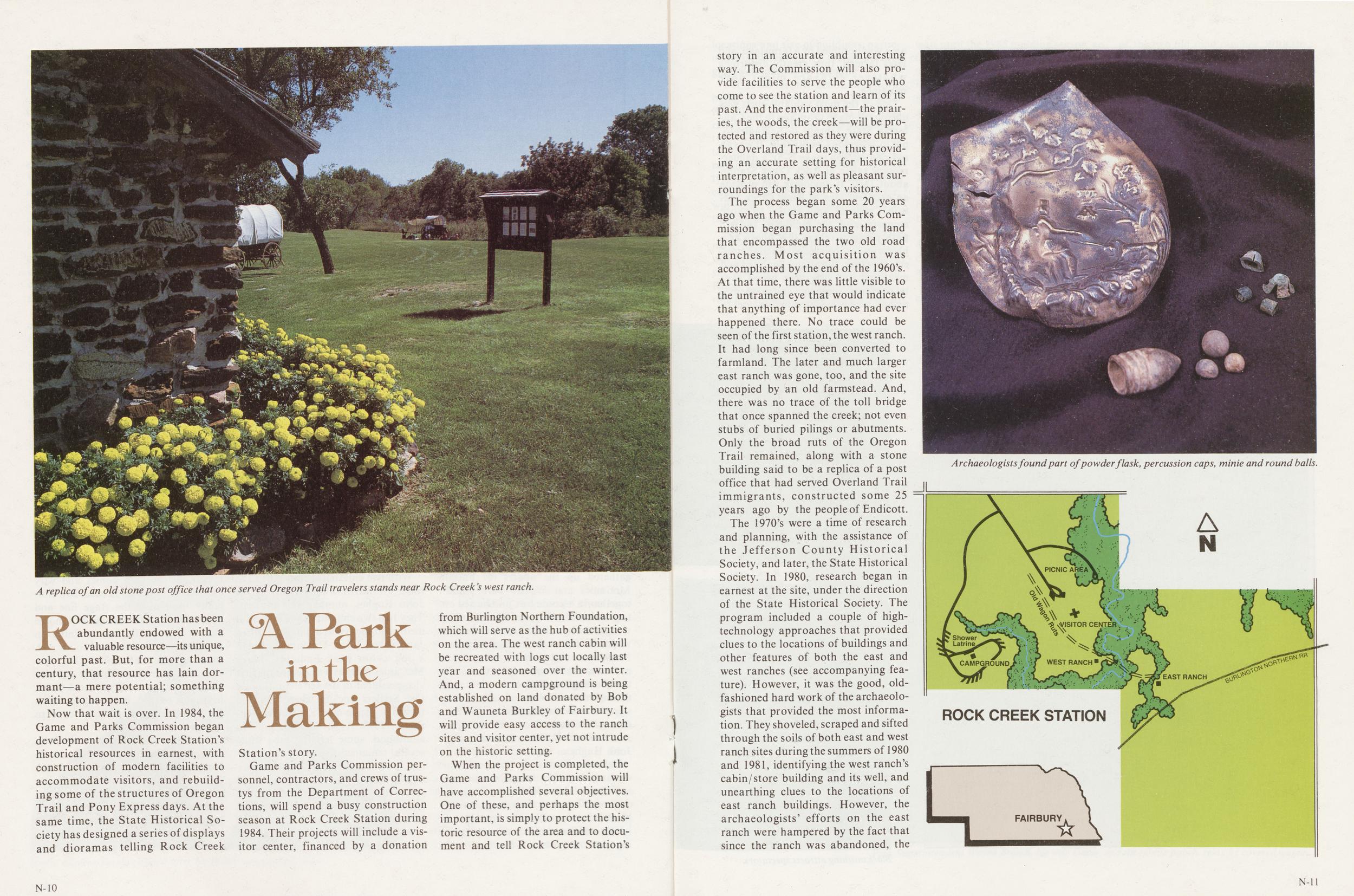
A replica of an old stone post office that once served Oregon Trail travelers stands near Rock Creek's west ranch.
A Park in the Making
ROCK CREEK Station has been abundantly endowed with a valuable resource—its unique, colorful past. But, for more than a century, that resource has lain dormant—a mere potential; something waiting to happen.
Now that wait is over. In 1984, the Game and Parks Commission began development of Rock Creek Station's historical resources in earnest, with construction of modern facilities to accommodate visitors, and rebuilding some of the structures of Oregon Trail and Pony Express days. At the same time, the State Historical Society has designed a series of displays and dioramas telling Rock Creek Station's story.
Game and Parks Commission personnel, contractors, and crews of trustys from the Department of Corrections, will spend a busy construction season at Rock Creek Station during 1984, Their projects will include a visitor center, financed by a donation from Burlington Northern Foundation, which will serve as the hub of activities on the area. The west ranch cabin will be recreated with logs cut locally last year and seasoned over the winter. And, a modern campground is being established on land donated by Bob and Wauneta Burkley of Fairbury. It will provide easy access to the ranch sites and visitor center, yet not intrude on the historic setting.
When the project is completed, the Game and Parks Commission will have accomplished several objectives. One of these, and perhaps the most important, is simply to protect the historic resource of the area and to document and tell Rock Creek Station's
N-10story in an accurate and interesting way. The Commission will also provide facilities to serve the people who come to see the station and learn of its past. And the environment—the prairies, the woods, the creek—will be protected and restored as they were during the Overland Trail days, thus providing an accurate setting for historical interpretation, as well as pleasant surroundings for the park's visitors.
The process began some 20 years ago when the Game and Parks Commission began purchasing the land that encompassed the two old road ranches. Most acquisition was accomplished by the end of the 1960's. At that time, there was little visible to the untrained eye that would indicate that anything of importance had ever happened there. No trace could be seen of the first station, the west ranch. It had long since been converted to farmland. The later and much larger east ranch was gone, too, and the site occupied by an old farmstead. And, there was no trace of the toll bridge that once spanned the creek; not even stubs of buried pilings or abutments. Only the broad ruts of the Oregon Trail remained, along with a stone building said to be a replica of a post office that had served Overland Trail immigrants, constructed some 25 years ago by the people of Endicott.
The 1970's were a time of research and planning, with the assistance of the Jefferson County Historical Society, and later, the State Historical Society. In 1980, research began in earnest at the site, under the direction of the State Historical Society. The program included a couple of high-technology approaches that provided clues to the locations of buildings and other features of both the east and west ranches (see accompanying feature). However, it was the good, old-fashioned hard work of the archaeologists that provided the most information. They shoveled, scraped and sifted through the soils of both east and west ranch sites during the summers of 1980 and 1981, identifying the west ranch's cabin/store building and its well, and unearthing clues to the locations of east ranch buildings. However, the archaeologists' efforts on the east ranch were hampered by the fact that since the ranch was abandoned, the
Archaeologists found part of powder flask, percussion caps, minie and round balls.
Rock Creek Station
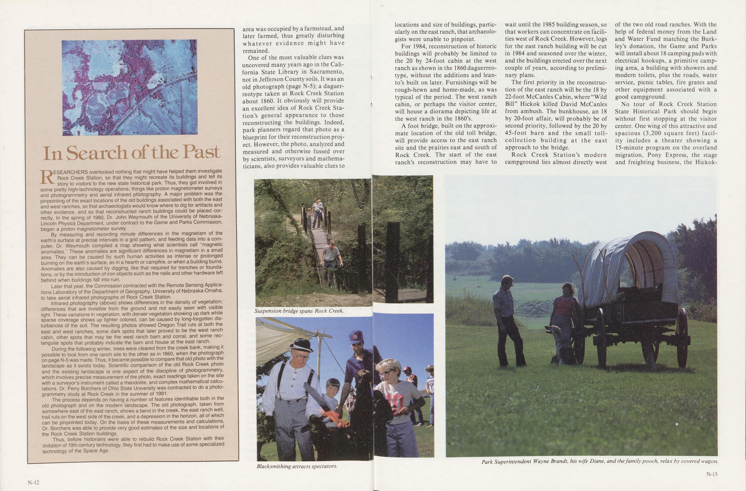
RESEARCHERS overlooked nothing that might have helped them investigate Rock Creek Station, so that they might recreate its buildings and tell its story to visitors to the new state historical park. Thus, they got involved in some pretty high-technology operations; things like proton magnetometer surveys and photogrammetry and aerial infrared photography. A major problem was the pinpointing of the exact locations of the old buildings associated with both the east and west ranches, so that archaeologists would know where to dig for artifacts and other evidence, and so that reconstructed ranch buildings could be placed correctly. In the spring of 1980, Dr. John Weymouth of the University of Nebraska-Lincoln Physics Department, under contract to the Game and Parks Commission, began a proton magnetometer survey.
By measuring and recording minute differences in the magnetism of the earth's surface at precise intervals in a grid pattern, and feeding data into a computer, Dr. Weymouth compiled a map showing what scientists call "magnetic anomalies." These anomalies are significant differences in magnetism in a small area. They can be caused by such human activities as intense or prolonged burning on the earth's surface, as in a hearth or campfire, or when a building bums. Anomalies are also caused by digging, like that required for trenches or foundations, or by the introduction of iron objects such as the nails and other hardware left behind when buildings fall into ruin.
Later that year, the Commission contracted with the Remote Sensing Applications Laboratory of the Department of Geography, University of Nebraska-Omaha, to take aerial infrared photographs of Rock Creek Station.
Infrared photography (above) shows differences in the density of vegetation; differences that are invisible from the ground and not easily seen with visible iight. These variations in vegetation, with denser vegetation showing up dark while sparse coverage shows up lighter colored, can be caused by long-forgotten disturbances of the soil. The resulting photos showed Oregon Trail ruts at both the east and west ranches, some dark spots that later proved to be the west ranch cabin, other spots that may be the west ranch barn and corral, and some rectangular spots that probably indicate the barn and house at the east ranch.
During the following winter, trees were cleared from the creek bank, making it possible to look from one ranch site to the other as in 1860, when the photograph on page N-5 was made. Thus, it became possible to compare that old photo with the landscape as it exists today. Scientific comparison of the old Rock Creek photo and the existing landscape is one aspect of the discipline of photogrammetry, which involves precise measurement of the photo, exact readings taken on the site with a surveyor's instrument called a theodolite, and complex mathematical calculations. Dr. Perry Borchers of Ohio State University was contracted to do a photogrammetry study at Rock Creek in the summer of 1981.
The process depends on having a number of features identifiable both in the old photograph and on the modern landscape. The old photograph, taken from somewhere east of the east ranch, shows a bend in the creek, the east ranch well, trail ruts on the west side of the creek, and a depression in the horizon, all of which can be pinpointed today. On the basis of these measurements and calculations, Dr. Borchers was able to provide very good estimates of the size and locations of the Rock Creek Station buildings.
Thus, before historians were able to rebuild Rock Creek Station with their imitation of 19th century technology, they first had to make use of some specialized technology of the Space Age.
area was occupied by a farmstead, and later farmed, thus greatly disturbing whatever evidence might have remained.
One of the most valuable clues was uncovered many years ago in the California State Library in Sacramento, not in Jefferson County soils. It was an old photograph (page N-5); a daguerreotype taken at Rock Creek Station about 1860. It obviously will provide an excellent idea of Rock Creek Station's general appearance to those reconstructing the buildings. Indeed, park planners regard that photo as a blueprint for their reconstruction project. However, the photo, analyzed and measured and otherwise fussed over by scientists, surveyors and mathematicians, also provides valuable clues to
Suspension bridge spans Rock Creek
Blacksmithing attracts spectators.
locations and size of buildings, particularly on the east ranch, that archaeologists were unable to pinpoint.
For 1984, reconstruction of historic buildings will probably be limited to the 20 by 24-foot cabin at the west ranch as shown in the 1860 daguerreotype, without the additions and lean-to's built on later. Furnishings will be rough-hewn and home-made, as was typical of the period. The west ranch cabin, or perhaps the visitor center, will house a diorama depicting life at the west ranch in the 1860's.
A foot bridge, built on the approximate location of the old toll bridge, will provide access to the east ranch site and the prairies east and south of Rock Creek. The start of the east ranch's reconstruction may have to wait until the 1985 building season, so that workers can concentrate on facilities west of Rock Creek. However, logs for the east ranch building will be cut in 1984 and seasoned over the winter, and the buildings erected over the next couple of years, according to preliminary plans.
The first priority in the reconstruction of the east ranch will be the 18 by 22-foot McCanles Cabin, where "Wild Bill" Hickok killed David McCanles from ambush. The bunkhouse, an 18 by 20-foot affair, will probably be of second priority, followed by the 20 by 45-foot barn and the small toll-collection building at the east approach to the bridge.
Rock Creek Station's modern campground lies almost directly west of the two old road ranches. With the help of federal money from the Land and Water Fund matching the Burkley's donation, the Game and Parks will install about 18 camping pads with electrical hookups, a primitive camping area, a building with showers and modern toilets, plus the roads, water service, picnic tables, fire grates and other equipment associated with a good campground.
No tour of Rock Creek Station State Historical Park should begin without first stopping at the visitor center. One wing of this attractive and spacious (3,200 square feet) facility includes a theater showing a 15-minute program on the overland migration, Pony Express, the stage and freighting business, the Hickok-McCanles
Park Superintendent Wayne Brandt, his wife Diane, and the family pooch, relax by covered wagon.
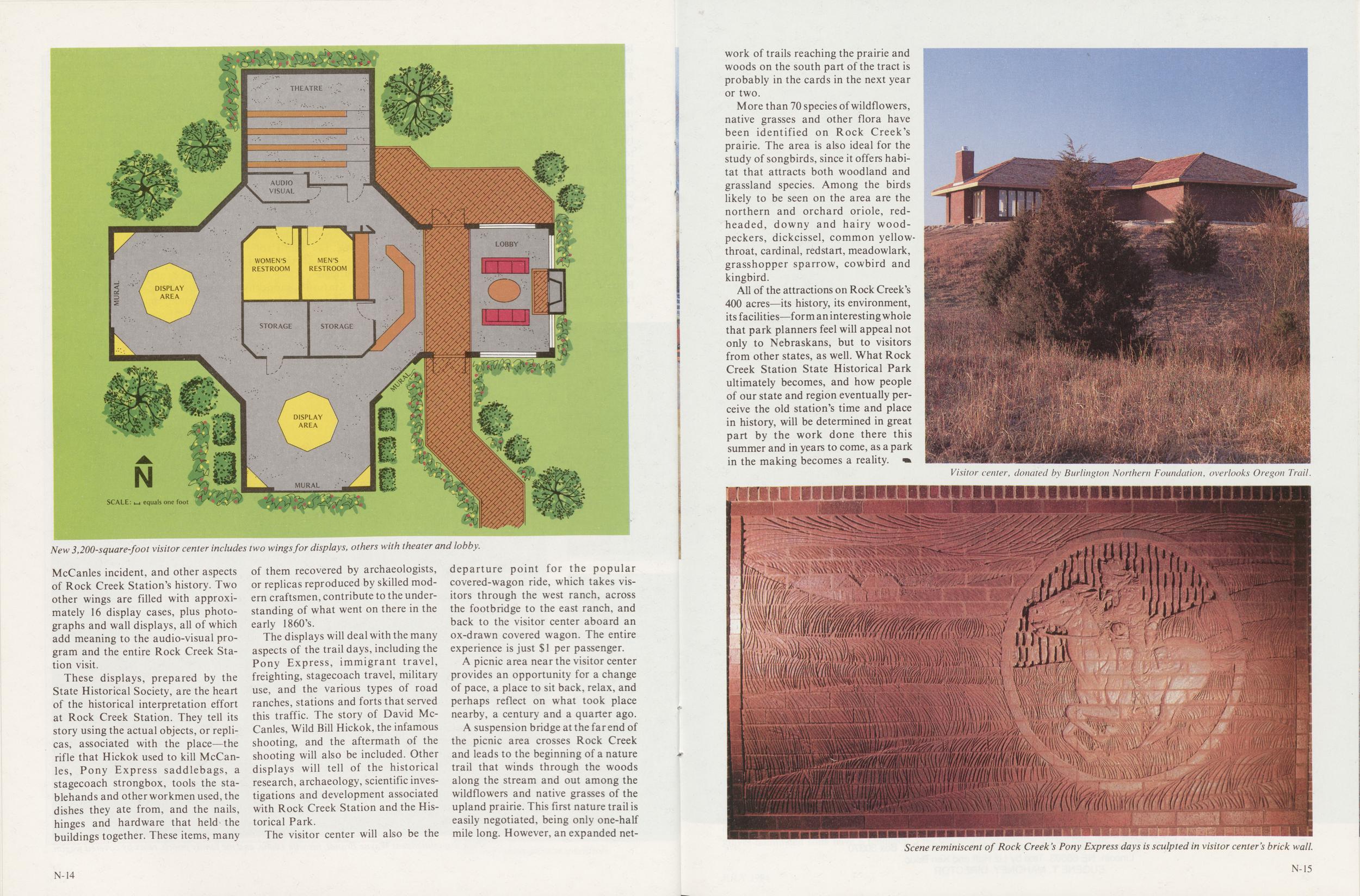
New 3,200-square-foot visitor center includes two wings for displays, others with theater and lobby.
incident, and other aspects of Rock Creek Station's history. Two other wings are filled with approximately 16 display cases, plus photographs and wall displays, all of which add meaning to the audio-visual program and the entire Rock Creek Station visit.
These displays, prepared by the State Historical Society, are the heart of the historical interpretation effort at Rock Creek Station. They tell its story using the actual objects, or replicas, associated with the place—the rifle that Hickok used to kill McCanles, Pony Express saddlebags, a stagecoach strongbox, tools the stablehands and other workmen used, the dishes they ate from, and the nails, hinges and hardware that held the buildings together. These items, many of them recovered by archaeologists, or replicas reproduced by skilled modern craftsmen, contribute to the understanding of what went on there in the early 1860's.
The displays will deal with the many aspects of the trail days, including the Pony Express, immigrant travel, freighting, stagecoach travel, military use, and the various types of road ranches, stations and forts that served this traffic. The story of David McCanles, Wild Bill Hickok, the infamous shooting, and the aftermath of the shooting will also be included. Other displays will tell of the historical research, archaeology, scientific investigations and development associated with Rock Creek Station and the Historical Park.
The visitor center will also be the departure point for the popular covered-wagon ride, which takes visitors through the west ranch, across the footbridge to the east ranch, and back to the visitor center aboard an ox-drawn covered wagon. The entire experience is just $1 per passenger.
A picnic area near the visitor center provides an opportunity for a change of pace, a place to sit back, relax, and perhaps reflect on what took place nearby, a century and a quarter ago.
A suspension bridge at the far end of the picnic area crosses Rock Creek and leads to the beginning of a nature trail that winds through the woods along the stream and out among the wildflowers and native grasses of the upland prairie. This first nature trail is easily negotiated, being only one-half mile long. However, an expanded network
N-14of trails reaching the prairie and woods on the south part of the tract is probably in the cards in the next year or two.
More than 70 species of wildflowers, native grasses and other flora have been identified on Rock Creek's prairie. The area is also ideal for the study of songbirds, since it offers habitat that attracts both woodland and grassland species. Among the birds likely to be seen on the area are the northern and orchard oriole, redheaded, downy and hairy woodpeckers, dickcissel, common yellow-throat, cardinal, redstart, meadowlark, grasshopper sparrow, cowbird and kingbird.
All of the attractions on Rock Creek's 400 acres—its history, its environment, its facilities—form an interesting whole that park planners feel will appeal not only to Nebraskans, but to visitors from other states, as well. What Rock Creek Station State Historical Park ultimately becomes, and how people of our state and region eventually perceive the old station's time and place in history, will be determined in great part by the work done there this summer and in years to come, as a park in the making becomes a reality.
Visitor center, donated by Burlington Northern Foundation, overlooks Oregon Trail.
Scene reminiscent of Rock Creek's Pony Express days is sculpted in visitor center's brick wall.
Rock Creek's Prairie
Text by Liz Huff and Ken Bouc BY CURT TWEDT Newcomers or old-timers, vegetation types here prove they have adapted to stringent, demanding environmentMANY CHANGES have come over the Rock Creek area since westbound pioneers slipped past its reassuring presence in the mid 1800's. The great bison herds have been replaced by other grazing animals under human control. The periodic fires that swept from horizon to horizon over the immense grasslands are no more; the human species has left its imprint everywhere. Yet, the prairie still ripples in the summer breeze, fall turns the hills to bronze, winter's silence will in turn grudgingly give way to the green surge of spring. Through the years and the ages, the grass endures.
Rock Creek Station's climate, topography and geologic history all contribute to the variety of its vegetation. As even a casual study of weather records reveals, the prairie and plains regions of the country have highly variable seasonal and annual patterns of precipitation. Long-term records indicate that average yearly moisture amounts to about 27 inches in Jefferson County. But the average is overshadowed by extremes. The same period of record which gives us a 27-inch moisture supply for an "average" year shows a range of from 15 inches to nearly 50 inches in a 12-month period. In any given year, precipitation might be more typical of anything from near-desert to lush woodlands.
Daily and seasonal temperature patterns act in tandem with the variable moisture supply. The frost-free growing season in southeastern Nebraska usually runs about 175 days, but variations of 20 days or more occur on either side of this average. Growing season limitations affect wild plants as well as agricultural crops, so it should be no great surprise that many native plants reach the northern or western extremes of their range in southeastern Nebraska.
Soil characteristics and topography also have considerable influence on plant distribution and abundance. Sand or gravel-dominated soils have a tendency to hold less moisture and to dry out more rapidly than soils with high silt or clay content. Ridge tops or south-facing slopes are considerably warmer than north-facing slopes, and the greater exposure to summer sun also means a more rapid depletion of soil moisture from the warmer sites.
Relatively small topographic variations, especially ravines and stream banks, provide a lot of well-protected sites where trees, shrubs and woodland wildflowers can thrive. It is fairly easy to see the differences that exist in sites only a few yards apart, especially on a midsummer afternoon. Stand on a sun-drenched ridge top for a few minutes, then make your way over to a wooded ravine. It's easy to feel the cooling effects of the tree canopy. It may be only a few degrees, but this small advantage can make a considerable difference in the plant and animal inhabitants of these microhabitats. The moist, cool banks of a ravine or creek can at times be almost like another world, and so it is to a number of plants, small mammals, birds, reptiles and amphibians.
Jefferson County and Rock Creek Station are situated in a transition zone between the eastern tall-grass prairie and the mixed-grass prairie of central Nebraska and central Kansas. Of course, there are no sharp boundaries between different types of grassland, and the overlap areas (sometimes called ecotones) can shift back and forth in response to climate.
A dramatic example of the shifting transition zones between major grassland types occurred during the drought of the 1930's. Large areas of tall-grass prairie were nearly taken over by shorter, more drought-tolerant species in a relatively short time. With the return of higher rainfall during the 1940's, the tall-grass species were spurred from near dormancy and again resumed their places in the plant community. One of the reasons for this ability to hold on during climatic hard times is the remarkable root systems of many prairie plants. The above-ground parts of the tall grasses such as big bluestem or Indiangrass are supported by massive root systems. In addition, many grasses and other prairie plants have underground stems called rhizomes which store nutrients and energy for future growth. It appears that the best adapted prairie plants can shift their life processes to a near standstill during drought periods and put their biological savings accounts on hold to wait for more favorable times to return. A detailed account of the climatic tug-of-war among prairie plants can be found in North American Prairie by J. E. Weaver.
Just as Rock Creek Station played host and trail guide to human travelers, a number of travelers of the plant world have found their way here too. Unlike the great majority of human migrants, the plant newcomers stayed on. Some were welcomed, others were (and are) regarded as pests. Still, nature makes no judgments and even the worst villains in the hazy category of "weeds" may rise to the occasion as fast-growing erosion control, or as feed for livestock and wildlife.
Observations, collections and photography of Rock Creek Station plants began on an occasional basis in 1978. One of the earlier attempts to determine composition of the area's flora showed a minimum of 70 species (not all were readily identifiable to exact species at the time). On the basis of abundance, grasses, legumes, and composites (e.g. sunflowers, goldenrods) are among the dominants of the prairies. A number of shrubs also occur along with the grasses and forbs (broadleaf, non-woody plants). Trees, shrubs and woody vines reach their greatest abundance and variety along Rock Creek and its small tributaries. Representative plants found at Rock Creek Station appear in a list on page 45 of this issue. A more complete flora inventory of the area will be prepared in the near future.
JULY 1984 35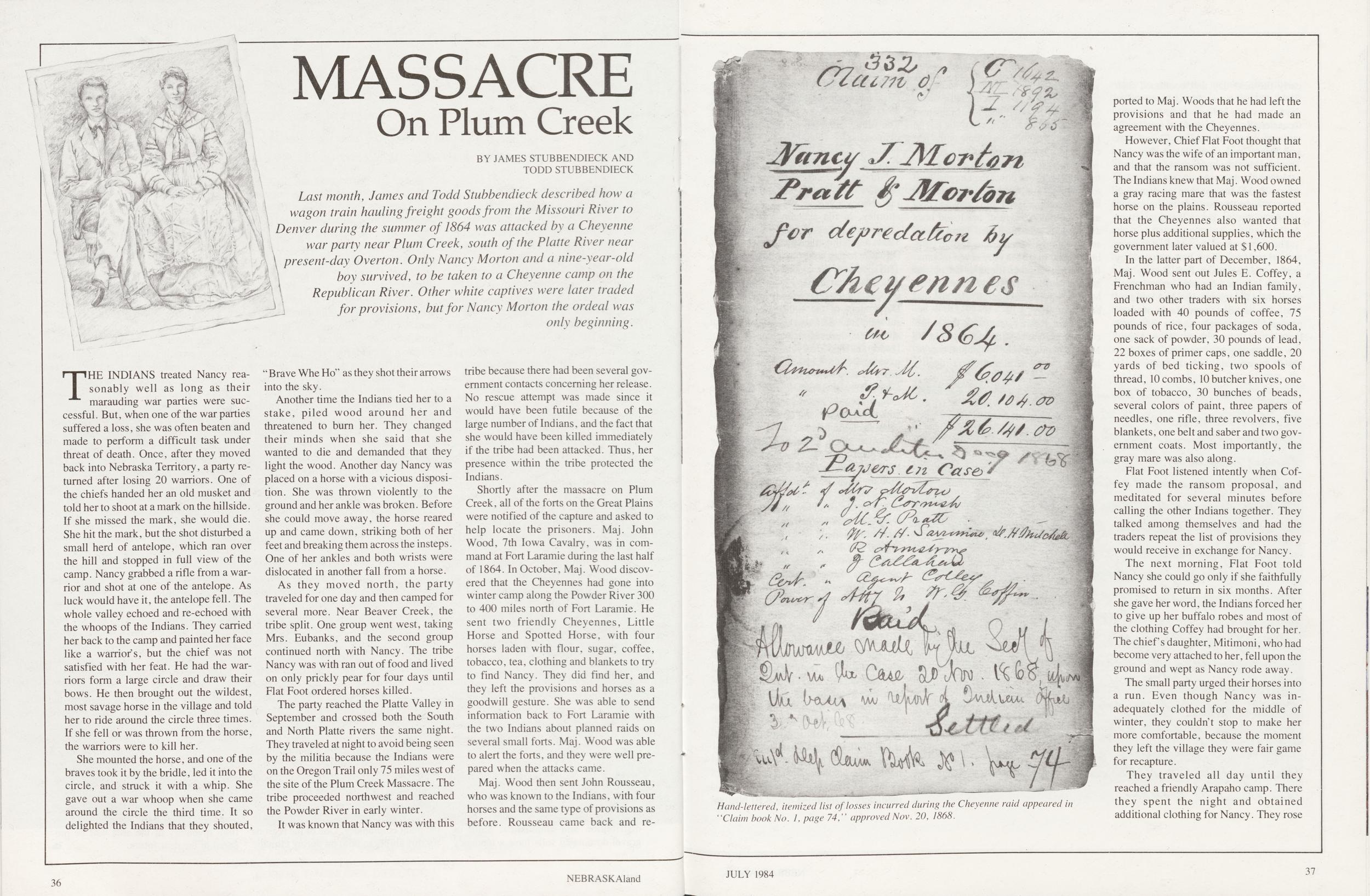
MASSACRE On Plum Creek
BY JAMES STUBBENDIECK AND TODD STUBBENDIECK Last month, James and Todd Stubbendieck described how a wagon train hauling freight goods from the Missouri River to Denver during the summer of 1864 was attacked by a Cheyenne war party near Plum Creek, south of the Platte River near I present-day Overton. Only Nancy Morton and a nine-year-old boy survived, to be taken to a Cheyenne camp on the Republican River. Other white captives were later traded for provisions, but for Nancy Morton the ordeal was only beginning.THE INDIANS treated Nancy reasonably well as long as their marauding war parties were successful. But, when one of the war parties suffered a loss, she was often beaten and made to perform a difficult task under threat of death. Once, after they moved back into Nebraska Territory, a party returned after losing 20 warriors. One of the chiefs handed her an old musket and told her to shoot at a mark on the hillside. If she missed the mark, she would die. She hit the mark, but the shot disturbed a small herd of antelope, which ran over the hill and stopped in full view of the camp. Nancy grabbed a rifle from a warrior and shot at one of the antelope. As luck would have it, the antelope fell. The whole valley echoed and re-echoed with the whoops of the Indians. They carried her back to the camp and painted her face like a warrior's, but the chief was not satisfied with her feat. He had the warriors form a large circle and draw their bows. He then brought out the wildest, most savage horse in the village and told her to ride around the circle three times. If she fell or was thrown from the horse, the warriors were to kill her.
She mounted the horse, and one of the braves took it by the bridle, led it into the circle, and struck it with a whip. She gave out a war whoop when she came around the circle the third time. It so delighted the Indians that they shouted, "Brave Whe Ho" as they shot their arrows into the sky.
Another time the Indians tied her to a stake, piled wood around her and threatened to burn her. They changed their minds when she said that she wanted to die and demanded that they light the wood. Another day Nancy was placed on a horse with a vicious disposition. She was thrown violently to the ground and her ankle was broken. Before she could move away, the horse reared up and came down, striking both of her feet and breaking them across the insteps. One of her ankles and both wrists were dislocated in another fall from a horse.
As they moved north, the party traveled for one day and then camped for several more. Near Beaver Creek, the tribe split. One group went west, taking Mrs. Eubanks, and the second group continued north with Nancy. The tribe Nancy was with ran out of food and lived on only prickly pear for four days until Flat Foot ordered horses killed.
The party reached the Platte Valley in September and crossed both the South and North Platte rivers the same night. They traveled at night to avoid being seen by the militia because the Indians were on the Oregon Trail only 75 miles west of the site of the Plum Creek Massacre. The tribe proceeded northwest and reached the Powder River in early winter.
It was known that Nancy was with this tribe because there had been several government contacts concerning her release. No rescue attempt was made since it would have been futile because of the large number of Indians, and the fact that she would have been killed immediately if the tribe had been attacked. Thus, her presence within the tribe protected the Indians.
Shortly after the massacre on Plum Creek, all of the forts on the Great Plains were notified of the capture and asked to help locate the prisoners. Maj. John Wood, 7th Iowa Cavalry, was in command at Fort Laramie during the last half of 1864. In October, Maj. Wood discovered that the Cheyennes had gone into winter camp along the Powder River 300 to 400 miles north of Fort Laramie. He sent two friendly Cheyennes, Little Horse and Spotted Horse, with four horses laden with flour, sugar, coffee, tobacco, tea, clothing and blankets to try to find Nancy. They did find her, and they left the provisions and horses as a goodwill gesture. She was able to send information back to Fort Laramie with the two Indians about planned raids on several small forts. Maj. Wood was able to alert the forts, and they were well prepared when the attacks came.
Maj. Wood then sent John Rousseau, who was known to the Indians, with four horses and the same type of provisions as before. Rousseau came back and reported
36 NEBRASKAlandHand-lettered, itemized list of losses incurred during the Cheyenne raid appeared in "Claim book No. 1, page 74," approved Nov. 20, 1868.
to Maj. Woods that he had left the provisions and that he had made an agreement with the Cheyennes.
However, Chief Flat Foot thought that Nancy was the wife of an important man, and that the ransom was not sufficient. The Indians knew that Maj. Wood owned a gray racing mare that was the fastest horse on the plains. Rousseau reported that the Cheyennes also wanted that horse plus additional supplies, which the government later valued at $1,600.
In the latter part of December, 1864, Maj. Wood sent out Jules E. Coffey, a Frenchman who had an Indian family, and two other traders with six horses loaded with 40 pounds of coffee, 75 pounds of rice, four packages of soda, one sack of powder, 30 pounds of lead, 22 boxes of primer caps, one saddle, 20 yards of bed ticking, two spools of thread, 10 combs, 10 butcher knives, one box of tobacco, 30 bunches of beads, several colors of paint, three papers of needles, one rifle, three revolvers, five blankets, one belt and saber and two government coats. Most importantly, the gray mare was also along.
Flat Foot listened intently when Coffey made the ransom proposal, and meditated for several minutes before calling the other Indians together. They talked among themselves and had the traders repeat the list of provisions they would receive in exchange for Nancy.
The next morning, Flat Foot told Nancy she could go only if she faithfully promised to return in six months. After she gave her word, the Indians forced her to give up her buffalo robes and most of the clothing Coffey had brought for her. The chiefs daughter, Mitimoni, who had become very attached to her, fell upon the ground and wept as Nancy rode away.
The small party urged their horses into a run. Even though Nancy was inadequately clothed for the middle of winter, they couldn t stop to make her more comfortable, because the moment they left the village they were fair game for recapture.
They traveled all day until they reached a friendly Arapaho camp. There they spent the night and obtained additional clothing for Nancy. They rose
JULY 1984 37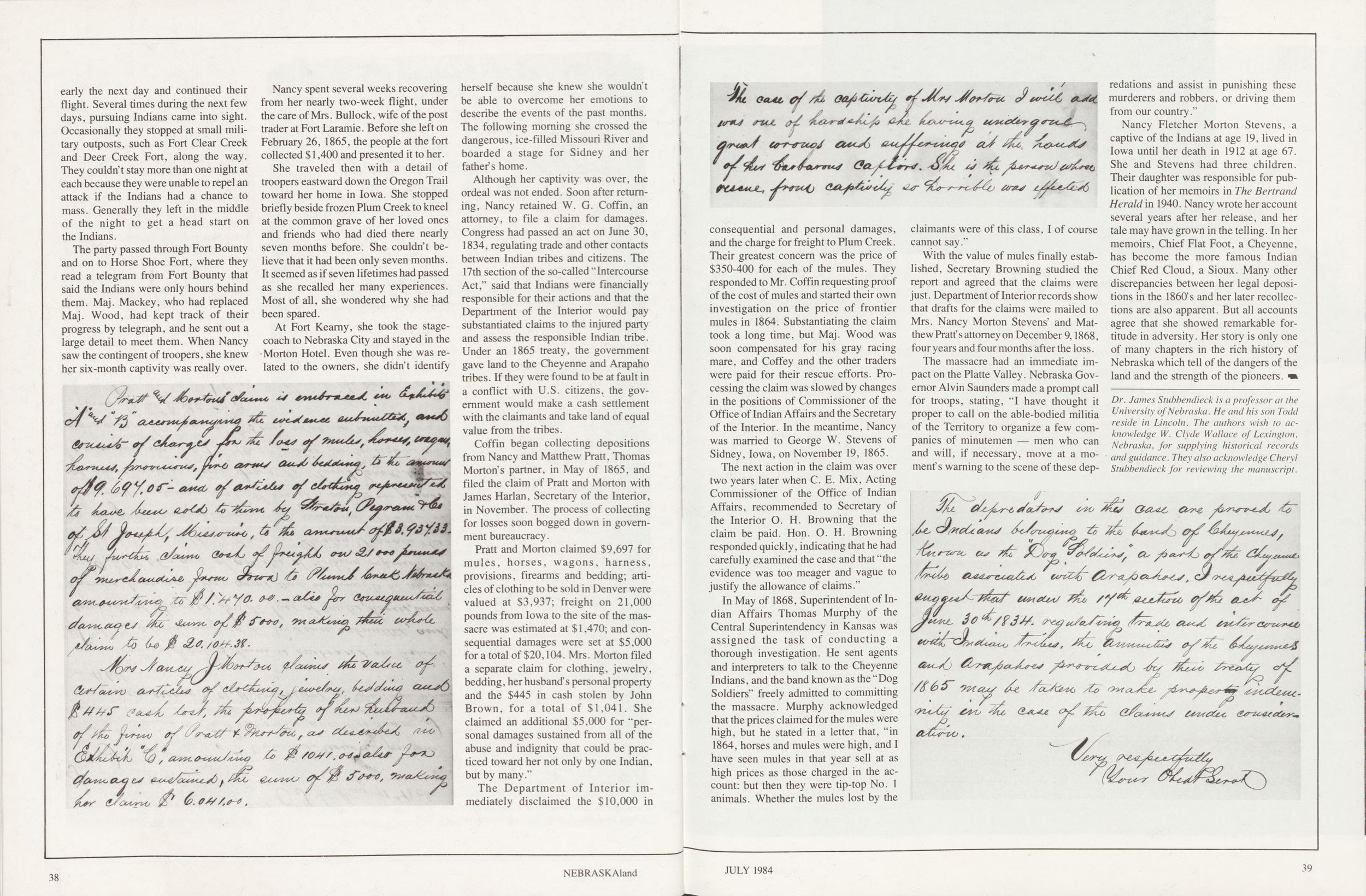
early the next day and continued their flight. Several times during the next few days, pursuing Indians came into sight. Occasionally they stopped at small military outposts, such as Fort Clear Creek and Deer Creek Fort, along the way. They couldn't stay more than one night at each because they were unable to repel an attack if the Indians had a chance to mass. Generally they left in the middle of the night to get a head start on the Indians.
The party passed through Fort Bounty and on to Horse Shoe Fort, where they read a telegram from Fort Bounty that said the Indians were only hours behind them. Maj. Mackey, who had replaced Maj. Wood, had kept track of their progress by telegraph, and he sent out a large detail to meet them. When Nancy saw the contingent of troopers, she knew her six-month captivity was really over.
Nancy spent several weeks recovering from her nearly two-week flight, under the care of Mrs. Bullock, wife of the post trader at Fort Laramie. Before she left on February 26, 1865, the people at the fort collected $1,400 and presented it to her.
She traveled then with a detail of troopers eastward down the Oregon Trail toward her home in Iowa. She stopped briefly beside frozen Plum Creek to kneel at the common grave of her loved ones and friends who had died there nearly seven months before. She couldn't believe that it had been only seven months. It seemed as if seven lifetimes had passed as she recalled her many experiences. Most of all, she wondered why she had been spared.
At Fort Kearny, she took the stagecoach to Nebraska City and stayed in the Morton Hotel. Even though she was related to the owners, she didn't identify herself because she knew she wouldn't be able to overcome her emotions to describe the events of the past months. The following morning she crossed the dangerous, ice-filled Missouri River and boarded a stage for Sidney and her father's home.
Although her captivity was over, the ordeal was not ended. Soon after returning, Nancy retained W. G. Coffin, an attorney, to file a claim for damages. Congress had passed an act on June 30, 1834, regulating trade and other contacts between Indian tribes and citizens. The 17th section of the so-called "Intercourse Act," said that Indians were financially responsible for their actions and that the Department of the Interior would pay substantiated claims to the injured party and assess the responsible Indian tribe. Under an 1865 treaty, the government gave land to the Cheyenne and Arapaho tribes. If they were found to be at fault in a conflict with U.S. citizens, the government would make a cash settlement with the claimants and take land of equal value from the tribes.
Coffin began collecting depositions from Nancy and Matthew Pratt, Thomas Mortons partner, in May of 1865, and filed the claim of Pratt and Morton with James Harlan, Secretary of the Interior, in November. The process of collecting for losses soon bogged down in government bureaucracy.
Pratt and Morton claimed $9,697 for mules, horses, wagons, harness, provisions, firearms and bedding; articles of clothing to be sold in Denver were valued at $3,937; freight on 21,000 pounds from Iowa to the site of the massacre was estimated at $1,470; and consequential damages were set at $5,000 for a total of $20,104. Mrs. Morton filed a separate claim for clothing, jewelry, bedding, her husband's personal property and the $445 in cash stolen by John Brown, for a total of $1,041. She claimed an additional $5,000 for "personal damages sustained from all of the abuse and indignity that could be practiced toward her not only by one Indian, but by many."
The Department of Interior immediately disclaimed the $10,000 in
38 NEBRASKAlandconsequential and personal damages, and the charge for freight to Plum Creek. Their greatest concern was the price of $350-400 for each of the mules. They responded to Mr. Coffin requesting proof of the cost of mules and started their own investigation on the price of frontier mules in 1864. Substantiating the claim took a long time, but Maj. Wood was soon compensated for his gray racing mare, and Coffey and the other traders were paid for their rescue efforts. Processing the claim was slowed by changes in the positions of Commissioner of the Office of Indian Affairs and the Secretary of the Interior. In the meantime, Nancy was married to George W. Stevens of Sidney, Iowa, on November 19, 1865.
The next action in the claim was over two years later when C. E. Mix, Acting Commissioner of the Office of Indian Affairs, recommended to Secretary of the Interior O. H. Browning that the claim be paid. Hon. O. H. Browning responded quickly, indicating that he had carefully examined the case and that "the evidence was too meager and vague to justify the allowance of claims."
In May of 1868, Superintendent of Indian Affairs Thomas Murphy of the Central Superintendency in Kansas was assigned the task of conducting a thorough investigation. He sent agents and interpreters to talk to the Cheyenne Indians, and the band known as the "Dog Soldiers" freely admitted to committing the massacre. Murphy acknowledged that the prices claimed for the mules were high, but he stated in a letter that, "in 1864, horses and mules were high, and I have seen mules in that year sell at as high prices as those charged in the account: but then they were tip-top No. 1 animals. Whether the mules lost by the claimants were of this class, I of course cannot say."
With the value of mules finally established, Secretary Browning studied the report and agreed that the claims were just. Department of Interior records show that drafts for the claims were mailed to Mrs. Nancy Morton Stevens' and Matthew Pratt's attorney on December 9,1868, four years and four months after the loss.
The massacre had an immediate impact on the Platte Valley. Nebraska Governor Alvin Saunders made a prompt call for troops, stating, "I have thought it proper to call on the able-bodied militia of the Territory to organize a few companies of minutemen — men who can and will, if necessary, move at a moment's warning to the scene of these depredations and assist in punishing these murderers and robbers, or driving them from our country."
Nancy Fletcher Morton Stevens, a captive of the Indians at age 19, lived in Iowa until her death in 1912 at age 67. She and Stevens had three children. Their daughter was responsible for publication of her memoirs in The Bertrand Herald in 1940. Nancy wrote her account several years after her release, and her tale may have grown in the telling. In her memoirs, Chief Flat Foot, a Cheyenne, has become the more famous Indian Chief Red Cloud, a Sioux. Many other discrepancies between her legal depositions in the 1860's and her later recollections are also apparent. But all accounts agree that she showed remarkable fortitude in adversity. Her story is only one of many chapters in the rich history of Nebraska which tell of the dangers of the land and the strength of the pioneers.
Dr. James Stubbendieck is a professor at the University of Nebraska. He and his son Todd reside in Lincoln. The authors wish to acknowledge W. Clyde Wallace of Lexington, Nebraska, for supplying historical records and guidance. They also acknowledge Cheryl Stubbendieck for reviewing the manuscript.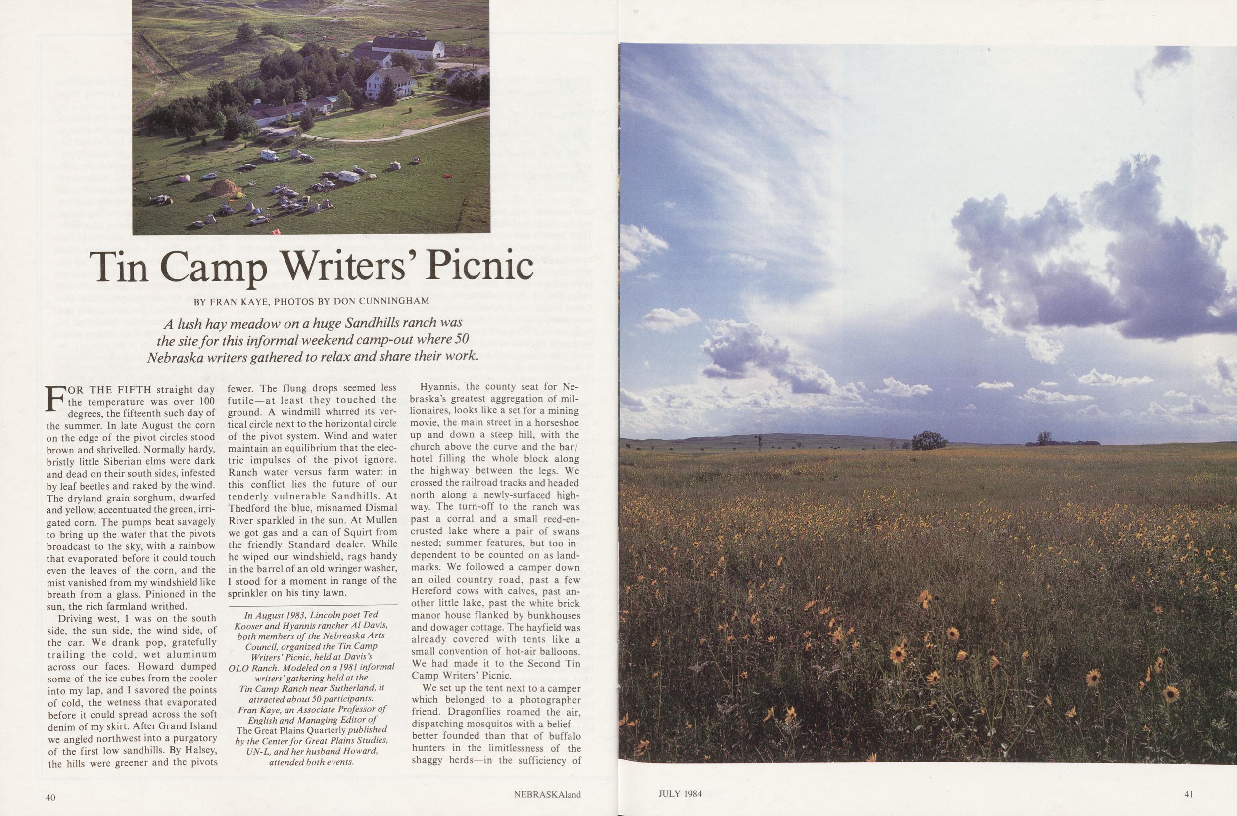
Tin Camp Writers' Picnic
BY FRAN KAYE, PHOTOS BY DON CUNNINGHAM A lush hay meadow on a huge Sandhills ranch was the site for this informal weekend camp-out where 50 Nebraska writers gathered to relax and share their work.FOR THE FIFTH straight day the temperature was over 100 degrees, the fifteenth such day of the summer. In late August the corn on the edge of the pivot circles stood brown and shrivelled. Normally hardy, bristly little Siberian elms were dark and dead on their south sides, infested by leaf beetles and raked by the wind. The dryland grain sorghum, dwarfed and yellow, accentuated the green, irrigated corn. The pumps beat savagely to bring up the water that the pivots broadcast to the sky, with a rainbow that evaporated before it could touch even the leaves of the corn, and the mist vanished from my windshield like breath from a glass. Pinioned in the sun, the rich farmland writhed.
Driving west, I was on the south side, the sun side, the wind side, of the car. We drank pop, gratefully trailing the cold, wet aluminum across our faces. Howard dumped some of the ice cubes from the cooler into my lap, and I savored the points of cold, the wetness that evaporated before it could spread across the soft denim of my skirt. After Grand Island we angled northwest into a purgatory of the first low sandhills. By Halsey, the hills were greener and the pivots fewer. The flung drops seemed less futile—at least they touched the ground. A windmill whirred its vertical circle next to the horizontal circle of the pivot system. Wind and water maintain an equilibrium that the electric impulses of the pivot ignore. Ranch water versus farm water: in this conflict lies the future of our tenderly vulnerable Sandhills. At Thedford the blue, misnamed Dismal River sparkled in the sun. At Mullen we got gas and a can of Squirt from the friendly Standard dealer. While he wiped our windshield, rags handy in the barrel of an old wringer washer, I stood for a moment in range of the sprinkler on his tiny lawn.
In August 1983, Lincoln poet Ted Kooser and Hyannis rancher Al Davis, both members of the Nebreaska Arts Council, organized the Tin Camp Writers' Picnic, held at Davis's OLO Ranch. Modeled on a 1981 informal writers' gathering held at the Tin Camp Ranch near Sutherland, it attracted about 50 participants. Fran Kaye, an Associate Professor of English and Managing Editor of The Great Plains Quarterly published by the Center for Great Plains Studies, UN-L, and her husband Howard, attended both events.Hyannis, the county seat for Nebraska's greatest aggregation of millionaires, looks like a set for a mining movie, the main street in a horseshoe up and down a steep hill, with the church above the curve and the bar/hotel filling the whole block along the highway between the legs. We crossed the railroad tracks and headed north along a newly-surfaced highway. The turn-off to the ranch was past a corral and a small reed-encrusted lake where a pair of swans nested; summer features, but too independent to be counted on as landmarks. We followed a camper down an oiled country road, past a few Hereford cows with calves, past another little lake, past the white brick manor house flanked by bunkhouses and dowager cottage. The hayfield was already covered with tents like a small convention of hot-air balloons. We had made it to the Second Tin Camp Writers' Picnic.
We set up the tent next to a camper which belonged to a photographer friend. Dragonflies roamed the air, dispatching mosquitos with a belief—better founded than that of buffalo hunters in the limitlessness of the shaggy herds—in the sufficiency of
40 NEBRASKAland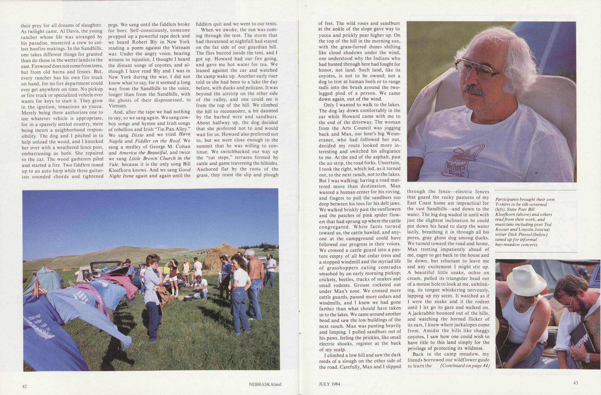
their prey for all dreams of slaughter. As twilight came, Al Davis, the young rancher whose life was arranged by his paradise, mustered a crew to collect bonfire makings. In the Sandhills, one takes different things for granted than do those in the wetter lands to the east. Firewood does not come from trees, but from old barns and fences. But, every rancher has his own fire truck on hand, for no fire department could ever get anywhere on time. No pickup or fire truck or specialized vehicle ever wants for keys to start it. They grow in the ignition, tenacious as yucca. Merely being there authorizes one to use whatever vehicle is appropriate, for in a sparsely settled country, mere being incurs a neighborhood responsibility. The dog and I pitched in to help unload the wood, and I knocked her over with a weathered fence post, embarrassing us both. She repaired to the car. The wood gatherers piled and started a fire. Two fiddlers tuned up to an auto harp while three guitarists sounded chords and tightened pegs. We sang until the fiddlers broke for beer. Self-consciously, someone propped up a powerful tape deck and we heard Robert Bly in New York reading a poem against the Vietnam war. Under the angry voice, bearing witness to injustice, I thought I heard the distant songs of coyotes, and although I have read Bly and I was in New York during the war, I did not know what to say, for it seemed a long way from the Sandhills to the voice, longer than from the Sandhills, with the ghosts of their dispossessed, to Vietnam.
And, after the tape we had nothing to say, so we sang again. We sang cowboy songs and hymns and Irish songs of rebellion and Irish "Tin Pan Alley." We sang Dixie and we tried Hava Nagila and Fiddler on the Roof. We sang a medley of George M. Cohan and America the Beautiful, and twice we sang Little Brown Church in the Vale, because it is the only song Bill Kloefkorn knows. And we sang Good Night Irene again and again until the fiddlers quit and we went to our tents.
When we awoke, the sun was coming through the tent. The storm that had threatened at nightfall had stayed on the far side of our guardian hill. The flies buzzed inside the tent, and I got up. Howard had our fire going, and gave me hot water for tea. We leaned against the car and watched the camp wake up. Another early riser told us she had been to a lake the day before, with ducks and pelicans. It was beyond the airstrip on the other side of the valley, and one could see it from the top of the hill. We climbed the hill to reconnoiter, a bit daunted by the barbed wire and sandburs. About halfway up, the dog decided that she preferred not to and would wait for us. Howard also preferred not to, but we were close enough to the summit that he was willing to continue. We switchbacked our way up the "cat steps," terraces formed by cattle and game traversing the hillsides. Anchored flat by the roots of the grass, they resist the slip and plough
of feet. The wild roses and sandburs at the ankle of the slope gave way to yucca and prickly pear higher up. On the top of the hill in the morning sun, with the grass-furred dunes shifting like cloud shadows under the wind, one understood why the Indians who had hunted through here had fought for honor, not land. Such land, like its coyotes, is not to be owned; not a dog to trot at human heels or to range radii into the brush around the two-legged plod of a person. We came down again, out of the wind.
Only I wanted to walk to the lakes. The dog lay down comfortably in the car while Howard came with me to the end of the driveway. The woman from the Arts Council was jogging back and Max, our host's big Weimeraner, who had followed her out, decided my route looked more interesting and switched his allegiance to me. At the end of the asphalt, past the air strip, the road forks. Uncertain, I took the right, which led, as it turned out, to the next ranch, not to the lakes. But I was walking; having a road mattered more than destination. Max wanted a human center for his roving, and fingers to pull the sandburs too deep between his toes for his deft jaws. We walked briskly past the sunflowers and the patches of pink spider flowers that had sprung up where the cattle congregated. White faces turned toward us, the cattle bawled, and anyone at the campground could have followed our progress in their voices. We crossed a cattle guard into a pasture empty of all but cedar trees and a stopped windmill and the myriad life of grasshoppers eating comrades smashed by an early morning pickup; crickets, beetles, tracks of snakes and small rodents. Grouse rocketed out under Max's nose. We crossed more cattle guards, passed more cedars and windmills, and I knew we had gone farther than what should have taken us to the lakes. We came around another bend and saw the low buildings of the next ranch. Max was panting heavily and limping. I pulled sandburs out of his paws, feeling the prickles, like small electric shocks, register at the back of my scalp.
I climbed a low hill and saw the dark reeds of a slough on the other side of the road. Carefully, Max and I slipped
through the fence—electric fences that guard the rocky pastures of my East Coast home are impractical for the vast Sandhills—and down to the water. The big dog waded in until with just the slightest inclination he could put down his head to slurp the water lazily, breathing it in through all his pores, gray ghost dog among ducks. We turned toward the road and home, Max trotting impatiently ahead of me, eager to get back to the house and lie down, but reluctant to leave me and any excitement I might stir up. A beautiful little snake, ochre on cream, pulled its triangular head out of a mouse hole to look at me, unblinking, its tongue whiskering nervously, lapping up my scent. It watched as if I were the snake and it the rodent until I let go its gaze and walked on. A jackrabbit bounced out of the hills, and watching the horned flicker of its ears, I knew where jackalopes come from. Amidst the hills like shaggy coyotes, I saw how one could wish to have title to this land simply for the privilege of protecting its wildness.
Back in the camp meadow, my friends borrowed our wildf lower guide to learn the
(Continued on page 44)
Tin Camp writers' picnic
(Continued from page 43)names of the flowers they had collected—white-flowered gilia and prickly poppy—and preserved in a beer bottle. T-shirts waved like flags, drying their new silk-screened emblems of the camp in the sun. Howard had painted water colors of the main house and the red-flied tent next to ours. While we had bully-beef sandwiches for lunch, people drifted by to see the paintings, and the woman who made rattlesnake earrings comissioned Howard for a portrait. The photographer moved quietly among the groups, talking while people came and went, and shooting pictures always when he was a participant in a conversation, not just an observer. We went into town for more beer and ice and pop for the group with whom we had eaten, then changed and moved up to the swimming pool by the house. Some of the story tellers tried to convince the children that a lake monster lived under the diving board, and the children enj oyed not being convinced. We stretched out in the sun, happy to welcome it again after a summer spent in shaded rooms. A friend came by to tell me my shoulders were getting burned, then went upstairs to take a shower in the marble bathroom with the tub built into the great arched window overlooking the valley. This lone land affords its own privacy, and no city notions of curtains need apply where there is no one to look in but the grave hills and the immense wheeling sky. For Sandhills people, the land is not hostile nor indifferent, not invasive nor threatening, but a condition of life too pervasive for any acknowledgement. One can stand naked in the dignity of the sky.
Dinner was an elaborate Mexican spread cooked from scratch by our host and his friends: chili and beans, tamales and enchiladas, tomatoes and peppers from the garden. The children ate what was mild and gave the rest to the dogs, who ate happily and drank long from the swimming pool. Sated, we moved down to the campfire and the business of the night: the readings.
Slowly from around the circle, one writer followed another up to the lantern on a post. In between someone threw more wood on the fire. After the last public-private words of the poems, we brushed our teeth and went to bed, hearing the familiar voices of the camp settle down around us.
In the morning I climbed the hill again, up into the cleansing wind and away from the flies and mosquitoes of the meadowland. The camper pulled out from next to our tent and drove over to the airstrip. A light plane took off. Our host's friend had volunteered to give our photographer an aerial view of the encampment for his magazine. The plane approached, tipped over the hill, and circled 'til the whole valley lay framed between the high escarpments of the hills that rippled out on either hand. I climbed down and we rolled up the sleeping bags, struck the tent, and packed the car. We found our host and gave him Howard's watercolor, which will go well on the brick walls of his living room, above the hooked rugs that picture his cattle and his brand.
We drove back to Hyannis, slow-blinking and reptilian-eyed in the Sunday morning sun, then south and east—south and east to the sweltering cities of the Plain. The car was alive with flies at our ankles and crickets chirping on the floor. On every hand lay the sandhills and their grazing cattle. These restless dunes of grassland, unique to our western hemisphere, preserved because they are not "good for anything," remind us how lightly we live upon this earth that is everywhere more fragile than we know. I grieved to pass the pivots that are slowly disgorging the water that subirrigates hay fields like the meadow in which we had camped. South and east, south and east we drove into the heat, past the restless circles of ever-more pivots until the green spots spread like ringworm over the shaggy grass coat of the sand. In the flat country near the Platte, where the soil is rich and the groundwater easily replenished, the pivots have a certain domestic tranquility, but in the Sandhills they mean a disrespect for the country as violent as war. And then the hot air closed around us and we were home to dinner and cool showers. The Writers' Picnic might never have been, save that when we closed our eyes we saw the long, dark shadow of the hill blocking the stars above our camp.
44 NEBRASKAlandCOMMON PLANTS OF ROCK CREEK STATION
(Continued from page 35) Grasses Indiangrass Big Bluestem Little Bluestem Porcupinegrass Side-oats Grama Blue Grama Switchgrass Prairie Junegrass Needle-and-Thread Prairie Dropseed Forbs Milkweeds (several species) Sunflowers (several species) Goldenrods (several species) Prairie Clover Wildindigo Scurfpea (wild alfalfa) Spiderwort Pitcher Sage Wild Strawberry Purple Poppymallow Western Ragweed Evening Primrose Blazing-Star Wild Onion Wild Petunia Woody Plants Trees Bur Oak Black Walnut Cottonwood Green Ash Hackberry American Elm Eastern Red Cedar Osage-orange Honey Locust Willow Mulberry Boxelder Shrubs Coralberry Chokecherry Wild Plum Wild Currant Gooseberry Leadplant Wild Rose Vines Wild Grape Virginia Creeper Catclaw Greenbrier Poison Ivy
The island
(Continued from page 13)ascendancy. They soon outstripped the willows and other shoreline vegetation as they began to build an ever firmer bulwark against the river. By the time a half-century had passed, the cottonwoods dominated the shoreline scene. Yet even they began to mature and slowly die as the island approached a century of separate existence. Finally, the more slowly growing ashes, elms, and hackberries added their stature to the narrow forest, and a rich array of flowering herbs flourished at their bases.
As the island approached the end of its first century, it had acquired a distinctive appearance. Like the prow of a great sailing ship headed into the surf, it was crowded at its upstream end with giant cottonwoods and elms. .For many decades they had borne the brunt of the yearly ice floes and stood well above summer water levels as they had gathered around their broad bases the sediments of a hundred springs. Lining the side channels of the island was a narrow but rich forest of ashes, boxelders, mulberries, and hackberries, as well as occasional cottonwoods and elms. Between them and the water's edge was a protective woody border of willows and shrubby dogwoods. Inside the wooded edges of the island was a large area of subirrigated native meadow, which was punctuated here and there by a tracery of trees or shrubs that still marked an old filled-in stream channel. Here too were irregular depressions that in spring filled with snow melt and which supported a profuse growth of cattails and other marsh plants. At the lower end of the island, shrubs trailed off into a sandy bar, where sandbar willow seedlings constantly engaged in their endless reclamation battles with the river.
By the time of the great immigrant influx, the darkly wooded island was a complete entity unto itself. The trails leading west from Nebraska City were well isolated from it by the broadest and southernmost of the Platte's major channels. Toward the north, it was separated from the Mormon Trail and Grand Island proper by the much narrower middle channel, which could be easily forded. Thus, the north side of the island was first influenced by the immigrants. Initially it was used for little more than summer cattle grazing on the rich meadows of its interior, but as bridges began to be constructed across the many small subdivisions of the erratic middle channel, the island was increasingly opened for homesteading.
As the Union Pacific Railroad approached Grand Island from the east in the mid 1860's, these bridges provided a convenient means for timber cutters to invade Shoemaker Island, Mormon Island, and other similar islands to cut the shoreline forest. The taller trees along the other banks of the Platte had long since either been chopped down for construction or firewood or perhaps had been destroyed by periodic prairie fires. So the trees of the island were prime targets for the railroad contractors, who ruthlessly invaded the lands of squatters and homesteaders and cut down all the trees large enough to use for railroad ties.
The south channel of the Platte was finally bridged successfully below Grand Island in 1874, and thereafter travel was unimpeded through Mormon Island to the region south of the river, where the town of Doniphan was founded in 1879. The area between Grand Island and Doniphan became known as the "Nine bridges," since that many wooden bridges were needed to cross all of the large and small channels of the Platte in that region. With the construction of these and other bridges farther upstream, linking Shoemaker Island with the mainland, Mormon and Shoemaker Islands began to lose their unique identities, and their prairie meadows were broken for cultivation. The river continued to rage every spring, flooding the lower parts of the islands and sometimes sweeping away livestock with it. Yet, each spring also brought the flocks of sandhill and whooping cranes that roosted nightly on sandy bars and islets annually swept clean of vegetation by the floodwaters, and the channels of the Platte were alive with hordes of migrating geese and ducks that waited for the rivers and lakes further north to become ice-free. From The Platte—Channels in Time (pp. 33-37). Copyright 1984 by University of Nebraska Press. Reprinted by permission of the publisher.
46 NEBRASKAlandIn The Kitchen
Fillets a la Diamond Jim 2 pounds fresh skinned fillets, cut in serving size portions 1 teaspoon salt 1/4-teaspoon pepper 1 Cup fish stock or water 18 oysters 18 shrimp Marguery Sauce PaprikaSprinkle portions with salt and pepper and place in a well-greased baking dish. Pour 1 cup fish stock or water over fillets. Bake at 350 degrees for 15 minutes or until fish flakes easily when tested with a fork. Remove fish carefully and place on a broiler tray, reserving juices. Simmer oysters and shrimp in water for 3 minutes. Arrange 3 poached oysters and 3 poached shrimp on top of each fish portion. Cover with Marguery sauce.
Marguery SauceIn small saucepan, combine juices from baked fish and water to equal 1 cup liquid. Cook until volume of liquid is reduced to 1/2 cup. Add 1 cup margarine and heat until melted. Stir in 1/2 cup of the hot liquid to 8 beaten egg yolks. Gradually beat yolks into remaining hot liquid with a wire whisk. Continue heating and beating until sauce thickens. Stir in 1/4-cup dry white wine and 2 tablespoons lemon juice.
Smoked FishStart fire in a hooded outdoor cooker using fewer briquets than usual to maintain a low cooking temperature. Place a handful of hickory chips in water and allow to soak. Dissolve 1 cup salt in 1 gallon of water. Marinate fish in brine according to table. Spread coals in cooker and add wet hickory chips. Grease grill well. Place fish on grill and baste with vegetable oil. Close hood and smoke according to table. Baste fish occasionally.
Size 'n shape How much to serve 6 How long to Cook at How long marinate in brine Fillets or steaks 2 pounds 30 minutes 150-175 1 hr. + 30 (1/2 inch thick) 200 45 minutes 250 30 minutes Fillets or steaks 2 pounds 45 minutes 150-175 1 hr. + 45 (1 inch thick) 200 30-45 min. 250 30 minutes Whole dressed fish 3-4 pounds 30-45 minutes 150-175 2 hours (1 1/2 to 2 1/2 pounds) 200 1 hr. + 15 250 45-50 min. Stuffed Fillets With Egg Sauce 2 pounds fresh fish fillets 4 cups fresh bread crumbs 1/2-cup melted margarine 1/4-cup milk 1/4-cup finely chopped onion 2 teaspoons dill weed 2 teaspoons chopped parsley 1 teaspoon thyme 2 eggs, beaten 1/2-teaspoon salt Dash pepper 2 tablespoons melted margarine Egg Sauce Sliced egg for garnishSprinkle fillets with salt and pepper. Place half the fillets in a well-greased baking dish. In large mixing bowl, combine bread crumbs, 1/2 cup melted margarine, milk, onion, dill weed, parsley, thyme, beaten eggs, salt and pepper. Spread stuffing on top of fillets in baking dish. Place remaining fillets on top of stuffing. Baste with 2 tablespoons melted margarine. Bake at 350 degrees for 30 to 35 minutes or until fish flakes easily when tested with a fork. Cover fish with egg sauce. Makes 4 to 6 servings.
Egg SauceIn small saucepan over low heat, melt l/4 cup margarine and blend in 1/4 cup flour. Add 1 teaspoon dry mustard, 1 teaspoon salt and 1/8 teaspoon white pepper. Gradually blend in 2 cups half-and-half cream. Stir constantly until thick, but do not boil. Stir in 1/4 teaspoon liquid hot pepper sauce, 3 coarsely grated, hard-cooked eggs and 2 tablespoons chopped parsley. Pour sauce over fish. Garnish with egg slices.
Rockport Red Sauce 1 Cup catsup 3 tbls lemon juice 1 tbls. horseradish 3 drops liquid hot pepper sauce 1/2-tsp. celery salt 1/8-tsp. saltCombine all ingredients well and chill. Makes about 1 cup sauce for any dish.
Continental Catfish 6 skinned, pan-dressed catfish 1 tsp. salt Dash pepper 1 Cup chopped parsley 1/4-Cup softened butter or oleo 1 egg, beaten 1/4-Cup milk 1 tsp. salt 3/4-Cup dry bread crumbs 1/2-Cup grated Swiss cheese 3 tbls. melted fat or oilIf frozen, thaw fish. Wash and dry. Sprinkle inside and out with salt and pepper. Add parsley to butter and mix thoroughly. Spread inside of each fish with about 1 tablespoon parsley butter. Combine egg, milk, and salt. Combine crumbs with cheese. Dip fish in egg mixture and roll in crumb mixture. Place on well-greased cookie sheet (15!/2 x 12 inches). Sprinkle remaining crumb mixture over top of fish. Drizzle with fat. Bake in very hot oven (500°) for 15 to 20 minutes or until fish flakes easily when tested with a fork.
Chipped Trout 2 lbs. trout or other fish fillets 1/2-Cup Caesar salad dressing 1 Cup crushed potato chips 1/2-Cup shredded sharp Cheddar cheeseDip fillets in salad dressing and place in a single layer, skin side down, in a baking dish. Combine chips and cheese and sprinkle over fillets. Bake at 500° for 10 to 15 minutes or until fish flakes easily when tested with a fork.
Roe and Bacon 1 1/2 lbs. shad or other fish roe, fresh or frozen 1/2-tsp. salt Dash pepper 12 slices baconThaw frozen roe. Drain on paper towels. Sprinkle with salt and pepper. Fry bacon until crisp in 10-inch fry pan. Drain. Fry roe in hot bacon fat at moderate heat for 3 to 5 minutes more until brown. Drain on paper towels and serve with bacon as breakfast treat.
FROM THE KITCHEN.. .appears periodically as we have room, and readers are invited to send their favorite recipe, either fish or game, for inclusion. If you have a savory recipe you would like to share, we will be happy to use it. Send to NEBRASKAland, Box 30370, Lincoln, NE 68503. JULY 1984 47
Bookshelf
By Curt Twedt BACK IN KEITH COUNTY John Janovy, Jr. 1984 University of Nebraska Press, Lincoln. Illus. by the author. Paperback reprint 179pp., $5.95ORIGINALLY published in 1981 by St. Martin's Press, Back in Keith County presents 14 diverse essays by John Janovy, Jr., a University of Nebraska-Lincoln biology professor. Janovy has served as teacher, research scientist, and director of the Cedar Point Field Laboratory near Ogallala since he came to UN-L more than 15 years ago.
The authors descriptions and insights range widely: the 1-80 rest area sculptures which got so much attention from the public and the media a few years ago; the North Platte Valley; the Sandhills; obscure plants and animals, and more. In between, the reader will encounter students, teachers, ranchers, bartenders and people from other walks of life. More than once I found myself rereading a passage and thinking, "that reminds me of so-and-so from a while back." I wager most readers will find similarities between some of the people described in the essays and their own family or friends.
The next-to-last chapter, "Disturbed Areas," presents what at first seems an unlikely combination of ingredients. Janovy describes several features of Arapaho Prairie, two square miles of Arthur County sandhills, and relates how two fellow scientists gave him some one-on-one lectures about grasshoppers, blowouts and other Sandhills phenomena. Elsewhere we catch glimpses of the highly publicized, and ultimately less than successful, Thunderboat races at Lake McConaughy a few years ago.
In the concluding passage of the chapter, Janovy writes.. ."After a week alone in Keith County, it seemed natural that a person could put together a tale of grasshoppers and Thunderboats, grass...and in the end come out with a common thread of meaning. ... Disturbed areas represent opportunity. Too much order represents the opposite." There it is — a small commentary that pretty well sums up Earth's history and human history. If you missed either Keith County Journal or Back in Keith County in the original editions, here's a chance to catch up. You may even start thinking about your own version of Keith County.
48 NEBRASKAlandTrading Post
DOGS TRAINING ALL BREEDS Hunting dogs—Vizslas for sale. Rozanek Kennels, Rt. 2, Schuvler, NE 68661. Phone (402) 352-8769. ENGLISH SETTERS and Pointers: Outstanding bloodlines! Puppies, started dogs, and stud service available. High Plains Kennels, 1411 Emerson, Alliance, NE 69301. Phone (308) 762-6709. GERMAN SHORTHAIRS — English Pointers and Beagles—Stud service, puppies and started dogs. Wavne Clark, Box 54, Union, Nebr. 68455. Phone (402)263-3495 or 263-3155. MISCELLANEOUS WINE AND BEER: Make your own. Send for free recipes and instructions. Omaha Supply, 13616 Polk, Omaha, Nebr. 68137. GUNS—Browning, Winchester, Remington, others, Hi-powers, shotguns, new, used, antiques. Want Pre-1964 Winchesters. Buy-Sell-Trade. Ph. (402) 729-6112 Bedlan's Sporting Goods, Fairbury, NE 68352. CAMPING, BACKPACKING and climbing gear — tents, sleeping bags, backpacks, clothes, boots, accessories. The Moose's Tooth Outdoor Sports, 1640 Holdrege, Lincoln, Nebr. Phone (402) 475-4453. BELT BUCKLES — solid brass, top quality, of the 1984 Nebraska Habitat Stamp goose art by Ed Wards. Limited edition, (of 1000) with each buckle numbered and registered — buyers will have first chance at same number for 1985 edition buckles. $19.95 plus sales tax and $1.50 shipping. To order or for details, write Malcolm Gun Club, P.O. Box 81444, Lincoln, NE 68501, or phone (402) 796-2519. RECYCLED PAPER is available! Many colors, styles; competitive prices. Send self-stamped envelope for free samples. Prairie Paper, Box 81814, Lincoln, NE 68501. Phone (402) 464-2356. GAME BIRDS for sale. Wild turkeys, wood ducks, mandarins, mallards, teal, Canada geese, pheasants—5 breeds chukkar quail. Many others not listed. Frontier Birds, Wauneta, NE 69045. Phone- day (308) 394-5577/evening (308) 394-5715. BEAUTIFUL HOME. Lakeview building lots. New A-Frame, Gate 18, Lake McConaughy. Ogallala. Over 200 miles of sandy beaches and good fishing. Write Box 1028, Imperial, Nebraska 69033. AIR GUNS Repaired, Benjamin, Crosman, Daisy, other American made. Restoration, old guns wanted. Air Guns, 1225 No. 46th, Lincoln, NE 68503. Phone (402) 466-9223. FISH FOR SALE. Channel catfish, bass, bluegill, crappie, trout, perch, white bass, minnows, hybrid grass carp, bullhead. We can ship fish, you can pick them up, or we deliver. Contact the Pleasant Valley Fish Farm, Rt. 1, McCook, NE 69001. Phone (308) 345-6599. CANOE ENTHUSIASTS. Quality and performance important? Mad River is the canoe for you! Mad River of Nebraska, 1231 Saunders, Lincoln, Nebraska 68521, Phone (402) 435-6588 or 205 Main, Springfield, NE 68059. Phone (402) 253-2000. N.E. NEBRASKA TROUT Fishing. For rent Mon.- Thurs. or Fri.-Sun. 2 modern cottages completely furnished. 5 spring-fed lakes with trout up to 7 lbs. Bass and bluegill also. Diamond E Trout Resort, Orchard, NE 68764. (402) 893-4745. TAXIDERMY JOHNSON TAXIDERMY-servicing southwest Nebraska, specializing in big-game mounts, life-sized mounts, rug work, fish, birds, tanning hair-on leather. Brochure and price list on request. Johnson Taxidermv, Rt. 1, Box 78, Lamar, NE 69035. Telephone (308) 882-5555. FREEZE-DRY TAXIDERMY Wally Allison's State Record Taxidermy, 2709 Birchwood, North Platte, NE 69101. Phone:(308)534-2324. Specializing in Fish and Small Game, Snake and Lizard and Novelties. (Nothing too small) Newest of all taxidermy methods employed. KARL SCHWARZ master taxidermist has moved to a new country studio; same professional mounting and tanning service. Schwarz Wild Wing Studio, 16804 South 180th St., Springfield, NE 68059. Phone (402) 253-2481. CREATIVE TAXIDERMY in all its branches since 1935, now includes Northstar Freeze-Dry processing of approved small specimens. Also tanning and deerskin processing. Naturecraft Studio. Nebraska City, Nebraska 68510. Joe Voges-Owner. Phone (402) 873-5491. DINGES TAXIDERMY Studio, 2763 So. 12th St., Omaha, NE 68108. Fourteen-time National Award Winning Taxidermy. Trust your trophies to a proven winner. Complete professional service. Mike and Mary Dinges (402) 342-3718. NEBRASKAland Magazine Order Form Please send me a subscription to NEBRASKAland, which will include next January's special issue..."The Birds of Nebraska." One-year $9.50 18-month $14.00 30-month $23.00 NAME ADDRESS ZIP CITY STATE Mail to: NEBRASKAland, Box 30370, Lincoln, NE 68503 NABITY'S TAXIDERMY. 31 years experience. Specializing in natural grass backgrounds for mammals, birds and fish. 13901 "O" St., Lincoln, NE 68505 4 miles east of 84th and "O". (402) 489-6351. BADE TAXIDERMY—Quality a must—Fast service. Fish, birds, rugs, tanning, full mounts and game heads. 2111 N. Christy St., Fremont, Nebraska 727-5463. PEISTER TAXIDERMY—a name you can trust. We give you professional life-like work at prices most sportsmen can afford. Member National Taxidermist Association, #5 Regency, Place, Kearney, Nebr. 68847 Phone (308) 237-7575. Harlan County Dam Vacation Apartments - fully furnished Color TV • Kitchen Facilities • Full Baths Game cleaning room with freezer One block from shopping center Weekend or week of pleasant living Security Deposit Required Sorry —No Pets Dean and Esther Stone Box 145 Ph. (308) 799-3422 Republican City, NE 68971 BERGMAN'S RESORT On Johnson Lake Modern Lakefront Cabins • Groceries • Bait • Tackle • Full RV Hookups Boats for Rent Swim — Fish — Golf Write or Call: RR 2, Elwood, NE 68937 (308) 785-2298 NEBRASKAland 35mm Slides Select photos in this issue are now available from NEBRASKAland Magazine as 35mm slides in 2" mounts. The slides may be used to round out your home slide file, or to make color enlargement prints to adorn your home or office walls. The slides may not be used in any commercial manner. Slides of other photos in this issue are not readily available. The slides cost $1 each plus appropriate sales tax. Please allow 4-6 weeks delivery. Slides available from this issue include: 7841 Rock Creek wagon Cover 7849 Rockford Lake p. 9 78413 Platte River p. 13 78434 Indian Grass p. 34 78441 Sandhills p. 41 Please indicate number and description of slides desired, and include check or money order for the full amount made to: NEBRASKAland Magazine. Send orders to: NEBRASKAland Slides, P.O. Box 30370, Lincoln, NE 68503. Nebraskans, please include appropriate sales tax. JULY 1984 49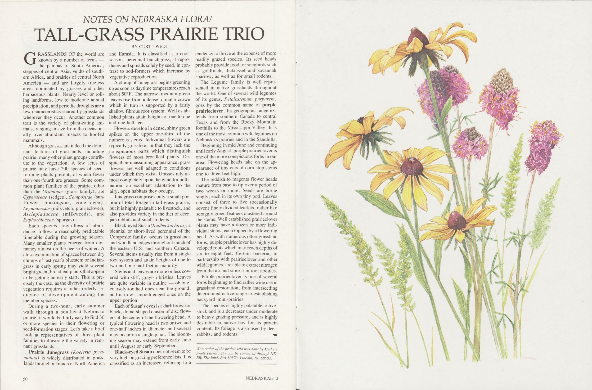
NOTES ON NEBRASKA FLORA / TALL-GRASS PRAIRIE TRIO
BY CURT TWEDTGRASSLANDS OF the world are known by a number of terms — the pampas of South America, steppes of central Asia, veldts of southern Africa, and prairies of central North America — and are largely treeless areas dominated by grasses and other herbaceous plants. Nearly level or rolling landforms, low to moderate annual precipitation, and periodic droughts are a few characteristics shared by grasslands wherever they occur. Another common trait is the variety of plant-eating animals , ranging in size from the occasionally overabundant insects to hoofed mammals.
Although grasses are indeed the dominant features of grasslands, including prairie, many other plant groups contribute to the vegetation. A few acres of prairie may have 200 species of seed-forming plants present, of which fewer than one-fourth are grasses. Some common plant families of the prairie, other than the Graminae (grass family), are Cyperaceae (sedges), Compositae (sunflower, blazingstar, coneflower), Leguminosae (milkvetch, prairieclover), Asclepiadaceae (milkweeds), and Euphorbiaceae (spurges).
Each species, regardless of abundance, follows a reasonably predictable timetable during the growing season. Many smaller plants emerge from dormancy almost on the heels of winter. A close examination of spaces between dry clumps of last year's bluestem or Indian-grass in early spring may yield several bright green, broadleaf plants that appear to be getting an early start. This is precisely the case, as the diversity of prairie vegetation requires a rather orderly sequence of development among the member species.
During a two-hour, early summer walk through a southeast Nebraska prairie, it would be fairly easy to find 30 or more species in their flowering or seed-formation stages. Let's take a brief look at representatives of three plant families to illustrate the variety in remnant grasslands.
Prairie Junegrass (Koeleria pyramidata) is widely distributed in grasslands throughout much of North America and Eurasia. It is classified as a cool-season, perennial bunchgrass; it reproduces and spreads solely by seed, in contrast to sod-formers which increase by vegetative reproduction.
A clump of Junegrass begins greening up as soon as daytime temperatures reach about 50°F. The narrow, medium-green leaves rise from a dense, circular crown which in turn is supported by a fairly shallow fibrous root system. Well established plants attain heights of one to one and one-half feet.
Flowers develop in dense, shiny green spikes on the upper one-third of the numerous stems. Individual flowers are typically grasslike, in that they lack the conspicuous parts which distinguish flowers of most broadleaf plants. Despite their unassuming appearance, grass flowers are well adapted to conditions under which they exist. Grasses rely almost completely upon the wind for pollination; an excellent adaptation to the airy, open habitats they occupy.
Junegrass comprises only a small portion of total forage in tall-grass prairie, but it is highly palatable to livestock, and also provides variety in the diet of deer, jackrabbits and small rodents.
Black-eyed Susan (Rudbeckia hirta), a biennial or short-lived perennial of the Composite family, occurs in grasslands and woodland edges throughout much of the eastern U.S. and southern Canada. Several stems usually rise from a single root system and attain heights of one to two and one-half feet at maturity.
Stems and leaves are more or less covered with stiff, grayish bristles. Leaves are quite variable in outline — oblong, coarsely-toothed ones near the ground, and narrow, smooth-edged ones on the upper portion.
Each of Susan's eyes is a dark brown or black, dome-shaped cluster of disc flowers at the center of the flowering head. A typical flowering head is two or two and one-half inches in diameter and several may occur on a single plant. The blooming season may extend from early June until August or early September.
Black-eyed Susan does not seem to be very high on grazing preference lists. It is classified as an increaser, referring to a tendency to thrive at the expense of more readily grazed species. Its seed heads probably provide food for songbirds such as goldfinch, dickcissel and savannah sparrow, as well as for small rodents.
The Legume family is well represented in native grasslands throughout the world. One of several wild legumes of its genus, Petalostemum purpurem, goes by the common name of purple prairieclover. Its geographic range extends from southern Canada to central Texas and from the Rocky Mountain foothills to the Mississippi Valley. It is one of the most common wild legumes on Nebraska's prairies and in the Sandhills.
Beginning in mid June and continuing until early August, purple prairieclover is one of the more conspicuous forbs in our area. Flowering heads take on the appearance of tiny ears of corn atop stems one to three feet high.
The reddish to magenta flower heads mature from base to tip over a period of two weeks or more. Seeds are borne singly, each in its own tiny pod. Leaves consist of three to five (occasionally seven) finely divided leaflets, rather like scraggly green feathers clustered around the stems. Well established prairieclover plants may have a dozen or more individual stems, each topped by a flowering head. As with numerous other grassland forbs, purple prairieclover has highly developed roots which may reach depths of six to eight feet. Certain bacteria, in partnership with prairieclover and other wild legumes, are able to extract nitrogen from the air and store it in root nodules.
Purple prairieclover is one of several forbs beginning to find rather wide use in grassland restoration, from interseeding deteriorated native range to establishing backyard mini-prairies.
The species is highly palatable to livestock and is a decreaser under moderate to heavy grazing pressure, and is highly desirable in native hay for its protein content. Its foliage is also used by deer, rabbits, and rodents.
Watercolor of the prairie trio was done by Miehele Angle Farrar. She can be contacted through NEBRASKAland, Box 30370, Lincoln, NE 68503. 50 NEBRASKAland
Get Hooked on Fishing
Fishing is something that can be tailored to each person's individual desires, and Nebraska has it all. Start enjoying the fun, beauty, relaxation and excitement of this great sport!
NEBRASKA GAME AND PARKS COMMISSION Eugene T. Mahoney, DirectorPosition: 353 (26 views)