Volume 61, Issue 1, 1983
NEBRASKAland Magazine's
Nebraska Rivers
NEBRASKAland Magazine's
Nebraska Rivers
Published by the Nebraska Game and Parks Commission VOL. 61 NO. 1 JANUARY-FEBRUARY 1983 NEBRASKAland Magazine ISSN: 0028-1964 Second class postage paid at Lincoln, Nebraska and at additional mailing offices
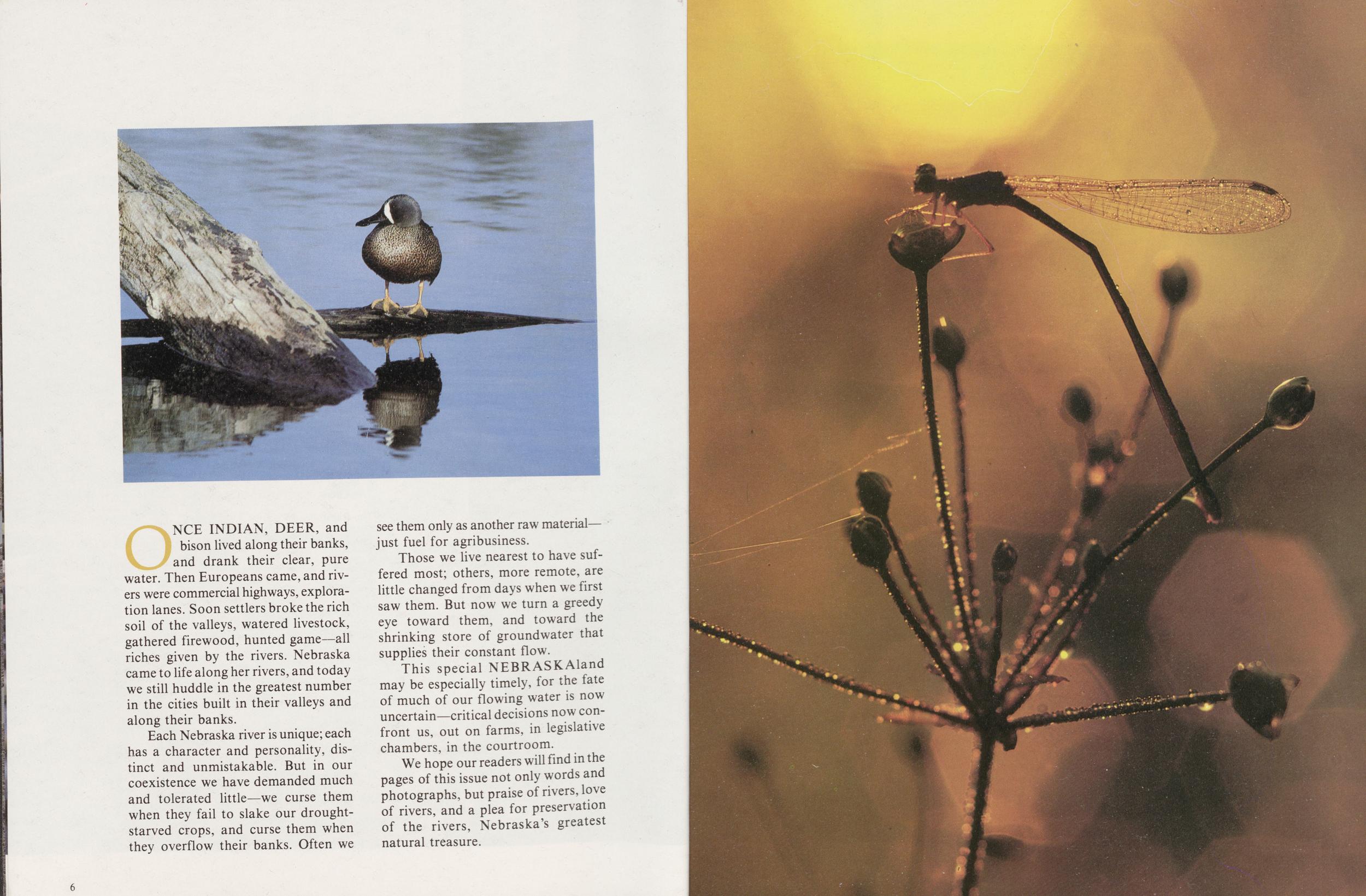
ONCE INDIAN, DEER, and bison lived along their banks, and drank their clear, pure water. Then Europeans came, and rivers were commercial highways, exploration lanes. Soon settlers broke the rich soil of the valleys, watered livestock, gathered firewood, hunted game—all riches given by the rivers. Nebraska came to life along her rivers, and today we still huddle in the greatest number in the cities built in their valleys and along their banks.
Each Nebraska river is unique; each has a character and personality, distinct and unmistakable. But in our coexistence we have demanded much and tolerated little—we curse them when they fail to slake our drought-starved crops, and curse them when they overflow their banks. Often we see them only as another raw material—just fuel for agribusiness.
Those we live nearest to have suffered most; others, more remote, are little changed from days when we first saw them. But now we turn a greedy eye toward them, and toward the shrinking store of groundwater that supplies their constant flow.
This special NEBRASKAland may be especially timely, for the fate of much of our flowing water is now uncertain—critical decisions now confront us, out on farms, in legislative chambers, in the courtroom.
We hope our readers will find in the pages of this issue not only words and photographs, but praise of rivers, love of rivers, and a plea for preservation of the rivers, Nebraska's greatest natural treasure.
6
RIVER PORTRAITS
The Dismal
BY JON FARRARIN THE 1870's there was no Highway 2 or Burlington tracks slicing diagonally across the Sandhills, opening up the interior. This featureless region of grass-covered dunes was perceived as hostile and uninhabitable by most who glimpsed it. It was natural that settlement should creep in tentatively from the margins. And so it did. Why the first Sandhills ranchers settled in the Dismal River country can be attributed to a prairie fire and an Englishman named John Bratt.
Ogallala was the trailhead for Texas cattle drives then, the rangey stock gaining back lost weight on Platte Valley grass while awaiting shipment east. In the fall of 1874, a prairie fire raged across the enormous piece of open range that Bratt claimed between the Platte and Republican rivers from Fort McPherson east of North Platte, to Fort Sedgwick (near present-day Julesburg, Colorado) on the west. His winter range in ashes, Bratt shipped four trainloads (30 cars each) of cattle to Chicago. What he couldn't sell he pushed north across the Platte into Indian territory. With two men, he searched deep into the Sandhills lake country for more range, across the Dismal River's two forks. Here he found ample grass, water for his herd, and cedar timber for cabins and corrals.
Word of the new range spread as fast as the prairie fire. In the fall of 1877, brothers Frank and Luther North joined with one William "Buffalo Bill" Cody and laid claim to open range on the Dismal River. Just 10 miles east of one of Bratt's winter camps, on a small lake at the headwaters of the Dismal's south fork, they established their headquarters; built a log ranch house, a sod stable and a big cedar-pole corral. To this day the lake is known as Cody Lake, although on some maps it is called Jefford Lake.
In his reminiscences, Luther North wrote: "The country was full of game: elk, whitetail and mule deer, antelope, and many prairie chickens, and the lakes west from the head of the Dismal River were alive with wild fowl: swans, sandhill cranes, geese and ducks by the millions." There were still wolves in the hills that could pull down a three-year-old heifer, and raiding parties of Sioux down from the Rosebud Agency stealing horses.
From the mouth of the Dismal, cattlemen were pushing their herds west, deeper into the Sandhills. An English company, Smith and Tee, located their headquarters at the mouth of the Dismal, just below present-day Dunning, in 1877. They, too, built a log cabin, the first in what would become Blaine County. But in just two years, Smith and Tee hands rounded up their cattle, along with some 300 wild elk, and sold out. The range was immediately claimed by the five Olive brothers from Texas, a family whose name would forever be tainted for involvement in the lynching and the burning of two Custer County 8
The 1870's were years of drought and big ranches, the 1880's a decade of settlers and frightful blizzards. No sooner did one rancher fail or decide to move on ahead of the flood of settlers, than another came to take his place. There were still ranches of enormous size. About 1882, David Rankin put together his Bar 7 Ranch that took in all the country between the Dismal and the North Loup rivers. But the number of settlers continued to swell and complicated the ranchers' free-wheeling operations. The ranchers had other problems, as well. In 1885 the cattle market crashed and the federal government let it be known that illegal fences on public land would come down and violators would be brought to justice.
The Dismal River range was no longer the Utopia that Bratt and the North brothers had found only a decade earlier. By 1886 the Burlington Railroad pushed to Broken Bow and two years later "burst through the Sandhills, brushed the sand from its locomotive headlight, combed the cactus from its cow-catcher ... and founded Alliance..."
Settlers lured by railroad promotions streamed into the Sandhills and began to turn the grass wrong side up. But, drought returned in the early 1890's and sent most scurrying for land better suited to the plow. The Dismal River country again became the domain of large cattle ranchers, often backed by European speculators.
At the turn of the century, the Black Brothers (backed by T. B. Hord, then building an empire of grain elevators, feedlots and ranches) ran cattle; too many cattle for the range along the Dismal River south of Thedford. Ranchers who came in after the Blacks said the range was just recovering from overgrazing when the dry 30's swept in on hot southwest winds. West of the Black Ranch the UBI, a British-owned ranch managed by Episcopal minister George T. Ware, was established in Hooker County and ran cattle between the Dismal and Middle Loup.
In 1904 the Kinkaid Act provided a free section of land to anyone who would settle in the Sandhills, and the fragile soil was again torn by the plow. One by one the big ranches folded, but within a few years the Kinkaiders were defeated by drought and by a soil best suited for growing grass and cattle. The ranchers who weathered the flood of grangers bought their sections and enlarged, this time on deeded land. Some Kinkaiders stayed, bought out their neighbors and became ranchers themselves. Finally, the destiny of the Dismal River country was sealed—this would be a cattleman's river; a meandering thread of lifegiving water wending its way through deep-cut canyons and dry sandhills; a wooded refuge that could carry cattle through the worst of Nebraska blizzards, but a river so deep, so fast, and with a sandy bottom so unsettled that to this day it tries even a cattleman's patience.
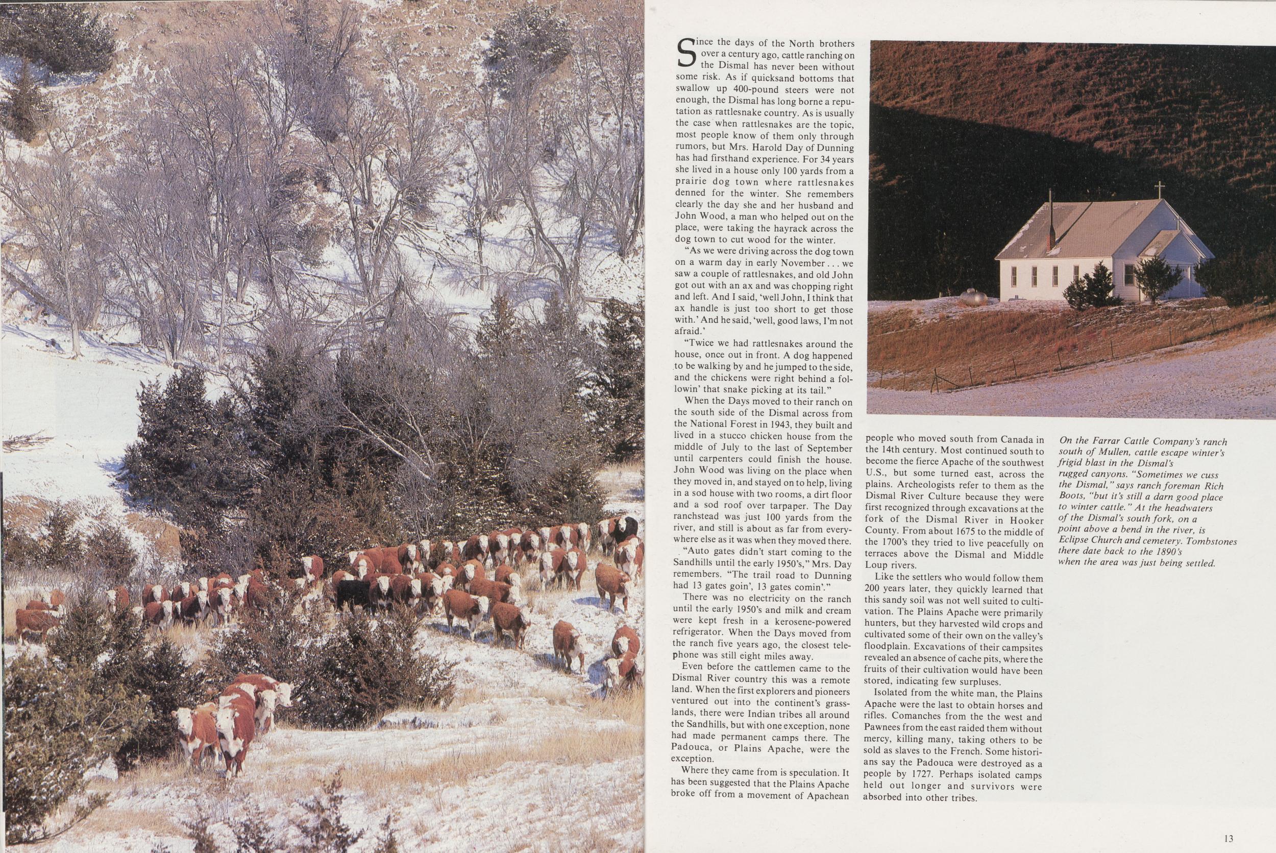
Last spring Rich Boots, foreman of the Farrar Cattle Company's east ranch, on the Dismal River south of Mullen, lost two steers in quicksand about eight miles east of the forks. The river is deep and fast for much of its length, and cattle balk at crossing it, but Boots was bringing them to a crossing that had been used for many years.
"When they started to cross, some just sank down. Then they started to pile up; 15 or 20 were mired in. I got off my horse and we got most of them turned around. The two we lost were still alive, but by the time we could get them out it was too late.
"We had a lot of rain in May and that softens up the river bottom. One rancher told me that in the late 20's and early 30's they used to lose cattle quite often on both the north and south forks.
"Sometimes we cuss the Dismal, but it's still a darn good place to winter cattle."
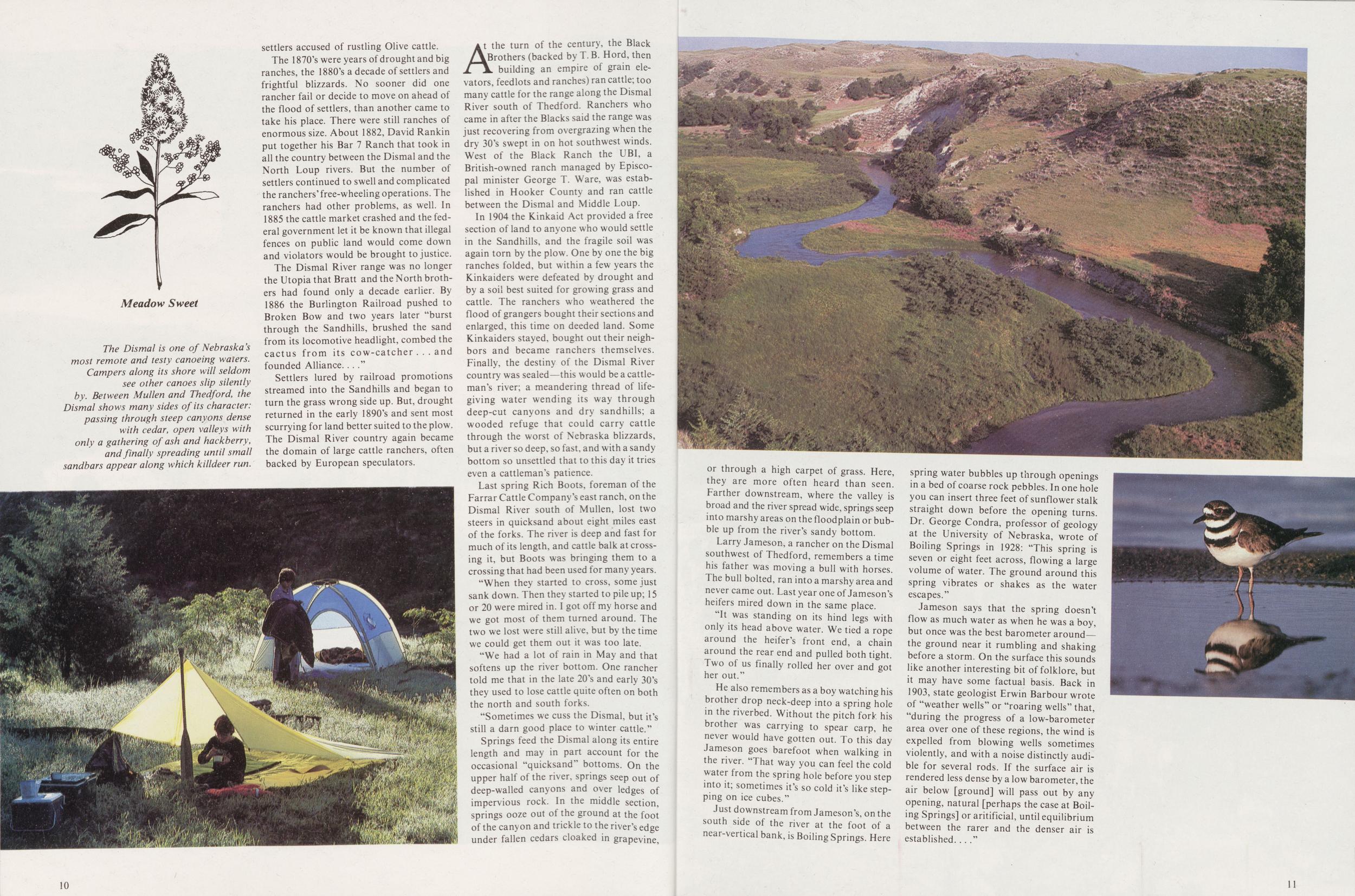
Springs feed the Dismal along its entire length and may in part account for the occasional "quicksand" bottoms. On the upper half of the river, springs seep out of deep-walled canyons and over ledges of impervious rock. In the middle section, springs ooze out of the ground at the foot of the canyon and trickle to the river's edge under fallen cedars cloaked in grapevine, 10
Larry Jameson, a rancher on the Dismal southwest of Thedford, remembers a time his father was moving a bull with horses. The bull bolted, ran into a marshy area and never came out. Last year one of Jameson's heifers mired down in the same place.
"It was standing on its hind legs with only its head above water. We tied a rope around the heifer's front end, a chain around the rear end and pulled both tight. Two of us finally rolled her over and got her out."
He also remembers as a boy watching his brother drop neck-deep into a spring hole in the riverbed. Without the pitch fork his brother was carrying to spear carp, he never would have gotten out. To this day Jameson goes barefoot when walking in the river. "That way you can feel the cold water from the spring hole before you step into it; sometimes it's so cold it's like stepping on ice cubes."
Just downstream from Jameson's, on the south side of the river at the foot of a near-vertical bank, is Boiling Springs. Here spring water bubbles up through openings in a bed of coarse rock pebbles. In one hole you can insert three feet of sunflower stalk straight down before the opening turns. Dr. George Condra, professor of geology at the University of Nebraska, wrote of Boiling Springs in 1928: "This spring is seven or eight feet across, flowing a large volume of water. The ground around this spring vibrates or shakes as the water escapes."
Jameson says that the spring doesn't flow as much water as when he was a boy, but once was the best barometer around—the ground near it rumbling and shaking before a storm. On the surface this sounds like another interesting bit of folklore, but it may have some factual basis. Back in 1903, state geologist Erwin Barbour wrote of "weather wells" or "roaring wells" that, "during the progress of a low-barometer area over one of these regions, the wind is expelled from blowing wells sometimes violently, and with a noise distinctly audible for several rods. If the surface air is rendered less dense by a low barometer, the air below [ground] will pass out by any opening, natural [perhaps the case at Boiling Springs] or aritificial, until equilibrium between the rarer and the denser air is established."
Since the days of the North brothers over a century ago. cattle ranching on the Dismal has never been without some risk. As if quicksand bottoms that swallow up 400-pound steers were not enough, the Dismal has long borne a reputation as rattlesnake country. As is usually the case when rattlesnakes are the topic, most people know of them only through rumors, but Mrs. Harold Day of Dunning has had firsthand experience. For 34 years she lived in a house only 100 yards from a prairie dog town where rattlesnakes denned for the winter. She remembers clearly the day she and her husband and John Wood, a man who helped out on the place, were taking the hayrack across the dog town to cut wood for the winter.
"As we were driving across the dog town on a warm day in early November we saw a couple of rattlesnakes, and old John got out with an ax and was chopping right and left. And I said, 'well John, I think that ax handle is just too short to get those with.' And he said, 'well, good laws, I'm not afraid.'
"Twice we had rattlesnakes around the house, once out in front. A dog happened to be walking by and he jumped to the side, and the chickens were right behind a followin' that snake picking at its tail."
When the Days moved to their ranch on the south side of the Dismal across from the National Forest in 1943, they built and lived in a stucco chicken house from the middle of July to the last of September until carpenters could finish the house. John Wood was living on the place when they moved in, and stayed on to help, living in a sod house with two rooms, a dirt floor and a sod roof over tarpaper. The Day ranchstead was just 100 yards from the river, and still is about as far from everywhere else as it was when they moved there.
. "Auto gates didn't start coming to the Sandhills until the early 1950's," Mrs. Day remembers. "The trail road to Dunning had 13 gates goin', 13 gates comin'."
There was no electricity on the ranch until the early 1950's and milk and cream were kept fresh in a kerosene-powered refrigerator. When the Days moved from the ranch five years ago, the closest telephone was still eight miles away.
Even before the cattlemen came to the Dismal River country this was a remote land. When the first explorers and pioneers ventured out into the continent's grasslands, there were Indian tribes all around the Sandhills, but with one exception, none had made permanent camps there. The Padouca, or Plains Apache, were the exception.
Where they came from is speculation. It has been suggested that the Plains Apache broke off from a movement of Apachean people who moved south from Canada in the 14th century. Most continued south to become the fierce Apache of the southwest U.S., but some turned east, across the plains. Archeologists refer to them as the Dismal River Culture because they were first recognized through excavations at the fork of the Dismal River in Hooker County. From about 1675 to the middle of the 1700's they tried to live peacefully on terraces above the Dismal and Middle Loup rivers.
Like the settlers who would follow them 200 years later, they quickly learned that this sandy soil was not well suited to cultivation. The Plains Apache were primarily hunters, but they harvested wild crops and cultivated some of their own on the valley's floodplain. Excavations of their campsites revealed an absence of cache pits, where the fruits of their cultivation would have been stored, indicating few surpluses.
Isolated from the white man, the Plains Apache were the last to obtain horses and rifles. Comanches from the the west and Pawnees from the east raided them without mercy, killing many, taking others to be sold as slaves to the French. Some historians say the Padouca were destroyed as a people by 1727. Perhaps isolated camps held out longer and survivors were absorbed into other tribes.
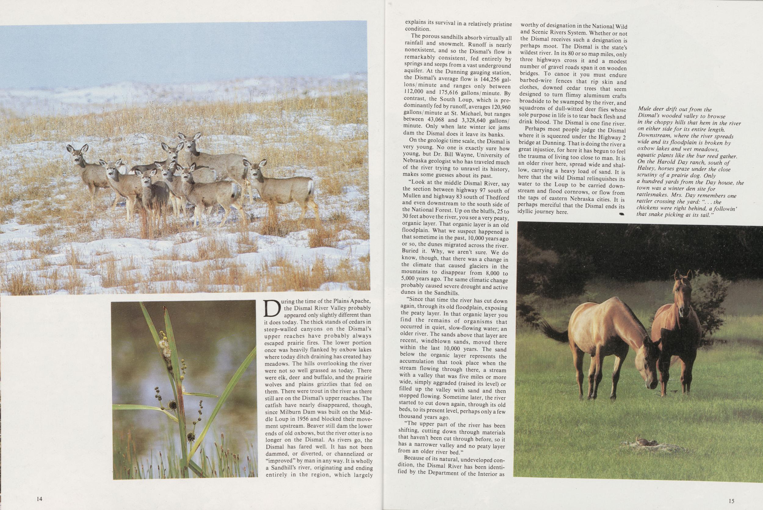
During the time of the Plains Apache, the Dismal River Valley probably appeared only slightly different than it does today. The thick stands of cedars in steep-walled canyons on the Dismal's upper reaches have probably always escaped prairie fires. The lower portion once was heavily flanked by oxbow lakes where today ditch draining has created hay meadows. The hills overlooking the river were not so well grassed as today. There were elk, deer and buffalo, and the prairie wolves and plains grizzlies that fed on them. There were trout in the river as there still are on the Dismal's upper reaches. The catfish have nearly disappeared, though, since Milburn Dam was built on the Middle Loup in 1956 and blocked their movement upstream. Beaver still dam the lower ends of old oxbows, but the river otter is no longer on the Dismal. As rivers go, the Dismal has fared well. It has not been dammed, or diverted, or channelized or "improved" by man in any way. It is wholly a Sandhill's river, originating and ending entirely in the region, which largely 14 explains its survival in a relatively pristine condition.
The porous sandhills absorb virtually all rainfall and snowmelt. Runoff is nearly nonexistent, and so the Dismal's flow is remarkably consistent, fed entirely by springs and seeps from a vast underground aquifer. At the Dunning gauging station, the Dismal's average flow is 144,256 gallons/minute and ranges only between 112,000 and 175,616 gallons/minute. By contrast, the South Loup, which is predominantly fed by runoff, averages 120,960 gallons/minute at St. Michael, but ranges between 43,068 and 3,328,640 gallons/minute. Only when late winter ice jams dam the Dismal does it leave its banks.
On the geologic time scale, the Dismal is very young. No one is exactly sure how young, but Dr. Bill Wayne, University of Nebraska geologist who has traveled much of the river trying to unravel its history, makes some guesses about its past.
"Look at the middle Dismal River, say the section between highway 97 south of Mullen and highway 83 south of Thedford and even downstream to the south side of the National Forest. Up on the bluffs, 25 to 30 feet above the river, you see a very peaty, organic layer. That organic layer is an old floodplain. What we suspect happened is that sometime in the past, 10,000 years ago or so, the dunes migrated across the river. Buried it. Why, we aren't sure. We do know, though, that there was a change in the climate that caused glaciers in the mountains to disappear from 8,000 to 5,000 years ago. The same climatic change probably caused severe drought and active dunes in the Sandhills.
"Since that time the river has cut down again, through its old floodplain, exposing the peaty layer. In that organic layer you find the remains of organisms that occurred in quiet, slow-flowing water; an older river. The sands above that layer are recent, windblown sands, moved there within the last 10,000 years. The sand below the organic layer represents the accumulation that took place when the stream flowing through there, a stream with a valley that was five miles or more wide, simply aggraded (raised its level) or filled up the valley with sand and then stopped flowing. Sometime later, the river started to cut down again, through its old beds, to its present level, perhaps only a few thousand years ago.
"The upper part of the river has been shifting, cutting down through materials that haven't been cut through before, so it has a narrower valley and no peaty layer from an older river bed."
Because of its natural, undeveloped condition, the Dismal River has been identified by the Department of the Interior as worthy of designation in the National Wild and Scenic Rivers System. Whether or not the Dismal receives such a designation is perhaps moot. The Dismal is the state's wildest river. In its 80 or so map miles, only three highways cross it and a modest number of gravel roads span it on wooden bridges. To canoe it you must endure barbed-wire fences that rip skin and clothes, downed cedar trees that seem designed to turn flimsy aluminum crafts broadside to be swamped by the river, and squadrons of dull-witted deer flies whose sole purpose in life is to tear back flesh and drink blood. The Dismal is one fine river.
Perhaps most people judge the Dismal where it is squeezed under the Highway 2 bridge at Dunning. That is doing the river a great injustice, for here it has begun to feel the trauma of living too close to man. It is an older river here, spread wide and shallow, carrying a heavy load of sand. It is here that the wild Dismal relinquishes its water to the Loup to be carried downstream and flood cornrows, or flow from the taps of eastern Nebraska cities. It is perhaps merciful that the Dismal ends its idyllic journey here.
RIVER PORTRAITS
The Frenchman
KEN BEARD lives a mile or so below the long, earthen dam that his grandfather and the grandfather of his closest neighbor, Rollo Maranville, dragged across the Frenchman River with a team of horses back in 1892. Known for some years as Arterburn Dam, that structure currently serves no real function to the farmers and ranchers of the Frenchman Valley except during years of excessive rainfall, when a small cache of water is collected behind its weedy berm.
During normal years, the riverbed above Arterburn is dry, as the groundwater that once formed the Frenchman has dropped recently from as far west as Logan County, Colorado. A few bubbling springs begin its present-day flow just above Beard's place.
From the backyard fence behind his house, Beard points out what's left of the Frenchman as it passes through the old Bussell Mill Pond that is also suffering from extensive dewatering. The flour mill has long since disappeared and only broken remnants of its natural rock foundation suggest an era of farming that began to replace early cattle ranching in the valley in 1885.
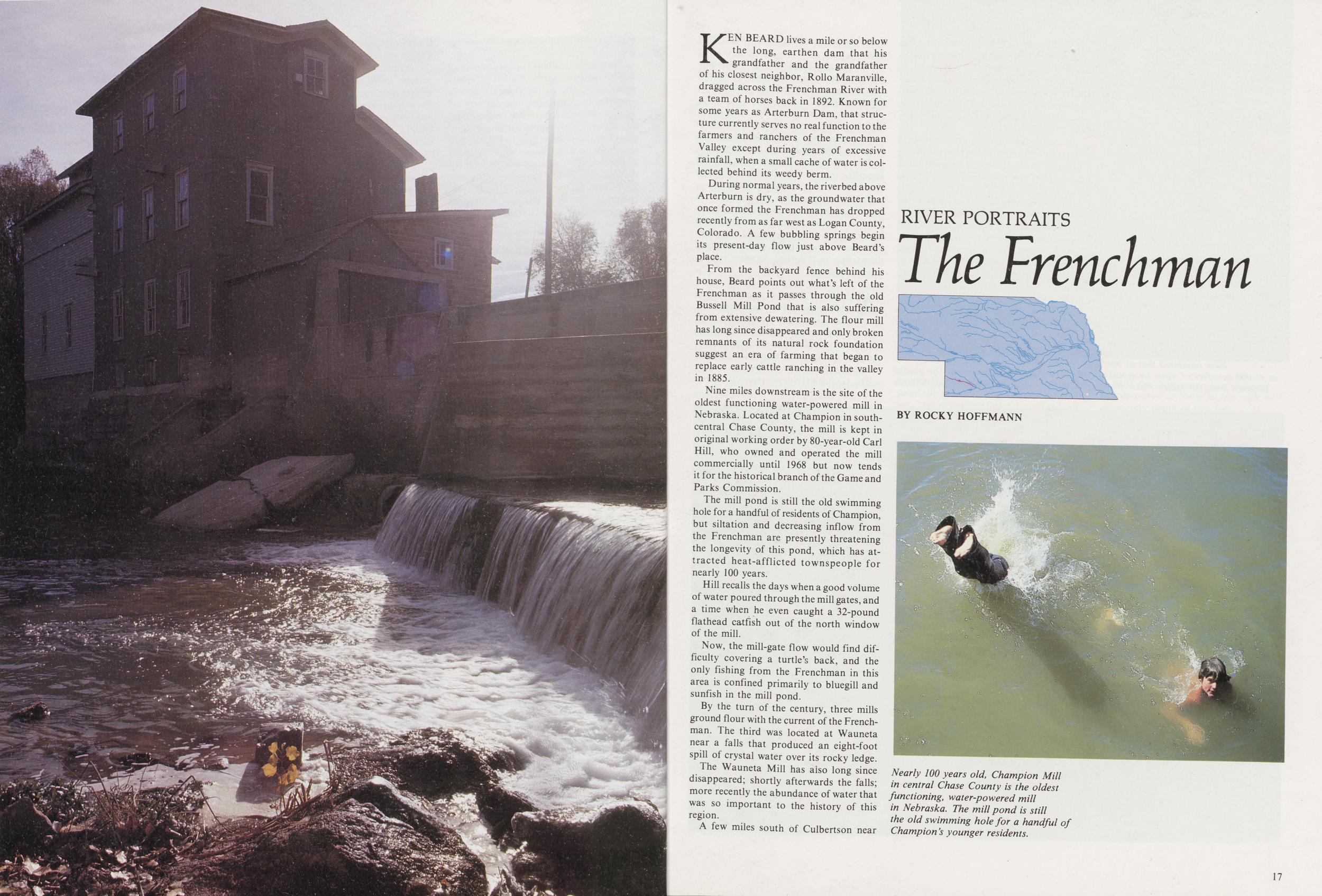
Nine miles downstream is the site of the oldest functioning water-powered mill in Nebraska. Located at Champion in south-central Chase County, the mill is kept in original working order by 80-year-old Carl Hill, who owned and operated the mill commercially until 1968 but now tends it for the historical branch of the Game and Parks Commission.
The mill pond is still the old swimming hole for a handful of residents of Champion, but siltation and decreasing inflow from the Frenchman are presently threatening the longevity of this pond, which has attracted heat-afflicted townspeople for nearly 100 years.
Hill recalls the days when a good volume of water poured through the mill gates, and a time when he even caught a 32-pound flathead catfish out of the north window of the mill.
Now, the mill-gate flow would find difficulty covering a turtle's back, and the only fishing from the Frenchman in this area is confined primarily to bluegill and sunfish in the mill pond.
By the turn of the century, three mills ground flour with the current of the Frenchman. The third was located at Wauneta near a falls that produced an eight-foot spill of crystal water over its rocky ledge.
The Wauneta Mill has also long since disappeared; shortly afterwards the falls; more recently the abundance of water that was so important to the history of this region.
A few miles south of Culbertson near
In all, the skeletal remains of more than 40 species of mammals have been unearthed, including those of what is believed to be the earliest mastadon recorded in Nebraska.
The site is an ancient watering hole that existed 14 million years ago, and the tremendous deposit of bones exemplifies the importance of water to this area even then.
As Voorhies relaxed in the shade of an abandoned farmhouse near the dig, he recounted the prehistory of the area; the life and death of ancient and often giant mammals; the shallow ocean that once made its bed across this continent; the Ogallala period with the uplift of the Rockies; the spread of sand and gravel across the plains; great volcanic explosions that would have dwarfed St. Helen's; and the Ice Age, which provided the glacial melt that began digging the Republican and Frenchman about one million years ago.
Voorhies explained that the Frenchman continued to cut in over subsequent glacial and interglacial periods for more than 950,000 years.
Sometime during the Ice Age which ended 10,000 years ago, the river encountered springs which trickled upward from the Ogallala aquifer, forming a self-sufficient stream no longer needing glacial run-offs—instead depending solely on the slow process of groundwater recharge.
Voorhies agrees that the million-year natural process of watering the Frenchman River is a mind-boggling exercise of prehistoric geological events, and the complete, unnatural process of its predicted dewatering in less than 30 years is even more staggering.
A U.S. GEOLOGICAL Survey report in 1979 confirmed that destruction, predicting a dry riverbed by 1992, and the Bureau of Reclamation believes believes that given the present circumstances, the river will serve no beneficial, irrigable use before the turn of the decade.
The Geological Survey report definitely 18 indicated that those circumstances result from excessive groundwater depletion, and Robert Kutz, project manager for the Bureau of Reclamation, points an accusing finger at deep-well irrigation on marginal land surrounding the Frenchman drainage
Very few dispute that charge, as extensive studies support the fact that deep-well pumping supplying center-pivot and some gravity-flow irrigation, is depleting Nebraska groundwater in the southwest at an alarming rate.
Like the buffalo that watered and grazed by the millions in the Frenchman and Republican basins, it is difficult to believe that such a vast amount of groundwater, which underlies South Dakota, Nebraska, Wyoming, Colorado, Kansas, Oklahoma, New Mexico, and Texas, could ever vanish.
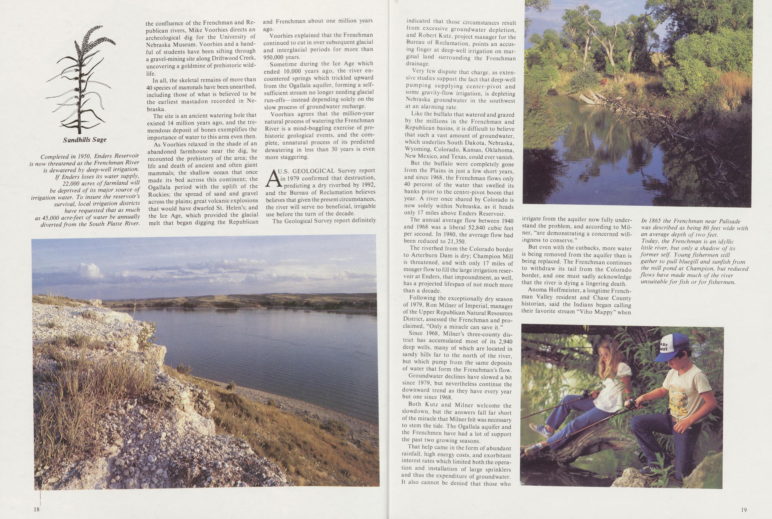
But the buffalo were completely gone from the Plains in just a few short years, and since 1968, the Frenchman flows only 40 percent of the water that swelled its banks prior to the center-pivot boom that year. A river once shared by Colorado is now solely within Nebraska, as it heads only 17 miles above Enders Reservoir.
The annual average flow between 1940 and 1968 was a liberal 52,840 cubic feet per second. In 1980, the average flow had been reduced to 21,350.
The riverbed from the Colorado border to Arterburn Dam is dry; Champion Mill is threatened, and with only 17 miles of meager flow to fill the large irrigation reservoir at Enders, that impoundment, as well, has a projected lifespan of not much more than a decade.
Following the exceptionally dry season of 1979, Ron Milner of Imperial, manager of the Upper Republican Natural Resources District, assessed the Frenchman and proclaimed, "Only a miracle can save it."
Since 1968, Milner's three-county district has accumulated most of its 2,940 deep wells, many of which are located in sandy hills far to the north of the river, but which pump from the same deposits of water that form the Frenchman's flow.
Groundwater declines have slowed a bit since 1979, but nevertheless continue the downward trend as they have every year but one since 1968.
Both Kutz and Milner welcome the slowdown, but the answers fall far short of the miracle that Milner felt was necessary to stem the tide. The Ogallala aquifer and the Frenchmen have had a lot of support the past two growing seasons.
That help came in the form of abundant rainfall, high energy costs, and exorbitant interest rates which limited both the operation and installation of large sprinklers and thus the expenditure of groundwater. It also cannot be denied that those who irrigate from the aquifer now fully understand the problem, and according to Milner, "are demonstrating a concerned willingness to conserve."
But even with the cutbacks, more water is being removed from the aquifer than is being replaced. The Frenchman continues to withdraw its tail from the Colorado border, and one must sadly acknowledge that the river is dying a lingering death.
Anoma Hoffmeister, a longtime Frenchman Valley resident and Chase County historian, said the Indians began calling their favorite stream "Viho Mappy" when
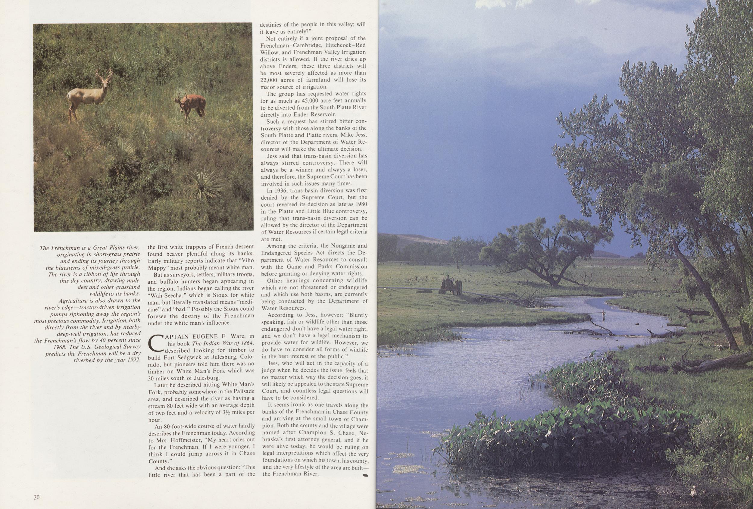
But as surveyors, settlers, military troops, and buffalo hunters began appearing in the region, Indians began calling the river "Wah-Seecha," which is Sioux for white man, but literally translated means "medicine" and "bad." Possibly the Sioux could foresee the destiny of the Frenchman under the white man's influence.
CAPTAIN EUGENE F. Ware, in his book The Indian War of 1864, described looking for timber to build Fort Sedgwick at Julesburg, Colorado, but pioneers told him there was no timber on White Man's Fork which was 30 miles south of Julesburg.
Later he described hitting White Man's Fork, probably somewhere in the Palisade area, and described the river as having a stream 80 feet wide with an average depth of two feet and a velocity of 3½ miles per hour.
An 80-foot-wide course of water hardly describes the Frenchman today. According to Mrs. Hoffmeister, "My heart cries out for the Frenchman. If I were younger, I think I could jump across it in Chase County."
And she asks the obvious question: "This little river that has been a part of the destinies of the people in this valley; will it leave us entirely?"
Not entirely if a joint proposal of the Frenchman-Cambridge, Hitchcock-Red Willow, and Frenchman Valley Irrigation districts is allowed. If the river dries up above Enders, these three districts will be most severely affected as more than 22,000 acres of farmland will lose its major source of irrigation.
The group has requested water rights for as much as 45,000 acre feet annually to be diverted from the South Platte River directly into Ender Reservoir.
Such a request has stirred bitter controversy with those along the banks of the South Platte and Platte rivers. Mike Jess, director of the Department of Water Resources will make the ultimate decision.
Jess said that trans-basin diversion has always stirred controversy. There will always be a winner and always a loser, and therefore, the Supreme Court has been involved in such issues many times.
In 1936, trans-basin diversion was first denied by the Supreme Court, but the court reversed its decision as late as 1980 in the Platte and Little Blue controversy, ruling that trans-basin diversion can be allowed by the director of the Department of Water Resources if certain legal criteria are met.
Among the criteria, the Nongame and Endangered Species Act directs the Department of Water Resources to consult with the Game and Parks Commission before granting or denying water rights.
Other hearings concerning wildlife which are not threatened or endangered and which use both basins, are currently being conducted by the Department of Water Resources.
According to Jess, however: "Bluntly speaking, fish or wildlife other than those endangered don't have a legal water right, and we don't have a legal mechanism to provide water for wildlife. However, we do have to consider all forms of wildlife in the best interest of the public."
Jess, who will act in the capacity of a judge when he decides the issue, feels that no matter which way the decision goes, it will likely be appealed to the state Supreme Court, and countless legal questions will have to be considered.
It seems ironic as one travels along the banks of the Frenchman in Chase County and arriving at the small town of Champion. Both the county and the village were named after Champion S. Chase, Nebraska's first attorney general, and if he were alive today, he would be ruling on legal interpretations which affect the very foundations on which his town, his county, and the very lifestyle of the area are built the Frenchman River.
20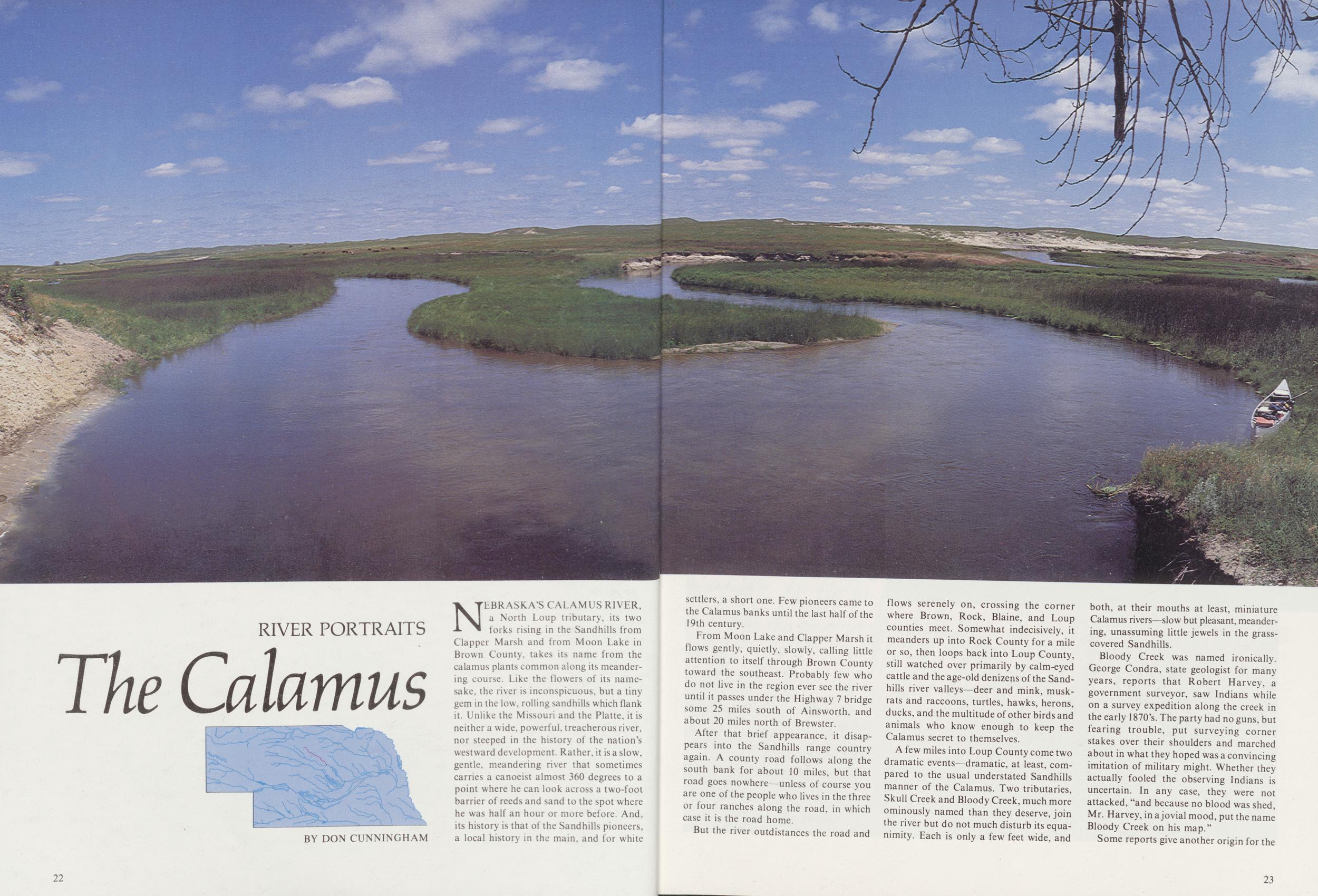
RIVER PORTRAITS
The Calamus
NEBRASKA'S CALAMUS RIVER, a North Loup tributary, its two forks rising in the Sandhills from Clapper Marsh and from Moon Lake in Brown County, takes its name from the calamus plants common along its meandering course. Like the flowers of its namesake, the river is inconspicuous, but a tiny gem in the low, rolling sandhills which flank it. Unlike the Missouri and the Platte, it is neither a wide, powerful, treacherous river, nor steeped in the history of the nation's westward development. Rather, it is a slow, gentle, meandering river that sometimes carries a canoeist almost 360 degrees to a point where he can look across a two-foot barrier of reeds and sand to the spot where he was half an hour or more before. And, its history is that of the Sandhills pioneers, a local history in the main, and for white 22
From Moon Lake and Clapper Marsh it flows gently, quietly, slowly, calling little attention to itself through Brown County toward the southeast. Probably few who do not live in the region ever see the river until it passes under the Highway 7 bridge some 25 miles south of Ainsworth, and about 20 miles north of Brewster.
After that brief appearance, it disappears into the Sandhills range country again. A county road follows along the south bank for about 10 miles, but that road goes nowhere—unless of course you are one of the people who lives in the three or four ranches along the road, in which case it is the road home.
But the river outdistances the road and flows serenely on, crossing the corner where Brown, Rock, Blaine, and Loup counties meet. Somewhat indecisively, it meanders up into Rock County for a mile or so, then loops back into Loup County, still watched over primarily by calm-eyed cattle and the age-old denizens of the Sandhills river valleys—deer and mink, muskrats and raccoons, turtles, hawks, herons, ducks, and the multitude of other birds and animals who know enough to keep the Calamus secret to themselves.
A few miles into Loup County come two dramatic events—dramatic, at least, compared to the usual understated Sandhills manner of the Calamus. Two tributaries, Skull Creek and Bloody Creek, much more ominously named than they deserve, join the river but do not much disturb its equanimity. Each is only a few feet wide, and both, at their mouths at least, miniature Calamus rivers—slow but pleasant, meandering, unassuming little jewels in the grasscovered Sandhills.
Bloody Creek was named ironically. George Condra, state geologist for many years, reports that Robert Harvey, a government surveyor, saw Indians while on a survey expedition along the creek in the early 1870's. The party had no guns, but fearing trouble, put surveying corner stakes over their shoulders and marched about in what they hoped was a convincing imitation of military might. Whether they actually fooled the observing Indians is uncertain. In any case, they were not attacked, "and because no blood was shed, Mr. Harvey, in a jovial mood, put the name Bloody Creek on his map."
Some reports give another origin for the 23 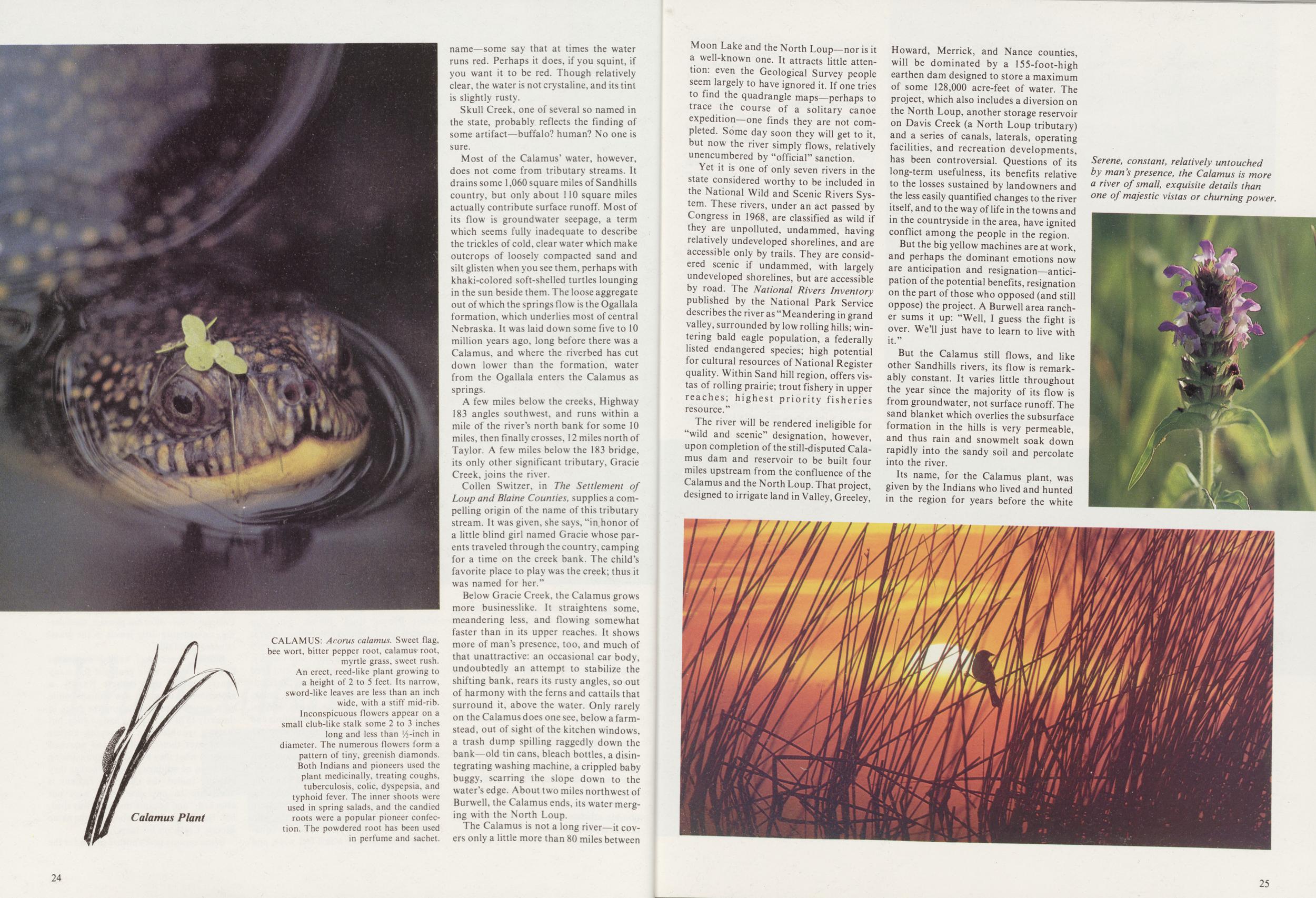
Skull Creek, one of several so named in the state, probably reflects the finding of some artifact—buffalo? human? No one is sure.
Most of the Calamus' water, however, does not come from tributary streams. It drains some 1,060 square miles of Sandhills country, but only about 110 square miles actually contribute surface runoff. Most of its flow is groundwater seepage, a term which seems fully inadequate to describe the trickles of cold, clear water which make outcrops of loosely compacted sand and silt glisten when you see them, perhaps with khaki-colored soft-shelled turtles lounging in the sun beside them. The loose aggregate out of which the springs flow is the Ogallala formation, which underlies most of central Nebraska. It was laid down some five to 10 million years ago, long before there was a Calamus, and where the riverbed has cut down lower than the formation, water from the Ogallala enters the Calamus as springs.
A few miles below the creeks, Highway 183 angles southwest, and runs within a mile of the river's north bank for some 10 miles, then finally crosses, 12 miles north of Taylor. A few miles below the 183 bridge, its only other significant tributary, Gracie Creek, joins the river.
Collen Switzer, in The Settlement of Loup and Blaine Counties, supplies a compelling origin of the name of this tributary stream. It was given, she says, "in honor of a little blind girl named Gracie whose parents traveled through the country, camping for a time on the creek bank. The child's favorite place to play was the creek; thus it was named for her."
Below Gracie Creek, the Calamus grows more businesslike. It straightens some, meandering less, and flowing somewhat faster than in its upper reaches. It shows more of man's presence, too, and much of that unattractive: an occasional car body, undoubtedly an attempt to stabilize the shifting bank, rears its rusty angles, so out of harmony with the ferns and cattails that surround it, above the water. Only rarely on the Calamus does one see, below a farmstead, out of sight of the kitchen windows, a trash dump spilling raggedly down the bank—old tin cans, bleach bottles, a disintegrating washing machine, a crippled baby buggy, scarring the slope down to the water's edge. About two miles northwest of Burwell, the Calamus ends, its water merging with the North Loup.
The Calamus is not a long river—it covers only a little more than 80 miles between 24 Moon Lake and the North Loup—nor is it a well-known one. It attracts little attention: even the Geological Survey people seem largely to have ignored it. If one tries to find the quadrangle maps—perhaps to trace the course of a solitary canoe expedition—one finds they are not completed. Some day soon they will get to it, but now the river simply flows, relatively unencumbered by "official" sanction.
Yet it is one of only seven rivers in the state considered worthy to be included in the National Wild and Scenic Rivers System. These rivers, under an act passed by Congress in 1968, are classified as wild if they are unpolluted, undammed, having relatively undeveloped shorelines, and are accessible only by trails. They are considered scenic if undammed, with largely undeveloped shorelines, but are accessible by road. The National Rivers Inventory published by the National Park Service describes the river as "Meandering in grand valley, surrounded by low rolling hills; wintering bald eagle population, a federally listed endangered species; high potential for cultural resources of National Register quality. Within Sand hill region, offers vistas of rolling prairie; trout fishery in upper reaches; highest priority fisheries resource."
The river will be rendered ineligible for "wild and scenic" designation, however, upon completion of the still-disputed Calamus dam and reservoir to be built four miles upstream from the confluence of the Calamus and the North Loup. That project, designed to irrigate land in Valley, Greeley, Howard, Merrick, and Nance counties, will be dominated by a 155-foot-high earthen dam designed to store a maximum of some 128,000 acre-feet of water. The project, which also includes a diversion on the North Loup, another storage reservoir on Davis Creek (a North Loup tributary) and a series of canals, laterals, operating facilities, and recreation developments, has been controversial. Questions of its long-term usefulness, its benefits relative to the losses sustained by landowners and the less easily quantified changes to the river itself, and to the way of life in the towns and in the countryside in the area, have ignited conflict among the people in the region. But the big yellow machines are at work, and perhaps the dominant emotions now are anticipation and resignation—anticipation of the potential benefits, resignation on the part of those who opposed (and still oppose) the project. A Burwell area rancher sums it up: "Well, I guess the fight is over. We'll just have to learn to live with it."
But the Calamus still flows, and like other Sandhills rivers, its flow is remarkably constant. It varies little throughout the year since the majority of its flow is from groundwater, not surface runoff. The sand blanket which overlies the subsurface formation in the hills is very permeable, and thus rain and snowmelt soak down rapidly into the sandy soil and percolate into the river.
Its name, for the Calamus plant, was given by the Indians who lived and hunted in the region for years before the white
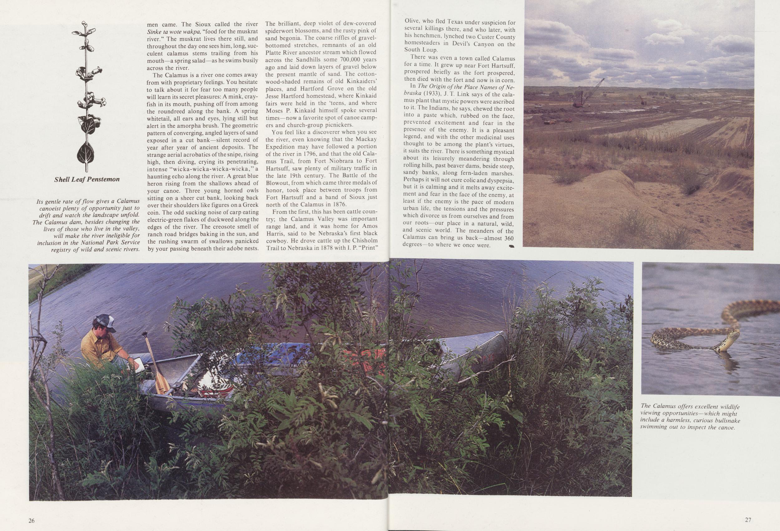
The Calamus is a river one comes away from with proprietary feelings. You hesitate to talk about it for fear too many people will learn its secret pleasures: A mink, crayfish in its mouth, pushing off from among the roundreed along the bank. A spring whitetail, all ears and eyes, lying still but alert in the amorpha brush. The geometric pattern of converging, angled layers of sand exposed in a cut bank—silent record of year after year of ancient deposits. The strange aerial acrobatics of the snipe, rising high, then diving, crying its penetrating, intense "wicka-wicka-wicka-wicka," a haunting echo along the river. A great blue heron rising from the shallows ahead of your canoe. Three young horned owls sitting on a sheer cut bank, looking back over their shoulders like figures on a Greek coin. The odd sucking noise of carp eating electric-green flakes of duckweed along the edges of the river. The creosote smell of ranch road bridges baking in the sun, and the rushing swarm of swallows panicked by your passing beneath their adobe nests. The brilliant, deep violet of dew-covered spiderwort blossoms, and the rusty pink of sand begonia. The coarse riffles of gravel-bottomed stretches, remnants of an old Platte River ancestor stream which flowed across the Sandhills some 700,000 years ago and laid down layers of gravel below the present mantle of sand. The cottonwood-shaded remains of old Kinkaiders' places, and Hartford Grove on the old Jesse Hartford homestead, where Kinkaid fairs were held in the 'teens, and where Moses P. Kinkaid himself spoke several times—now a favorite spot of canoe campers and church-group picnickers.
You feel like a discoverer when you see the river, even knowing that the Mackay Expedition may have followed a portion of the river in 1796, and that the old Calamus Trail, from Fort Niobrara to Fort Hartsuff, saw plenty of military traffic in the late 19th century. The Battle of the Blowout, from which came three medals of honor, took place between troops from Fort Hartsuff and a band of Sioux just north of the Calamus in 1876.
From the first, this has been cattle country; the Calamus Valley was important range land, and it was home for Amos Harris, said to be Nebraska's first black cowboy. He drove cattle up the Chisholm Trail to Nebraska in 1878 with I. P. "Print" 26 Olive, who fled Texas under suspicion for several killings there, and who later, with his henchmen, lynched two Custer County homesteaders in Devil's Canyon on the South Loup.
There was even a town called Calamus for a time. It grew up near Fort Hartsuff, prospered briefly as the fort prospered, then died with the fort and now is in corn.
In The Origin of the Place Names of Nebraska (1933). J. T Link says of the calamus plant that mystic powers were ascribed to it. The Indians, he says, chewed the root into a paste which, rubbed on the face, prevented excitement and fear in the presence of the enemy. It is a pleasant legend, and with the other medicinal uses thought to be among the plant's virtues, it suits the river. There is something mystical about its leisurely meandering through rolling hills, past beaver dams, beside steep, sandy banks, along fern-laden marshes. Perhaps it will not cure colic and dyspepsia, but it is calming and it melts away excitement and fear in the face of the enemy, at least if the enemy is the pace of modern urban life, the tensions and the pressures which divorce us from ourselves and from our roots-our place in a natural, wild, and scenic world. The meanders of the Calamus can bring us back—almost 360 degrees -to where we once were.
RIVER PORTRAITS
The Platte
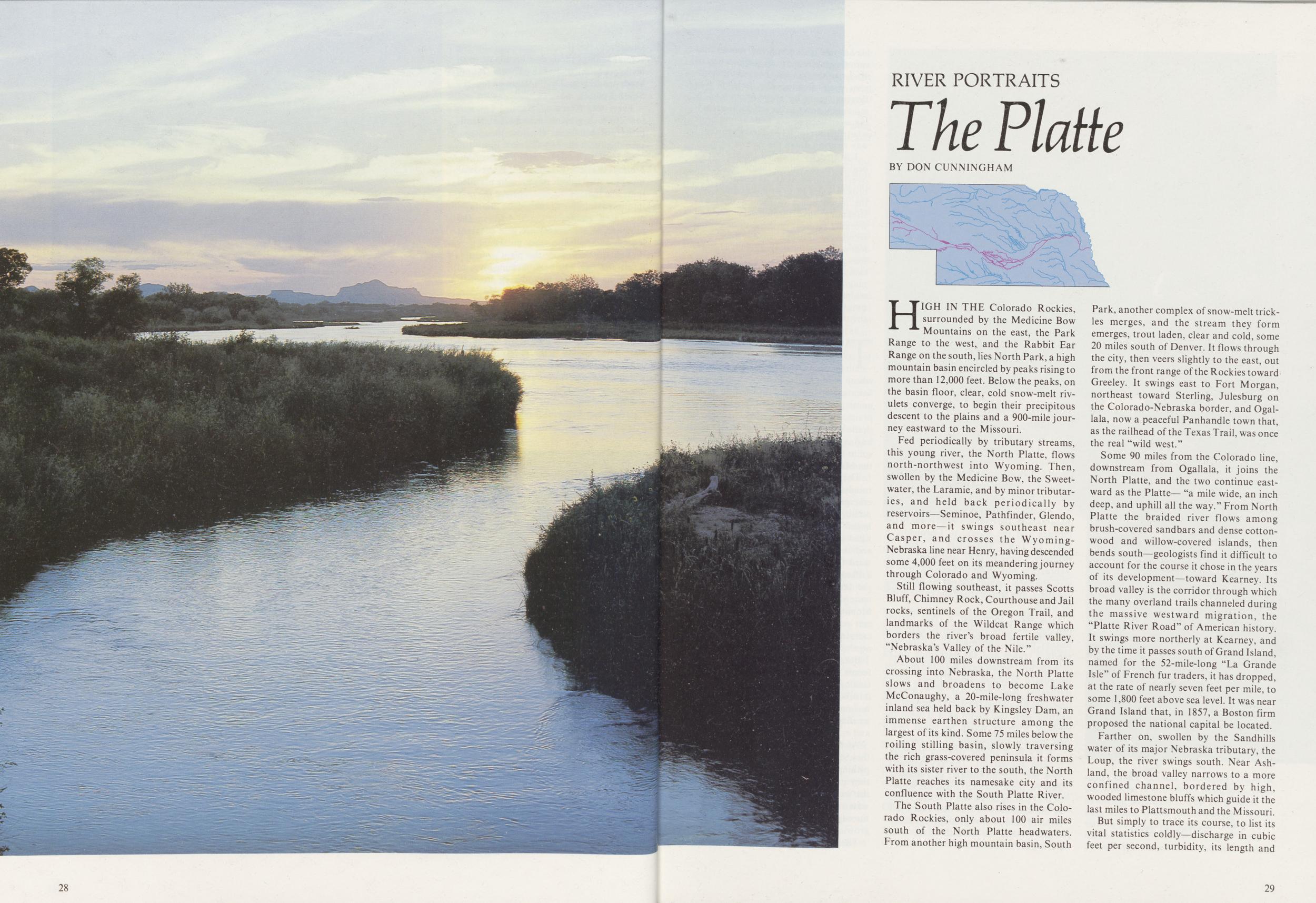
BY DON CUNNINGHAMHIGH IN THE Colorado Rockies, surrounded by the Medicine Bow Mountains on the east, the Park Range to the west, and the Rabbit Ear Range on the south, lies North Park, a high mountain basin encircled by peaks rising to more than 12,000 feet. Below the peaks, on the basin floor, clear, cold snow-melt rivulets converge, to begin their precipitous descent to the plains and a 900-mile journey eastward to the Missouri.
Fed periodically by tributary streams, this young river, the North Platte, flows north-northwest into Wyoming. Then, swollen by the Medicine Bow, the Sweetwater, the Laramie, and by minor tributaries, and held back periodically by reservoirs—Seminoe, Pathfinder, Glendo, and more—it swings southeast near Casper, and crosses the Wyoming-Nebraska line near Henry, having descended some 4,000 feet on its meandering journey through Colorado and Wyoming.
Still flowing southeast, it passes Scotts Bluff, Chimney Rock, Courthouse and Jail rocks, sentinels of the Oregon Trail, and landmarks of the Wildcat Range which borders the river's broad fertile valley, "Nebraska's Valley of the Nile."
About 100 miles downstream from its crossing into Nebraska, the North Platte slows and broadens to become Lake McConaughy, a 20-mile-long freshwater inland sea held back by Kingsley Dam, an immense earthen structure among the largest of its kind. Some 75 miles below the roiling stilling basin, slowly traversing the rich grass-covered peninsula it forms with its sister river to the south, the North Platte reaches its namesake city and its confluence with the South Platte River.
The South Platte also rises in the Colorado Rockies, only about 100 air miles south of the North Platte headwaters. From another high mountain basin, South Park, another complex of snow-melt trickles merges, and the stream they form emerges, trout laden, clear and cold, some 20 miles south of Denver. It flows through the city, then veers slightly to the east, out from the front range of the Rockies toward Greeley. It swings east to Fort Morgan, northeast toward Sterling, Julesburg on the Colorado-Nebraska border, and Ogallala, now a peaceful Panhandle town that, as the railhead of the Texas Trail, was once the real "wild west."
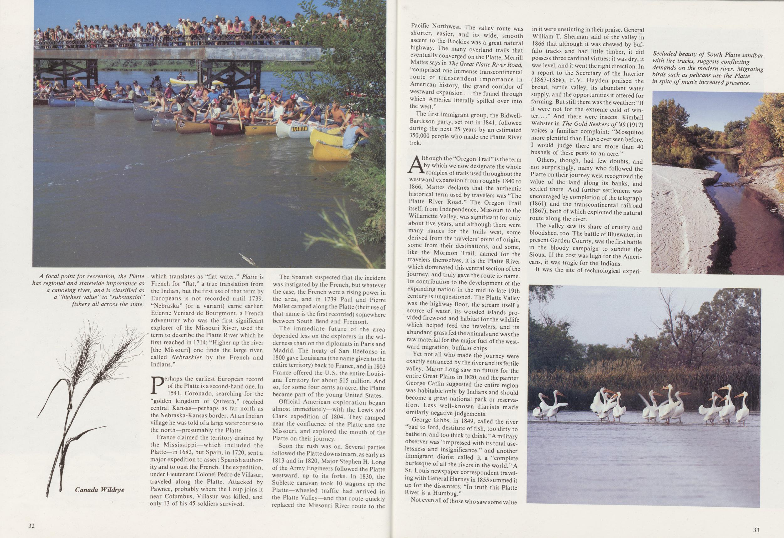
Some 90 miles from the Colorado line, downstream from Ogallala, it joins the North Platte, and the two continue eastward as the Platte— "a mile wide, an inch deep, and uphill all the way." From North Platte the braided river flows among brush-covered sandbars and dense cottonwood and willow-covered islands, then bends south—geologists find it difficult to account for the course it chose in the years of its development—toward Kearney. Its broad valley is the corridor through which the many overland trails channeled during the massive westward migration, the "Platte River Road" of American history. It swings more northerly at Kearney, and by the time it passes south of Grand Island, named for the 52-mile-long "La Grande Isle" of French fur traders, it has dropped, at the rate of nearly seven feet per mile, to some 1,800 feet above sea level. It was near Grand Island that, in 1857, a Boston firm proposed the national capital be located.
Farther on, swollen by the Sandhills water of its major Nebraska tributary, the Loup, the river swings south. Near Ashland, the broad valley narrows to a more confined channel, bordered by high, wooded limestone bluffs which guide it the last miles to Plattsmouth and the Missouri.
But simply to trace its course, to list its vital statistics coldly—discharge in cubic feet per second, turbidity, its length and 29 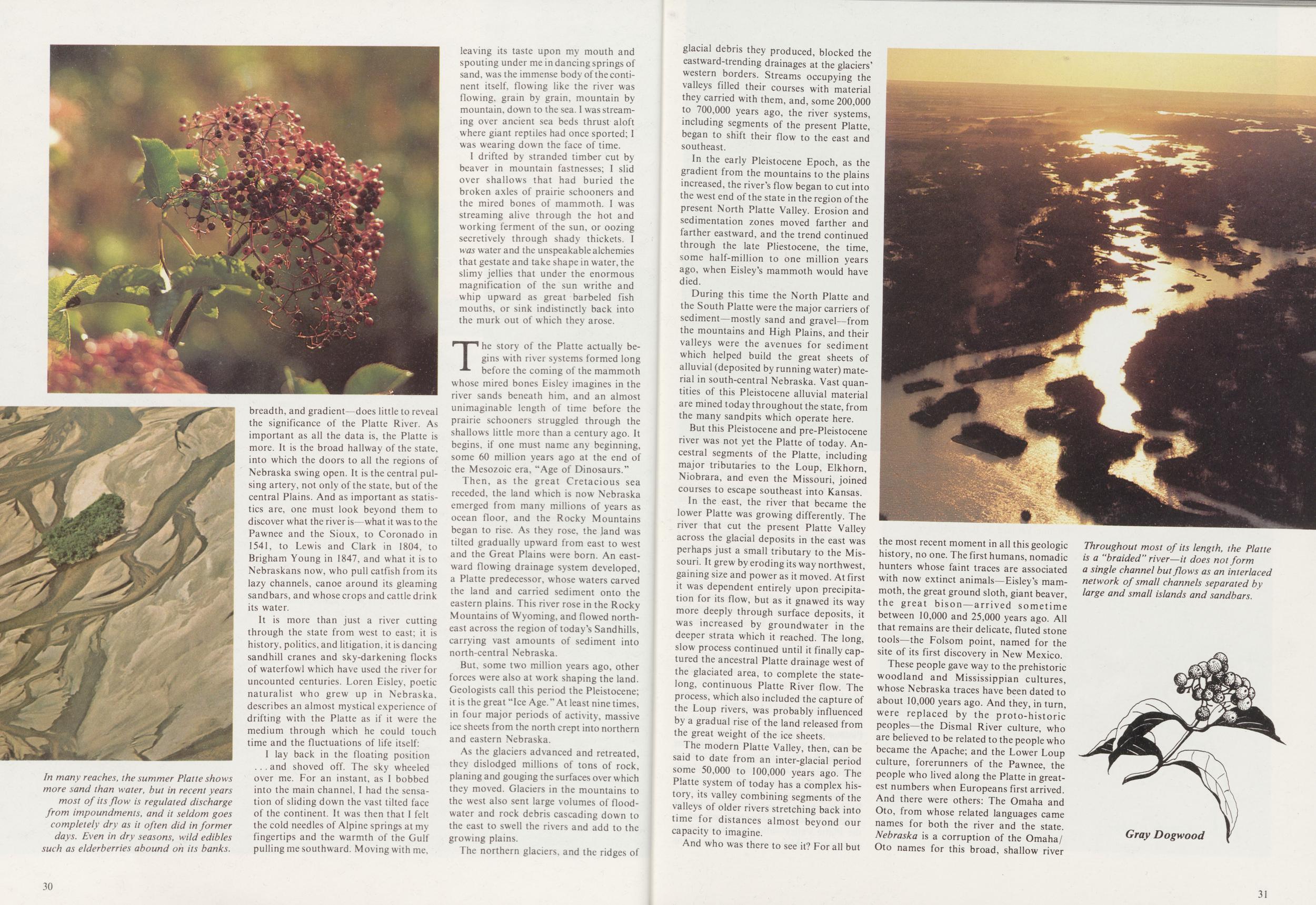
It is more than just a river cutting through the state from west to east; it is history, politics, and litigation, it is dancing sandhill cranes and sky-darkening flocks of waterfowl which have used the river for uncounted centuries. Loren Eisley, poetic naturalist who grew up in Nebraska, describes an almost mystical experience of drifting with the Platte as if it were the medium through which he could touch time and the fluctuations of life itself: I lay back in the floating position and shoved off. The sky wheeled over me. For an instant, as I bobbed into the main channel, I had the sensation of sliding down the vast tilted face of the continent. It was then that I felt the cold needles of Alpine springs at my fingertips and the warmth of the Gulf pulling me southward. Moving with me, leaving its taste upon my mouth and spouting under me in dancing springs of sand, was the immense body of the continent itself, flowing like the river was flowing, grain by grain, mountain by mountain, down to the sea. I was streaming over ancient sea beds thrust aloft where giant reptiles had once sported; I was wearing down the face of time.
I drifted by stranded timber cut by beaver in mountain fastnesses; I slid over shallows that had buried the broken axles of prairie schooners and the mired bones of mammoth. I was streaming alive through the hot and working ferment of the sun, or oozing secretively through shady thickets. I was water and the unspeakable alchemies that gestate and take shape in water, the slimy jellies that under the enormous magnification of the sun writhe and whip upward as great barbeled fish mouths, or sink indistinctly back into the murk out of which they arose.
The story of the Platte actually begins with river systems formed long before the coming of the mammoth whose mired bones Eisley imagines in the river sands beneath him, and an almost unimaginable length of time before the prairie schooners struggled through the shallows little more than a century ago. It begins, if one must name any beginning, some 60 million years ago at the end of the Mesozoic era, "Age of Dinosaurs."
Then, as the great Cretacious sea receded, the land which is now Nebraska emerged from many millions of years as ocean floor, and the Rocky Mountains began to rise. As they rose, the land was tilted gradually upward from east to west and the Great Plains were born. An eastward flowing drainage system developed, a Platte predecessor, whose waters carved the land and carried sediment onto the eastern plains. This river rose in the Rocky Mountains of Wyoming, and flowed northeast across the region of today's Sandhills, carrying vast amounts of sediment into north-central Nebraska.
But, some two million years ago, other forces were also at work shaping the land. Geologists call this period the Pleistocene; it is the great "Ice Age." At least nine times, in four major periods of activity, massive ice sheets from the north crept into northern and eastern Nebraska.
As the glaciers advanced and retreated, they dislodged millions of tons of rock, planing and gouging the surfaces over which they moved. Glaciers in the mountains to the west also sent large volumes of floodwater and rock debris cascading down to the east to swell the rivers and add to the growing plains.
The northern glaciers, and the ridges of 30 glacial debris they produced, blocked the eastward-trending drainages at the glaciers' western borders. Streams occupying the valleys filled their courses with material they carried with them, and, some 200,000 to 700,000 years ago, the river systems, including segments of the present Platte, began to shift their flow to the east and southeast.
In the early Pleistocene Epoch, as the gradient from the mountains to the plains increased, the river's flow began to cut into the west end of the state in the region of the present North Platte Valley. Erosion and sedimentation zones moved farther and farther eastward, and the trend continued through the late Pliestocene, the time, some half-million to one million years ago, when Eisley's mammoth would have died.
During this time the North Platte and the South Platte were the major carriers of sediment—mostly sand and gravel—from the mountains and High Plains, and their valleys were the avenues for sediment which helped build the great sheets of alluvial (deposited by running water) material in south-central Nebraska. Vast quantities of this Pleistocene alluvial material are mined today throughout the state, from the many sandpits which operate here.
But this Pleistocene and pre-Pleistocene river was not yet the Platte of today. Ancestral segments of the Platte, including major tributaries to the Loup, Elkhorn, Niobrara, and even the Missouri, joined courses to escape southeast into Kansas.
In the east, the river that became the lower Platte was growing differently. The river that cut the present Platte Valley across the glacial deposits in the east was perhaps just a small tributary to the Missouri. It grew by eroding its way northwest, gaining size and power as it moved. At first it was dependent entirely upon precipitation for its flow, but as it gnawed its way more deeply through surface deposits, it was increased by groundwater in the deeper strata which it reached. The long, slow process continued until it finally captured the ancestral Platte drainage west of the glaciated area, to complete the state-long, continuous Platte River flow. The process, which also included the capture of the Loup rivers, was probably influenced by a gradual rise of the land released from the great weight of the ice sheets.
The modern Platte Valley, then, can be said to date from an inter-glacial period some 50,000 to 100,000 years ago. The Platte system of today has a complex history, its valley combining segments of the valleys of older rivers stretching back into time for distances almost beyond our capacity to imagine.
And who was there to see it? For all but the most recent moment in all this geologic history, no one. The first humans, nomadic hunters whose faint traces are associated with now extinct animals—Eisley's mammoth, the great ground sloth, giant beaver, the great bison—arrived sometime between 10,000 and 25,000 years ago. All that remains are their delicate, fluted stone tools—the Folsom point, named for the site of its first discovery in New Mexico.
These people gave way to the prehistoric woodland and Mississippian cultures, whose Nebraska traces have been dated to about 10,000 years ago. And they, in turn, were replaced by the proto-historic peoples—the Dismal River culture, who are believed to be related to the people who became the Apache; and the Lower Loup culture, forerunners of the Pawnee, the people who lived along the Platte in greatest numbers when Europeans first arrived. And there were others: The Omaha and Oto, from whose related languages came names for both the river and the state. Nebraska is a corruption of the Omaha/Oto names for this broad, shallow river
Perhaps the earliest European record of the Platte is a second-hand one. In 1541, Coronado, searching for'the "golden kingdom of Quivera," reached central Kansas—perhaps as far north as the Nebraska-Kansas border. At an Indian village he was told of a large watercourse to the north—presumably the Platte.
France claimed the territory drained by the Mississippi—which included the Platte—in 1682, but Spain, in 1720, sent a major expedition to assert Spanish authority and to oust the French. The expedition, under Lieutenant Colonel Pedro de Villasur, traveled along the Platte. Attacked by Pawnee, probably where the Loup joins it near Columbus, Villasur was killed, and only 13 of his 45 soldiers survived.
The Spanish suspected that the incident was instigated by the French, but whatever the case, the French were a rising power in the area, and in 1739 Paul and Pierre Mallet camped along the Platte (their use of that name is the first recorded) somewhere between South Bend and Fremont.
The immediate future of the area depended less on the explorers in the wilderness than on the diplomats in Paris and Madrid. The treaty of San Ildefonso in 1800 gave Louisiana (the name given to the entire territory) back to France, and in 1803 France offered the U.S. the entire Louisiana Territory for about $15 million. And so, for some four cents an acre, the Platte became part of the young United States.
Official American exploration began almost immediately—with the Lewis and Clark expedition of 1804. They camped near the confluence of the Platte and the Missouri, and explored the mouth of the Platte on their journey.
Soon the rush was on. Several parties followed the Platte downstream, as early as 1813 and in 1820, Major Stephen H. Long of the Army Engineers followed the Platte westward, up to its forks. In 1830, the Sublette caravan took 10 wagons up the Platte—wheeled traffic had arrived in the Platte Valley—and that route quickly replaced the Missouri River route to the 32 Pacific Northwest. The valley route was shorter, easier, and its wide, smooth ascent to the Rockies was a great natural highway. The many overland trails that eventually converged on the Platte, Merrill Mattes says in The Great Platte River Road, "comprised one immense transcontinental route of transcendent importance in American history, the grand corridor of westward expansion the funnel through which America literally spilled over into the west."
The first immigrant group, the Bidwell-Bartleson party, set out in 1841, followed during the next 25 years by an estimated 350,000 people who made the Platte River trek.
Although the "Oregon Trail" is the term by which we now designate the whole complex of trails used throughout the westward expansion from roughly 1840 to 1866, Mattes declares that the authentic historical term used by travelers was "The Platte River Road." The Oregon Trail itself, from Independence, Missouri to the Willamette Valley, was significant for only about five years, and although there were many names for the trails west, some derived from the travelers' point of origin, some from their destinations, and some, like the Mormon Trail, named for the travelers themselves, it is the Platte River which dominated this central section of the journey, and truly gave the route its name. Its contribution to the development of the expanding nation in the mid to late 19th century is unquestioned. The Platte Valley was the highway floor, the stream itself a source of water, its wooded islands provided firewood and habitat for the wildlife which helped feed the travelers, and its abundant grass fed the animals and was the raw material for the major fuel of the westward migration, buffalo chips.
Yet not all who made the journey were exactly entranced by the river and its fertile valley. Major Long saw no future for the entire Great Plains in 1820, and the painter George Catlin suggested the entire region was habitable only by Indians and should become a great national park or reservation. Less well-known diarists made similarly negative judgements.
George Gibbs, in 1849, called the river "bad to ford, destitute offish, too dirty to bathe in, and too thick to drink." A military observer was "impressed with its total uselessness and insignificance," and another immigrant diarist called it a "complete burlesque of all the rivers in the world." A St. Louis newspaper correspondent traveling with General Harney in 1855 summed it up for the dissenters: "In truth this Platte River is a Humbug."
Not even all of those who saw some value in it were unstinting in their praise. General William T. Sherman said of the valley in 1866 that although it was chewed by buffalo tracks and had little timber, it did possess three cardinal virtues: it was dry, it was level, and it went the right direction. In a report to the Secretary of the Interior (1867-1868), F.V. Hayden praised the broad, fertile valley, its abundant water supply, and the opportunities it offered for farming. But still there was the weather: "If it were not for the extreme cold of winter" And there were insects. Kimball Webster in The Gold Seekers of'49(1917) voices a familiar complaint: "Mosquitos more plentiful than I have ever seen before. I would judge there are more than 40 bushels of these pests to an acre."
Others, though, had few doubts, and not surprisingly, many who followed the Platte on their journey west recognized the value of the land along its banks, and settled there. And further settlement was encouraged by completion of the telegraph (1861) and the transcontinental railroad (1867), both of which exploited the natural route along the river.
The valley saw its share of cruelty and bloodshed, too. The battle of Bluewater, in present Garden County, was the first battle in the bloody campaign to subdue the Sioux. If the cost was high for the Americans, it was tragic for the Indians.
It was the site of technological experiments
And, settlement increased. And with increasing population came the desire for territorial organization, and the Omaha/Oto name for the flat water of the Platte became first a territorial designation, and in 1867 the name of the 37th state.
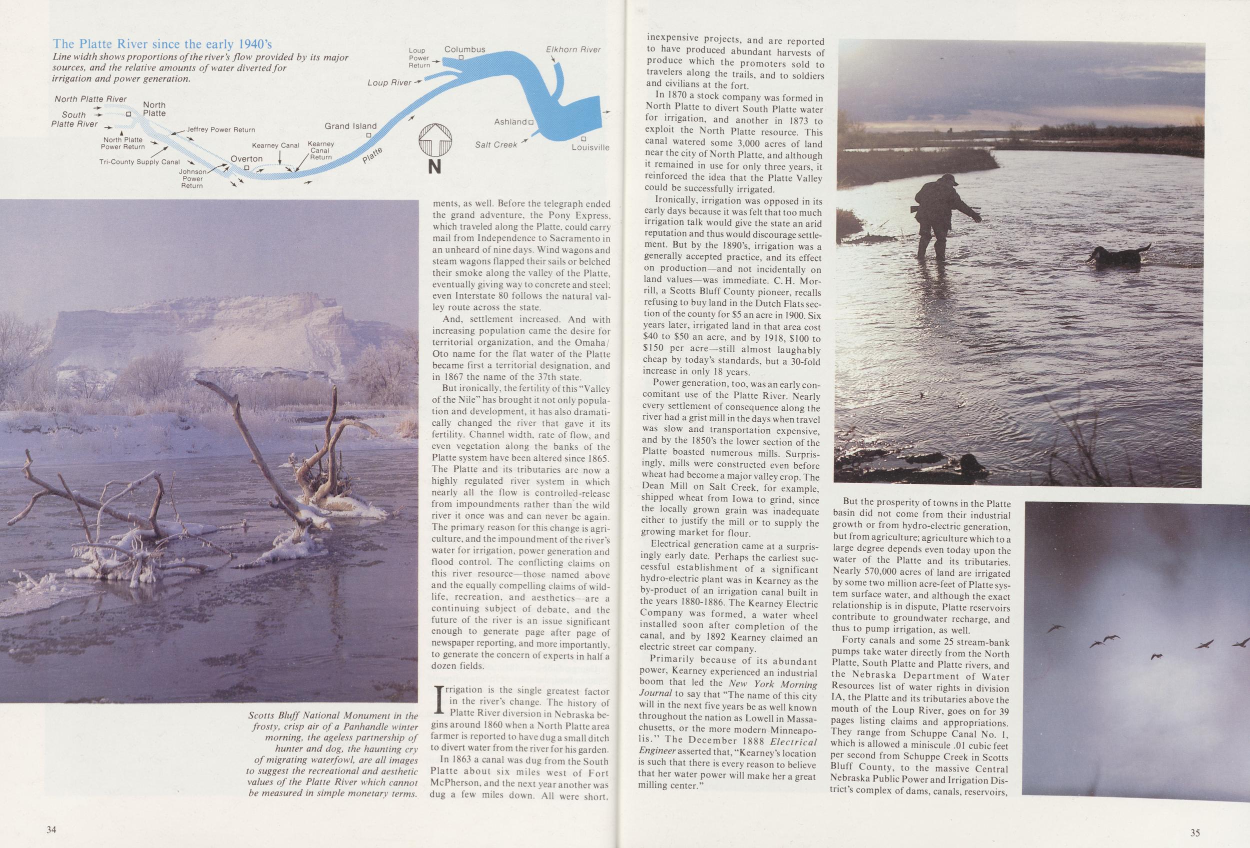
But ironically, the fertility of this "Valley of the Nile" has brought it not only population and development, it has also dramatically changed the river that gave it its fertility. Channel width, rate of flow, and even vegetation along the banks of the Platte system have been altered since 1865. The Platte and its tributaries are now a highly regulated river system in which nearly all the flow is controlled-releasc from impoundments rather than the wild river it once was and can never be again. The primary reason for this change is agriculture, and the impoundment of the river's water for irrigation, power generation and flood control. The conflicting claims on this river resource—those named above and the equally compelling claims of wildlife, recreation, and aesthetics- are a continuing subject of debate, and the future of the river is an issue significant enough to generate page after page of newspaper reporting, and more importantly, to generate the concern of experts in half a dozen fields.
Irrigation is the single greatest factor in the river's change. The history of Platte River diversion in Nebraska begins around 1860 when a North Platte area farmer is reported to have dug a small ditch to divert water from the river for his garden.
In 1863 a canal was dug from the South Platte about six miles west of Fort McPherson, and the next year another was dug a few miles down. All were short. 34 inexpensive projects, and are reported to have produced abundant harvests of produce which the promoters sold to travelers along the trails, and to soldiers and civilians at the fort.
In 1870 a stock company was formed in North Platte to divert South Platte water for irrigation, and another in 1873 to exploit the North Platte resource. This canal watered some 3,000 acres of land near the city of North Platte, and although it remained in use for only three years, it reinforced the idea that the Platte Valley could be successfully irrigated.
Ironically, irrigation was opposed in its early days because it was felt that too much irrigation talk would give the state an arid reputation and thus would discourage settlement. But by the 1890's, irrigation was a generally accepted practice, and its effect on production—and not incidentally on land values—was immediate. C. H. Morrill, a Scotts Bluff County pioneer, recalls refusing to buy land in the Dutch Flats section of the county for $5 an acre in 1900. Six years later, irrigated land in that area cost $40 to $50 an acre, and by 1918, $100 to $150 per acre—still almost laughably cheap by today's standards, but a 30-fold increase in only 18 years.
Power generation, too, was an early concomitant use of the Platte River. Nearly every settlement of consequence along the river had a grist mill in the days when travel was slow and transportation expensive, and by the 1850's the lower section of the Platte boasted numerous mills. Surprisingly, mills were constructed even before wheat had become a major valley crop. The Dean Mill on Salt Creek, for example, shipped wheat from Iowa to grind, since the locally grown grain was inadequate either to justify the mill or to supply the growing market for flour.
Electrical generation came at a surprisingly early date. Perhaps the earliest successful establishment of a significant hydro-electric plant was in Kearney as the by-product of an irrigation canal built in the years 1880-1886. The Kearney Electric Company was formed, a water wheel installed soon after completion of the canal, and by 1892 Kearney claimed an electric street car company.
Primarily because of its abundant power, Kearney experienced an industrial boom that led the New York Morning Journal to say that "The name of this city will in the next five years be as well known throughout the nation as Lowell in Massachusetts, or the more modern Minneapolis." The December 1888 Electrical Engineer asserted that, "Kearney's location is such that there is every reason to believe that her water power will make her a great milling center."
But the prosperity of towns in the Platte basin did not come from their industrial growth or from hydro-electric generation, but from agriculture; agriculture which to a large degree depends even today upon the water of the Platte and its tributaries. Nearly 570,000 acres of land are irrigated by some two million acre-feet of Platte system surface water, and although the exact relationship is in dispute, Platte reservoirs contribute to groundwater recharge, and thus to pump irrigation, as well.
Forty canals and some 25 stream-bank pumps take water directly from the North Platte, South Platte and Platte rivers, and the Nebraska Department of Water Resources list of water rights in division IA, the Platte and its tributaries above the mouth of the Loup River, goes on for 39 pages listing claims and appropriations. They range from Schuppe Canal No. 1, which is allowed a miniscule .01 cubic feet per second from Schuppe Creek in Scotts Bluff County, to the massive Central Nebraska Public Power and Irrigation District's complex of dams, canals, reservoirs,
Diversion of water for irrigation, based on a "first-come, first-served" system of appropriation, began to have a noticeable effect on the river's flows in the 1880's. The solution to the depletion of middle and late-summer flows was construction of the Pathfinder Dam on the North Platte in Wyoming in 1909 to impound snow-melt for use in summer. Since then, 14 more dams have been built in the Platte River system, seven in Colorado and eight in Nebraska. Lake McConaughy, the largest reservoir in Nebraska, has a storage capacity of some two million acre-feet of water.
The result has been a significant change in the river. Old records indicate that in early spring, before snow melt, the river flow was low and occasionally ceased altogether in some reaches. Snow melt at the mountain headwaters then brought on a period of high flow7 beginning in April or May, reaching a peak in June, and usually receding in July. These high flows scoured the river channels and sandbars of vegetation and temporarily widened the river to the edges of its flood plain.
Then, in late summer and early fall, depending on rainfall and on groundwater seepage into the river, the Platte might flow continuously, but in many years would go completely dry in long stretches upstream from the mouth of the Loup. Other factors, such as consumption of water by streambank vegetation, and after 1870, irrigation, contributed to the frequent drying up of the river. After the year's first killing frost, vegetation died, irrigation ended, and flow was restored again, although the shallow river would often freeze to its bed during the coldest months of winter.
But now, the series of dams storing water for irrigation and power production have altered this pattern. Peak flows are retarded and the water is stored for release during the months when historically there might be little or no water flowing in many reaches of the river. Controlled discharge from these upstream reservoirs also has apparently reduced the amount of sediment carried by the river, especially at times of peak flow. This leveling out of peaks and low flows, and the reduction of scouring high water and sediment, have worked major changes in the river in only about 100 years.
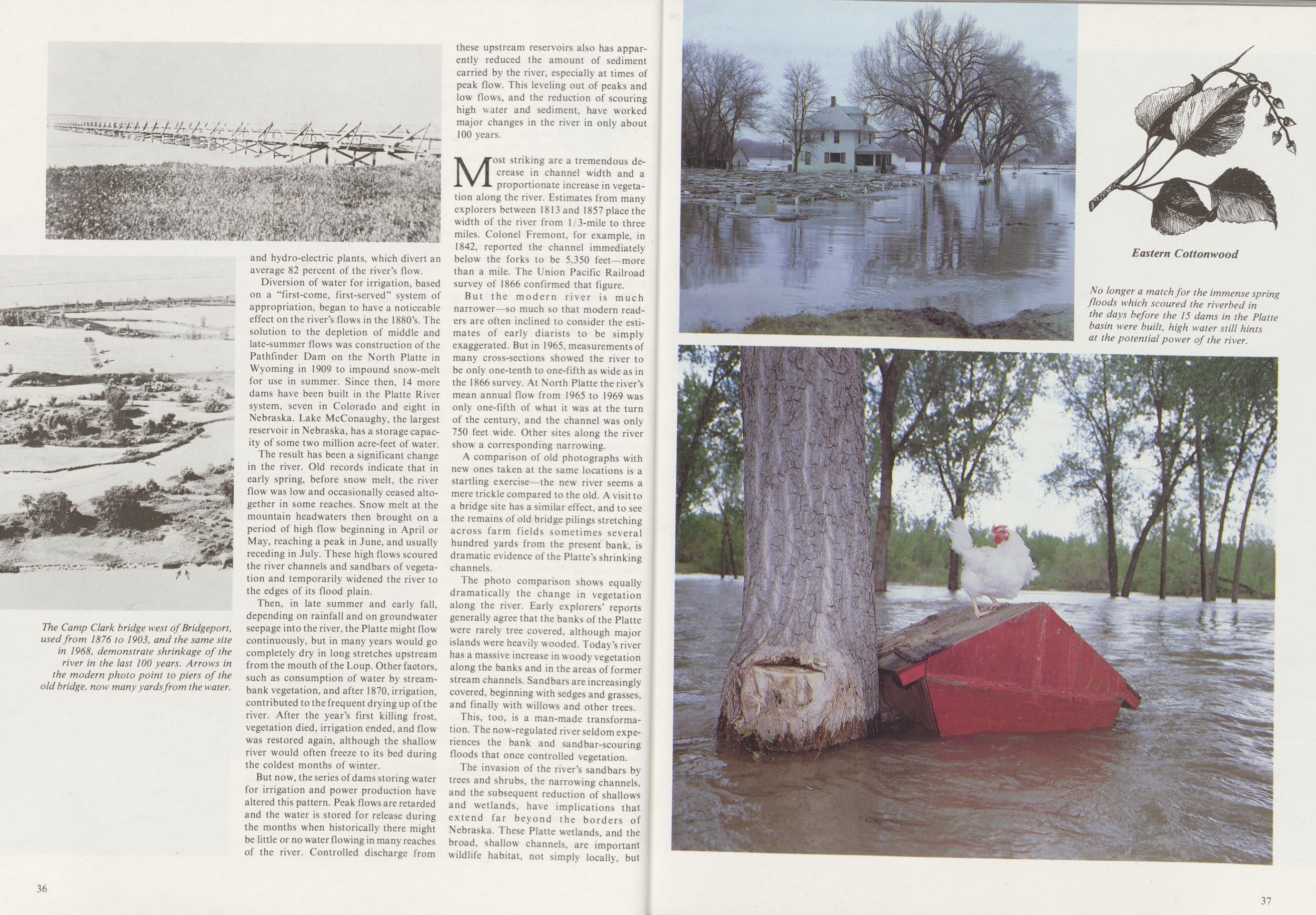
Most striking are a tremendous decrease in channel width and a proportionate increase in vegetation along the river. Estimates from many explorers between 1813 and 1857 place the width of the river from 1/3-mile to three miles. Colonel Fremont, for example, in 1842, reported the channel immediately below the forks to be 5,350 feet—more than a mile. The Union Pacific Railroad survey of 1866 confirmed that figure.
But the modern river is much narrower—so much so that modern readers are often inclined to consider the estimates of early diarists to be simply exaggerated. But in 1965, measurements of many cross-sections showed the river to be only one-tenth to one-fifth as wide as in the 1866 survey. At North Platte the river's mean annual flow from 1965 to 1969 was only one-fifth of what it was at the turn of the century, and the channel was only 750 feet wide. Other sites along the river show a corresponding narrowing.
A comparison of old photographs with new ones taken at the same locations is a startling exercise—the new river seems a mere trickle compared to the old. A visit to a bridge site has a similar effect, and to see the remains of old bridge pilings stretching across farm fields sometimes several hundred yards from the present bank, is dramatic evidence of the Platte's shrinking channels.
The photo comparison shows equally dramatically the change in vegetation along the river. Early explorers' reports generally agree that the banks of the Platte were rarely tree covered, although major islands were heavily wooded. Today's river has a massive increase in woody vegetation along the banks and in the areas of former stream channels. Sandbars are increasingly covered, beginning with sedges and grasses, and finally with willows and other trees.
This, too, is a man-made transformation. The now-regulated river seldom experiences the bank and sandbar-scouring floods that once controlled vegetation.
The invasion of the river's sandbars by trees and shrubs, the narrowing channels, and the subsequent reduction of shallows and wetlands, have implications that extend far beyond the borders of Nebraska. These Platte wetlands, and the broad, shallow channels, are important wildlife habitat, not simply locally, but 36
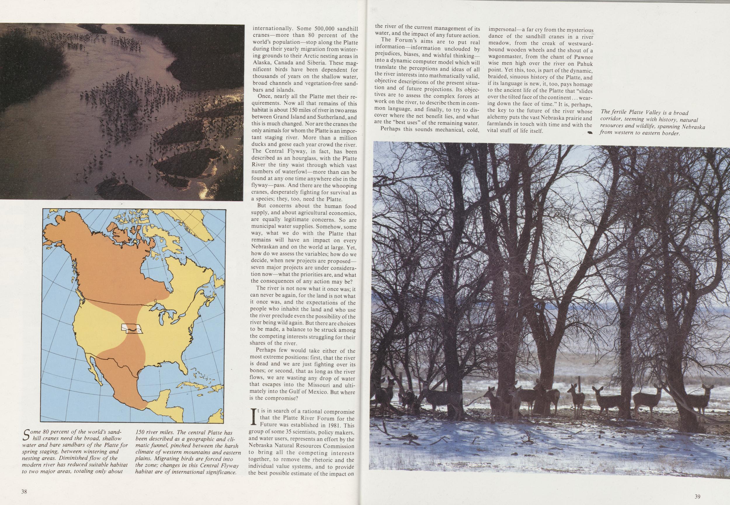
Once, nearly all the Platte met their requirements. Now all that remains of this habitat is about 150 miles of river in two areas between Grand Island and Sutherland, and this is much changed. Nor are the cranes the only animals for whom the Platte is an important staging river. More than a million ducks and geese each year crowd the river. The Central Flyway, in fact, has been described as an hourglass, with the Platte River the tiny waist through which vast numbers of waterfowl—more than can be found at any one time anywhere else in the flyway—pass. And there are the whooping cranes, desperately fighting for survival as a species; they, too, need the Platte.
But concerns about the human food supply, and about agricultural economics, are equally legitimate concerns. So are municipal water supplies. Somehow, some way, what we do with the Platte that remains will have an impact on every Nebraskan and on the world at large. Yet, how do we assess the variables; how do we decide, when new projects are proposed—seven major projects are under consideration now what the priorities are, and what the consequences of any action may be?
The river is not now what it once was; it can never be again, for the land is not what it once was, and the expectations of the people who inhabit the land and who use the river preclude even the possibility of the river being wild again. But there are choices to be made, a balance to be struck among the competing interests struggling for their shares of the river.
Perhaps few would take either of the most extreme positions: first, that the river is dead and we are just fighting over its bones; or second, that as long as the river flows, we are wasting any drop of water that escapes into the Missouri and ultimately into the Gulf of Mexico. But where is the compromise?
It is in search of a rational compromise that the Platte River Forum for the Future was established in 1981. This group of some 35 scientists, policy makers, and water users, represents an effort by the Nebraska Natural Resources Commission to bring all the competing interests together, to remove the rhetoric and the individual value systems, and to provide the best possible estimate of the impact on 38 the river of the current management of its water, and the impact of any future action.
The Forum's aims are to put real information—information unclouded by prejudices, biases, and wishful thinking—into a dynamic computer model which will translate the perceptions and ideas of all the river interests into mathmatically valid, objective descriptions of the present situation and of future projections. Its objectives are to assess the complex forces at work on the river, to describe them in common language, and finally, to try to discover where the net benefit lies, and what are the "best uses" of the remaining water.
Perhaps this sounds mechanical, cold, impersonal—a far cry from the mysterious dance of the sandhill cranes in a river meadow, from the creak of westwardbound wooden wheels and the shout of a wagonmaster, from the chant of Pawnee wise men high over the river on Pahuk point. Yet this, too, is part of the dynamic, braided, sinuous history of the Platte, and if its language is new, it, too, pays homage to the ancient life of the Platte that "slides over the tilted face of the continent wearing down the face of time." It is, perhaps, the key to the future of the river whose alchemy puts the vast Nebraska prairie and farmlands in touch with time and with the vital stuff of life itself.
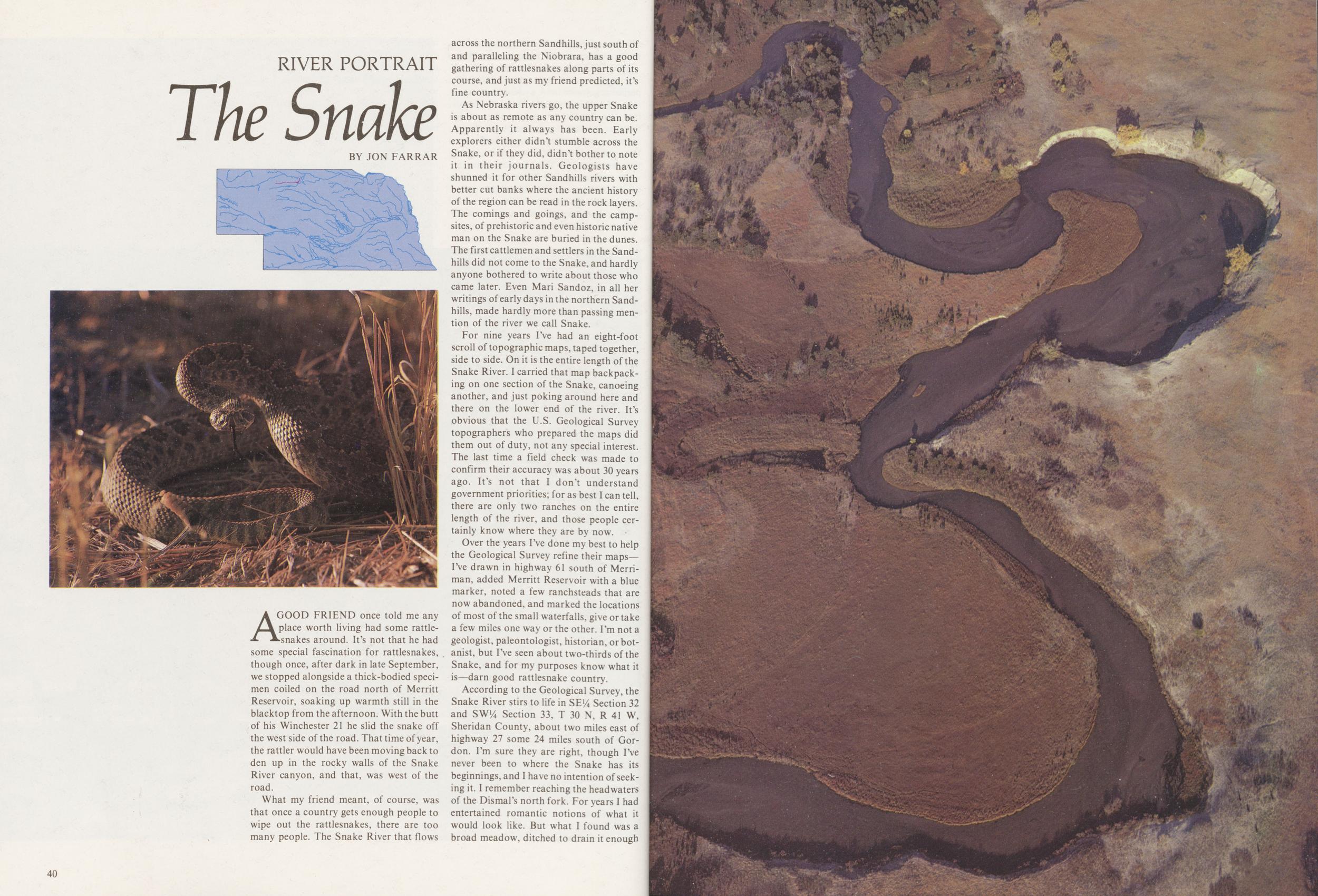
RIVER PORTRAIT
The Snake
BY JON FARRARA GOOD FRIEND once told me any place worth living had some rattlesnakes around. It's not that he had some special fascination for rattlesnakes, though once, after dark in late September, we stopped alongside a thick-bodied specimen coiled on the road north of Merritt Reservoir, soaking up warmth still in the blacktop from the afternoon. With the butt of his Winchester 21 he slid the snake off the west side of the road. That time of year, the rattler would have been moving back to den up in the rocky walls of the Snake River canyon, and that, was west of the road.
What my friend meant, of course, was that once a country gets enough people to wipe out the rattlesnakes, there are too many people. The Snake River that flows across the northern Sandhills, just south of and paralleling the Niobrara, has a good gathering of rattlesnakes along parts of its course, and just as my friend predicted, it's fine country.
As Nebraska rivers go, the upper Snake is about as remote as any country can be. Apparently it always has been. Early explorers either didn't stumble across the Snake, or if they did, didn't bother to note it in their journals. Geologists have shunned it for other Sandhills rivers with better cut banks where the ancient history of the region can be read in the rock layers. The comings and goings, and the campsites, of prehistoric and even historic native man on the Snake are buried in the dunes. The first cattlemen and settlers in the Sandhills did not come to the Snake, and hardly anyone bothered to write about those who came later. Even Mari Sandoz, in all her writings of early days in the northern Sandhills, made hardly more than passing mention of the river we call Snake.
For nine years I've had an eight-foot scroll of topographic maps, taped together, side to side. On it is the entire length of the Snake River. I carried that map backpacking on one section of the Snake, canoeing another, and just poking around here and there on the lower end of the river. It's obvious that the U.S. Geological Survey topographers who prepared the maps did them out of duty, not any special interest. The last time a field check was made to confirm their accuracy was about 30 years ago. It's not that I don't understand government priorities; for as best I can tell, there are only two ranches on the entire length of the river, and those people certainly know where they are by now.
Over the years I've done my best to help the Geological Survey refine their maps—I've drawn in highway 61 south of Merriman, added Merritt Reservoir with a blue marker, noted a few ranchsteads that are now abandoned, and marked the locations of most of the small waterfalls, give or take a few miles one way or the other. I'm not a geologist, paleontologist, historian, or botanist, but I've seen about two-thirds of the Snake, and for my purposes know what it is—darn good rattlesnake country.
According to the Geological Survey, the Snake River stirs to life in SE!4 Section 32 and SW!4 Section 33, T 30 N, R 41 W, Sheridan County, about two miles east of highway 27 some 24 miles south of Gordon. I'm sure they are right, though I've never been to where the Snake has its beginnings, and I have no intention of seeking it. I remember reaching the headwaters of the Dismal's north fork. For years I had entertained romantic notions of what it would look like. But what I found was a broad meadow, ditched to drain it enough 40
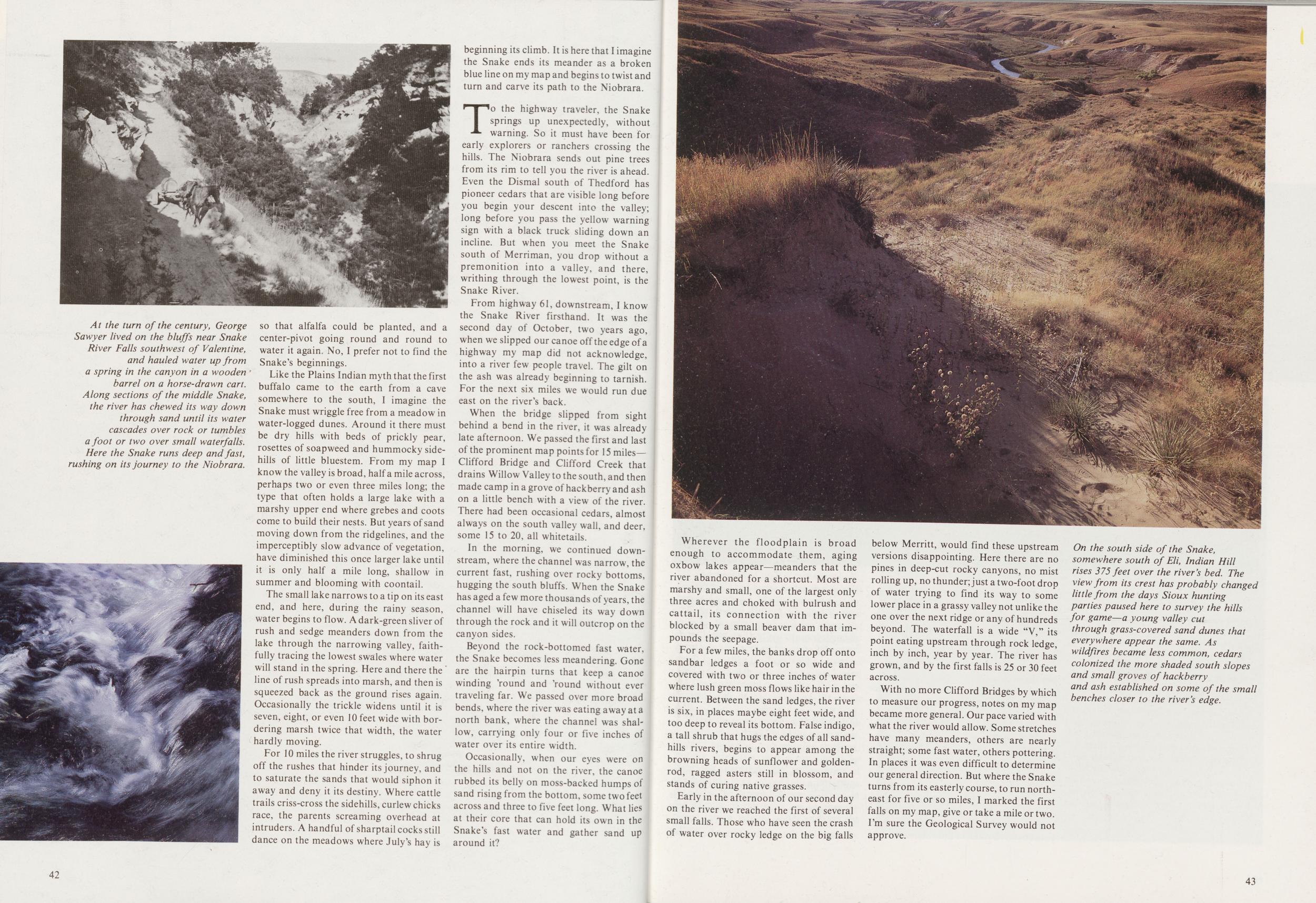
Like the Plains Indian myth that the first buffalo came to the earth from a cave somewhere to the south, I imagine the Snake must wriggle free from a meadow in water-logged dunes. Around it there must be dry hills with beds of prickly pear, rosettes of soapweed and hummocky sidehills of little bluestem. From my map I know the valley is broad, half a mile across, perhaps two or even three miles long; the type that often holds a large lake with a marshy upper end where grebes and coots come to build their nests. But years of sand moving down from the ridgelines, and the imperceptibly slow advance of vegetation, have diminished this once larger lake until it is only half a mile long, shallow in summer and blooming with coontail.
The small lake narrows to a tip on its east end, and here, during the rainy season, water begins to flow. A dark-green sliver of rush and sedge meanders down from the lake through the narrowing valley, faithfully tracing the lowest swales where water will stand in the spring. Here and there the line of rush spreads into marsh, and then is squeezed back as the ground rises again. Occasionally the trickle widens until it is seven, eight, or even 10 feet wide with bordering marsh twice that width, the water hardly moving.
For 10 miles the river struggles, to shrug off the rushes that hinder its journey, and to saturate the sands that would siphon it away and deny it its destiny. Where cattle trails criss-cross the sidehills, curlew chicks race, the parents screaming overhead at intruders. A handful of sharptail cocks still dance on the meadows where July's hay is beginning its climb. It is here that I imagine the Snake ends its meander as a broken blue line on my map and begins to twist and turn and carve its path to the Niobrara.
To the highway traveler, the Snake springs up unexpectedly, without warning. So it must have been for early explorers or ranchers crossing the hills. The Niobrara sends out pine trees from its rim to tell you the river is ahead. Even the Dismal south of Thedford has pioneer cedars that are visible long before you begin your descent into the valley; long before you pass the yellow warning sign with a black truck sliding down an incline. But when you meet the Snake south of Merriman, you drop without a premonition into a valley, and there, writhing through the lowest point, is the Snake River.
From highway 61, downstream, I know the Snake River firsthand. It was the second day of October, two years ago, when we slipped our canoe off the edge of a highway my map did not acknowledge, into a river few people travel. The gilt on the ash was already beginning to tarnish. For the next six miles we would run due east on the river's back.
When the bridge slipped from sight behind a bend in the river, it was already late afternoon. We passed the first and last of the prominent map points for 15 miles—Clifford Bridge and Clifford Creek that drains Willow Valley to the south, and then made camp in a grove of hackberry and ash on a little bench with a view of the river. There had been occasional cedars, almost always on the south valley wall, and deer, some 15 to 20, all whitetails.
In the morning, we continued downstream, where the channel was narrow, the current fast, rushing over rocky bottoms, hugging the south bluffs. When the Snake has aged a few more thousands of years, the channel will have chiseled its way down through the rock and it will outcrop on the canyon sides.
Beyond the rock-bottomed fast water, the Snake becomes less meandering. Gone are the hairpin turns that keep a canoe winding 'round and 'round without ever traveling far. We passed over more broad bends, where the river was eating away at a north bank, where the channel was shallow, carrying only four or five inches of water over its entire width.
Occasionally, when our eyes were on the hills and not on the river, the canoe rubbed its belly on moss-backed humps of sand rising from the bottom, some two feet across and three to five feet long. What lies at their core that can hold its own in the Snake's fast water and gather sand up around it?
42Wherever the floodplain is broad enough to accommodate them, aging oxbow lakes appear—meanders that the river abandoned for a shortcut. Most are marshy and small, one of the largest only three acres and choked with bulrush and cattail, its connection with the river blocked by a small beaver dam that impounds the seepage.
For a few miles, the banks drop off onto sandbar ledges a foot or so wide and covered with two or three inches of water where lush green moss flows like hair in the current. Between the sand ledges, the river is six, in places maybe eight feet wide, and too deep to reveal its bottom. False indigo, a tall shrub that hugs the edges of all sandhills rivers, begins to appear among the browning heads of sunflower and goldenrod, ragged asters still in blossom, and stands of curing native grasses.
Early in the afternoon of our second day on the river we reached the first of several small falls. Those who have seen the crash of water over rocky ledge on the big falls below Merritt, would find these upstream versions disappointing. Here there are no pines in deep-cut rocky canyons, no mist rolling up, no thunder; just a two-foot drop of water trying to find its way to some lower place in a grassy valley not unlike the one over the next ridge or any of hundreds beyond. The waterfall is a wide "V," its point eating upstream through rock ledge, inch by inch, year by year. The river has grown, and by the first falls is 25 or 30 feet across.
With no more Clifford Bridges by which to measure our progress, notes on my map became more general. Our pace varied with what the river would allow. Some stretches have many meanders, others are nearly straight; some fast water, others pottering. In places it was even difficult to determine our general direction. But where the Snake turns from its easterly course, to run northeast for five or so miles, I marked the first falls on my map, give or take a mile or two. I'm sure the Geological Survey would not approve.
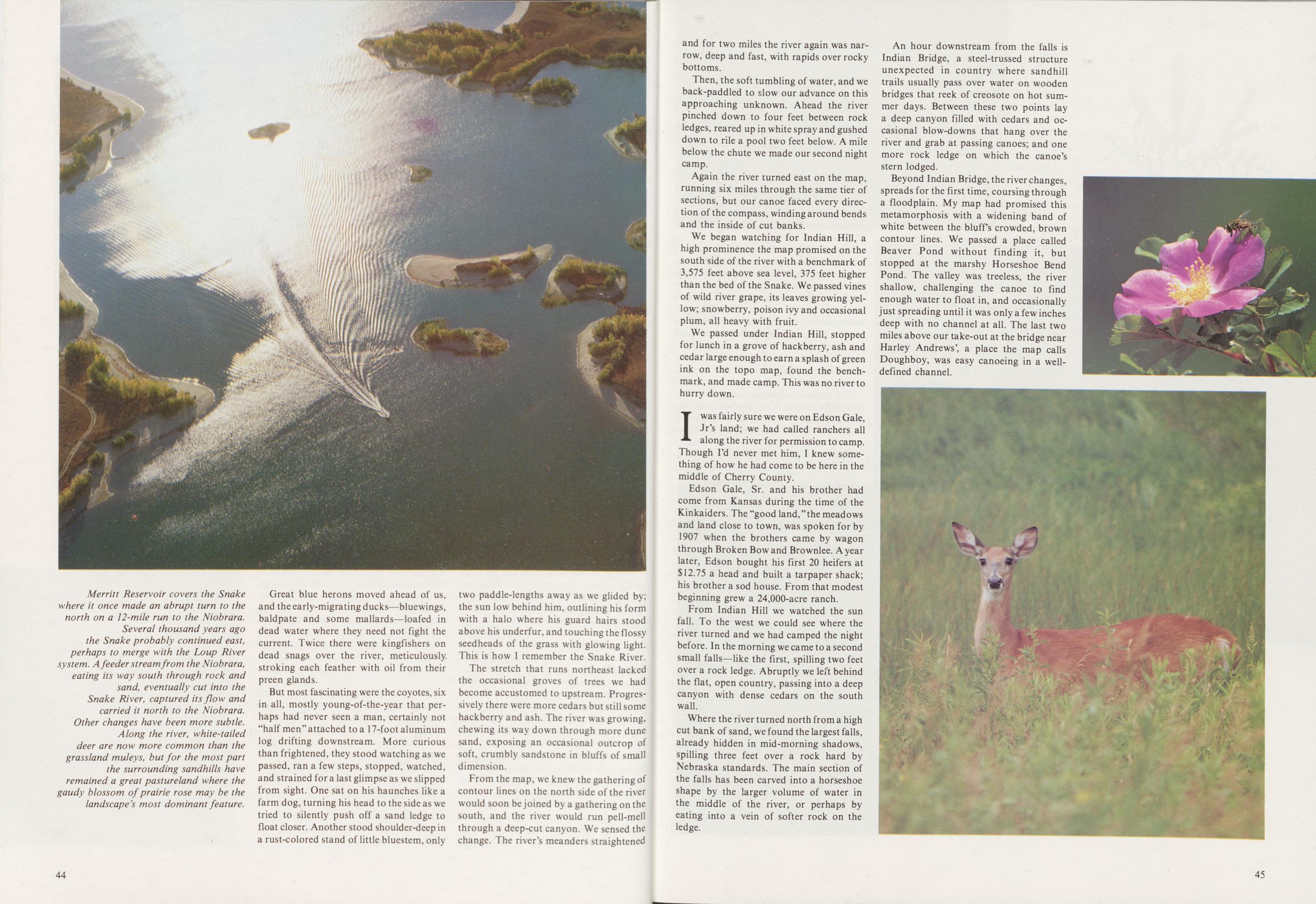
Great blue herons moved ahead of us, and the early-migrating ducks—bluewings, baldpate and some mallards—loafed in dead water where they need not fight the current. Twice there were kingfishers on dead snags over the river, meticulously stroking each feather with oil from their preen glands.
But most fascinating were the coyotes, six in all, mostly young-of-the-year that perhaps had never seen a man, certainly not "half men" attached to a 17-foot aluminum log drifting downstream. More curious than frightened, they stood watching as we passed, ran a few steps, stopped, watched, and strained for a last glimpse as we slipped from sight. One sat on his haunches like a farm dog, turning his head to the side as we tried to silently push off a sand ledge to float closer. Another stood shoulder-deep in a rust-colored stand of little bluestem, only two paddle-lengths away as we glided by; the sun low behind him, outlining his form with a halo where his guard hairs stood above his underfur, and touching the flossy seedheads of the grass with glowing light. This is how I remember the Snake River.
The stretch that runs northeast lacked the occasional groves of trees we had become accustomed to upstream. Progressively there were more cedars but still some hackberry and ash. The river was growing, chewing its way down through more dune sand, exposing an occasional outcrop of soft, crumbly sandstone in bluffs of small dimension.
From the map, we knew the gathering of contour lines on the north side of the river would soon be joined by a gathering on the south, and the river would run pell-mell through a deep-cut canyon. We sensed the change. The river's meanders straightened 44 and for two miles the river again was narrow, deep and fast, with rapids over rocky bottoms.
Then, the soft tumbling of water, and we back-paddled to slow our advance on this approaching unknown. Ahead the river pinched down to four feet between rock ledges, reared up in white spray and gushed down to rile a pool two feet below. A mile below the chute we made our second night camp.
Again the river turned east on the map, running six miles through the same tier of sections, but our canoe faced every direction of the compass, winding around bends and the inside of cut banks.
We began watching for Indian Hill, a high prominence the map promised on the south side of the river with a benchmark of 3,575 feet above sea level, 375 feet higher than the bed of the Snake. We passed vines of wild river grape, its leaves growing yellow; snowberry, poison ivy and occasional plum, all heavy with fruit.
We passed under Indian Hill, stopped for lunch in a grove of hackberry, ash and cedar large enough to earn a splash of green ink on the topo map, found the benchmark, and made camp. This was no river to hurry down.
I was fairly sure we were on Edson Gale, Jr's land; we had called ranchers all along the river for permission to camp. Though I'd never met him, I knew something of how he had come to be here in the middle of Cherry County.
Edson Gale, Sr. and his brother had come from Kansas during the time of the Kinkaiders. The "good land,"the meadows and land close to town, was spoken for by 1907 when the brothers came by wagon through Broken Bow and Brownlee. A year later, Edson bought his first 20 heifers at $12.75 a head and built a tarpaper shack; his brother a sod house. From that modest beginning grew a 24,000-acre ranch.
From Indian Hill we watched the sun fall. To the west we could see where the river turned and we had camped the night before. In the morning we came to a second small falls—like the first, spilling two feet over a rock ledge. Abruptly we left behind the flat, open country, passing into a deep canyon with dense cedars on the south wall.
Where the river turned north from a high cut bank of sand, we found the largest falls, already hidden in mid-morning shadows, spilling three feet over a rock hard by Nebraska standards. The main section of the falls has been carved into a horseshoe shape by the larger volume of water in the middle of the river, or perhaps by eating into a vein of softer rock on the ledge.
An hour downstream from the falls is Indian Bridge, a steel-trussed structure unexpected in country where sandhill trails usually pass over water on wooden bridges that reek of creosote on hot summer days. Between these two points lay a deep canyon filled with cedars and occasional blow-downs that hang over the river and grab at passing canoes; and one more rock ledge on which the canoe's stern lodged.
Beyond Indian Bridge, the river changes, spreads for the first time, coursing through a floodplain. My map had promised this metamorphosis with a widening band of white between the bluffs crowded, brown contour lines. We passed a place called Beaver Pond without finding it, but stopped at the marshy Horseshoe Bend Pond. The valley was treeless, the river shallow, challenging the canoe to find enough water to float in, and occasionally just spreading until it was only a few inches deep with no channel at all. The last two miles above our take-out at the bridge near Harley Andrews', a place the map calls Doughboy, was easy canoeing in a well-defined channel.
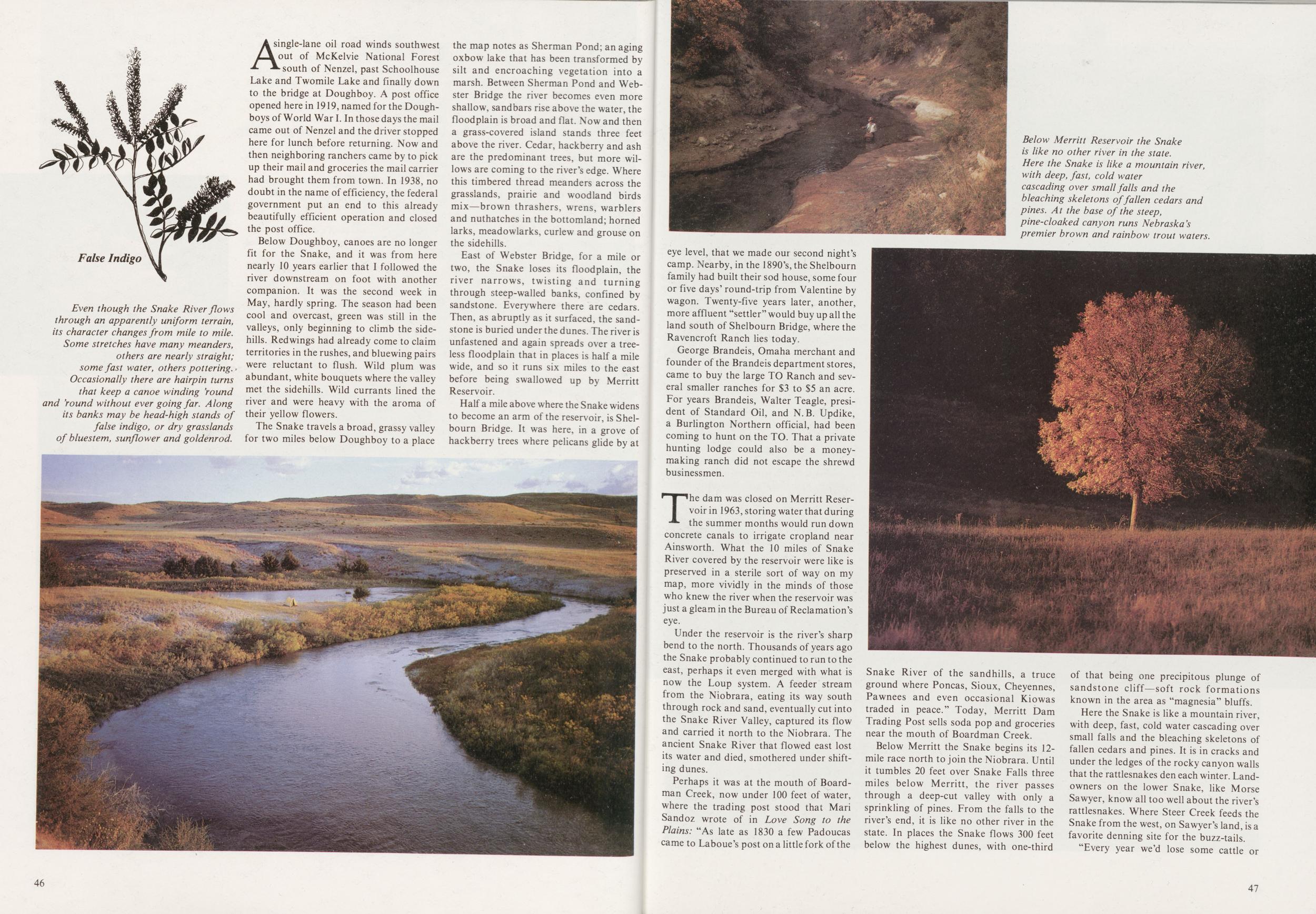
A single-lane oil road winds southwest nut of McKelvie National Forest south of Nenzel, past Schoolhouse Lake and Twomile Lake and finally down to the bridge at Doughboy. A post office opened herein 1919, named for the Doughboys of World War I. In those days the mail came out of Nenzel and the driver stopped here for lunch before returning. Now and then neighboring ranchers came by to pick up their mail and groceries the mail carrier had brought them from town. In 1938, no doubt in the name of efficiency, the federal government put an end to this already beautifully efficient operation and closed the post office.
Below Doughboy, canoes are no longer fit for the Snake, and it was from here nearly 10 years earlier that I followed the river downstream on foot with another companion. It was the second week in May, hardly spring. The season had been cool and overcast, green was still in the valleys, only beginning to climb the sidehills. Redwings had already come to claim territories in the rushes, and bluewing pairs were reluctant to flush. Wild plum was abundant, white bouquets where the valley met the sidehills. Wild currants lined the river and were heavy with the aroma of their yellow flowers.
The Snake travels a broad, grassy valley for two miles below Doughboy to a place the map notes as Sherman Pond; an aging oxbow lake that has been transformed by silt and encroaching vegetation into a marsh. Between Sherman Pond and Webster Bridge the river becomes even more shallow, sandbars rise above the water, the floodplain is broad and flat. Now and then a grass-covered island stands three feet above the river. Cedar, hackberry and ash are the predominant trees, but more willows are coming to the river's edge. Where this timbered thread meanders across the grasslands, prairie and woodland birds mix—brown thrashers, wrens, warblers and nuthatches in the bottomland; horned larks, meadowlarks, curlew and grouse on the sidehills.
East of Webster Bridge, for a mile or two, the Snake loses its floodplain, the river narrows, twisting and turning through steep-walled banks, confined by sandstone. Everywhere there are cedars. Then, as abruptly as it surfaced, the sandstone is buried under the dunes. The river is unfastened and again spreads over a treeless floodplain that in places is half a mile wide, and so it runs six miles to the east before being swallowed up by Merritt Reservoir.
Half a mile above where the Snake widens to become an arm of the reservoir, is Shelbourn Bridge. It was here, in a grove of hackberry trees where pelicans glide by at 46
George Brandeis, Omaha merchant and founder of the Brandeis department stores, came to buy the large TO Ranch and several smaller ranches for $3 to $5 an acre. For years Brandeis, Walter Teagle, president of Standard Oil, and N. B. Updike, a Burlington Northern official, had been coming to hunt on the TO. That a private hunting lodge could also be a money-making ranch did not escape the shrewd businessmen.
The dam was closed on Merritt Reservoir in 1963, storing water that during the summer months would run down concrete canals to irrigate cropland near Ainsworth. What the 10 miles of Snake River covered by the reservuir were like is preserved in a sterile sort of way on my map, more vividly in the minds of those who knew the river when the reservoir was just a gleam in the Bureau of Reclamation's eye.
Under the reservoir is the river's sharp bend to the north. Thousands of years ago the Snake probably continued to run to the east, perhaps it even merged with what is now the Loup system. A feeder stream from the Niobrara, eating its way south through rock and sand, eventually cut into the Snake River Valley, captured its flow and carried it north to the Niobrara. The ancient Snake River that flowed east lost its water and died, smothered under shifting dunes.
Perhaps it was at the mouth of Boardman Creek, now under 100 feet of water, where the trading post stood that Mari Sandoz wrote of in Love Song to the Plains: "As late as 1830 a few Padoucas came to Laboue's post on a little fork of the Snake River of the sandhills, a truce ground where Poncas, Sioux, Cheyennes, Pawnees and even occasional Kiowas traded in peace." Today, Merritt Dam Trading Post sells soda pop and groceries near the mouth of Boardman Creek.
Below Merritt the Snake begins its 12-mile race north to join the Niobrara. Until it tumbles 20 feet over Snake Falls three miles below Merritt, the river passes through a deep-cut valley with only a sprinkling of pines. From the falls to the river's end, it is like no other river in the state. In places the Snake flows 300 feet below the highest dunes, with one-third of that being one precipitous plunge of sandstone cliff—soft rock formations known in the area as "magnesia" bluffs.
Here the Snake is like a mountain river, with deep, fast, cold water cascading over small falls and the bleaching skeletons of fallen cedars and pines. It is in cracks and under the ledges of the rocky canyon walls that the rattlesnakes den each winter. Land-owners on the lower Snake, like Morse Sawyer, know all too well about the river's rattlesnakes. Where Steer Creek feeds the Snake from the west, on Sawyer's land, is a favorite denning site for the buzz-tails.
'Every year we'd lose some cattle or 47 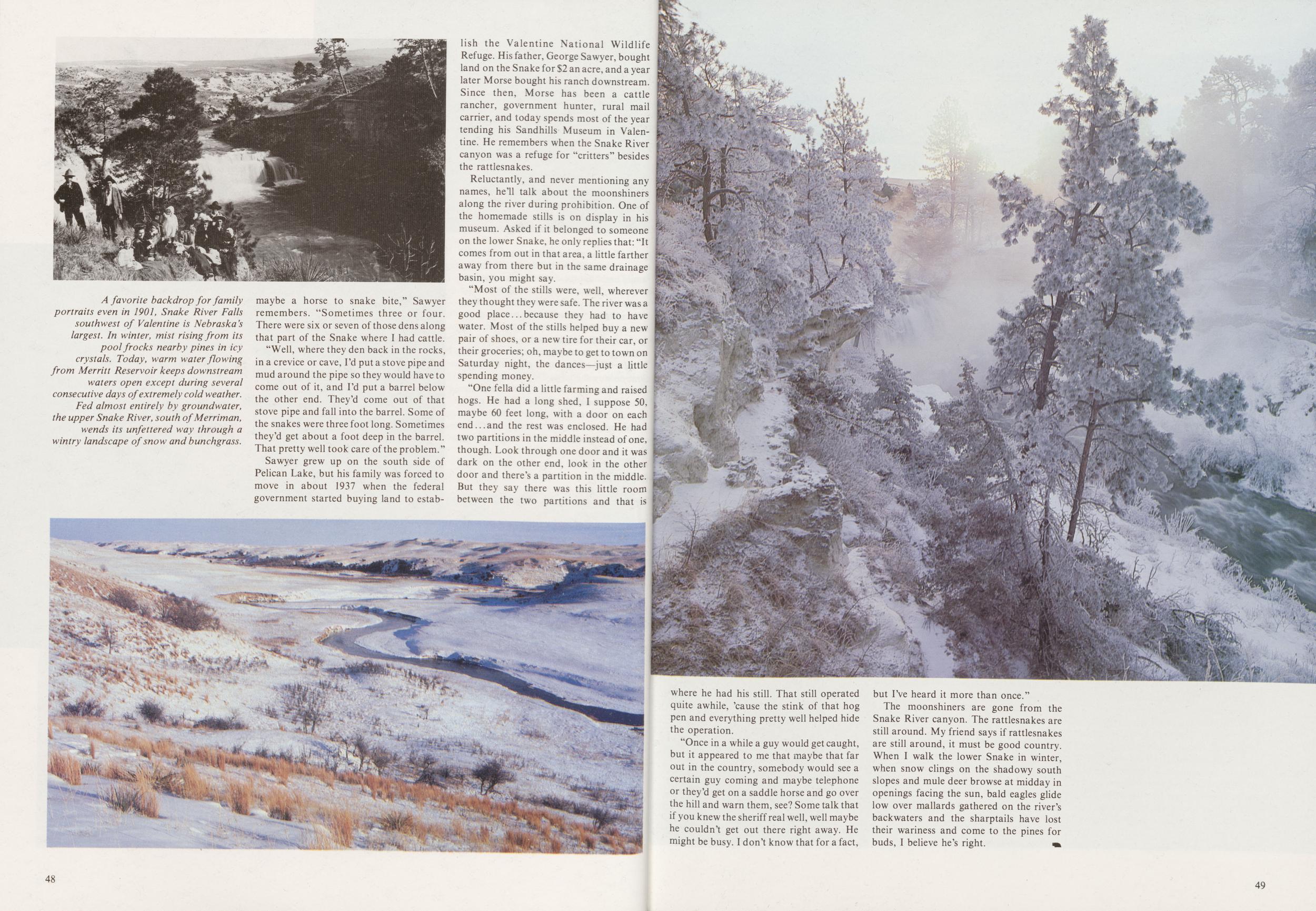
"Well, where they den back in the rocks, in a crevice or cave, I'd put a stove pipe and mud around the pipe so they would have to come out of it, and I'd put a barrel below the other end. They'd come out of that stove pipe and fall into the barrel. Some of the snakes were three foot long. Sometimes they'd get about a foot deep in the barrel. That pretty well took care of the problem."
Sawyer grew up on the south side of Pelican Lake, but his family was forced to move in about 1937 when the federal government started buying land to establish the Valentine National Wildlife Refuge. His father, George Sawyer, bought land on the Snake for $2 an acre, and a year later Morse bought his ranch downstream. Since then, Morse has been a cattle rancher, government hunter, rural mail carrier, and today spends most of the year tending his Sandhills Museum in Valentine. He remembers when the Snake River canyon was a refuge for "critters" besides the rattlesnakes.
Reluctantly, and never mentioning any names, he'll talk about the moonshiners along the river during prohibition. One of the homemade stills is on display in his museum. Asked if it belonged to someone on the lower Snake, he only replies that: "It comes from out in that area, a little farther away from there but in the same drainage basin, you might say.
"Most of the stills were, well, wherever they thought they were safe. The river was a good place. ..because they had to have water. Most of the stills helped buy a new pair of shoes, or a new tire for their car, or their groceries; oh, maybe to get to town on Saturday night, the dances—just a little spending money.
"One fella did a little farming and raised hogs. He had a long shed, I suppose 50, maybe 60 feet long, with a door on each end...and the rest was enclosed. He had two partitions in the middle instead of one, though. Look through one door and it was dark on the other end, look in the other door and there's a partition in the middle. But they say there was this little room between the two partitions and that is 48
"Once in a while a guy would get caught, but it appeared to me that maybe that far out in the country, somebody would see a certain guy coming and maybe telephone or they'd get on a saddle horse and go over the hill and warn them, see? Some talk that if you knew the sheriff real well, well maybe he couldn't get out there right away. He might be busy. I don't know that for a fact, but I've heard it more than once."
The moonshiners are gone from the Snake River canyon. The rattlesnakes are still around. My friend says if rattlesnakes are still around, it must be good country. When I walk the lower Snake in winter, when snow clings on the shadowy south slopes and mule deer browse at midday in openings facing the sun, bald eagles glide low over mallards gathered on the river's backwaters and the sharptails have lost their wariness and come to the pines for buds, I believe he's right.
49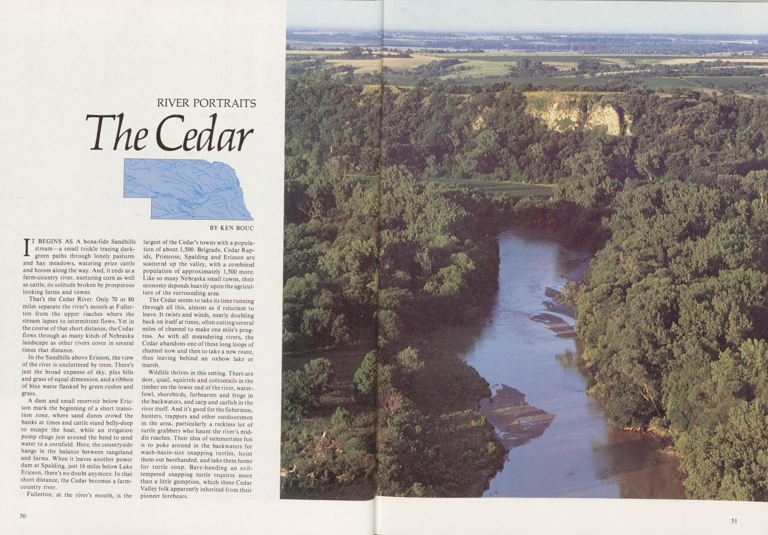
RIVER PORTRAITS
The Cedar
IT BEGINS AS A bona-fide Sandhills stream—a small trickle tracing dark-green paths through lonely pastures and hay meadows, watering prize cattle and horses along the way. And, it ends as a farm-country river, nurturing corn as well as cattle, its solitude broken by prosperous looking farms and towns.
That's the Cedar River. Only 70 or 80 miles separate the river's mouth at Fullerton from the upper reaches where the stream lapses to intermittent flows. Yet in the course of that short distance, the Cedar flows through as many kinds of Nebraska landscape as other rivers cover in several times that distance.
In the Sandhills above Ericson, the view of the river is uncluttered by trees. There's just the broad expanse of sky, plus hills and grass of equal dimension, and a ribbon of blue water flanked by green rushes and grass.
A dam and small reservoir below Ericson mark the beginning of a short transition zone, where sand dunes crowd the banks at times and cattle stand belly-deep to escape the heat, while an irrigation pump chugs just around the bend to send water to a cornfield. Here, the countryside hangs in the balance between rangeland and farms. When it leaves another power dam at Spalding, just 16 miles below Lake Ericson, there's no doubt anymore. In that short distance, the Cedar becomes a farm-country river.
Fullerton, at the river's mouth, is the largest of the Cedar's towns with a population of about 1,500. Belgrade, Cedar Rapids, Primrose, Spalding and Ericson are scattered up the valley, with a combined population of approximately 1,500 more. Like so many Nebraska small towns, their economy depends heavily upon the agriculture of the surrounding area.
The Cedar seems to take its time running through all this, almost as if reluctant to leave. It twists and winds, nearly doubling back on itself at times, often cutting several miles of channel to make one mile's progress. As with all meandering rivers, the Cedar abandons one of these long loops of channel now and then to take a new route, thus leaving behind an oxbow lake or marsh.
Wildlife thrives in this setting. There are deer, quail, squirrels and cottontails in the timber on the lower end of the river, waterfowl, shorebirds, furbearers and frogs in the backwaters, and carp and catfish in the river itself. And it's good for the fishermen, hunters, trappers and other outdoorsmen in the area, particularly a reckless lot of turtle grabbers who haunt the river's middle reaches. Their idea of summertime fun is to poke around in the backwaters for wash-basin-size snapping turtles, hoist them out barehanded, and take them home for turtle soup. Bare-handing an evil-tempered snapping turtle requires more than a little gumption, which these Cedar Valley folk apparently inherited from their pioneer forebears.
50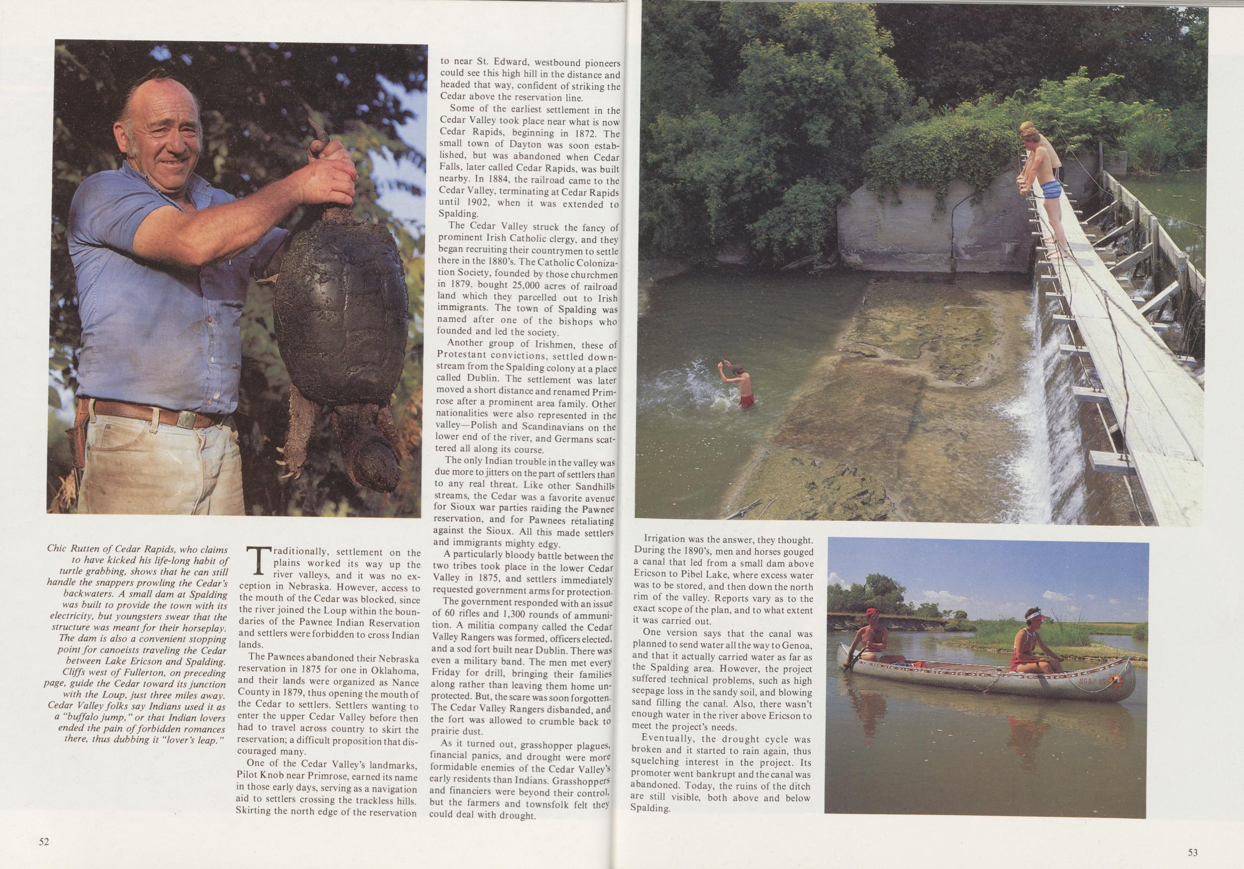
Traditionally, settlement on the plains worked its way up the river valleys, and it was no exception in Nebraska. However, access to the mouth of the Cedar was blocked, since the river joined the Loup within the boundaries of the Pawnee Indian Reservation and settlers were forbidden to cross Indian lands.
The Pawnees abandoned their Nebraska reservation in 1875 for one in Oklahoma, and their lands were organized as Nance County in 1879, thus opening the mouth of the Cedar to settlers. Settlers wanting to enter the upper Cedar Valley before then had to travel across country to skirt the reservation; a difficult proposition that discouraged many.
One of the Cedar Valley's landmarks, Pilot Knob near Primrose, earned its name in those early days, serving as a navigation aid to settlers crossing the trackless hills. Skirting the north edge of the reservation to near St. Edward, westbound pioneers could see this high hill in the distance and headed that way, confident of striking the Cedar above the reservation line.
Some of the earliest settlement in the Cedar Valley took place near what is now Cedar Rapids, beginning in 1872. The small town of Dayton was soon established, but was abandoned when Cedar Falls, later called Cedar Rapids, was built nearby. In 1884, the railroad came to the Cedar Valley, terminating at Cedar Rapids until 1902, when it was extended to Spalding.
The Cedar Valley struck the fancy of prominent Irish Catholic clergy, and they began recruiting their countrymen to settle there in the 1880's. The Catholic Colonization Society, founded by those churchmen in 1879. bought 25,000 acres of railroad land which they parcelled out to Irish immigrants. The town of Spalding was named after one of the bishops who founded and led the society.
Another group of Irishmen, these of Protestant convictions, settled down-stream from the Spalding colony at a place called Dublin. The settlement was later moved a short distance and renamed Primrose after a prominent area family. Other nationalities were also represented in the valley—Polish and Scandinavians on the lower end of the river, and Germans scattered all along its course.
The only Indian trouble in the valley was due more to jitters on the part of settlers than to any real threat. Like other Sandhills streams, the Cedar was a favorite avenue for Sioux war parties raiding the Pawnee reservation, and for Pawnees retaliating against the Sioux. All this made settlers and immigrants mighty edgy.
A particularly bloody battle between the two tribes took place in the lower Cedar Valley in 1875, and settlers immediately requested government arms for protection.
The government responded with an issue of 60 rifles and 1,300 rounds of ammunition. A militia company called the Cedar Valley Rangers was formed, officers elected, and a sod fort built near Dublin. There was even a military band. The men met every Friday for drill, bringing their families along rather than leaving them home unprotected. But, the scare was soon forgotten-The Cedar Valley Rangers disbanded, and the fort was allowed to crumble back to prairie dust.
As it turned out, grasshopper plagues, financial panics, and drought were more formidable enemies of the Cedar Valley's early residents than Indians. Grasshoppers and financiers were beyond their control, but the farmers and townsfolk felt they could deal with drought.
52Irrigation was the answer, they thought. During the 1890's, men and horses gouged a canal that led from a small dam above Ericson to Pibel Lake, where excess water was to be stored, and then down the north rim of the valley. Reports vary as to the exact scope of the plan, and to what extent it was carried out.
One version says that the canal was planned to send water all the way to Genoa, and that it actually carried water as far as the Spalding area. However, the project suffered technical problems, such as high seepage loss in the sandy soil, and blowing sand filling the canal. Also, there wasn't enough water in the river above Ericson to meet the project's needs.
Eventually, the drought cycle was broken and it started to rain again, thus squelching interest in the project. Its promoter went bankrupt and the canal was abandoned. Today, the ruins of the ditch are still visible, both above and below Spalding.
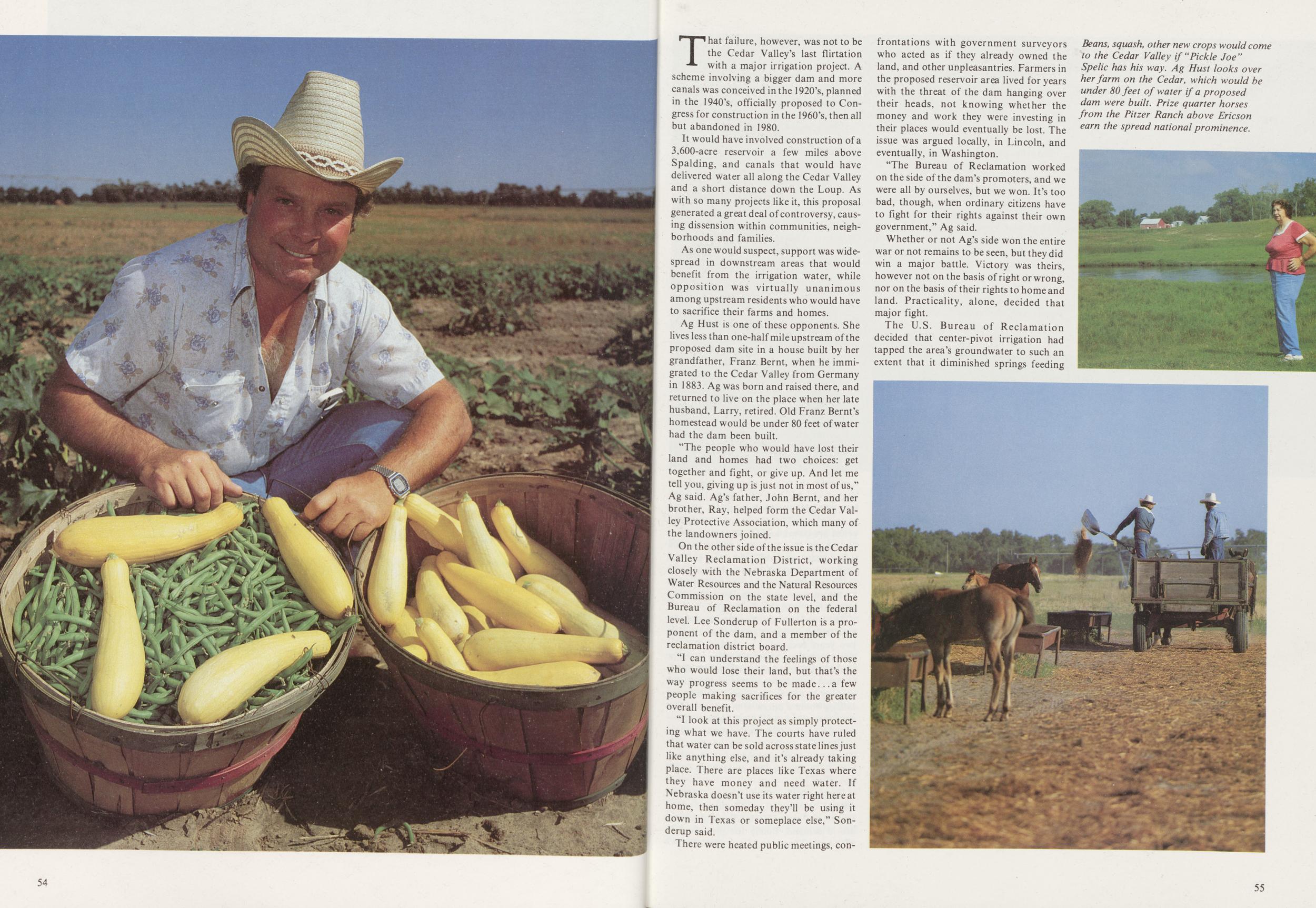 54
54
That failure, however, was not to be the Cedar Valley's last flirtation with a major irrigation project. A scheme involving a bigger dam and more canals was conceived in the 1920's, planned in the 1940's, officially proposed to Congress for construction in the 1960's, then all but abandoned in 1980.
It would have involved construction of a 3,600-acre reservoir a few miles above Spalding, and canals that would have delivered water all along the Cedar Valley and a short distance down the Loup. As with so many projects like it, this proposal generated a great deal of controversy, causing dissension within communities, neighborhoods and families.
As one would suspect, support was widespread in downstream areas that would benefit from the irrigation water, while opposition was virtually unanimous among upstream residents who would have to sacrifice their farms and homes.
Ag Hust is one of these opponents. She lives less than one-half mile upstream of the proposed dam site in a house built by her grandfather, Franz Bernt, when he immigrated to the Cedar Valley from Germany in 1883. Ag was born and raised there, and returned to live on the place when her late husband, Larry, retired. Old Franz Bernt's homestead would be under 80 feet of water had the dam been built.
The people who would have lost their land and homes had two choices: get together and fight, or give up. And let me tell you, giving up is just not in most of us," Ag said. Ag's father, John Bernt, and her brother, Ray, helped form the Cedar Valley Protective Association, which many of the landowners joined.
On the other side of the issue is the Cedar Valley Reclamation District, working closely with the Nebraska Department of Water Resources and the Natural Resources Commission on the state level, and the Bureau of Reclamation on the federal level. Lee Sonderup of Fullerton is a proponent of the dam, and a member of the reclamation district board.
"I can understand the feelings of those who would lose their land, but that's the way progress seems to be made a few people making sacrifices for the greater overall benefit.
"I look at this project as simply protecting what we have. The courts have ruled that water can be sold across state lines just like anything else, and it's already taking place. There are places like Texas where they have money and need water. If Nebraska doesn't use its water right here at home, then someday they'll be using it down in Texas or someplace else," Sonderup said.
There were heated public meetings, confrontations with government surveyors who acted as if they already owned the land, and other unpleasantries. Farmers in the proposed reservoir area lived for years with the threat of the dam hanging over their heads, not knowing whether the money and work they were investing in their places would eventually be lost. The issue was argued locally, in Lincoln, and eventually, in Washington.
"The Bureau of Reclamation worked on the side of the dam's promoters, and we were all by ourselves, but we won. It's too bad, though, when ordinary citizens have to fight for their rights against their own government," Ag said.
Whether or not Ag's side won the entire war or not remains to be seen, but they did win a major battle. Victory was theirs, however not on the basis of right or wrong, nor on the basis of their rights to home and land. Practicality, alone, decided that major fight.
The U.S. Bureau of Reclamation decided that center-pivot irrigation had tapped the area's groundwater to such an extent that it diminished springs feeding
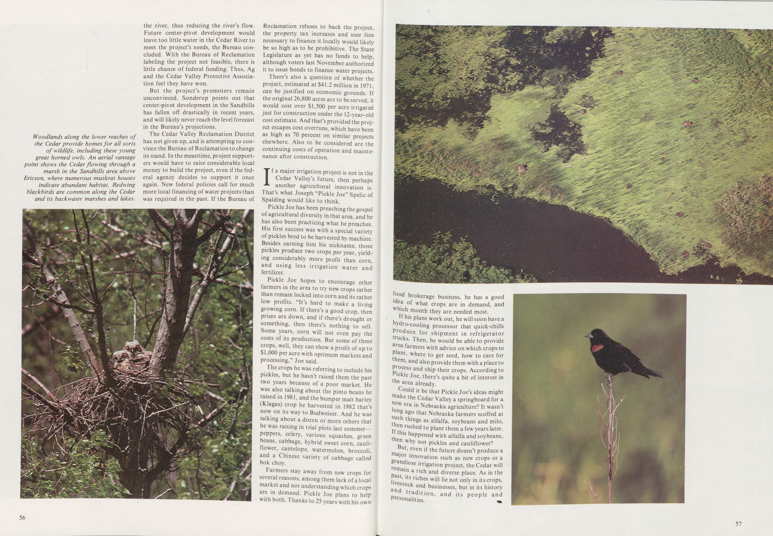
But the project's promoters remain unconvinced. Sonderup points out that center-pivot development in the Sandhills has fallen off drastically in recent years, and will likely never reach the level forecast in the Bureau's projections.
The Cedar Valley Reclamation District has not given up, and is attempting to convince the Bureau of Reclamation to change its stand. In the meantime, project supporters would have to raise considerable local money to build the project, even if the federal agency decides to support it once again. New federal policies call for much more local financing of water projects than was required in the past. If the Bureau of Reclamation refuses to back the project, the property tax increases and user fees necessary to finance it locally would likely be so high as to be prohibitive. The State Legislature as yet has no funds to help, although voters last November authorized it to issue bonds to finance water projects.
There's also a question of whether the project, estimated at $41.2 million in 1971, can be justified on economic grounds. If the original 26,800 acres are to be served, it would cost over $1,500 per acre irrigated just for construction under the 12-year-old cost estimate. And that's provided the project escapes cost overruns, which have been as high as 70 percent on similar projects elsewhere. Also to be considered are the continuing costs of operation and maintenance after construction.
If a major irrigation project is not in the Cedar Valley's future, then perhaps another agricultural innovation is. That's what Joseph "Pickle Joe" Spelic of Spalding would like to think.
Pickle Joe has been preaching the gospel of agricultural diversity in that area, and he has also been practicing what he preaches. His first success was with a special variety of pickles bred to be harvested by machine. Besides earning him his nickname, those pickles produce two crops per year, yielding considerably more profit than corn, and using less irrigation water and fertilizer.
Pickle Joe hopes to encourage other farmers in the area to try new crops rather than remain locked into corn and its rather low profits. "It's hard to make a living growing corn. If there's a good crop, then prices are down, and if there's drought or something, then there's nothing to sell. Some years, corn will not even pay the costs of its production. But some of these crops, well, they can show a profit of up to $ 1,000 per acre with optimum markets and processing," Joe said.
The crops he was referring to include his pickles, but he hasn't raised them the past two years because of a poor market. He was also talking about the pinto beans he raised in 1981, and the bumper malt barlev (Klagas) crop he harvested in 1982 that's now on its way to Budweiser. And he was talking about a dozen or more others that he was raising in trial plots last summer-peppers, celery, various squashes, green beans, cabbage, hybrid sweet corn, cauliflower, cantelope, watermelon, broccoli, and a Chinese variety of cabbage called bok choy.
Farmers stay away from new crops for several reasons, among them lack of a local market and not understanding which crops are in demand. Pickle Joe plans to help with both. Thanks to 25 years with his own 56 food brokerage business, he has a good idea of what crops are in demand, and which month they are needed most.
If his plans work out, he will soon have a hydro-cooling processor that quick-chills Produce for shipment in refrigerator rucks- Then, he would be able to provide area farmers with advice on which crops to P|ant, where to get seed, how to care for em, and also provide them with a place to Process and ship their crops. According to pickle Joe, there's quite a bit of interest in the area already.
Could it be that Pickle Joe's ideas might make the Cedar Valley a springboard for a new era in Nebraska agriculture? It wasn't long ago that Nebraska farmers scoffed at such things as alfalfa, soybeans and milo, Then rushed to plant them a few years later. If this happened with alfalfa and soybeans, then why not pickles and cauliflower?
But, even if the future doesn't produce a major innovation such as new crops or a grandiose irrigation project, the Cedar will remain a rich and diverse place. As in the past, its riches will lie not only in its crops, livestock and businesses, but in its history and tradition, and its people and personalities.
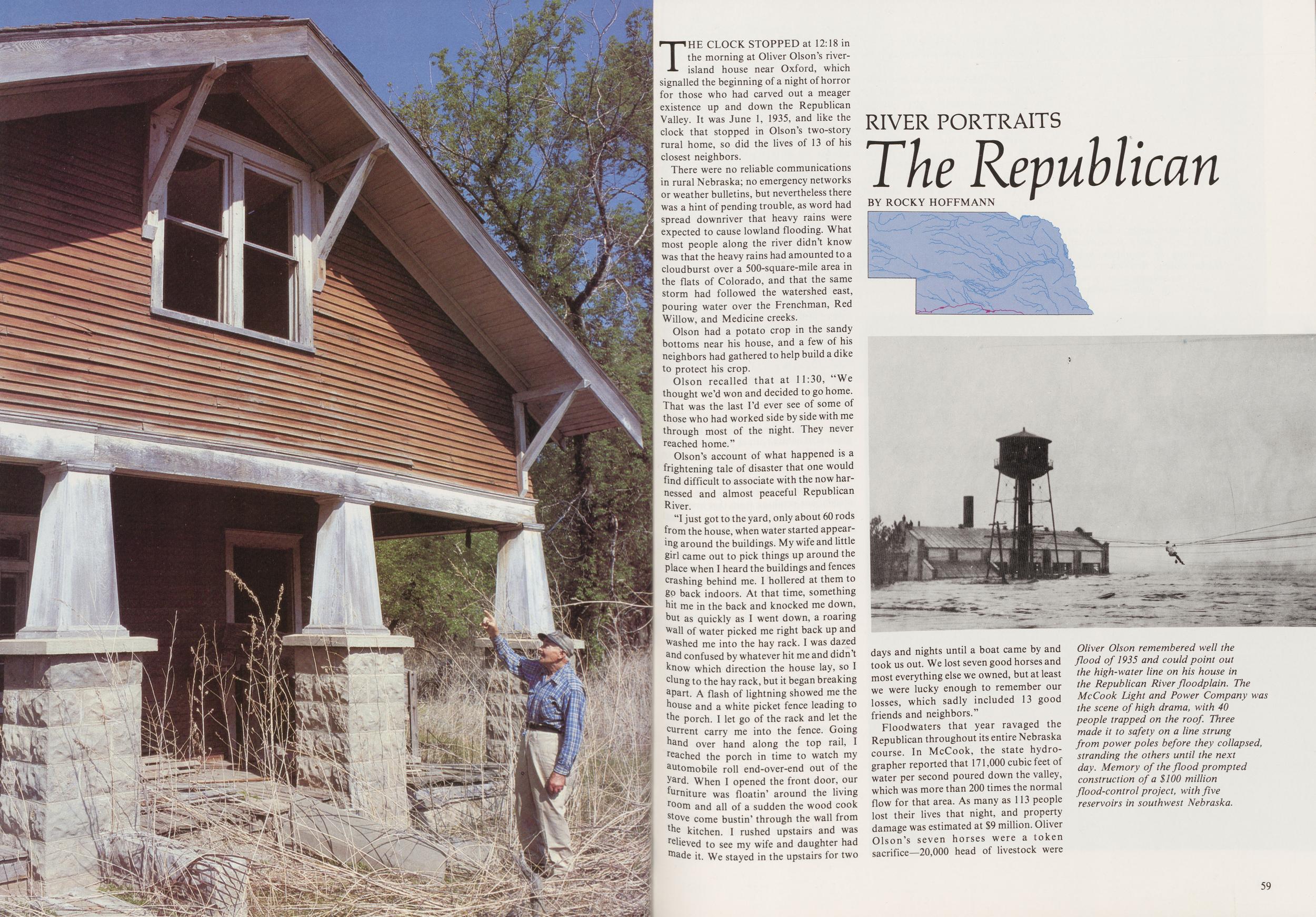
RIVER PORTRAITS
The Republican
BY ROCKY HOFFMANNTHE CLOCK STOPPED at 12:18 in the morning at Oliver Olson's river-island house near Oxford, which signalled the beginning of a night of horror for those who had carved out a meager existence up and down the Republican Valley. It was June 1, 1935, and like the clock that stopped in Olson's two-story rural home, so did the lives of 13 of his closest neighbors.
There were no reliable communications in rural Nebraska; no emergency networks or weather bulletins, but nevertheless there was a hint of pending trouble, as word had spread downriver that heavy rains were expected to cause lowland flooding. What most people along the river didn't know was that the heavy rains had amounted to a cloudburst over a 500-square-mile area in the flats of Colorado, and that the same storm had followed the watershed east, pouring water over the Frenchman, Red Willow, and Medicine creeks.
Olson had a potato crop in the sandy bottoms near his house, and a few of his neighbors had gathered to help build a dike to protect his crop.
Olson recalled that at 11:30, "We thought we'd won and decided to go home. That was the last I'd ever see of some of those who had worked side by side with me through most of the night. They never reached home."
Olson's account of what happened is a frightening tale of disaster that one would find difficult to associate with the now harnessed and almost peaceful Republican River.
"I just got to the yard, only about 60 rods from the house, when water started appearing around the buildings. My wife and little girl came out to pick things up around the Place when I heard the buildings and fences crashing behind me. I hollered at them to go back indoors. At that time, something nit me in the back and knocked me down, but as quickly as I went down, a roaring wall of water picked me right back up and Washed me into the hay rack. I was dazed and confused by whatever hit me and didn't know which direction the house lay, so I dung to the hay rack, but it began breaking aPart. A flash of lightning showed me the house and a white picket fence leading to the porch. I let go of the rack and let the current carry me into the fence. Going hand over hand along the top rail, I Cached the porch in time to watch my automobile roll end-over-end out of the yard. When I opened the front door, our furniture was floatin' around the living room and all of a sudden the wood cook stove come bustin' through the wall from the kitchen. I rushed upstairs and was relieved to see my wife and daughter had made it. We stayed in the upstairs for two days and nights until a boat came by and took us out. We lost seven good horses and most everything else we owned, but at least we were lucky enough to remember our losses, which sadly included 13 good friends and neighbors."
Floodwaters that year ravaged the Republican throughout its entire Nebraska course. In McCook, the state hydrographer reported that 171,000 cubic feet of water per second poured down the valley, which was more than 200 times the normal flow for that area. As many as 113 people lost their lives that night, and property damage was estimated at $9 million. Oliver Olson's seven horses were a token sacrifice—20,000 head of livestock were
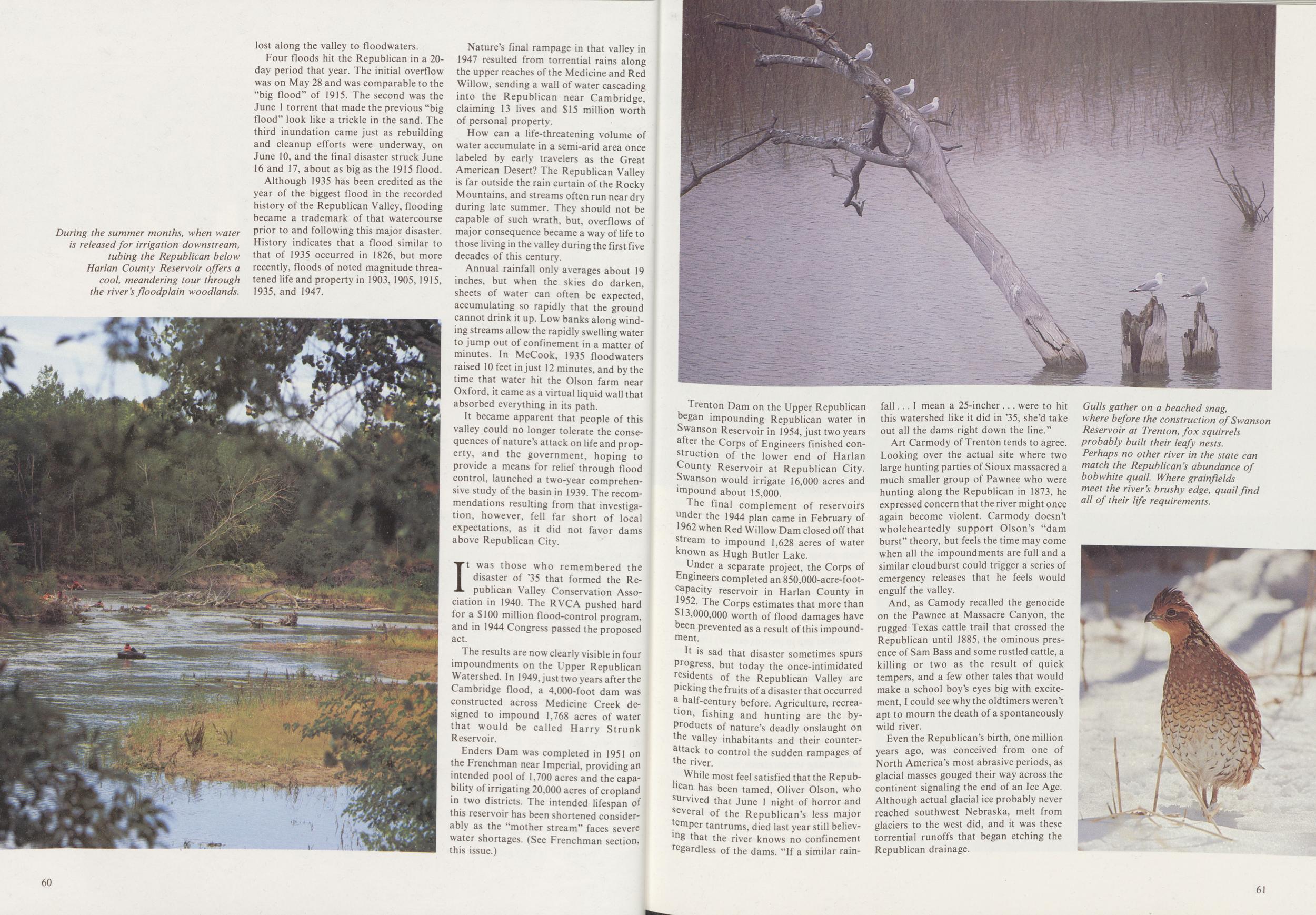
Four floods hit the Republican in a 20-day period that year. The initial overflow was on May 28 and was comparable to the "big flood" of 1915. The second was the June 1 torrent that made the previous "big flood" look like a trickle in the sand. The third inundation came just as rebuilding and cleanup efforts were underway, on June 10, and the final disaster struck June 16 and 17, about as big as the 1915 flood.
Although 1935 has been credited as the year of the biggest flood in the recorded history of the Republican Valley, flooding became a trademark of that watercourse prior to and following this major disaster. History indicates that a flood similar to that of 1935 occurred in 1826, but more recently, floods of noted magnitude threatened life and property in 1903, 1905, 1915, 1935, and 1947.
Nature's final rampage in that valley in 1947 resulted from torrential rains along the upper reaches of the Medicine and Red Willow, sending a wall of water cascading into the Republican near Cambridge, claiming 13 lives and $15 million worth of personal property.
How can a life-threatening volume of water accumulate in a semi-arid area once labeled by early travelers as the Great American Desert? The Republican Valley is far outside the rain curtain of the Rocky Mountains, and streams often run near dry during late summer. They should not be capable of such wrath, but, overflows of major consequence became a way of life to those living in the valley during the first five decades of this century.
Annual rainfall only averages about 19 inches, but when the skies do darken, sheets of water can often be expected, accumulating so rapidly that the ground cannot drink it up. Low banks along winding streams allow the rapidly swelling water to jump out of confinement in a matter of minutes. In McCook, 1935 floodwaters raised 10 feet in just 12 minutes, and by the time that water hit the Olson farm near Oxford, it came as a virtual liquid wall that absorbed everything in its path.
It became apparent that people of this valley could no longer tolerate the consequences of nature's attack on life and property, and the government, hoping to provide a means for relief through flood control, launched a two-year comprehensive study of the basin in 1939. The recommendations resulting from that investigation, however, fell far short of local expectations, as it did not favor dams above Republican City.
It was those who remembered the disaster of 35 that formed the Republican Valley Conservation Association in 1940. The RVCA pushed hard for a $100 million flood-control program, and in 1944 Congress passed the proposed act.
The results are now clearly visible in four impoundments on the Upper Republican Watershed. In 1949, just two years after the Cambridge flood, a 4,000-foot dam was constructed across Medicine Creek designed to impound 1,768 acres of water that would be called Harry Strunk Reservoir.
Enders Dam was completed in 1951 on the Frenchman near Imperial, providing an intended pool of 1,700 acres and the capability of irrigating 20,000 acres of cropland in two districts. The intended lifespan of this reservoir has been shortened considerably as the "mother stream" faces severe water shortages. (See Frenchman section, this issue.)
60Trenton Dam on the Upper Republican began impounding Republican water in Swanson Reservoir in 1954, just two years after the Corps of Engineers finished construction of the lower end of Harlan County Reservoir at Republican City. Swanson would irrigate 16,000 acres and impound about 15,000.
The final complement of reservoirs under the 1944 plan came in February of 1962 when Red Willow Dam closed off that stream to impound 1,628 acres of water known as Hugh Butler Lake.
Under a separate project, the Corps of Engineers completed an 850,000-acre-foot-capacity reservoir in Harlan County in 1952. The Corps estimates that more than $13,000,000 worth of flood damages have been prevented as a result of this impoundment.
It is sad that disaster sometimes spurs Progress, but today the once-intimidated residents of the Republican Valley are Picking the fruits of a disaster that occurred a half-century before. Agriculture, recreation, fishing and hunting are the by-products of nature's deadly onslaught on the valley inhabitants and their counterattack to control the sudden rampages of the river.
While most feel satisfied that the Republican has been tamed, Oliver Olson, who survived that June 1 night of horror and several of the Republican's less major temPer tantrums, died last year still believing that the river knows no confinement regardless of the dams. "If a similar rainfall I mean a 25-incher were to hit this watershed like it did in '35, she'd take out all the dams right down the line."
Art Carmody of Trenton tends to agree. Looking over the actual site where two large hunting parties of Sioux massacred a much smaller group of Pawnee who were hunting along the Republican in 1873, he expressed concern that the river might once again become violent. Carmody doesn't wholeheartedly support Olson's "dam burst" theory, but feels the time may come when all the impoundments are full and a similar cloudburst could trigger a series of emergency releases that he feels would engulf the valley.
And, as Camody recalled the genocide on the Pawnee at Massacre Canyon, the rugged Texas cattle trail that crossed the Republican until 1885, the ominous presence of Sam Bass and some rustled cattle, a killing or two as the result of quick tempers, and a few other tales that would make a school boy's eyes big with excitement, I could see why the oldtimers weren't apt to mourn the death of a spontaneously wild river.
Even the Republican's birth, one million years ago, was conceived from one of North America's most abrasive periods, as glacial masses gouged their way across the continent signaling the end of an Ice Age. Although actual glacial ice probably never reached southwest Nebraska, melt from glaciers to the west did, and it was these torrential runoffs that began etching the Republican drainage.
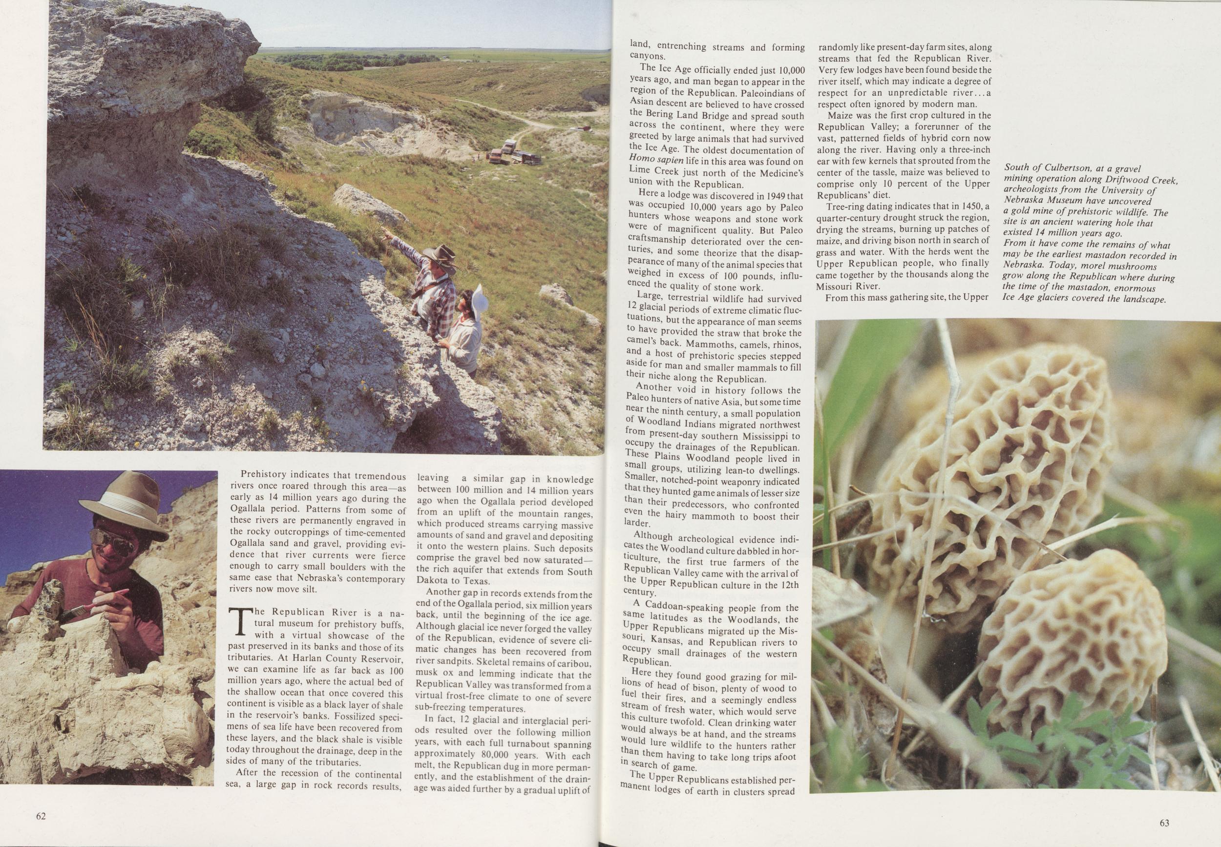
Prehistory indicates that tremendous rivers once roared through this area—as early as 14 million years ago during the Ogallala period. Patterns from some of these rivers are permanently engraved in the rocky outcroppings of time-cemented Ogallala sand and gravel, providing evidence that river currents were fierce enough to carry small boulders with the same ease that Nebraska's contemporary rivers now move silt.
The Republican River is a natural museum for prehistory buffs, with a virtual showcase of the past preserved in its banks and those of its tributaries. At Harlan County Reservoir, we can examine life as far back as 100 million years ago, where the actual bed of the shallow ocean that once covered this continent is visible as a black layer of shale in the reservoir's banks. Fossilized specimens of sea life have been recovered from these layers, and the black shale is visible today throughout the drainage, deep in the sides of many of the tributaries.
After the recession of the continental sea, a large gap in rock records results, leaving a similar gap in knowledge between 100 million and 14 million years ago when the Ogallala period developed from an uplift of the mountain ranges, which produced streams carrying massive amounts of sand and gravel and depositing it onto the western plains. Such deposits comprise the gravel bed now saturated—the rich aquifer that extends from South Dakota to Texas.
Another gap in records extends from the end of the Ogallala period, six million years back, until the beginning of the ice age. Although glacial ice never forged the valley of the Republican, evidence of severe climatic changes has been recovered from river sandpits. Skeletal remains of caribou, musk ox and lemming indicate that the Republican Valley was transformed from a virtual frost-free climate to one of severe sub-freezing temperatures.
In fact, 12 glacial and interglacial periods resulted over the following million years, with each full turnabout spanning approximately 80,000 years. With each melt, the Republican dug in more permanently, and the establishment of the drainage was aided further by a gradual uplift of 62 land, entrenching streams and forming canyons.
The Ice Age officially ended just 10,000 years ago, and man began to appear in the region of the Republican. Paleoindians of Asian descent are believed to have crossed the Bering Land Bridge and spread south across the continent, where they were greeted by large animals that had survived the Ice Age. The oldest documentation of Homo sapien life in this area was found on Lime Creek just north of the Medicine's union with the Republican.
Here a lodge was discovered in 1949 that was occupied 10,000 years ago by Paleo hunters whose weapons and stone work were of magnificent quality. But Paleo craftsmanship deteriorated over the centuries, and some theorize that the disappearance of many of the animal species that weighed in excess of 100 pounds, influenced the quality of stone work.
Large, terrestrial wildlife had survived facial periods of extreme climatic fluctuations, but the appearance of man seems to have provided the straw that broke the camel's back. Mammoths, camels, rhinos, and a host of prehistoric species stepped aside for man and smaller mammals to fill their niche along the Republican.
Another void in history follows the Paleo hunters of native Asia, but some time near the ninth century, a small population of Woodland Indians migrated northwest from present-day southern Mississippi to occupy the drainages of the Republican. These Plains Woodland people lived in small groups, utilizing lean-to dwellings. Smaller, notched-point weaponry indicated that they hunted game animals of lesser size than their predecessors, who confronted even the hairy mammoth to boost their larder.
Although archeological evidence indicates the Woodland culture dabbled in horticulture, the first true farmers of the Republican Valley came with the arrival of the Upper Republican culture in the 12th century.
A Caddoan-speaking people from the same latitudes as the Woodlands, the Upper Republicans migrated up the Missouri, Kansas, and Republican rivers to occupy small drainages of the western Republican
Here they found good grazing for millions of head of bison, plenty of Wood to fuel their fires,and a seemingly endless stream of fresh water, which would serve this culture twofold. Clean drinking water would always be at hand, and the streams would lure wildlife to the hunters rather than them having to take long trips afoot in search of game.
The Upper Republicans established permanent lodges of earth in clusters spread randomly like present-day farm sites, along streams that fed the Republican River. Very few lodges have been found beside the river itself, which may indicate a degree of respect for an unpredictable river a respect often ignored by modern man.
Maize was the first crop cultured in the Republican Valley; a forerunner of the vast, patterned fields of hybrid corn now along the river. Having only a three-inch ear with few kernels that sprouted from the center of the tassle, maize was believed to comprise only 10 percent of the Upper Republicans' diet.
Tree-ring dating indicates that in 1450, a quarter-century drought struck the region, drying the streams, burning up patches of maize, and driving bison north in search of grass and water. With the herds went the Upper Republican people, who finally came together by the thousands along the Missouri River.
From this mass gathering site, the Upper
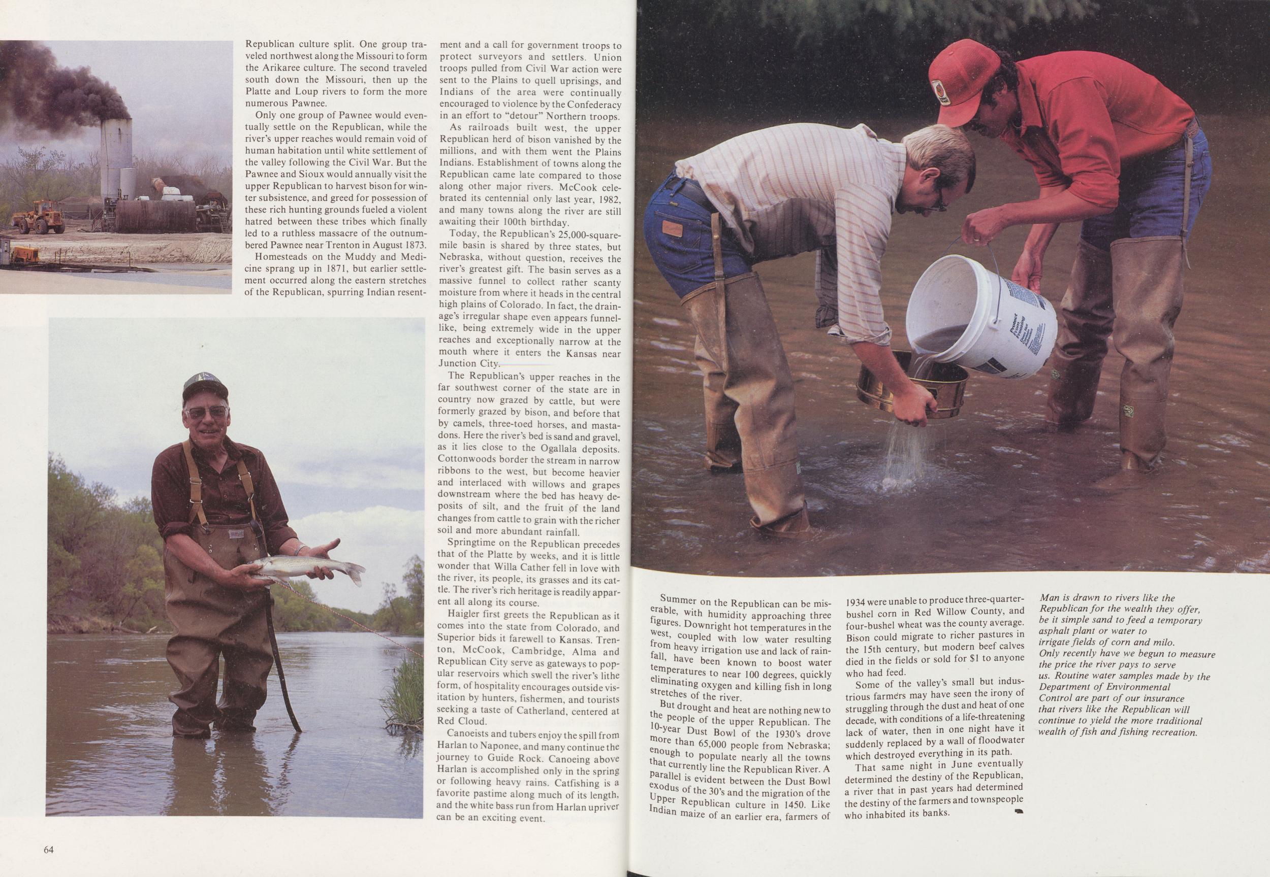
Only one group of Pawnee would eventually settle on the Republican, while the river's upper reaches would remain void of human habitation until white settlement of the valley following the Civil War. But the Pawnee and Sioux would annually visit the upper Republican to harvest bison for winter subsistence, and greed for possession of these rich hunting grounds fueled a violent hatred between these tribes which finally led to a ruthless massacre of the outnumbered Pawnee near Trenton in August 1873.
Homesteads on the Muddy and Medicine sprang up in 1871, but earlier settlement occurred along the eastern stretches of the Republican, spurring Indian resentment and a call for government troops to protect surveyors and settlers. Union troops pulled from Civil War action were sent to the Plains to quell uprisings, and Indians of the area were continually encouraged to violence by the Confederacy in an effort to "detour" Northern troops.
As railroads built west, the upper Republican herd of bison vanished by the millions, and with them went the Plains Indians. Establishment of towns along the Republican came late compared to those along other major rivers. McCook celebrated its centennial only last year, 1982, and many towns along the river are still awaiting their 100th birthday.
Today, the Republican's 25,000-squaremile basin is shared by three states, but Nebraska, without question, receives the river's greatest gift. The basin serves as a massive funnel to collect rather scanty moisture from where it heads in the central high plains of Colorado. In fact, the drainage's irregular shape even appears funnel-like, being extremely wide in the upper reaches and exceptionally narrow at the mouth where it enters the Kansas near Junction City.
The Republican's upper reaches in the far southwest corner of the state are in country now grazed by cattle, but were formerly grazed by bison, and before that by camels, three-toed horses, and mastadons. Here the river's bed is sand and gravel, as it lies close to the Ogallala deposits. Cottonwoods border the stream in narrow ribbons to the west, but become heavier and interlaced with willows and grapes downstream where the bed has heavy deposits of silt, and the fruit of the land changes from cattle to grain with the richer soil and more abundant rainfall.
Springtime on the Republican precedes that of the Platte by weeks, and it is little wonder that Willa Cather fell in love with the river, its people, its grasses and its cattle. The river's rich heritage is readily apparent all along its course.
Haigler first greets the Republican as it comes into the state from Colorado, and Superior bids it farewell to Kansas. Trenton, McCook, Cambridge, Alma and Republican City serve as gateways to popular reservoirs which swell the river's lithe form, of hospitality encourages outside visitation by hunters, fishermen, and tourists seeking a taste of Catherland, centered at Red Cloud.
Canoeists and tubers enjoy the spill from Harlan to Naponee, and many continue the journey to Guide Rock. Canoeing above Harlan is accomplished only in the spring or following heavy rains. Catfishing is a favorite pastime along much of its length, and the white bass run from Harlan upriver can be an exciting event.
64Summer on the Republican can be miserable, with humidity approaching three figures. Downright hot temperatures in the west, coupled with low water resulting from heavy irrigation use and lack of rainfall have been known to boost water temperatures to near 100 degrees, quickly eliminating oxygen and killing fish in long stretches of the river.
But drought and heat are nothing new to the people of the upper Republican. The 10-year Dust Bowl of the 1930's drove more than 65,000 people from Nebraska; enough to populate nearly all the towns that currently line the Republican River. A parallel is evident between the Dust Bowl exodus of the 30's and the migration of the Upper Republican culture in 1450. Like Indian maize of an earlier era, farmers of 1934 were unable to produce three-quarter-bushel corn in Red Willow County, and four-bushel wheat was the county average. Bison could migrate to richer pastures in the 15th century, but modern beef calves died in the fields or sold for $1 to anyone who had feed.
Some of the valley's small but industrious farmers may have seen the irony of struggling through the dust and heat of one decade, with conditions of a life-threatening lack of water, then in one night have it suddenly replaced by a wall of floodwater which destroyed everything in its path.
That same night in June eventually determined the destiny of the Republican, a river that in past years had determined the destiny of the farmers and townspeople who inhabited its banks.
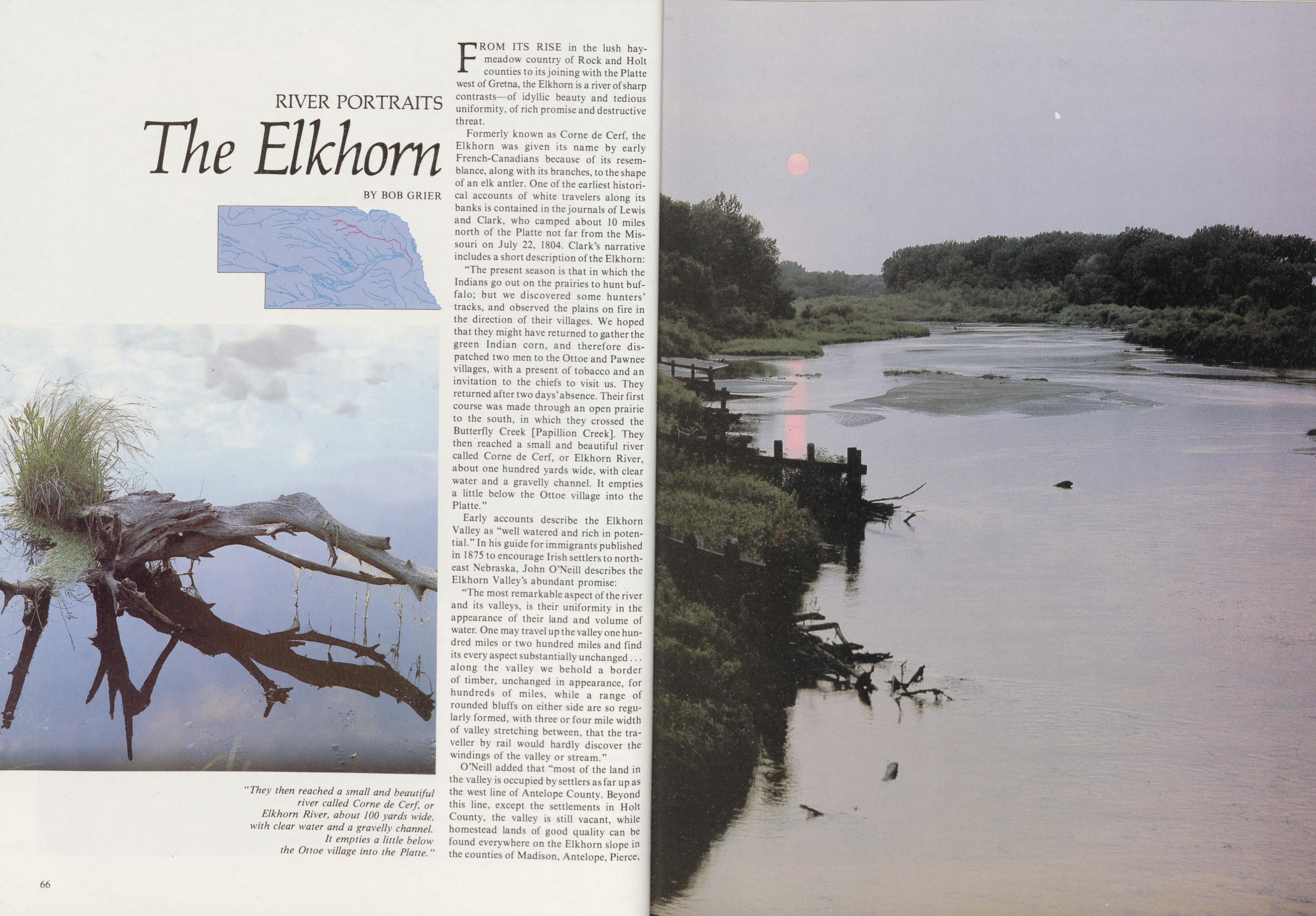
RIVER PORTRAITS
The Elkhorn
BY BOB GRIERFROM ITS RISE in the lush hay-meadow country of Rock and Holt counties to its joining with the Platte west of Gretna, the Elkhorn is a river of sharp contrasts—of idyllic beauty and tedious uniformity, of rich promise and destructive threat.
Formerly known as Corne de Cerf, the Elkhorn was given its name by early French-Canadians because of its resemblance, along with its branches, to the shape of an elk antler. One of the earliest historical accounts of white travelers along its banks is contained in the journals of Lewis and Clark, who camped about 10 miles north of the Platte not far from the Missouri on July 22, 1804. Clark's narrative includes a short description of the Elkhorn:
"The present season is that in which the Indians go out on the prairies to hunt buffalo; but we discovered some hunters' tracks, and observed the plains on fire in the direction of their villages. We hoped that they might have returned to gather the green Indian corn, and therefore dispatched two men to the Ottoe and Pawnee villages, with a present of tobacco and an invitation to the chiefs to visit us. They returned after two days'absence. Their first course was made through an open prairie to the south, in which they crossed the Butterfly Creek [Papillion Creek]. They then reached a small and beautiful river called Corne de Cerf, or Elkhorn River, about one hundred yards wide, with clear water and a gravelly channel. It empties a little below the Ottoe village into the Platte."
Early accounts describe the Elkhorn Valley as "well watered and rich in potential." In his guide for immigrants published in 1875 to encourage Irish settlers to northeast Nebraska, John O'Neill describes the Elkhorn Valley's abundant promise:
"The most remarkable aspect of the river and its valleys, is their uniformity in the appearance of their land and volume of water. One may travel up the valley one hundred miles or two hundred miles and find its every aspect substantially unchanged along the valley we behold a border of timber, unchanged in appearance, for hundreds of miles, while a range of rounded bluffs on either side are so regularly formed, with three or four mile width of valley stretching between, that the traveller by rail would hardly discover the windings of the valley or stream."
O'Neill added that "most of the land in the valley is occupied by settlers as far up as the west line of Antelope County. Beyond this line, except the settlements in Holt County, the valley is still vacant, while homestead lands of good quality can be found everywhere on the Elkhorn slope in the counties of Madison, Antelope, Pierce, 66
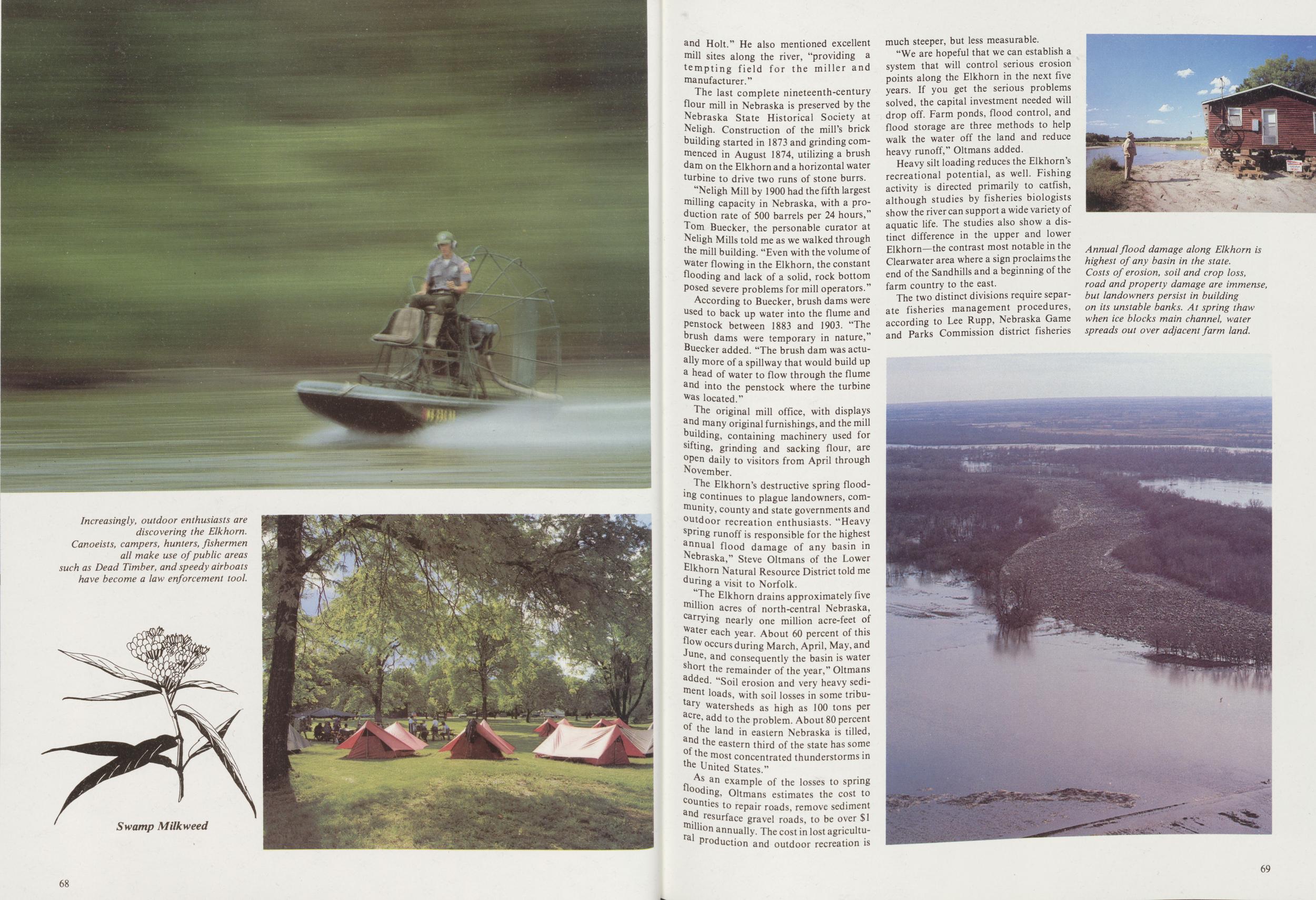
The last complete nineteenth-century flour mill in Nebraska is preserved by the Nebraska State Historical Society at Neligh. Construction of the mill's brick building started in 1873 and grinding commenced in August 1874, utilizing a brush dam on the Elkhorn and a horizontal water turbine to drive two runs of stone burrs.
"Neligh Mill by 1900 had the fifth largest milling capacity in Nebraska, with a production rate of 500 barrels per 24 hours," Tom Buecker, the personable curator at Neligh Mills told me as we walked through the mill building. "Even with the volume of water flowing in the Elkhorn, the constant flooding and lack of a solid, rock bottom Posed severe problems for mill operators."
According to Buecker, brush dams were used to back up water into the flume and Penstock between 1883 and 1903. "The brush dams were temporary in nature," Buecker added. "The brush dam was actually more of a spillway that would build up a head of water to flow through the flume and into the penstock where the turbine was located."
The original mill office, with displays and many original furnishings, and the mill building, containing machinery used for sifting, grinding and sacking flour, are open daily to visitors from April through November.
The Elkhorn's destructive spring flooding continues to plague landowners, community, county and state governments and outdoor recreation enthusiasts. "Heavy spring runoff is responsible for the highest annual flood damage of any basin in Nebraska," Steve Oltmans of the Lower Elkhorn Natural Resource District told me during a visit to Norfolk.
"The Elkhorn drains approximately five million acres of north-central Nebraska, carrying nearly one million acre-feet of Water each year. About 60 percent of this flow occurs during March, April, May, and June, and consequently the basin is water short the remainder of the year," Oltmans added. "Soil erosion and very heavy sediment loads, with soil losses in some tributary watersheds as high as 100 tons per acre, add to the problem. About 80 percent the land in eastern Nebraska is tilled, and the eastern third of the state has some of the most concentrated thunderstorms in the United States."
As an example of the losses to spring flooding, Oltmans estimates the cost to counties to repair roads, remove sediment and resurface gravel roads, to be over $1 million annually. The cost in lost agricultural Production and outdoor recreation is much steeper, but less measurable.
"We are hopeful that we can establish a system that will control serious erosion points along the Elkhorn in the next five years. If you get the serious problems solved, the capital investment needed will drop off. Farm ponds, flood control, and flood storage are three methods to help walk the water off the land and reduce heavy runoff," Oltmans added.
Heavy silt loading reduces the Elkhorn's recreational potential, as well. Fishing activity is directed primarily to catfish, although studies by fisheries biologists show the river can support a wide variety of aquatic life. The studies also show a distinct difference in the upper and lower Elkhorn—the contrast most notable in the Clearwater area where a sign proclaims the end of the Sandhills and a beginning of the farm country to the east.
The two distinct divisions require separate fisheries management procedures, according to Lee Rupp, Nebraska Game and Parks Commission district fisheries
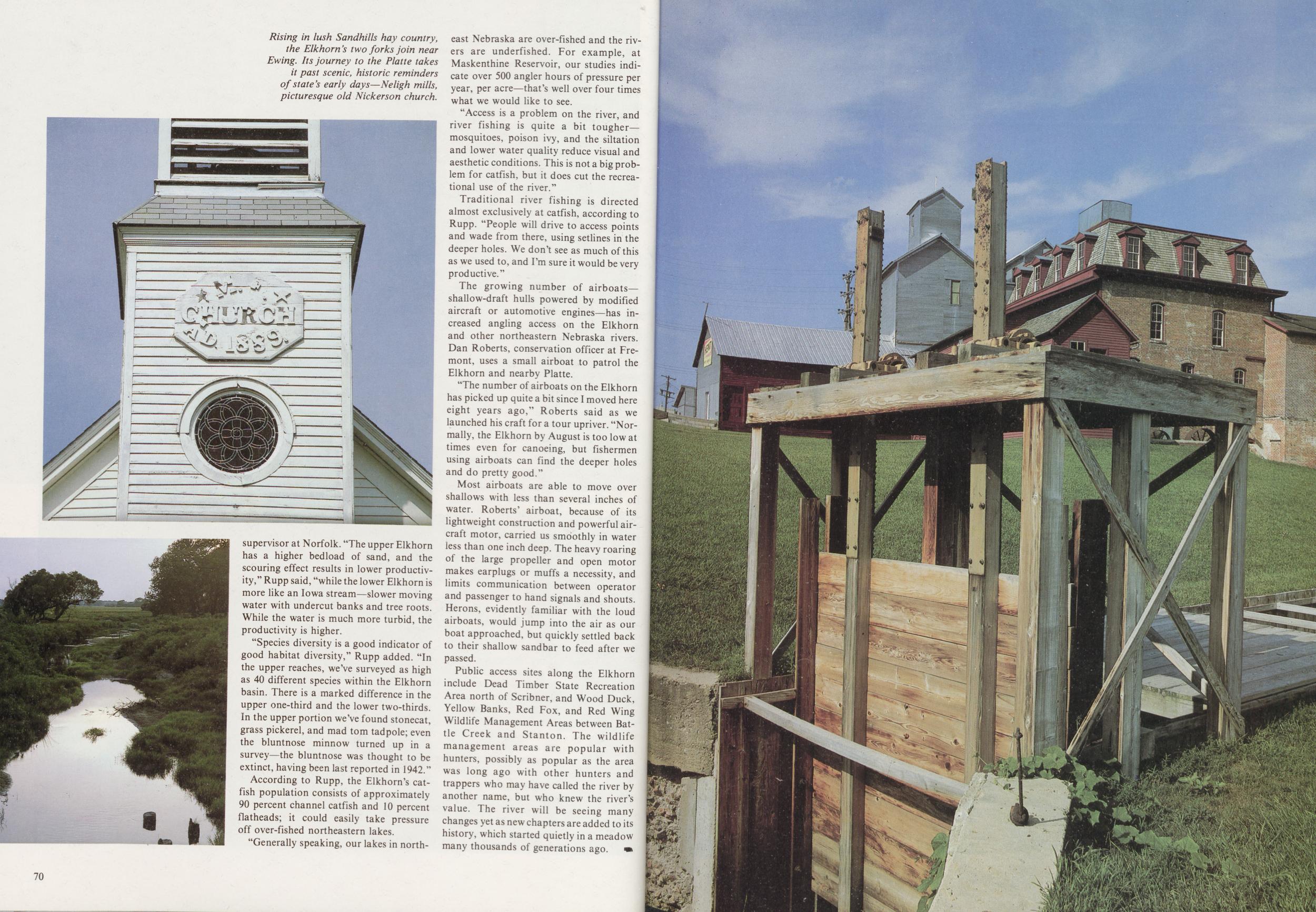
"Species diversity is a good indicator of good habitat diversity," Rupp added. "In the upper reaches, we've surveyed as high as 40 different species within the Elkhorn basin. There is a marked difference in the upper one-third and the lower two-thirds. In the upper portion we've found stonecat, grass pickerel, and mad torn tadpole; even the bluntnose minnow turned up in a survey—the bluntnose was thought to be extinct, having been last reported in 1942."
According to Rupp, the Elkhorn's catfish population consists of approximately 90 percent channel catfish and 10 percent flatheads; it could easily take pressure off over-fished northeastern lakes.
"Generally speaking, our lakes in northeast Nebraska are over-fished and the rivers are underfished. For example, at Maskenthine Reservoir, our studies indicate over 500 angler hours of pressure per year, per acre—that's well over four times what we would like to see.
"Access is a problem on the river, and river fishing is quite a bit tougher—mosquitoes, poison ivy, and the siltation and lower water quality reduce visual and aesthetic conditions. This is not a big problem for catfish, but it does cut the recreational use of the river."
Traditional river fishing is directed almost exclusively at catfish, according to Rupp. "People will drive to access points and wade from there, using setlines in the deeper holes. We don't see as much of this as we used to, and I'm sure it would be very productive."
The growing number of airboats—shallow-draft hulls powered by modified aircraft or automotive engines—has increased angling access on the Elkhorn and other northeastern Nebraska rivers. Dan Roberts, conservation officer at Fremont, uses a small airboat to patrol the Elkhorn and nearby Platte.
"The number of airboats on the Elkhorn has picked up quite a bit since I moved here eight years ago," Roberts said as we launched his craft for a tour upriver. "Normally, the Elkhorn by August is too low at times even for canoeing, but fishermen using airboats can find the deeper holes and do pretty good."
Most airboats are able to move over shallows with less than several inches of water. Roberts' airboat, because of its lightweight construction and powerful aircraft motor, carried us smoothly in water less than one inch deep. The heavy roaring of the large propeller and open motor makes earplugs or muffs a necessity, and limits communication between operator and passenger to hand signals and shouts. Herons, evidently familiar with the loud airboats, would jump into the air as our boat approached, but quickly settled back to their shallow sandbar to feed after we passed.
Public access sites along the Elkhorn include Dead Timber State Recreation Area north of Scribner, and Wood Duck, Yellow Banks, Red Fox, and Red Wing Wildlife Management Areas between Battle Creek and Stanton. The wildlife management areas are popular with hunters, possibly as popular as the area was long ago with other hunters and trappers who may have called the river by another name, but who knew the river's value. The river will be seeing many changes yet as new chapters are added to its history, which started quietly in a meadow many thousands of generations ago.
70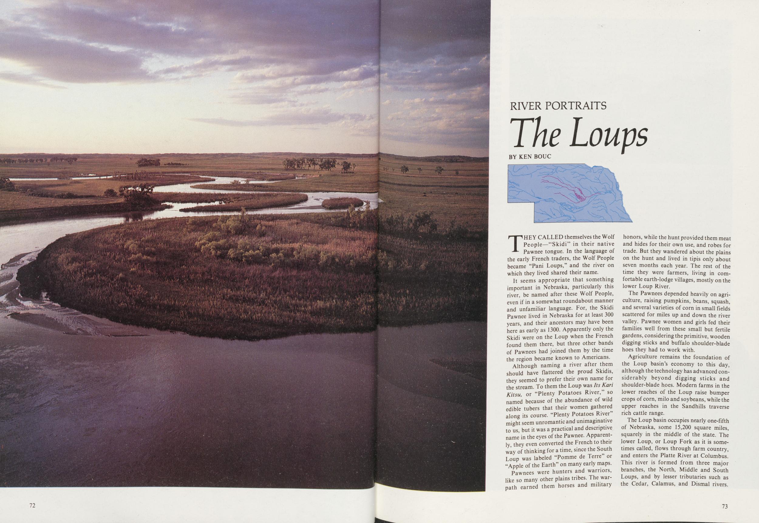
RIVER PORTRAITS
The Loups
BY KEN BOUCTHEY CALLED themselves the Wolf People—"Skidi" in their native Pawnee tongue. In the language of the early French traders, the Wolf People became "Pani Loups," and the river on which they lived shared their name.
It seems appropriate that something important in Nebraska, particularly this river, be named after these Wolf People, even if in a somewhat roundabout manner and unfamiliar language. For, the Skidi Pawnee lived in Nebraska for at least 300 years, and their ancestors may have been here as early as 1300. Apparently only the Skidi were on the Loup when the French found them there, but three other bands of Pawnees had joined them by the time the region became known to Americans.
Although naming a river after them should have flattered the proud Skidis, they seemed to prefer their own name for the stream. To them the Loup was Its Kari Kitsu, or "Plenty Potatoes River," so named because of the abundance of wild edible tubers that their women gathered along its course. "Plenty Potatoes River-might seem unromantic and unimaginative to us, but it was a practical and descriptive name in the eyes of the Pawnee. Apparently, they even converted the French to their way of thinking for a time, since the South Loup was labeled "Pomme de Terre" or "Apple of the Earth" on many early maps.
Pawnees were hunters and warriors, like so many other plains tribes. The warpath earned them horses and military honors, while the hunt provided them meat and hides for their own use, and robes for trade. But they wandered about the plains on the hunt and lived in tipis only about seven months each year. The rest of the time they were farmers, living in comfortable earth-lodge villages, mostly on the lower Loup River.
The Pawnees depended heavily on agriculture, raising pumpkins, beans, squash, and several varieties of corn in small fields scattered for miles up and down the river valley. Pawnee women and girls fed their families well from these small but fertile gardens, considering the primitive, wooden digging sticks and buffalo shoulder-blade hoes they had to work with.
Agriculture remains the foundation of the Loup basin's economy to this day, although the technology has advanced considerably beyond digging sticks and shoulder-blade hoes. Modern farms in the lower reaches of the Loup raise bumper crops of corn, milo and soybeans, while the upper reaches in the Sandhills traverse rich cattle range.
The Loup basin occupies nearly one-fifth of Nebraska, some 15,200 square miles, squarely in the middle of the state. The lower Loup, or Loup Fork as it is sometimes called, flows through farm country, and enters the Platte River at Columbus. This river is formed from three major branches, the North, Middle and South Loups, and by lesser tributaries such as the Cedar, Calamus, and Dismal rivers. 73 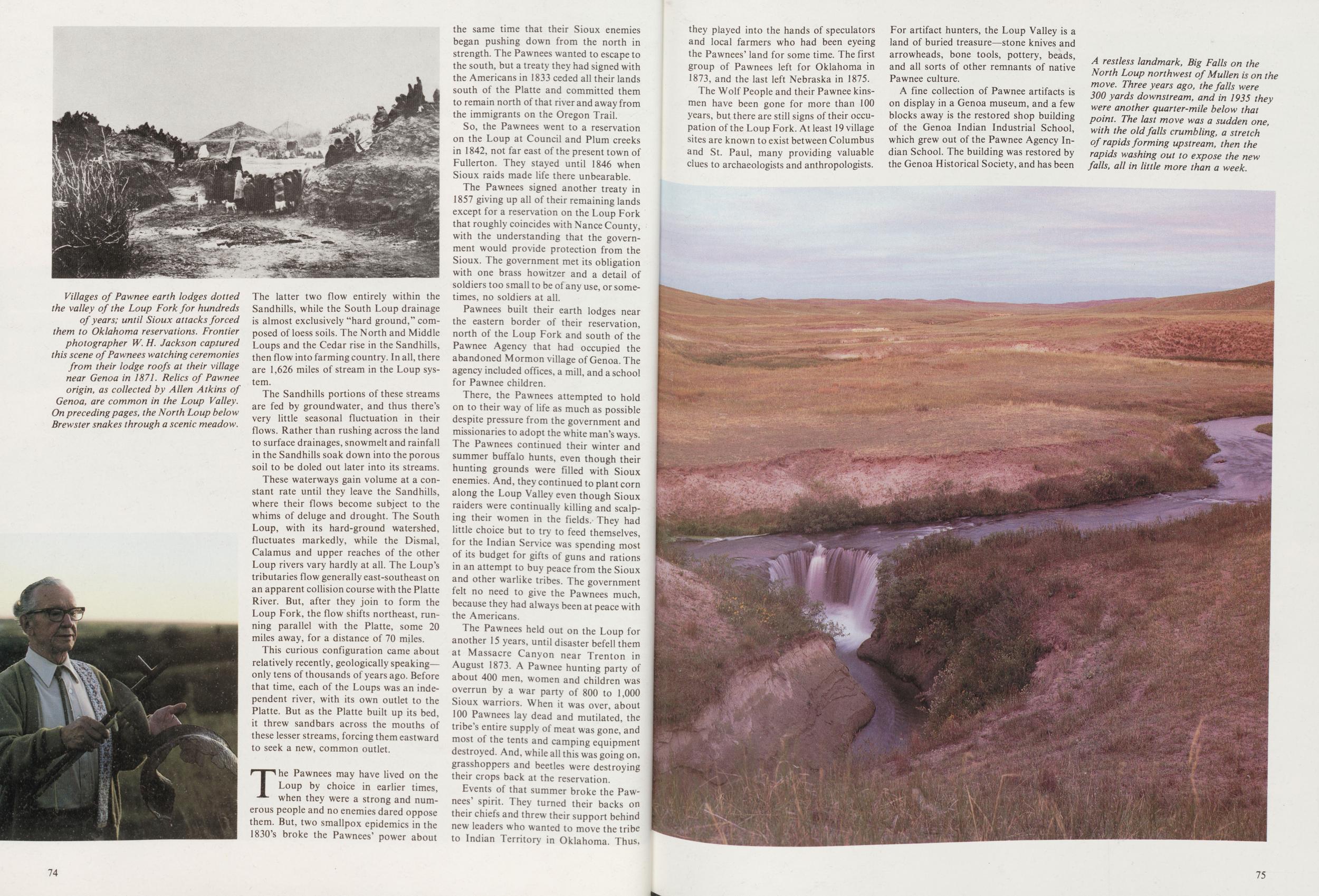
The Sandhills portions of these streams are fed by groundwater, and thus there's very little seasonal fluctuation in their flows. Rather than rushing across the land to surface drainages, snowmelt and rainfall in the Sandhills soak down into the porous soil to be doled out later into its streams.
These waterways gain volume at a constant rate until they leave the Sandhills, where their flows become subject to the whims of deluge and drought. The South Loup, with its hard-ground watershed, fluctuates markedly, while the Dismal, Calamus and upper reaches of the other Loup rivers vary hardly at all. The Loup's tributaries flow generally east-southeast on an apparent collision course with the Platte River. But, after they join to form the Loup Fork, the flow shifts northeast, running parallel with the Platte, some 20 miles away, for a distance of 70 miles.
This curious configuration came about relatively recently, geologically speaking—only tens of thousands of years ago. Before that time, each of the Loups was an independent river, with its own outlet to the Platte. But as the Platte built up its bed, it threw sandbars across the mouths of these lesser streams, forcing them eastward to seek a new, common outlet.
The Pawnees may have lived on the Loup by choice in earlier times, when they were a strong and numerous people and no enemies dared oppose them. But, two smallpox epidemics in the 1830's broke the Pawnees' power about the same time that their Sioux enemies began pushing down from the north in strength. The Pawnees wanted to escape to the south, but a treaty they had signed with the Americans in 1833 ceded all their lands south of the Platte and committed them to remain north of that river and away from the immigrants on the Oregon Trail.
So, the Pawnees went to a reservation on the Loup at Council and Plum creeks in 1842, not far east of the present town of Fullerton. They stayed until 1846 when Sioux raids made life there unbearable.
The Pawnees signed another treaty in 1857 giving up all of their remaining lands except for a reservation on the Loup Fork that roughly coincides with Nance County, with the understanding that the government would provide protection from the Sioux. The government met its obligation with one brass howitzer and a detail of soldiers too small to be of any use, or sometimes, no soldiers at all.
Pawnees built their earth lodges near the eastern border of their reservation, north of the Loup Fork and south of the Pawnee Agency that had occupied the abandoned Mormon village of Genoa. The agency included offices, a mill, and a school for Pawnee children.
There, the Pawnees attempted to hold on to their way of life as much as possible despite pressure from the government and missionaries to adopt the white man's ways. The Pawnees continued their winter and summer buffalo hunts, even though their hunting grounds were filled with Sioux enemies. And, they continued to plant corn along the Loup Valley even though Sioux raiders were continually killing and scalping their women in the fields. They had little choice but to try to feed themselves, for the Indian Service was spending most of its budget for gifts of guns and rations in an attempt to buy peace from the Sioux and other warlike tribes. The government felt no need to give the Pawnees much, because they had always been at peace with the Americans.
The Pawnees held out on the Loup for another 15 years, until disaster befell them at Massacre Canyon near Trenton in August 1873. A Pawnee hunting party of about 400 men, women and children was overrun by a war party of 800 to 1,000 Sioux warriors. When it was over, about 100 Pawnees lay dead and mutilated, the tribe's entire supply of meat was gone, and most of the tents and camping equipment destroyed. And, while all this was going on, grasshoppers and beetles were destroying their crops back at the reservation.
Events of that summer broke the Pawnees' spirit. They turned their backs on their chiefs and threw their support behind new leaders who wanted to move the tribe to Indian Territory in Oklahoma. Thus, 74 they played into the hands of speculators and local farmers who had been eyeing the Pawnees' land for some time. The first group of Pawnees left for Oklahoma in 1873, and the last left Nebraska in 1875.
The Wolf People and their Pawnee kinsmen have been gone for more than 100 years, but there are still signs of their occupation of the Loup Fork. At least 19 village sites are known to exist between Columbus and St. Paul, many providing valuable clues to archaeologists and anthropologists. For artifact hunters, the Loup Valley is a land of buried treasure—stone knives and arrowheads, bone tools, pottery, beads, and all sorts of other remnants of native Pawnee culture.
A fine collection of Pawnee artifacts is on display in a Genoa museum, and a few blocks away is the restored shop building of the Genoa Indian Industrial School, which grew out of the Pawnee Agency Indian School. The building was restored by the Genoa Historical Society, and has been
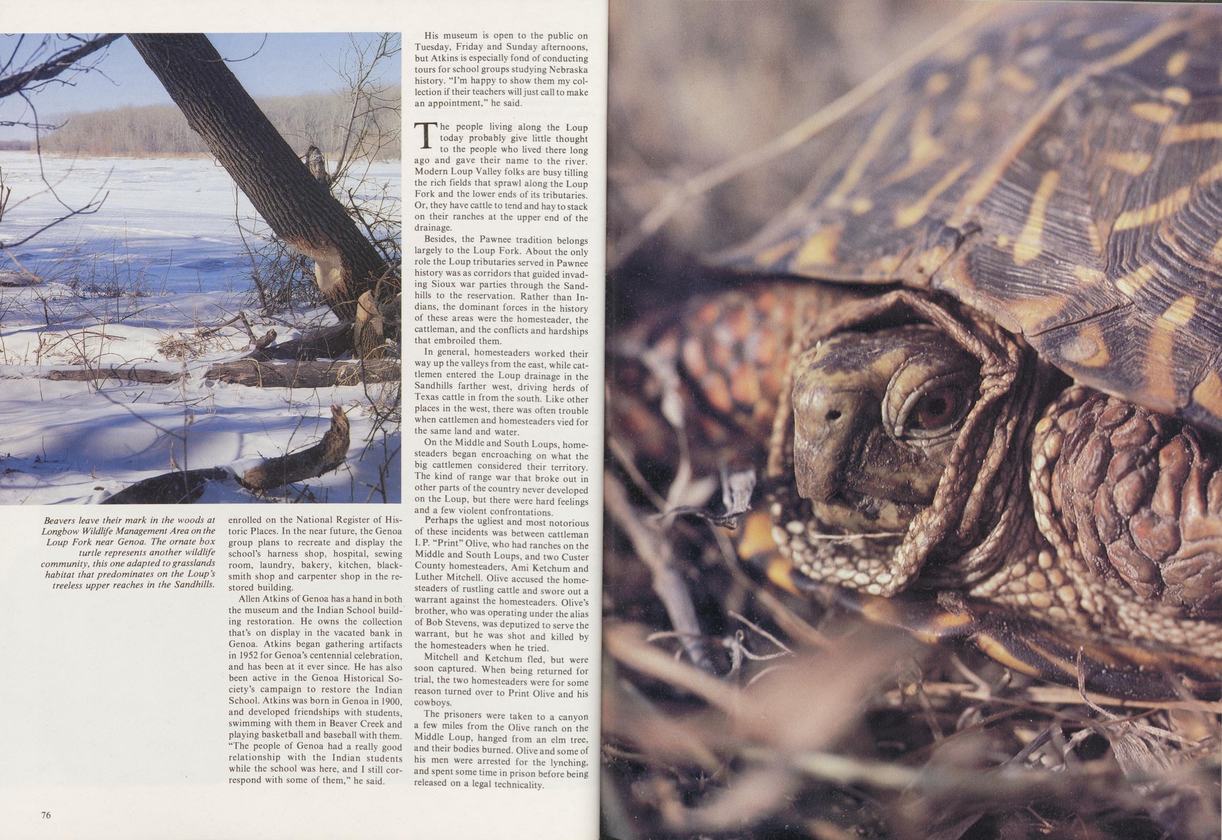
Allen Atkins of Genoa has a hand in both the museum and the Indian School building restoration. He owns the collection that's on display in the vacated bank in Genoa. Atkins began gathering artifacts in 1952 for Genoa's centennial celebration, and has been at it ever since. He has also been active in the Genoa Historical Society's campaign to restore the Indian School. Atkins was born in Genoa in 1900, and developed friendships with students, swimming with them in Beaver Creek and playing basketball and baseball with them. "The people of Genoa had a really good relationship with the Indian students while the school was here, and I still correspond with some of them," he said.
His museum is open to the public on Tuesday, Friday and Sunday afternoons, but Atkins is especially fond of conducting tours for school groups studying Nebraska history. "I'm happy to show them my collection if their teachers will just call to make an appointment," he said.
The people living along the Loup today probably give little thought to the people who lived there long ago and gave their name to the river. Modern Loup Valley folks are busy tilling the rich fields that sprawl along the Loup Fork and the lower ends of its tributaries. Or, they have cattle to tend and hay to stack on their ranches at the upper end of the drainage.
Besides, the Pawnee tradition belongs largely to the Loup Fork. About the only role the Loup tributaries served in Pawnee history was as corridors that guided invading Sioux war parties through the Sandhills to the reservation. Rather than Indians, the dominant forces in the history of these areas were the homesteader, the cattleman, and the conflicts and hardships that embroiled them.
In general, homesteaders worked their way up the valleys from the east, while cattlemen entered the Loup drainage in the Sandhills farther west, driving herds of Texas cattle in from the south. Like other places in the west, there was often trouble when cattlemen and homesteaders vied for the same land and water.
On the Middle and South Loups, homesteaders began encroaching on what the big cattlemen considered their territory. The kind of range war that broke out in other parts of the country never developed on the Loup, but there were hard feelings and a few violent confrontations.
Perhaps the ugliest and most notorious of these incidents was between cattleman I. P. "Print" Olive, who had ranches on the Middle and South Loups, and two Custer County homesteaders, Ami Ketchum and Luther Mitchell. Olive accused the homesteaders of rustling cattle and swore out a warrant against the homesteaders. Olive's brother, who was operating under the alias of Bob Stevens, was deputized to serve the warrant, but he was shot and killed by the homesteaders when he tried.
Mitchell and Ketchum fled, but were soon captured. When being returned for trial, the two homesteaders were for some reason turned over to Print Olive and his cowboys.
The prisoners were taken to a canyon a few miles from the Olive ranch on the Middle Loup, hanged from an elm tree, and their bodies burned. Olive and some of his men were arrested for the lynching, and spent some time in prison before being released on a legal technicality.
76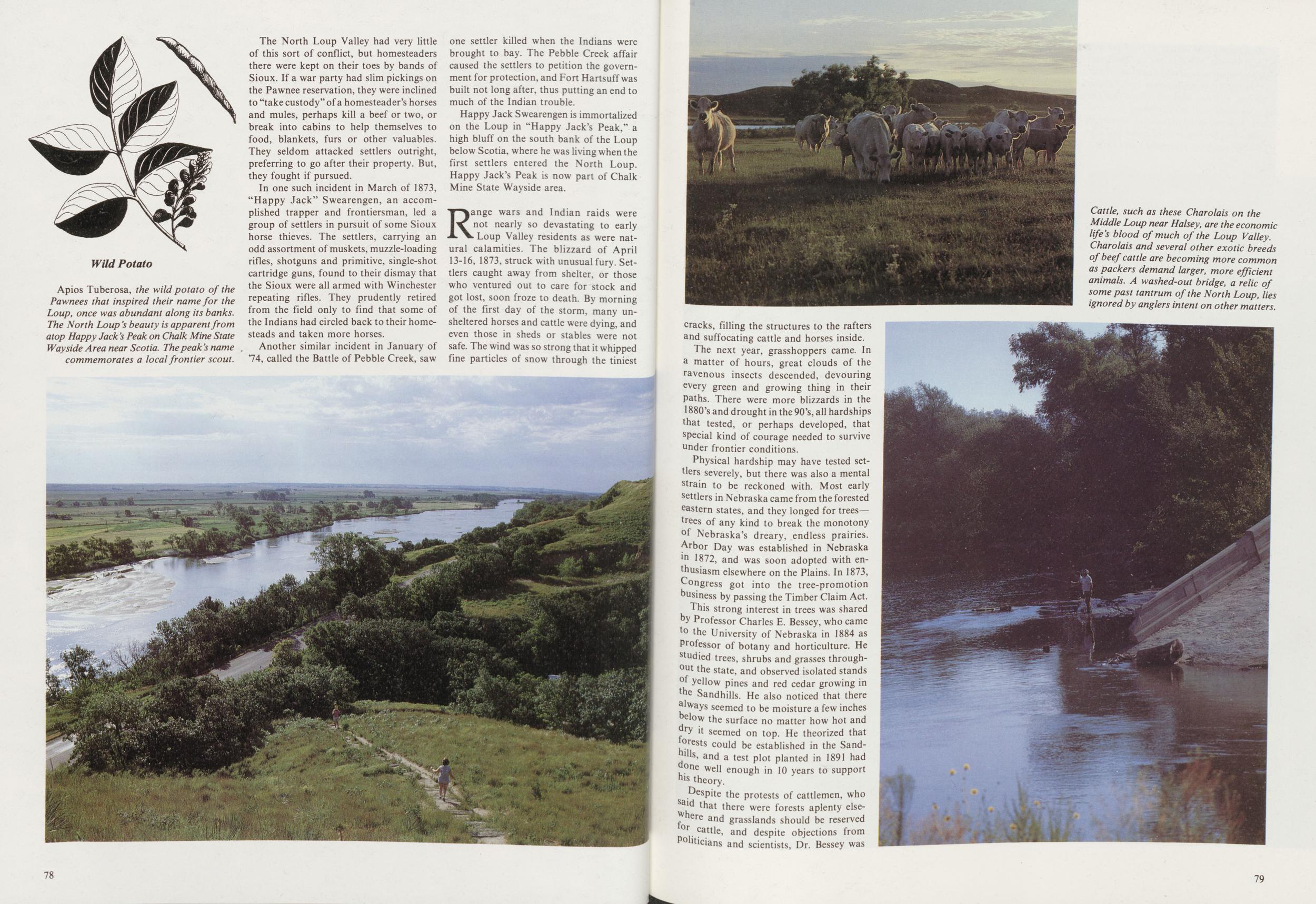
The North Loup Valley had very little of this sort of conflict, but homesteaders there were kept on their toes by bands of Sioux. If a war party had slim pickings on the Pawnee reservation, they were inclined to "take custody" of a homesteader's horses and mules, perhaps kill a beef or two, or break into cabins to help themselves to food, blankets, furs or other valuables. They seldom attacked settlers outright, preferring to go after their property. But, they fought if pursued.
In one such incident in March of 1873, "Happy Jack" Swearengen, an accomplished trapper and frontiersman, led a group of settlers in pursuit of some Sioux horse thieves. The settlers, carrying an odd assortment of muskets, muzzle-loading rifles, shotguns and primitive, single-shot cartridge guns, found to their dismay that the Sioux were all armed with Winchester repeating rifles. They prudently retired from the field only to find that some of the Indians had circled back to their homesteads and taken more horses.
Another similar incident in January of 74, called the Battle of Pebble Creek, saw one settler killed when the Indians were brought to bay. The Pebble Creek affair caused the settlers to petition the government for protection, and Fort Hartsuff was built not long after, thus putting an end to much of the Indian trouble.
Happy Jack Swearengen is immortalized on the Loup in "Happy Jack's Peak," a high bluff on the south bank of the Loup below Scotia, where he was living when the first settlers entered the North Loup. Happy Jack's Peak is now part of Chalk Mine State Wayside area.
Range wars and Indian raids were not nearly so devastating to early Loup Valley residents as were natural calamities. The blizzard of April 13-16, 1873, struck with unusual fury. Settlers caught away from shelter, or those who ventured out to care for stock and got lost, soon froze to death. By morning of the first day of the storm, many unsheltered horses and cattle were dying, and even those in sheds or stables were not safe. The wind was so strong that it whipped fine particles of snow through the tiniest 78 cracks, filling the structures to the rafters and suffocating cattle and horses inside.
The next year, grasshoppers came. In a matter of hours, great clouds of the ravenous insects descended, devouring every green and growing thing in their paths. There were more blizzards in the 1880's and drought in the 90's, all hardships that tested, or perhaps developed, that special kind of courage needed to survive under frontier conditions.
Physical hardship may have tested settlers severely, but there was also a mental strain to be reckoned with. Most early settlers in Nebraska came from the forested eastern states, and they longed for trees—trees of any kind to break the monotony of Nebraska's dreary, endless prairies. Arbor Day was established in Nebraska in 1872, and was soon adopted with enthusiasm elsewhere on the Plains. In 1873, Congress got into the tree-promotion business by passing the Timber Claim Act.
This strong interest in trees was shared by Professor Charles E. Bessey, who came to the University of Nebraska in 1884 as Professor of botany and horticulture. He studied trees, shrubs and grasses throughout the state, and observed isolated stands of yellow pines and red cedar growing in the Sandhills. He also noticed that there always seemed to be moisture a few inches below the surface no matter how hot and dry it seemed on top. He theorized that forests could be established in the Sandhills, and a test plot planted in 1891 had one well enough in 10 years to support his theory.
Despite the protests of cattlemen, who said that there were forests aplenty elsewhere and grasslands should be reserved for cattle, and despite objections from Politicians and scientists, Dr. Bessey was
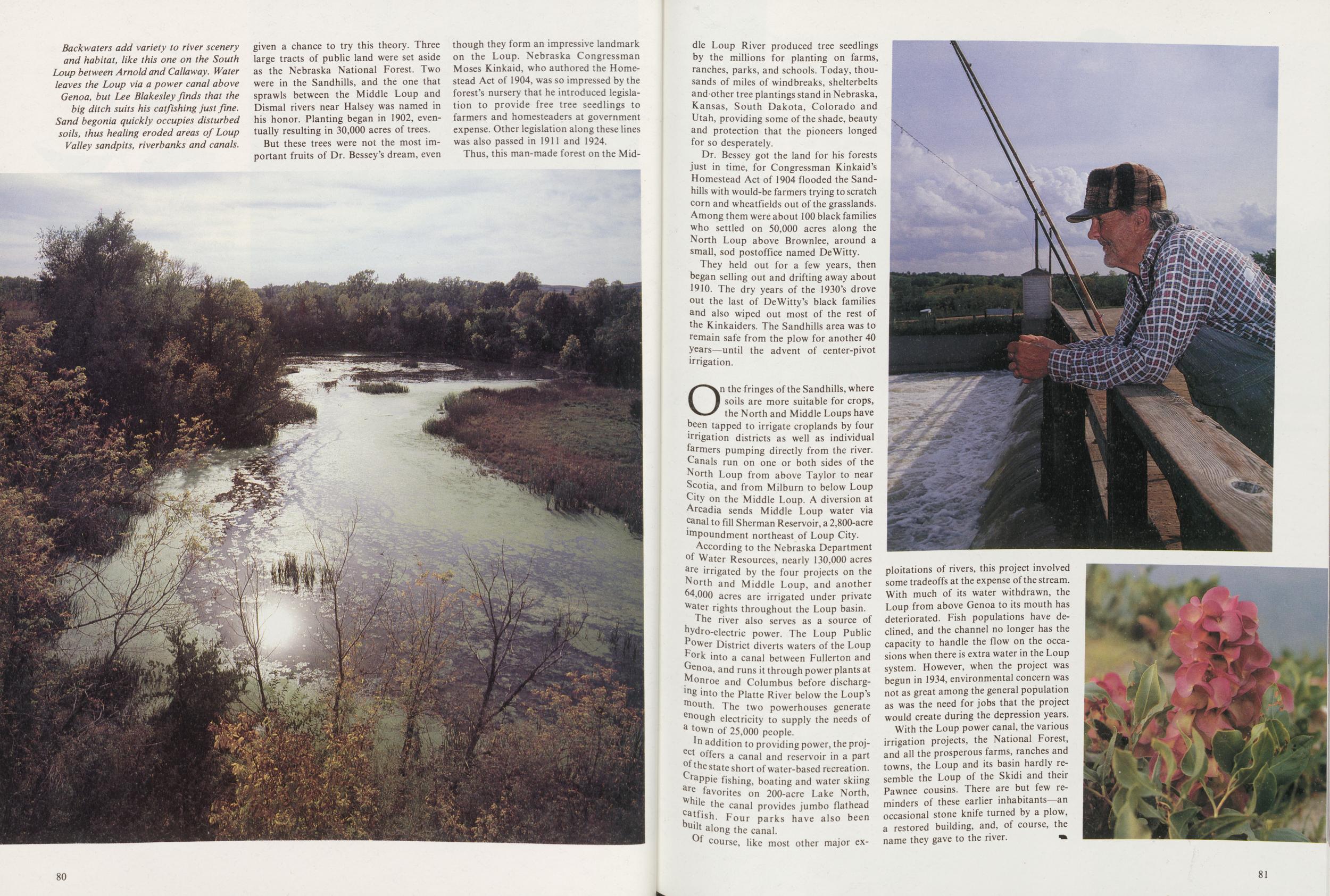
But these trees were not the most important fruits of Dr. Bessey's dream, even though they form an impressive landmark on the Loup. Nebraska Congressman Moses Kinkaid, who authored the Homestead Act of 1904, was so impressed by the forest's nursery that he introduced legislation to provide free tree seedlings to farmers and homesteaders at government expense. Other legislation along these lines was also passed in 1911 and 1924.
Thus, this man-made forest on the Middle 80 Loup River produced tree seedlings by the millions for planting on farms, ranches, parks, and schools. Today, thousands of miles of windbreaks, shelterbelts andother tree plantings stand in Nebraska, Kansas, South Dakota, Colorado and Utah, providing some of the shade, beauty and protection that the pioneers longed for so desperately.
Dr. Bessey got the land for his forests just in time, for Congressman Kinkaid's Homestead Act of 1904 flooded the Sandhills with would-be farmers trying to scratch corn and wheatfields out of the grasslands. Among them were about 100 black families who settled on 50,000 acres along the North Loup above Brownlee, around a small, sod postoffice named DeWitty.
They held out for a few years, then began selling out and drifting away about 1910. The dry years of the 1930's drove out the last of DeWitty's black families and also wiped out most of the rest of the Kinkaiders. The Sandhills area was to remain safe from the plow for another 40 years—until the advent of center-pivot irrigation.
On the fringes of the Sandhills, where soils are more suitable for crops, the North and Middle Loups have been tapped to irrigate croplands by four irrrigation districts as well as individual farmers pumping directly from the river. Canals run on one or both sides of the North Loup from above Taylor to near Scotia, and from Milburn to below Loup City on the Middle Loup. A diversion at Arcadia sends Middle Loup water via canal to fill Sherman Reservoir, a 2,800-acre impoundment northeast of Loup City.
According to the Nebraska Department of Water Resources, nearly 130,000 acres are irrigated by the four projects on the North and Middle Loup, and another 64,000 acres are irrigated under private Water rights throughout the Loup basin.
The river also serves as a source of hydro-electric power. The Loup Public power District diverts waters of the Loup Fork into a canal between Fullerton and Genoa, and runs it through power plants at Monroe and Columbus before discharging into the Platte River below the Loup's mouth. The two powerhouses generate enough electricity to supply the needs of a town of 25,000 people.
In addition to providing power, the project offers a canal and reservoir in a part of the state short of water-based recreation. Crappie fishing, boating and water skiing are favorites on 200-acre Lake North, while the canal provides jumbo flathead catfish. Four parks have also been built along the canal.
Of course, like most other major exploitations of rivers, this project involved some tradeoffs at the expense of the stream. With much of its water withdrawn, the Loup from above Genoa to its mouth has deteriorated. Fish populations have declined, and the channel no longer has the capacity to handle the flow on the occasions when there is extra water in the Loup system. However, when the project was begun in 1934, environmental concern was not as great among the general population as was the need for jobs that the project would create during the depression years.
With the Loup power canal, the various irrigation projects, the National Forest, and all the prosperous farms, ranches and towns, the Loup and its basin hardly resemble the Loup of the Skidi and their Pawnee cousins. There are but few reminders of these earlier inhabitants—an occasional stone knife turned by a plow, a restored building, and, of course, the name they gave to the river.
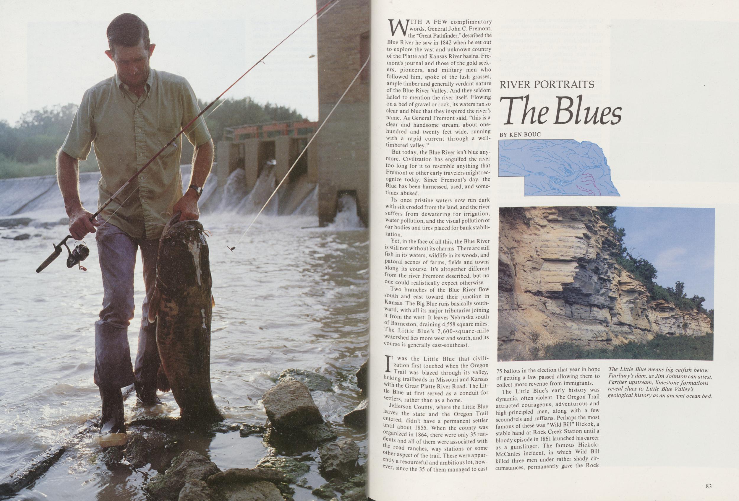
RIVER PORTRAITS
The Blues
BY KEN BOUCWITH A FEW complimentary words, General John C. Fremont, the "Great Pathfinder/'described the Blue River he saw in 1842 when he set out to explore the vast and unknown country of the Platte and Kansas River basins. Fremont's journal and those of the gold seekers, pioneers, and military men who followed him, spoke of the lush grasses, ample timber and generally verdant nature of the Blue River Valley. And they seldom failed to mention the river itself. Flowing on a bed of gravel or rock, its waters ran so clear and blue that they inspired the river's name. As General Fremont said, "this is a clear and handsome stream, about one-hundred and twenty feet wide, running with a rapid current through a well-timbered valley."
But today, the Blue River isn't blue anymore. Civilization has engulfed the river too long for it to resemble anything that Fremont or other early travelers might recognize today. Since Fremont's day, the Blue has been harnessed, used, and sometimes abused.
Its once pristine waters now run dark with silt eroded from the land, and the river suffers from dewatering for irrigation, water pollution, and the visual pollution of car bodies and tires placed for bank stabilization.
Yet, in the face of all this, the Blue River is still not without its charms. There are still fish in its waters, wildlife in its woods, and patoral scenes of farms, fields and towns along its course. It's altogether different from the river Fremont described, but no one could realistically expect otherwise.
Two branches of the Blue River flow south and east toward their junction in Kansas. The Big Blue runs basically southward, with all its major tributaries joining 11 from the west. It leaves Nebraska south of Barneston, draining 4,558 square miles. The Little Blue's 2,600-square-mile Watershed lies more west and south, and its course is generally east-southeast.
It was the Little Blue that civilization first touched when the Oregon Trail was blazed through its valley, linking trailheads in Missouri and Kansas With the Great Platte River Road. The Little Blue at first served as a conduit for Settlers, rather than as a home.
Jefferson County, where the Little Blue leaves the state and the Oregon Trail entered, didn't have a permanent settler Until about 1855. When the county was organized in 1864, there were only 35 residents and all of them were associated with e road ranches, way stations or some other aspect of the trail. These were apparently a resourceful and ambitious lot, however since the 35 of them managed to cast 75 ballots in the election that year in hope of getting a law passed allowing them to collect more revenue from immigrants.
The Little Blue's early history was dynamic, often violent. The Oregon Trail attracted courageous, adventurous and high-principled men, along with a few scoundrels and ruffians. Perhaps the most famous of these was "Wild Bill" Hickok, a stable hand at Rock Creek Station until a bloody episode in 1861 launched his career as a gunslinger. The famous Hickok-McCanles incident, in which Wild Bill killed three men under rather shady circumstances, permanently gave the Rock
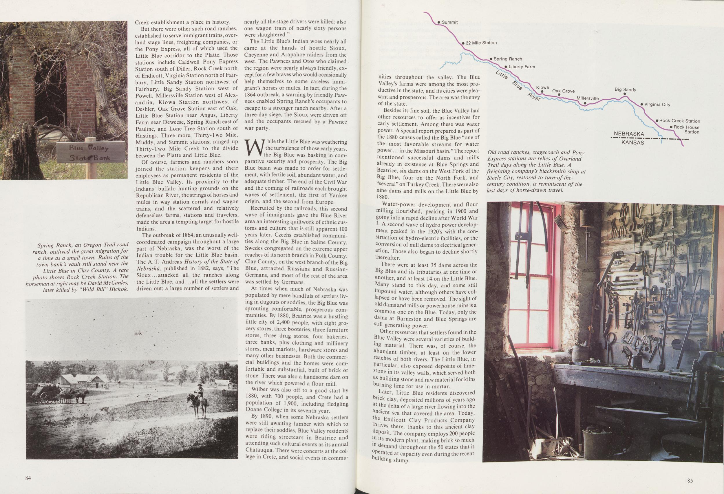
But there were other such road ranches, established to serve immigrant trains, overland stage lines, freighting companies, or the Pony Express, all of which used the Little Blue corridor to the Platte. Those stations include Caldwell Pony Express Station south of Diller, Rock Creek north of Endicott, Virginia Station north of Fairbury, Little Sandy Station northwest of Fairbury, Big Sandy Station west of Powell, Millersville Station west of Alexandria, Kiowa Station northwest of Deshler, Oak Grove Station east of Oak, Little Blue Station near Angus, Liberty Farm near Deweese, Spring Ranch east of Pauline, and Lone Tree Station south of Hastings. Three more, Thirty-Two Mile, Muddy, and Summit stations, ranged up Thirty-Two Mile Creek to the divide between the Platte and Little Blue. Of course, farmers and ranchers soon joined the station keepers and their employees as permanent residents of the Little Blue Valley. Its proximity to the .Indians' buffalo hunting grounds on the Republican River, the strings of horses and mules in way station corrals and wagon trains, and the scattered and relatively defenseless farms, stations and travelers, made the area a tempting target for hostile Indians.
The outbreak of 1864, an unusually well-coordinated campaign throughout a large part of Nebraska, was the worst of the Indian trouble for the Little Blue basin. The A.T. Andreas History of the State of Nebraska, published in 1882, says, "The Sioux attacked all the ranches along the Little Blue, and all the settlers were driven out; a large number of settlers and nearly all the stage drivers were killed; also one wagon train of nearly sixty persons were slaughtered."
The Little Blue's Indian woes nearly all came at the hands of hostile Sioux, Cheyenne and Arapahoe raiders from the west. The Pawnees and Otos who claimed the region were nearly always friendly, except for a few braves who would occasionally help themselves to some careless immigrant's horses or mules. In fact, during the 1864 outbreak, a warning by friendly Pawnees enabled Spring Ranch's occupants to escape to a stronger ranch nearby. After a three-day siege, the Sioux were driven off and the occupants rescued by a Pawnee war party.
While the Little Blue was weathering the turbulence of those early years, the Big Blue was basking in comparative security and prosperity. The Big Blue basin was made to order for settlement, with fertile soil, abundant water, and adequate timber. The end of the Civil War and the coming of railroads each brought waves of settlement, the first of Yankee origin, and the second from Europe.
Recruited by the railroads, this second wave of immigrants gave the Blue River area an interesting quiltwork of ethnic customs and culture that is still apparent 100 years later. Czechs established communities along the Big Blue in Saline County, Swedes congregated on the extreme upper reaches of its north branch in Polk County. Clay County, on the west branch of the Big Blue, attracted Russians and Russian-Germans, and most of the rest of the area was settled by Germans.
At times when much of Nebraska was populated by mere handfuls of settlers living in dugouts or soddies, the Big Blue was sprouting comfortable, prosperous communities. By 1880, Beatrice was a bustling little city of 2,400 people, with eight grocery stores, three booteries, three furniture stores, three drug stores, four bakeries, three banks, plus clothing and millinery stores, meat markets, hardware stores and many other businesses. Both the commercial buildings and the homes were comfortable and substantial, built of brick or stone. There was also a handsome dam on the river which powered a flour mill.
Wilber was also off to a good start by 1880, with 700 people, and Crete had a population of 1,900, including fledgling Doane College in its seventh year.
By 1890, when some Nebraska settlers were still awaiting lumber with which to replace their soddies, Blue Valley residents were riding streetcars in Beatrice and attending such cultural events as its annual Chatauqua. There were concerts at the college in Crete, and social events in communities 84
Besides its fine soil, the Blue Valley had other resources to offer as incentives for early settlement. Among these was water power. A special report prepared as part of the 1880 census called the Big Blue "one of the most favorable streams for water power in the Missouri basin." The report mentioned successful dams and mills already in existence at Blue Springs and Beatrice, six dams on the West Fork of the Big Blue, four on the North Fork, and "several" on Turkey Creek. There were also nine dams and mills on the Little Blue by 1880.
Water-power development and flour milling flourished, peaking in 1900 and going into a rapid decline after World War I. A second wave of hydro power development peaked in the 1920's with the construction of hydro-electric facilities, or the conversion of mill dams to electrical generation. Those also began to decline shortly thereafter.
There were at least 35 dams across the Big Blue and its tributaries at one time or another, and at least 14 on the Little Blue. Many stand to this day, and some still mipound water, although others have collapsed or have been removed. The sight of old dams and mills or powerhouse ruins is a common one on the Blue. Today, only the dams at Barneston and Blue Springs are still generating power.
Other resources that settlers found in the Blue Valley were several varieties of building material. There was, of course, the abundant timber, at least on the lower reaches of both rivers. The Little Blue, in Particular, also exposed deposits of limestone in its valley walls, which served both as building stone and raw material for kilns burning lime for use in mortar.
Later, Little Blue residents discovered rick day, deposited millions of years ago at the delta of a large river flowing into the ancient sea that covered the area. Today, the Endicott Clay Products Company thrives there, thanks to this ancient clay deposit. The company employs 200 people in its modern plant, making brick so much in demand throughout the 50 states that it operated at capacity even during the recent building slump.
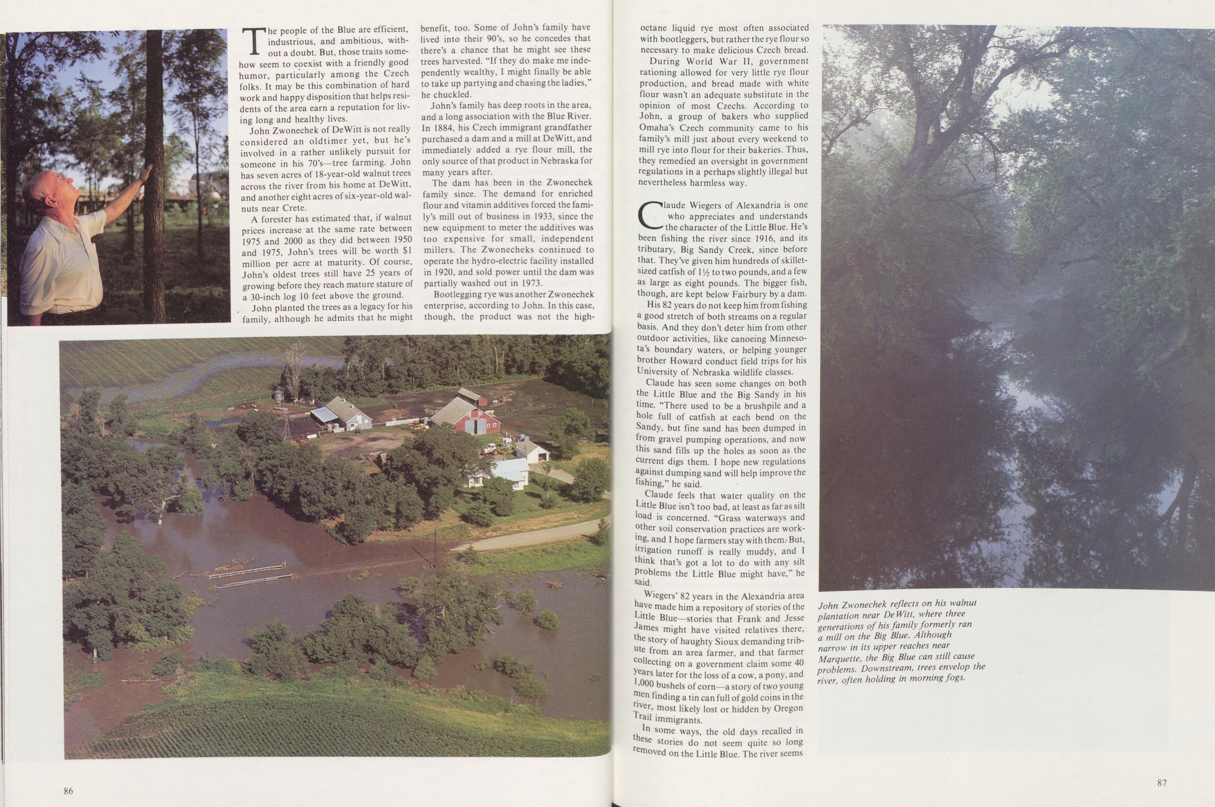
The people of the Blue are efficient, industrious, and ambitious, without a doubt. But, those traits somehow seem to coexist with a friendly good humor, particularly among the Czech folks. It may be this combination of hard work and happy disposition that helps residents of the area earn a reputation for living long and healthy lives.
John Zwonechek of DeWitt is not really considered an oldtimer yet, but he's involved in a rather unlikely pursuit for someone in his 70's—tree farming. John has seven acres of 18-year-old walnut trees across the river from his home at DeWitt, and another eight acres of six-year-old walnuts near Crete.
A forester has estimated that, if walnut prices increase at the same rate between 1975 and 2000 as they did between 1950 and 1975, John's trees will be worth $1 million per acre at maturity. Of course, John's oldest trees still have 25 years of growing before they reach mature stature of a 30-inch log 10 feet above the ground.
John planted the trees as a legacy for his family, although he admits that he might benefit, too. Some of John's family have lived into their 90's, so he concedes that there's a chance that he might see these trees harvested. "If they do make me independently wealthy, I might finally be able to take up partying and chasing the ladies," he chuckled.
John's family has deep roots in the area, and a long association with the Blue River. In 1884, his Czech immigrant grandfather purchased a dam and a mill at DeWitt, and immediately added a rye flour mill, the only source of that product in Nebraska for many years after.
The dam has been in the Zwonechek family since. The demand for enriched flour and vitamin additives forced the family's mill out of business in 1933, since the new equipment to meter the additives was too expensive for small, independent millers. The Zwonecheks continued to operate the hydro-electric facility installed in 1920, and sold power until the dam was partially washed out in 1973.
Bootlegging rye was another Zwonechek enterprise, according to John. In this case, though, the product was not the high-octane 86 liquid rye most often associated with bootleggers, but rather the rye flour so necessary to make delicious Czech bread.
During World War II, government rationing allowed for very little rye flour production, and bread made with white flour wasn't an adequate substitute in the opinion of most Czechs. According to John, a group of bakers who supplied Omaha's Czech community came to his family's mill just about every weekend to mill rye into flour for their bakeries. Thus, they remedied an oversight in government regulations in a perhaps slightly illegal but nevertheless harmless way.
Claude Wiegers of Alexandria is one who appreciates and understands the character of the Little Blue. He's been fishing the river since 1916, and its tributary, Big Sandy Creek, since before that. They've given him hundreds of skillet-sized catfish of 11/2 to two pounds, and a few as large as eight pounds. The bigger fish, though, are kept below Fairbury by a dam.
His 82 years do not keep him from fishing a good stretch of both streams on a regular basis. And they don't deter him from other outdoor activities, like canoeing Minnesota's boundary waters, or helping younger brother Howard conduct field trips for his University of Nebraska wildlife classes.
Claude has seen some changes on both the Little Blue and the Big Sandy in his time. "There used to be a brushpile and a hole full of catfish at each bend on the Sandy, but fine sand has been dumped in from gravel pumping operations, and now this sand fills up the holes as soon as the current digs them. I hope new regulations against dumping sand will help improve the fishing," he said.
Claude feels that water quality on the Little Blue isn't too bad, at least as far as silt load is concerned. "Grass waterways and other soil conservation practices are working, and I hope farmers stay with them. But, irrigation runoff is really muddy, and I think that's got a lot to do with any silt Problems the Little Blue might have," he said.
Wiegers' 82 years in the Alexandria area have made him a repository of stories of the Little Blue—stories that Frank and Jesse James might have visited relatives there, the story of haughty Sioux demanding tribute from an area farmer, and that farmer collecting on a government claim some 40 years later for the loss of a cow, a pony, and 1,000 bushels of corn a story of two young men Ending a tin can full of gold coins in the river, most likely lost or hidden by Oregon Trail immigrants.
In some ways, the old days recalled in these stories do not seem quite so long removed on the Little Blue. The river seems
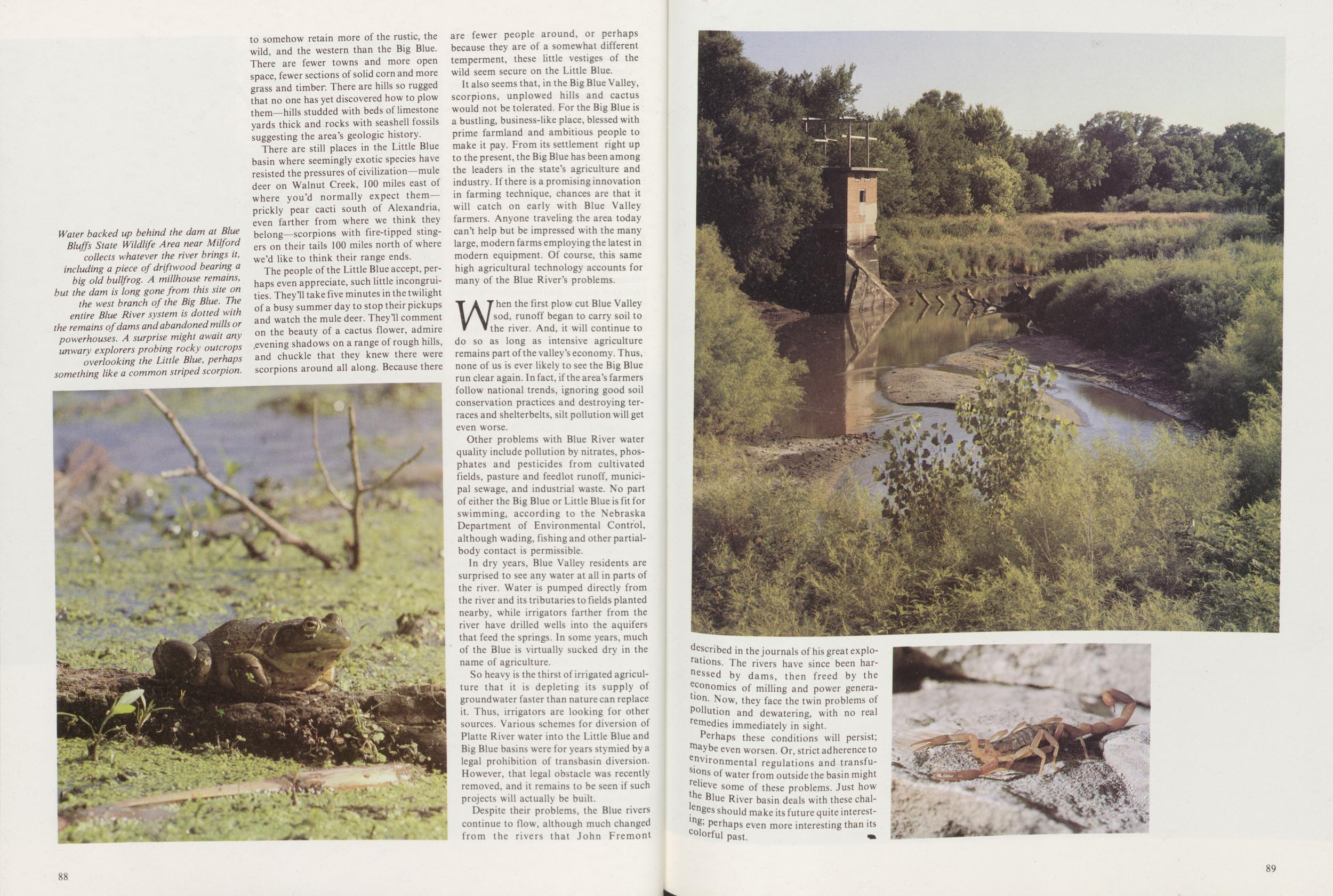
There are still places in the Little Blue basin where seemingly exotic species have resisted the pressures of civilization—mule deer on Walnut Creek, 100 miles east of where you'd normally expect them—prickly pear cacti south of Alexandria, even farther from where we think they belong—scorpions with fire-tipped stingers on their tails 100 miles north of where we'd like to think their range ends.
The people of the Little Blue accept, perhaps even appreciate, such little incongruities. They'll take five minutes in the twilight of a busy summer day to stop their pickups and watch the mule deer. They'll comment on the beauty of a cactus flower, admire ,evening shadows on a range of rough hills, and chuckle that they knew there were scorpions around all along. Because there are fewer people around, or perhaps because they are of a somewhat different temperment, these little vestiges of the wild seem secure on the Little Blue. It also seems that, in the Big Blue Valley, scorpions, unplowed hills and cactus would not be tolerated. For the Big Blue is a bustling, business-like place, blessed with prime farmland and ambitious people to make it pay. From its settlement right up to the present, the Big Blue has been among the leaders in the state's agriculture and industry. If there is a promising innovation in farming technique, chances are that it will catch on early with Blue Valley farmers. Anyone traveling the area today can't help but be impressed with the many large, modern farms employing the latest in modern equipment. Of course, this same high agricultural technology accounts for many of the Blue River's problems.
When the first plow cut Blue Valley sod runoff began to carry soil to the river. And, it will continue to do so as long as intensive agriculture remains part of the valley's economy. Thus, none of us is ever likely to see the Big Blue run clear again. In fact, if the area's farmers follow national trends, ignoring good soil conservation practices and destroying terraces and shelterbelts, silt pollution will get even worse.
Other problems with Blue River water quality include pollution by nitrates, phosphates and pesticides from cultivated fields, pasture and feedlot runoff, municipal sewage, and industrial waste. No part of either the Big Blue or Little Blue is fit for swimming, according to the Nebraska Department of Environmental Control, although wading, fishing and other partial-body contact is permissible.
In dry years, Blue Valley residents are surprised to see any water at all in parts of the river. Water is pumped directly from the river and its tributaries to fields planted nearby, while irrigators farther from the river have drilled wells into the aquifers that feed the springs. In some years, much of the Blue is virtually sucked dry in the name of agriculture.
So heavy is the thirst of irrigated agriculture that it is depleting its supply of groundwater faster than nature can replace it. Thus, irrigators are looking for other sources. Various schemes for diversion of Platte River water into the Little Blue and Big Blue basins were for years stymied by a legal prohibition of transbasin diversion. However, that legal obstacle was recently removed, and it remains to be seen if such projects will actually be built.
Despite their problems, the Blue rivers continue to flow, although much changed from the rivers that John Fremont 88
Perhaps these conditions will persist; maybe even worsen. Or, strict adherence to environmental regulations and transfusions of water from outside the basin might relieve some of these problems. Just how Blue River basin deals with these challenges should make its future quite interesting & Perhaps even more interesting than its Colorful past.
89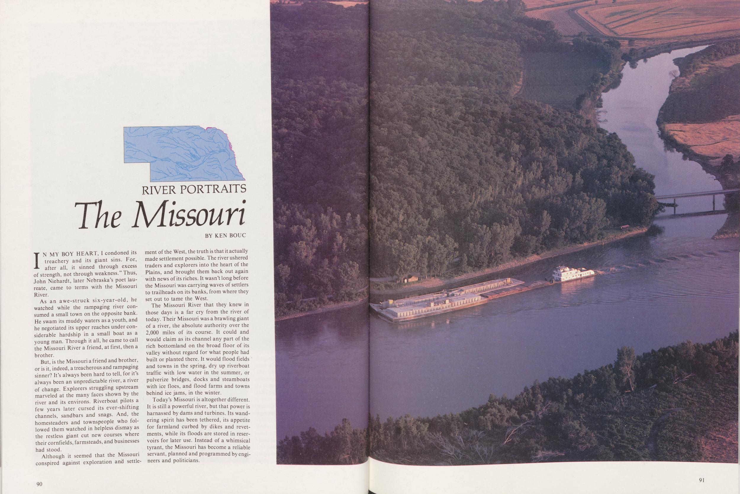
RIVER PORTRAITS
The Missouri
BY KEN BOUCIN MY BOY HEART, I condoned its treachery and its giant sins. For, after all, it sinned through excess of strength, not through weakness." Thus, John Niehardt, later Nebraska's poet laureate, came to terms with the Missouri River.
As an awe-struck six-year-old, he watched while the rampaging river consumed a small town on the opposite bank. He swam its muddy waters as a youth, and he negotiated its upper reaches under considerable hardship in a small boat as a young man. Through it all, he came to call the Missouri River a friend, at first, then a brother.
But, is the Missouri a friend and brother, or is it, indeed, a treacherous and rampaging sinner? It's always been hard to tell, for it's always been an unpredictable river, a river of change. Explorers struggling upstream marveled at the many faces shown by the river and its environs. Riverboat pilots a few years later cursed its ever-shifting channels, sandbars and snags. And, the homesteaders and townspeople who followed them watched in helpless dismay as the restless giant cut new courses where their cornfields, farmsteads, and businesses had stood.
Although it seemed that the Missouri conspired against exploration and settle- ment of the West, the truth is that it actually made settlement possible. The river ushered traders and explorers into the heart of the Plains, and brought them back out again with news of its riches. It wasn't long before the Missouri was carrying waves of settlers to trailheads on its banks, from where they set out to tame the West.
The Missouri River that they knew in those days is a far cry from the river of today. Their Missouri was a brawling giant of a river, the absolute authority over the 2,000 miles of its course. It could and would claim as its channel any part of the rich bottomland on the broad floor of its valley without regard for what people had built or planted there. It would flood fields and towns in the spring, dry up riverboat traffic with low water in the summer, or pulverize bridges, docks and steamboats with ice floes, and flood farms and towns behind ice jams, in the winter.
Today's Missouri is altogether different. It is still a powerful river, but that power is harnassed by dams and turbines. Its wandering spirit has been tethered, its appetite for farmland curbed by dikes and revetments, while its floods are stored in reservoirs for later use. Instead of a whimsical tyrant, the Missouri has become a reliable servant, planned and programmed by engineers and politicians.
90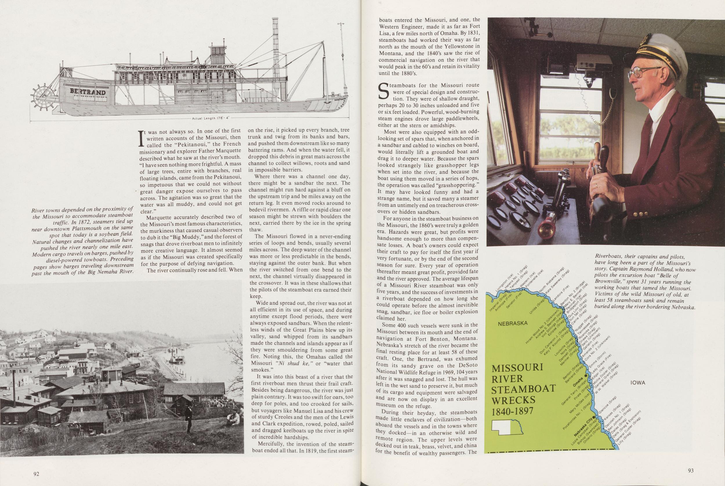
It was not always so. In one of the first written accounts of the Missouri, then called the "Pekitanoui," the French missionary and explorer Father Marquette described what he saw at the river's mouth. "I have seen nothing more frightful. A mass of large trees, entire with branches, real floating islands, came from the Pekitanoui, so impetuous that we could not without 1 great danger expose ourselves to pass across. The agitation was so great that the water was all muddy, and could not get clear."
Marquette accurately described two of the Missouri's most famous characteristics, the murkiness that caused casual observers to dub it the "Big Muddy,"and the forest of snags that drove riverboat men to infinitely more creative language. It almost seemed as if the Missouri was created specifically for the purpose of defying navigation.
The river continually rose and fell. When on the rise, it picked up every branch, tree trunk and twig from its banks and bars, and pushed them downstream like so many battering rams. And when the water fell, it dropped this debris in great mats across the channel to collect willows, roots and sand in impossible barriers.
Where there was a channel one day, there might be a sandbar the next. The channel might run hard against a bluff on the upstream trip and be miles away on the return leg. It even moved rocks around to bedevil rivermen. A riffle or rapid clear one season might be strewn with boulders the next, carried there by the ice in the spring thaw.
The Missouri flowed in a never-ending series of loops and bends, usually several miles across. The deep water of the channel was more or less predictable in the bends, staying against the outer bank. But when the river switched from one bend to the next, the channel virtually disappeared in the crossover. It was in these shallows that the pilots of the steamboat era earned their keep.
Wide and spread out, the river was not at all efficient in its use of space, and during anytime except flood periods, there were always exposed sandbars. When the relentless winds of the Great Plains blew up its valley, sand whipped from its sandbars made the channels and islands appear as if they were smouldering from some great fire. Noting this, the Omahas called the Missouri "Ni shud ke,' or "water that smokes."
It was into this beast of a river that the first riverboat men thrust their frail craft. Besides being dangerous, the river was just plain contrary. It was too swift for oars, too deep for poles, and too crooked for sails, but voyagers like Manuel Lisa and his crew of sturdy Creoles and the men of the Lewis and Clark expedition, rowed, poled, sailed and dragged keelboats up the river in spite of incredible hardships.
Mercifully, the invention of the steamboat ended all that. In 1819, the first steamboats 92 entered the Missouri, and one, the Western Engineer, made it as far as Fort Lisa, a few miles north of Omaha. By 1831, steamboats had worked their way as far north as the mouth of the Yellowstone in Montana, and the 1840's saw the rise of commercial navigation on the river that would peak in the 60's and retain its vitality until the 1880's.
Steamboats for the Missouri route were of special design and construction. They were of shallow draught, perhaps 20 to 30 inches unloaded and five or six feet loaded. Powerful, wood-burning steam engines drove large paddlewheels, either at the stern or amidships.
Most were also equipped with an odd-looking set of spars that, when anchored in a sandbar and cabled to winches on board, would literally lift a grounded boat and drag it to deeper water. Because the spars looked strangely like grasshopper legs when set into the river, and because the boat using them moved in a series of hops, the operation was called "grasshoppering." It may have looked funny and had a strange name, but it saved many a steamer from an untimely end on treacherous crossovers or hidden sandbars.
For anyone in the steamboat business on the Missouri, the 1860's were truly a golden era. Hazards were great, but profits were handsome enough to more than compensate losses. A boat's owners could expect their craft to pay for itself the first year if very fortunate, or by the end of the second season for sure. Every year of operation thereafter meant great profit, provided fate and the river approved. The average lifespan °f a Missouri River steamboat was only five years, and the success of investments in a riverboat depended on how long she could operate before the almost inevitible snag, sandbar, ice floe or boiler explosion claimed her.
Some 400 such vessels were sunk in the Missouri between its mouth and the end of navigation at Fort Benton, Montana. Nebraska's stretch of the river became the final resting place for at least 58 of these craft. One, the Bertrand, was exhumed from its sandy grave on the DeSoto National Wildlife Refuge in 1969, 104 years after it was snagged and lost. The hull was left in the wet sand to preserve it, but much of its cargo and equipment were salvaged and are now on display in an excellent museum on the refuge.
During their heyday, the steamboats made little enclaves of civilization—both aboard the vessels and in the towns where they docked—in an otherwise wild and remote region. The upper levels were Recked out in teak, brass, velvet, and china for the benefit of wealthy passengers. The
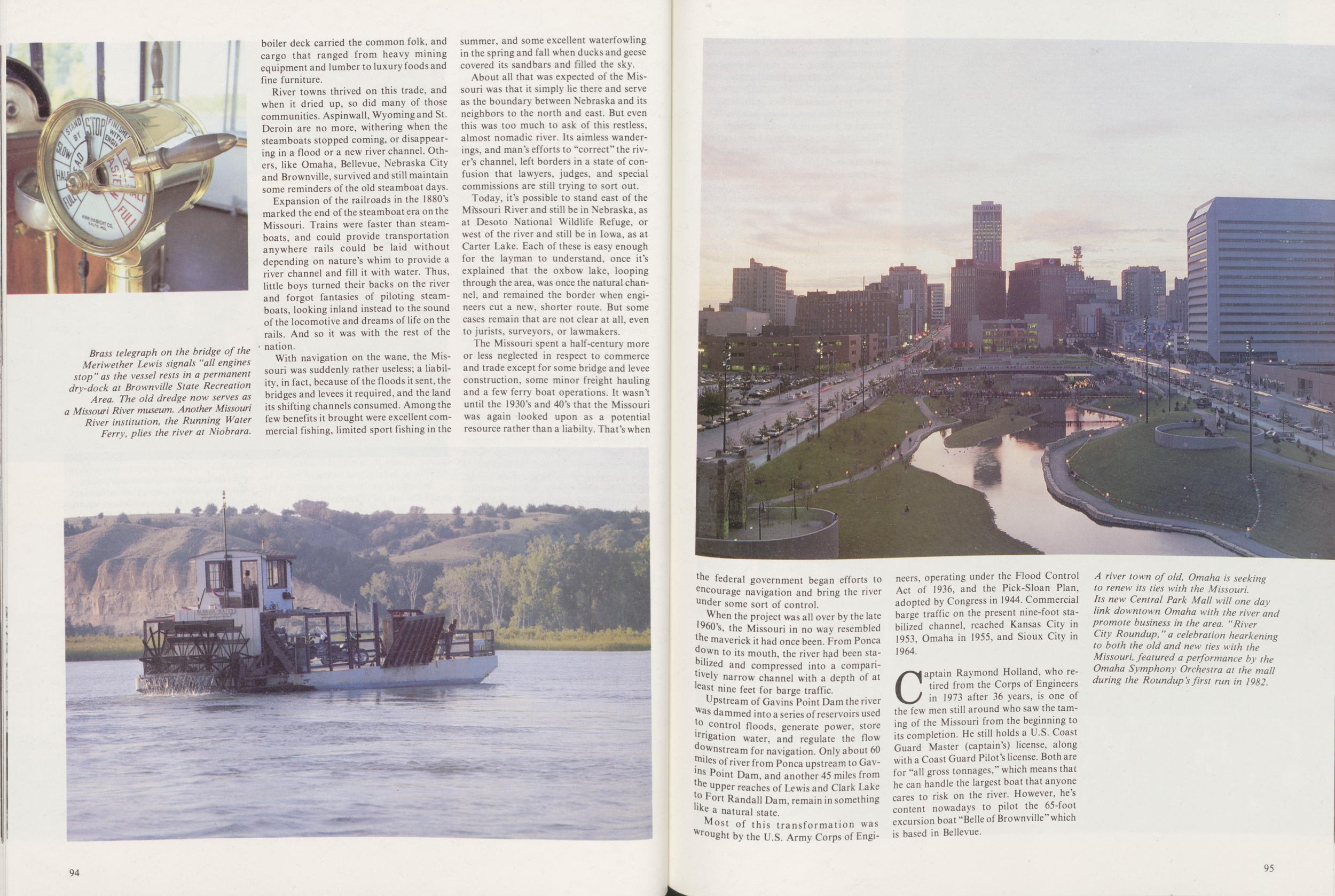
River towns thrived on this trade, and when it dried up, so did many of those communities. Aspinwall, Wyoming and St. Deroin are no more, withering when the steamboats stopped coming, or disappearing in a flood or a new river channel. Others, like Omaha, Bellevue, Nebraska City and Brownville, survived and still maintain some reminders of the old steamboat days.
Expansion of the railroads in the 1880's marked the end of the steamboat era on the Missouri. Trains were faster than steamboats, and could provide transportation anywhere rails could be laid without depending on nature's whim to provide a river channel and fill it with water. Thus, little boys turned their backs on the river and forgot fantasies of piloting steamboats, looking inland instead to the sound of the locomotive and dreams of life on the rails. And so it was with the rest of the nation.
With navigation on the wane, the Missouri was suddenly rather useless; a liability, in fact, because of the floods it sent, the bridges and levees it required, and the land its shifting channels consumed. Among the few benefits it brought were excellent commercial fishing, limited sport fishing in the summer, and some excellent waterfowling in the spring and fall when ducks and geese covered its sandbars and filled the sky.
About all that was expected of the Missouri was that it simply lie there and serve as the boundary between Nebraska and its neighbors to the north and east. But even this was too much to ask of this restless, almost nomadic river. Its aimless wanderings, and man's efforts to "correct" the river's channel, left borders in a state of confusion that lawyers, judges, and special commissions are still trying to sort out.
Today, it's possible to stand east of the Missouri River and still be in Nebraska, as at Desoto National Wildlife Refuge, or west of the river and still be in Iowa, as at Carter Lake. Each of these is easy enough for the layman to understand, once it's explained that the oxbow lake, looping through the area, was once the natural channel, and remained the border when engineers cut a new, shorter route. But some cases remain that are not clear at all, even to jurists, surveyors, or lawmakers.
The Missouri spent a half-century more or less neglected in respect to commerce and trade except for some bridge and levee construction, some minor freight hauling and a few ferry boat operations. It wasn't until the 1930's and 40's that the Missouri was again looked upon as a potential resource rather than a liabilty. That's when 94 the federal government began efforts to encourage navigation and bring the river under some sort of control.
When the project was all over by the late 1960's, the Missouri in no way resembled the maverick it had once been. From Ponca down to its mouth, the river had been stabilized and compressed into a comparitively narrow channel with a depth of at least nine feet for barge traffic.
Upstream of Gavins Point Dam the river was dammed into a series of reservoirs used to control floods, generate power, store ligation water, and regulate the flow downstream for navigation. Only about 60 miles of river from Ponca upstream to Gavins Point Dam, and another 45 miles from the upper reaches of Lewis and Clark Lake to Fort Randall Dam, remain in something like a natural state.
Most of this transformation was Wrought by the U.S. Army Corps of Engineers, operating under the Flood Control Act of 1936, and the Pick-Sloan Plan, adopted by Congress in 1944. Commercial barge traffic on the present nine-foot stabilized channel, reached Kansas City in 1953, Omaha in 1955, and Sioux City in 1964.
Captain Raymond Holland, who retired from the Corps of Engineers in 1973 after 36 years, is one of the few men still around who saw the taming of the Missouri from the beginning to its completion. He still holds a U.S. Coast Guard Master (captain's) license, along with a Coast Guard Pilot's license. Both are for "all gross tonnages," which means that he can handle the largest boat that anyone cares to risk on the river. However, he's content nowadays to pilot the 65-foot excursion boat "Belle of Brownville" which is based in Bellevue.
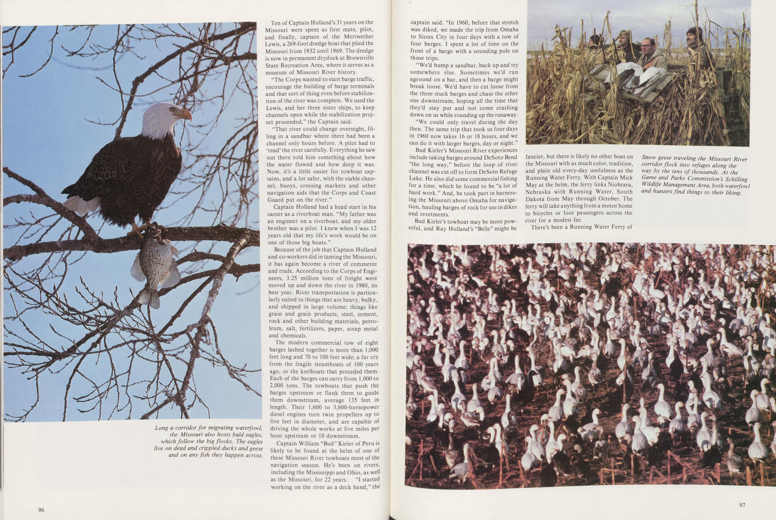
Captain William "Bud" Kieler of Peru is likely to be found at the helm of one of these Missouri River towboats most of the navigation season. He's been on rivers, including the Mississippi and Ohio, as well as the Missouri, for 22 years. "1 started working on the river as a deck hand," the 96 captain said. "In 1960, before that stretch was diked, we made the trip from Omaha to Sioux City in four days with a tow of four barges. I spent a lot of time on the front of a barge with a sounding pole on those trips.
"We'd bump a sandbar, back up and try somewhere else. Sometimes we'd run aground on a bar, and then a barge might break loose. We'd have to cut loose from the three stuck barges and chase the other one downstream, hoping all the time that they'd stay put and not come crashing down on us while rounding up the runaway.
"We could only travel during the day then. The same trip that took us four days in 1960 now takes 16 or 18 hours, and we can do it with larger barges, day or night."
Bud Kieler's Missouri River experiences include taking barges around DeSoto Bend "the long way," before the loop of river channel was cut off to form DeSoto Refuge Lake. He also did some commercial fishing for a time, which he found to be "a lot of hard work." And, he took part in harnessing the Missouri above Omaha for navigation, hauling barges of rock for use in dikes and revetments.
Bud Kieler's towboat may be more powerful, and Ray Holland's "Belle" might be fancier, but there is likely no other boat on the Missouri with as much color, tradition, and plain old every-day usefulness as the Running Water Ferry. With Captain Mick May at the helm, the ferry links Niobrara, Nebraska with Running Water, South Dakota from May through October. The ferry will take anything from a motor home to bicycles or foot passengers across the river for a modest fee.
There's been a Running Water Ferry of
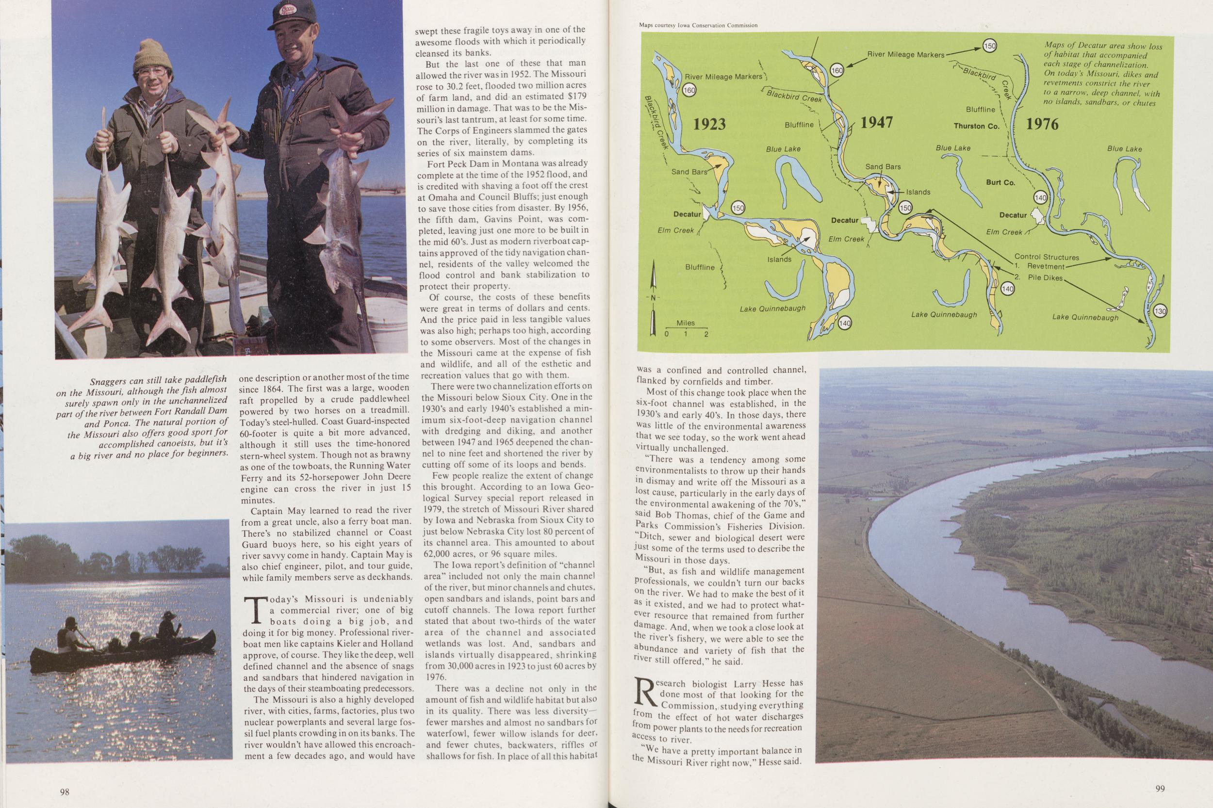
Captain May learned to read the river from a great uncle, also a ferry boat man. There's no stabilized channel or Coast Guard buoys here, so his eight years of river savvy come in handy. Captain May is also chief engineer, pilot, and tour guide, while family members serve as deckhands.
Today's Missouri is undeniably a commercial river; one of big boats doing a big job, and doing it for big money. Professional riverboat men like captains Kieler and Holland approve, of course. They like the deep, well defined channel and the absence of snags and sandbars that hindered navigation in the days of their steamboating predecessors.
The Missouri is also a highly developed river, with cities, farms, factories, plus two nuclear powerplants and several large fossil fuel plants crowding in on its banks. The river wouldn't have allowed this encroachment a few decades ago, and would have swept these fragile toys away in one of the awesome floods with which it periodically cleansed its banks.
But the last one of these that man allowed the river was in 1952. The Missouri rose to 30.2 feet, flooded two million acres of farm land, and did an estimated $179 million in damage. That was to be the Missouri's last tantrum, at least for some time. The Corps of Engineers slammed the gates on the river, literally, by completing its series of six mainstem dams.
Fort Peck Dam in Montana was already complete at the time of the 1952 flood, and is credited with shaving a foot off the crest at Omaha and Council Bluffs; just enough to save those cities from disaster. By 1956, the fifth dam, Gavins Point, was completed, leaving just one more to be built in the mid 60's. Just as modern riverboat captains approved of the tidy navigation channel, residents of the valley welcomed the flood control and bank stabilization to protect their property.
Of course, the costs of these benefits were great in terms of dollars and cents. And the price paid in less tangible values was also high; perhaps too high, according to some observers. Most of the changes in the Missouri came at the expense of fish and wildlife, and all of the esthetic and recreation values that go with them.
There were two channelization efforts on the Missouri below Sioux City. One in the 1930's and early 1940's established a minimum six-foot-deep navigation channel with dredging and diking, and another between 1947 and 1965 deepened the channel to nine feet and shortened the river by cutting off some of its loops and bends.
Few people realize the extent of change this brought. According to an Iowa Geological Survey special report released in 1979, the stretch of Missouri River shared by Iowa and Nebraska from Sioux City to just below Nebraska City lost 80 percent of its channel area. This amounted to about 62,000 acres, or 96 square miles.
The Iowa report's definition of "channel area" included not only the main channel of the river, but minor channels and chutes, open sandbars and islands, point bars and cutoff channels. The Iowa report further stated that about two-thirds of the water area of the channel and associated wetlands was lost. And, sandbars and islands virtually disappeared, shrinking from 30,000 acres in 1923 to just 60 acres by 1976.
There was a decline not only in the amount of fish and wildlife habitat but also in its quality. There was less diversity-fewer marshes and almost no sandbars for waterfowl, fewer willow islands for deer, and fewer chutes, backwaters, riffles or shallows for fish. In place of all this habitat 98
Most of this change took place when the six-foot channel was established, in the 1930's and early 40's. In those days, there was little of the environmental awareness that we see today, so the work went ahead virtually unchallenged.
There was a tendency among some environmentalists to throw up their hands Jn dismay and write off the Missouri as a lost cause, particularly in the early days of the environmental awakening of the 70's," said Bob Thomas, chief of the Game and Parks Commission's Fisheries Division. "Ditch, sewer and biological desert were just some of the terms used to describe the Missouri in those days.
"But, as fish and wildlife management Professionals, we couldn't turn our backs on the river. We had to make the best of it as it existed, and we had to protect whatever resource that remained from further damage. And, when we took a close look at the river's fishery, we were able to see the abundance and variety of fish that the river still offered," he said.
Research biologist Larry Hesse has done most of that looking for the Commission, studying everything from the effect of hot water discharges from power plants to the needs for recreation aceess to river.
We have a pretty important balance in he Missouri River right now," Hesse said.
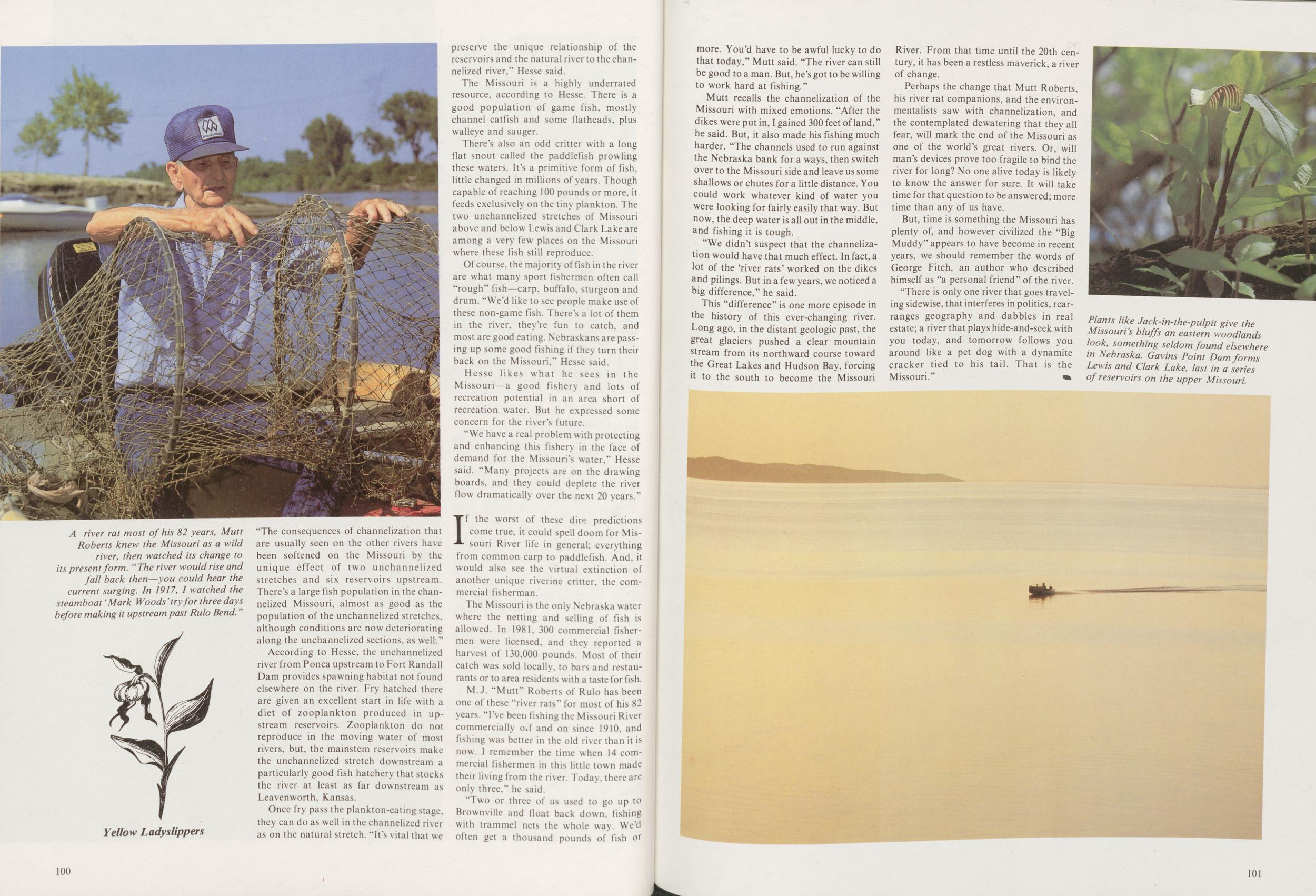
According to Hesse, the unchannelized river from Ponca upstream to Fort Randall Dam provides spawning habitat not found elsewhere on the river. Fry hatched there are given an excellent start in life with a diet of zooplankton produced in upstream reservoirs. Zooplankton do not reproduce in the moving water of most rivers, but, the mainstem reservoirs make the unchannelized stretch downstream a particularly good fish hatchery that stocks the river at least as far downstream as Leavenworth, Kansas.
Once fry pass the plankton-eating stage. they can do as well in the channelized river as on the natural stretch, "it's vital that we preserve the unique relationship of the reservoirs and the natural river to the channelized river," Hesse said.
The Missouri is a highly underrated resource, according to Hesse. There is a good population of game fish, mostly channel catfish and some flatheads, plus walleye and sauger.
There's also an odd critter with a long flat snout called the paddlefish prowling these waters. It's a primitive form of fish, little changed in millions of years. Though capable of reaching 100 pounds or more, it feeds exclusively on the tiny plankton. The two unchannelized stretches of Missouri above and below Lewis and Clark Lake are among a very few places on the Missouri where these fish still reproduce.
Of course, the majority offish in the river are what many sport fishermen often call "rough" fish—carp, buffalo, sturgeon and drum. "We'd like to see people make use of these non-game fish. There's a lot of them in the river, they're fun to catch, and most are good eating. Nebraskans are passing up some good fishing if they turn their back on the Missouri," Hesse said.
Hesse likes what he sees in the Missouri—a good fishery and lots of recreation potential in an area short of recreation water. But he expressed some concern for the river's future.
"We have a real problem with protecting and enhancing this fishery in the face of demand for the Missouri's water," Hesse said. "Many projects are on the drawing boards, and they could deplete the river flow dramatically over the next 20 years."
If the worst of these dire predictions come true, it could spell doom for Missouri River life in general; everything from common carp to paddlefish. And, it would also see the virtual extinction of another unique riverine critter, the commercial fisherman.
The Missouri is the only Nebraska water where the netting and selling of fish is allowed. In 1981, 300 commercial fishermen were licensed, and they reported a harvest of 130,000 pounds. Most of their catch was sold locally, to bars and restaurants or to area residents with a taste for fish.
M.J. "Mutt" Roberts of Rulo has been one of these "river rats" for most of his 82 years. "I've been fishing the Missouri River commercially off and on since 1910, and fishing was better in the old river than it is now. I remember the time when 14 commercial fishermen in this little town made their living from the river. Today, there are only three." he said.
Two or three of us used to go up to Brownville and float back down, fishing with trammel nets the whole way. We'd often get a thousand pounds of fish or 100 more. You'd have to be awful lucky to do that today," Mutt said. "The river can still be good to a man. But, he's got to be willing to work hard at fishing."
Mutt recalls the channelization of the Missouri with mixed emotions. "After the dikes were put in, I gained 300 feet of land," he said. But, it also made his fishing much harder. "The channels used to run against the Nebraska bank for a ways, then switch over to the Missouri side and leave us some shallows or chutes for a little distance. You could work whatever kind of water you were looking for fairly easily that way. But now, the deep water is all out in the middle, and fishing it is tough.
"We didn't suspect that the channelization would have that much effect. In fact, a lot of the 'river rats' worked on the dikes and pilings. But in a few years, we noticed a big difference," he said.
This "difference" is one more episode in the history of this ever-changing river. Long ago, in the distant geologic past, the great glaciers pushed a clear mountain stream from its northward course toward the Great Lakes and Hudson Bay, forcing ^ to the south to become the Missouri River. From that time until the 20th century, it has been a restless maverick, a river of change.
Perhaps the change that Mutt Roberts, his river rat companions, and the environmentalists saw with channelization, and the contemplated dewatering that they all fear, will mark the end of the Missouri as one of the world's great rivers. Or, will man's devices prove too fragile to bind the river for long? No one alive today is likely to know the answer for sure. It will take time for that question to be answered; more time than any of us have.
But, time is something the Missouri has plenty of, and however civilized the "Big Muddy" appears to have become in recent years, we should remember the words of George Fitch, an author who described himself as "a personal friend" of the river.
"There is only one river that goes traveling sidewise, that interferes in politics, rear-ranges geography and dabbles in real estate; a river that plays hide-and-seek with you today, and tomorrow follows you around like a pet dog with a dynamite cracker tied to his tail. That is the Missouri."
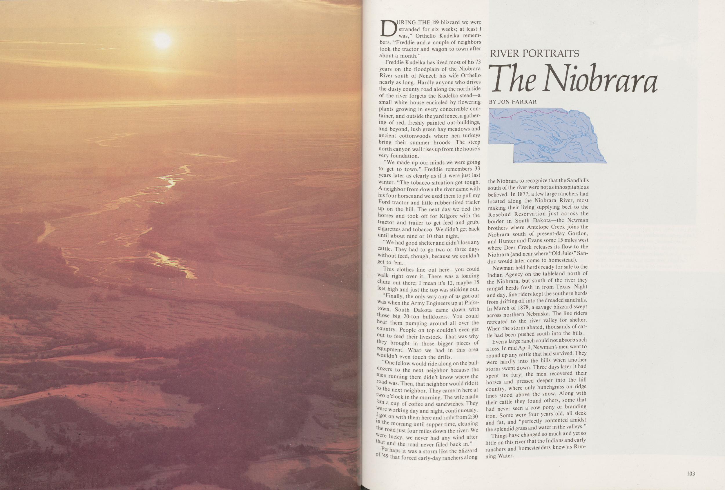
RIVER PORTRAITS
The Niobrara
BY JON FARRARDURING THE '49 blizzard we were stranded for six weeks; at least I was," Orthello Kudelka remembers. "Freddie and a couple of neighbors took the tractor and wagon to town after about a month."
Freddie Kudelka has lived most of his 73 years on the floodplain of the Niobrara River south of Nenzel; his wife Orthello nearly as long. Hardly anyone who drives the dusty county road along the north side of the river forgets the Kudelka stead—a small white house encircled by flowering plants growing in every conceivable container, and outside the yard fence, a gathering of red, freshly painted out-buildings, and beyond, lush green hay meadows and ancient cottonwoods where hen turkeys bring their summer broods. The steep north canyon wall rises up from the house's very foundation.
"We made up our minds we were going to get to town," Freddie remembers 33 years later as clearly as if it were just last winter. "The tobacco situation got tough. A neighbor from down the river came with his four horses and we used them to pull my Ford tractor and little rubber-tired trailer up on the hill. The next day we tied the horses and took off for Kilgore with the tractor and trailer to get feed and grub, cigarettes and tobacco. We didn't get back until about nine or 10 that night.
"We had good shelter and didn't lose any cattle. They had to go two or three days without feed, though, because we couldn't get to 'em.
This clothes line out here—you could walk right over it. There was a loading chute out there; I mean it's 12, maybe 15 feet high and just the top was sticking out.
"Finally, the only way any of us got out Was when the Army Engineers up at Picks-town, South Dakota came down with those big 20-ton bulldozers. You could hear them pumping around all over the country. People on top couldn't even get out to feed their livestock. That was why they brought in those bigger pieces of equipment. What we had in this area Wouldn't even touch the drifts.
"One fellow would ride along on the bull-dozers to the next neighbor because the men running them didn't know where the road was. Then, that neighbor would ride it to the next neighbor. They came in here at two o'clock in the morning. The wife made 'em a cup of coffee and sandwiches. They were working day and night, continuously. I got on with them here and rode from 2:30 in the morning until supper time, cleaning the road just four miles down the river. We were lucky we never had any wind after that and the road never filled back in."
Perhaps it was a storm like the blizzard of '49 that forced early-day ranchers along the Niobrara to recognize that the Sandhills south of the river were not as inhospitable as believed. In 1877, a few large ranchers had located along the Niobrara River, most making their living supplying beef to the Rosebud Reservation just across the border in South Dakota—the Newman brothers where Antelope Creek joins the Niobrara south of present-day Gordon, and Hunter and Evans some 15 miles west where Deer Creek releases its flow to the Niobrara (and near where "Old Jules" Sandoz would later come to homestead).
Newman held herds ready for sale to the Indian Agency on the tableland north of the Niobrara, but south of the river they ranged herds fresh in from Texas. Night and day, line riders kept the southern herds from drifting off into the dreaded sandhills. In March of 1878, a savage blizzard swept across northern Nebraska. The line riders retreated to the river valley for shelter. When the storm abated, thousands of cattle had been pushed south into the hills.
Even a large ranch could not absorb such a loss. In mid April, Newman's men went to round up any cattle that had survived. They were hardly into the hills when another storm swept down. Three days later it had spent its fury; the men recovered their horses and pressed deeper into the hill country, where only bunchgrass on ridge lines stood above the snow. Along with their cattle they found others, some that had never seen a cow pony or branding iron. Some were four years old, all sleek and fat, and "perfectly contented amidst the splendid grass and water in the valleys. "
Things have changed so much and yet so little on this river that the Indians and early ranchers and homesteaders knew as Running Water.
103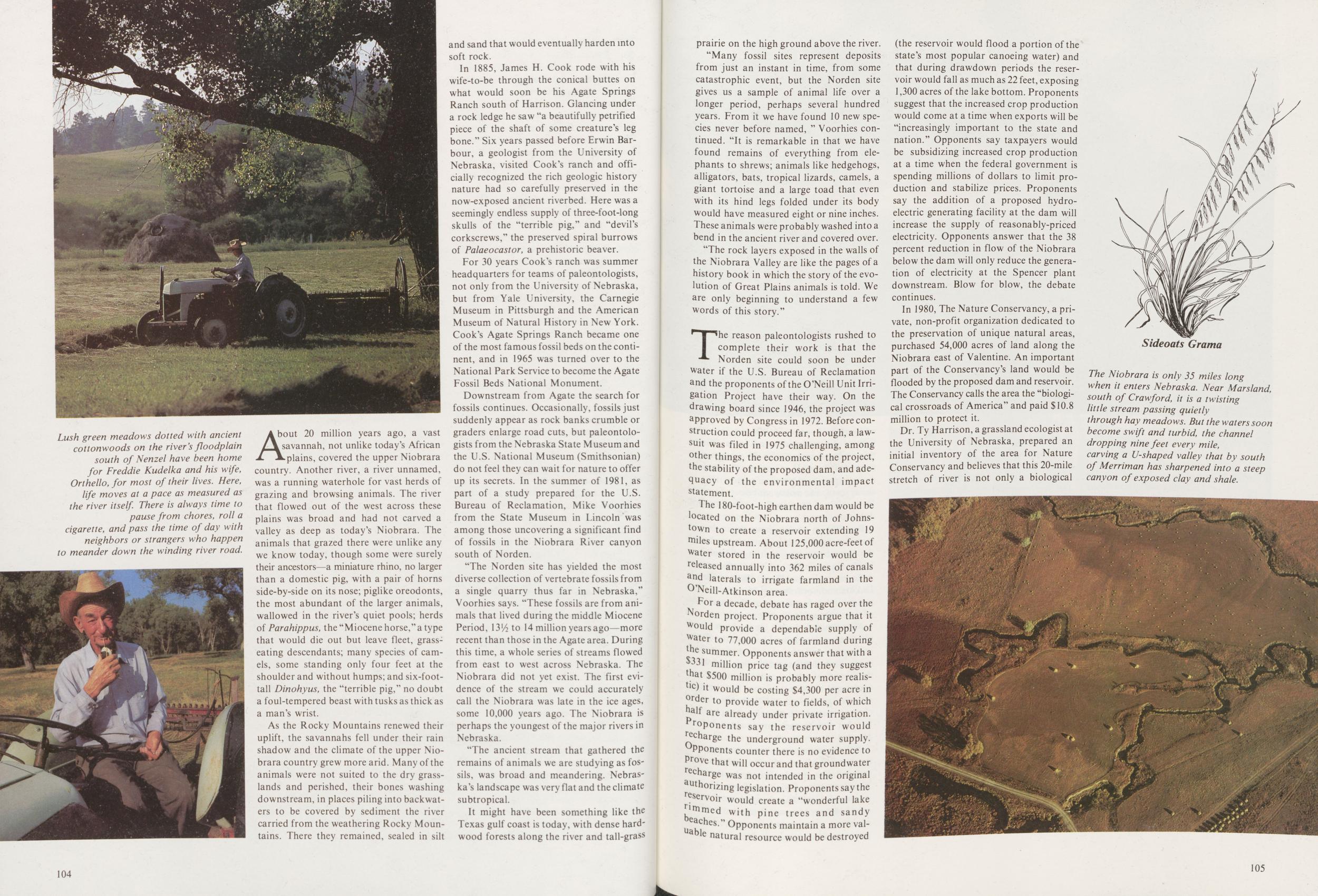
About 20 million years ago, a vast savannah, not unlike today's African plains, covered the upper Niobrara country. Another river, a river unnamed, was a running waterhole for vast herds of grazing and browsing animals. The river that flowed out of the west across these plains was broad and had not carved a valley as deep as today's Niobrara. The animals that grazed there were unlike any we know today, though some were surely their ancestors—a miniature rhino, no larger than a domestic pig, with a pair of horns side-by-side on its nose; piglike oreodonts, the most abundant of the larger animals, wallowed in the river's quiet pools; herds of Parahippus, the "Miocene horse," a type that would die out but leave fleet, grass-eating descendants; many species of camels, some standing only four feet at the shoulder and without humps; and six-foot-tall Dinohyus, the "terrible pig," no doubt a foul-tempered beast with tusks as thick as a man's wrist.
As the Rocky Mountains renewed their uplift, the savannahs fell under their rain shadow and the climate of the upper Niobrara country grew more arid. Many of the animals were not suited to the dry grasslands and perished, their bones washing downstream, in places piling into backwaters to be covered by sediment the river carried from the weathering Rocky Mountains. There they remained, sealed in silt and sand that would eventually harden into soft rock.
In 1885, James H. Cook rode with his wife-to-be through the conical buttes on what would soon be his Agate Springs Ranch south of Harrison. Glancing under a rock ledge he saw "a beautifully petrified piece of the shaft of some creature's leg bone." Six years passed before Erwin Barbour, a geologist from the University of Nebraska, visited Cook's ranch and officially recognized the rich geologic history nature had so carefully preserved in the now-exposed ancient riverbed. Here was a seemingly endless supply of three-foot-long skulls of the "terrible pig," and "devil's corkscrews," the preserved spiral burrows of Palaeocastor, a prehistoric beaver.
For 30 years Cook's ranch was summer headquarters for teams of paleontologists, not only from the University of Nebraska, but from Yale University, the Carnegie Museum in Pittsburgh and the American Museum of Natural History in New York. Cook's Agate Springs Ranch became one of the most famous fossil beds on the continent, and in 1965 was turned over to the National Park Service to become the Agate Fossil Beds National Monument.
Downstream from Agate the search for fossils continues. Occasionally, fossils just suddenly appear as rock banks crumble or graders enlarge road cuts, but paleontologists from the Nebraska State Museum and the U.S. National Museum (Smithsonian) do not feel they can wait for nature to offer up its secrets. In the summer of 1981, as part of a study prepared for the U.S. Bureau of Reclamation, Mike Voorhies from the State Museum in Lincoln was among those uncovering a significant find of fossils in the Niobrara River canyon south of Norden.
"The Norden site has yielded the most diverse collection of vertebrate fossils from a single quarry thus far in Nebraska,'1 Voorhies says. "These fossils are from animals that lived during the middle Miocene Period, W/iXo 14 million years ago—more recent than those in the Agate area. During this time, a whole series of streams flowed from east to west across Nebraska. The Niobrara did not yet exist. The first evidence of the stream we could accurately call the Niobrara was late in the ice ages, some 10,000 years ago. The Niobrara is perhaps the youngest of the major rivers in Nebraska.
"The ancient stream that gathered the remains of animals we are studying as fossils, was broad and meandering. Nebraska's landscape was very flat and the climate subtropical.
It might have been something like the Texas gulf coast is today, with dense hardwood forests along the river and tall-grass 104 prairie on the high ground above the river.
"Many fossil sites represent deposits from just an instant in time, from some catastrophic event, but the Norden site gives us a sample of animal life over a longer period, perhaps several hundred years. From it we have found 10 new species never before named, " Voorhies continued. "It is remarkable in that we have found remains of everything from elephants to shrews; animals like hedgehogs, alligators, bats, tropical lizards, camels, a giant tortoise and a large toad that even with its hind legs folded under its body would have measured eight or nine inches. These animals were probably washed into a bend in the ancient river and covered over.
"The rock layers exposed in the walls of the Niobrara Valley are like the pages of a history book in which the story of the evolution of Great Plains animals is told. We are only beginning to understand a few words of this story."
The reason paleontologists rushed to complete their work is that the Norden site could soon be under water if the U.S. Bureau of Reclamation and the proponents of the O'Neill Unit Irrigation Project have their way. On the drawing board since 1946, the project was approved by Congress in 1972. Before construction could proceed far, though, a lawsuit was filed in 1975 challenging, among other things, the economics of the project, the stability of the proposed dam, and adequacy of the environmental impact statement.
The 180-foot-high earthen dam would be located on the Niobrara north of Johnstown to create a reservoir extending 19 miles upstream. About 125,000 acre-feet of Water stored in the reservoir would be Pleased annually into 362 miles of canals and laterals to irrigate farmland in the O'Neill-Atkinson area. For a decade, debate has raged over the Norden project. Proponents argue that it Would provide a dependable supply of water to 77,000 acres of farmland during the summer. Opponents answer that with a $331 million price tag (and they suggest nat $500 million is probably more realistic) it would be costing $4,300 per acre in order to provide water to fields, of which half are already under private irrigation. proponents say the reservoir would recharge the underground water supply. Opponents counter there is no evidence to Prove that will occur and that groundwater recharge was not intended in the original authorizing legislation. Proponents say the reservoir would create a "wonderful lake kerned with pine trees and sandy aches." Opponents maintain a more valley natural resource would be destroyed (the reservoir would flood a portion of the state's most popular canoeing water) and that during drawdown periods the reservoir would fall as much as 22 feet, exposing 1,300 acres of the lake bottom. Proponents suggest that the increased crop production would come at a time when exports will be "increasingly important to the state and nation." Opponents say taxpayers would be subsidizing increased crop production at a time when the federal government is spending millions of dollars to limit production and stabilize prices. Proponents say the addition of a proposed hydro-electric generating facility at the dam will increase the supply of reasonably-priced electricity. Opponents answer that the 38 percent reduction in flow of the Niobrara below the dam will only reduce the generation of electricity at the Spencer plant downstream. Blow for blow, the debate continues.
In 1980, The Nature Conservancy, a private, non-profit organization dedicated to the preservation of unique natural areas, purchased 54,000 acres of land along the Niobrara east of Valentine. An important part of the Conservancy's land would be flooded by the proposed dam and reservoir. The Conservancy calls the area the "biological crossroads of America" and paid $10.8 million to protect it.
Dr. Ty Harrison, a grassland ecologist at the University of Nebraska, prepared an initial inventory of the area for Nature Conservancy and believes that this 20-mile stretch of river is not only a biological
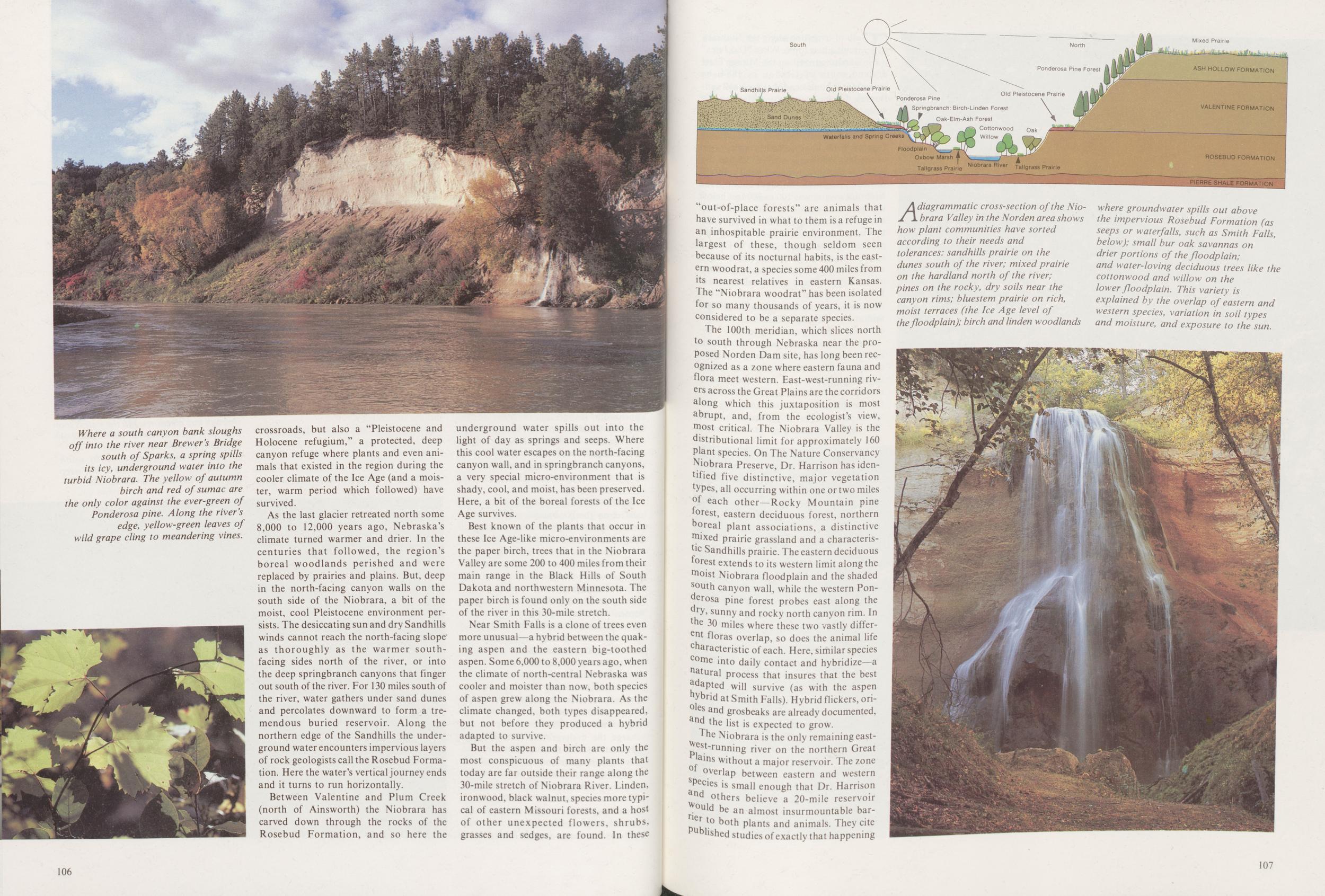
As the last glacier retreated north some 8,000 to 12,000 years ago, Nebraska's climate turned warmer and drier. In the centuries that followed, the region's boreal woodlands perished and were replaced by prairies and plains. But, deep in the north-facing canyon walls on the south side of the Niobrara, a bit of the moist, cool Pleistocene environment persists. The desiccating sun and dry Sandhills winds cannot reach the north-facing slope as thoroughly as the warmer south-facing sides north of the river, or into the deep springbranch canyons that finger out south of the river. For 130 miles south of the river, water gathers under sand dunes and percolates downward to form a tremendous buried reservoir. Along the northern edge of the Sandhills the under-ground water encounters impervious layers of rock geologists call the Rosebud Formation. Here the water's vertical journey ends and it turns to run horizontally.
Between Valentine and Plum Creek (north of Ainsworth) the Niobrara has carved down through the rocks of the Rosebud Formation, and so here the underground water spills out into the light of day as springs and seeps. Where this cool water escapes on the north-facing canyon wall, and in springbranch canyons, a very special micro-environment that is shady, cool, and moist, has been preserved. Here, a bit of the boreal forests of the Ice Age survives.
Best known of the plants that occur in these Ice Age-like micro-environments are the paper birch, trees that in the Niobrara Valley are some 200 to 400 miles from their main range in the Black Hills of South Dakota and northwestern Minnesota. The paper birch is found only on the south side of the river in this 30-mile stretch.
Near Smith Falls is a clone of trees even more unusual—a hybrid between the quaking aspen and the eastern big-toothed aspen. Some 6,000 to 8,000 years ago, when the climate of north-central Nebraska was cooler and moister than now, both species of aspen grew along the Niobrara. As the climate changed, both types disappeared, but not before they produced a hybrid adapted to survive.
But the aspen and birch are only the most conspicuous of many plants that today are far outside their range along the 30-mile stretch of Niobrara River. Linden, ironwood, black walnut, species more typical of eastern Missouri forests, and a host of other unexpected flowers, shrubs, grasses and sedges, are found. In these 106
The 100th meridian, which slices north to south through Nebraska near the proposed Norden Dam site, has long been recognized as a zone where eastern fauna and flora meet western. East-west-running rivers across the Great Plains are the corridors along which this juxtaposition is most abrupt, and, from the ecologist's view, "lost critical. The Niobrara Valley is the distributional limit for approximately 160 Plant species. On The Nature Conservancy Niobrara Preserve, Dr. Harrison has identified five distinctive, major vegetation types, all occurring within one or two miles of each other—Rocky Mountain pine forest, eastern deciduous forest, northern oreal plant associations, a distinctive mixed prairie grassland and a characterisc Sandhills prairie. The eastern deciduous forest extends to its western limit along the moist Niobrara floodplain and the shaded south canyon wall, while the western Ponderosa pine forest probes east along the dry, sunny and rocky north canyon rim. In the 30 miles where these two vastly different floras overlap, so does the animal life characteristic of each. Here, similar species come into daily contact and hybridize—a natural process that insures that the best adapted will survive (as with the aspen hybrid at Smith Falls). Hybrid flickers, orioles and grosbeaks are already documented, and the list is expected to grow.
The Niobrara is the only remaining east-west-running river on the northern Great Plains without a major reservoir. The zone overlap between eastern and western Species is small enough that Dr. Harrison and others believe a 20-mile reservoir would be an almost insurmountable barrier to both plants and animals. They cite published studies of exactly that happening
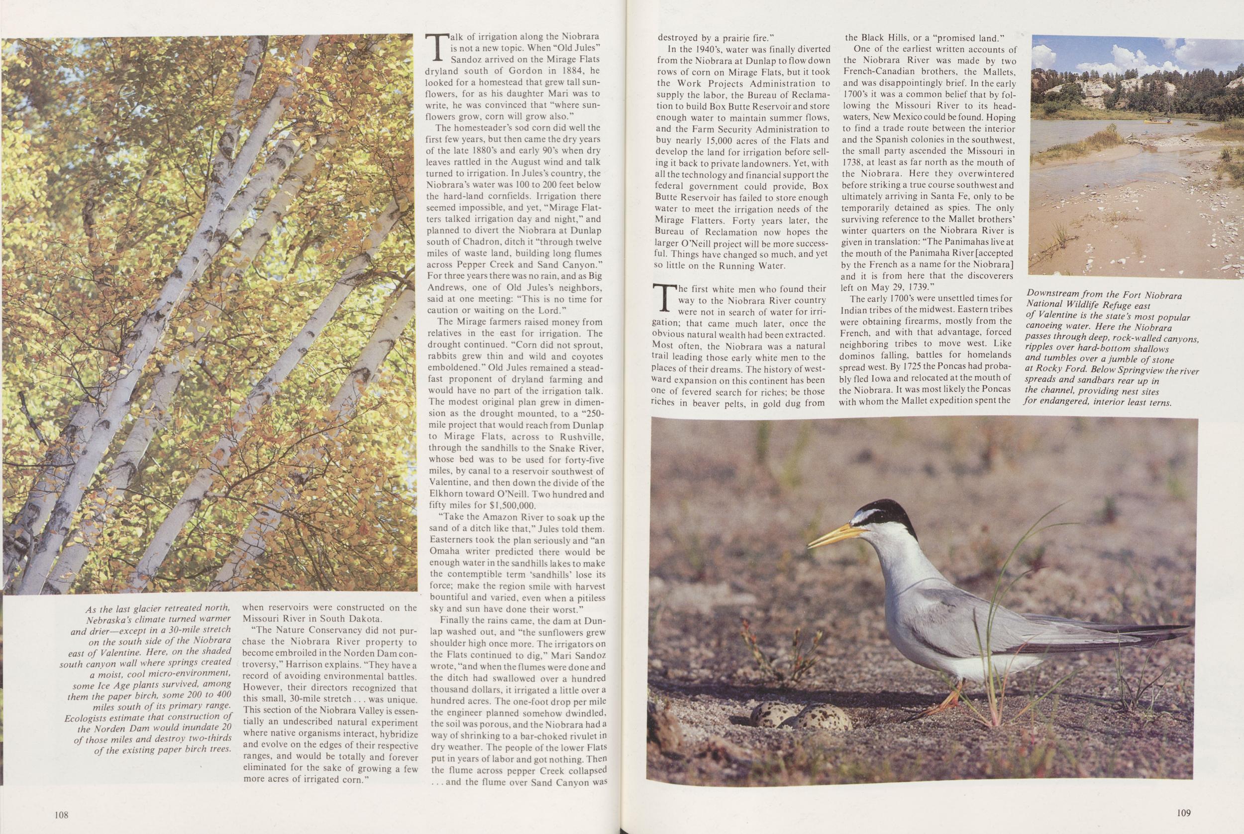
"The Nature Conservancy did not purchase the Niobrara River property to become embroiled in the Norden Dam controversy," Harrison explains. "They have a record of avoiding environmental battles. However, their directors recognized that this small, 30-mile stretch was unique. This section of the Niobrara Valley is essentially an undescribed natural experiment where native organisms interact, hybridize and evolve on the edges of their respective ranges, and would be totally and forever eliminated for the sake of growing a few more acres of irrigated corn."
Talk of irrigation along the Niobrara is not a new topic. When "Old Jules" Sandoz arrived on the Mirage Flats dryland south of Gordon in 1884, he looked for a homestead that grew tall sunflowers, for as his daughter Mari was to write, he was convinced that "where sunflowers grow, corn will grow also."
The homesteader's sod corn did well the first few years, but then came the dry years of the late 1880's and early 90's when dry leaves rattled in the August wind and talk turned to irrigation. In Jules's country, the Niobrara's water was 100 to 200 feet below the hard-land cornfields. Irrigation there seemed impossible, and yet, "Mirage Flatters talked irrigation day and night," and planned to divert the Niobrara at Dunlap south of Chadron, ditch it "through twelve miles of waste land, building long flumes across Pepper Creek and Sand Canyon." For three years there was no rain, and as Big Andrews, one of Old Jules's neighbors, said at one meeting: "This is no time for caution or waiting on the Lord."
The Mirage farmers raised money from relatives in the east for irrigation. The drought continued. "Corn did not sprout, rabbits grew thin and wild and coyotes emboldened." Old Jules remained a steadfast proponent of dryland farming and would have no part of the irrigation talk. The modest original plan grew in dimension as the drought mounted, to a "250-mile project that would reach from Dunlap to Mirage Flats, across to Rushville, through the sandhills to the Snake River, whose bed was to be used for forty-five miles, by canal to a reservoir southwest of Valentine, and then down the divide of the Elkhorn toward O'Neill. Two hundred and fifty miles for $1,500,000.
Take the Amazon River to soak up the sand of a ditch like that," Jules told them. Easterners took the plan seriously and "an Omaha writer predicted there would be enough water in the sandhills lakes to make the contemptible term 'sandhills' lose its force; make the region smile with harvest bountiful and varied, even when a pitiless sky and sun have done their worst."
Finally the rains came, the dam at Dunlap washed out, and "the sunflowers grew shoulder high once more. The irrigators on the Flats continued to dig," Mari Sandoz wrote, "and when the flumes were done and the ditch had swallowed over a hundred thousand dollars, it irrigated a little over a hundred acres. The one-foot drop per mile the engineer planned somehow dwindled, the soil was porous, and the Niobrara had a way of shrinking to a bar-choked rivulet in dry weather. The people of the lower Flats put in years of labor and got nothing. Then the flume across pepper Creek collapsed and the flume over Sand Canyon was 108 destroyed by a prairie fire."
In the 1940's, water was finally diverted from the Niobrara at Dunlap to flow down rows of corn on Mirage Flats, but it took the Work Projects Administration to supply the labor, the Bureau of Reclamation to build Box Butte Reservoir and store enough water to maintain summer flows, and the Farm Security Administration to buy nearly 15,000 acres of the Flats and develop the land for irrigation before selling it back to private landowners. Yet, with all the technology and financial support the federal government could provide, Box Butte Reservoir has failed to store enough water to meet the irrigation needs of the Mirage Flatters. Forty years later, the Bureau of Reclamation now hopes the larger O'Neill project will be more successful. Things have changed so much, and yet so little on the Running Water.
The first white men who found their way to the Niobrara River country were not in search of water for irrigation; that came much later, once the obvious natural wealth had been extracted. Most often, the Niobrara was a natural trail leading those early white men to the Places of their dreams. The history of westward expansion on this continent has been one of fevered search for riches; be those riches in beaver pelts, in gold dug from the Black Hills, or a "promised land."
One of the earliest written accounts of the Niobrara River was made by two French-Canadian brothers, the Mallets, and was disappointingly brief. In the early 1700's it was a common belief that by following the Missouri River to its headwaters, New Mexico could be found. Hoping to find a trade route between the interior and the Spanish colonies in the southwest, the small party ascended the Missouri in 1738, at least as far north as the mouth of the Niobrara. Here they overwintered before striking a true course southwest and ultimately arriving in Santa Fe, only to be temporarily detained as spies. The only surviving reference to the Mallet brothers' winter quarters on the Niobrara River is given in translation: "The Panimahas live at the mouth of the Panimaha River [accepted by the French as a name for the Niobrara] and it is from here that the discoverers left on May 29, 1739."
The early 1700's were unsettled times for Indian tribes of the midwest. Eastern tribes were obtaining firearms, mostly from the French, and with that advantage, forced neighboring tribes to move west. Like dominos falling, battles for homelands spread west. By 1725 the Poncas had probably fled Iowa and relocated at the mouth of the Niobrara. It was most likely the Poncas with whom the Mallet expedition spent the
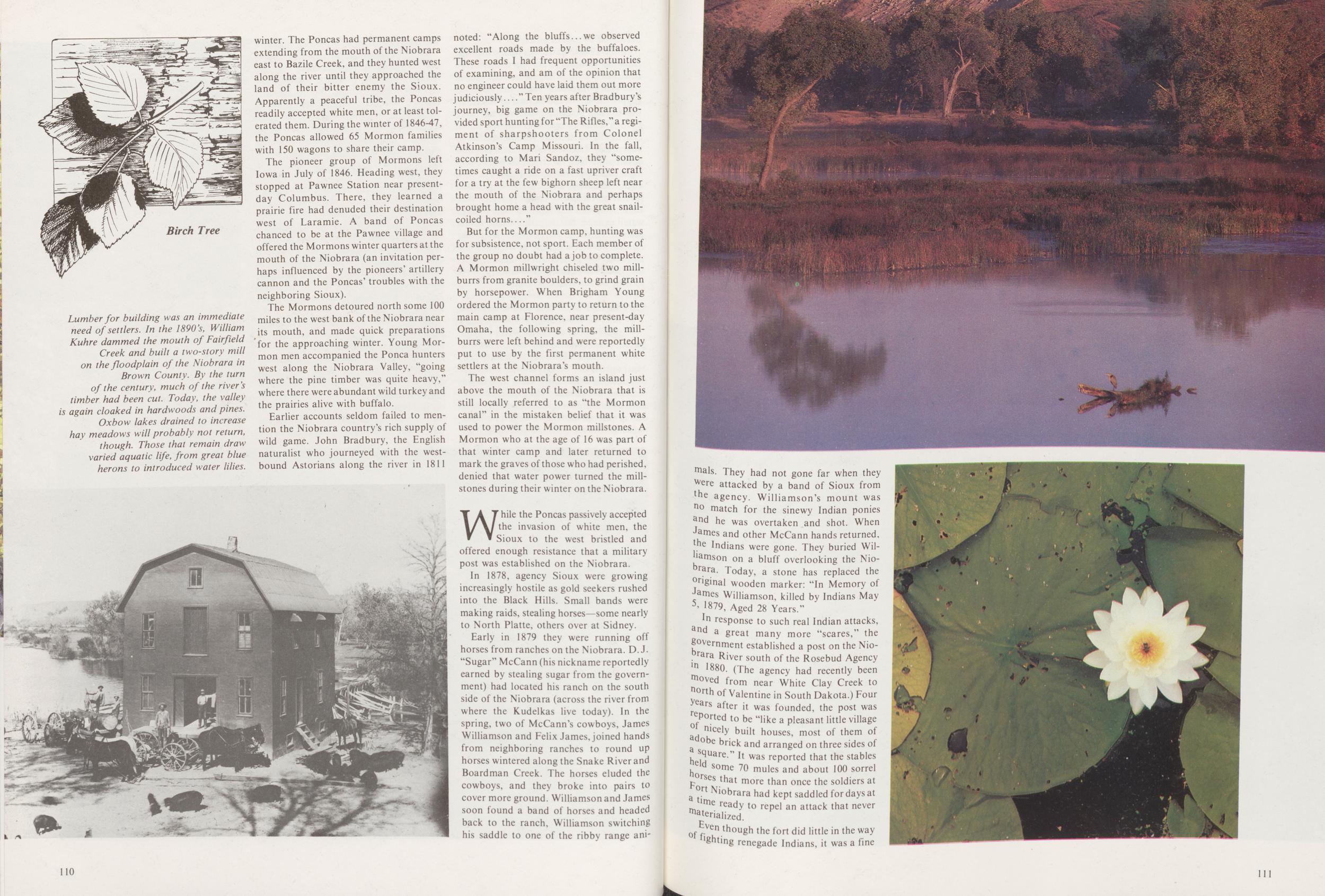
The pioneer group of Mormons left Iowa in July of 1846. Heading west, they stopped at Pawnee Station near present-day Columbus. There, they learned a prairie fire had denuded their destination west of Laramie. A band of Poncas chanced to be at the Pawnee village and offered the Mormons winter quarters at the mouth of the Niobrara (an invitation perhaps influenced by the pioneers' artillery cannon and the Poncas' troubles with the neighboring Sioux).
The Mormons detoured north some 100 miles to the west bank of the Niobrara near its mouth, and made quick preparations for the approaching winter. Young Mormon men accompanied the Ponca hunters west along the Niobrara Valley, "going where the pine timber was quite heavy," where there were abundant wild turkey and the prairies alive with buffalo.
Earlier accounts seldom failed to mention the Niobrara country's rich supply of wild game. John Bradbury, the English naturalist who journeyed with the westbound Astorians along the river in 1811 noted: "Along the bluffs we observed excellent roads made by the buffaloes. These roads I had frequent opportunities of examining, and am of the opinion that no engineer could have laid them out more judiciously" Ten years after Bradbury's journey, big game on the Niobrara provided sport hunting for "The Rifles," a regiment of sharpshooters from Colonel Atkinson's Camp Missouri. In the fall, according to Mari Sandoz, they "sometimes caught a ride on a fast upriver craft for a try at the few bighorn sheep left near the mouth of the Niobrara and perhaps brought home a head with the great snailcoiled horns"
But for the Mormon camp, hunting was for subsistence, not sport. Each member of the group no doubt had a job to complete. A Mormon millwright chiseled two millburrs from granite boulders, to grind grain by horsepower. When Brigham Young ordered the Mormon party to return to the main camp at Florence, near present-day Omaha, the following spring, the millburrs were left behind and were reportedly put to use by the first permanent white settlers at the Niobrara's mouth.
The west channel forms an island just above the mouth of the Niobrara that is still locally referred to as "the Mormon canal" in the mistaken belief that it was used to power the Mormon millstones. A Mormon who at the age of 16 was part of that winter camp and later returned to mark the graves of those who had perished, denied that water power turned the millstones during their winter on the Niobrara.
Wr hile the Poncas passively accepted the invasion of white men, the Sioux to the west bristled and offered enough resistance that a military post was established on the Niobrara.
In 1878, agency Sioux were growing increasingly hostile as gold seekers rushed into the Black Hills. Small bands were making raids, stealing horses—some nearly to North Platte, others over at Sidney.
Early in 1879 they were running off horses from ranches on the Niobrara. D.J. "Sugar" McCann (his nickname reportedly earned by stealing sugar from the government) had located his ranch on the south side of the Niobrara (across the river from where the Kudelkas live today). In the spring, two of McCann's cowboys, James Williamson and Felix James, joined hands from neighboring ranches to round up horses wintered along the Snake River and Board man Creek. The horses eluded the cowboys, and they broke into pairs to cover more ground. Williamson and James soon found a band of horses and headed back to the ranch, Williamson switching his saddle to one of the ribby range animals. 110
In response to such real Indian attacks, and a great many more "scares," the government established a post on the Niorara River south of the Rosebud Agency in 1880. (The agency had recently been moved from near White Clay Creek to north of Valentine in South Dakota.) Four years after it was founded, the post was reported to be "like a pleasant little village nicely built houses, most of them of adobe brick and arranged on three sides of Square." It was reported that the stables held some 70 mules and about 100 sorrel horses that more than once the soldiers at Fort Niobrara had kept saddled for days at a time ready to repel an attack that never materialized.
Even though the fort did little in the way of fighting renegade Indians, it was a fine
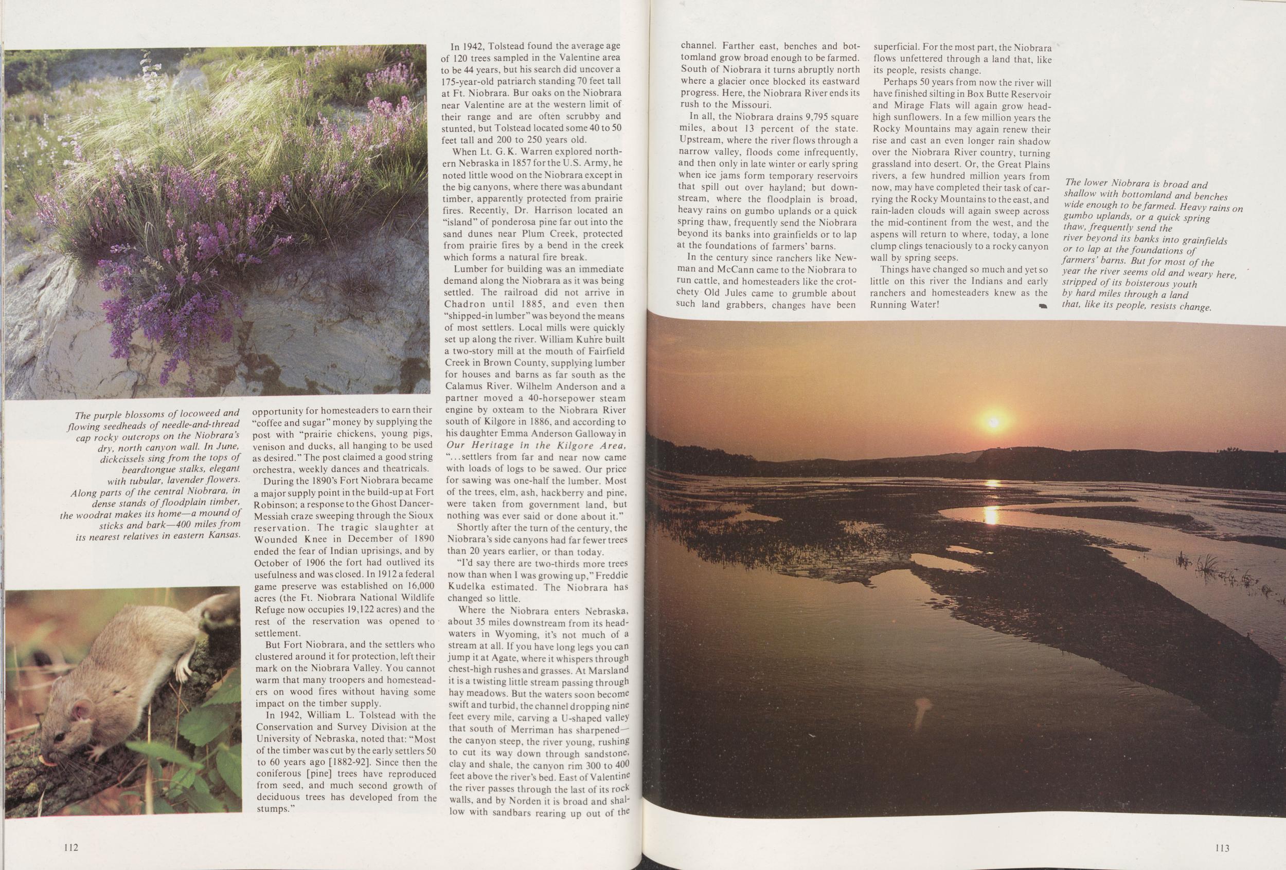
During the 1890's Fort Niobrara became a major supply point in the build-up at Fort Robinson; a response to the Ghost Dancer-Messiah craze sweeping through the Sioux reservation. The tragic slaughter at Wounded Knee in December of 1890 ended the fear of Indian uprisings, and by October of 1906 the fort had outlived its usefulness and was closed. In 1912 a federal game preserve was established on 16,000 acres (the Ft. Niobrara National Wildlife Refuge now occupies 19,122 acres) and the rest of the reservation was opened to settlement.
But Fort Niobrara, and the settlers who clustered around it for protection, left their mark on the Niobrara Valley. You cannot warm that many troopers and homesteaders on wood fires without having some impact on the timber supply.
In 1942, William L. Tolstead with the Conservation and Survey Division at the University of Nebraska, noted that: "Most of the timber was cut by the early settlers 50 to 60 years ago [1882-92]. Since then the coniferous [pine] trees have reproduced from seed, and much second growth of deciduous trees has developed from the stumps."
In 1942, Tolstead found the average age of 120 trees sampled in the Valentine area to be 44 years, but his search did uncover a 175-year-old patriarch standing 70 feet tall at Ft. Niobrara. Bur oaks on the Niobrara near Valentine are at the western limit of their range and are often scrubby and stunted, but Tolstead located some 40 to 50 feet tall and 200 to 250 years old.
When Lt. G. K. Warren explored northern Nebraska in 1857 for the U.S. Army, he noted little wood on the Niobrara except in the big canyons, where there was abundant timber, apparently protected from prairie fires. Recently, Dr. Harrison located an "island" of ponderosa pine far out into the sand dunes near Plum Creek, protected from prairie fires by a bend in the creek which forms a natural fire break.
Lumber for building was an immediate demand along the Niobrara as it was being settled. The railroad did not arrive in Chadron until 1885, and even then "shipped-in lumber" was beyond the means of most settlers. Local mills were quickly set up along the river. William Kuhre built a two-story mill at the mouth of Fairfield Creek in Brown County, supplying lumber for houses and barns as far south as the Calamus River. Wilhelm Anderson and a partner moved a 40-horsepower steam engine by oxteam to the Niobrara River south of Kilgore in 1886, and according to his daughter Emma Anderson Galloway in Our Heritage in the Kilgore Area, "settlers from far and near now came with loads of logs to be sawed. Our price for sawing was one-half the lumber. Most of the trees, elm, ash, hackberry and pine, were taken from government land, but nothing was ever said or done about it."
Shortly after the turn of the century, the Niobrara's side canyons had far fewer trees than 20 years earlier, or than today.
"I'd say there are two-thirds more trees now than when I was growing up," Freddie Kudelka estimated. The Niobrara has changed so little.
Where the Niobrara enters Nebraska, about 35 miles downstream from its headwaters in Wyoming, it's not much of a stream at all. If you have long legs you can jump it at Agate, where it whispers through chest-high rushes and grasses. At Marsland it is a twisting little stream passing through hay meadows. But the waters soon become swift and turbid, the channel dropping nine feet every mile, carving a U-shaped valley that south of Merriman has sharpened the canyon steep, the river young, rushing to cut its way down through sandstone, clay and shale, the canyon rim 300 to 400 feet above the river's bed. East of Valentine the river passes through the last of its rock walls, and by Norden it is broad and shallow with sandbars rearing up out of the 112 channel. Farther east, benches and bottomland grow broad enough to be farmed. South of Niobrara it turns abruptly north where a glacier once blocked its eastward progress. Here, the Niobrara River ends its rush to the Missouri.
In all, the Niobrara drains 9,795 square miles, about 13 percent of the state. Upstream, where the river flows through a narrow valley, floods come infrequently, and then only in late winter or early spring when ice jams form temporary reservoirs that spill out over hayland; but downstream, where the floodplain is broad, heavy rains on gumbo uplands or a quick spring thaw, frequently send the Niobrara beyond its banks into grainfields or to lap at the foundations of farmers' barns.
In the century since ranchers like Newman and McCann came to the Niobrara to run cattle, and homesteaders like the crotchety Old Jules came to grumble about such land grabbers, changes have been superficial. For the most part, the Niobrara flows unfettered through a land that, like its people, resists change.
Perhaps 50 years from now the river will have finished silting in Box Butte Reservoir and Mirage Flats will again grow head-high sunflowers. In a few million years the Rocky Mountains may again renew their rise and cast an even longer rain shadow over the Niobrara River country, turning grassland into desert. Or, the Great Plains rivers, a few hundred million years from now, may have completed their task of carrying the Rocky Mountains to the east, and rain-laden clouds will again sweep across the mid-continent from the west, and the aspens will return to where, today, a lone clump clings tenaciously to a rocky canyon wall by spring seeps.
Things have changed so much and yet so little on this river the Indians and early ranchers and homesteaders knew as the Running Water!
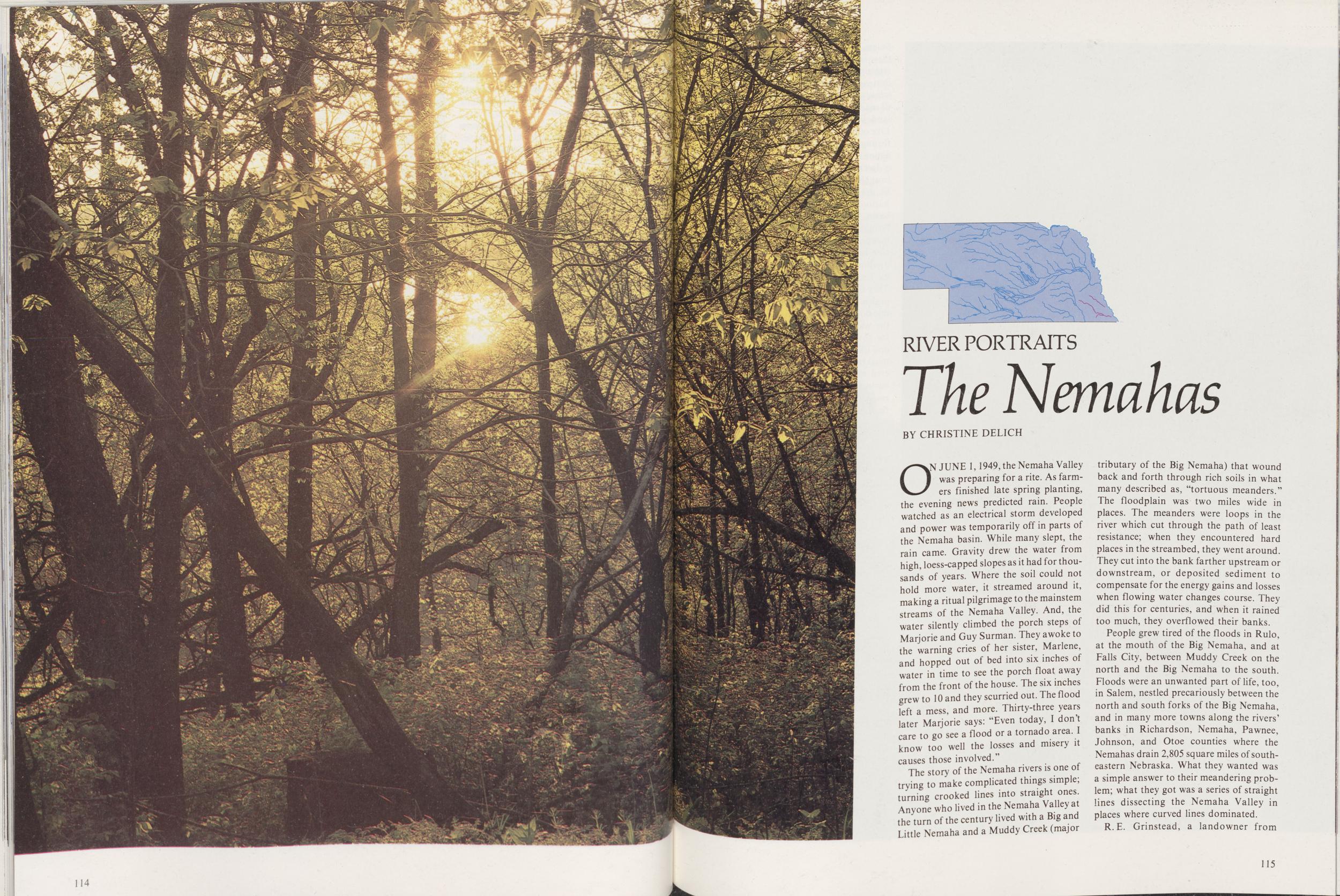
RIVER PORTRAITS
The Nemahas
BY CHRISTINE DELICHON JUNE 1,1949, the Nemaha Valley was preparing for a rite. As farmers finished late spring planting, the evening news predicted rain. People watched as an electrical storm developed and power was temporarily off in parts of the Nemaha basin. While many slept, the rain came. Gravity drew the water from high, loess-capped slopes as it had for thousand's of years. Where the soil could not hold more water, it streamed around it, making a ritual pilgrimage to the mainstem streams of the Nemaha Valley. And, the water silently climbed the porch steps of Marjorie and Guy Surman. They awoke to the warning cries of her sister, Marlene, and hopped out of bed into six inches of water in time to see the porch float away from the front of the house. The six inches grew to 10 and they scurried out. The flood left a mess, and more. Thirty-three years later Marjorie says: "Even today, I don't care to go see a flood or a tornado area. I know too well the losses and misery it causes those involved."
The story of the Nemaha rivers is one of trying to make complicated things simple; turning crooked lines into straight ones. Anyone who lived in the Nemaha Valley at the turn of the century lived with a Big and Little Nemaha and a Muddy Creek (major tributary of the Big Nemaha) that wound back and forth through rich soils in what many described as, "tortuous meanders." The floodplain was two miles wide in places. The meanders were loops in the river which cut through the path of least resistance; when they encountered hard places in the streambed, they went around. They cut into the bank farther upstream or downstream, or deposited sediment to compensate for the energy gains and losses when flowing water changes course. They did this for centuries, and when it rained too much, they overflowed their banks.
People grew tired of the floods in Rulo, at the mouth of the Big Nemaha, and at Falls City, between Muddy Creek on the north and the Big Nemaha to the south. Floods were an unwanted part of life, too, in Salem, nestled precariously between the north and south forks of the Big Nemaha, and in many more towns along the rivers' banks in Richardson, Nemaha, Pawnee, Johnson, and Otoe counties where the Nemahas drain 2,805 square miles of southeastern Nebraska. What they wanted was a simple answer to their meandering problem; what they got was a series of straight lines dissecting the Nemaha Valley in places where curved lines dominated.
R.E. Grinstead, a landowner from 115 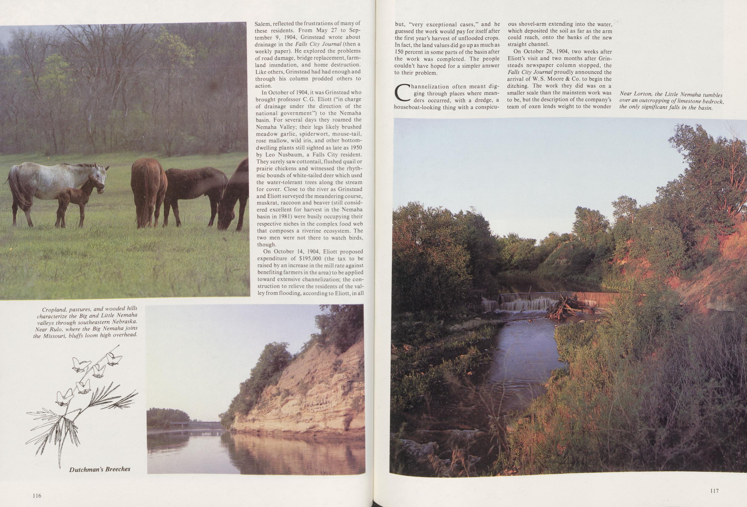 Salem, reflected the frustrations of many of these residents. From May 27 to September 9, 1904, Grinstead wrote about drainage in the Falls City Journal (then a weekly paper). He explored the problems of road damage, bridge replacement, farmland inundation, and home destruction. Like others, Grinstead had had enough and through his column prodded others to action.
In October of 1904, it was Grinstead who brought professor C.G. Eliott ("in charge of drainage under the direction of the national government") to the Nemaha basin. For several days they roamed the Nemaha Valley; their legs likely brushed meadow garlic, spiderwort, mouse-tail, rose mallow, wild iris, and other bottom-dwelling plants still sighted as late as 1950 by Leo Nusbaum, a Falls City resident. They surely saw cottontail, flushed quail or prairie chickens and witnessed the rhythmic bounds of white-tailed deer which used the water-tolerant trees along the stream for cover. Close to the river as Grinstead and Eliott surveyed the meandering course, muskrat, raccoon and beaver (still considered excellent for harvest in the Nemaha basin in 1981) were busily occupying their respective niches in the complex food web that composes a riverine ecosystem. The two men were not there to watch birds, though.
On October 14, 1904, Eliott proposed expenditure of $195,000 (the tax to be raised by an increase in the mill rate against benefiting farmers in the area) to be applied toward extensive channelization; the construction to relieve the residents of the valley from flooding, according to Eliott, in all
Channelization often meant digging through places where meanders occurred, with a dredge, a houseboat-looking thing with a conspicuous shovel-arm extending into the water, which deposited the soil as far as the arm could reach, onto the banks of the new straight channel.
On October 28, 1904, two weeks after Eliott's visit and two months after Grinsteads newspaper column stopped, the Falls City Journal proudly announced the arrival of W. S. Moore & Co. to begin the ditching. The work they did was on a smaller scale than the mainstem work was to be, but the description of the company's team of oxen lends weight to the wonder
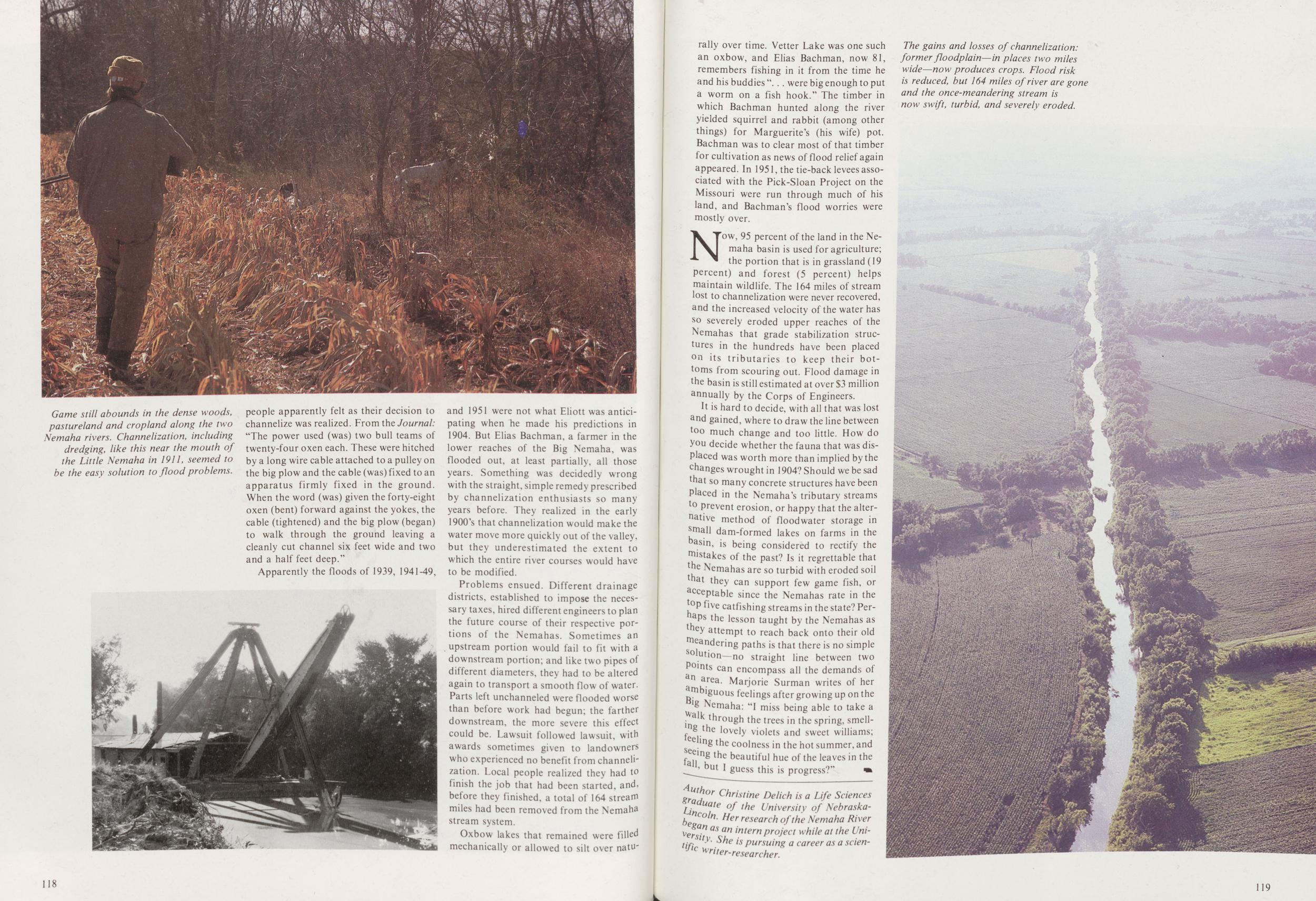
Apparently the floods of 1939, 1941-49, and 1951 were not what Eliott was anticipating when he made his predictions in 1904. But Elias Bachman, a farmer in the lower reaches of the Big Nemaha, was flooded out, at least partially, all those years. Something was decidedly wrong with the straight, simple remedy prescribed by channelization enthusiasts so many years before. They realized in the early 1900's that channelization would make the water move more quickly out of the valley, but they underestimated the extent to which the entire river courses would have to be modified.
Problems ensued. Different drainage districts, established to impose the necessary taxes, hired different engineers to plan the future course of their respective portions of the Nemahas. Sometimes an upstream portion would fail to fit with a downstream portion; and like two pipes of different diameters, they had to be altered again to transport a smooth flow of water. Parts left unchanneled were flooded worse than before work had begun; the farther downstream, the more severe this effect could be. Lawsuit followed lawsuit, with awards sometimes given to landowners who experienced no benefit from channelization. Local people realized they had to finish the job that had been started, and, before they finished, a total of 164 stream miles had been removed from the Nemaha stream system.
Oxbow lakes that remained were filled mechanically or allowed to silt over naturally 118 over time. Vetter Lake was one such an oxbow, and Elias Bachman, now 81, remembers fishing in it from the time he and his buddies " were big enough to put a worm on a fish hook." The timber in which Bachman hunted along the river yielded squirrel and rabbit (among other things) for Marguerite's (his wife) pot. Bachman was to clear most of that timber for cultivation as news of flood relief again appeared. In 1951, the tie-back levees associated with the Pick-Sloan Project on the Missouri were run through much of his land, and Bachman's flood worries were mostly over.
Now, 95 percent of the land in the Nemaha basin is used for agriculture; the portion that is in grassland (19 percent) and forest (5 percent) helps maintain wildlife. The 164 miles of stream lost to channelization were never recovered, and the increased velocity of the water has so severely eroded upper reaches of the Nemahas that grade stabilization structures in the hundreds have been placed 011 its tributaries to keep their bottoms from scouring out. Flood damage in the basin is still estimated at over $3 million annually by the Corps of Engineers.
It is hard to decide, with all that was lost and gained, where to draw the line between too much change and too little. How do you decide whether the fauna that was displaced was worth more than implied by the changes wrought in 1904? Should we be sad that so many concrete structures have been Placed in the Nemaha's tributary streams to prevent erosion, or happy that the alterative method of floodwater storage in small dam-formed lakes on farms in the basin, is being considered to rectify the mistakes of the past? Is it regrettable that the Nemahas are so turbid with eroded soil that they can support few game fish, or acceptable since the Nemahas rate in the toP five catfishing streams in the state? Perhaps the lesson taught by the Nemahas as they attempt to reach back onto their old meandering paths is that there is no simple solution—no straight line between two Points can encompass all the demands of n area. Marjorie Surman writes of her ambiguous feelings after growing up on the Big Nemaha: "I miss being able to take a walk through the trees in the spring, smelling the lovely violets and sweet williams; feeling the coolness in the hot summer, and seeing the beautiful hue of the leaves in the fall but I guess this is progress?"
Author Christine Delich is a Life Sciences graduate of the University of Nebraska-Lincoln. Her research of the Nemaha River Began as an intern project while at the University. She is pursuing a career as a scientific writer-researcher.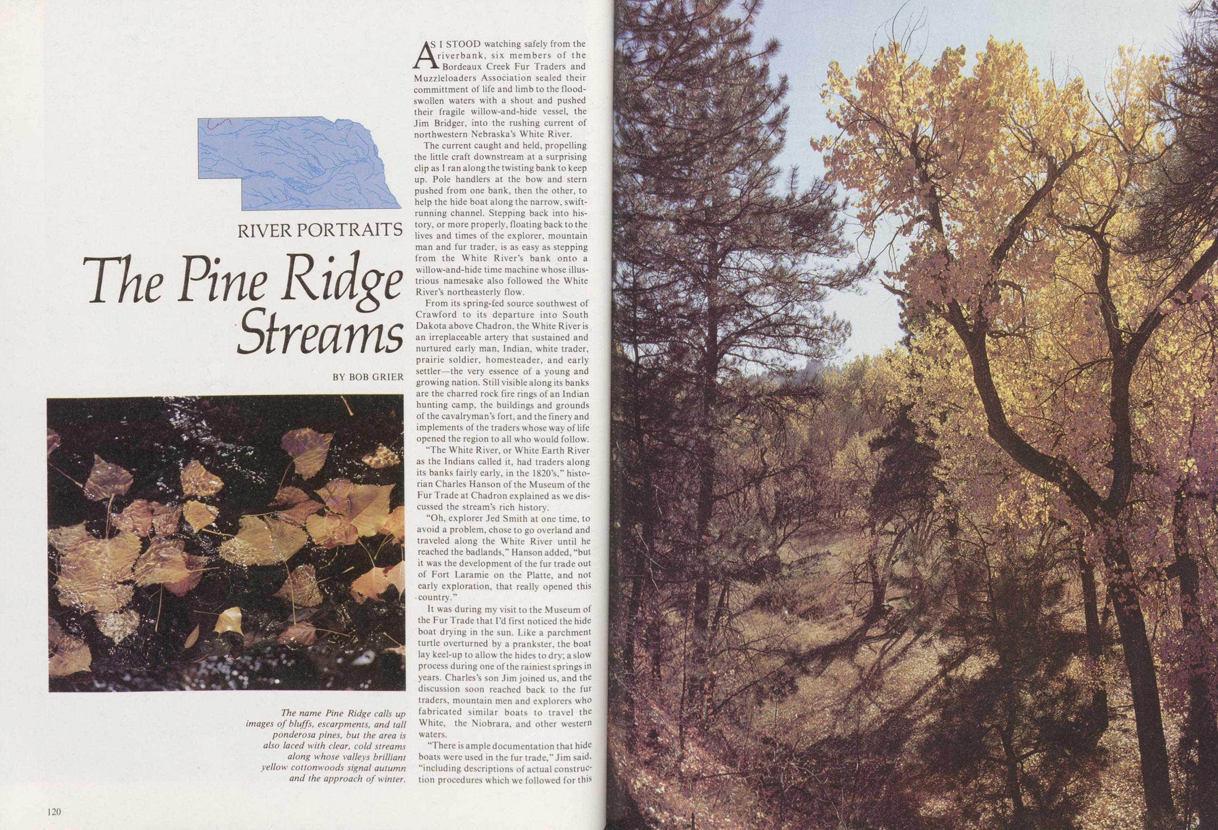
RIVER PORTRAITS
The Pine Ridge Streams
BY BOB GRIERAS I STOOD watching safely from the riverbank, six members of the Bordeaux Creek Fur Traders and Muzzleloaders Association sealed their committment of life and limb to the flood-swollen waters with a shout and pushed their fragile willow-and-hide vessel, the Jim Bridger, into the rushing current of northwestern Nebraska's White River.
The current caught and held, propelling the little craft downstream at a surprising clip as I ran along the twisting bank to keep up. Pole handlers at the bow and stern pushed from one bank, then the other, to help the hide boat along the narrow, swift-running channel. Stepping back into history, or more properly, floating back to the lives and times of the explorer, mountain man and fur trader, is as easy as stepping from the White River's bank onto a willow-and-hide time machine whose illustrious namesake also followed the White River's northeasterly flow.
From its spring-fed source southwest of Crawford to its departure into South Dakota above Chadron, the White River is an irreplaceable artery that sustained and nurtured early man, Indian, white trader, prairie soldier, homesteader, and early settler—the very essence of a young and growing nation. Still visible along its banks are the charred rock fire rings of an Indian hunting camp, the buildings and grounds of the cavalryman's fort, and the finery and implements of the traders whose way of life opened the region to all who would follow.
"The White River, or White Earth River as the Indians called it, had traders along its banks fairly early, in the 1820's," historian Charles Hanson of the Museum of the Fur Trade at Chadron explained as we discussed the stream's rich history.
"Oh, explorer Jed Smith at one time, to avoid a problem, chose to go overland and traveled along the White River until he reached the badlands," Hanson added, "but it was the development of the fur trade out of Fort Laramie on the Platte, and not early exploration, that really opened this country."
It was during my visit to the Museum of the Fur Trade that I'd first noticed the hide boat drying in the sun. Like a parchment turtle overturned by a prankster, the boat lay keel-up to allow the hides to dry; a slow process during one of the rainiest springs in years. Charles's son Jim joined us, and the discussion soon reached back to the fur traders, mountain men and explorers who fabricated similar boats to travel the White, the Niobrara, and other western waters.
There is ample documentation that hide boats were used in the fur trade," Jim said, "including descriptions of actual construction procedures which we followed for this 120
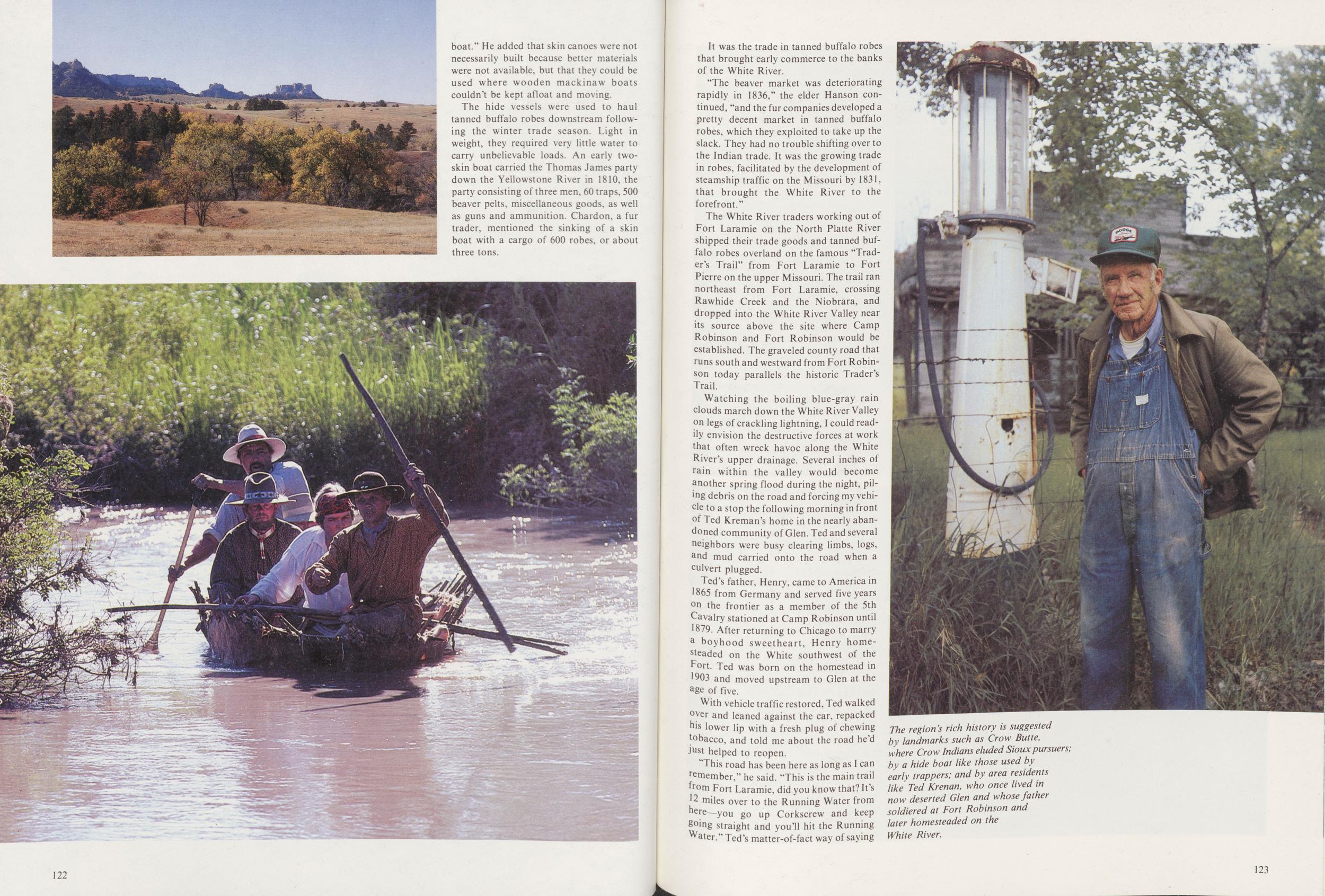
The hide vessels were used to haul tanned buffalo robes downstream following the winter trade season. Light in weight, they required very little water to carry unbelievable loads. An early two-skin boat carried the Thomas James party down the Yellowstone River in 1810, the party consisting of three men, 60 traps, 500 beaver pelts, miscellaneous goods, as well as guns and ammunition. Chardon, a fur trader, mentioned the sinking of a skin boat with a cargo of 600 robes, or about three tons.
122It was the trade in tanned buffalo robes that brought early commerce to the banks of the White River.
"The beaver market was deteriorating rapidly in 1836," the elder Hanson continued, "and the fur companies developed a pretty decent market in tanned buffalo robes, which they exploited to take up the slack. They had no trouble shifting over to the Indian trade. It was the growing trade in robes, facilitated by the development of steamship traffic on the Missouri by 1831, that brought the White River to the forefront."
The White River traders working out of Fort Laramie on the North Platte River shipped their trade goods and tanned buffalo robes overland on the famous "Trader's Trail" from Fort Laramie to Fort Pierre on the upper Missouri. The trail ran northeast from Fort Laramie, crossing Rawhide Creek and the Niobrara, and dropped into the White River Valley near its source above the site where Camp Robinson and Fort Robinson would be established. The graveled county road that runs south and westward from Fort Robinson today parallels the historic Trader's Trail.
Watching the boiling blue-gray rain clouds march down the White River Valley on legs of crackling lightning, I could readily envision the destructive forces at work that often wreck havoc along the White River's upper drainage. Several inches of rain within the valley would become another spring flood during the night, piling debris on the road and forcing my vehicle to a stop the following morning in front of Ted Kreman's home in the nearly abandoned community of Glen. Ted and several neighbors were busy clearing limbs, logs, and mud carried onto the road when a culvert plugged.
Ted's father, Henry, came to America in 1865 from Germany and served five years °n the frontier as a member of the 5th Cavalry stationed at Camp Robinson until 1879. After returning to Chicago to marry a boyhood sweetheart, Henry homebeaded on the White southwest of the Port. Ted was born on the homestead in 1903 and moved upstream to Glen at the age of five.
With vehicle traffic restored, Ted walked over and leaned against the car, repacked his lower lip with a fresh plug of chewing tobacco, and told me about the road he'd just helped to reopen.
"This road has been here as long as I can remember," he said. "This is the main trail from Fort Laramie, did you know that? It's 12 miles over to the Running Water from here—you go up Corkscrew and keep going straight and you'll hit the Running Water." Ted's matter-of-fact way of saying
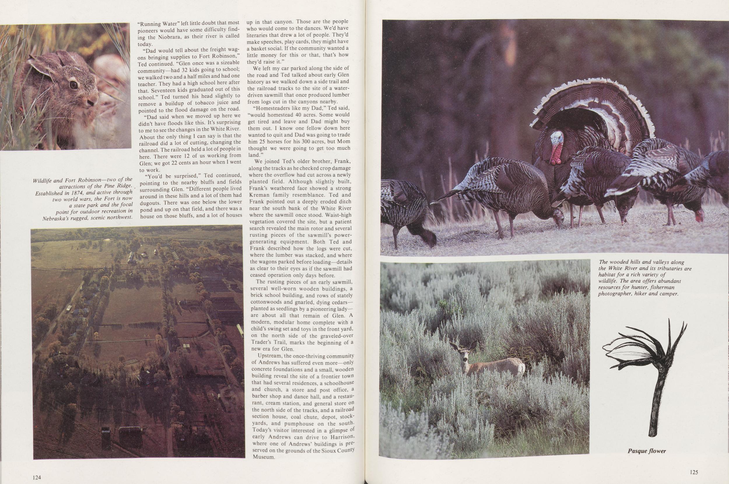
"Dad would tell about the freight wagons bringing supplies to Fort Robinson," Ted continued. "Glen once was a sizeable community—had 32 kids going to school; we walked two and a half miles and had one teacher. They had a high school here after that. Seventeen kids graduated out of this school." Ted turned his head slightly to remove a buildup of tobacco juice and pointed to the flood damage on the road.
"Dad said when we moved up here we didn't have floods like this. It's surprising to me to see the changes in the White River. About the only thing I can say is that the railroad did a lot of cutting, changing the channel. The railroad held a lot of people in here. There were 12 of us working from Glen; we got 22 cents an hour when I went to work.
"You'd be surprised," Ted continued, pointing to the nearby bluffs and fields surrounding Glen. "Different people lived around in these hills and a lot of them had dugouts. There was one below the lower pond and up on that field, and there was a house on those bluffs, and a lot of houses up in that canyon. Those are the people who would come to the dances. We'd have literaries that drew a lot of people. They'd make speeches, play cards, they might have a basket social. If the community wanted a little money for this or that, that's how they'd raise it."
We left my car parked along the side of the road and Ted talked about early Glen history as we walked down a side trail and the railroad tracks to the site of a water-driven sawmill that once produced lumber from logs cut in the canyons nearby.
"Homesteaders like my Dad," Ted said, "would homestead 40 acres. Some would get tired and leave and Dad might buy them out. I know one fellow down here wanted to quit and Dad was going to trade him 25 horses for his 300 acres, but Mom thought we were going to get too much land."
We joined Ted's older brother, Frank, along the tracks as he checked crop damage where the overflow had cut across a newly planted field. Although slightly built, Frank's weathered face showed a strong Kreman family resemblance. Ted and Frank pointed out a deeply eroded ditch near the south bank of the White River where the sawmill once stood. Waist-high vegetation covered the site, but a patient search revealed the main rotor and several rusting pieces of the sawmill's power-generating equipment. Both Ted and Frank described how the logs were cut, where the lumber was stacked, and where the wagons parked before loading—details as clear to their eyes as if the sawmill had ceased operation only days before.
The rusting pieces of an early sawmill, several well-worn wooden buildings, a brick school building, and rows of stately cottonwoods and gnarled, dying cedars— planted as seedlings by a pioneering lady—are about all that remain of Glen. A modern, modular home complete with a child's swing set and toys in the front yard, on the north side of the graveled-over Trader's Trail, marks the beginning of a new era for Glen.
Upstream, the once-thriving community of Andrews has suffered even more—only concrete foundations and a small, wooden building reveal the site of a frontier town that had several residences, a schoolhouse and church, a store and post office, a barber shop and dance hall, and a restaurant, cream station, and general store on the north side of the tracks, and a railroad section house, coal chute, depot, stock-yards, and pumphouse on the south. Today's visitor interested in a glimpse of early Andrews can drive to Harrison, where one of Andrews' buildings is preserved on the grounds of the Sioux County Museum.
124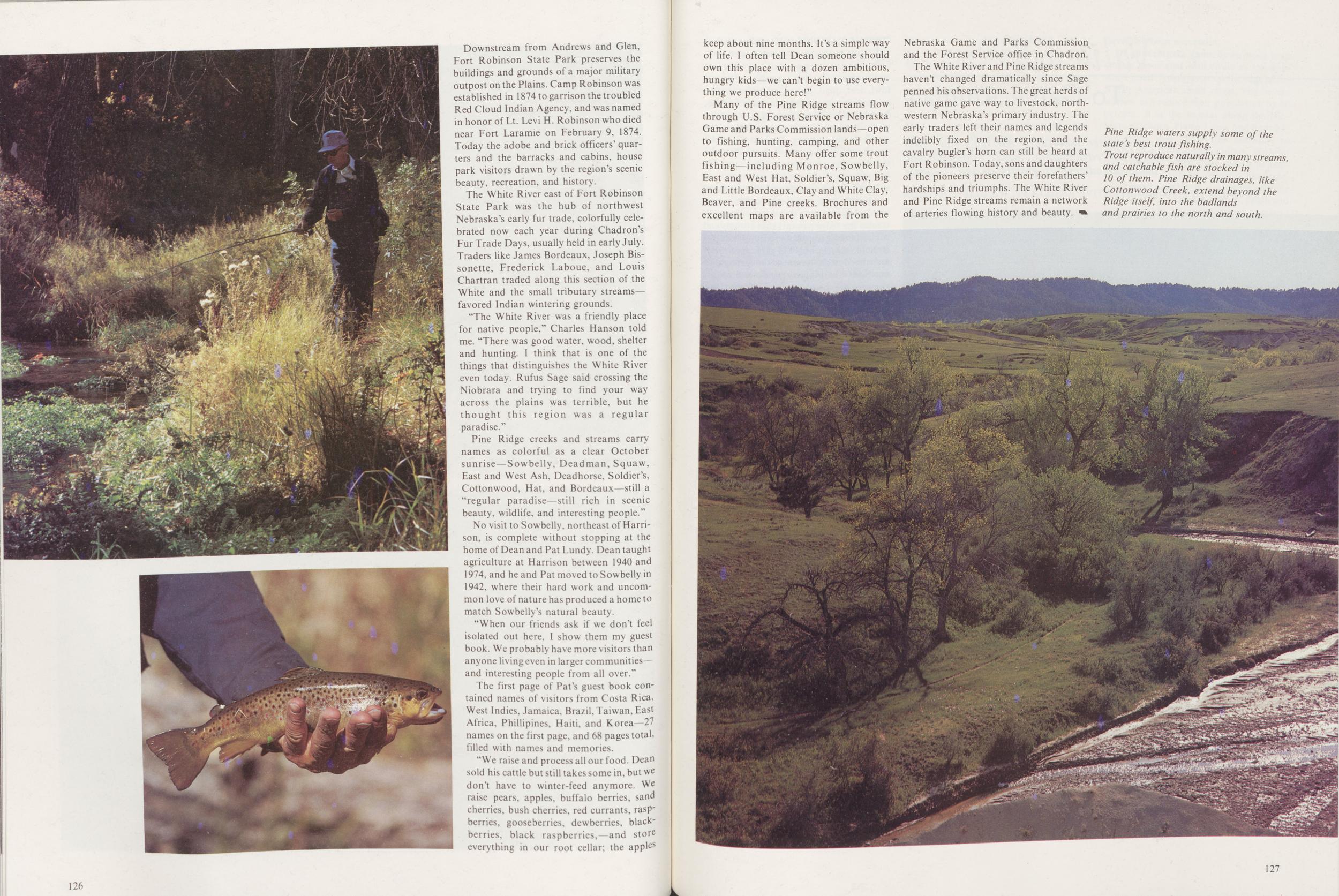
Downstream from Andrews and Glen, Fort Robinson State Park preserves the buildings and grounds of a major military outpost on the Plains. Camp Robinson was established in 1874 to garrison the troubled Red Cloud Indian Agency, and was named in honor of Lt. Levi H. Robinson who died near Fort Laramie on February 9, 1874. Today the adobe and brick officers' quarters and the barracks and cabins, house park visitors drawn by the region's scenic beauty, recreation, and history.
The White River east of Fort Robinson State Park was the hub of northwest Nebraska's early fur trade, colorfully celebrated now each year during Chadron's Fur Trade Days, usually held in early July. Traders like James Bordeaux, Joseph Bissonette, Frederick Laboue, and Louis Chartran traded along this section of the White and the small tributary streams-favored Indian wintering grounds.
"The White River was a friendly place for native people," Charles Hanson told me. "There was good water, wood, shelter and hunting. I think that is one of the things that distinguishes the White River even today. Rufus Sage said crossing the Niobrara and trying to find your way across the plains was terrible, but he thought this region was a regular paradise."
Pine Ridge creeks and streams carry names as colorful as a clear October sunrise—Sowbelly, Deadman, Squaw, East and West Ash, Deadhorse, Soldier's, Cottonwood, Hat, and Bordeaux—still a "regular paradise still rich in scenic beauty, wildlife, and interesting people."
No visit to Sowbelly, northeast of Harrison, is complete without stopping at the home of Dean and Pat Lundy. Dean taught agriculture at Harrison between 1940 and 1974, and he and Pat moved to Sowbelly in 1942, where their hard work and uncommon love of nature has produced a home to match Sowbelly's natural beautv
"When our friends ask if we don't feel isolated out here, I show them my guest book. We probably have more visitors than anyone living even in larger communities—and interesting people from all over."
The first page of Pat's guest book contained names of visitors from Costa Rica, West Indies, Jamaica, Brazil, Taiwan, East Africa, Phillipines, Haiti, and Korea 27 names on the first page, and 68 pages total-filled with names and memories
"We raise and process all our food. Dean sold his cattle but still takes some in, but WC don't have to winter-feed anymore. We raise pears, apples, buffalo berries, sand cherries, bush cherries, red currants, raspberries, gooseberries, dewberries, blackberries, black raspberries, and stoic everything in our root cellar; the apples 126 keep about nine months. It's a simple way of life. I often tell Dean someone should own this place with a dozen ambitious, hungry kids—we can't begin to use everything we produce here!"
Many of the Pine Ridge streams flow through U.S. Forest Service or Nebraska Game and Parks Commission lands—open to fishing, hunting, camping, and other outdoor pursuits. Many offer some trout fishing—including Monroe, Sowbelly, East and West Hat, Soldier's, Squaw, Big and Little Bordeaux, Clay and White Clay, Beaver, and Pine creeks. Brochures and excellent maps are available from the Nebraska Game and Parks Commission and the Forest Service office in Chadron.
The White River and Pine Ridge streams haven't changed dramatically since Sage penned his observations. The great herds of native game gave way to livestock, north-western Nebraska's primary industry. The early traders left their names and legends indelibly fixed on the region, and the cavalry bugler's horn can still be heard at Fort Robinson. Today, sons and daughters of the pioneers preserve their forefathers' hardships and triumphs. The White River and Pine Ridge streams remain a network of arteries flowing history and beauty.
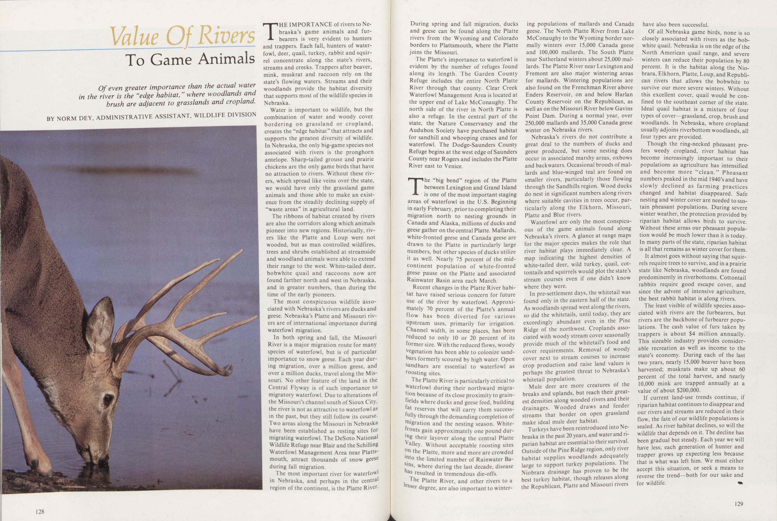
Value Of Rivers
To Game Animals
Of even greater importance than the actual water in the river is the "edge habitat," where woodlands and brush are adjacent to grasslands and cropland. BY NORM DEY, ADMINISTRATIVE ASSISTANT, WILDLIFE DIVISIONTHE IMPORTANCE of rivers to Nebraska's game animals and furbearers is very evident to hunters and trappers. Each fall, hunters of waterfowl, deer, quail, turkey, rabbit and squirrel concentrate along the state's rivers, streams and creeks. Trappers after beaver, mink, muskrat and raccoon rely on the state's flowing waters. Streams and their woodlands provide the habitat diversity that supports most of the wildlife species in Nebraska.
Water is important to wildlife, but the combination of water and woody cover bordering on grassland or cropland, creates the "edge habitat" that attracts and supports the greatest diversity of wildlife. In Nebraska, the only big-game species not associated with rivers is the pronghorn antelope. Sharp-tailed grouse and prairie chickens are the only game birds that have no attraction to rivers. Without these rivers, which spread like veins over the state, we would have only the grassland game animals and those able to make an existence from the steadily declining supply of "waste areas" in agricultural land.
The ribbons of habitat created by rivers are also the corridors along which animals pioneer into new regions. Historically, rivers like the Platte and Loup were not wooded, but as man controlled wildfires, trees and shrubs established at streamside and woodland animals were able to extend their range to the west. White-tailed deer, bobwhite quail and raccoons now are found farther north and west in Nebraska, and in greater numbers, than during the time of the early pioneers.
The most conspicuous wildlife associated with Nebraska's rivers are ducks and geese. Nebraska's Platte and Missouri rivers are of international importance during waterfowl migration.
In both spring and fall, the Missouri River is a major migration route for many species of waterfowl, but is of particular importance to snow geese. Each year during migration, over a million geese, and over a million ducks, travel along the Missouri. No other feature of the land in the Central Flyway is of such importance to migratory waterfowl. Due to alterations of the Missouri's channel south of Sioux City, the river is not as attractive to waterfowl as in the past, but they still follow its course. Two areas along the Missouri in Nebraska have been established as resting sites for migrating waterfowl. The DeSoto National Wildlife Refuge near Blair and the Schilling Waterfowl Management Area near Plattsmouth, attract thousands of snow geese during fall migration
The most important river for waterfowl in Nebraska, and perhaps in the central region of the continent, is the Platte River 128 During spring and fall migration, ducks and geese can be found along the Platte rivers from the Wyoming and Colorado borders to Plattsmouth, where the Platte joins the Missouri.
The Platte's importance to waterfowl is evident by the number of refuges found along its length. The Garden County Refuge includes the entire North Platte River through that county. Clear Creek Waterfowl Management Area is located at the upper end of Lake McConaughy. The north side of the river in North Platte is also a refuge. In the central part of the state, the Nature Conservancy and the Audubon Society have purchased habitat for sandhill and whooping cranes and for waterfowl. The Dodge-Saunders County Refuge begins at the west edge of Saunders County near Rogers and includes the Platte River east to Venice.
The "big bend" region of the Platte between Lexington and Grand Island is one of the most important staging areas of waterfowl in the U.S. Beginning in early February, prior to completing their migration north to nesting grounds in Canada and Alaska, millions of ducks and geese gather on the central Platte. Mallards, white-fronted geese and Canada geese are drawn to the Platte in particularly large numbers, but other species of ducks utilize it as well. Nearly 75 percent of the mid-continent population of white-fronted geese pause on the Platte and associated Rainwater Basin area each March.
Recent changes in the Platte River habitat have raised serious concern for future use of the river by waterfowl. Approximately 70 percent of the Platte's annual How has been diverted for various upstream uses, primarily for irrigation. Channel width, in some places, has been reduced to only 10 or 20 percent of its former size. With the reduced flows, woody vegetation has been able to colonize sandbars formerly scoured by high water. Open sandbars are essential to waterfowl as roosting sites.
The Platte River is particularly critical to waterfowl during their northward migration because of its close proximity to grain-helds where ducks and geese feed, building fat reserves that will carry them successfully through the demanding completion of migration and the nesting season. White-fronts gain approximately one pound during their layover along the central Platte Valley. Without acceptable roosting sites on the Platte, more and more are crowded into the limited number of Rainwater Basins, where during the last decade, disease has resulted in tremendous die-offs.
The Platte River, and other rivers to a lesser degree, are also important to wintering populations of mallards and Canada geese. The North Platte River from Lake McConaughy to the Wyoming border normally winters over 15,000 Canada geese and 100,000 mallards. The South Platte near Sutherland winters about 25,000 mallards. The Platte River near Lexington and Fremont are also major wintering areas for mallards. Wintering populations are also found on the Frenchman River above Enders Reservoir, on and below Harlan County Reservoir on the Republican, as well as on the Missouri River below Gavins Point Dam. During a normal year, over 250,000 mallards and 35,000 Canada geese winter on Nebraska rivers.
Nebraska's rivers do not contribute a great deal to the numbers of ducks and geese produced, but some nesting does occur in associated marshy areas, oxbows and backwaters. Occasional broods of mallards and blue-winged teal are found on smaller rivers, particularly those flowing through the Sandhills region. Wood ducks do nest in significant numbers along rivers where suitable cavities in trees occur, particularly along the Elkhorn, Missouri, Platte and Blue rivers.
Waterfowl are only the most conspicuous of the game animals found along Nebraska's rivers. A glance at range maps for the major species makes the role that river habitat plays immediately clear. A map indicating the highest densities of white-tailed deer, wild turkey, quail, cottontails and squirrels would plot the state's stream courses even if one didn't know where they were.
In pre-settlement days, the whitetail was found only in the eastern half of the state. As woodlands spread west along the rivers, so did the whitetails, until today, they are exceedingly abundant even in the Pine Ridge of the northwest. Croplands associated with woody stream cover seasonally provide much of the whitetail's food and cover requirements. Removal of woody cover next to stream courses to increase crop production and raise land values is perhaps the greatest threat to Nebraska's whitetail population.
Mule deer are more creatures of the breaks and uplands, but reach their greatest densities along wooded rivers and their drainages. Wooded draws and feeder streams that border on open grassland make ideal mule deer habitat.
Turkeys have been reintroduced into Nebraska in the past 20 years, and water and riparian habitat are essential to their survival. Outside of the Pine Ridge region, only river habitat supplies woodlands adequately large to support turkey populations. The Niobrara drainage has proven to be the best turkey habitat, though releases along the Republican, Platte and Missouri rivers have also been successful.
Of all Nebraska game birds, none is so closely associated with rivers as the bob-white quail. Nebraska is on the edge of the North American quail range, and severe winters can reduce their population by 80 percent. It is the habitat along the Niobrara, Elkhorn, Platte, Loup, and Republican rivers that allows the bobwhite to survive our more severe winters. Without this excellent cover, quail would be confined to the southeast corner of the state. Ideal quail habitat is a mixture of four types of cover—grassland, crop, brush and woodlands. In Nebraska, where cropland usually adjoins riverbottom woodlands, all four types are provided.
Though the ring-necked pheasant prefers weedy cropland, river habitat has become increasingly important to their populations as agriculture has intensified and become more "clean." Pheasant numbers peaked in the mid 1940's and have slowly declined as farming practices changed and habitat disappeared. Safe nesting and winter cover are needed to sustain pheasant populations. During severe winter weather, the protection provided by riparian habitat allows birds to survive. Without these areas our pheasant population would be much lower than it is today. In many parts of the state, riparian habitat is all that remains as winter cover for them.
It almost goes without saying that squirrels require trees to survive, and in a prairie state like Nebraska, woodlands are found predominently in riverbottoms. Cottontail rabbits require good escape cover, and since the advent of intensive agriculture, the best rabbit habitat is along rivers.
The least visible of wildlife species associated with rivers are the furbearers, but rivers are the backbone of furbearer populations. The cash value of furs taken by trappers is about $4 million annually. This sizeable industry provides considerable recreation as well as income to the state's economy. During each of the last two years, nearly 15,000 beaver have been harvested; muskrats make up about 60 percent of the total harvest, and nearly 10,000 mink are trapped annually at a value of about $200,000.
If current land-use trends continue, if riparian habitat continues to disappear and our rivers and streams are reduced in their flow, the fate of our wildlife populations is sealed. As river habitat declines, so will the wildlife that depends on it. The decline has been gradual but steady. Each year we will have less; each generation of hunter and trapper grows up expecting less because that is what was left him. We must either accept this situation, or seek a means to reverse the trend—both for our sake and for wildlife.
129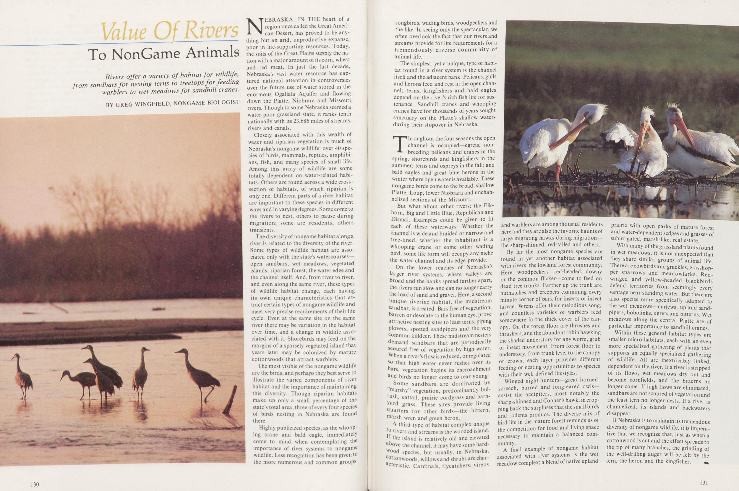
Value of Rivers To NonGame Animals
Rivers offer a variety of habitat for wildlife, from sandbars for nesting terns to treetops for feeding warblers to wet meadows for sandhill cranes.
BY GREG WINGFIELD, NONGAME BIOLOGISTNEBRASKA, IN THE heart of a region once called the Great American Desert, has proved to be anything but an arid, unproductive expanse, poor in life-supporting resources. Today, the soils of the Great Plains supply the nation with a major amount of its corn, wheat and red meat. In just the last decade, Nebraska's vast water resource has captured national attention in controversies over the future use of water stored in the enormous Ogallala Aquifer and flowing down the Platte, Niobrara and Missouri rivers. Though to some Nebraska seemed a water-poor grassland state, it ranks tenth nationally with its 23,686 miles of streams, rivers and canals.
Closely associated with this wealth of water and riparian vegetation is much of Nebraska's nongame wildlife: over 40 species of birds, mammals, reptiles, amphibians, fish, and many species of small life. Among this array of wildlife are some totally dependent on water-related habitats. Others are found across a wide cross-section of habitats, of which riparian is only one. Different parts of a river habitat are important to these species in different ways and in varying degrees. Some come to the rivers to nest, others to pause during migration; some are residents, others transients.
The diversity of nongame habitat along a river is related to the diversity of the river. Some types of wildlife habitat are associated only with the state's watercourses—open sandbars, wet meadows, vegetated islands, riparian forest, the water edge and the channel itself. And, from river to river, and even along the same river, these types of wildlife habitat change, each having its own unique characteristics that attract certain types of nongame wildlife and meet very precise requirements of their life cycle. Even at the same site on the same river there may be variation in the habitat over time, and a change in wildlife associated with it. Shorebirds may feed on the margins of a sparsely vegetated island that years later may be colonized by mature cottonwoods that attract warblers.
The most visible of the nongame wildlife are the birds, and perhaps they best serve to illustrate the varied components of river habitat and the importance of maintaining this diversity. Though riparian habitats make up only a small percentage of the state's total area, three of every four species of birds nesting in Nebraska are found there.
Highly publicized species, as the whooping crane and bald eagle, immediately come to mind when contemplating the importance of river systems to nongame wildlife. Less recognition has been given to the more numerous and common groups 130 songbirds, wading birds, woodpeckers and the like. In seeing only the spectacular, we often overlook the fact that our rivers and streams provide for life requirements for a tremendously diverse community of animal life.
The simplest, yet a unique, type of habitat found in a river system is the channel itself and the adjacent bank. Pelicans, gulls and herons feed and rest in the open channel; terns, kingfishers and bald eagles depend on the river's rich fish life for sustenance. Sandhill cranes and whooping cranes have for thousands of years sought sanctuary on the Platte's shallow waters during their stopover in Nebraska.
Throughout the four seasons the open channel is occupied—egrets, non-breeding pelicans and cranes in the spring; shorebirds and kingfishers in the summer; terns and ospreys in the fall; and bald eagles and great blue herons in the winter where open water is available. These nongame birds come to the broad, shallow Platte, Loup, lower Niobrara and unchannelized sections of the Missouri.
But what about other rivers: the Elkhorn, Big and Little Blue, Republican and Dismal. Examples could be given to fit each of these waterways. Whether the channel is wide and braided or narrow and tree-lined, whether the inhabitant is a whooping crane or some other wading bird, some life form will occupy any niche the water channel and its edge provide.
On the lower reaches of Nebraska's larger river systems, where valleys are broad and the banks spread farther apart, the rivers run slow and can no longer carry the load of sand and gravel. Here, a second unique riverine habitat, the midstream sandbar, is created. Bars free of vegetation, barren or desolate to the human eye, prove attractive nesting sites to least terns, piping plovers, spotted sandpipers and the very common killdeer. These midstream nesters demand sandbars that are periodically scoured free of vegetation by high water. When a river's flow is reduced, or regulated so that high water never rushes over its bars, vegetation begins its encroachment and birds no longer come to rear young.
Some sandbars are dominated by "marshy" vegetation, predominantly bulrush, cattail, prairie cordgrass and barnyard grass. These sites provide living quarters for other birds—the bittern, marsh wren and green heron.
A third type of habitat complex unique to rivers and streams is the wooded island. If the island is relatively old and elevated above the channel, it may have some hardWood species, but usually, in Nebraska, cottonwoods. willows and shrubs are characteristic, Cardinals, flycatchers, vireos and warblers are among the usual residents here and they are also the favorite haunts of large migrating hawks during migration—the sharp-shinned, red-tailed and others.
By far the most nongame species are found in yet another habitat associated with rivers: the lowland forest community. Here, woodpeckers—red-headed, downy or the common flicker—come to feed on dead tree trunks. Farther up the trunk are nuthatches and creepers examining every minute corner of bark for insects or insect larvae. Wrens offer their melodious song, and countless varieties of warblers feed somewhere in the thick cover of the canopy. On the forest floor are thrushes and thrashers, and the abundant robin hawking the shaded understory for any worm, grub or insect movement. From forest floor to understory, from trunk level to the canopy or crown, each layer provides different feeding or nesting opportunities to species with their well defined lifestyles.
Winged night hunters—great-horned, screech, barred and long-eared owls-assist the accipiters, most notably the sharp-shinned and Cooper's hawk, in cropping back the surpluses that the small birds and rodents produce. The diverse mix of bird life in the mature forest reminds us of the competition for food and living space necessary to maintain a balanced community.
A final example of nongame habitat associated with river systems is the wet meadow complex; a blend of native upland prairie with open parks of mature forest and water-dependent sedges and grasses of subirrigated, marsh-like, real estate.
With many of the grassland plants found in wet meadows, it is not unexpected that they share similar groups of animal life. There are cowbirds and grackles, grasshopper sparrows and meadowlarks. Redwinged and yellow-headed blackbirds defend territories from seemingly every vantage near standing water. But there are also species more specifically adapted to the wet meadows—curlews, upland sand-pipers, bobolinks, egrets and bitterns. Wet meadows along the central Platte are of particular importance to sandhill cranes.
Within these general habitat types are smaller micro-habitats, each with an even more specialized gathering of plants that supports an equally specialized gathering of wildlife. All are inextricably linked, dependent on the river. If a river is stripped of its flows, wet meadows dry out and become cornfields, and the bitterns no longer come. If high flows are eliminated, sandbars are not scoured of vegetation and the least tern no longer nests. If a river is channelized, its islands and backwaters disappear.
If Nebraska is to maintain its tremendous diversity of nongame wildlife, it is imperative that we recognize that, just as when a cottonwood is cut and the effect spreads to the tip of many branches, the grinding of the well-drilling auger will be felt by the tern, the heron and the kingfisher.
131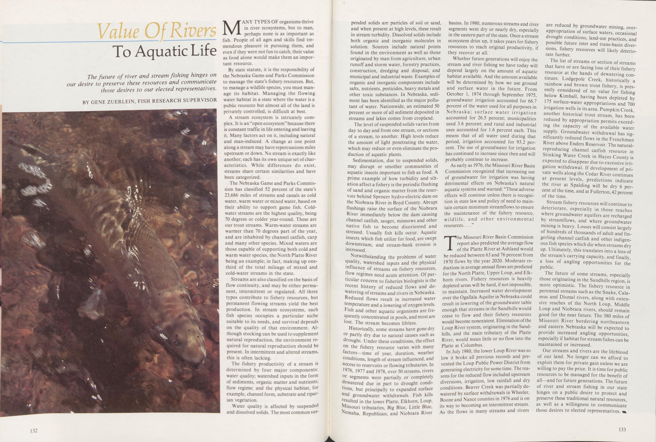
Value Uf Rivers To Aquatic Life
The future of river and stream fishing hinges on our desire to preserve these resources and communicate those desires to our elected representatives. BY GENE ZUERLEIN, FISH RESEARCH SUPERVISORMANY TYPES OF organisms thrive in river ecosystems, but to man, perhaps none is as important as fish. People of all ages and skills find tremendous pleasure in pursuing them, and even if they were not fun to catch, their value as food alone would make them an important resource.
By state statute, it is the responsibility of the Nebraska Game and Parks Commission to manage the state's fishery resources. But, to manage a wildlife species, you must manage its habitat. Managing the flowing water habitat in a state where the water is a public resource but almost all of the land is privately controlled, is difficult at best.
A stream ecosystem is intricately complex. It is an "open ecosystem" because there is constant traffic in life entering and leaving it. Many factors act on it, including natural and man-induced. A change at one point along a stream may have repercussions miles upstream or down. No stream is exactly like another; each has its own unique set of characteristics. While differences do exist, streams share certain similarities and have been categorized.
The Nebraska Game and Parks Commission has classified 52 percent of the state's 23,686 miles of streams and canals as cold water, warm water or mixed water, based on their ability to support game fish. Coldwater streams are the highest quality, being 70 degrees or colder year-round. These are our trout streams. Warm-water streams are warmer than 70 degrees part of the year, and are inhabited by channel catfish, carp and many other species. Mixed waters are those capable of supporting both cold and warm water species, the North Platte River being an example; in fact, making up one-third of the total mileage of mixed and cold-water streams in the state.
Streams are also classified on the basis of flow continuity, and may be either permanent, intermittent or regulated. All three types contribute to fishery resources, but permanent flowing streams yield the best production. In stream ecosystems, each fish species occupies a particular niche suitable to its needs, and survival depends on the quality of that environment. Although stocking can be used to supplement natural reproduction, the environment required for natural reproduction should be present. In intermittent and altered streams, this is often lacking.
The fishery productivity of a stream is determined by four major components: water quality; watershed inputs in the form of sediments, organic matter and nutrients: flow regime; and the physical habitat, for example, channel form, substrate and riparian vegetation. Water quality is affected by suspended and dissolved solids. The most common suspended 132 solids are particles of soil or sand, and when present at high levels, these result in stream turbidity. Dissolved solids include both organic and inorganic molecules in solution. Sources include natural points found in the environment as well as those originated by man from agriculture, urban runoff and storm water, forestry practices, construction, dredging and disposal, and municipal and industrial waste. Examples of organic and inorganic components include salts, nutrients, pesticides, heavy metals and other toxic substances. In Nebraska, sediment has been identified as the major pollutant of water. Nationwide, an estimated 50 percent or more of all sediment deposited in streams and lakes comes from cropland.
The level of suspended solids varies from day to day and from one stream, or sections of a stream, to another. High levels reduce the amount of light penetrating the water, which may reduce or even eliminate the production of aquatic plants.
Sedimentation, due to suspended solids, may disrupt or smother communities of aquatic insects important to fish as food. A prime example of how turbidity and siltation affect a fishery is the periodic flushing of sand and organic matter from the reservoir behind Spencer hydro-electric dam on the Niobrara River in Boyd County. Abrupt flushings raise the surface of the Niobrara River immediately below the dam causing channel catfish, sauger, minnows and other native fish to become disoriented and stressed. Usually fish kills occur. Aquatic insects which fish utilize for food, are swept downstream, and stream-bank erosion is increased.
Notwithstanding the problems of water quality, watershed inputs and the physical influence of streams on fishery resources, flow regimes need acute attention. Of particular concern to fisheries biologists is the recent history of reduced flows and dewatering of streams and rivers in Nebraska. Reduced flows result in increased water temperature and a lowering of oxygen levels. Fish and other aquatic organisms are frequently concentrated in pools, and most are lost. The stream becomes lifeless.
Historically, some streams have gone dry or partly dry due to natural causes such as drought. Under these conditions, the effect 0n the fishery resource varies with many factors—time of year, duration, weather conditions, length of stream influenced, and access to reservoirs or flowing tributaries. In ,9?6, 1977 and 1978, over 50 streams, rivers or segments were partially or completely dewatered due in part to drought condions, but principally to expanded surface and groundwater withdrawals. Fish kills resulted in the lower Platte, Elkhorn, Loup, Missouri tributaries. Big Blue, Little Blue, Nemaha, Republican, and Niobrara River basins. In 1980, numerous streams and river segments went dry or nearly dry, especially in the eastern part of the state. Once a stream ecosystem dries up, it takes years for fishery resources to reach original productivity, if they recover at all.
Whether future generations will enjoy the stream and river fishing we have today will depend largely on the amount of aquatic habitat available. And the amount available will be determined by how we use ground and surface water in the future. From October 1, 1974 through September 1975, groundwater irrigation accounted for 66.7 percent of the water used for all purposes in Nebraska; surface water irrigation accounted for 26.5 percent; municipalities used 3.6 percent; and rural and industrial uses accounted for 1.6 percent each. This means that of all water used during that period, irrigation accounted for 93.2 percent. The use of groundwater for irrigation has continued to increase since then and will probably continue to increase.
As early as 1976, the Missouri River Basin Commission recognized that increasing use of groundwater for irrigation was having detrimental effects on Nebraska's natural aquatic systems and warned: "These adverse effects will continue unless there is recognition in state law and policy of need to maintain certain minimum streamflows to ensure the maintenance of the fishery resource, wildlife, and other environmental resources."
The Missouri River Basin Commission report also predicted the average flow of the Platte River at Ashland would be reduced between 63 and 76 percent from 1970 flows by the year 2020. Moderate reductions in average annual flows are predicted for the North Platte, Upper Loup, and Elkhorn rivers. Fishery resources is heavily depleted areas will be hard, if not impossible, to maintain. Increased water development over the Ogallala Aquifer in Nebraska could result in lowering of the groundwater table enough that streams in the Sandhills would cease to flow and their fishery resources would become nonexistent. Elimination of the Loup River system, originating in the Sandhills, and the main tributary of the Platte River, would mean little or no flow into the Platte at Columbus.
In July 1980, the lower Loup River was so low it broke all previous records and prevented the Loup Public Power District from generating electricity for some time. The reasons for the reduced flow included upstream diversions, irrigation, low rainfall and dry conditions. Beaver Creek was partially dewatered by surface withdrawals in Wheeler, Boone and Nance counties in 1976 and is on its way to becoming an intermittent stream. As the flows in many streams and rivers are reduced by groundwater mining, over-appropriation of surface waters, occasional drought conditions, land-use practices, and possible future inter and trans-basin diversions, fishery resources will likely deteriorate further.
The list of streams or section of streams that have or are facing loss of their fishery resource at the hands of dewatering continues: Lodgepole Creek, historically a rainbow and brown trout fishery, is presently considered of no value for fishing below Kimball, having been depleted by 175 surface-water appropriations and 700 irrigation wells in its area. Pumpkin Creek, another historical trout stream, has been reduced by appropriation permits exceeding the capacity of the available water supply. Groundwater withdrawal has significantly reduced flows in the Frenchman River above Enders Reservoir. The natural-reproducing channel catfish resource in Stinking Water Creek in Hayes County is expected to disappear due to excessive irrigation withdrawal. If development of private wells along the Cedar River continues at present levels, predictions indicate the river at Spalding will be dry 6 percent of the time, and at Fullerton, 42 percent of the time.
Stream fishery resources will continue to deteriorate, especially in those reaches where groundwater aquifers are recharged by streamflows, and where groundwater mining is heavy. Losses will consist largely of hundreds of thousands of adult and fingerling channel catfish and other indigenous fish species which die when streams dry up. Ultimately, this translates into a loss of the stream's carrying capacity, and finally, a loss of angling opportunities for the public.
The future of some streams, especially those originating in the Sandhills region, is more optimistic. The fishery resource in perennial streams such as the Snake, Calamus and Dismal rivers, along with extensive reaches of the North Loup, Middle Loup and Niobrara rivers, should remain good for the near future. The 380 miles of Missouri River bordering northeastern and eastern Nebraska will be expected to provide increased angling opportunities, especially if habitat for stream fishes can be maintained or increased.
Our streams and rivers are the lifeblood of our land. No longer can we afford to exploit them for private gain unless we are willing to pay the price. It is time for public resources to be managed for the benefit of all—and for future generations. The future of river and stream fishing in our state hinges on a public desire to protect and preserve these traditional natural resources, as well as a willingness to communicate those desires to elected representatives.
133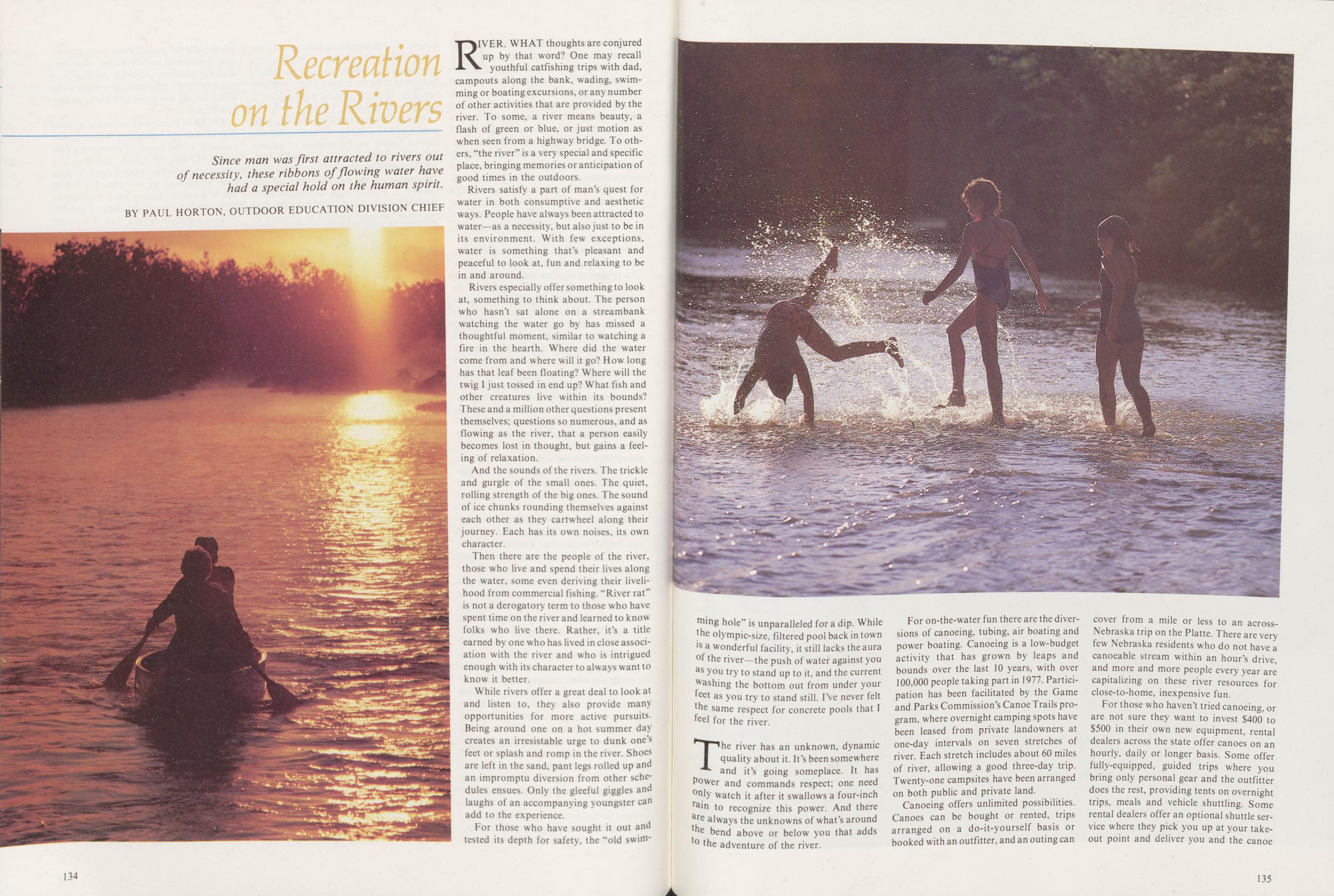
Recreation on the Rivers
Since man was first attracted to rivers out of necessity, these ribbons of flowing water have had a special hold on the human spirit. BY PAUL HORTON, OUTDOOR EDUCATION DIVISION CHIEFRIVER. WHAT thoughts are conjured up by that word? One may recall youthful catfishing trips with dad, campouts along the bank, wading, swimming or boating excursions, or any number of other activities that are provided by the river. To some, a river means beauty, a flash of green or blue, or just motion as when seen from a highway bridge. To others, "the river" is a very special and specific place, bringing memories or anticipation of good times in the outdoors.
Rivers satisfy a part of man's quest for water in both consumptive and aesthetic ways. People have always been attracted to water—as a necessity, but also just to be in its environment. With few exceptions, water is something that's pleasant and peaceful to look at, fun and relaxing to be in and around.
Rivers especially offer something to look at, something to think about. The person who hasn't sat alone on a streambank watching the water go by has missed a thoughtful moment, similar to watching a fire in the hearth. Where did the water come from and where will it go? How long has that leaf been floating? Where will the twig I just tossed in end up? What fish and other creatures live within its bounds? These and a million other questions present themselves; questions so numerous, and as flowing as the river, that a person easily becomes lost in thought, but gains a feeling of relaxation.
And the sounds of the rivers. The trickle and gurgle of the small ones. The quiet, rolling strength of the big ones. The sound of ice chunks rounding themselves against each other as they cartwheel along their journey. Each has its own noises, its own character.
Then there are the people of the river, those who live and spend their lives along the water, some even deriving their livelihood from commercial fishing. "River rat" is not a derogatory term to those who have spent time on the river and learned to know folks who live there. Rather, it's a title earned by one who has lived in close association with the river and who is intrigued enough with its character to always want to know it better.
While rivers offer a great deal to look at and listen to, they also provide many opportunities for more active pursuits. Being around one on a hot summer day creates an irresistable urge to dunk one's feet or splash and romp in the river. Shoes are left in the sand, pant legs rolled up and an impromptu diversion from other schedules ensues. Only the gleeful giggles and laughs of an accompanying youngster can add to the experience.
For those who have sought it out and tested its depth tor safety, the "old swimming 134
The river has an unknown, dynamic quality about it. It's been somewhere and it's going someplace. It has power and commands respect; one need only watch it after it swallows a four-inch rain to recognize this power. And there are always the unknowns of what's around the bend above or below you that adds to the adventure of the river.
For on-the-water fun there are the diversions of canoeing, tubing, air boating and power boating. Canoeing is a low-budget activity that has grown by leaps and bounds over the last 10 years, with over 100,000 people taking part in 1977. Participation has been facilitated by the Game and Parks Commission's Canoe Trails program, where overnight camping spots have been leased from private landowners at one-day intervals on seven stretches of river. Each stretch includes about 60 miles of river, allowing a good three-day trip. Twenty-one campsites have been arranged on both public and private land.
Canoeing offers unlimited possibilities. Canoes can be bought or rented, trips arranged on a do-it-yourself basis or booked with an outfitter, and an outing can cover from a mile or less to an across-Nebraska trip on the Platte. There are very few Nebraska residents who do not have a canoeable stream within an hour's drive, and more and more people every year are capitalizing on these river resources for close-to-home, inexpensive fun.
For those who haven't tried canoeing, or are not sure they want to invest $400 to $500 in their own new equipment, rental dealers across the state offer canoes on an hourly, daily or longer basis. Some offer fully-equipped, guided trips where you bring only personal gear and the outfitter does the rest, providing tents on overnight trips, meals and vehicle shuttling. Some rental dealers offer an optional shuttle service where they pick you up at your takeout point and deliver you and the canoe 135 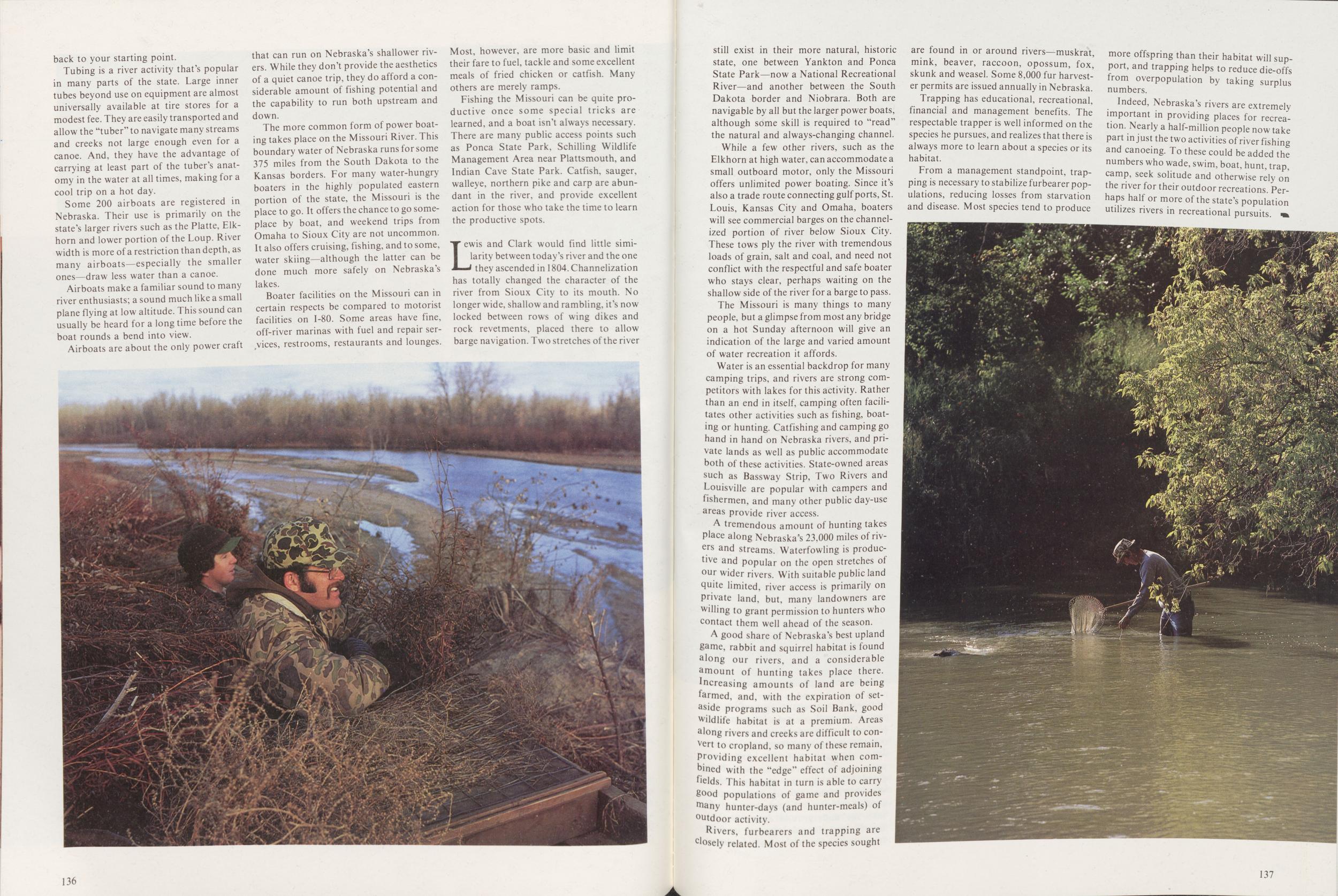 back to your starting point.
Tubing is a river activity that's popular in many parts of the state. Large inner tubes beyond use on equipment are almost universally available at tire stores for a modest fee. They are easily transported and allow the "tuber" to navigate many streams and creeks not large enough even for a canoe. And, they have the advantage of carrying at least part of the tuber's anatomy in the water at all times, making for a cool trip on a hot day.
Some 200 airboats are registered in Nebraska. Their use is primarily on the state's larger rivers such as the Platte, Elkhorn and lower portion of the Loup. River width is more of a restriction than depth, as many airboats—especially the smaller ones—draw less water than a canoe.
Airboats make a familiar sound to many river enthusiasts; a sound much like a small plane flying at low altitude. This sound can usually be heard for a long time before the boat rounds a bend into view.
Airboats are about the only power craft that can run on Nebraska's shallower rivers. While they don't provide the aesthetics of a quiet canoe trip, they do afford a considerable amount of fishing potential and the capability to run both upstream and down.
The more common form of power boating takes place on the Missouri River. This boundary water of Nebraska runs for some 375 miles from the South Dakota to the Kansas borders. For many water-hungry boaters in the highly populated eastern portion of the state, the Missouri is the place to go. It offers the chance to go someplace by boat, and weekend trips from Omaha to Sioux City are not uncommon. It also offers cruising, fishing, and to some, water skiing—although the latter can be done much more safely on Nebraska's lakes.
Boater facilities on the Missouri can in certain respects be compared to motorist facilities on 1-80. Some areas have fine, off-river marinas with fuel and repair services, restrooms, restaurants and lounges. Most, however, are more basic and limit their fare to fuel, tackle and some excellent meals of fried chicken or catfish. Many others are merely ramps.
Fishing the Missouri can be quite productive once some special tricks are learned, and a boat isn't always necessary. There are many public access points such as Ponca State Park, Schilling Wildlife Management Area near Plattsmouth, and Indian Cave State Park. Catfish, sauger, walleye, northern pike and carp are abundant in the river, and provide excellent action for those who take the time to learn the productive spots.
Lewis and Clark would find little similarity between today's river and the one they ascended in 1804. Channelization has totally changed the character of the river from Sioux City to its mouth. No longer wide, shallow and rambling, it's now locked between rows of wing dikes and rock revetments, placed there to allow barge navigation. Two stretches of the river
While a few other rivers, such as the Elkhorn at high water, can accommodate a small outboard motor, only the Missouri offers unlimited power boating. Since it's also a trade route connecting gulf ports, St. Louis, Kansas City and Omaha, boaters will see commercial barges on the channelized portion of river below Sioux City. These tows ply the river with tremendous loads of grain, salt and coal, and need not conflict with the respectful and safe boater who stays clear, perhaps waiting on the shallow side of the river for a barge to pass.
The Missouri is many things to many people, but a glimpse from most any bridge on a hot Sunday afternoon will give an indication of the large and varied amount of water recreation it affords.
Water is an essential backdrop for many camping trips, and rivers are strong competitors with lakes for this activity. Rather than an end in itself, camping often facilitates other activities such as fishing, boating or hunting. Catfishing and camping go hand in hand on Nebraska rivers, and private lands as well as public accommodate both of these activities. State-owned areas such as Bassway Strip, Two Rivers and Louisville are popular with campers and fishermen, and many other public day-use areas provide river access.
A tremendous amount of hunting takes Place along Nebraska's 23.000 miles of rivers and streams. Waterfowling is productive and popular on the open stretches of our wider rivers. With suitable public land quite limited, river access is primarily on private land, but, many landowners are willing to grant permission to hunters who contact them well ahead of the season.
A good share of Nebraska's best upland game, rabbit and squirrel habitat is found along our rivers, and a considerable amount of hunting takes place there, increasing amounts of land are being farmed, and, with the expiration of set-aside programs such as Soil Bank, good wildlife habitat is at a premium. Areas along rivers and creeks are difficult to convert to cropland, so many of these remain, Providing excellent habitat when combined with the "edge" effect of adjoining fields. This habitat in turn is able to carry good populations of game and provides many hunter-days (and hunter-meals) of outdoor activity.
Rivers, furbearers and trapping are Closely related. Most of the species sought are found in or around rivers—muskrat, mink, beaver, raccoon, opossum, fox, skunk and weasel. Some 8,000 fur harvester permits are issued annually in Nebraska.
Trapping has educational, recreational, financial and management benefits. The respectable trapper is well informed on the species he pursues, and realizes that there is always more to learn about a species or its habitat.
From a management standpoint, trapping is necessary to stabilize furbearer populations, reducing losses from starvation and disease. Most species tend to produce more offspring than their habitat will support, and trapping helps to reduce die-offs from overpopulation by taking surplus numbers.
Indeed, Nebraska's rivers are extremely important in providing places for recreation. Nearly a half-million people now take part in just the two activities of river fishing and canoeing. To these could be added the numbers who wade, swim, boat, hunt, trap, camp, seek solitude and otherwise rely on the river for their outdoor recreations. Perhaps half or more of the state's population utilizes rivers in recreational pursuits.
Managing the Rivers
Legislation may be our last resort to preserve the flow of Nebraska rivers, but the awesome responsibility of preserving the water's quality rests with private landowners. BY GERALD CHAFFIN, WATER RESOURCE ANALYSTTHERE DOESNT seem to be enough water to go around anymore. At any rate, hardly a week passes that competition and disputes over Nebraska's water don't make the newspapers. And according to those news articles, some folks would not allow any water to leave the state, even diverting it from one river system to another. There are plans to build new reservoirs to store it, and talk of limiting its extraction from the underground reservoir. Water is at the heart of each of these issues, and the rivers and streams are the arteries through which it flows.
Frequently, and from either side of any water issue, is heard the cry, "there ought to be a law." At one time or another, nearly all major water issues put in an appearance before Congress, State Legislature, or the courts. The hazard in shaping each piece of the water resource puzzle separately is that when finished, they may not fit together. We often take the narrow view and fail to see the broad scene. To understand one issue, we must understand the whole complex system that influences supplies and quality of Nebraska water.
WATERSHED MANAGEMENTAll water flowing in our streams initially comes from precipitation in the watershed above. This rain and snow melt enters streams as overland runoff or outflow from groundwater reservoirs. Virtually the entire flow of some streams is derived from groundwater, while others receive hardly any. Most Nebraska streams, though, are supported by both. Typically, streams supported by groundwater flows are stable, while runoff streams are highly variable, fluctuating with rainfall and snow melt.
An important factor influencing whether a stream's flow is supplemented by groundwater is the management of its watershed. Therefore, the land-management decisions of thousands of farmers and ranchers are especially important to maintaining minimum flows during drought years. Their challenge is to use the land according to its capability and treat it according to its needs.
On a well managed watershed, erosion-prone soils are maintained in perennial plant cover and used as range, woodlands or forests, or as wildlife areas. Soils less subject to erosion may be tilled for crop production if practices such as crop residue management, grassed waterways and terraces, erosion-control dams, and floodwater-retention reservoirs are used. These practices maximize the quantity of water that soaks into the soil, increasing the amount that passes through the soil profile into the underground reservoir. Ultimately, years, decades or even centuries later, the water that escapes immediate 138 uptake by growing plants, may seep into a wetland or into a river. Even during periods of unusually heavy precipitation, runoff from properly managed rangeland or cropland will not carry a damaging sediment load.
The awesome responsibility for the wise management of Nebraska watersheds rests with private landowners, but technical assistance and information are available. Natural resources districts have the legal responsibility to influence soil conservation and watershed management at the local level. At the state level, the Natural Resources Commission participates in soil conservation, erosion control and watershed programs. The University of Nebraska Institute of Agriculture and Natural Resources has several programs dealing with soil conservation and erosion control. These include education and technical assistance offered by the Extension Service and the State Forester's office, and research and data collection by the Conservation
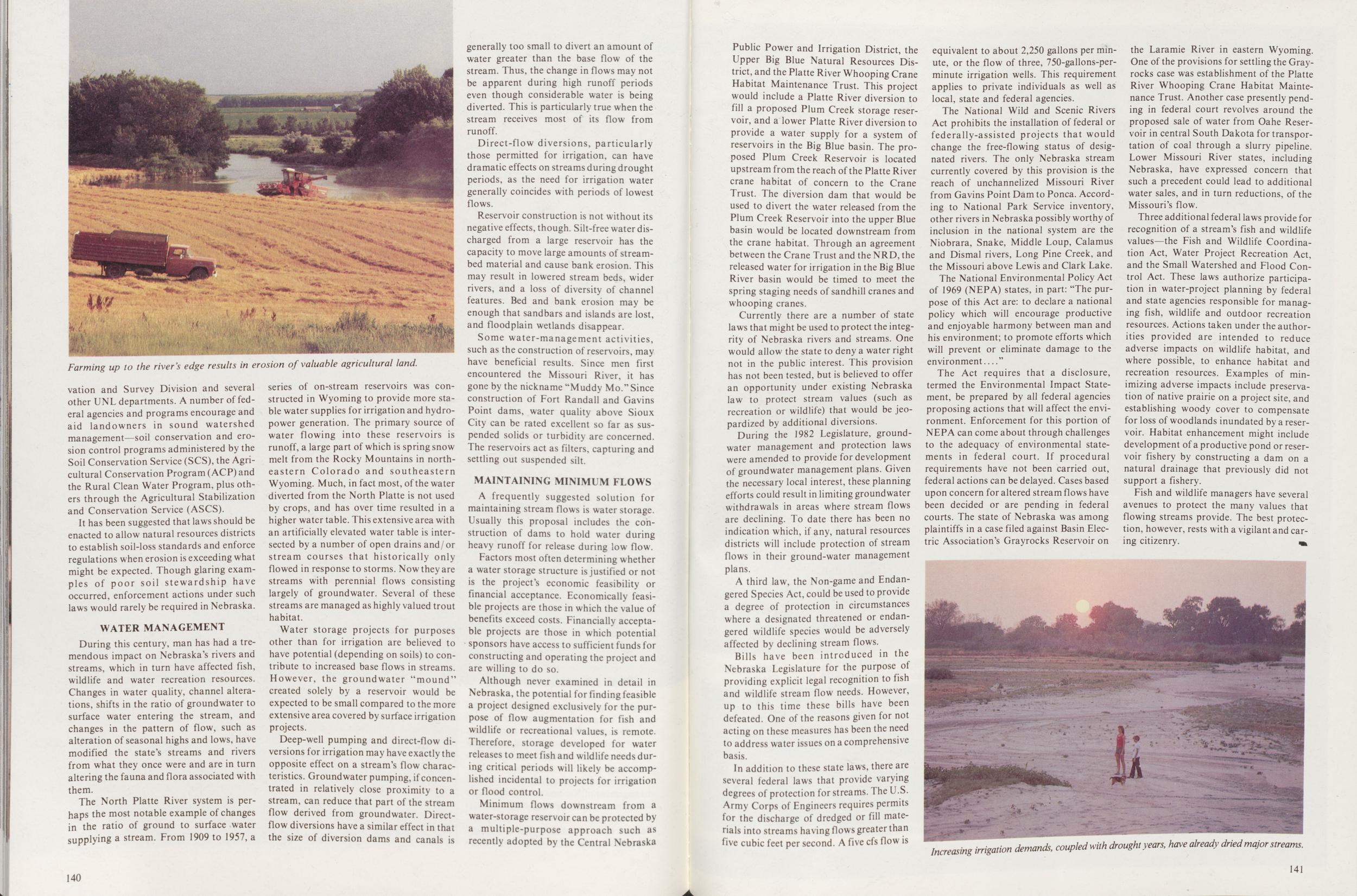
It has been suggested that laws should be enacted to allow natural resources districts to establish soil-loss standards and enforce regulations when erosion is exceeding what might be expected. Though glaring examples of poor soil stewardship have occurred, enforcement actions under such laws would rarely be required in Nebraska.
WATER MANAGEMENTDuring this century, man has had a tremendous impact on Nebraska's rivers and streams, which in turn have affected fish, wildlife and water recreation resources. Changes in water quality, channel alterations, shifts in the ratio of groundwater to surface water entering the stream, and changes in the pattern of flow, such as alteration of seasonal highs and lows, have modified the state's streams and rivers from what they once were and are in turn altering the fauna and flora associated with them.
The North Platte River system is perhaps the most notable example of changes in the ratio of ground to surface water supplying a stream. From 1909 to 1957, a series of on-stream reservoirs was constructed in Wyoming to provide more stable water supplies for irrigation and hydro-power generation. The primary source of water flowing into these reservoirs is runoff, a large part of which is spring snow melt from the Rocky Mountains in northeastern Colorado and southeastern Wyoming. Much, in fact most, of the water diverted from the North Platte is not used by crops, and has over time resulted in a higher water table. This extensive area with an artificially elevated water table is intersected by a number of open drains and/ or stream courses that historically only flowed in response to storms. Now they are streams with perennial flows consisting largely of groundwater. Several of these streams are managed as highly valued trout habitat.
Water storage projects for purposes other than for irrigation are believed to have potential (depending on soils) to contribute to increased base flows in streams. However, the groundwater "mound' created solely by a reservoir would be expected to be small compared to the more extensive area covered by surface irrigation projects.
Deep-well pumping and direct-flow diversions for irrigation may have exactly the opposite effect on a stream's flow characteristics. Groundwater pumping, if concentrated in relatively close proximity to a stream, can reduce that part of the stream flow derived from groundwater. Direct-flow diversions have a similar effect in that the size of diversion dams and canals is generally too small to divert an amount of water greater than the base flow of the stream. Thus, the change in flows may not be apparent during high runoff periods even though considerable water is being diverted. This is particularly true when the stream receives most of its flow from runoff.
Direct-flow diversions, particularly those permitted for irrigation, can have dramatic effects on streams during drought periods, as the need for irrigation water generally coincides with periods of lowest flows.
Reservoir construction is not without its negative effects, though. Silt-free water discharged from a large reservoir has the capacity to move large amounts of stream-bed material and cause bank erosion. This may result in lowered stream beds, wider rivers, and a loss of diversity of channel features. Bed and bank erosion may be enough that sandbars and islands are lost, and floodplain wetlands disappear.
Some water-management activities, such as the construction of reservoirs, may have beneficial results. Since men first encountered the Missouri River, it has gone by the nickname "Muddy Mo." Since construction of Fort Randall and Gavins Point dams, water quality above Sioux City can be rated excellent so far as suspended solids or turbidity are concerned. The reservoirs act as filters, capturing and settling out suspended silt.
MAINTAINING MINIMUM FLOWSA frequently suggested solution for maintaining stream flows is water storage. Usually this proposal includes the construction of dams to hold water during heavy runoff for release during low flow.
Factors most often determining whether a water storage structure is justified or not is the project's economic feasibility or financial acceptance. Economically feasible projects are those in which the value of benefits exceed costs. Financially acceptable projects are those in which potential sponsors have access to sufficient funds for constructing and operating the project and are willing to do so.
Although never examined in detail in Nebraska, the potential for finding feasible a project designed exclusively for the purpose of flow augmentation for fish and wildlife or recreational values, is remote. Therefore, storage developed for water releases to meet fish and wildlife needs during critical periods will likely be accomplished incidental to projects for irrigation or flood control.
Minimum flows downstream from a water-storage reservoir can be protected by a multiple-purpose approach such as recently adopted by the Central Nebraska 140 Public Power and Irrigation District, the Upper Big Blue Natural Resources District, and the Platte River Whooping Crane Habitat Maintenance Trust. This project would include a Platte River diversion to fill a proposed Plum Creek storage reservoir, and a lower Platte River diversion to provide a water supply for a system of reservoirs in the Big Blue basin. The proposed Plum Creek Reservoir is located upstream from the reach of the Platte River crane habitat of concern to the Crane Trust. The diversion dam that would be used to divert the water released from the Plum Creek Reservoir into the upper Blue basin would be located downstream from the crane habitat. Through an agreement between the Crane Trust and the NRD, the released water for irrigation in the Big Blue River basin would be timed to meet the spring staging needs of sandhill cranes and whooping cranes.
Currently there are a number of state laws that might be used to protect the integrity of Nebraska rivers and streams. One would allow the state to deny a water right not in the public interest. This provision has not been tested, but is believed to offer an opportunity under existing Nebraska law to protect stream values (such as recreation or wildlife) that would be jeopardized by additional diversions.
During the 1982 Legislature, groundwater management and protection laws were amended to provide for development of groundwater management plans. Given the necessary local interest, these planning efforts could result in limiting groundwater withdrawals in areas where stream flows are declining. To date there has been no indication which, if any, natural resources districts will include protection of stream flows in their ground-water management plans.
A third law, the Non-game and Endangered Species Act, could be used to provide a degree of protection in circumstances where a designated threatened or endangered wildlife species would be adversely affected by declining stream flows.
Bills have been introduced in the Nebraska Legislature for the purpose of providing explicit legal recognition to fish and wildlife stream flow needs. However, up to this time these bills have been defeated. One of the reasons given for not acting on these measures has been the need to address water issues on a comprehensive basis.
In addition to these state laws, there are several federal laws that provide varying degrees of protection for streams. The U.S. Army Corps of Engineers requires permits for the discharge of dredged or fill materials into streams having flows greater than five cubic feet per second. A five cfs flow is equivalent to about 2,250 gallons per minute, or the flow of three, 750-gallons-per-minute irrigation wells. This requirement applies to private individuals as well as local, state and federal agencies.
The National Wild and Scenic Rivers Act prohibits the installation of federal or federally-assisted projects that would change the free-flowing status of designated rivers. The only Nebraska stream currently covered by this provision is the reach of unchannelized Missouri River from Gavins Point Dam to Ponca. According to National Park Service inventory, other rivers in Nebraska possibly worthy of inclusion in the national system are the Niobrara, Snake, Middle Loup, Calamus and Dismal rivers, Long Pine Creek, and the Missouri above Lewis and Clark Lake.
The National Environmental Policy Act of 1969 (NEPA) states, in part: "The purpose of this Act are: to declare a national policy which will encourage productive and enjoyable harmony between man and his environment; to promote efforts which will prevent or eliminate damage to the environment"
The Act requires that a disclosure, termed the Environmental Impact Statement, be prepared by all federal agencies proposing actions that will affect the environment. Enforcement for this portion of NEPA can come about through challenges to the adequacy of environmental statements in federal court. If procedural requirements have not been carried out, federal actions can be delayed. Cases based upon concern for altered stream flows have been decided or are pending in federal courts. The state of Nebraska was among plaintiffs in a case filed against Basin Electric Association's Grayrocks Reservoir on the Laramie River in eastern Wyoming. One of the provisions for settling the Gray-rocks case was establishment of the Platte River Whooping Crane Habitat Maintenance Trust. Another case presently pending in federal court revolves around the proposed sale of water from Oahe Reservoir in central South Dakota for transportation of coal through a slurry pipeline. Lower Missouri River states, including Nebraska, have expressed concern that such a precedent could lead to additional water sales, and in turn reductions, of the Missouri's flow.
Three additional federal laws provide for recognition of a stream's fish and wildlife values—the Fish and Wildlife Coordination Act, Water Project Recreation Act, and the Small Watershed and Flood Control Act. These laws authorize participation in water-project planning by federal and state agencies responsible for managing fish, wildlife and outdoor recreation resources. Actions taken under the authorities provided are intended to reduce adverse impacts on wildlife habitat, and where possible, to enhance habitat and recreation resources. Examples of minimizing adverse impacts include preservation of native prairie on a project site, and establishing woody cover to compensate for loss of woodlands inundated by a reservoir. Habitat enhancement might include development of a productive pond or reservoir fishery by constructing a dam on a natural drainage that previously did not support a fishery.
Fish and wildlife managers have several avenues to protect the many values that flowing streams provide. The best protection, however, rests with a vigilant and caring citizenry.
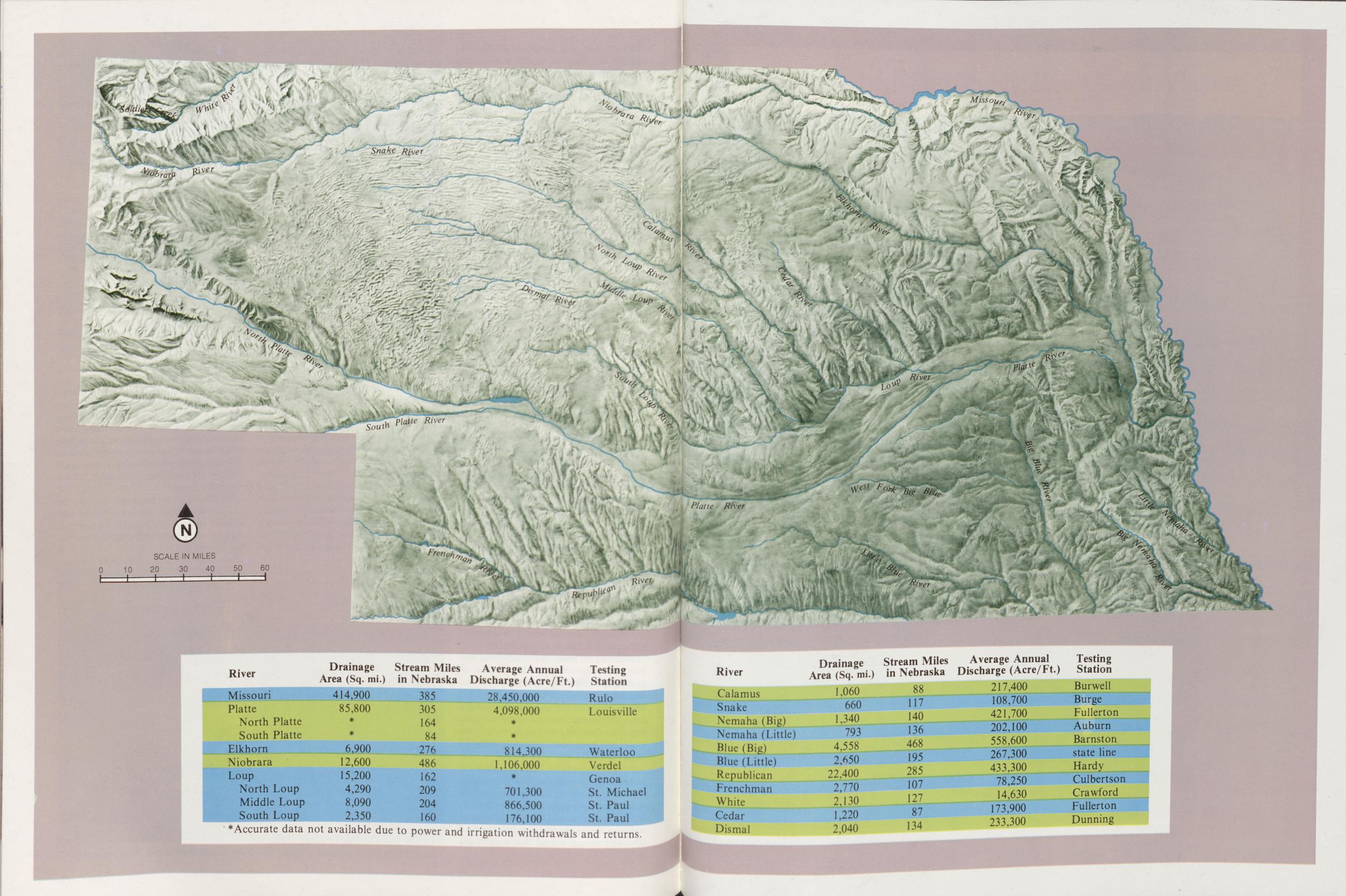
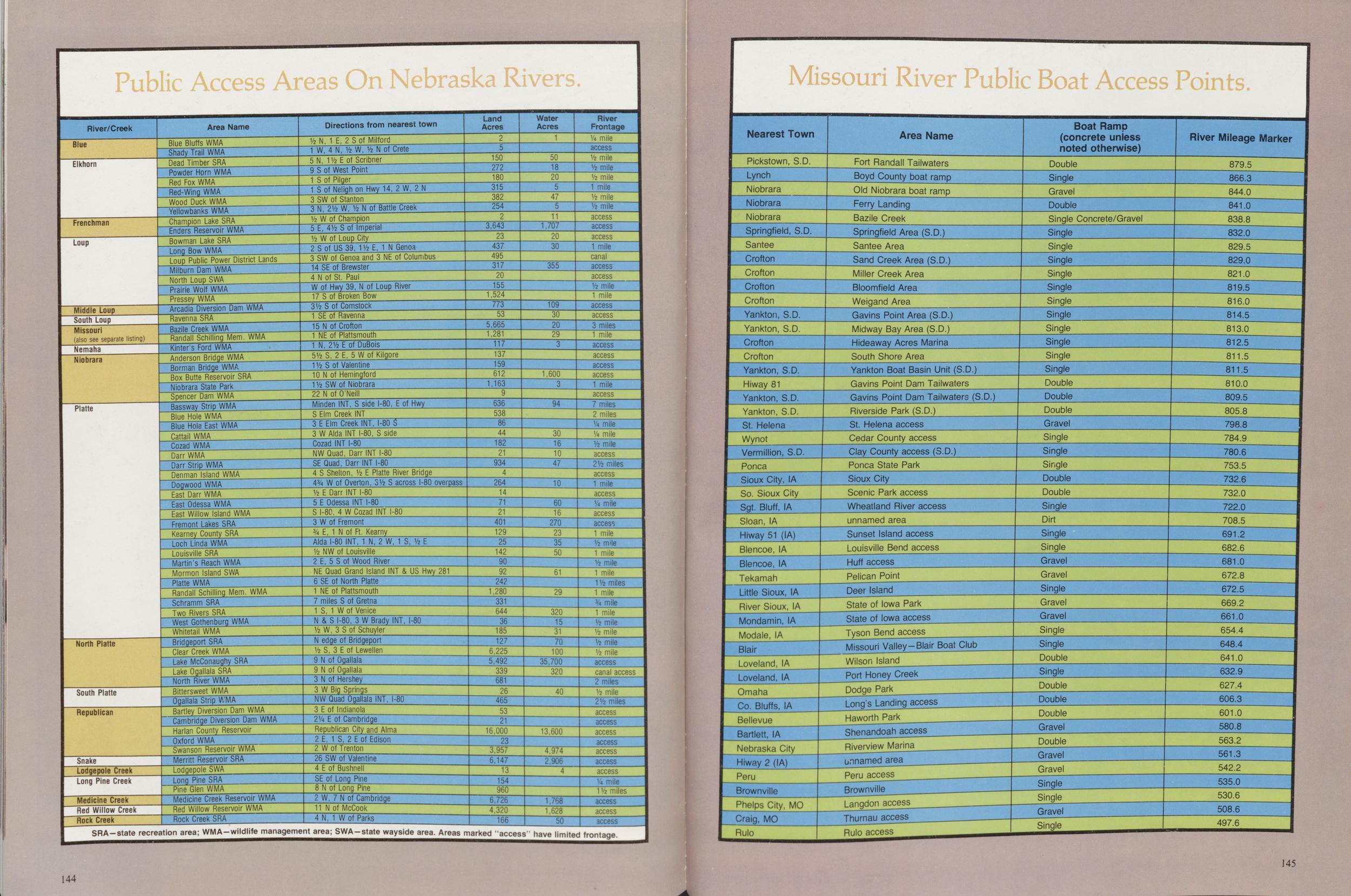 Area Name Blue Bluffs WMA Shady Trail WMA Dead Timber SRA Powder Horn WMA Red Fox WMA Red-Wing WMA Wood Duck WMA Yellowbanks WMA Champion Lake SRA Enders Reservoir WMA Bowman Lake SRA Long Bow WMA Loup Public Power District Lands Milburn Dam WMA North Loup SWA Prairie Wolf WMA Pressey WMA Arcadia Diversion Dam WMA Ravenna SRA Bazile Creek WMA Randall Schilling Mem. WMA Kinter's Ford WMA Anderson Bridge WMA Borman Bridge WMA Box Butte Reservoir SRA Niobrara State Park Spencer Dam WMA Bassway Strip WMA Blue Hole WMA Blue Hole East WMA Cattail WMA Cozad WMA Darr WMA Parr Strip WMA Denman Island WMA Rock Creek Dogwood WMA East Darr WMA East Odessa WMA East Willow Island WMA Fremont Lakes SRA Kearney County SRA Loch Linda WMA Louisville SRA Martin's Reach WMA Mormon Island SWA Platte WMA Randall Schilling Mem. WMA Schramm SRA Two Rivers SRA West Gothenburg WMA Whitetail WMA Bridgeport SRA Clear Creek WMA Lake McConaughy SRA Lake Ogallala SRA North River WMA Bittersweet WMA Ogallala Strip WMA Bartley Diversion Dam WMA Cambridge Diversion Dam WMA Harlan County Reservoir Oxford WMA Swanson Reservoir WMA Merritt Reservoir SRA Lodgepole SWA Long Pine SRA Pine Glen WMA Medicine Creek Reservoir WMA Red Willow Reservoir WMA Directions from nearest town Vz N, 1 E, 2 Sof Milford 1 W, 4 N, Vz W, Vz N of Crete 5 N, 1 1/2 E of Scribner 9 S of West Point 1 S of Pilger 1 S of Neligh on Hwy 14, 2 W, 2 N 3 SW of Stanton 3 N, 2 1/2 W, 1/2 N of Battle Creek 1/2 W of Champion 5 E, 4 1/2 S of Imperial 1/2 W of Loup City 2 S of US 39, 1 1/2 E, 1 N Genoa 3 SW of Genoa and 3 NE of Columbus 14 SE of Brewster Land Acres 150 272 180 315 382 254 3,643 23 437 495 4 N of St. Paul W of Hwy 39, N of Loup River 17 S of Broken Bow 3 1/2 S of Comstock 1 SE of Ravenna 15 N of Crofton 1 NE of Plattsmouth 1 N, 2 1/2 E of DuBois 5 1/2 S, 2 E, 5 W of Kilgore 1 1/2 S of Valentine 10 N of Hemingford 1 1/2 SW of Niobrara 22 N of O'Neill Minden INT, S side I-80, E of Hwy S Elm Creek INT 3 E Elm Creek INT, I-80 S 3 W Alda INT I-80, S side Cozad INT I-80 NWQuad, Darr INT I-80 SE Quad, Darr INT I-80 317 20 155 1,524 773 53 5,665 1,281 117 137 159 612 1,163 636 538 86 44 182 21 4 S Shelton, 1/2 E Platte River Bridge 4 3/4 W of Overton, 31/2 S across I-80 overpass 1/2 E Darr INT I-80 5 E Odessa INT I-80 S I-80, 4 W Cozad INT I-80 3 W of Fremont 3/4 E, 1 N of Ft. Kearny Alda I-80 INT, 1 N, 2 W, 1 S, 1/2 E 1/2 NW of Louisville 2 E, 5 S of Wood River NE Quad Grand Island INT & US Hwy 281 6 SE of North Platte 1 NE of Plattsmouth 7 miles S of Gretna 1 S, 1 W of Venice N & S I-80, 3 W Brady INT, I-80 1/2 W, 3 S of Schuyler N edge of Bridgeport 1/2 S, 3 E of Lewellen 9 N of Ogallala 934 264 14 71 21 401 129 25 142 90 92 242 1,280 331 644 36 185 127 6,225 9 N of Ogallala 3 N of Hershey 3 W Big Springs NW Quad Ogallala INT, I-80 3 E of Indianola 2 1/4 E of Cambridge Republican City and Alma 2 E, 1 S, 2 E of Edison 2 W of Trenton 26 SW of Valentine 4 E of Bushnell SE of Long Pine 8 N of Long Pine 2 W, 7 N of Cambridge 11 N of McCook 4 N, 1 W of Parks 5,492 339 681 26 Water Acres 1 50 18 20 47 11 1,707 20 30 355 109 30 20 29 1,600 94 30 16 10 47 10 60 16 270 23 35 50 61 29 465 53 21 16,000 23 3,957 6,147 13 154 960 6,726 4,320 320 15 31 70 100 35,700 320 40 13,600 4,974 2.906 1,768 1,628 River Frontage 1/4 mile access 1/2 mile 1/2 mile 1/2 mile 1 mile 1/2 mile 1/2 mile access access access 1 mile canal access access 1/2 mile 1 mile access access 3 miles 1 mile access access access access 1 mile access 7 miles 2 miles 1/4 mile 1/4 mile 1/2 mile access 2 1/2 miles access 1 mile access 1/4 mile access access 1 mile 1/2 mile 1 mile 1/2 mile 1 mile 1 1/2 miles 1 mile 3/4 mile 1 mile 1/2 mile 1/2 mile 1/2 mile 1/2 mile access canal access 2 miles 1/2 mile 2 1/2 miles access access access access access access access 1/4 mile 1 1/2 miles access access access Rock Creek Rock Creek SRA 4 N,1 W of Parks 166 56 SRA-state recreation area; WMA-wildlife management area; SWA-state wayside area. Areas marked access have limited frontage Missouri River Public Boat Access Points 144 Nearest Town Pickstown, S.D. Lynch Niobrara Niobrara Niobrara Area Name Fort Randall Tailwaters Boyd County boat ramp Old Niobrara boat ramp Ferry Landing Bazile Creek Boat Ramp (concrete unless noted otherwise) Double Single River Mileage Marker Gravel Double Springfield, S.D. Santee Crofton Crofton Crofton Crofton Springfield Area (S.D.) Santee Area Sand Creek Area (S.D.) Single Concrete/Gravel Single Single Miller Creek Area Single Single Bloomfield Area Yankton, S.D. Yankton, S.D. Crofton Weigand Area Gavins Point Area (S.D.) Single Single Single Midway Bay Area (S.D.) Single Crofton Yankton, S.D. Hi way 81 Hideaway Acres Marina South Shore Area Yankton Boat Basin Unit (S.D.) Single Single Single Gavins Point Dam Tailwaters Yankton, S.D. Yankton, S.D. St. Helena Gavins Point Dam Tailwaters (S.D.) Double Riverside Park (S.D.) St. Helena access Wynot Vermillion, S.D. Cedar County access Double Double Gravel Clay County access (S.D.) Ponca Sioux City, IA So. Sioux City Sgt. Bluff, IA Ponca State Park Sioux City Scenic Park access Single Single Single Double Double Wheatland River access Sloan, IA Hiway 51 (IA) Blencoe, IA Blencoe, IA Tekamah Little Sioux, IA River Sioux, IA Mondamin, IA unnamed area Sunset Island access Single Dirt Louisville Bend access Huff access Pelican Point Deer Island State of Iowa Park Single Single Gravel Gravel Single Modale, IA Blair Loveland, IA Loveland, IA Omaha State of Iowa access Tyson Bend access Missouri Valley-Blair Boat Club Wilson Island Port Honey Creek Gravel Gravel Single Single Double Dodge Park Co. Bluffs, IA Bellevue Bartlett, IA Nebraska City Hiway 2 (IA) Peru Long's Landing access Haworth Park Shenandoah access Single Double Double Double Riverview Marina Brownville Phelps City, MO Craig, MO Rulo unnamed area Peru access Brownville Langdon access Gravel Double Gravel Gravel Single Single Thurnau access Rulo access Gravel Single 681.0 672.8 672.5 669.2 661.0 654.4 648.4 641.0 632.9 627.4 606.3 601.0 580.8 563.2 561.3 542.2 535.0 530.6 508.6 497.6 144 145 146 145
NEBRASKAland
Published by the Nebraska Game and Parks Commission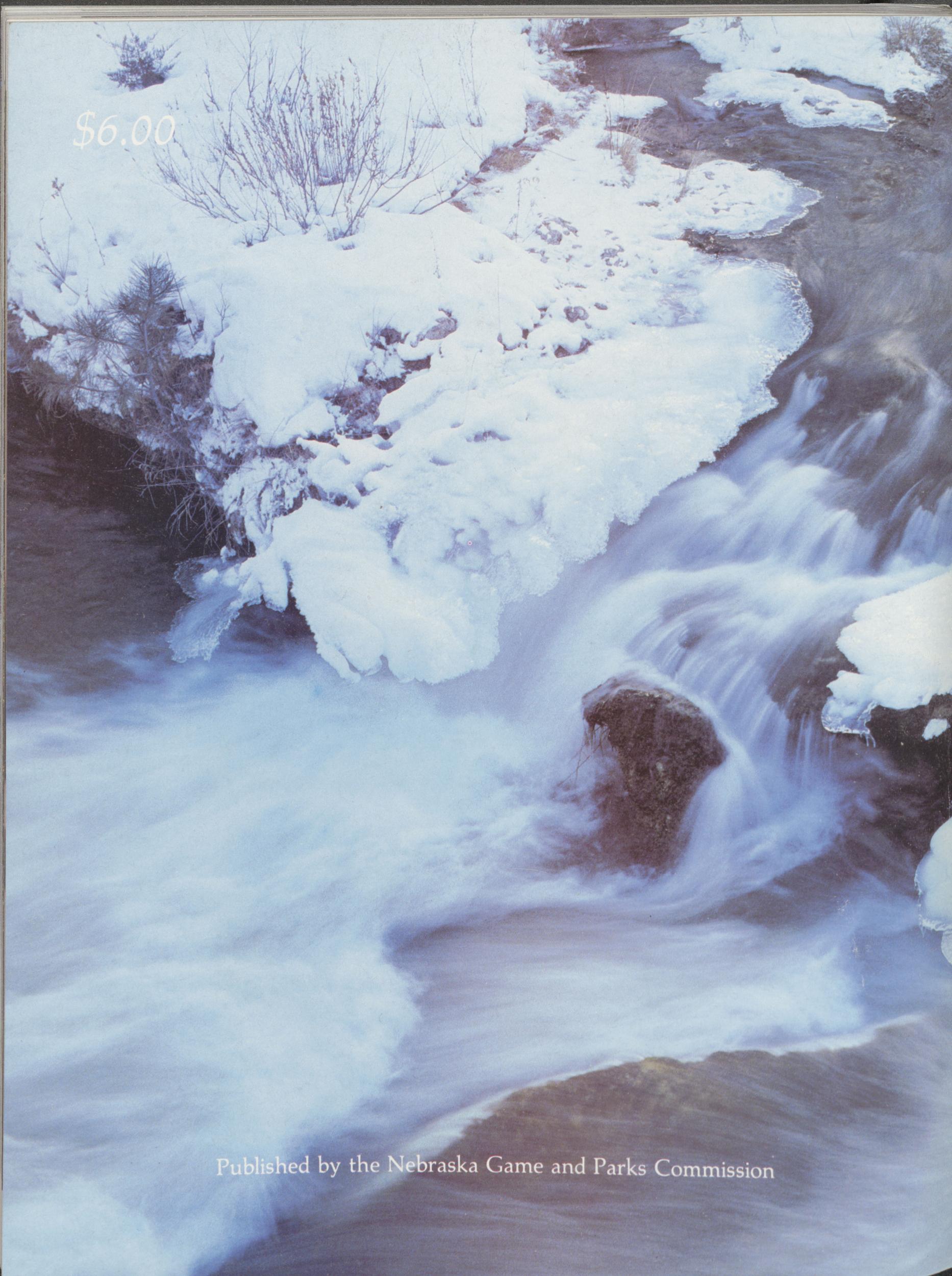
Position: 292 (29 views)