Volume 60, Issue 2, 1982
Discover Nebraska
TRAVEL GUIDE
NEBRASKAland
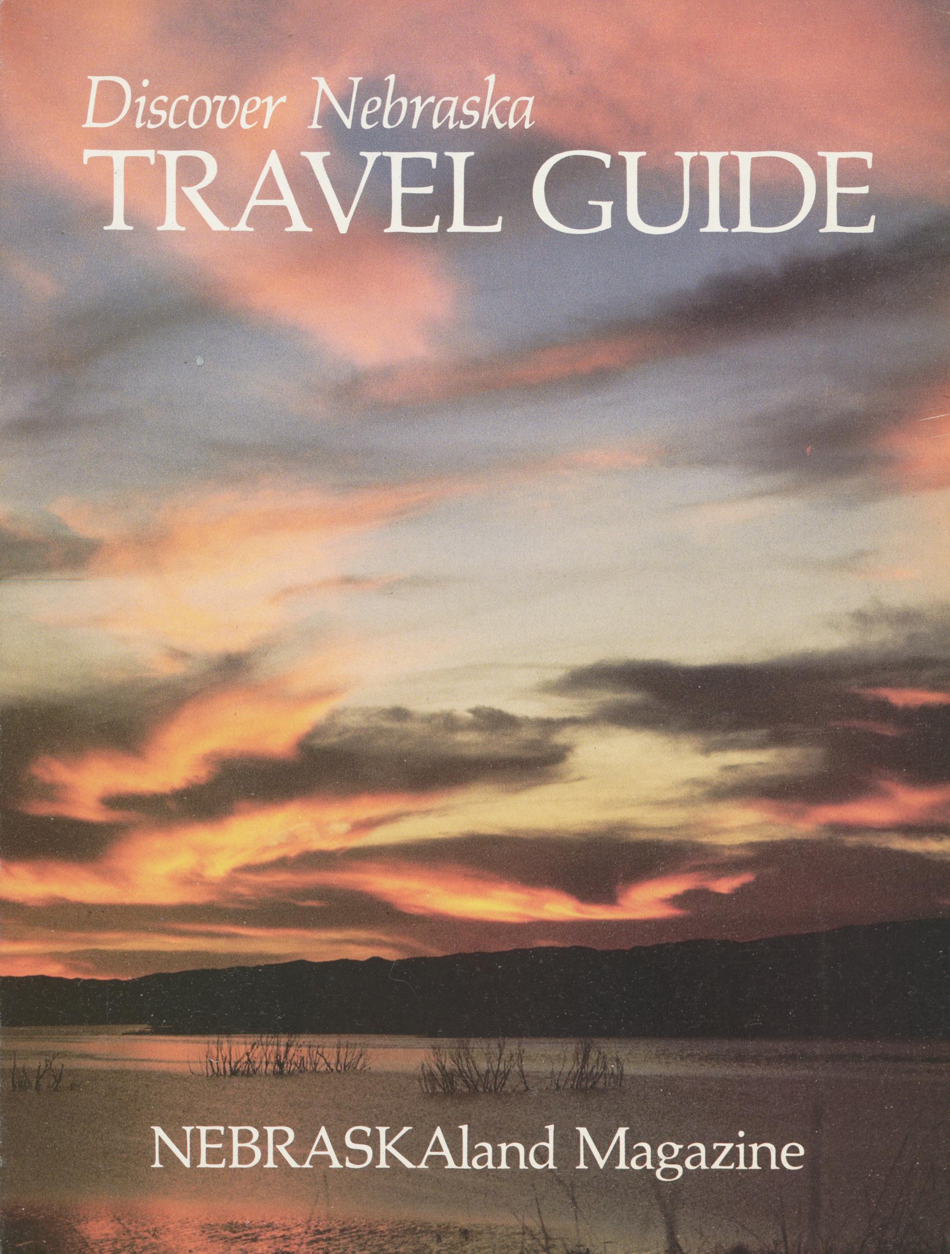
Discover Nebraska
TRAVEL GUIDE
NEBRASKAland Magazine
Published by the Nebraska Game and Parks Commission Contents WELCOME 4 THIS IS NEBRASKAland 6 COUNTRY LIVING 20 METRO WEST 32 THE WAY IT WAS 52 NEBRASKA PARKLANDS 66 THE GREAT OUTDOORS 83 A NEBRASKA DIRECTORY 98 NEBRASKAland Magazine VOL. 60 / NO. 2 / JANUARY 1982 Published twice monthly by the Nebraska Game and Parks Commission, 2200 North 33rd Street, Lincoln, Nebraska 68503. Copyright 1982 by the Nebraska Game and Parks Commission, all rights reserved. Subscription rates: $7.50 for one year, $13 for two years, $19 for three years. ISSN: 0028-1964 Second class postage paid at Lincoln, Nebraska and at additional mailing offices.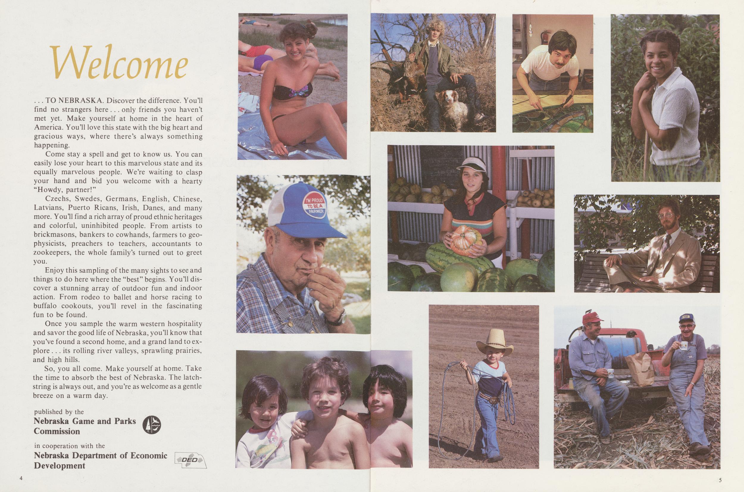
Welcome
... TO NEBRASKA. Discover the difference. You'll find no strangers here . . . only friends you haven't met yet. Make yourself at home in the heart of America. You'll love this state with the big heart and gracious ways, where there's always something happening.
Come stay a spell and get to know us. You can easily lose your heart to this marvelous state and its equally marvelous people. We're waiting to clasp your hand and bid you welcome with a hearty "Howdy, partner!"
Czechs, Swedes, Germans, English, Chinese, Latvians, Puerto Ricans, Irish, Danes, and many more. You'll find a rich array of proud ethnic heritages and colorful, uninhibited people. From artists to brickmasons, bankers to cowhands, farmers to geophysicists, preachers to teachers, accountants to zookeepers, the whole family's turned out to greet you.
Enjoy this sampling of the many sights to see and things to do here where the "best" begins You'll discover a stunning array of outdoor fun and indoor action. From rodeo to ballet and horse racing to buffalo cookouts, you'll revel in the fascinating fun to be found.
Once you sample the warm western hospitality and savor the good life of Nebraska, you'll know that you've found a second home, and a grand land to explore ... its rolling river valleys, sprawling prairies, and high hills.
So, you all come. Make yourself at home. Take the time to absorb the best of Nebraska. The latchstring is always out, and you're as welcome as a gentle breeze on a warm day.
published by the Nebraska Game and Parks Commission in cooperation with the Nebraska Department of Economic Development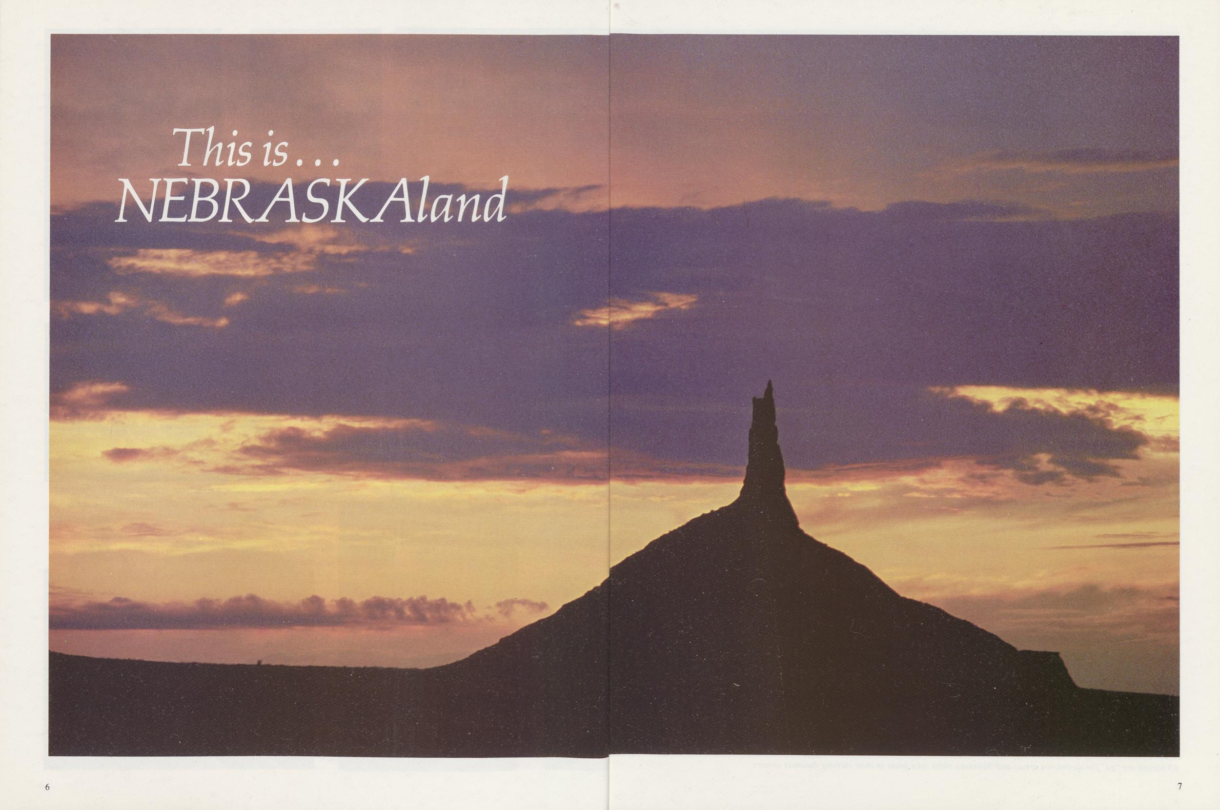
This is... NERBASKAland
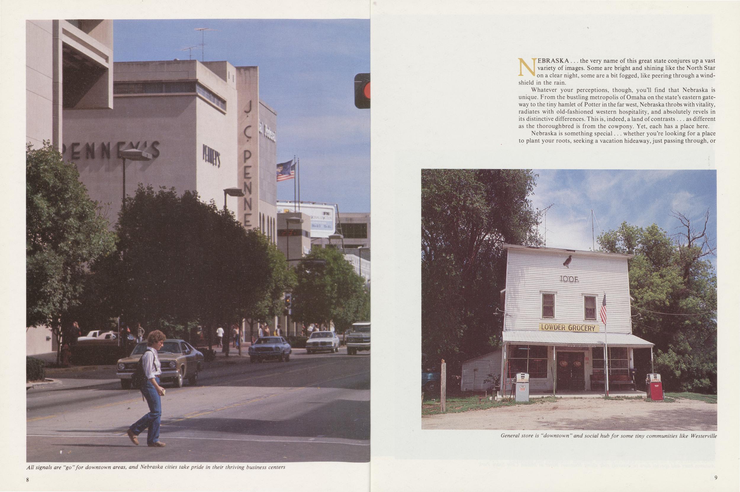
All signals are "go" for downtown areas, and Nebraska cities take pride in their thriving business centers
NEBRASKA ... the very name of this great state conjures up a vast variety of images. Some are bright and shining like the North Star on a clear night, some are a bit fogged, like peering through a windshield in the rain.
Whatever your perceptions, though, you'll find that Nebraska is unique. From the bustling metropolis of Omaha on the state's eastern gateway to the tiny hamlet of Potter in the far west, Nebraska throbs with vitality, radiates with old-fashioned western hospitality, and absolutely revels in its distinctive differences. This is, indeed, a land of contrasts ... as different as the thoroughbred is from the cowpony. Yet, each has a place here.
General store is "downtown" and social hub for some tiny communities like Westerville
 have lived here all your life. This state generates a charm and warmth that
can be matched in very few other places. Its 77,213 square miles sit smack
dab in the middle of this great land known as America, and there are a lot of
enviable statistics going for it.
have lived here all your life. This state generates a charm and warmth that
can be matched in very few other places. Its 77,213 square miles sit smack
dab in the middle of this great land known as America, and there are a lot of
enviable statistics going for it.With a population of about 1½ million friendly people, there's elbow room aplenty ... for home folks and visitors alike. Nebraskans enjoy average normal temperatures that range from a low of 19.7° F. in January in the northeast to an average of 77.3° F. in July in the south-central and southeast. The relative humidity registers a comfortable average of 60 percent at Scottsbluff to 69 percent at the Capital City of Lincoln. Balmy breezes aid
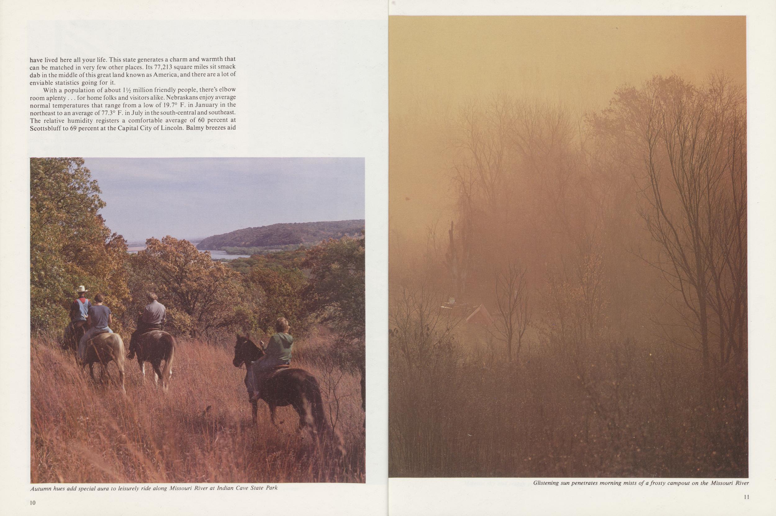
Autumn hues add special aura to leisurely ride along Missouri River at Indian Cave State Park
Glistening sun penetrates morning mists of a frosty campout on the Missouri River
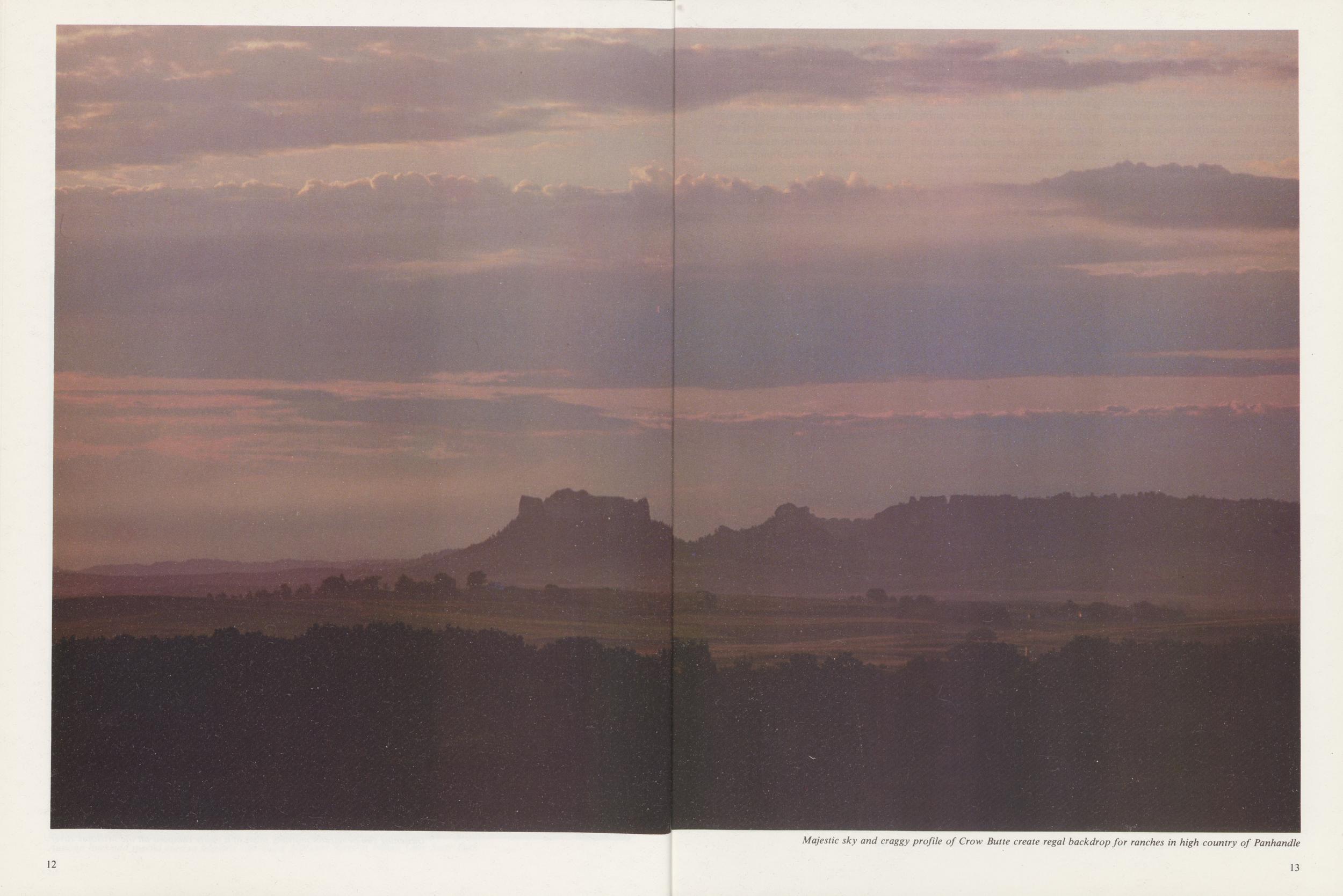
Majestic sky and craggy profile of Crow Butte create regal backdrop for ranches in high country of Panhandle
the comfort index, with average velocities of about 10 ½ miles per hour. The rains come often enough to keep things green and clean, ranging from 78 days of precipitation at Valentine to 99 days at Omaha. Annual precipitation measures from 17.36 inches in the arid Panhandle to nearly 31 inches in the verdant southeast.
In the low country of the southeast corner, where the altitude is about 840 feet above sea level, the craggy Missouri River bluffs resemble the Ozarks with their oak, hickory, and coffee trees. Gracious 19th Century homes merge with the more modern glass and steel structures of today. Out west, though, the frontier still thrives amid the rugged beauty of the Wildcat Hills and Pine Ridge, where altitudes exceed a mile above sea level and cowboy boots are always in vogue.
Nebraskans cherish the traditions that helped carve a great state from a wilderness not so very long ago. Folks here are close to the land and read the changing weather like the well-thumbed pages of a best-seller. When Nebraskans discuss the weather, it's more than just small talk. It's a vital part of their lives, for this state contributes its share and more to the nation's shopping carts.
Fields of waving grain, wheat, oats,
Nebraskans love the land and the history it represents. Markers, museums, and monuments dot the state, as lasting reminders and tributes to the people and events that helped shape destiny. At the same time, these same Nebraskans are unafraid to dare the unknown* They take justifiable pride in trying the untried, in blazing a path for less courageous souls to follow.
Progress enhanced by tradition, that's the Nebraska way. These are the people who dared to experiment with a one-house, nonpartisan legislature and saw it succeed. These are the people who began experimenting with a
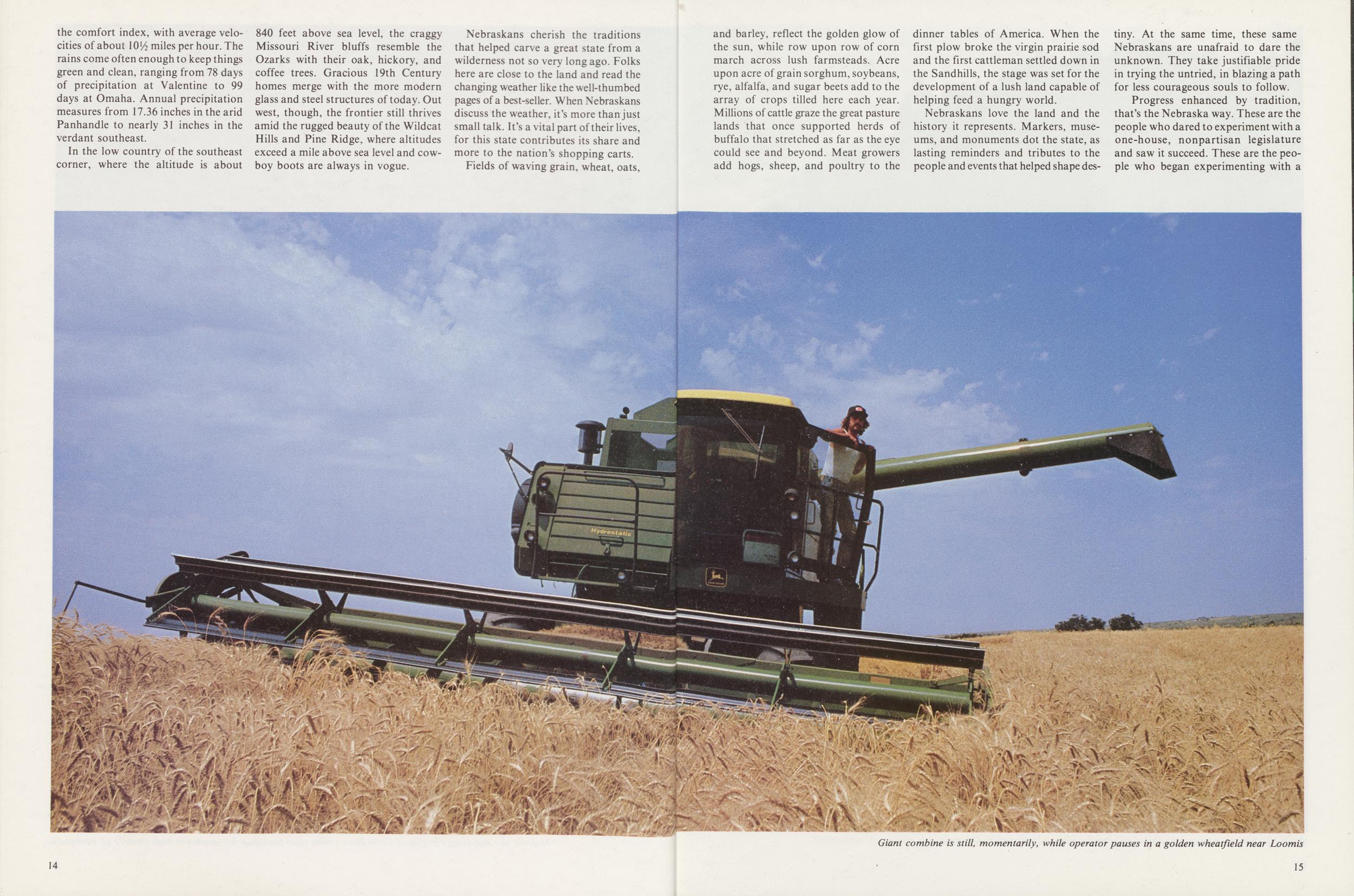
Giant combine is still, momentarily, while operator pauses in a golden wheatfield near Loomis
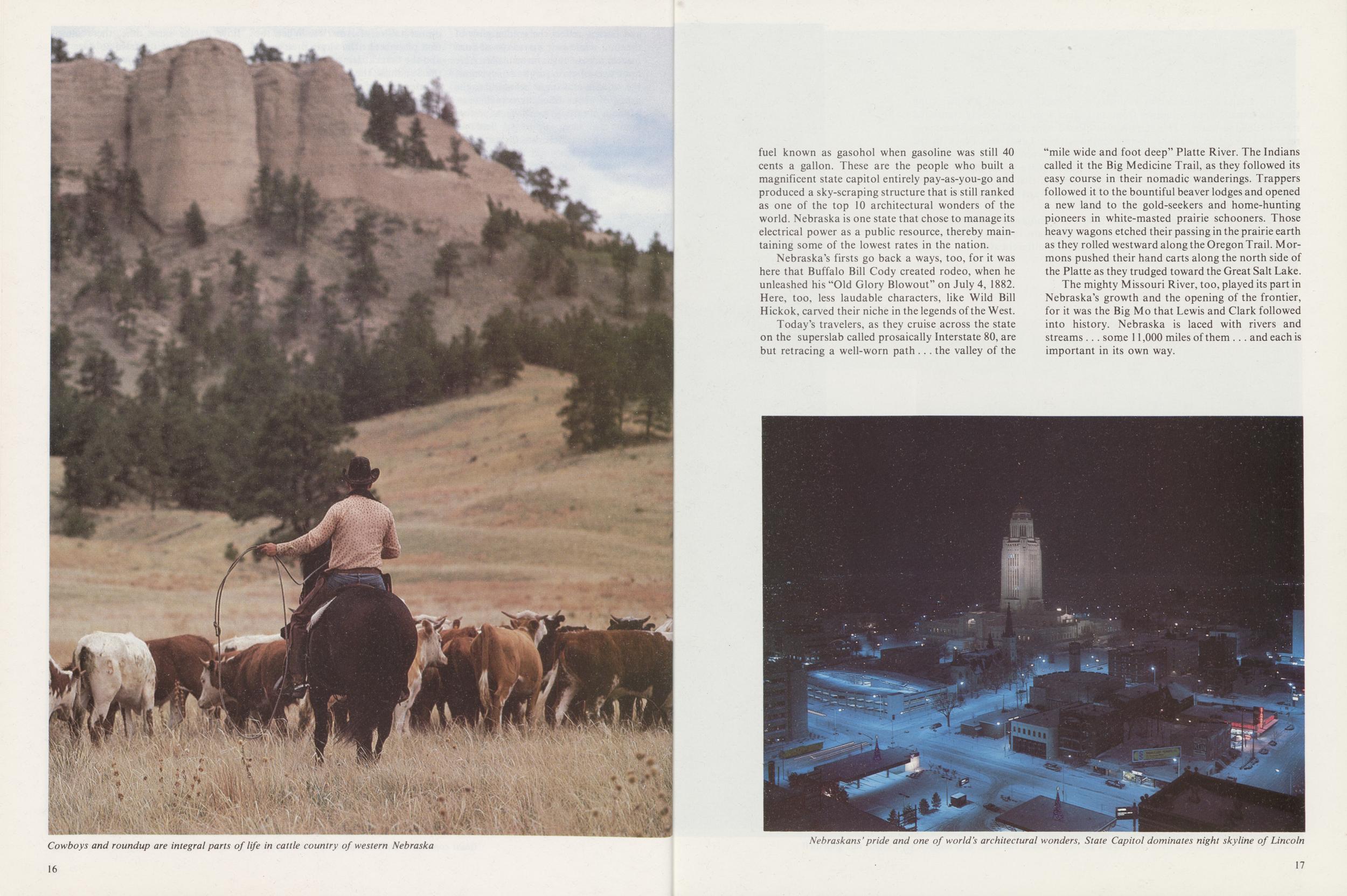
Cowboys and roundup are integral parts of life in cattle country of western Nebraska
fuel known as gasohol when gasoline was still 40 cents a gallon. These are the people who built a magnificent state capitol entirely pay-as-you-go and produced a sky-scraping structure that is still ranked as one of the top 10 architectural wonders of the world. Nebraska is one state that chose to manage its electrical power as a public resource, thereby maintaining some of the lowest rates in the nation.
Nebraska's firsts go back a ways, too, for it was here that Buffalo Bill Cody created rodeo, when he unleashed his "Old Glory Blowout" on July 4, 1882. Here, too, less laudable characters, like Wild Bill Hickok, carved their niche in the legends of the West.
Today's travelers, as they cruise across the state on the superslab called prosaically Interstate 80, are but retracing a well-worn path . . . the valley of the "mile wide and foot deep" Platte River. The Indians called it the Big Medicine Trail, as they followed its easy course in their nomadic wanderings. Trappers followed it to the bountiful beaver lodges and opened a new land to the gold-seekers and home-hunting pioneers in white-masted prairie schooners. Those heavy wagons etched their passing in the prairie earth as they rolled westward along the Oregon Trail. Mormons pushed their hand carts along the north side of the Platte as they trudged toward the Great Salt Lake.
The mighty Missouri River, too, played its part in Nebraska's growth and the opening of the frontier, for it was the Big Mo that Lewis and Clark followed into history. Nebraska is laced with rivers and streams .. . some 11,000 miles of them ... and each is important in its own way.
Nehraskans'pride and one of world's architectural wonders, State Capitol dominates night skyline of Lincoln
For a land once labeled as a "desert" by John C. Fremont, it's interesting that the name Nebraska comes from an Indian word that loosely translated means "flowing water." This state is also blessed with 3,000 lakes. Man-made reservoirs like McConaughy in the southwest and Lewis and Clark in the northeast are the giants, but tiny lakes dot the state, especially in the unique area known as the Sandhills. Covering nearly 20,000 square miles, the "Hills" are unparalleled outside the Steppes of Russia. Tis said that a whole army troop once ventured too far into the "Hills" and was never heard from again. A colorful yarn, but highly suspect, to say the least.
Today, visitors can hardly get lost, unless they choose to lose themselves in the warmth and hospitality that is Nebraska. Then again, they may just lose their hearts and fall head over heels for this delightfully different state.
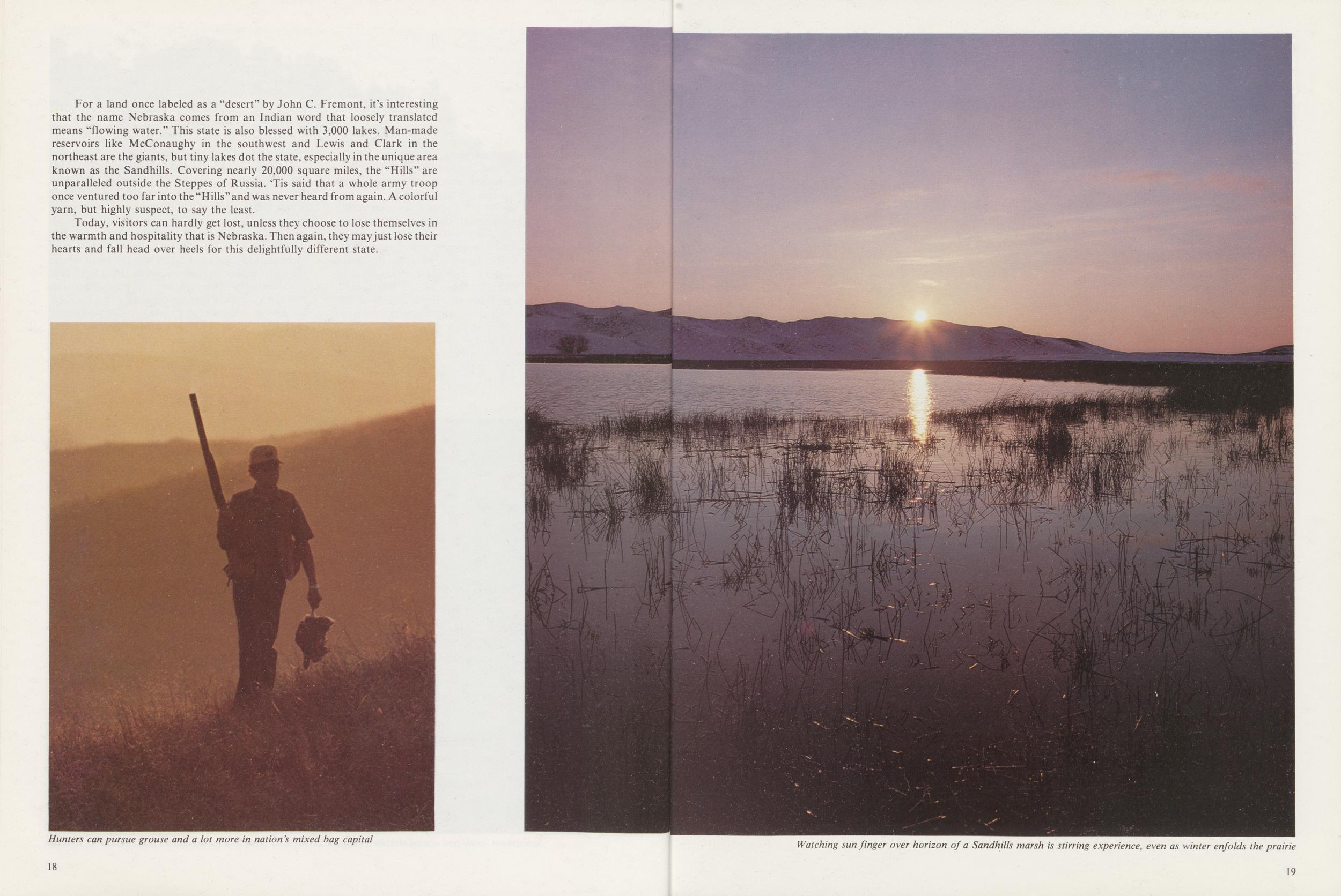
Hunters can pursue grouse and a lot more in nations mixed bag capital
Watching sun finger over horizon of a Sandhills marsh is stirring experience, even as winter enfolds the prairie
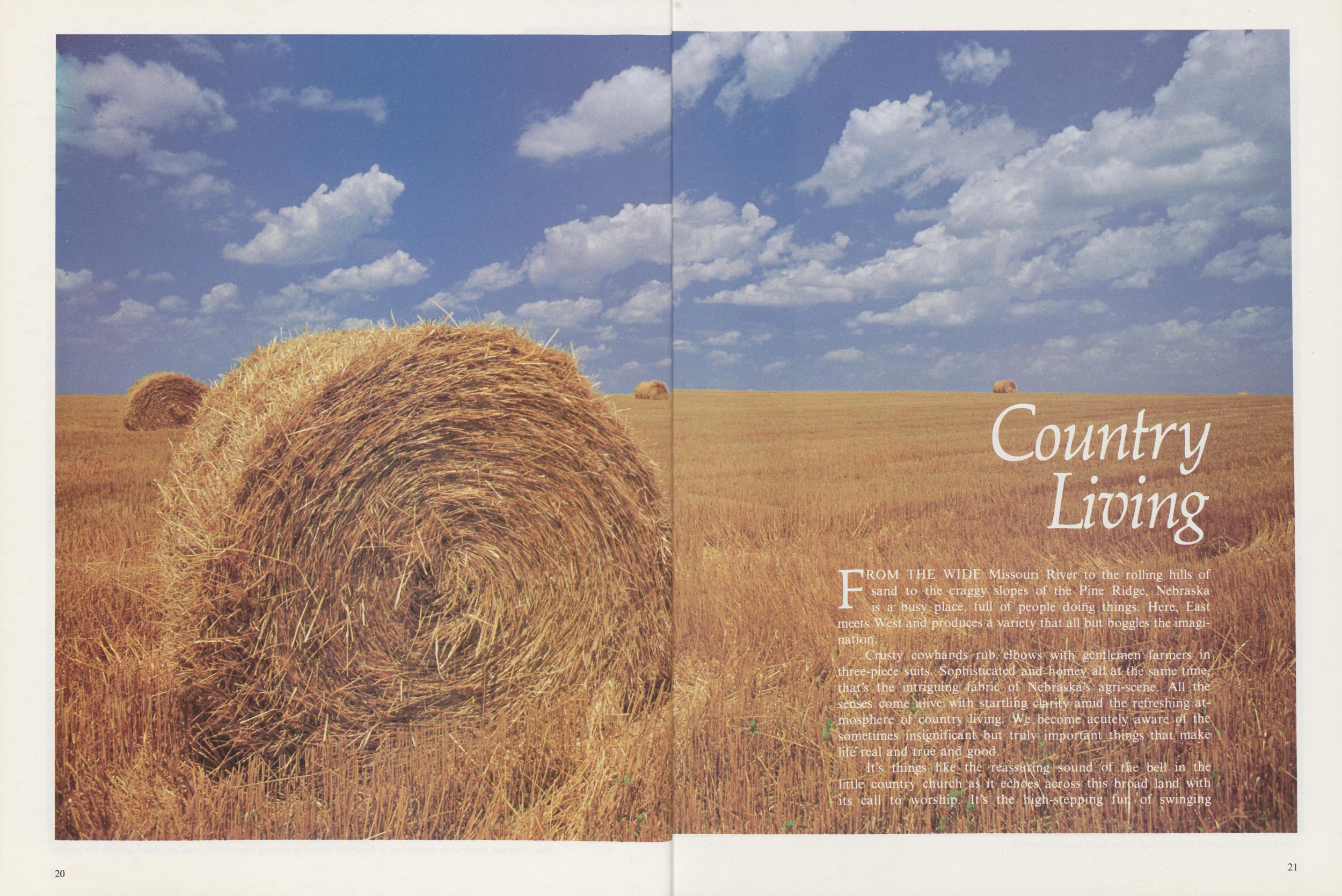
Country Living
FROM THE WIDE Missouri River to the rolling hills o — sand to the craggy slopes of the Pine Ridge, Nebraska is a busy place, full of people doing things. Here, East meets West and produces a variety that all but boggles the imagination.
Crusty cowhands rub elbows with gentlemen farmers in three-piece suits. Sophisticated and homey alt at the same time that's the intriguing fabric of Nebraska's agri-scene. All the senses come alive with startling clarity amid the refreshing atmosphere of country Jiving. We become acutely aware of the sometimes insignificant but truly important things that make life*real and true and good.
It's things like the reassuring sound of the bell in the
little country church as it echoes across this broad land with
its call to worship. It's the high-stepping fur of swinging
21
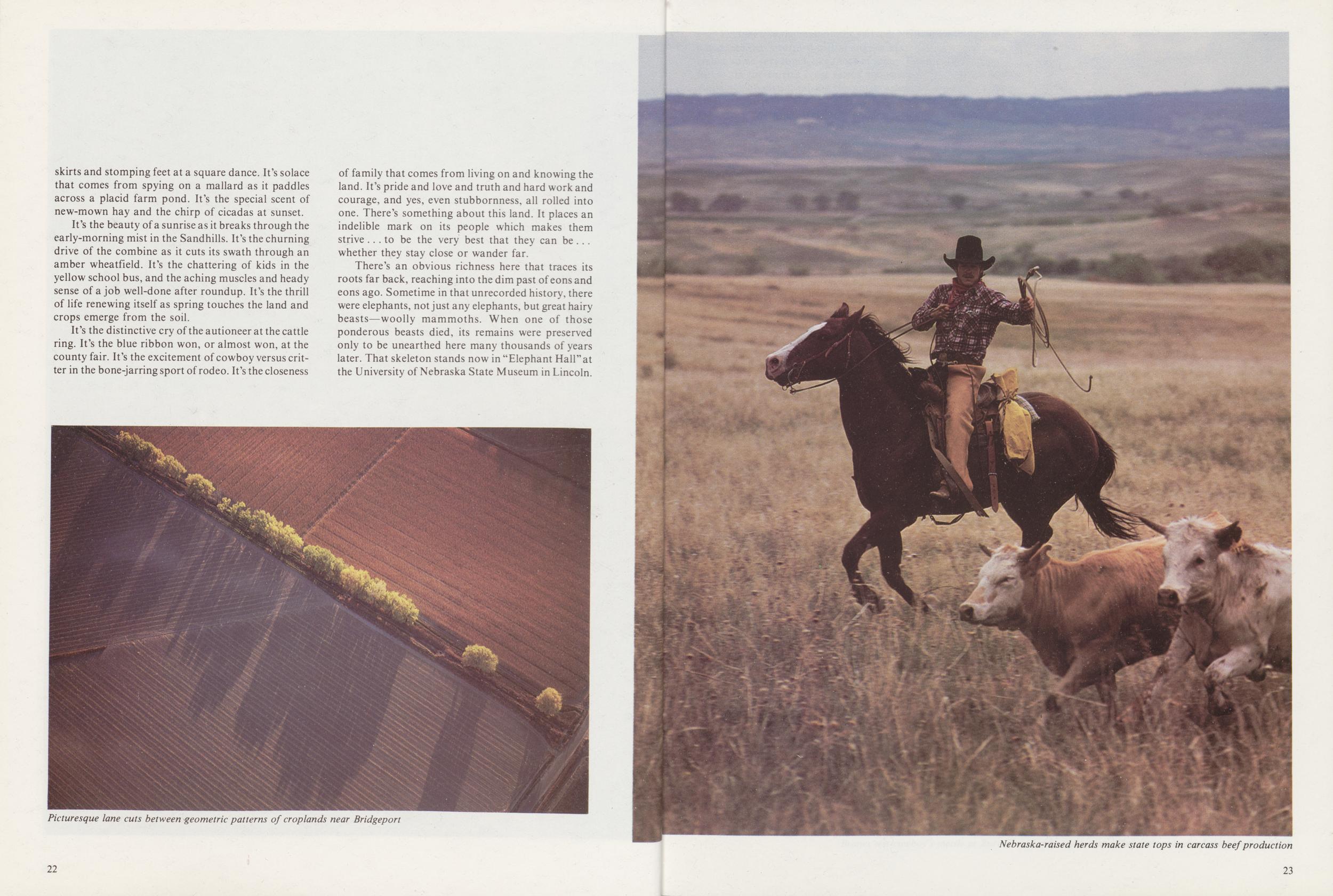 skirts and stomping feet at a square dance. It's solace
that comes from spying on a mallard as it paddles
across a placid farm pond. It's the special scent of
new-mown hay and the chirp of cicadas at sunset.
skirts and stomping feet at a square dance. It's solace
that comes from spying on a mallard as it paddles
across a placid farm pond. It's the special scent of
new-mown hay and the chirp of cicadas at sunset.
It's the beauty of a sunrise as it breaks through the early-morning mist in the Sandhills. It's the churning drive of the combine as it cuts its swath through an amber wheatfield. It's the chattering of kids in the yellow school bus, and the aching muscles and heady sense of a job well-done after roundup. It's the thrill of life renewing itself as spring touches the land and crops emerge from the soil.
It's the distinctive cry of the auctioneer at the cattle ring. It's the blue ribbon won, or almost won, at the county fair. It's the excitement of cowboy versus critter in the bone-jarring sport of rodeo. It's the closeness of family that comes from living on and knowing the land. It's pride and love and truth and hard work and courage, and yes, even stubbornness, all rolled into one. There's something about this land. It places an indelible mark on its people which makes them strive ... to be the very best that they can be . . . whether they stay close or wander far.
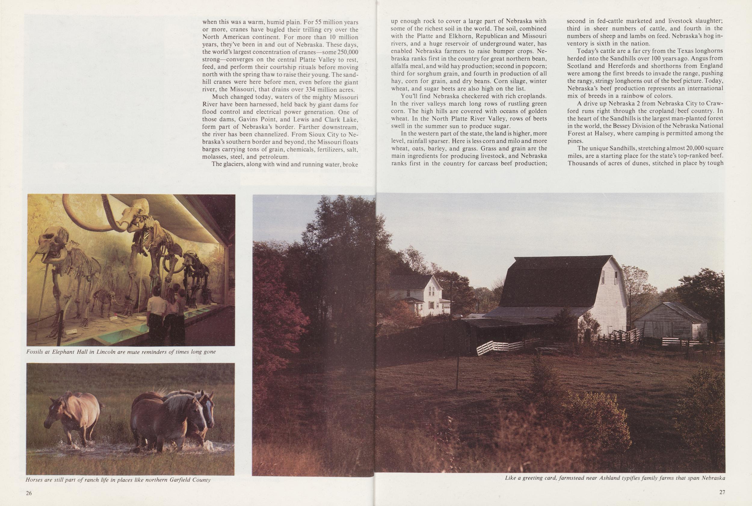
There's an obvious richness here that traces its roots far back, reaching into the dim past of eons and eons ago. Sometime in that unrecorded history, there were elephants, not just any elephants, but great hairy beasts—woolly mammoths. When one of those ponderous beasts died, its remains were preserved only to be unearthed here many thousands of years later. That skeleton stands now in "Elephant Hall" at the University of Nebraska State Museum in Lincoln.
Picturesque lane cuts between geometric patterns of croplands near Bridgeport
Nebraska-raised herds make state tops in carcass beef production
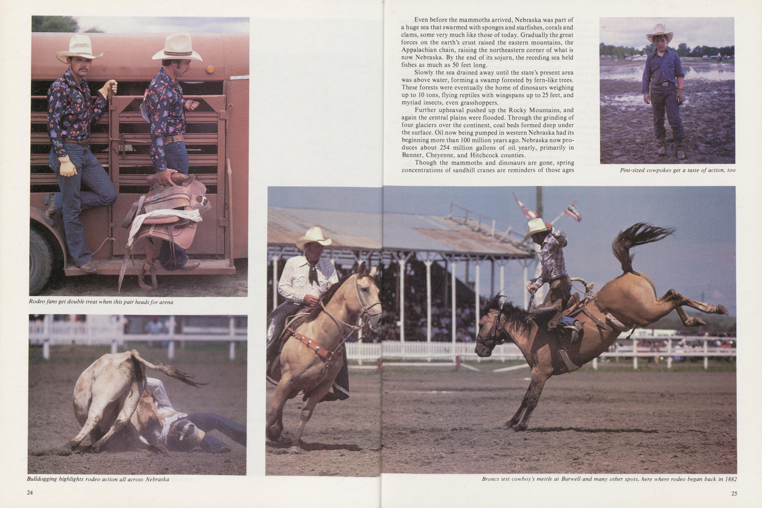
Rodeo fans get double treat when this pair heads for arena
Bulldogging highlights rodeo action all across Nebraska
Even before the mammoths arrived, Nebraska was part of a huge sea that swarmed with sponges and starfishes, corals and clams, some very much like those of today. Gradually the great forces on the earth's crust raised the eastern mountains, the Appalachian chain, raising the northeastern corner of what is now Nebraska. By the end of its sojurn, the receding sea held fishes as much as 50 feet long.
Slowly the sea drained away until the state's present area was above water, forming a swamp forested by fern-like trees. These forests were eventually the home of dinosaurs weighing up to 10 tons, flying reptiles with wingspans up to 25 feet, and myriad insects, even grasshoppers.
Further upheaval pushed up the Rocky Mountains, and again the central plains were flooded. Through the grinding of four glaciers over the continent, coal beds formed deep under the surface. Oil now being pumped in western Nebraska had its beginning more than 100 million years ago. Nebraska now produces about 254 million gallons of oil. yearly,, primarily in Banner, Cheyenne, and Hitchcock counties.
Though the mammoths and dinosaurs are gone, spring concentrations of sandhill cranes are reminders of those ages
Pint-sized cowpokes get a taste of action, too
Broncs test cowboy's mettle at Burwell and many other spots, here where rodeo began back in 1882
when this was a warm, humid plain. For 55 million years or more, cranes have bugled their trilling cry over the North American continent. For more than 10 million years, they've been in and out of Nebraska. These days, the world's largest concentration of cranes—some 250,000 strong—converges on the central Platte Valley to rest, feed, and perform their courtship rituals before moving north with the spring thaw to raise their young. The sandhill cranes were here before men, even before the giant river, the Missouri, that drains over 334 million acres.
Much changed today, waters of the mighty Missouri River have been harnessed, held back by giant dams for flood control and electrical power generation. One of those dams, Gavins Point, and Lewis and Clark Lake, form part of Nebraska's border. Farther downstream, the river has been channelized. From Sioux City to Nebraska's southern border and beyond, the Missouri floats barges carrying tons of grain, chemicals, fertilizers, salt, molasses, steel, and petroleum.
The glaciers, along with wind and running water, broke
Fossils at Elephant Hall in Lincoln are mute reminders of times long gone
Horses are still part of ranch life in places like northern Garfield County
up enough rock to cover a large part of Nebraska with some of the richest soil in the world. The soil, combined with the Platte and Elkhorn, Republican and Missouri rivers, and a huge reservoir of underground water, has enabled Nebraska farmers to raise bumper crops. Nebraska ranks first in the country for great northern bean, alfalfa meal, and wild hay production; second in popcorn; third for sorghum grain, and fourth in production of all hay, corn for grain, and dry beans. Corn silage, winter wheat, and sugar beets are also high on the list.
You'll find Nebraska checkered with rich croplands. In the river valleys march long rows of rustling green corn. The high hills are covered with oceans of golden wheat. In the North Platte River Valley, rows of beets swell in the summer sun to produce sugar.
In the western part of the state, the land is higher, more level, rainfall sparser. Here is less corn and milo and more wheat, oats, barley, and grass. Grass and grain are the main ingredients for producing livestock, and Nebraska ranks first in the country for carcass beef production; second in fed-cattle marketed and livestock slaughter; third in sheer numbers of cattle, and fourth in the numbers of sheep and lambs on feed. Nebraska's hog inventory is sixth in the nation.
Today's cattle are a far cry from the Texas longhorns herded into the Sandhills over 100 years ago. Angus from Scotland and Herefords and shorthorns from England were among the first breeds to invade the range, pushing the rangy, stringy longhorns out of the beef picture. Today, Nebraska's beef production represents an international mix of breeds in a rainbow of colors.
A drive up Nebraska 2 from Nebraska City to Crawford runs right through the cropland/beef country. In the heart of the Sandhills is the largest man-planted forest in the world, the Bessey Division of the Nebraska National Forest at Halsey, where camping is permitted among the pines.
The unique Sandhills, stretching almost 20,000 square miles, are a starting place for the state's top-ranked beef. Thousands of acres of dunes, stitched in place by tough
Like a greeting card, farmstead near Ashland typifies family farms that span Nebraska
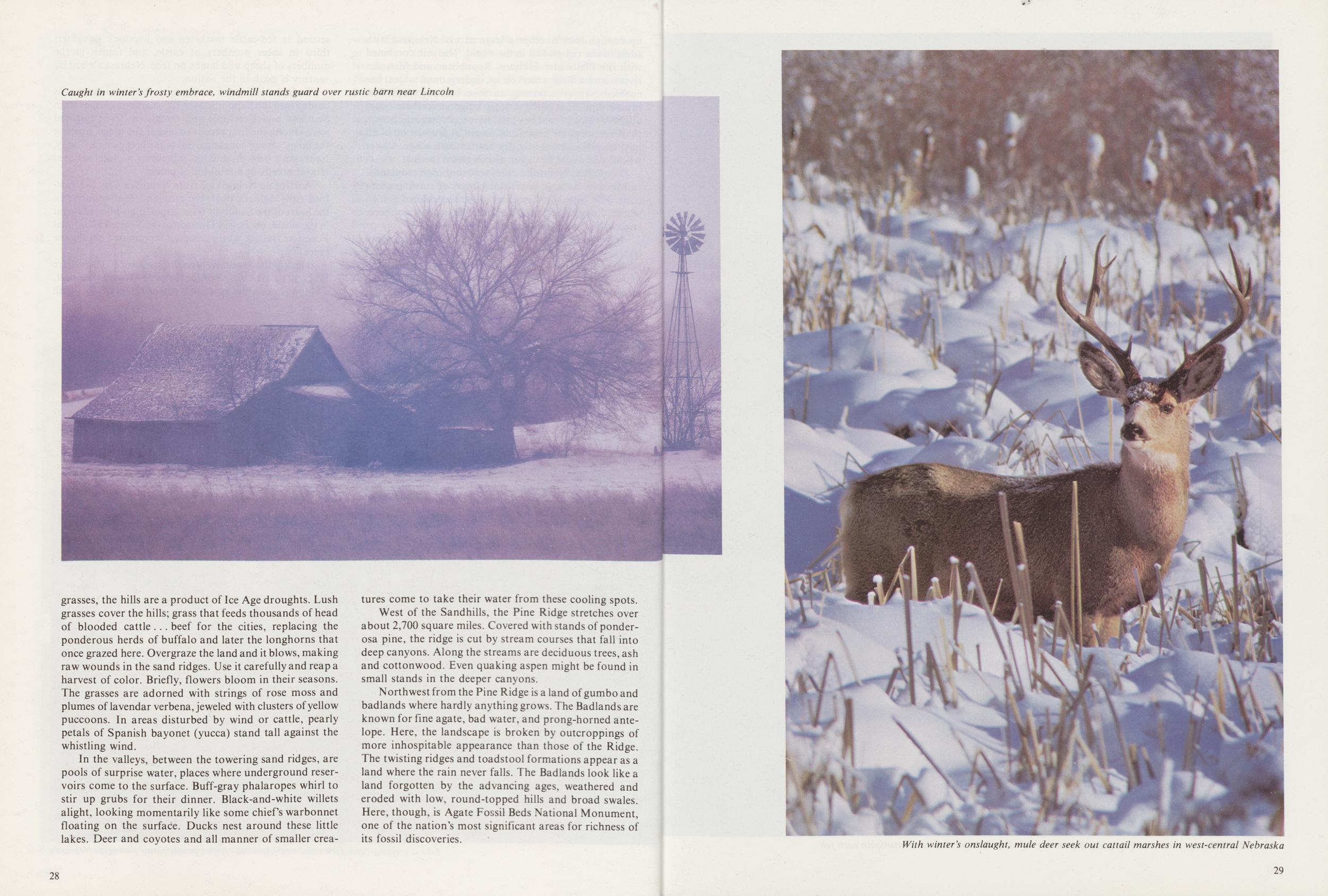
Caught in winter's frosty embrace, windmill stands guard over rustic barn near Lincoln
grasses, the hills are a product of Ice Age droughts. Lush grasses cover the hills; grass that feeds thousands of head of blooded cattle ... beef for the cities, replacing the ponderous herds of buffalo and later the longhorns that once grazed here. Overgraze the land and it blows, making raw wounds in the sand ridges. Use it carefully and reap a harvest of color. Briefly, flowers bloom in their seasons. The grasses are adorned with strings of rose moss and plumes of lavendar verbena, jeweled with clusters of yellow puccoons. In areas disturbed by wind or cattle, pearly petals of Spanish bayonet (yucca) stand tall against the whistling wind.
In the valleys, between the towering sand ridges, are pools of surprise water, places where underground reservoirs come to the surface. Buff-gray phalaropes whirl to stir up grubs for their dinner. Black-and-white willets alight, looking momentarily like some chiefs warbonnet floating on the surface. Ducks nest around these little lakes. Deer and coyotes and all manner of smaller creatures come to take their water from these cooling spots.
West of the Sandhills, the Pine Ridge stretches over about 2,700 square miles. Covered with stands of ponderosa pine, the ridge is cut by stream courses that fall into deep canyons. Along the streams are deciduous trees, ash and cottonwood. Even quaking aspen might be found in small stands in the deeper canyons.
Northwest from the Pine Ridge is a land of gumbo and badlands where hardly anything grows. The Badlands are known for fine agate, bad water, and prong-horned antelope. Here, the landscape is broken by outcroppings of more inhospitable appearance than those of the Ridge. The twisting ridges and toadstool formations appear as a land where the rain never falls. The Badlands look like a land forgotten by the advancing ages, weathered and eroded with low, round-topped hills and broad swales. Here, though, is Agate Fossil Beds National Monument, one of the nation's most significant areas for richness of its fossil discoveries.
28With winter's onslaught, mule deer seek out cattail marshes in west-central Nebraska
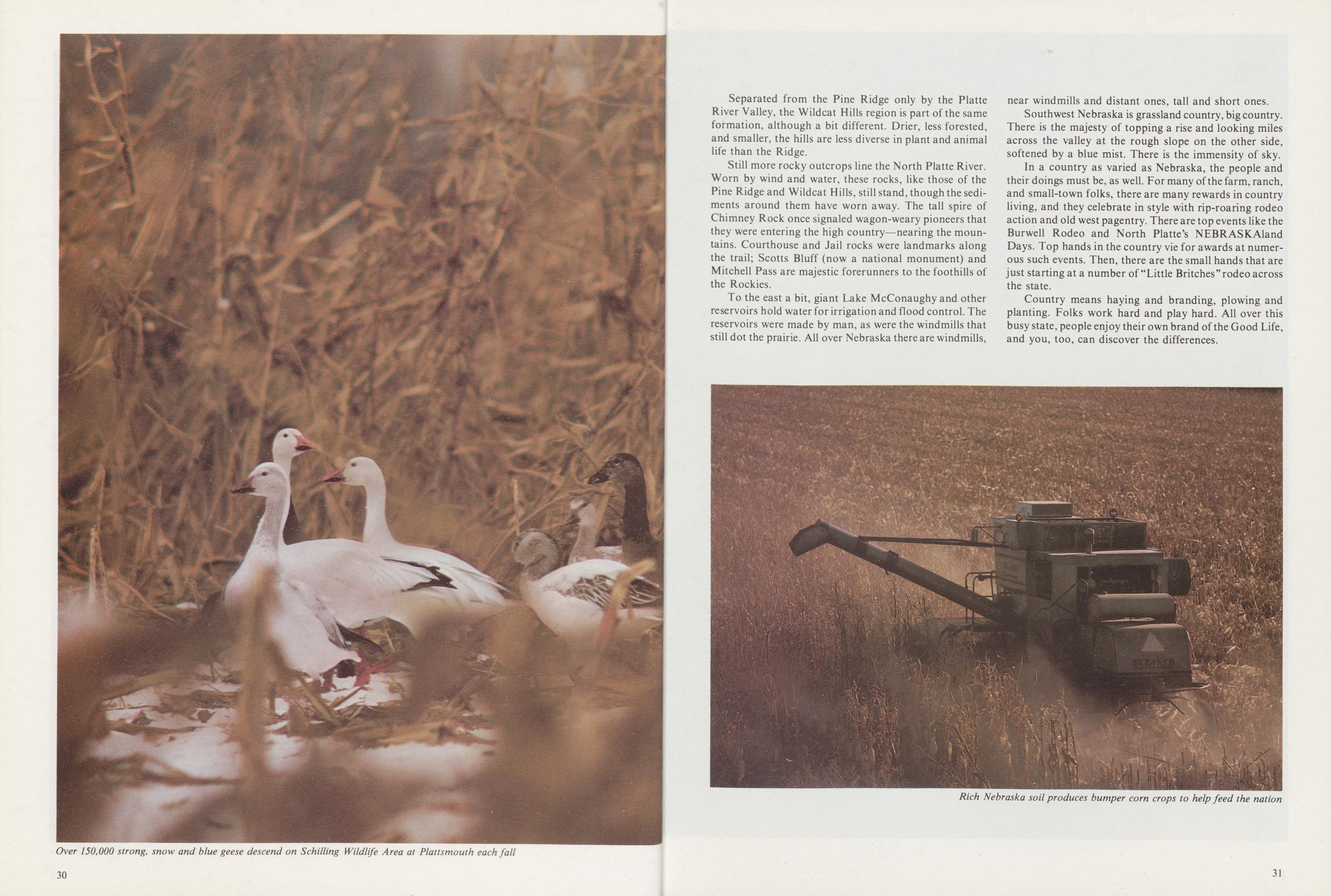
Over 150,000 strong, snow and blue geese descend on Schilling Wildlife Area at Plattsmouth each fall
Separated from the Pine Ridge only by the Platte River Valley, the Wildcat Hills region is part of the same formation, although a bit different. Drier, less forested, and smaller, the hills are less diverse in plant and animal life than the Ridge.
Still more rocky outcrops line the North Platte River. Worn by wind and water, these rocks, like those of the Pine Ridge and Wildcat Hills, still stand, though the sediments around them have worn away. The tall spire of Chimney Rock once signaled wagon-weary pioneers that they were entering the high country—nearing the mountains. Courthouse and Jail rocks were landmarks along the trail; Scotts Bluff (now a national monument) and Mitchell Pass are majestic forerunners to the foothills of the Rockies.
To the east a bit, giant Lake McConaughy and other reservoirs hold water for irrigation and flood control. The reservoirs were made by man, as were the windmills that still dot the prairie. All over Nebraska there are windmills, near windmills and distant ones, tall and short ones.
Southwest Nebraska is grassland country, big country. There is the majesty of topping a rise and looking miles across the valley at the rough slope on the other side, softened by a blue mist. There is the immensity of sky.
In a country as varied as Nebraska, the people and their doings must be, as well. For many of the farm, ranch, and small-town folks, there are many rewards in country living, and they celebrate in style with rip-roaring rodeo action and old west pagentry. There are top events like the Burwell Rodeo and North Platte's NEBRASKAland Days. Top hands in the country vie for awards at numerous such events. Then, there are the small hands that are just starting at a number of "Little Britches "rodeo across the state.
Country means haying and branding, plowing and planting. Folks work hard and play hard. All over this busy state, people enjoy their own brand of the Good Life, and you, too, can discover the differences.
Rich Nebraska soil produces bumper corn crops to help feed the nation
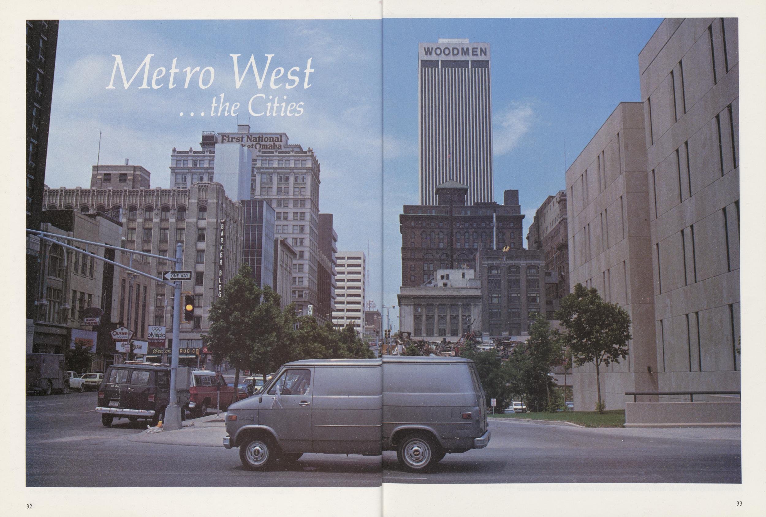
OMAHA, OGALLALA, O'Neill, Orchard, Ord, Oakland . . . Lincoln, Lewellen, Lexington, Louisville, Long Pine, Loup City. .. Grand Island, Gordon, Grant, Gretna, Guide Rock ... just a small sampling of the hundreds of charming communities that dot the Nebraska countryside.
Each has a captivating personality all its own, and yet, big city, small city, hamlet or village, they all have one marvelous trait in common. Each carries on the Nebraska tradition of warm, western hospitality. Long-time resident, new-comer, or traveler . . . everyone quickly discovers the difference. The welcome mat is always out.
Whether eastbound through Mitchell Pass in the west or westbound across the wide Missouri,
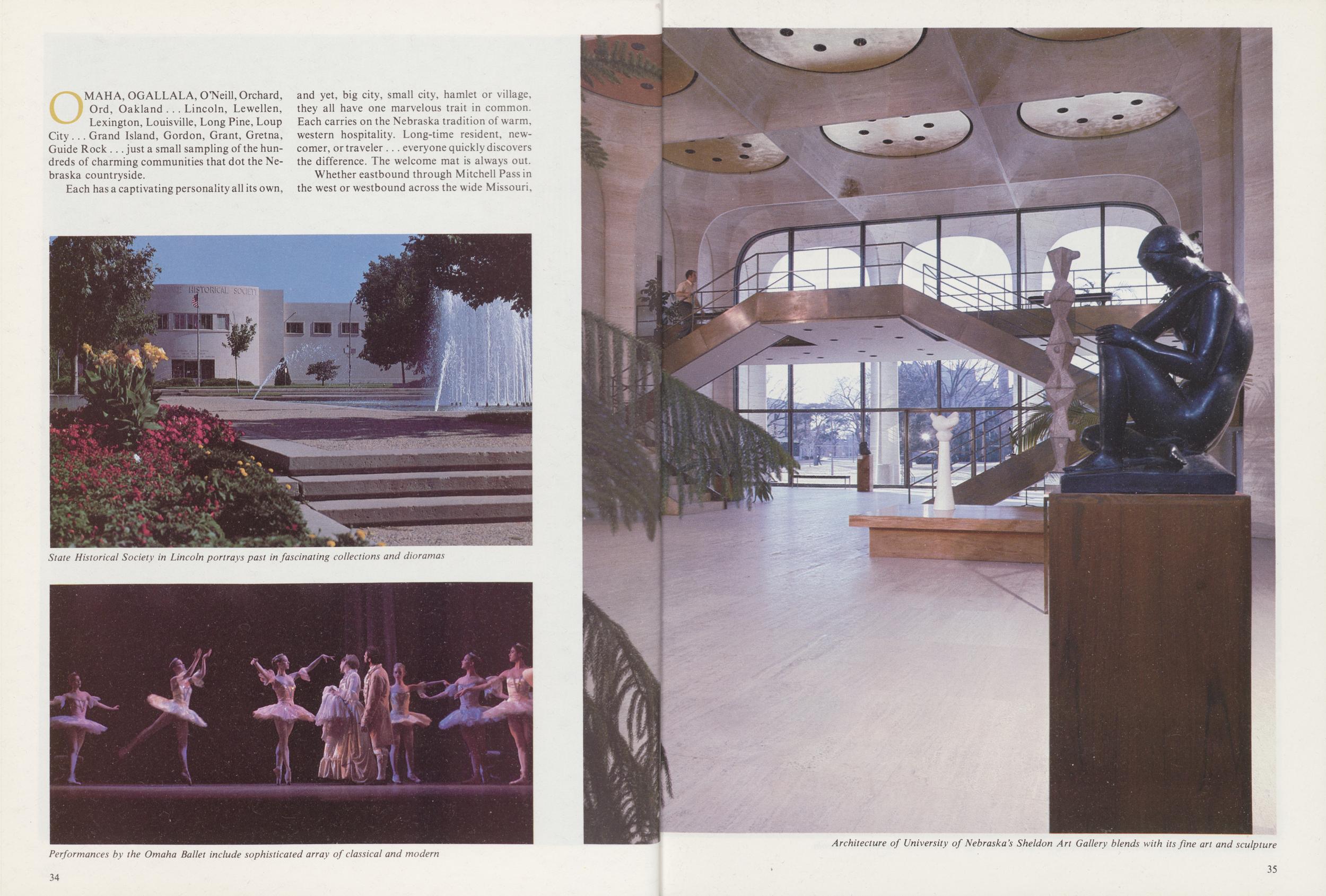
State Historical Society in Lincoln portrays past in fascinating collections and dioramas
Performances by the Omaha Ballet include sophisticated array of classical and modern
Architecture of University of Nebraska's Sheldon Art Gallery blends with its fine art and sculpture
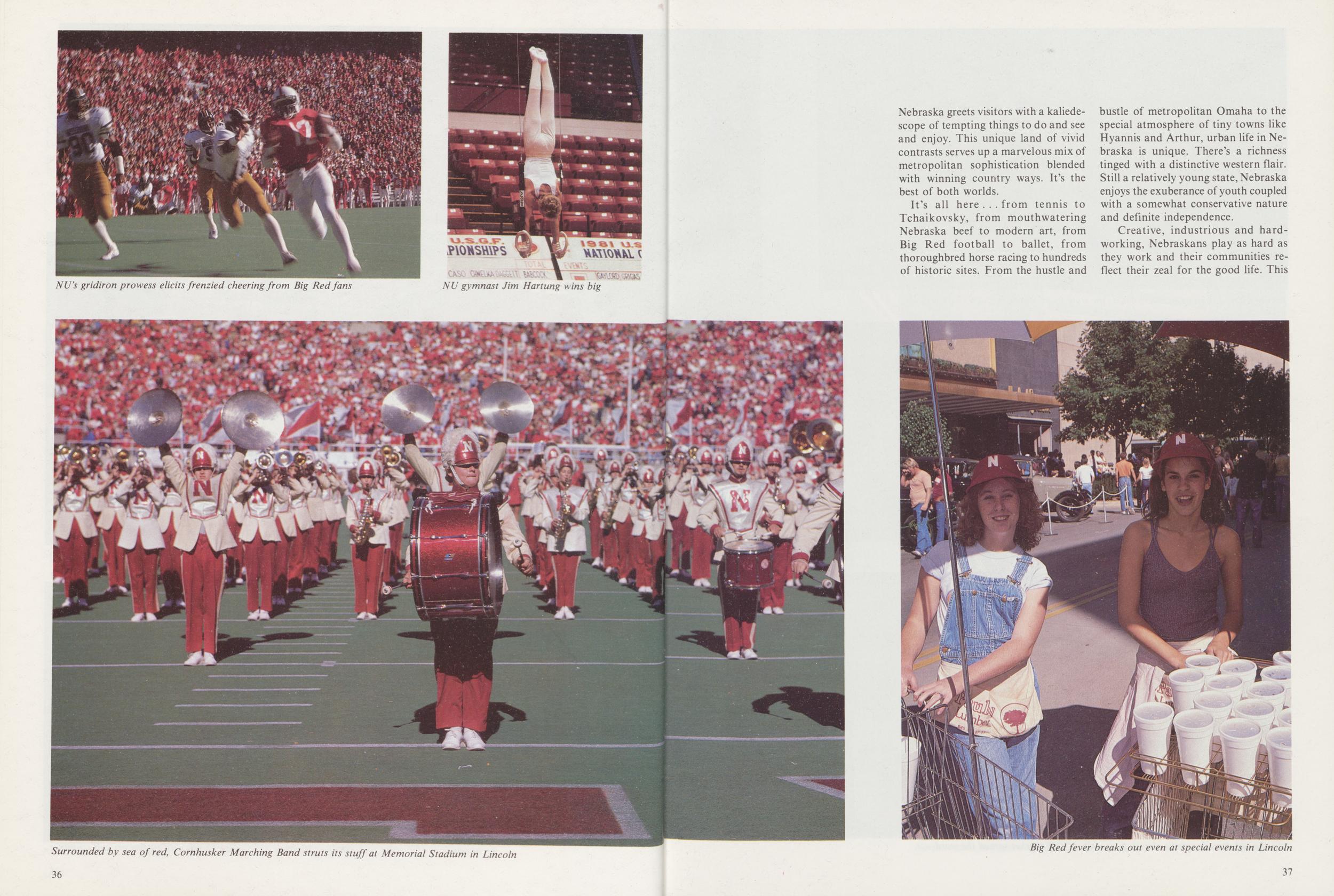
NU's gridiron prowess elicits frenzied cheering from Big Red fans
NU gymnast Jim Hartung wins big
Surrounded by sea of red, Cornhusker Marching Band struts its stuff at Memorial Stadium in Lincoln
Nebraska greets visitors with a kaliedescope of tempting things to do and see and enjoy. This unique land of vivid contrasts serves up a marvelous mix of metropolitan sophistication blended with winning country ways. It's the best of both worlds.
It's all here . . . from tennis to Tchaikovsky, from mouthwatering Nebraska beef to modern art, from Big Red football to ballet, from thoroughbred horse racing to hundreds of historic sites. From the hustle and bustle of metropolitan Omaha to the special atmosphere of tiny towns like Hyannis and Arthur, urban life in Nebraska is unique. There's a richness tinged with a distinctive western flair. Still a relatively young state, Nebraska enjoys the exuberance of youth coupled with a somewhat conservative nature and definite independence.
Creative, industrious and hardworking, Nebraskans play as hard as they work and their communities reflect their zeal for the good life. This
Big Red fever breaks out even at special events in Lincoln
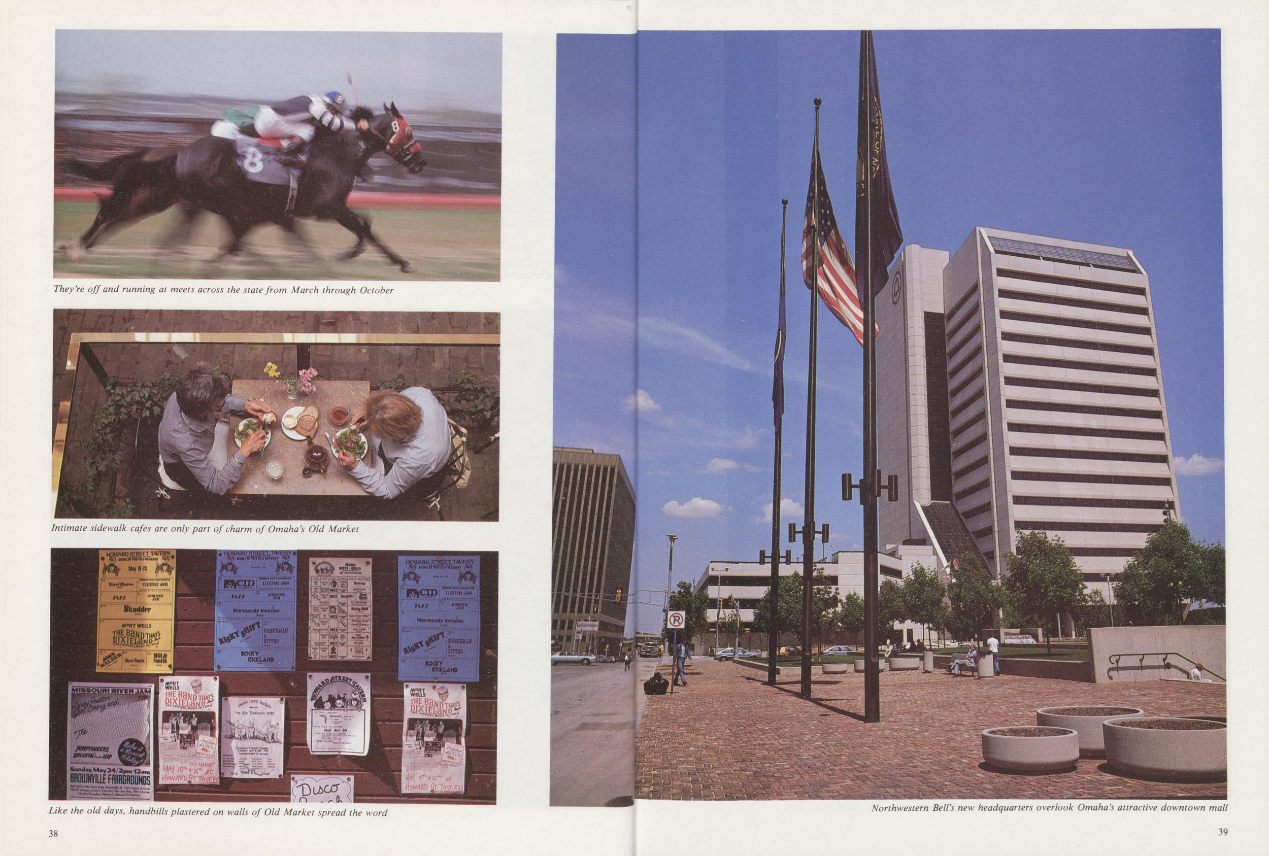
They're off and running at meets across the state from March through October
Intimate sidewalk cafes are only part of charm of Omaha's Old Market
Like the old days, handbills plastered on walls of Old Market spread the word
Northwestern Bell's new headquarters overlook Omaha's attractive downtown mall
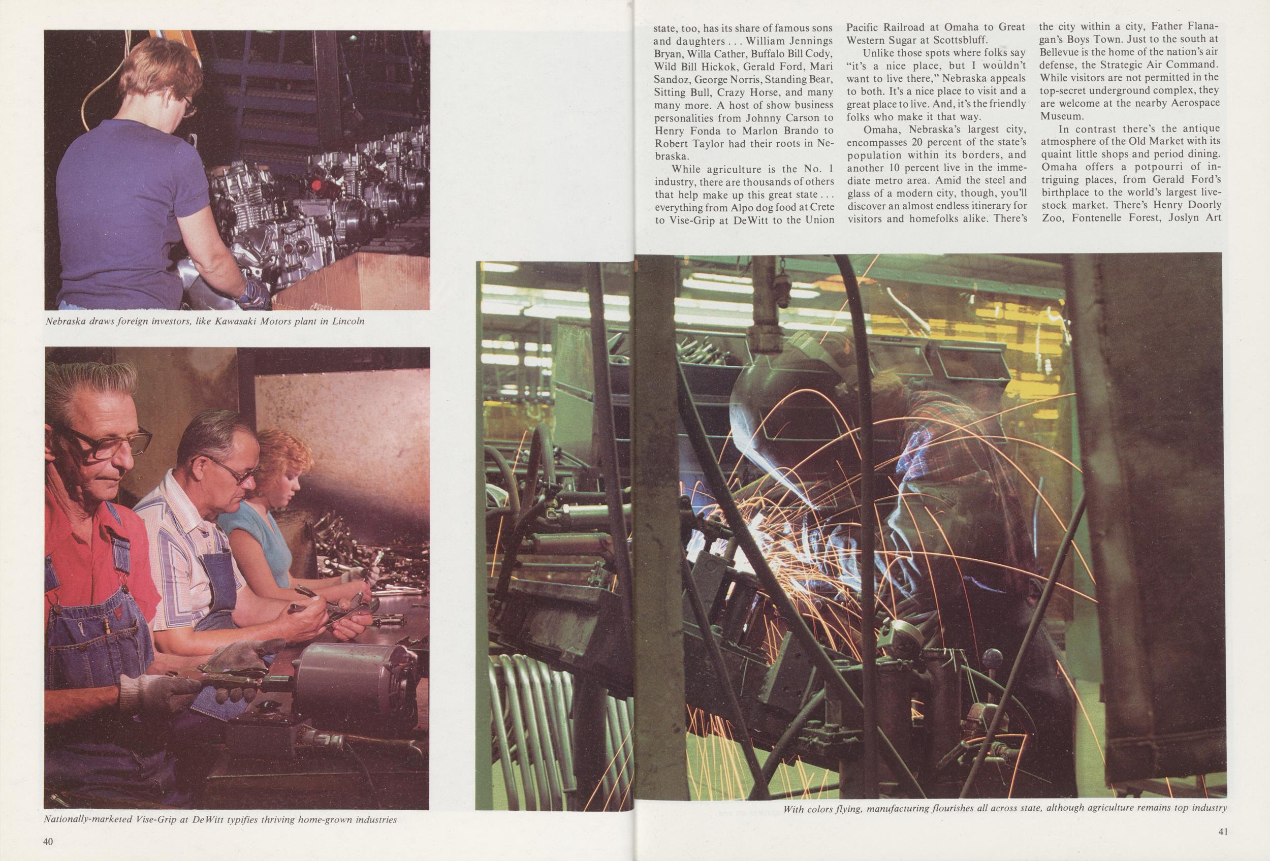
Nebraska draws foreign investors, like Kawasaki Motors plant in Lincoln
Nationally-marketed Vise-Grip at DeWitt typifies thriving home-grown industries
state, too, has its share of famous sons and daughters . . . William Jennings Bryan, Willa Gather, Buffalo Bill Cody, Wild Bill Hickok, Gerald Ford, Mari Sandoz, George Norris, Standing Bear, Sitting Bull, Crazy Horse, and many many more. A host of show business personalities from Johnny Carson to Henry Fonda to Marlon Brando to Robert Taylor had their roots in Nebraska.
While agriculture is the No. 1 industry, there are thousands of others that help make up this great state ... everything from Alpo dog food at Crete to Vise-Grip at DeWitt to the Union Pacific Railroad at Omaha to Great Western Sugar at Scottsbluff.
Unlike those spots where folks say "it's a nice place, but I wouldn't want to live there," Nebraska appeals to both. It's a nice place to visit and a great place to live. And, it's the friendly folks who make it that way.
Omaha, Nebraska's largest city, encompasses 20 percent of the state's population within its borders, and another 10 percent live in the immediate metro area. Amid the steel and glass of a modern city, though, you'll discover an almost endless itinerary for visitors and homefolks alike. There's the city within a city, Father Flanagan's Boys Town. Just to the south at Bellevue is the home of the nation's air defense, the Strategic Air Command. While visitors are not permitted in the top-secret underground complex, they are welcome at the nearby Aerospace Museum.
In contrast there's the antique atmosphere of the Old Market with its quaint little shops and period dining. Omaha offers a potpourri of intriguing places, from Gerald Ford's birthplace to the world's largest livestock market. There's Henry Doorly Zoo, Fontenelle Forest, Joslyn Art
With colors flying, manufacturing flourishes all across state, although agriculture remains top industry
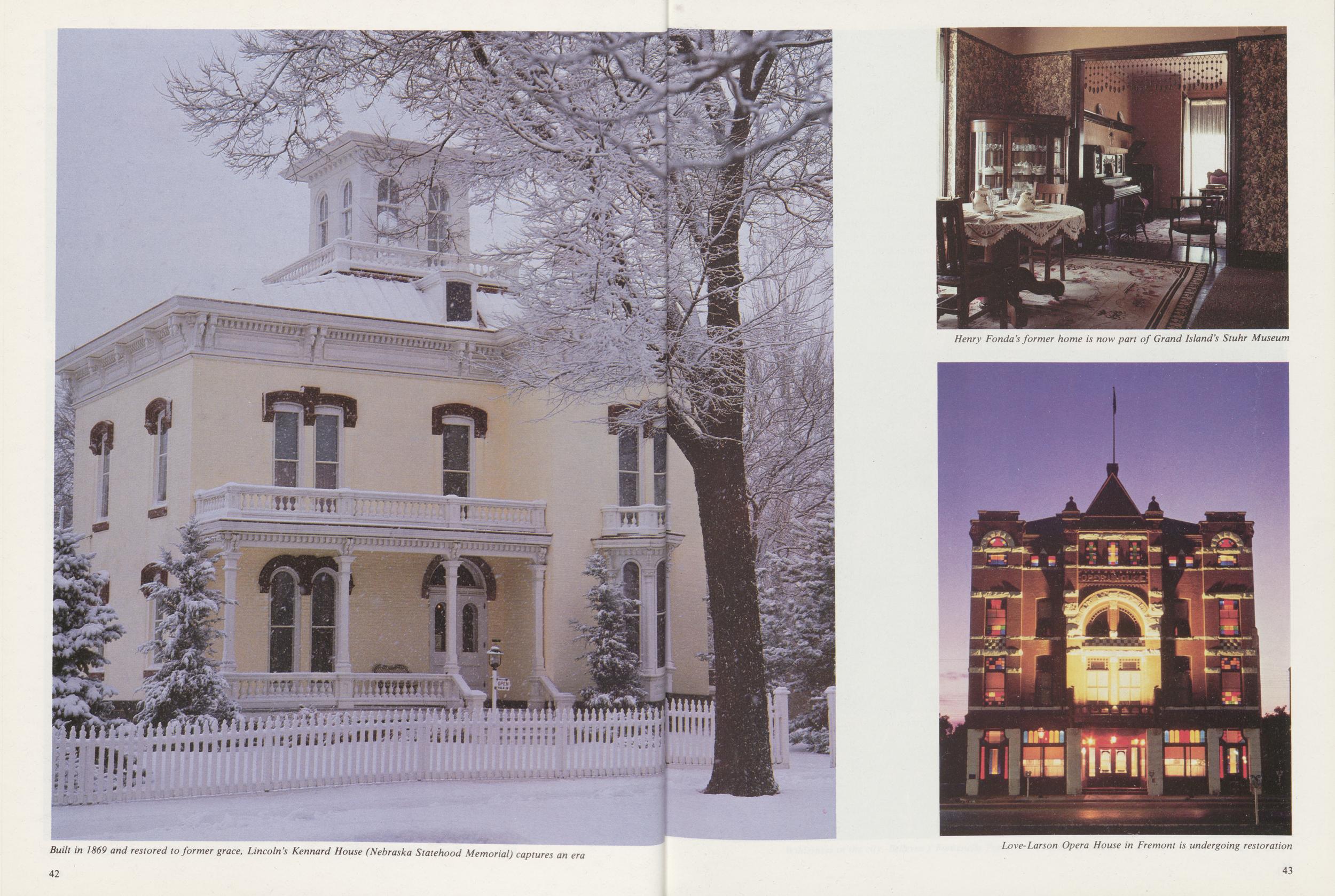
Built in 1869 and restored to former grace, Lincoln's Kennard House (Nebraska Statehood Memorial) captures an era
Henry Fonda's former home is now part of Grand Island's Stuhr Museum
Love-Larson Opera House in Fremont is undergoing restoration
Museum, the Union Pacific Museum, riverboats, the Mormon Cemetery and Winter Quarters at Florence, Ak-Sar-Ben horse racing and rodeo, dinner theater, symphony concerts, Peony Park and a whole lot more.
Just 50 miles down the road is the Capital City of Lincoln, home of the nation's only one-house legislature, and main campus of the University of Nebraska. The exceptional State Capitol has been judged one of the top 10 architectural wonders of the world. On a football Saturday, you'll see red ... a sea of red ... as the fans turn out to cheer their Big Red, the NU Cornhuskers, perennial power in the Big Eight Conference. Visitors will find a host of other attractions, as well, from William Jennings Bryan's home to Sheldon Art Gallery, the University of Nebraska State Museum (Elephant Hall), the Hay Market district, and Children's Zoo.
For those with a yen for fine food, there's a savory smorgasbord waiting to tempt the taste buds just about anyplace in the state. Of course, a prime Nebraska steak is on the menu everywhere. But, the bill of fare encompasses a whole gamut of palate-pleasing, delectable tidbits from buffalo burgers to kolaches. Depending on your tastes, you can choose fine restaurants with unique decors and cuisine, or good,
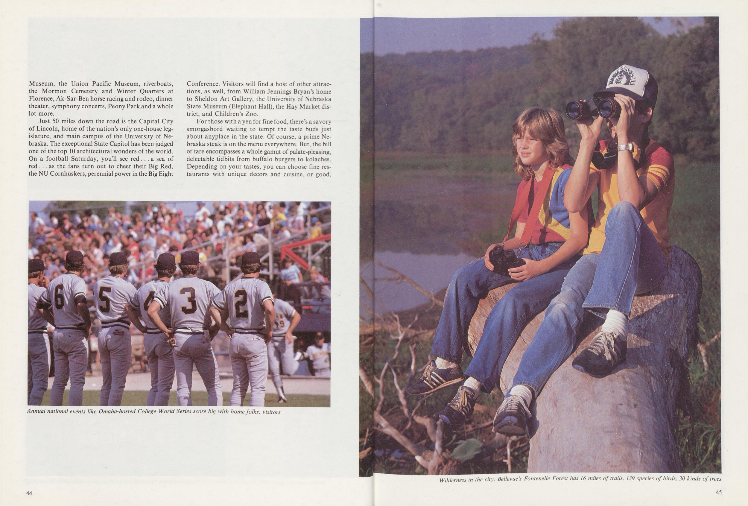
Annual national events like Omaha-hosted College World Series score big with home folks, visitors
Wilderness in the city, Bellevue's Fontenelle Forest has 16 miles of trails, 139 species of birds, 30 kinds of trees
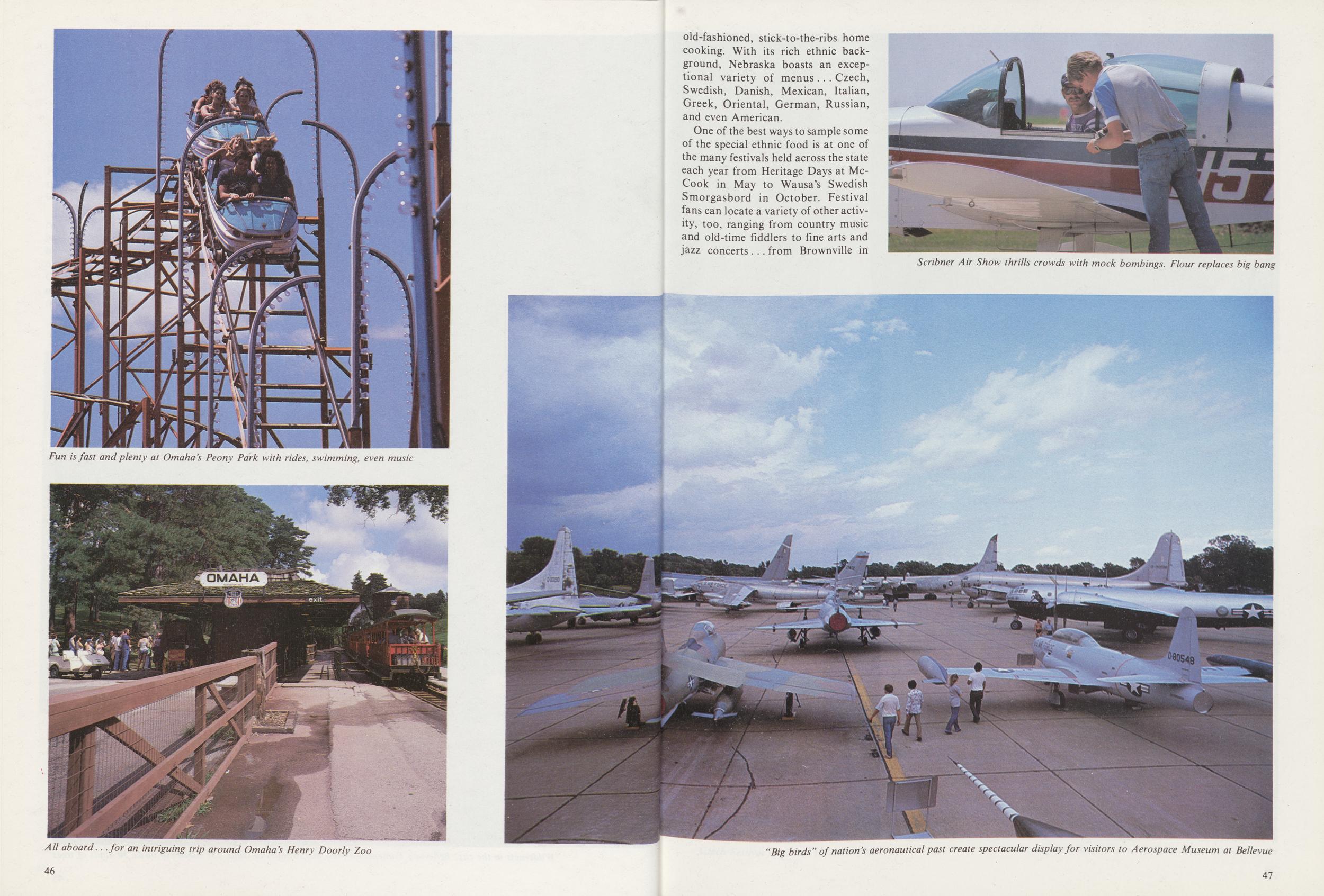
Fun is fast and plenty at Omaha's Peony Park with rides, swimming, even music
All aboard. . .for an intriguing trip around Omaha's Henry Doorly Zoo
old-fashioned, stick-to-the-ribs home cooking. With its rich ethnic background, Nebraska boasts an exceptional variety of menus . . . Czech, Swedish, Danish, Mexican, Italian, Greek, Oriental, German, Russian, and even American.
One of the best ways to sample some of the special ethnic food is at one of the many festivals held across the state each year from Heritage Days at McCook in May to Wausa's Swedish Smorgasbord in October. Festival fans can locate a variety of other activity, too, ranging from country music and old-time fiddlers to fine arts and jazz concerts . . . from Brownville in
Scribner Air Show thrills crowds with mock bombings. Flour replaces big bang
"Big birds" of nation's aeronautical past create spectacular display for visitors to Aerospace Museum at Bellevue
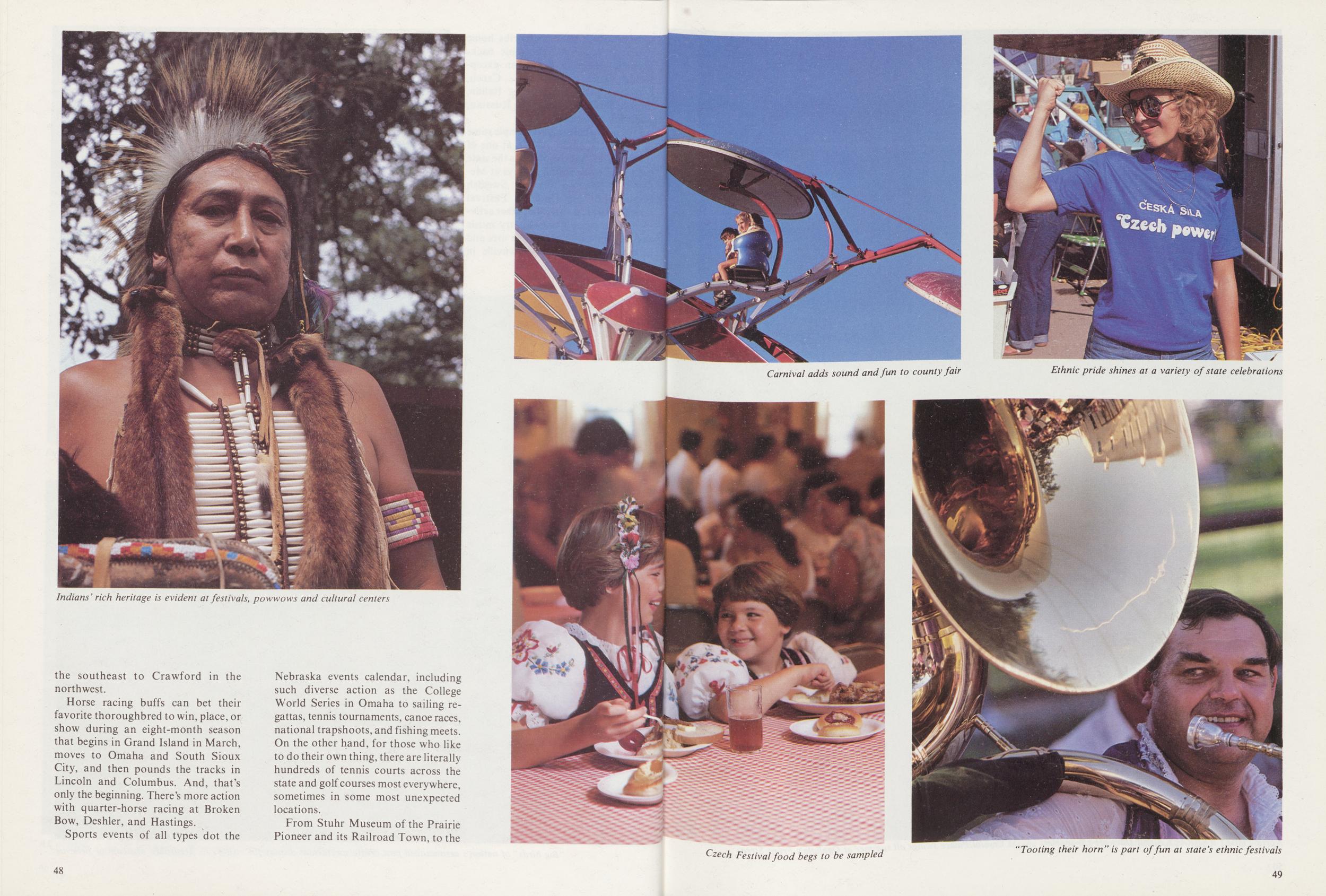
Indians' rich heritage is evident at festivals, powwows and cultural centers
the southeast to Crawford in the northwest.
Horse racing buffs can bet their favorite thoroughbred to win, place, or show during an eight-month season that begins in Grand Island in March, moves to Omaha and South Sioux City, and then pounds the tracks in Lincoln and Columbus. And, that's only the beginning. There's more action with quarter-horse racing at Broken Bow, Deshler, and Hastings.
Sports events of all types dot the Nebraska events calendar, including such diverse action as the College World Series in Omaha to sailing regattas, tennis tournaments, canoe races, national trapshoots, and fishing meets. On the other hand, for those who like to do their own thing, there are literally hundreds of tennis courts across the state and golf courses most everywhere, sometimes in some most unexpected locations.
From Stuhr Museum of the Prairie Pioneer and its Railroad Town, to the
48Carnival adds sound and fun to county fair
Ethnic pride shines at a variety of state celebrations
Czech Festival food begs to be sampled
"'Tooting their horn" is part of fun at state's ethnic festivals
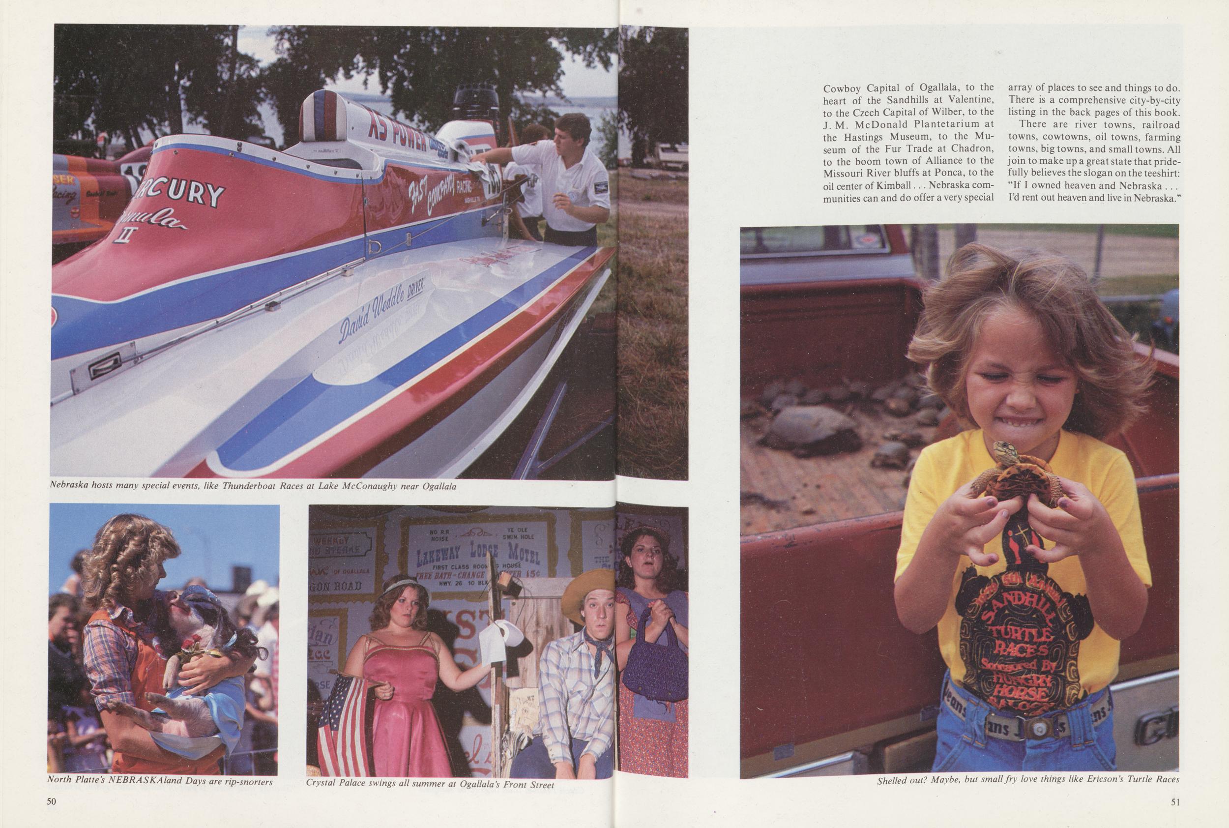
Nebraska hosts many special events, like Thunderboat Races at Lake McConaughy near Ogallala
North Platte's NEBRASKAland Days are rip-snorters
Crystal Palace swings all summer at Ogallala's Front Street
Cowboy Capital of Ogallala, to the heart of the Sandhills at Valentine, to the Czech Capital of Wilber, to the J. M. McDonald Plantetarium at the Hastings Museum, to the Museum of the Fur Trade at Chadron, to the boom town of Alliance to the Missouri River bluffs at Ponca, to the oil center of Kimball... Nebraska communities can and do offer a very special array of places to see and things to do. There is a comprehensive city-by-city listing in the back pages of this book.
There are river towns, railroad towns, cowtowns, oil towns, farming towns, big towns, and small towns. All join to make up a great state that pridefully believes the slogan on the teeshirt: "If I owned heaven and Nebraska ... I'd rent out heaven and live in Nebraska."
Shelled out? Maybe, but small fry love things like Ericson's Turtle Races
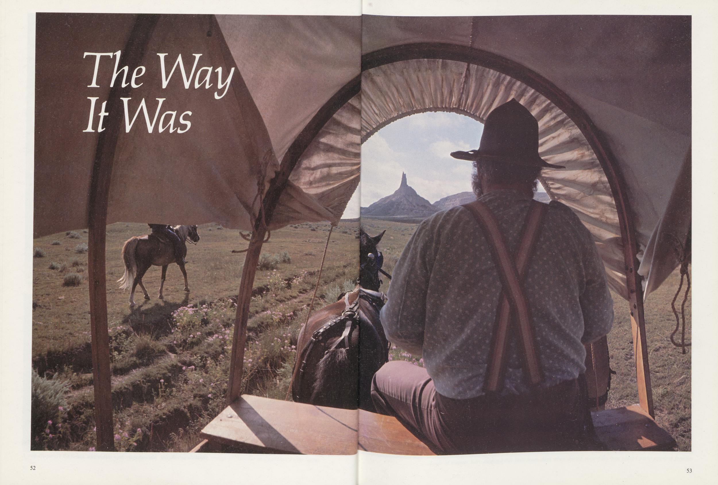
The Way It Was
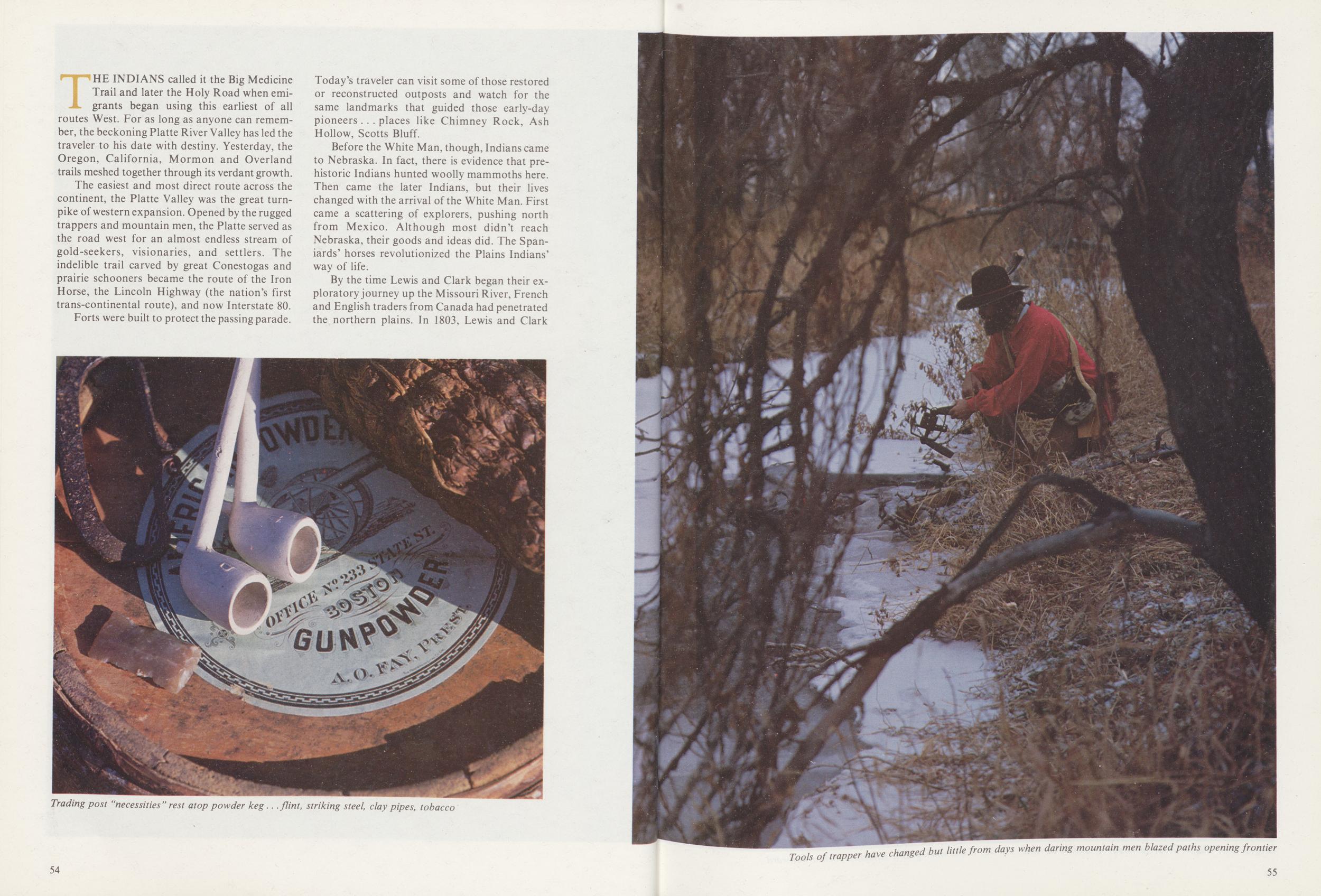
THE INDIANS called it the Big Medicine Trail and later the Holy Road when emigrants began using this earliest of all routes West. For as long as anyone can remember, the beckoning Platte River Valley has led the traveler to his date with destiny. Yesterday, the Oregon, California, Mormon and Overland trails meshed together through its verdant growth.
The easiest and most direct route across the continent, the Platte Valley was the great turnpike of western expansion. Opened by the rugged trappers and mountain men, the Platte served as the road west for an almost endless stream of gold-seekers, visionaries, and settlers. The indelible trail carved by great Conestogas and prairie schooners became the route of the Iron Horse, the Lincoln Highway (the nation's first trans-continental route), and now Interstate 80.
Forts were built to protect the passing parade. Today's traveler can visit some of those restored or reconstructed outposts and watch for the same landmarks that guided those early-day pioneers . . . places like Chimney Rock, Ash Hollow, Scotts Bluff.
Before the White Man, though, Indians came to Nebraska. In fact, there is evidence that prehistoric Indians hunted woolly mammoths here. Then came the later Indians, but their lives changed with the arrival of the White Man. First came a scattering of explorers, pushing north from Mexico. Although most didn't reach Nebraska, their goods and ideas did. The Spaniards' horses revolutionized the Plains Indians' way of life.
By the time Lewis and Clark began their exploratory journey up the Missouri River, French and English traders from Canada had penetrated the northern plains. In 1803, Lewis and Clark
Trading post "necessities" rest atop powder keg...flint, striking steel, clay pipes, tobacco
Tools of trapper have changed but little from days when daring mountain men blazed paths opening frontier
camped at a place they called Council Bluff to hold talks with local Indians. Near there on the Nebraska side of the river, the first fort west of the Missouri was built in 1820. Fort Atkinson was established to protect trappers and traders who were already journeying up and down the river. Manuel Lisa had a fortified station just downstream when the soldiers began Fort Atkinson.
Today, Fort Atkinson sits on the bluffs overlooking a fickle river that moved three miles away. Now a state historical park, the fort is partially reconstructed. Work is still in progress to restore the entire garrison, but it is open to the public. Although the Missouri River trading posts are gone, the Museum of the Fur Trade at Chadron in the Pine Ridge depicts the Bordeaux Trading Post in its heyday, and history buffs will find a historical marker at Chadron Creek Trading Post.
Jed Smith, Jim Bridger, Tom Fitzpatrick, and Jim Clyman passed by Fort Atkinson the spring before they began their westward jaunts looking for a pass through the Rockies, and it was to Fort Atkinson that they returned with news they had found it. In a few years, thousands of emigrants would pour over their route to settle in Oregon or pan for gold in California.
There had been an economic depression in the East in the 1830's with some 600 bank closings in 1837 alone. Many travelers were looking for a new start. Thousands had died in the East from cholera, typhoid, tuberculosis, dysentery, scarlet fever, and malaria. Little did those trying
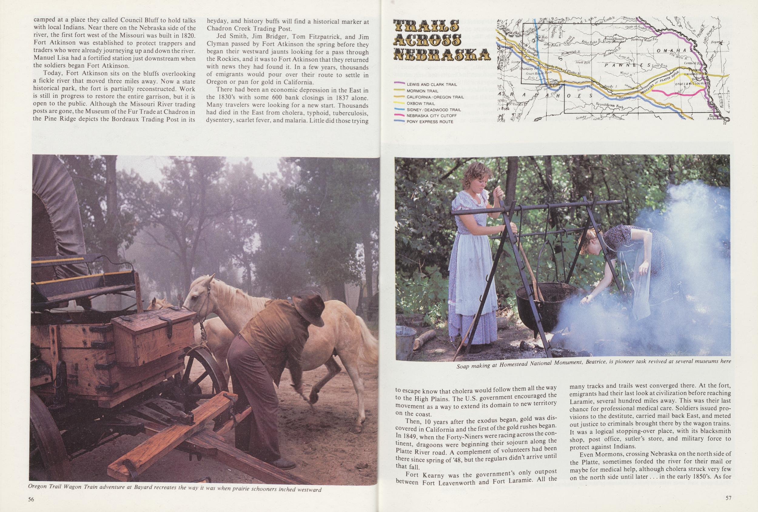
Oregon Trail Wagon Train adventure at Bayard recreates the way it was when prairie schooners inched westward
Soap making at Homestead National Monument, Beatrice, is pioneer task revived at several museums here
to escape know that cholera would follow them all the way to the High Plains. The U.S. government encouraged the movement as a way to extend its domain to new territory on the coast.
Then, 10 years after the exodus began, gold was discovered in California and the first of the gold rushes began. In 1849, when the Forty-Niners were racing across the continent, dragoons were beginning their sojourn along the Platte River road. A complement of volunteers had been there since spring of '48, but the regulars didn't arrive until that fall.
Fort Kearny was the government's only outpost between Fort Leavenworth and Fort Laramie. All the many tracks and trails west converged there. At the fort, emigrants had their last look at civilization before reaching Laramie, several hundred miles away. This was their last chance for professional medical care. Soldiers issued provisions to the destitute, carried mail back East, and meted out justice to criminals brought there by the wagon trains. It was a logical stopping-over place, with its blacksmith shop, post office, sutler's store, and military force to protect against Indians.
Even Mormons, crossing Nebraska on the north side of
the Platte, sometimes forded the river for their mail or
maybe for medical help, although cholera struck very few
on the north side until later ... in the early 1850's. As for
57
 protection from the Indians, the
Mormons held little fear of their red
brothers, whom they called the lost
children of Israel, and had little trouble
with them.
protection from the Indians, the
Mormons held little fear of their red
brothers, whom they called the lost
children of Israel, and had little trouble
with them.
Today, the blacksmith shop at Fort Kearny has been rebuilt, and during the summer season a smithy works there demonstrating how it was done "back then." An interpretive center displays artifacts from the old fort, and one of four stockades built during the Indian War of 1864 has been reconstructed.
All across Nebraska in those years, people were busy moving to and fro in numbers that stagger the imagination—even as does their means of transportation. There were freighters hauling tons of supplies along the Great Platte River Road. With teams of plodding oxen or stubborn mules, they walked across America sweating over breakdowns, quieting animals during thunderstorms, fighting Indians, and choking on trail dust.
But Conestoga wagons and mules or oxen were slow, especially when gold fever struck again in 1858 with the discovery of Colorado gold at Pike's Peak. The need for speed led to stage lines. Instead of loading enough supplies for a five-month trip in a wagon and walking 2,000 miles to California, a person could board a stagecoach in Omaha and start across the prairie at breakneck speed, flying over chuckholes and clods, hanging on with all his or her strength, and arrive in days, not months. Colorado, of course, was closer. The traveler could buy means at "home" stations, like
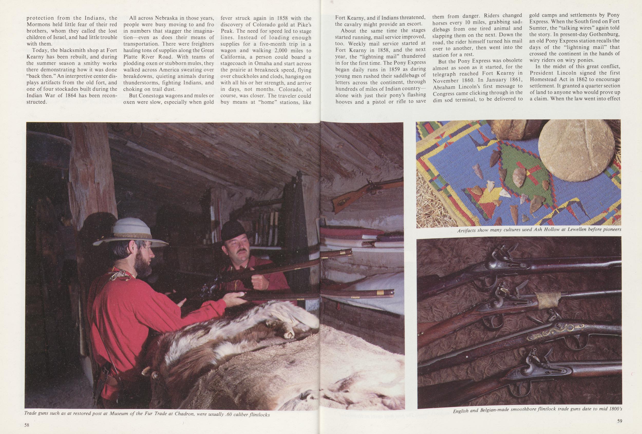
Trade guns such as at restored post at Museum of the Fur Trade at Chadron, were usually .60 caliber flintlocks
Fort Kearny, and if Indians threatened, the cavalry might provide an escort.
About the same time the stages started running, mail service improved, too. Weekly mail service started at Fort Kearny in 1858, and the next year, the "lightning mail" thundered in for the first time. The Pony Express began daily runs in 1859 as daring young men rushed their saddlebags of letters across the continent, through hundreds of miles of Indian country—alone with just their pony's flashing hooves and a pistol or rifle to save them from danger. Riders changed horses every 10 miles, grabbing saddlebags from one tired animal and slapping them on the next, Down the road, the rider himself turned his mail over to another, then went into the station for a rest.
But the Pony Express was obsolete almost as soon as it started, for the telegraph reached Fort Kearny in November 1860. In January 1861, Abraham Lincoln's first message to Congress came clicking through in the dim sod terminal, to be delivered to gold camps and settlements by Pony Express. When the South fired on Fort Sumter, the "talking wires" again told the story. In present-day Gothenburg, an old Pony Express station recalls the days of the "lightning mail" that crossed the continent in the hands of wiry riders on wiry ponies.
In the midst of this great conflict, President Lincoln signed the first Homestead Act in 1862 to encourage settlement. It granted a quarter section of land to anyone who would prove up a claim. When the law went into effect
Artifacts show many cultures used Ash Hollow at Lewellen before pioneers
English and Belgian-made smoothbore flintlock trade guns date to mid 1800's
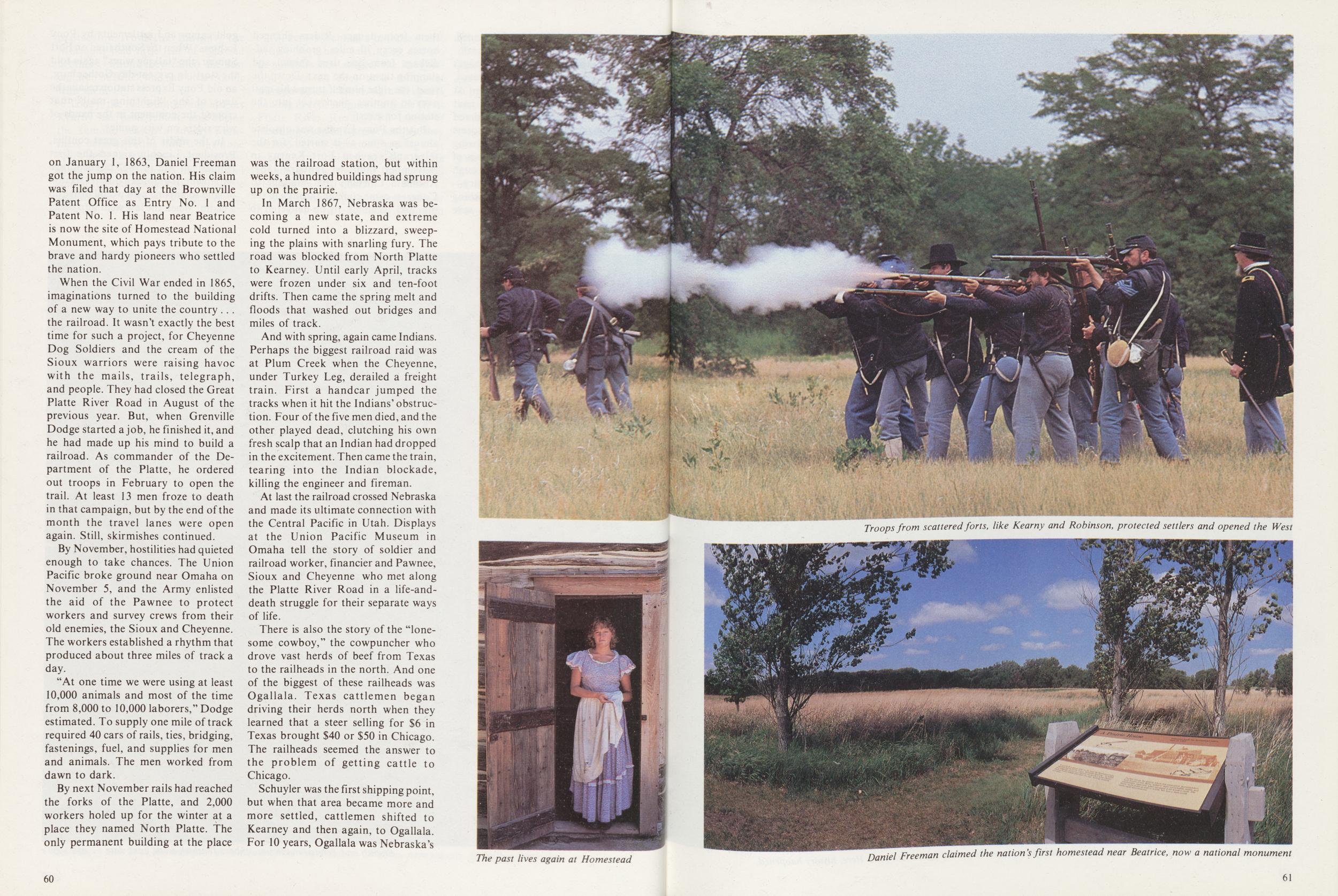
on January 1, 1863, Daniel Freeman got the jump on the nation. His claim was filed that day at the Brownville Patent Office as Entry No. 1 and Patent No. 1. His land near Beatrice is now the site of Homestead National Monument, which pays tribute to the brave and hardy pioneers who settled the nation.
When the Civil War ended in 1865, imaginations turned to the building of a new way to unite the country .. . the railroad. It wasn't exactly the best time for such a project, for Cheyenne Dog Soldiers and the cream of the Sioux warriors were raising havoc with the mails, trails, telegraph, and people. They had closed the Great Platte River Road in August of the previous year. But, when Grenville Dodge started a job, he finished it, and he had made up his mind to build a railroad. As commander of the Department of the Platte, he ordered out troops in February to open the trail. At least 13 men froze to death in that campaign, but by the end of the month the travel lanes were open again. Still, skirmishes continued.
By November, hostilities had quieted enough to take chances. The Union Pacific broke ground near Omaha on November 5, and the Army enlisted the aid of the Pawnee to protect workers and survey crews from their old enemies, the Sioux and Cheyenne. The workers established a rhythm that produced about three miles of track a day.
"At one time we were using at least 10,000 animals and most of the time from 8,000 to 10,000 laborers," Dodge estimated. To supply one mile of track required 40 cars of rails, ties, bridging, fastenings, fuel, and supplies for men and animals. The men worked from dawn to dark.
By next November rails had reached the forks of the Platte, and 2,000 workers holed up for the winter at a place they named North Platte. The only permanent building at the place was the railroad station, but within weeks, a hundred buildings had sprung up on the prairie.
In March 1867, Nebraska was becoming a new state, and extreme cold turned into a blizzard, sweeping the plains with snarling fury. The road was blocked from North Platte to Kearney. Until early April, tracks were frozen under six and ten-foot drifts. Then came the spring melt and floods that washed out bridges and miles of track.
And with spring, again came Indians. Perhaps the biggest railroad raid was at Plum Creek when the Cheyenne, under Turkey Leg, derailed a freight train. First a handcar jumped the tracks when it hit the Indians' obstruction. Four of the five men died, and the other played dead, clutching his own fresh scalp that an Indian had dropped in the excitement. Then came the train, tearing into the Indian blockade, killing the engineer and fireman.
At last the railroad crossed Nebraska and made its ultimate connection with the Central Pacific in Utah. Displays at the Union Pacific Museum in Omaha tell the story of soldier and railroad worker, financier and Pawnee, Sioux and Cheyenne who met along the Platte River Road in a life-and-death struggle for their separate ways of life.
There is also the story of the "lonesome cowboy," the cowpuncher who drove vast herds of beef from Texas to the railheads in the north. And one of the biggest of these railheads was Ogallala. Texas cattlemen began driving their herds north when they learned that a steer selling for $6 in Texas brought $40 or $50 in Chicago. The railheads seemed the answer to the problem of getting cattle to Chicago.
Schuyler was the first shipping point, but when that area became more and more settled, cattlemen shifted to Kearney and then again, to Ogallala. For 10 years, Ogallala was Nebraska's
The past lives again at Homestead
Troops from scattered forts, like Kearny and Robinson, protected settlers and opened the West
Daniel Freeman claimed the nation's first homestead near Beatrice, now a national monument
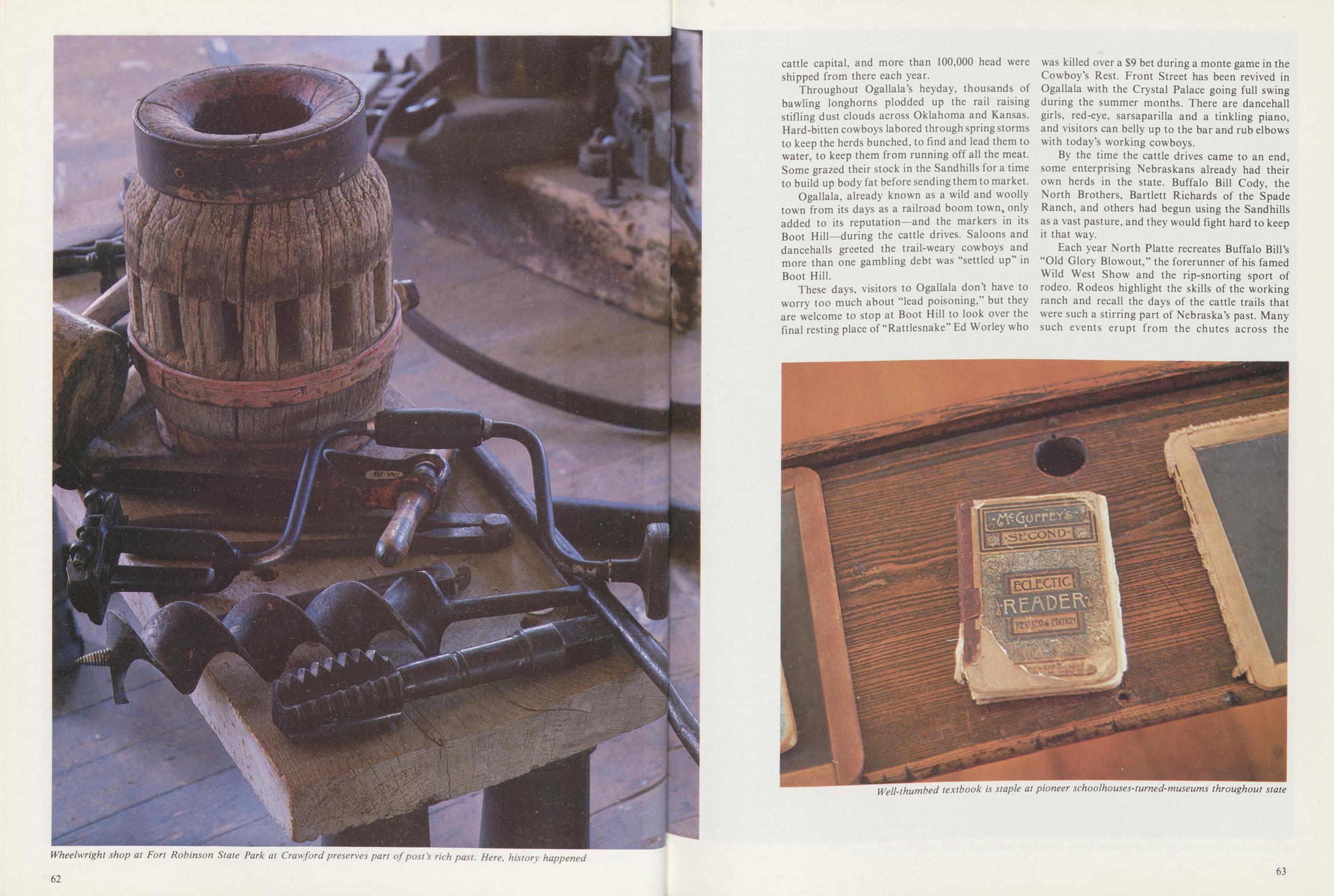
Wheelwright shop at Fort Robinson State Park at Crawford preserves part of post's rich past. Here, history happened
cattle capital, and more than 100,000 head were shipped from there each year.
Throughout Ogallala's heyday, thousands of bawling longhorns plodded up the rail raising stifling dust clouds across Oklahoma and Kansas. Hard-bitten cowboys labored through spring storms to keep the herds bunched, to find and lead them to water, to keep them from running off all the meat. Some grazed their stock in the Sandhills for a time to build up body fat before sending them to market.
Ogallala, already known as a wild and woolly town from its days as a railroad boom town only added to its reputation—and the markers in its Boot Hill—during the cattle drives. Saloons and dancehalls greeted the trail-weary cowboys and more than one gambling debt was "settled up" in Boot Hill.
These days, visitors to Ogallala don't have to worry too much about "lead poisoning," but they are welcome to stop at Boot Hill to look over the final resting place of "Rattlesnake" Ed Worley who was killed over a $9 bet during a monte game in the Cowboy's Rest. Front Street has been revived in Ogallala with the Crystal Palace going full swing during the summer months. There are dancehall girls, red-eye, sarsaparilla and a tinkling piano, and visitors can belly up to the bar and rub elbows with today's working cowboys.
By the time the cattle drives came to an end, some enterprising Nebraskans already had their own herds in the state. Buffalo Bill Cody, the North Brothers, Bartlett Richards of the Spade Ranch, and others had begun using the Sandhills as a vast pasture, and they would fight hard to keep it that way.
Each year North Platte recreates Buffalo Bill's "Old Glory Blowout," the forerunner of his famed Wild West Show and the rip-snorting sport of rodeo. Rodeos highlight the skills of the working ranch and recall the days of the cattle trails that were such a stirring part of Nebraska's past. Many such events erupt from the chutes across the
Well-thumbed textbook is staple at pioneer schoolhouses-turned-museums throughout state
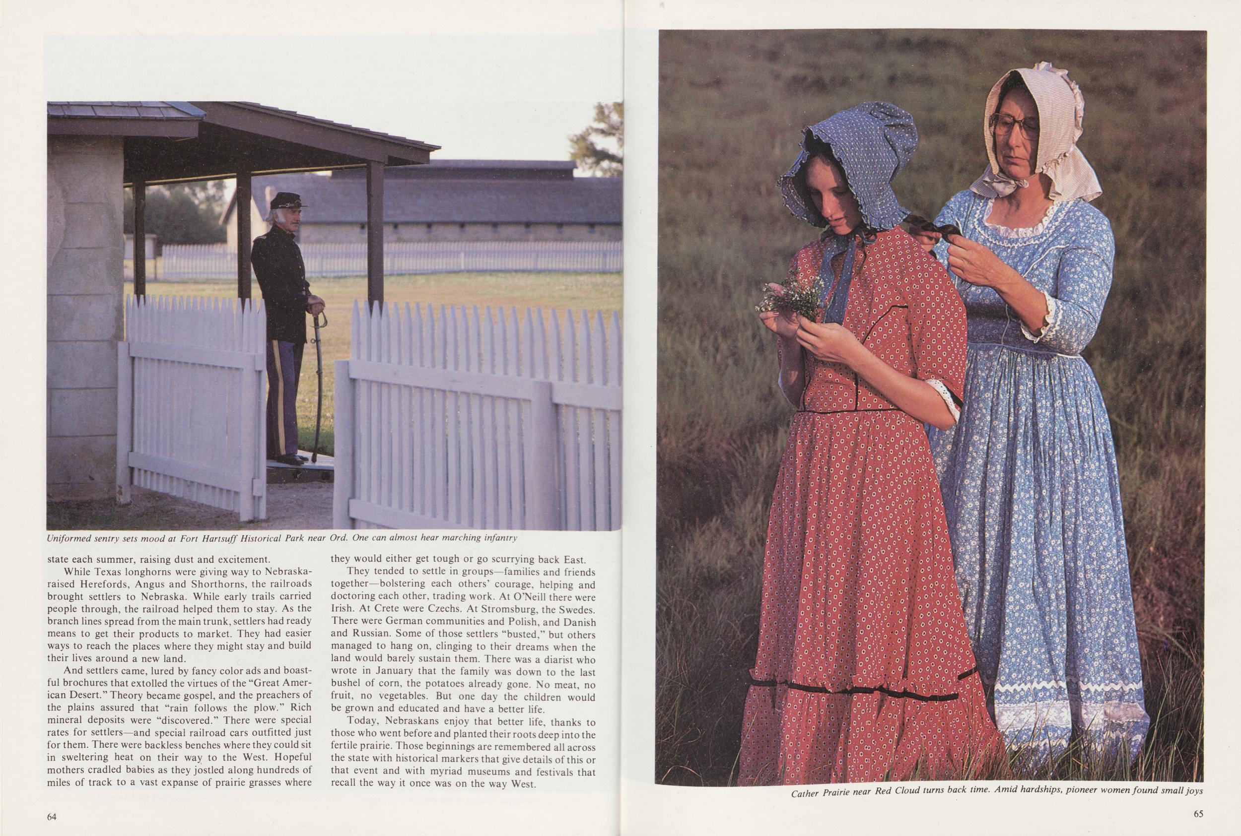
Uniformed sentry sets mood at Fort Hartsuff Historical Park near Ord. One can almost hear marching infantry
state each summer, raising dust and excitement.
While Texas longhorns were giving way to Nebraska-raised Herefords, Angus and Shorthorns, the railroads brought settlers to Nebraska. While early trails carried people through, the railroad helped them to stay. As the branch lines spread from the main trunk, settlers had ready means to get their products to market. They had easier ways to reach the places where they might stay and build their lives around a new land.
And settlers came, lured by fancy color ads and boastful brochures that extolled the virtues of the "Great American Desert." Theory became gospel, and the preachers of the plains assured that "rain follows the plow.v Rich mineral deposits were "discovered." There were special rates for settlers—and special railroad cars outfitted just for them. There were backless benches where they could sit in sweltering heat on their way to the West. Hopeful mothers cradled babies as they jostled along hundreds of miles of track to a vast expanse of prairie grasses where they would either get tough or go scurrying back East.
They tended to settle in groups—families and friends together—bolstering each others' courage, helping and doctoring each other, trading work. At O'Neill there were Irish. At Crete were Czechs. At Stromsburg, the Swedes. There were German communities and Polish, and Danish and Russian. Some of those settlers "busted," but others managed to hang on, clinging to their dreams when the land would barely sustain them. There was a diarist who wrote in January that the family was down to the last bushel of corn, the potatoes already gone. No meat, no fruit, no vegetables. But one day the children would be grown and educated and have a better life.
Today, Nebraskans enjoy that better life, thanks to those who went before and planted their roots deep into the fertile prairie. Those beginnings are remembered all across the state with historical markers that give details of this or that event and with myriad museums and festivals that recall the way it once was on the way West.
64Cather Prairie near Red Cloud turns back time. Amid hardships, pioneer women found small joys
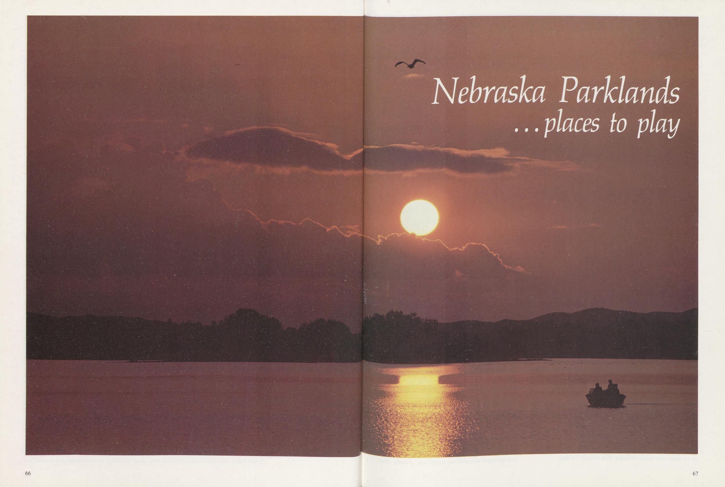
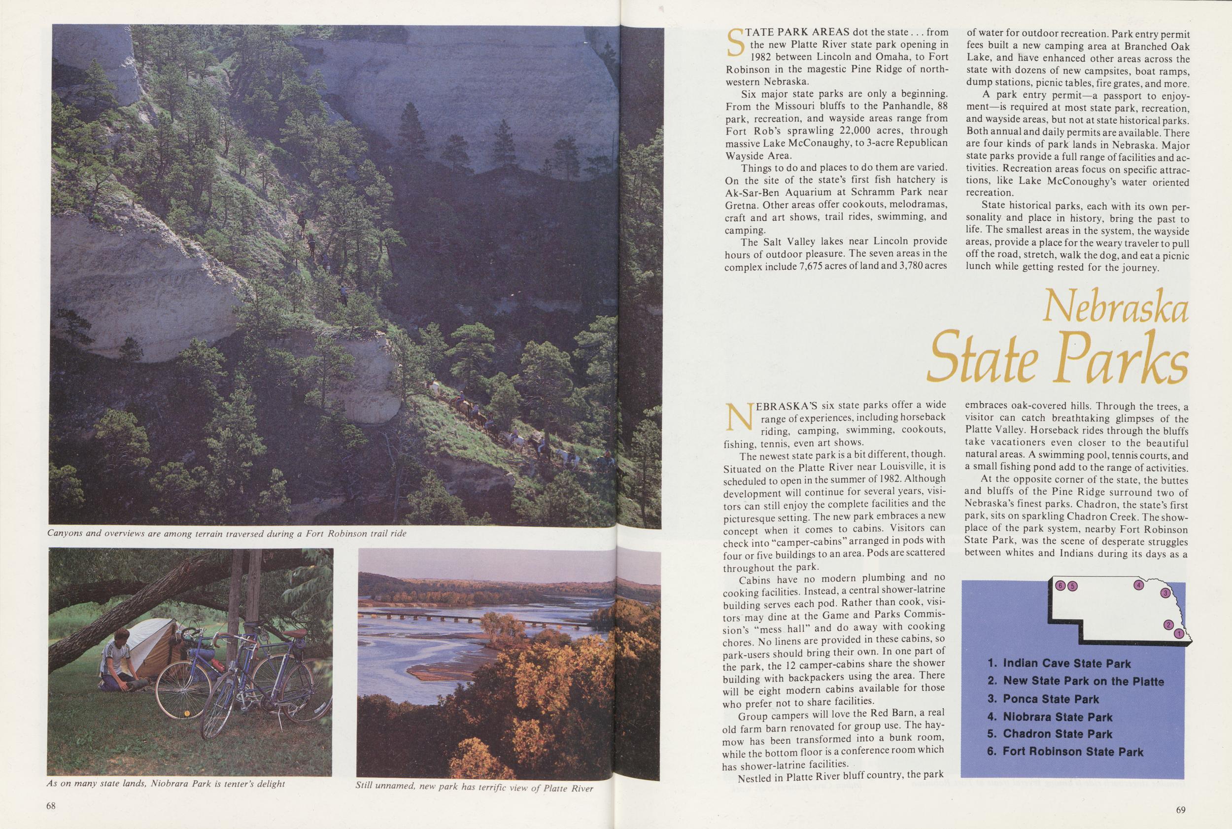
Canyons and overviews are among terrain traversed during a Fort Robinson trail ride
As on many state lands, Niobrara Park is tenter's delight
Still unnamed, new park has terrific view of Platte River
STATE PARK AREAS dot the state . .. from the new Platte River state park opening in 1982 between Lincoln and Omaha, to Fort Robinson in the magestic Pine Ridge of northwestern Nebraska.
Six major state parks are only a beginning. From the Missouri bluffs to the Panhandle, 88 park, recreation, and wayside areas range from Fort Rob's sprawling 22,000 acres, through massive Lake McConaughy, to 3-acre Republican Wayside Area.
Things to do and places to do them are varied. On the site of the state's first fish hatchery is Ak-Sar-Ben Aquarium at Schramm Park near Gretna. Other areas offer cookouts, melodramas, craft and art shows, trail rides, swimming, and camping.
The Salt Valley lakes near Lincoln provide hours of outdoor pleasure. The seven areas in the complex include 7,675 acres of land and 3,780 acres of water for outdoor recreation. Park entry permit fees built a new camping area at Branched Oak Lake, and have enhanced other areas across the state with dozens of new campsites, boat ramps, dump stations, picnic tables, fire grates, and more.
A park entry permit—a passport to enjoyment—is required at most state park, recreation, and wayside areas, but not at state historical parks. Both annual and daily permits are available. There are four kinds of park lands in Nebraska. Major state parks provide a full range of facilities and activities. Recreation areas focus on specific attractions, like Lake McConoughy's water oriented recreation.
State historical parks, each with its own personality and place in history, bring the past to life. The smallest areas in the system, the wayside areas, provide a place for the weary traveler to pull off the road, stretch, walk the dog, and eat a picnic lunch while getting rested for the journey.
Nebraska State ParksNEBRASKA'S six state parks offer a wide range of experiences, including horseback riding, camping, swimming, cookouts, fishing, tennis, even art shows.
The newest state park is a bit different, though. Situated on the Platte River near Louisville, it is scheduled to open in the summer of 1982. Although development will continue for several years, visitors can still enjoy the complete facilities and the picturesque setting. The new park embraces a new concept when it comes to cabins. Visitors can check into "camper-cabins" arranged in pods with four or five buildings to an area. Pods are scattered throughout the park.
Cabins have no modern plumbing and no cooking facilities. Instead, a central shower-latrine building serves each pod. Rather than cook, visitors may dine at the Game and Parks Commission's "mess hall" and do away with cooking chores. No linens are provided in these cabins, so park-users should bring their own. In one part of the park, the 12 camper-cabins share the shower building with backpackers using the area. There will be eight modern cabins available for those who prefer not to share facilities.
Group campers will love the Red Barn, a real old farm barn renovated for group use. The haymow has been transformed into a bunk room, while the bottom floor is a conference room which has shower-latrine facilities.
Nestled in Platte River bluff country, the park embraces oak-covered hills. Through the trees, a visitor can catch breathtaking glimpses of the Platte Valley. Horseback rides through the bluffs take vacationers even closer to the beautiful natural areas. A swimming pool, tennis courts, and a small fishing pond add to the range of activities.
At the opposite corner of the state, the buttes and bluffs of the Pine Ridge surround two of Nebraska's finest parks. Chadron, the state's first park, sits on sparkling Chadron Creek. The showplace of the park system, nearby Fort Robinson State Park, was the scene of desperate struggles between whites and Indians during its days as a
2. New State Park on the Platte
3. Ponca State Park
4. Niobrara State Park
5. Chadron State Park
6. Fort Robinson State Park
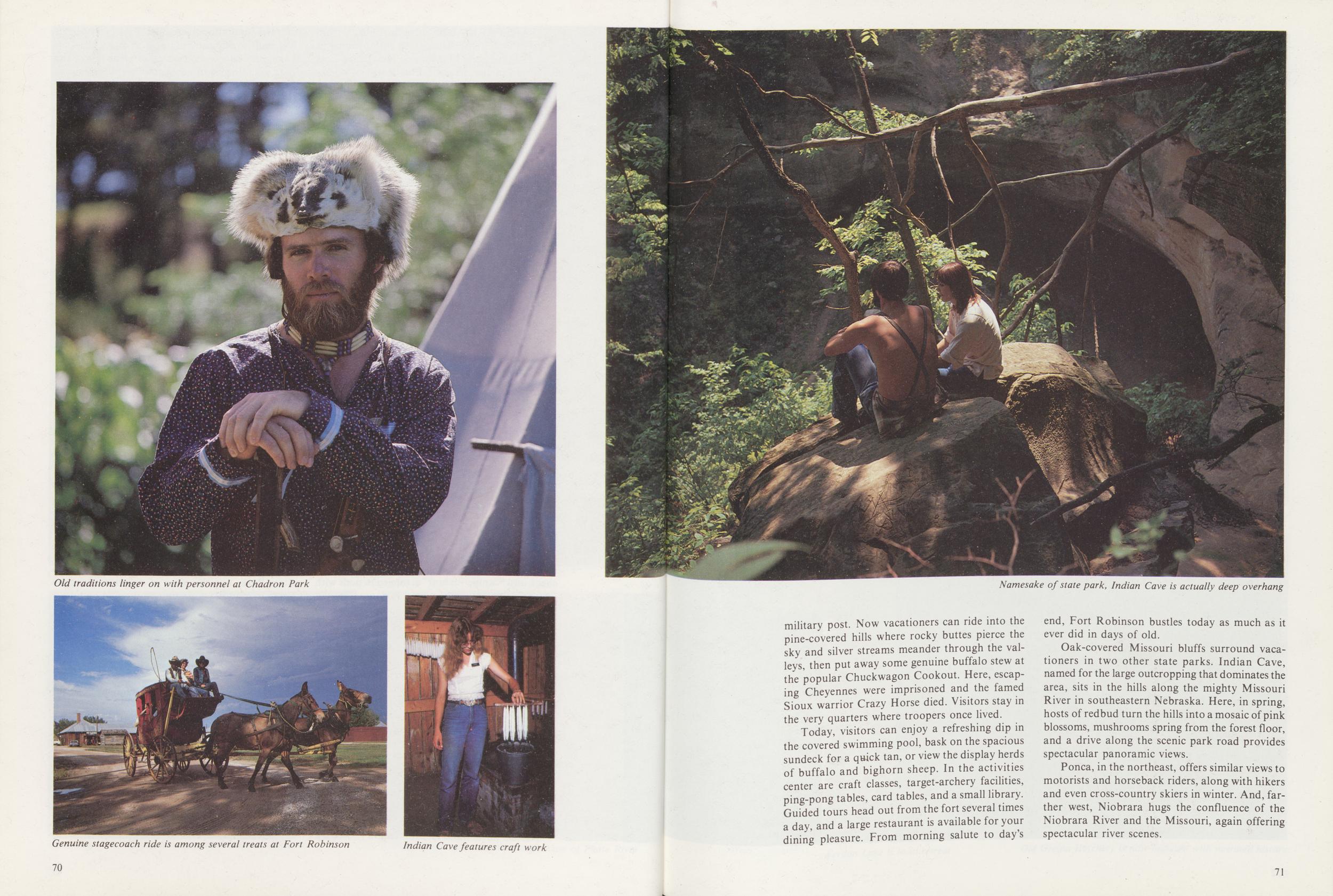
Old traditions linger on with personnel at Chadron Park
Genuine stagecoach ride is among several treats at Fort Robinson
Indian Cave features craft work
Namesake of state park, Indian Cave is actually deep overhang
military post. Now vacationers can ride into the pine-covered hills where rocky buttes pierce the sky and silver streams meander through the valleys, then put away some genuine buffalo stew at the popular Chuckwagon Cookout. Here, escaping Cheyennes were imprisoned and the famed Sioux warrior Crazy Horse died. Visitors stay in the very quarters where troopers once lived.
Today, visitors can enjoy a refreshing dip in the covered swimming pool, bask on the spacious sundeck for a quick tan, or view the display herds of buffalo and bighorn sheep. In the activities center are craft classes, target-archery facilities, ping-pong tables, card tables, and a small library. Guided tours head out from the fort several times a day, and a large restaurant is available for your dining pleasure. From morning salute to day's end, Fort Robinson bustles today as much as it ever did in days of old.
Oak-covered Missouri bluffs surround vacationers in two other state parks. Indian Cave, named for the large outcropping that dominates the area, sits in the hills along the mighty Missouri River in southeastern Nebraska. Here, in spring, hosts of redbud turn the hills into a mosaic of pink blossoms, mushrooms spring from the forest floor, and a drive along the scenic park road provides spectacular panoramic views.
Ponca, in the northeast, offers similar views to motorists and horseback riders, along with hikers and even cross-country skiers in winter. And, farther west, Niobrara hugs the confluence of the Niobrara River and the Missouri, again offering spectacular river scenes.
71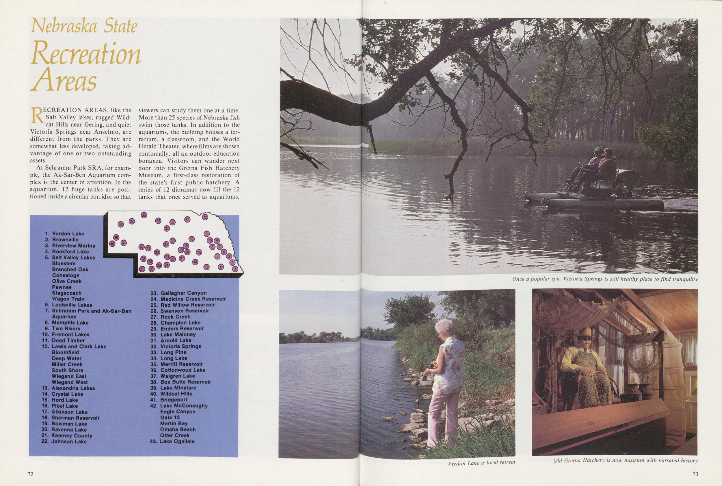
Nebraska State
Recreation Areas
RECREATION AREAS, like the Salt Valley lakes, rugged Wildcat Hills near Gering, and quiet Victoria Springs near Anselmo, are different from the parks. They are somewhat less developed, taking advantage of one or two outstanding assets.
At Schramm Park SRA, for example, the Ak-Sar-Ben Aquarium complex is the center of attention. In the aquarium, 12 huge tanks are positioned inside a circular corridor so that viewers can study them one at a time. More than 25 species of Nebraska fish swim those tanks. In addition to the aquariums, the building houses a terrarium, a classroom, and the World Herald Theater, where films are shown continually; all an outdoor-education bonanza. Visitors can wander next door into the Gretna Fish Hatchery Museum, a first-class restoration of the state's first public hatchery. A series of 12 dioramas now fill the 12 tanks that once served as aquariums,
Once a popular spa, Victoria Springs is still healthy place to find tranquility
Verdon Lake is local retreat
Old Gretna Hatchery is now museum with narrated history
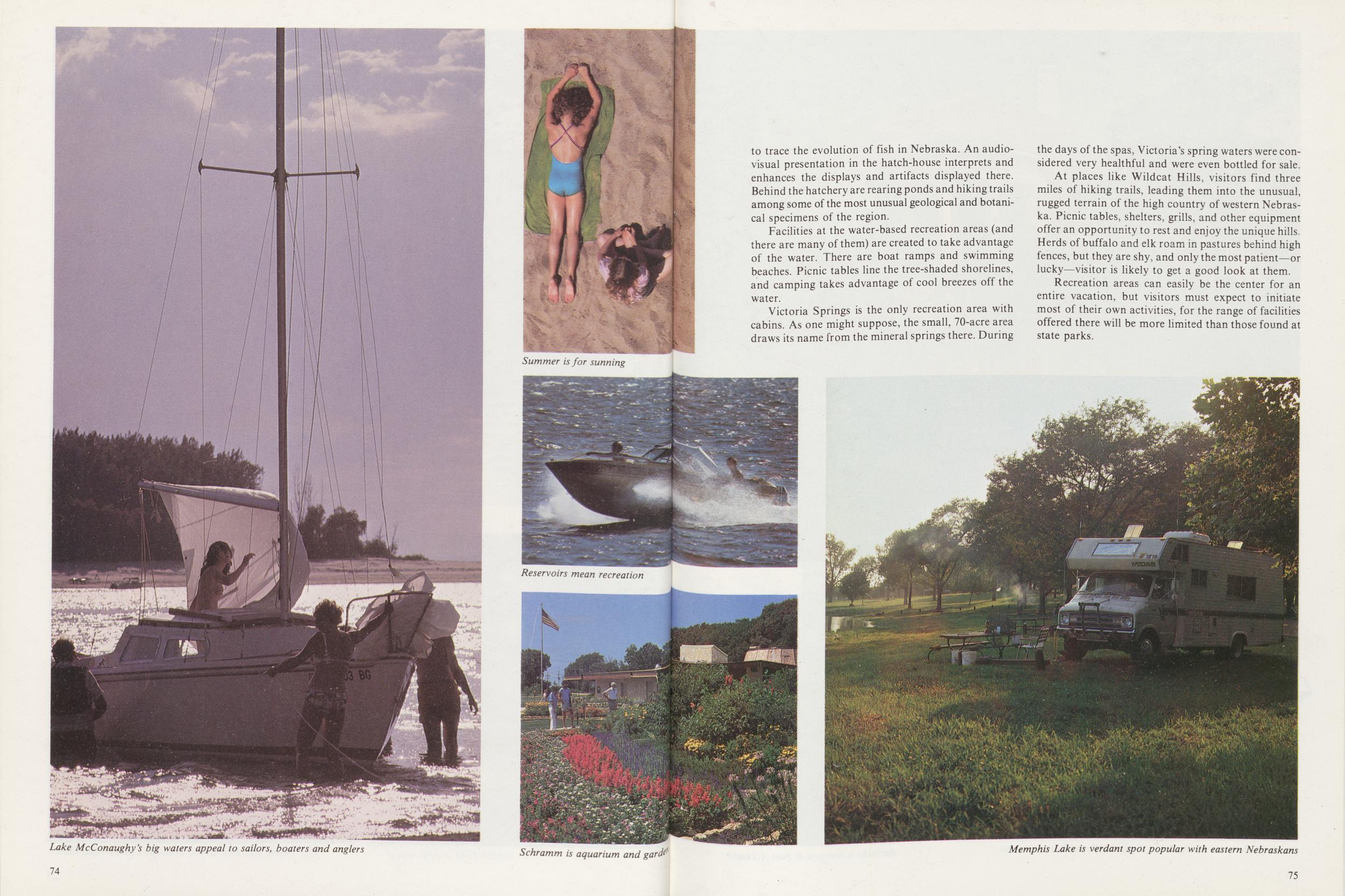
Lake McConaughy's big waters appeal to sailors, boaters and anglers
Summer is for sunning
Reservoirs mean recreation
Schramm is aquarium and gardens
to trace the evolution of fish in Nebraska. An audiovisual presentation in the hatch-house interprets and enhances the displays and artifacts displayed there. Behind the hatchery are rearing ponds and hiking trails among some of the most unusual geological and botanical specimens of the region.
Facilities at the water-based recreation areas (and there are many of them) are created to take advantage of the water. There are boat ramps and swimming beaches. Picnic tables line the tree-shaded shorelines, and camping takes advantage of cool breezes off the water.
Victoria Springs is the only recreation area with cabins. As one might suppose, the small, 70-acre area draws its name from the mineral springs there. During the days of the spas, Victoria's spring waters were considered very healthful and were even bottled for sale.
At places like Wildcat Hills, visitors find three miles of hiking trails, leading them into the unusual, rugged terrain of the high country of western Nebraska. Picnic tables, shelters, grills, and other equipment offer an opportunity to rest and enjoy the unique hills, Herds of buffalo and elk roam in pastures behind high fences, but they are shy, and only the most patient—or lucky—visitor is likely to get a good look at them.
Recreation areas can easily be the center for an entire vacation, but visitors must expect to initiate most of their own activities, for the range of facilities offered there will be more limited than those found at state parks.
Memphis Lake is verdant spot popular with eastern Nebraskans
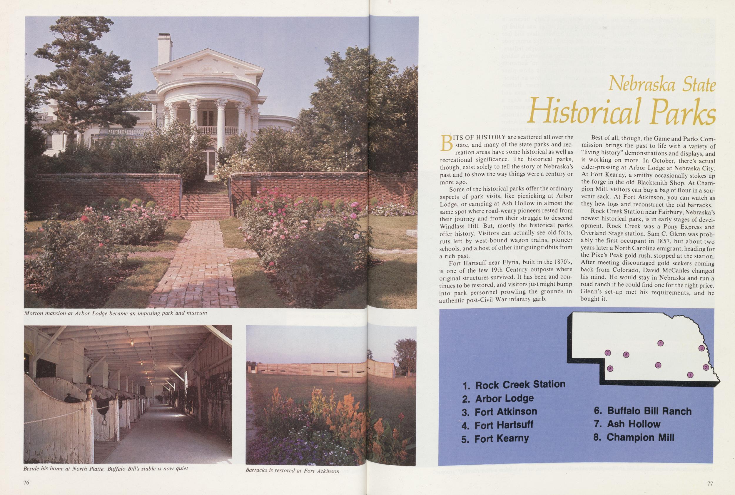
Morton mansion at Arbor Lodge became an imposing park and museum
Beside his home at North Platte, Buffalo Bill's stable is now quiet
Barracks is restored at Fort Atkinson
Nebraska State
Historical Parks
BITS OF HISTORY are scattered all over the state, and many of the state parks and recreation areas have some historical as well as recreational significance. The historical parks, though, exist solely to tell the story of Nebraska's past and to show the way things were a century or more ago.
Some of the historical parks offer the ordinary aspects of park visits, like picnicking at Arbor Lodge, or camping at Ash Hollow in almost the same spot where road-weary pioneers rested from their journey and from their struggle to descend Windlass Hill. But, mostly the historical parks offer history. Visitors can actually see old forts, ruts left by west-bound wagon trains, pioneer schools, and a host of other intriguing tidbits from a rich past.
Fort Hartsuff near Elyria, built in the 1870's, is one of the few 19th Century outposts where original structures survived. It has been and continues to be restored, and visitors just might bump into park personnel prowling the grounds in authentic post-Civil War infantry garb.
Best of all, though, the Game and Parks Commission brings the past to life with a variety of "living history" demonstrations and displays, and is working on more. In October, there's actual cider-pressing at Arbor Lodge at Nebraska City. At Fort Kearny, a smithy occasionally stokes up the forge in the old Blacksmith Shop. At Champion Mill, visitors can buy a bag of flour in a souvenir sack. At Fort Atkinson, you can watch as they hew logs and reconstruct the old barracks.
Rock Creek Station near Fairbury, Nebraska's newest historical park, is in early stages of development. Rock Creek was a Pony Express and Overland Stage station. Sam C. Glenn was probably the first occupant in 1857, but about two years later a North Carolina emigrant, heading for the Pike's Peak gold rush, stopped at the station. After meeting discouraged gold seekers coming back from Colorado, David McCanles changed his mind. He would stay in Nebraska and run a road ranch if he could find one for the right price. Glenn's set-up met his requirements, and he bought it.
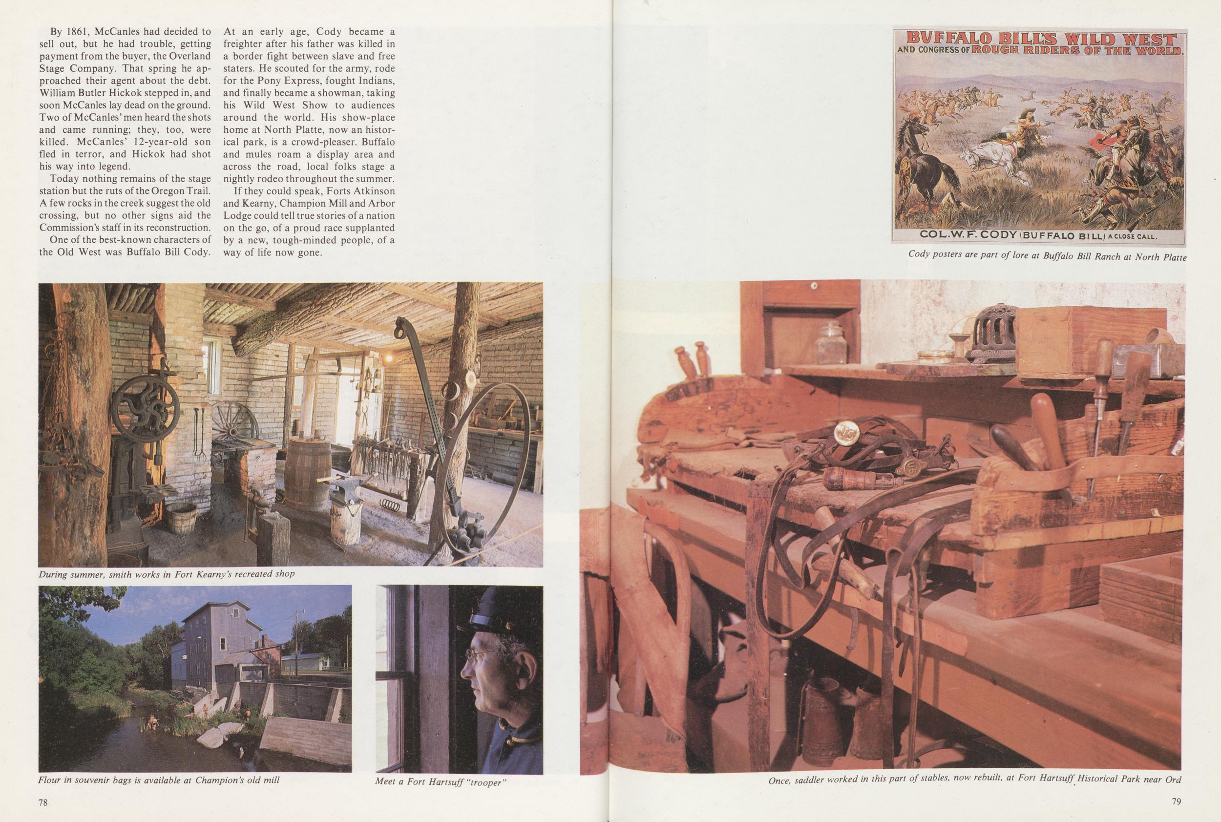
By 1861, McCanles had decided to sell out, but he had trouble, getting payment from the buyer, the Overland Stage Company. That spring he approached their agent about the debt. William Butler Hickok stepped in, and soon McCanles lay dead on the ground. Two of McCanles' men heard the shots and came running; they, too, were killed. McCanles' 12-year-old son fled in terror, and Hickok had shot his way into legend.
Today nothing remains of the stage station but the ruts of the Oregon Trail. A few rocks in the creek suggest the old crossing, but no other signs aid the Commission's staff in its reconstruction. One of the best-known characters of the Old West was Buffalo Bill Cody. At an early age, Cody became a freighter after his father was killed in a border fight between slave and free staters. He scouted for the army, rode for the Pony Express, fought Indians, and finally became a showman, taking his Wild West Show to audiences around the world. His show-place home at North Platte, now an historical park, is a crowd-pleaser. Buffalo and mules roam a display area and across the road, local folks stage a nightly rodeo throughout the summer.
If they could speak, Forts Atkinson and Kearny, Champion Mill and Arbor Lodge could tell true stories of a nation on the go, of a proud race supplanted by a new, tough-minded people, of a way of life now gone.
During summer, smith works in Fort Kearny's recreated shop
Flour in souvenir bags is available at Champion's old mill
Meet a Fort Hartsuff "trooper"
Cody posters are part of lore at Buffalo Bill Ranch at North Platte
Once, saddler worked in this part of stables, now rebuilt, at Fort Hartsuff Historical Park near Ord
Nebraska State
Wayside Areas
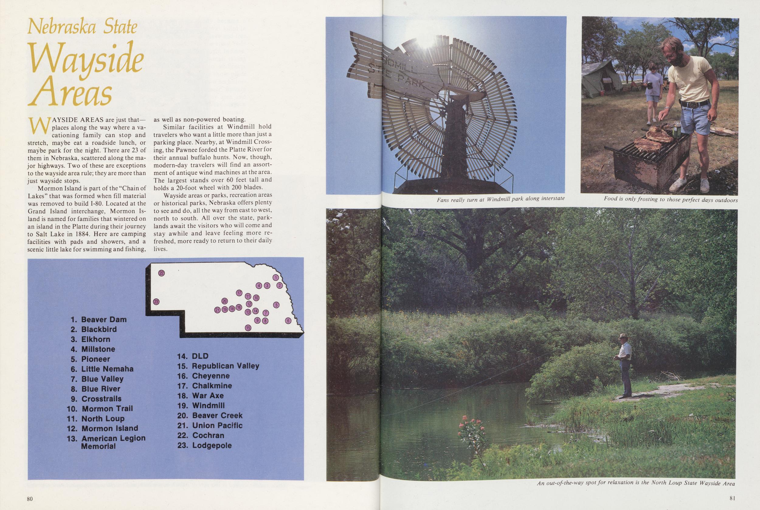
WAYSIDE AREAS are just that— places along the way where a vacationing family can stop and stretch, maybe eat a roadside lunch, or maybe park for the night. There are 23 of them in Nebraska, scattered along the major highways. Two of these are exceptions to the wayside area rule; they are more than just wayside stops.
Mormon Island is part of the "Chain of Lakes" that was formed when fill material was removed to build 1-80. Located at the Grand Island interchange, Mormon Island is named for families that wintered on an island in the Platte during their journey to Salt Lake in 1884. Here are camping facilities with pads and showers, and a scenic little lake for swimming and fishing, as well as non-powered boating.
Similar facilities at Windmill hold travelers who want a little more than just a parking place. Nearby, at Windmill Crossing, the Pawnee forded the Platte River for their annual buffalo hunts. Now, though, modern-day travelers will find an assortment of antique wind machines at the area. The largest stands over 60 feet tall and holds a 20-foot wheel with 200 blades.
Wayside areas or parks, recreation areas or historical parks, Nebraska offers plenty to see and do, all the way from east to west, north to south. All over the state, parklands await the visitors who will come and stay awhile and leave feeling more refreshed, more ready to return to their daily lives.
Fans really turn at Windmill park along interstate
Food is only frosting to those perfect days outdoors
An out-of-the-way spot for relaxation is the North Loup State Wayside Area
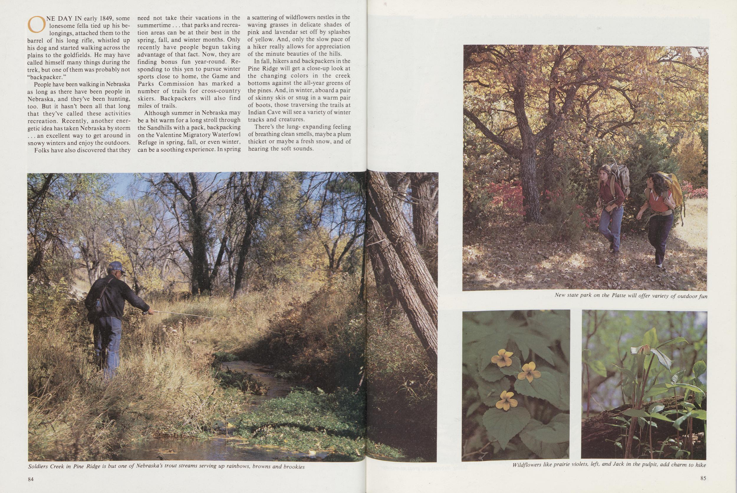
the Great Outdoors
ONE DAY IN early 1849, some lonesome fella tied up his belongings, attached them to the barrel of his long rifle, whistled up his dog and started walking across the plains to the goldfields. He may have called himself many things during the trek, but one of them was probably not "backpacker."
People have been walking in Nebraska as long as there have been people in Nebraska, and they've been hunting, too. But it hasn't been all that long that they've called these activities recreation. Recently, another energetic idea has taken Nebraska by storm ... an excellent way to get around in snowy winters and enjoy the outdoors. Folks have also discovered that they need not take their vacations in the summertime .. . that parks and recreation areas can be at their best in the spring, fall, and winter months. Only recently have people begun taking advantage of that fact. Now, they are finding bonus fun year-round. Responding to this yen to pursue winter sports close to home, the Game and Parks Commission has marked a number of trails for cross-country skiers. Backpackers will also find miles of trails.
Although summer in Nebraska may be a bit warm for a long stroll through the Sandhills with a pack, backpacking on the Valentine Migratory Waterfowl Refuge in spring, fall, or even winter, can be a soothing experience. In spring a scattering of wildflowers nestles in the waving grasses in delicate shades of pink and lavendar set off by splashes of yellow. And, only the slow pace of a hiker really allows for appreciation of the minute beauties of the hills. In fall, hikers and backpackers in the Pine Ridge will get a close-up look at the changing colors in the creek bottoms against the all-year greens of the pines. And, in winter, aboard a pair of skinny skis or snug in a warm pair of boots, those traversing the trails at Indian Cave will see a variety of winter tracks and creatures.
There's the lung- expanding feeling of breathing clean smells, maybe a plum thicket or maybe a fresh snow, and of hearing the soft sounds.
Soldiers Creek in Pine Ridge is but one of Nebraska's trout streams serving up rainbows, browns and brookies
New state park on the Platte will offer variety of outdoor fun
Wildflowers like prairie violets, left, and Jack in the pulpit, add charm to hike
For those who choose to carry along a rifle or a bow during the fall hunting season, there's the thrill of spotting that big buck across a canyon and trying to get close enough for a shot. It's your civilization-hardened senses against his. There's the chattering call of a squirrel and the flash of a rabbit scurrying under a snow-covered brushpile.
Nebraska's Game and Parks Commission has marked backpack and hiking trails on several areas, from the butte country of the Pine Ridge to wooded hills of the Missouri. In between are the U.S. Fish and Wildlife Service trails through the rolling Sandhills.
There are all kinds of trails in Nebraska—backpacking, cross-country skiing, biking, nature trails and even national historic trails that pass through parts of the state. So start walking, skiing, peddling, even driving. There's plenty of room. It doesn't cost much. And, you can take a vacation just about anytime.
HIKING AND BACKPACKING Nebraska boasts three National Recreation Trails for backpackers, hikers, and cross-country skiers. One winds through Wilderness Park in Lincoln. The trail is 14 miles long, with shorter segments for those who get short of breath just thinking about walking. The second is Fontenelle Forest at Bellevue, a natural wilderness of 1,250 acres. Hiking through this area gives one a close look at many varieties of birds and trees amid a breathtaking array of wildflowers.
Nebraskans have been enjoying the third at Schramm Park State Recreation Area for a century now. Signs along the first ½-mile loop identify and describe trees. A meditation shelter invites hikers to stop and enjoy their surroundings. The second, "backwoods" loop is designed for dedicated hikers, backpackers, and cross-country skiers. Covering rougher terrain, it calls for more physical conditioning and better developed skills.
Although not singled out for federal notice, there's an arboretum at Branched Oak Lake, north of Lincoln, where you can follow a nature trail to learn more about your surroundings. A similar nature trail crisscrosses DeSoto National Wildlife Refuge near Blair on the Nebraska-Iowa border. Arbor Lodge State Historical Park at Nebraska City also boasts an exceptional arboretum/tree trail.
At Kearney County State Recreation Area, a hike-bike trail crosses the south channel of the Platte River, just over the sandbar roosting areas used by sandhill cranes during their spring migration.
The nature trail at Fort Atkinson State Historical Park descends the steep Missouri bluffs into wet bottoms where ancient trees shade a scattering of woodland wildflowers. At Chadron State Park in the Pine Ridge, visitors can walk a nature trail dominated by ponderosa pines and rocky pinnacles.
On the banks of the Missouri River in southeast Nebraska, Indian Cave State Park's backpacking trails offer a variety of terrain and surfaces. Many of the trails climb the park's bluffs. Though steep, these trails aren't rocky or overly difficult, and they follow ridgelines wherever possible to allow level walking.
The 71,500 acres of Valentine Migratory Waterfowl Refuge offer solitude in a setting of natural lakes, marshes, lush meadows, and
Many park areas, like Ponca, attract cross-country skiers to their trails
Skiing Nebraska is great at any age
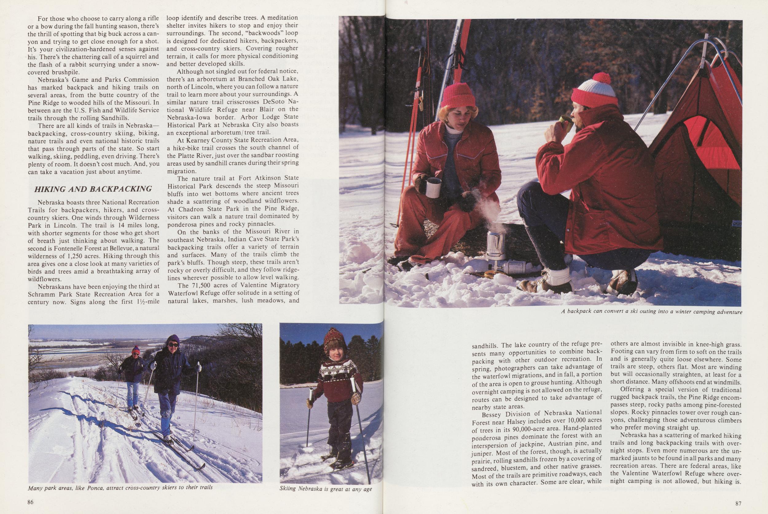
A backpack can convert a ski outing into a winter camping adventure
sandhills. The lake country of the refuge presents many opportunities to combine backpacking with other outdoor recreation. In spring, photographers can take advantage of the waterfowl migrations, and in fall, a portion of the area is open to grouse hunting. Although overnight camping is not allowed on the refuge, routes can be designed to take advantage of nearby state areas.
Bessey Division of Nebraska National Forest near Halsey includes over 10,000 acres of trees in its 90,000-acre area. Hand-planted ponderosa pines dominate the forest with an interspersion of jackpine, Austrian pine, and juniper. Most of the forest, though, is actually prairie, rolling sandhills frozen by a covering of sandreed, bluestem, and other native grasses. Most of the trails are primitive roadways, each with its own character. Some are clear, while others are almost invisible in knee-high grass. Footing can vary from firm to soft on the trails and is generally quite loose elsewhere. Some trails are steep, others flat. Most are winding but will occasionally straighten, at least for a short distance. Many offshoots end at windmills.
Offering a special version of traditional rugged backpack trails, the Pine Ridge encompasses steep, rocky paths among pine-forested slopes. Rocky pinnacles tower over rough canyons, challenging those adventurous climbers who prefer moving straight up.
Nebraska has a scattering of marked hiking trails and long backpacking trails with overnight stops. Even more numerous are the unmarked jaunts to be found in all parks and many recreation areas. There are federal areas, like the Valentine Waterfowl Refuge where overnight camping is not allowed, but hiking is.
87 CROSS-COUNTRY SKIINGMany of Nebraska's cross-country ski trails follow the same routes hikers and backpackers use in the summer.
Given a few inches of snow, a skier can clamp on skies and swish quietly down some of the steep slopes at Chadron State Park, amid the splendor and hush of a ponderosa pine forest. The park's nature trail is exceptionally well-suited to ski touring and can be both challenging to the novice and exciting to the experienced skier. The park's multi-use facility makes an excellent base camp for spending several days skiing the Ridge.
Nearby Fort Robinson is vast, so plan several days if you really want to see the park on skis. Ski trails coverall types of terrain and scenery including pine-covered hills, rugged butte country, rolling prairies and tree-lined waterways. Distances are deceptive in the Pine Ridge, so discuss plans with park personnel, especially if you plan to leave the regular trails. Almost all long tours at the fort require a physically fit skier.
At Indian Cave in the Missouri River bluffs, the restored St. Deroin schoolhouse adds historical flavor to a ski tour, and the old cemetery recalls the hard times when settlers were just starting to tame the country. Trails lead into dense hardwood forests and up to scenic overlooks of the broad Missouri. There are numerous primitive tent sites and Adirondac shelters, plus a developed camping area.
Skiers may glide along a three-mile trail at Schramm Park or try out some of the 17 miles of trails at Ponca State Park along the Missouri. Situated in bluffs along the Platte River, the Schramm trail may pose some difficulty for novices with its steep ascents and descents, but when snow is adequate the graveled picnic area road is scenic and offers an alternative.
At Ponca, novices appreciate the unplowed roads and open hillsides of the camping area in the northern portion of the park. More experienced skiers generally prefer the maze of trails in the center of the park.
Nebraska National Forest at Halsey offers thousands of acres, and there are smaller rec areas at Johnson Lake, Lake Maloney, and Kearney County.
BICYCLINGIf strapping a pack on your back and walking or skiing over hill and dale is not for you, try a bicycle. Not many bike trails are marked in Nebraska, but the road from Gering to Scotts Bluff National Monument is.
Biking, like hiking, is allowed on park and recreation areas, even though
Biking is increasing pastime at Louisville and across the state
Fun can be found year-round at Fort Robinson Wood Reserve
formal trails may not be marked. The Game and Parks Commission also has route maps for cyclists, outlining the way from Lincoln or Omaha to a number of parks and recreation areas.
Although areas open to hikers may not be open to bicycles because of the terrain, there are still, quiet areas to be explored. The soft sound of bicycle tires on gravel or pavement mingles companionably with the songs of meadowlarks or wrens, and what a marvelous way to see and hear all the sights and sounds of a glorious day.
As in cross-country skiing and backpacking, bike trails are limited only by the imagination of the riders.
Be they for hiking, biking, horseback riding, or maybe just driving, Nebraska has a wealth of trails to follow. All across the state, trails marked and unmarked, lead to adventure in the great out-of-doors.
Some 20,000 farm ponds provide fishing
The ringneck is king of Nebraska game birds. Long, productive seasons lure many
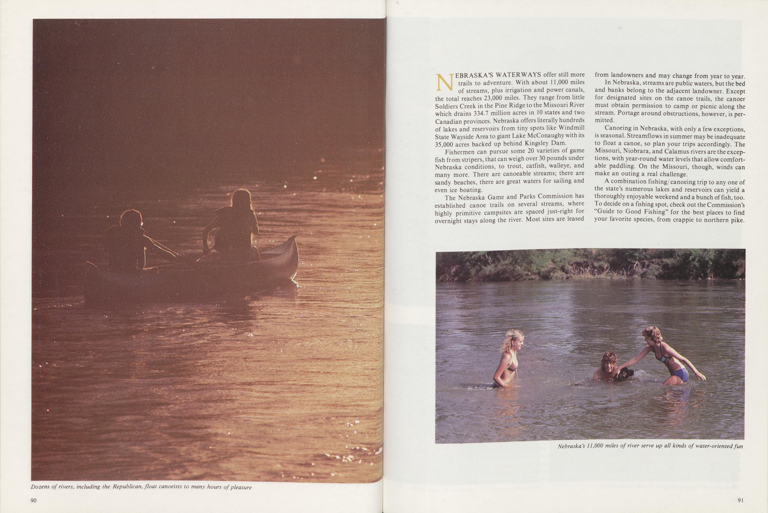
Dozens of rivers, including the Republican, float canoeists to many hours of pleasure
NEBRASKA'S WATERWAYS offer still more trails to adventure. With about 11,000 miles of streams, plus irrigation and power canals, the total reaches 23,000 miles. They range from little Soldiers Creek in the Pine Ridge to the Missouri River which drains 334.7 million acres in 10 states and two Canadian provinces. Nebraska offers literally hundreds of lakes and reservoirs from tiny spots like Windmill State Wayside Area to giant Lake McConaughy with its 35,000 acres backed up behind Kingsley Dam.
Fishermen can pursue some 20 varieties of game fish from stripers, that can weigh over 30 pounds under Nebraska conditions, to trout, catfish, walleye, and many more. There are canoeable streams; there are sandy beaches, there are great waters for sailing and even ice boating.
The Nebraska Game and Parks Commission has established canoe trails on several streams, where highly primitive campsites are spaced just-right for overnight stays along the river. Most sites are leased from landowners and may change from year to year.
In Nebraska, streams are public waters, but the bed and banks belong to the adjacent landowner. Except for designated sites on the canoe trails, the canoer must obtain permission to camp or picnic along the stream. Portage around obstructions, however, is permitted.
Canoeing in Nebraska, with only a few exceptions, is seasonal. Streamflows in summer may be inadequate to float a canoe, so plan your trips accordingly. The Missouri, Niobrara, and Calamus rivers are the exceptions, with year-round water levels that allow comfortable paddling. On the Missouri, though, winds can make an outing a real challenge.
A combination fishing/ canoeing trip to any one of the state's numerous lakes and reservoirs can yield a thoroughly enjoyable weekend and a bunch offish, too. To decide on a fishing spot, check out the Commission's "Guide to Good Fishing" for the best places to find your favorite species, from crappie to northern pike.
Nebraska's 11,000 miles of river serve up all kinds of water-oriented fun
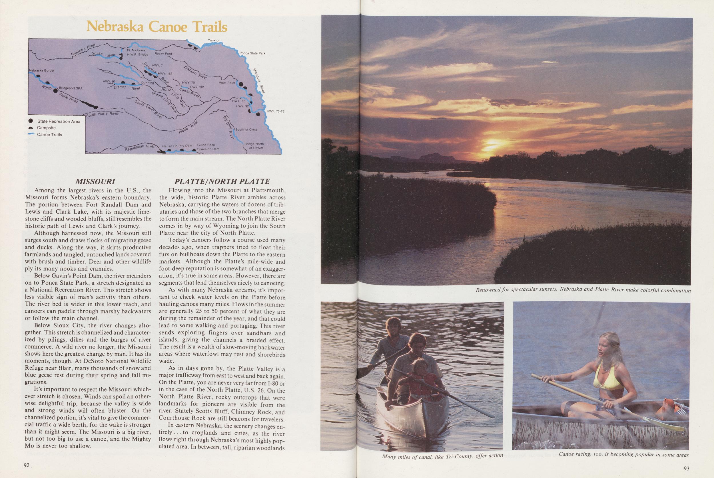
Among the largest rivers in the U.S., the Missouri forms Nebraska's eastern boundary. The portion between Fort Randall Dam and Lewis and Clark Lake, with its majestic limestone cliffs and wooded bluffs, still resembles the historic path of Lewis and Clark's journey.
Although harnessed now, the Missouri still surges south and draws flocks of migrating geese and ducks. Along the way, it skirts productive farmlands and tangled, untouched lands covered with brush and timber. Deer and other wildlife ply its many nooks and crannies.
Below Gavin's Point Dam, the river meanders on to Ponca State Park, a stretch designated as a National Recreation River. This stretch shows less visible sign of man's activity than others. The river bed is wider in this lower reach, and canoers can paddle through marshy backwaters or follow the main channel.
Below Sioux City, the river changes altogether. This stretch is channelized and characterized by pilings, dikes and the barges of river commerce. A wild river no longer, the Missouri shows here the greatest change by man. It has its moments, though. At DeSoto National Wildlife Refuge near Blair, many thousands of snow and blue geese rest during their spring and fall migrations.
It's important to respect the Missouri whichever stretch is chosen. Winds can spoil an otherwise delightful trip, because the valley is wide and strong winds will often bluster. On the channelized portion, it's vital to give the commercial traffic a wide berth, for the wake is stronger than it might seem. The Missouri is a big river, but not too big to use a canoe, and the Mighty Mo is never too shallow.
PLATTE/NORTH PLATTEFlowing into the Missouri at Plattsmouth, the wide, historic Platte River ambles across Nebraska, carrying the waters of dozens of tributaries and those of the two branches that merge to form the main stream. The North Platte River comes in by way of Wyoming to join the South Platte near the city of North Platte.
Today's canoers follow a course used many decades ago, when trappers tried to float their furs on bullboats down the Platte to the eastern markets. Although the Platte's mile-wide and foot-deep reputation is somewhat of an exaggeration, it's true in some areas. However, there are segments that lend themselves nicely to canoeing.
As with many Nebraska streams, it's important to check water levels on the Platte before hauling canoes many miles. Flows in the summer are generally 25 to 50 percent of what they are during the remainder of the year, and that could lead to some walking and portaging. This river sends exploring fingers over sandbars and islands, giving the channels a braided effect. The result is a wealth of slow-moving backwater areas where waterfowl may rest and shorebirds wade.
As in days gone by, the Platte Valley is a major trafficway from east to west and back again. On the Platte, you are never very far from 1-80 or in the case of the North Platte, U.S. 26. On the North Platte River, rocky outcrops that were landmarks for pioneers are visible from the river. Stately Scotts Bluff, Chimney Rock, and Courthouse Rock are still beacons for travelers.
In eastern Nebraska, the scenery changes entirely ... to croplands and cities, as the river flows right through Nebraska's most highly populated area. In between, tall, riparian woodlands
92Renowned for spectacular sunsets, Nebraska and Platte River make colorful combination
Many miles of canal like Tri-County, offer action
Canoe racing, too, is becoming popular in some areas
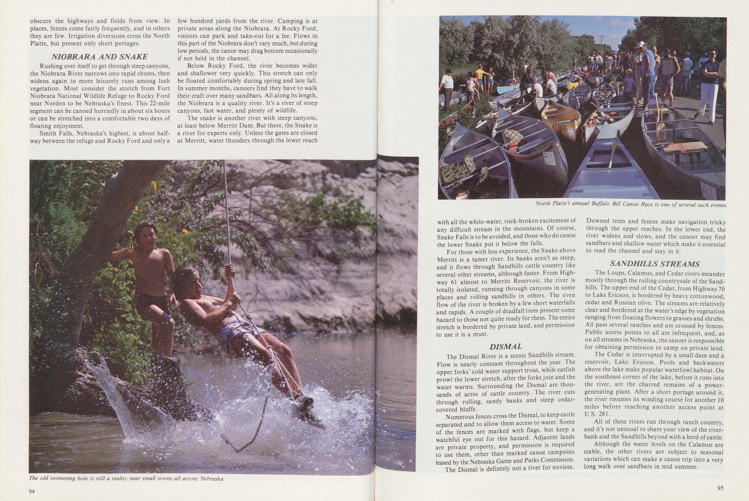
obscure the highways and fields from view. In places, fences come fairly frequently, and in others they are few. Irrigation diversions cross the North Platte, but present only short portages.
NIOBRARA AND SNAKERushing over itself to get through steep canyons, the Niobrara River narrows into rapid chutes, then widens again to more leisurely runs among lush vegetation. Most consider the stretch from Fort Niobrara National Wildlife Refuge to Rocky Ford near Norden to be Nebraska's finest. This 22-mile segment can be canoed hurriedly in about six hours or can be stretched into a comfortable two days of floating enjoyment.
Smith Falls, Nebraska's highest, is about halfway between the refuge and Rocky Ford and only a few hundred yards from the river. Camping is at private areas along the Niobrara. At Rocky Ford, visitors can park and take-out for a fee. Flows in this part of the Niobrara don't vary much, but during low periods, the canoe may drag bottom occasionally if not held in the channel.
Below Rocky Ford, the river becomes wider and shallower very quickly. This stretch can only be floated comfortably during spring and late fall. In summer months, canoers find they have to walk their craft over many sandbars. All along its length, the Niobrara is a quality river. It's a river of steep canyons, fast water, and plenty of wildlife.
The snake is another river with steep canyons, at least below Merritt Dam. But there, the Snake is a river for experts only. Unless the gates are closed at Merritt, water thunders through the lower reach
The old swimming hole is still a reality near small towns all across Nebraska
North Platte's annual Buffalo Canoe Race is one of several such events
with all the white-water, rock-broken excitement of any difficult stream in the mountains. Of course, Snake Falls is to be avoided, and those who do canoe the lower Snake put it below the falls.
For those with less experience, the Snake above Merritt is a tamer river. Its banks aren't as steep, and it flows through Sandhills cattle country like several other streams, although faster. From Highway 61 almost to Merritt Reservoir, the river is totally isolated, running through canyons in some places and rolling sandhills in others. The even flow of the river is broken by a few short waterfalls and rapids. A couple of deadfall trees present some hazard to those not quite ready for them. The entire stretch is bordered by private land, and permission to use it is a must.
DISMALThe Dismal River is a scenic Sandhills stream. Flow is nearly constant throughout the year. The upper forks' cold water support trout, while catfish prowl the lower stretch, after the forks join and the water warms. Surrounding the Dismal are thousands of acres of cattle country. The river cuts through rolling, sandy banks and steep cedar-covered bluffs.
Numerous fences cross the Dismal, to keep cattle separated and to allow them access to water. Some of the fences are marked with flags, but keep a watchful eye out for this hazard. Adjacent lands are private property, and permission is required to use them, other than marked canoe campsites leased by the Nebraska Game and Parks Commission.
The Dismal is defintely not a river for novices. Downed trees and fences make navigation tricky through the upper reaches. In the lower end, the river widens and slows, and the canoer may find sandbars and shallow water which make it essential to read the channel and stay in it.
SANDHILLS STREAMSThe Loups, Calamus, and Cedar rivers meander mostly through the roiling countryside of the Sandhills. The upper end of the Cedar, from Highway 70 to Lake Ericson, is bordered by heavy cottonwood, cedar and Russian olive. The streams are relatively clear and bordered at the water's edge by vegetation ranging from floating flowers to grasses and shrubs. All pass several ranches and are crossed by fences. Public access points to all are infrequent, and, as on all streams in Nebraska, the canoer is responsible for obtaining permission to camp on private land.
The Cedar is interrupted by a small dam and a reservoir, Lake Ericson. Pools and backwaters above the lake make popular waterfowl habitat. On the southeast corner of the lake, before it runs into the river, are the charred remains of a power-generating plant. After a short portage around it, the river resumes its winding course for another 10 miles before reaching another access point at U.S. 281.
All of these rivers run through ranch country, and it's not unusual to share your view of the riverbank and the Sandhills beyond with a herd of cattle.
Although the water levels on the Calamus are stable, the other rivers are subject to seasonal variations which can make a canoe trip into a very long walk over sandbars in mid summer.
95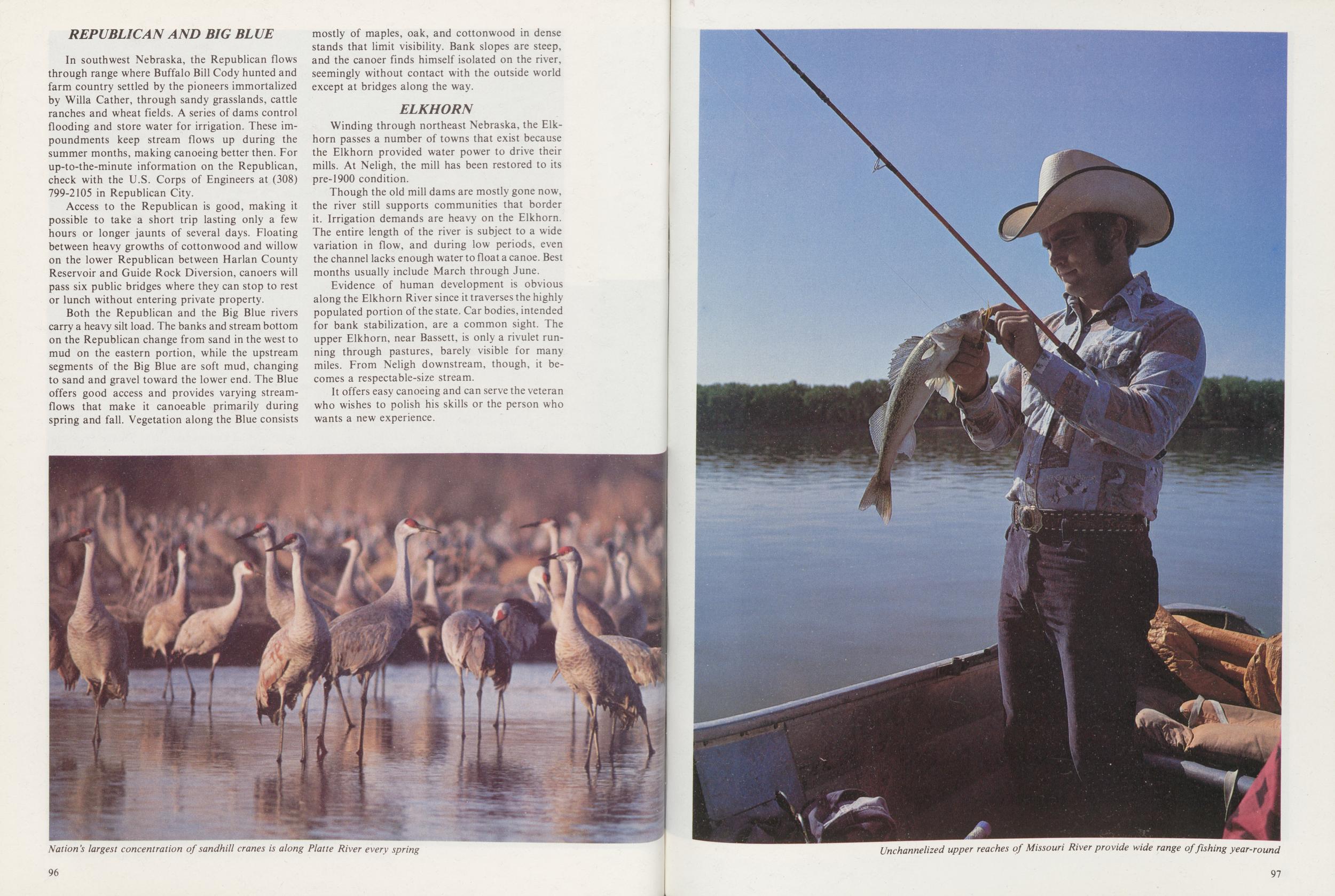 REPUBLICAN AND BIG BLUE
In southwest Nebraska, the Republican flows through range where Buffalo Bill Cody hunted and farm country settled by the pioneers immortalized by Willa Cather, through sandy grasslands, cattle ranches and wheat fields. A series of dams control flooding and store water for irrigation. These impoundments keep stream flows up during the summer months, making canoeing better then. For up-to-the-minute information on the Republican, check with the U.S. Corps of Engineers at (308) 799-2105 in Republican City.
Access to the Republican is good, making it possible to take a short trip lasting only a few hours or longer jaunts of several days. Floating between heavy growths of cottonwood and willow on the lower Republican between Harlan County Reservoir and Guide Rock Diversion, canoers will pass six public bridges where they can stop to rest or lunch without entering private property.
Both the Republican and the Big Blue rivers carry a heavy silt load. The banks and stream bottom on the Republican change from sand in the west to mud on the eastern portion, while the upstream segments of the Big Blue are soft mud, changing to sand and gravel toward the lower end. The Blue offers good access and provides varying streamflows that make it canoeable primarily during spring and fall. Vegetation along the Blue consists mostly of maples, oak, and cottonwood in dense stands that limit visibility. Bank slopes are steep, and the canoer finds himself isolated on the river, seemingly without contact with the outside world except at bridges along the way.
ELKHORNWinding through northeast Nebraska, the Elkhorn passes a number of towns that exist because the Elkhorn provided water power to drive their mills. At Neligh, the mill has been restored to its pre-1900 condition.
Though the old mill dams are mostly gone now, the river still supports communities that border it. Irrigation demands are heavy on the Elkhorn. The entire length of the river is subject to a wide variation in flow, and during low periods, even the channel lacks enough water to float a canoe. Best months usually include March through June.
Evidence of human development is obvious along the Elkhorn River since it traverses the highly populated portion of the state. Car bodies, intended for bank stabilization, are a common sight. The upper Elkhorn, near Bassett, is only a rivulet running through pastures, barely visible for many miles. From Neligh downstream, though, it becomes a respectable-size stream.
It offers easy canoeing and can serve the veteran who wishes to polish his skills or the person who wants a new experience.
Nation's largest concentration of sandhill cranes is along Platte River every spring
Unchannelized upper reaches of Missouri River provide wide range of fishing year-round
A Nebraska Directory
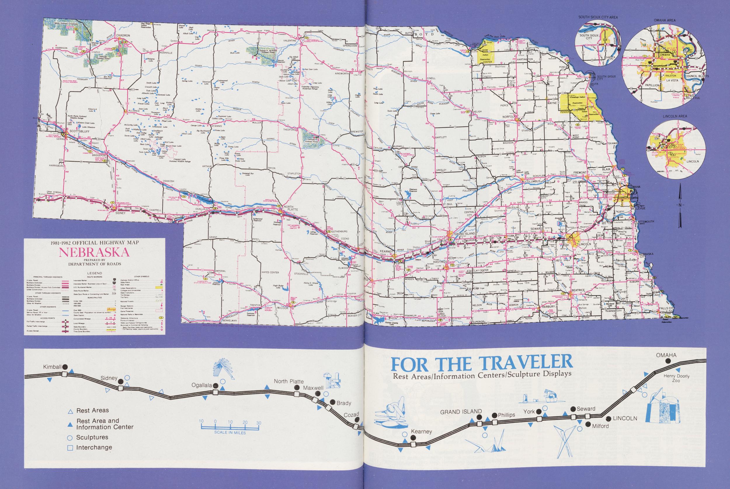
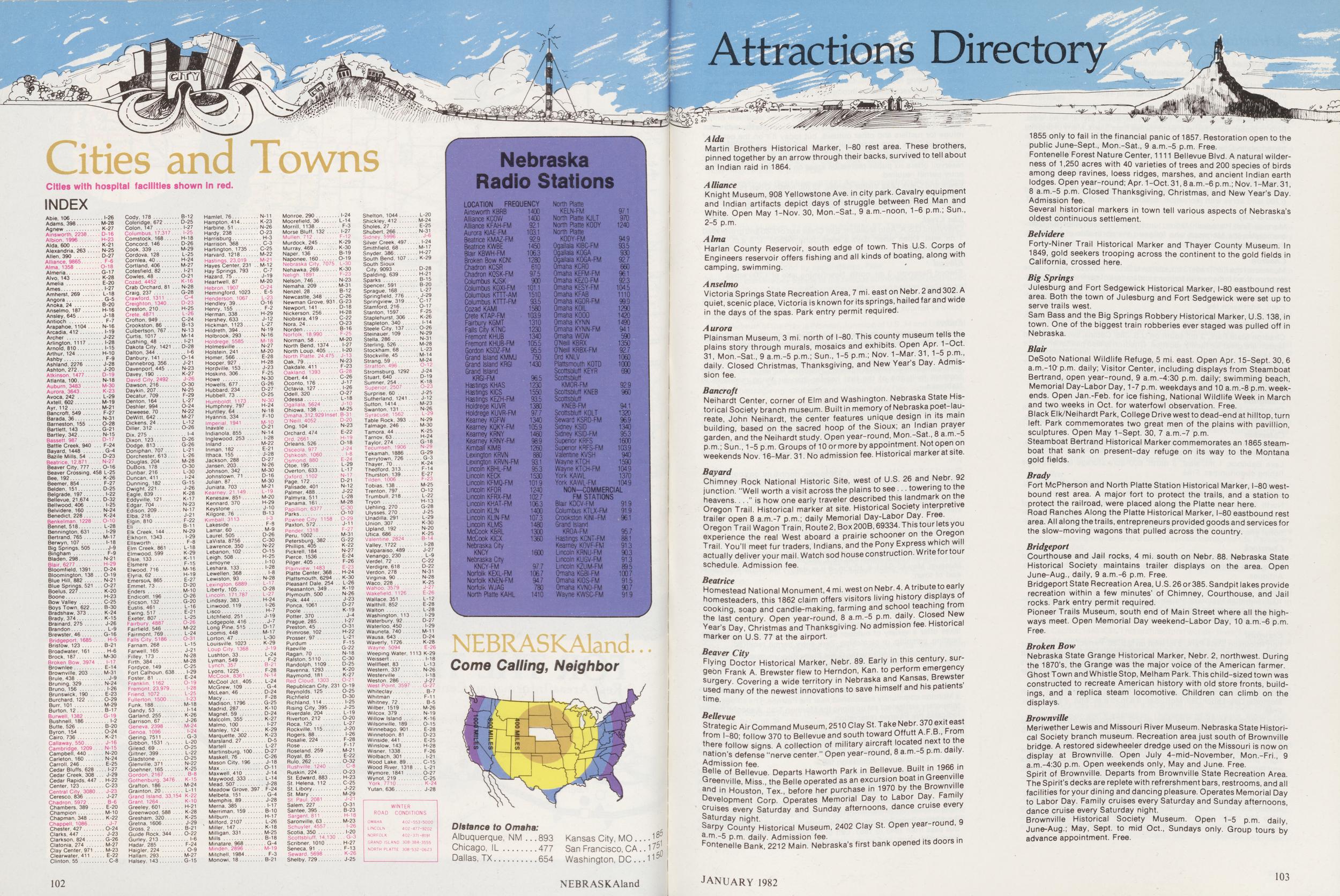
Attractions Directory
Cities and Towns
Cities with hospital facilities shown In red. INDEX Abie, 106 I-26 Adams, 398 M-28 Agnew K-27 Ainsworth, 2238 D-16 Albion, 1996 H-23 Alda, 600 K-21 Alexandria, 263 N-25 Allen, 390 D-27 Alliance, 9865 F-6 Alma, 1358 0-18 Almeria G-17 Alvo, 143 K-28 Amelia E-20 Ames I-27 Amherst, 269 L-18 Angora G-5 Anoka, 24 B-20 Anselmo. 187 H-16 Ansiey. 645 J-18 Antioch F-7 Arapahoe, 1104 N-16 Arcadia, 412 1-19 Archer J-22 Arlington, 1117 1-28 Arnold, 810 1-15 Arthur, 124 H-10 Ashby F-9 Ashland, 2276 J-28 Ashton. 272 J-20 Atkinson, 1477 D-19 Atlanta, 100 N-18 Auburn, 3483 M-30 Aurora, 3643 K-23 Avoca, 242 L-29 Axtell, 602 M-19 Ayr, 112 M-21 Bancroft, 549 F-27 Barada, 36 N-31 Barneston, 155 0-28 Bartlett, 143 G-21 Bartley. 342 N-15 Bassett. 987 D-17 Battle Creek, 940 F-24 Bayard, 1448 G-4 Bazile Mills. 54 D-23 Beatrice, 12,871 N-27 Beaver City, 777 0-16 Beaver Crossing, 458 L-25 Bee. 192 K-26 Beemer, 854 F-27 Belden, 151 D-25 Belgrade. 197 1-22 Bellevue, 21,674 D-32 Bellwood. 406 I-25 Belvidere. 160 N-24 Benedict, 228 K-24 Benkelman, 1228 O-10 Bennet, 518 L-28 Bennington, 631 I-29 Bertrand, 765 M-17 Berwyn, 107 1-18 Big Springs, 505 J-9 Bingham F-9 Bladen. 298 N-21 Blair, 6277 H-29 Bloomfield, 1391 D-24 Bloomington, 138 0-19 Blue Hill, 882 N-21 Blue Springs. 521 0-27 Boelus, 227 K-20 Boone H-23 Bow Valley C-25 Boys Town. 622 B-30 Bradshaw, 373 K-24 Brady. 374 K-15 Brainard, 275 J-26 Brandon L-9 Brewster, 46 G-16 Bridgeport, 1685 H-5 Bristow. 123 B-21 Broadwater, 161 H-6 Brock. 187 M-30 Broken Bow. 3974 1-17 Brownlee E-14 Brownville. 203 M-31 Brule. 438 J-9 Bruning, 329 N-24 Bruno. 156 I-26 Brunswick. 190 E-23 Burchard, 122 0-29 Burr. 101 M-29 Burton, 12 B-17 Burwell, 1382 G-19 Bushnell, 186 I-2 Butte, 526 B-20 Byron, 154 0-24 Cairo, 736 K-21 Callaway, 550 J-16 Cambridge, 1209 N-15 Campbell. 440 N-20 Carleton, 160 N-24 Carroll, 246 E-25 Cedar Bluffs, 628 I-27 Cedar Creek, 308 J-29 Cedar Rapids, 447 H-22 Center. 123 C-23 Central City, 3080 J-23 Ceresco. 836 J-27 Chadron. 5972 B-6 Chambers, 389 E-20 Champion M-10 Chapman. 348 K-22 Chappell. 1086 J-7 Chester, 427 0-24 Clarks, 447 J-23 Clarkson, 824 G-26 Clatonia, 274 M-27 Clay Center, 971 M-23 Clearwater. 411 E-22 Clinton, 55 C-8 Cody. 178 B-12 Coleridge. 672 D-25 Colon, 147 I-27 Columbus, 17,317 I-25 Comstock. 168 H-18 Concord, 146 D-26 Cook, 339 M-29 Cordova, 128 L-25 Cornlea, 40 H-24 Cortland, 406 M-27 Cotesfield, 82 1-21 Cowles, 48 0-21 Cozad, 4452 K-16 Crab Orchard, 81 N-28 Craig. 237 G-28 Crawford, 1311 C-4 Creighton, 1340 D-23 Creston. 210 H-25 Crete, 4871 L-26 Crofton, 949 C-24 Crookston, 86 B-13 Culbertson, 767 N-13 Curtis, 1017 M-14 Cushing, 48 1-21 Dakota City, 1421 D-28 Dalton, 344 I-6 Danbury, 141 0-14 Dannebrog, 356 J-21 Davenport, 445 N-23 Davey, 190 K-27 David City, 2492 J-26 Dawson, 216 O-30 Daykin, 207 N-25 Decatur. 709 F-29 Denton. 164 L-27 Deshler, 994 0-24 Deweese, 70 N-22 DeWitt, 642 M-27 Dickens, 24 L-12 Oilier, 312 0-26 Dix. 275 I-4 Dixon, 123 D-26 Dodge. 813 G-26 Doniphan. 707 L-21 Dorchester, 613 L-26 Douglas, 204 M-28 DuBois. 178 O-30 Dunbar. 216 L-30 Duncan, 411 I-24 Dunning, 182 G-15 Dwight. 221 J-26 Eagle. 839 K-28 Eddyville, 121 K-17 Edgar. 704 N-23 Edison. 209 N-17 Elba. 218 J-21 Elgin. 810 F-22 Eli B-11 Elk Creek. 144 N-29 Elkhorn. 1343 I-29 Ellsworth F-8 Elm Creek. 861 L-18 Elmwood, 599 K-29 Elsie, 133 K-11 Elsmere F-15 Elwood. 716 M-16 Elyria. 62 H-19 Emerson. 865 E-27 Emmet. 73 D-20 Enders M-10 Endicott. 196 0-26 Encson. 132 G-20 Eustis. 461 L-16 Ewing. 517 E-21 Exeter. 807 L-25 Fairbury. 4887 0-26 Fairfield, 546 M-22 Fairmont. 769 L-24 Falls City. 5186 0-31 Farnam. 268 L-15 Farwell, 165 J-21 Filley. 173 N-28 Firth, 384 M-28 Fordyce. 149 C-25 Fort Calhoun. 638 I-29 Foster. 81 E-24 Franklin, 1162 0-19 Fremont, 23.979 1-28 Friend, 1072 L-25 Fullerton, 1500 I-23 Funk, 188 M-18 Gandy, 53 1-14 Garland. 255 K-26 Garrison, 67 J-26 Geneva, 2398 M-24 Genoa. 1096 I-24 Gering. 7511 G-3 Gibbon, 1531 L-20 Gilead. 69 0-25 Giltner. 399 L-22 Gladstone 0-25 Glenvilie. 371 N-22 Goehner. 165 K-25 Gordon, 2167 B-8 Gothenburg. 3476 K-15 Grafton. 186 M-24 Grainton. 20 L-11 Grand Island. 33.154 K-22 Grant. 1264 K-10 Greeley. 601 H-21 Greenwood, 588 K-28 Gresham, 320 K-25 Gretna, 1606 J-29 Gross, 2 B-21 Guide Rock, 344 0-22 Gurley. 213 I-6 Hadar. 285 F-24 Haigler, 224 0-9 Hallam. 293 M-27 Halsey. 143 G-15 Hamlet. 76 N-11 Hampton, 414 K-23 Harbine, 51 N-26 Hardy, 238 0-23 Harrisburg H-3 Harrison. 368 C-3 Hartington, 1735 C-25 Harvard. 1218 M-22 Hastings. 23.019 M-21 Hayes Center. 231 M-12 Hay Springs, 793 C-7 Hazard, 75 J-19 Heartwell, 87 M-20 Hebron, 1907 0-24 Hemingford. 1023 E-5 Henderson, 1067 L-23 Hendley, 39 0-16 Henry, 155 F-2 Herman, 338 H-29 Hershey, 633 J-12 Hickman, 1123 L-27 Hildreth, 394 N-19 Holbrook, 293 N-16 Holdrege, 5585 M-18 Holmesville N-27 Holstein, 241 M-20 Homer. 566 E-28 Hooper, 927 H-28 Hordville. 153 J-23 Hoskins, 306 F-25 Howe N-30 Howells. 677 G-26 Hubbard. 234 D-27 Hubbell. 73 0-25 Humboldt. 1173 N-30 Humphrey. 797 H-24 Huntley. 64 N-18 Hyannis. 334 F-10 Imperial. 1941 M-10 Inavale 0-21 Indianola. 855 N-14 Inglewood, 253 I-28 Inland M-22 Inman. 182 E-21 Ithaca. 155 J-28 Jackson. 288 D-27 Jansen. 203 N-26 Johnson. 342 M-30 Johnstown, 71 D-16 Julian. 87 M-30 Juniata. 703 M-21 Kearney. 21.149 L-19 Kenesaw. 851 M-20 Kennard. 370 H-29 Keystone J-10 Kilgore, 76 B-13 Kimball. 3113 I-3 Lakeside F-9 Lamar. 60 M-9 Laurel. 505 D-26 LaVista. 8756 C-30 Lawrence. 350 N-22 Lebanon. 102 0-15 Leigh. 508 H-25 Lemoyne. 1-10 Leshara. 133 I-28 Lewellen. 368 I-8 Lewiston. 93 N-28 Lexington. 6889 L-17 Liberty. 105 0-28 Lincoln. 171.787 L-27 Lindsay. 383 H-24 Lmwood. 119 I-26 Lisco H-7 Litchfield. 251 J-19 Lodgepole. 416 J-7 Long Pine. 5.5 D-17 Loomis. 448 M-17 Lorton. 47 L-30 Louisville. 1023 K-29 Loup City. 1368 J-19 Lushton, 33 L-24 Lyman, 549 F-2 Lynch. 357 B-21 Lyons. 1225 F-28 McCook, 8361 N-14 McCool Jet. 405 L-24 McGrew, 109 G-4 McLean. 46 D-24 Macy. F-28 Madison, 1796 G-25 Madrid, 287 K-10 Magnet, 59 D-24 Malcolm. 355 K-27 Malmo. 100. I-27 Manley, 124 K-29 Marquette. 302 K-23 Marsland, 27 D-5 Martell L-27 Martinsburg. 100 D-27 Maskell, 76. C-26 Mason City. 196 J-18 Max 0-11 Maxwell. 410 J-14 Maywood. 333 L-14 Mead, 507 J-28 Meadow Grove, 397 F-24 Melbeta, 151 G-4 Memphis. 89 J-28 Merna. 385 1-17 Merriman, 159 B-10 Milburn H-17 Milford. 2107 L-26 Miller, 147 K-18 Milhgan, 331 M-25 Mills B-18 Mmatare, 968 G-4 Minden, 2896 M-19 Mitchell. 1984 F-3 Monowi. 18 B-21 Monroe. 290 I-24 Moorefield. 36 L-14 Morrill, 1138 F-3 Morse Bluff, 132 I-27 Mullen. 712 F-12 Murdock, 245 K-29 Murray, 469 K-30 Naper, 136 B-19 Naponee, 160 0-19 Nebraska City, 7075 L-30 Nehawka, 269 K-30 Nehgh. 1891 F-23 Nelson, 746 N-23 Nemaha. 209 M-31 Nenzel. 28 B-12 Newcastle, 348 C-26 Newman Grove. 931 G-23 Newport. 141 D-18 Nickerson, 256 H-28 Niobrara, 419 C-22 Nora, 24 0-23 Norden. B-16 Norfolk, 18.990 F-25 Norman, 58 M-20 North Bend. 1374 I-27 North Loup, 405 1-20 North Platte. 24.475 J-13 Oak. 79 N-23 Oakdale, 411 F-23 Oakland. 1393 G-28 Obert. 44. C-26 Oconto, 176 J-17 Octavia, 127 I-26 Odell. 320 0-27 Odessa L-18 Ogallala. 5624 J-10 Ohiowa. 138 M-25 Omaha, 312.929 Inset B-31 O'Neill. 4052 D-20 Ong. 104 N-23 Orchard, 474 E-22 Ord. 2661 H-19 Orleans. 526 0-18 Osceola. 977 J-24 Oshkosh. 1060 I-8 Osmond. 880 E-24 Otoe. 195 L-29 Overton, 633 L-17 Oxford. 1102 N-17 Page, 172 D-21 Palisade, 401 N-12 Palmer. 488 J-22 Palmyra. 511 L-28 Panama. 161 M-28 Papillion, 6377 C-30 Parks O"10 Pawnee City, 1158 0-29 Paxton, 572 J-11 Pender. 1318 f-27 Peru, 1002 M-31 Petersburg. 382 G-22 Phillips. 405 K-22 Pickrell. 184 N-27 Pierce. 1536 E-24 Pilger. 405 F-26 Plamview. 1483 E-23 Platte Center, 368 H-24 Plattsmouth. 6294 K-30 Pleasant Dale. 254 L-26 Pleasanton. 349 K-19 Plymouth. 500 N-26 Polk. 444 J-23 Ponca. 1061 D-27 Poole K-19 Potter. 370 J-4 Prague. 285 I-27 Preston, 45 0-31 Primrose. 102 H-22 Prosser, 97 L-21 Purdum F-15 Raeville G-22 Ragan, 70 N-18 Ralston. 5110 C-30 Randolph. 1109 D-25 Ravenna. 1293 K-20 Raymond. 181 K-27 Red Cloud. 1303 0-21 Republican City. 231 0-19 Reynolds, 125 0-25 Richfield D-30 Richland. 114 I-25 Rising City. 395 J-25 Riverdale. 204 L-19 Riverlon. 212 O-20 Roca. 125 L-27 Rockville, 115 J-20 Rogers, 88 I-26 Rosalie, 224 F-28 Rose F-17 Roseland. 259 M-21 Royal, 85 E-22 Rulo. 262 0-32 Rushville, 1240 C-8 Ruskin, 224 0-23 St Edward, 883 H-23 St. Helena, 112 C-25 St. Libory J-22 St Mary M-29 St Paul. 2081 J-21 Salem. 227 0-31 Santee. 395 B-23 Sargent. 811 H-18 Saronville, 63 M-23 Schuyler. 4557 I-26 Scotia. 350 I-20 Scottsbluff. 14,130 G-3 Scribner, 1010 H-27 Seneca, 91 F-13 Seward. 5698 K-26 Shelby. 729 J-25 Shelton, 1044 L-20 Shickley, 412 M-24 Sholes, 27 E-25 Shubert, 266 N-31 Sidney 5996 J-6 Silver Creek, 497 1-24 Smithfield, 68 M-17 Snyder. 386 H-27 South Bend. 107 K-29 South Sioux City. 9093 D-28 Spalding. 639 H-21 Sparks B-15 Spencer, 591 B-20 Sprague, 168 L-27 Springfield, 776 J-29 Springview, 319 C-17 Stamford. 216 0-17 Stanton, 1597 F-25 Staplehurst, 306 K-26 Stapleton, 340 1-14 Steele City. 137 0-26 Steinauer, 109 N-29 Stella. 286 N-31 Sterling, 526 M-28 Stockham, 68 L-23 Stockville, 45 M-14 Strang. 59 M-24 Stratton. 496 0-12 Stromsburg. 1292 J-24 Stuart. 640 D-19 Sumner. 254 K-18 Superior. 2507 0-23 Surprise, 60 J-25 Sutherland, 1241 J-12 Sutton, 1414 M-23 Swanton. 131 N-26 Syracuse. 1562 L-29 Table Rock. 393 N-29 Talmage. 246 M-30 Tamora. 44 K-25 Tarnov. 63 H-24 Taylor. 274 G-18 Tecumseh. 1906 N-29 Tekamah, 1886 G-29 Terrytown, 726 G-3 Thayer, 70 K-24 Thedford. 313 F-14 Thurston. 139 E-27 Tilden. 1006 F-23 Tobias. 138 M-25 Trenton. 797 0-12 Trumbull. 218 L-22 Tryon H-13 Uehling, 270 G-28 Ulysses. 270 J-25 Unadilla, 291 L-29 Union. 307 K-30 Upland. 192 N-20 Utica. 686 K-25 Valentine. 2824 B-14 Valley. 1722 I-28 Valparaiso. 489 J-27 Venango. 230 L-9 Verdel. 72 C-22 Verdigre. 618 D-22 Verdon, 278 N-31 Virginia. 90 N-28 Waco. 228 K-25 Wahoo. 3579 J-27 Wakefield. 1126 E-26 Wallace. 351 L-12 Walthill, 852 E-28 Walton L-28 Washington, 113 1-29 Waterbury. 92 D-27 Waterloo, 450 1-29 Wauneta. 740 M-11 Wausa. 643 D-24 Waverly. 1726 K-28 Wayne. 5094 E-26 Weeping Water. 1113 K-29 Weissert 1-18 Wellfleet. 83 L-13 Western. 337 N-26 Westerville 1-18 Weston 286 J-27 West Point. 3597 G-27 Whiteclay B-7 Whitman F-11 Whitney. 72 B-5 Wilber, 1519 M-26 Wilcox 379 N-19 Willow Island K-16 Wilsonville. 189 0-15 Winnebago. 901 E-28 Winnetoon. 81 D-23 Winside. 441 E-25 Wmslow. 143 H-28 Wisner. 1338 F-26 Wolbach. 301 1-21 Wood Lake. 89 C-15 Wood River. 1318 L-21 Wymore. 1841 0-27 Wynot. 219. C-25 York. 7710 K-24 Yutan. 636 J-28 WINTER ROAD CONDITIONS OMAHA 402-553-5000 LINCOLN 402-477-9202 NORFOLK 402-371 -8191 GRAND ISLAND 308-384-3555 NORTH PLATTE 308-532-0623 Nebraska Radio Stations LOCATION FREQUENCY Ainsworth KBRB 1400 Alliance KCOW Alliance KFAH-FM Aurora KIAE-FM Beatrice KMAZ-FM Beatrice KWBE Blair KBWH-FM Broken Bow KCNI Chadron KCSR Chadron KGSK-FM Columbus KJSK Columbus KOXI-FM Columbus KTTT-AM Columbus KTTT-FM Cozad KAMI Crete KTAP-FM Fairbury KGMT Falls City KTNC Fremont KHUB Fremont KHUB-FM Gordon KSDZ-FM Grand Island KMMJ Grand Island KRGI Grand Island KRGI-FM Hastings KHAS Hastings KICS Hastings KEZH-FM Holdreqe KUVR Holdrege KUVR-FM Kearney KGFW Kearney KQKY-FM Kearney KRNY Kearney KRNY-FM Kimball KIMB Lexington KRVN Lexington KRVN-FM Lincoln KBHL-FM Lincoln KECK Lincoln KFMQ-FM Lincoln KFOR Lincoln KFRX-FM Lincoln KHAT-FM Lincoln KLIN Lincoln KLIN-FM Lincoln KLMS McCook KBRL McCook KICX Nebraska City KNCY Nebraska City KNCY-FM Norfolk KEXL-FM Norfolk KNEN-FM Norfolk WJAG North Platte KAHL 400 92.1 103.1 92.9 1450 106.3 1280 610 97.5 900 101.1 1510 93.5 1580 103.9 1310 1230 1340 105.5 95.5 750 1430 96.5 1230 1550 93.5 1380 97.7 1340 105.9 1460 98.9 1260 880 93.1 95.3 1530 101.9 1240 1027 106.3 1400 107.3 1480 1300 1360 1600 97.7 106.7 94.7 780 1410 North Platte KELN-FM North Platte KJLT North Platte KOOY North Platte KOOY-FM Ogallala KIBC-FM Ogallala KOGA Ogallala KOGA-FM Omaha KCRO Omaha KEFM-FM Omaha KEZO-FM Omaha KESY-FM Omaha KFAB Omaha KGOR-FM Omaha KOIL Omaha K000 Omaha KYNN Omaha KYNN-FM Omaha WOW O'Neill KBRX O'Neill KRBX-FM Ord KNLV Plattsmouth KOTD Scottsbluff KEYR Scottsbluff KMOR-FM Scottsbluff KNEB Scottsbluff KNEB-FM Scottsbluff KOLT Seward KSRD-FM Sidney KSIO Sidney KSID-PM Superior KRFS Superior KRFS-FM Valentine KVSH Wayne KTCH Wayne KTCH-FM York KAWL York KAWL-FM NON-COMMERCIAL FM STATIONS Blair KOCV-FM Columbus KTLX-FM Crookston KINI-FM Grand Island KROA-FM Hastings KCNT-FM Kearney KOVF-FM Lincoln KRNU-FM Lincoln KUGV-FM Lincoln KZUM-FM Omaha KG8I-FM Omaha KIOS-FM Omaha KVN0-FM Wayne KWSC-FM 94.9 93.5 930 92.7 660 961 92.3 104.5 1110 99.9 1290 1420 1490 941 590 1350 92.7 1060 1000 690 92.9 960 94.1 1320 96.9 1340 95.3 1600 103.9 940 1590 104.9 1370 104.9 91.9 91.9 96.1 957 88.1 91.3 90.3 91.3 895 007 915 90.7 919 NEBRASKAland... Come Calling, Neighbor Distance to Omaha: Albuquerque, NM .. .893 Chicago, IL........477 Dallas, TX..........654 102 Kansas City, MO....1 San Francisco, CA.. 17 Washington, DC..J15 102 NEBRASKAland Attractions Directory AldaMartin Brothers Historical Marker, I-80 rest area. These brothers, pinned together by an arrow through their backs, survived to tell about an Indian raid in 1864.
AllianceKnight Museum, 908 Yellowstone Ave. in city park. Cavalry equipment and Indian artifacts depict days of struggle between Red Man and White. Open May 1-Nov. 30, Mon.-Sat., 9 a.m.-noon, 1-6 p.m.; Sun., 2-5 p.m.
AlmaHarlan County Reservoir, south edge of town. This U.S. Corps of Engineers reservoir offers fishing and all kinds of boating, along with camping, swimming.
AnselmoVictoria Springs State Recreation Area, 7 mi. east on Nebr. 2 and 302. A quiet, scenic place, Victoria is known for its springs, hailed far and wide in the days of the spas. Park entry permit required.
AuroraPlainsman Museum, 3 mi. north of I-80. This county museum tells; the plains story through murals, mosaics and exhibits. Open Apr. 1-Oct. 31, Mon.-Sat., 9 a.m.-5 p.m.; Sun., 1-5 p.m.; Nov. 1-Mar. 31, 1-5p.m., daily. Closed Christmas, Thanksgiving, and New Year's Day. Admission fee.
BancroftNeihardt Center, corner of Elm and Washington. Nebraska State Historical Society branch museum. Built in memory of Nebraska poet-laureate, John Neihardt, the center features unique design in its main building, based on the sacred hoop of the Sioux; an Indian prayer garden, and the Neihardt study. Open year-round, Mon.-Sat., 8 a.m. 5 p.m.; Sun., 1-5 p.m. Groups of 10 or more by appointment. Not open on weekends Nov. 16-Mar. 31. No admission fee. Historical marker at site.
BayardChimney Rock National Historic Site, west of U.S. 26 and Nebr. 92 junction. "Well worth a visit across the plains to see. . towering to the heavens...." is how one early traveler described this landmark on the Oregon Trail. Historical marker at site. Historical Society interpretive trailer open 8 a.m.-7 p.m.; daily Memorial Day-Labor Day. Free. Oregon Trail Wagon Train, Route 2, Box 200B, 69334. This tour lets you experience the real West aboard a prairie schooner on the Ore9on Trail. You'll meet fur traders, Indians, and the Pony Express which will actually deliver your mail. Watch sod house construction. Write fortour schedule. Admission fee.
BeatriceHomestead National Monument, 4 mi. west on Nebr. 4. A tribute to early homesteaders, this 1862 claim offers visitors living history displays of cooking, soap and candle-making, farming and school teaching from the last century. Open year-round, 8 a.m.-5 p.m. daily. Closed New Year's Day, Christmas and Thanksgiving. No admission fee. Historical marker on U.S. 77 at the airport.
Beaver CityFlying Doctor Historical Marker, Nebr. 89. Early in this century, surgeon Frank A. Brewster flew to Herndon, Kan. to perform emergency surgery. Covering a wide territory in Nebraska and Kansas, Brewster used many of the"newest innovations to save himself and his patients' time.
BellevueStrategic Air Command Museum, 2510 Clay St. Take Nebr.:370 exit east from I-80; follow 370 to Bellevue and south toward Offutt A.F.B From there follow signs. A collection of military aircraft located next to the nation's defense "nerve center." Open year-round, 8 a.m.-5 p.m. daily. Admission fee.
Belle of Bellevue. Departs Haworth Park in Bellevue. Built in 1966 in Greenville, Miss., the Belle operated as an excursion boat in Greenville and in Houston, Tex., before her purchase in 1970 by the Brownville Development Corp Operates Memorial Day to Labor Day. Family cruises every Saturday and Sunday afternoons, dance cruise every Saturday night.
Sarpy County Historical Museum, 2402 Clay St. Open year-round, 9 am.-5 p.m. daily. Admission fee.
Fontenelle Bank, 2212 Main. Nebraska's first bank opened its doors in 1855 only to fail in the financial panic of 1857. Restoration open to the public June-Sept., Mon.-Sat., 9 a.m.-5 p.m. Free.
Fontenelle Forest Nature Center, 1111 Bellevue Blvd. A natural wilderness of 1,250 acres with 40 varieties of trees and 200 species of birds among deep ravines, loess ridges, marshes, and ancient Indian earth lodges. Open year-round; Apr. 1-Oct. 31,8a.m.-6 p.m.; Nov. 1-Mar. 31, 8 a.m.-5 p.m. Closed Thanksgiving, Christmas, and New Year's Day. Admission fee.
Several historical markers in town tell various aspects of Nebraska's oldest continuous settlement.
BelvidereForty-Niner Trail Historical Marker and Thayer County Museum. In 1849, gold seekers trooping across the continent to the gold fields in California, crossed here.
Big SpringsJulesburg and Fort Sedgewick Historical Marker, I-80 eastbound rest area. Both the town of Julesburg and Fort Sedgewick were set up to serve trails west.
Sam Bass and the Big Springs Robbery Historical Marker, U.S. 138, in town. One of the biggest train robberies ever staged was pulled off in Nebraska.
BlairDeSoto National Wildlife Refuge, 5 mi. east. Open Apr. 15-Sept. 30, 6 a.m.-10 p.m. daily; Visitor Center, including displays from Steamboat Bertrand, open year-round, 9 a.m.-4:30 p.m. daily; swimming beach, Memorial Day-Labor Day, 1-7 p.m. weekdays and 10 a.m.-8 p.m. weekends. Open Jan.-Feb. for ice fishing, National Wildlife Week in March and two weeks in Oct. for waterfowl observation. Free.
Black Elk/Neihardt Park, College Drive west to dead-end at hilltop, turn left. Park commemorates two great men of the plains with pavillion, sculptures. Open May 1-Sept. 30, 7 a.m.-7 p.m.
Steamboat Bertrand Historical Marker commemorates an 1865 steamboat that sank on present-day refuge on its way to the Montana gold fields.
BradyFort McPherson and North Platte Station Historical Marker, I-80 westbound rest area. A major fort to protect the trails, and a station to protect the railroad, were placed along the Platte near here. Road Ranches Along the Platte Historical Marker, I-80 eastbound rest area. All along the trails, entrepreneurs provided goods and services for the slow-moving wagons that pulled across the country.
BridgeportCourthouse and Jail rocks, 4 mi. south on Nebr. 88. Nebraska State Historical Society maintains trailer displays on the area. Open June-Aug., daily, 9 a.m.-6 p.m. Free.
Bridgeport State Recreation Area, U.S. 26 or385. Sandpit lakes provide recreation within a few minutes' of Chimney, Courthouse, and Jail rocks. Park entry permit required.
Pioneer Trails Museum, south end of Main Street where all the highways meet. Open Memorial Day weekend-Labor Day, 10 a.m.-6 p.m. Free.
Broken BowNebraska State Grange Historical Marker, Nebr. 2, northwest. During the 1870's, the Grange was the major voice of the American farmer. Ghost Town and Whistle Stop, Melham Park. This child-sized town was constructed to recreate American history with old store fronts, buildings, and a replica steam locomotive. Children can climb on the displays.
BrownvilleMeriwether Lewis and Missouri River Museum. Nebraska State Historical Society branch museum. Recreation area just south of Brownville bridge. A restored sidewheeler dredge used on the Missouri is now on display at Brownville. Open July 4-mid-November, Mon.-Fri., 9 a.m.-4:30 p.m. Open weekends only, May and June. Free.
Spirit of Brownville. Departs from Brownville State Recreation Area. The Spirit's decks are replete with refrershment bars, restrooms, and all facilities for your dining and dancing pleasure. Operates Memorial Day to Labor Day. Family cruises every Saturday and Sunday afternoons, dance cruise every Saturday night.
Brownville Historical Society Museum. Open 1-5 p.m. daily, June-Aug.; May, Sept. to mid Oct., Sundays only. Group tours by advance appointment. Free.
JANUARY 1982 103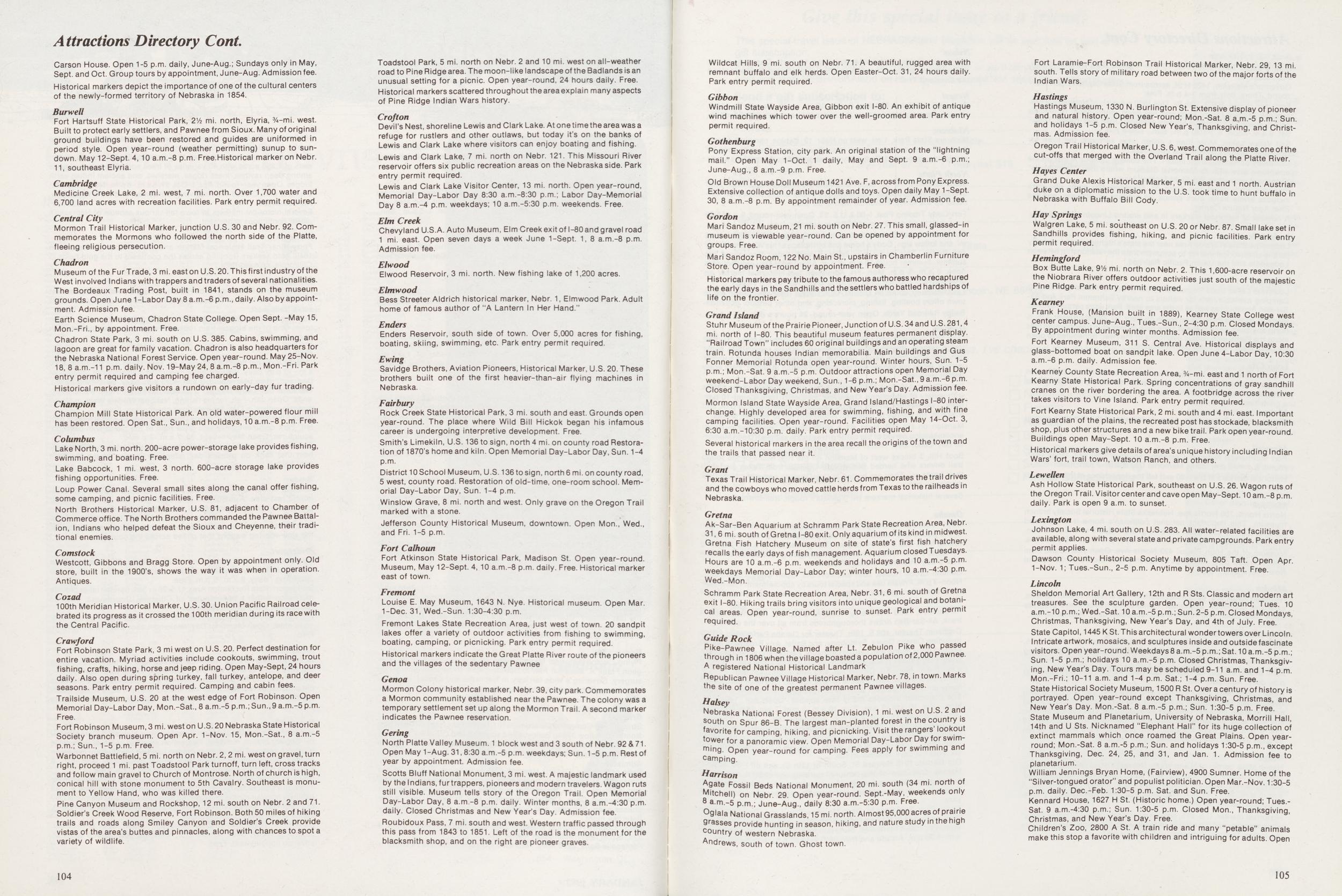 Attractions Directory Cont
Carson House. Open 1-5 p.m. daily, June-Aug.; Sundays only in May,
Sept. and Oct. Group tours by appointment, June-Aug. Admission fee.
Historical markers depict the importance of one of the cultural centers
of the newly-formed territory of Nebraska in 1854.
Burwell
Attractions Directory Cont
Carson House. Open 1-5 p.m. daily, June-Aug.; Sundays only in May,
Sept. and Oct. Group tours by appointment, June-Aug. Admission fee.
Historical markers depict the importance of one of the cultural centers
of the newly-formed territory of Nebraska in 1854.
Burwell
Fort Hartsuff State Historical Park, 2½ mi. north, Elyria, 3½-mi. west. Built to protect early settlers, and Pawnee from Sioux. Many of original ground buildings have been restored and guides are uniformed in period style. Open year-round (weather permitting) sunup to sundown. May 12-Sept. 4,10 a.m.-8 p.m. Free.Historical marker on Nebr. 11, southeast Elyria.
CambridgeMedicine Creek Lake, 2 mi. west, 7 mi. north. Over 1,700 water and 6,700 land acres with recreation facilities. Park entry permit required.
Central CityMormon Trail Historical Marker, junction U.S. 30 and Nebr. 92. Commemorates the Mormons who followed the north side of the Platte, fleeing religious persecution.
ChadronMuseum of the FurTrade, 3 mi. east on U.S. 20. Thisfirst industry of the West involved Indians with trappers and traders of several nationalities. The Bordeaux Trading Post, built in 1841, stands on the museum grounds. Open June 1 -Labor Day 8 a.m.-6 p.m., daily. Also by appointment. Admission fee. Earth Science Museum, Chadron State College. Open Sept. -May 15, Mon.-Fri., by appointment. Free. Chadron State Park, 3 mi. south on U.S. 385. Cabins, swimming, and lagoon are great for family vacation. Chadron is also headquarters for the Nebraska National Forest Service. Open year-round. May 25-Nov. 18, 8 a.m.-11 p.m. daily. Nov. 19-May 24, 8 a.m.-8 p.m., Mon.-Fri. Park entry permit required and camping fee charged. Historical markers give visitors a rundown on early-day fur trading.
ChampionChampion Mill State Historical Park. An old water-powered flour mill has been restored. Open Sat., Sun., and holidays, 10 a.m.-8 p.m. Free.
ColumbusLake North, 3 mi. north. 200-acre power-storage lake provides fishing, swimming, and boating. Free. Lake Babcock, 1 mi. west, 3 north. 600-acre storage lake provides fishing opportunities. Free. Loup Power Canal. Several small sites along the canal offer fishing, some camping, and picnic facilities. Free. North Brothers Historical Marker, U.S. 81, adjacent to Chamber of Commerce office. The North Brothers commanded the Pawnee Battalion, Indians who helped defeat the Sioux and Cheyenne, their traditional enemies.
ComstockWestcott, Gibbons and Bragg Store. Open by appointment only. Old store, built in the 1900's, shows the way it was when in operation. Antiques.
Cozad100th Meridian Historical Marker, U.S. 30. Union Pacific Railroad celebrated its progress as it crossed the 100th meridian during its race with the Central Pacific.
CrawfordFort Robinson State Park, 3 mi west on U.S. 20. Perfect destination for entire vacation. Myriad activities include cookouts, swimming, trout fishing, crafts, hiking, horse and jeep riding. Open May-Sept, 24 hours daily. Also open during spring turkey, fall turkey, antelope, and deer seasons. Park entry permit required. Camping and cabin fees. Trailside Museum, U.S. 20 at the west edge of Fort Robinson. Open Memorial Day-Labor Day, Mon.-Sat., 8 a.m.-5 p.m.; Sun.,9 a.m.-5 p.m. Free.
Fort Robinson Museum, 3 mi. west on U.S. 20 Nebraska State Historical Society branch museum. Open Apr. 1-Nov. 15, Mon.-Sat., 8 a.m.-5 p.m.; Sun., 1-5 p.m. Free. Warbonnet Battlefield, 5 mi. north on Nebr. 2, 2 mi. west on gravel, turn right, proceed 1 mi. past Toadstool Park turnoff, turn left, cross tracks and follow main gravel to Church of Montrose. North of church is high, conical hill with stone monument to 5th Cavalry. Southeast is monument to Yellow Hand, who was killed there. Pine Canyon Museum and Rockshop, 12 mi. south on Nebr. 2 and 71. Soldier's Creek Wood Reserve, Fort Robinson. Both 50 miles of hiking trails and roads along Smiley Canyon and Soldier's Creek provide vistas of the area's buttes and pinnacles, along with chances to spot a variety of wildlife. Toadstool Park, 5 mi. north on Nebr. 2 and 10 mi. west on all-weather road to Pine Ridge area. The moon-like landscape of the Badlands is an unusual setting for a picnic. Open year-round, 24 hours daily. Free. Historical markers scattered throughout the area explain many aspects of Pine Ridge Indian Wars history.
CroftonDevil's Nest, shoreline Lewis and Clark Lake. At one time the area was a refuge for rustlers and other outlaws, but today it's on the banks of Lewis and Clark Lake where visitors can enjoy boating and fishing. Lewis and Clark Lake, 7 mi. north on Nebr. 121. This Missouri River reservoir offers six public recreation areas on the Nebraska side. Park entry permit required. Lewis and Clark Lake Visitor Center, 13 mi. north. Open year-round, Memorial Day-Labor Day 8:30 a.m.-8:30 p.m.; Labor Day-Memorial Day 8 a.m.-4 p.m. weekdays; 10 a.m.-5:30 p.m. weekends. Free.
Elm CreekChevyland U.S.A. Auto Museum, Elm Creek exit of I-80 and gravel road 1 mi. east. Open seven days a week June 1-Sept. 1, 8 a.m.-8 p.m. Admission fee.
ElwoodElwood Reservoir, 3 mi. north. New fishing lake of 1,200 acres.
ElmwoodBess Streeter Aldrich historical marker, Nebr. 1, Elmwood Park. Adult home of famous author of "A Lantern In Her Hand."
EndersEnders Reservoir, south side of town. Over 5,000 acres for fishing, boating, skiing, swimming, etc. Park entry permit required.
EwingSavidge Brothers, Aviation Pioneers, Historical Marker, U.S. 20. These brothers built one of the first heavier-than-air flying machines in Nebraska.
FairburyRock Creek State Historical Park, 3 mi. south and east. Grounds open year-round. The place where Wild Bill Hickok began his infamous career is undergoing interpretive development. Free. Smith's Limekiln, U.S. 136 to sign, north 4 mi. on county road Restoration of 1870's home and kiln. Open Memorial Day-Labor Day, Sun. 1-4 p.m.
District 10 School Museum, U.S. 136 to sign, north 6 mi. on county road, 5 west, county road. Restoration of old-time, one-room school. Memorial Day-Labor Day, Sun. 1-4 p.m. Winslow Grave, 8 mi. north and west. Only grave on the Oregon Trail marked with a stone. Jefferson County Historical Museum, downtown. Open Mon., Wed., and Fri. 1-5 p.m.
Fort CalhounFort Atkinson State Historical Park, Madison St. Open year-round. Museum, May 12-Sept. 4, 10 a.m.-8 p.m. daily. Free. Historical marker east of town.
FremontLouise E. May Museum, 1643 N. Nye. Historical museum. Open Mar. 1-Dec. 31, Wed.-Sun. 1:30-4:30 p.m. Fremont Lakes State Recreation Area, just west of town. 20 sandpit lakes offer a variety of outdoor activities from fishing to swimming, boating, camping, or picnicking. Park entry permit required. Historical markers indicate the Great Platte River route of the pioneers and the villages of the sedentary Pawnee
GenoaMormon Colony historical marker, Nebr. 39, city park. Commemorates a Mormon community established near the Pawnee. The colony was a temporary settlement set up along the Mormon Trail. A second marker indicates the Pawnee reservation.
GeringNorth Platte Valley Museum. 1 block west and 3 south of Nebr. 92 and 71. Open May 1-Aug. 31,8:30 a.m.-5 p.m. weekdays; Sun. 1 -5 p.m. Rest of year by appointment. Admission fee. Scotts Bluff National Monument, 3 mi. west. A majestic landmark used by the Indians, fur trappers, pioneers and modern travelers. Wagon ruts still visible. Museum tells story of the Oregon Trail. Open Memorial Day-Labor Day, 8 a.m -8 p.m. daily. Winter months, 8 a.m.-4:30 p.m. daily. Closed Christmas and New Year's Day. Admission fee. Roubidoux Pass, 7 mi. south and west. Western traffic passed through this pass from 1843 to 1851. Left of the road is the monument for the blacksmith shop, and on the right are pioneer graves.
104Wildcat Hills, 9 mi. south on Nebr. 71. A beautiful, rugged area with remnant buffalo and elk herds. Open Easter-Oct. 31, 24 hours daily. Park entry permit required.
GibbonWindmill State Wayside Area, Gibbon exit I-80. An exhibit of antique wind machines which tower over the well-groomed area. Park entry permit required.
GothenburgPony Express Station, city park. An original station of the "lightning mail." Open May 1-Oct. 1 daily, May and Sept. 9 a.m.-6 p.m.; June-Aug., 8 a.m.-9 p.m. Free. Old Brown House Doll Museum 1421 Ave. F, across from Pony Express. Extensive collection of antique dolls and toys. Open daily May 1-Sept. 30, 8 a.m.-8 p.m. By appointment remainder of year. Admission fee.
GordonMari Sandoz Museum, 21 mi. south on Nebr. 27. This small, glassed-in museum is viewable year-round. Can be opened by appointment for groups. Free. Mari Sandoz Room, 122 No. Main St., upstairs in Chamberlin Furniture Store. Open year-round by appointment. Free. Historical markers pay tribute to the famous authoress who recaptured the early days in the Sandhills and the settlers who battled hardships of life on the frontier.
Grand IslandStuhr Museum of the Prairie Pioneer, Junction of U.S. 34 and U.S. 281,4 mi. north of I-80. This beautiful museum features permanent display. "Railroad Town" includes 60 original buildings and an operating steam train. Rotunda houses Indian memorabilia. Main buildings and Gus Fonner Memorial Rotunda open year-round. Winter hours, Sun. 1-5 p.m.; Mon.-Sat. 9 a.m.-5 p.m. Outdoor attractions open Memorial Day weekend-Labor Day weekend, Sun., 1-6 p.m.; Mon.-Sat., 9 a.m.-6 p.m. Closed Thanksgiving, Christmas, and New Year's Day. Admission fee. Mormon Island State Wayside Area, Grand Island/Hastings I-80 interchange. Highly developed area for swimming, fishing, and with fine camping facilities. Open year-round. Facilities open May 14-Oct. 3, 6:30 a.m.-10:30 p.m. daily. Park entry permit required. Several historical markers in the area recall the origins of the town and the trails that passed near it.
GrantTexas Trail Historical Marker, Nebr. 61. Commemorates the trail drives and the cowboys who moved cattle herds from Texas to the railheads in Nebraska.
GretnaAk-Sar-Ben Aquarium at Schramm Park State Recreation Area, Nebr. 31, 6 mi. south of Gretna I-80 exit. Only aquarium of its kind in midwest. Gretna Fish Hatchery Museum on site of state's first fish hatchery recalls the early days of fish management. Aquarium closed Tuesdays. Hours are 10 a.m.-6 p.m. weekends and holidays and 10 a.m.-5 p.m. weekdays Memorial Day-Labor Day; winter hours, 10 a.m.-4:30 p.m. Wed.-Mon. Schramm Park State Recreation Area, Nebr. 31, 6 mi. south of Gretna exit I-80. Hiking trails bring visitors into unique geological and botanical areas. Open year-round, sunrise to sunset. Park entry permit required.
Guide RockPike-Pawnee Village. Named after Lt. Zebulon Pike who passed through in 1806 when the village boasted a population of 2,000 Pawnee. A registered National Historical Landmark Republican Pawnee Village Historical Marker, Nebr. 78, in town. Marks the site of one of the greatest permanent Pawnee villages.
HalseyNebraska National Forest (Bessey Division), 1 mi. west on U.S. 2 and south on Spur 86-B. The largest man-planted forest in the country is favorite for camping, hiking, and picnicking. Visit the rangers' lookout tower for a panoramic view. Open Memorial Day-Labor Day for swimming. Open year-round for camping. Fees apply for swimming and camping.
HarrisonAgate Fossil Beds National Monument, 20 mi. south (34 mi. north of Mitchell) on Nebr. 29. Open year-round. Sept.-May, weekends only 8 a.m.-5 p.m.; June-Aug., daily 8:30 a.m.-5:30 p.m. Free. °glala National Grasslands, 15 mi. north. Almost 95,000 acres of prairie Qrasses provide hunting in season, hiking, and nature study in the high country of western Nebraska. Andrews, south of town. Ghost town. Fort Laramie-Fort Robinson Trail Historical Marker, Nebr. 29, 13 mi. south. Tells story of military road between two of the major forts of the Indian Wars.
HastingsHastings Museum, 1330 N. Burlington St. Extensive display of pioneer and natural history. Open year-round; Mon.-Sat. 8 a,m.-5 p.m.; Sun. and holidays 1-5 p.m. Closed New Year's, Thanksgiving, and Christmas. Admission fee. Oregon Trail Historical Marker, U.S. 6, west. Commemorates one of the cut-offs that merged with the Overland Trail along the Platte River.
Hayes CenterGrand Duke Alexis Historical Marker, 5 mi. east and 1 north. Austrian duke on a diplomatic mission to the U.S. took time to hunt buffalo in Nebraska with Buffalo Bill Cody.
Hay SpringsWalgren Lake, 5 mi. southeast on U.S. 20 or Nebr. 87. Small lake set in Sandhills provides fishing, hiking, and picnic facilities. Park entry permit required.
HemingfordBox Butte Lake, 91/a mi. north on Nebr. 2. This 1,600-acre reservoir on the Niobrara River offers outdoor activities just south of the majestic Pine Ridge. Park entry permit required.
KearneyFrank House, (Mansion built in 1889), Kearney State College west center campus. June-Aug., Tues.-Sun., 2-4:30 p.m. Closed Mondays. By appointment during winter months. Admission fee. Fort Kearney Museum, 311 S. Central Ave. Historical displays and glass-bottomed boat on sandpit lake. Open June4-Labor Day, 10:30 a.m.-6 p.m. daily. Admission fee. Kearney County State Recreation Area, 3/4-mi. east and 1 north of Fort Kearny State Historical Park. Spring concentrations of gray sandhill cranes on the river bordering the area. A footbridge across the river takes visitors to Vine Island. Park entry permit required. Fort Kearny State Historical Park, 2 mi. south and 4 mi. east. Important as guardian of the plains, the recreated post has stockade, blacksmith shop, plus other structures and a new bike trail. Park open year-round. Buildings open May-Sept. 10 a.m.-8 p.m. Free. Historical markers give details of area's unique history including Indian Wars' fort, trail town, Watson Ranch, and others.
LewellenAsh Hollow State Historical Park, southeast on U.S. 26. Wagon ruts of the Oregon Trail. Visitor center and cave open May-Sept. 10am.-8 p.m. daily. Park is open 9 a.m. to sunset.
LexingtonJohnson Lake, 4 mi. south on U.S. 283. All water-related facilities are available, along with several state and private campgrounds. Park entry permit applies. Dawson County Historical Society Museum, 805 Taft. Open Apr. 1-Nov. 1; Tues.-Sun., 2-5 p.m. Anytime by appointment. Free.
LincolnSheldon Memorial Art Gallery, 12th and R Sts. Classic and modern art treasures. See the sculpture garden. Open year-round; Tues. 10 a.m.-10 p.m.; Wed.-Sat. 10 a.m.-5 p.m.; Sun. 2-5 p.m. Closed Mondays, Christmas, Thanksgiving, New Year's Day, and 4th of July. Free. State Capitol, 1445 K St. This architectural wonder towers over Lincoln. Intricate artwork, mosaics, and sculptures inside and outside fascinate visitors. Open year-round. Weekdays8 a.m.-5 p.m.; Sat. 10 a.m.-5 p.m.; Sun. 1-5 p.m.; holidays 10 a.m.-5 p.m. Closed Christmas, Thanksgiving, New Year's Day. Tours may be scheduled 9-11 a.m. and 1-4 p.m. Mon.-Fri.; 10-11 a.m. and 1-4 p.m. Sat.; 1-4 p.m. Sun. Free. State Historical Society Museum, 1500 R St. Over a century of history is portrayed. Open year-round except Thanksgiving, Christmas, and New Year's Day. Mon.-Sat. 8 a.m.-5 p.m.; Sun. 1:30-5 p.m. Free. State Museum and Planetarium, University of Nebraska, Morrill Hall, 14th and U Sts. Nicknamed "Elephant Hall" for its huge collection of extinct mammals which once roamed the Great Plains. Open year-round; Mon.-Sat. 8 a.m.-5 p.m.; Sun. and holidays 1:30-5 p.m., except Thanksgiving, Dec. 24, 25, and 31, and Jan. 1. Admission fee to planetarium. William Jennings Bryan Home, (Fairview), 4900 Sumner. Home of the "Silver-tongued orator" and populist politician. Open Mar.-Nov. 1:30-5 p.m. daily. Dec.-Feb. 1:30-5 p.m. Sat. and Sun. Free. Kennard House, 1627 H St. (Historic home.) Open year-round; Tues.-Sat. 9 a.m.-4:30 p.m.; Sun. 1:30-5 p.m. Closed Mon., Thanksgiving, Christmas, and New Year's Day. Free. Children's Zoo, 2800 A St. A train ride and many "petable" animals make this stop a favorite with children and intriguing for adults. Open
105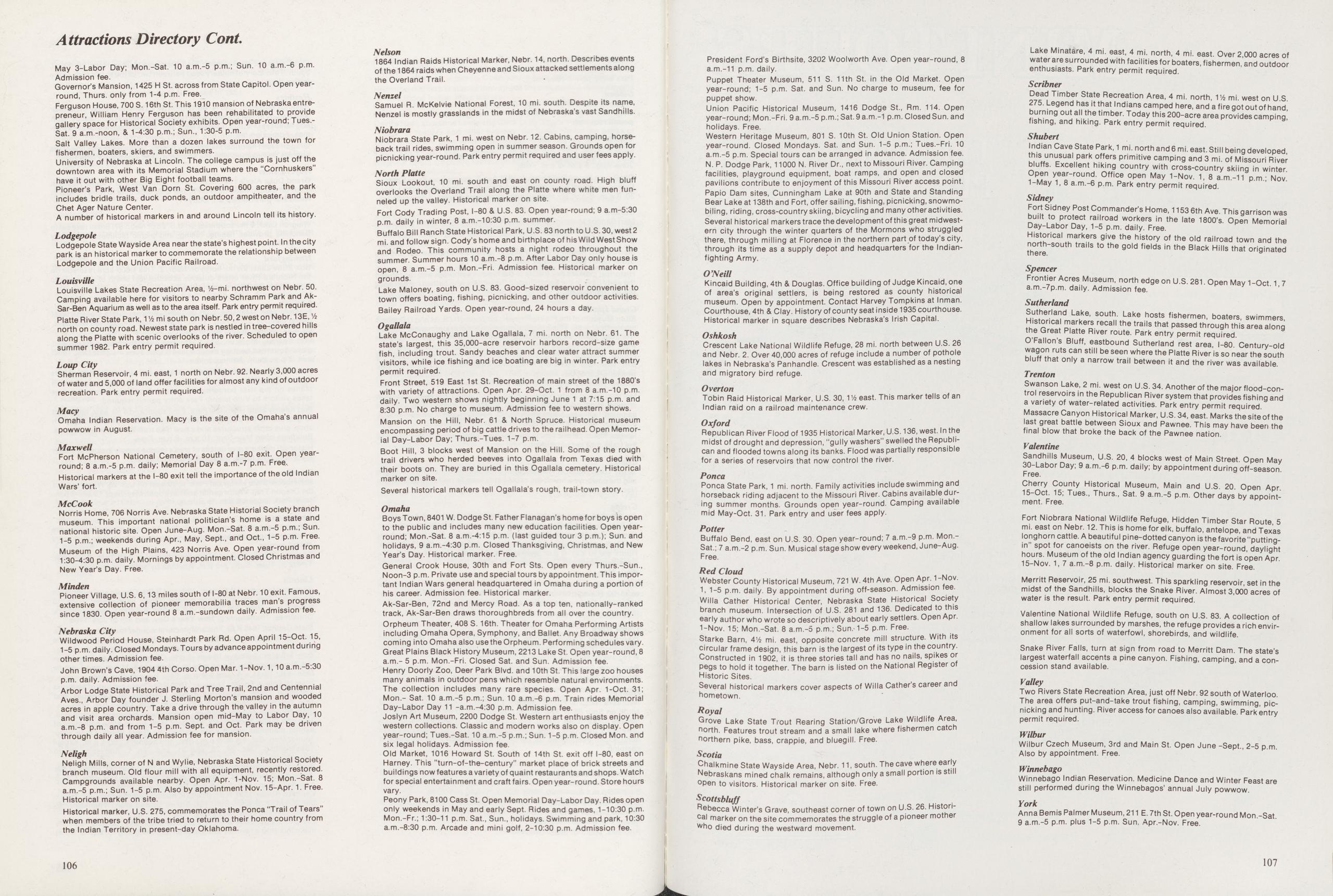
Attractions Di May 3-Labor Day; Mon.-Admission fee. Governor's Mansion, 1425 round, Thurs. only from 1-Ferguson House, 700 S. 16t preneur, William Henry Fe gallery space for Historical Sat. 9 a.m.-noon, and 1-4:30 Salt Valley Lakes. More tl fishermen, boaters, skiers, University of Nebraska at I downtown area with its M have it out with other Big I Pioneer's Park, West Van includes bridle trails, duch Chet Ager Nature Center. A number of historical mar
LodgepoleLodgepole State Wayside A park is an historical marker Lodgepole and the Union I
LouisvilleLouisville Lakes State Recr Camping available here for Sar-Ben Aquarium as well as Platte River State Park, 1 Vi r north on county road. New€ along the Platte with scenic summer 1982. Park entry p
Loup CitySherman Reservoir, 4 mi. e of water and 5,000 of land o recreation. Park entry permit
MacyOmaha Indian Reservation powwow in August.
MaxwellFort McPherson National i round; 8 a.m.-5 p.m. daily; Historical markers at the l-l Wars' fort.
McCookNorris Home, 706 Norris Av museum. This important r national historic site. Open 1-5 p.m.; weekends during Museum of the High Plain 1:30-4:30 p.m. daily. New Year's Day. Free.
MindenPioneer Village, U.S. 6, 13 extensive collection of since 1830. Open year-round
Nebraska CityWildwood Period House, S1 1-5 p.m. daily. Closed Monday other times. Admission fee. John Brown's Cave, 1904 4th Corso. Open Mar. 1-Nov. 1,10 a.m.-5:30 p.m. daily. Admission fee. Arbor Lodge State Historical Park and Tree Trail, 2nd and Centennial Aves., Arbor Day founder J. Sterling Morton's mansion and wooded acres in apple country. Take a drive through the valley in the autumn and visit area orchards. Mansion open mid-May to Labor Day, 10 a.m.-8 p.m. and from 1-5 p.m. Sept. and Oct. Park may be driven through daily all year. Admission fee for mansion.
NelighNeligh Mills, corner of N and Wylie, Nebraska State Historical Society branch museum. Old flour mill with all equipment, recently restored. Campgrounds available nearby. Open Apr. 1-Nov. 15; Mon.-Sat. 8 a.m.-5 p.m.; Sun. 1-5 p.m. Also by appointment Nov. 15-Apr. 1. Free. Historical marker on site. Historical marker, U.S. 275, commemorates the Ponca "Trail of Tears" when members of the tribe tried to return to their home country from the Indian Territory in present-day Oklahoma. Nebraska Department of Economic Development Division of Travel and Tourism P.O. Box 94666 Lincoln, Nebraska 68509
Great Plains Black History Museum, 2213 Lake St. Open year-round, 8 a.m.- 5 p.m. Mon.-Fri. Closed Sat. and Sun. Admission fee. Henry Doorly Zoo, Deer Park Blvd. and 10th St. This large zoo houses many animals in outdoor pens which resemble natural environments. The collection includes many rare species. Open Apr. 1-Oct. 31; Mon.- Sat. 10 a.m.-5 p.m.; Sun. 10 a.m.-6 p.m. Train rides Memorial Day-Labor Day 11 -a.m.-4:30 p.m. Admission fee. Joslyn Art Museum, 2200 Dodge St. Western art enthusiasts enjoy the western collections. Classic and modern works also on display. Open year-round; Tues.-Sat. 10 a.m.-5 p.m.; Sun. 1-5 p.m. Closed Mon. and six legal holidays. Admission fee. Old Market, 1016 Howard St. South of 14th St. exit off I-80, east on Harney. This "turn-of-the-century" market place of brick streets and buildings now features a variety of quaint restaurants and shops. Watch for special entertainment and craft fairs. Open year-round. Store hours vary.
Peony Park, 8100 Cass St. Open Memorial Day-Labor Day. Rides open only weekends in May and early Sept. Rides and games, 1-10:30 p.m. Mon.-Fr.; 1:30-11 p.m. Sat., Sun., holidays. Swimming and park, 10:30 a.m.-8:30 p.m. Arcade and mini golf, 2-10:30 p.m. Admission fee.
106President Ford's Birthsite, 3202 Woolworth Ave. Open year-round, 8 a.m.-11 p.m. daily. Puppet Theater Museum, 511 S. 11th St. in the Old Market. Open year-round; 1-5 p.m. Sat. and Sun. No charge to museum, fee for puppet show. Union Pacific Historical Museum, 1416 Dodge St., Rm. 114. Open year-round; Mon.-Fri. 9 a.m.-5 p.m.; Sat. 9 a.m.-1 p.m. Closed Sun. and holidays. Free. Western Heritage Museum, 801 S. 10th St. Old Union Station. Open year-round. Closed Mondays. Sat. and Sun. 1-5 p.m.; Tues.-Fri. 10 a.m.-5 p.m. Special tours can be arranged in advance. Admission fee. N. P. Dodge Park, 11000 N. River Dr., next to Missouri River. Camping facilities, playground equipment, boat ramps, and open and closed pavilions contribute to enjoyment of this Missouri River access point. Papio Dam sites, Cunningham Lake at 90th and State and Standing Bear Lake at 138th and Fort, offer sailing, fishing, picnicking, snowmobiling, riding, cross-country skiing, bicycling and many other activities. Several historical markers trace the development of this great midwestern city through the winter quarters of the Mormons who struggled there, through milling at Florence in the northern part of today's city, through its time as a supply depot and headquarters for the Indian-fighting Army.
O'NeillKincaid Building, 4th and Douglas. Office building of Judge Kincaid, one of area's original settlers, is being restored as county historical museum. Open by appointment. Contact Harvey Tompkins at Inman. Courthouse, 4th and Clay. History of county seat inside 1935 courthouse. Historical marker in square describes Nebraska's Irish Capital.
OshkoshCrescent Lake National Wildlife Refuge, 28 mi. north between U.S. 26 and Nebr. 2. Over 40,000 acres of refuge include a number of pothole lakes in Nebraska's Panhandle. Crescent was established as a nesting and migratory bird refuge.
OvertonTobin Raid Historical Marker, U.S. 30, 11/2 east. This marker tells of an Indian raid on a railroad maintenance crew.
OxfordRepublican River Flood of 1935 Historical Marker, U.S. 136, west. In the midst of drought and depression, "gully washers" swelled the Republican and flooded towns along its banks. Flood was partially responsible for a series of reservoirs that now control the river.
PoncaPonca State Park, 1 mi. north. Family activities include swimming and horseback riding adjacent to the Missouri River. Cabins available during summer months. Grounds open year-round. Camping available mid May-Oct. 31. Park entry and user fees apply.
PotterBuffalo Bend, east on U.S. Open year-round 7 a.m. -9 p.m. Mon.-Sat. 7 a.m.-2 p.m. Sun. Musical stage show every weekend. June-Aug. Free.
Red CloudWebster County Historical Museum, 721 W. 4th Ave. Open Apr. 1-Nov. 1, 1-5 p.m. daily. By appointment during off-season. Admission fee. Willa Cather Historical Center, Nebraska State Historical Society branch museum. Intersection of U.S. 281 and 136. Dedicated to this early author who wrote so descriptively about early settlers. Open Apr. 1-Nov. 15; Mon.-Sat. 8 a.m.-5 p.m.; Sun.-1-5 p.m. Free. Starke Barn, 41/2 mi. east, opposite concrete mill structure. With its circular frame design, this barn is the largest of its type in the country. Constructed in 1902, it is three stories tall and has no nails, spikes or pegs to hold it together. The barn is listed on the National Register of Historic Sites. Several historical markers cover aspects of Willa Cather's career and hometown.
RoyalGrove Lake State Trout Rearing Station/Grove Lake Wildlife Area, north. Features trout stream and a small lake where fishermen catch northern pike, bass, crappie, and bluegill. Free.
ScotiaChalkmine State Wayside Area, Nebr. 11, south. The cave where early Nebraskans mined chalk remains, although only a small portion is still °pen to visitors. Historical marker on site. Free.
ScottsbluffRebecca Winter's Grave, southeast corner of town on U.S. 26. Historical marker on the site commemorates the struggle of a pioneer mother who died during the westward movement.
Lake Minatare, 4 mi. east, 4 mi. north, 4 mi. east. Over 2,000 acres of water are surrounded with facilities for boaters, fishermen, and outdoor enthusiasts. Park entry permit required.
ScribnerDead Timber State Recreation Area, 4 mi. north, Vh mi. west on U.S. 275. Legend has it that Indians camped here, and a fire got out of hand, burning out all the timber. Today this 200-acre area provides camping, fishing, and hiking. Park entry permit required.
ShubertIndian Cave State Park, 1 mi. north and 6 mi. east. Still being developed, this unusual park offers primitive camping and 3 mi. of Missouri River bluffs. Excellent hiking country with cross-country skiing in winter. Open year-round. Office open May 1-Nov. 1, 8 a.m.-11 p.m.; Nov. 1-May 1, 8 a.m.-6 p.m. Park entry permit required.
SidneyFort Sidney Post Commander's Home, 1153 6th Ave. This garrison was built to protect railroad workers in the late 1800's. Open Memorial Day-Labor Day, 1-5 p.m. daily. Free. Historical markers give the history of the old railroad town and the north-south trails to the gold fields in the Black Hills that originated there.
SpencerFrontier Acres Museum, north edge on U.S. 281. Open May 1-Oct. 1,7 a.m.-7p.m. daily. Admission fee.
SutherlandSutherland Lake, south. Lake hosts fishermen, boaters, swimmers, Historical markers recall the trails that passed through this area along the Great Platte River route. Park entry permit required. O'Fallon's Bluff, eastbound Sutherland rest area, I-80. Century-old wagon ruts can still be seen where the Platte River is so near the south bluff that only a narrow trail between it and the river was available.
TrentonSwanson Lake, 2 mi. west on U.S. 34. Another of the major flood-control reservoirs in the Republican River system that provides fishing and a variety of water-related activities. Park entry permit required. Massacre Canyon Historical Marker, U.S. 34, east. Marks the site of the last great battle between Sioux and Pawnee. This may have been the final blow that broke the back of the Pawnee nation.
ValentineSandhills Museum, U.S. 20, 4 blocks west of Main Street. Open May 30-Labor Day; 9 a.m.-6 p.m. daily; by appointment during off-season. Free.
Cherry County Historical Museum, Main and U.S. 20. Open Apr. 15-Oct. 15; Tues., Thurs., Sat. 9 a.m.-5 p.m. Other days by appointment. Free.
Fort Niobrara National Wildlife Refuge, Hidden Timber Star Route, 5 mi. east on Nebr. 12. This is home for elk, buffalo, antelope, and Texas longhorn cattle. A beautiful pine-dotted canyon is the favorite "putting-in" spot for canoeists on the river. Refuge open year-round, daylight hours. Museum of the old Indian agency guarding the fort is open Apr. 15-Nov. 1, 7 a.m.-8 p.m. daily. Historical marker on site. Free. Merritt Reservoir, 25 mi. southwest. This sparkling reservoir, set in the midst of the Sandhills, blocks the Snake River. Almost 3,000 acres of water is the result. Park entry permit required. Valentine National Wildlife Refuge, south on U.S. 83. A collection of shallow lakes surrounded by marshes, the refuge provides a rich environment for all sorts of waterfowl, shorebirds, and wildlife. Snake River Falls, turn at sign from road to Merritt Dam. The state's largest waterfall accents a pine canyon. Fishing, camping, and a concession stand available.
ValleyTwo Rivers State Recreation Area, just off Nebr. 92 south of Waterloo. The area offers put-and-take trout fishing, camping, swimming, picnicking and hunting. River access for canoes also available. Park entry permit required.
WilburWilbur Czech Museum, 3rd and Main St. Open June -Sept., 2-5 p.m. Also by appointment. Free.
WinnebagoWinnebago Indian Reservation. Medicine Dance and Winter Feast are still performed during the Winnebagos' annual July powwow.
YorkAnna Bemis Palmer Museum, 211 E. 7th St. Open year-round Mon.-Sat. 9 a.m.-5 p.m. plus 1-5 p.m. Sun. Apr.-Nov. Free.
107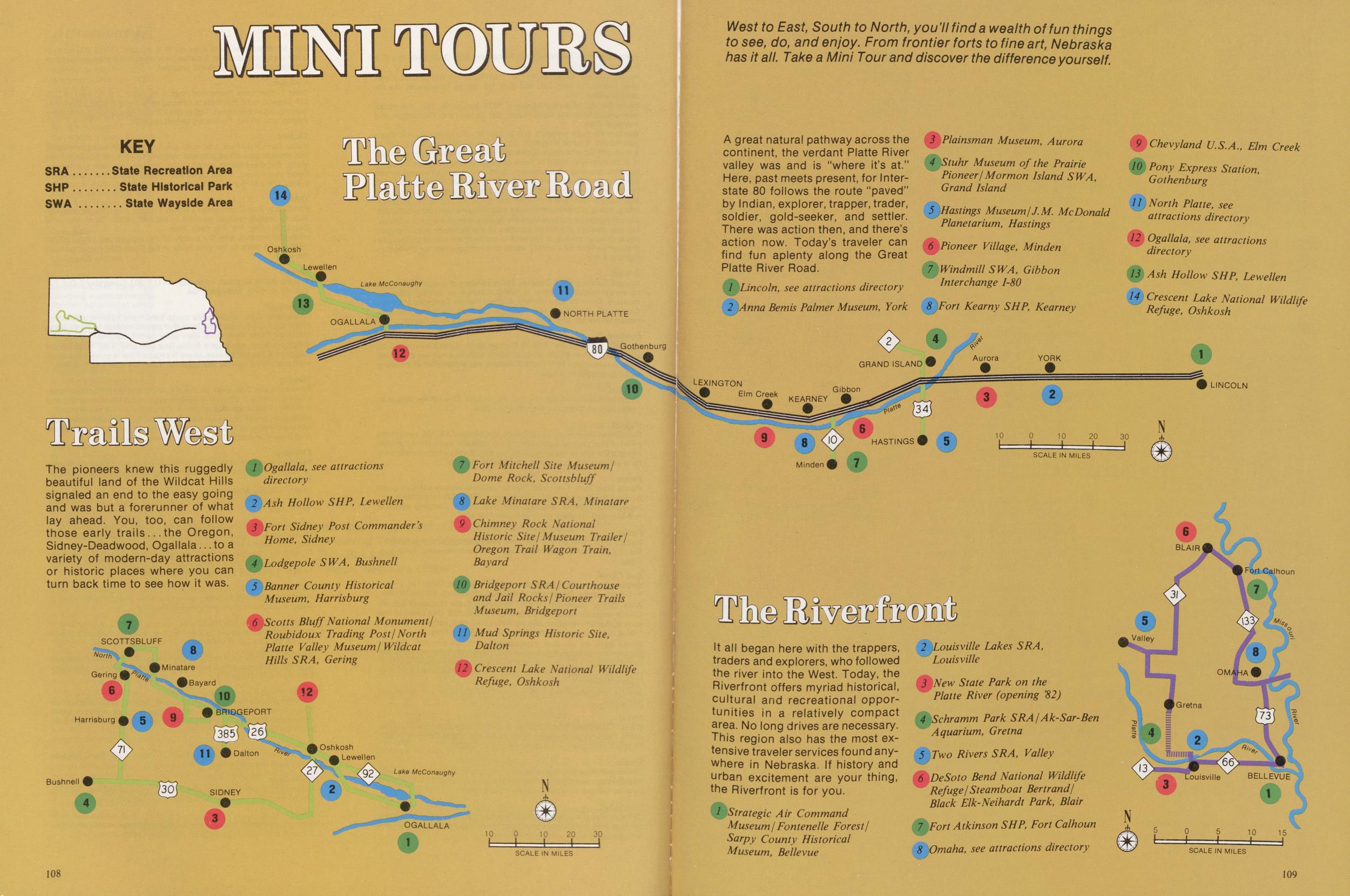
The pioneers knew this ruggedly beautiful land of the Wildcat Hills signaled an end to the easy going and was but a forerunner of what lay ahead. You, too, can follow those early trails...the Oregon, Sidney-Deadwood, Ogallala... to a variety of modern-day attractions or historic places where you can turn back time to see how it was.
A great natural pathway across the continent, the verdant Platte River valley was and is "where it's at." Here, past meets present, for Interstate 80 follows the route "paved" by Indian, explorer, trapper, trader, soldier, gold-seeker, and settler. There was action then, and there's action now. Today's traveler can find fun aplenty along the Great Platte River Road.
It all began here with the trappers, traders and explorers, who followed the river into the West. Today, the Riverfront offers myriad historical, cultural and recreational opportunities in a relatively compact area. No long drives are necessary. This region also has the most extensive traveler services found anywhere in Nebraska. If history and urban excitement are your thing, the Riverfront is for you.
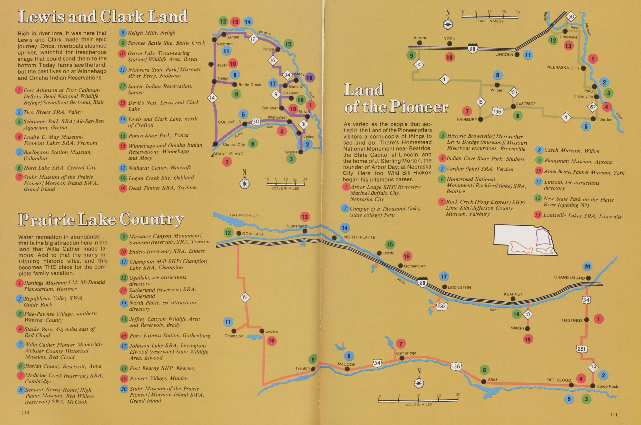
Rich in river lore, it was here that Lewis and Clark made their epic journey. Once, riverboats steamed upriver, watchful for treacherous snags that could send them to the bottom. Today, farms lace the land, but the past lives on at Winnebago and Omaha Indian Reservations.
Water recreation in abundance... that is the big attraction here in the land that Willa Cather made famous. Add to that the many intriguing historic sites, and this becomes THE place for the complete family vacation.
As varied as the people that settled it, the Land of the Pioneer offers visitors a cornucopia of things to see and do. There's Homestead National Monument near Beatrice, the State Capitol at Lincoln, and the home of J. Sterling Morton, the founder of Arbor Day, at Nebraska City. Here, too, Wild Bill Hickok began his infamous career.
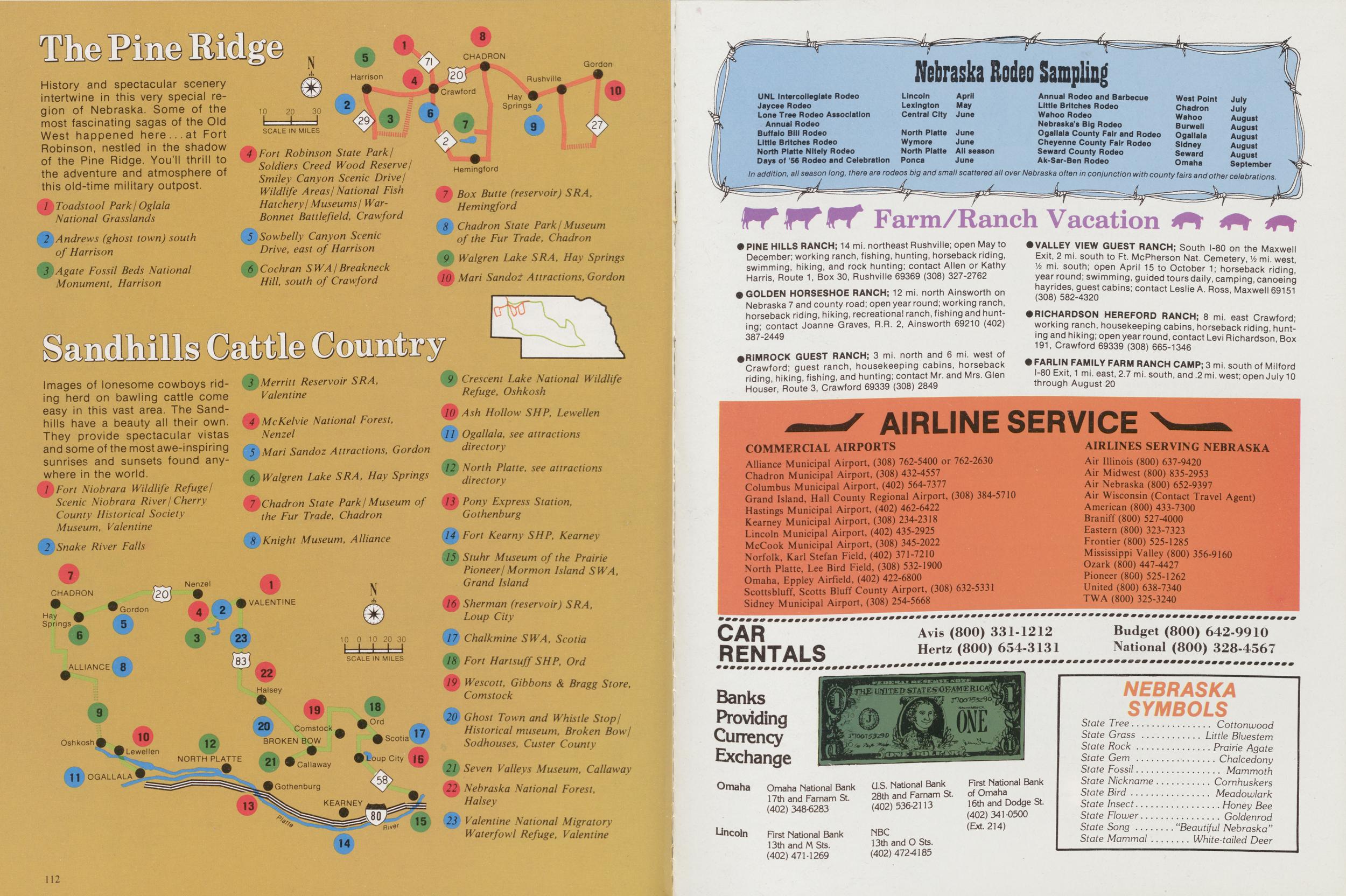
The Pine Ridge
History and spectacular scenery intertwine in this very special region of Nebraska. Some of the most fascinating sagas of the Old West happened here... at Fort Robinson, nestled in the shadow of the Pine Ridge. You'll thrill to the adventure and atmosphere of this old-time military outpost.
Images of lonesome cowboys riding herd on bawling cattle come easy in this vast area. The Sandhills have a beauty all their own. They provide spectacular vistas and some of the most awe-inspiring sunrises and sunsets found anywhere in the world.
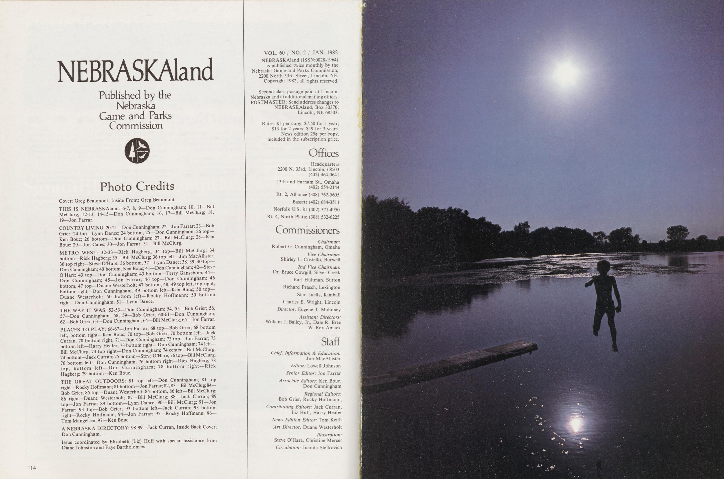
NEBRASKAland
Published by the Nebraska Game and Parks Commission
Photo Credits
Cover: Greg Beaumont, Inside Front: Greg Beaumont THIS IS NEBRASKAland: 6-7, 8, 9—Don Cunningham; 10, 11—Bill McClurg; 12-13, 14-15—Don Cunningham; 16, 17—Bill McClurg; 18, 19—Jon Farrar. COUNTRY LIVING: 20-21—Don Cunningham; 22—Jon Farrar; 23—Bob Grier; 24 top—Lynn Dance; 24 bottom, 25—Don Cunningham; 26 top— Ken Bouc; 26 bottom—Don Cunningham; 27—Bill McClurg; 28—Ken Bouc; 29—Jon Cates; 30—Jon Farrar; 31—Bill McClurg. METRO WEST: 32-33—Rick Hagberg; 34 top-Bill McClurg; 34 bottom—Rick Hagberg; 35—Bill McClurg; 36 top left—Jim MacAllister; 36 top right—Steve O'Hare; 36 bottom, 37—Lynn Dance; 38, 39, 40 top- Don Cunningham; 40 bottom; Ken Bouc; 41—Don Cunningham; 42—Steve O'Hare; 43 top—Don Cunningham; 43 bottom—Terry Gansebom; 44— Don Cunningham; 45—Jon Farrar; 46 top—Don Cunningham; 46 bottom, 47 top—Duane Westerholt; 47 bottom, 48, 49 top left, top right, bottom right—Don Cunningham; 49 bottom left—Ken Bouc; 50 top— Duane Westerholt; 50 bottom left—Rocky Hoffmann; 50 bottom right—Don Cunningham; 51—Lynn Dance. THE WAY IT WAS: 52-53—Don Cunningham; 54, 55—Bob Grier; 56, 57—Don Cunningham; 58, 59—Bob Grier; 60-61—Don Cunningham; 62—Bob Grier; 63—Don Cunningham; 64—Bill McClurg; 65—Jon Farrar. PLACES TO PLAY: 66-67—Jon Farrar; 68 top—Bob Grier; 68 bottom left, bottom right—Ken Bouc; 70 top—Bob Grier; 70 bottom left—Jack Curran; 70 bottom right, 71—Don Cunningham; 73 top—Jon Farrar; 73 bottom left—Harry Heafer; 73 bottom right—Don Cunningham; 74 left- Bill McClurg; 74 top right—Don Cunningham; 74 center—Bill McClurg; 74 bottom—Jack Curran; 75 bottom—Steve O'Hare; 76 top—Bill McClurg; 76 bottom left—Don Cunningham; 76 bottom right—Rick Hagberg; 78 top, bottom left—Don Cunningham; 78 bottom right—Rick Hagberg; 79 bottom—Ken Bouc. THE GREAT OUTDOORS: 81 top left—Don Cunningham; 81 top right—Rocky Hoffmann; 81 bottom—Jon Farrar; 82,83—Bill McClug; 84— Bob Grier; 85 top—Duane Westerholt; 85 bottom, 86 left—Bill McClurg; 86 right—Duane Westerholt; 87—Bill McClurg; 88—Jack Curran; S9 top—Jon Farrar; 89 bottom—Lynn Dance; 90—Bill McClurg; 91—Jon Farrar; 93 top—Bob Grier; 93 bottom left—Jack Curran; 93 bottom right—Rocky Hoffmann; 94—Jon Farrar; 95—Rocky Hoffmann; 96— Tom Mangelsen; 97—Ken Bouc. A NEBRASKA DIRECTORY: 98-99—Jack Curran, Inside Back Cover; Don Cunningham. Issue coordinated by Elizabeth (Liz) Huff with special assistance from Diane Johnston and Faye Bartholomew. 114 VOL. 60 / NO. 2 / JAN. 1982 NEBRASKAland (ISSN:0028-1964) is published twice monthly by the Nebraska Game and Parks Commission, 2200 North 33rd Street, Lincoln, NE. Copyright 1982, all rights reserved. Second-class postage paid at Lincoln, Nebraska and at additional mailing offices. POSTMASTER: Send address changes to NEBRASKAland, Box 30370, Lincoln, NE 68503. Rates: $1 per copy; $7.50 for 1 year; $13 for 2 years; $19 for 3 years. News edition 25c per copy, included in the subscription price. Offiices Headquarters 2200 N. 33rd, Lincoln, 68503 (402) 464-0641 13th and Farnam St., Omaha (402) 554-2144 Rt. 2, Alliance (308) 762-5605 Bassett (402) 684-3511 Norfolk U.S. 81 (402) 371-4950 Rt. 4, North Platte (308) 532-6225 Commissioners Chairman: Robert G. Cunningham, Omaha Vice Chairman: Shirley L. Costello, Burwell 2nd Vice Chairman: Dr. Bruce Cowgill, Silver Creek Earl Hultman, Sutton Richard Prasch, Lexington Stan Juelfs, Kimball Charles E. Wright, Lincoln Director: Eugene T. Mahoney Assistant Directors: William J. Bailey, Jr., Dale R. Bree W. Rex Amack Staff Chief, Information and Education: Jim MacAllister Editor: Lowell Johnson Senior Editor: Jon Farrar Associate Editors: Ken Bouc, Don Cunningham Regional Editors: Bob Grier, Rocky Hoffmann, Contributing Editors: Jack Curran, Liz Huff, Harry Heafer News Edition Editor: Tom Keith Art Director: Duane Westerholt Illustration: Steve O'Hare, Christine Mercer Circulation: Juanita Stefkovich
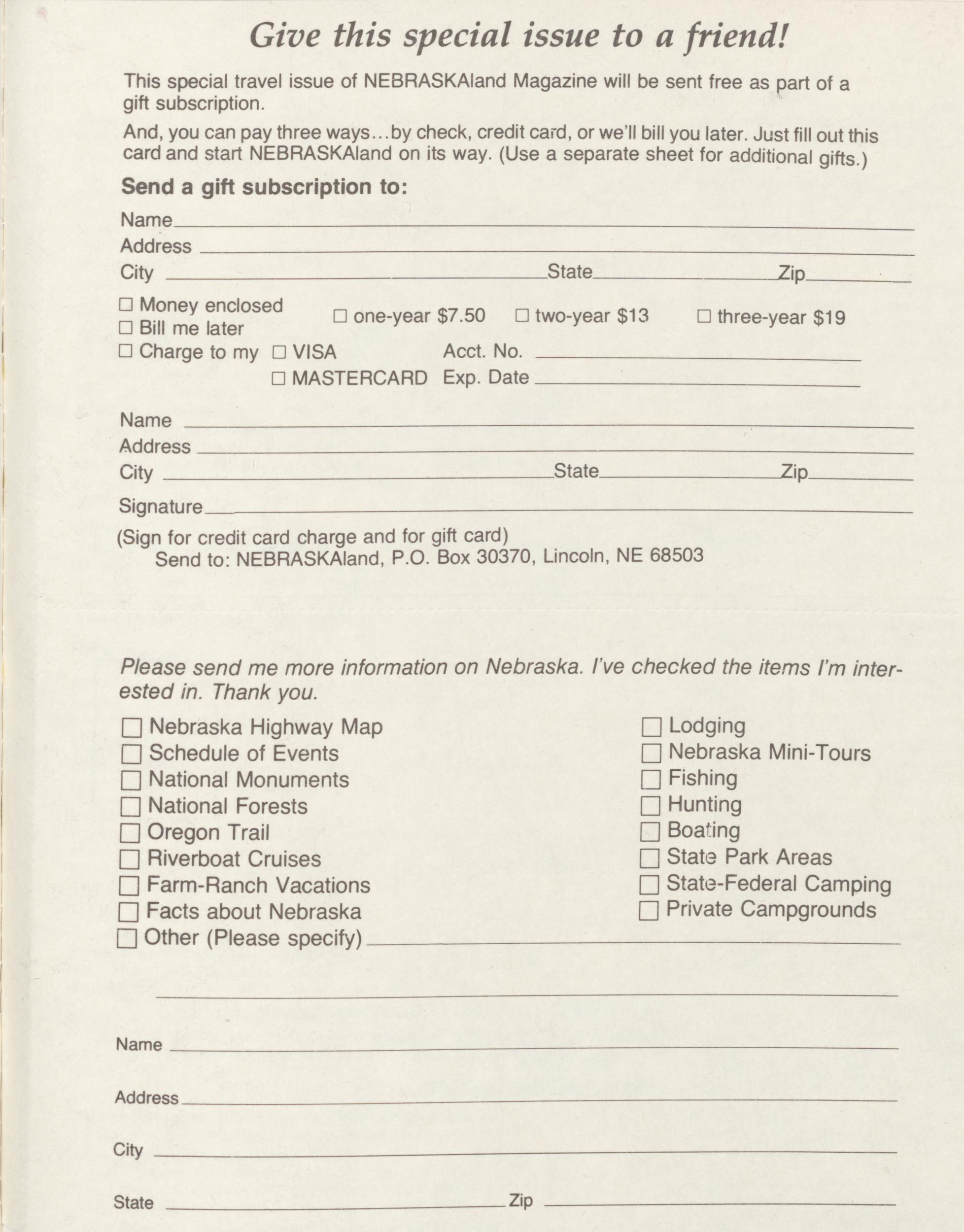
This special travel issue of NEBRASKAIand Magazine will be sent free as part of a gift subscription.
And, you can pay three ways., .by check, credit card, or we'll bill you later. Just fill out this card and start NEBRASKAIand on its way. (Use a separate sheet for additional gifts.) Send a gift subscription to:
Name Address City State Zip: Money enclosed $13 Bill me later Charge to my VISA Acct. No. MASTERCARD Exp. Date three-year $19 Name Address City State Zip Signature (Sign for credit card charge and for gift card) Send to: NEBRASKAland, P.O. Box 30370, Lincoln, NE 68503 Please send me more information on Nebraska, I've checked the items I'm interested in. Thank you. Nebraska Highway Map Schedule of Events National Monuments National Forests Oregon Trail Riverboat Cruises Farm-Ranch Vacations Facts about Nebraska Other (Please specify) Lodging Nebraska Mini-Tours Fishing Hunting Boating State Park Areas State-Federal Camping Private Campgrounds Name Address City State Zip Nebraska Department of Economic Development Division of Travel and Tourism P.O. Box 94666 Lincoln, Nebraska 68509Position: 270 (30 views)